ROGEP ENVIRONMENTAL AND SOCIAL RISK MANAGEMENT (ESRM) STRATEGY
Upload
julius-gibsonCategory
view
213download
0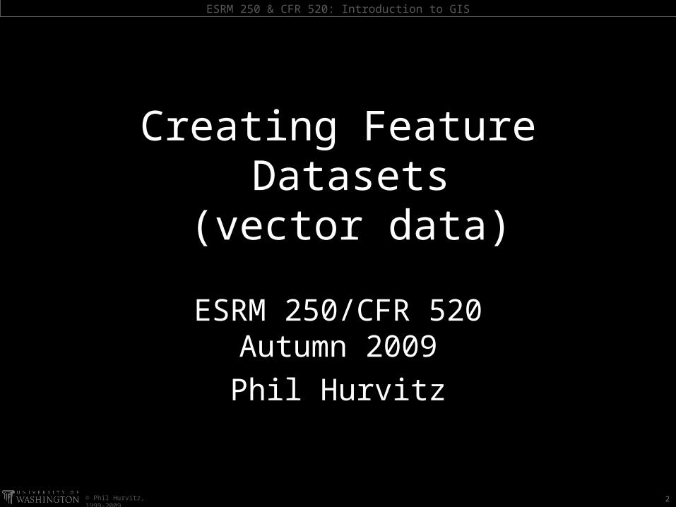
ESRM 250 & CFR 520: Introduction to GIS
© Phil Hurvitz, 1999-2009
ESRM 250/CFR 520Autumn 2009Phil Hurvitz
Creating Feature Datasets
(vector data)
2
ESRM 250 & CFR 520: Introduction to GIS
© Phil Hurvitz, 1999-2009
DigitizingCreating vector data
setsConverting to feature
classCreating new
datasetsSnappingAltering the shape of
lines and polygonsSplitting features
Unioning polygonsMerging polygonsIntersecting polygonsClipping polygonsAdding attributesUndoing editsSaving edits
Overview
ESRM 250 & CFR 520: Introduction to GIS
© Phil Hurvitz, 1999-2009
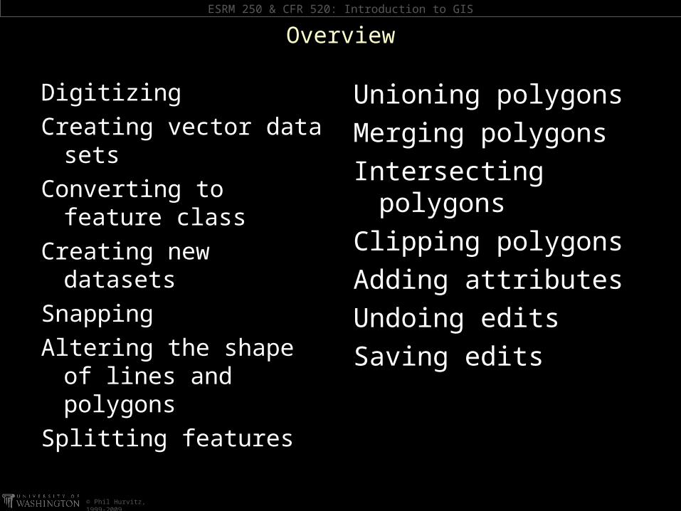
most common “legacy” method of getting data into a GIS
Digitizing
tedious & detail-oriented work

ESRM 250 & CFR 520: Introduction to GIS
© Phil Hurvitz, 1999-2009
How the digitizing tablet works
Digitizing tablet
operatorclicks on or traces features
y = 10
x = 5
coordinates are placed in database
ESRM 250 & CFR 520: Introduction to GIS
© Phil Hurvitz, 1999-2009
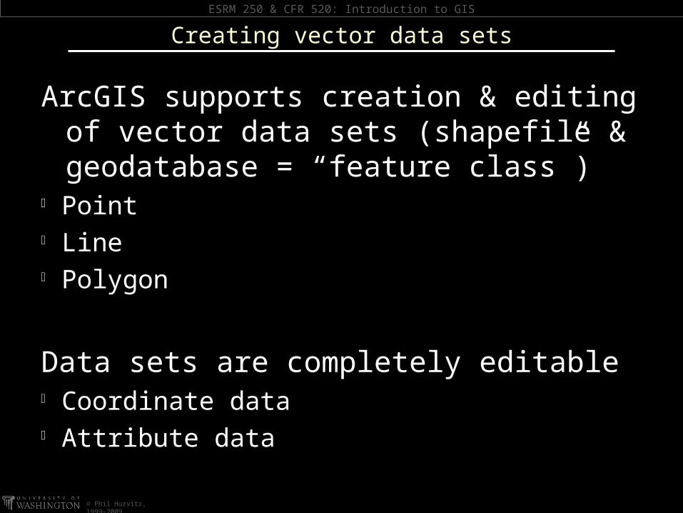
ArcGIS supports creation & editing of vector data sets (shapefile & geodatabase = “feature class”)
Point Line Polygon
Data sets are completely editable Coordinate data Attribute data
Creating vector data sets

ESRM 250 & CFR 520: Introduction to GIS
© Phil Hurvitz, 1999-2009
Any supported vector data set can be converted to feature class
Converting to feature class
CAD data

ESRM 250 & CFR 520: Introduction to GIS
© Phil Hurvitz, 1999-2009
Any supported vector data set can be converted to feature class
Converting to feature class
shapefile or gdb feature class
ESRM 250 & CFR 520: Introduction to GIS
© Phil Hurvitz, 1999-2009
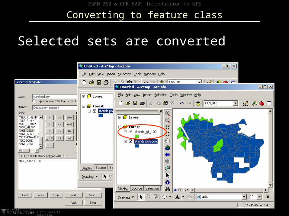
Selected sets are converted
Converting to feature class
ESRM 250 & CFR 520: Introduction to GIS
© Phil Hurvitz, 1999-2009
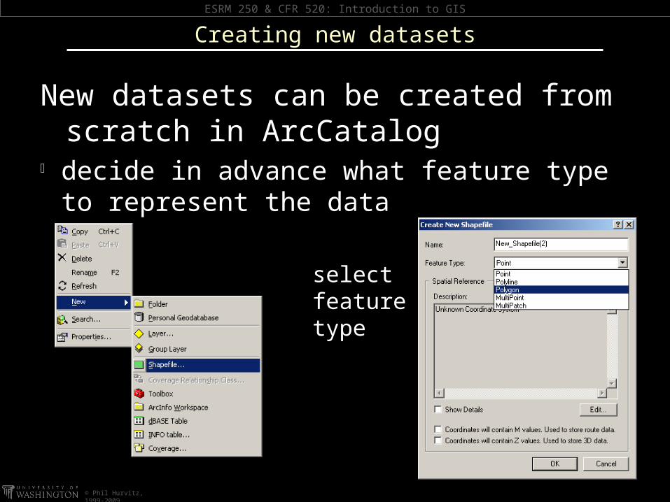
New datasets can be created from scratch in ArcCatalog
decide in advance what feature type to represent the data
Creating new datasets
select feature type

ESRM 250 & CFR 520: Introduction to GIS
© Phil Hurvitz, 1999-2009
New datasets can be created from scratch in ArcCatalog
specify coordinate system
Creating new datasets
ESRM 250 & CFR 520: Introduction to GIS
© Phil Hurvitz, 1999-2009
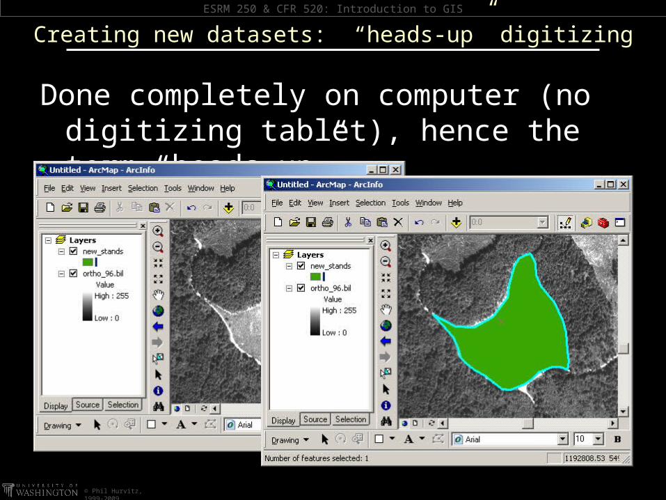
Creating new datasets: “heads-up” digitizing
Done completely on computer (no digitizing tablet), hence the term “heads-up”
ESRM 250 & CFR 520: Introduction to GIS
© Phil Hurvitz, 1999-2009
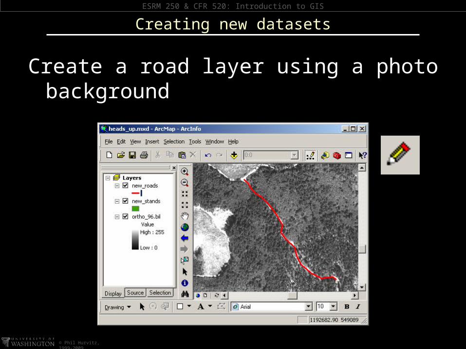
Create a road layer using a photo background
Creating new datasets

ESRM 250 & CFR 520: Introduction to GIS
© Phil Hurvitz, 1999-2009
New features can be created from tracing existing selected features
Creating new datasets
ESRM 250 & CFR 520: Introduction to GIS
© Phil Hurvitz, 1999-2009
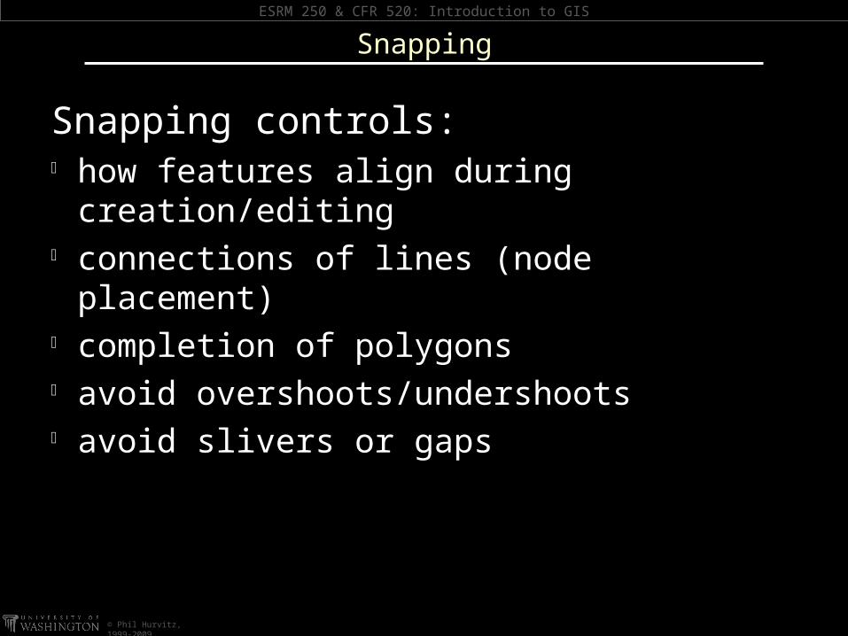
Snapping controls: how features align during creation/editing connections of lines (node placement) completion of polygons avoid overshoots/undershoots avoid slivers or gaps
Snapping

ESRM 250 & CFR 520: Introduction to GIS
© Phil Hurvitz, 1999-2009
Snapping behavior controlled by the Snapping Environment dialog
Snapping
ESRM 250 & CFR 520: Introduction to GIS
© Phil Hurvitz, 1999-2009
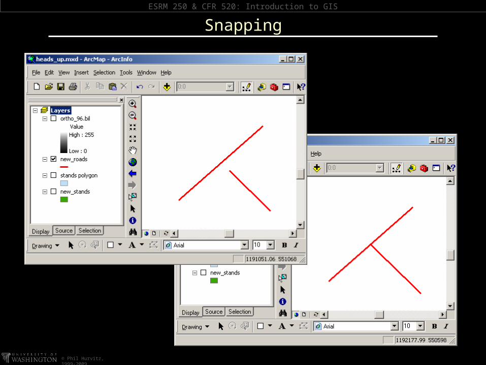
Snapping

ESRM 250 & CFR 520: Introduction to GIS
© Phil Hurvitz, 1999-2009
Interactive snapping options Snap to an existing vertex Snap to an existing line segment or
polygon edge Snap to an intersection of two or more
lines Snap to an existing line endpoint Snapping can be layer-to-layer
Snapping options
ESRM 250 & CFR 520: Introduction to GIS
© Phil Hurvitz, 1999-2009
Snapping
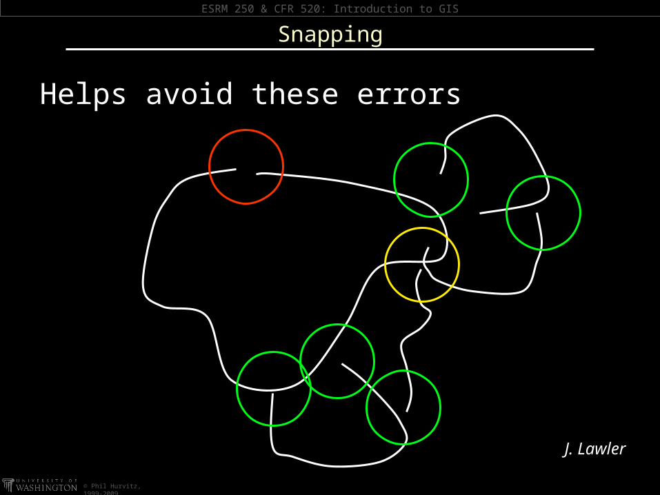
Helps avoid these errors
J. Lawler
ESRM 250 & CFR 520: Introduction to GIS
© Phil Hurvitz, 1999-2009
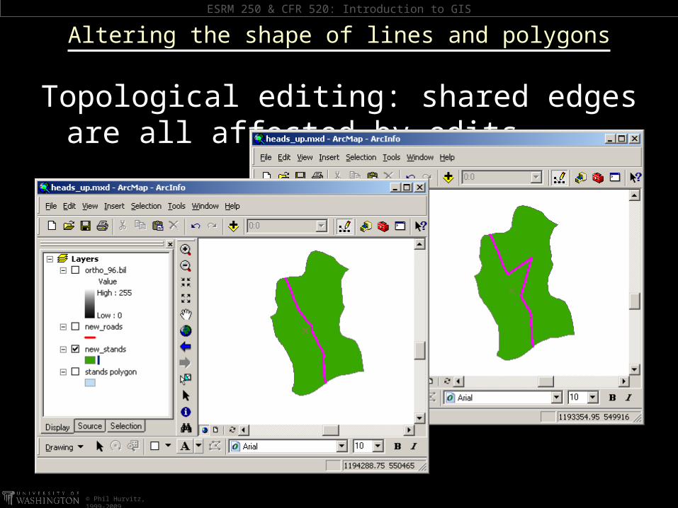
Topological editing: shared edges are all affected by edits
Altering the shape of lines and polygons
ESRM 250 & CFR 520: Introduction to GIS
© Phil Hurvitz, 1999-2009
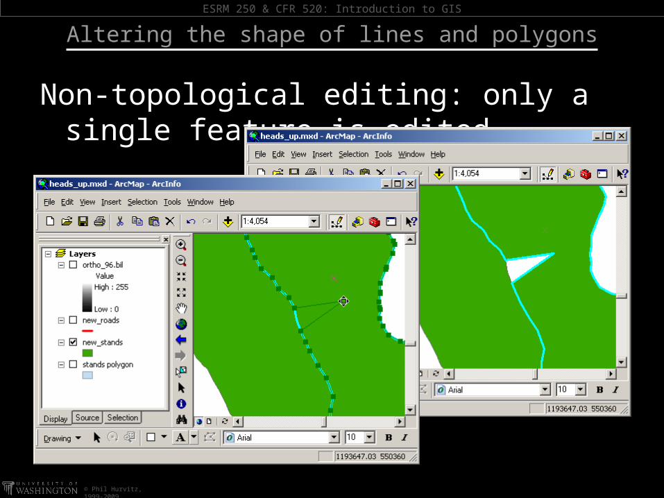
Non-topological editing: only a single feature is edited
Altering the shape of lines and polygons
ESRM 250 & CFR 520: Introduction to GIS
© Phil Hurvitz, 1999-2009
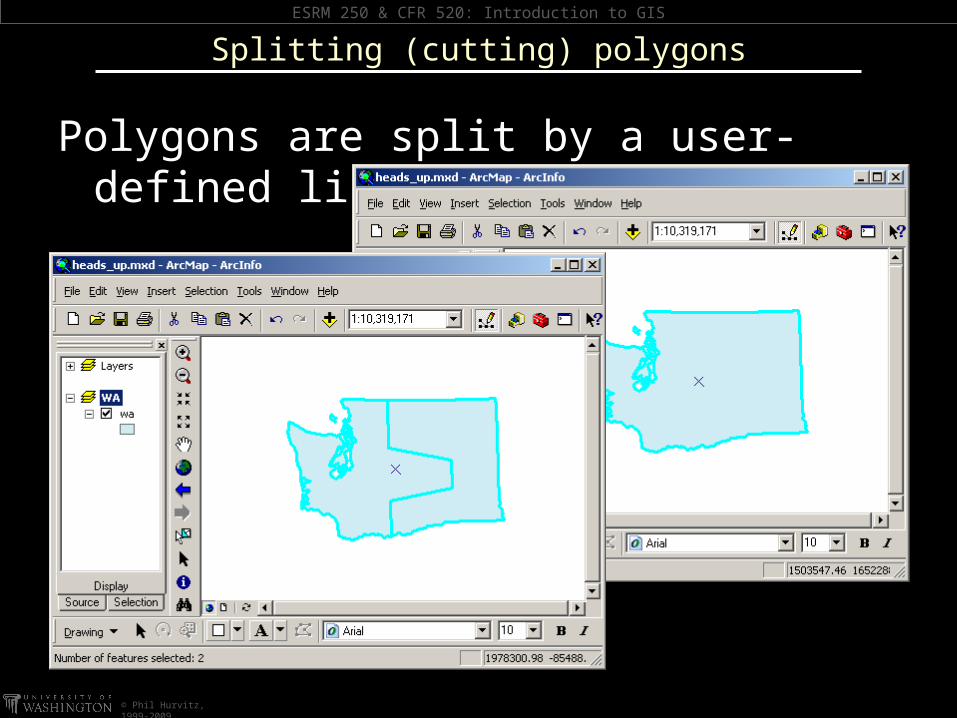
Polygons are split by a user-defined line
Splitting (cutting) polygons
ESRM 250 & CFR 520: Introduction to GIS
© Phil Hurvitz, 1999-2009
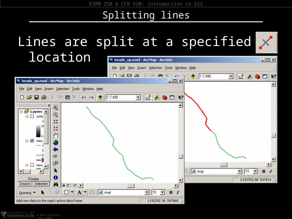
Lines are split at a specified location
Splitting lines
ESRM 250 & CFR 520: Introduction to GIS
© Phil Hurvitz, 1999-2009
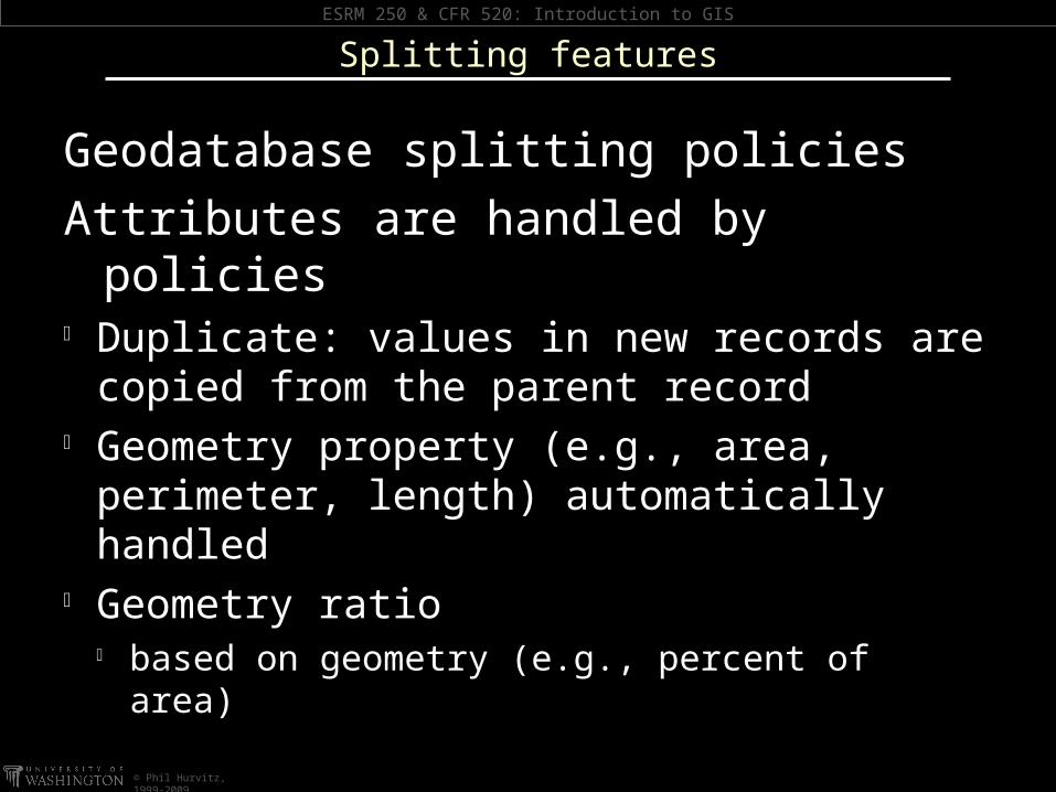
Geodatabase splitting policiesAttributes are handled by policies Duplicate: values in new records are
copied from the parent record Geometry property (e.g., area, perimeter,
length) automatically handled Geometry ratio
based on geometry (e.g., percent of area)
Splitting features
ESRM 250 & CFR 520: Introduction to GIS
© Phil Hurvitz, 1999-2009
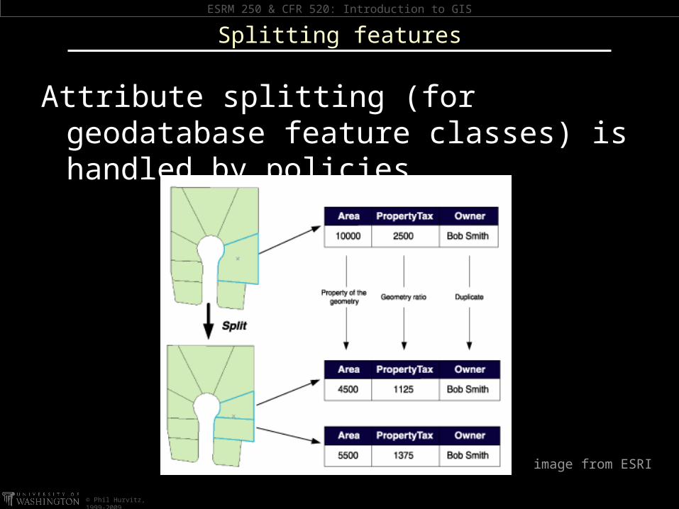
Attribute splitting (for geodatabase feature classes) is handled by policies
Splitting features
image from ESRI

ESRM 250 & CFR 520: Introduction to GIS
© Phil Hurvitz, 1999-2009
Merging polygons
select multiple polygons from the same layer
original polygons are merged into a single new polygon
ESRM 250 & CFR 520: Introduction to GIS
© Phil Hurvitz, 1999-2009
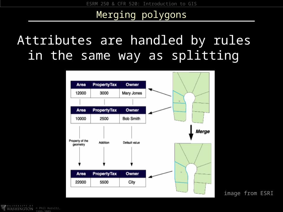
Attributes are handled by rules in the same way as splitting
Merging polygons
image from ESRI
ESRM 250 & CFR 520: Introduction to GIS
© Phil Hurvitz, 1999-2009
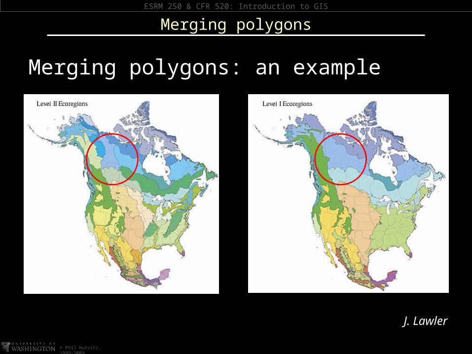
Merging polygons: an example
Merging polygons
J. Lawler
ESRM 250 & CFR 520: Introduction to GIS
© Phil Hurvitz, 1999-2009
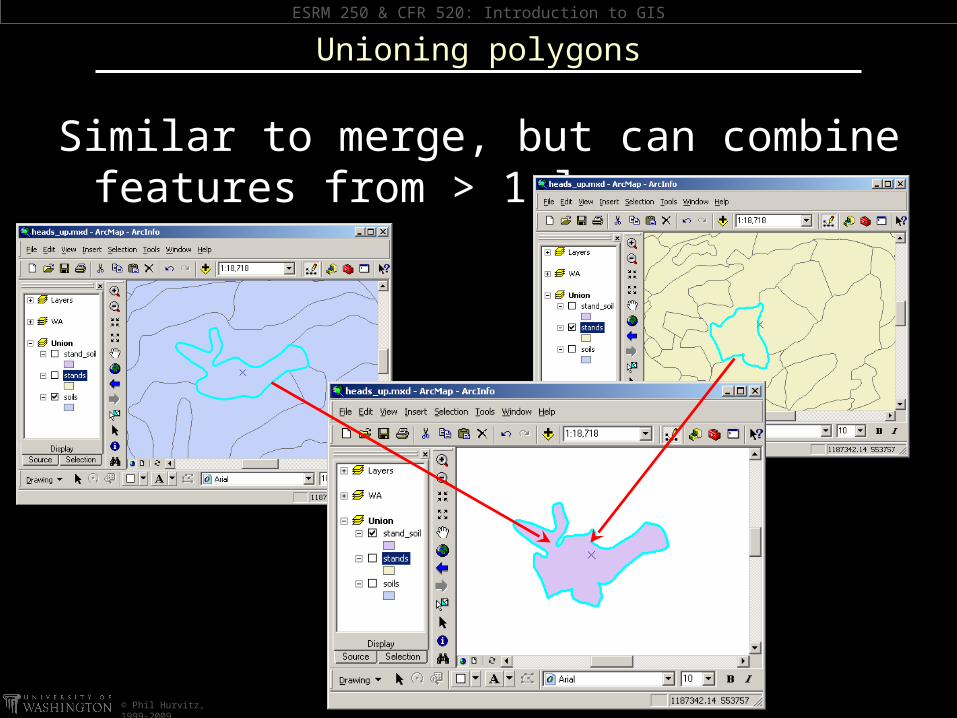
Similar to merge, but can combine features from > 1 layer
Unioning polygons
ESRM 250 & CFR 520: Introduction to GIS
© Phil Hurvitz, 1999-2009
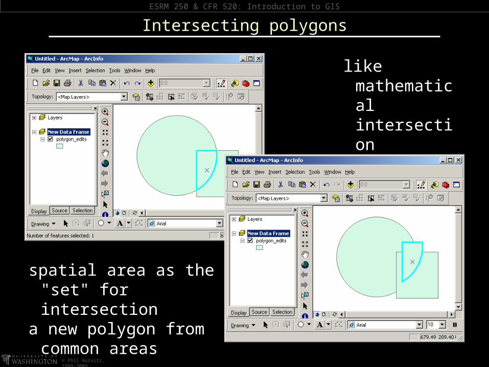
Intersecting polygons
spatial area as the "set" for intersection
a new polygon from common areas
like mathematical intersection

ESRM 250 & CFR 520: Introduction to GIS
© Phil Hurvitz, 1999-2009
Clipping polygons
Option 1: discard the intersection
ESRM 250 & CFR 520: Introduction to GIS
© Phil Hurvitz, 1999-2009
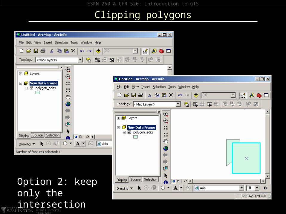
Clipping polygons
Option 2: keep only the intersection
ESRM 250 & CFR 520: Introduction to GIS
© Phil Hurvitz, 1999-2009
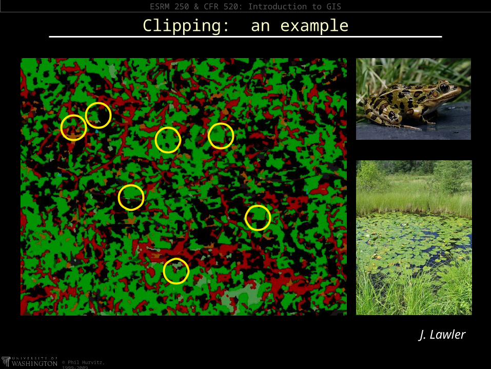
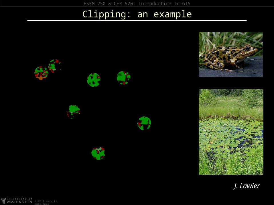
Clipping: an example
J. Lawler
ESRM 250 & CFR 520: Introduction to GIS
© Phil Hurvitz, 1999-2009
Clipping: an example
J. Lawler
ESRM 250 & CFR 520: Introduction to GIS
© Phil Hurvitz, 1999-2009
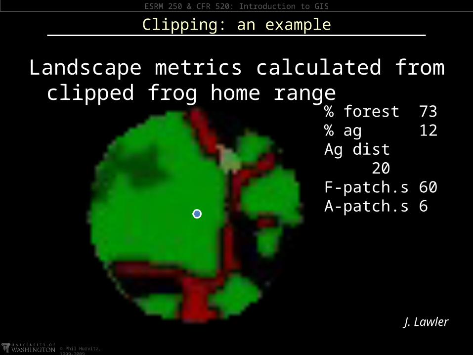
Landscape metrics calculated from clipped frog home range
% forest 73% ag 12Ag dist
20F-patch.s 60A-patch.s 6
Clipping: an example
J. Lawler
ESRM 250 & CFR 520: Introduction to GIS
© Phil Hurvitz, 1999-2009
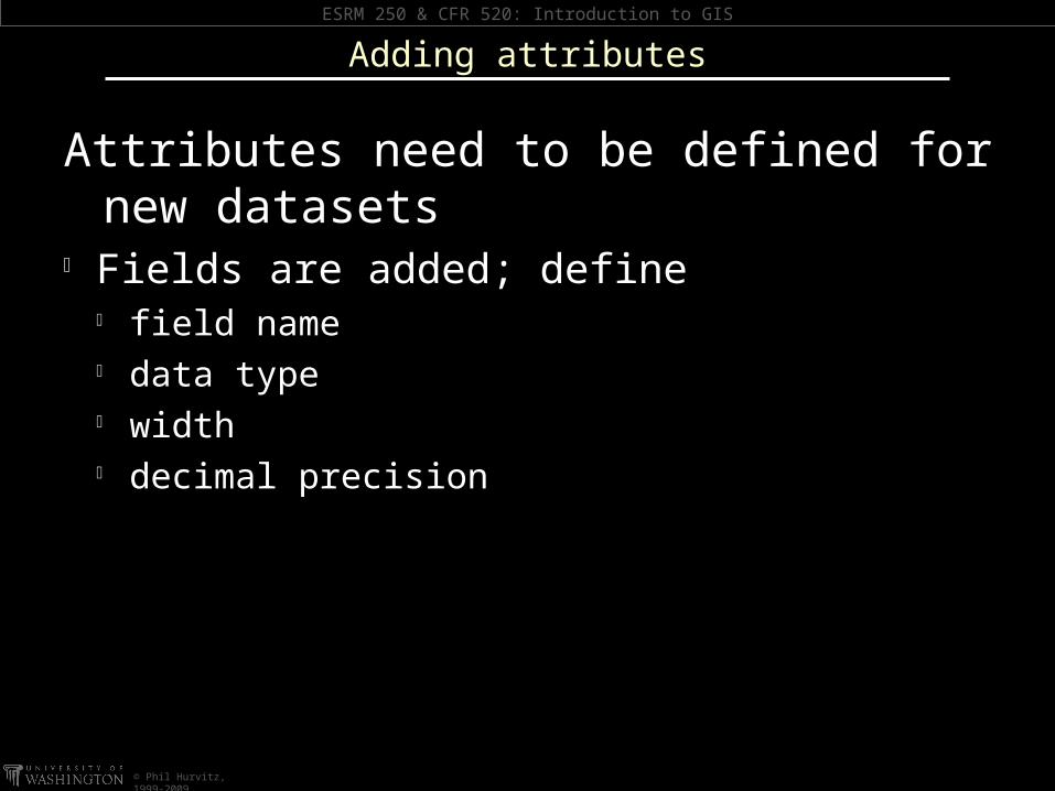
Attributes need to be defined for new datasets
Fields are added; define field name data type width decimal precision
Adding attributes

ESRM 250 & CFR 520: Introduction to GIS
© Phil Hurvitz, 1999-2009
Adding & defining fields: note field names & data types
Adding attributes
ESRM 250 & CFR 520: Introduction to GIS
© Phil Hurvitz, 1999-2009
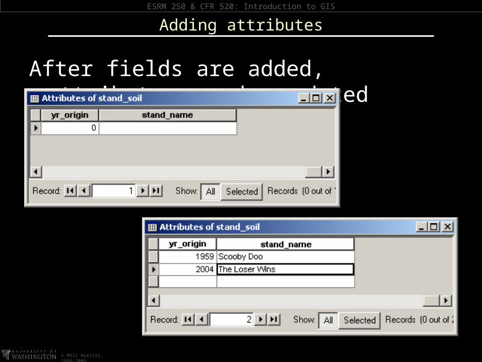
After fields are added, attributes can be updated
Adding attributes
ESRM 250 & CFR 520: Introduction to GIS
© Phil Hurvitz, 1999-2009
Edits can be undone in reverse order
Edits can be undone up to the previous save (or creation)
Once a dataset’s changes are saved, edits cannot be undone
It can be good to have a backup of the data created before an editing session
Undoing edits

ESRM 250 & CFR 520: Introduction to GIS
© Phil Hurvitz, 1999-2009
Save EARLY and OFTEN
You are prompted to save edits when: Dataset is closed for editing Another dataset is opened for editing Document is saved or closed ArcGIS is closed
Saving edits