ESPON 2013 Programme – Open Seminar European Territorial Evidence for EU Cohesion Policy and...
16
ESPON 2013 Programme – Open Seminar “European Territorial Evidence for EU Cohesion Policy and Programming” 13-14 June 2012 - Aalborg, Denmark Session 2 - Workshop 7 Environmental Resources, Climate Change and Risk Prevention ESPON EU-LUPA European Land use Patterns
-
Upload
stephanie-hutchison -
Category
Documents
-
view
222 -
download
1
Transcript of ESPON 2013 Programme – Open Seminar European Territorial Evidence for EU Cohesion Policy and...

ESPON 2013 Programme – Open Seminar“European Territorial Evidence for EU Cohesion Policy and Programming”
13-14 June 2012 - Aalborg, Denmark
Session 2 - Workshop 7Environmental Resources, Climate Change and Risk Prevention
ESPON EU-LUPAEuropean Land use Patterns
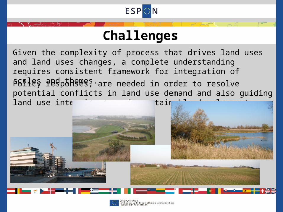
Policy responses, are needed in order to resolve potential conflicts in land use demand and also guiding land use intensity towards sustainable development.
Given the complexity of process that drives land uses and land uses changes, a complete understanding requires consistent framework for integration of scales and themes.
Challenges

EU-LUPA approach assesses land use patterns and dynamics at regional level in the EU with a multi-sector perspective addressing major territorial challenges and political priorities.
This project is about combining and aggregating land cover, land use and administrative data into meaningful typologies as potential input for policy making at European, national and regional level.
Project approach

Project approach
4
Corine Land CoverPrevailing characteristics
Socio-economic data
Quantity
Intensity
Typology of changes
Corine Land Cover changes
Hot spots
Land Use Functions
ChallengesOpportunitiesPerformance
Corine Land Cover
expert judgement
baseline
Dominant processes
expert judgementaggregation
How much

5
How much has changed (1990-2006)?

Land use change: Hot spots
6
1990-20062000-2006

Typologies of change
7

Land Use Functions
• Changes analysis based on CLC could be broaden to better understand land use dynamics in EU27
• To assess the impacts of land use change in a comprehensive way: multi-criteria analysis of indicators
• The Land Use Functions provide a way to enhance the understanding of:– Multi-functionality – Sustainability: integration of the economic, social and
environmental dimension

The LUFs method: aggregation scheme
Basic aggregation scheme, after Paracchini et al. (2008). The symbols represent individual indicators contributing to more than one LUF
LUF6: Biotic resources
Sustainability
EnvironmentEconomySociety
LUF5: Abiotic resources
LUF4:Housing Infrastructure
LUF3: Food & bio-energy
LUF2: Leisure & recreation
LUF1: Work
19
1817
1512
87
21
25
1512
119
72
25
6
41
21
24 27
1813
75
21 26
2019
1716
125
31
21
2019
1716
123
21
0.333 0.333 0.333
0.166 0.166 0.166 0.166 0.166 0.166
Indicator1

LUF1 – Provision of work

LUF3 – Provision of food and bioenergy
3

Eu-lupa could be used as basis for building territorial evidence relevant for the Common Strategic Framework, providing inputs to:
– the thematic objectives mentioned in the Common Strategic Framework, and;
– also as an input for the Partnership Contracts.
contribution to the Common Strategic Framework
12

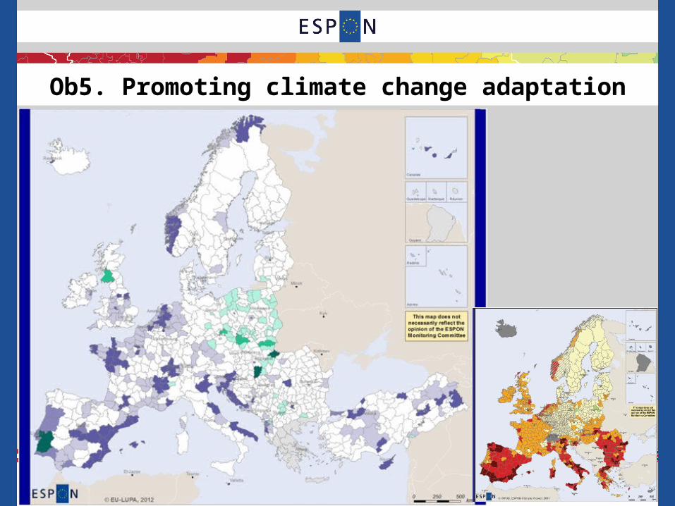
Ob5. Promoting climate change adaptation
Potential links between land use patterns and climate-vulnerability if combining EU-LUPA with ESPON-CLIMATE or other vulnerability assessments:– Artificialisation and sprawl intensification patters in regions with
foreseen urban climate risks could increase their vulnerability.– Forest and agriculture land use changes (extensification or
intensification) in regions with foreseen changes in agricultural productivity or ecological niche due to climate should explore the potentials or define how to reduce vulnerability (soil degradation, hydrological cycle regulation, economic activities).
contribution to the thematic objectives
13
Ob5. Promoting climate change adaptation

Ob6. Protecting the environment and promoting resource efficiency
EU-LUPA could help identifying regional challenges and related objectives:
• water supply, waste-water, waste management, reduce transport related air pollution and integrated urban development, including through sustainable urban drainage, soil desealing measures, rehabilitation of contaminated sites Through sprawl dynamics and Land Use Functions
• green infrastructure, including Natura 2000 sites Through land use patterns
• protecting and enhancing cultural heritage and landscapes Through land use patterns
• efficiency in the use of water by agriculture Through land use patterns• improvement of water and soil quality, and contribute to protecting soil
from erosion, compaction, salinisation, landslides, and loss of organic matter Through land use patterns
contribution to the thematic objectives
15

Relevant elements mentioned by the Commission to be taken into account in the design of the PC:
1) An analysis of the Member State’s or region’s development potential and capacity justifying links between land use patterns and socioeconomic performance
2) An assessment of the major challenges to be addressed by the region or Member State, including the identification of the bottlenecks and missing links, innovation gaps, the lack of planning and implementation capacity etc. land use patter as a potential major challenge to be included
3) horizontal coordination; and 4) vertical coordination also to be analyzed in the field of spatial planning policies and instruments
5) Partnership Contract and programmes based on appropriate result indicators. Typologies, Land Use Functions and Land Use Efficiency as potential indicators.
contribution to the Partnership Contracts
16