Environmental Science Division: Capabilities in Natural ... · ENVIRONMENTAL SCIENCE DIVISION:...
23
Argonne National Laboratory ENVIRONMENTAL SCIENCE DIVISION: CAPABILITIES IN NATURAL RESOURCE MANAGEMENT AND ENERGY POLICY Cristina Negri, Division Director Heidi Hartmann, Program Manager Air Quality & Climate Modeling Cultural Resources Decision Support Ecology Economics/Ecosystem Services Geohydrology Geospatial Information Systems Natural Resource Management Remote Sensing Soils Science Visual Resources EVS Website: http://www.evs.anl.gov/
Transcript of Environmental Science Division: Capabilities in Natural ... · ENVIRONMENTAL SCIENCE DIVISION:...

Argonne National Laboratory
ENVIRONMENTAL SCIENCE DIVISION: CAPABILITIES IN NATURAL RESOURCE MANAGEMENT AND ENERGY POLICYCristina Negri, Division DirectorHeidi Hartmann, Program Manager
Air Quality & Climate Modeling Cultural Resources Decision Support Ecology Economics/Ecosystem Services GeohydrologyGeospatial Information SystemsNatural Resource Management Remote Sensing Soils ScienceVisual Resources
EVS Website: http://www.evs.anl.gov/
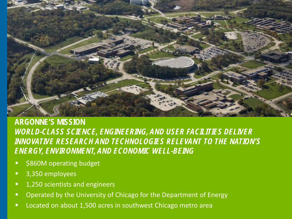
$860M operating budget 3,350 employees 1,250 scientists and engineers Operated by the University of Chicago for the Department of Energy Located on about 1,500 acres in southwest Chicago metro area
ARGONNE’S MISSIONWORLD-CLASS SCIENCE, ENGINEERING, AND USER FACILITIES DELIVER INNOVATIVE RESEARCH AND TECHNOLOGIES RELEVANT TO THE NATION’S ENERGY, ENVIRONMENT, AND ECONOMIC WELL-BEING
3
Conduct research to understand how environmental system components change as a result of energy development, application of emerging technologies, and major new federal policies and programs
About 85 full-time and 50 part-time staff with an FY2016 budget of $43M
Focus on: − Land and renewable resources− Surface and subsurface hydrology − Coupled ecosystem processes − Radiation and chemical risk management − Environmental restoration − Atmospheric processes and measurement and climate research
Provide rigorous science and engineering analyses about present and possible future state of the environment
Operate Southern Great Plains Atmospheric Radiation Measurement (ARM) site, the world’s premier climate research facility
ABOUT THE ENVIRONMENTAL SCIENCE DIVISION (EVS)
4
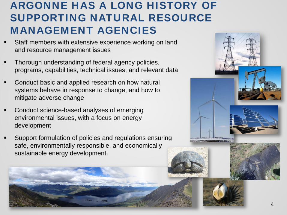
Staff members with extensive experience working on land and resource management issues
Thorough understanding of federal agency policies, programs, capabilities, technical issues, and relevant data
Conduct basic and applied research on how natural systems behave in response to change, and how to mitigate adverse change
Conduct science-based analyses of emerging environmental issues, with a focus on energy development
Support formulation of policies and regulations ensuring safe, environmentally responsible, and economically sustainable energy development.
ARGONNE HAS A LONG HISTORY OF SUPPORTING NATURAL RESOURCE MANAGEMENT AGENCIES
5
EXPERIENCE CONDUCTING INTEGRATED ASSESSMENTS TO SUPPORT ENVIRONMENTAL DECISION-MAKING & POLICY
Broad experience preparing National Environmental Policy Act (NEPA) analyses to support development of new policies and programs
Environmental studies to support science-based decisions: biological studies, hydrologic modeling, watershed studies, air quality modeling, climate change modeling, ecosystem services, life-cycle assessment
Analyses of cultural and social system issues: assessments of impacts to cultural resources, Native American concerns, visual resources, and human dimensions
Development and implementation of landscape-scale approaches to support regional planning, mitigation, monitoring, and adaptive management strategies
Implementation of innovative technologies and methods for assessing environmental conditions (e.g., remote sensing technologies, geospatial analyses)
Supporting multi-agency collaboration and stakeholder engagement through effective information sharing and facilitated dialogue.
Federal Agency Customers
U.S. Department of Energy
Western Area Power Administration
Bonneville Power Administration
U.S. Department of Defense
U.S. Nuclear Regulatory Commission
Environmental Protection Agency
Bureau of Ocean Energy Management
Bureau of Safety and Environmental Enforcement
Bureau of Land Management
U.S. Forest Service
Bureau of Reclamation
National Park Service
U.S. Fish and Wildlife Service
DOI Office of Indian Energy and Economic Development
6
CAPABILITIES OVERVIEW
7
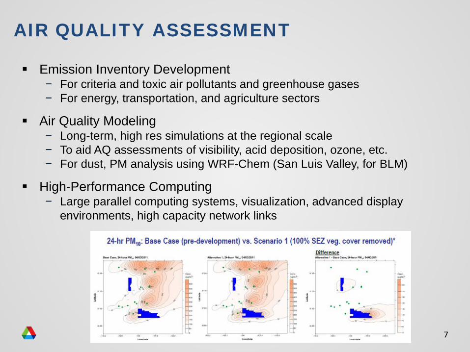
AIR QUALITY ASSESSMENT
Emission Inventory Development− For criteria and toxic air pollutants and greenhouse gases− For energy, transportation, and agriculture sectors
Air Quality Modeling− Long-term, high res simulations at the regional scale− To aid AQ assessments of visibility, acid deposition, ozone, etc.− For dust, PM analysis using WRF-Chem (San Luis Valley, for BLM)
High-Performance Computing− Large parallel computing systems, visualization, advanced display
environments, high capacity network links
8
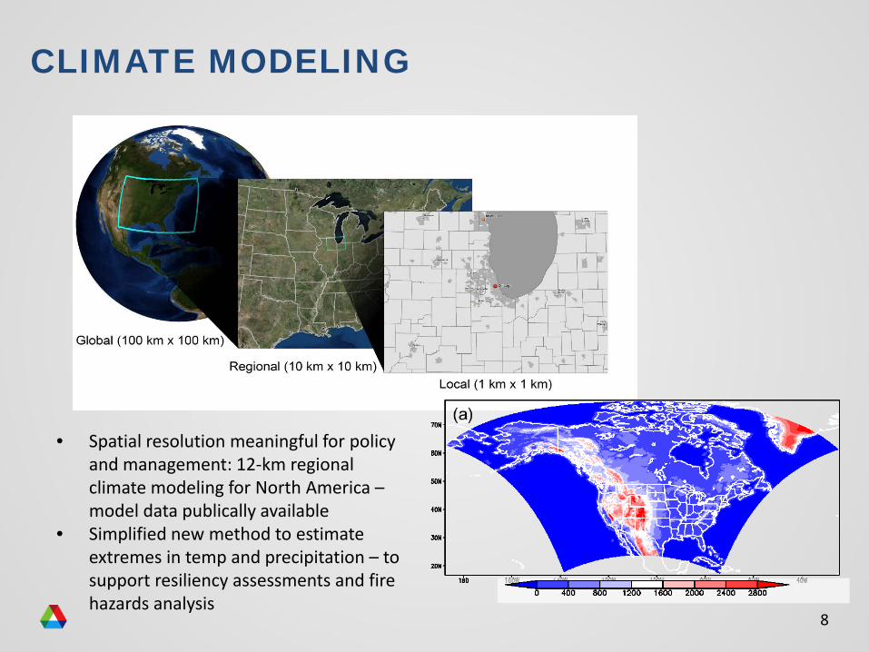
CLIMATE MODELING
• Spatial resolution meaningful for policy and management: 12-km regional climate modeling for North America –model data publically available
• Simplified new method to estimate extremes in temp and precipitation – to support resiliency assessments and fire hazards analysis
9
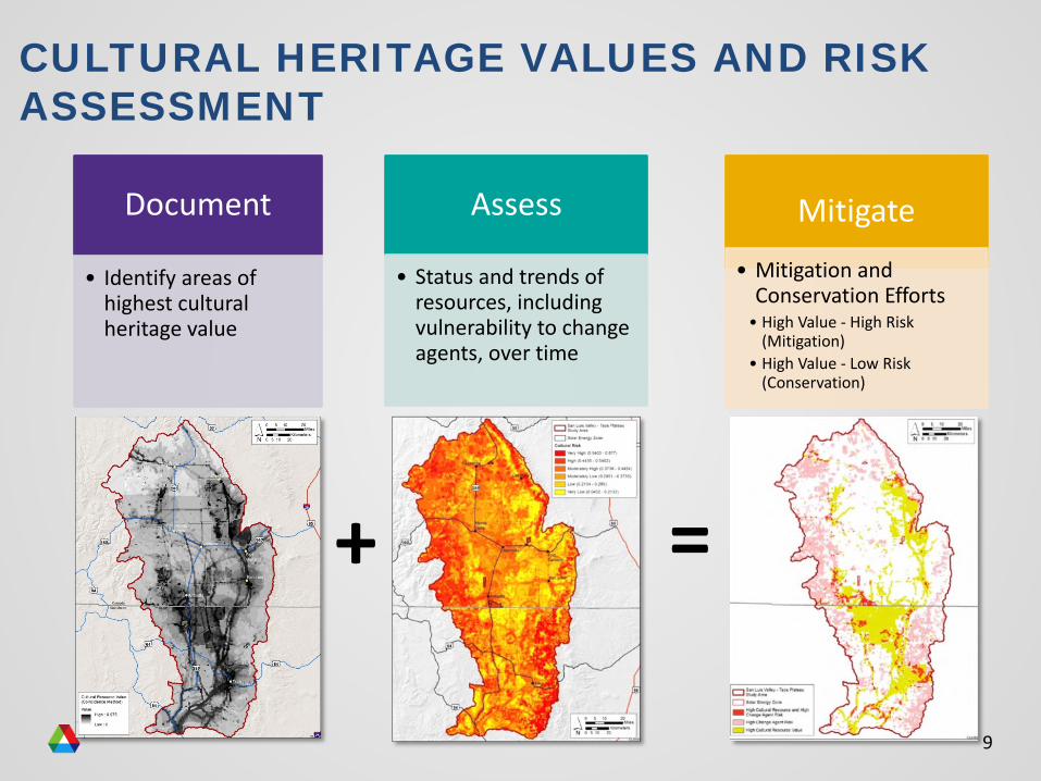
CULTURAL HERITAGE VALUES AND RISK ASSESSMENT
+ =
Document
• Identify areas of highest cultural heritage value
Assess
• Status and trends of resources, including vulnerability to change agents, over time
Mitigate
• Mitigation and Conservation Efforts• High Value - High Risk
(Mitigation)• High Value - Low Risk
(Conservation)
10
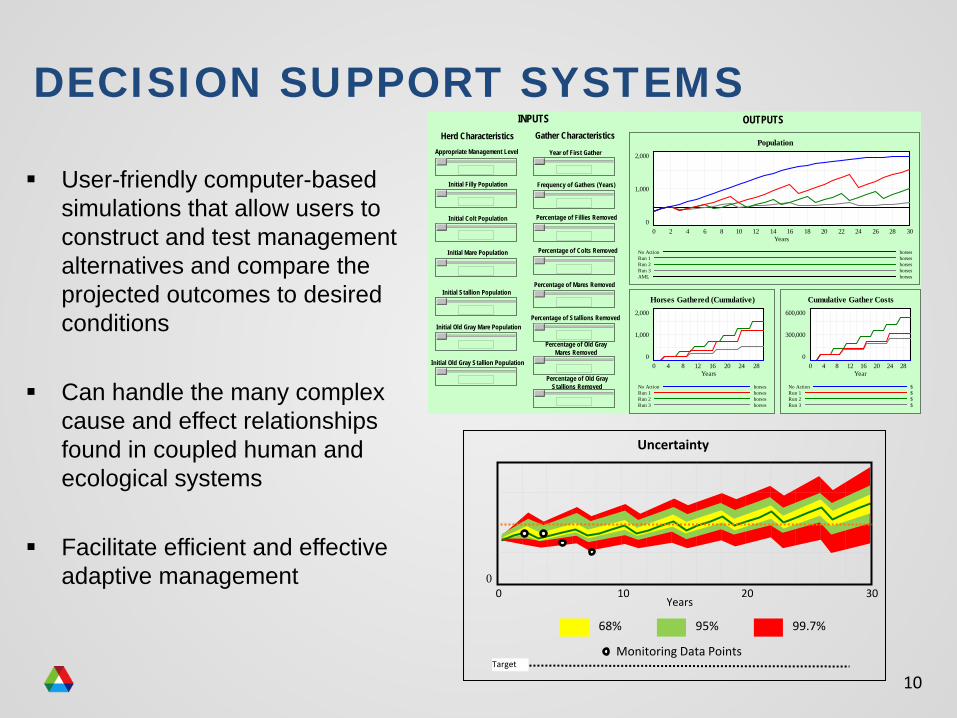
DECISION SUPPORT SYSTEMS
User-friendly computer-based simulations that allow users to construct and test management alternatives and compare the projected outcomes to desired conditions
Can handle the many complex cause and effect relationships found in coupled human and ecological systems
Facilitate efficient and effective adaptive management
Appropriate Management Level
Frequency of Gathers (Years)
Percentage of Colts Removed
Percentage of Mares Removed
Percentage of Stallions Removed
Percentage of Old GrayMares Removed
Percentage of Old GrayStallions Removed
Percentage of Fillies Removed
Initial Filly Population
Initial Mare Population
Initial Colt Population
Initial Stallion Population
Initial Old Gray Stallion Population
Initial Old Gray Mare Population
Population2,000
1,000
00 2 4 6 8 10 12 14 16 18 20 22 24 26 28 30
Years
No Action horsesRun 1 horsesRun 2 horsesRun 3 horsesAML horses
Horses Gathered (Cumulative)2,000
1,000
00 4 8 12 16 20 24 28
Years
No Action horsesRun 1 horsesRun 2 horsesRun 3 horses
Herd Characteristics Gather Characteristics
INPUTS OUTPUTS
Year of First Gather
Cumulative Gather Costs600,000
300,000
00 4 8 12 16 20 24 28
Year
No Action $Run 1 $Run 2 $Run 3 $
68% 99.7%95%
Monitoring Data Points
00 10 20 30
Years
Target
Uncertainty
11
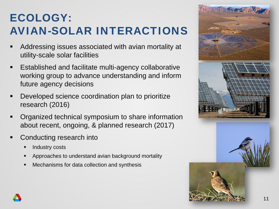
ECOLOGY: AVIAN-SOLAR INTERACTIONS Addressing issues associated with avian mortality at
utility-scale solar facilities
Established and facilitate multi-agency collaborative working group to advance understanding and inform future agency decisions
Developed science coordination plan to prioritize research (2016)
Organized technical symposium to share information about recent, ongoing, & planned research (2017)
Conducting research into Industry costs Approaches to understand avian background mortality Mechanisms for data collection and synthesis
12
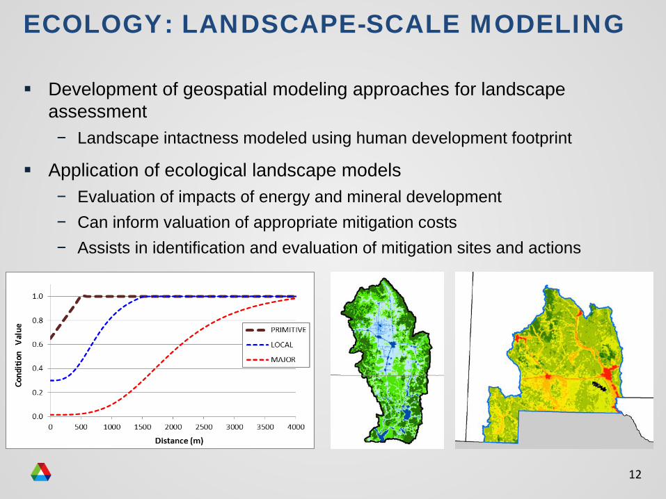
Development of geospatial modeling approaches for landscape assessment− Landscape intactness modeled using human development footprint
Application of ecological landscape models− Evaluation of impacts of energy and mineral development− Can inform valuation of appropriate mitigation costs− Assists in identification and evaluation of mitigation sites and actions
ECOLOGY: LANDSCAPE-SCALE MODELING
13
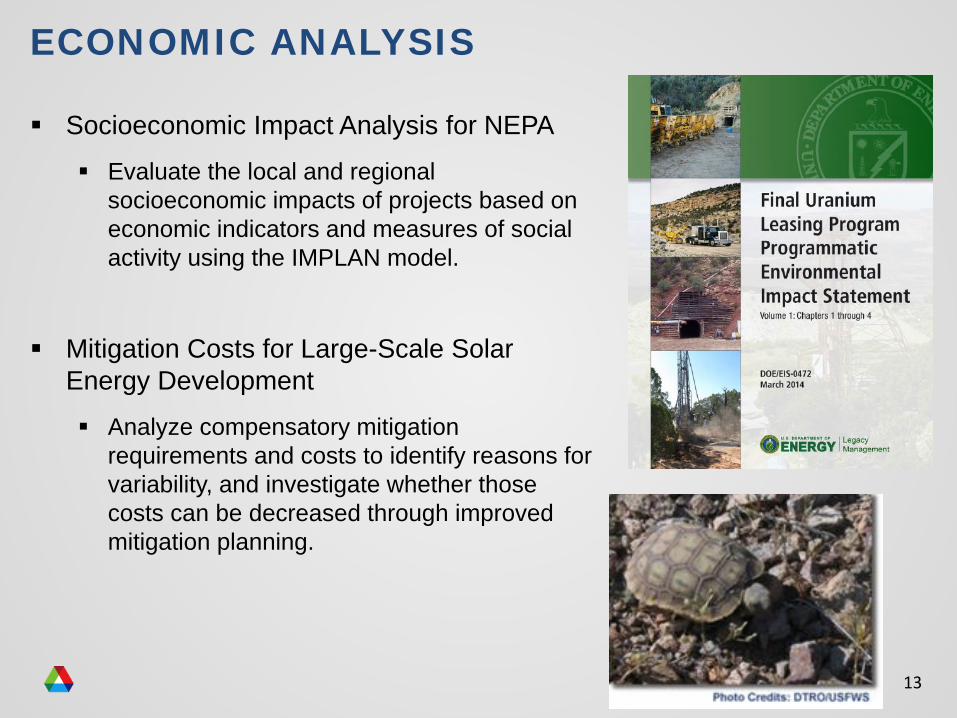
ECONOMIC ANALYSIS
Socioeconomic Impact Analysis for NEPA Evaluate the local and regional
socioeconomic impacts of projects based on economic indicators and measures of social activity using the IMPLAN model.
Mitigation Costs for Large-Scale Solar Energy Development Analyze compensatory mitigation
requirements and costs to identify reasons for variability, and investigate whether those costs can be decreased through improved mitigation planning.
14
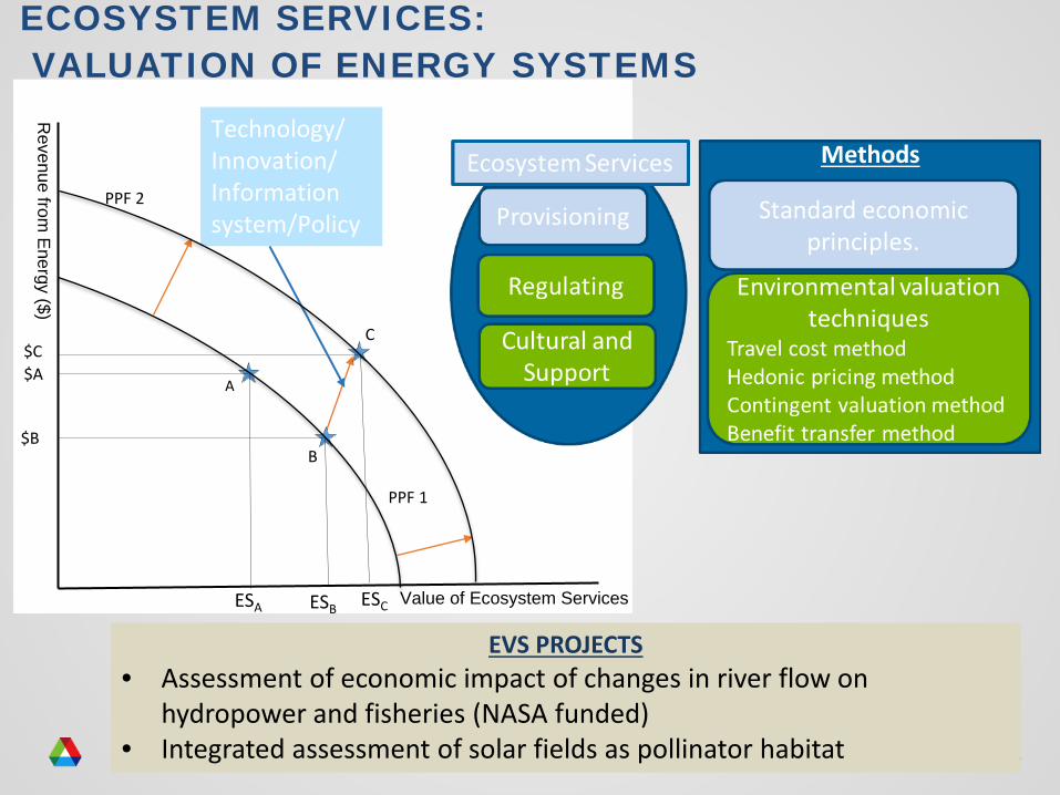
ECOSYSTEM SERVICES:VALUATION OF ENERGY SYSTEMS
Value of Ecosystem Services
Revenue from
Energy ($)
$AA
$C
$BB
C
PPF 2
PPF 1
ESA ESB ESC
Technology/ Innovation/ Information system/Policy
EVS PROJECTS• Assessment of economic impact of changes in river flow on
hydropower and fisheries (NASA funded)• Integrated assessment of solar fields as pollinator habitat
15
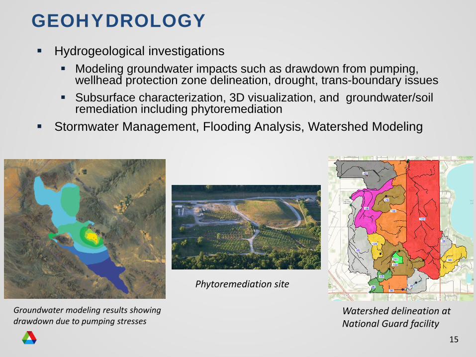
Hydrogeological investigations Modeling groundwater impacts such as drawdown from pumping,
wellhead protection zone delineation, drought, trans-boundary issues Subsurface characterization, 3D visualization, and groundwater/soil
remediation including phytoremediation Stormwater Management, Flooding Analysis, Watershed Modeling
GEOHYDROLOGY
Watershed delineation at National Guard facility
Groundwater modeling results showing drawdown due to pumping stresses
Phytoremediation site
16
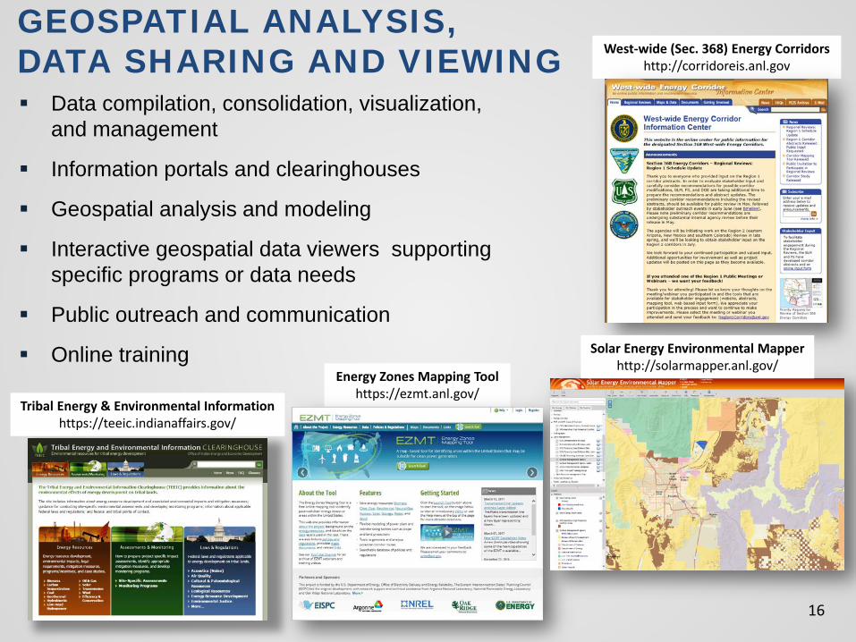
GEOSPATIAL ANALYSIS, DATA SHARING AND VIEWING West-wide (Sec. 368) Energy Corridors
http://corridoreis.anl.gov
Energy Zones Mapping Toolhttps://ezmt.anl.gov/
Solar Energy Environmental Mapperhttp://solarmapper.anl.gov/
Tribal Energy & Environmental Informationhttps://teeic.indianaffairs.gov/
Data compilation, consolidation, visualization, and management
Information portals and clearinghouses
Geospatial analysis and modeling
Interactive geospatial data viewers supporting specific programs or data needs
Public outreach and communication
Online training
17
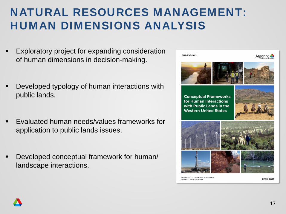
NATURAL RESOURCES MANAGEMENT: HUMAN DIMENSIONS ANALYSIS
Exploratory project for expanding consideration of human dimensions in decision-making.
Developed typology of human interactions with public lands.
Evaluated human needs/values frameworks for application to public lands issues.
Developed conceptual framework for human/ landscape interactions.
18
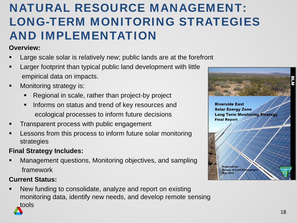
NATURAL RESOURCE MANAGEMENT: LONG-TERM MONITORING STRATEGIES AND IMPLEMENTATION Overview: Large scale solar is relatively new; public lands are at the forefront Larger footprint than typical public land development with little
empirical data on impacts. Monitoring strategy is:
Regional in scale, rather than project-by project Informs on status and trend of key resources and
ecological processes to inform future decisions Transparent process with public engagement Lessons from this process to inform future solar monitoring
strategiesFinal Strategy Includes: Management questions, Monitoring objectives, and sampling
frameworkCurrent Status: New funding to consolidate, analyze and report on existing
monitoring data, identify new needs, and develop remote sensing tools
19
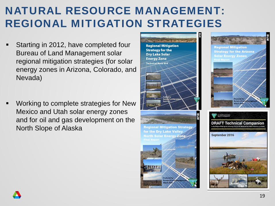
NATURAL RESOURCE MANAGEMENT:REGIONAL MITIGATION STRATEGIES
Starting in 2012, have completed four Bureau of Land Management solar regional mitigation strategies (for solar energy zones in Arizona, Colorado, and Nevada)
Working to complete strategies for New Mexico and Utah solar energy zones and for oil and gas development on the North Slope of Alaska
20
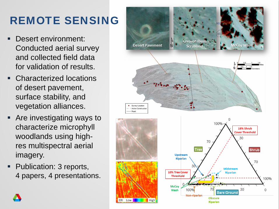
Desert environment: Conducted aerial survey and collected field data for validation of results.
Characterized locations of desert pavement, surface stability, and vegetation alliances.
Are investigating ways to characterize microphyll woodlands using high-res multispectral aerial imagery.
Publication: 3 reports, 4 papers, 4 presentations.
REMOTE SENSING
21
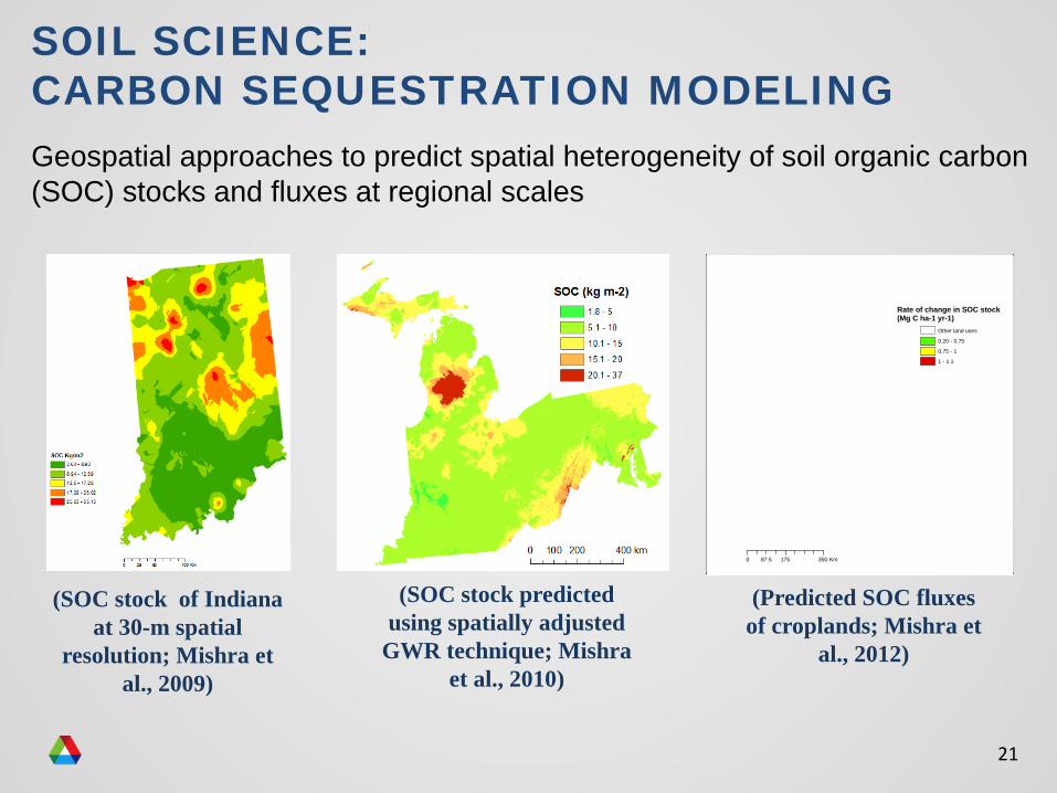
Geospatial approaches to predict spatial heterogeneity of soil organic carbon (SOC) stocks and fluxes at regional scales
(SOC stock predicted using spatially adjusted
GWR technique; Mishra et al., 2010)
0 175 35087.5 Km
Rate of change in SOC stock(Mg C ha-1 yr-1)
Other land uses
0.20 - 0.75
0.75 - 1
1 - 1.1
(Predicted SOC fluxes of croplands; Mishra et
al., 2012)
(SOC stock of Indiana at 30-m spatial
resolution; Mishra et al., 2009)
SOIL SCIENCE: CARBON SEQUESTRATION MODELING
22
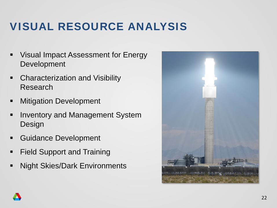
VISUAL RESOURCE ANALYSIS
Visual Impact Assessment for Energy Development
Characterization and Visibility Research
Mitigation Development
Inventory and Management System Design
Guidance Development
Field Support and Training
Night Skies/Dark Environments
23
Argonne can provide a variety of services to support initiatives related to natural resource and land management and energy policy:
− Subject matter expertise for a variety of environmental sciences
− Environmental analysis, monitoring and mitigation strategy efforts
− High performance computing, data management, visualization, and geospatial analysis
− Website design, development, and deployment
− Internal and external stakeholder engagement
Heidi Hartmann630-252-6487
Cristina [email protected]