
Enhanced analytical decision support tools The Scheme level Final workshop of the DISTILLATE...
25
Enhanced analytical decision support tools The Scheme level Final workshop of the DISTILLATE programme Great Minster House, London Tuesday 22 nd January 2008 Dr Simon Shepherd ITS, University of Leeds
-
Upload
vincent-gibbs -
Category
Documents
-
view
214 -
download
0
Transcript of Enhanced analytical decision support tools The Scheme level Final workshop of the DISTILLATE...
Enhanced analytical decision support tools
The Scheme levelFinal workshop of the DISTILLATE programme
Great Minster House, LondonTuesday 22nd January 2008
Dr Simon ShepherdITS, University of Leeds

ObjectivesObjectives/Indicators
(7)
Assess problems (8)
Possible instruments (9)
Predict impacts (12)
Compare solutions (13)
Implement (15)
Evaluate performance (15)
Monitor (15)
Barriers (10)
Possible strategies (11)
Optimisation (14)
Appraisal (13)
Scenarios (11)
• To enhance existing predictive models to represent a wider range of policy instruments
• To improve the ability of users to apply models

Suggested Themes
1. Demand restraint measures 2. Public transport improvements3. Land use measures4. Soft measures (attitudinal)5. Slow modes and small scheme
impacts6. Data issues7. Model use
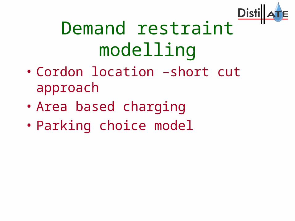
Demand restraint modelling
• Cordon location –short cut approach
• Area based charging
• Parking choice model
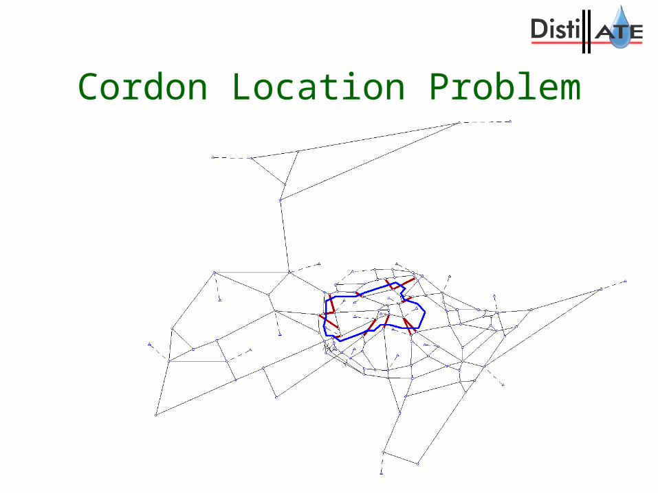
Cordon Location Problem
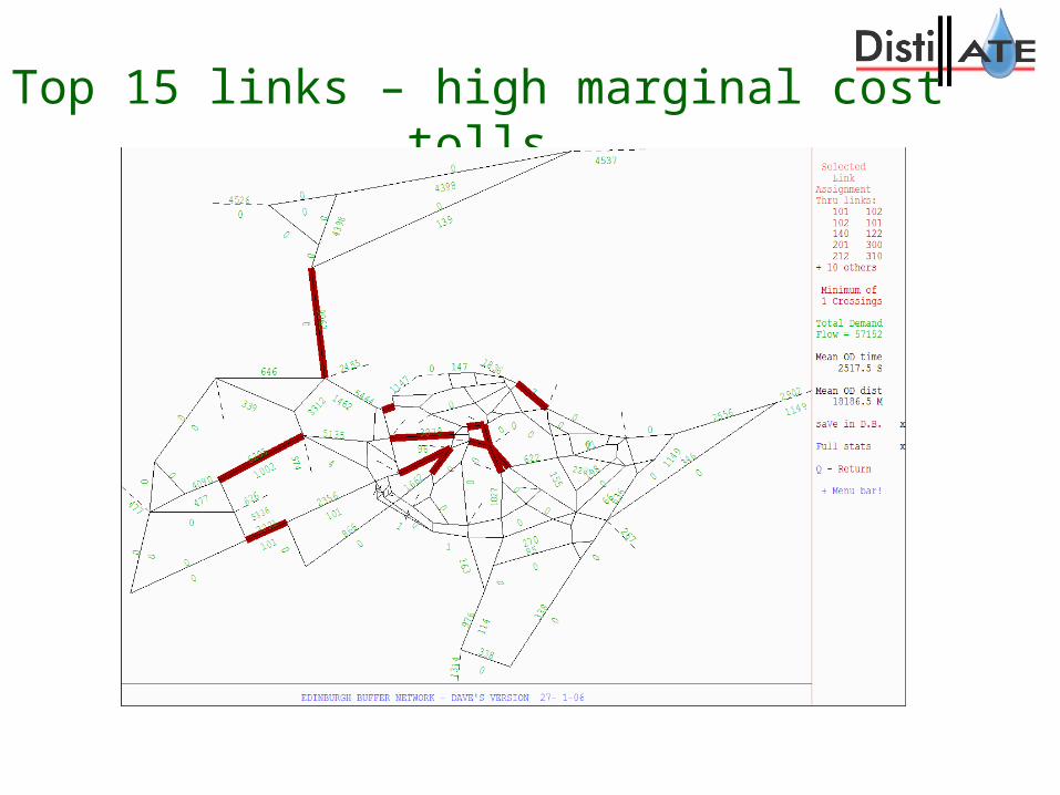
Top 15 links – high marginal cost tolls
A short cut approach• Aim to develop a method between
judgement and GA based approach• Use fact that Top 15 MC tolls gave high
proportion of first best benefits• Charge a high cost trip somewhere – not
necessarily on the high cost links• Use SLA to design where best to place
cordon and catch the high cost flows

Display SLA using bandwidths
Summary cordon location
• Proven for networks of Cambridge, York, Leeds and Edinburgh
• Adapted for simulation networks of Shrewsbury and Cambridge
• Approach included in DfT webtag advice
• Now being used on Nottingham network
Area based charging
• Adapt models to charge for trips within an area rather than per crossing of a cordon
• Allow exemptions or discounts for residents
• Implemented in SATURN
• Tested on a Cambridge network
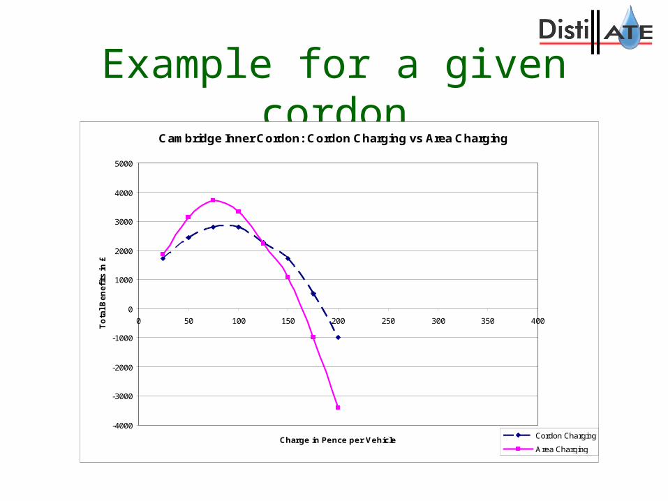
Example for a given cordon
Cambridge Inner Cordon: Cordon Charging vs Area Charging
-4000
-3000
-2000
-1000
0
1000
2000
3000
4000
5000
0 50 100 150 200 250 300 350 400
Charge in Pence per Vehicle
To
tal B
en
efi
ts in
£
Cordon Charging
Area Charging

Area based charging benefit surface
0 50
10
0
15
0
20
0
25
0
30
0
050
10
0
15
0
20
0
-3000-2000-1000010002000300040005000600070008000900010000110001200013000
Benefits, £
Cordon Fee, Pence
Area Fee, Pence
Surface of Benefits12000-13000
11000-12000
10000-11000
9000-10000
8000-9000
7000-8000
6000-7000
5000-6000
4000-5000
3000-4000
2000-3000
1000-2000
0-1000
-1000-0
-2000--1000
-3000--2000

Parking model - Aims
• Develop a simple parking location choice model with the demand spread over multiple time periods
• Integrate within assignment stage of the transport modelling process
• Develop a modelling framework that can be used to test parking demand management policies
• Illustrate the method with practically available data for a realistic network of Leeds

Implemented for Leeds SATURN model
Car park 1
Car park 2
Parking summary
• Car park choice for multiple user classes and across time periods has been incorporated within an equilibrium assignment approach (matching Lam et al)
• Impact of car park pricing structures/capacity can be modelled with the approach
• Further possible extensions – departure time choice, elastic demand, etc.

Improved Public transport modelling
1. DRACULA – Bus reliability
2. STM Partial modelling of Trip chaining (extended park and ride)
DRACULA – Bus reliability
• Incorporates interactions between bus operation, passenger arrivals, boarding times and private traffic.
• Simulation helps understand impacts on reliability and tested alternatives to increase reliability
• York case study

The DRACULA model of Route 4
• The bus route in red
• DRACULA model: – 138
junctions (39 signalised)
– 260 links– 21 bus
stops– 2 bus lanes
Results of model validation
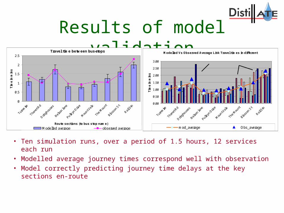
• Ten simulation runs, over a period of 1.5 hours, 12 services each run• Modelled average journey times correspond well with observation• Model correctly predicting journey time delays at the key sections en-route
Travel time between bus-stops
0
0.5
1
1.5
2
2.5
Turnm
ire
Tha
net R
d
Drin
ghou
ses
Nelso
n la
ne
Pulle
yn D
rive
Mou
nt Val
e
The M
ount
Bloss
on S
t
Rail S
tn
Route sections (to bus stop name)
Tim
e in
min
s
Modelled average observed average
Modelled Vs Observed Average Link Travel times in different
0.00
0.50
1.00
1.50
2.00
2.50
3.00
Turnm
ire
Thane
t Rd
Dringh
ouses
Nel
son
lane
Pulley
n Driv
e
Mou
nt Val
e
The M
ount
Bloss
on S
t
Rail S
tn
Route Sections
Tim
e in
min
s
mod_average Obs_average
Modelled Vs Observed Average Link Travel times in different
0.00
0.50
1.00
1.50
2.00
2.50
3.00
Turnm
ire
Thane
t Rd
Dringh
ouses
Nel
son
lane
Pulley
n Driv
e
Mou
nt Val
e
The M
ount
Bloss
on S
t
Rail S
tn
Route Sections
Tim
e in
min
s
mod_average Obs_average
Summary of results• Headway variation and number of passengers boarding
interrelated:
• Unreliability increases with congestion and passenger demand
• Passenger demand has more serious impact on headway variability than on total journey time
• Extension of bus-lane itself does not improve reliability, but combined with signal gating strategy will bring benefit
• Reduced boarding time (advanced ticketing system) brings in most significant improvements
STM – Park and Ride• Treats trip chaining in terms of park and ride at
Glasgow underground stations (Subway system). The entire Subway system can be modelled.
• Uses model of capacity constraint including ‘overflow’ model to transfer excess demand at car parks.
• Used to investigate interaction between direct travel to Glasgow centre and by Subway park and ride in context of strategic model.

Subway choice sets
• Additional program used to generate viable Subways for choice for each OD movement.
• Based on routes for direct travel
• Currently up to 5 Subways possible ( a middle possibility and 2 side alternatives)
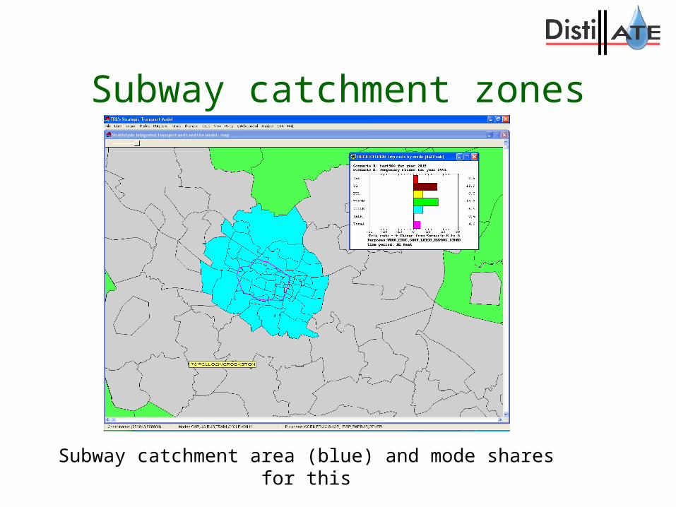
Subway catchment zones
Subway catchment area (blue) and mode shares for this

Run I (50% increase in jobs) – impact on Subway system
% mode share increases for all the catchment zones – Subway increases by about 16%

QUESTIONS?
Contact : Dr Simon Shepherd
Institute for Transport Studies
University of Leeds
Tel : 0113 343 6616