Editing multi-user Geodatabases - Esri Australia Pty Ltd · Session path • The role of the...
52
Transcript of Editing multi-user Geodatabases - Esri Australia Pty Ltd · Session path • The role of the...

Editing multi-user Geodatabases : An IntroductionWalter Simonazzi & Craig Carpenter

Objectives
• Key messages• What’s in it for me?• Agenda
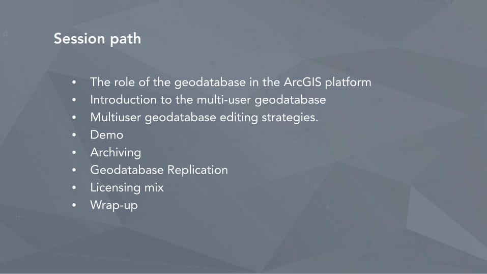
Session path
• The role of the geodatabase in the ArcGIS platform• Introduction to the multi-user geodatabase• Multiuser geodatabase editing strategies.• Demo• Archiving• Geodatabase Replication• Licensing mix• Wrap-up
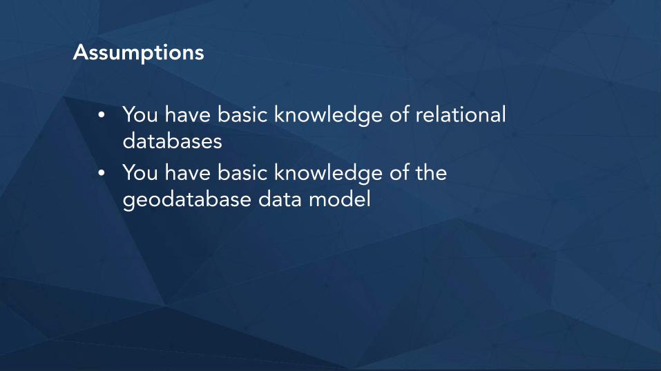
Assumptions
• You have basic knowledge of relational databases
• You have basic knowledge of the geodatabase data model
Session path
• The role of the geodatabase in the ArcGIS platform• Introduction to the multi-user geodatabase• Multiuser geodatabase editing strategies.• Demo• Archiving• Geodatabase Replication• Licensing mix• Wrap-up
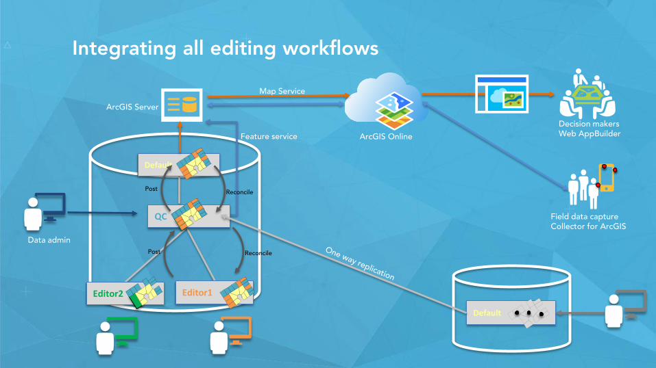
Integrating all editing workflows
Editor2
Default
ArcGIS Server
ArcGIS Online
Default
Feature service
Decision makersWeb AppBuilder
Data admin
Map Service
Reconcile
QC
Editor1
Post
Field data captureCollector for ArcGIS
Post Reconcile
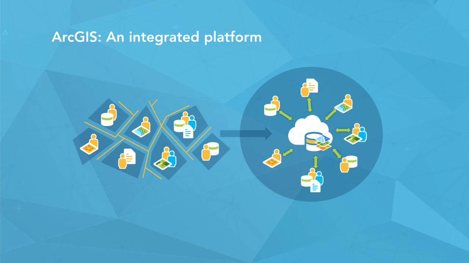
ArcGIS: An integrated platform
Session path
• The role of the geodatabase in the ArcGIS platform• Introduction to the multi-user geodatabase
• What is the multi-user geodatabase• Differences between a multi-user geodatabase and a database that
supports spatial types• Types of geodatabases• What is ArcSDE
• Multiuser geodatabase editing strategies.• Demo• Archiving• Geodatabase Replication• Licensing mix• Wrap-up
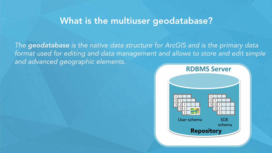
What is the multiuser geodatabase?
The geodatabase is the native data structure for ArcGIS and is the primary data format used for editing and data management and allows to store and edit simple and advanced geographic elements.
RDBMS Server
Repository
User schema SDE schema
What is ArcSDE?
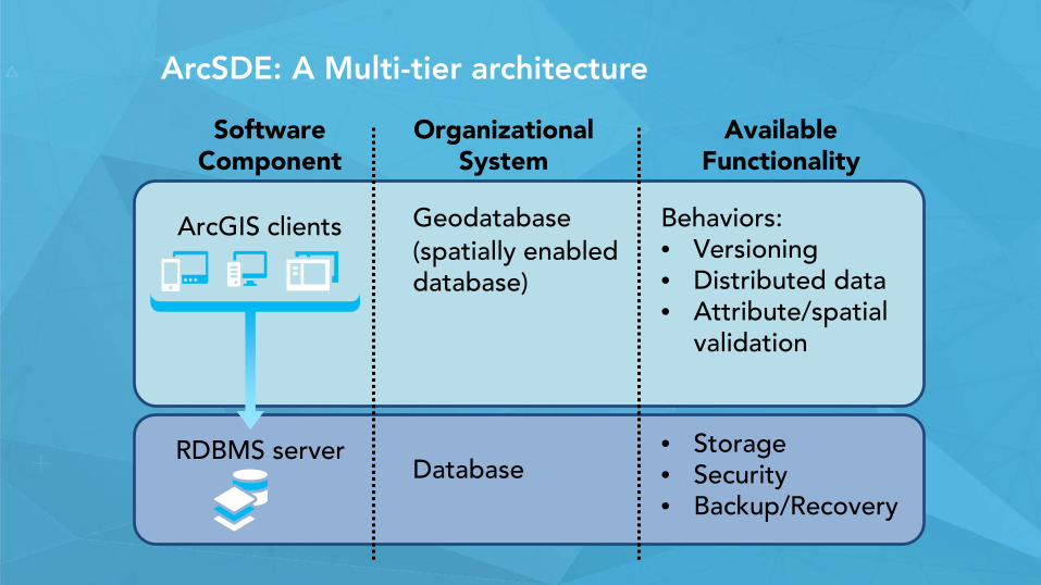
Software Component
Organizational System
Available Functionality
RDBMS server
Geodatabase(spatially enabled database)
Database
Behaviors:• Versioning• Distributed data• Attribute/spatial
validation
• Storage• Security• Backup/Recovery
ArcGIS clients
ArcSDE: A Multi-tier architecture
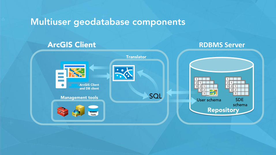
Multiuser geodatabase components
ArcGIS Client RDBMS Server
Repository
User schema SDE schema
RDBMSTools
Management tools SQL
Translator
ArcGIS Client and DB client
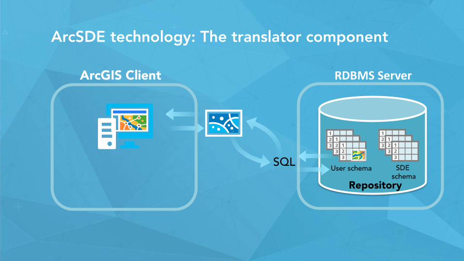
ArcSDE technology: The translator component
ArcGIS Client RDBMS Server
Repository
User schema SDE schema
SQL
ArcGIS Client RDBMS Server
Repository
User schema SDE schema
SQL
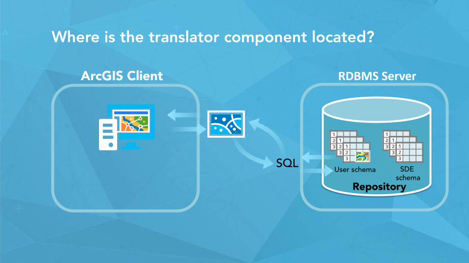
Where is the translator component located?

ArcGIS Client RDBMS Server
Repository
User schema SDE schema
SQL
Where is the translator component located?
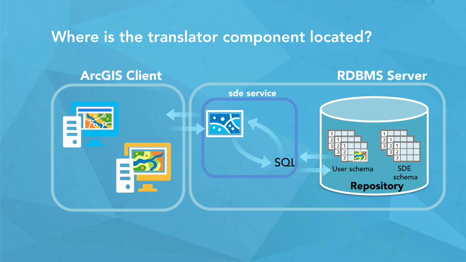
Where is the translator component located?
ArcGIS Client RDBMS Server
Repository
User schema SDE schema
SQL
sde service
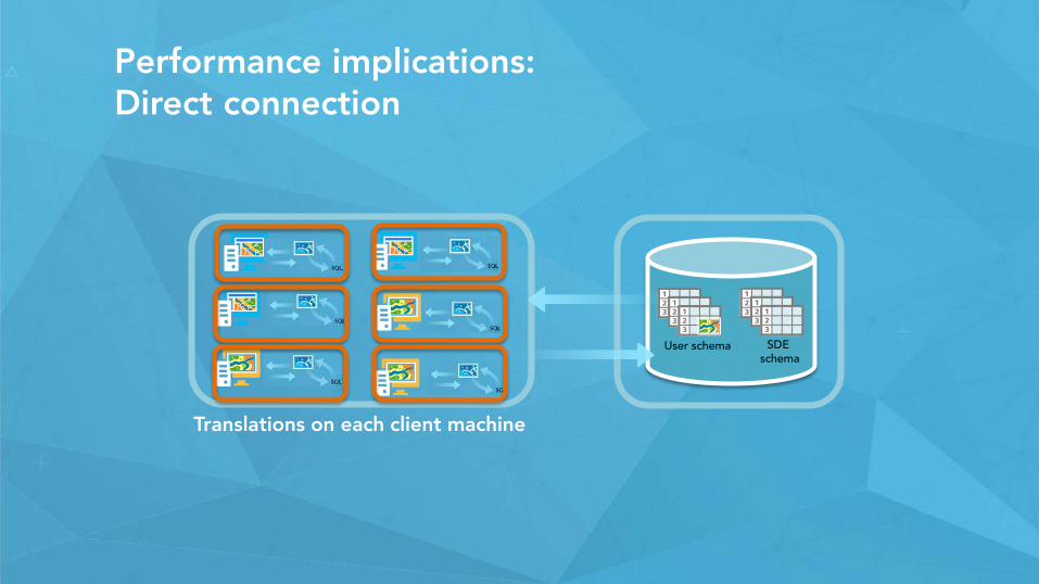
Performance implications: Direct connection
User schema SDE schema
Translations on each client machine
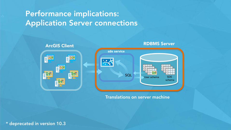
Performance implications: Application Server connections
ArcGIS Client RDBMS Server
User schema SDE schema
SQL
sde service
Translations on server machine
* deprecated in version 10.3
Session path
• The role of the geodatabase in the ArcGIS platform• Introduction to the multi-user geodatabase• Multiuser geodatabase editing strategies.
• What is versioning• Versioned Editing• Non-Versioned editing• Versioned editing with the move to base option
• Demo• Archiving• Geodatabase Replication• Licensing mix• Wrap-up
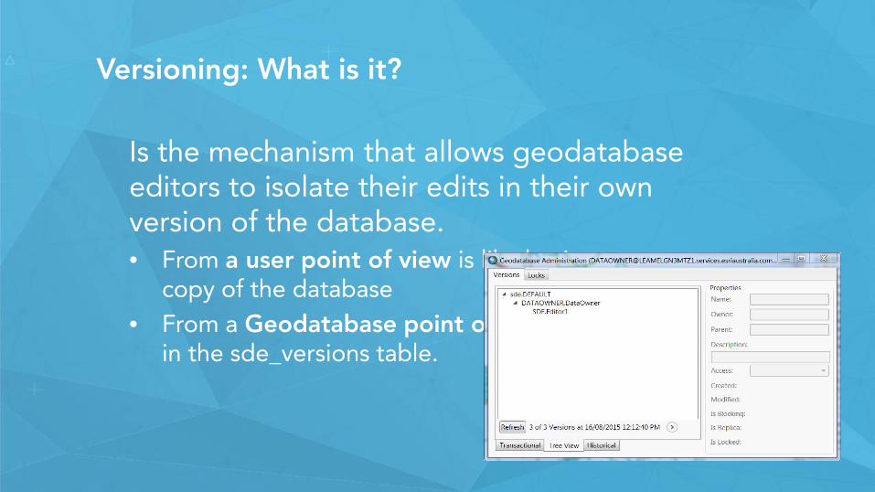
Versioning: What is it?
Is the mechanism that allows geodatabase editors to isolate their edits in their own version of the database.• From a user point of view is like having your own
copy of the database• From a Geodatabase point of view is just a new row
in the sde_versions table.
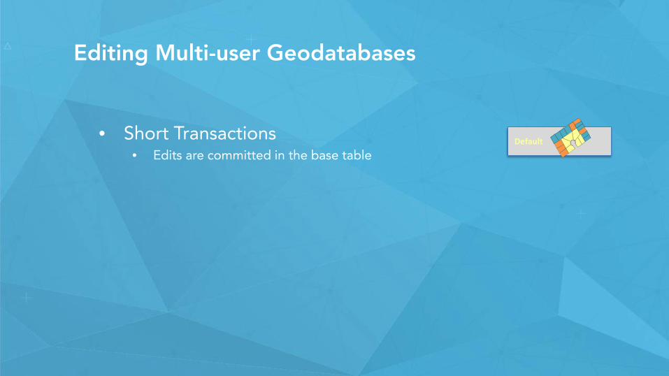
Editing Multi-user Geodatabases
• Short Transactions• Edits are committed in the base table
Default
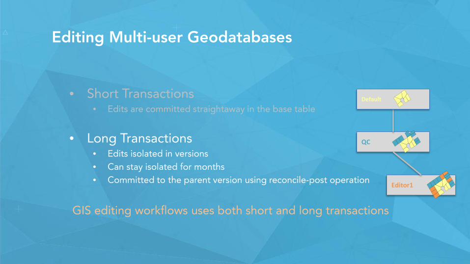
Editing Multi-user Geodatabases
• Short Transactions• Edits are committed straightaway in the base table
• Long Transactions• Edits isolated in versions• Can stay isolated for months• Committed to the parent version using reconcile-post operation
GIS editing workflows uses both short and long transactions
QC
Editor1
Default
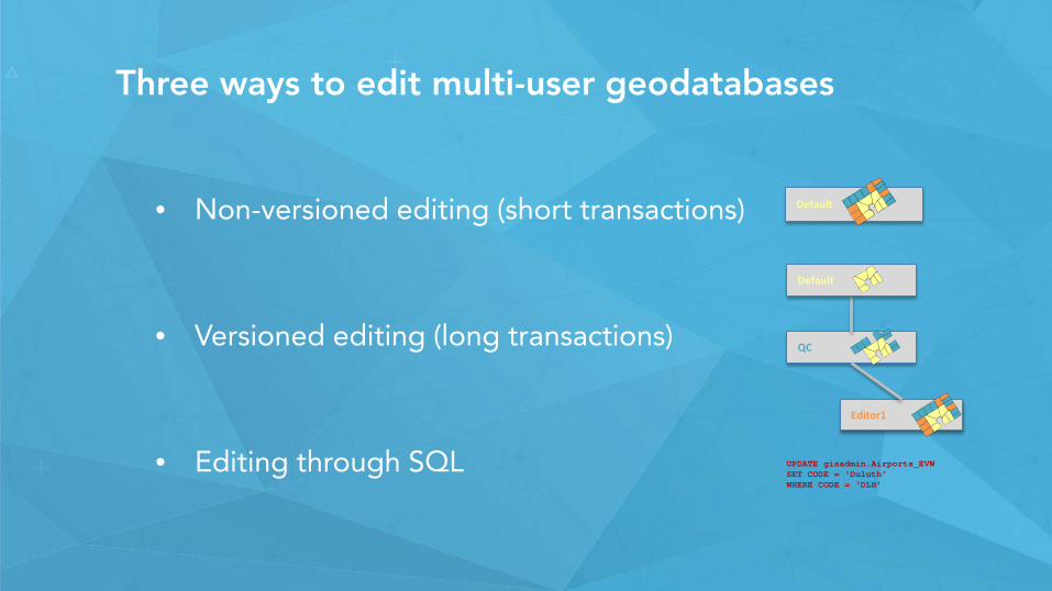
Three ways to edit multi-user geodatabases
• Non-versioned editing (short transactions)
• Versioned editing (long transactions)
• Editing through SQL
Default
QC
Editor1
Default
UPDATE gisadmin.Airports_EVWSET CODE = ‘Duluth’WHERE CODE = ‘DLH’
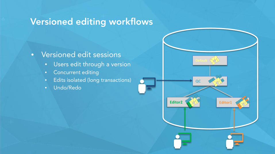
Versioned editing workflows
• Versioned edit sessions• Users edit through a version• Concurrent editing• Edits isolated (long transactions) • Undo/Redo
QC
Editor1
Default
Editor2
Adds
Deletes
User 1
User 2 User 3
User 3User 2
User 1
How versioning works:
Data owner
Register as versioned
AddsBase
Deletes
+
+Base
EditsAdd
User 1
+BaseEditsDeletes
+BaseEditsUpdate
User 3
User 2
Good practices
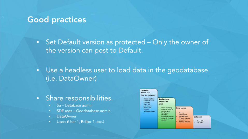
• Set Default version as protected – Only the owner of the version can post to Default.
• Use a headless user to load data in the geodatabase. (i.e. DataOwner)
• Share responsibilities.• Sa – Database admin• SDE user – Geodatabase admin• DataOwner• Users (User 1, Editor 1, etc.)
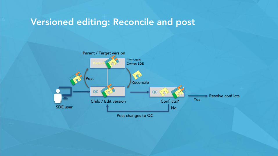
Versioned editing: Reconcile and post
Reconcile
QC
Conflicts? YesResolve conflicts
Default
QC
Parent / Target version
Child / Edit versionSDE user
ProtectedOwner: SDE
Post
No
Post changes to QC
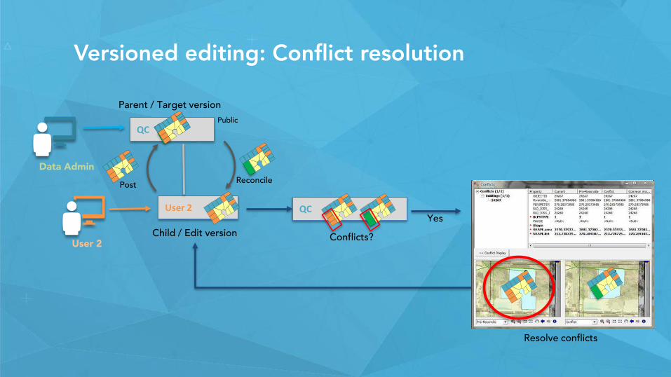
Versioned editing: Conflict resolution
Reconcile
User 2
QC
Parent / Target version
Child / Edit version
Public
User 2
Data Admin
Conflicts?
QCYes
Resolve conflicts
Post
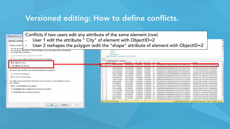
Versioned editing: How to define conflicts.
Conflicts if two users edit any attribute of the same element (row)- User 1 edit the attribute “ City” of element with ObjectID=2- User 2 reshapes the polygon (edit the “shape” attribute of element with ObjectID=2
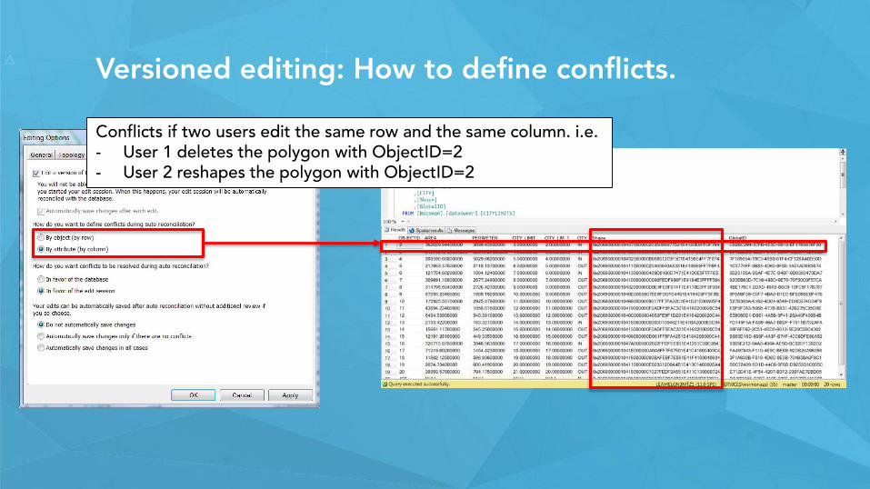
Versioned editing: How to define conflicts.
Conflicts if two users edit the same row and the same column. i.e.- User 1 deletes the polygon with ObjectID=2- User 2 reshapes the polygon with ObjectID=2
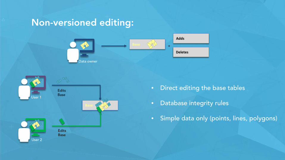
Non-versioned editing:
Data owner
BaseAdds
Deletes
+
EditsBase
Base
User 1
• Direct editing the base tables
• Database integrity rules
• Simple data only (points, lines, polygons)
User 2
EditsBase
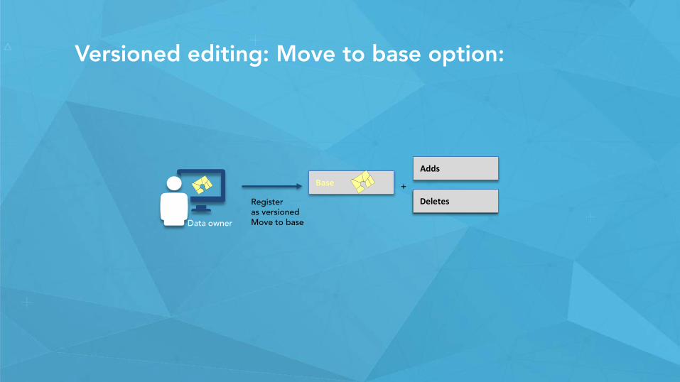
Versioned editing: Move to base option:
Data owner
Register as versionedMove to base
AddsBase
Deletes
+
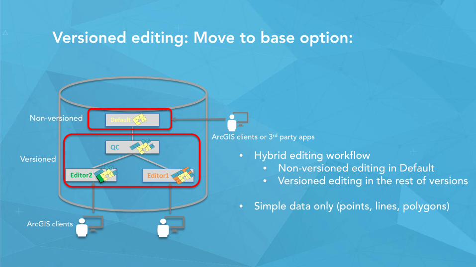
Versioned editing: Move to base option:
• Hybrid editing workflow• Non-versioned editing in Default• Versioned editing in the rest of versions
• Simple data only (points, lines, polygons)
QC
Editor1
Default
Editor2
Non-versioned
Versioned
ArcGIS clients or 3rd party apps
ArcGIS clients
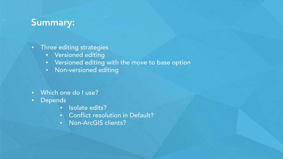
Summary:
• Three editing strategies• Versioned editing • Versioned editing with the move to base option• Non-versioned editing
• Which one do I use?• Depends
• Isolate edits?• Conflict resolution in Default?• Non-ArcGIS clients?
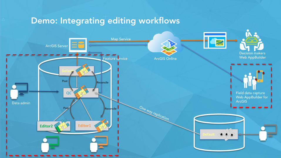
Demo: Integrating editing workflows
Editor2
Default
ArcGIS Server
ArcGIS Online
Default
Feature service
Decision makersWeb AppBuilder
Data admin
Map Service
Reconcile
QC
Editor1
Post
Field data captureWeb AppBuilder for ArcGIS
Post Reconcile
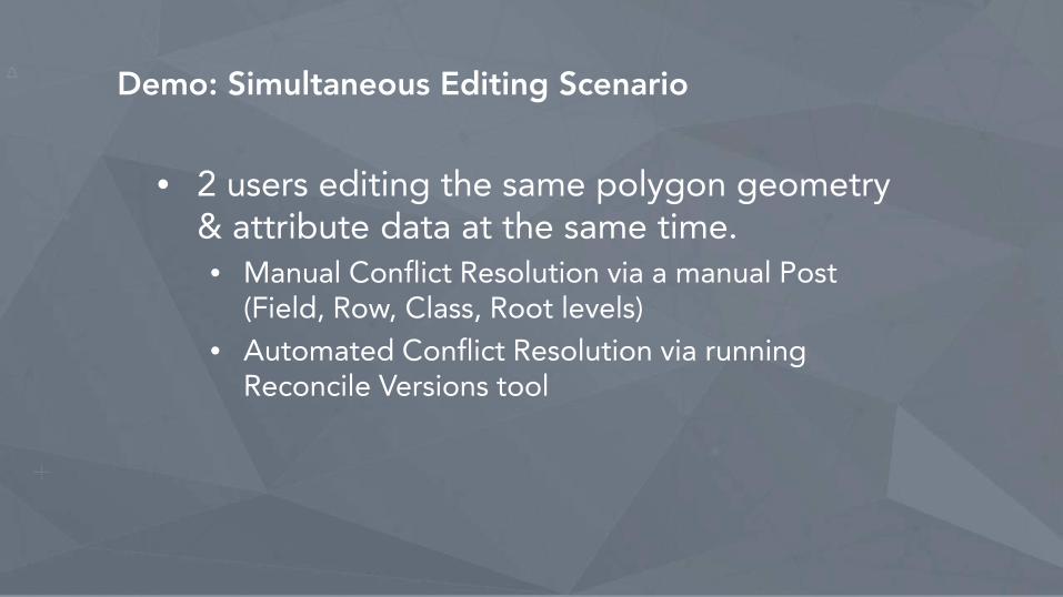
Demo: Simultaneous Editing Scenario
• 2 users editing the same polygon geometry & attribute data at the same time.• Manual Conflict Resolution via a manual Post
(Field, Row, Class, Root levels)• Automated Conflict Resolution via running
Reconcile Versions tool
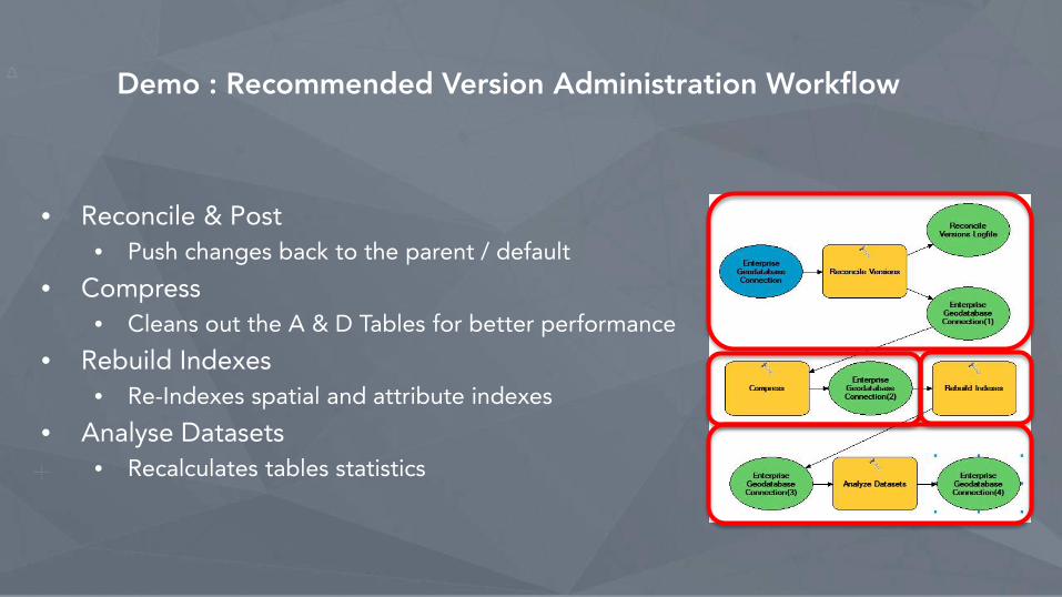
Demo : Recommended Version Administration Workflow
• Reconcile & Post• Push changes back to the parent / default
• Compress• Cleans out the A & D Tables for better performance
• Rebuild Indexes• Re-Indexes spatial and attribute indexes
• Analyse Datasets• Recalculates tables statistics

Session path
• The role of the geodatabase in the ArcGIS platform• Introduction to the multi-user geodatabase• Versioning workflows• Multiuser geodatabase editing strategies.• Demo• Archiving• Geodatabase Replication• Licensing mix• Wrap-up
Geodatabase archiving: what is it?
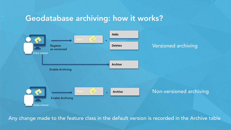
Geodatabase archiving: how it works?
Data owner
Register as versioned
AddsBase
Deletes
+
Enable Archiving
Archive
Any change made to the feature class in the default version is recorded in the Archive table
Data owner
Base +
Enable Archiving
Archive
Versioned archiving
Non-versioned archiving
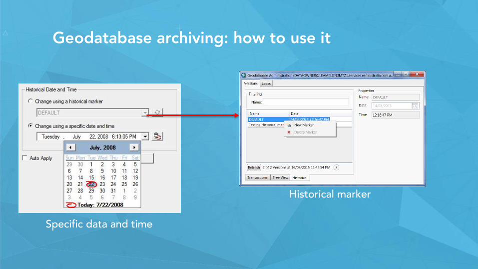
Geodatabase archiving: how to use it
Specific data and time
Historical marker
Session path
• The role of the geodatabase in the ArcGIS platform• Introduction to the multi-user geodatabase• Versioning workflows• Multiuser geodatabase editing strategies.• Demo• Archiving• Geodatabase Replication• Licensing mix• Wrap-up
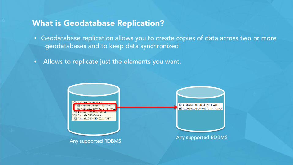
What is Geodatabase Replication?
• Geodatabase replication allows you to create copies of data across two or more geodatabases and to keep data synchronized
• Allows to replicate just the elements you want.
Any supported RDBMSAny supported RDBMS
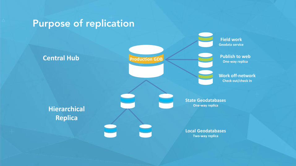
Purpose of replication
Publish to webOne-way replica
Work off-networkCheck out/check in
Field workGeodata service
Central Hub
Hierarchical Replica
Production GDB
State GeodatabasesOne-way replica
Local GeodatabasesTwo-way replica
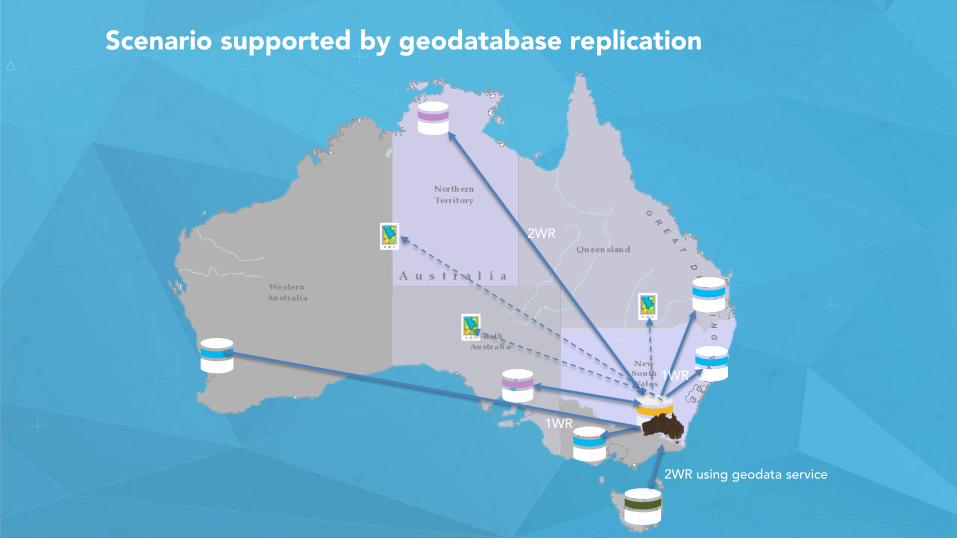
2WR using geodata service
2WR
1WR
1WR
Scenario supported by geodatabase replication
Session path
• The role of the geodatabase in the ArcGIS platform• Introduction to the multi-user geodatabase• Versioning workflows• Multiuser geodatabase editing strategies.• Demo• Archiving• Geodatabase Replication• Licensing mix• Wrap-up
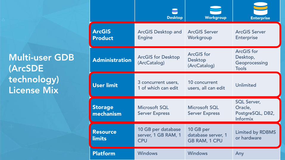
Multi-user GDB (ArcSDE technology) License Mix
ArcGIS Product
ArcGIS Desktop and Engine
ArcGIS Server Workgroup
ArcGIS Server Enterprise
Administration ArcGIS for Desktop (ArcCatalog)
ArcGIS for Desktop (ArcCatalog)
ArcGIS for Desktop, GeoprocessingTools
User limit 3 concurrent users, 1 of which can edit
10 concurrentusers, all can edit Unlimited
Storagemechanism
Microsoft SQL Server Express
Microsoft SQL Server Express
SQL Server, Oracle, PostgreSQL, DB2, Informix
Resource limits
10 GB per database server, 1 GB RAM, 1 CPU
10 GB per database server, 1 GB RAM, 1 CPU
Limited by RDBMS or hardware
Platform Windows Windows Any
Desktop Workgroup Enterprise
Session path
• The role of the geodatabase in the ArcGIS platform• Introduction to the multi-user geodatabase• Versioning workflows• Multiuser geodatabase editing strategies.• Demo• Archiving• Geodatabase Replication• Licensing mix• Wrap-up
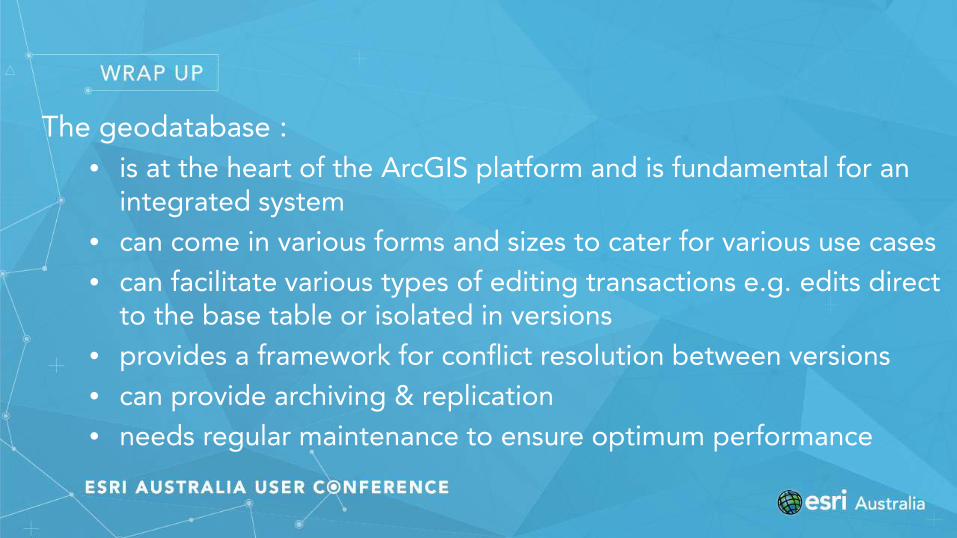
The geodatabase : • is at the heart of the ArcGIS platform and is fundamental for an
integrated system• can come in various forms and sizes to cater for various use cases• can facilitate various types of editing transactions e.g. edits direct
to the base table or isolated in versions• provides a framework for conflict resolution between versions• can provide archiving & replication• needs regular maintenance to ensure optimum performance
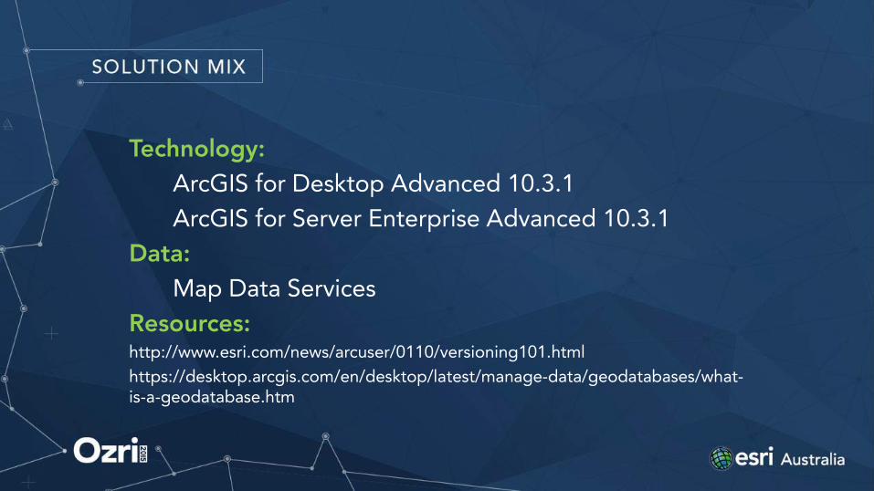
Technology:ArcGIS for Desktop Advanced 10.3.1ArcGIS for Server Enterprise Advanced 10.3.1
Data:Map Data Services
Resources:http://www.esri.com/news/arcuser/0110/versioning101.htmlhttps://desktop.arcgis.com/en/desktop/latest/manage-data/geodatabases/what-is-a-geodatabase.htm

STAY CONNECTED
Linked In: https://www.linkedin.com/in/simonazzi
https://www.linkedin.com/in/craigcarpenterau
Esri Australia’s Technical Blog:http://esriaustraliatechblog.wordpress.com
Esri Australia Training: https://esriaustralia.com.au/training
Subscribe to our e-newsletters:https://esriaustralia.com.au/contact-us-subscribe