Ecoregions of Texas - Texas A&M Universitypeople.tamu.edu/~j-packard/publications/BS09.03.pdf ·...
20
ECOREGIONS OF TEXAS Texas Master Naturalists Brazos Valley Chapter
Transcript of Ecoregions of Texas - Texas A&M Universitypeople.tamu.edu/~j-packard/publications/BS09.03.pdf ·...
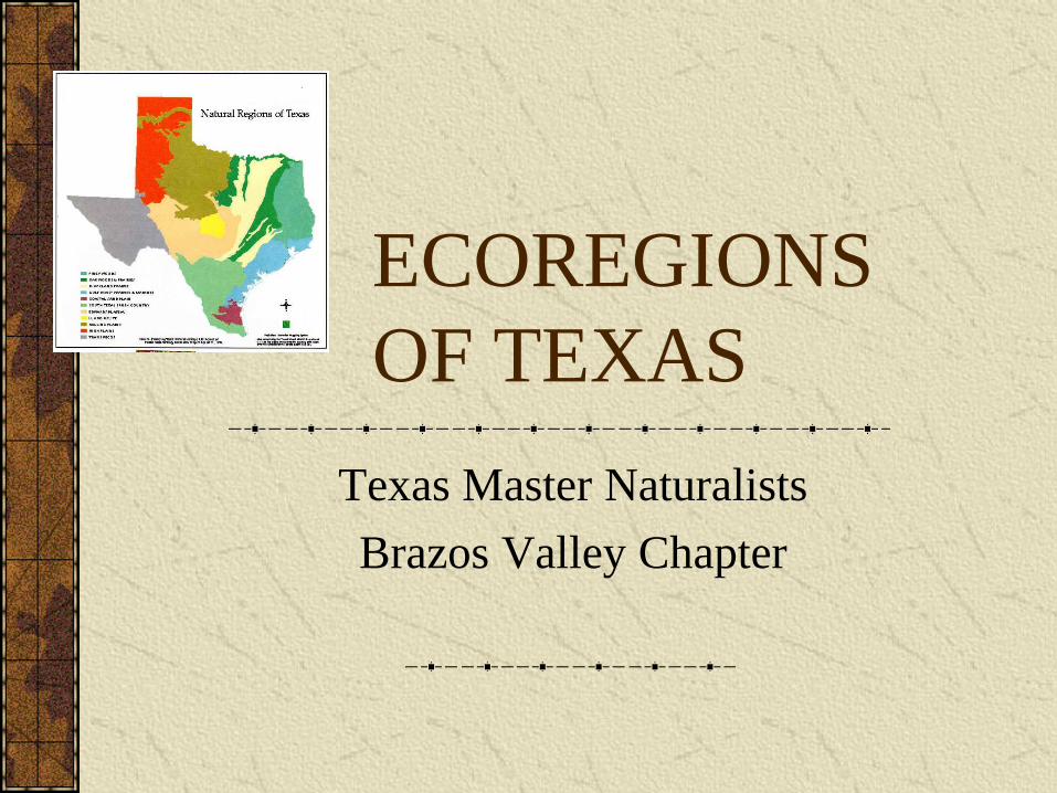
ECOREGIONS
OF TEXAS
Texas Master Naturalists
Brazos Valley Chapter
VIDEO: Texas Nature Celebration

LEARNING GOALS
1. Identify 9-11 ecological regions and understand how they relate to larger biomes (6) and smaller subregions (25)
2. Explain why managers use different maps at different scales to solve different problems
3. Explain why ecoregions differ in biodiversity
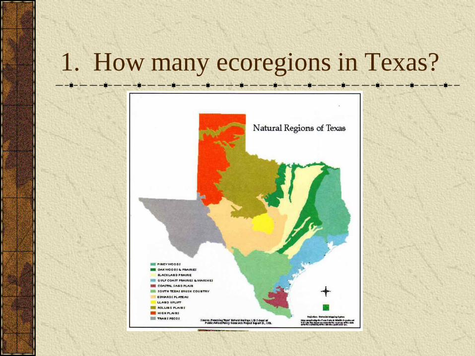
1. How many ecoregions in Texas?
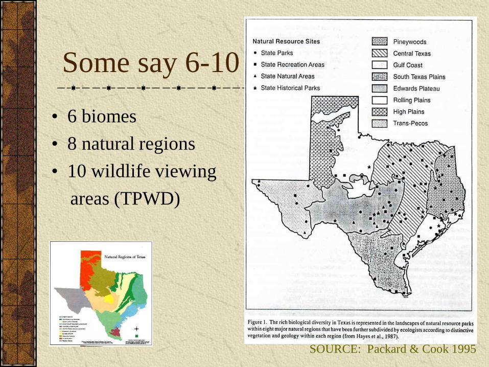
Some say 6-10
• 6 biomes
• 8 natural regions
• 10 wildlife viewing
areas (TPWD)
SOURCE: Packard & Cook 1995

Or is it 25, counting subregions!
Major Land
Resource Areas
MLRA
SOURCE: USDA, NRCS

BIOMES: ecoregions (subregions)
1. KANSAN PRAIRIE: grassland plains
rolling plains (3 subregions)
high plains
2. CENTRAL TEXAN: savannah
blackland prairie (2 subregions)
oakwoods & prairie (3 subregions)
3. BALCONIAN: hill country
Edwards plateau (3 subregions)
Llano uplift
4. AUSTRORIPARIAN: pineywoods (2 subregions)
5. TAMAULIPAN SCRUB: south Texas brush country (3 subregions)
6. GULF COAST: coastal sand plain (2 subregions)
7. CHIHUAHUAN DESERT: Trans pecos (6 subregions)
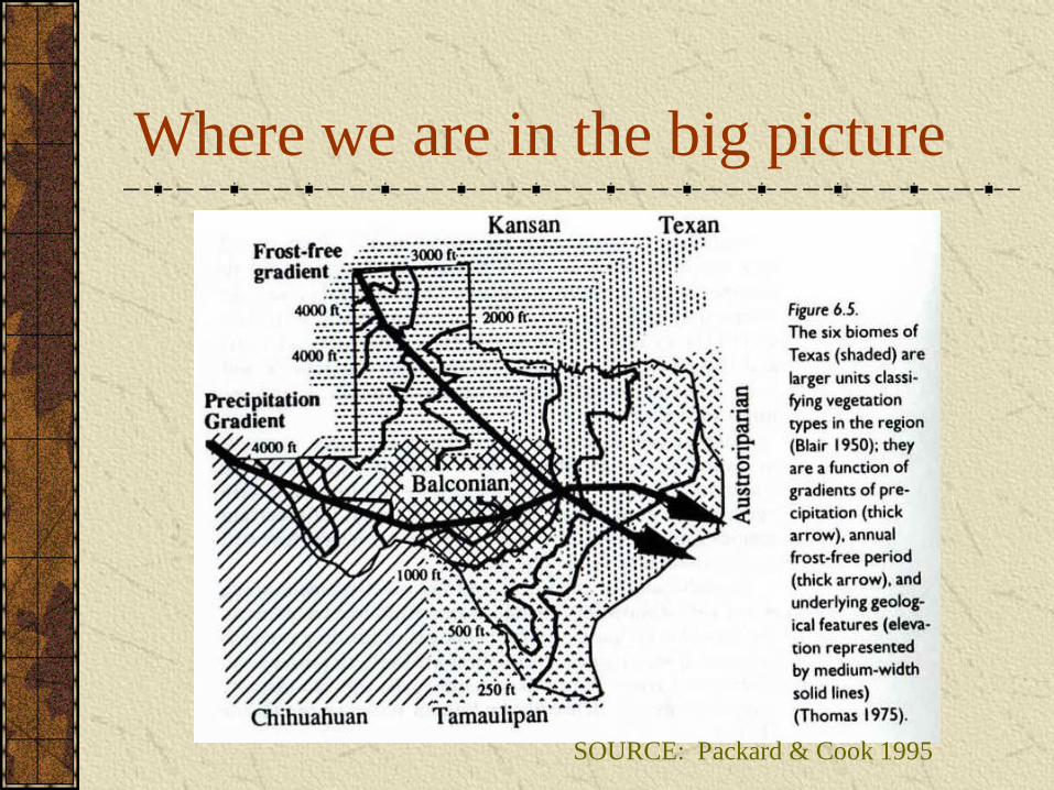
Where we are in the big picture
SOURCE: Packard & Cook 1995
2. Why so many different maps?
History- coarse grain maps initially covered large
areas of the continent
Technology- satellite imagery resulted in much
finer resolution
Scale of the Problem- scale matters, since
managers implement national, state & local laws
Biodiversity stewardship- communities,
populations, genotypes
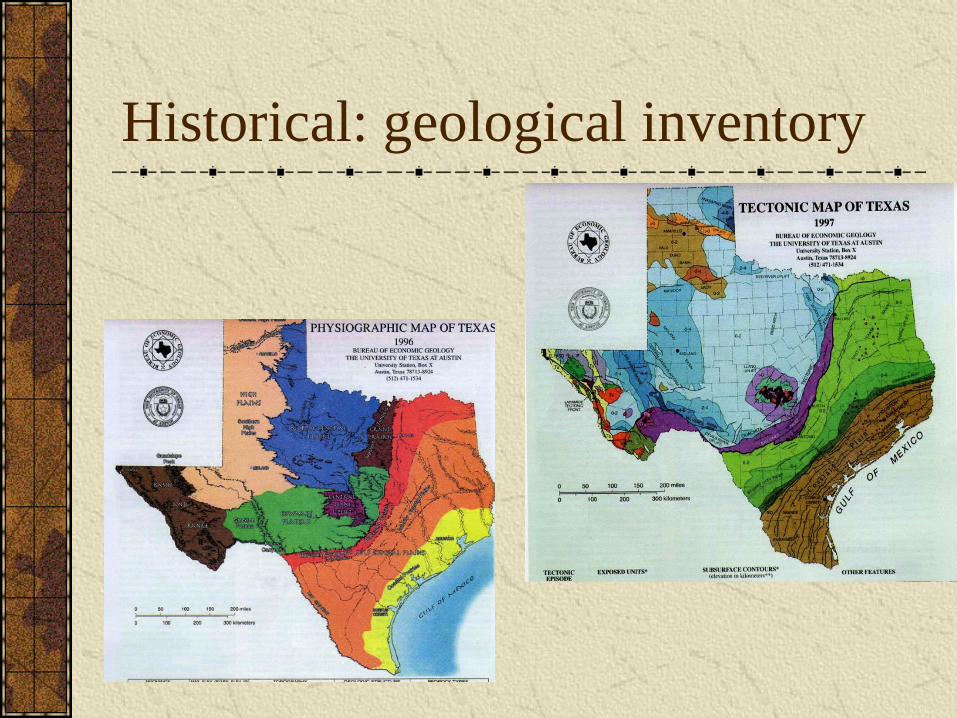
Historical: geological inventory

Technology: satellite imagery
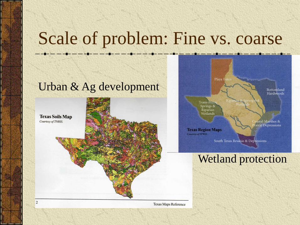
Scale of problem: Fine vs. coarse
Wetland protection
Urban & Ag development
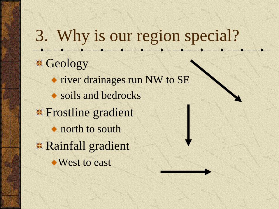
3. Why is our region special?
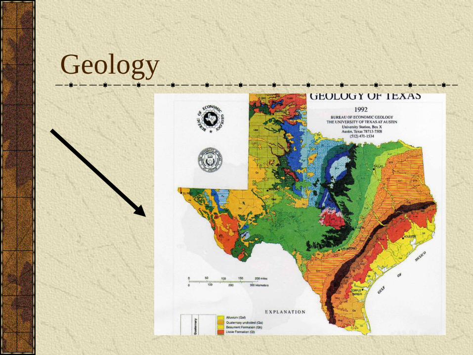
Geology
river drainages run NW to SE
soils and bedrocks
Frostline gradient
north to south
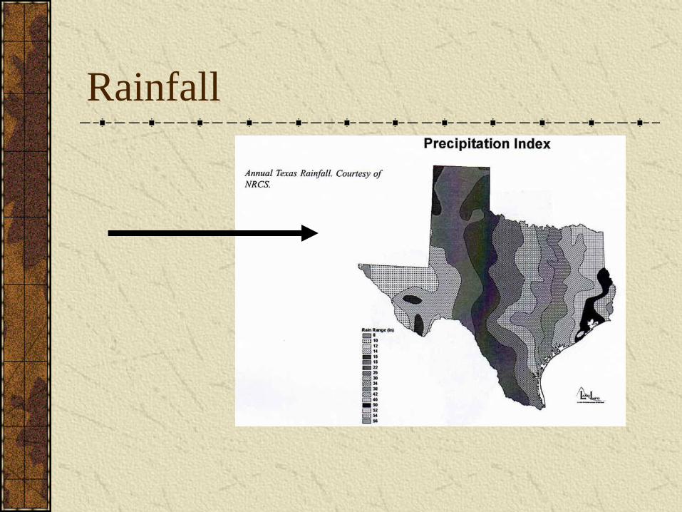
Rainfall gradient
West to east
Geology

Temperature
Rainfall

Connectivity
SOURCE: Packard & Cook 1995
• climate conditions
predicted to move northeast
• perpendicular rivers may
be barriers to species
moving along natural
gradients

Biodiversity stewardship
•Habitat
fragmentation
•Global climate
change

SUMMARY
Ecoregions within continental biomes (subregions)Central Texan savannah (blackland prairie (2), oakwoods & prairie (3))
Austroriparian (pineywoods (2) )
Balconian escarpment (Edwards plateau (3), Llano uplift)
Kansan plains (rolling plains (3), high plains)
Chihuahuan desert (Trans pecos (6))
Tamaulipan scrub (south Texas brush country/plains (3))
Gulf coast (coastal sand plain)
Map technology depends on the “problem”Biodiversity = Communities (coarse), populations, genotypes (fine)
Ecoregions differ in biodiversity due to geology (northwest/southeast), the frost line (north/south) and the rainfall gradient (west/east)
Sources
Texas Master Naturalist Training Handbook. Texas A&M
University. http://masternaturalist.tamu.edu
Biodiversity. Jane M. Packard, Wendy Gordon and Judith
Clarkson. 2009. In: The Impact of Global Warming on
Texas. Gerald R. North, Jurgen Schmandt, Judith Clarkson
(ed.). University of Texas Press, Austin. http://wfsc.tamu.edu/jpackard/share/my pubs/ch5biodiversity.pdf