Eberswalde Crater: Learning to Read the Fluvial System
46
Eberswalde Crater Learning to read the fluvial system William E. Dietrich Earth and Planetary Science University of California, Berkeley MSL Landing Site Workshop, Dietrich 1
-
Upload
nguyenkhanh -
Category
Documents
-
view
216 -
download
1
Transcript of Eberswalde Crater: Learning to Read the Fluvial System
Eberswalde Crater
Learning to read the fluvial system
William E. Dietrich Earth and Planetary Science University of California, Berkeley
MSL Landing Site Workshop, Dietrich 1

Bill, John Grotzinger just emailed you….
MSL Landing Site Workshop, Dietrich 2
With guidance from Melissa Rice, Kevin Lewis, Sanjeev Gupta, Edwin Kite and Alan Howard
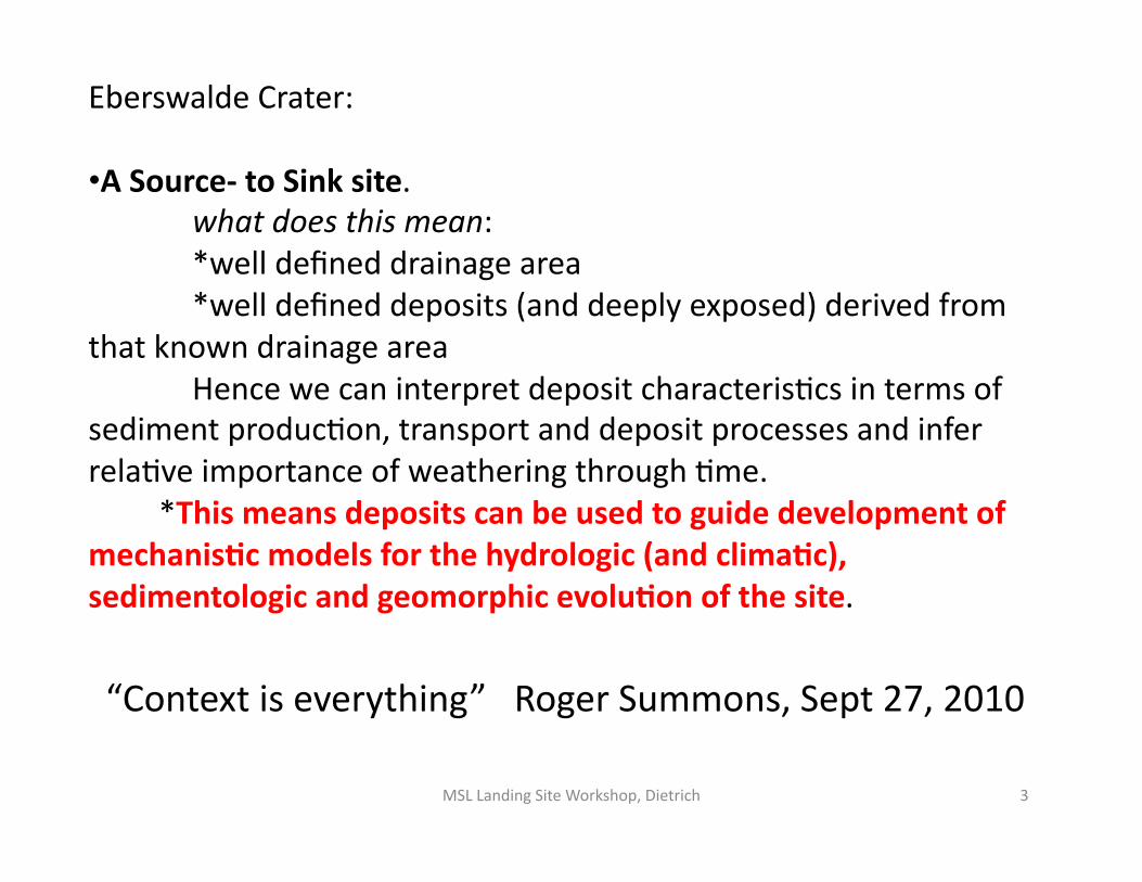
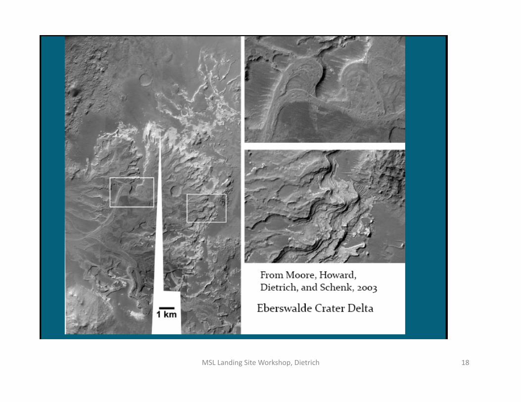
Eberswalde Crater:
• A Source‐ to Sink site. what does this mean: *well defined drainage area *well defined deposits (and deeply exposed) derived from
that known drainage area Hence we can interpret deposit characterisVcs in terms of
sediment producVon, transport and deposit processes and infer relaVve importance of weathering through Vme. *This means deposits can be used to guide development of mechanis:c models for the hydrologic (and clima:c), sedimentologic and geomorphic evolu:on of the site.
“Context is everything” Roger Summons, Sept 27, 2010
MSL Landing Site Workshop, Dietrich 3
Significant increase in evidence of drainage channels, fans, and well‐developed stra:graphy in Eberswalde • Growing evidence that the crater did have a lake(s) • Growing evidence that major deposit is a delta‐ not a erosional remnant of a terrestrial fan • No evidence that the delta was significantly more extensive than now River channels provide unique and essen:al informa:on: • River channels provide the only informaVon on rates of surface runoff but without ground observa2ons these observa2ons will be order of magnitude only • Fluvial features occur at Gale and Holden (and many places on Mars) and rover‐based observa2ons should provide key observaVons to understand their origin and controls. This will guide interpretaVon of channels elsewhere but also should provide significant informaVon about Mars climate, hydrology, and geochemistry. • Downstream river morphologic change may indicate fluvial transiVon to deltaic condiVons
MSL Landing Site Workshop, Dietrich 4
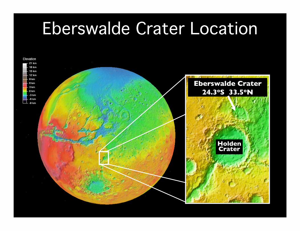
20 km Holden Crater
Eberswalde Crater 24.3oS 33.5oN
Eberswalde Crater Location
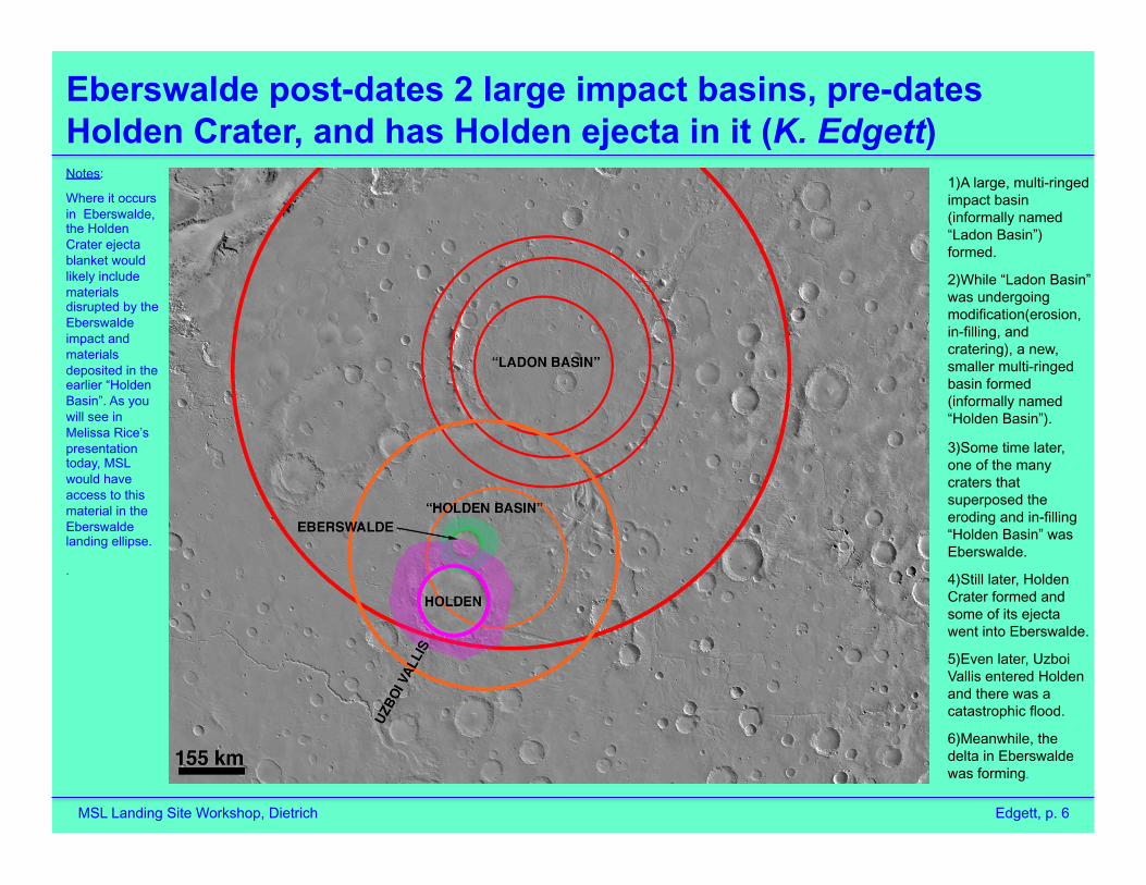
Eberswalde post-dates 2 large impact basins, pre-dates Holden Crater, and has Holden ejecta in it (K. Edgett)
MSL Landing Site Workshop, Dietrich Edgett, p. 6
1) A large, multi-ringed impact basin (informally named “Ladon Basin”) formed.
2) While “Ladon Basin” was undergoing modification(erosion, in-filling, and cratering), a new, smaller multi-ringed basin formed (informally named “Holden Basin”).
3) Some time later, one of the many craters that superposed the eroding and in-filling “Holden Basin” was Eberswalde.
4) Still later, Holden Crater formed and some of its ejecta went into Eberswalde.
5) Even later, Uzboi Vallis entered Holden and there was a catastrophic flood.
6) Meanwhile, the delta in Eberswalde was forming.
Notes:
Where it occurs in Eberswalde, the Holden Crater ejecta blanket would likely include materials disrupted by the Eberswalde impact and materials deposited in the earlier “Holden Basin”. As you will see in Melissa Rice’s presentation today, MSL would have access to this material in the Eberswalde landing ellipse.
.
7 MSL Landing Site Workshop, Dietrich
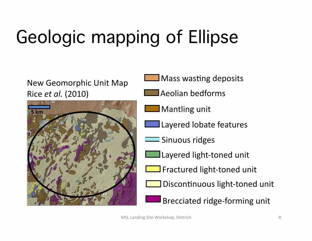
Mass wasVng deposits
Aeolian bedforms
Mantling unit
Layered lobate features
Fractured light‐toned unit
DisconVnuous light‐toned unit
Layered light‐toned unit
Brecciated ridge‐forming unit
Sinuous ridges
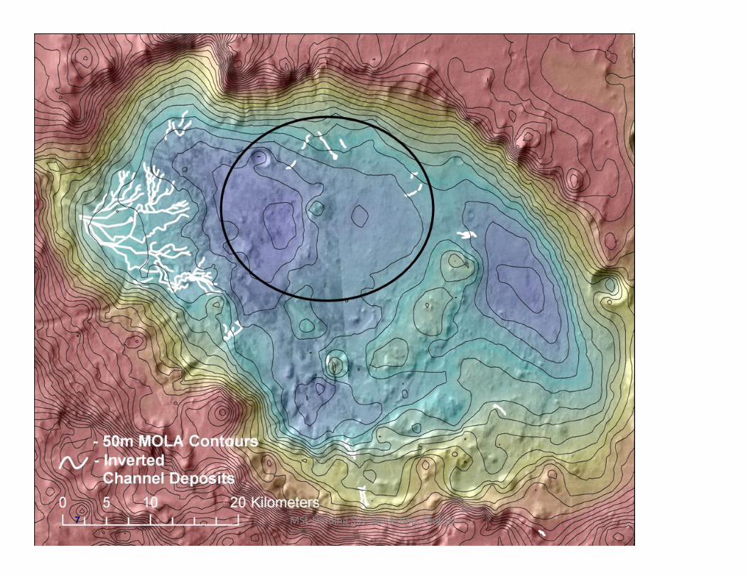
New Geomorphic Unit Map Rice et al. (2010)
5 km
Geologic mapping of Ellipse
MSL Landing Site Workshop, Dietrich 8

CTX image P01_001336_1560
2 km 1 km
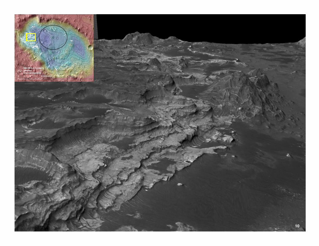
Eberswalde “Delta”: The opportunity
HiRISE image PSP_004356_1560 MSL Landing Site Workshop, Dietrich 9
Mars Science Laboratory Project Jet Propulsion Laboratory
10

Mars Science Laboratory Project Jet Propulsion Laboratory
11

Mars Science Laboratory Project Jet Propulsion Laboratory
R. Milliken 12
Water content

closest delta deposits to landing site: 1‐2 km from edge of ellipse
From Jim Rice’s 3rd Landing Site Workshop Presenta2on MSL Landing Site Workshop, Dietrich 13

MSL Landing Site Workshop, Dietrich 14

Source to Sink Sediment Signal
Transmission
AienuaVon
Internal dynamics
source transfer deposiVon
Eberswalde offers a closed basin in which sediment source dynamics, perhaps driven by hydrologic/climaVc variaVon, may be recorded in the straVgraphic record of the terminal deposit
MSL Landing Site Workshop, Dietrich 15
No subsidence in Eberswalde delta

Bhaiacharya et al. 2005
The delta is compose of several disVnct lobes.
MSL Landing Site Workshop, Dietrich 16

17
MSL Landing Site Workshop, Dietrich 18
MSL Landing Site Workshop, Dietrich 19
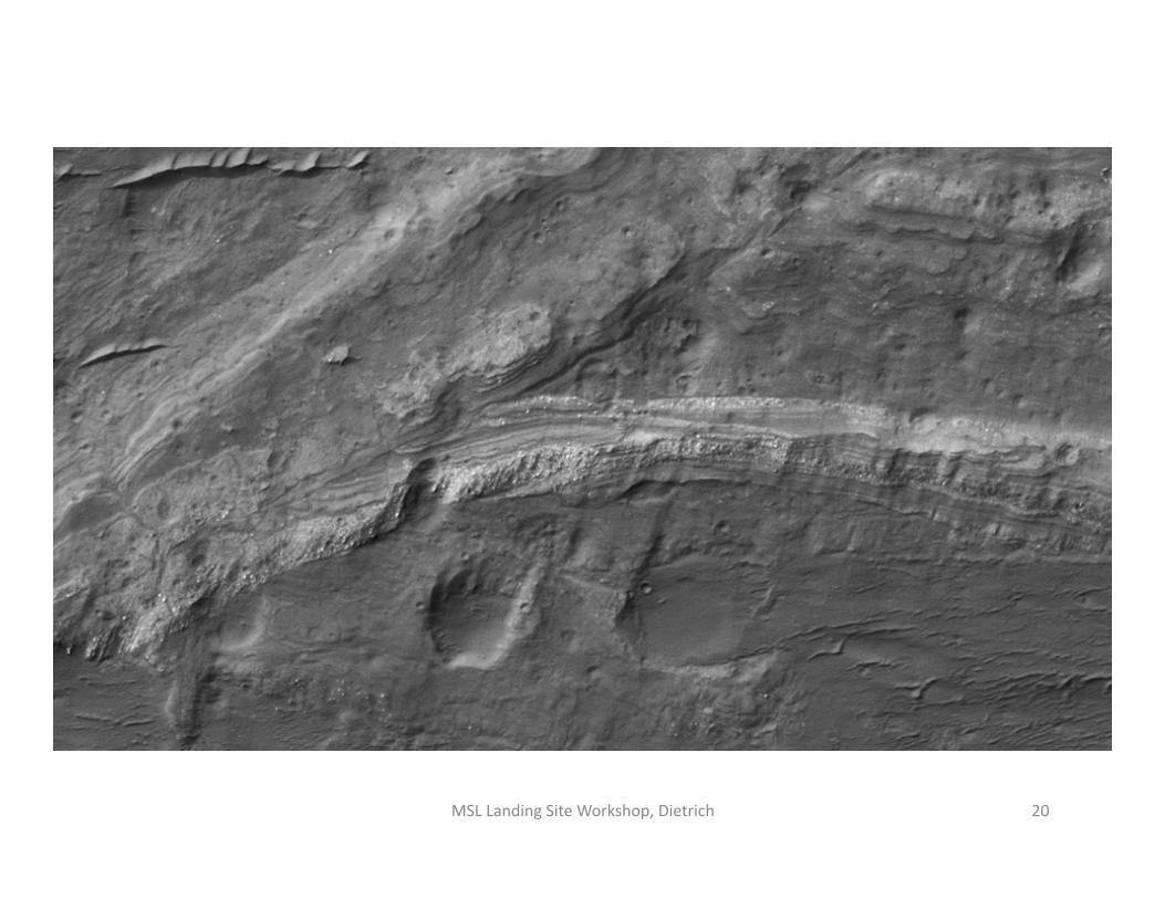
MSL Landing Site Workshop, Dietrich 20

MSL Landing Site Workshop, Dietrich 21

River channels can be used to es:mate surface discharge of water:
Q = W H V
Width can be esVmated remotely– not without uncertainty (canyon width may be much wider than the channel that cut it)
H (depth) is ooen guessed on assumed W/H raVo.
V (velocity) is calculated (with large uncertainty)
Ooen Q is esVmated from terrestrial correlaVons with width, meander wavelength or drainage area (large uncertainty)
MSL Landing Site Workshop, Dietrich 22

Discharge esVmates for Eberswalde main channel:
“bankfull discharge” m3/s reference
700 (300‐1600) Moore et al. 2003
410 ( 240‐950) Jerolmack et al. 2004
550 Irwin et al. 2005 1 cm/d
MSL Landing Site Workshop, Dietrich 23
Rover‐based observa:ons that would greatly reduce discharge uncertainty: River bed grain‐size, bedforms (dunes, bars), and direct observaVon of channel depth.
DuraVon and frequency of flows are much more difficult to esVmate.
ObservaVons on layering and sorVng would reveal sediment transport processes and guide esVmates of rates of deliver to delta

Meandering River Braided River (high bank strength) (low bank strength)

Meanders need bank strength. And it must be able to lose strength (and become erodible on the outside bank) and gain strength (once deposited in the inside bank)
Source of strength can not be determine by remote sensing . 1. Mud (silt and clay): this has implicaVons for weathering in the source area‐ and duraVon of “wet climate” 2. Cement: has implicaVons for Mars climate, mineralology, geochemistry, hydrology and site evoluVon 3. Ice: would imply a condiVon of free running water in a frozen environment, with major implicaVons for Mars climate history.
MSL Landing Site Workshop, Dietrich 25
Braudrick and Dietrich, PN
AS, 2009
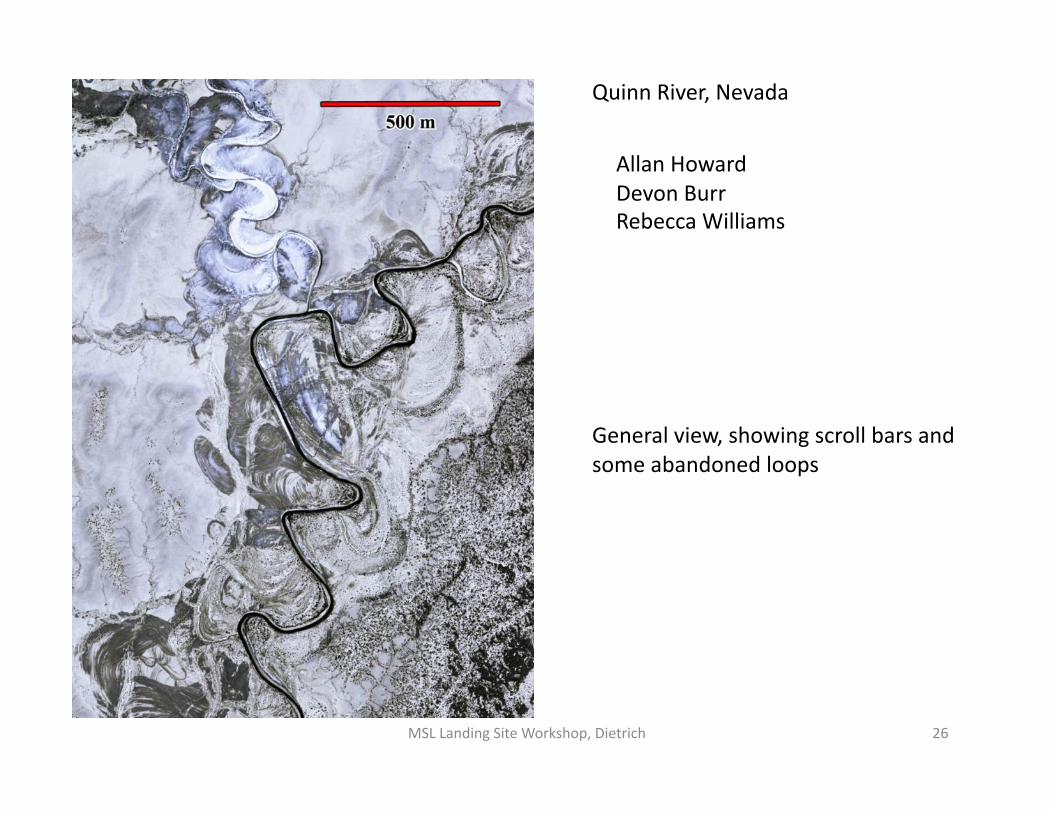
General view, showing scroll bars and some abandoned loops
Quinn River, Nevada
Allan Howard Devon Burr Rebecca Williams
MSL Landing Site Workshop, Dietrich 26

MSL Landing Site Workshop, Dietrich 27

Exposed Point bar deposits
MSL Landing Site Workshop, Dietrich 28
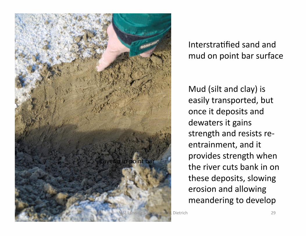
Layerin in point bar
InterstraVfied sand and mud on point bar surface
Mud (silt and clay) is easily transported, but once it deposits and dewaters it gains strength and resists re‐ entrainment, and it provides strength when the river cuts bank in on these deposits, slowing erosion and allowing meandering to develop
MSL Landing Site Workshop, Dietrich 29

3 km
Yana River, Siberia 67 deg N, Landsat 7,4,2
Channels cut against permafrost strengthen banks and deposit sediment on the inside bank into which the permafrost progressively advances.
MSL Landing Site Workshop, Dietrich 30
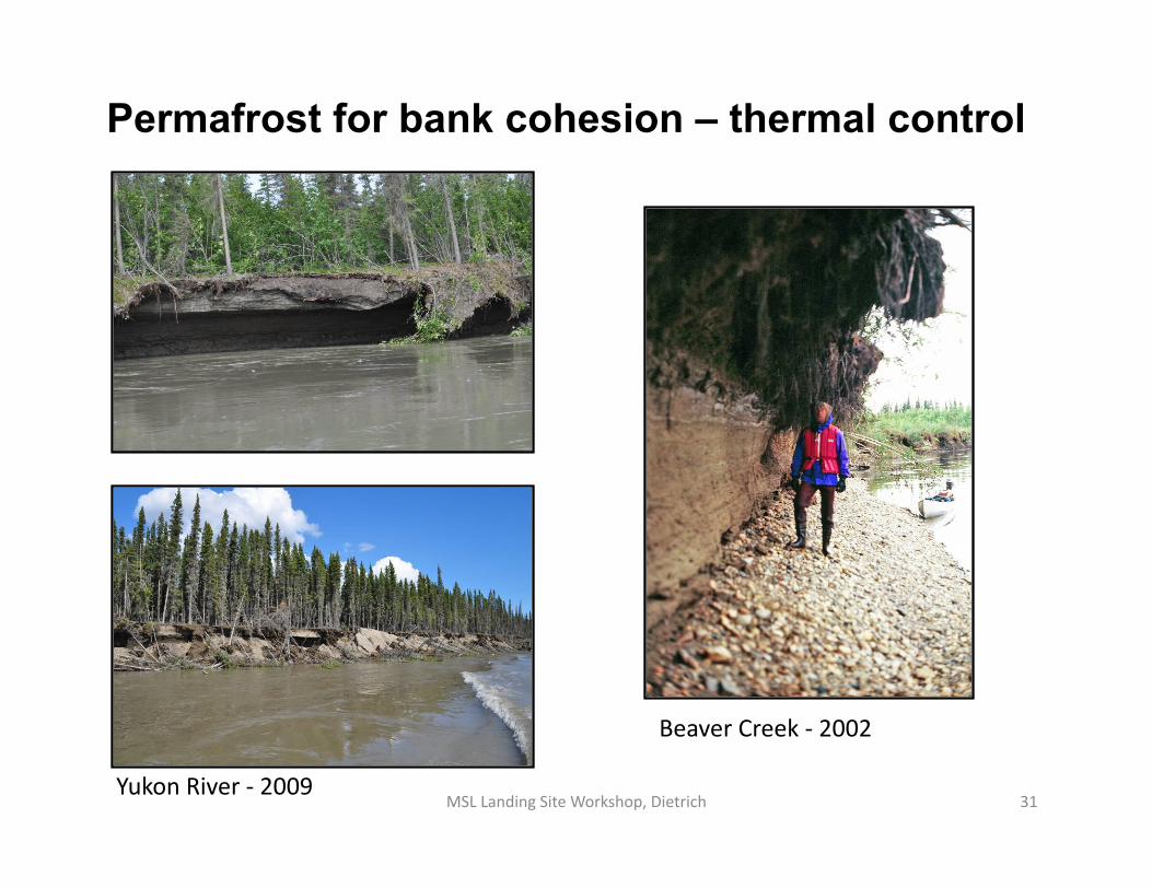
Permafrost for bank cohesion – thermal control
Yukon River ‐ 2009
Beaver Creek ‐ 2002
MSL Landing Site Workshop, Dietrich 31

MSL Landing Site Workshop, Dietrich 32

ESP_018056_1555_RED
MOLA context
CTX context
HiRISE context
100 m

Gale Crater, within the landing ellipse, Anderson and Bell (2010) MSL Landing Site Workshop, Dietrich 34
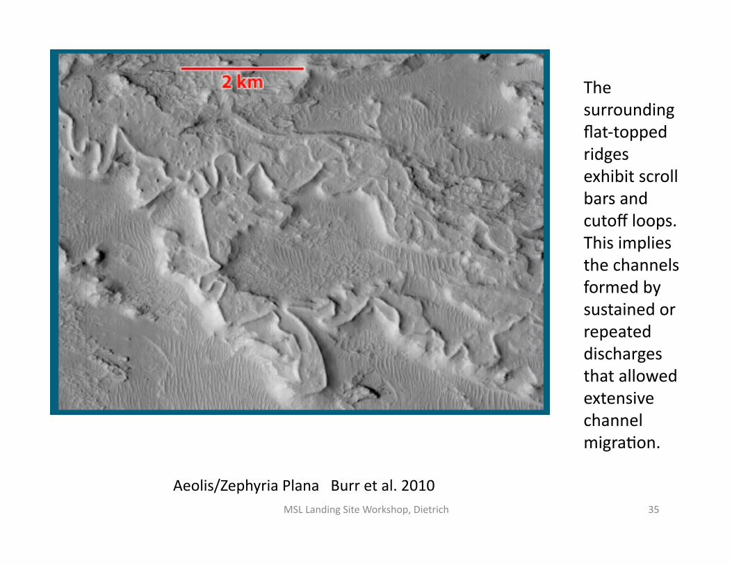
Aeolis/Zephyria Plana Burr et al. 2010
The surrounding flat‐topped ridges exhibit scroll bars and cutoff loops. This implies the channels formed by sustained or repeated discharges that allowed extensive channel migraVon.
MSL Landing Site Workshop, Dietrich 35

Aeolis MSL Landing Site Workshop, Dietrich 36

Inverted channels, Atacama Desert, A. Howard
MSL Landing Site Workshop, Dietrich 37

Significant and systemaVc downstream change in change morphology
MSL Landing Site Workshop, Dietrich 38

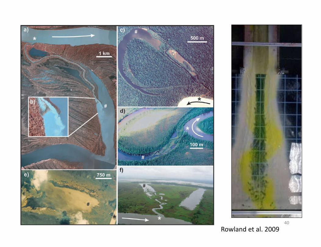
As sediment-laden rivers enter lakes and oceans they typically build distinct channels..
Herbert River, Papua New Guinea
(Dietrich)
Wax Lake delta, Louisiana, USA (Google Earth)
Former river bend
Channel advancing into the lake
Herbert River
New channels advancing into the ocean
MSL Landing Site Workshop, Dietrich 40
Rowland et al. 2009

Significant and systemaVc downstream change in change morphology
MSL Landing Site Workshop, Dietrich 41
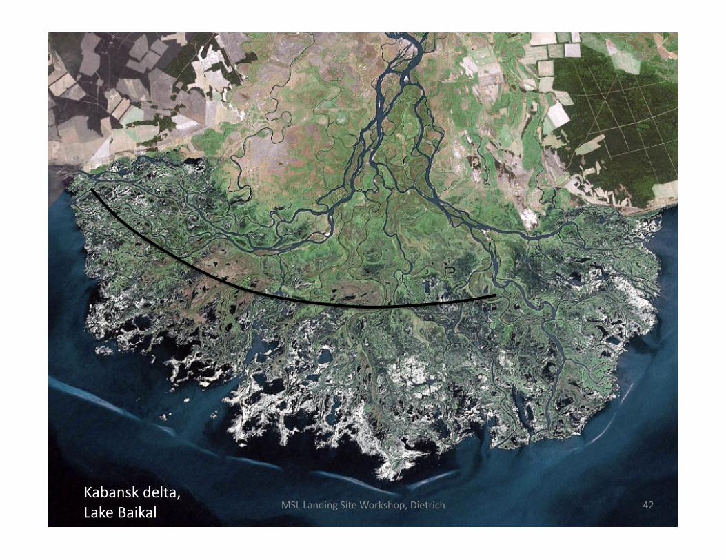
Kabansk delta, Lake Baikal MSL Landing Site Workshop, Dietrich 42

MSL Landing Site Workshop, Dietrich 43
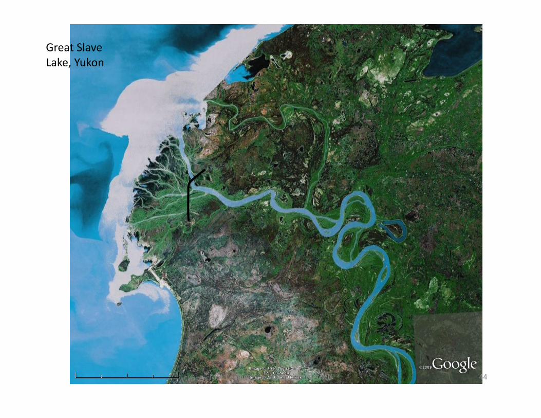
Great Slave Lake, Yukon
MSL Landing Site Workshop, Dietrich 44

Eberswalde Crater
Source to sink observaVons enable much deeper understanding of mechanisms, Vming, duraVon of processes and can be used to build constrained models
Increasing evidence that the major deposit is a delta and Eberswalde was at Vmes occupied by a lake.
Downstream variaVon in channel morphology may be indicaVve of transiVon into lake environment.
Rover‐based observaVons in fluvial channels can: 1) significantly improve esVmates of water discharge, and 2) reveal processes controlling meandering, which would then provide unique informaVon on climate, hydrology, weathering and geochemistry of Mars, which has implicaVons for understanding habitability!
MSL Landing Site Workshop, Dietrich 45
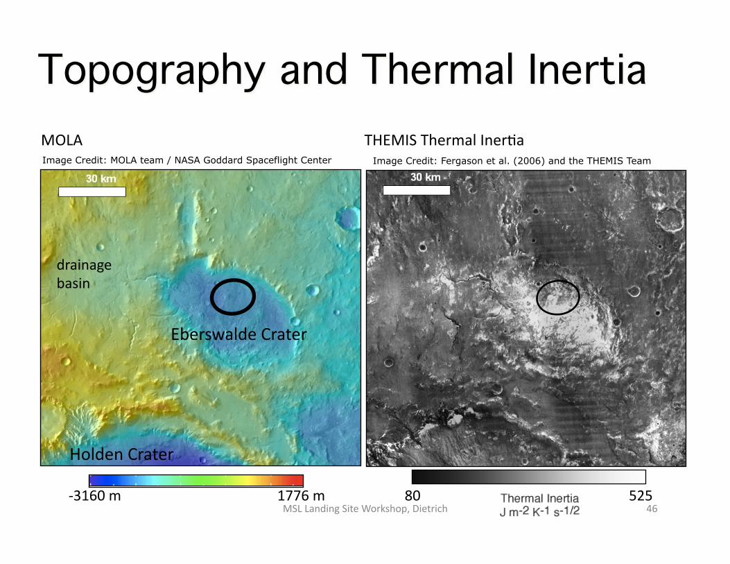
80 525
drainage basin
Holden Crater
MOLA THEMIS Thermal InerVa
1776 m ‐3160 m
Eberswalde Crater
Topography and Thermal Inertia
Image Credit: MOLA team / NASA Goddard Spaceflight Center Image Credit: Fergason et al. (2006) and the THEMIS Team
MSL Landing Site Workshop, Dietrich 46