E-Navigation in China - IALA AISM · Most prestige and largest maritime university in China One of...
35
1 E-Navigation in China Zhengjie Liu Sino-European Usability Center Dalian Maritime University, China www.usabilitychina.com www.dlmu.edu.cn
Transcript of E-Navigation in China - IALA AISM · Most prestige and largest maritime university in China One of...

1
E-Navigation in China
Zhengjie Liu
Sino-European Usability Center
Dalian Maritime University, China
www.usabilitychina.com
www.dlmu.edu.cn
2
The background …
3
Content
Development and Efforts in China
Relevant Work in DMU
4
Development and Efforts
in China
Development and Efforts in China
Started from the Digital Aids to Navigation in the 1990s, a variety of digital beacon based applications have been established and have already begun to take shape
A series of applications, including maritime information systems, aerial information systems, ship reporting systems, GMDSS, RBN/DGPS, AIS, VTS, beacon-based remote sensing and control systems, etc. have been set up, that have provided strong technical support for China‘s coastal maritime safety
Development and Efforts in China
To 1999, the RBN / DGPS station chain was built covering the coastal, and remote sensing and control based on telemetry buoy system was also built in several key waters
By 2005, China Maritime Safety Administration has built a network of coastal AIS, basically covering the coastal navigable waters and the lower reaches of the Yangtze River

Development and Efforts in China
Multiple coverage of AIS for traffic-intensive waters, key waters and complex waters was implemented
By the end of 2008, China built a total of 28 VTS, 20 DGPS stations, 94 AIS base stations
The construction of inland waterway AIS network is undergoing currently
Development and Efforts in China
In March 2012, China formally implemented the National Seafarers Competency Exam and Certification Rules, which clearly established the electrical and electronic staff positions
Several maritime colleges opened specialties for electrical and electronic staff and the graduates are well accepted widely by the maritime industry

AIS Vessel's Track in Laotieshan Waterway
Since September 2008, the Maritime Bureau of Ministry of Transportation has officially offered electronic charts for the nation's coastal ports and channels, that is in line with international standards
By 2010, full coverage of electronic chart to China's coastal has been achieved
Development and Efforts in China
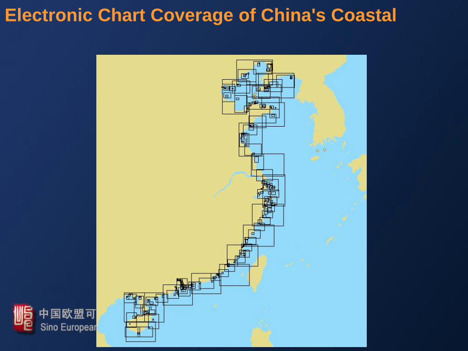
Electronic Chart Coverage of China's Coastal
Development and Efforts in China
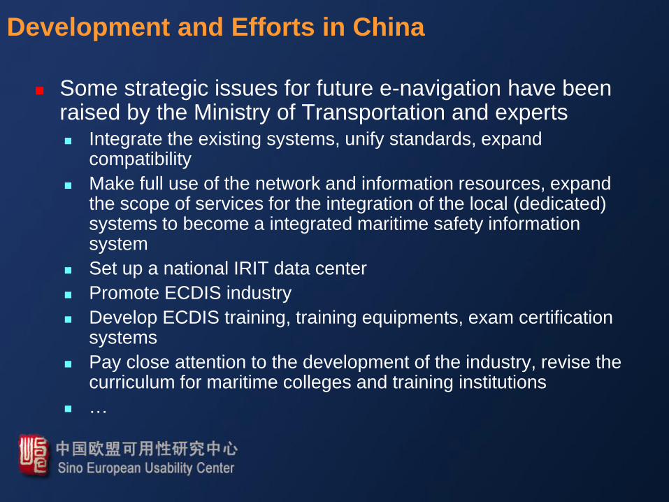
Some strategic issues for future e-navigation have been raised by the Ministry of Transportation and experts Strategic planning for the e-navigation development
Expand the research and application of AIS
Space-based AIS
R mode AIS
The second generation AIS
GPS differential correction information broadcasting by AIS
…
Development and Efforts in China
Some strategic issues for future e-navigation have been raised by the Ministry of Transportation and experts Promote information technology for maritime safety systems
Expand electronic chart coverage
Strengthen hydrological data publishing and application
Strengthen the research on three-dimensional, multi-dimensional data
…
Development and Efforts in China
Some strategic issues for future e-navigation have been raised by the Ministry of Transportation and experts Integrate the existing systems, unify standards, expand
compatibility
Make full use of the network and information resources, expand the scope of services for the integration of the local (dedicated) systems to become a integrated maritime safety information system
Set up a national IRIT data center
Promote ECDIS industry
Develop ECDIS training, training equipments, exam certification systems
Pay close attention to the development of the industry, revise the curriculum for maritime colleges and training institutions
…
15
Relevant Work in DMU

16
Where we are
Dalian
1 hour from Beijing
or Seoul
economic center in
northeast China
1.6 million urban
population
one of the ‘most
livable cities

17
DMU Overview
Founded in 1909
286 full-professor, over 1000 academic staff and 25,000 students
Most prestige and largest maritime university in China
One of the top 100 universities in China – National 211 Program
Sponsored by the Ministry of Transportation
Dalian Campus of the World Maritime University (WMU)

18
Colleges & Departments
Navigation College
Marine Engineering College
Information Sci. & Tech. College
Transportation Management College
Transportation & Logistics Engineering College
Law School
Environmental Science and Engineering College
Humanities and Social Sciences College
School of Foreign Languages
Joint program with WMU on maritime safety and environmental management
…

19
Research Facilities
National Key Engineering Research Center for Navigation
Two full mission ship-handling simulators and one engine room simulator

20
Research Facilities
Two ocean-going training vessels Teaching and training
Test bed for research in nautical science and marine engineering

2013/1/30 21/48
Relevant Projects - Research on e-navigation policies and key technologies
Policies for e-Navigation implementation
Standard system for e-Navigation
Design of e-Navigation testing and testbed

2013/1/30 22/48
Relevant Projects - Research on key technologies of AIS
AIS core processing chip technology
Automatic testing of AIS terminals
Automatic testing platform construction for the Maritime Safety Administration of China and the China Classification Society in 2014
Theories for AIS-R mode positioning technology

2013/1/30 23/48
Relevant Projects - Research on Chinese Beidou satellite navigation system
Development of chips for receiver of the Beidou satellite navigation
International standards for implementing Beidou navigation system
Testing of Beidou satellite navigation for AIS

24
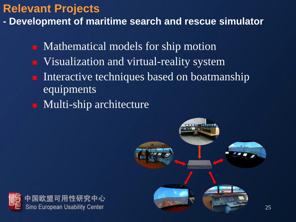
Relevant Projects - Development of maritime search and rescue simulator
25
Relevant Projects - Development of maritime search and rescue simulator
Mathematical models for ship motion
Visualization and virtual-reality system
Interactive techniques based on boatmanship equipments
Multi-ship architecture

26
Relevant Projects - Coastal broadband wireless communication and demo
applications for e-navigation

2013/1/30 27/48
Research
Characterization
and integration
of maritime
information
Broadband
communication
for ship-shore,
ship-ship and
shore-shore E-navigation
applications
Relevant Projects - Coastal broadband wireless communication and demo
applications for e-navigation
2013/1/30 28/48
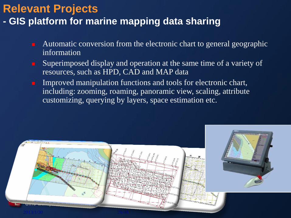
Relevant Projects - GIS platform for marine mapping data sharing
Automatic conversion from the electronic chart to general geographic information
Superimposed display and operation at the same time of a variety of resources, such as HPD, CAD and MAP data
Improved manipulation functions and tools for electronic chart, including: zooming, roaming, panoramic view, scaling, attribute customizing, querying by layers, space estimation etc.

2013/1/30 29/48
Relevant Projects - Development of ship dynamic video monitoring system
Based on GPS, AIS and ship-shore communication technology
Ship dynamic queries, tracking, track playback
Short message communication and two-way voice conversations with the ship
Real-time ship-shore transmission of ship video/audio information via wireless routing, such as 3G, CDMA, maritime satellite etc.

2013/1/30 30/48
Relevant Projects - Development of online monitoring system of ocean-going
vessels and cargo transportation
Ship polymorphic data acquisition and online analysis
Ship navigation safety risk warning
Ship-shore communication optimization
Deployed in more than 40 ocean-going ships
2013/1/30 31/48
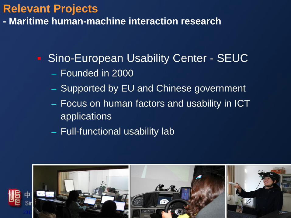
Relevant Projects - Maritime human-machine interaction research
Sino-European Usability Center - SEUC
– Founded in 2000
– Supported by EU and Chinese government
– Focus on human factors and usability in ICT
applications
– Full-functional usability lab
2013/1/30 32/48
Relevant Projects - Maritime human-machine interaction research
2013/1/30 33/48
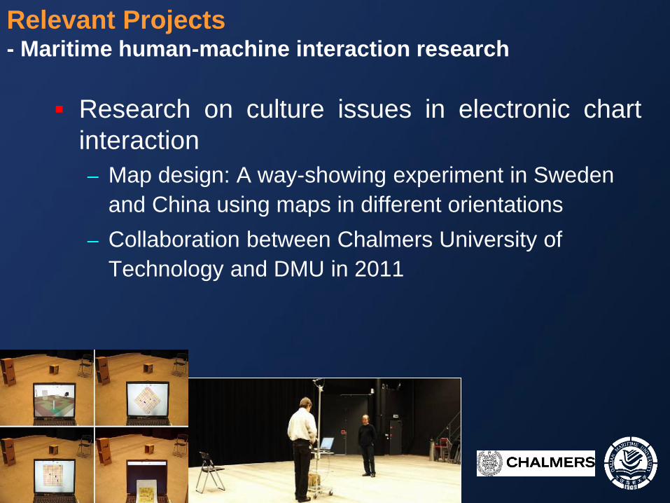
Relevant Projects - Maritime human-machine interaction research
Research on culture issues in electronic chart
interaction
– Map design: A way-showing experiment in Sweden
and China using maps in different orientations
– Collaboration between Chalmers University of
Technology and DMU in 2011
2013/1/30 34/48
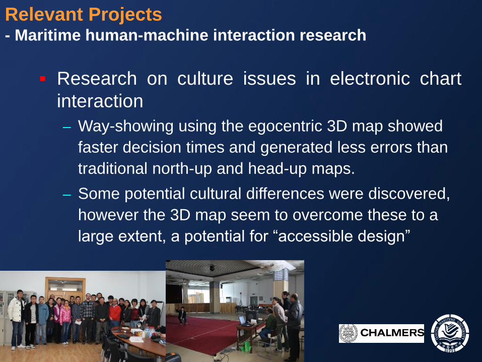
Relevant Projects - Maritime human-machine interaction research
Research on culture issues in electronic chart
interaction
– Way-showing using the egocentric 3D map showed
faster decision times and generated less errors than
traditional north-up and head-up maps.
– Some potential cultural differences were discovered,
however the 3D map seem to overcome these to a
large extent, a potential for “accessible design”
35
Thank you
Zhengjie Liu
Sino-European Usability Center
Dalian Maritime University, China