DRAFT FUTURE LAND USE ELEMENT TABLE OF CONTENTS · DRAFT FUTURE LAND USE ELEMENT TABLE OF CONTENTS...
119
FLUE 1-1 DRAFT FUTURE LAND USE ELEMENT TABLE OF CONTENTS DRAFT FUTURE LAND USE ELEMENT TABLE OF CONTENTS 1-1 1 FUTURE LAND USE ELEMENT 1-3 GOAL 1.0 PURPOSE OF FUTURE LAND USE ELEMENT 1-3 OBJECTIVE 1.1 Planning Framework 1-3 OBJECTIVE 1.2 Future Land Use 1-6 OBJECTIVE 1.3 Urban Future Land Use Series 1-9 OBJECTIVE 1.4 Rural Future Land Use Series 1-23 OBJECTIVE 1.5 Public Benefit Future Land Use Series 1-29 GOAL 2.0 SPECIAL COMMUNITIES 1-31 OBJECTIVE 2.1 Mount Plymouth-Sorrento Community 1-31 OBJECTIVE 2.2 Sunnyside Community 1-35 OBJECTIVE 2.3 Ferndale Community 1-37 GOAL 3.0 WEKIVA AREA. 1-41 OBJECTIVE 3.1 Wekiva River Protection Area and Wekiva Study Area. 1-41 OBJECTIVE 3.2 Wekiva River Protection Area (WRPA). 1-44 OBJECTIVE 3.3 Wekiva Study Area (WSA). 1-60 GOAL 4.0 GREEN SWAMP PROTECTION AREA 1-67 OBJECTIVE 4.1 Green Swamp 1-68 OBJECTIVE 4.2 Future Land Uses within the GSACSC 1-71 OBJECTIVE 4.3 Development within the GSACSC Relative to the Protection of Natural Resources 1-77 OBJECTIVE 4.4 Development within the GSACSC Relative to Public Facilities 1-77 OBJECTIVE 4.5 Specific Regulated Activities and Uses within the GSACSC 1-78 GOAL 5.0 LAKE COUNTY RURAL PROTECTION AREAS 1-82 Rural Protection Area Framework 1-82 OBJECTIVE 5.2 Wekiva-Ocala Rural Protection Area 1-84 OBJECTIVE 5.3 Emeralda Marsh Rural Protection Area 1-85 GOAL 6.0 OVERLAY DISTRICTS 1-87 OBJECTIVE 6.1 Historic Overlay Districts 1-87 OBJECTIVE 6.2 Scenic Roadway Overlay Districts 1-87 OBJECTIVE 6.3 Lake Apopka Basin Overlay District 1-91 OBJECTIVE 6.4 Pinecastle Military Operations Area Overlay District 1-93
-
Upload
hoangquynh -
Category
Documents
-
view
223 -
download
0
Transcript of DRAFT FUTURE LAND USE ELEMENT TABLE OF CONTENTS · DRAFT FUTURE LAND USE ELEMENT TABLE OF CONTENTS...

FLUE 1-1
DRAFT FUTURE LAND USE ELEMENT TABLE OF CONTENTS
DRAFT FUTURE LAND USE ELEMENT TABLE OF CONTENTS 1-1
1 FUTURE LAND USE ELEMENT 1-3
GOAL 1 .0 PURPOSE OF FUTURE LAND USE ELEMENT 1 -3
OBJECTIVE 1.1 Planning Framework 1-3
OBJECTIVE 1.2 Future Land Use 1-6
OBJECTIVE 1.3 Urban Future Land Use Series 1-9
OBJECTIVE 1.4 Rural Future Land Use Series 1-23
OBJECTIVE 1.5 Public Benefit Future Land Use Series 1-29
GOAL 2 .0 SPECIAL COMMUNIT IES 1 -31
OBJECTIVE 2.1 Mount Plymouth-Sorrento Community 1-31
OBJECTIVE 2.2 Sunnyside Community 1-35
OBJECTIVE 2.3 Ferndale Community 1-37
GOAL 3 .0 WEKIVA AREA. 1 -41
OBJECTIVE 3.1 Wekiva River Protection Area and Wekiva Study Area. 1-41
OBJECTIVE 3.2 Wekiva River Protection Area (WRPA). 1-44
OBJECTIVE 3.3 Wekiva Study Area (WSA). 1-60
GOAL 4 .0 GREEN SWAMP PROTECT ION AREA 1 -67
OBJECTIVE 4.1 Green Swamp 1-68
OBJECTIVE 4.2 Future Land Uses within the GSACSC 1-71
OBJECTIVE 4.3 Development within the GSACSC Relative to the Protection of Natural Resources 1-77
OBJECTIVE 4.4 Development within the GSACSC Relative to Public Facilities 1-77
OBJECTIVE 4.5 Specific Regulated Activities and Uses within the GSACSC 1-78
GOAL 5 .0 LAKE COUNTY RURAL PROTECTION AREAS 1 -82
Rural Protection Area Framework 1-82
OBJECTIVE 5.2 Wekiva-Ocala Rural Protection Area 1-84
OBJECTIVE 5.3 Emeralda Marsh Rural Protection Area 1-85
GOAL 6 .0 OVERLAY DISTRICTS 1 -87
OBJECTIVE 6.1 Historic Overlay Districts 1-87
OBJECTIVE 6.2 Scenic Roadway Overlay Districts 1-87
OBJECTIVE 6.3 Lake Apopka Basin Overlay District 1-91
OBJECTIVE 6.4 Pinecastle Military Operations Area Overlay District 1-93

FLUE 1-2
OBJECTIVE 6.5 Rural Protection Area Overlay Districts 1-94
GOAL 7 .0 IMPLEMENTATION 1 -95
OBJECTIVE 7.1 Protect Neighborhoods 1-95
OBJECTIVE 7.2 Protect Rural Lifestyles 1-98
OBJECTIVE 7.3 Coordinate Land Use with Environmental Protection 1-100
OBJECTIVE 7.4 Retention of Agricultural Lands 1-103
OBJECTIVE 7.5 Nonconformities and Vested Rights 1-103
OBJECTIVE 7.6 Planned Developments. 1-107
OBJECTIVE 7.7 Developments of Regional Impact 1-108
OBJECTIVE 7.8 Public Facilities and Services 1-109
OBJECTIVE 7.9 Community Enhancement Areas 1-111
OBJECTIVE 7.10 Intergovernmental Coordination 1-112
OBJECTIVE 7.11 Utilities 1-114
OBJECTIVE 7.12 Comprehensive Plan Amendment Standards of Review 1-116
OBJECTIVE 7.13 GREENHOUSE GAS REDUCTION. 1-118
FLUE 1-3
1 FUTURE LAND USE ELEMENT
GOAL 1.0 PURPOSE OF FUTURE LAND USE ELEMENT
The goal of the Future Land Use Element is to define the character of Lake County and identify the location of land uses that:
• Promote conservation of Lake County’s natural and cultural resources;
• Provide public facilities and services concurrent with the impacts from development and comply with adopted levels of service standards;
• Maximize economic benefits for existing and future residents;
• Promote a compact growth and development pattern that establishes a clear delineation between urban and rural land uses;
• Ensure compatibility between land uses; and
• Minimize detrimental impacts to health, safety and welfare.
OBJECTIVE 1.1 Planning Framework
Lake County shall establish a planning framework to provide for the efficient provision of services, use of innovative planning techniques, a variety of transportation, employment and housing options, protection of the environment, and a sustainable diversified economy.
Policy 1.1.1 Elements of Innovative Planning
The Comprehensive Plan embodies strategies designed to protect the rural character of the County; build long-term community value; discourage urban sprawl; and ensure that public facilities and services are provided in the most cost-effective and efficient manner. The County shall develop and enforce Land Development Regulations designed to protect residential neighborhoods, enhance the economic viability of the community, promote the efficient use of infrastructure, including transportation, and preserve natural resources. The Comprehensive Plan and Land Development Regulations shall protect:
• Quality communities;
• Public lands and natural resources;
• Water resources;
• Parks and trails;
• Viewscapes and gateways;
• Business and Employment opportunities; and
• Rural areas and lifestyles.

FLUE 1-4
Policy 1.1.2 Economic Development Strategies
Economic development encompasses a broad range of strategies to substantially diversify the tax base of the County and its municipalities, increase the number of close-to-home jobs for residents, and create a vibrant environment for business.
These strategies include:
• Preparing of a strategic economic development vision and plan within twelve (12) months of adoption of this Comprehensive Plan;
• Ensuring Protect the quality of life, including educational, recreational, and cultural opportunities, as a means to attract businesses and employment opportunities;
• Providing financial incentives to attract a diversity of businesses;
• Locating employment opportunities and employment based Future Land Use Categories near existing and planned residential areas;
• Coordinating with the Lake-Sumter Metropolitan Planning Organization and other agencies to identify infrastructure improvements necessary for employment areas;
• Promoting energy-efficient land use patterns, accounting for existing and future electric power generation and transmission systems; and
• Providing for the most efficient use of existing public infrastructure.
•Reducing the consumption of fuel and improving air quality.
Policy 1.1.3 Direct Orderly, Compact Growth
Land use patterns delineated on the Future Land Use Map shall direct orderly, compact growth. The County shall discourage urban sprawl, as defined in Rule 9J-5 F.A.C., and direct growth and development to areas where public facilities and services are presently in place and to those areas where public facilities are planned.
Policy 1.1.4 Direct Density to Existing Urban Centers
Land use patterns delineated in the Future Land Use Map shall promote orderly, compact growth. The County shall direct growth to urban areas where public facilities and services are presently in place, and discourage growth within rural areas. Higher intensity commercial and higher density residential infill development shall be encouraged within municipalities and existing urbanized areas of the County.
Policy 1.1.5 Reservation of Facilities and Services
The County shall require that an applicant requesting an amendment to the Future Land Use Map demonstrate that all facilities or service capacities are currently available or shall be available after the implementation of scheduled capital improvements to meet general needs of the proposed land use at the time of development. A future land use amendment shall not constitute the reservation of capacity for any public facility. Reservation of capacities shall only be granted to development orders or permits which demonstrate specific impacts that a development project will place on capacity.
The County shall require the issuance of a certification of level of service compliance prior to the approval of any of the following Development Orders:
• Development of Regional Impact (DRI);

FLUE 1-5
• Florida Quality Development;
• Preliminary Site Plan; and
• Subdivision Plat.
Policy 1.1.6 Economic Evaluation of Land Use Amendments
The County shall require an evaluation of the long-term economic impacts of proposed Future Land Use Map amendments.
Policy 1.1.7Monthly Report for the Purposes of Planning Analysis
The County shall publish a monthly report for the purposes of planning analysis, which tabulates the number of development orders by type, acreage, location, population change, density, or intensity. By tracking zoning and subdivision approvals, building permits and other development orders from the County and incorporated areas, it will be possible to determine the amount, rate, and location of new development orders, and it will be possible to determine the amount, rate, and location of new development by type.
Policy 1.1.8Policy 1.1.7 Adopt Land Development Regulations
The County shall adopt and maintain a set of specific and detailed Land Development Regulations that implement and are consistent with the goals, objectives and policies of the Comprehensive Plan. The Land Development Regulations at a minimum shall address the following:
• Zoning and the subdivision of land;
• Incentives to dDirect growth to urban areas that will minimize and mitigate development’s negative impacts on the natural and aesthetic environment and to encourage preservation of rural areas;
• Standards for development including but not limited to permitted uses, floor area, building height, architecture, setbacks, parking, access, lighting, landscaping, signage, sidewalks, tree protection, open space, and buffers, walls, or screening;
• Transfer of development rights;
• Development and site design standards to ensure preservation of natural resources including but not limited to surface waters, wetlands, wildlife, sensitive natural habitat, aquifer recharge, springsheds, and karst features;
• Tree preservation or replacement of native vegetation;
• Dedication of land or facilities for active and passive recreation;
• Floodplain management and regulation of areas vulnerable to flooding;
• Land disturbance activities, including but not limited to grading, stockpiling and filling;
• Stormwater, drainage, erosion and sedimentation control;
• Water conservation measures and Florida Friendly (right plant in the right place) landscaping;
• Extraction of natural resources;

FLUE 1-6
• Provision of public facilities including but not limited to potable water, sanitary sewer, reclaimed water, gas and electric utilities, and emergency services;
• Minimum standards for water wells and septic tanks;
• Fire prevention, building and electric codes, health and sanitation;
• Circulation, access, and parking for various modes of transportation;
• Implementation and enforcement of the Concurrency Management System, including level of service standards, prior to issuance of a development order or permit;
• Clustering of development to create large tracts of common open space protected by conservation easement or similar recorded and legally binding instrument;
• Criteria for a littoral protection zone for lake front areas and wetlands;
• Provision of gateway and landmark features to announce entrances and transitions within the County and to facilitate community identity; and
• Low Impact Development techniques;
• Criteria for protection of historically significant structures and sites which merit protection.
Policy 1.1.9Policy 1.1.8 Protection of Private Property Rights
The County shall comply with all constitutional and statutory requirements governing the protection of property rights when enacting its Land Development Regulations.
Policy 1.1.10Water and Sewer Service Connections
The County shall encourage compact development and ensure that future urban development occurs in a contiguous fashion through the detailed requirements of policies within the Potable Water and Sanitary Sewer Sub-Elements. Central water and sewer services are not intended nor required for areas within the Rural Future Land Use Series, provided however that property within the Rural Transition Future Land Use Category adjacent to urban areas shall be encouraged to connect to central services if available. Otherwise central services shall only be provided within the Rural Future Land Use Series if the absence of such facilities would result in a threat to public health or the environment.
OBJECTIVE 1.2 Future Land Use
Lake County shall establish Future Land Use Categories (FLUCs) that reflect the grouping of compatible land uses, provide sufficient acreage to meet projected population growth, designate suitable land for development and redevelopment, recognize existing land uses, and provide guidance in the preparation and updating of the Land Development Regulations.
To implement this objective, the County shall seek to:
• Achieve an appropriate balance between public and private interests;
• Protect the environment;
• Create favorable economic conditions;

FLUE 1-7
• Provide adequate housing;
• Provide adequate services and facilities;
• Maintain established residential neighborhoods;
• Promote compact growth;
• Preserve rural and agricultural areas; and
• Protect private property rights.
Policy 1.2.1 Future Land Use Map Series
The framework plan for future land use within Lake County shall be depicted through the adoption of the Future Land Use Map (FLUM) series. The FLUM shall be comprised of the following exhibits:
Exhibit Title
1 Future Land Use Map
2 Transportation Network
3 Rivers, Lakes and Flood Plains (100 Year Flood Plain)
4 General Soils and Minerals (Soils Classification)
5 Joint Planning Areas/ Interlocal Service Boundary Agreement Areas
6 Aquifer Recharge Areas
7 Existing and planned public potable water wells and wellhead protection area.
8 Conservation Lands
9 Wetlands (Wetlands Classification Map)
10 Pinecastle Military Operations Area
11 Trails Network
Policy 1.2.2 Consistency between Future Land Use and Zoning
The County shall regulate land use activities within the Future Land Use Categories and overlay areas illustrated on the Future Land Use Map and described within the Comprehensive Plan through the implementation of zoning districts. Zoning districts shall be defined within the Land Development Regulations, and a zoning map produced that depicts the demarcation of each zoning district. The maximum density and intensity established for each zoning district shall not exceed the density or intensity provided for by the corresponding Future Land Use Category. When a proposed use exceeds

FLUE 1-8
the allowable density or intensity for the Future Land Use Category or is not allowed within the existing Future Land Use Category, then a Future Land Use Map amendment shall be necessary.
Policy 1.2.3 Calculation of Residential Density
Maximum residential density, expressed as “dwelling units per net acre,” shall be defined as the total allowable number of dwelling units that may be constructed on the “net buildable area” of a parcel. “Net buildable area” shall be defined as the total area of a parcel, less wetlands and water bodies. In addition to the aforementioned allowance, one (1) additional dwelling unit may be built within the net buildable area of a parcel for every five (5) acres of wetlands on the entire subject parcel. The term “net acre” shall be synonymous with the term “net buildable acre.”
Within the Green Swamp Area of Critical State Concern only one (1) additional dwelling unit may be built within the net buildable area of a parcel for every twenty (20) acres of wetlands on the subject parcel.
Within the Wekiva River Protection Area Sending Area 1, only one (1) additional dwelling unit may be built within the net buildable area of a parcel for every forty (40) acres of wetlands of the subject parcel. Within the Wekiva River Protection Area Sending Area 2 and Wekiva River Protection Area Receiving Area 1, only one (1) additional dwelling unit may be built within the net buildable area of a parcel for every twenty (20) acres of wetlands of the subject parcel.
Any subdivision of land or lot split shall not create densities greater than that allowed by the assigned Future Land Use Category specified in this Comprehensive Plan.
Policy 1.2.4 Calculation of Intensity
Intensity shall be defined as the total square feet of gross floor area on a property, divided by the total square feet of net buildable area comprising the lot, parcel or building site. Intensity computations shall include all fully enclosed nonresidential uses on the lot, parcel or site. Parking structures shall not count as part of the floor area, but shall be counted when computing building height and number of stories. For the purposes of this policy, the term “property” shall include lots, parcels or building sites, including aggregated development of contiguous parcels under common ownership or having shared facilities. Floor Area Ratio (FAR) shall be synonymous with Intensity.
Policy 1.2.5 Calculation of Density and Intensity in Mixed Use Development Within a mixed-use development, the sum of the maximum percentage of residential density and the maximum percentage of non-residential intensity shall not exceed 100%:
Actual residential density + Actual non-residential FAR < 100% Maximum allowed density Maximum allowed FAR
Residential density and non-residential intensity may be calculated over the entire net buildable area of the parcel.
Policy 1.2.6 Interpretation of Density and Intensity Allocations
The maximum density or intensity provided within a Future Land Use Category shall not be construed as a guaranteed right or entitlement. The application of the goals, objectives, and policies within the Comprehensive Plan and zoning, subdivision, and site plan review criteria and procedures contained within the LDRs shall assure that the specific density or intensity assigned to a development project or parcel of land is compatible with established development patterns and protects natural resources. Criteria to be considered in allocating the specific density and intensity through zoning shall include, but not be limited to, the following:

FLUE 1-9
• Presence of onsite and adjacent natural resources or environmentally-sensitive features such as surface waters, wetlands, tree canopy, upland habitat, listed species, wildlife corridors, and karst features;
• Floodplain and flood hazards;
• Neighborhood compatibility, cohesiveness and stability of established community character;
• Compatibility to abutting land uses such as residential development or public conservation land;
• Availability of infrastructure and services; and
• Zoning overlay policies or special criteria contained within the Comprehensive Plan or LDRs specific to the area.
OBJECTIVE 1.3 Urban Future Land Use Series
The Urban Future Land Use Series is established to identify areas within the County that are suitable for urban development. Categories within the Urban Future Land Use Series include: Urban Low Density, Urban Medium Density, Urban High Density, Commercial, Office, Light Industrial, and Heavy Industrial. Lands within this series require a full range of services, utilities and facilities.
Policy 1.3.1 Traditional Neighborhood Development
Within the Urban Future Land Use Series, Traditional Neighborhood development is preferred over conventional design. This form of development provides the framework within which one or more planned communities achieve a functional mix of land uses in a livable and sustainable manner. Traditional Neighborhood Development is intended to foster infill and redevelopment, deter urban sprawl, encourage a mix of housing options, and reduce vehicular trips. Traditional Neighborhood Development encourages mixed-use, compact design which is sensitive to environmental characteristics of the land, facilitates efficient use of services, and provides for diversification and integration of land uses including residential, commercial, office, recreation, and civic within close proximity to each other.
Traditional Neighborhood Development integrates residential uses with:
1. Commercial and office uses that serve the community; Recreation and Open Space systems;
2. Institutional, Civic and Public Facility uses; and
3. A coordinated multi-modal transportation system for automobiles, bicycles, pedestrians, and mass transit.
1.3.1.1 Applicability
Principles of Traditional Neighborhood Development shall be generally encouraged within the Urban Future Land Use Series for projects with a residential component. All new residential or mixed-use development in excess of 50 net buildable acres within the Urban Future Land Use Series shall be required to demonstrate compliance with the principles of Traditional Neighborhood Design, described by policies of the Comprehensive Plan contained herein and the Land Development Regulations.
1.3.1.2 Guiding Principles of Traditional Neighborhood Development
Traditional Neighborhood Development shall be guided by the following principles:

FLUE 1-10
• Provide a range of housing types for various ages, incomes, and lifestyles;
• Ensure compatibility with established neighborhoods and with rural or transitional areas that may be adjacent to the Traditional Neighborhood;
• Provide for an integrated network of local two-lane streets, bicycle trails, and pedestrian paths to connect neighborhoods, access the Neighborhood Core and promote connectivity throughout the Traditional Neighborhood;
• Limit isolating features including gated communities and cul-de-sac design;
• Create a sense of place by implementing design standards, traditional village architectural guidelines, traffic calming, lighting and landscaping standards, liberal use of street trees, community parks, and open space that protect and enhance the character of the Traditional Neighborhood; and
• Provide for environmentally responsible development through the minimization of land disturbance in order to maintain existing topography and natural amenities, Low Impact Development practices and implementation of building standards such as Leadership in Energy and Environmental Design (LEED), Florida WaterStar and Energy Star.
1.3.1.3 Functional Areas
Traditional Neighborhood Developments in excess of 750 dwelling units and greater than 200 net buildable acres shall be comprised of three functional areas, including at least one mixed-use Neighborhood Core, a Neighborhood Proper and a Neighborhood Edge, which are described as follows. A proposed development project may contain multiple Traditional Neighborhoods.
1. Neighborhood Core
Each Traditional Neighborhood shall be organized around one or more mixed-use centers that contain neighborhood-serving shops and services, civic uses such as libraries, schools or religious institutions, and appropriately located public spaces such as squares, greens, parks and conservation areas. Each Neighborhood Core shall be located within a comfortable walking distance (up to one-half mile) from a majority of the housing units located within the supporting Neighborhood Proper. The Neighborhood Core shall also contain the highest density of residential development within the Traditional Neighborhood, such as multi-family homes, duplexes, and condominiums. Upper-story residences or office space located above ground-level shops shall be encouraged. The Neighborhood Core shall not be located along an arterial or collector roadway unless it meets the requirements of Policy 1.3.11.5 for Commercial Centers.
2. Neighborhood Proper
Each Neighborhood Core shall serve an adjoining Neighborhood Proper that is comprised primarily of various types of housing units, but may also contain appropriately placed and compatible services such as child and senior care facilities, bed and breakfast inns and other similar uses. The Neighborhood Proper serves as an area of transition from the higher intensity Neighborhood Core to the Neighborhood Edge.
3. Neighborhood Edge
The Neighborhood Edge is intended to provide the final means of transition from the Traditional Neighborhood to adjoining properties and Future Land Use Categories. Characteristics of the

FLUE 1-11
Neighborhood Edge shall ensure compatibility with existing and planned development on adjacent land.
1.3.1.4 Provisions for Commercial and Office Uses
Provisions for commercial and office uses shall be allocated to serve the need of residents within the Traditional Neighborhood. The maximum number of acres or square feet of commercial or office space shall be based upon the number of residential units; projected household factors related to income, household size, expenditures for goods and services; and accessibility to the Neighborhood Core. Within 12 months of the effective date of this plan, specific criteria shall be defined and included in the Land Development Regulations, consistent with the underlying Future Land Use Category. Such criteria shall maintain consistency with the requirements for commercial centers contained in Policy 1.3.11.5, except in the Traditional Neighborhood Core.
Commercial and office uses shall be located primarily within the Traditional Neighborhood Core, with specific standards for placement contained in the Land Development Regulations. These standards shall place the front of buildings close to primary access streets, or common areas such as parks and plazas, with parking provided to the rear of the site or within shared pools of parking strategically located within the Neighborhood Core. Commercial and office uses shall be limited in scale and size through a combination of site and architectural design standards contained in the Land Development Regulations that address elements including but not limited to maximum ground floor area/floor area; building height and façade design.
1.3.1.5 Civic Uses and Public Space
Civic uses and public spaces play an important role in the place making process within Traditional Neighborhood Development. Strategic sites for civic uses, public spaces, and activities that they support shall be planned and reserved based on the hierarchy of streets, proximity to and walkability from residential units, the form and character of functional areas, and compatibility with property inside and adjoining the neighborhood. Specific criteria shall be defined and included in the Land Development Regulations within 12 months of the effective date of this plan.
Civic uses and public spaces also provide the opportunity to locate architectural features that contribute to character. Project designs shall be encouraged to take advantage of topography, such as elevated locations that can serve as place markers. Examples of this include steeples, bell towers and other architectural features incorporated within civic and public spaces to establish community identity.
1.3.1.6 Open Space within Traditional Neighborhood Developments
Open space shall be provided consistent with the applicable Future Land Use Category or categories in which the Traditional Neighborhood Development is located. Open space within Traditional Neighborhoods shall be designed to enhance community aesthetics, provide common areas for passive recreation, and promote community trails and pedestrian connections. The following criteria for open space design within Traditional Neighborhoods apply:
• Where feasible, the internal open space system shall be connected to open space within adjacent properties and the countywide system of public lands;
• Open space buffers and landscaping shall be used to maximize compatibility between existing and proposed land uses based on the intensity of proposed uses;
• Open space shall be planned to ensure the protection of natural resources including but not limited to wildlife and habitat, wildlife corridors, wetland buffers, karst features, and aquifer recharge areas. Wetland impacts shall be limited to the greatest extent possible. Where

FLUE 1-12
impacts cannot be avoided, mitigation shall be required. All wetlands and open space shall be protected by Conservation Easement or similar binding instrument.
1.3.1.7 Active Recreation
In addition to passive recreation afforded through the provision of open space, active recreation shall be a required component of Traditional Neighborhood Development. A minimum of one (1) percent of the net buildable area of a Traditional Neighborhood shall be dedicated to active recreation.
1.3.1.8 Transportation Access and Circulation
Traditional Neighborhood Development shall be designed to provide an internally connected hierarchy of streets, pedestrian paths, and bicycle trails within each neighborhood, and connectivity with adjoining functional areas. A detailed plan for transportation access and circulation shall be required. It shall be the intent of the access and circulation system to serve the needs of pedestrians and motorists in a manner that functionally integrates the various uses and activities within the project and does not negatively impact adjoining local or regional transportation networks. Provisions for mass transit shall be included, consistent with county and MPO plans.
In order to limit vehicular traffic, standards and requirements necessary to achieve a minimum internal trip capture rate of 20% shall be established. These standards and requirements shall consider the mix of residential, commercial and office land uses within the project, phasing of development within functional areas, and programs linking housing development and job creation.
1.3.1.9 Public Facilities and Services
Public Facilities and Services including but not limited to roads, schools, utilities, and emergency services shall be addressed for all Traditional Neighborhood Development projects. Adopted levels of service shall be maintained as specified in the Comprehensive Plan, and all services must be available concurrent with the impacts of development. Central water and sewer services shall be required for new development, and stormwater management systems shall be planned, designed and phased for the entire project.
Policy 1.3.2 Urban Low Density Future Land Use Category
The Urban Low Density Future Land Use Category provides for a range of residential development at a maximum density of four (4) dwelling units per net buildable acre in addition to civic, institutional, commercial, and office uses at an appropriate scale and intensity to serve this category. Limited light industrial uses may only be allowed as a conditional use. This category shall be located on or in proximity to collector or arterial roadways to minimize traffic on local streets and provide convenient access to transit facilities. This category may serve as an effective transition between more intense and less intense urban land uses. Within this category any residential development in excess of 10 dwelling units shall be required to provide a minimum 25% of the net buildable area of the entire site as common open space. The maximum intensity in this category shall be 0.25, except for institutional uses which shall be 0.35. The maximum Impervious Surface Ratio shall be 0.60 and building height shall be limited to 40 feet.
USES:
• Single-family residences;
• Duplexes and Multi-family residences;
• Group homes;
• Residential professional offices;

FLUE 1-13
• Passive parks;
• Religious institutions;
• Schools; and
• Commercial uses as allowed pursuant to Policy 1.3.11.
USES REQUIRING A CONDITIONAL USE PERMIT:
• Active parks and recreation facilities;
• Adult congregate living facilities;
• Light industrial;
• Daycare facilities;
• Guest cottages;
• Cemeteries and columbariums;
• Indoor Kennels;
• Resource Extraction, including but not limited to Mines and borrow pits;
• Hospitals;
• Emergency Services; and
• Regional water and wastewater utilities.
Policy 1.3.3 Urban Medium Density Future Land Use Category
The Urban Medium Density Future Land Use Category provides for a range of residential development at a maximum density of seven (7) dwelling units per one (1) net buildable acre, in addition to civic, institutional, commercial, and office uses at an appropriate scale and intensity to serve this category. Limited light industrial uses may only be allowed as a conditional use. This category shall be located on or in close proximity to major collectors and arterial roadways to minimize traffic on local and minor collector roadways and to provide convenient access to transit facilities. This category may serve as an effective transition between more intense and less intense urban land uses. Within this category any residential development in excess of 10 dwelling units shall be required to provide at a minimum 20% of the net buildable area of the entire site as common open space. The maximum intensity in this category shall be 0.35, except for institutional uses which shall be 0.50. The maximum Impervious Surface Ratio shall be 0.70 and building height shall be limited to 50 feet.
Uses:
• Single-family residences;
• Duplexes and Multi-family residences;
• Boarding and lodging houses;

FLUE 1-14
• Group homes;
• Residential professional offices;
• Passive parks;
• Schools;
• Religious institutions;
• Office uses; and
• Other commercial uses as allowed pursuant to Policy 1.3.11.
USES REQUIRING A CONDITIONAL USE PERMIT:
• Active parks and recreation facilities;
• Adult congregate living facilities;
• Light industrial;
• Daycare facilities;
• Guest cottages;
• Cemeteries, columbariums and crematoriums;
• Indoor kennels;
• Resource Extraction, including but not limited to Mines and borrow pits;
• Hospitals;
• Emergency Services; and
• Regional water and wastewater utilities.
Policy 1.3.4 Urban High Density Future Land Use Category
The Urban High Density Future Land Use Category provides for a range of residential development at a minimum density of four (4) dwelling units and a maximum density of twelve (12) dwelling units per net buildable acre, in addition to civic, institutional, commercial, and office uses at an appropriate scale and intensity to serve this category. Limited light industrial uses may only be allowed as a conditional use. This category shall be located adjacent to major collectors and arterial roadways to minimize traffic on local and minor collector roadways and to provide convenient access to transit facilities. This category shall be restricted to urban core areas that are substantially surrounded by and adjacent to one or more municipalities and anticipated to be annexed. Within this category any residential development in excess of 10 dwelling units shall be required to provide a minimum 10% of the net buildable area of the entire site as common open space. The maximum intensity in this category shall be 2.0. The maximum Impervious Surface Ratio shall be 0.80.
Uses:

FLUE 1-15
• Single-family residences;
• Duplexes and multifamily residences;
• Apartments;
• Boarding and lodging houses;
• Group homes;
• Residential professional offices;
• Public and private parks;
• Schools;
• Religious institutions;
• Office uses; and
• Commercial uses.
USES REQUIRING A CONDITIONAL USE PERMIT:
• Active parks and recreation facilities;
• Adult congregate living facilities;
• Light industrial
• Daycare facilities;
• Guest cottages;
• Hospitals;
• Convalescent and nursing homes;
• Cemeteries, columbariums and crematoriums;
• Resource Extraction, including but not limited to Mines and borrow pits;
• Emergency Services; and
• Regional water and wastewater utilities.
Policy 1.3.5 Cagan Crossings Future Land Use Category
This Future Land Use Category shall consist solely of the uses, densities and intensities on the property within the Southlake Development a/k/a Cagan Crossings, approved by the Cagan Crossings FQD Development Order as recorded in Book 2470 Page 815 of the Official Records of Lake County,

FLUE 1-16
incorporated herein by reference. This category shall exist solely on the property identified in the above-referenced development order and shall apply only to this property.
Policy 1.3.6 Regional Office (RO) Future Land Use Category
The Regional Office (RO) Future Land Use Category provides for a variety of office uses and limited commercial uses that support office uses. This category is intended to accommodate office development which exhibits a high level of site and building amenities to include extensive landscaping, plazas and pedestrian/employee-friendly gathering areas, central building entrances, enhanced building and site security features, and accessory uses included within the building footprint. This Future Land Use Category shall be located along collector and arterial roadways to minimize traffic on local streets and to provide convenient access to transit facilities, and should be located in proximity to urban residential uses. With the exception of hotels and motels, no more than ten percent (10%) of the floor area shall be allocated to commercial uses that support office uses. Only commercial uses that support this category shall be permitted, such as restaurants, cafes, associated retail/wholesale, daycares or shops located within an office park or office building. Office parks may utilize these allocations within the boundary of the park. It is the express intent of this provision to restrict highway-oriented commercial uses.
Zoning amendment applications within the Regional Office (RO) Future Land Use Category must be accompanied by a site/master plan as set forth in the LDRs. Such plans shall address, at a minimum, buffering, setbacks, lighting and building heights, to ensure compatibility with adjacent uses.
Design standards shall be provided in the LDRs that ensure that office development is compatible with adjoining properties. Standards shall include, but not be limited to, building style, design and scale; exterior building materials; roof design and construction; building size and placement; site furnishings; fences and entrance features; and the size and location of service areas. Projects shall be designed with a minimum of fifteen percent (15%) of the net buildable area as open space. A maximum floor area ratio of 1.0 shall be established as a base intensity but may be up to a maximum 3.0 FAR through a conditional use approval process that considers such factors as adjoining land uses, size of the development site and traffic impacts. The maximum Impervious Surface Ratio shall be 0.75.
USES:
• General office development and technologically-based industry;
• Limited commercial uses that support office land uses;
• Light manufacturing in fully enclosed buildings;
• Nursery schools and day care facilities;
• Laboratories;
• Religious institutions;
• Institutes of learning, colleges and universities;
• Emergency Services;
• Hotels and motels; and
• Regional water and wastewater utilities.
USES REQUIRING A CONDITIONAL USE PERMIT:

FLUE 1-17
• Light industrial, with the exception of light manufacturing as provided above;
• Hospitals; and
• Cemeteries, columbariums and crematoriums.
Policy 1.3.7 Regional Commercial (RC) Future Land Use Category
This Regional Commercial (RC) Future Land Use Category shall provide for a variety of commercial uses concentrated within or in proximity to a large planned project, such as a regional mall with a non-residential floor area typically in excess of 299,000 square feet. This category is intended to accommodate commercial development, which exhibits a high level of site and building amenities to include extensive landscaping, plazas and pedestrian friendly gathering areas. Office and limited light industrial uses shall also be permitted within this category. This category shall be located along collector and arterial roadways to minimize traffic on local streets and to provide convenient access to transit facilities, and should be located in proximity to urban residential uses. This land use shall be located at the intersections of major roadways and along these roadways as infill development.
Zoning amendment applications within the Regional Commercial Future Land Use Category must be accompanied by a site/master plan as set forth in the LDRs. Such plans shall address, at a minimum, buffering, setbacks, lighting and building heights, to ensure compatibility with adjacent uses.
Design standards shall be provided in the LDRs that ensure that commercial development is compatible with adjoining properties. Standards shall include, but not be limited to, building style, design and scale; exterior building materials; roof design and construction; building size and placement; site furnishings; fences and entrance features; and the size and location of service areas. Projects shall be designed with a minimum of fifteen percent (15%) of the net buildable area as open space. The intensity in this category shall be between1.0-3.0 Floor Area Ratio. The maximum Impervious Surface Ratio shall be 0.85. Development above 1.5 FAR shall only be permitted through a conditional use approval process that considers such factors as adjoining land uses, size of the development site and traffic impacts.
USES:
• Commercial uses;
• Office uses;
• Limited light industrial uses;
• Amusement, entertainment and commercial recreation within an enclosed building;
• Religious institutions;
• Day care facilities;
• Institutes of learning, colleges and universities;
• Hotels and motels;
• Emergency Services; and
• Regional water and wastewater utilities.

FLUE 1-18
Policy 1.3.8 Light Industrial (LI) Future Land Use Category
The Light Industrial Future Land Use Category is designed to group together a wide range of industrial uses which do not produce objectionable environmental influences and which provide compatibility between permitted uses and those in nearby commercial and residential categories. This category consists of industrial land uses oriented toward the processing, manufacturing, compounding, assembly, packaging, treatment, or fabrication of materials and products, from processed or previously manufactured materials, generally within fully enclosed buildings, but may allow parking of vehicles or storage of finished materials outside. This category shall be located with direct access to rail systems, collector roadways, or arterial roadways. No more than twenty percent (20%) of the floor area shall be allocated to commercial uses and office uses. Only commercial and office uses that support light industry shall be allowed, such as restaurants, cafes, associated retail/wholesale, daycares or shops located within an industrial park or industrial building. Industrial parks may utilize these allocations within the boundary of the park. It is the express intent of this provision to restrict highway-oriented commercial and office uses.
The maximum intensity in this category shall be 1.0, except for office/manufacturing uses which shall be 2.0. The maximum Impervious Surface Ratio shall be 0.80 and building height shall be limited to 40 feet.
Uses:
• Light manufacturing;
• Distribution and terminals;
• Warehousing;
• Large machinery sales;
• Automotive/mechanical repair, paint and body shops;
• Publishing plants;
• Medical and biomedical operations;
• Emergency services; and
• Crematoriums.
USES REQUIRING A CONDITIONAL USE PERMIT INCLUDE:
• Regional water and wastewater utilities;
• Heliports and airports;
• Lumberyards;
• Light Industrial uses that could have an adverse impact on water quality or sensitive environmental resources; and
• Other Light Industrial uses described in the Land Development Regulations.

FLUE 1-19
Policy 1.3.9 Heavy Industrial (HI) Future Land Use Category
The Heavy Industrial Future Land Use Category is intended for industrial uses with nuisance or hazardous characteristics which, by the nature of their normal operations and activities as well as for reasons of health, safety, environmental effects or welfare, are best segregated from other uses. This category consists of uses that may have significant potential impacts on the environment or adjacent uses including but not limited to noise, hazards, emissions, vibration and odors, where more than twenty (20) percent of the use takes place outside of an enclosed building, or where exterior storage equals or exceeds building floor area. This category shall be located with direct access to rail systems, collector roadways or arterial roadways. No more than ten percent (10%) of the floor area shall be allocated to commercial uses and office uses that support industrial uses. Only commercial and office uses that support this category shall be permitted, such as restaurants, cafes, associated retail/wholesale, daycares or shops located within an industrial park or industrial building. Industrial parks may utilize these allocations within the boundary of the park. It is the express intent of this provision to restrict highway-oriented commercial and office uses.
The maximum intensity in this category shall be 1.0. The maximum Impervious Surface Ratio shall be 0.80 and building height shall be limited to 40 feet.
Uses:
• All uses allowed in the Light Industry Future Land Use Category;
• Vehicle recycling and disposal centers;
• Rail yards;
• Bulk petroleum storage;
• Concrete or fiberglass product manufacturing;
• Crematorium;
• Fabrication facilities with open air blasting or painting;
• Chemical formulation, storage, or processing facilities;
• Stockyards;
• Emergency services;
• Composting operations; and
• Other heavy industrial uses described in the Land Development Regulations.
USES REQUIRING A CONDITIONAL USE PERMIT INCLUDE:
• Regional water and wastewater utilities.
• Bottling operations;
• Resource Extraction, including but not limited to Mines and borrow pits;
• Heliports and airports;

FLUE 1-20
• Coal, oil, natural gas and nuclear or biomass energy generation;
• Incinerators;
• Private landfillsLandfills;
• Concrete and asphalt batch plants;
• Heavy industrial uses that could have an adverse impact on water quality or sensitive environmental resources; and
Policy 1.3.10 Allocation and Compatibility of Industrial Land Uses
Potentially incompatible land uses such as residential or commercial, shall not be established adjacent to Heavy Industrial Future Land Use Category. Proposed future land use changes from the Industrial Future Land Use Categories to other Future Land Use Categories shall be evaluated for potential impacts to the long-term economic viability of the County. Adequate land shall be maintained for industrial uses to serve projected market demand in order to enhance job creation and the economy of Lake County.
Policy 1.3.11 Commercial Activities within the Urban Land Use Series
Within the Urban Future Land Use Series, Lake County shall allocate sufficient land area to accommodate commercial activities that provide goods and services, with consideration to economic benefits and environmental impacts to the County. For the purposes of this Objective, the term “Commercial” shall include commercial, retail, office, limited light industrial uses and other uses commonly associated with these activities. The location and distribution of commercial land uses within Lake County shall be guided by information contained in the Data Inventory and Analysis for the Future Land Use and Economic Elements. Within 12 months of the effective date of the Comprehensive Plan, Lake County shall complete an economic development study and incorporate appropriate findings relating to commercial planning into the Comprehensive Plan through the Evaluation and Appraisal Report process. The policies below shall apply to commercial development within the Urban Future Land Use Series.
1.3.11.1 Access to Commercial Land Uses
Access requirements for commercial sites shall conform to the Transportation Element. Commercial uses shall be required to meet or exceed the adopted levels of service for adjacent or affected roads. The availability of road capacity, proximity to nearby or adjacent roadway improvements, or satisfaction of locational criteria alone shall not be construed as necessarily justifying the approval for a commercial use or zoning. Within 12 months of the effective date of the Comprehensive Plan, the County shall adopt Land Development Regulations to implement access standards.
1.3.11.2 Commercial Service Areas
Commercial Centers and Commercial Corridors shall be planned within service areas, and located to prevent the overlapping of new service areas with existing service areas.
1.3.11.3 Commercial Site Design and Compatibility with Adjacent Land Uses.
All commercial development shall require a unified master site plan. This site plan shall include an internal circulation system that maintains or enhances the integrity of adjacent uses.
The County shall require landscaped buffers, use of open space, and architectural/artistic elements as appropriate to ensure transition between all commercial and residential uses. These commercial features and signage shall be designed to enhance community aesthetics, maintain neighborhood viability, reduce incompatibility with adjacent uses, and limit glare and noise. The design of commercial development shall not compromise the integrity of adjacent uses or encroach upon conservation or environmentally

FLUE 1-21
sensitive areas. Within 12 months of the effective date of the Comprehensive Plan, the County shall adopt Land Development Regulations to implement this policy.
1.3.11.4 Availability of Facilities to Support Commercial Development
The provision and intensity of commercial uses shall be compatible with the availability of public facilities adequate to meet adopted level of service standards.
1.3.11.5 Criteria for Commercial Centers and Corridors
Commercial Centers and Corridors may be permitted as an allowable use within the Urban Low Density, Urban Medium Density, and Urban High Density Future Land Use Categories, provided that the criteria below relating to location, size, and function are satisfied. The intensity of Commercial Centers shall be limited to a maximum Floor Area Ratio of the underlying Future Land Use Category.
The following are minimum required criteria, however no provision contained herein shall be construed as a guarantee that a requested commercial use or zoning shall be granted. Other relevant factors that may also be considered by the County include but are not limited to principles of sound planning and input from the public and municipalities. Where a Commercial Center is designated within a Commercial Corridor, the more intensive criteria shall apply.
1. Community Commercial Centers:
Community Commercial Centers may only be located within the Urban High Density and Urban Medium Density Future Land Use Categories. These centers are intended to provide a mix of uses that serve a larger population and service area. At a minimum, community centers shall contain at least two distinctive types of use, such as retail and office as further defined in the Land Development Regulations. Where located, a Community Commercial Center shall be defined to exist within a distance of 660 feet measured perpendicular to the road from the edge of the right of way extending a distance of 660 feet along the right of way from the nearest corner of the intersection. Community Commercial Centers shall not use local streets for principle traffic access.
2. Neighborhood Commercial Centers:
Neighborhood Commercial Centers may be located within the Urban High Density, Urban Medium Density, Urban Medium Density, or Urban Low Density Future Land Use Categories. These centers are intended to accommodate the retail, office, and service needs of residents within the surrounding area. Neighborhood Core Neighborhood Commercial Centers shall allow for an individual building floor area allocation not to exceed 15,000 square feet. Where located, a Neighborhood Commercial Center shall be defined to exist within a distance of 330 feet measured perpendicular to the road from the edge of the right of way extending a distance of 330 feet along the right of way from the nearest corner of the intersection. A Neighborhood Commercial Center shall only be located at the intersection of two arterial roads or at the intersection of an arterial and collector road.
3. Neighborhood Convenience Commercial Centers:
Neighborhood Convenience Commercial Centers may be located within the Urban High Density, Urban Medium Density, or Urban Low Density future land use categories. These centers are intended to accommodate the convenient shopping needs of nearby residents living within the immediate area. Neighborhood Convenience Commercial Centers shall allow for an individual building floor area allocation not to exceed 5,000 square feet. Where located, a Neighborhood Convenience Commercial Center shall be defined to exist within a distance of 200 feet measured perpendicular to the road from the edge of the right of way extending a distance of 200 feet along the right of way from the nearest corner of the intersection. A Neighborhood Convenience Commercial Center shall only be located at an intersection of collector roads. Neighborhood Core
1.3.11.6 Criteria for Commercial Corridors:
FLUE 1-22
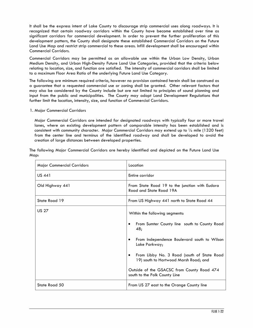
It shall be the express intent of Lake County to discourage strip commercial uses along roadways. It is recognized that certain roadway corridors within the County have become established over time as significant corridors for commercial development. In order to prevent the further proliferation of this development pattern, the County shall designate these established Commercial Corridors on the Future Land Use Map and restrict strip commercial to these areas. Infill development shall be encouraged within Commercial Corridors.
Commercial Corridors may be permitted as an allowable use within the Urban Low Density, Urban Medium Density, and Urban High-Density Future Land Use Categories, provided that the criteria below relating to location, size, and function are satisfied. The intensity of commercial corridors shall be limited to a maximum Floor Area Ratio of the underlying Future Land Use Category.
The following are minimum required criteria, however no provision contained herein shall be construed as a guarantee that a requested commercial use or zoning shall be granted. Other relevant factors that may also be considered by the County include but are not limited to principles of sound planning and input from the public and municipalities. The County may adopt Land Development Regulations that further limit the location, intensity, size, and function of Commercial Corridors.
1. Major Commercial Corridors
Major Commercial Corridors are intended for designated roadways with typically four or more travel lanes, where an existing development pattern of comparable intensity has been established and is consistent with community character. Major Commercial Corridors may extend up to ¼ mile (1320 feet) from the center line and terminus of the identified roadway and shall be developed to avoid the creation of large distances between developed properties.
The following Major Commercial Corridors are hereby identified and depicted on the Future Land Use Map:
Major Commercial Corridors Location
US 441 Entire corridor
Old Highway 441 From State Road 19 to the junction with Eudora Road and State Road 19A
State Road 19 From US Highway 441 north to State Road 44
US 27 Within the following segments:
• From Sumter County line south to County Road 48;
• From Independence Boulevard south to Wilson Lake Parkway;
• From Libby No. 3 Road (south of State Road 19) south to Hartwood Marsh Road; and
Outside of the GSACSC from County Road 474 south to the Polk County Line
State Road 50 From US 27 east to the Orange County line

FLUE 1-23
US 192 Entire corridor
2. Minor Commercial Corridors
Minor Commercial Corridors are intended for designated roadway corridors with two or more travel lanes, where an existing development pattern of comparable intensity has been established and is consistent with community character. Minor Commercial Corridors may extend up to 1/8 mile (660 feet) from the center line and terminus of the identified roadway. Commercial Buildings over 8,000 square feet shall only be permitted through a conditional use approval process that considers such factors as compatibility, adjoining land uses, size of the development site and traffic impacts. The maximum individual commercial building size shall be 30,000 square feet.
The following Minor Commercial Corridors are hereby identified and depicted on the Future Land Use Map:
Minor Commercial Corridors Location
State Road 19 From Baker Road (Altoona) south to US Highway 441
State Road 19A From US Highway 441 south to Old Highway 441
State Road 40 (Astor) From River Road east to the Volusia County line
OBJECTIVE 1.4 Rural Future Land Use Series
The “Rural Future Land Use Series” is established to identify areas within Lake County where rural character and agricultural potential shall be preserved and enhanced; a reduced level of investment for public facilities is required due to rural patterns of development and levels of service; and environmental qualities shall be protected by limiting density and intensity. Except for vested development, urban land uses shall not be permitted within this series. The “Rural Future Land Use Series” shall include the following future land use categories: Rural and Rural Transition.
Policy 1.4.1 Elements of Rural Character
The character of future development within the Rural Future Land Use Series shall be compatible and consistent with rural characteristics described below.
• Individual parcels that are generally equal to or larger than five (5) acres in size.
• Smaller parcels clustered in a configuration that provides contiguous common open space while maintaining rural densities over the net buildable area of the development site.
• A predominance of sites wherein a limited number of principal and accessory structures are surrounded by substantial areas of undeveloped land.
• An emphasis on agriculture, equestrian-related activities and conservation areas.

FLUE 1-24
• A system of rural roads intended to provide access to widely spaced home-sites and farms with substantial building setbacks from adjoining roadways.
• Naturally occurring or informal vegetative patterns protective of the environment.
• Commercial and civic land uses limited in distribution, scale and scope to serve the basic and special needs of rural areas and to ensure compatibility with the character of rural areas.
Within 12 months of the effective date of the Comprehensive Plan, Lake County’s Land Development Regulations shall be updated to include rural planning and design standards that address, at a minimum, each of the elements of rural character defined above and to regulate features including, but not limited to, the type, size, height, and location of uses and structures, fencing, signage, lighting, landscaping and viewscapes.
Policy 1.4.2 Scale of Development
The scale of development within rural areas is a key factor in efforts to preserve character and ensure compatibility. This element of character shall be addressed by comprehensive plan policies and land development regulations that establish standards for the intensity, size, and physical separation of single or clustered structures within a development site and from adjoining property. The scale of development normally associated with a Development of Regional Impact is not consistent with the purposes and intent of the Rural Future Land Use Series and shall be prohibited.
Policy 1.4.3 Purpose of the Rural Future Land Use Series
The Rural Future Land Use Series is intended to accomplish the following:
• Maintain the rural character by permitting new single family homes at a rural density and intensity, by encouraging large areas to remain in a natural or open state, by reducing road congestion, and by limiting commercial and civic uses to the needs of a rural community;
• Limit the number of road access locations from parcels as a means to preserve road capacity, minimize vehicle conflicts and accidents, promote safety of pedestrians, bicyclists and motorists, and minimize disturbance of the vegetative and visual qualities of the road corridor;
• Ensure that principal and accessory structures are located behind a rural character setback line to be determined for each rural roadway and incorporated within the Land Development Regulations;
• Permit horses and other livestock on large residential lots;
• Minimize conflicts with agricultural operations (such as traffic congestion, noise, odor and visual conflicts) and non-agricultural land uses through the application of buffering and use separation standards;
• Minimize planned and programmed expenditures for public facilities (such as, roadway improvements, schools, fire and law enforcement protection.);
• Control the scale, appearance and operation of public and private uses to ensure compatibility with rural character. This shall be accomplished through rural planning and design standards and guidelines that shall be developed and incorporated within the land development regulations. These standards and guidelines should also specifically address public and private uses that tend to draw people from outside of rural areas to ensure that such uses minimize conflict with rural character and the perpetuation of rural functions;

FLUE 1-25
• Maintain existing wildlife habitat, wildlife corridors and environmentally sensitive resources including but not limited to wetlands and upland habitat types, karst features, and groundwater recharge areas; and
• Maintain levels of service that reflect the characteristics of a rural density and intensity of use.
Policy 1.4.4 Rural Future Land Use Category
The Rural Future Land Use Category is intended to protect rural lifestyles represented by single family homes on large lots and to accommodate agricultural pursuits. This Future Land Use Category provides for residential development at densities equal to or less than one (1) dwelling unit per five (5) net buildable acres, agricultural operations, civic uses compatible with a rural community, and rural support functions where appropriate. Regional water and wastewater utilities shall not be allowed in this category. The maximum Impervious Surface Ratio within this category shall be 0.20, except for agricultural, institutional and recreational uses which shall be 0.30.
USES:
• Single family residential at one dwelling unit per five (5) net buildable acres;
• Public and private parks and passive recreation facilities;
• Agricultural operations and attendant structures, greenhouses, nurseries and silviculture;
• Group homes;
• Equestrian related uses;
• K-12 Schools; and
• Religious institutions;
• Rural Support Uses as provided for in this Comprehensive Plan.
USES REQUIRING A CONDITIONAL USE PERMIT:
• Resource Extraction, including but not limited to Mines and borrow pits;
• Active parks and recreation facilities;
• Adult congregate living facilities;
• Daycare facilities;
• Country clubs;
• Cemeteries,
• Kennels;
• Community buildings and club houses;
• Unpaved airstrips; and

FLUE 1-26
• Emergency services.
• Landfills.
Policy 1.4.5 Rural Transition Future Land Use Category
The Rural Transition Future Land Use Category is intended to address “edge” conditions where Rural Future Land Use Categories abut Urban Future Land Use Categories. These “edges” represent areas where lower rural densities may be increased for Conservation Subdivisions that utilize clustering techniques.
This Future Land Use Category provides for residential development at densities equal to or less than one (1) dwelling unit per five (5) net buildable acres, agricultural operations, civic uses compatible with a rural community, and rural support functions where appropriate.
Alternatively, residential development not to exceed a maximum density of one (1) dwelling unit per three (3) net buildable acres may be permitted provided that any subdivision shall be developed as a clustered Rural Conservation Subdivision utilizing PUD zoning, and provided that at least 35% of the net buildable area of the entire PUD site shall be dedicated in perpetuity for preservation as common open space through the use of a conservation easement or similar recorded and legally binding instrument. A proposed Rural Conservation Subdivision shall consist of at least fifteen (15) net buildable acres in order to be considered for this alternate density.
As a third alternative, residential development not to exceed a maximum density of one (1) dwelling unit per one (1) net buildable acre may be permitted provided that any subdivision shall be developed as a clustered Rural Conservation Subdivision utilizing PUD zoning, and provided that at least 50% of the net buildable area of the entire PUD site shall be dedicated in perpetuity for preservation as common open space through the use of a conservation easement or similar recorded and legally binding instrument. A proposed Rural Conservation Subdivision shall consist of at least fifteen (15) net buildable acres in order to be considered for this alternate density.
The maximum Impervious Surface Ratio within this category shall be 0.30, except for agricultural, institutional and recreational uses which shall be 0.50.
USES:
• Single family residential development subject to density and open space criteria specified above;
• Public and private parks and passive recreation facilities;
• Agricultural operations and attendant structures, greenhouses, nurseries, and silviculture;
• Group homes;
• Equestrian related uses;
• K-12 Schools; and
• Religious institutions;
• Rural Support uses as provided for in this Comprehensive Plan.
USES REQUIRING A CONDITIONAL USE PERMIT:

FLUE 1-27
• Resource Extraction, including but not limited to Mines and borrow pits;
•Landfills;
• Active parks and recreation facilities;
• Adult congregate living facilities;
• Daycare facilities;
• Country clubs;
• Cemeteries;
• Kennels;
• Community buildings and club houses;
• Unpaved airstrips;
• Emergency services; and
• Regional water and wastewater utilities.
Policy 1.4.6 Open Space within Rural Conservation Subdivisions
Open space within Rural Conservation Subdivisions shall be applied and protected as follows:
Open space shall be designated to remain undeveloped and protected in perpetuity through the use of conservation easements, plat restrictions, or similar legally recorded and binding instruments that run with the land and establish the conditions and restrictions on the use of the open space area. Open space conservation easements shall be dedicated to one or a combination of the following, which shall be designated prior to development:
• Conservation agency such as Florida Department of Environmental Protection or St. Johns River Water Management District;
• Non-profit conservation organization or land trust; and/or
• Lake County, subject to County approval.
Open space shall be shown on all plats as a common area, which shall be deeded to the homeowners association, the County, a conservation agency, or non-profit conservation organization for ownership and maintenance. Any deeded open space shall be credited to the dedicating subdivision in calculating open space requirements. The cost and responsibility of maintaining open space shall be borne by the owner of the open space. An open space management plan shall be required to accompany the development, subject to County approval. The management plan shall establish conservation objectives, outline procedures, and define the roles and responsibilities for managing open space, including establishment of a Qualified Management Entity (QME) as appropriate. If not properly maintained, the County may enforce maintenance. Designated open space shall be clearly delineated on project site plans, including recorded plats, and marked in the field.

FLUE 1-28
Clustering shall mean that the built area of the development site is well defined and compact, thereby enabling the creation of contiguous expanses of open space and the protection of environmentally sensitive areas. At least 50% of required open space shall be configured in a single contiguous tract. Open space shall be contiguous with protected open space on adjacent parcels and public conservation lands to the maximum extent feasible and configured to ensure compatibility with adjacent rural properties.
Policy 1.4.7 Rural Support
Rural Support uses are intended to address the need for narrowly defined commercial and office uses that support the resident population of areas within the Rural Future Land Use Series. Rural Support land uses include professional offices, personal services, convenience retail, agricultural-related retail sales of goods and services, or similar uses as defined in the Land Development Regulations. Such uses shall be limited in scale and scope to serve the basic and special needs of rural areas and ensure compatibility with the character of rural areas.
Elements of compatibility shall be addressed in the Land Development Regulations, including but not limited to signage, hours of operation, lighting, building orientation, height, facade, architectural design, parking, landscaping and buffering. New Rural Support uses shall not be located adjacent to public conservation land.
With the exception of commercial uses vested pursuant to this Comprehensive Plan, rural support uses shall be limited to designated Rural Support Intersections, Rural Support Corridors, and as an allowable use within the Rural Transition Future Land Use Category.
1.4.7.1 Rural Support Intersections
Intersections appropriate for Rural Support uses shall be limited to specific locations identified within the Comprehensive Plan and depicted on the Future Land Use Map. Where located, a Rural Support Intersection shall be defined to exist within a distance of 300 feet measured perpendicular to the road from the edge of the right of way extending a distance of 300 feet along the right of way from the nearest corner of the intersection Primary structures shall be limited to a maximum aggregate floor-area ratio of 0.055 within each property zoned for rural support and no single primary structure shall exceed 5000 square feet. A new Rural Support Intersection may only be located at the junction of two roads classified as arterials or collectors. No new Rural Support Intersections shall be located less than five (5) miles from another Rural Support Intersection or a Rural Support Corridor.
The following Rural Support Intersections are recognized:
Rural Support Intersection Location
Astor Park Intersection of State Road 40 and Cedar Crest Road
Lake Mack Intersection of County Road 42 and Lake Mack Drive (south of County Road 42 only)
Emeralda Marsh area Intersection of County Road 452 and Emeralda Island/Em En El Grove Road
West Lake County Intersection of County Road 33 and Austin Merrit/Bridges Road
1.4.7.2 Rural Support Corridors
Corridors appropriate for Rural Support uses shall be limited to specific locations identified within the Comprehensive Plan and depicted on the Future Land Use Map. In order to maintain the functional and aesthetic integrity of rural areas, Rural Support Corridors shall be limited strictly to rural communities with an established pattern of commercial activity. Where located, a Rural Support Corridor shall be

FLUE 1-29
defined to exist within a distance of 330 feet measured perpendicular to the road between specified termini. The County shall adopt Land Development Regulations defining characteristics including but not limited to the specific type, size, height, and appearance of rural support uses within the corridor. Subject to further restrictions within the Land Development Regulations, the maximum aggregate floor-area ratio for primary structures in any Rural Support Corridor shall not exceed 0.10 calculated on the area of the lot within the Rural Support Corridor, and no single primary structure shall exceed 5000 square feet.
The following Rural Support Corridors are recognized:
Rural Support Corridor Location
Paisley Starting at the center of the intersection of County Road 42 and Central Avenue, then running northward along CR42 to the center of the intersection of County Road 42 and Country Squire Road.
Ferndale Starting from a point on the centerline of County Road 455 located 330 feet south of the center of the intersection of County Road 455 and Trousdale Street, then running northward along CR455 to a point on the centerline of County Road 455 located 330 feet north of the center of the intersection of County Road 455 and County Road 561A.
Lake Jem County Road 448 from the center of the intersection of County Road 448 and Grand Oak Lane, then running eastward along County Road 448 to the Apopka-Beau Claire Canal.
Altoona Starting at the center of the intersection of State Road 19 and Baker Road, then running northward along State Road 19 to the center of the intersection of SR 19 and East Altoona Road.
1.4.7.3 Rural Support within the Rural Transition Future Land Use Category
Rural Support uses may be permitted as a part of a Planned Unit Development (PUD) within the Rural Transition Future Land Use Category, provided that the use serves residents of the PUD and is located interior to the PUD. Rural Support uses within a PUD shall be limited to increments of one (1) acre per 500 dwelling units. Primary structures shall be limited to a maximum aggregate floor-area ratio of 0.055, and no single primary structure shall exceed 5,000 square feet. Land containing a Rural Support use within a PUD shall not count toward buildable area in the determination of residential density.
OBJECTIVE 1.5 Public Benefit Future Land Use Series
The Public Benefit Future Land Use Series is established to identify lands that benefit the public or general welfare such as conservation, recreation, and public facilities or infrastructure. Land within this series may be located in rural or urban areas. Property within this series is generally held by governmental entities, but may be privately owned if it serves a public benefit such as natural resource protection or community infrastructure. Future Land Use Categories within this series include Conservation, Recreation, and Public Service Facilities and Infrastructure.
Policy 1.5.1 Conservation Future Land Use Category
This Conservation Future Land Use Category consists of property managed for the permanent protection of natural resources, including but not limited to open water bodies, wildlife habitat, wetlands, and

FLUE 1-30
aquifer recharge. Lands within the Conservation Future Land Use Category shall be maintained in a natural state.
The Conservation Future Land Use Category includes public resource lands such as federal, state, and locally managed parks, reserves, preserves, forests and wildlife management areas. Water management areas held by the St. Johns River Water Management District or Southwest Florida Water Management District for conservation purposes may also be included within this category.
The Conservation Future Land Use Category may include privately-owned property only if such land is protected in perpetuity by conservation easement held by a public agency or private non-profit conservation entity. At a minimum, this conservation easement shall contain provisions for the management of natural resources and environmentally-sensitive features specific to the subject property, restrict activities that are inconsistent with the protection of said resources, preclude future development, and provide for enforcement of the easement. Wetland or upland mitigation banks subject to the aforementioned conditions may be included in this category.
Permitted activities within the Conservation Future Land Use Category shall be limited to resource-based passive recreation, including but not limited to hiking, horseback riding, wildlife observation, fishing, and hunting, subject to conditions set forth by the appropriate land management agency. Sustainable silviculture and limited grazing operations may be permitted within this category only if performed under the direction and oversight of a public land management agency such as the Florida Department of Environmental Protection or United States Forest Service, or pursuant to a conservation easement that requires the use of Best Management Practices and limits such operations as consistent with purposes of the Conservation Future Land Use Category.
USES:
• Local, state and federal public lands such as passive parks, preserves, reserves, forests, and wildlife management areas;
• Water management areas held by SJRWMD or SWFWMD; and
• Private land protected in perpetuity by conservation easement held by a public agency or not-for-profit private conservation entity;
USES REQUIRING A CONDITIONAL USE PERMIT INCLUDE:
• Caretaker residence;
• Nature centers; and
• Rustic cabins and similar facilities.
Policy 1.5.2 Recreation (R) Future Land Use Category
The Recreation (R) Future Land Use Category consists of County-wide public or private recreational facilities, park lands and open space preservation areas. Active or passive uses are appropriate within the Recreation Land Use category, subject to conditions established for the particular facility. The maximum intensity in this category shall be 0.10. The maximum Impervious Surface Ratio shall be 0.50 and building height shall be limited to 40 feet.
Uses:
• Public and private recreation and open space; and
• County parks, community parks.

FLUE 1-31
Policy 1.5.3 Public Service Facilities and Infrastructure Future Land Use Category
This Public Service Facilities and Infrastructure Future Land Use Category consists of uses needed to address public facility or infrastructure needs. The maximum intensity in this category shall be 1.0. The maximum Impervious Surface Ratio shall be 0.80 and building height shall be limited to 50 feet.
Uses:
• Government and civic buildings;
• Public safety facilities;
• Active and passive recreation facilities;
• Transportation facilities;
• Schools;
• Libraries;
• Power Plants; and
• Regional water and wastewater utilities.
USES REQUIRING A CONDITIONAL USE PERMIT:
• Borrow pits; and
• Landfills.
GOAL 2.0 SPECIAL COMMUNITIES
Lake County contains historically established communities with unique character that warrant special attention and planning approaches to ensure their distinctive qualities are retained. The County shall protect the integrity and long-term viability of these communities through Comprehensive Plan policies and Land Development Regulations prepared specifically for these areas that address characteristics including but not limited to land use, scale, form, infrastructure, and amenities.
OBJECTIVE 2.1 Mount Plymouth-Sorrento Community
The County shall implement and enforce policies and programs designed to preserve and reinforce the positive qualities of the lifestyle and charm presently enjoyed in the Mount Plymouth-Sorrento Community, and thereby ensure that these qualities are available to future residents. The County recognizes that it is the intent of the Mount Plymouth-Sorrento Community to discourage annexations.
Policy 2.1.1 Recognition of the Mount Plymouth-Sorrento Community
Within 12 months of the effective date of this Comprehensive Plan, the County shall develop Land Development Regulations for the Mount Plymouth-Sorrento Planning Area, established pursuant to Ordinance No. 2004-67 and depicted on the Future Land Use Map, that recognize the Mount Plymouth-Sorrento Community as a part of Lake County with unique character and charm. It shall be the policy of the County that this area requires approaches to land use intensities and densities, rural roadway corridor protection, the provision of services and facilities, environmental protection and the enforcement of Land Development Regulations consistent with the community’s character.

FLUE 1-32
Policy 2.1.2 Guiding Principles for Development
The County shall ensure that new development within the Mount Plymouth-Sorrento Community is of high quality while maintaining community character and protecting property rights. Consideration of proposals for development within the Mount Plymouth-Sorrento Planning Area shall be guided by the following principles:
• Provide a range of housing types for all ages, incomes, and lifestyles while focusing the highest density and intensity of new development within the Main Street Future Land Use Category;
• Ensure compatibility with established neighborhoods and rural lifestyles;
• Ensure compatibility with rural and transitional uses adjacent to the Planning Area;
• Provide for an integrated network of local two-lane streets, bicycle trails, and pedestrian paths to connect neighborhoods and provide access to the Main Street and throughout the planning area, and prohibit new gated communities;
• Create a sense of place by implementing design standards, traditional village architectural guidelines, traffic calming, lighting and landscaping standards, liberal use of street trees, community parks, and open space that protect and enhance the character of the Mount Plymouth-Sorrento Community; and
• Provide for environmentally-responsible development and design appropriate within the Wekiva Study Area.
Policy 2.1.3 Mount Plymouth-Sorrento Future Land Use Categories
The County shall adopt Land Development Regulations containing design standards for new development, including but not limited to parking, lighting, signage, open space, architectural guidelines, building scale, and landscaping to preserve the character of the Mount Plymouth-Sorrento Community and define the community. Future Land Use Categories located within the Mount Plymouth-Sorrento Community and outside of the Wekiva River Protection Area include Mount Plymouth-Sorrento Main Street, Mount Plymouth-Sorrento Neighborhood, Rural Transition, and Office. Future Land Use Categories located within the Mount Plymouth-Sorrento Community and inside of the Wekiva River Protection Area include Receiving Area One and Receiving Area Two. In addition, Future Land Use Categories within the Public Benefit Future Land Use Series may be located within the Mount Plymouth-Sorrento Community.
Policy 2.1.4 Mount Plymouth-Sorrento Main Street Future Land Use Category
The County hereby establishes the Mount Plymouth-Sorrento Main Street Future Land Use Category to preserve a sense of place and shared identity for the Mount Plymouth-Sorrento Community.
The Main Street Future Land Use Category consists of a Main Street corridor and surrounding neighborhoods that provide a balanced mix of land uses. Retail, office, residential, and civic uses shall be planned at appropriate densities and intensities within the Main Street Future Land Use Category. This mix of uses is intended to establish a diverse, sustainable community by meeting the housing and daily needs of people from all stages of life, incomes, and professions. A maximum density of 5.5 dwelling units per net buildable acre may be allowed within the Main Street Future Land Use Category. The intent of this higher density is to establish a market within walking distance to support small shops within the Main Street Category and provide opportunities for alternative modes of transportation such as walking, biking, and public transportation. Residential development surrounding the Main Street Corridor includes the integration of new housing, along with the anticipated redevelopment and infill

FLUE 1-33
near existing housing. The maximum intensity in this category shall be 0.30. The maximum Impervious Surface Ratio shall be 0.60.
Land Development Regulations for the Main Street Future Land Use Category shall be developed to emulate a traditional community feel, including but not be limited to, the follow requirements:
• Require specific design standards affecting the size and architecture of residential and non residential structures, consistent with the Main Street Future Land Use Category;
• Require specific additional standards for infill housing to preserve the character of the historic Sorrento neighborhood;
• Require that building structures present a traditional storefront face and entrance to the Main Street, and provide wide sidewalks for pedestrian activity with street furniture for outdoor cafes and benches for rest and shading; and require the planting of canopy trees (such as Live Oaks, Sweet Gum, and Drake Elms) at regular intervals along Main Street. Outdoor lamps shall utilize full-cutoff lighting with traditional-style fixtures;
• Require that all parking be located in the rear of building structures facing Main Street, with the exception of on-street angle or parallel parking. Pervious parking is encouraged;
• Encourage upper-story residences or office space located above ground-level shops, and provide for multi-family homes, including town homes, duplexes, and condominiums along and near the Main Street corridor; and
• Include the provision for an anchor store, such as a grocery, to be sized to serve the needs of the Mount Plymouth-Sorrento Planning Area and not to exceed 30,000 square feet of floor area. Such a store, if located within the Planning Area, must not be visible from Main Street, and shall be designed with architectural features compatible with the character of the Mount Plymouth-Sorrento Community.
• Provide for a maximum buildings height of two (2) habitable stories not to exceed 40 feet with varied rooflines unless such look is provided by adjacent buildings.
• Provide for one or more areas within the Main Street Future Land Use Category to serve as a community park or civic space, and which shall be designed with appropriate landscaping and amenities to enhance the public realm and community identity.
Policy 2.1.5 Mount Plymouth-Sorrento Neighborhood Future Land Use Category
The County hereby establishes the Mount Plymouth-Sorrento Neighborhood Future Land Use Category. The Future Land Use Category is defined to include property within the Mount Plymouth-Sorrento Planning Area outside of the Wekiva River Protection Area and immediately adjacent to the Mount Plymouth-Sorrento Main Street Future Land Use Category. Land proposed for urban development within the Mount Plymouth-Sorrento Neighborhood Future Land Use Category, unless otherwise vested, may be allowed to develop at a maximum residential density of two (2) dwelling units per net buildable acre, provided that development exceeding ten (10) dwelling units shall be required to utilize PUD zoning and protect a minimum 50% of the net area as open space. Property within the Mount Plymouth-Sorrento Neighborhood Future Land Use Category having a zoning assignment prior to the effective date of this policy that would otherwise allow for a density greater than two (2) dwelling units per net acre shall be exempt from this provision. The maximum intensity in this category shall be 0.20, except for institutional uses which shall be 0.30. The maximum Impervious Surface Ratio shall be 0.30.

FLUE 1-34
Policy 2.1.6 Rural Transitional Area
The County shall provide for a rural transitional area within the Mount Plymouth-Sorrento Community outside of the Neighborhood Category. This area shall utilize the Rural Transition Future Land Use Category defined within the Comprehensive Plan and adhere to all open space requirements pertaining to this category. The intent of this Future Land Use Category is to ensure compatibility with established rural residential neighborhoods in the Wolf Branch Road corridor, and to provide for the protection of environmentally sensitive lands.
Policy 2.1.7 Office Employment Center
The County shall coordinate with the City of Mount Dora to establish a Regional Professional Employment Center utilizing the Regional Office (RO) Future Land Use Category in the vicinity of State Road 46 and Round Lake Road for the purpose of creating quality professional jobs within the east Lake County and convenient to the residential areas of both communities. The intent of this employment center shall be to promote orderly and logical development of land for office complexes and light, clean industrial development in an attractively designed, park-type setting, and to assure appropriate design in order to maintain the integrity of existing or future nearby residential areas.
Policy 2.1.8 Gateway/Landmark Features
The County shall allow for the placement of gateway/landmark features to define the Mount Plymouth-Sorrento Community on County Road 437 (north and south entrance), County Road 435 (south entrance), Wolf Branch Road (west entrance), and on the segment of State Road 46 described as the Main Street District (east and west entrance). Gateway/landmark features shall be used to announce entrances and transitions to and through the Mount Plymouth-Sorrento Community and to facilitate community identity.
Policy 2.1.9 Environmental Design Standards
The County shall require compliance with environmental design standards established for the Wekiva Study Area within the Mount Plymouth Sorrento Planning Area. The County shall require environmentally-responsible development and design appropriate within the Wekiva Study Area, including but not limited to the protection of aquifer recharge areas, wetlands, karst features, wildlife, trees and native vegetation; the use of drought-tolerant landscaping; the use of reclaimed water for irrigation where appropriate, and the promotion of energy efficient “green-building”.
Policy 2.1.10 Preservation of Tree Canopy
The County shall require that mature native trees and tree canopies be protected within Mount Plymouth-Sorrento. A mature tree shall be defined as a tree with a caliper of 12”, or more, diameter at breast height (DBH). Where mature native tree stands exist, land use and design requirements shall minimize the impact to the existing trees and tree canopies. Within Mount Plymouth-Sorrento, Lake County shall emphasize the protection of mature native trees and promote the use of trees along roadways and within all new development.
Policy 2.1.11 Protection of Dark Skies
Within 12 months of the effective date of this Comprehensive Plan, Lake County shall adopt an exterior lighting ordinance for the Mount Plymouth-Sorrento Planning Area to preserve dark skies, based on recommendations of the International Dark Sky Association and exemplified by the City of Casselberry Exterior Lighting Ordinance (May 2002).
Policy 2.1.12 Signage and Advertisement
Within 12 months of the effective date of this Comprehensive Plan, the County shall adopt land development regulations that limit the location, height, size, and illumination of signs and advertisement structures within Mount Plymouth-Sorrento in order to enhance community character and limit the visual intrusion of commercial features.

FLUE 1-35
Policy 2.1.13 Transportation Network in the Mount Plymouth-Sorrento Community
It shall be a priority of Lake County to preserve two lane roads while improving connectivity within and through the Mount Plymouth and Sorrento Community. In order to accomplish this effort and meet the needs of current and future residents, the County shall require new developments to reserve land for transportation routes that connect to existing and planned roads in the network. Provision shall also be made for roads, bicycling, walking, equestrian, and golf cart trails.
A community transportation vision and preferred transportation network shall be established for the Mount Plymouth-Sorrento Planning Area that identifies the functional type, cross-sections for different streets, and recreational trail connectivity. Site development plans/plats shall incorporate the applicable transportation vision and network for streets, trails, and their connections. This transportation vision and network shall anticipate the coordination and integration of roads with other modes of transportation where appropriate, such as bicycle, walking, equestrian, and golf cart trails.
In order to protect the long-term integrity of the Mount Plymouth-Sorrento Category within the Main Street District, it shall be the expressed intent of the County to maintain State Road 46 within the Planning Area as a two-lane facility, herein referred to as “Main Street”, and to coordinate with the Florida Department of Transportation to achieve this purpose.
The County shall establish rural scenic road and community road guidelines that define the functional type and cross-sections for these roads. Further, in order to maintain the scenic quality of rural roadways and limit traffic through established residential areas, the County shall designate Wolf Branch Road and Adair Road within the boundaries of the Planning Area as local scenic roadways that shall be policy constrained to remain as two-lane facilities and be treated with traffic calming techniques (i.e. chicanes, bulb outs, and other traffic calming mechanisms). The County shall develop land use, landscaping, and design standards protective of the unique character of these roadway corridors.
Policy 2.1.14 Parking in the Mount Plymouth Sorrento Community
In an effort to create a pedestrian realm and storefront activity on Main Street, parking lots shall be hidden behind the buildings that front Main Street. The Main Street Future Land Use Category shall emphasize the use of parking in the form of individual small lots of typically twenty-five (25) spaces or less. All parking lots shall be required to extensively use trees, landscaping, and utilize full-cutoff lighting with traditional-style fixtures. Design of the Main Street corridor shall accommodate on-street parallel or angled parking. Calculations for shared parking spaces are encouraged for lots that serve mixed-use buildings.
Parking standards for the Planning Area shall include adequate off street parking for residents within all residential subdivisions.
Policy 2.1.15 Traffic Calming
The use of traffic calming measures such as round-a-bouts, speed humps, bulb outs, chicanes, and similar measures shall be encouraged to reduce the speed of traffic within all districts within the Mount Plymouth and Sorrento Planning Area.
Policy 2.1.16 Mount Plymouth and Sorrento Finance Mechanism
The County shall explore mechanisms to fund plans, construction, maintenance, or improvements to roads and community amenities.
OBJECTIVE 2.2 Sunnyside Community
The County shall implement and enforce policies and programs designed to preserve and reinforce the positive qualities of the rural lifestyle and charm presently enjoyed in the Sunnyside Community, and thereby ensure that these qualities are available to future residents.

FLUE 1-36
Policy 2.2.1 Recognition of Sunnyside Community
The County shall develop and enforce Land Development Regulations for the Sunnyside Planning Area consistent with the Sunnyside Task Force Study Report, adopted in June 2004, that recognizes the unique rural character and charm of the Sunnyside Community. It shall be the policy of the County that this area requires approaches to land use intensities and densities, rural roadway corridor protection and enhancement, the provision of services and facilities, and environmental protection consistent with the community’s character. Land Development Regulations shall apply to new development and redevelopment within the Sunnyside Community and shall address both rural and urban development patterns. These regulations shall include, but not to be limited to: parking, lighting, signage, open space, architecture, building scale and landscaping.
Policy 2.2.2 Guiding Principles for Development
The County shall ensure that new development within the Sunnyside Community is of high quality while maintaining community character and protecting property rights. Consideration of proposals for future development and redevelopment within the Sunnyside Planning Area shall be guided by the following principles:
• The Sunnyside Planning Area should include a variety of residential densities. There should be a transition between high intensity development and low intensity development, with higher intensity development occurring closer to US 441 and transitioning to lower intensity development occurring closer to Lake Harris.
• Wetland areas shall be delineated as part of any development application. Wetlands within the property proposed for development shall be placed under a conservation easement and dedicated or deeded to an approved governmental or non-governmental conservation agency.
• Utilities and government services should be provided in a planned, coordinated and efficient manner. Annexation/developer agreements shall reflect these requirements.
• Centralized utilities shall be required for areas with a density exceeding one (1) dwelling unit per net acre.
• Roads shall be upgraded prior to new development, including substantial redevelopment. New development shall provide for an integrated network of sidewalks, bus stops, local two-lane streets, bicycle trails, and pedestrian paths to connect neighborhoods.
Policy 2.2.3 Densities within the Sunnyside Community.
Within the Sunnyside Community, the County shall assign Urban Low Density, Urban Medium Density, Urban High Density, and Rural Transition Future Land Use Categories to establish a density reducing gradient of residential development from US 441 to Lake Harris.
Policy 2.2.4 Sunnyside Commercial Uses
The County shall establish standards and guidelines for commercial and office uses to preserve a sense of place and identity for the Sunnyside Community. Significant buffers shall be required for commercial and office development adjacent to residential uses, consistent with findings of the Sunnyside Task Force.
Commercial and Office uses within the Sunnyside Community shall be restricted to the US 441 corridor. This area is located on the east side of Sleepy Hollow Road with landscape buffer requirements and on the east side of Fern Drive.

FLUE 1-37
OBJECTIVE 2.3 Ferndale Community
Lake County shall implement and enforce policies and programs designed to preserve and reinforce the positive qualities of the rural lifestyle and charm presently enjoyed in the Ferndale community, and thereby ensure that these qualities are available to both present and future residents. The County recognizes that it is the intent of the Ferndale Community to discourage annexations.
Policy 2.3.1 Annexation Agreements
Within 12 months of the effective date of the Comprehensive Plan, the County shall pursue Annexation Agreements with the Town of Montverde and City of Minneola in order to preserve the integrity of Ferndale as a rural community within unincorporated Lake County.
Policy 2.3.2 Recognition of the Ferndale Community
Within 12 months of the effective date of this Comprehensive Plan, the County shall develop Land Development Regulations for the Ferndale Community, depicted on the Future Land Use Map that recognizes Ferndale as a part of Lake County with unique rural character. It shall be the policy of Lake County that this area requires approaches to land use, rural roadway corridor protection, environmental protection and the enforcement of Land Development Regulations consistent with the community’s character.
Policy 2.3.3 Guiding Principles for Development
Lake County shall ensure that new development within Ferndale is of high quality, while maintaining community character and protecting property rights. Consideration of proposals for future development and redevelopment within Ferndale shall be guided by the following principles:
• Maintain rural densities of development while providing for commercial, office and civic uses located within a central corridor district, appropriately scaled to serve the needs of the Ferndale community;
• Ensure compatibility with established neighborhoods, rural uses and rural lifestyles;
• Provide for an integrated network of local two-lane streets, bicycle trails, and pedestrian paths;
• Create a sense of place by implementing design standards using traditional architectural guidelines, traffic calming, lighting and landscaping standards, liberal use of street trees, community parks, and open space that protect and enhance the character of Ferndale;
• Provide for environmentally responsible development and design appropriate with the Green Mountain Scenic Byway Corridor and Lake Apopka Protection Area; and
• Maintain Ferndale as an equestrian friendly community.
Policy 2.3.4 Residential Land Use
Within the Ferndale Community, all residential development shall be consistent with the Rural Future Land Use Category of one (1) dwelling unit per five (5) net buildable acres; provided that a legal lot of record existing on or before the effective date of this policy that is smaller than five (5) acres in size may be permitted one dwelling unit, consistent with all other provisions of this Comprehensive Plan and the Land Development Regulations. Within the Ferndale Center District, one (1) dwelling unit may coexist with a commercial or office use on a legal lot of record. This may be a detached single-family dwelling or an upper-story residence within the same structure.

FLUE 1-38
Policy 2.3.5 Ferndale Center District
The County shall establish standards and guidelines for a Rural Support Corridor, herein referred to as the Ferndale Center District, to preserve a sense of place and shared identity for the Ferndale Community. Commercial and office development within the Ferndale Center District shall be designed and scaled to serve the Ferndale community. The Ferndale Center District is hereby defined to include only land within a parcel 330 feet from the centerline of County Road 455 from the intersection of County Road 561A to Trousdale Street. The purpose of this district shall be to provide for a mix of uses including commercial, office, civic, and limited residential. Commercial and office uses shall not be permitted outside of the Center District. Land Development Regulations for the Ferndale Center District shall be developed to emulate a traditional rural community, including but not limited to the following requirements:
• Require specific design standards affecting the size and architecture of residential and nonresidential structures, consistent with the Center District;
• Require that building structures present a traditional storefront face and entrance to CR 455 or side streets, and provide wide sidewalks for pedestrian activity with street furniture for outdoor cafes and benches for rest and shading;
• Require the planting of canopy trees at regular intervals along roads within the Center District, and require that lamps utilize full-cutoff lighting with traditional-style fixtures;
• Require that all parking be located in the rear of building structures facing the main street corridor, with the exception of on-street angle or parallel parking;
• Encourage upper-story residences or office space located above ground-level shops;
• Provide for maximum building height of three (3) stories with varied rooflines unless such look is provided by adjacent buildings;
• Provide for one or more areas within the Ferndale Center District that shall serve as a community park or civic space, which shall be designed with appropriate landscaping and amenities that enhance the public realm and community identity.
Policy 2.3.6 Development Plan Approval
In addition to Comprehensive Plan amendment standards of review, development applications in the Ferndale Center District shall be required to submit as a condition for approval:
• A narrative describing how the proposed development will maintain and/or protect the existing rural and historic integrity of Ferndale;
• An inventory and analysis of nearby existing and/or approved uses in order to demonstrate compatibility of the proposed development;
• Transportation information describing the existing road network, the current conditions of the adjacent and feeder road(s), and projected additional traffic levels resulting from the proposed development; and
• A graphic illustration of the existing development conditions in proximity to the proposed site.
Policy 2.3.7 Community Participation
Development approval for any project within the Ferndale Community in excess of 10 dwelling units or within the Ferndale Center District in excess of 2500 square feet shall require at least one (1) advertised public meeting with additional individual notice provided to all property owners within the Ferndale Community. This meeting shall be held at an accessible location within Ferndale and conducted prior to

FLUE 1-39
the first relevant public hearing. The intent of this public meeting will be to provide information and obtain community input.
Policy 2.3.8 Rural Conservation Subdivisions in the Ferndale Community
Within the Ferndale Community, development containing 10 or more dwelling units shall be processed using Planned Unit Development Zoning as a Rural Conservation Subdivision consistent with Error! Reference source not found. A minimum of 50% of the net buildable area of the entire site shall be dedicated as open space. It is the intent of this policy to encourage equestrian and similar uses.
Policy 2.3.9 Potable Water and Sanitary Sewer
New development within Ferndale and outside of the Ferndale Center District shall generally not be designed nor constructed with central water and/or sewer systems. Public and private central systems may be permitted in the future only if it is clearly and convincingly demonstrated that a potential or actual health problem exists for which there is no other feasible solution.
Policy 2.3.10 Development Entrances
Entrances to residential developments should compliment the rural and historic character of Ferndale by using architectural design and landscaping features that are natural, rustic, or equestrian in appearance. Solid fences and walled developments shall be prohibited within Ferndale.
Policy 2.3.11 Architectural Standards
Within 12 months of the effective date of the Comprehensive Plan, Lake County shall adopt architectural design and landscape guidelines and regulations as appropriate for all commercial and rural support uses within the Ferndale Center District.
Policy 2.3.12 Agriculture
Lake County shall encourage sustainable agriculture that uses Best Management Practices within Ferndale. Consistent with this, the County shall recognize the primacy of agriculture within Ferndale. This determination shall be construed in favor of existing agricultural operations relative to issues of compatibility with residential or commercial development, including but not limited to odor and noise. High intensity livestock operations such as feedlots shall be discouraged within Ferndale.
Policy 2.3.13 Gateway/Landmark Features
Lake County shall pursue the placement of gateway/landmark features to define the Ferndale community on C.R. 455 (north and south entrance) and C.R. 561A (west entrance). Gateway/landmark features shall be used to announce entrances and transitions to and through Ferndale, and to facilitate community identity.
Policy 2.3.14 Environmental Design Standards
The County shall require environmentally responsible development and design consistent with the protection of wetlands, natural upland habitat, wildlife, trees and native vegetation, and aquifer recharge in the Lake Apopka Basin. Development standards shall also be compatible with the Green Mountain Scenic Byway. The filling of wetlands within Ferndale shall be prohibited, except as necessary to provide legal ingress and egress to buildable areas.
Policy 2.3.15 Viewscape
Lake County shall place high priority on the protection of viewscape from roadway corridors within Ferndale as a positive reinforcement of the rural and historic character of the area. These viewscapes include Sugarloaf Mountain, forested and agricultural lands, pastures, water views and rural estates. Within 12 months of the effective date of this plan, Lake County shall adopt Land Development Regulations to limit topographic cuts and fill. . The intent of these regulations is to limit site alterations

FLUE 1-40
that negatively impact unique vistas, including limitations on changes that would alter ridges and hillsides.
Building height shall be limited to three (3) habitable stories in order to maintain and protect the integrity of the natural rolling vistas and scenic viewscapes within Ferndale.
Communication Towers within Ferndale shall be housed within traditional structures, such as church steeples or flag poles, or otherwise disguised to protect viewscapes where possible.
Policy 2.3.16 Historic Structures and Sites
Lake County shall place high priority upon the preservation of historic structures and sites to preserve the identity and character of Ferndale. Lake County shall support and promote a survey within Ferndale to identify historic structures and sites. The Ferndale cemetery and other appropriate archeological sites shall be protected as historic landmarks.
Policy 2.3.17 Preservation of Tree Canopy
Lake County shall require that mature native trees and tree canopies be protected within Ferndale. A mature tree shall be defined as a tree with a caliper of eight (8) inches, or more, diameter at breast height (DBH). Where mature native tree stands exist, land use and design requirements are intended to minimize the impact to the existing tree canopy. Within Ferndale, Lake County shall require the protection of mature native trees along roadways and within all new development. Lake County shall encourage tree trimming operations to adhere to National Tree Care Industry Association Standards in order to preserve existing tree canopies throughout Ferndale.
Policy 2.3.18 Underground Utilities
In order to protect community aesthetics and preserve the character of Ferndale, Lake County shall encourage the installation of underground utilities.
Policy 2.3.19 Protection of Dark Skies
The County shall encourage the Ferndale Community to participate in the development of lighting standards consistent with the Conservation Element to preserve dark skies, based on recommendations of the International Dark Sky Association and exemplified by the City of Casselberry Exterior Lighting Ordinance (May 2002).
Policy 2.3.20 Signage and Advertisement
Within 12 months of the effective date of this plan, Lake County shall adopt land development regulations that limit the location, height, size, and illumination of signs and advertisement structures within Ferndale in order to enhance community character and limit the visual intrusion of commercial features.
Policy 2.3.21 Fencing
The County shall require that fencing within Ferndale maintain a rustic, rural appearance. Examples of this include but are not limited to livestock fences, wood rail fences, board fences, and field fences. Barbed wire fences shall be discouraged except where necessary to contain livestock. Solid fences and walls shall be prohibited.
Policy 2.3.22 Transportation Network
It shall be a priority of Lake County to preserve two-lane roads within Ferndale while improving local connectivity. In order to protect the long-term integrity of Ferndale as a historic rural community, the County shall designate the Green Mountain Scenic Byway segment of C.R. 455 as a local scenic roadway. The County shall pursue the designation of C.R. 561A within the boundaries of Ferndale as a local scenic roadway. Local Scenic Roadways shall be constrained as two-lane roadways. The County

FLUE 1-41
shall develop landscaping and design standards protective of the unique character of these roadway corridors. If financially feasible, Lake County shall develop and implement plans for paved shoulders or trails suitable for bicycles along the Green Mountain Scenic Byway segment of County Road 455 along County Road 561A within the boundaries of Ferndale.
Policy 2.3.23 Economic Value of the Green Mountain Scenic Byway
Lake County shall recognize the state designated Green Mountain Scenic Byway as both a treasure to protect and an economic opportunity for Ferndale. As use of the byway by casual and recreational users grows, the County shall encourage the development of small retail or commercial businesses within the Ferndale Center District that are oriented towards the needs of Ferndale residents or the casual traveler. Lake County shall adopt Land Development Regulations for the Center District specifically intended to emphasize the rural atmosphere, history, and lifestyle of the Ferndale community and to ensure that all new development within the district shall be of a scale and form that is consistent with these values. These regulations shall be compatible with the Green Mountain Scenic Byway Roadside and Corridor Overlay Districts.
Policy 2.3.24 Traffic Calming
The use of traffic calming measures such as roundabouts, speed humps, bulb outs, chicanes, and similar measures shall be encouraged to facilitate the reduction of the speed of traffic within Ferndale.
Policy 2.3.25 Trails
Consistent with maintaining the rural character of Ferndale, Lake County shall work to establish an integrated network of trails within the community for pedestrian, biking, and equestrian use. It shall be the intent of the County to link this trail system with the Ferndale Preserve and proposed trails planned for the Hills of Minneola, Sugarloaf Mountain, the Lake Apopka North Shore Restoration Area, and The Green Mountain Scenic Byway.
Policy 2.3.26 Ferndale Finance Mechanism
Lake County shall explore funding mechanisms such as Community Redevelopment Area and Neighborhood Revitalization Strategy Area grants to fund plans, construction, maintenance, or improvements to the roads and community amenities.
GOAL 3.0 WEKIVA AREA.
The Wekiva basin and springshed, including the Wekiva River and its tributaries, springs, aquifer recharge areas, wetland and upland habitats, sensitive natural habitats, wildlife, and wildlife corridors, are natural resources of irreplaceable value. Furthermore, the Wekiva basin and springshed are essential components of a larger Wekiva-Ocala ecosystem of public and private lands that extends into the Ocala National Forest. Collectively this Wekiva-Ocala Area constitutes an integrated set of natural resources of irreplaceable value to the people of Lake County, State of Florida, and citizens of the United States. Lake County shall maintain the long-term viability of these natural resources through a comprehensive and holistic approach to land use, land preservation, water resource protection, and wildlife and habitat needs within the Wekiva basin, Wekiva springshed, and greater Wekiva-Ocala Ecosystem.
OBJECTIVE 3.1 Wekiva River Protection Area and Wekiva Study Area.
Lake County shall, through the implementation of the Comprehensive Plan, preserve and protect the Wekiva River Protection Area and Wekiva Study Area as natural resources of critical state and regional importance. The Wekiva River Protection Area and Wekiva Study Area are illustrated in Figure 1.

FLUE 1-42
Figure 1 Wekiva Study Area & Wekiva River Protection Area
Policy 3.1.1 Definitions Applicable to Wekiva River Protection Area and Wekiva Study Area.
The purpose of this Policy is to eliminate ambiguity by providing a full definition of certain words and phrases which are used within the Wekiva River Protection Area and Wekiva Study Area. Should the definitions contained under this Policy conflict with the definitions contained elsewhere in the Lake County Comprehensive Plan or in the Lake County Code or in the Land Development Regulations, the following definitions shall apply to the Wekiva River Protection Area and Wekiva Study Area, as defined in Florida Statutes.
Open space – Open space within the Wekiva Study Area (WSA) and Wekiva River Protection Area shall be defined as the land area that remains undeveloped or minimally developed, such as trails and boardwalks, as part of a natural resource preserve or passive recreation area and shall include land preserved for conservation purposes. Within a development site, the County shall require that a minimum quantity of buildable area remain preserved, which shall represent the minimum open space requirement. The minimum required open space shall exclude water bodies, wetlands, residential lots, street rights of way, parking lots, impervious surfaces, and active recreation areas. Minimum required
Public Land in
As of January 2007

FLUE 1-43
open space may include permeable stormwater management areas if enhanced as amenities utilizing native vegetation. Golf courses shall be generally excluded with the exception that areas of a golf course outside of the regularly maintained fairways that are naturally vegetated and not subject to chemical application may be credited toward the minimum open space requirement. The minimum required quantity of open space within a development site shall be calculated over the net buildable area of a parcel, which is defined as the total area of a parcel less wetlands and water bodies. Non-buildable areas, including wetlands and water bodies, are recognized as protected features but shall not be credited toward the minimum open space requirement.
Receiving area – An area designated for potential development beyond its base density through the transfer of development rights from a designated sending area. Receiving Area Number One and Receiving Area Number Two located within the Wekiva River Protection Area are defined and described in the Future Land Use Element of the Lake County Comprehensive Plan.
Sending Area – An area designated as environmentally sensitive and therefore suitable for the reduction of development potential through the transfer of development rights to a designated receiving area. Sending Area Number One and Sending Area Number Two located within the Wekiva River Protection Area are defined and described in the Future Land Use Element of the Lake County Comprehensive Plan.
Wekiva Study Area - The Wekiva Study Area is defined by 369.316 F.S. to include the following land: Begin at the northwest corner of Section 6, Township 18 South, Range 28 East, Lake County, Florida, said corner lying on the north line of Township 18 South; thence Easterly along said north line of Township 18 South to the northeast corner of Section 5, Township 18 South, Range 29 East; thence Southerly along the east line of said Section 5 to the northeast corner of Section 8, Township 18 South, Range 29 East; thence Southerly along the east line of said Section 8 to the northeast corner of Section 17, Township 18 South, Range 29 East; thence Southerly along the east line of said Section 17 to the northeast corner of Section 20, Township 18 South, Range 29 East; thence Southerly along the east line of said Section 20 to the northeast corner of Section 29, Township 18 South, Range 29 East; thence Southerly along the east line of said Section 29 to the northeast corner of Section 32, Township 18 South, Range 29 East; thence Southerly along the east line of said Section 32 to the southeast corner thereof, said corner lying on the south line of Township 18 South; thence Easterly along the south line of said Township 18 South to an intersection with the east line of Range 29 East; thence Southerly along the east line of said Range 29 East to the southeast corner of Section 24, Township 21 South, Range 29 East; thence Westerly along the south line of said Section 24 to the southeast corner of Section 23, Township 21 South, Range 29 East; thence Westerly along the south line of said Section 23, to an intersection with the centerline of Interstate Highway No. 4; thence generally Southerly along the centerline of Interstate Highway No. 4 to an intersection with the south line of Section 13, Township 22 South, Range 29 East; thence Westerly along the south line of said Section 13 to the southeast corner of Section 14, Township 22 South, Range 29 East; thence Westerly along the south line of said Section 14 to the southeast corner of Section 15, Township 22 South, Range 29 East; thence Westerly along the south line of said Section 15 to the northeast corner of Section 21, Township 22 South, Range 29 East; thence Southerly along the east line of said Section 21 to an intersection with the centerline of State Road No. 50; thence Westerly along the centerline of said State Road No. 50 to the northeast corner of Section 30, Township 22 South, Range 28 East; thence Southerly along the east line of said Section 30 to the northeast corner of Section 31, Township 22 South, Range 28 East; thence Southerly along the east line of said Section 31 to the southeast corner thereof, said corner lying on the south line of Township 22 South; thence Westerly along said south line of Township 22 South to the northeast corner of Section 2, Township 23 South, Range 27 East; thence Southerly along the east line of said Section 2 to the northeast corner of Section 11, Township 23 South, Range 27 East; thence Southerly along the east line of said Section 11 to the southeast corner thereof; thence Westerly along the south line of said Section 11 to the southeast corner of Section 10, Township 23 South, Range 27 East; thence Westerly along the south line of said Section 10 to the southeast corner of Section 9, Township 23 South, Range 27 East; thence Westerly along the south line of said Section 9 to the southeast corner of Section 8, Township 23 South, Range 27 East; thence Westerly along the south line of said Section 8 to the southeast corner of Section 7, Township 23 South, Range 27 East; thence Westerly along the south line of said Section 7 to the southwest corner

FLUE 1-44
thereof, said corner lying on the line of demarcation between Orange County and Lake County; thence generally Northerly and along said county line to the northeast corner of Section 12, Township 20 South, Range 26 East, said corner lying on the east line of Range 26 East; thence generally Northerly and along said east line of Range 26 East to the southeast corner of Section 24, Township 19 South, Range 26 East; thence Westerly along the south line of said Section 24 to the southeast corner of Section 23, Township 19 South, Range 26 East; thence Westerly along the south line of said Section 23 to the southwest corner thereof; thence Northerly along the west line of said Section 23 to the southwest corner of Section 14, Township 19 South, Range 26 East; thence Northerly along the west line of said Section 14 to the southwest corner of Section 11, Township 19 South, Range 26 East; thence generally Northeasterly to the southwest corner of Section 1, Township 19 South, Range 26 East; thence generally Northeasterly to the southwest corner of Section 31, Township 18 South, Range 27 East; thence generally Northeasterly to the southwest corner of Section 29, Township 18 South, Range 27 East; thence generally Northeasterly to the northwest corner of Section 28, Township 18 South, Range 27 East; thence Easterly along the north line of said Section 28 to the northwest corner of Section 27, Township 18 South, Range 27 East; thence Easterly along the north line of said Section 27 to the northwest corner of Section 26, Township 18 South, Range 27 East; thence Easterly along the north line of said Section 26 to the northwest corner of Section 25, Township 18 South, Range 27 East; thence Easterly along the north line of said Section 25 to an intersection with the west line of Range 28 East; thence Northerly along the west line of said Range 28 East, to the northwest corner of Section 6, Township 18 South, Range 28 East, and the Point of Beginning.
Wekiva River Protection Area - means those lands defined by 369.303 F.S. lands within: Township 18 south Range 28 east; Township 18 south Range 29 east; Township 19 south Range 28 east, less those lands lying west of a line formed by County Road 437, State Road 46, and County Road 435; Township 19 south range 29 east; Township 20 south range 28 east, less all lands lying west of County Road 435; and Township 20 south range 29 east, less all those lands east of Markham Woods Road.
OBJECTIVE 3.2 Wekiva River Protection Area (WRPA).
The County shall regulate the use of land within the WRPA as defined by Florida Statutes, to implement protection policies and regulations that maintain rural density and character in the aggregate, concentrate development farthest from surface waters and wetlands of the Wekiva River System, minimize impacts on water quantity and quality, protecting native vegetation, wetlands, habitat, wildlife and wildlife corridors, and restrict open space areas to conservation and passive recreational uses.
Regardless of the land use designation or zoning classification assigned to any parcel of property located within the Wekiva River Protection Area, no development may be approved upon parcels so located unless the proposed development conforms to the provisions of the Wekiva River Protection Act and the requirements and performance standards adopted pursuant to this Comprehensive Plan. The following policies pertain to the Wekiva River Protection Area.
Policy 3.2.1 Restrict Expansion of Public Facilities and Services within the Wekiva River Protection Area.
Lake County shall restrict expansion of services and major arterial roads beyond planned urban areas, unless it can be demonstrated that such services, such as central water and sewer facilities, will have less harmful impacts upon the environment than if they were prohibited. However, such improvements or construction shall follow the path of existing rights-of-way to the greatest practical extent.
Policy 3.2.2 Limit Density and Intensity of Land Use within the Wekiva River Protection Area.
Lake County shall set the following limitations on density within the Wekiva River Protection Area, which are deemed necessary in order to protect and enhance the natural resources contained therein. In order to implement this policy, the overlay districts provided for in this section have been created to restrict permitted density.

FLUE 1-45
1. General Provisions. Land within the Wekiva River Protection Area proposed to be developed at densities higher than the base density allowed under the “A-1-40” Wekiva River Protection Area and the “A-1-20” Wekiva River Protection Area set forth below, must comply with the Development Point Rating System also described below. Such development shall utilize the concept of clustering of units, promote protection of environmentally sensitive areas, concentrate units on those portions of a parcel of land farthest away from publicly owned conservation or preservation lands, and from the surface waters and wetlands of the Wekiva River System and the Wekiva River Protection Area; shall have less impact on natural resources than if developed at lower densities under its overlay district zoning classification; and shall otherwise meet all other requirements of the Lake County Comprehensive Plan, Lake County Land Development Regulations set forth in the Lake County Code, regulations of the St. Johns River Water Management District, regulations of the Florida Department of Environmental Protection, and the Florida Statutes. Development shall provide central water and sewer facilities where such facilities are shown to be economically feasible and environmentally necessary, as determined by the County.
2. Transfer of Development Rights within the Wekiva River Protection Area. In order to permit the owners of property subject to the limitation on density established herein to utilize the development potential of that property, a system of transferability of development rights is desirable. In order to facilitate such a system, Sending Areas and Receiving Areas are hereby established and identified.
a. Sending Area Number One – “A-1-40” Wekiva River Protection Area.
Land within the Wekiva River Protection Area, inside the Wekiva River Hydrologic Basin Protection Zones established pursuant to the Florida Statutes, not vested pursuant to the policies above, and excluding the Receiving Areas described below, shall be allowed a maximum base density of one (1) dwelling unit per forty (40) net acres. This shall be known as the “A-1-40” Wekiva River Protection Area. Density may be increased to a maximum of one (1) dwelling unit per ten (10) net acres through the application of the Development Point Rating System described below.
This area is hereby designated as Sending Area Number One for transferable development rights, as shown on the Future Land Use Map, the Wekiva River Protection Area Transferable Development Rights Sending and Receiving Area Map, attached hereto and incorporated herein. Transferable development rights shall be calculated on the gross density permitted under the zoning classification for the particular sending parcel in place immediately prior to March 12, 1990.
b. Sending Area Number Two – “A-1-20”, Wekiva River Protection Area.
Land within the Wekiva River Protection Area, outside the Wekiva River Hydrologic Basin Protection Zones established pursuant to the Florida Statutes, not vested pursuant to the Policies above, and excluding the Receiving Areas described below, shall be allowed a maximum density of one (1) dwelling unit per twenty (20) net acres. This area is a portion of the “A-1-20” Wekiva River Protection Area. Density may be increased to a maximum of one (1) dwelling unit per five (5) net acres through the application of the Development Point Rating System described below.
This area is hereby designated as Sending Area Number Two for transferable development rights as shown on Future Land Use Map. Transferable development rights shall be calculated on the gross density permitted under the zoning classification for the particular sending parcel in place immediately prior to March 12, 1990.
c. Receiving Area Number One – “A-1-20”, Wekiva River Protection Area.
FLUE 1-46
Land within the Wekiva River Protection Area and contained in the area described below shall have a base density of one (1) dwelling unit per twenty (20) net acres. This area is a portion of the “A-1-20” Wekiva River Protection Area. Density may be increased to a maximum of one (1) dwelling unit per five (5) net acres through the application of the Development Point Rating System described below. Density may be also increased to a maximum of one (1) dwelling unit per one (1) net acre utilizing the Development Point Rating System in conjunction with the purchase and utilization of Transferable Development Rights from Sending Areas Numbers One and Two.
This area is hereby designated as Receiving Area Number One for transferable development rights as shown on Future Land Use Map, and is described as follows:
Beginning at the Southwest corner of Township 18 South, Range 28 East, thence north along the west line of Twp 18 South, Range 28 East to the northwest corner of the South ½ of Section 30, Twp 18 S, R 28E; thence east along the north line of the south ½ of Section 30 to the northeast corner thereof; thence south along the east line of Section 30 to the southeast corner thereof; thence east along the north line of Section 32, Twp 18 S, Range 28E to the centerline of Ranch Road (4—6588); thence south along the centerline of Ranch Road to a point on the north line of the south ½ of Section 32; thence east along the north line of the south ½ of Section 32, and continuing east along the north line of the south ½ of Sections 33 and 34 to the northeast corner of the west ½ of the southwest ¼ of Section 34, Twp 18 S, R 28E., which point is on a line with the northerly extension of the centerline of Huff Road (4-5991); thence south along the east line of the west ½ of the southwest ¼ of Section 34 to SR 44A and its intersection with the centerline of Huff Road; thence continuing south and southwest along the centerline of Huff Road (4-5991) and west along the centerline of West Huff Road (4-5789) to the west line of Section 4, Twp 19 S, R 28E; thence south along the west line of Section 4 to the southwest corner thereof; thence west along the north line of Section 8, Twp 19 S, R 28E to the northwest corner of the east ½ of said Section 8; thence south along the west line of the east ½ of Section 8 to the south line of said Section 8; thence continuing south along the west line of the northeast ¼ of Section 17, Twp 19 S, R 28 E to the southwest corner of the northeast ¼ of Section 17; thence east along the south line of the northeast ¼ of Section 17 to the east line of Section 17; thence south along the east line of Section 17 to the southeast corner thereof; thence continuing south along the west line of Section 21, Twp 19S, R 28 E to the northwest corner of the south ½ of Section 21; thence east along the north line of the south ½ of Section 21 to the east line of Section 21; thence continuing east along the north line of the south ½ of Section 22, Twp 19 S, R 28 E to the east line of Section 22; thence south along the east line of Section 22 to the center line of SR 46; thence southwest and west along the centerline of SR 46 to the east line of Section 28, Twp 19 S, R 28 E; thence north along the east line of Section 28 to the northeast corner thereof; thence west along the north line of Section 28 and along the north line of Section 29, Twp 19 S, R 28E to the northwest corner of Section 29; thence north along the west line of Section 20, Twp 19 S, R 28 E to the northwest corner thereof; thence east along the south line of Section 17, Twp 19 S, Range 28 E to the southeast corner of the southwest ¼ of the southwest ¼ of Section 17; thence north along the east line of the southwest ¼ of the southwest ¼ Section 17 to the northeast corner of the southwest ¼ of the southwest ¼ of Section 17; thence west along the north line of the southwest ¼ of the Southwest ¼ of Section 17 to the west line of Section 17; thence north along the west line of Section 17 to the northeast corner of the south ½ of Section 18, Twp 19 S, R 28 E; thence west along the north line of the south ½ of Section 18 to the centerline of CR 437; thence north along the centerline of CR 437 to the south line of Twp 18 S, R 28 E; thence west along the south line of Twp 18 S, R 28 E to the point of beginning.
d. Receiving Area Number Two – Mount Plymouth-Sorrento Community within Wekiva River Protection Area.

FLUE 1-47
Lands which are within the Mount Plymouth-Sorrento Community and also within the Wekiva River Protection Area Boundary may be developed to a maximum density of five and one-half (5.5) dwelling units per one (1) net acre through the purchase and use of Transferable Development Rights (TDRs) from Sending Areas Numbers One and Two. These lands must utilize the “R-6” Residential district, the “RP” Residential Professional district, or the “PUD” Planned Unit Development district, as provided in the Lake County Land Development Regulations, Lake County Code. Any increase in density above that permitted by the zoning classification in place immediately prior to March 12, 1990, shall require the purchase and use of TDRs development rights.
This area is hereby designed as Receiving Area Number Two for Transferable Development Rights as shown on Future Land Use Map and is described as follows:
The Southwest ¼ of the Southwest ¼ of Section 17, Township 19 South, Range 28 East; the South ½ of Section 18, Township 19 South, Range 28 East; Sections 19, 28, 29, 30, 32, and 33, Township 19 South, Range 28 East; less all lands outside of the Wekiva River Protection Area.
Policy 3.2.3 Development Point Rating System and Submittal Requirements for Development Permits within the Wekiva River Protection Area.
Where applicable, lands proposed to be developed within the Wekiva River Protection Area shall be evaluated according to the Development Point Rating System embodied in Tables 1 through 3, in order to be considered for an increase in density. The objectives of these criteria are to:
• Ensure environmental protection;
• Control urban sprawl;
• Maximize land use efficiency;
• Promote the efficient use of public facilities;
• Ensure that services required by development are in place or are programmed concurrent with development impacts; and
• Direct appropriate growth patterns within the Wekiva River Protection Area.
The achievement of density points shall not bind the Lake County Board of County Commissioners to grant an increase in density. The application of the Development Point Rating System criteria and the achievement of points are based upon the location of land within the Wekiva River Protection Area. Not all criteria will be specifically applicable to a parcel of land proposed for development. In addition, the Development Point Rating System will be used as a guide to evaluate all residential project densities during:
1. The review of an application for a development permit initiated by a property owner or an authorized agent.
2. The review of a DRI, pursuant to Florida Statutes.
3. The preparation of any future sector or small area plans.
Table 1: Point System Rating Criteria

FLUE 1-48
Point System Rating Criteria Points
Submission of Project as a Planned Unit Development (5 points possible) 5
Project is contained wholly within TDR Receiving Area One (5 points possible) 5
Purchase of TDRs sufficient to reach density of one (1) dwelling unit per net acre (5 points possible) 5
Innovation in Site Design by Providing More Open Space and Protecting Environmentally Sensitive Land than would be protected under existing regulations. (80 points possible) 80
a. Incorporation of pervious Pavement or Grassed Parking 1
b. Preservation of Native Vegetation within the 100 year Floodplain 2
c. Zero Disturbance or Encroachment within the 100 year Floodplain 5
d. Restriction of Intensity of Development Adjacent to Publicly Owned Lands.
If property is not adjacent to publicly owned lands, 5 points can be granted.
(5 points possible)
5
1. 150 foot buffer 5
2. 100 foot buffer 4
3. 50 foot buffer 3
e. Preservation of existing Native Vegetation (upland and wetland species) 10
f. Use of Native Vegetation in Landscaping 2
g. Buffers on Wetlands (10 points possible) 10
1. 35 feet 10
2. 25 feet 5
3. 10 feet 3
h. Dedication of Natural Areas for Preservation (uplands only – wetlands are
already required to be dedicated). (20 points possible) 20
1. 25 percent of each natural upland habitat type 20
2. 10 percent of each natural upland habitat type 15
3. 5 percent of each natural upland habitat type 10
i. Preservation of Existing Hydrological Patterns (surface and ground water).
Must demonstrate minimum interruption of surface and ground water flow 5

FLUE 1-49
regime (minimize ground water withdrawals and maximize recharge).
(5 points possible)
j. Clustering of units to promote common open space, passive recreation, and
preservation of environmentally sensitive areas. 10
k. If 70 points are attained, an additional 10 points may be granted. 10
If it can be demonstrated that the development tract or parcel does not have any pre-existing environmental constraints and therefore not afforded the ability to achieve points, the proposed development can receive 67 points. An example of this type of property would be one that has historically (greater than 10 years) been used for citrus production, has no wetlands and no natural upland communities remaining on-site.
Contributes to the Expansion of an Existing or Proposed Wildlife Corridor (on or off-site). (10 points possible) 10
Provides Sufficient Habitat for Feeding, Nesting, Roosting, and Resting so as to Maintain Viable Populations of Species Designated as Endangered, Threatened, or Species of Special Concern pursuant to the Florida Administrative Code (on or off-site). (5 points possible)
5
Provision of Affordable Housing. (5 points possible) 5
a. 15 percent of units for moderate, low, or very low income housing. 5
b. 5 percent of units for moderate, low, or very low-income housing. 2
Vehicular access to an Arterial Road with Level of Service (LOS) “C” Average Daily Trips (ADT) or better. Ten points can be granted for making improvements to bring up the LOS to “C.” (10 points possible)
10
a. Directly Adjacent (existing or proposed) 10
b. Within 1 mile via collector (existing or proposed) 7
c. Greater than 1 mile via collector (existing or proposed) 5
d. Less than 2 miles via local road 2
Potable Water Supply. (10 points possible) 10
a. Within an Existing Public Supply System Franchise Area with excess
capacity or the creation of a franchise. 10
b. Central system 7
c. Private well 0
Sanitary Sewer Service. (10 points possible) 10
a. Within an Existing Wastewater Treatment Franchise Area with excess 10

FLUE 1-50
capacity or the creation of a franchise.
b. Central System 7
c. Innovative septic system 5
d. Septic tank 0
Irrigation Water Supply. (10 points possible) 10
a. Grey water reuse (dual water system) 10
b. Surface water 5
c. Surficial aquifer 2
d. Potable Water 0
Fire Protection. (5 points possible) 5
a. Dedication of land and/or facilities sufficient to meet the requirements of the
project. 5
b. Within a fire district having a rating of 7 or better and within 3 miles from a
fire station. 3
c. Within a fire district having a rating of 7 or better and more than 3 miles
from a fire station. 2
d. Within a fire district having a rating of 8 to 9 and within 3 miles from a
fire station. 2
e. Within a fire district having a rating of 8 to 9. 1
Proximity to Public Schools (5 points possible) 5
a. Dedication of sufficient acreage to satisfy the requirements of the Lake
County School District (on or off-site). 5
b. Within ½ mile radius of an existing school and linked by sidewalks and/or
bicycle paths. 5
c. Within ½-mile radius of an existing school. 4
d. Within one mile radius of an existing school and linked by sidewalks
and/or bicycle paths. 4
e. Within one-mile radius of an existing school. 1
Neighborhood Parks (5 points) 5

FLUE 1-51
a. Within ½ mile radius of a developed park and linked by sidewalks and/or
bicycle paths. 5
b. Dedication of parkland and provision of facilities that meet the County’s
Level of Service. Facility must be open to the general public. 5
c. Dedication of environmentally sensitive lands that is suited for passive
recreation. 5
d. Within ½-mile radius of a developed park. 2
e. Within one mile radius of a developed park and linked by sidewalks and/or
bicycle paths. 3
f. Within one-mile radius of a developed park. 1
Other (5 points possible) 5
The Board of County Commissioners may within its discretion, grant additional points up to a maximum of five (5) points, to developers who opt to provide facilities, land or funds for facilities not specifically identified in the criteria set out above. This provision may also include voluntary impact fees over and above those required by the Lake County Code.
Table 2: Density Evaluation, A-1-40
Maximum Number of Units *
Points Scored Per Net Developable Acre
≥ 120 1 per 10 acres
100 – 119 1 per 20 acres
70 – 99 1 per 30 acres
<70 1 per 40 acres
Table 3: Density Evaluation, A-1-20
Maximum Number of Units *
Points Scored Per Net Developable Acre

FLUE 1-52
≥ 140 1 per 1 acres
130 – 139 1 per 1.5 acres
110 – 129 1 per 2 acres
100 – 109 1 per 3 acres
80 – 99 1 per 4 acres
60 – 79 1 per 5 acres*
50 – 59 1 per 10 acres
<49 50 1 per 20 acres
* Note 1: The maximum density for Sending Area Two is 1 dwelling unit per 5 net acres.
SUBMITTAL REQUIREMENTS FOR DEVELOPMENT PERMITS WITHIN THE WEKIVA RIVER PROTECTION AREA.
The following information shall be submitted in narrative or graphic form, or both, as appropriate, as part of the application for a development permit within the Wekiva River Protection Area. The information is supplemental to any other submittal requirements contained in the Lake County Code.
1. General Information: A. Legal Description and Location Map. B. Property survey showing the location of Wekiva River Hydrologic Basin Protection Zones. C. Soil Classifications. D. Surface and ground water hydrology and hydrogeology.
2. Wetlands and Uplands: A. Type and percent of biological communities existing on site and described using the Florida Land
Use and Cover Classification System (FLUCCS). B. A typical vegetative inventory of the following:
1) Overstay or canopy (trees) 2) Under story or sub-canopy (shrubs, small trees)
C. A typical animal/wildlife inventory using methodology of the Florida Fish and Wildlife Conservation Commission. 1) Mammals 2) Birds 3) Reptiles and Amphibians 4) Fish 5) Invertebrates
D. Pre and post-development acreage/percent of wetlands and uplands. E. Monitoring programs (ongoing) for wetland and upland systems. F. Borrow and fill requirements.
3. Wildlife Corridors (U.S. Fish and Wildlife Criteria): A. Pre and post-development acreage of corridors. B. Impact of development on corridors. C. Proposed management, monitoring and maintenance measures for protection of corridors.
4. Designated Wildlife and Vegetation:

FLUE 1-53
A. List designated species as specified in the Florida Administrative Code as Endangered, Threatened, or Species of Special Concern.
B. List vegetation specified in the Florida Statutes. C. Pre and post-development acreage of designated vegetation and wildlife. D. Plan for protection of designated plant and animal species.
5. Buffers: A. Building setbacks from:
1) Wetlands 2) Uplands 3) Wildlife corridor 4) Publicly owned conservation/preservation lands 5) Wekiva River or other surface water bodies
B. Acreage of Buffers C. Types of buffers, i.e.; vegetative (trees, shrub, or combination), masonry, fence, berms, etc. D. Use within buffers (i.e.; parks, recreational boardwalks, nature trails, bike paths, non-use, etc.) E. Percent/Acreage of property dedicated to County for conservation easements or deeded to
County for public purpose. 6. Water Resource Management:
A. Complete statement and calculations of the following: B. Water quality and quantity for both pre and post-development.
1) hydrological and hydrogeologic evaluation of development including karst features and aquifer vulnerability
2) plans for conservation of potable water such as reuse of waste water (treated effluent and/or grey water including use of natural vegetation to reduce irrigation needs)
3) recharge and discharge areas/recharge mechanisms 4) potential contamination and abatement procedures 5) use of under drains/side drains 6) degree of saline water in the Floridan AquiferAir Quality:
C. Residential Emission Sources (fireplaces, type of heat-oil, gas, heat pump) D. Monitoring Plans/Mechanisms
7. Storm and Waste Water Management: A. Stormwater
1) Calculations 2) Retention/detention design
a) Type of system (wet, dry, on-line, off-line, etc.) b) Pond/Swale
(1) Volume (2) Elevations (3) Overflow mechanisms (4) flood elevations (5) discharge point (internal, to tributary of the Wekiva River, or to the Wekiva River)
c) Culvert, pipe, channel hydraulics d) Soil borings
(1) Energy dissipation/erosion and sediment control measures. (2) Grading/drainage plan
(a) Materials Used (pervious/impervious) (b) Percent pervious/impervious surface
(3) Monitoring plans/mechanisms B. Wastewater
1) Collection a) Pump stations
(1) wet well water level control elevations (2) emergency pump connection (3) backup pump (at least two pumps total in pump station) (4) Elevation above 100-year flood elevation

FLUE 1-54
b) Gravity lines (1) slopes (2) clearance from water lines
2) Treatment System a) Type (septic-conventional/non-conventional, on-site-low pressure, etc., package plant on-
site/off-site, regional plant-on-site/off-site b) Siting
(1) relation to 100-year flood elevation (2) adjacent property
c) Plant (1) general process (2) bypass (3) hydraulic profile (4) flow diagram
3) Effluent disposal method a) Spray field b) Percolation pond c) Reuse d) Wetland
(1) Location of disposal area (2) Analysis
(a) soil report 1. soil type 2. ground water depth 3. K factor 4. confining layers
(b) impact on ground water quality/quantity 4) Design
a) Application b) Load/rest schedule c) Pond on steep slope
(1) dam design for berms; seepage prevention (2) rip rap for influent flow
d) pond bottom compared to soil profile e) overflow f) elevations g) buffers h) nearby potable wells
5) Monitoring wells a) background – upstream b) compliance downstream
8. Potable Water System: A. Type (individual wells, package plant, regional plant) B. Location (on-site, off-site) C. Withdrawal rate/consumptive use D. Treatment Methods E. Impact on aquifers
Policy 3.2.4 Non-Exempt Parcels.
Parcels of lands within the Wekiva River Protection Area, not exempted due to a determination of vested rights, under single ownership and twenty (20) or forty (40) acres or less in total area, depending upon the land’s location within the Wekiva River Protection Area, as of March 12, 1990, shall be allowed a maximum of one (1) dwelling unit provided that a minimum of 12,500 square feet is not classified as open water bodies and wetlands under the jurisdiction of Lake County or St. Johns River

FLUE 1-55
Water Management District, or within the Wekiva River Basin Riparian Habitat Protection Zone established pursuant to the Florida Statutes or designated flood prone areas by the Federal Emergency Management Administration. Any easement existing on a parcel of land under this policy may be utilized in the calculation of the required minimum area of 12,500 square feet.
Policy 3.2.5 Wekiva System Buffers and Riparian Protection Zones.
The following shall apply to all development activity associated with or adjacent to wetlands and water bodies of the Wekiva River System, including the Wekiva River, Blackwater Creek, Sulphur Run, Seminole Creek and Lake Norris:
• Any proposal for development shall be required to demonstrate that said activity will not adversely affect the abundance, food sources, or habitat of aquatic or wetland dependant species within Riparian Habitat Protection Zones consistent with rules of the St. Johns Water Management District; and
• Any proposal for development at a minimum shall be required to maintain a vegetated natural buffer extending 50 feet landward from associated wetlands of the Wekiva River System or a minimum 200 feet from the ordinary high water mark, whichever is farther landward.
Policy 3.2.6 Restrictions on Land Adjacent to Conservation or Preservation Area.
No land adjacent to publicly owned conservation or preservation areas within the Wekiva River Protection Area shall be developed for commercial or industrial uses.
Policy 3.2.7 General Prohibitions.
Parcels of land adjacent to the surface waters and watercourses of the Wekiva River System, including the Wekiva River, Black Water Creek, Sulphur Run, Lake Norris, and Seminole Creek, shall not be subdivided so as to interfere with the implementation of protection zones as established pursuant to Section 373.415, Florida Statutes; any applicable setbacks from the surface waters and wetlands in the Wekiva River System and in the Wekiva River Protection Area which are established by Lake County; or the policy requiring the concentration of development in the Wekiva River Protection Area as far from the surface waters and wetlands of the Wekiva River System as practicable.
Policy 3.2.8 Lakeshore and Waterfront Development.
Lake County shall limit the density and intensity of lakeshore and waterfront development within the Wekiva River Protection Area. Lakeshore and waterfront development shall occur in a manner which will enhance its natural character, avoid damage to indigenous environmental factors and assure an adequate amount of public access to waterfront and lakeshore areas within the limits defined by the environmental requirements of Lake County Land Development Regulations, the St. Johns River Water Management District and other state, regional and local agencies having jurisdiction over such areas.
• Industrial or commercial uses shall not be permitted adjacent to water bodies.
• Lake County shall purchase, when possible, waterfront areas and islands for public use when identified as an environmentally sensitive resource.
• Lake County shall require environmental surveys to be conducted in accordance with a County approved methodology to assess the impacts of waterfront development on ground and surface water quality, quantity, and hydrology; native and endangered vegetation and wildlife species; wetlands and associated uplands before granting approval of the proposed development.
FLUE 1-56
• Lake County shall utilize the Planned Unit Development approach to waterfront development wherever appropriate in order to maintain the best possible controls over such developments.
• Lake County shall require setbacks in conformance with Chapter 40C-41, F.A.C. and those of the Lake County Comprehensive Plan, and Land Development Regulations to ensure safety, protect environmental factors and conserve public shores as established by local, State and Federal agencies to protect environmental factors and conserve public and private waterfront areas.
Policy 3.2.9 Location of Commercial Development:
Commercial areas shall be developed in clearly defined complexes, harmoniously related to surrounding land use, traffic flow and the Lake County Comprehensive Plan.
1. Commercial Zoning Districts within the Wekiva River Protection Area existing on March 12, 1990, are vested for commercial use whether or not a site plan has been previously approved, and if a site plan has not been previously approved, County approval is required.
2. Commercial development within the Wekiva River Protection Area, except as provided above shall be discouraged. Such development, if permitted, shall be restricted to the following intersections:
• SR 44 and CR 437;
• CR 44A and CR 437;
• SR 46 and CR 437, consistent with MPSC Policies; and
• SR 46 and CR 435 consistent with MPSC Policies.
3. Commercial development shall not exceed two (2) acres in the aggregate at each intersection, and shall be developed under Planned Commercial zoning. Limited commercial development will also be considered in the Pine Lakes and Cassia areas when a small area study conducted by the Lake County Growth Management Department determines the need for such development. Commercial development will also be allowed as a part of a “PUD” Planned Unit Development, which shall be located interior to the PUD, in increments of one (1) acre per 500 dwelling units. No commercial uses shall be considered in the vicinity of the proposed interchange of the proposed northwest beltway until the completion of the beltway interchange and after a small area study to determine appropriate uses and locations has been conducted by the Lake County Growth Management Department.
4. Commercial facilities may be permitted, operated or leased by local, State or Federal agencies or established non-profit entities on conservation or preservation lands which are owned by the public or such non-profit entity. Such uses shall be related solely to the use and enjoyment of such lands by the public.
Policy 3.2.10 Location of School Facilities within the Wekiva River Protection Area.
Notwithstanding any other provision of this Comprehensive Plan, in order to limit the intensity of structures and facilities, new primary and secondary school sites shall only be allowed within the Receiving Area Number Two.
Policy 3.2.11 Industrial Development.
New Industrial development shall be prohibited within the Wekiva River Protection Area.
FLUE 1-57
Policy 3.2.12 Maintenance of Open Space System.
Lake County shall maintain an open space system to serve the needs of people and shall range from neighborhood to regional scale. Such system shall also include passive recreation and conservational elements and shall conform to open space requirements pursuant to clustering provisions of this Comprehensive Plan. This system shall include the following:
1. Flood zones along streams or rivers, excluding wetlands, shall qualify for open space requirements. The use of flood prone areas for purposes compatible with the hydrological character of the area shall be regulated. Passive recreation is recognized as a beneficial use of flood prone areas.
2. Building within swamps and marshes is prohibited, except in accordance with the policies of this Comprehensive Plan, the Lake County Code, and in accordance with a wetland alteration/mitigation plan approved by Lake County.
3. All structures shall have floor elevations at least 18 inches above the 100-year flood plain, and also require all public improvements such as roads, sewer and water lines, etc. to be designed to meet the criteria of the Flood Disaster Act of 1973, Public Law 93-234 and other applicable Federal, State and local requirements.
4. Native vegetation within the 100-year flood plain in the Wekiva River Protection Area shall be preserved to the greatest extent possible. Clearing of native vegetation shall be limited to only those areas approved through a vegetation survey and protection plan approved by Lake County, with the exception of those areas devoted to bona fide agricultural uses as specified in this element and those activities necessary for normal yard maintenance..
Policy 3.2.13 Consideration of Environmental Factors.
Full consideration shall be given to environmental factors within Lake County as they pertain to land use. The County shall work towards establishing and maintaining the natural state of the Wekiva River System and the Wekiva River Protection Area.
Policy 3.2.14 Agricultural Uses.
Recognizing agriculture as an important and necessary economic activity within Florida and Lake County, adequate and appropriate land and water shall be reserved for its continuance. Agriculture, as defined by Section 570.02 F.S. and more specifically Section 193.461 F.S. conducted in compliance with appropriate BMPs, is recognized as a legitimate and productive use of lands within the Wekiva River Protection Area. All agricultural activities within the Wekiva River Protection Area shall comply with Best Management Practices (BMPs) developed by the U.S. Department of Agriculture Natural Resources Conservation Service and BMPs contained in the publication “Protecting Florida’s Springs-Land Use Planning Strategies and Best Management Practices”(Department of Community Affairs/Department of Environmental Protection, 2002).
Policy 3.2.15 Silviculture in Wekiva River Protection Area.
Silviculture, conducted as an agricultural operation as defined by Section 570.02 F.S. and more specifically in 193.461 F.S. as a bona fide agricultural operation, is recognized as a legitimate and productive use of lands within the Wekiva River Protection Area. All silviculture activities, including harvesting plans, within the Wekiva River Protection Area shall comply with Best Management Practices (BMPs) developed by the U.S. Department of Agriculture Natural Resources Conservation Service and BMPs contained in the publication “Protecting Florida’s Springs-Land Use Planning Strategies and Best Management Practices” (Department of Community Affairs/Department of Environmental Protection, 2002). Long crop rotation shall be encouraged when land within Primary Springshed Zones is used for silviculture.

FLUE 1-58
Policy 3.2.16 Surface and Subsurface Hydrology.
The hydrology of a site shall be utilized in determining land use as opposed to land use determining hydrology. This entails discouraging any land use that would significantly alter surface and subsurface water levels and have an adverse effect on the environment. Any mitigation shall be subject to approval by Lake County.
Policy 3.2.17 Protection of the Water Quantity, Water Quality and Hydrology of the Wekiva River System.
Special consideration shall be given to the protection of the water quantity, water quality and hydrology of the Wekiva River System as defined in the Florida Statutes.
Policy 3.2.18 Restriction of Development within the Floodplain.
Floodplain maps prepared by FEMA shall be used in the development of the theory of the people water principle: in existing urbanized areas, keep the water from interfering with the people. In all other areas, keep the people from interfering with the water.
Policy 3.2.19 Protection and Conservation of Wetlands and Wetlands Systems.
It is the intent of Lake County to protect and conserve wetlands and wetlands systems to the maximum extent possible. This shall be accomplished through policies and provisions of this Comprehensive Plan and Land Development Regulations.
Policy 3.2.20 Preservation of Natural Habitats within the Wekiva River Protection Area.
Preserve natural habitats essential to any animals or plants designated as endangered, threatened, or species of special concern pursuant to the Florida Administrative Code and the Florida Statutes, particularly as they apply to the Wekiva River Protection Area. The preservation of such habitat shall ensure sufficient habitat exists for feeding, nesting, roosting, resting, traveling and migration, so as to maintain viable populations of those species listed.
Policy 3.2.21 Preservation of Native Vegetation within the Wekiva River Protection Area.
Native vegetation within the Wekiva River Protection Area shall be preserved to the greatest extent possible. Therefore, clearing of native vegetation shall be limited to only those areas approved in accordance with a vegetation survey and protection plan submitted to, and approved by, Lake County, with the exception of those areas devoted to agricultural uses as specified under Policy 3.2.14 and Policy 3.2.15 and those activities necessary for normal yard maintenance.
Policy 3.2.22 Protection of Aquatic and Wetland-dependent Wildlife Species Associated with the Wekiva River System.
The County shall protect aquatic and wetland-dependent wildlife species associated with the Wekiva River System by requiring that existing wetlands, associated habitat and aquatic systems are maintained in a natural state to the maximum extent possible.
Policy 3.2.23 Mining and Borrow Activities within the Wekiva River Protection Area.
New mining activities shall be prohibited within the Wekiva River Protection Area. Expansion of existing mining activities within the Wekiva River Protection Area shall be subject to the provisions of the Lake County Code and the approval of the Board of County Commissioners.
Borrow activities within the Wekiva River Protection Area may be permitted only after approval by the Board of County Commissioners. It is the intent herein to limit borrow activities to those necessary for the construction of or improvement to highways or other public works projects within the Wekiva River Protection Area.

FLUE 1-59
Policy 3.2.24 Preserve Environmentally Sensitive Areas.
Lake County shall seek to preserve those environmentally sensitive areas identified in environmental studies prepared by government agencies, or approved by the Board of County Commissioners, in order to safeguard Lake County’s resources for present and future residents and particularly those areas within the Wekiva River Protection Area.
Policy 3.2.25 Encourage Acquisition of Environmentally Sensitive Areas.
Lake County shall support and actively encourage acquisition of Environmentally Sensitive Areas by donation or purchase by Federal, State or units of local government and non-profit groups that would preserve them in their natural state. The County shall utilize revenue bonds from the Lake County Land Acquisition program and partner to the greatest extent possible with the aforementioned entities to acquire, or assist in the acquisition of, environmentally sensitive areas for permanent preservation.
Policy 3.2.26 Wild and Scenic River Designation.
Lake County shall participate in functions of the federal Wekiva River System Advisory Management Committee, established pursuant to designation of the Wekiva River System as a Wild and Scenic River. The County shall support purposes of the committee, including development of a management plan for the Wekiva River System and advising the United States Department of the Interior with respect to management responsibilities for the Wekiva River System consistent with the Federal Wild and Scenic Rivers Act.
Policy 3.2.27 Provision of Active Recreation Facilities.
Within the Wekiva River Protection Area, Lake County shall provide recreational areas in such a manner that active recreation facilities will be located only in urban areas.
Policy 3.2.28 Water Conservation Practices.
Lake County shall discourage wasteful practices that would deplete supplies of potable water and shall promote water conservation practices.
Policy 3.2.29 Provision of Central Water Systems within the Wekiva River Protection Area.
Central Water Systems shall be required within the Wekiva River Protection Area where provision of such a system is shown to be environmentally necessary, as determined by the County. The development of a regional water supply system is encouraged in order to augment the feasibility and desirability of providing central water supply facilities consistent with policies in the Potable Water Sub-element for service to occur within the Mount Plymouth-Sorrento Community when densities are such that centralized services are feasible.
Policy 3.2.30 Protection of Ground and Surface Waters.
Lake County shall protect the quantity, quality, and flow of ground and surface waters, associated with resources of federal, state and regional concern including designated areas such as the Wekiva River Protection Area and Wekiva Study Area.
Policy 3.2.31 Sewage Treatment and Disposal Facilities.
Lake County shall encourage the development of sewage handling and disposal facilities that utilize the best available technology in order to minimize any detrimental effect to the environment.
Policy 3.2.32 Provision of Central Sewer Systems within the Wekiva River Protection Area.
Central sewer systems shall be required within the Wekiva River Protection Area where provision of such system is shown to be environmentally necessary, as determined by the County. The development of a regional sewage treatment system is encouraged in order to augment the feasibility and desirability of

FLUE 1-60
providing central sewage treatment facilities consistent with policies in the Sanitary Sewer Sub-element for service to occur within the Mount Plymouth-Sorrento Community when densities are such that centralized services are feasible.
OBJECTIVE 3.3 Wekiva Study Area (WSA).
The County shall regulate the use of land within the Wekiva Study Area, as defined by Florida Statutes, through land use strategies that protect and preserve the function of natural resources within the Wekiva Study Area, including but not limited to springs, springsheds, karst features, most-effective recharge areas, sensitive natural habitats, wetlands, wildlife, and wildlife corridors. It is the intent of this section to supplement the provisions contained in this Comprehensive Plan relative to portions of the Wekiva Study Area that include the Wekiva River Protection Area.
Regardless of the land use designation or zoning classification assigned to any parcel of property located within the Wekiva Study Area, no development may be approved upon parcels so located unless the proposed development conforms to the provisions of the Wekiva Parkway and Protection Act and the requirements and performance standards adopted pursuant to this Comprehensive Plan. The following policies pertain to the Wekiva Study Area.
Policy 3.3.1 Surveys and Studies.
The County shall require the following surveys and studies to be submitted with applications for rezonings, site plans, plats or development proposals, subject to verification and approval by Lake County.
1. An analysis of soils shall be performed by a qualified professional to determine the location of most effective recharge areas, considered Type “A” Hydrologic soils described by the NRCS Soil Survey maps.
2. A Site specific hydrogeologic and geotechnical report shall be submitted to determine the hydrogeologic character of a site. At a minimum this report shall be prepared by a qualified Professional Geologist or Engineer qualified in the field of hydrogeology and shall identify all surface and sub-surface features that could be potential pathways for contamination to enter the Floridan aquifer. At a minimum, this report shall address wastewater disposal, recharge, water supply, and potential locations of stormwater management facilities. Borings shall be performed at potential locations of wastewater disposal areas and stormwater management facilities sufficiently deep enough to characterize the subsurface and confining unit. The overburden material shall be characterized (grain size, percent organic matter, etc.) to determine its permeability, filtering capacity and ability to bind pollutants. Specific requirements for the report shall be established in the LDRs based on the size and intensity of the project. The report analysis may take into account specific on-site best management practices and compensatory treatment for nutrient and pollutant reduction both on and off-site.
3. The information contained in the report shall be used to establish the location of karst features and establish setbacks from the delineated karst feature consistent with FLU Element Policy 3.3.9, in addition to the use of karst features, buffers, open space and other best management practices to minimize development impacts. Site stormwater and effluent disposal systems will only be allowed in locations with the least potential for nutrients and pollutants entering the aquifer.
4. An analysis of the site shall be performed by a qualified biologist, to identify flora and fauna, state and federal listed species, and vegetative habitat types including but not limited to wetlands and sensitive nature habitat defined as Longleaf Pine, Sand Hill, Sand Pine and Xeric Oak Scrub. This analysis shall include field surveys and use of best available information from federal, state, regional and local agencies. This site analysis shall also consider ecosystem connectivity in relationship to adjacent properties and surrounding areas in coordination with the Florida Fish and Wildlife

FLUE 1-61
Conservation Commission and the Florida Department of Environmental Protection. Size threshold and location requirements for the biology survey shall be established in the LDRs.
5. The county shall maintain maps identifying natural resources within the WSA including but not limited to Most Effective Recharge, areas of aquifer vulnerability, karst features, wetlands, floodplains, sensitive natural habitats, and listed species. These maps are for reference purposes and not intended to substitute for professional site surveys and studies required pursuant to this Comprehensive Plan and the Land Development Regulations.
Policy 3.3.2 Land Use Strategy within the Wekiva Study Area (WSA) and Outside the Wekiva River Protection Area (WRPA).
The Wekiva Parkway and Protection Act recognizes both clustering and low-density rural development as strategies applicable to the protection of natural resources within the WSA. Consistent with this, and in order to provide for responsible growth management boundaries that respect the integrity of urban and rural areas, the County shall adopt the following overlay districts and provisions within that portion of the WSA located outside the WRPA. No provision contained herein shall be construed as a right to develop at the maximum density or intensity described or a guarantee that a requested zoning or land use shall be granted. Additional conditions to ensure the protection of natural resources and community character may be incorporated into the Land Development Regulations.
1. Wekiva Traditional Rural District
The Wekiva Traditional Rural Overlay District is hereby established and as identified in Figure 2. It is the intent of this district to promote the viability of rural communities and protect natural resources of the WSA through the continued pursuit of low-impact rural activity. Land within the Wekiva Traditional Rural District may be allowed to develop at a maximum residential density of one (1) dwelling unit per five (5) net acres, or alternatively at a maximum residential density of one (1) dwelling unit per three (3) net acres with PUD zoning and provided that 35% or more of the net buildable area of the site is dedicated as open space in perpetuity through a conservation easement or similar recorded and legally binding instrument. Non-residential uses within this district shall protect a minimum of 35% of the net buildable area of the site as open space.
2. Wekiva Transitional District
The Wekiva Transitional Overlay District is hereby established and identified in Figure 2. It is the intent of this district to promote the use of clustering while providing for transitional densities and intensities between designated rural lands and the urban areas associated with Mount Dora, Eustis and Mount Plymouth-Sorrento. Residential development consistent with the Wekiva Traditional Rural District may be permitted within this district. Alternatively, within the Wekiva Transitional District the County may consider a Future Land Use Map Amendment submitted for the development of land utilizing PUD zoning and not to exceed a residential density of one (1) dwelling unit per one (1) net buildable acre, provided that any such development exceeding ten acres in size dedicates 50% or more of the net buildable area of the site as open space in perpetuity through a conservation easement or other similar recorded and legally binding instrument, and further provided that all other requirements of the Comprehensive Plan and Land Development Regulations are satisfied. Non-residential uses within this district shall protect a minimum of 35% of the net buildable area of the site as open space.
3. Municipal Joint Planning Areas and Mount Plymouth-Sorrento
The County shall coordinate with the municipalities of Mount Dora and Eustis regarding the distribution of density and intensity and the protection of open space within their respective Joint Planning Areas (JPAs), consistent with adopted Joint Planning Agreements as they may be amended from time to time. Development of property within the Mount Plymouth-Sorrento Planning Area outside of the WRPA shall comply with policies established within this Comprehensive Plan and the Land Development Regulations

FLUE 1-62
for the Mount Plymouth-Sorrento Community. A Main Street district not to exceed 1.5 square miles in size shall be defined, which shall be considered the urban core of the Mount Plymouth-Sorrento community most appropriate for in-fill and providing for a mix of uses including retail, office, civic, and residential. Outside of the Main Street district, new residential urban development shall be required to protect a minimum 50% of the net buildable area of the site as open space, and new non-residential development shall be required to protect a minimum of 35% of the net buildable area of the site as open space.
Figure 2 Wekiva Study Area Districts Outside of the WRPA.
Policy 3.3.3 Open Space Requirements within the Wekiva Study Area (WSA).
In order to protect sensitive natural resources, including but not limited to: aquifer recharge, karst features, native vegetation, habitat, and wildlife; the County shall require that new development within the WSA preserve and dedicate open space in perpetuity subject to the following requirements:
1. Clustering of units shall be required, where the term clustering means that the built areas of the development site are well defined and compact, thereby enabling the creation of contiguous expanses of common open space and the protection of environmentally sensitive areas. Development shall be clustered away from the most environmentally sensitive areas on site and away from contiguous conservation land. Providing for environmental clustering, development shall also be clustered away from contiguous rural

FLUE 1-63
residential property of five (5) acres or greater. Open space created through clustering shall be connected to the greatest extent possible to adjacent open space areas and public conservation lands to create contiguous networks and corridors of larger open space. Clustering shall be implemented through the use of PUD zoning, subject to all other policies and Land Development Regulations.
2. Within the WSA and outside of the WRPA, minimum open space requirements shall be consistent with Policy 3.3.2. Within the WSA and inside of the WRPA, if a proposed development seeks to increase density through the WRPA points system, PUD zoning shall be required and a minimum 50% of the net buildable area shall be protected as open space; and
3. At least 50% of the required open space shall be in a single contiguous area. Open space shall be contiguous with protected open space on adjacent parcels and public conservation lands to the maximum extent feasible.
Policy 3.3.4 Priority for Preservation within the Wekiva Study Area (WSA).
Priority for preservation and dedication shall be given to the following natural resources: Most Effective Recharge Areas, wetlands, wetland buffers, springs, spring runs, sinkholes and karst features with an aquifer connection, as well as sensitive natural habitats including long leaf pine, sand hill, xeric oak scrub, and sand pine scrub vegetative communities.
Policy 3.3.5 Dedication of Open Space within the Wekiva Study Area (WSA).
Open space required within the WSA shall be protected as follows:
1. Open space shall be designated to remain undeveloped and protected in perpetuity through the use of conservation easements, plat restrictions, or similar legally recorded and binding instruments that run with the land and establish the conditions and restrictions on the use of the open space area.
2. In order to ensure its permanent protection, open space shall be dedicated by easement to one or a combination of the following, which shall be designated prior to development to:
• Conservation Agency such as FDEP or SJRWMD;
• Non-profit conservation organization or land trust; and/or
• Lake County, subject to county approval.
The boundaries of the designated open space shall be clearly delineated on project site plans, including recorded plats, and marked in the field using posts or similar devices acceptable to Lake County at a maximum interval of 50 feet to distinguish these areas from areas suitable for development. The 50-foot marking requirement will apply to open space areas greater than one (1) acre in size.
The cost and responsibility of maintaining open space shall be borne by the owner of the open space, typically a Home Owners Association (HOA). An open space management plan shall be required to accompany the development, subject to County approval. The management plan shall establish conservation objectives, outline procedures, and define the roles and responsibilities for managing open space, including establishment of a Qualified Management Entity (QME) as appropriate. If not properly maintained, the County may enforce maintenance.

FLUE 1-64
Policy 3.3.6 Development Design Standards.
In order to protect natural resources, including but not limited to aquifer recharge, karst features, native vegetation, habitat, and wildlife, new development within the Wekiva Study Area (WSA) shall implement conservation design standards including:
1. Clustering of dwelling units on smaller lots and concentration of accessory and non-residential development on site to create contiguous tracts of common open space to preserve and protect wildlife, natural habitat, karst features, and aquifer recharge, pursuant to Policy 3.3.2 and Policy 3.3.3; and
2. Preservation of wildlife, natural habitat, and karst features on site; and
3. Maintain, enhance, and protect corridors for wildlife movement in coordination with adjacent properties; and
4. Protection of open space in perpetuity by easement, plat, or similar recorded binding instrument; and
5. Minimal site disturbance and alteration of terrain, through use of design techniques that protect native vegetation and minimize earth movement such as reduced pavement widths, stem-wall construction, swales, and native landscaping; and
6. Use of native plants and “right plant-right place” landscaping techniques that provide compatibility with the natural environment shall be encouraged, and limiting lawn and landscaped areas requiring irrigation or regular chemical applications to no more than 50% of all pervious areas, including residential lots; and
7. Central water and sewer facilities that can be connected to a regional system when available for all new development within the WSA with a density in excess of one unit per net buildable acre, as described in the public facilities element; and
8. Installation of reclaimed water lines within service areas in order to ensure the present or future capability to receive treated reuse water; and
9. Best management practices according to the principles and practices of the Florida Yard and Neighbors Program.
Policy 3.3.7 Protection of Karst Features.
The County shall require that new development be designed to avoid and protect karst features with the intent of maintaining their natural function, integrity and structure. Karst features with an aquifer connection shall be considered for potential acquisition by the County with priority given to those areas where protection would render a property undevelopable.
Policy 3.3.8 Identification of Karst Features.
The County shall require that karst features are accurately identified on development proposals, and protected during construction and after development by the following:
• Inclusion of karst features into pervious open space areas;
• Use of natural landscape design principles to incorporate karst features as aesthetic elements;
FLUE 1-65
• Pretreatment of stormwater runoff in accordance with applicable federal, state, regional, and local regulations, prior to discharge to karst features; prohibition of stormwater discharge, directly or indirectly, to karst features with an aquifer connection;
• Prohibition of discharge of wastewater effluent directly or indirectly to any karst features; and
• Perimeter buffering around karst features having an aquifer connection to maintain natural function, edge vegetation, and structural protection.
Policy 3.3.9 Setbacks from Karst Features.
Development shall be set back from karst features and spring runs as specified below. The setback shall consist of a buffer that retains all natural vegetation within the setback area.
Feature Minimum setback
Springs 300 feet
Spring runs 100 feet
Karst features 100 feet
If a lot of record existing on the effective date of this policy, is too small to comply with the setback requirements above, structures and pervious surfaces shall be located at the maximum distance possible from the karst feature(s), and a swale and berm shall be built between the developed area and karst feature to direct drainage away from the feature.
Policy 3.3.10 Development BMPs for Ground Water Protection.
In order to minimize the contribution of nutrients and pollutants to ground water and to foster stewardship of the Wekiva springshed, special design and best management practices shall be instituted for development within the Wekiva Study Area (WSA):
1. Development shall use joint or shared access to the maximum extent feasible in order to minimize impervious surfaces.
2. Nonresidential development shall minimize the size of contiguous impervious areas and shall use shared parking to the maximum extent feasible in order to minimize impervious surfaces. All parking lots with 100 or more spaces shall be designed with a minimum of 20% of the parking spaces as pervious area.
3. Design of parking lots, sidewalks, buildings, and other impervious surfaces shall minimize connections between impervious surfaces through techniques that shall be depicted on the development site plan, such as:
• Directing flows from roof drains to vegetated areas or to rain barrels or cisterns for reuse;
• Directing flows from paved areas to vegetated areas;
• Locating impervious surfaces to drain to vegetated buffers or natural areas; and
• Breaking up flow directions from large paved surfaces.
4. The use of porous pavement materials, pervious concrete, and pervious asphalt shall be encouraged to minimize the amount of impervious surface.

FLUE 1-66
5. Drainage for streets and roads within new development shall be through roadside swales and berms. Curb and gutter design should not be approved, except where safety issues exist. Infill and redevelopment within existing urban areas with existing curb and gutter are exempt from these requirements. Where curb and gutter is approved, and to the extent feasible, the curb and gutter shall be designed to provide adequate curb cuts to allow run-off to be directed to roadside landscaped swales for infiltration and treatment prior to discharge.
6. Development shall be designed to minimize site disturbance using techniques including but not limited to:
• Limiting clearing to the minimum area necessary for development;
• Avoid or minimize the removal of existing noninvasive trees and vegetation;
• Minimize soil compaction to the footprint of development; and
• Minimize connected impervious surfaces to reduce water runoff flows and increase opportunities for infiltration.
OBJECTIVE 3.4 Wekiva-Ocala Protection Area
The County shall regulate the use of land within the Wekiva-Ocala Protection Area, depicted on Future Land Use Map as Rural Protection Area 1, with an emphasis on sustaining rural land use patterns and the preservation of natural habitat, wildlife populations, and opportunities for passive recreation.
Policy 3.4.1 Development within the Wekiva-Ocala Protection Area.
Lake County shall protect the Wekiva-Ocala Protection Area through application of the Low Density Rural Future Land Use Category. The County may require PUD zoning and clustering for any proposed development within the Wekiva-Ocala Protection Area, to ensure the protection of natural resources including, but not limited to: habitat, wildlife, wildlife corridors, or to provide for resource management such as prescribed burning. In order to protect natural resources, including, but not limited to, aquifer recharge, karst features, native vegetation, habitat, and wildlife, the County shall require that new development within the Wekiva-Ocala Protection Area, preserve and dedicate the required open space in perpetuity subject to the following requirements:
•Clustering development, such as the creation of smaller lots for dwelling units in a PUD, to create contiguous tracts of common open space for the protection of natural habitat, wildlife, and wildlife corridors;
•Maintain, enhance, and protect corridors for wildlife movement in coordination with adjacent properties;
•Protection of open space in perpetuity by easement, plat, or similar recorded binding instrument;
•Minimization of site disturbance and alteration of terrain, through use of design techniques that protect native vegetation and minimize earth movement such as reduced pavement widths, stem-wall construction, swales, and native landscaping;
•Use of native or non-invasive drought tolerant plants and “right plant-right place” landscaping techniques, which provide compatibility with the natural environment and minimize the use of chemicals, pesticides, and water for irrigation;

FLUE 1-67
•Protection of karst features, sensitive natural habitat, and minimum required open spaces consistent with Wekiva Study Area requirements contained within this element; and
•Within 12 months of the effective date, the Land Development Regulations of Lake County shall be updated to implement the aforementioned standards.
Policy 3.4.2 Development within the Ocala National Forest.
In order to protect natural resources of the Ocala National Forest, it shall be the policy of Lake County to limit future development on private land within boundaries of the forest to the Rural Low Density Future Land Use Category, with the exception of the Astor Community. Lake County shall review all proposals for the development of private land within the boundaries of the Ocala National Forest for potential impact to forest resources.
Policy 3.4.3 Coordination of Land Use within the Objectives of the Wekiva-Ocala Greenway Project.
Lake County, in cooperation with the Department of Environmental Protection and the Florida Fish and Wildlife Conservation Commission, shall initiate a study to identify essential ecological corridors within northeast Lake County and the Florida Division of State Lands Wekiva-Ocala Greenway project area. The study shall identify areas that are necessary to establish a viable and permanent landscape linkage between the Wekiva basin and Ocala National Forest. This study shall consider habitat connectivity, corridors for wildlife movement, and the relationship between public and private lands within the project area, with the intent of developing a comprehensive land use and conservation strategy for ensuring long-term protection of the greater Wekiva-Ocala ecosystem. Lake County shall prioritize the acquisition of lands identified in the study to preserve landscape linkages. Development on property containing identified linkages shall strictly comply with clustering to minimize impacts on the resource.
Policy 3.4.4 Land Preservation within the Wekiva-Ocala Protection Area.
Lake County shall support, assist and actively encourage public land acquisition and conservation easements as appropriate in order to protect environmentally-sensitive areas and wildlife corridors within the Wekiva-Ocala Protection Area and Florida Division of State Lands Wekiva-Ocala Greenway project. The County shall utilize revenue bonds from the Lake County Land Acquisition program and partner to the greatest extent possible with federal, state and local governments and agencies, and with private non-profit conservation organizations as appropriate, to achieve this purpose.
Policy 3.4.5 Agriculture within the Wekiva-Ocala Protection Area.
The county shall support the use of land within the Wekiva-Ocala Protection Area for sustainable agriculture, such as silviculture, that is compatible with natural resource protection. The County shall require compliance with the most current revision of “Silviculture Best Management Practices” developed by the Florida Department of Agriculture and Consumer Services, Division of Forestry and “Protecting Florida’s Springs-Land Use Planning Strategies and Best Management Practices” (Department of Community Affairs/Department of Environmental Protection, 2002).
GOAL 4.0 GREEN SWAMP PROTECTION AREA
The Green Swamp Protection Area encompassing the Green Swamp Area of Critical State Concern, including its wetlands, forests, prairie, and wildlife, is a natural resource of irreplaceable value to the people of Lake County and State of Florida. Furthermore, due to its high groundwater elevation, the Green Swamp serves as a recharge area for the Floridan Aquifer and therefore plays a critical role in protecting Central Florida’s water supply. Lake County shall maintain the long-term viability of these natural resources through a comprehensive and holistic approach to land use, water resource protection, and wildlife and habitat needs within the Green Swamp. A portion of the Cagan Crossings Future Land Use Category as described in Policy 1.3.5 of this element is recognized to exist in the GSACSC prior to

FLUE 1-68
the adoption of this Comprehensive Plan and continues to be recognized. The Cagan Crossings Future Land Use Category shall not be expanded or applied to any other property.
OBJECTIVE 4.1 Green Swamp
Lake County shall, through the implementation of this Comprehensive Plan, preserve and protect the Green Swamp as a natural resource of critical state and regional importance.
Policy 4.1.1 Green Swamp Boundary
The GSACSC was designated in 1979 by the Florida Legislature pursuant to the Florida Statutes. This legislation set forth the requirements of the designation that are also found within the Florida Administrative Code. The boundary of the GSACSC is depicted on the Future Land Use Map and is legally described within Rule Chapter 28-28, FAC. The Green Swamp Area of Critical State Concern consists of all that certain lot, piece, or parcel of land situated, lying, and being in Lake County, in the State of Florida, being more particularly described as follows:
Beginning at a point in Section 34, Township 24 South, Range 24 East, which point is the southwest corner of said Section 34, and running thence:
(1) In Lake County, north along the west boundary line of Sections 34, 27 and 22 in Township 24 South, Range 24 East, a distance of three (3) miles; thence
(2) Turning and running east along the north boundary line of Section 22 in Township 24 South, Range 24 East, to the point of intersection of the north boundary line of said Section 22 and the westerly right-of way line of the Seaboard Coast Line Railroad; thence
(3) Northwesterly along the westerly right-of-way line of the Seaboard Coast Line Railroad to a point in the north boundary line of Section 4, in Township 24 South, Range 24 East, a distance of 3.5 miles, more or less; thence
(4) Turning and running west along the boundary between Townships 23 and 24 South, which boundary is the south boundary line of Sections 33 and 32 in Township 23 South, Range 24 East; thence
(5) Turning and running north along the west boundary of Section 32 in Township 23 South, Range 24 East, a distance of one mile; thence
(6) Turning and running east along the north boundary line of Sections 32 and 33 in Township 23 South, Range 24 East to a point in the westerly right-of-way line of the Seaboard Coast Line Railroad; thence
(7) Turning and running northwesterly along the westerly right-of-way line of Seaboard Coast Line Railroad to a point, which point is in the boundary between Ranges 23 East and 24 East, which point is also in the west boundary of Section 31 in Township 22 South, Range 24 East, a distance of six miles more or less; thence
(8) Turning and running north along the boundary between Range 23 East and Range 24 East to a point in the southerly right-of-way line of the Seaboard Coast Line Railroad, a distance of 3.25 miles, more or less; thence
(9) Turning and running east along the south right-of-way line of said Seaboard Coast Line Railroad to a point in the east boundary line of Section 16 in Township 22 South, Range 24 East; thence
(10) Turning and running south along the east boundary line of Section 16, in Township 22 South, Range 24 East, a distance of one-half mile; thence
(11) Turning and running east along the north boundary line of Section 22 in Township 22 South, Range 24 East, a distance of one mile; thence
(12) Turning and running south along the east boundary line of Section 22 in Township 22 South, Range 24 East, a distance of one mile; thence

FLUE 1-69
(13) Turning and running east along the north boundary line of Sections 26 and 25 Township 22 South, Range 24 East and Section 30 in Township 22 South, Range 25 East, a distance of three miles; thence
(14) Turning and running north along the west boundary of Section 20, Township 22 South, Range 25 East to a point in the south right-of-way line of State Road 50, a distance of one-half mile, more or less; thence
(15) Turning and running east along the south right-of-way line of State Road 50 to a point in Section 23, Township 22 South, Range 25 East, which point is the point of intersection of State Road 50 and the east boundary of the canal which connects Lake Minnehaha and Lake Minneola; thence
(16) Turning and running south along the eastern bank of said canal and continuing south along the eastern shore of Lake Palatlakaha to a point in the westerly right-of-way line of State Road 561, a distance of one-half mile, more or less; thence
(17) Southerly along the westerly right-of-way line of State Road 561 to a point in Section 11, Township 23 South, Range 25 East, which point is the point of intersection of State Road 561, a distance of one-half mile, more or less; thence
(18) Turning and running west along the north right-of-way line of State Road 565B to a point in the west boundary line of Section 11 in Township 23 South, Range 25 East, a distance of one-quarter mile, more or less; thence
(19) South along the west boundary line of Sections 11 and 14 Township 23 South, Range 25 East, a distance of 1.5 miles, more or less; thence
(20) East along the south boundary line of Sections 14 and 13 in Township 23 South, Range 25 East, a distance of two miles; thence
(21) North along the west boundary line of Section 18 and 7 in Township 23 South, Range 26 East, to a point in the north right-of-way line of Hull Road, which is depicted on the February 1969 edition of the Florida State Road Department General Highway Map of Lake County as a graded and drained road skirting the south end of Lake Susan while running approximately along the north boundary line of Section 12 in Township 23 South, Range 25 East; thence
(22) Turning and running west along the north right-of-way line of Hull Road a distance of one-half mile, more or less, to a point in Section 12, Township 23 South, Range 25 East, which point is the intersection of the north right-of-way line of Hull Road with the east right-of-way line of Lake Shore Road, which is depicted on the February 1969 edition of the Florida State Road Department General Highway Map of Lake County as a paved road running west and then north of Lake Susan; thence
(23) Turning and running north, then easterly, along the easterly, then southerly, right-of-way line of Lake Shore Road a distance of 1.5 miles, more or less, to a point in Section 6, Township 23 South, Range 26 East, which point is the intersection of the southerly right-of-way line of Lake Shore Road, with the west right-of-way line of Lake Louisa Road, which is depicted on the February 1969 edition of the Florida State Road Department General Highway Map of Lake County as a bituminous road running in a north-south direction to the east of Lake Susan and skirting the northeast shoreline of Lake Louisa; thence
(24) Turning and running south, then southeasterly, along the westerly right-of-way line of Lake Louisa Road to a point in Section 16, Township 23 South, Range 26 East, which point is the intersection of the westerly right-of-way line of Lake Louisa Road with the west right-of-way line of United States Route 27 (State Road 25), a distance of four miles, more or less; thence
(25) South along the west right-of-way line of United States Route 27 to a point of intersection of the south boundary of Lake County and the north boundary of Polk County; thence
(26) Turning and running west, then north, then west, then south, then west along the south boundary of Lake County, to the point of beginning.
Specifically excluding and exempting Lake Louisa State Park.

FLUE 1-70
Policy 4.1.2 Development within the GSACSC
Development in the GSACSC shall conform to the regulatory guidelines and objectives outlined in the Principles for Guiding Development for the GSACSC.
Policy 4.1.3 Uses of Land Determined to be of Ecological or Environmental Value
Land determined to be of ecological or environmental value is set aside to be conserved. The GSACSC is one such area that has been determined to be of environmental value. For the purpose of these land use categories, "conserve" shall imply uses such as parks, agriculture, rural transitional residential which will not overly damage natural conditions, as well as "no development" use. It is intended that the Conservation Element shall determine actual preservation areas as specific inventories and information becomes available. Within these Future Land Use Categories, criteria such as drainage patterns, soil types, flood types, flood zones and indigenous vegetation shall be utilized.
Policy 4.1.4 Conformance with the Principals for Guiding Development for the GSACSC
Residential development in the GSACSC shall conform to the regulatory guidelines and objectives outlined in the Principles for Guiding Development for the GSACSC below.
Policy 4.1.5 Transportation-Related Construction Activities within the GSACSC
Construction of new roads in the GSACSC shall conform to the regulatory guidelines and objectives outlined in the Principles for Guiding Development for the GSACSC below.
Policy 4.1.6 Review of Development Proposals within the GSACSC for Environmental Considerations
Development in the GSACSC shall conform to the regulatory guidelines and objectives outlined in the Principles for Guiding Development for the GSACSC.
Policy 4.1.7 Principles for Guiding Development within the GSACSC
The following shall apply to the GSACSC, in order to effectively and equitably conserve and protect its environmental and economic resources; provide a land and water management system to protect resources; and facilitate orderly and well planned growth:
Protection Objectives:
1. Minimize the adverse impacts of development on resources of the Floridian Aquifer, wetlands, and flood detention areas.
2. Protect the normal quantity, quality, and flow of groundwater and surface water, which are necessary for the protection of resources of State and regional concern.
3. Protect the water available for aquifer recharge.
4. Protect the functions of the Green Swamp Potentiometric High of the Floridian Aquifer.
5. Protect the normal supply of ground and surface waters.
6. Prevent further salt-water intrusion into the Floridian Aquifer.
7. Protect or improve existing ground and surface water quality.
8. Protect the water-retention, and biological filtering capabilities of wetlands.
9. Protect the natural flow regime of drainage basins.

FLUE 1-71
10. Protect the design capacity of flood detention areas, and the water-management objectives of these areas through the maintenance of hydrologic characteristics of drainage basins.
Regulatory Guidelines:
1. Site Planning - The platting of land shall be permitted only when such platting commits development to a pattern which will not result in the alteration of the natural surface water flow regime, and which will not reduce the natural recharge rate of the platted site.
2. Site Alteration - Site Alteration shall be permitted only when such alteration will not adversely affect the natural surface water flow regime, or natural recharge capabilities of the site; and when it will not cause siltation of wetlands, or reduce the natural retention and filtering capabilities of wetlands. Any site alteration shall adhere to Low Impact Development principles and practices and shall minimize site disturbance, clearing of natural vegetation, and soil compaction.
3. All site alteration activities shall provide for water retention and settling facilities, maintain an overall site runoff equivalent to the natural flow regime prior to alteration, and maintain a runoff rate which does not cause erosion. No site work shall be initiated prior to the issuance of drainage/stormwater permits by concerned agencies. Stormwater management systems shall be designed according Low Impact Development principles and practices over conventional systems.
4. Soils - All exposed soils as a result of site alteration or development activities shall be located and stabilized in a manner to prevent the alteration of the natural flow regime. All soil exposed as a result of site alteration or development activities shall be restored with suitable vegetation.
5. Groundwater - Ground water withdrawal shall not exceed the safe yield per acre as determined by the St. John's River Water Management District or the Southwest Florida Water Management District, or their successor agencies.
6. Stormwater – Pre-treated Stormwater runoff shall be released into the wetlands in a manner approximating the natural flow regime if consistent with the stormwater management ordinance.
7. Any industrial waste, sewage, or other human-induced wastes shall be effectively treated by the latest technological advances, and shall not be allowed to discharge into these waters unless in conformance with Florida Department of Environmental Protection rules and regulations.
8. Solid Waste - There shall be no solid waste facilities located in the GSACSC.
9. Structures - Structures shall be placed in a manner that will not adversely affect the natural flow regime and which will not reduce the recharge capabilities. Placement of structures shall be consistent with sound floodplain management practices such as compliance with the Flood Disaster Protection Act of 1973.
OBJECTIVE 4.2 Future Land Uses within the GSACSC
Lake County shall continue to protect natural resources of the GSACSC through application of four Future Land Use Categories specific to the GSACSC: Ridge, Transition, Rural/Conservation, and

FLUE 1-72
Core/Conservation. These limitations on density and intensity are deemed necessary in order to protect and enhance the natural resources contained therein.
Policy 4.2.1 Densities and Intensities Applicable to the GSACSC
The densities and intensities established in these policies are the only densities and intensities that apply in the GSACSC. Proposed development shall be required to follow the policies set forth which are additional to the other requirements of the Comprehensive Plan.
Policy 4.2.2 Limitations of Development within the GSACSC
Lake County shall limit the amount of development that can occur in the GSACSC to the uses allowed in each of the land use categories identified in the policies below and which are located on the County's FLUM.
Policy 4.2.3 Consistency with other Management Plans
Lake County shall coordinate with other local, regional, and state agencies to ensure that policies as established in this Comprehensive Plan are consistent with other management plans.
Policy 4.2.4 Ridge Future Land Use Category
The Ridge Future Land Use Category shall allow residential densities up to 4 units per acre provided central sewer service is provided. The following restrictions apply:
• All developments shall use water conservation devices;
• All developments must provide assurances that all of the services needed to support that development are in place concurrent with the impacts of the development, including fire, police, schools. Development orders shall be issued with a condition that specifies the regional wastewater service provider and that requires the development to connect to the regional provider when sewer services are available;
• Clustering of development on the least environmentally sensitive areas;
• Residential planned unit developments shall require 40 percent of the project site be retained as open space;
• Impervious surface ratio shall be limited to 45 percent of the site;
• All developments shall contain facilities for the retention of all stormwater on site or at regional facilities located in the same area of recharge. such systems shall be designed using Low Impact Development principles and practices;
• A residential density of one (1) unit per twenty (20) acres of wetlands is transferable to the uplands; and
• Mixed use PUDs in the Ridge area shall be limited to a maximum of 20 percent of the development site utilized as commercial.
Uses:
All land uses are allowed within the Ridge Future Land Use Category except the following land uses:
• Residential development over 4 DU/AC of uplands;

FLUE 1-73
• Commercial development greater than 5,000 square feet;
• Corridor commercial;
• Industrial development, excluding manufacturing uses allowed in commercial designations;
• Mining;
• Golf courses may be permitted on a case by case basis, consistent with the Green Swamp Principles for Guiding Development;
• Power plants;
• Incinerators;
• Class I, Class II, and Class III sanitary landfills as identified in Chapter 17-701 F.A.C.; and
• Airports as defined in Chapter 9J-5.003(4) F.A.C.
Policy 4.2.5 Green Swamp Rural Future Use Land Category.
The Transitional Future Land Use Category shall allow development to occur at one unit per five acres. In addition, density may transfer to the upland portions of the site at a ratio of 1 unit per 20 acres of wetlands. The following restrictions apply:
• Water conserving devices are mandatory for all development;
• Impervious surface ratio is limited to 30 percent of the site;
• Sixty percent of the project site shall be retained as open space;
• A qualitative wetland study is required for all developments in excess of 100 acres. The purpose of said wetland study is to maintain the integrity of wetland systems;
• Development shall be clustered on uplands away from environmentally sensitive lands as identified in the Comprehensive Plan;
• All developments shall contain facilities for the retention of all stormwater on site or at regional facilities located in the same area of recharge. such systems shall be designed using Low Impact Development principles and practices;
• A study for threatened and endangered species and species of special concern is required for all proposed developments exceeding 50 acres. If it is determined that listed species are located on the site, a habitat management plan must be prepared using guidelines and protocols of the Florida Fish and Wildlife Conservation Commission (FFWCC). This plan must be reviewed by FFWCC prior to the issuance of a development order by the County; and
• No exotic or nuisance plant species shall be used in landscaping.
Uses:
All land uses are allowed within the Transitional Future Land Use Category except the following:

FLUE 1-74
• Residential development over 1 DU/5 AC of uplands;
• Commercial development greater than 5000 square feet;
• Corridor commercial;
• Industrial development, excluding manufacturing uses allowed in commercial designations;
• Mining;
• Golf courses may be permitted on a case-by-case basis, consistent with the Green Swamp Principles for Guiding Development;
• Power plants;
• Incinerators;
• Class I, Class II, and Class III sanitary landfills as identified in Chapter 17-701 F.A.C.; and
• Airports as defined in Chapter 9J-5.003(4) F.A.C..
Permit and lot approval limits within the Transitional Future Land Use Category:
Within the Transitional Future Land Use Category, the County shall not approve more than 120 lots per year for platting and shall not issue more than 100 building permits per year. The foregoing maximums are presumed to be valid and legally binding. In the event these maximums are stricken by a court of competent jurisdiction, the County shall suspend the review or issuance of any new development orders within this Future Land Use Category for the purpose of adoption of amendments to the Comprehensive Plan. This suspension shall remain in full force and effect until such time as the County has amended its Comprehensive Plan to establish appropriate densities in accordance with the requirements of Chapter 163, FS and Chapter 9J-5, FAC.
Policy 4.2.6 Rural/Conservation Future Land Use Category
The Rural/Conservation Future Land Use Category shall allow development to occur at one (1) dwelling unit per 10 acres of uplands. Density may be transferred to the upland portions of the site at a ratio of one (1) dwelling unit per 20 acres. The following restrictions also apply:
• Residential development shall be serviced by private wells;
• Septic tanks shall be regulated in accordance with the specific policies for the GSACSC set forth below;
• A qualitative wetland study for all developments in excess of 100 acres shall be required. The purpose of said wetland study is to maintain the integrity of wetland systems;
• Residential developments require 80 percent of the project site be retained as open space;
• Development shall be clustered on uplands away from environmentally sensitive lands as identified in this Comprehensive Plan;

FLUE 1-75
• All developments shall contain facilities for the retention of all stormwater on site or at regional facilities located in the same area of recharge. such systems shall be designed using Low Impact Development principles and practices;
• A study for threatened and endangered species and species of special concern is required for all proposed developments exceeding 100 acres. If it is determined that listed species are located on the site, a habitat management plan must be prepared using guidelines and protocols of the Florida Fish and Wildlife Conservation Commission (FFWCC). The plan must be reviewed by FFWCC prior to the issuance of a development order by the County; and
• No exotic or nuisance plant species shall be used in landscaping.
Uses:
All land uses are allowed within the Rural/Conservation Future Land Use Category except the following land uses:
• Residential development over 1 DU/10 AC of uplands;
• Commercial development;
• Industrial development, excluding manufacturing uses allowed in commercial designations;
• Mining;
• Active Tourist Attraction Based Recreation facilities which include such uses as water slide parks, RV parks, stadiums, racetracks, Jai-Alai frontons, arenas, amusement parks, zoological/botanical gardens and parks, and aquariums;
• Other active facility based recreation unless provided solely for the purposes of serving the residents within the GSACSC;
• Golf courses;
• Power plants;
• Incinerators;
• Class I, Class II, and Class III sanitary landfills as identified in Chapter 17-701 F.A.C.; and
• Airports as defined in Chapter 9J-5.003(4) F.A.C.
Permit and lot approval limits within the Rural/Conservation Future Land Use Category:
Within the Rural/Conservation Future Land Use Category, the County shall not approve more than 60 lots per year for platting and shall not issue more than 50 building permits per year.
Policy 4.2.7 Core/Conservation Future Land Use Category
Within the Core/Conservation Future Land Use Category, development may occur at one unit per twenty acres. In addition, the following criteria shall be met:

FLUE 1-76
1. Developments of more than six (6) parcels shall be processed as residential planned unit developments (PUD). Developments shall require a minimum of 90% of the project site to be retained as open space;
2. Development shall be clustered on the uplands away from environmentally sensitive land as defined in this Comprehensive Plan; and
3. All other criteria for development in the Rural/Conservation area shall apply.
Uses:
All land uses are allowed within the Core/Conservation Land Use category except the following land uses:
• Residential development over 1 DU/20 acres of uplands;
• Commercial development;
• Industrial development, excluding manufacturing uses allowed in commercial designations;
• Mining;
• Roadway construction utilizing public funds except paving which may be provided to assure access for emergency vehicles necessary for the protection of the residents health, safety and welfare;
• Active Tourist Attraction Based Recreation facilities which include such uses as water slide parks, RV parks, stadiums, racetracks, Jai-Alai frontons, arenas, amusement parks, zoological/botanical gardens and parks, and aquariums;
• Other active facility based recreation unless provided solely for the purposes of serving the residents within the GSACSC;
• Golf courses;
• Power plants;
• Incinerators;
• Class I, Class II, and Class III sanitary landfills as identified in Chapter 17-701 F.A.C.; and
• Airports as defined in Chapter 9J-5.003(4) F.A.C.
Permit and lot approval limits within the Core/Conservation Future Land Use Category:
Within the Core/Conservation Future Land Use Category, the County shall not approve more than 35 lots per year for platting and shall not issue more than 50 building permits per year.

FLUE 1-77
OBJECTIVE 4.3 Development within the GSACSC Relative to the Protection of Natural Resources
Lake County shall protect its water resources in view of the benefits that can be derived by present and future residents of Lake County. Protection of water resources in the GSACSC is required by the Principles for Guiding Development for the GSACSC.
Policy 4.3.1 Minimization of Adverse Impact to the Floridan Aquifer in the GSACSC
Lake County shall minimize the adverse impacts of development on resources of the Floridan Aquifer.
Policy 4.3.2 Protection of Ground and Surface Waters
Lake County shall protect the normal quantity, quality, and flow of ground and surface water, which are necessary for the protection of resources of State and regional concern such as the GSACSC.
Policy 4.3.3 Protection of the Amount of Water Available for Aquifer recharge
Lake County shall protect the water available for aquifer recharge.
Policy 4.3.4 Protection of the Water Supply
Lake County shall protect the normal supply of ground and surface waters.
Policy 4.3.5 Prevention of Salt-water Intrusion into the Floridan Aquifer
Lake County shall prevent further salt-water intrusion into the Floridan Aquifer.
Policy 4.3.6 Maintenance of the Potentiometric High of the Floridian Aquifer
Lake County shall protect the functions of the Green Swamp Potentiometric High of the Floridian Aquifer.
Policy 4.3.7 Minimization of Adverse Impacts to Wetlands Caused by Development Activities
Lake County shall minimize the adverse impacts of development on wetlands.
Policy 4.3.8 Protection of the Functions of Wetlands
Lake County shall protect the water-retention and biological filtering capabilities of wetlands.
Policy 4.3.9 Protection of Water Quality and Quantity
Water quality and quantity in the GSACSC shall be protected in accordance with the Principles for Guiding Development for the GSACSC.
OBJECTIVE 4.4 Development within the GSACSC Relative to Public Facilities
Lake County shall protect surface and groundwater resources relative to the provision of public facilities. Protection of water resources in the GSACSC is required by the Principles for Guiding Development for the GSACSC.
Policy 4.4.1 Protection of Groundwater Resources
Lake County shall protect its groundwater recharge areas from development, which would substantially reduce the amount of potential recharge. Protection of aquifer recharge areas in the GSACSC is required by the Principles for Guiding Development for the GSACSC.

FLUE 1-78
Policy 4.4.2 Ensure the Safety of the Public by Controlling Surface Water Runoff and Flow
Lake County shall, in the GSACSC, conserve and protect the environmental resources consistent with the Principles for Guiding Development for the GSACSC as it relates to stormwater runoff. Lake County shall prepare and adopt a comprehensive stormwater management ordinance, which meets or exceeds the site alteration criteria for the GSACSC as found within the Florida Administrative Code. Wetland alteration shall be consistent with the policies of the Conservation Element. Stormwater shall be treated to the level for quality and quantity (Levels of Service) as established within the Stormwater Sub-element Goals, Objectives, and Policies and in conformance with this Comprehensive Plan.
Within twelve (12) months of the effective date of this Comprehensive Plan, Lake County shall prepare and adopt a comprehensive stormwater management ordinance, which meets or exceeds the site alteration criteria for the GSACSC as found within the Florida Administrative Code. The Stormwater Ordinance shall contain at a minimum:, Definitions, permit requirements, exemptions, performance criteria, system design criteria, dedication of drainage easements and rights-of-way, application requirements, payment of fees, maintenance of systems, inspections, enforcement, emergency exemptions, variance provisions, provisions for appeals, and provide for penalties and violations. The Stormwater Ordinance will incorporate the principles and practices of Low Impact Development.
Impacts to wetlands and floodplains, including the depositing of fill, shall be prohibited within the GSACSC, except as necessary to provide for legal ingress or egress to upland areas. In such circumstances, structural enhancements shall be required to maintain wetland connectivity and natural flow regimes.
The County shall prohibit construction within wetland and floodplain areas inside the GSACSC, except where necessary to provide legal ingress or egress to a legal lot of record for which no other access exists.
Policy 4.4.3 Minimization of Threats to Life and Property
Lake County shall enforce the County's Floodplain Ordinance, which shall be included within the LDRs, so as to minimize the threat of life and property from flooding. In the GSACSC, the County shall enforce regulation consistent with the Principles for Guiding Development for the GSACSC.
Policy 4.4.4 Stormwater Management Considerations within the GSACSC
Lake County shall minimize the adverse impacts of development on flood detention areas, protect the natural flow regime of natural drainage basins, protect the design capacity of flood detention areas, and the water-management objectives of these areas through the maintenance of hydrologic characteristics of drainage basins. Stormwater management systems shall be designed using Low Impact Development principles and practices to better maintain natural, pre-development hydrological conditions.
OBJECTIVE 4.5 Specific Regulated Activities and Uses within the GSACSC
Lake County shall regulate specific land uses within the GSACSC.
Policy 4.5.1 Manufacturing Uses Allowed Within Commercial Designations
Within commercial uses, manufacturing uses shall be limited to those primarily involved with the assembly of goods and products processed without the use of excessive chemicals, heat or machinery. Activities which might be obnoxious or offensive by reason of emission of odor, dust, smoke, gas or noise beyond the buildings are prohibited.
1. Unacceptable Manufacturing Products
Products and goods not allowed to be manufactured within commercial areas include: Any chemical or mineral listed on the Florida Substance List, gas of any kind, ammonia, asphalt, cement, fertilizer, brass,

FLUE 1-79
brick, tile, metal, dyes, paper, pulp, glue, gunpowder, paint and/or its constituents, explosives, emery cloth, sandpaper, candles, disinfectant, dyestuffs, insect extermination, ice and ice cream.
2. Unacceptable Uses
Manufacturing uses prohibited in commercial areas include: Abattoir (slaughterhouses) and meat packing plants, bakeries (other than those whose products are made and sold only on the premises), bottling works, boiler works, brass and copper works, canning plants, coke ovens, cleaning and dyeing establishments, distillery, fish smoking and curing, incinerators, metal or woodworking shops, milk depot (other than a retail business conducted on the premises), and a rendering or reduction plant of any kind.
Policy 4.5.2 Location of Schools within the GSACSC
Notwithstanding any other provision of this Comprehensive Plan, in order to appropriately locate schools in the vicinity of population centers and limit the intensity of structures and facilities, school facilities within the GSACSC shall only be permitted within the Ridge Future Land Use Category.
Policy 4.5.3 Water Quality and Quantity within the GSACSC
Within the GSACSC, development shall not alter the quantity or quality of surface water runoff from the project area or alter the quantity or quality of groundwater recharge from the project area.
Policy 4.5.4 Septage Disposal
Within the GSACSC it will be unlawful for any person to dispose of any type of sludge from a wastewater treatment plant or land spreading of septage from septic tanks.
Policy 4.5.5 River and Stream Crossings
New river and stream crossings will be prohibited unless required for site access.
Policy 4.5.6 Silviculture and Agricultural Activities
Silviculture and agricultural activities shall follow Best Management Practices as identified in other policies of the Comprehensive Plan.
Policy 4.5.7 Septic Tank Provisions
For all developments in the GSACSC that propose the use of septic tanks, the following criteria shall apply:
1. All septic tanks and all the drainfields shall be required to have a 75-foot setback from the furthest upland extent of any wetland using the most extensive determination of the wetland area by the Department of Environmental Protection, the appropriate Water Management District (WMD), the Army Corps of Engineers, or Lake County, if applicable. In the event of a disagreement regarding the jurisdictional line, the Natural Resources and Conservation Service shall make the final determination.
2. Where septic tanks are permitted in the GSACSC, the minimum lot size shall be one (1) acre. However, development in the Transitional Future Land Use Category shall be allowed to cluster on lots no less than one-half (1/2) acre in size provided there is sufficient upland to contain the structure, contain the septic tank and drainfield, and meet the 75-foot wetland setback requirement. Additionally, development in the Transitional Future Land Use Category shall only be allowed to cluster on lots no less than one-half (1/2) acre in size provided the soils are rated slight to moderately restricted for septic tank percolation by the Natural Resources and Conservation Service prior to fill being added to the site, and all other requirements of the Transitional Future Land Use Category can be met.

FLUE 1-80
For development on lots legally created on or before March 2, 1993, as well as lots located in a subdivision listed below, which cannot meet the seventy-five (75) foot setback requirement and would otherwise be deemed unbuildable, an administrative adjustment may be granted by the County Manager or designee to allow the placement of the septic tank and drainfield; whereby, the location of the septic tank and drainfield would least impact surface waters and wetlands. In those instances where a wetland is considered by the Department of Health to also be the same as the ordinary high water line of surface water, the Department of Health variance process established pursuant to the Florida Statutes shall substitute for the County administrative adjustment process.
SUBDIVISION NAME DATE RECORDED
Beula Heights April 24, 1925
Bowman Realty Co. November 22, 1913
Cypress Walk April 21, 1982
Edges Subdivision November 10, 1922
Empire Acres May 15, 1986
Graceland May 6, 1987
Greater Groves Phase 1 September 25, 1991
Greater Groves Phase 2 July 29, 1992
Greater Groves Phase 3 January 11, 1994
Groveland Farms September 26, 1911
Grovella Park January 18, 1926
Lake Nellie Oaks July 9, 1991
Lake Glona Shores February 21, 1989
Lake Kirkland Shores August 11, 1987
Lake Louisa Park June 14, 1974
Lake Monte Vista June 12, 1988
Lake Susan Homesites January 30, 1959
Lake Susan Outlook June 21, 1989
Lancaster Beach January 10, 1952
Little Acres April 5, 1926
Monte Vista Park Farms February 13, 1914
Murcott Hill April 12, 1978
Pine Island/Watson's Sub. December 18, 1924
Pine Island Estates January 8, 1992
Postal Colony February 15, 1926
Postal Groves March 29, 1927

FLUE 1-81
Postal Groves Replat December 2, 1929
Quail Lake July 22, 1988
Skiing Paradise Phase 1 December 2, 1988
Skiing Paradise Phase 2 July 30, 1991
Tropical Winds March 23, 1976
Trustee's Subdivision October 10, 1983
Westchester Phase 1 August 9, 1994
The County shall establish a review and approval mechanism in its LDRs for the purpose of granting adjustments to the 75–foot standard for lots legally created on or before March 2, 1993, as well as lots located in a subdivision listed above. If the application of the 75-foot wetland setback would result in the inability to develop a lot with a typical single family residence, the lot shall be eligible for an administrative adjustment. Any adjustment to the wetland setback shall be applied on a case by case basis only to the particular lot which could otherwise be developed with a single family residence and then only to the maximum extent necessary to provide a reasonable beneficial use of the lot. Any review and approval mechanism shall not become effective, amended or modified, and no action taken under such mechanism shall be effective, until first reviewed and approved by the Department of Community Affairs, pursuant to Chapter 380, FS.
3. At least once every five (5) years, or except as otherwise provided herein, the lot owner shall have all septic tanks cleaned and inspected in accordance with the requirements of the Lake County Department of Health. The Lake County Department of Health shall require that the septic tank be cleaned, that the mound, drainfield and septic tank system be in good working order and in compliance with the standards of Chapter 64, FAC, and the standards described herein. The Lake County Department of Health shall assess a fee to be paid by the lot owner to cover the costs of administering this program. The lot owner shall make all repairs that are necessary to bring the septic tank system in compliance with all the requirements hereof.
4. The developer shall disclose the above conditions to the purchaser of the lot by including them on the sales contract or deed, as appropriate.
Policy 4.5.8 Treatment of Wetlands for Development Approval
Wetlands within a project shall be placed in a conservation easement which shall run in favor of and be enforceable by the County, other governmental agency or a qualified non-profit conservation organization. The conservation easement shall require that the wetlands be maintained in their natural and unaltered state. The entity accepting said conservation easement shall enforce its provisions. In addition, wetlands shall not be included as part of any platted lot, but the wetland shall be shown on the plat as a common area, which shall be dedicated to the home owners association or the County at its option, for ownership and maintenance. Wetlands may be included in the platted lots for subdivisions which have no home owners association and which contain 10 lots or less. Any isolated wetland of less than one acre shall be exempt from these requirements.
Policy 4.5.9 Flood Insurance Study Requirements
A detailed flood insurance study shall be performed for all subdivision proposals and other proposed development, including proposals for manufactured home parks, which have 5 acres or more in the 100-year floodplain or which contain 50 lots or more in the 100-year floodplain. The construction of a single-family residence on a parcel of land containing five (5) or more acres which is not part of a subdivision or which is part of a subdivision in existence on the effective date of this Plan, such as Groveland Farms Subdivision, is exempt from this requirement. Phases of a larger development, if the

FLUE 1-82
larger development meets the 5-acre or 50 lot criteria, are not exempt from this requirement. If existing subdivisions are proposed for replatting, the replatted portion shall be required to comply with this requirement if the replatted portion meets the 5-acre or 50 lot criteria. Subdivisions which contain 10 lots or less shall be exempt from these requirements.
The study shall be performed in accordance with the Flood Insurance Study Guidelines and Specifications for Flood Contractors (FEMA Publication 37). The purpose of this study shall be to map more precisely the extent of the 100-year floodplain. Subdivisions with septic tanks shall be designed so that each lot has at least one acre of upland not contained within the floodplain. The one-acre upland area must be of sufficient size and shape to accommodate the proposed structures, including septic tank and drainfield, without any part infringing into the floodplain or any required septic tank setback.
Policy 4.5.10 New Road Construction in the Core/Conservation Area
In the Core/Conservation Future Land Use Category, the County shall not construct nor use public funds for the construction of new roads. The County may maintain roads in the Core/Conservation area. In addition, the County may improve or upgrade roads within this area provided the improvement or upgrading is necessary for the public safety, health or welfare.
Policy 4.5.11 Prohibition of New Mines in the GSACSC
New peat or phosphate mines and expansion of existing mines, in the GSACSC shall be prohibited.
Policy 4.5.12 Prohibition of Industrial Uses in the GSACSC
All new industrial businesses and land uses in the GSACSC shall be prohibited.
GOAL 5.0 LAKE COUNTY RURAL PROTECTION AREAS
Rural lands and rural lifestyles are intrinsic, inalienable parts of the character, history, culture, and quality of life within Lake County. The preservation of rural land, coupled with sustainable agriculture and forestry, contributes to the conservation of natural resources. Rural areas also offer opportunities for recreation and ecotourism that enrich the experience of both residents and visitors. Lake County shall recognize the preservation of three core rural areas, described herein as Rural Protection Areas, as a fundamental component of its growth management plan. Together with the statutorily recognized Wekiva River Protection Area and Green Swamp Area of Critical State Concern, it shall be the express intent of Lake County, through the designation of these Rural Protection Areas, to define a long-term vision for the future that maintains the integrity of rural land within Lake County through the planning horizon and beyond.
OBJECTIVE 5.1 Rural Protection Area Framework
Lake County shall exercise extraordinary care to uphold the long-term integrity of Rural Protection Areas and shall recognize their primacy in future land use decisions.
Policy 5.1.1 Rural Protection Area Density and Land Use Compatibility With the exception of legal lots of record existing prior to adoption of this Comprehensive Plan, the County shall limit residential density within Rural Protection Areas to one (1) dwelling unit per five (5) net buildable acre, as provided by the Rural Future Land Use Category. Adjacent to Rural Protection Areas, the County shall utilize either the Rural or Rural Transition Future Land Use Category wherever possible to safeguard the long-term integrity of Rural Protection Areas and maintain a lasting compatible boundary between rural areas and more dense urban land uses. Common open space within the Rural Transition Future Land Use Category adjacent to Rural Protection Areas shall be configured as necessary to provide, land use compatibility and allow for the ongoing pursuit of rural activities within the Rural Protection Area.

FLUE 1-83
1.Policy 5.1.2 Transfer of Development Rights Within thirty-six (36) months of the effective date of the Comprehensive Plan, the County shall evaluate the efficacy of establishing sending and receiving areas appropriate for the transfer of development rights from inside of Rural Protection Areas to outside of Rural Protection Areas. This may include methods of development right transfer from unincorporated areas to municipalities facilitated through Joint Planning Agreements. It shall be the intent of this policy to direct development away from Rural Protection Areas and toward existing urban areas.
2.Policy 5.1.3 Rural Protection Area Principles Rural Protection Areas shall adhere to the following principles:
• Protection of environmentally sensitive land by land acquisition and purchase of development rights ensured through perpetual conservation easement or similar legally binding instrument;
• Protection of equestrian and agrarian lifestyles and economies; • Promotion of passive recreation and ecotourism; • Protection of existing topography, wetlands, floodplains, and water bodies; • Protection of native vegetation, wildlife and habitat, wildlife corridors and greenways; • Establishment of design standards to protect rural character; and • Designation of scenic rural roadways and trails.
Policy 5.1.4 Development Design Standards Within 12 months of the effective date of this plan, the County shall update Land Development Regulations to implement conservation design standards for Rural Protection Areas, which shall at a minimum include the following:
• Clustering of development within Rural Conservation Subdivisions, in order to create large contiguous tracts of common open space for the protection of natural resources, including but not limited to habitat, wildlife, and wildlife corridors; maximize buffers and open space adjacent to public conservation land, and provide opportunities for passive recreation;
• Maintaining, enhancing, and protecting corridors for wildlife movement in coordination with
adjacent properties; • Protection of common open space in perpetuity by easement, plat, or similar recorded legally
binding instrument;
• Minimization of site disturbance and alteration of terrain, through use of design techniques that protect native vegetation and minimize earth movement such as reduced pavement widths, stem-wall construction, and swales;
• Use of native landscaping and “right plant-right place” landscaping techniques to provide
compatibility with the natural environment and minimize the use of chemicals, pesticides, and water for irrigation;
• Limiting irrigated lawn and landscaping to no more than 50% of all pervious areas, including
within both residential lots and common areas.
3.Policy 5.1.5 Sustainable Agriculture The County shall support sustainable agriculture, including silviculture, within Rural Protection Areas that is compatible with the protection of natural resources. The County shall coordinate with landowners regarding the implementation of best management practices to protect natural features, conserve water, and limit the use of fertilizers and pesticides in compliance with “Silviculture Best Management Practices” (FDACS, Division of Forestry) and “Protecting Florida’s Springs-Land Use Planning Strategies and Best

FLUE 1-84
Management Practices” (DCA/DEP, 2002). Within twenty-four (24) months following the adoption of this comprehensive plan, the County shall evaluate the use of agricultural easements to support sustainable agriculture compatible the protection of natural resources.
Policy 5.1.6 Protection of Rural Roads In order to protect rural character, the County shall limit the capacity of all county roads within the Rural Protection Areas to no more than two (2) travel lanes.
Policy 5.1.7 Protection of Wetlands Wetland impacts, including the depositing of fill in wetlands, shall be prohibited within the Emeralda Rural Protection Areas except as necessary to provide for legal ingress or egress to upland areas. In such circumstances, structural enhancements shall be required to maintain wetland connectivity and natural flow regimes.
Policy 5.1.8 Coordination with Conservation Agencies The County shall coordinate with state and local conservation agencies, including but not limited to the U.S. Forestry Service, FDEP Division of State Lands, DACS Division of Forestry, SJRWMD and Lake County Water Authority, regarding natural resource issues. These efforts may involve coordination on issues affecting the protection and management of wildlife, habitat, and natural communities; public access and management of preserved areas; water quality and flood control; control of exotic species; silviculture activities; and prescribed fire.
Policy 5.1.9 Support Land Acquisition and Conservation Easements Lake County shall support, assist and actively encourage public land acquisition and conservation easements as appropriate in order to protect environmentally-sensitive areas and wildlife corridors. The County may utilize revenue bonds from the Lake County Land Acquisition program and partner to the greatest extent possible with federal, state and local governments and agencies, and with private non-profit conservation organizations as appropriate, to achieve this purpose.
OBJECTIVE 5.2 Wekiva-Ocala Rural Protection Area
The County hereby establishes the Wekiva-Ocala Rural Protection Area, encompassing lands outside of the designated Wekiva River Protection Area, extending north into the Ocala National Forest, and east of Umatilla and Eustis, as depicted on the Future Land Use Map. This Rural Protection Area is intended to preserve rural density, character, and lifestyles, and to protect the ecological integrity of public and private lands associated with the Ocala National Forest, Wekiva-Ocala Greenway, and St Johns River.
Policy 5.2.1 Importance of the Wekiva-Ocala Rural Protection Area The Wekiva-Ocala Rural Protection Area in northeast Lake County constitutes an important ecological linkage between the Wekiva River basin and Ocala National Forest, and as such represents a natural resource of unique value at the national, state, and local level. Integral to the greater Wekiva-Ocala ecosystem, this Rural Protection Area supports a wide variety of habitat types ranging from xeric scrub to floodplain forests, and provides home to a rich diversity of wildlife, including threatened species such as the Florida Black Bear and Florida Scrub Jay. At its northern extent, this Rural Protection Area includes the Ocala National Forest—the oldest national forest in the eastern United States and largest intact expanse of sand pine scrub in the world. South of County Road 42, the Wekiva-Ocala Rural Protection Area consists of privately-owned property intertwined with public conservation land, including Seminole State Forest, Lower Wekiva River Preserve State Park, Lake Norris Conservation Area, and Lake County Water Authority lands. Much of this Rural Protection Area is located within the Florida Forever Wekiva-Ocala Greenway, a priority acquisition project of the state. Within the Wekiva-Ocala Rural Protection Area, private land use is largely characterized by agrarian and equestrian-oriented activities that represent a valuable part of the history, culture, and lifestyle of rural Lake County.

FLUE 1-85
Policy 5.2.2 Land Use in the Wekiva-Ocala RPA Lake County shall limit future land use within the Wekiva-Ocala RPA to the Rural Future Land Use Category and Public Benefit Future Land Use Series. The County may require Rural Conservation Subdivision design with clustering, for any proposed development within the Wekiva-Ocala RPA to ensure the protection of natural resources including, but not limited to habitat, wildlife, and wildlife corridors. Inside that portion of the Wekiva-Ocala Rural Protection Area located south of the Ocala National Forest and north of the Wekiva River Protection Area, any subdivision of land into three (3) or more lots, and resulting in an allowable density greater than one (1) dwelling unit per twenty (20) net acres calculated over the original parcel shall be configured as a clustered Rural Conservation Subdivision and dedicate at least 35% of the net buildable area of the original parcel as common open space. Clustering and common open space shall emphasize the protection of natural resources including but not limited to habitat, wildlife, and wildlife corridors, maximize buffers and open space adjacent to public conservation land, and provide opportunities for passive recreation.
Policy 5.2.3 Coordination of Land Use with Wekiva-Ocala Greenway Protection Lake County shall work cooperatively with the Department of Environmental Protection, the Florida Fish and Wildlife Conservation Commission, and University of Florida to identify ecological corridors within northeast Lake County and the Florida Division of State Lands Wekiva-Ocala Greenway project area necessary to establish a viable and permanent linkage between the Wekiva basin and Ocala National Forest. This effort shall consider habitat connectivity, corridors for wildlife movement, and the relationship between public and private lands, with the intent of developing a comprehensive land use and conservation strategy for ensuring long-term protection of the greater Wekiva-Ocala ecosystem. Lake County shall prioritize the acquisition of land and establishment of conservation easements to preserve these ecological corridors. Development within the Wekiva-Ocala RPA shall utilize clustering to protect ecological corridors and minimize impact upon natural resources.
OBJECTIVE 5.3 Emeralda Marsh Rural Protection Area
The County hereby establishes the Emeralda Marsh Rural Protection Area, encompassing lands south of the Marion County line between Lake Griffin and Lake Yale, west of Umatilla, east of Lady Lake and Fruitland Park, and north of State Road 44, as depicted on the Future Land Use Map. This Rural Protection Area is intended to preserve rural density, character, and lifestyles, and to protect the ecological integrity of public and private lands associated with Emeralda Marsh, Sawgrass Island Preserve, Lake Griffin, Lake Yale, and the Ocklawaha River.
Policy 5.3.1 Importance of the Emeralda Marsh Rural Protection Area The centerpiece of this Rural Protection Area is Emeralda Marsh. The Emeralda Marsh, including its waters, wetlands, floodplain, and pasture, is a natural resource of unique value to Lake County and has been federally designated as a National Natural Landmark. Comprised of public and private lands between Lake Yale and Lake Griffin, the Emeralda Marsh area supports a unique mosaic of wildlife habitat, functions as an important bird rookery, and provides regional ecosystem connectivity to the Ocklawaha River system and Ocala National Forest. Similarly, Sawgrass Island Preserve provides a valuable wildlife sanctuary on Lake Yale. Within the Emeralda Marsh Rural Protection Area, private land use is largely characterized by agrarian and equestrian-oriented activities that represent a valuable part of the history, culture, and lifestyle of rural Lake County.
Policy 5.3.1Development within the EMPA
Lake County shall protect the EMPA by limiting future land use to the Rural Low Density, Rural Medium Density and Public Benefit Series Future Land Use Categories. The County may require Rural

FLUE 1-86
Conservation Subdivision design, utilizing Planned Development zoning and clustering, for any proposed development within the EMPA to ensure the protection of natural resources including, but not limited to habitat, wildlife, and wildlife corridors. Clustering and common open space shall be used to provide upland connectivity between wetlands, to protect corridors for wildlife movement, and to maximize buffers and open space adjacent to public conservation land. At least 50% of the required open space on a development site shall be configured as a single contiguous tract.
Policy 5.3.2 Development Design Standards
New residential development utilizing PUD zoning within the EMPA shall implement conservation subdivision design standards including:
1. Clustering of dwelling units on smaller lots to create contiguous tracts of common open space for the protection of wildlife and natural habitat;
2. Maintaining, enhancing, and protecting corridors for wildlife movement in coordination with adjacent property owners;
3. Protection of open space in perpetuity by easement, plat, or similar recorded binding instrument;
4. Minimal site disturbance and alteration of terrain, through use of design techniques that protect native vegetation and minimize earth movement such as reduced pavement widths, stem-wall construction, swales, and native landscaping; and
5. Use of right plant right place landscaping and limiting lawn and landscaped areas requiring irrigation to no more than 50% of all pervious areas, including residential lots.
Policy 5.3.2 Land Use in the Emeralda Marsh RPA Lake County shall limit future land use within the Emeralda Marsh RPA to the Rural Future Land Use Category and Public Benefit Future Land Use Series. Inside that portion of the Emeralda Rural Protection Area located east of Lake Griffin and west CR452, any subdivision of land into three (3) or more lots and resulting in an allowable density greater than one (1) dwelling unit per twenty (20) net acres calculated over the original parcel shall be configured as a clustered Rural Conservation Subdivision and dedicate at least 35% of the net buildable area of the original parcel as common open space. In addition, the County may require Rural Conservation Subdivision design with clustering, for any proposed development within the Emeralda Marsh RPA to ensure the protection of natural resources including, but not limited to habitat, wildlife, and wildlife corridors. Clustering and common open space shall be used to provide upland connectivity between wetlands, to protect habitat and corridors for wildlife movement, and to maximize buffers and open space adjacent to public conservation land. Objective 5.4 Yalaha-Lake Apopka Rural Protection Area The County hereby establishes the Yalaha-Lake Apopka Rural Protection Area encompasses the rural areas south of Lake Harris and east of US Highway 27 and extending to the east to include Lake Apopka. This Protection Area includes portions of the Yalaha and Lake Jem Communities and is characterized by agricultural and equestrian uses. This Rural Protection Area is intended to preserve rural density, character, and lifestyle compatibility with the Yalaha community, to protect the ecological integrity of public and private lands associated with the Lake Apopka Basin and North Shore Restoration Area, and to provide for hydrologic and ecologic connectivity to the Harris Chain of Lakes.
Policy 5.3.3 Importance of the Yalaha-Lake Apopka Rural Protection Area The Yalaha-Lake Apopka Rural Protection Area, including its waters, wetlands, floodplain, and pasture, is a natural resource of unique value to Lake County. Comprised of public and private rural lands east of US 27 and south of Lake Harris extending east to Lake Apopka. This Rural Protection Area is characterized by

FLUE 1-87
agrarian and equestrian-oriented uses that represent a valuable part of the history, culture, and lifestyle of rural Lake County. [bts1]
Policy 5.3.4 Land Use in the Yalaha-Lake Apopka RPA Lake County shall limit future land use within the Yalaha-Lake Apopka RPA to the Rural Future Land Use Category and Public Benefit Future Land Use Series. The County may require Rural Conservation Subdivision design with clustering, for any proposed development within the Yalaha-Lake Apopka RPA to ensure the protection of natural resources including, but not limited to habitat, wildlife, and wildlife corridors. Clustering and common open space shall emphasize the protection of natural resources including but not limited to habitat, wildlife, and wildlife corridors, maximize buffers and open space adjacent to public conservation land, and provide opportunities for passive recreation.
GOAL 6.0 OVERLAY DISTRICTS
Lake County shall develop Land Development Regulations for areas or corridors that have special planning needs through use of overlay districts.
OBJECTIVE 6.1 Historic Overlay Districts
Historic Overlay Districts shall recognize and protect the unique character of existing, historic communities within Lake County.
Policy 6.1.1 Creation of Historic Overlay Districts
Land Development Regulations for a Historic Overlay District shall be prepared and implemented through either of the following two community-based processes:
5. The County may conduct one or more advertised public workshops to obtain input regarding the proposed Historic Overlay District; or
6. The County may appoint a citizen advisory committee consisting of residents within the Historic Overlay District subject to requirements of the Florida Sunshine law. The citizen advisory committee shall participate in the process of recommending regulations to the County and serve as the principal means of communication with residents and property owners within the Historic Overlay District.
The Land Development Regulations for Historic Overlay Districts shall address means and methods of preserving historic qualities and characteristics through architectural, landscape, site or community design standards and guidelines. An historic overlay district may not be used as grounds to expand historically recognized, or platted, subdivisions within rural parts of the county.
OBJECTIVE 6.2 Scenic Roadway Overlay Districts
The County shall protect and enhance the intrinsic resources and rural character of designated scenic roadways and corridors.

FLUE 1-88
Policy 6.2.1 Green Mountain Scenic Byway Overlay Districts.
Within 12 months of the effective date of the Comprehensive Plan, the County shall develop Land Development Regulations relating to the Green Mountain Scenic Byway Roadside Overlay District and Corridor Overlay District for County Roads 455 and Old Highway 50, consistent with the Green Mountain Scenic Byway Corridor Management Committee’s Goals, Objectives, and Strategies to protect and enhance the intrinsic resources and rural character of the area.
6.2.1.1 Green Mountain Roadside Overlay District
The Roadside Overlay District shall extend 330 feet on each side of the right-of-way center, and will generally correspond to the building, parking, and clearing setbacks unless specifically determined that a particular structure or activity within the district uniquely reinforces the rural character of the area.
The Roadside Overlay District shall regulate land development along County Road 455 and Old Highway 50 by, at a minimum, establishing requirements for:
• Land use types and frequencies;
• Preservation of existing canopy trees;
• Planting of new canopy trees;
• Landscaping;
• Clearing setbacks and restrictions;
• Building character, setbacks and locations;
• Parking;
• Location of equipment storage;
• Walls, fences, entrance features and similar structures;
• Location and design of retention ponds;
• Access management;
• Number of travel lanes;
• Number and location of traffic signals;
• Absence or presence of overhead power lines or their presence on only one side of the street with lateral crossings underground;
• Location and design of signage;
• Location and design of lighting to protect rural character and dark skies;; and
• Easements, deed restrictions or similar legally binding instruments to perpetually preserve privately owned land adjacent to the roadway corridor.
6.2.1.2 Green Mountain Corridor Overlay District

FLUE 1-89
The Corridor Overlay District shall correspond to the Corridor Limits as delineated on the map entitled Green Mountain Scenic Byway, Route and Corridor Limits produced for and contained within the Green Mountain Scenic Byway Corridor Management Plan.
The intent of the Corridor Overlay District is to preserve, maintain, protect and enhance the cultural, historical, archaeological, recreational, natural, and scenic resources of the Green Mountain Scenic Byway Corridor. These resources include the St Johns River Water Management District’s North Shore Restoration Area and the shoreline of Lake Apopka located to the east and north of the Scenic Byway, the skyline of the Lake Wales Ridge located to the west of the Scenic Byway, the Ferndale Preserve, the recorded and currently unrecorded archaeological sites along the shores of Lake Apopka, and the unique use of the Scenic Byway as a recreational resource by touring and competitive cyclists.
The Corridor Overlay District shall regulate land development within the delineated Green Mountain Scenic Byway Corridor by, at a minimum, establishing standards for:
7. Protection of Federal and State listed plants and animals species and the habitat for those species;
8. Grading on the Lake Wales Ridge skyline and preservation and enhancement of the viewscape;
9. Preservation of the rural character of Ferndale;
10. Identification and preservation of cultural, historic and archaeological resources; and
11. Maintenance and enhancement of the Scenic Byway as a recreational resource for touring and competitive cyclists.
Policy 6.2.2 Florida Black Bear Scenic Byway Overlay Districts
Within 12 months of the effective date of the Comprehensive Plan, the County shall develop Land Development Regulations relating to the Florida Black Bear Scenic Byway Roadside Overlay District and Corridor Overlay District for State Road 40 and loop and spur corridors along State Road 19 and County 445, consistent with the Florida Black Bear Scenic Byway Corridor Management Committee’s Vision Statement, Goals, Objectives, and Strategies, in order to protect and enhance the intrinsic natural resources and rural character of the area and the Ocala National Forest.
6.2.2.1 Florida Black Bear Roadside Overlay District
The Roadside Overlay District shall extend 320 feet on each side of the right-of-way center, and will generally correspond to the building, parking, and clearing setbacks, unless specifically determined that a particular structure or activity within the district uniquely reinforces the rural character of the area. Within Astor, the Roadside Overlay District shall reinforce the unique character of this established community.
The Roadside Overlay District shall regulate the development of private land and public facilities along State Road 40 and the loop and spur corridors along State Road 19 and County Road 445 by, at a minimum, establishing requirements for:
12. Protection of existing trees and native vegetation;
13. Planting of trees and native vegetation;

FLUE 1-90
14. Landscaping;
15. Clearing setbacks and restrictions;
16. Building character, setbacks and restrictions;
17. Parking;
18. Location of equipment storage;
19. Walls, fences, entrance features and similar structures;
20. Location and design of retention ponds;
21. Access management;
22. Number and location of traffic signals;
23. Location and design of signage;
24. Location and design of lighting to protect rural character and dark skies;;
25. Easements, deed restrictions or similar legally binding instruments to perpetually preserve privately owned land adjacent to the roadway corridor.
6.2.2.2 Florida Black Bear Corridor Overlay District
The Corridor Overlay District shall correspond to the Corridor Limits as delineated on the map entitled Florida Black Bear Scenic Byway, Route and Corridor Limits produced for and contained within the Florida Black Bear Scenic Byway Corridor Management Plan.
The intent of the Corridor Overlay District is to preserve, maintain, protect and enhance the cultural, historical, archaeological, recreational, natural, and scenic resources of the Florida Black Bear Scenic Byway Corridor. These resources relate to values of the Ocala National Forest, including but not limited to the diversity of habitat and wildlife that the forest supports, its rich history, and its many resource based recreational opportunities such as hiking, camping and horseback riding. These resources shall be protected through the establishment of standards for:
26. Protection of Federal and State listed species of plants, animals and the habitat for those species;
27. Preservation of the rural character of the corridor and established communities along the Corridor;
28. Identification and preservation of cultural, historic and archaeological resources;
29. Maintenance and enhancement of the Corridor as a recreational resource providing access to the forest;

FLUE 1-91
30. Reestablishment and preservation of habitat connectively to maintain ecosystems along the corridor;
31. Maintenance and enhancement of the Corridor viewscape;
32. Promotion of outdoor recreation in a natural setting in harmony with the protection of natural resources;
33. Creation and maintenance of a safe Corridor for people and wildlife, including the provision of wildlife crossing structures;
34. Provision of bicycle and pedestrian facilities or trails within the Corridor as appropriate; and
35. Promotion of nature and heritage based tourism.
OBJECTIVE 6.3 Lake Apopka Basin Overlay District
Lake County shall, through the implementation of this Comprehensive Plan, preserve and protect the Lake Apopka Basin as a natural resource of regional significance through the creation of the Lake Apopka Basin Overlay District. Within 12 months of the effective date of this Comprehensive Plan, the County shall adopt Land Development Regulations to achieve and implement the policies of this objective.
Policy 6.3.1 Boundary of the Lake Apopka Basin Overlay District
The Lake Apopka Basin Overlay District, also known as the Lake Apopka Basin, shall be described as follows:
From the Lake County Line, Hartwood Marsh Road west to U.S. Highway 27, north to State Road 50, east to Citrus Tower Boulevard, north to Old Highway 50, east on Old Highway 50 to Turkey Farms Road, north on Turkey Farms Road to Grassy Lake Road, Grassy Lake Road to County Road 561A, west to County Road 561, north on County Road 561 to County Road 48, east on County Road 48 to County Road 448, north to Duda Road, east to the Lake County Line as shown on the Future Land Use Map
Policy 6.3.2 Shoreline Treatment and Development
Lake County shall adopt Land Development Regulations that set forth specific measures for shoreline treatment and development criteria within the Lake Apopka Basin Overlay District for the purpose of creating uniform protection standards to support the restoration of Lake Apopka’s water quality. These regulations shall ensure that all proposed development is consistent with the overall goal to balance economic development and resource protection with sound land management practices. Public access to Lake Apopka shall be encouraged. Regulatory agencies shall be encouraged to extend incentives to landowners who voluntarily restore lakefronts.
Policy 6.3.3 Lake Apopka Loop Trail
Lake County shall support the adoption and development of the Lake Apopka Loop Trail System and connections to existing trails and recreational facilities.
Policy 6.3.4 Permitted Uses within the Lake Apopka Basin Overlay District.
The following uses may be allowed in the Lake Apopka Basin Overlay District:

FLUE 1-92
•1. Agricultural practices that do not contribute to contamination of surface or groundwater from fertilizers or pesticides and are conducted in accordance with Best Management Practices.
•2. Residential, commercial, and office uses within designated areas provided that development is clustered on the landward portion of the property, and away from environmentally-sensitive features and habitat.
•3. Light industry within designated areas, provided that the specific activity will not contribute to degradation of natural resources of the Lake Apopka Basin.
Policy 6.3.5 Agricultural Uses in the Lake Apopka Basin Overlay District
The County shall support the use of land within the Lake Apopka Basin Overlay District for sustainable agriculture, such as silviculture, that is compatible with natural resource protection. The County shall require compliance with the most current revision of “Silviculture Best Management Practices” developed by the Florida Department of Agriculture and Consumer Services, Division of Forestry and “Protecting Florida’s Springs-Land Use Planning Strategies and Best Management Practices” (Department of Community Affairs/Department of Environmental Protection, 2002).
Policy 6.3.6 Resource Protection Standards in the Lake Apopka Basin Overlay District.
The County may require Planned Development and clustering for any proposed development within the Lake Apopka Basin Overlay District, to ensure the protection of natural resources. Within 12 months of the effective date of the Comprehensive Plan, Lake County shall adopt resource protection standards in the Land Development Regulations that require at a minimum:
1. A fifty (50) foot natural upland buffer consisting of native vegetation shall be required between any development and wetlands. No structures shall be allowed in the buffer. Best Management Practices shall be required to ensure that no pesticides or fertilizers are used in the buffer;
2. Site disturbance and alteration of terrain shall be minimized, through the use of design techniques that protect native vegetation and minimize earth movement such as reduced pavement widths, stem-wall construction, swales, and native landscaping;
3. Access and clearing standards shall be established;
4. Corridors for wildlife movement shall be maintained, enhanced, and protected in coordination with adjacent properties;
5. Use of native or non-invasive drought tolerant plants and “right plant-right place” landscaping techniques shall be required. These practices provide compatibility with the natural environment and minimize the use of chemicals, pesticides, and water for irrigation. Exotic and nuisance species shall be removed and replaced with native vegetation;
6. Areas located on wetlands or water bodies that are developed for the purpose of providing public access shall utilize elevated walkways and boat docks to minimize foot traffic through the environmentally sensitive lakeshore area; and
7. Public access to the lake for passive recreation shall be encouraged; private access other than community docks shall be discouraged.
FLUE 1-93
Policy 6.3.7 Water and Wastewater Standards in the Lake Apopka Basin Overlay District.
Lake County shall consider adoption of design standards in the Land Development Regulations for septic systems and central water/wastewater systems. For central wastewater systems, Advanced Wastewater Treatment shall be required in areas where there is likelihood for nutrients to reach Lake Apopka or connected waterways.
Policy 6.3.8 Stormwater Standards.
Development within the Lake Apopka Basin Overlay District must comply with stormwater management requirements specified by the St. Johns River Water Management District. Stormwater swales shall be provided between development and the lake. Direct discharge to Lake Apopka or connected surface water is prohibited. Stormwater management systems shall be designed using Low Impact Development principles and practices to better maintain natural, pre-development hydrological conditions and to improve treatment and removal of pollutants, nutrients, and sediments.
Policy 6.3.9
OBJECTIVE 6.4 Pinecastle Military Operations Area Overlay District
The U.S. Navy Pinecastle Range Complex (Range) Military Operations Area (MOA) is the special use airspace designated by the Federal Aviation Administration utilized by the U.S. Military for training and exercises overlying parts of northern Lake County and administered by the U.S. Naval Air Station in Jacksonville, Florida. Airspace contained within the Range consists of the Palatka 1 and Palatka 2 Military Operations Areas and Restricted Areas 2906, 2907A, 2907B, 2910, 2910 A, and 2910B. Lake County shall protect the mission and the long-term viability of this military installation through the management of underlying future land uses.
Policy 6.4.1 Land Use Compatibility with the MOA
The County shall ensure that future development within areas underlying the MOA will not negatively impact the current and long-term viability and use of this installation and will protect the public health, safety and welfare by ensuring land use activities are compatible with the testing and training mission of the U.S. Armed Forces by allowing only compatible land uses within this area.
Policy 6.4.2 Area of Influence
The County hereby establishes those portions of Lake County underlying the Range including areas within the Ocala National Forest, as an Overlay District in the Future Land Use Map Series. The Pinecastle MOA Overlay District (Pinecastle MOA) shall be depicted in the Future Land Use Map Series. The Pinecastle MOA is the area of the County within which review comments on proposed Comprehensive Plan amendments, proposed Land Development Regulations changes, development orders and permits will be sought from the Military. Within the Pinecastle MOA, the County will apply growth management policies and regulatory techniques to guide land use activities and construction in a manner compatible with the long-term viability of the facility and the protection of public health and safety.
Policy 6.4.3 Residential Density Increases
The County finds that existing development density and intensity is compatible with the testing and training mission of the Range and MOA. Increases in residential development within the MOA bombing ranges and approach zones shall be considered incompatible with the mission of the Range unless determined to be compatible by the representative of the Range.
Policy 6.4.4 Building Heights
Within the Pinecastle MOA, building heights shall not exceed 35 feet above ground level.

FLUE 1-94
Policy 6.4.5 Cell Towers
Within the Pine Castle MOA, cell towers shall be limited to monopoles. Applications for cell tower approval shall include written evidence from the Range that the location, height and operation of the tower does not adversely affect the operations and mission of the Range prior to application to Lake County. A cell tower shall not be approved by the County if the Range certifies that the tower would constitute an unacceptable encroachment and interference with safe operations related to the mission of the facility.
Policy 6.4.6 Lighting Standards
Within the Pinecastle MOA, all artificial lighting equipment, including but not limited to flood lights and searchlights, whether temporary or permanent installations, shall comply with the lighting standards of the Land Development Regulations. Lights shall be fully shielded with positive optical control so that all light emitted by the fixture, either directly from the lamp or indirectly from the fixture, is projected below a horizontal plane extending from the bottom of the light fixture. No building permit shall be granted within the Pinecastle MOA unless this requirement is met. In addition, lights or illumination used in conjunction with street, parking, signs or use of land and structures shall be arranged and operated in such a manner that it is not misleading or dangerous to aircraft operating within the MOA or under operational control of the Range. The purpose of these lighting standards is to reduce distractions to training pilots.
Policy 6.4.7 Real Estate Disclosure
A Military Influence Area Notice Acknowledgement (MIANA) disclosing the fact that a parcel is located within the Pinecastle MOA shall be affixed to all subdivision plats, planned unit developments and other zoning and subdivision actions and recorded in the Public Records of Lake County.
Policy 6.4.8 Planning Coordination
Lake County shall seek to achieve a high degree of intergovernmental coordination and communication to ensure that planning programs work in concert to promote the continued existence of the Range and avoid incompatible land use activities.
Policy 6.4.9 Planning and Zoning Board Membership
The County shall ensure close coordination with U.S. Military and that this coordination can be fostered through the inclusion of a representative of the Range as an ex-officio, non-voting member of the Local Planning Agency and Zoning Board. The County shall request that the Commanding Officer, Naval Air Station Jacksonville designate a representative to serve in this capacity. The designated representative shall be notified of all meetings and provided with copies of agenda packages related to the Pinecastle MOA, as well as any special planning studies, such as the Evaluation and Appraisal Report.
Policy 6.4.10 Review of Proposed Actions
The County shall refer to the Range representative for review and comment prior to final action by the County, all proposed Comprehensive Plan amendments, proposed land development regulations, rezonings, waivers, exceptions, variances and similar applications which, if approved, would affect the intensity, density, or use of land within the Pinecastle MOA as specified in 163.3175(3), as may be amended.
OBJECTIVE 6.5 Rural Protection Area Overlay Districts
The County shall recognize and protect rural areas through the use of protection areas.

FLUE 1-95
Policy 6.5.1 Designation of Rural Protection Areas
It shall be the express intent of the County to recognize the long-term preservation of three (3) Rural Protection Areas designated on the Future Land Use Map as a fundamental component of its growth management plan. The County shall limit residential densities within these Rural Protection Areas to the Rural Low Density (1du/5 net buildable acres) and Rural Medium Density (1 du/3 net buildable acres) Future Land Use Categoryies. The County shall evaluate and analyze sending and receiving areas appropriate for transfer of development rights to areas outside of the Rural Protection Areas within 24 months of the effective date of the Comprehensive Plan. The Rural Protection Areas shall have the following principles:
36. Transfer of Development Rights (TDR) or other flexible methods of land development transfer that would direct development towards existing urban areas. The TDR process may include methods of transfer from County to municipalities facilitated through Joint Planning Areas;
37. Conservation easements;
38. Viewscape easements;
39. Protection of existing topography;
40. Rural supportive design standards;
41. The continued designation of scenic roadways; and
42. Emphasis on protecting wildlife corridors and greenways.
GOAL 7.0 IMPLEMENTATION
The County shall ensure that the Future Land Use Element is implemented and that the character and location of land uses promote conservation of natural, agricultural, and cultural resources; provide public facilities and services concurrent with the impacts of development; maximize economic benefits for existing and future citizens; comply with adopted levels of service; and minimize the detrimental impacts to health, safety, and welfare.
OBJECTIVE 7.1 Protect Neighborhoods
The County shall ensure the long-term viability of residential neighborhoods by regulating future development to create compatibility with surrounding land uses.
Policy 7.1.1 Enforce Regulatory Standards on All Development
The County shall maintain the viability of established and future residential neighborhoods by enforcing Land Development Regulations relating, but not limited to:
43. Development within flood-prone areas;
44. Building setbacks and heights;

FLUE 1-96
45. Roadway buffers and buffers between land uses;
46. Landscaping;
47. Tree preservation;
48. Signage;
49. On-site traffic circulation and parking;
50. Drainage and stormwater management;
51. Fences, walls and entrance features;
52. Maintenance and use of common open space areas through homeowners associations;
53. Interconnection of neighborhoods and pedestrian accessibility;
54. Lighting; and
55. Transportation corridor preservation.
Policy 7.1.2 Minimize Impacts of Active Uses on Residential Areas
Within 12 months of the effective date of the Comprehensive Plan, the County shall adopt standards in the Land Development Regulations for active uses to minimize adverse impacts on residential areas. These standards may include, but are not limited to, landscape buffering, fencing, parking and loading, requiring refuse containers, signage, lighting, and storage areas.
Policy 7.1.3 Home Occupations
Within 12 months of the effective date of this Comprehensive Plan Lake County shall adopt Land Development Regulations for home occupations. Home occupations shall be permitted within all Future Land Use Categories allowing residential uses subject to a special approval process established within the Land Development Regulations containing criteria to limit impacts on the community.
The Land Development Regulations shall address, but may not be limited to, scale, parking, hours of operation and usage of accessory structures. A home occupation is an accessory use in a residential area consisting of an occupation performed entirely within a dwelling or accessory structure. Home occupation shall not be visible from neighboring properties. Home occupations shall not employ more than two (2) employees onsite who do not also reside in the dwelling.
Policy 7.1.4 Affordable Housing
The County shall implement programs to promote quality affordable housing for existing and future residents to support affordable housing needs and ensure the continued viability of low incomeaffordable housing by encouraging de-concentration of low income neighborhoods.
Within 12 months of the effective date of the Comprehensive Plan, the County shall establish provisions and programs relating to affordable housing within the Urban Future Land Use Series that include the following:

FLUE 1-97
56. Encouraging duplex, zero-lot line, multi-family and smaller structure housing;
57. Providing standards to ensure the integration of housing to prevent the undue concentration of lower income dwellings within a development site;
58. Requiring long term binding affordability agreements to ensure dwellings are priced as affordable housing for owners and renters;
59. Coordinating with the municipalities to provide affordable housing in urban areas;
60. Encouraging the revitalization of existing housing and neighborhoods; and
61. Providing for inclusionary zoning as determined appropriate following completion of a study.
Policy 7.1.5 Ensure Roadway Compatibility
Within 12 months of the effective date of the Comprehensive Plan, the County shall adopt Land Development Regulations that encourage the viability of residential neighborhoods by:
62. Requiring additional setbacks and buffers for residential development adjacent to future major collector and arterial roadways to minimize the impacts of future roadway improvements;
63. Requiring minimum setbacks and vegetated buffers between new roads and the property line of existing residential development;
64. Requiring development plans to transition residential and nonresidential land use intensities at major intersections to maximize compatibility with existing residential neighborhoods;
65. Discouraging through traffic on local residential roadways;
66. Creating standards, in the Land Development Regulations, Providing when and where pedestrian, bicycle and vehicular linkages between abutting residential areas are required to provide convenient access to recreation, schools, libraries, and shopping. Vehicular connections between subdivisions shall be designed to serve local residents and discourage through traffic;
67. Designing in such a manner that calms speed on local roads through the use of speed bumps, roundabouts, narrow streetscapes, and other appropriate features; and
68. Incorporating professionally recognized practices related to Transit Oriented Design (TOD).

FLUE 1-98
Policy 7.1.6 Regulate Location of Communication Towers
The County shall regulate the location and construction of communication towers to protect existing and future residential neighborhoods from potential adverse impacts resulting from these facilities. The County shall research the telecommunication needs of the County and consider those needs when reviewing proposed towers. Siting criteria and design requirements shall be defined within the Land Development Regulations within 12 months of the effective date of the Comprehensive Plan.
Policy 7.1.7 Regulate Higher Density Residential and Age Restricted Communities
The County shall encourage higher density (Urban Future Land Use Series) and age restricted housing near commercial centers, bus transit routes, and community facilities.
Policy 7.1.8 Allow for Neighborhood Commercial Uses
The County may allow commercial plan amendments in areas designated for residential uses that discourage urban sprawl as defined in 9J-5, F.A.C., subject to and consistent with other provisions of this Comprehensive Plan.
Policy 7.1.9 Ensure Provision of Transitional Land Uses
The County shall evaluate Plan amendment and zoning requests to ensure that transitional land uses are provided as a buffer between residential and nonresidential uses, between varying intensities of residential uses, and in managing redevelopment of areas no longer appropriate as viable residential areas.
Policy 7.1.10 Allow for Conversion of Residential Structures
The County shall allow conversion of existing residential structures to professional office and restricted neighborhood commercial uses only where:
• The character of the area has undergone a significant change due to roadway improvements or development trends;
• Adequate access and parking for redeveloped parcels can be maintained; and
• Buffers can be provided to effectively maintain the viability of adjacent residential uses.
Policy 7.1.11 Limit Location of Industrial Uses
The County shall ensure that future Comprehensive Plan amendments for industrial uses adjacent to or in close proximity to residential areas shall be limited to light industrial uses to protect residences from the adverse impacts of smoke, fumes, emissions, vibrations, light, glare, odors, noise and other negative externalities.
Policy 7.1.12 Support Art in Public and Private Spaces
The County shall consider and support as appropriate innovative regulations, techniques and programs that promote the provision of art in public and private projects.
OBJECTIVE 7.2 Protect Rural Lifestyles
The County shall institute policies and programs designed to preserve and reinforce the positive qualities of the rural lifestyle enjoyed by residents living in rural areas. The following policies apply to the Rural Future Land Use Series, WRPA and GSACSC.

FLUE 1-99
Policy 7.2.1 Recognition of Rural Areas
The County shall, through Comprehensive Plan policies and Land Development Regulations, recognize those parts of the County within the Rural Future Land Use Series, WRPA and GSACSC as areas with specific rural character where established rural development patterns shall be retained. These areas require special protection from the intrusion of urban uses, densities and intensities. It shall be the policy of the County that properties within these areas require approaches to land use intensities and densities, rural roadway corridor protection, the provision of services, environmental protection and LDR enforcement consistent with the rural character of such areas.
Policy 7.2.2 Annexation within Rural Areas
The County shall coordinate with its municipalities to the greatest extent possible to maintain the integrity of rural areas through joint planning and to ensure consistent standards for compatibility of proposed development adjacent to rural lands. If a municipality annexes property located within the Rural Future Land Use Series, WRPA or GSACSC, and takes action to amend the future land use, rezone, or in any way change the allowable use of the subject property in a manner that is inconsistent with the protection of rural density and character, the County shall retain the right to object to said action.
Policy 7.2.3 Conservation Subdivision Design[b2]
Within 12 months of the effective date of the Comprehensive Plan, Land Development Regulations shall be adopted to provide design criteria and guidelines for the development of Conservation Subdivisions in the Rural Future Land Use Series. Lake County shall require clustering and use of other Conservation Subdivision techniques, as a tool to preserve the value of rural land within certain Future Land Use Categories. These design criteria and guidelines shall adhere to the following principles:
69. Maximize the creation of common open space for the preservation of wildlife, habitat, and aquifer recharge, and to provide for passive recreational use consistent with these purposes;
70. Maintain, enhance, and protect corridors for wildlife movement in coordination with adjacent properties;
71. Minimize alteration of the natural landscape and terrain using design techniques that protect native vegetation and minimize earth movement such as reduced pavement widths, stem-wall construction, swales, and right-plant/right-place landscaping;
72. Preserve open space permanently in rural residential areas;
73. Preserve natural amenity areas;
74. Preserve evening skies through dark skies lighting ordinances;
75. Enhance the rural character of the area;
76. Ensure that site development, including stormwater management systems, is designed using Low Impact Development principles and practices;
76.77. Ensure that development along roadway corridors improves or protects the visual character of the corridor; and

FLUE 1-100
77.78. Implement water conservation techniques such as right-plant/right-place landscaping, limiting turf grass and the size of areas requiring irrigation, and providing for the use of reclaimed water.
The conservation subdivision regulations are intended to affect the location of the number of dwelling units authorized by the Future Land Use Categories and not to serve as a vehicle for increasing the lot yield above the number of units authorized by the designated Rural Future Land Use Category.
Policy 7.2.4 Non-Residential Rural Design Standards
Within 12 months of the effective date of the Comprehensive Plan, the County shall adopt design standards within the LDRs for non-residential development located within and adjacent to the Rural Future Land Use Series, WRPA and GSACSC. Such standards are intended to ensure the protection of rural character, and may include but are not limited to building size, location, architecture, parking, lighting, and landscaping.
Policy 7.2.5 Protection of Rural Viewscapes
Within 12 months of the effective date of the Comprehensive Plan, Lake County shall adopt LDRs that protect forested areas, native vegetation, and natural topography within the Rural Future Land Use Series, WRPA and GSACSC in order to maintain and protect the integrity of natural vistas and scenic viewscapes. The County shall enforce such regulations to the extent feasible, recognizing the rights of bona fide agricultural activities established in statute.
Policy 7.2.6 Rural Roadways
In order to prevent urban sprawl and maintain rural character, the County shall discourage the expansion of roadways within the Rural Future Land Use Series, WRPA and GSACSC. As defined within the Transportation Element, certain roads shall be designated as rural Scenic Roadways, and shall be constrained by policy to remain as two (2) travel lanes. Within 12 months of the effective date of the Comprehensive Plan, the County shall adopt LDRs relating to access, land use, building setbacks, landscaping, lighting and other factors associated with protecting the rural character of these corridors.
Policy 7.2.7 Protection of Natural Resources
Within the Rural Future Land Use Series, the County shall encourage and as appropriate require the use of Rural Conservation Subdivision and low impact development techniques at rural densities in order to enhance the protection of common open space, rural viewscapes, and wildlife corridors. The County shall protect water resources by permitting rural residential development that minimizes water consumption and maximizes aquifer recharge; relying on small individual residential wells that disperse the potentially adverse effects of groundwater draw-down; and relying on properly installed and periodically inspected septic systems as the primary system of wastewater disposal.
Policy 7.2.8 Rural Lighting Standards
In order to preserve the rural character and values attributed to the Rural Future Land Use Series, WRPA and GSACSC, the County shall amend the Land Development Regulations within 12 months of the effective date of the Comprehensive Plan. These regulations shall include rural lighting standards that address artificial outdoor illumination and limits the emission of undesirable light into the night sky, glare to on-coming traffic, light intrusion onto adjacent properties, and light pollution in general which may have a detrimental effect on communities, wildlife, and rural ambiance.
OBJECTIVE 7.3 Coordinate Land Use with Environmental Protection
The County shall ensure that natural resources are protected for the enjoyment of all citizens through provisions of this Comprehensive Plan and the LDRs.

FLUE 1-101
Policy 7.3.1 Designation of Conservation and Recreation Future Land Use
The County shall ensure the long-term preservation of environmentally sensitive areas and ecosystems and provide opportunities for passive recreation through the assignment of land to the Conservation and Recreation Future Land Use Categories.
Policy 7.3.2 Consistency with Conservation Element
The County shall require that proposals for a change in the use of land or development of property conform to all applicable goals, objectives, and policies of the Conservation Element before such proposal can be considered to be consistent with the Future Land Use Element. Prior to obtaining approval for a change in the use of land or development of property, the location and significance of all environmental features and constraints shall be identified, including but not limited to topography, wetlands, vegetation, wildlife, habitat, flood hazards, the 100 year floodplain, soils, springsheds, karst features, and adjacent conservation lands and environmentally sensitive lands. The County shall require that all such features and constraints be included within applications and site plans submitted as part of the development review process.
Policy 7.3.3 Protect Floodplains
Within 12 months of the effective date of the Comprehensive Plan the County shall adopt Land Development Regulations that protect floodplains, as identified by the Federal Emergency Management Agency as amended, or as identified by Lake County, through Land Development Regulations that accomplish the following:
78.79. Restrict uses which are dangerous to health, safety and property and minimize public and private losses due to flood conditions;
79.80. Prohibit land filling and grade changes where such activity will cause erosion or inhibit flood waters;
80.81. Require development to comply with the requirements and rules of the National Flood Insurance Program and Florida Department of Health;
81.82. Require all subdivisions and site plans to maintain pre-development run off characteristics, provide compensating storage, comply with wetland regulations, and dedicate post-development flood prone and wetland areas to the County or appropriate state agency as a conservation easement; and
82.83. Designate environmentally sensitive floodplains and establish criteria to limit development or development impacts therein.
Policy 7.3.4 Protect Wetlands and Implement Wetland Classification Program
Within 12 months of the effective date of this Comprehensive Plan, the County shall implement a wetlands classification program and adopt regulations within the LDRs that accomplish the following:
83.84. Regulate development activities according to wetland significance;
84.85. Require the identification of wetland type, land use, extent, significance, development compatibility, and applicable performance standards prior to County review and approval of development activities;

FLUE 1-102
85.86. Require, at a minimum, compliance with all performance standards set forth in the LDRs of Lake County, which standards and guidelines are accepted herein verbatim by this reference; and
86.87. Depending on wetland significance provide for development flexibility through mitigation/compensation measures where more beneficial environmental results may be achieved.
The County shall require dedication of a conservation easement to the County and/or other agency of all post-development wetlands. This conservation easement shall require that the wetlands be maintained in their natural and unaltered state. The entity accepting a conservation easement shall enforce its provisions.
Policy 7.3.5 Platting of Wetlands and Water Bodies
Except as provided below, wetlands and water bodies shall not be included as part of any platted lot. Wetlands and water bodies shall be shown on the plat as a common area, which shall be deeded to the homeowners association, the County, a conservation agency, or non-profit conservation organization for ownership and maintenance. A portion of wetlands between an upland lot and a water body may be included in the lot to allow the lot owner access to the water. Wetlands and water bodies may be included in the platted lots for subdivisions which do not have a homeowners association and which contain ten (10) lots or less. Any isolated wetland, or water body, of less than one acre shall also be exempt from these requirements.
Policy 7.3.6 Ground Water Protection
Lake County shall regulate uses and activities consistent with the Conservation Element and other policies of this plan in order to protect ground water resources, including but not limited to aquifer recharge, springsheds, karst features and areas of aquifer vulnerability.
Policy 7.3.7 Preservation of Wildlife and Habitat
Lake County shall regulate uses and activities consistent with the Conservation Element and other policies of this plan in order to protect wildlife, habitat and wildlife corridors.
Policy 7.3.6Policy 7.3.8 Require Conservation Easements
The County shall require conservation easements in accordance with the Florida Statutes or dedication of post-development flood prone and wetland areas as a limitation to any future encroachment or development of environmentally-sensitive areas. Further, the County shall require that areas designated as open space within a conservation subdivision, including but not limited to upland habitat, karst features, and aquifer recharge, be permanently protected by conservation easement or dedicated to the County, a conservation agency and/or non-profit conservation entity.
Policy 7.3.7Policy 7.3.9 Natural Resource Extraction
Lake County shall regulate uses that extract or deplete natural resources of the County, to the extent allowed by federal and state law. In addition to requiring compliance with all other provisions of the Comprehensive Plan and Land Development Regulations, these uses including but not limited to mining and bottling operations shall require a conditional use permit approved by the Board of County Commissioners. The approval, or existence, of a mine or other extractive use shall not be construed as the basis for a future land use change.

FLUE 1-103
OBJECTIVE 7.4 Retention of Agricultural Lands
Lake County shall become proactive in developing partnerships with the agriculture industry, property owners, and local, regional and state organizations for the purpose of developing a better understanding of how local government can ensure the continued viability of agriculture as a key component of the local economy.
Policy 7.4.1 Agricultural Primacy
The County shall encourage the continuation of agriculture within the Rural Future Land Use Series, WRPA, and GSACSC. Agricultural uses on lands that have an agricultural exemption from the Lake County Property Appraiser shall have primacy. For the purpose of this policy, primacy shall mean that conflicts between such agricultural lands and other non-agricultural uses, all other factors being equal, will be resolved in favor of the agricultural interests. Agricultural operations shall utilize best management practices to reduce conflicts to the greatest extent possible.
Policy 7.4.2 Agricultural Land Retention Study
Within 24 months of the effective date of the Comprehensive Plan, Lake County shall initiate an Agricultural Lands Retention Study (ALRS) to identify agricultural lands suitable for protection and conservation. The study shall also identify property owner incentives for the conservation of identified lands; methods to maintain viable agricultural economies; potential barriers to the conduct of agricultural activities; and scenarios that describe the types and characteristics of agricultural uses and practices for Lake County in the future.
Policy 7.4.3 Implement Strategies for Agricultural Land Retention
Lake County shall consider the findings of the ALRS and facilitate the implementation of strategies identified in the ALRS that are determined to be appropriate by the County. Lake County may adopt amendments to the Comprehensive Plan and Land Development Regulations as appropriate and may consider incentives to protect agricultural lands from conversion to other uses such as through the voluntary elimination or transfer of development rights.
Policy 7.4.4 Agricultural Easements
Lake County shall consider the use of agricultural easements and less-than-fee simple acquisition as means of conserving agricultural lands.
Policy 7.4.5 Agricultural Buffers
Within 12 months of the effective date of the Comprehensive Plan, the County shall adopt Land Development Regulations that require adequate buffering and/or setbacks between agriculture and residential uses in order to protect such agricultural uses from adverse impacts associated with encroachment of residential areas or a nuisance perception created by agricultural operations. Buffers shall be used to minimize or eliminate incompatibility between agricultural and residential uses so that the long-term continuance of both is not threatened by one or the other. Buffers shall be provided to screen each land use from intrusions relating to the application of fertilizers, pesticides, noise, glare, odor, dust, trespassing, pets, vehicles and smoke. Agricultural buffers shall be a minimum of fifty (50) feet wide and utilize natural material to the greatest extent possible.
OBJECTIVE 7.5 Nonconformities and Vested Rights
The County shall reduce or eliminate existing nonconforming land uses and structures to the greatest reasonable and practical extent without intruding on the constitutional rights of the affected land owners.

FLUE 1-104
Policy 7.5.1 Reduce Nonconforming Uses and Antiquated Plats
Within 12 months of the effective date of the Comprehensive Plan, the County shall adopt Land Development Regulations to reduce the number of uses that are inconsistent with community character, Future Land Uses and service and facility plans through a systematic program to reduce non-conforming uses, eliminate nonconforming zonings, and resolve issues related to antiquated plats.
Specific regulations shall be adopted that allow for the continuation and or reestablishment of nonconforming uses previously existing on a site, including the type, size and intensity of such uses, that do not conform to the Commercial Location Criteria contained in Policy 1.4.11.5 Criteria for Commercial Centers and Corridors unless:
• The use is abandoned or discontinued for a period of 18 months; or
• Is determined to be inconsistent with the character of the surrounding community.
Minor expansions may be allowed to accommodate compliance with regulatory requirements up to 10% of the nonconforming use existing as of the effective date of this Comprehensive Plan. [b3]
Policy 7.5.2 Inventory Antiquated Plats, Parcels of Record
The County shall inventory antiquated plats and lots of record in order to resolve land use compatibility, environmental concerns and infrastructure issues related to antiquated plats.
Policy 7.5.3 Vested Rights Provisions.
Within 12 months of the effective date of the Comprehensive Plan, Lake County shall enact a vested rights ordinance to ensure that existing rights of property owners are preserved in accord with the Constitutions of the State of Florida and the United States. Property ownership patterns as of the adoption date of the Comprehensive Plan shall be the basis for all determinations of vesting. The details of this ordinance shall be guided by principles of statutory vesting and common law vesting.
1. Statutory vesting is defined in Subsection 163.3167(8), Florida Statutes, and gives the property owner the right to complete any development that has been authorized as a Development of Regional Impact pursuant to Chapter 380, or has been issued a final local development order and development has commenced and is continuing in good faith.
2. Common law vesting is generally found to exist when an applicant proves that the owner of a project or parcel of land, acting in good faith upon some act or omission of the County, has made a substantial change in position or has incurred such extensive obligations or expenses that it would be inequitable and unjust to destroy the right to develop or to continue development of the property.
Policy 7.5.5Policy 7.5.4 Existing Lot Exception for Density.
There shall be an exception to the densityies requirements established by this Comprehensive Plan for lots or parcels that were legally created prior to the adoption of this Comprehensive Plan or any Future Land Use amendment which may be adopted in the future. If the requirements specified below are met, the lot will be considered a buildable lot subject to all other requirements of this plan. These This exceptions relates to density only. Development undertaken pursuant to this policy shall be consistent with and is subject to the all other provisions of the Comprehensive Plan, including, but not limited to, concurrency and protection of natural resources. Within twelve (12) months of the effective date of this Comprehensive Plan, The Lake County shall adopt Land Development Regulations shall contain criteria which these lots or parcels shall meet in order to be eligible for the exception created byto implement this policy.

FLUE 1-105
If a lot, or combination of lots, meets one of the five (5) criteria listed below, an exception to the densities established by this Comprehensive Plan shall be granted:
1. There shall be an exception to the density requirements for lots or parcels which were legally created by a deed dated and recorded in the Public Records of Lake County, Florida on or before May 20, 1981. A dwelling unit and accessory uses thereto, may be permitted on the lot, or combination of lots, provided that each of the following requirements are met: These lots or parcels must meet the following criteria:
a. The lot or parcel shall be required toshall front on a publicly maintained road, or an easement. If the lot or parcel fronts on an easement, the easement must connect to a publicly maintained road, and the lot or parcel must shall be within 1,320 feet of the publicly maintained road;.
b. The lot or parcel must shall be accessible by public safety and other public (i.e. sanitation) agencies;.
c. The lot or parcel must shall have a minimum frontage of forty (40) feet;. and
d. Additionally, the Land Development Regulations shall require that suchThe lots shall or parcels contain a minimum of 12,500 square feet (excluding open water bodies), unless the lot or parcel will beis served by central water and wastewater utility service;.
o Contiguous lots or parcels may be combined into one or more sites lots in order to meet the criteria set forth in this section.
o If the lot or parcel fronts on an easement that is within 1,320 feet from a publicly maintained road as described above, the property owner(s) must shall execute a legal document wherein the property owner(s) agrees to be subject to a special assessment for road improvements. Lake County shall record said document in the public records of Lake County, at the owner's cost.
F.2. There shall be an exception to the density requirements of this Comprehensive Plan for a lot or combination of lots created through a subdivision approved by the Board of County Commissioners of Lake County, Florida and recorded in the Public Records of Lake County in Plat Books 1 through 22; or, lots created through one of the following Recognized Unrecorded Subdivisions. :

FLUE 1-106
• H.O. Peters and Associates
• Villa City Shores
• Sunnyside Shores
• Western Shores
• Banning Beach
• Belmont Heights Unit 2
• Robbins Heights
• Astor Forest Campsites
• Blue Creek Point
• Ravenswood
• Pittman
• St. Johns Waterfront Est. 1st Add.
• Deerhaven
• Grovewood
• Villa City
• Forest Acres
• River Road Acres
• Oak Ridge
• Forest Ridge
• Forest Park
A dwelling unit and accessory uses thereto, may be permitted on the lot, or combination of lots, provided that each of the following requirements are met:
These lots or parcels must meet the following criteria:
b.a. The lot or parcel Sshall be required to front on a publicly maintained road, or an easement. If the lot or parcel fronts on an easement, the easement must connect to a publicly maintained road, and the lot or parcel must shall be within 1320 feet of a publicly maintained road.
c.b. The lot or parcel must shall be accessible by public safety and other public (i.e. sanitation) agencies.
d.c. The lot or parcel must shall have a minimum frontage of forty (40) feet.
e.d. The Land Development Regulations shall require that such lots shall or parcels contain a minimum of 12,500 square feet (excluding open water bodies), unless the lot or parcel will be served by central water and wastewater utility service.
Contiguous lots or parcels may be combined into one or more sites lots in order to meet the criteria set forth in this section.
If the lot or parcel fronts on an easement that is within 1320 feet from a publicly maintained road as described above, the property owner(s) must shall execute a legal document wherein the property owner(s) agrees to be subject to a special assessment for road improvements. Lake County shall record said document in the public records of Lake County, at the owner's cost.
3. There shall be an exception to the density requirements of this Comprehensive Plan for a lots or combination of lots, if a lot or parcel described in Paragraphs 1 or 2 above but do not meet the requirements contained therein. cannot meet the criteria listed in such paragraph it shall still be entitled to an exception to the densities established by this Plan A dwelling unit and accessory uses thereto, may be permitted on the lot, or combination of lots, if one of the following criteria is met::

FLUE 1-107
a. If The owner demonstrates that on March 2, 1993 such lot or parcel was owned by the owner or their predecessor in title and no contiguous lots or parcels were owned by the owner or their predecessor in title on that date;.
b. If Contiguous lots or parcels owned by the owner or their predecessor in title on March 2, 1993 have been aggregated so that the aggregated lots or parcels meet the minimum density of the future land use designation category or a minimum lot size of five (5) acres (excluding open water bodies), whichever creates the least density; or.
c. If All contiguous lots or parcels owned by the owner or their predecessor in title on March 2, 1993 have been aggregated, then only one building permit shall be issued for all such lots or parcels.
4. There shall be an exception to the density requirements of this Comprehensive Plan for a lot within any platAll Plats, beginning with Plat Book 23, that have met all requirements at the time they it were was approved by the Board of County Commissioners of Lake County, Florida and recorded in the Public Records of Lake County. are exempt from the densities established in this Plan or any Future Land Use amendment which may be adopted in the future. A dwelling unit and accessory uses thereto may be permitted on the lot.
5. There shall be an exception for to the density requirements to this Comprehensive Plan for any lot or parcel for which a final Lot of Record determination was completed and approved by Lake County, in accordance with terms and conditions of such approval, in place prior to the adoption of this policyPlan or any amendment which may be adopted in the future. A dwelling unit and accessory uses thereto may be permitted on the lot.
Policy 7.5.5 Lots and Subdivision Nonconforming to Density and Clustering
Lots of Record and Subdivisions containing Lots of Record, existing on the effective date of this Comprehensive Plan shall be considered conforming to open space and clustering requirements providing that the density or number of lots is not increased. [b4]
OBJECTIVE 7.6 Planned Developments.
Land Development Regulations shall be developed which include provisions for Planned Developments, and other innovative land use techniques.
Policy 7.6.1 Requirements for Planned Unit Developments.
All Planned Unit Developments (PUDs) shall be developed as an integrated unit with one or more land uses and shall be subject to the following:
• A PUDs density and intensity shall not exceed the density and intensity of the underlying Future Land Use Categories and may be further restricted in the Land Development Regulations.
• Within 12 months of the effective date of this Comprehensive Plan, PUD criteria shall be developed and incorporated into Land Development Regulations that allow for diversification of uses and structures in a manner that shall ensure compatibility with existing and allowed uses on neighboring properties.
• Planned Unit Developments shall be required to include provisions for the retention of open space and for the conservation and protection of significant natural resources that may be located within the development site. The clustering of structures on site shall be required.

FLUE 1-108
• Planned Unit Development shall provide for application of innovative concepts of site planning in the creation of aesthetically pleasing living, shopping, and working environments on properties of adequate size and location.
Within twelve (12) months of the effective date of this Comprehensive Plan, the County shall establish a process within the Land Development Regulations for application, implementation, and reconsideration of development utilizing a Planned Development zoning district. The following criteria shall apply to Planned Unit Developments constructed after the effective date of this Comprehensive Plan:
• Planned Unit Developments zoning shall be required for any application seeking to increase density with the potential of fifty (50) or more dwelling units.
• Physical construction of infrastructure must begin within three (3) years of the effective date of the PUD zoning ordinance. During this timeframe the PUD shall be considered active.
• If a phased development is proposed, a timeframe shall be established for commencement and completion of each phase of the development in the ordinance.
• Prior to expiration of the three-year timeframe, the Board of County Commissioners may grant, via a Public Hearing, one (1) extension of the timeframe for a maximum of two (2) years upon a showing that reasonable efforts have been made towards securing the required approvals and commencement of work. The applicant shall be required to demonstrate that the proposed development meets all concurrency requirements prior to granting of a time extension.
• If the above timeframes expire, then the PUD shall become inactive and no further development shall be permitted until a public hearing on the ordinance occurs to consider a change in zoning. A time certain shall be established within the LDRs within which a mandatory public hearing shall occur to consider and adopt an appropriate zoning assignment for the subject property.
• The intensity of development within a PUD shall be contingent upon the ability to provide, concurrent with the impacts of the development, the adopted level of service of public services and facilities.
OBJECTIVE 7.7 Developments of Regional Impact
The County recognizes that, by definition, Developments of Regional Impacts (DRIs) constitute a size and intensity of land use that require special attention to growth management, the protection of natural resources, and the provision of infrastructure and services necessary in order to preserve the quality of life within Lake County. The following policies shall apply to DRIs.
Policy 7.7.1 Location of DRIs
In order to prevent urban sprawl, provide for growth in proximity to existing infrastructure and services, and ensure the long-term protection of rural areas, the County shall guide new DRIs to municipalities and to the Urban Future Land Use Series as designated within the Future Land Use Element. Due to the inherent scale and intensity of a DRI, a proposal for a DRI within an area assigned to the Rural Future Land Use Series shall be inconsistent with the goals, objectives, and policies of this Comprehensive Plan relative to the protection of rural areas and the prevention of urban sprawl. The burden of proof shall rest upon the applicant to overcome said presumptions and demonstrate a compelling need for the proposed DRI and any associated future land use change.

FLUE 1-109
Policy 7.7.2 Integration of the DRI Process with Local Comprehensive Planning
In order to better integrate the DRI process with County planning activities and ensure consistency with growth management objectives of this Comprehensive Plan, the Local Planning Agency shall be notified of any Development of Regional Impact under consideration within or affecting Lake County when said DRI comes to the attention of the County.
The Local Planning Agency as a body shall be updated on activities involving county staff with respect to anticipated Future Land Use Map amendments (pre-application checklist) associated with Developments of Regional Impact.
OBJECTIVE 7.8 Public Facilities and Services
The County shall require that all development be consistent with the Capital Improvements Element and the approved facility and service plans in order to discourage urban sprawl, meet adopted level of service standards, and thereby minimize associated public costs.
Policy 7.8.1 Establish a Schedule for the Phasing of Large-Scale Residential Development
Within 12 months of the effective date of the Comprehensive Plan, the County shall establish a schedule for the phasing of large-scale residential development to ensure the coordination of community needs including but not limited to education, jobs and housing.
Policy 7.8.2 Cumulative traffic analysis
Cumulative traffic analysis shall be conducted for a proposed Future Land Use Map (FLUM) amendment and must consider other proposed FLUM amendments.
Policy 7.8.3 Ensure Consistency of Development Orders, Permits and Agreements
The County shall ensure that all development orders, permits, and agreements are consistent with the adopted level of service standards and provisions of the Capital Improvements Element and the appropriate facility element, as well as all other provisions of this Comprehensive Plan.
Policy 7.8.4 Concurrency Requirements
The County shall ensure that all development orders, permits, and agreements are subject to the adopted Concurrency Management System standards and provisions to ensure that facilities and services needed to serve the development are available at the adopted level of service consistent with the Concurrency Management Element of this Comprehensive Plan.
Policy 7.8.5 Provide Facilities and Infrastructure as a Condition of Approval (COA)
The County shall require that all development provide services and facilities or phase the development as a COA if development needs precede adopted service and facility plans and Capital Improvement Plan and if adopted levels of service can be maintained.
Policy 7.8.6 Require Private Investment
The County shall require private investment in infrastructure improvements (e.g., schools, feeder roads, aerial fire apparatus, right-of-way, signalization, access improvements, transit facilities, stormwater, etc.) where a rational nexus demonstrates that the improvements are needed to accommodate the development and to minimize attendant public costs associated with growth.
Policy 7.8.7 Plan for Public and Institutional Facilities
Lake County shall ensure that public services and facilities are developed concurrent with new development. Sufficient land shall be available to accommodate public facility improvements proposed within the Comprehensive Plan and programmed in the Capital Improvement Program.

FLUE 1-110
Policy 7.8.8 Sufficient land for public facility improvements
Sufficient land shall be available to accommodate public facility improvements proposed within the Comprehensive Plan and programmed in the Capital Improvement Program.
Policy 7.8.9 Coordinate with Local Governments and Agencies
Lake County shall coordinate with the local governments and agencies for the adequate provision of existing and planned capacity of public facilities.
Policy 7.8.10 Internet Notice of Applications
Lake County shall, when an application to change the Comprehensive Plan, zoning, or a request for variance is determined to be sufficient for review, post the information to the County Website.
OBJECTIVE 7.9 Provision of Schools
Policy 7.9.1Policy 7.8.11 Coordinate with Local Governments and Agenciesthe Lake County School Board
Public schools are community facilities which are necessary to serve residents in Lake County. Lake County shall participate in the coordinatione of planning for school facilities with the Lake County School Board, and citiesmunicipalities and the State of Florida for the adequate provision of existing and planned capacity of public facilities. The provision of schools shall be consistent with the Interlocal Agreement between Lake County and the Lake County School Board and Municipalities for School Facilities Planning and Siting.
Policy 7.9.2Policy 7.8.12 Coordinate the Development Review Process with the Lake County School Board
Lake County, through its development review process, shall consider the comments received by the School Board regarding the school enrollment impacts anticipated to result from any proposed land use application or development proposal and whether sufficient capacity exists or is planned.
Policy 7.9.3 Consideration of School Capacity
In reviewing and approving comprehensive plan amendments, rezonings and development proposals for residential developments, the County shall consider the available school capacity or planned improvements to increase school capacity. If it is found that there is not sufficient public school capacity or planned improvements to serve the proposed residential development, the County shall deny the comprehensive plan amendment, rezoning and/or development proposal.
Policy 7.9.4 Location Criteria for Schools
Lake County shall require the following location criteria for schools:
• The proposed location shall be compatible with the present and protected uses of adjacent properties;
• Adequate public facilities and services, as well as police and fire protection, shall be available concurrent to support the proposed public school site;
• The proposed location shall not be located within a velocity flood zone/flood way;
• The proposed site should be located so as to encourage co-location with parks, libraries and community centers;

FLUE 1-111
The County shall encourage that schools be located so to be in walking or biking distance (within one mile) of surrounding neighborhoods. Land development regulations relating to provisions for sidewalks, trails, and other appropriate design features within one mile of public schools shall support a pedestrian-friendly and bicycle-friendly environment.
Policy 7.9.5 Acquire School Sites
The County shall coordinate and interact with the School District with regard to locating future school sites, in the acquisition of sites during the development approval process and as to all related matters. The County shall encourage the location of public schools proximate to urban residential areas, proximate to approved development and with concurrent public facilities. Public facilities are considered concurrent if currently available, paid for or budgeted for in the appropriate Capital Improvements Plan. At a minimum, public school sites shall be located based on the following criteria:
87. Public school sites shall be located within municipal joint planning areas or be compatible with compact urban growth patterns provided, however, that elementary schools, by nature of their service characteristics, are compatible in rural areas only when located proximate to existing established residential communities;
88. Public school sites shall be served by public facilities;
89. Public school sites shall be compatible with environmental protection, based on the soils, topography, and other natural resources on site; and
90. An assessment of critical transportation issues, including provision of adequate roadway capacity, transit, walkways and bikeways, shall be made for proposed school sites prior to any development to ensure the safe and efficient transport of students.
OBJECTIVE 7.10OBJECTIVE 7.9 Community Enhancement Areas
The County shall guide and assist unincorporated communities to develop action plans to improve their quality of life through the Community Enhancement Area (CEA) Partnership Program.
County resources shall be combined with federal and state funds and neighborhood resources to implement Community Enhancement Area Action Plans. Implementation will be jointly overseen by the County and the subject Community Enhancement Area governing body. All agencies committing resources during the strategic planning phase will be expected to fully cooperate during the implementation phase. Plan implementation shall occur consistent with the LDRs.
Policy 7.10.1Policy 7.9.1 Action Plan Guiding Principles
The County shall assist each designated Community Enhancement Area to develop a partnership-based improvement strategy built upon identified assets within the community. These plans shall provide improvement options including, but not limited to infrastructure, housing, community appearance and amenities, human services, and financing mechanisms.
Community Enhancement Area Plans shall reflect the following guiding principles:
91.88. A holistic, neighborhood-based approach that addresses the socioeconomic environment as well as the physical environment including the protection of natural resources;

FLUE 1-112
92.89. Identified assets within the community to build improvement strategies;
93.90. Partnerships that could include neighborhood groups and associations, the business community, outside organizations and County government; and
94.91. Geographic coordination of delivery of services when there is community involvement and need.
Policy 7.10.2Policy 7.9.2 Community Enhancement Area Designation Process
Community Enhancement Areas shall be designated through a competitive process explained in the "Community Enhancement Area Partnership Program Application" from a list of potential Community Enhancement Areas. The list of potential CEAs shall be updated by the County periodically as information becomes available.
Policy 7.10.3Policy 7.9.3 Neighborhood Revitalization Strategy Area
When appropriate, the County shall apply for Neighborhood Revitalization Strategy Area (NRSA) designation from HUD for CEAs. In order to be designated a NRSA, the planning area shall meet location and requirements outlined in Appendix 1 of the HUD publication "HOME and Neighborhoods: A Guide to Comprehensive Revitalization Techniques."
OBJECTIVE 7.11OBJECTIVE 7.10 Intergovernmental Coordination
The County shall coordinate with other local governments and agencies to encourage consistent facility and land use plans, to provide cost-effective services, to maintain compatible land uses, and to ensure coordination of resource planning and management plans. The County shall coordinate with responsible local, regional and state authorities and private utility companies, as applicable, in the establishment of level of service standards for public facilities. Upon adoption of level of service standards, the County shall initiate further coordination efforts, if necessary, to ensure compliance with adopted level of service standards.
Policy 7.11.1Policy 7.10.1 Adopt Joint Planning Areas
The County may pursue Joint Planning Areas (JPAs) with each of the municipalities in Lake County and with adjacent counties to address, at minimum, future annexations, provision of services and facilities and land use compatibility.
7.11.1.17.10.1.1 JPA with the City of Clermont
The County shall enforce the adopted joint planning agreement with the City of Clermont to address, at minimum, future annexations, provision of services and facilities, land use compatibility, and protection of the GSACSC. The JPA shall also include agreement on future densities and intensities of properties that it may annex and a procedure for resolution of any future conflicts and/or disputes. It shall also include criteria for when and/or how to amend the joint planning area boundary.
7.11.1.27.10.1.2 JPA with the City of Mount Dora
The County shall enforce the adopted joint planning agreement with the City of Mount Dora to address, at minimum, future annexations, provision of services and facilities, land use compatibility and protection of the Wekiva Study Area. The JPA shall also include agreement on future densities and intensities of properties that it may annex and a procedure for resolution of any future conflicts and/or disputes. It shall also include criteria for when and/or how to amend the joint planning area boundary.

FLUE 1-113
7.11.1.37.10.1.3 JPA with the Town of Lady Lake
The County shall enforce the adopted joint planning agreement with the Town of Lady Lake to address, at minimum, future annexations, provision of services and facilities and land use compatibility. The JPA shall also include agreement on future densities and intensities of properties that it may annex and a procedure for resolution of any future conflicts and/or disputes. It shall also include criteria for when and/or how to amend the joint planning area boundary.
Policy 7.11.2Policy 7.10.2 Interlocal Service Boundary Agreements
The County shall adhere to this Comprehensive Plan, including but not limited to the Future Land Use Map, when negotiating Interlocal Service Boundary Agreements.
Interlocal Service Boundary Agreements that allow a municipality to annex land in a pattern that waives the statutorily described requirements of compactness and contiguity or creates an enclave shall include:
• Future Land Use assignments mutually agreed to by the County and municipality for all lands subject to such annexation or affected by the Interlocal Agreement; and
• Agreement by the County and municipality that subsequent changes in Future Land Use assignments on lands subject to such annexation or affected by the agreement may not be approved by said municipality, whether or not incorporated, unless also approved by the County.
Policy 7.11.3Policy 7.10.3 Evaluate Intergovernmental Agreement Effectiveness
If a municipality initiates action to annex property that is not reasonably compact, contiguous to the present municipal corporate limits, or creates an enclave, as described per Florida Statute, the County shall object to the annexation and shall legally challenge the annexation.
The County shall evaluate the effectiveness and update, as necessary, the joint planning and intergovernmental agreements with the municipalities and School Board relating to notification of land use actions when such actions may affect adjacent jurisdictions.
Policy 7.11.4Policy 7.10.4 Intergovernmental Agreements with Adjacent Counties
The County shall endeavor to develop and maintain intergovernmental agreements and/or joint planning agreements with adjacent counties to provide for the following:
95.92. Coordination of land use density and intensity and transportation facilities along the County boundary;
96.93. Improved opportunities to review and comment on proposed Developments of Regional Impact, Comprehensive Plan amendments, Planned Developments, preliminary site plans and capital projects in proximity to its border;
97.94. Sharing of planning, development and capital improvement data;
98.95. Exchange of plans, studies, ordinances and land development regulations that may affect either government; and
99.96. Distribution of information concerning the level of service standards for public facilities/services.

FLUE 1-114
Policy 7.11.5Policy 7.10.5 Establish Future Service Areas
The County shall provide the most cost-effective services to future development by establishing future service area boundaries and with Interlocal Agreements for drainage, fire protection, and other public facilities.
Policy 7.11.6Policy 7.10.6 Develop and Implement Resource Management Plans
The County shall coordinate with federal, state, regional, and local agencies in the development and implementation of resource management plans through the following:
100.97. Continued participation on the Wekiva River Commission and other working groups;
101.98. Forwarding development proposals to federal and state agencies for review and comment on projects located within the Wekiva River Protection Area, Wekiva Study Area, and GSACSC or adjacent to publicly owned lands prior to final action;
102.99. Continuing to review the East Central Florida Regional Planning Council work programs and providing assistance in the development of regional resource plans;
103.100. Continuing to coordinate with the Water Management Districts, the Department of Environmental Protection and other agencies in identifying high priority acquisition areas and providing staff and financial resources; and
104.101. Participating in and supporting the implementation of efforts associated with the Wekiva River system as a Wild and Scenic River.
Policy 7.11.7Policy 7.10.7 Coordinate With Utility Providers
The County shall require applicants to submit site plans and plats to the electrical, potable water, sanitary sewer, reclaimed water and all other public or private utilities at the same time plans are submitted to the County for review to assist in the planning and programming of utility service.
Policy 7.11.8Policy 7.10.8 Coordinate Levels of Service
The County shall, to the best of its ability, ensure that its levels of service for public and private facilities are compatible with adopted levels of service of neighboring jurisdictions in and adjacent to Lake County and appropriate state and regional authorities through active intergovernmental coordination..
OBJECTIVE 7.12OBJECTIVE 7.11 Utilities
Utilities needed to support adopted Future Land Uses and zoning in the unincorporated area shall be provided.
Policy 7.12.1Policy 7.11.1 Location of Private or public electric utilities
Private or public electric utilities needed to support adopted Future Land Use and zoning may be permitted in all land use designations, except as expressly prohibited or restricted elsewhere within the Comprehensive Plan. Small-scale, site-specific, or off-grid electrical generation systems serving single users or less than four (4) homes and which use alternative energy sources shall not be considered utilities and shall be allowed in all future land use categories. Such alternative systems shall be allowed to connect to an available electrical energy distribution system to sell excess power to an electric utility

FLUE 1-115
provider. All substations adjacent to neighborhoods or visible from a public roadway shall be reviewed by the County and required to provide landscaping and buffering to minimize visual and noise impacts.
Policy 7.12.2Policy 7.11.2 Permit Potable Water, Sanitary Sewer and Reclaimed Water Utilities
Potable water, sanitary sewer and reclaimed water public utilities needed to support adopted Future Land Uses and zoning may be permitted in all Urban Future Land Use Categories.
Policy 7.12.3Policy 7.11.3 Provision of Central Water and Sewer Services
The County shall encourage compact development and ensure that future urban development occurs in a contiguous fashion through the detailed requirements of policies within the Potable Water and Sanitary Sewer Sub-Elements. Central water and sewer services are not intended nor required for areas within the Rural Future Land Use Series, provided however that property within the Rural Transition Future Land Use Category adjacent to urban areas shall be encouraged to connect to central services if available. Otherwise central services shall only be provided within the Rural Future Land Use Series if the absence of such facilities would result in a threat to public health or the environment.
Consistent with the reduced need for services and facilities within the Rural Future Land Use Series, the County shall:
105.102. Rely primarily upon individual on-site waste water treatment and disposal systems and wells as the method of disposal of wastewater and providing potable water within the Rural Future Land Use Series;
106.103. Encourage private central systems that exist as of the effective date of this Plan to provide an adequate level of service to users in their respective service areas; and
107.104. Require that new development outside of the Urban Future Land Use Series shall not be designed nor constructed with public central water and/or sewer systems. Public and private central systems may be permitted in the future in clustered developments and if it is clearly and convincingly demonstrated by the proponents of the system expansion that a health or environmental problem exists in a built but underserved area for which there is no other feasible solution. The provision of central utilities shall not be used as sole justification for a future land use amendment.
Policy 7.12.4Policy 7.11.4 Methods of Collecting and Disposing of Solid Wastes
Consistent with the provision of services and facilities, the County shall use the solid and hazardous waste collection and disposal systems provided throughout the County.
Policy 7.12.5Policy 7.11.5 Methods of Managing Stormwater
Consistent with the provision of services and facilities, the County shall:
•105. Regulate stormwater management consistent with Countywide regulations with the objective of minimizing site impacts and changes in hydrology, maximizing water-quality treatment, maximizing aquifer recharge, minimizing flooding and protecting wetland systems; and
106. Incorporate and promote Low Impact Development principles and practices in stormwater management; and
108.107. Utilize Municipal Service Benefit Units and other mechanisms to fund drainage improvements when appropriate.

FLUE 1-116
OBJECTIVE 7.13OBJECTIVE 7.12 Comprehensive Plan Amendment Standards of Review
The Lake County Comprehensive Plan is designed to preserve and enhance the public health, safety, and welfare through the management of growth, the provision of adequate public services, and the protection of natural resources. These purposes are accomplished by the legislative establishment of goals, objectives, and policies that are designed to guide the future growth and development of lands within the unincorporated portions of Lake County.
Policy 7.13.1Policy 7.12.1 Framework for Review
All applications for a Comprehensive Plan amendment relating to the development patterns described and supported within the Plan, including but not limited to site specific applications for changes in land use designations, are presumed to involve a legislative function of local government which, if approved, would be by legislative act of the County and shall, therefore, be evaluated based upon the numerous generally acceptable planning, compatibility, and public facility considerations detailed or inferred in the policies of the Comprehensive Plan. Each application for an amendment to the Exhibit FLUM by changing the land use designation assigned to a parcel of property shall also be reviewed to determine and assess any Countywide impacts or any significant area-wide impacts of the proposed amendment including but not limited to the affect of the land use change on either the internal consistency or fiscal structure of the Comprehensive Plan.
The Land Development Regulations shall contain provisions that establish an amendment application process which shall, at a minimum, require:
109.108. A standardized application and report format for all Future Land Use Map amendments, including the provision of the staff report to the Local Planning Agency a minimum of seven (7) days prior to the public hearing on the application;
110.109. The application shall comply with all policies of the Comprehensive Plan;
111.110. The evaluation of the application to be governed by the general regulatory guidelines and development policies of the Comprehensive Plan; and
112.111. Provisions for intergovernmental coordination.
Policy 7.13.2Policy 7.12.2 Mandatory Consistency with the Comprehensive Plan
Any proposed amendment to the Future Land Use Map or Comprehensive Plan must undergo an assessment of consistency with all applicable goals, objectives and policies of this Comprehensive Plan. The above standards shall be evaluated by means of the preparation of a needs-analysis statement, economic impact statements, environmental impact statements and land use compatibility analyses. If an amendment to the Future Land Use Map or Comprehensive Plan is adopted, the above referenced documentation shall be submitted as supporting information for compliance review.
Policy 7.13.3Policy 7.12.3 Services and Facilities/Concurrency
Minimum facilities needed to support a Future Land Use Category amendment shall be those defined in the Capital Improvements Element and shall be subject to the Concurrency Management Standards and provisions contained in the Concurrency Management Element of this Plan. Future Land Use Map amendments that impact facilities shall require associated Comprehensive Plan amendments to the appropriate Element, including the Capital Improvements Element to ensure adequate facilities can be provided.

FLUE 1-117
Policy 7.13.4Policy 7.12.4 Alternative Future Land Use Designation
The Board of County Commissioners may determine that a FLUM designation other than the designation requested by the applicant is appropriate, provided that the approved FLUM designation and/or use does not exceed the density or intensity of the Future Land Use designation and/or use that was publicly advertised for consideration.
Policy 7.13.5Policy 7.12.5 State/Federal Agency Review
Proposed amendments shall be forwarded to appropriate State agencies (and Federal agencies when appropriate) for review and comment on projects located adjacent to State or Federally owned lands and easements, within any area subject to special provisions of law or upon request of the State or Federal agency.
Policy 7.13.6Policy 7.12.6 Standards for Amending the Comprehensive Plan
The County shall include within its Land Development Regulations provisions governing amendments to the County’s Comprehensive Plan. At a minimum, the LDRs shall include the following standards of review:
113.112. Demonstration that additional urban lands are needed to accommodate population or employment projections consistent with the Comprehensive Plan;
114.113. Demonstration of need shall include the proposed use of land and a conceptual site plan;
115.114. Demonstration that facilities and services are available within the levels of service adopted throughout the Comprehensive Plan, including but not limited to water, sewer, traffic, parks and recreational facilities and schools;
116.115. Demonstration that the amendment will not fiscally burden County services;
117.116. Demonstration that the amendment would not negatively impact natural resources, including but not limited to wetlands, uplands, habitat, wildlife corridors, wildlife, groundwater and surface water, recharge and karst features and further demonstration that the integrity of interconnected ecosystems of local, state, regional and federal significance will be preserved;
118.117. Demonstration that historic and cultural resources will not be negatively impacted;
119.118. Demonstration that the proposed development is contiguous to existing urban development patterns outside of the Rural Future Land Use Series so as to discourage urban sprawl; and
119. Demonstration that the proposed amendment provides an appropriate transition of land uses adjacent to the rural area, and that the amendment shall create a final area of transition between the rural area and existing urban development to constrain future intrusion into the rural area. Adequate transition shall be required to maintain compatibility with adjacent, existing communities.

FLUE 1-118
OBJECTIVE 7.13 GREENHOUSE GAS REDUCTION.
The County shall seek to reduce Greenhouse Gases (GHG) produced in the County by requiring compact land-use planning and by developing strategies to reduce GHG emissions in the transportation, construction, and industrial sectors. Innovative approaches to implementing energy-efficiency measures in public and commercial buildings will be implemented wherever feasible.
Policy 7.13.1 Encourage Trip-Capturing Development.
Lake County shall encourage mixed use, self-contained projects and development patterns that promote shorter trip lengths and reduce Vehicle Miles Travelled (VMT).
Policy 7.13.2 Reducing Emissions from the Transportation Sector.
The County shall reduce or stabilize vehicular emissions using, but not limited to the following strategies:
• Require efficient land use patterns which decrease Vehicle Miles Travelled (VMT); • Use access management standards to reduce VMT; • Allow innovative site designs and roadway configurations to minimize the number of lane-
miles needed while maximizing access; • Require roads, access, and parking areas be designed to minimize turning movements,
stopping, and other conflict points; • Increase the number of roadway interconnections and intersections, where appropriate; • Limit gated communities which prevent existing or future roadway interconnections; • Require development along transit corridors and routes to accommodate mass transit and
provide for park-n-ride areas, sheltered bus/rail stops, and bus turnouts, as appropriate; • Discourage the use of single-occupancy vehicles by adopting reduced parking
requirements and by limiting roadway capacity on key roads, as appropriate, as a disincentive to travel;
• Encourage Transit-Oriented Development and development which takes advantage of existing and potential passenger rail;
• Protect existing railroad corridors, encourage and facilitate the location of industrial and commercial employment centers along those corridors, and encourage increased use of rail transport by industrial and commercial enterprises; and
• Require bikeways, trails, and pedestrian paths, wherever practical and appropriate, to provide alternatives to motor vehicles.
Policy 7.13.3 County Facilities.
All new facilities constructed by the County shall be designed and built according to the principles and practices promoted by the Leadership in Energy and Environmental Design (LEED), Energy Star, and Water Star programs, as appropriate and financially feasible.

FLUE 1-119
Policy 7.13.4 Energy Audits.
Energy efficiency is a priority, therefore, the County shall conduct audits of every County facility at least once every five years to determine electric power usage and the potential for energy and cost savings in, but not limited to, lighting, heating and cooling of air and water, equipment power usage, and potential alternative/renewable electric power generation sources. The County may create a central database, or other appropriate system, to track electric and other utility costs.
Policy 7.13.5 Greenhouse Gas (GHG) Reduction Program.
The County shall consider instituting a GHG Reduction Program. Methodologies and tools have been developed and technical assistance is available through the International Council for Local Environmental Initiatives Cities for Climate Protection program. The GHG Reduction Program evaluation shall consider the costs and benefits of the following:
• An inventory and forecast of community and County greenhouse gas emissions; • Establishment of specific GHG emission reduction goals; and • Development of a Greenhouse Gas Reduction Strategy Plan specifying the measures to be
taken to achieve the emission reduction goal with a monitoring system to assess progress.
If the County establishes a formal GHG reduction program, it will consider membership in the Cities for Climate Protection program which is a performance-oriented campaign that offers a framework for local governments to reduce greenhouse gas emissions, improve air quality, and enhance livability within their communities.