Dr. Larry Mayer of the University of New Hampshire
63
December 2013 LARRY A. MAYER Professor and Director School of Marine Science and Ocean Engineering Center for Coastal and Ocean Mapping Phone: (603) 862-2615 NOAA/UNH Joint Hydrographic Center Fax: (603) 862-0839 University of New Hampshire Email: [email protected] Durham, N.H. 03824 Birthdate: 17 May 1952 Citizenship: U.S. LARRY MAYER is a Professor and the Director of the School of Marine Science and Ocean Engineering and The Center for Coastal and Ocean Mapping at the University of New Hampshire. He graduated magna cum laude with an Honors degree in Geology from the University of Rhode Island in 1973 and received a Ph.D. from the Scripps Institution of Oceanography in Marine Geophysics in 1979. At Scripps he worked with the Marine Physical Laboratory's Deep-Tow Geophysical package, applying this sophisticated acoustic sensor to problems of deep-sea mapping and the history of climate. After being selected as an astronaut candidate finalist for NASA's first class of mission specialists, Larry went on to a Post-Doc at the School of Oceanography at the University of Rhode Island where he worked on the early development of the Chirp Sonar and problems of deep-sea sediment transport and paleoceanography. In 1982, he became an Assistant Professor in the Dept. of Oceanography at Dalhousie University and in 1991 moved to the University of New Brunswick to take up the NSERC Industrial Research Chair in Ocean Mapping. In 2000 Larry became the founding director of the Center for Coastal and Ocean Mapping at the University of New Hampshire and the co-director of the NOAA/UNH Joint Hydrographic Center. Larry has participated in more than 90 cruises (over 70 months at sea!) during the last 35 years, and has been chief or co-chief scientist of numerous expeditions including two legs of the Ocean Drilling Program and five mapping expeditions in the ice covered regions of the high Arctic. He has served on, or chaired, far too many international panels and committees and has the requisite large number of publications on a variety of topics in marine geology and geophysics. He is the recipient of the Keen Medal for Marine Geology and an Honorary Doctorate from the University of Stockholm. He was a member of the President’s Panel on Ocean Exploration, National Science Foundation’s Advisory Committee for the Geosciences, and chaired a National Academy of Science Committee on national needs for coastal mapping and charting. He is currently co-chair of the NOAA’s Ocean Exploration Advisory Working Group, Vice- Chair of the Consortium of Ocean Leadership’s Board of Trustees, and a member of the State Dept’s Extended Continental Shelf Task Force. He is also currently chairing the National Academy of Science Committee charged with evaluating the impact of the Deepwater Horizon Spill on ecosystem services in the Gulf of Mexico. Larry's present research deals with sonar imaging and remote characterization of the seafloor as well as advanced applications of 3-D visualization to ocean mapping problems and applications of mapping to Law of the Sea issues, particularly in the Arctic.
-
Upload
larry-mayer-unh -
Category
Education
-
view
185 -
download
3
description
Larry Mayer UNH has a broad-based background in marine geology and geophysics that is reflected in his association with both the Ocean Engineering and Earth Science Departments. He graduated magna cum laude with an Honors degree in Geology from the University of Rhode Island in 1973 and received a Ph.D. from the Scripps Institution of Oceanography in Marine Geophysics in 1979. At Scripps his schizophrenic future was determined as he worked with the Marine Physical Laboratory's Deep-Tow Geophysical package, but applied this sophisticated acoustic sensor to problems of the history of ocean climate. After being selected as an astronaut candidate finalist for NASA's first class of mission specialists, he went on to a Post-Doc at the School of Oceanography at the University of Rhode Island where he worked on problems of deep-sea sediment transport and paleoceanography of the equatorial Pacific.
Transcript of Dr. Larry Mayer of the University of New Hampshire
December 2013
LARRY A. MAYER Professor and Director School of Marine Science and Ocean Engineering Center for Coastal and Ocean Mapping Phone: (603) 862-2615 NOAA/UNH Joint Hydrographic Center Fax: (603) 862-0839 University of New Hampshire Email: [email protected] Durham, N.H. 03824 Birthdate: 17 May 1952 Citizenship: U.S. LARRY MAYER is a Professor and the Director of the School of Marine Science and Ocean Engineering and The Center for Coastal and Ocean Mapping at the University of New Hampshire. He graduated magna cum laude with an Honors degree in Geology from the University of Rhode Island in 1973 and received a Ph.D. from the Scripps Institution of Oceanography in Marine Geophysics in 1979. At Scripps he worked with the Marine Physical Laboratory's Deep-Tow Geophysical package, applying this sophisticated acoustic sensor to problems of deep-sea mapping and the history of climate. After being selected as an astronaut candidate finalist for NASA's first class of mission specialists, Larry went on to a Post-Doc at the School of Oceanography at the University of Rhode Island where he worked on the early development of the Chirp Sonar and problems of deep-sea sediment transport and paleoceanography. In 1982, he became an Assistant Professor in the Dept. of Oceanography at Dalhousie University and in 1991 moved to the University of New Brunswick to take up the NSERC Industrial Research Chair in Ocean Mapping. In 2000 Larry became the founding director of the Center for Coastal and Ocean Mapping at the University of New Hampshire and the co-director of the NOAA/UNH Joint Hydrographic Center. Larry has participated in more than 90 cruises (over 70 months at sea!) during the last 35 years, and has been chief or co-chief scientist of numerous expeditions including two legs of the Ocean Drilling Program and five mapping expeditions in the ice covered regions of the high Arctic. He has served on, or chaired, far too many international panels and committees and has the requisite large number of publications on a variety of topics in marine geology and geophysics. He is the recipient of the Keen Medal for Marine Geology and an Honorary Doctorate from the University of Stockholm. He was a member of the President’s Panel on Ocean Exploration, National Science Foundation’s Advisory Committee for the Geosciences, and chaired a National Academy of Science Committee on national needs for coastal mapping and charting. He is currently co-chair of the NOAA’s Ocean Exploration Advisory Working Group, Vice-Chair of the Consortium of Ocean Leadership’s Board of Trustees, and a member of the State Dept’s Extended Continental Shelf Task Force. He is also currently chairing the National Academy of Science Committee charged with evaluating the impact of the Deepwater Horizon Spill on ecosystem services in the Gulf of Mexico. Larry's present research deals with sonar imaging and remote characterization of the seafloor as well as advanced applications of 3-D visualization to ocean mapping problems and applications of mapping to Law of the Sea issues, particularly in the Arctic.
December 2013
LARRY A. MAYER Professor and Director Center for Coastal and Ocean Mapping Phone: (603) 862-2615 NOAA/UNH Joint Hydrographic Center Fax: (603) 862-0839 University of New Hampshire Email: [email protected] Durham, N.H. 03824 Birthdate: 17 May 1952 Citizenship: U.S. Education: 1979 Ph.D. Scripps Institution of Oceanography, University of California, San Diego, Marine Geology/Geophysics. 1973 B.S. University of Rhode Island, magna cum laude, Honors program Geology. Work Experience: 2004 - Adjunct Scientist – Woods Hole Oceanographic Institution 2000 - Professor and Director of Center for Coastal and Ocean Mapping University of New Hampshire, Durham, New Hampshire 1991- 99 Professor and NSERC Chair in Ocean Mapping Dept. of Geodesy and Geomatics Engineering, Univ. of New Brunswick 1988-89 Visiting Professor, Dept. de Geologie Dynamique, Univ. of Paris. 1986-91 Associate Professor of Oceanography, Department of Oceanography, Dalhousie University. 1986 Visiting Professor Chair, University of Kiel, W. Germany. 1982-86 Assistant Professor of Oceanography, Department of Oceanography, Dalhousie University. 1980-Present Adjunct Professor of Ocean Engineering, Department of Ocean Engineering, University of Rhode Island. 1980-82 Assistant Marine Scientist, Graduate School of Oceanography, University of Rhode Island. 1979-80 Post-doctoral Research Associate, Graduate School of Oceanography, University of Rhode Island.

December 2013
1979 Post-doctoral Research Associate, Marine Physical Lab, Scripps Institution of Oceanography 1974-79 Research Assistant, Marine Physical Lab, Scripps Institution of Oceanography. Professional Societies: American Geophysical Union, Oceanography Society, The Hydrographic Society Honors and Awards: Superior Honor Award – Department of State 2013 Class of 1944 Professorship – University of New Hampshire – 2013-2016 Vice-Chair Consortium of Ocean Leadership Board of Trustees 2013- Chair – National Academy of Sciences Committee on Effects of Deepwater Horizon Spill on Ecosystem Services in the Gulf of Mexico – 2011 -- Trustee – Consortium of Ocean Leadership – 2009 - 2012 University of Rhode Island – School of Oceanography Distinguished Alumni Award - 2007 University of New Hampshire Excellence in Research Award - 2007 Chair- Nat. Academies Committee on National Needs for Coastal Mapping and Charting , 2003 Member of U.S. Presidential Panel on Ocean Exploration – 2000 Doctor of Philosophy honoris causa – University of Stockholm, 1999 Geological Assoc. of Canada’s Michael J. Keen Medal for contributions to marine geoscience – 1998 President -- Canadian Geophysical Union -- 1997 - 1999 Member, Minister of Natural Resources Canada National Advisory Board for Earth Science – 1996 – 1999 Member, Board of Directors Ocean Networks Canada, 2012- Member, Board of Directors, Canadian Scientific Submersible Facility Member, Board of Directors, ISOTRACE Laboratories, Toronto 1993 - 1997 Member, Board of Directors, Institute of Acoustics of Atlantic Canada – 1994 - 1997 Member, Board of Directors, Champlain Institute - 1996 - 1997 Vice President, Board of Directors, Atlantic Center for Remote Sensing of the Oceans 1993 Lansdowne Visiting Appointment -- University of Victoria 1991-1992 CONOCO Distinguished Lecturer, Woods Hole Oceanographic Inst., May 1987 Kiel University Visiting Professor Chair, 1986 Scripps Institution of Oceanography Dissertation Fellowship Selected as Astronaut Candidate finalist for the NASA Space Shuttle Program Phi Kappa Phi Honor Society N.Y. State Regents Scholarship Committee Memberships: International: Herzberg Medal Selection Committee – Natural Sciences and Engineering Research Council of Canada – Member - 2010 International Review Committee – Natural Sciences and Engineering Research Council of Canada
December 2013
Member – 2007 Scientific Board – Research Center on Ocean Margins, Bremen Germany – Member 2006- Data Management Task Force – Integrated Ocean Drilling Program – Member 2006- Scientific Planning and Policy Oversight Committee of the Integrated Ocean Drilling Program – member – 2003 - 2005 Scientific Planning Committee – Ocean Drilling Program and Integrated Drilling Program (Interim) – Member -- 2000-2003 Inter-Union Commission on the Lithosphere - Arctic Geology\Geophysics W.G. - Member Executive of the Organizing Committee for the Conference on the Scientific Objectives of Ocean Drilling Beyond 2003 IUGS Task Group on Global Changes - WG1 - Member Executive Committee of the Ocean Drilling Program – Member 1994 - 1998 US National Science Foundation Academic Fleet Review Committee – 1999 American Geophysical Union - Comm. on Education & Human Resources – Member 1993 - 1998 GEBCO -- Scientific Advisor SCOR WG 100 - Member Walter Munk Award Selection Committee -- Member Nansen Arctic Drilling Program Scientific Committee - Chairman 1993- 1996 Sediments and Ocean History Panel - Ocean Drilling Program - Chairman 1987 - 1989 USAC Workshop on Sealevel -- Deep-sea Working Group -- Co-chairman 1989 American Geophysical Union Committee on Paleoceanography - Member - 1990 - 1993 National: National Academy of Sciences Committee on Effects of Deepwater Horizon Spill on Ecosystem Services in the Gulf of Mexico – Chair -- 2011- 2013 Joint Analysis Group – Deepwater Horizon – member NOAA Hydrographic Services Review Panel - member NOAA Ocean Exploration Advisory Working Group– Co-chair National Geographic OCEANUS TV series Board of Advisors UNOLS Arctic Icebreaker Coordinating Committee - member Interagency Task Force on the Extended Continental Shelf – member OOI Program Advisory Committee – member – 2010-2013 ORION Cyberinfrastructure Committee - Chair 2002-2006 National Science Foundation Geosciences Directorate Advisory Committee 2004 - 2006 NSF Ocean Sciences Subcommittee – AC/GEO – Chair 2004 - 2006 NOAA – Hydrographic Services Review Panel NSF – EWING Replacement Review Committee NSF – Ocean Information Technology Working Group NOAA – Conversion of the USNS CAPABLE – Requirements Working Group National Academy of Sciences Committee on National Needs for Coastal Mapping and Charting – Chair – 2002-2004 President’s Ocean Exploration Panel – A panel on ocean exploration reporting to the President of the United States – member 2000-2003 Minister of Natural Resources Canada National Advisory Board for Earth Sciences 1996-2000 Natural Sciences and Engineering Council’s Committee on Research NSERC Group Chair -- Solid Earth Science, Environmental Earth Science, Interdisciplinary
December 2013
Committees 1997-2000 Canadian Council for ODP – Chairman – 1994-1998 Royal Society of Canada's Global Change Program (CGCP) - Working group on Marine-Atmospheric Interactions - member Marine Geoscience Committee of the Canadian Geoscience Council - executive member Scentific Advisory Committee -- Marine Science Workshop NSERC Strategic Grant Selection Panel -- member 1993 - 1996 NACOM -- National Action Committee for Ocean Mapping -- invited member Canadian Planning Committee for ODP - member -- 1988 - 1991 NSERC Ad Hoc Committee on Research Vessels - Chairman 1992 - 1993 Canadian National Programme for JGOFS - Working Group on Paleoceanography and Paleoclimate -- Co-chairman Cruise Participation: Participated in more than 90 cruises (over 70 months at sea!) over the last 35 years; have been chief or co-chief scientist of numerous expeditions including two legs of the Ocean Drilling Program and five mapping expeditions in the ice covered regions of the high Arctic.

December 2013
Reviewed Publications: Moore, T.C., Mayer, L.A., and Lyle, M., in press, Sediment mixing in the tropical Pacific and Radiolarian stratigraphy, Geochem. Geophys. Geosyst., doi:10.1029/2012GC004198, in press. Jakobsson, M., Mayer, L.A., Coakley, B. et al., in press, The International Bathymetric Chart of the Arctic Ocean (IBCAO) Version 3.0, Geophysical Research Letters, Vol. 39, No. 12, L12609, doi:10.1029/2012GL052219 Trembanis, A., DuVal, C., Beaudoin, J., Schmidt, V., Miller, D., and Mayer, L., 2013, A detailed seabed signature from Hurricane Sandy revealed in bedforms and scour, Geochemistry, Geophysics, Geosystems, in press. Online August 2013 Doi:10.1002/ggge.20260 ISSN:1525-2027 Mitchell, G., Mayer, L.A., Bell, K.C., Ballard, R. D., Rainault, N. A., Roman, C., Ballard, W.B., Cornwell, K., Hine, A. Shinn, E., Dimitriadis, I., and Bogdan, O., 2013, Exploration of Eratosthenes Seamount – A continental fragment being forced down an oceanic trench, Oceanography, v. 26, no.1, supplement Hickman S.H., Hsieh, P.A., Mooney, W.D., Enomoto, C.B., Nelson, P.H., Mayer, L.A., Weber, T.C., Moran, K., Flemings, P.B., and McNutt, M.K., Scientific basis for safely shutting in the Macondo Well after the April 20, 2010 Deepwater Horizon blowout, in Science Applications in the Deepwater Horizon Oil Spill Special Feature - Physical Sciences - Environmental Sciences PNAS 2012 109 (50) 20268-20273; published ahead of print December 3, 2012, doi:10.1073/pnas.1115847109
Mayer, L.A., 2012, Arctic Marine Research: A U.S. Practitioner’s Perspective, in: S Wasum-Rainer, I. Winkelmann, and K. Tiroch, eds., Arctic Science, International Law and Climate Change, Max-Planck-Institut fur auslandisches offentliches Recht und Volkerrect, v. 235, Springer Heidleberg, pp. 83-95. Doi: 10.1007/978-3-642-24203-8 Weber, T.C, Mayer, L.A, Beaudoin, J., Jerram, K, Shedd, W., and Rice, G., 2012, Mapping Gas Seeps with the Deepwater Multibeam Echosounder on Okeanos Explorer Oceanography, Vol. 25, No. 1, Supplement Mayer, L.A., 2012, The Continental Shelf and Changing Sea Level, in, M. Nordquist and J. Norton Moore, eds,. Maritime Boundary Diplomacy, Center for Oceans Law and Policy Series, Martinus Nijhoff Publishers, Leiden, pp. 197-212. Rzhanov, Y., Fonseca L., and Mayer L. A., 2012 “Construction of Seafloor Thematic Maps from Multibeam Acoustic Backscatter Angular Response Data,” Computers and Geosciences Journal, v. 41, pp. 181-187.
December 2013
Mayer, L. A., Roach, J.A., and Baker, B., 2012, Deepwater Horizon and the Arctic: Is there a Need for International Regulation, in, M. Nordquist and J. N. Moore, A.H.A. Soons, and H. Kim eds., The Law of the Sea Convention: U.S. Accession and Globalization, Center for Oceans Law and Policy Series, Martinus Nijhoff Publishers, Leiden, pp. 512 - 528. Mayer, L.A., 2012, Recent Advances in Ocean Mapping, The Journal of Ocean Technology, vol 7, no, 2. pp. 1-12. Weber, T.C., De Robertis, AS., Greenaway, S.F., Smith S., Mayer, L.A., and Rice. G. 2011, Estimating oil concentration and flow rate with calibrated vessel-mounted acoustic echo sounders in: Science Applications in the Deepwater Horizon Oil Spill Special Feature: PNAS 2011 : 1108771108v1-6. Trusel, Luke D., Cochrane, Guy R., Etherington, Lisa L. Powell, Ross D., and Mayer, Larry A., 2010, Marine benthic habitat mapping of Muir Inlet, Glacier Bay National Park and Preserve, Alaska, with an evaluation of the Coastal and Marine Ecological Classification Standard III: U.S. Geological Survey Scientific Investigations Map 3122, 4 sheets, various scales, 1 pamphlet, 26 p. Mayer, L.A., Armstrong, A. A., Calder, B. and Gardner, J. V., 2010, Seafloor mapping in the Arctic: support for a potential U.S. extended continental shelf, International Hydrographic Review, No. 3, pp. 14 – 23.
Jakobsson, M, Nilsson, J, O’Regan, M.A., Backman, J., Lowemark, L., Dowdewell, J.A., Mayer, L.A., Polyak, L., Colleoni, F., Anderson, L., Bjork, G., Darby, D., Eriksson, J., Hanslik, D., Hell, B., Marcussen, C., Sellen, E., and Wallin, 2010, A., An Arctic ice shelf during MIS 6 constrained by new geophysical and geological data, Quarternary Research. V. 29 pp. 3505-3517 doi:10.1016 Mayer, L.A., 2010, Seafloor mapping and exploration in an changing Arctic sea ice environment, in Nordquist, M. H., J. N. Moore and T. H. Heidar (eds.), Changes in the Arctic Environment and the Law of the Sea, Center for Oceans Law and Policy, 33. Leiden/Boston: Martinus Nijhoff Publishers, pp. 83-106. Gurshin, C.W.D., J.M. Jech, W.H. Howell, T.C. Weber and L.A. Mayer. 2009. Measurements of acoustic backscatter and density of captive Atlantic cod with synchronized 300-kHz multibeam and 120-kHz split-beam echosounders. ICES Journal of Marine Science 66:1303-1309. Grizzle, R. E., Ward, L.G., Mayer, L.A., Malik, M. A., Cooper, A.B., Abeels, H.A., Greene, J.K., Brodeur, M.A., and Rosenberg, A.R., 2009, Effects of a large fishing closure on benthic communities in the western Gulf of Maine, USA: recovery from the effects of gillnets and otter trawls, Fisheries Bulletin, V. 107, pp. 308-317. Fonseca, L. C.,. Brown,, B. Calder, L.A. Mayer, and Y. Rzhanov, 2009, Angular Range Analysis of acoustic themes from Stanton Banks Ireland: A link between
December 2013
visual interpretation and multibeam echosounder angular signatures, Journal of Applied Acoustics, v. 70, pp. 1298-1304. Special Issue doi: 10.1016/j.apacoust.2008.09.008 Jakobsson, M., Macnab, R., Mayer, M., Anderson, R., Edwards, M., Hatzky, J., Schenke, H-W., and Johnson, P., 2008, An improved bathymetric portrayal of the Arctic Ocean: Implications for ocean modeling and geological, geophysical and oceanographic analyses, v. 35, L07602, Geophysical Research Letters, doi:10.1029/2008GL033520 Mayer, L.A., Raymond, R., Glang, G., Richardson, M.D., Traykovski, P., and Trembanis, A, 2007, High, Resolution mapping of mines and ripples at the Martha’s Vineyard Coastal Observatory, IEEE Journal of Oceanic Engineering, v. 32, n. 1, pp. 133 – 149. Traykovski, P., Richardson, M.D, Mayer, L.A., and Irish, J.D., 2007, Mine Burial Experiments at the Martha’s Vineyard Coastal Observatory, IEEE Journal of Oceanic Engineering, v. 32, n. 1, pp. 150 – 166. Fonseca, L., and Mayer, L.A., 2007, Remote estimation of surficial seafloor properties though the application of Angular Range Analysis to multibeam sonar data, Marine Geophysical Researches, v. 28, n. 2, pp. 119-126, DOI 10.1007/s11001-007-9019-4 Gulick, S.P.S., Lowe, L.A., Pavlis, T., Mayer, L.A., and Gardner, J.V., 2007, New insights into the Transition Fault debate: Propagating strike-slip in response to stalled subduction in the Gulf of Alaska, Geology, v. 35, no. 8, pp 763-766. Bekins, B., Spivak, A., Davis, E., and Mayer, L.A., 2007, Dissolution of biogenic ooze over basement edifices in the equatorial Pacific with implications for hydrothermal ventilation of the oceanic crust, Geology, v. 35, no. 8., pp. 679-682. Gardner, J.V., Calder, B.R., Hughes Clarke, J.E., Mayer, L.A., Elston, G., and Rzhanov, Y., 2007, Drowned shelf-edge delta complexes and barrier islands and related features along the outer continental shelf north of the head of De Soto Canyon, NE Gulf of Mexico, Geomorphology, v. 89, pp. 370–390 Jakobsson, M., Backman, J., Rudels, B., Nycander, J., Frank, M., Mayer, L., Jokat, W., Sangiorgi, F., O'Regan, M., Brinkhuis, H., King, J., & Moran, K., 2007, The early Miocene onset of a ventilated circulation regime in the Arctic Ocean, Nature 447, 986-990 (21 June 2007) | doi:10.1038/nature05924
Malik, M. and Mayer, L. A., 2007, Investigation of seabed fishing impacts on benthic structure using multi-beam sonar, sidescan sonar, and video, ICES Journal of Marine Science, v. 64, n. 5, pp. 1053-1065. ID: FSM056
December 2013
Kraft, B. J., I. Overeem, C. W. Holland, L. F. Pratson, Syvitski, J. P. M., and L. A. Mayer, 2006, Stratigraphic model predictions of geoacoustic properties, IEEE J. of Ocean. Eng., Vol. 31, No. 2., pp. 266 - 283 Backman, J., Moran, K., McInroy, D.B., Mayer, L.A., and the Expedition 302 Scientists, Proc. IODP, 302: Edinburgh (Integrated Ocean Drilling Program Management International, Inc.). doi:10.2204/iodp.proc.302.105.2006 Ballard, R., Hammond, S., and Mayer, L. A., 2006, NOAA’s OKEANOS EXPLORER and Telepresence Technology, Marine Technology Reporter, Vol. 49, No. 2., pp. 24-33 Mayer, L.A., 2006, Frontiers in seafloor mapping and visualization, Marine Geophysical Researches, Vol. 27, No. 1., pp. 7-17. Gardner, J.V., Mayer, L.A., and Armstrong, A., 2006, Mapping supports potential submission to U.N. Law of the Sea, EOS, Transactions of the American Geophysical Union, v. 87, no. 16, pp. 157 -160. Cutter, G.R., Rzhanov, Y., Mayer, L.A., and Grizzle, R.E., 2005, Ground-truthing benthic habitat characteristics using video mosaic images, in Barnes, P.W., and Thomas, J.P., eds, Benthic Habitats and the Effects of Fishing, American Fisheries Society Symposium 41, American Fisheries Society, Bethesda Md., pp. 171 -179 Kent, G.M., Babcock, J.M., Driscoll, N.W., Harding, A.J., Dinger, J.A., Seitz, G.G., Gardner, J.V., Mayer, L.A., Goldman, C.R., Heyvaert, A.C., Richards, R.C., Karlin, R., Morgan, C.W., Gayes, P.T., and Owen, L.A., 2005, 60 k.y. record of extension across the western boundary of the Basin and Range province: Estimate of slip rates from offset shoreline terraces and a catastrophic slide beneath Lake Tahoe, Geology, v. 33, no. 5, p. 365-368. Jakobsson, M., Gardner, J.V, Vogt, P., Mayer, L., Armstrong, A., Backman, J., Brennan, R., Calder, B., Hall, J., and Kraft, B, 2005, Multibeam bathymetric and sediment profiler evidence for ice grounding on the Chukchi Borderland, Arctic Ocean, Quaternary Research, v. 63, p. 150-160. Foote, K.G., Chu, D., Hammar, T.R., Baldwin, K.C., Mayer, L.A., Hufnagle, Jr., L. C., and Jech, J.M., 2005, Protocols for calibrating multibeam, sonar, J. Acoust. Soc. Am., 117, 2013-2027 Mayer, L. A., Jakobsson, M., and Hall, J., 2005, Challenges of collecting Law of the Sea data in the Arctic., in Nordquist, M., Moore, J.N, and Skarirdov, A.S, eds, International Energy Policy, the Arctic and Law of the Sea Martinus, Nijhoff Publishers, Leiden, Netherlands, pp. 125-140.
December 2013
Gardner, J.V., Dartnell, P., Mayer, L.A., Hughes Clarke, J.E., Calder, B.R., and Duffy, G., 2005, Shelf-edge deltas and drowned barrier-island complexes on the NW Florida outer continental shelf. Geomorphology, v. 64, p. 133-166. Mayer, L.A, Jakobsson, M., and Armstrong, A., 2004, Evaluating U.S. data holdings relevant to the definition of continental shelf limits, in, Legal and Scientific Aspects of Continental Shelf Limits, Nordquist, M., Moore, J.N, and Heider, T., eds, Martinus Nijhoff Publishers, Leiden, Netherlands, pp. 313-330 Goff, J. A., B. J. Kraft, L. A. Mayer, S.G. Schock, C.K. Sommerfield, H. C. Olson, S. P. Gulick and S. Nordfjord, 2004, Seabed characterization on the New Jersey middle and outer shelf: Correlability and spatial variability of seafloor sediment properties, Marine Geology v. 209, pp. 147-172 Dartnell, P., Gardner, J.V., Mayer, L.A., and Hughes Clarke, J.E., 2004, Los Angeles and San Diego margin high-resolution multibeam bathymetry and backscatter data. U.S. Geological Survey Open-File Report 2004-1221 (http://pubs.usgs.gov/of/2004/1221). Calder, B. R. and Mayer, L. A., 2003, Automatic Processing of High-Rate, High-Density Multibeam Echosounder Data, Geochem., Geophys. and Geosystems (G3), 10.1029/2002GC000486, 4(6). Cutter, G. R., Y. Rzhanov, L. A. Mayer, 2003, Automated segmentation of seafloor bathymetry from multibeam echosounder data using local Fourier histogram texture features. Experimental Marine Biology and Ecology, 285/286, 355-370. Gardner, J.V., Dartnell, P., Mayer, L.A., Hughes Clarke, J.E., 2003, Geomorphology, acoustic backscatter, and processes in Santa Monica Bay from multibeam mapping, Marine Environmental Research, V. 56, p. 15-46
Dartnell, P., J. V. Gardner, J. E. Hughes Clarke, L. A. Mayer, 2003, Bathymetry and acoustic backscatter of the mid and outer continental shelf, head of De Soto Canyon, northeastern Gulf of Mexico data, images, and GIS, U.S. Geological Survey Open-File Report OF03-007 (DVD). Calder, B.R., and Mayer, L.A., 2003, Automatic processing of high-rate, high-density multibeam echosounder data, Geochem, Geophys. And Geosystems (G3), 10.1029/2002GC000486, 4(6) Gardner, J.V., Hughes Clarke, J.E. Mayer, L.A., and Dartnell, P., 2003, Bathymetry and acoustic backscatter of the mid and outer continental shelf, head of De Soto Canyon, northeastern Gulf of Mexico - data, images, and GIS, U.S. Geological Survey Open-File Report OF03-007 (DVD).

December 2013
Jakobsson, M., Mayer, L.A., and Armstrong, A., 2003, Analysis of data relevant to establishing outer limits of a continental shelf under Law of the Sea Article 76, International Hydrographic Review, Vol. 4, No. 1., pp. 2-18. Jakobsson, M., Calder, B., & Mayer, L. A., 2002 On the Estimation of Errors in Sparse Geophysical Datasets”, 2002, J. Geophys. Res., Vol., 107 Number: B12 Pages: ETG 14-1 to ETG 14-11 Date: 2002-12-20 ISSN/ISBN: 0148-0227 Citation No.: 2358 DOI: doi:10.1029/2001JB000616 Article ID: 2001JB000616 Bacon, C.R., Gardner, J.V., Mayer, L.A., Buktenica, M.W., Dartnell, P, Ramsey, D.W., and Robinson, J.E., 2002, Morphology, volcanism, and mass wasting in Crater Lake, Oregon, Geol. Soc. AM., Bull., v. 114, no. 6., p. 675-692. Mayer, L.A., and Baldwin, K. C, 2002, Shallow Water Survey 2001: Papers based on selected presentations from the Second International Conference on High Resolution Surveys in Shallow Water, Marine Technology Society Journal, v. 35, n. 4, p. 3-4. Gardner, J.V., Dartnell, P., Stone, J.C., Mayer, L.A., and Hughes Clarke, J.E., 2002, Bathymetry and selected perspective views offshore greater Los Angeles, California. U.S. Geological Survey Water Resources Investigations Report 02-2146, 1 sheet, scale 1:40,000. Gardner, J.V., Hughes Clarke, J.E., and Mayer, L.A., 2002, Bathymetry and acoustic backscatter of the mid and outer continental shelf, head of De Soto Canyon, northeastern Gulf of Mexico. US Geological Survey Open-File Rept. 02-396, 51p.
Fonseca, L., Mayer, L.A, Orange, D. and Driscoll, N.,2002, The high frequency backscattering angular response of gassy sediments: Model/data comparisons from the Eel River Margin, California, , Jour. Acoustical Society of America.v. 111, n. 6 pg. 2621-2631. Mayer, L.A., Li, Yanchao, and Melvin, G., 2002, 3-D visualization for pelagic fisheries assessment and research, ICES Journal of Marine Science, v59, pp. 216-225. Melvin, G., Li, Yanchao, Mayer, L.A., and Clay, A., 2002,, Automated tools for sonar logging on commercial fishing vessels, ICES Journal of Marine Science., v. 59, pp. Fonseca, L., Mayer, L.A. and Paton, M., 2002, ArcView Objects in the Fledermaus Interactive 3-D Visualization System: Examples from the STRATAFORM GIS, in. Wright, D. ed., Undersea With GIS, ESRI Press, Redlands, CA, pp. 1-23 . Weber, M.E., Mayer, L.A., Hillaire-Marcel, C., Bilodeau, G., Rack, F., Hiscott, R.N., and Aksu, A., 2001, Derivation of del18O from sediment cores log data: Implications for millennial-scale climate change in the Laborador Sea, Paleoceanography, v. 16, n. 5, pp. 503 – 514..

December 2013
Fenstermacher, L.E., Crawford, G.B., Borgeld, J.C., Britt, T, George, M., Klien, A. Driscoll, N., and Mayer, L.A. , 2001, Enhanced acoustic reflectivity due to high abundance of sand dollars, Dendraster excentricus, Marine Georesources and Geotechnology, v. 19, p. 135-145 Gardner, J.V., Mayer, L.A., Hughes Clarke, J.E., Dartnell, P., and Sulak, K.J., 2001, The bathymetry and acoustic backscatter of the mid shelf to upper slope off Panama City, Florida, northeastern Gulf of Mexico. US Geological Survey Open-File Rept. 01-448, 59 p.
Lewis, C.F.M., Mayer, L.A., Mukhopadhyay, P.K., Kruge, M.A., Coakley, J.P., and Smith, M.D., 2000, Multibeam sonar backscatter lineaments and anthropogenic organic components in lacustrine silty clay, evidence of shipping in western Lake Ontario, Intl. Journal of Coal Geology, v. 43, pp. 307 – 324.
Gardner, J.V., Mayer, L.A., and Hughes Clarke, J.E. 2000, Morphology and processes in Lake Tahoe (California – Nevada), Bull. Geol. Soc. America, v 112, no. 5, p. 736 – 746 Mayer, L.A,, Hughes Clarke, J.E., and Dijkstra, S., 1999, Multibeam Sonar: Potential Applications for Fisheries Research, Jour. Shellfish Research, v. 17, no. 5., 1463- 1467 Goff, J., Orange, D.L., Mayer, L.A., and Hughes Clarke, J.E, 1999, Detailed investigation of contintnetal shelf morphology from a high-resolution swath sonar survey over the Eel River Basin, Northern California, Marine Geology, v. 154, p. 255 – 270. Goff, J.A., Swift, D.J.P., Duncan, C.S., Mayer, L.A, and Hughes Clarke, J., 1999, High-resolution swath sonar investigation of sand ridge, dune and ripple morphology in the offshore environment of the New Jersey margin, Marine Geology, v. 161, pp. 307-337. Borgeld, J.C., Hughes Clarke, J.E., Goff, J.A., Mayer, L.A., and Curtis, J.A., 1999, Acoustic backscatter of the 1995 flood deposit on the Eel Shelf, Marine Geology , v. 154, p. 197 – 210.. Gardner, J.M, Mayer, L.A., Hughes Clarke, J.E.H., and Kleiner, A., 1998, High-resolution multibeam bathymetry of East Flower Gardens and Stetson Bank, Gulf of Mexico, Gulf of Mexico Science, v. 16, no 2., , p. 131 - 144. Brew, D. and Mayer, L.A., 1998, Modelling of Pliocene-Pleistocene abyssal mudwaves using synthetic seismograms: Marine Geol., v. 149, pp. 3-16. Lewis., C.F.M, Mayer, L.A., Cameron, G.D.M, and Todd, B.J., 1997, Drumlins in Lake Ontario, in Davies, T.A., Bell, T., Cooper, A.K, Josenhans, H, Polyak, L., Soldheim, A., Stoker, M.S., and Stravers, J.A., eds, Acoustic Images of Glaciated Continental Margins, Chapman Hall, London., pp. 48 -49.

December 2013
Bloomer, S.F. and Mayer, L. A.,1997, Core-log-seismic integration as a framework for determining the basin-wide significance of regional reflectors in the eastern equatorial Pacific, Geophysical Research Letters, v. 24, no. 3, p. 321-324. Hughes Clarke, John E., Mayer, Larry A. and Wells, David E., 1996, Shallow-water imaging multibeam sonars: A new tool for investigating seafloor processes in the coastal zone and on the continental shelf. Marine Geophysical Researches, v. 18, n. 6, p. 607-629. Mayer, L.A., Gobrecht, C., and Pisias, N.G.,1996 , Three-dimensional visualization of orbital forcing and climatic response: Interactively exploring the pacemaker of the ice-ages, Geoligische Rundschau, v. 85, p. 505- 512. Goff, J.A., Mayer, L.A., Hughes Clarke, J.E., and Pratson, L.F., 1996, Swath mapping on the continental shelf and slope: the Eel River Basin, Northern California, Oceanography, v. 9, no. 3, p. 178- 182. Du, Z, Wells, D. and Mayer, L. A., 1996, An Approach to Automatic Detection of Outliers in Multibeam Echo Sounding Data, The Hydrographic Journal, No. 79, p. 19-23. Masry, S., Mayer, L.A., and Hughes Clarke, J.E., 1995, Integrating Geographic Information and Image Analysis Functionality into a Single Spatial Analysis System, Schriftenreihe des Studientgangs Vermessungswesen, p. 179 - 183. Bloomer, S.F., Mayer, L.A., and Moore, T.C., 1995, Seismic stratigraphy of the eastern equatorial Pacific: paleoceanographic implications, In: Pisias, N. G., Mayer, L.A., and Janecek, T.R., (Eds.), Proc. ODP, Sci. Results: 138, College Station, TX., p. 537 - 554. Hagelberg, T.K., Pisias, N.G., Mayer, L.A., Shackleton, N.J. and Mix, A.C., 1995. Spatial and temporal variability of late Neogene equatorial Pacific carbonate: ODP Leg 138, In: Pisias, N. G., Mayer, L.A., and Janecek, T.R., (Eds.), Proc. ODP, Sci. Results: 138, College Station, TX., p. 321-336. Pisias, N.G., Mayer, L.A., and Mix, A.C., 1995. Paleoceanography of the eastern equatorial Pacific during the Neogene: Synthesis of Leg 138 drilling results, In: Pisias, N. G., Mayer, L.A., and Janecek, T.R., (Eds.), Proc. ODP, Sci. Results: 138, College Station, TX, (Ocean Drilling Program) p. 5 - 24. Pisias, N. G., Mayer, L.A., and Janecek, T.R., (Eds.), 1995, Proc. ODP, Sci. Results: 138, College Station, TX, (Ocean Drilling Program). 960 pp. Moore, T.C., Rea, D.K., Mayer, L.A., Lewis, C.F.M., and Dobson, D.M., 1994, Seismic stratigraphy of Lake Huron - Georgian Bay and post-glacial lake level history, Canadian Journal of Earth Science, v. 31, p. 1606 - 1617
December 2013
Rea, D.K., Moore, T.C., Lewis, C.F.M., Mayer, L.A., Dettman, D.L., Smith, A.J., and Dobson., D.M. 1994, Stratigraphy and paleolimnologic record of lower Holocene sediments in Norther Lake Huron and Georgian Bay, Canadian Journal of Earth Science. v. 31, p. 1586 - 1605. Mayer, L.A., 1994, Paleoceanography from a single hole to the ocean basins through seismics and logging, OCEANUS, v. 36, n. 4, p. 40 - 44. Rea, D.K, Moore, T.C., Jr., Anderson, T.W., Lewis, C.F.M., Dobson, D., Dettman, D.L., Smith, A.J., and Mayer, L.A., 1994, Great Lakes paleohydrology: Complex interplay of glacial meltwater, lake levels and sill depths, Geology, v. 22., p. 1059-1062 Mayer, L.A., 1993, Future trends in the Earth Sciences: The Oceans. Geoscience Canada, v. 20, no. 3. pp. 123 - 127. Mayer, L.A., Jansen, E., Backman, J. and Takayama, T, 1993, Climatic cyclicity at Site 806: the GRAPE record. Proceedings of the Ocean Drilling Program: Scientific Results, Volume 130, pages 623-639.
Jansen, E., Mayer, L.A., Backman, J., Leckie, M., and Takayama, T., 1993. Evolution of Pliocene climatic cyclicity at Site 806B (5-2 Ma): oxygen isotope record, Proceedings of the Ocean Drilling Program: Scientific Results, Volume 130, pages 349-362. Urmos, J., Wilkens, R.H., Bassinot, F., Lyle, M., Marsters, J., and Mayer, L.A., 1993. Laboratory and Well-Log Velocity and Density Measurements from the Ontong Java Plateau: New in-situ corrections to laboratory data for pelagic carbonates, Proceedings of the Ocean Drilling Program: Scientific Results, Volume 130, pages 607-622. Lyle, M., Wilkens, R., and Mayer, L. A., 1993, Detailed stratigraphic correlation of the Neogene sedimentary sequences on the Ontong Java Plateau by well logging: ODP Sites 803, 805, 806, 807. and DSDP Site 586, Proceedings of the Ocean Drilling Program: Scientific Results, Volume 130, pages 587-606. Mosher, D., Mayer L.A., T.H. Shipley, E.L. Winterer, R.A. Hagen, J.C. Marsters, F. Bassinot, R.H. Wilkens and M. Lyle, 1993. Seismic stratigraphy of the Ontong Java Plateau, Proceedings of the Ocean Drilling Program: Scientific Results, Volume 130, pages 33-49. Bassinot, F., Marsters, J., Mayer, L.A., and Wilkens, T., 1993. Velocity anisotropy in calcareous sediments from Leg 130, Ontong Java Plateau. Proceedings of the Ocean Drilling Program: Scientific Results, Volume 130, pages 663-672.

December 2013
Bassinot, F.C., Marsters, J.C., Mayer, L.A., and Wilkens, R.H., 1993. Variations of porosity in calcareous sediments from the Ontong Java Plateau. Proceedings of the Ocean Drilling Program: Scientific Results, Volume 130, pages 653-661. Hagen, R.A., Mayer, L.A., Mosher, D.C., Kroenke, L.W., Shipley, T.H., and Winterer, E.L., 1993. Basement structure of the northern Ontong Java Plateau. Proceedings of the Ocean Drilling Program: Scientific Results, Volume 130, pages 23-31. Courtney, R.C. and Mayer, L.A., 1993. Calculation of acoustic parameters by a filter correlation method, Jour. Acous. Soc. Amer. 93 (2), pages 1145-1154. Courtney, R.C., and Mayer, L.A., 1993. Acoustic properties of fine-grained sediments from Emerald Basin: Towards an inversion for physical properties using the Biot-Stoll model, Jour. Acous. Soc. Amer. 93 (6), pages 3193-3200. Mayer, L.A., Pisias, N.P., and Janecek, T., 1992, Proceedings of the Ocean Drilling Program - Initial Reports: 138 College Station, Texas (Ocean Drilling Program). 1462 pp. Lyle, M., Mayer, L., Pisias, N., Hagelberg, T., Dadey, K., Bloomer, S. and the Shipboard Scientific Party of Leg 138, 1992. Downhole logging as a paleoceanographic tool on Ocean Drilling Program Leg 138: Interface between high-resolution stratigraphy and regional syntheses, Paeloceanography, Volume 7, No. 6, pages 691-700, December 1992. Berger, W.H., Kroenke, L.W., Mayer, L.A., Bachman., J., Janecek, T., Krissek. L., Leckie, M., and Lyle, M. 1992. The record of Ontong Java Plateau: Main Results of ODP Leg 130, Bull. Geol. Soc. Amer., v. 104, p. 954-972. Berger, W.H., Kroenke, L.W., Mayer, L.A., 1992, Proceedings of the Ocean Drilling Program, Scientific Results: 130, College Station, Texas (Ocean Drilling Program) , 867 pp. LeBlanc, L., Mayer, L.A., Rufino, M., and Schock, S., 1992, Marine sediment classification using the chirp sonar, Jour. Acous. Soc. America, v. 91, 1, p.107-115. Herbert, T.D., and Mayer, L.A., 1991, Long climatic time series from sediment physical property measurements, Jour. of Sed. Pet., v. 61, no. 7, p. 1089-1108. Wells, D.E., Mayer, L.A., and Hughes Clarke, J.E., 1991, Ocean Mapping: From where? to what?, Jour. Can. Inst. of Mapping and Surveying, v. 45, no. 4., p. 383-391. Mayer, L. A., 1991, Extraction of high-resolution carbonate records for paleoclimatic reconstruction, Nature, v.352,p. 148-150.

December 2013
Mayer, L.A., Shipley, T., Winterer, E.L., Mosher, D., and Hagen, R., 1991, SeaBeam and seismic reflection surveys on the Ontong Java Plateau, in Berger, W.H. and Kroenke, L., eds., Proceedings of the Ocean Drilling Program Volume 130, p. 45-76. Tarduno, J.A., Mayer, L.A., Musgrave, R., and the Shipboard Scientific Party, 1991, High-resolution whole core magnetic susceptibility data from ODP Leg 130,in, Berger, W.H., and Kroenke, L., eds., Proceedings of the Ocean Drilling Program, Volume 130, p. 549-552. Jansen, E., Mayer, L.A., and the Shipboard Scientific Party, 1991 ,Cyclicity in Leg 130 GRAPE records, in, Berger, W.H., and Kroenke, L., eds., Proceedings of the Ocean Drilling Program, Volume 130, p.553-558 Berger, W.H., Kroenke. L.W, Mayer, L.A., and the Shipboard Scientific Party: Ontong Java Plateau:, 1991, Leg 130 Synopsis of major drilling results, Proceedings of the Ocean Drilling Program: Initial Repts, Volume 130, p. 497-540. Shor, A.N., Piper, D.J.W., Hughes Clarke, J. E., and Mayer, L.A., 1990, Giant flute-like scour and other erosional features formed by the 1929 Grand Banks turbidity current, Sedimentology, v. 37, p. 631-645. Mienert, J., Mayer, L.A., Jones., G.A., and King, J.W., 1990, Physical and acoustic properties of Arctic Ocean deep-sea sediments: Paleoclimatic implications, in Bleil, U. and Thiede, J., eds., Geological History of the Polar Oceans: Arctic versus Antarctic, NATO ASI Series, Kluwer Academic Publishers, Dordrecht, p. 455 - 474. Shackleton, N.J., van Andel, Tj. H., Boyle, E.A., Jansen, E., Labeyrie, L., Leinen, M., McKenzie, J., Mayer, L., and Sundquist, E., 1990, Contributions from the oceanic record to the study of global change on three time scales, Paleo, Paleo, Paleo, (Global and Planetary Change Section), v. 82., p. 5-37. Hughes Clarke, J.E, Shor, A.N., Piper, D. J.W., and Mayer, L.A., 1990, Large-scale current induced erosion and deposition in the path of the 1929 Grand Banks turbidity current, Sedimentology, v. 37, p. 1-17 Theyer, F., Vincent, E., and Mayer, L.A. 1990, Sedimentation and paleoceanography of the central equatorial Pacific, in, Winterer, E.L., Hussong, D.M., and Decker, R.W., eds., The Geology of North America, Vol N., Chap. 18,The Eastern Pacific Ocean and Hawaii, Geolgical Society of America, Boulder, Colo., p 347-372. Hempel, P., Mayer, L.A., Bohrmann, G., Pittenger, A., and Taylor, E., 1989, The influence of biogenic silica on seismic lithostratigraphy at ODP Sites 642, 643, eastern Norwegian Sea, in, Eldholm, O., and Thiede, J., eds., Proceedings of the Ocean Drilling Program, Volume 104, p.941 -951.

December 2013
Hughes Clarke, J., Mayer, L.A., Piper, D.J.W., and Shor, A.N, 1989, Pisces IV submersible dives in the epicentral region of the 1929 Grand Banks earthquake, in Piper, D.J.W., ed., Submersible studies off the east coast of Canada, Geological Society of Canada Special Paper No. 88-20, p.57-69. Scott, D.B., Mudie, P.J., de Vernal, A., Hillaire-Marcel, C., Baki, V., Mackinnon, L.D., Medioli, F., and Mayer, L.A.,1989, Lithostratigraphy, biostratigraphy, and stable isotope stratigraphy of cores from ODP Leg 105 site surveys. Labrador Sea - Baffin Bay, in, Arthur M.A., and Srivastava, S., eds., Proceedings of the Ocean Drilling Program Volume 105, p. 561-582. Shipley, T., Mayer, L.A., and Winterer, E.L., 1989, Seismic reflections and sedimentation in the pelagic equatorial Pacific, in Bally, A.W., ed., Atlas of Seismic Stratigraphy, Vol. 3, AAPG Studies in Geology #27,. AAPG, Tulsa Okla. Schock, S., LeBlanc, L., and Mayer, L.A., 1989, Sediment property determinations using a wide-band, frequency modulated sonar system, Geophysics, v. 54, No. 4, p. 445-450. Kong, L., Detrick. R.S., Fox, P.J., Mayer, L., and Ryan, W.B.F., 1988, The morphology and tectonics of the MARK area from Sea Beam and Sea MARC I observations (Mid-Atlantic Ridge 23o N), Marine Geophysical Researches, v. 10, p.59-90. Mayer, L.A., Shor, A.N., Hughes Clarke, J., and Piper, D.J.W, 1988, Dense biological communities at 3850 m on the Laurentian Fan and their relationship to the deposits of the 1929 Grand Banks earthquake, Deep Sea Research, Vol. 35, no. 8, pp. 1235-1246 Thiede, J., Johnson, G.L., Kristoffersen, Y., Blasco, S., and Mayer, L.A., 1988, Deep Sea Drilling in the ice-covered Arctic: Scientific, environmental, technical and political challenge, in, Wolfrum, R., ed., Antarctic Challenge III, Duncker and Humbolt, Berlin, p. 563-582. Detrick, R.S., Fox, P.J., Schulz., N., Polkalny, R., Kong, L., Mayer, L., and Ryan, W.B.F., 1988, Geologic and tectonic setting of the MARK area, in, Detrick, R.S., Honnerez, J., et al,Proceedings of the Ocean Drilling Program, Volume 106/109, p. 15-22. Berger, W.H., and Mayer, L.A., 1987, Cenozoic paleoceanography 1986: An introduction, in Berger, W.H. and Mayer, L.A., eds. Paleoceanography, Vol. 2., no. 6., pp. 613-623. Mayer, L.A., Shipley, T. and Winterer, E.L., 1986. Equatorial Pacific seismic reflectors as indicators of global oceanographic events, Science, vol. 233, pg 761-764. Mayer, L.A. and Theyer, F. eds., 1985. Initial Reports of the Deep Sea Drilling Project Vol. 85, Washington, (U.S. Government Printing Office). 1021 pp. - this includes six introductory and site chapters of which I am the lead author.

December 2013
Mayer, L.A., Shipley, T.H., Theyer, F., Wilkens, R.F. and Winterer, E.L., 1985. Seismic modelling and paleoceanography at DSDP Site 574, In, Mayer, L., and Theyer, F. Initial Reports DSDP Vol 85, (U.S. Government Printing Office), pp. 947-970. Theyer, F., Mayer, L.A., Barron, J. and Thomas, E., 1985. A synthesis of equatorial Pacific paleoceanography, In, Mayer, L., and Theyer, Initial Reports DSDP Vol 85, (U.S. Government Printing Office), pp. 971-986. Wimbush, M. and Mayer, L.A. 1984. Time lapse Recording of Deep- Sea Sediment Transport, in, Underwater Photography: Scientific and Engineering Applications, P.F. Smith, ed. Van Nostrand Reinhold, N.Y., p. 141-158. Mayer, L.A., 1982. Physical properties of sediment recovered on Deep Sea Drilling Project Leg 68 with the Hydraulic Piston Corer, in Prell, W.L., Gardner, J.V., et al. Init. Repts of DSDP Vol 68, US Govt. Printing Office, Washington D.C. pp 365-382. Mayer, L. A., Theyer, F., and the scientific staff of DSDP Leg 85, 1982. The fifth major D/V Challenger operation in central equatorial waters, Nature, vol. 298, pg. 512-515. Mayer, L. A., Theyer, F., and the scientific staff of DSDP Leg 85, 1982. Piston corring the bulge: Challenger returns to the central equatorial Pacific, Geotimes, v. 27, no. 10, p. 19-20. Hamilton, E. L., Bachman, R. T., Berger, W. H., Johnson, T. C., and Mayer, L. A., 1982, Acoustic and other related properties of calcareous deep-sea sediment, 1982, Jour. Sed. Petrology, v. 52, no. 3, p. 733-753. Richardson, M. J., Wimbush, M., Mayer, L. A., 1981. An exceptionally strong near-bottom current on the continental rise of Nova Scotia, Science, v. 213, no. 4510, p. 887-888. Lonsdale, P. F., Hollister, C. D., and Mayer, L. A., 1981. Erosion and deposition in interplain channels of the Maury channel system, Northeast Atlantic, Oceanologica Acta, v. 4, no. 2, 185-200. Mayer, L. A., 1981. Erosional troughs in deep-sea carbonates and their relationship to basement structure, Marine Geology, v. 39, pp. 59-80. Tyce, R. C., Mayer, L. A., and Spiess, F. N., 1980. Near-bottom seismic profiling: High lateral variability, anomalous amplitudes, and estimates of attenuation, Jour. Acoustical Society of America, v. 68, n. 5, p. 1391-1402. Mayer, L. A., 1980. Deep-sea carbonates physical property relationships and the origin of high frequency acoustic reflectors, Marine Geology, v. 38, p. 165-183.
December 2013
Embley, R. W., Hoose, P. J., Lonsdale, P., Mayer, L. A., Tucholke, B. E., 1980. Furrowed mudwaves on the western Bermuda Rise, Geol. Soc. Am. Bull. Part I, v. 91, n. 12, p. 731-740. Prell, W. L., Gardner, J. V., Adelseck, C., Bleichschmidt, G., Fleet, A., Keigwin, L. D., Kent, D., Ledbetter, M. T., Mann, U., Mayer, L. A., Reidel, W. R., Sancetta, C., Spariosu, D., and Zimmerman, H. B., 1980. Hydraulic piston coring of late Neogene and Quaternary sections in the Caribbean and equatorial Pacific: Preliminary results of Deep Sea Drilling Project Leg 68, Geol. Soc. of American Bull. Part I, v. 91, p. 433-444. Mayer, L. A., 1979. Deep-sea carbonates: acoustic, physical, and stratigraphic properties. Jour. Sed. Petrology, v. 49, n. 3, p. 819-836. Mayer, L. A., 1979. The origin of fine-scale acoustic stratigraphy in deep-sea carbonates: Journal of Geophysical Research, v. 84, n. B-11, p. 6177-6184. Berger, W. H. and Mayer, L. A., 1978. Deep-sea carbonates: Acoustic reflectors and lysocline fluctuations: Geology, v. 6, n. 1, pp. 11-16. Berger, W. H., Adelseck, C. G., and Mayer, L. A., 1976. Distribution of carbonate in surface sediments of the Pacific Ocean: Journal of Geophysical Research, v. 81, n. 15, pp. 2617-2627. Unreviewed Conference Proceedings or other papers: Mayer, L.A., Croff-Bell, K.L., Ballard, R.D., Nicolaides, S., Konnaris, K., Hall, J.K., Tibor, G., Austin, J.A., and Shank, T., 2011, Discovery of sinkholes and seeps on Eratosthenes Seamount, Oceanography v. 24, no.1, Supplement, pp. 28-29. Bell, R., Mayer, L.A., Konnaris, K., Croff Bell, K.L., and Ballard, R.D., 2011, Potential marine mammal-induced seafloor scours on Eratosthenes Seamount, Oceanography v. 24, no.1, Supplement, pp. 31. Fonseca, L., Gardiner, J.V, Calder, B, Mayer, L., and Armstrong, A., 2008, UNCLOS Multibeam Data, Hydro International, Nov. 2008, pp. 14-17. Fonseca L., Mayer L.A., Kraft B., 2005, Seafloor characterization through the application of AVO analysis to multibeam sonar data. In: Pace NG, Blondel P (Eds) Boundary Influences In High Frequency, Shallow Water Acoustics. Institute of Acoustics, Bath University Press, pp 241-250. Mayer, L.A., Calder, B., Schmidt, J., and Malzone, C., 2004, Exploring the third dimension: high-resolution multibeam sonar as a tool for archaeological investigations –
December 2013
an example from the D-Day beaches of Normandy, in, Akal, T,. Ballard, R.D., and Bass, G.F., eds., The Application of Recent Advances in Underwater Detection and Survey Techniques to Underwater Archaeology, Institute of Nautical Archaeology Press, Bodrum, Turkey, pp. 70-79. Mayer, L.A., Calder, B.R., Schmidt., J.S., and Malzonne, C., 2003, Providing the third dimension: High-resolution multibeam sonar as a tool for archaeological investigations – an example from the D-Day beaches of Normandy, in, Proceedings of the U.S. Hydrographic Conference, Technical Papers CD, March 2003 Mayer, L.A., Kraft, B.J, Simpkin, P., Lavoie, P. Jabs, E. and Lynsky, E., 2002, In Situ determination of the variability of seafloor acoustic properties: an example from the ONR Geoclutter area, In, Impact of Littoral Environmental Variability on Acoustic Predictions and Sonar Performance, N.G. Pace and F.B. Jensen, eds. Kluwer Press., Dordrecht pp. 115 – 122. Kraft, B.J, Mayer, L.A., Simpkin, P., Lavoie, P. Jabs, E., Lynsky, E. and Goff, J., 2002, Calculation of in situ acoustic wave properties in marine sediments, In, Impact of Littoral Environmental Variability on Acoustic Predictions and Sonar Performance, N.G. Pace and F.B. Jensen, eds. Kluwer Press., Dordrecht, pp. 123- 130 Depner, J., Reed, B., Byrne, S., Parker, J., Paton, M., Mayer, L. and Ware, C., 2002, Dealing with increasing data volumes and decreasing resources, in Proc. IEEE Oceans, 2002, Biloxi, Ms. Ware, C., Arsenault, R., Plumlee, M. Mayer, L., and Smith, S., 2001, GeoZui3D: Data Fusion for Interpreting Oceanographic Data. Proceedings, Oceans 2001, pp. 2498 - 2502 Calder, B., & Mayer, L. A., 2001, Robust Automatic Multi-Beam Bathymetric Processing”, Proceedings of the US Hydrographic Conference, Norfolk, VA, May 2001. Jakobsson, M., Calder, B., Mayer , L.A., & Armstrong, A., 2001, Error Estimation of Bathymetric Grid Models Derived from Historic and Contemporary Datasets”, , US Hydrographic Conference, Norfolk, VA, May 2001. Mayer, L.A., Fonseca, L., Ware, C., Paton, M., Gee, L., Gardner J. and Orange, D., 2001, Interactive 3-D Visualization and Exploration of Deepwater Geohazards, Paper, No. 12955, Proceedings of the Offshore Technology Conference, Houston, TX., 11 pp. Paton, M., Mayer, L.A., and Ware, C., 1997, Interactive 3-D tools for pipeline route planning, Proceedings of the IEEE- Oceans 97, Vol. 2, pg. 1216 - 1222 Mayer, L.A., Dijkstra, S., Hughes Clarke, J.E., Paton, M.and Ware, C., 1997, Interactive tools for the exploration and analysis of multibeam and other seafloor acoustic data, in

December 2013
Pace, N.G., Pouliquen, E., Bergem., O., and Lyons., eds., High Frequency Acoustics in Shallow Water, SACLANT Conference Proceedings Series, CP-45, NATO SACTLANT Research Centre, La Spezia, Italy, p. 355 - 362. Mayer, L.A., Paton, C.W., Gee, L, Gardner, J.V., and Ware, C.W., 2000, Interactive 3-D Visualization: A tool for seafloor navigation, exploration, and engineering, Proceedings of the IEEE Oceans,Vol. 2., pp. 913 – 920 Armstrong, A. and Mayer, L. A., 2000 , The NOAA Joint Hydrographic Center and the UNH Center for Coastal and Ocean Mapping: An Educational and Research Partnership of the Federal Government, the University of New Hampshire and Ocean Industry, IEEE, Oceans, V. 1, pp. 705-710. Dijkstra, S. and Mayer, L.A., TracEd: A remote acoustic seafloor characterization system for use with vertical incidence echosounders, Proceedings of the IEEE Oceans,Vol. 2., pp. 1211 –1217 Locat, J., Mayer L., Gardner, J., Lee H., Kammerer, E., and Doucet, N., 1999. The use of multibeam surveys for submarine landslide investigations. Article invité. International Symposium on: Slope Stability Engineering: Geotechnical and Geoenvironmental Aspects, Shikoku, 8 p
Monahan, David and Larry Mayer, 1999, An examination of publicly available bathymetry data sets using digital mapping tools to determine their applicability to Article 76 of UNCLOS. Proceedings, International conference on Technical Aspects Of Maritime Boundary Delineation and Delimitation., International Hydrographic Organization, International Association of Geodesy, International Board on Technical Aspects of Law of the Sea (ABLOS). Monaco, 8-9 Sept., pp 183-190. Monahan, David, M.S. Loughridge, M.T. Jones and L. Mayer, 1999., A model for using publicly available data and methodologies to begin preparing a claim to an extended continental shelf under article 76 of the United Nations Convention on Law of the Sea (UNCLOS). Proceedings, International conference on Technical Aspects Of Maritime Boundary Delineation and Delimitation, International Hydrographic Organization, International Association of Geodesy, International Board on Technical Aspects of Law of the Sea (ABLOS). Monaco, 8-9 Sept., pp 171-182 Mayer, L.A., Li, Yanchao, Melvin, G., and Ware, C., 1998, The application of 3-D visualization technology to pelagic fisheries assessment and research, ICES, CM 1998/S:14, 12pp. Hughes Clarke, J.E., Gardner, J.V., Torreson, M., and Mayer, L.A., 1998, The limits of spatial resolution achievable using a 30 kHz multibeam sonar: model predictions and field results., in IEEE Oceans 98, Conference Proceedings, v. 3. pg. 1823 – 1827.
December 2013
Gardner, J. V., Butman, P.B., Mayer, L.A. and Hughes Clarke, J.E., 1998, Mapping U.S. continental shclves, Sea Technology, v. 39., no. 6, pg. 10 – 18. Melvin, G., Li, Yanchao, Mayer, L.A., and Clay, A., 1998, The development of an automated sounder/sonar acoustic logging system for deployment on commercial fishing vessels., ICES CM 1998/S:14, 16 pp. Mayer, L.A., Hughes Clarke, J.E., and Dijkstra, S., 1997, Multibeam Sonar: Applications in Fisheries Research, In: Boehlert, G.W. and Schumacher, J.D., eds., Changing Oceans and Changing Fisheries: Environmental Data for Fisheries Research and Management. NOAA Special Publication NOAA-TM-NMFS-SWFSC, pg. 79 - 92. Dijkstra, S.J. and Mayer, L. A., 1996, "Lassoo!: an interactive graphical tool for seafloor classification", Proc. IEEE-MTS Oceans '96, 1064-1070, 1996. Du., Z, Mayer, L.A., Wells, D.E. and Huff, L., 1994, Uncertainty in SIMRAD EM1000 and RESON Seabat 9001 multibeam echo soundings in shallow water -- a case study, Proceedings of the Hydrographic Society, Special Publication No. 32, p. 103 - 110. Praeger, B., Inkster, R., LaCroix, P., and Mayer, L.A., 1993, ISAH-S Bottom classification -- preliminary results, Oceans-93, v. III, pp. 202-207. Hughes Clarke, J.E., Mayer, L.A., Mitchell, N.C., Godin, A. and Costello, G., 1993 Processing and interpretation of 95 kHz backscatter data from shallow-water multibeam sonars, Oceans - 93., v. II. pp. 437-442. Mayer, L.A., Hughes Clarke, J.E., Wells, D.E. and the HYGRO-92 Team, 1993, A multi-faceted acoustic ground-truthing experiment in the Bay of Fundy. In N.G. Pace and D.N. Langhorne, eds., Acoustic Classification and Mapping of the Seabed, Proceedings of the Institute of Acoustics, V. 15, pt. 2, pages 203-220, Bath University Press, Bath, U.K. Hughes Clarke, J.E., Mayer, L.A., Wells, D.E., and Costello, G., 1992. Ocean Mapping – A Canadian Perspective, Proceedings of the 1991 Exclusive Economic Zone Symposium on Mapping and Research: Working Together in the Pacific EEZ, by M. Lockwood and B.A. McGregor (eds.), pages 20-28. Mayer, L.A., 1990, High-resolution acoustic profiling and remote sediment determinations using, among other things, a deeply-towed, broad-band source, in, Simpkin, P., ed., The Correlation of Acoustic and Physical Properties of Marine Sediments, Geological Survey of Canada Open File Report No. 1519, pp 3-14. Moran, K., Piper, D.J.W, Mayer, L.A., Courtney, R., Driscoll, A., and Hall, F.,1989, Scientific results of long coring on the eastern Canadian continental margin, Proceedings

December 2013
of the Offshore Technology Conference, Houston, Texas, May, 1989, Paper No. 5963, p. 65-71. Mayer, L. A. 1983. A depositional-process-oriented impedance model for marine sediments, in Pace, N. G., ed., Acoustics and the Sea-Bed, Bath Univ. Press. Mayer, L. A. and LeBlanc, L. R., 1983. The Chirp Sonar: A new quantitative high-resolution profiling system; in Pace, N. G., ed., Acoustics and the Sea-Bed, Bath Univ. Press. Invited Talks and Published Abstracts (1984) Mayer, L.A. and Barron, J.A., 1984, DSDP Leg 85: Equatorial Pacific-wide seismic reflectors as indicators of major middle Miocene and late Miocene paleoceanographic events, Proceedings of CMOS/CGU 18th Annual Congress, May 1984. Mayer, L.A. and Detrick, R.S., 1984. A seismic intercalibration experiment at DSDP Site 603 in the western North Atlantic, Proceedings CSPG-CSEG National Meeting June, 1984, pg 262- 263. Mayer, L.A., Shipley, T.H., Theyer, F. and Winterer, E.L. 1984 The paleoceanographic significance of equatorial Pacific seismic reflections - Invited paper EOS vol 65, no 45 pg 977. Detrick, R.S., Fox, P.J., Kastens, K., Ryan W.B.F., Mayer, L.A. and Karson, J., 1984. A Sea Beam survey of the Kane Fracture Zone and the adjacent Mid-Atlantic Ridge rift valley, EOS vol 65, no. 45 pg 1006. Mayer, L.A. 1984. The Chirp Sonar: Towards a quantitative high- resolution seismic profiler; Inaugural lecture of Atlantic Section, Marine Techology Society, Dec, 1984. Invited talks and published Abstracts (1985) Mayer, L.A. 1985. Drilling-related research on sediments and ocean history - Canadian National Workshop on Ocean Drilling, Halifax, Jan, 1985. Mayer, L.A., 1985, High-resolution acoustic stratigraphy: Paleoceanographic applications - Invited paper. 75th Annual Meeting of Geologische Vereinigung, Kiel, W. Germany Terra Cognita Vol 5, no. 1, pg 74. Mayer, L.A., 1985, Seismic stratigraphy in the equatorial Pacific: paleoceanography and global events. Atlantic Geoscience Society. Public lecture March, 1985. Mayer, L.A., 1985. The Chirp Sonar: Towards a quantitative seismic profiler, Invited Paper, SEG Workshop on Geologic Environment for High Resolution Seismics, SEG Annual Meeting Oct, 1985.
December 2013
Mayer, L.A. 1985, High resolution seismic profiling and remote sediment property determination using broad-band seismic profilers, Invited Paper, Defense Research Establishment Atlantic, Nov 1985. Mayer, L.A., Ryan, W.B.F., Kong, L., Detrick, R.S., Fox, P.J. and Manchester, K. 1985, The structure and topography of the Mid- Atlantic Ridge south of the Kane Fracture Zone based on Sea MARC I and Sea Beam site surveys, EOS v 66 no 46 p. 1092. Kong, L., Ryan, W.B.F., Mayer, L., Detrick, R.S., Fox, P.S., Manchester, K. 1985, Bare-rock drill sites, ODP Legs 106 and 109: Evidence for hydrothermal activity at 23N on the Mid-Atlantic Ridge EOS, Vol 66, no 46 pg. 936. Paleoceanography in the Equatorial Pacific: Can Geophysics tell us what the weather was like twelve million years ago? Department of Oceanography Seminar Series, Dalhousie University, Sept. 1985. Invited Talks and Published Abstracts: (1986) Marine geological/geotechnical acoustic testing, Workshop on Geotechnical In Situ Testing for the Canadian Offshore, Bedford Institute of Oceanography, January 1986. Sediment attenuation measurements using high-resolution Chirp Sonar - 5th Biennial SEG/ONR Joint Technical Symposium, 26- 27 Feb. 1986. Sediment and Ocean History Problems, ODP. Conference on Ocean Drilling, Dalhousie University, March 1986. Quantitative acoustic profiling and remote sediment property determinations using a Chirp Sonar, Special Colloquiem in Geophysics, Institute for Geophysics University of Kiel, June 1986. Tectonics and morphology of the Mid-Atlantic Ridge - Special Lectures in Modern Oceanography - Institute of Geology and Paleontology, University of Kiel, June 1986. Paleoceanography and acoustic stratigraphy: Special Lectures in Modern Oceanography - Institute of Geology and Paleontology, University of Kiel, June 1986. Paleoceanographic significance of equatorial Pacific seismic record, Second International Conference on Paleoceanography Woods Hole, Mass, September 1986. Submersible observations of the slope failure and giant bedforms resulting from the 1929 Grand Banks earthquake, (w/ J.Hughes Clarke) SEPM Meeting, September 1986.

December 2013
Evenements Paleoceanographiques et Reflecteurs sismiques dans le Pacific Equatorial. (w/ E. Vincent) Reunion specialisee de la Societe geologique de France `Oceans' Villefranche-sur- mer, Dec 1986. Invited Talks and Published Abstracts (1987) Quantitative seismic profiling and remote sediment property determinations using broad-band sources, British Geological Survey, Edinburgh Scotland, February 1987. High-resolution seismic profiling: Applications in paleoceanography and remote sediment classification - Conoco Distinguished Lectures - Woods Hole Mass, May 1987. Towards quantitative seismic profiling: The extraction of sediment properties from broad - band seismic signals, Conoco Distinguished Lectures, Woods Hole Mass, May 1987. Mayer, L.A., Courtney, R.C. and Moran, K. Ultrasonic measurements of marine sediment properties, Proceedings: Oceans 87, v. 1 pg 139. Mayer, L.A. Moran, K., Piper, D.J. and Courtney, R.C. Long cores from Emerald Basin Nova Scotia: Physical and acoustical properties EOS, v. 68, no. 44 pg. 1324. Courtney, R.C., Mayer, L.A., and Moran K. Long cores from Emerald Basin Nova Scotia: Estimates of intrinsic attenuation. EOS v. 68, no. 44, pg 1324. Invited Talks and Published Abstracts (1988) Mayer, L.A., The ODP Sediments and Ocean History Program: A Framework for future drilling. Geol. Assoc. of Canada National Meeting. St. Johns, Nfld. May 1988. Mienert, J, Mayer, L, and Jones, G.A., Paleoenvironmental implications of rockmagnetic and geoacoustic properties of late Quaternary deep-sea sediments from the central eastern Arctic, presented at: Geologic History of the Polar Oceans: Arctic versus Antarctic, NATO Advanced Research Workshop, Bremen Germany, Oct. 1988 Boyd, R, and Mayer, L., Sedimentary Processes and the Ocean Drilling Program, Invited talk, American Geophysical Union Meeting, San Fransisco; Dec. 1988 Invited Talks and Published Abstracts (1989,1990)
Acoustic Stratigraphy -- a special lecture series given at the Univ. of Paris VI, Feb. 1989 High resolution acoustic stratigraphy: Applications in paleoceanography; ETH, Zurich Switzerland, May 1989

December 2013
Quantitative acoustic profiling and remote sediment property determination, IPG, Paris France, June 1989 Moran, K., Christian, H., Mayer, L.A., and Fader, G.B.J., 1989, The physical properties and Quaternary sediments of the the Grand Banks of Newfoundland, 25th Conference on Quaternary Engineering Geology, Edinburgh, Scotland, Sept. 1989 Hempel, P., Vincent, E, Mayer, L, Melieres, F, and Bassinot, F., Indo-Pacific oceanographic events and the high-resolution seismic record, Third Intl. Conf. on Paleoceanography, Cambridge England, Sept. 1989 High-resolution acoustic profiling: progress towards the direct extraction of sediment properties and paleoceanographic data, Canadian Acoustical Association Annual Meeting, Halifax, Oct. 1989 Predictive carbonate stratigraphy: A new tool for extremely high-resolution paleoceanographic studies and the potential for the remote extraction of paleoclimatic data, EOS, v. , p. American Geophysical Union National Meeting, San Francisco, Dec. 1989 Mayer, L.A., Shor, A.N., Hughes Clarke, J., and Piper, D.J.W, Dense biological communities at 3850 m on the Laurentian Fan and their relationship to the deposits of the 1929 Grand Banks earthquake, Geol. Assoc. of Canada National Meeting, Vancouver, May, 1990 Mayer, L.A., Acoustic Stratigraphy: Applications to Deep Sea Paleoceanography -- a series of lectures given in Bergen Norway to representatives of the Nordic scientific community. Nov. 1990 Mayer, L.A., and Thompson, K., 1990, Predictive carbonate stratigraphy and the generation of long, extremely high-resolution paleoceanographic time-series. EOS, v. 71, no. 43, p. 1378. Tarduno, J., Mayer, L.A., Musgrave, R., and the ODP Leg 130 Shipboard Party, High-resolution whole-core magnetic susceptibility data form ODP Leg 130, Ontong Java Plateau. EOS, v. 71, no. 43, p. 1280. Berger, W.H., Kroenke,L., Mayer, L.A., Backman,J. and the Leg 130 Scientific Party, Drilling on Ontong Java Plateau, Leg 130: the Neogene Carbonate Paradox, EOS, V. 71, no. 43., p. 1358. Invited Talks and Published Abstracts (1991): Vincent, E., Herbert, T.D., and Mayer, L.A., 1991, Extending Pleistocene-like stratigraphic resolution into the Neogene, European Union of Geology VI, Trieste, Italy

December 2013
Jansen, E., Mayer, L.A., Backman, J, Leckie, M, and Takayama, T., 1991, High-resolution paleoclimate record for the period 5 - 2 Ma from the Ontong Java Plateau: Long-term and short-term climatic changes, EOS v. 72, no. 44, p. 258- 259. Wilkens, R., Bassinot F., Lyle, M., Mayer, L.A, and Mosher, D., 1991, New corrections to laboratory velocities of pelagic carbonates: where the seismic stratigraphers went wrong, EOS, v. 72, no. 44, p. 250. Mayer, L.A., Porta, D., Schock, S, and LeBlanc, L., 1991, A digital FM (Chirp) profiling technique for high resolution surveys of surficial subbottom sediments, EOS, v. 72, no. 51, p. 29. Hughes Clarke, J.E., Costello, G., Mayer, L.A., and Wells, D.E., 1991, Ocean Mapping: A Canadian Perspective, 1991 Exclusive Economic Zone Symposium, Seattle, Washington. Stanton, T.K., Chu, D., Mayer, L.A., and Courtney, R., 1991, Estimating unresolved roughness from echo amplitude fluctuations, Jour. Acoust. Soc. Amer., v.90, no.4, pt. 2, pg. 2231. Mayer, L.A., 1991, Ocean Mapping at the University of New Brunswick, SeaBEAM Users Group Annual Meeting, San Francisco, California, Dec. 1991 Invited Talks and Published Abstracts (1992): Mayer, L.A., Ocean Drilling Program Leg 138: Preliminary Results, Canadian National Committee on ODP, Ottawa, Ont. Jan. 1992 Mayer. L.A., Ocean Mapping Activities in Canada, Office of Naval Research, Naval Research Lab Workshop on Mine Countermeasures, Austin Texas, Feb., 1992 Mayer, L.A., and Hughes Clarke, J.H., Ocean Mapping at the University of New Brunswick and the Hydrographic Ground Truthing Experiment, Atlantic Geoscience Centre Science Hour, Feb., 1992 Mayer, L. A., The Ocean Drilling Program and Unravelling the History of Climate, Landsdowne Lecture, University of Victoria, March 1992 Mayer, L.A., High Resolution Acoustic Stratigraphy: Applications in Paleoceanography and the Remote Classification of Seafloor Materials, Landsdowne Lecture, Univ. of Victoria March, 1992 Mayer, L.A., Ocean Mapping at UNB and the Hydrographic Ground Truthing Experiment, Canadian Hydrographic Association, Victoria, B.C., March 1992
December 2013
Mayer, L.A., New Views of the Ocean: Developments in the Art of Ocean Mapping, Lansdowne Lecture, Univ. of Victoria, March, 1992 Mayer, L.A., Ocean Mapping at UNB and the Hydrographic Ground Truthing Experiment, Defence Research Establishment Pacific, Victoria, B.C., March 1992 Mayer, L.A., Future Trends in the Earth Sciences: The Oceans -- Big Programs, Big Costs, Big Thinking? Geologic Association of Canada Annual Meeting, Special Session in Honour of the 125th Anniversary of the Geolgical Survey of Canada, Wolfville, N.S. May, 1992. Bloomer, S.F., Mayer, L.A., and Leg 138 Shipboard Scientific Party, Preliminary results of a study of the seismic stratigraphy of the Eastern Equatorial Pacific, Proceedings of the Fourth International Conference on Paleoceanography, Kiel, Germany, pp. 67-68, September 1992. Hagelberg, T., Shackleton, N., Mayer, L., Pisias, N., Mix, A., and ODP Leg 138 Shipboard Party, Spatial and temporal variability of late Neogene equatorial Pacific carbonate: ODP Leg 138, Proceedings of the Fourth International Conference on Paleoceanography, Kiel, Germany, pp. 134-135, September 1992. Mayer, L.A., Shackleton, N.J., Hagelberg, T., Pisias, N., Ware, C., Marinelli, K., and the ODP Leg 138 Scientific Party, 3-d visualization of evolutionary spectra of Leg 138 carbonate records, Proceedings of the Fourth International Conference on Paleoceanography, Kiel, Germany, pp. 192-193, September 1992. Pisias, N., Mayer, L., Shackleton, N., Hagelberg, T., Mix, A., and ODP Leg 138 Shipboard Party, Temporal response of the east Pacific carbonate system to orbital forcing: evidence from site 849 Leg 138, Proceedings of the Fourth International Conference on Paleoceanography, Kiel, Germany, pp. 228-229, September 1992. Shackleton, N.J., Hall, M.A., Mayer, L., Pisias, N., and ODP Leg 138 Shipboard Party, Oxygen isotope stratigraphy of the Pliocene in ODP Site 846, Proceedings of the Fourth International Conference on Paleoceanography, Kiel, Germany, pp. 260-261, September 1992. Mayer, L.A., Nov 6, 1992 -- "New tools and approaches to the visualization and interpretation of ocean mapping and paleoclimatic data" The Lamont Colloquium, Lamont Doherty Geological Observatory, New York. Pisias, N.P., Mayer, L.A. and the Leg 138 Scientific Party, 1992, High-resolution late Neogene records from the Equatorial Pacific -- Legacy of ODP Leg 138, EOS, v. 73, n. 43, p. 249.
December 2013
Hagelberg, T., Pisias, N., Shackleton, N.J., and Mayer, L.A., 1992, Spatial and temporal variability of late Neogene sediment composition in the eastern equatorial Pacific: ODP Leg 138, EOS, v. 73, no. 43. p. 250. Mayer, L.A., Pisias, N.G., Berger, W.H., Rea, D.R., Janecek, T., and the staffs of ODP Legs 130, 138 and 145, 1992, High resolution paleoceanographic drilling in the Pacific: towards a synthesis, EOS, v. 73, no. 43., p. 250. Mayer, L.A., 1992, "New tools and visualization techniques of the UNB Ocean Mapping Group", SeaBEAM Users Group Meeting, San Francisco Calif., Dec. 1992. Invited Talks and Published Abstracts (1993): New Tools and Approaches for Exploring Ocean Mapping Data -- DuPont/CONOCO Hot Topics in Earth Sciences Lecture -- Woods Hole Oceanographic Institution, 22 Jan. 1993 Integration and interpretation of satellite, airborne, and ocean-mapping data: Annual General Meeting of the Eastern Section of the Marine Technology Society, Halifax, Nova Scotia, 25 Feb. 1993 A multifaceted hydrographic ground-truthing experiment in the Bay of Fundy, Keynote Talk, Acoustic Classification and Mapping of the Seabed, Institute of Acoustics, Bath England, 15 April 1993 Carbonate Sedimentation in the Pacific, Third Technical Meeting on Natural Sources and Sinks of Greenhouse Gases, AES, Toronto, 21 April, 1993 New Tools and Approaches for Exploring Ocean Mapping Data -- Inst. of Geophysics and Planetary Physics, Scripps Inst. of Oceanography, La Jolla, Calif. 5 May, 1993 HYGRO-92 -- An Acoustic Ground Tuthing Experiment in the Bay of Fundy -- Canadian Inst. of Mapping and Surveying Annual Meeting, Toronto, 10 June, 1993 New Tools and Approaches for Exploring Ocean Mapping Data -- -- Univ. of Bergen, Norway, 18 June 1993 High-resolution, Multii-parameter mapping of the Bay of Fundy -- Submerged Lands Management Conference, St. Andrews, N.B. Sept. 1993. Bloomer, S.F. and Mayer, L.A., 1993, Can the lateral extent of high productivity events be mapped from seismic records, EOS., v 74.,n.43, p. 368. Mayer, L.A., Ware, C., Miller, S., Macdonald, K.,C., Schierer, D., Wright, D., and Forsyth, D., 1993, Interactive flight through SeaBEAM 2000 data from the East Pacific Rise between 15 and 19 degrees south, EOS v. 74, no. 43, p. 594.

December 2013
Invited Talks and Published Abstracts (1994): New Tools and Approaches and Approaches to Seafloor Mapping and Remote Sediment Classification -- Keynote address at British Petroleum Surveyors Technical Exchange, Aberdeen, Scotland, 28 January 1994. Ocean Mapping Activities at The University of New Brunswick -- Address to Naval Oceanographic Office and Naval Research Lab, Stennis Space Center, Bay St. Louis Miss., 28 Feb. 1994. Strategic Alliances in Ocean Mapping -- CeBIT '94 Hannover Germany, 24 March, 1994.
New Tools and Approaches and Approaches to Seafloor Mapping and Seafloor Visualization University of Rhode Island Marine Geology Seminar - Narragansett R.I., 1 April 94. Ocean Mapping Trends and Article 76, Law of the Sea Article 76 Workshop, Fredericton N.B., 14 April, 1994 L. A. Mayer, C.F.M. Lewis, A. Godin, and A.G. Sherin, Swath bathymetric mapping in two Lake Ontario areas: Evidence for lakebed drumlins and ship traffic debris, Geol. Assoc. of Canada Annual Meeting, May, 1994. L. A. Mayer, T. Janecek, N. Pisias, N.Shackleton, J. Farrell, and T. Hagelberg, ODP Leg 138: a high-resolution look at the paleoceanography of the eastern equatorial Pacific, Geol Assoc. of Canada Annual Meeting, May, 1994. U.S./Canadian Hydrographic Commission (NOAA/CHS) Multibeam Training Course -- St Andrews, NB. 13- 27 August, 1994 Bloomer, S.F. and Mayer, L.A., 1994, Connecting the seismic stratigraphy of the eastern equatorial Pacific to the carbonate stratigraphy of the central equatorial Pacific and the southern ocean, EOS, Trans. of Am. Geophys. Un., v. 75, no. 44, p. 309. Invited Talks and Published Abstracts (1995): New Approaches to Seafloor Mapping and the Remote Identification of Seafloor Properties: Hawaii Inst. of Geophysics, Feb. 1, 1995 Three Dimensional Visualization of Orbital Forcing and Climatic Response: Interactively Exploring the Pacemaker of the Ice-Ages: Geologische Vereinegung, Bremen Germany, 23 Feb. 1995 Royal Danish Hydrographic Organization -- Multibeam Training Course -- Hundasted, Denmark, 13 - 17 March, 1995
December 2013
Storage and Display of Bathymetric and Coastline Information for Tactical Sonar Applications, Defence Research Establishment Atlantic, 4 April 1995 Three Dimensional Visualization of Orbital Forcing and Climatic Response: Interactively Exploring the Pacemaker of the Ice-Ages, Dalhousie University Oceanography Seminar Series, 4 April, 1994 Real-time Processing and Interactive 3-D Visualization of Multibeam Sonar Data, European Union of Geosciences, Strasbourg, France, 11 April 1995 U.S./Canadian Hydrographic Commission (NOAA/CHS) Multibeam Sonar Training Course St. Andrews. NB. 18-29 June, 1994 Climate System History and Dynamics, Royal Society of Canada Global Change Meeting, 28 Sept. 1995 Bloomer S.F., and Mayer, L.A., 1995, Prediction of acoustic impedances from seismic records using autoregressive deconvolution, Proc. of the Fifth Intl. Conf. on Paleoceanography, Halifax, N.S., p. 32. Bloomer, S.F., Rack, F. R. and Mayer, L.A., 1995, Evaluating the global significance of seismic events in the eastern equatorial Pacific by correlating GRAPE stratigraphies, Proc. of the Fifth Intl. Conf. on Paleoceanography, Halifax, N.S., p.184. Mayer L.A., and Gobrecht, C.A., 1995, Three dimensional visualization of orbital forcing and climatic response, Proc. of the Fifth Intl. Conf. on Paleoceanography, Halifax, N.S., p. 52. Canada and the Ocean Drilling Program, Korea Inst. of Geology, Mining and Materials, Taejon, Korea, 15 Nov., 1995 Ocean Mapping and Seafloor Classification, Korea Inst. of Geology, Mining and Materials, Taejon, Korea, 16 Nov., 1995 Ocean Mapping Group Activities: Applications to Fisheries Geomatics, Inst. Maurice LaMontagne, Mont Joli, P.Q., 30 Nov. 1995 Building a high-resolution database: the experience from ODP Leg 138, Ocean Drilling Stratigraphic Network Workshop, Bremen, Germany, 20 Dec. 1995 Invited Talks and Published Abstracts (1996): Fisheries Geomatics at UNB -- Canadian Hydroacoustics Program Workshop, Ottawa, March 4, 1996
December 2013
Western Australia Hydrographic Association/Naurtonix -- Multibeam Sonar Training Course -- Perth Australia , 11 - 15 March, 1996 Ocean Mapping at UNB -- Western Pacific Hydrographic Assoc Meeting, Perth, Australia, March 14, 1996 US Army Corps of Engineers Multibeam Sonar Training Course, Mobile Ala., 18-20 March 1996 IMAGES - The Marine Component of CSHD, Can Geophysical Union Meeting, Banff, Alb. May, 1996. U.S./Canadian Hydrographic Commission (NOAA/CHS) Multibeam Sonar Training Course St. Andrews, NB. 15 - 26 June, 1996 Multibeam Sonar: Potential Applications for Fisheries Research, NOAA Environmental Data for Fisheries Research Workshop, Pacific Grove, CA., July 1996 Interactive 3-D Visualization of Passamaquoddy Bay -- RARGOM Conference, St. Andrews N.B., Sept. 1996 Extraction and visualization of high-resolution paleoclimatic records in the equatorial Pacific, Les Lundis du GEOTOP, invited seminar, Oct. 1996 Unravelling the History of Oceanic Variability, invited talk at: The Earth System: Geology Lessons for our Future, An International Symposium of the Earth System Evolution Program of the Canadian Institute for Advanced Reseach, Toronto, Canada, Dec. 5 - 7, 1996 C L Schuur, J A Goff, J A Austin Jr, and C Fulthorpe , L A Mayer, J E Hughes Clarke, 1996, Quaternary geomorphology of the New Jersey continental shelf from acoustic swath mapping and high-resolution seismic reflection data, EOS, v.77, no. 46., p. 329. Dec. 1996 L.A. Mayer, J.E. Hughes Clarke, J. A. Goff, C. L. Schuur , D. J. P. Swift, 1996, Multibeam Sonar Bathymetry and Imagery from the New Jersey Continental Margin: Preliminary Results, EOS, v.77, no. 46., p. 329. Invited. Dec. 1996 J. A. Goff, C. L. Schuur, L. Mayer, J. E. Hughes Clarke High-resolution bathymetric survey of the New Jersey continental margin: Quantitative analysis of sand ridge morphology, EOS, v.77, no. 46., p. 329.. Dec. 1996 J.E. Hughes Clarke, L.A. Mayer ,J. A. Goff, H. Lee, W. Wakefield, 1996, Regional seabed characterisation through analysis of the angular response of seabed backscatter strength: application to STRATAFORM East and West Coast surveys. EOS, v.77, no. 46., p. 329., Dec. 1996
December 2013
S.E. Bloomer and L.A. Mayer, 1996, Limitations of Carbonate Prediction Techniques from Wet-Bulk Density, EOS, v. 77. no. 46, p. 291. Dec. 1996. Invited Talks and Published Abstracts (1997): Jan. 15 1997 -- Multibeam Mapping and Fisheries Geomatics -- Invited Talk at World Bank, N.Y. Multibeam Sonar Training Course, RACAL Ltd. Grt Yarmouth UK, 3 - 7 Feb., 1997 April 3, 1997 -- Recent advances in seafloor mapping and remote seafloor classification -- Invited Talk -- Alaska Fisheries Science Center -- Seattle, WA April 19, 1997 -- Recent advanced in Seafloor Mapping and Visualization -- Keynote Talk -- Spatial Data and Remote Sensing in Invertebrate Fisheries Workshop -- Fort Walton Beach, Florida. Mayer, L.A., Gobrecht, C., Hou, T., and Rack, F., 1997, Interactive 3-D visualization of Milankovitch forcing and the spectral response of long-paleoclimate time-series. Keynote Talk, Annual Meeting of the Canadian Geophysical Union, Abstracts of the CGU Annual Meeting, Banff, Alberta., pg. 57 Mayer, L.A., Multibeam Mapping of Continental Margins and the STRATAFORM Program Keynote Address, 3rd EU Conference on Exchange Processes at the Continent/Ocean Margins in the North Atlantic, Vigo Spain, 15 May, 1997 13 June, 1997 Multibeam Mapping and the STRATAFORM Program -- Invited Talk -- IFREMER -- Brest France US/Canadian Hydrographic Commission (NOAA/CHS) Multibeam Sonar Training Course -- St. Andrews NB., 16 - 27 June, 1997 Mayer, L.A., Dijkstra, S., Hughes Clarke, J.E., Paton, M.and Ware, C., 1997, Interactive tools for the exploration and analysis of multibeam and other seafloor acoustic data, Keynote Talk at NATO SACTLANT Workshop on High Frequency Acoustics in Shallow Water, La Spezia, Italy, July 1997 Mayer, L.A., Carbonate Sedimentation in the Equatorial Pacific: A non-chemist’s perspective, Keynote Talk, Albatross Symposium -- Royal Swedish Academy of Sciences, Stockholm, Sweden, 18 August 1997 Mayer, L.A., Rack, F.R., Hillaire-Marcel, C., de Vernal., A., and Bilodeau, G., High-resolution paleoclimate time series derived from multi-sensor track data, Proceedings, AGU, EOS, v.

December 2013
Invited Talks and Published Abstracts (1998) Mayer, L.A., 1998, Visualization as a tool in fisheries assessment”, Invited talk at “Methods of Fisheries Resource Assessment” sponsored by The Research Council of Norway and the Norwegian Ministry of Fisheries, Ustaoset, Noway, 2 - 4 February. US Naval Oceanographic Office -- Multibeam Sonar Training Course, Gulfport, Miss., 15 - 20 Feb. 1998 US/Canadian Hydrographic Commission Multibeam Training Course, Victoria, B.C., 2 - 9 March 1998 Mayer, L.A., 1998, New Approaches to Ocean Mapping and Seafloor Visualization, Univ. of New Hampshire, 13 March, 1998 Geological Survey of Canada -- Multibeam Training Course, Halifax, Nova Scotia, 20 -24 April, 1998 Mayer., L.A., Ocean Mapping Activities in Canada, Canada Day Seminars – Louis St. Laurent at EXPO’98 , Lisbon Portugal, 1 July 1998 Mayer. L.A., Unraveling Climatic Variability through Ocean Drilling, Univ. of Western Ontario, 1 October 1998 Mayer, L.A., Three-D Visualization of multibeam sonar data – Eigth Biennial Benthic Workshop, Huntsman Marine Science Centre, St. Andrews,NB, 7 Oct. 1998 Mayer, L.A., Paton, M., Gardner, J., and Ware, C., 1998, Interactive 3-D Visualization jof Multibeam Sonar and Other Data: Seeing is Understanding, EOS, Transaction of the American Geophysical Union, Vol. 79, No. 45, p. F818 Mayer, L.A., Gardner, J., Hughes Clarke, J.E., 1998, The continental shelf and slope off San Diego, California: A high-resolution multibeam survey, EOS, Transaction of the American Geophysical Union, Vol. 79, No. 45, p. F824- 825 Orange, D.L., Field, M., Driscoll, N., Mayer, L.A., 1998, High-resolution seismic images of stacked transgressive sequences proximal to an active fault on the Northern California Margin, EOS, Transaction of the American Geophysical Union, Vol. 79, No. 45, p. F497. Field, M., Gardner, J., Mayer, L., Hughes Clarke, J.E., and Beaumont, B., 1198, High-resolution multibeam survey of the insular shelf and slope of windward and southern Oahu, Hawaii, EOS, Transaction of the American Geophysical Union, Vol. 79, No. 45, p. F826.
December 2013
Gardner, J., Mayer, L.A., and Hughes Clarke, J., 1998, Norht Maui, Pailolo, Auau, and Kealaikahiku Channels (Maui, Molokai, Lanai, and Kohoolawe, Hawaii): A high-resolution multibeam survey, EOS, Transaction of the American Geophysical Union, Vol. 79, No. 45, p. F827 Hou, T., and Mayer, L. A., 1998, Application of a wavelet multiresolution approach to the processing and analysis of multibeam sonar backscatter data from the California Margin, EOS, Transactions of the American Geophysical Union, Vol., 79, No. 45, pl. F497. Dartnell, P., Gardner, J., Mayer, L.A., and Hughes Clarke, J.E., 1998, The Continental Shelf off Los Angeles, Long Beach and Newport, Calif.: A high-resolution multibeam survey, EOS, Transaction of the American Geophysical Union, Vol. 79, No. 45, p. F827. Torresan, M., Gardner, J., Hughes Clarke, J.E., and Mayer, L..A., 1998, The Southeast insular margin of Kauai, Hawaii: A high-resolution multibeam survey., EOS, Transaction of the American Geophysical Union, Vol. 79, No. 45, p. F827
Invited Talks and Abstracts Published (1999) Mayer, L.A., New Advanc es in Ocean Mapping and Seafloor Classification – Invited Lecture, State University of New York, Stony Brook, 16 April 1999 Mayer, L. A., Weber, M. and Rack, F., Prediction of oxygen isotope stratigraphy from IMAGES core MST records, Abstracts, Can Geophys. Union Annual Meeting, Banff, Alberta, May , 1999 Mayer, L.A., Viewing the seafloor and ocean history in new ways, Invited Lecture – University of Stockholm, 27 Sept. 1999 John E. Hughes Clarke and Larry Mayer, John Shaw and Russell Parrott, Mike Lamplugh,, Jim Bradford, Data handling methods and target detection results for multibeam and sidescan data collected as part of the search for SwissAir Flight 111., High-Resolution Shallow Water Acoustics, Sydney Australia, October, 1999
Mayer, L.A., Hughes Clarke, John, Ware, Colin, Gee, Lindsay Paton, Mark, Gardner, Kleiner, Art, and Elson, Scott, 1999, Interactive 3-D visualization and analysis of multi-sensor, multi-resolution data sets, High-Resolution Shallow Water Acoustics, Sydney Australia, October, 1999 Mayer, L. A., The New Approaches to Ocean Mapping in Support of Safe Navigation, Invited Talk, National Marine Transportation Safety Workshop, National Academy of Sciences, Washington, D.C., Nov. 1999 Mayer, L.A., Li, Y. and Melvin, G., Applications of Multibeam Sonar and 3-D visualization for fisheries management, Invited Talk, Inst. of Marine Research , Bergen Norway, Nov.,. 1999
December 2013
Mayer, L.A., and Jakobsson, M, 1999, 3D Visualization of Multiscale Arctic Ocean Bathymetry, ., EOS, Transaction of the American Geophysical Union, Vol. 80, No. 46, p. F996.
Weber, M E, Mayer, L A, Hillaire-Marcel, C, Bilodeau, G., 1999, d18O Prediction From Corelog Data - High-resolution Paleoclimate Proxy Generation, EOS, Transactions of the Amer. Geophys. Union, v. 80, No. 46, p. F15. Backman, J :,Coakley, B , Edwards, M, Forsberg, Jackson, R, Jakobsson, M, Jokat, W,: Kristoffersen, Y,: Mayer, L , Musatov, E., 1999, Seafloor Sampling on the Lomonsov Ridge: the First Objective for Arctic Scientific Drilling, EOS, Transactions of the American Geophysical Union, v. 80, No. 46 p. F999.
Invited Talks and Published Abstracts (2000) Mayer, L.A., Ocean Mapping at UNH, Chapman Colloquium, Dept. of Earth Science, Univ. of New Hampshire. Jan, 2000 Mayer, L.A., New Advances in Ocean Mapping, Invited Talk – American Assoc. of Mechanical Engineers, N.E. Chapter m Jan, 2000 Mayer, L. A., Ocean Mapping at the Univ. of New Hampshire, Coastal Environmental Technology Briefing, U.S. Congress, April, 2000 Mayer, L. A., Applications of 3-D Visualization for a Census of Marine Life, Sloan Foundation Census of Marine Life Workshop, NAS, Woods Hole MA, May 2000 Mayer, L.A., Ocean Mapping: A Canadian Success Story, Invited presentation – Committee on Research Grants – NSERC, May, 2000 Weber, M.E., Mayer, L. A., Hillaire-Marcel, C., DeVernal, A., Bilodeau, G., Piper, D., Aksu, A. and Hiscott, R., 2000, Proceedings of the Canadian Geophysical Union, Weber, M.E., and Mayer, L.A., 2000, Sub-Milankovitch Spectral Evolution of Key Climate Proxies in the Labrador Sea During the last Glacial., Proceedings of GEOCANADA 2000, Calgary, Al. Mayer, L.A., 2000, The Ocean Drilling Program and Paleoceanography: Unraveling the History of Oceanic Variability, Proceedings of GeoCANADA 2000, Calgary Al. Mayer, L.A., 2000, New Advances in Ocean Mapping: The Convergence of Technologies in Support of Science and Engineering, Keynote Lecture, GeoCANADA 2000, Calgary Al. Mayer, L.A. 2000, Multibeam Sonar: Applications for marine census work:
December 2013
Sloan Foundation Pilot Census of Marine Life Meeting, Woods Hole Oceanographic., Sept. 2000 Mayer, L.A., The Future of Ocean Mapping, USGS/GSC Joint meeting on Ocean Mapping , Woods Hole, Ma., invited lecture, October, 17, 2000. Mayer, L.A., 2000, The UNH Center for Coastal and Ocean Mapping, invited lecture at the University of Southern Miss., Workshop on Hydrographic Sciences. October 30, 2000 Mayer, L.A., Multibeam Sonars for seafloor and midwater mapping, National Marine Fisheries Service Woods Hole Mass, invited lecture, 27 November, 2000 Mayer, L.A., New Advances in Seafloor Mapping – DARPA Deep Ocean Access workshop, Woods Hole Mass, invited lecture, 12Dec. 2000. Calder, B R,: Rzhanov, Y Fonseca, L : Mayer, L A, Flood, R D, 2000, Statistical Processing of Multibeam Sonar Data From SAX-99, EOS, Transactions of the American Geophyscial Union, V. 82, Dec. 2000.OS62A-32 Mayer, L A, LeBlanc, L R, Schock, S G, 2000, Joe Kravitz and the Chirp Sonar: The Vision of a Prophet, the Patience of a Saint, EOS, Transactions of the American Geophyscial Union, V. 82, Dec, 2000, OS52F-07
Flood, R D, Ferrini, V L, Mayer, L, 2000, Multibeam Bathymetry and Backscatter at 300 kHz in the SAX99 Study Area, West Florida Shelf., EOS Transactions of the American Geophyscial Union, V. 82, Dec. 2000, OS62A-17
Fonseca, L and Mayer, L.A., 2000, Modeling High-Frequency Seafloor Backscattering of Gassy Sediments: The Eel River Margin Case, EOS, Transactions of the American Geophyscial Union, V. 82, Dec. 2000, OS62A-18.
Weber, M E, Mayer, L A: Hillaire-Marcel, C., 2000, Physical Properties and Their Relation to High-Frequency Climate Change as Recorded by IMAGES Cores From the Labrador Sea, EOS, Transactions of the American Geophyscial Union, V. 82, Dec, 2000, OS52C-14
Schock, S G,LeBlanc, L R, and, Mayer, L, 2000, The Development of Chirp Sonar Technology and its Applications, EOS, Transactions of the American Geophyscial Union, V. 82, Dec, 2000, OS62A-23 Gardner, J V: Mayer, L A, Buktenica, M W, Bacon, C R, Dartnell, P, Hellequin, L , Ramsey, D., : Robinson, J E, 2000, High-Resolution Multibeam Mapping of Crater Lake, Oregon, EOS, Transactions of the American Geophyscial Union, V. 82, Dec, 2000, V11B-02

December 2013
Invited Talks and Published Abstracts (2001) Mayer, Larry, Visions of the Seafloor, invited lecture of the Seacoast Science Center, Hampton, N.H., 18 Jan, 2001 Mayer, Larry, Interactive 3-D Visualization and Exploration of Deepwater Geohazards, Keynote Address, Deep-Sea Geohazards – Offshore Technology Conference, Houston Texas, 30 April, 2001 Mayer, Larry, The Strataform GIS – invited presentation – Marine Geology and Geophysics Database Management Workshop, 15 May, 2001, La Jolla, California Mayer, Larry, Future Directions in Seafloor Mapping and Visualization, Univ of Mass. Seminar Series, 17 May, 2001 Mayer, Larry, Melvin, Gary, Li, Yanchao, and Cochrane, Norm, Multibeam Sonars: Applications in Fisheries Research, Invited Tutorial, Acoustical Society of America Annual Meeting, Chicago, Ill. 4 June, 2001. Mayer, Larry and Calder, Brian, Mapping and Visualizing Uncertainty in Multibeam Sonar Data, ONR Uncertainty DRI Meeting, Seattle, WA, 27 June, 2001 Mayer, Larry, New Frontiers in Sea Floor Mapping and Data Visualization - invited address to National Academy of Sciences Ocean Studies Board, Woods Hole, Ma, 10 July 2001 Jakobsson, M., Calder, B., Mayer L. A., & Armstrong, A., 2001, On the Estimation of Errors in Sparse Bathymetric Geophysical Datasets”, Eos. Trans. AGU, 82(20), Spring Meet. Suppl., Abstract OS21A-08. Jakobsson, M., Calder, B., Mayer, L., and Armstrong, 2001, The uncertainty of a bathymetric contour: implications for the cut-off line, ABLOS Conference, Monaco Mayer, L.A., Multibeam mapping and seafloor visualization – invited Lecture: Gulf of Maine Marine Habitat Mapping Workshop—October 22, 2001 Mayer, L.A., New advances in seafloor mapping and data visualization, invited Lecture, GEOFORUM, Houston, TX, 30 October, 2001 Mayer, L A; Fonseca, L ; Fonseca, L ; Paton, M ; Jakobsson, M ; McLeod, P, 2001, The STRATAFORM GIS: Interactive Exploration in 2 and 3 Dimensions , Eos Trans. AGU, 82 (47), Fall Meeting Suppl., Abstract OS11B-0351 Ramsey, D W; Robinson, J E; Dartnell, P ; Bacon, C R; Gardner, J V; Mayer, L A; Buktenica, M W., 2001, Crater Lake Revealed: Using GIS to Visualize and Analyze Postcaldera Volcanoes Beneath Crater Lake, Oregon, Eos Trans. AGU, 82 (47), Fall Meeting Suppl., Abstract V42C-1041

December 2013
Riedel, M ; Kelly, D S; Delaney, J R; Spence, G D; Hyndman, R D; Hyndman, R D; Mayer, L ; Calder, B ; Lilley, M D; Olson, E O; Schrenk, M O; Coffin, R , 2001, Discovery of an Active Submarine Mud Volcano Along the Nootka Fault West of Vancouver Island, Eos Trans. AGU, 82 (47), Fall Meeting Suppl., Abstract OS12B-0428 Austin, J ; Goff, J ; Gulick, S ; Fulthorpe, C ; Nordfjord, S ; Wiederspahn, M ; Saustrup, S ; Schock, S ; Wulf, J ; Gjerding, K ; Mayer, L ; Sommerfield, C, 2001, Assessing the ``GEO'' in GEOCLUTTER: New Chirp Sonar, Sampling, and Compressional Wave Veolcity Results From the New Jersey Shelf, Eos Trans. AGU, 82 (47), Fall Meeting Suppl., Abstract OS42A-0456
Dingler, J A; Kent, G M; Babcock, J A; Driscoll, N W; Harding, A J; Seitz, G G; Gardner, J V; Goldman, C R; Mayer, L ; Morgan, C W; Richards, B C, 2001, Differential Strain Accumulation Across Lake Tahoe as Measured From Submerged Paleo-Shorelines., Eos Trans. AGU, 82 (47), Fall Meeting Suppl., Abstract S52C-0645 Mayer, L.A., The status of scientific planning in the Integrated Ocean Drilling Program, ODP/IODP Town Meeting, San Francisco, CA., 11 Dec. 2001
Invited Talks and Published Abstracts (2002): The Mine Burial Prediction Web Site: Mine Burial Prediction Workshop, Scripps Institution of Oceanography, La Jolla, CA, Jan 15, 2002 New Directions in Seafloor Mapping and Data Visualization, Invited Talk, American Academy for the Advancement of Science , Boston, MA, 18 Feb. 2002 New Directions in Seafloor Mapping and Visualization, Invited Talk, Reson User Group Seminar, London, England, 5 March 2002 Seafloor Mapping and Ocean Exploration, Invited Talk, National Academies of Science, International Global Ocean Exploration Workship, Paris , Fr. 14 May, 2002 Mapping the U.S. EEZ: Presentation to the U.S. Commission on Ocean Policy, 22 July, 2002 UNH Study of Status of Data in Support of U.S. Law of the Sea Claim, Law of the Sea Working Group, NOAA HQ, Bethesda MD, Sept. 9, 2002 Feasibility and technical limitations in sonar detection of time-dependent seafloor topography, Seafloor Geodesy Workshop, Deep Ocean Exploration Institute, Woods Hole, MA. 11 October, 2002
December 2013
Gee, L., Reed, B., and Mayer, L. A., Interactive 3D Visualization: An Important Element in Dealing with Increasing Data Volumes and Decreasing Resources, EOS Trans. AGU, 83 (47), Fall Meet. Suppl., Abstract U52-04, 2002 Goff, J.A., Mayer, L.A., Schwab, B., Traykovski,P., Wilkins, R., Jenkins, C., Kraft, B., Evans, R., Buynevich, I., Site Survey of the Martha's Vineyard Coastal Observatory: Backscatter, Grain Size and Temporal Evolution of Rippled Scour Depressions, , EOS Trans. AGU, 83 (47), Fall Meet. Suppl., Abstract OS61A-0181, 2002
Kraft, B.J., Mayer, L A Simpkin, P., Goff J.A., , Schwab,B., Jenkins C., In Situ Measurement of Sediment Properties and Relationship to Backscatter: An Example From the ONR Mine Burial Program, Martha's Vineyard Coastal Observatory, EOS Trans. AGU, 83 (47), Fall Meet. Suppl., Abstract OS61A-0182, 2002 Mayer, L A Raymond, R., Glang, G., Huff, L., Resolving the Ripples (and a Mine): High-Resolution Multibeam Survey of Martha's Vineyard ONR Mine Burial Program Field Area, EOS Trans. AGU, 83 (47), Fall Meet. Suppl., Abstract OS61A-0183, 2002 Hou, T., Mayer, L.A., Kraft, B., Seafloor Characterization from Spatial Variation of Multibeam Backscatter vs. "Best Estimated" Grazing Angle, EOS Trans. AGU, 83 (47), Fall Meet. Suppl., Abstract S71C-0296, 2002
Invited Talks and Published Abstracts (2003): Bransdsottir, B., P. Einarsson, R. S. Detrick, L. A. Mayer, B. R. Calder, N. Driscoll and B. Richter, 2003, Lost in Iceland? Fracture Zone Complications Along the Mid-Atlantic Plate Boundary. EOS Transactions, AGU 84 (46), Abstract, T22A-0504. Detrick, R. S., B. Brandsottir, N. Driscoll, B. Richter, L. A. Mayer, D. Fornari, B. R. Calder and G. Kent, 2003, The Tectonic Evolution of the Tj \“{o}rnes Fracture Zone, offshore Northern Iceland-Ridge Jumps and Rift Propagation. EOS Transactions, AGU 84 (46), Abstract, T21E-03.
Lewis, C.F.M., Blasco, S.M., Forsyth, D.A., Mayer, L.A., Dijkstra, S., Jacobi, R.D., Todd, B.J., Coakley, J.P. and King, J.W., 2003, Do Quaternary sediments register paleoseismicity or neotectonic rejuvenation of ancient faults beneath Lake Ontario?, Geol. Soc. Amer. NE Section 38 Annual Meeting, March 2003. Mayer, L.A., New Directions in Seafloor Mapping and Data Visualization, Invited Talk, Ocean Engineering Seminar Series, University of Rhode Island, 7 Feb. 2003 Mayer, L.A., Multibeam 101, Invited Talk, NOAA Multibeam Sonar Technology Workshop 12 Feb. 2003
December 2013
Mayer, L.A. Future Directions of Multibeam Technology, Invited Talk, NOAA Multibeam Sonar Technology Workshop 12 Feb. 2003 Mayer, L. A., Martha’s Vineyard Multibeam Surveys, Invited Talk ONR Mine Burial Workshop, St. Petersberg FL, 28 Jan. 2003 Mayer, L. A., Fundamentals of Multibeam Mapping, Invited Talk, NOAA Multibeam Workshop, Silver Springs MD, 12 Feb. 2003 Mayer, L. A., Future Directions in Seafloor Mapping, Invited Talk, NOAA Multibeam Workshop, Silver Springs, MD. 12 Feb. 2003 Mayer, L.A., Visualization Tools for Seafloor Mapping, Invited presentation at workshop, U.S. Hydrographic Conference, Biloxi MS, 27 March 2003 Mayer, L. A., The Future of Seafloor Mapping, Invited Presentation GEBCO Centenary Celebration, Monaco, 17 April 2003 Mayer, L. A., Jakobbson, M, and Armstrong, A., Evaluating U.S. Holdings Relevant to Definition of the Limits of the Continental Shelf, Invited Presentation, Intl. Symposium on Legal and Scientific Aspects of Continental Shelf Limits, Reykjavik Iceland, 26 June 2003
Mayer, L. A., Visualization of Geophysical Data Sets, Invited Lecture, Darling Marine Center Summer Institute for Geospatial Data Analysis, 22 July 2003. Mayer, L. A., Evaluating U.S. Holdings Relevant to Definition of the Limits of the Continental Shelf, U.S. Senate Forum on Law of the Sea, Washington D.C., 1 October 2003. Mayer, L. A., New Paradigms for Multibeam Data Processing, Keynote Lecture, Shallow Survey 2003, Sydney, Australia, 18 Oct. 2003. Mayer, L. A., Overview of NOAA Technical Needs for Multibeam Mapping, NOAA Multibeam Workshop, Durham, N.H., 27 October. Mayer, L. A., Jeffries Ledge Multibeam Surveys, Marine Closed Area Working Group, Brown Center, Durham N.H. 30 Oct. 2003. Mayer, L. A., New Directions in Seafloor Mapping and Visualization, Deep Submergence Lab Lecture Series, Woods Hole Oceanographic Inst. Woods Hole MA, 3-4 Nov. Mayer, L. A., B. R. Calder, R. Brennan, L. Gee, S. Smith, C. Ware, L. Alexander,
December 2013
A. Armstrong, R. Arsenault, M. Jurley, F. Mogger, M. Paton and M. Plumlee, New Paradigms for Hydrographic Data Processing and Products (invited), Proceedings: 3rd Int. Conference. On High-Resolution Surveys in Shallow Water, Sydney, Australia, Nov. 2003. Mayer, L. A., B. R. Calder and J. S. Schmidt, 2003, High Resolution Multibeam Sonar Survey and Interactive 3-D Exploration of the D-Day Wrecks off Normandy. EOS Transactions, AGU 84 (46) Abstract, ED31E-02. Mayer, L. A., B. R., Calder, J. S., Schmidt, and C. Malzonne, 2003, Providing the third dimension: High-resolution multibeam sonar as a tool for archaeological investigations – an example from the D-Day beaches of Normandy, in, Proceedings of the U.S. Hydrographic Conference, Technical Papers CD
Paton, M., L. Gee, B. R. Calder and L. A. Mayer, The Integrated Seafloor: Efficient Multi-Sensor Processing and Visualization Techniques for Seafloor Mapping Data. Proceedings: 4th Australasian Hydrographic Symposium, Nov 2003, Christchurch, NZ. Rzhanov, Y., L. A. Mayer, D. Fornari, T. Shank, S. Humphris, D. Scheirer, J. Kinsey and L. Whitcomb, 2003, High-Resolution Photo-Mosaicing of the Rosebud Hydrothermal Vent Site and Surrounding Lava Flows, Galapagos Rift 86W: Techniques and Interpretation. EOS Transactions, AGU 84 (46), Abstract, OS32A-0231. Rzhanov, Y., G.R. Cutter and L. A. Mayer, Seafloor segmentation based on bathymetric measurements from multibeam echosounder data, Proceedings: 7th International Symposium on Signal processing and its Applications, Paris, France, July 2003.
Invited Talks and Published Abstracts (2004): Larry Mayer, Visualizing Components of the Climate: Milankovitch Cycles – Invited Lecture, University of Bergen, Norway, January 14, 2004 Larry Mayer, Visualization Principles and Applications, Invited Lecture, University of Bergen, Norway, January 15 2004 Larry Mayer, New Tools for Fusion and Visualization of Ocean Mapping Data, Invited Keynote Address, Geological Society of London, London, England, February 24th 2004 Larry Mayer, New Directions in Seafloor Mapping and Data Visualization, Invited Seminar – The Bedford Institute of Oceanography Seminar Series, Halifax, N.S. , 5 March 2004, Finney, B.P., Jaeger, J.M., Mix, A.C., Cowan, E.A., Gulick, S.S., Mayer, L.A., Pisias, N.G., Powell, R.D., Prahl, F., Stoner, J.S. (2004), High-Resolution Holocene

December 2013
Records of Paleoceanographic and Paleoclimatic Variability from the Southern Alaskan Continental Margin. EOS Trans. AGU, 85(47), Fall Meet. Suppl., Abstract 0S52A-04
Brandsdottir, B., Richter, B., Riedel, C., Dahm, T., Helgadottir, G., Kjartansson, E., Dertick, R., Magnusson, A., Asgrimsson, A.L., Palsson, B.H., Karson, J., S’mundsson, K., Mayer, L.A., Calder, B., Dricoll, N. (2004), Tectonic Details of the Tjornes Fracture Zone, an Onshore-Offshore Ridge-Transform in N-Iceland. EOS Trans. AGU, 85(47), Fall Meet. Suppl., Abstract T41A-1172
Gulik, S.S., Powell, R.D., Jaeger, J.M., Cowan, E.A., Mayer, L.A., Mix, A.C., Finney, B.P., Pisias, N.G., Prahl, F., Stoner, J.S. (2004), Glacial Advances and Retreats in Tectonic Southeast Alaska During the Little Ice Age and Last Glacial Maximum: Preliminary Results from EW0408. EOS Trans. AGU, 85(47), Fall Meet. Suppl., Abstract H51A-1099
Mayer, L.A., Rzhanov, Y., Fornari, D.J., Soule, A., Shank, T.M., Beaulieu, S.E., Schouten, H., Tivey, M. (2004), Mosaicking Techniques for Deep Submergence Vehicle Video Imagery - Applications to Ridge2000 Science. EOS Trans. AGU, 85(47), Fall Meet. Suppl., Abstract B13A-0163
Fonseca, L., Mayer, L., Kraft, B., Brandsdottir, B., Richter, B., (2004), AVO Analysis of Multibeam Backscatter, an example from Little Bay, NH and Skjalfandi Bay, Iceland. EOS Trans. AGU, 85(47), Fall Meet. Suppl., Abstract OS41C-0483 Invited Talks and Published Abstracts (2005): Mapping and Visualizing the Seafloor: Seeing Without Really Being There, Invited Presentation , Annual Meeting of the American Association of Advancement of Science, Washington D.C., Feb19, 2005 New Directions in Seafloor Mapping and Visualization, Invited Presentation, Lamont Colloquium , Lamont Doherty Earth Observatory, N.Y., Feb. 25, 2005 Mapping the Unseen: High Tech Imaging of the Seafloor, Invited Presentation, Sea Secrets Lecture Series of the University of Miami and The Ocean Research and Education Foundation, Miami, Fl., March 16, 2005 New Directions in Seafloor Mapping and Data Visualization: Keynote Talk – RESON Multibeam Users Workshop – Tokyo Japan, April 20, 2005 New Directions in Seafloor Mapping and Data Visualization: Invited Lecture – National Geospatial Intelligence Agency – Bethesda Md., July 13, 2005 Mapping the Unseen: New Directions in Seafloor Mapping and Data Visualization – Bock Memorial Lecture, United States Naval Academy, October 18, 2005.
December 2013
Invited Talks and Published Abstracts (2006): Vogt, P.R., Jung, W., Jakobsson, M., Mayer, L., and Williamson, M., 2006, The Alpha-Mendeleev Magmatic Province, Arctic Ocean: A New Synthesis, EOS, Transactions of the American Geophysical Union, v. 87, no. 36, Jt. Assem. Suppl. Abstract No. OS31A-02 “Changing Perspectives of the Seafloor: New Approaches to Seafloor Mapping and Data Visualization”, Sedimentology Lecture Series, ETH, Zurich, Switzerland, 16 January 2006.
Evans, R.L., Kraft, B.J., and Mayer, L.A., 2006, Use of seafloor electromagnetic and acoustic backscatter data for seafloor classification: an example from Martha's Vineyard, Massachusetts: Eos. Trans. American Geophysical Union, v. 87 (52). Kraft, B.J., de Moustier, C.P., Calder, B.R., and Mayer, L.A., 2006, High resolution mapping and backscatter studies in support of the Ripples Program: J. Acout. Soc. Am, v. 120, p. 3180. “New View of the Gulf of Alaska: Mapping a Transitional Margin”, International Symposium on Scientific and Technical Aspects of the of the Outer Limits of the Continental Shelf beyond 200 Nautical Miles, United National University, Tokyo, Japan, 7 March 2006. “An Academic Desktop Survey of Existing U.S. Data Holding Relevant to the Definition of the Continental Shelf Limits”, International Symposium on Scientific and Technical Aspects of the of the Outer Limits of the Continental Shelf beyond 200 Nautical Miles, United National University, Tokyo, Japan, 8 March 2006. “New Approaches to Ocean Mapping and Data Visualization”, Ocean Seminar Series, the University of Delaware, Newark, Delaware, 16 March 2006. “Orion-Cyber Infrastructure”, Orion-OOI Meeting, Salt Lake City, Utah, 28 March 2006. “Ocean Mapping”, NSF Advisory Committee-GeoSciences, Washington, DC, 5 May 2006. “New Advances in Ocean Mapping”, New England Mapping Association, University of New Hampshire, Durham, NH, 8 June 2006. [Invited] “Ocean Exploration”, NOAA-Science Advisory Board, Monterey, CA, 25 July 2006. “Seafloor Mapping in Support of Habitat Studies”, NMFS Fish Habitat Workshop, Seattle, WA, 30 August 2006. “Seafloor Mapping and Law of the Sea, Seminar: University of Massachusetts, Boston, MA, 18 October 2006.

December 2013
Fish Memorial Lecture: New Directions in Seafloor Mapping”, University of Rhode Island, Kingston, RI, 3 November 2006. “New Tools for Seafloor Mapping” Lecture New England Consortium, Portsmouth, NH, 5 December 2006. [Invited]
Invited Talks and Published Abstracts (2007): Gardner, J.V., Mayer, L.A., and Armstrong, A., 2007, High-resolution mapping in support of UNCLOS Article 76: Seeing the seafloor with new eyes, U.S. Hydro Conference, Norfolk, VA., 12 pp. Sweeney, E.M., Gardner, J.V., Mayer, L.A., and Johnson, J.E., 2007, Interpretations of low backscatter anomaly found in12 kHz data on the U.S. mid-Atlantic lower continental slope, Geological Society of America NE Section Meeting, Durham N.H. Rzhanov, Y., Mayer, L.A., Beaulieu, S., Soule, A., and Shank, T., 2007, The generation of georeferenced video mosaics in support of submersible and ROV operations, CenSeam Standardization Working Group and Data Analysis Working Group Meeting, 15 -17 May, Dartington Hall, Plymouth, U.K. Delimiting the Outer Boundary of the U.S. Extended Continental Shelf, invited talk, NOAA Office of General Counsel 2007 International Law Training Seminar, 31 January, 2007 New Directions in Seafloor Mapping and Data Visualization, invited lecture, Portsmouth Propeller Club, 15 Feburary 2007 New Directions in Seafloor Mapping and Data Visualization, invited seminar, University of New England, 16 February, 2007 Mayer, L.A., and Malik, M., Assessing bottom gear impact in the WGOM Closure Area: A multifaceted approach, invited paper, Western Gulf of Maine Closure Area: 2007 Symposium, Durham NH, 26 March 2007 Multibeam Echosounding as a Tool for Fisheries Habitat Studies, Mayer, L.A. and Fonseca, L., invited lecture, Marine Habitat Mapping Technology Workshop, Anchorage Alaska, 2 April, 2007 New Views of Seafloors and Tsunamis: Interactive Visualization of Geospatial Data, invited seminar, Institute for Pure and Applied Math, Univ. of Calif. Los Angeles, 21 May, 2007

December 2013
Progress on U.S. Mapping in Support of an Extended Continental Shelf, invited presentation, Task Force on U.S. Extended Continental Shelf, Washington D.C., 29 May, 2007 Testimony to House Subcommittee on Fisheries Wildlife and Oceans, Washington, D.C., 5 June 2007 Hydrography: Its not just for charting anymore, invited presentation, Capital Hill Oceans Week, 6 June, 2007 Changing Perspectives of the Seafloor – Geologischce Vereiningung e.V., Bremen Germany, Invited Plenary Lecture , 4 October 2007 New Directions in Seafloor Mapping and Visualization – InWaterTec: International Conference on Marine Technologies, Kiel, Germany, Invited Plenary Lecture Mayer, L.A., K Moran, J Backman, 2008, Invited Talk and published abstract The Cenozoic Arctic Ocean Unveiled through Scientific Ocean Drilling, Eos Trans. AGU, 88(52), Fall Meet. Suppl., Abstract PP43D-02. Gardner, J.V., Mayer, L.A. and Armstrong, A., 2007, Multibeam Bathymetry Mapping for U.S. UNCLOS Concerns: A Gold Mine for Marine Geology, Eos Trans. AGU, 88(52), Fall Meet. Suppl., Abstract OS53A-0965 M A Malik, J M Licciardi, L G Ward, L A Mayer, 2007, Glacial Features in the Western Gulf of Maine Inferred From High Resolution Bathymetric Data Eos Trans. AGU, 88(52), Fall Meet. Suppl., Abstract U31A-0005
Invited Talks and Published Abstracts (2008): Mayer, L.A., UNH Desktop Study and Bathymetric Data Collection in the Arctic Ocean, Invited Talk, State Dept. ECS Taskforce Arctic Geology Workshop, Arlington, Va., 31 Jan. 2008 Mayer, L.A., Intergrated Ocean Mapping? Keynote address at Interagency Working Group on Ocean and Coastal Mapping, National Ocean and Coastal Mapping, Strategic Action Plan Workshop, Dania Beach Florida,, 26 Feb. 2008 Mayer, L.A., Initial Assessment of Pacific Areas in UNH Desktop Study and Why Foot of the Slope is the Critical Factor, ECS Taskforce Pacific Geology Workshop, Honolulu, HI, 22 April 2008. Mayer, L.A., Seafloor Characterization, Invited Talk, Geoscience Australia, Canberra, Australia, 30 April, 2008

December 2013
Mayer, L.A., Mapping the Uncharted Arctic, Invited Talk, National Defense University, National War College Symposium on National Security, Climate Change and the Arctic Frontier, 13 May 2008. Mayer, L.A., Gardner, J.V. and Armstrong, A., U.S. Efforts to Delineate its Extended Continental, Invited Lecture, International Geological Congress, Oslo Norway, 6 August, 2008, Mayer, L.A., Arctic Mapping in Support of Law of the Sea, Invited Lecture, Southwest School of Law, Los Angeles California, 3 October, 2008, Mayer, L.A., Recovering the TRIFFID and other Sailboat Adventures, Invited Lecture, Mark Wimbush Symposium, University of Rhode Island, 17 October, 2008 Mayer, L.A., ., Initial Assessment Bering Sea and Gulf of Alaska in UNH Desktop Study and Potential Implications of the Statement of Understanding, Invited Talk, ECS Taskforce Pacific Geology Workshop, Menlo Park, CA, 3 December, 2008. Mayer, L.A. and Martin Jakobsson, Seafloor Mapping in the High Arctic: The Challenges and the Joys, Plenary Talk, Arctic Change 2008, Quebec City, Canada, 11 December 2008. Mayer, L. A., Mapping the Arctic Ocean for science and country: Recent results and availability of bathymetric data from the Chukchi and Beaufort Seas, Invited Talk, Arctic Research: Goals, Updates and Opportunities -- Arctic Research Commission Town Hall Meeting, American Geophysical Union, 13 December 2008, San Francisco, CA. Trusel, L.D., B A Willems, R D Powell, L A Mayer, 2008, Quantification of Glacimarine Sediment Yields Using Multibeam Sonar in Alaskan Fjords, Eos Trans. AGU, 89(53), Fall Meet. Suppl., Abstract C11B-0508. Mayer, L.A., K Brumley, A Andronikov, D N Chayes, A A Armstrong, B Calder, J K Hall, W C Clyde, W A Bothner, J V Gardner, 2008, Recent mapping ans sampling on the Chukchi Borderland and Alpha/Mendeleev Ridge, Eos Trans. AGU, 89(53), Fall Meet. Suppl., Abstract C11C-0516. Jakobsson, L A., Mayer, HEALY Scientific Party, ODEN Scientific Party , 2008, Glaciogenic bedforms on the Chukchi Borderland, Morris Jesup Rise and Yermak Plateau: three prolongations of the Arctic Ocean continental margin, , Eos Trans. AGU, 89(53), Fall Meet. Suppl., Abstract C14A-05. Felzenberg, J.A., L G Ward, Y Rzhanov, J D Irish, L A Mayer, 2008, Detecting Bedform Migration in Portsmouth Harbor, New Hampshire, USA on Relatively Short Spatial and Temporal Scales, Eos Trans. AGU, 89(53), Fall Meet. Suppl., Abstract OS21E-1219.

December 2013
Andronikov, A., S Mukasa, L A Mayer, K Brumley, 2008, First Recovery of Submarine Basalts from the Chukchi Borderland and Alpha / Mendeleev Ridge, Arctic Ocean, Eos Trans. AGU, 89(53), Fall Meet. Suppl., Abstract V41D-2124. Brumley, K., L.A. Mayer, E L Miller, B Coakley, 2008, Dredged Rock Samples from the Alpha Ridge, Arctic Ocean: Implications for the Tectonic History and Origin of the Amerasian Basin, Eos Trans AGU, 89(53), Fall Meet. Suppl., Abstract T43B-2013. Invited Talks and Published Abstracts (2009): Trusel, L.D., Powell, R.D., Willems, B.A. and Mayer. L.A., 2009, Inferences into temperate fjord deglaciation from glacial and paraglacial submarine landforms in southeast Alaska, Geological Society of America North-Central Section - 43rd Annual Meeting (2-3 April 2009) Mayer, L.A., Continental Shelf Issues: Mounting Tensions and Melting Ice: Exploring the Legal and Political Future of the Arctic – Invited talk. Vanderbilt University School of Law, 6 Feb. 2009, Memphis Tenn. Mayer, L.A., Arctic ECS Issues: Invited Talk, 22nd Annual United States Pacific Command International Military Operations and Law Conference, Auckland, N.Z., 2 April 2009. Malik, M, Weirich, J, Russel, C, Stuart, E., Peters, C., Mayer, L., and Armstrong, A., Okeanos Explorer – Aligning today’s technology to a new paradigm of ocean exploration, Invited Talk (delivered by Mayer) FEMME 2009, Lisbon, Portugal, 22 April 2009. Mayer, Larry, Center for Coastal and Ocean Mapping Activities – A national center for ocean mapping activities, Invited Talk Portuguese Hydrographic Institute, Lisbon Portugal, 23 April 2009. Mayer, Larry, Changing Perspectives of the Seafloor: New Approaches to Seafloor Mapping and Data Visualization, Invited Talk – Geosciences Symposium, Texas A&M University, College Station TX, 27 April 2009. Mayer, L.A., Armstrong, A., and Gardner J., 2009, Mapping in the Arctic in support of a potential U.S. Extended Continental Shelf, U.S. Hydro Conference, Invited talk and paper on CD, 14 May 2009, Norfolk, Va. Mayer, L.A., New Tools and Approaches for Ocean (and Atmospheric) Mapping – Keynote Address – NOAA Corps Dining Out, Washington D.C., 16 May 2009 Mayer, L.A., Mapping and Exploring in a Changing Sea Ice Environment, Invited Talk, 33rd Center for Ocean Law and Policy Conference “Changes in the Arctic and the Law of the Sea”, Seward Alaska, 21 May, 2009.

December 2013
Mayer, L.A., New Tools for Seafloor Mapping: Lifting the Veil, Invited Talk, Capitol Hill Ocean Week, Washington D.C., 10 June 2009 Mayer, L.A., U.S. Mapping of the Extended Continental Shelf in the Arctic, Invited Talk, 3rd Symposium on the Impacts of an Ice-Diminishing Arctic on Naval and Maritime Operations, Annapolis MD., 11 June 2009 Mayer, L.A., Invited Keynote, Autonomous Vehicle Applications in Estuaries, 16 June, 2009, Annapolis MD. Mayer, L.A., U.S. Mapping Activities in the Arctic, Invited presentation for Asst. Secretary of State Kerry Anne Jones, 30 Sept. 2009 Mayer, L.A., New Views of the Chukchi Borderland and Alpha/Mendeleev Ridge Complex, Invited Presentation, Penrose Conference on Tectonic Development of the Amerasian Basin, Banff, AL Canada, 5 October, 2009 Mayer, L.A., Mapping in the Arctic, Invited presentation to National Geographic Society Advisory Board for OCEANUS TV Series, 27 October, 2009 Mayer, L.A., U.S. ECS Activities in the Arctic, Invited presentation, Canadian, U.S., Russian and Danish Joint Meeting on Arctic ECS Activities, Halifax, N.S., 17 November, 2009. Mayer, L.A., Requirements for UNCLOS Article 76, Invited presentation, U.S. ECS Task Force Data Management Workshop, Durham, N.H., 8 December, 2009.
Invited Talks and Published Abstracts (2010): Mayer, L.A., Law of the Sea and Mapping the Extended Continental Shelf in the Arctic, Keynote Presentation, Alaska Marine Science Symposium, 20 January 2010, Anchorage, Alaska. Mayer, L.A., Adding the Third Dimension: High-Resolution Multibeam Sonar as a Tool for Archaeological Investigations, Invited Talk, U.S. Naval Academy, Annapolis Md., 9 March 2010. Mayer, L.A., Marine Spatial Planning: An Academic Perspective, Consortium of Ocean Leadership Public Policy Forum, Panel Moderator and Presenter, 10 March 2010, Washington, D.C. Mayer, L.A., Mapping the Unseen: New Approaches to Ocean Exploration, Invited Lecture – UNH College of Engineering and Physical Sciences Alumni Association, Durham, N.H., 29 March 2010.
December 2013
Mayer, L.A., Mapping the Unseen: New Approaches to Seafloor Mapping and Ocean Exploration, Invited Lecture, College of Charleston, Charleston S.C., 2 April 2010. Mayer, L.A., Seafloor Mapping and the Law of the Sea, Invited Talk, University of Delaware, Newark Delaware, 22 April 2010 Mayer, L.A., Testimony before the Subcommittee on Insular Affairs, Oceans and Wildlife of the Natural Resources Committee Legislative Hearing on H.R. 2864 – Congress, Washington, D.C., 6 May, 2010. Mayer, L.A. and Lobecker, E., Current Status of Multibeam Sonar Acquisition and Processing on the NOAA Vessel OKEANOS EXPLORER, Invited Presentation, NSF Workshop on Multibeam Sonar Operations, NSF HQ, Arlington, Va., 16 June 2010. Mayer, L.A., The Center for Coastal and Ocean Mapping and Deepwater Horizon, Invited presentation to Board of Trustees, Univ. of New Hampshire, Durham, N.H., 24 June 2010. Mayer, L.A., Marine Geology, Climate Change and Law of the Sea – a series of lectures at the Rhodes Academy of Ocean Policy and Law, Rhodes, Greece, 28 June- 1 July, 2010 Mayer, L.A., Subsurface Monitoring Activities in Support of Deepwater Horizon, Tele-presentation to Congressional Staffers from E/V Nautilus, 24 August, 2010 Mayer, L.A., UNH/CCOM Response to the Deepwater Horizon MC252: Subsurface Monitoring, Invited presentation to Senate Staffers, Capitol Building, Washington D.C., 24 Sept. 2010. Mayer, L.A., Mapping the Unseen: New Approaches to Ocean Exploration, Invited Five Colleges Lecture, Univ. of Mass. Amherst, Amherst MA. 25 October, 2010 Mayer, L.A., Delineation of the Continental Shelf in the Arctic, Invited Lecture, Canadian Council on International Law, Ottawa Ontario, 30 October, 2010. Mayer, L.A., New Capabilities in Ocean Mapping and Data Visualization, Invited Lecture, International Meeting on AUV’s and Sensor Capabilities, Waikoloa, HI, 9 November, 2010. Mayer, L.A., Delineating the Continental Shelf in the Arctic, Invited Lecture – Preserving the Environment of the Arctic Region, Beckman Center of the National Academy of Sciences, Irvine CA., 12 Nov., 2010.

December 2013
Weber, Thomas, C., Mayer L.A., De Robertis, A., Wilson, C.D., Greenaway, S., Smith, S., and Rice, G., 2011, Acoustic Observations in Support of the Response to the Deepwater Horizon Oil Spill, Invited Talk, 2nd Pan-American/Iberian on Acoustics, Cancun Mexico. November 17th 2010 Mayer, L.A., Research Activities at the Center for Coastal and Ocean Mapping, University of New Hampshire, Invited Lecture, National University of Singapore, Singapore, 23 November, 2010. Mayer, L.A., Deepwater Horizon and the Arctic: Is There a Need for International Regulation? Invited Lecture, Globalization and Law of the Sea, Washington, D.C., 3 December 2010.
Mayer, L.A., Weber, T., Gardner, J., Malik, M., Doucet, M, and Beaudoin, J., More
than the Bottom: Multibeam Sonars and Water-column Imaging, Invited Lecture, American Geophysical Union Meeting, San Francisco CA., 13 December 2010.
Mosher, D C., Shimeld, J., Jackson, R., Hutchinson, D R., Chapman, B.,Chian, D., Childs, J. R., Mayer, L A., Edwards, B D., and Verhoef, J., 2010, Sedimentation in Canada Basin, Western Arctic Abstract T31A-2126, presented at 2010 Fall Meeting, AGU, San Francisco, Calif., 13-17 Dec. Hutchinson, D R., Mosher, D C., Shimeld, J., Jackson, R., Chian, D, Edwards, B D., Hart, P E., Mayer, L.A., 2010 A new look at Northwind Ridge: implications for the history of the Canada Basin, Abstract T31A-2128, presented at 2010 Fall Meeting, AGU, San Francisco, Calif., 13-17 Dec. Gottlieb, E S., Miller, E L., Andronikov, A V., Brumley, K., Mayer, L A., Mukasa, S B., 2010. Cretaceous Arctic magmatism: Slab vs. plume? Or slab and plume? Abstract T31A-2139, presented at 2010 Fall Meeting, AGU, San Francisco, Calif., 13-17 Dec. Brumley, K., Miller, E ., Mayer, L A., Andronikov, A., Wooden, J L., Dumitru, T A., Elliott, B., Gehrels, G E., Mukasa, S B., 2010, Petrography and U-Pb detrital zircon geochronology of metasedimentary strata dredged from the Chukchi Borderland, Amerasia Basin, Arctic Ocean, Abstract T31A-2144, presented at 2010 Fall Meeting, AGU, San Francisco, Calif., 13-17 Dec. Invited Talks and Published Abstracts (2011): Battle for the Arctic? 2011, Keynote Speaker – Heritage Dinner, Seacoast Science Center, Rye, New Hampshire 10 February, 2011 Mayer, L.A., 2011, Arctic Marine Research: The Perspective of a U.S. Practitioner, Invited Talk., International Conference on Arctic Marine Science, International Law

December 2013
and Climate Protection, hosted by the German Federal Foreign Office and Ministry of Foreign Affairs of Finland, Berlin Germany, 17 March 2011. Mayer, L.A., 2011, Mapping in the Gulf of Mexico After the Deepwater Horizon Spill, invited lecture, Ministry of Marine Affairs and Fisheries, Indonesia, 7 April 2011. Mayer, L.A., 2011, Ocean Mapping: A Fundamental Tool for Ocean Exploration, invited lecture – BPPT (Agency for Assessment and Advancement of Technology), Jakarta Indonesia, 8 April 2011 Mayer, L.A., 2011, Hydrographic Science and the Deepwater Horizon, Keynote Address – U.S. Hydrographic Conference, 26 April 2011. Mayer, L.A., 2011, Status of U.S. Arctic Mapping Activities, Invited Talk, Arctic-Antarctic Mapping, Stockholm Sweden, 3 May 2011. Mayer, L.A., 2011, Status of U.S. Arctic Mapping Activities, Invited Talk, Navigation, Hydrography And Oceanography: Priorities Of Development And Innovations Of Maritime Activities, "NHO-2011”, St. Petersburg, Russia, 18 May, 2011. Mayer, L.A., 2011, New Approaches to Seafloor Mapping: From D-Day to Deepwater Horizon, Keynote Public Lecture, Oceans Week, Halifax, Nova Scotia, 1 June, 2011. Mayer, L.A., 2011, The Continental Shelf and Sea Level Change, Invited Talk, International Conference on Maritime Boundary Diplomacy, Bali Indonesia, 23 June, 2011. Mayer, L.A, 2011, Law of the Sea and Mapping the Extended Continental Shelf in the Arctic, Invited Lecture, Roger Williams Law School, 11 October, 2011. Mayer, L.A., 2011, Ocean Mapping and the Deepwater Horizon Spill, Invited Lecture, URI Graduate School of Oceanography Lecture Series, 14 October, 2011. Mayer, L.A., 2011, Adventures in Arctic Mapping, Dinner Lecture, UNH Foundation, 9 November, 2011. Mayer, L.A., 2011, Status of U.S. Bathymetric Mapping in the Arctic, Invited Lecture, A-5 Arctic Summit, Copenhagen, Denmark, 16 November, 2011. Mayer, L.A., 2011, Ocean Mapping and the Deepwater Horizon Oil Spill, Invited Lecture., U.S./Japan Natural Resources Subcommitee on Seafloor Mapping, Boulder Co., 1 December, 2011.
December 2013
Brumley, K.; E L. Miller; L A. Mayer; J L. Wooden; T A. Dumitru, Petrography and U-Pb zircon geochronology of Caledonian age orthogneisses dredged from the Chukchi Borderland, Arctic Ocean., Abstract T51K-07, presented at 2011 Fall Meeting, AGU, San Francisco, Calif., 5-9 Dec. Bell, K.L,; R D. Ballard; D F. Coleman; C Roman; M L. Brennan; T Turanli; M Duman; S Carey; P Nomikou; M Marani; M Rosi; J A. Austin; M Canals; Jy Karson; L A. Mayer; Y Makovsky New Frontiers in Ocean Exploration: The 2011 E/V NAUTILUS Field Season, Abstract OS21A-1570, presented at 2011 Fall Meeting, AGU, San Francisco, Calif., 5-9 Dec. Invited Talks and Published Abstracts (2012): Mayer, L.A., 2012, From Whence We’ve Come and Where We Might Be Going, Keynote Address, Shallow Survey 2012, Wellingington, N.Z., Feb. 20th 2012. Mayer, L.A., 2012, Extended Continental Shelf in the Arctic, Invited Talk, ArcticNet Workshop on Maritime Boundaries in the Arctic, Salt Spring Island, BC Canada, 2 March, 2012 Mayer, L.A., 2012, New Directions in Ocean Mapping: From D-Day to Deepwater Horizon, Invited Talk – Eminent Lecture Series, Univ. of South Florida, Tampa, Florida, 5 April 2012 Mayer, L.A., 2012, Mapping the Continental Shelf in a Changing Arctic, Invited Lecture, Leadership for the Arctic Conference, United States Coast Guard Academy, New London, Conn., 12 April 2012 Mayer, L.A., 2012, The Meaning of Natural Prolongation in Article 76 of the Law of the Sea Treaty, Invited Talk, State Dept. ECS Technical Workshop, Woods Hole, MA, 17 April 2012 Mayer, L.A., 2012, Extended Continental Shelf on the Atlantic Margin, Invited Talk, State Dept. ECS Technical Workshop, Woods Hole, MA, 17 April 2012 Mayer L.A., 2012, Adventures in Ocean Mapping, Invited Talk, UNH Foundation Luncheon, 2, Portsmouth, N.H., June 2012 Mayer, L.A., 2012, Future Trends in Seafloor and Ocean Mapping, Invited Talk, UNOLS Fleet Improvement Committee, Boston MA, 5 June 2012 Mayer, L.A., 2012, Lessons Learned from Deepwater Horizon: Perspectives from the Field, Invited Talk, The Regulation of Continental Shelf Development Conference, Halifax, N.S. 22 June 2012

December 2013
Mayer, L.A., 2012, Exploration of Eratosthenes Seamount on the E/V NAUTILUS, Invited Talk, Ocean Exploration Trust Educators at Sea Symposium, Narragansett R.I., 25 June 2012 Mayer, L.A., 2012, Atlantic Margin Extended Continental Shelf, Invited Talk, State Dept. Extended Continental Shelf Scenario Reckoning Workshop, Washington D.C., 28 June 2012 Mayer, L.A., 2012, Law of the Sea and Mapping in the Arctic (and elsewhere), Invited Talk, National Academy of Engineering, Washington D.C., 1 October, 2012
Mitchell, G., Mayer, L. A., Rzhanov, Y., OCEANS 2012, MTS/IEEE, Exploring Eratosthenes Seamount with Deep Submergence Vehicles Telepresence and the E/V Nautilus, OCEANS 2012, Hampton Roads, VA, USA, October 14, 2012. Mayer, L.A., 2012, Ocean Mapping: Exploring the Secrets of the Deep, Keynote Lecture, Bedford Institute of Oceanography 50th Anniversary Lecture Series, Halifax, N.S., 22 October, 2012 Mayer, L.A., Armstrong, A., Hutchinson, D., Van Pay, B., and Moore, B., 2012, Status of U.S. Mapping Activities in the Arctic, Invited Talk, International Scientific Conference on the Extended Continental Shelf in the Arctic, Portsmouth, N.H., 6 November 2012 Mayer, L.A., 2012, Mapping in the Arctic in Support of Law of the Sea: Implications of Climate Change, Invited Talk, 9th Marine Law Symposium, Roger Williams Law School, Bristol, R.I., 14 November 2012. Mayer, L.A., 2012, Call a Doctor: A New Paradigm for Ocean Exploration, Invited Talk, Ocean Exploration Caribbean Workshop, Miami Fl. 16 November 2012 Mosher, D.C., Shimeld, J., Hutchinson, D., Jackson, R., Chian, D, Lebedeva-Ivanova, N., Oakey, G, Evangaletos, J, Li, Q., Funck, T., Mayer, L., Verhoef, J., and Forbes, S., 2012, Re-evaluating Amerasian Basin tectonics and sedimentation with new geophysical data, International Geologic Congress, Brisbane Australia
Louis L. Whitcomb, Andrew Bowen, Dana R. Yoerger, Christopher R. German, James C. Kinsey, Larry A. Mayer, Michael Jakuba, Daniel Gomez-Ibanez, Christopher L. Taylor, Casey Machado, Jonathan C. Howland, Carl L. Kaiser, Matthew Heintz, 2012, Development of Nereid-UI: A Remotely Operated Underwater Vehicle for Oceanographic Access Under Ice, Abs. # C13E-0654. presented at 2012 Fall Meeting, AGU, San Francisco, Calif., 3-7 Dec. Anastasia Abramova, David Monahan, Larry A. Mayer, Thomas C. Lippmann, Brian R. Calder, 2012, Quality Assessment of GEBCO_08, Smith and Sandwell

December 2013
and SRTM30_Plus Grids in the Arctic, Abs. # OS51D-1905. presented at 2012 Fall Meeting, AGU, San Francisco, Calif., 3-7 Dec.
Katherine L. Bell, Robert D. Ballard, Michael L. Brennan, Nicole A. Raineault, Timothy M. Shank, Larry A. Mayer, Chris Roman, Garrett A. Mitchell, Dwight F. Coleman, 2012, Exploration of the Black, Aegean, and Mediterranean Seas Aboard E/V Nautilus, Abs. # OS51D-1911, presented at 2012 Fall Meeting, AGU, San Francisco, Calif., 3-7
Invited Talks and Published Abstracts (2013): Mayer, L.A., 2013, Ocean Mapping, Invited Talk, Chief of Naval Operations Strategic Study Group, Naval War College, Newport, R.I., 12 February 2013. Mayer, L. A., 2013, The Arctic and the Gulf Oil Spill: What if Deepwater Horizon happened in the Arctic? Invited Talk, Seacoast Science Center Heritage Dinner Series, Rye, N.H., 28 March 2013. Mayer, L.A., 2013, An “Almost Old” Man’s Look at from Whence We’ve Come and Where we Might be Going, Keynote Address FEMME 2013, Boston, MA. , 17 April 2013. Mayer, L.A., 2013, New Directions in Visualizing the Ocean: From D-Day to Deepwater Horizon to Law of the Sea, Invited Lecture, Worcester State University, Worcester, MA., 25 April 2013. Mayer, L.A., 2013, U.S. Seabed and Habitat Mapping Initiatives, Invited Lecture, The Atlantic – A Shared Resource, Galway, Ireland, 23 May, 2013.
Mayer, L.A., 2013, Mapping the Extended Continental Shelf in an Changing Arctic, Invited Lecture, 5th Symposium on the Impacts of an Ice-Diminishing Arctic on Naval and Maritime Operations, Navy Memorial Washington D.C., 17 July 2013.
Mayer, L.A. 2013, Ocean Mapping: Exposing the Secrets of the Deep, Invited Public Lecture, Aquarium of the Pacific Ocean Exploration Lecture Series, Long Beach CA., August 29, 2013, http://www.aquariumofpacific.org/multimedia/player/lecture_archive_larry_mayer Mayer, L.A., 2013, Law of the Sea and Mapping in the Arctic (and elsewhere), Invited Lecture, Arctic Studies Group, Naval War College, Newport R.I., 30 Sept. 2013 Mayer, L.A., 2013, Law of the Sea and Mapping the Extended Continental Shelf in the Arctic, Invited Lecture, Roger Williams School of Law, Bristol, R.I., 30 Sept. 2013.

December 2013
Mayer, L.A., 2013, Law of the Sea and Mapping the Continental Shelf in the Arctic, Invited Plenary, Arctic Circle Assembly, Reykjavik Iceland, 13 Oct. 2013. Mayer, L.A., 2013, Deepwater Horizon and the Arctic – An Academic Practitioner’s Perspective, Invited Lecture, Arctic Circle Assembly, Reykjavik, Iceland, 13 Oct. 2013. Mayer, L.A., Armstrong, A., and Brumley, K., 2013, U.S. Bathymetric Mapping and Sampling Activities in the Arctic, Arctic V Meeting, Stavanger, Norway, 5 Nov. 2013. Jakobsson, M., Mayer, L.A., Marcussen, C., 2013, Scientific Discoveries in the Central Arctic Ocean Based on Seafloor Mapping Carried Out to Support Article 76 Extended Continental Shelf Claims (Invited), Abs. #OS12B-03, presented at 2013 Fall Meeting, AGU, San Francisco, Calif., 9-13 December. Brumley, K.J., Mukasa, S.B., O'Brien, T.M., Mayer, L.A., Chayes, D.N., 2013, Dredged Bedrock Samples from the Amerasia Basin, Arctic Ocean, Abs. #OS13B-1707, presented at 2013 Fall Meeting, AGU, San Francisco, Calif., 9-13 December.
Sowers, D., Mayer, L.A., Gardner, J.V., 2013, Utilizing New Multibeam Sonar Datasets to Map Potential Locations of Sensitive Benthic Habitats in the U.S. Atlantic Extended Continental Shelf, Abs. #OS13B-1709, presented at 2013 Fall Meeting, AGU, San Francisco, Calif., 9-13 December.
O'Brien, T., Brumley, K.J., Miller, E.L., Mayer, L.A., 2013, The Caledonian suture in the high Arctic? New Data from the Chukchi Borderland, Amerasia Basin, Abs. #T13B-2522, presented at 2013 Fall Meeting, AGU, San Francisco, Calif., 9-13 December. DuVal, C., Trembanis, A., Beaudoin, J., Schmidt, V., and Mayer, L., 2013, Hurricane Sandy’s Fingerprint: Ripple Bedforms at an Inner Continental Shelf Sorted Bedform Site, Abs. #OS31A-1695, presented at 2013 Fall Meeting, AGU, San Francisco, Calif., 9-13 December. Trembanis, A., Beaudoin, J., DuVal, C., Schmidt, V., and Mayer, L., 2013, Morphodynamic Impacts of Hurricane Sandy on the Inner-shelf (Invited), Abs. #OS33C-03, presented at 2013 Fall Meeting, AGU, San Francisco, Calif., 9-13 December. Whitcomb, L., Bowen, A., Yoerger, D., German C., Kinsey, J., Mayer, L. Jakuba, M., Gomez-Ibanez, D., Taylor, C., Machado, C., Howland, J., Kaiser, C., Heintz, M, Pontbriand, C., Suman. S., and O’hara, L., 2013, Design and Fabrication of

December 2013
Nereid-UI: A Remotely Operated Vehicle for Oceanographic Access Under Ice, Abs. #C31B-0646, presented at 2013 Fall Meeting, AGU, San Francisco, Calif., 9-13 December.
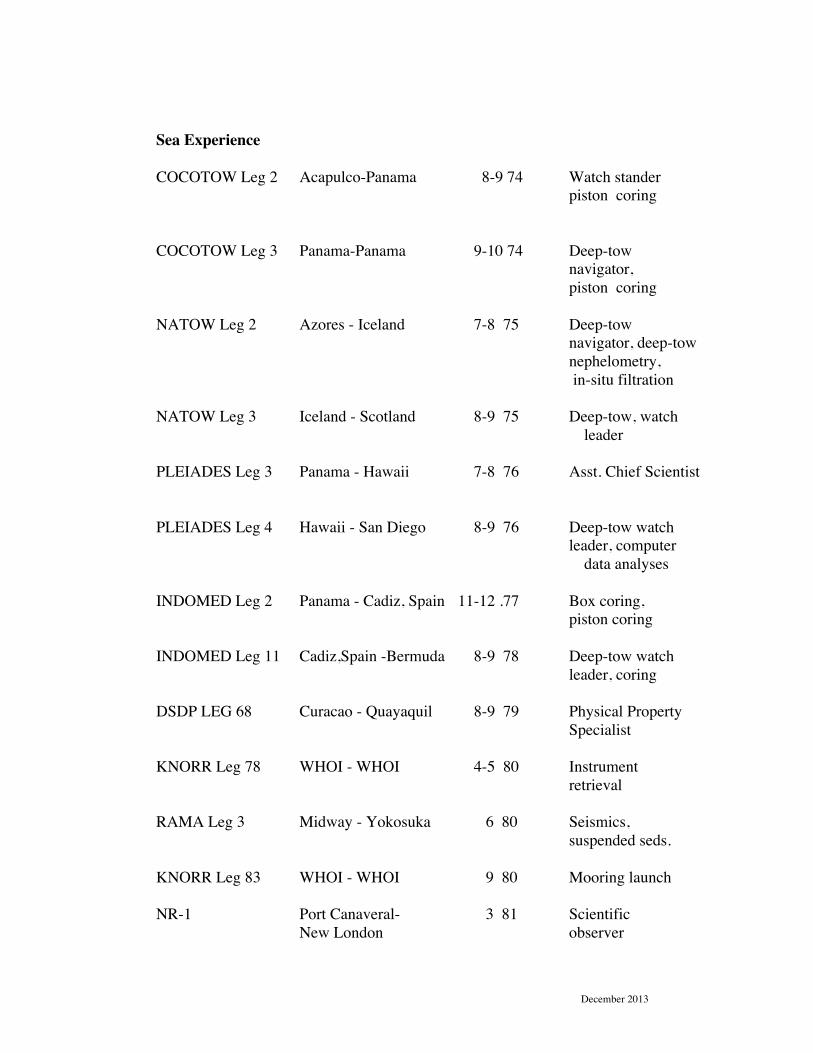
December 2013
Sea Experience COCOTOW Leg 2 Acapulco-Panama 8-9 74 Watch stander piston coring COCOTOW Leg 3 Panama-Panama 9-10 74 Deep-tow navigator, piston coring NATOW Leg 2 Azores - Iceland 7-8 75 Deep-tow navigator, deep-tow nephelometry, in-situ filtration NATOW Leg 3 Iceland - Scotland 8-9 75 Deep-tow, watch leader PLEIADES Leg 3 Panama - Hawaii 7-8 76 Asst. Chief Scientist PLEIADES Leg 4 Hawaii - San Diego 8-9 76 Deep-tow watch leader, computer data analyses INDOMED Leg 2 Panama - Cadiz, Spain 11-12 .77 Box coring, piston coring INDOMED Leg 11 Cadiz,Spain -Bermuda 8-9 78 Deep-tow watch leader, coring DSDP LEG 68 Curacao - Quayaquil 8-9 79 Physical Property Specialist KNORR Leg 78 WHOI - WHOI 4-5 80 Instrument retrieval RAMA Leg 3 Midway - Yokosuka 6 80 Seismics, suspended seds. KNORR Leg 83 WHOI - WHOI 9 80 Mooring launch NR-1 Port Canaveral- 3 81 Scientific New London observer
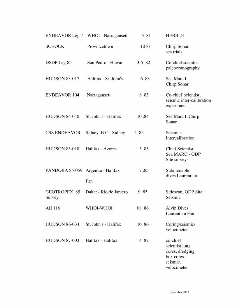
December 2013
ENDEAVOR Leg 7 WHOI - Narragansett 5 81 HEBBLE SCHOCK Provincetown 10 81 Chirp Sonar sea trials DSDP Leg 85 San Pedro - Hawaii 3-5 82 Co-chief scientist paleoceanography HUDSON 83-017 Halifax - St. John's 6 83 Sea Marc I, Chirp Sonar ENDEAVOR 104 Narragansett 8 83 Co-chief scientist, seismic inter-calibration experiment HUDSON 84-040 St. John's - Halifax 10 .84 Sea Marc I, Chirp Sonar CSS ENDEAVOR Sidney, B.C.- Sidney 4 .85 Seismic Intercalibration HUDSON 85-010 Halifax - Azores 5 .85 Chief Scientist Sea MARC - ODP Site surveys PANDORA 85-059 Argentia - Halifax 7 .85 Submersible dives Laurentian Fan GEOTROPEX 85 Dakar - Rio de Janiero 9 85 Sidescan, ODP Site Survey Seismic AII 116 WHOI-WHOI 08 86 Alvin Dives Laurentian Fan HUDSON 86-034 St. John's - Halifax 10 86 Coring/seismic/ velocimeter HUDSON 87-003 Halifax - Halifax 4 87 co-chief scientist long cores, dredging box cores, seismic, velocimeter

December 2013
R/V HENLOPEN WHOI-Del. 9 .87 Chirp sonar, High resolution seismics BALDER CHALL. Halifax - Halifax 9 87 Borehole drilling velocimeter, seismics HMCS QUEST Bermuda- Halifax 3 .88 ROV operations R/V ATLANTIC N.Y. - N.Y 6 .88 Chirp Sonar TWIN R/V THOMAS Majuro-Majuro 12 .88 Seismics, ODP WASHINGTON site surveys R/V THOMAS San Diego- Manzanillo 11.89 Seismics, ODP WASHINGTON site surveys JOIDES Guam - Guam 1 - 4 .90 ODP Drilling RESOLUTION Leg 130 Ontong Java Plateau R/V Laurentian Sault St. Marie 6.90 High-res seismic sidescan, paleoclimate JOIDES Panama - San Diego 5 - 7 . 91 Co-chief Scientist RESOLUTION Leg 138 R/V Laurentian Lake Huron 9.91 High-res seismic sidescan, coring R/V Farnella West Coast 5-92 High-res seismic FCG SMITH Bay of Fundy 7-92 Hydrographic ground truth FG CREED Bay of Fundy 8-92 Hydrographic ground truth FG CREED Lake Ontario 6-93 Neotectonic studies R/V Miramachi Saint John Harbor 8-93 Hydrographic ground truth Surveyor
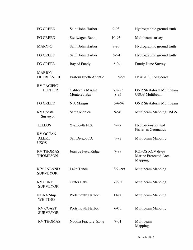
December 2013
FG CREED Saint John Harbor 9-93 Hydrographic ground truth FG CREED Stellwagen Bank 10-93 Multibeam survey MARY-O Saint John Harbor 9-93 Hydrographic ground truth FG CREED Saint John Harbor 5-94 Hydrographic ground truth FG CREED Bay of Fundy 6-94 Fundy Dune Survey MARION DUFRESNE II Eastern North Atlantic 5-95 IMAGES, Long cores RV PACIFIC HUNTER California Margin 7/8-95 ONR Strataform Multibeam Monterey Bay 8-95 USGS Multibeam FG CREED N.J. Margin 5/6-96 ONR Strataform Multibeam RV Coastal Santa Monica 9-96 Multibeam Mapping USGS Surveyor TELEOS Yarmouth N.S. 9-97 Hydroacoustics and Fisheries Geomatics RV OCEAN ALERT San Diego, CA 3-98 Multibeam Mapping USGS RV THOMAS Juan de Fuca Ridge 7-99 ROPOS ROV dives THOMPSON Marine Protected Area Mapping R/V INLAND Lake Tahoe 8/9 –99 Multibeam Mapping SURVEYOR RV SURF Crater Lake 7/8-00 Multibeam Mapping SURVEYOR NOAA Ship Portsmouth Harbor 11-00 Multibeam Mapping
WHITING RV COAST Portsmouth Harbor 6-01 Multibeam Mapping SURVEYOR RV THOMAS Nootka Fracture Zone 7-01 Multibeam Mapping

December 2013
THOMPSON R/V CAPE N.J. Margin 8-01 ONR Geoclutter HENLOPEN in-situ acoustic
measurements R/V MOANA N.E. Gulf of Mexico 9-01 Multibeam mapping WAVE R/V MOANA N.W. Gulf of Mexico 7-02 Multibeam mapping WAVE OCEAN Martha’s Vineyard 7-02 Multibeam mapping EXPLORER ONR Mine Burial CS GENESIS Normandy 7-8-02 Wreck mapping USNHC Archeology CS Various Toledo Bend TX 03-03 Space Shuttle Columbia Search R/V BALDUR Husavik, Iceland 08-03 Multibeam Mapping USCG HEALY Barrow – Barrow AL 8-9-03 Multibeam Mapping LoS Arctic CS Loughrea Scanner WHOI-WHOI 9-10-03 Multibeam Mapping ONR –Mine Burial CS
R/V EWING Newport Ore – Kodiak Alaska 8-9-04 Multibeam mapping, seismic and coring Alaskan Fjords, NSF IODP Site Surveys USCG HEALY Nome Al – Barrow Al 10 –04 Multibeam Mapping - LoS-Arctic - CS
M/V THE Phuket – Phuket Thailand 5-6-05 ROV Operations – at PERFORMER tsunami site R/V Kilo Moana Kodiak – Honolulu 8-9-05 LoS Mapping – Gulf of Alaska CS

December 2013
USCG HEALY Barrow-Barrow 8-9-07 LoS Mapping Arctic CS USCG HEALY Barrow-Barrow 8-9-08 LoS Mapping, Dredging CS R/V TIOGA WHOI-WHOI 07-09 AUV work ONR USCG HEALY Barrow-Barrow 8-9-09 LoS Mapping, Seismic Dredging – Arctic CS E/V NAUTILUS Santorini- Haifa 8-9-10 Exploration, ROV, video CS USCG HEALY Barrow-Dutch Harbor 8-9-11 LOS Mapping, Arctic CS E/V NAUTILUS Paphos – Paphos Cyprus 08-12 Exploration ROV video CS USCG HEALY Barrow – Dutch Harbor 8-9-12 LoS Mapping, Arctic CS OCEAN EXPLORER OF SWEDEN Upernavik – Greenland 08-13 Exploration, Mapping