![Earth and Beyond [Grade 5 English]](https://static.fdocuments.us/doc/165x107/546a169cb4af9fde078b4e49/earth-and-beyond-grade-5-english.jpg)
DOCUMENT RESUME ED 061 189 SP 007 375 Earth Science, Grade ... · TITLE Earth Science, Grade 7. ......
38
DOCUMENT RESUME ED 061 189 SP 007 375 TITLE Earth Science, Grade 7. INSTITUTION Buffalo Public Schoo s N.Y. PUB DATE 70 NOTE 370. EDRS PRICE DESCRIPTORS ABSTRACT ME-$0.65 HC-$3.29 Astronomy; *Curriculum Guides; *Earth Sci e; Geology; *Grade 7; Meteorology; *Physical Sciences GRADES OR AGES: Grade 7. SUBJECT MATTER: Earth science. ORGANIZATION AND PHYSICAL APPEARANCE: The introductory material suggests a time schedule for the major units and gives details of the reference materials referred to in the text. The main text is presented in four columns: topical outline, basic understandings, suggested activities and procedures, and r f rences and supplementary information. The sections are introduction to science, astronomy, geology, and meteorology. The guide is lithographed and spiral bound with a soft cover. OBJECTIVES AND ACTIVITIES: The objectives for each section are listed under basic understandings. Activities are suggested but are not given in any detail. INSTRUCTIONAL MATERIALS: Films, filmstrips, and books are listed under suggested activities and procedures. STUDENT ASSESSMENT: No provision is made for evaluation. (MBM)
Transcript of DOCUMENT RESUME ED 061 189 SP 007 375 Earth Science, Grade ... · TITLE Earth Science, Grade 7. ......

DOCUMENT RESUME
ED 061 189 SP 007 375
TITLE Earth Science, Grade 7.INSTITUTION Buffalo Public Schoo s N.Y.PUB DATE 70NOTE 370.
EDRS PRICEDESCRIPTORS
ABSTRACT
ME-$0.65 HC-$3.29Astronomy; *Curriculum Guides; *Earth Sci e;
Geology; *Grade 7; Meteorology; *Physical Sciences
GRADES OR AGES: Grade 7. SUBJECT MATTER: Earthscience. ORGANIZATION AND PHYSICAL APPEARANCE: The introductorymaterial suggests a time schedule for the major units and givesdetails of the reference materials referred to in the text. The maintext is presented in four columns: topical outline, basicunderstandings, suggested activities and procedures, and r f rencesand supplementary information. The sections are introduction toscience, astronomy, geology, and meteorology. The guide islithographed and spiral bound with a soft cover. OBJECTIVES ANDACTIVITIES: The objectives for each section are listed under basicunderstandings. Activities are suggested but are not given in anydetail. INSTRUCTIONAL MATERIALS: Films, filmstrips, and books arelisted under suggested activities and procedures. STUDENT ASSESSMENT:No provision is made for evaluation. (MBM)

EARTH SCIENCE
Grade 7
U.S. DEPARTMENT OF HEALTH.EDUCATION & WELFAREOFFICE OF EDUCATION
THIS DOCUMENT HAS SEEN REPRODUCED EXACTLY AS RECEIVED FROM
THE PERSON OR ORGANIZATION ORIG-INATING IT POINTS OF VIEW OR OPIN-IONS STATED DO NOT NECESSARILYREPRESENT OFFICIAL OFFICE OF EDU-CATION POSITION OR POLICY
Buffalo Public SchoolsBuffalo, New York
Division of Curriculum Evaluation and Developme t

C-3
EARTH SCIENCE GRADE 7
BUFFALO PUBLIC SCHOOLSBUFFALO, NEW YORK
Superintendent of SchoolsDr. Joseph Manch
Board af Education
Dr. Matt A. Gajewski, PresidentDr. George E. Blackman, Vice-President
George F. Goodyear
Joseph E. Murphy
Anthony J. Nitkowski
Carmelo A. Parlato
Prepared Under the Direction of:
Alfred J. Naish
Director of Science
John P. Gallivan
Supervisor of Science
Committee Members
Anthony P. Catalfamo, Chairman
Stephen L. Korutko
Richard Davis
Mrs. Helen R. Nun ley
Richard A. Ehinger
Salvatore Schillaci
Division of Curriculum Evaluation and Development
Dr. Frank J. DresslerAssociate Superintendent
First Printing 1967
ReNdsed Printing 1970

FOREWORD
The rapid accumulation of scientific information about the universehas made it impossible for any individual to remain informed about anymore than a very narrow segment of science, and unwise for designers ofscience courses to attempt to limit these courses to the transmission offacts. If education today is to be education for change, then science edu-cators must prepare their students to use the methods of science to solveyet unstated problems.
This course has been designed to make it possible for the student toacquire both information and the ability to solve problems by scientificmethods. Facts can be used to lead to an understanding of the continuity ofscience. Experiments, used skillfully and carefully, can create for the studentthe thrill that a professional scientist feels when he solves a problem in hisstudy or laboratory.
The committee that drafted this course outline has blended facts withactivities with the hope that science will come alive for all students. Deptha treatment will vary with the individual. Methods may have to be changed,but the basic approach to science remains the same for all students. Addedemphasis on student activities, teacher demonstrations and audio-visual aidswill make it possible for students to achieve a successful undertsanding ofboth concepts and methods.
In all cases the material in the Guide is the minimum required and thefinal examinations will test this required material. Occasionally questionsmay be asked concerning current scientific advances of significance. Mater-ial that can be used as enrichment to challenge gifted students is indicatedby asterisks.

INTRODUCTION
Changes in our society which present many educational challenges have led to anincreased concern for and emphasis upon the school curriculum. Methods and pro-cedures of the past arc no longer adequate to our needs. The explosion of knowledgein many areas and new understandings of the learning behavior of children requireconstant revision of existing programs, For this reason, the Board of Education, uponmy recommendation, created a Division of Curriculum Evaluation and Development.
This Division is now engaged in the process of developing new courses of study andrevising long-established curriculums.
Science is one of the areas in which significant changes are thking place. Thedemand for more and more knowledge about and understanding of the physical envi-ronment has greatly increased the emphasis upon science instruction. This CurriculumGuide, Seventh Grade Earth Science, deals with the nature of the physical environmentand the effect of this environment upon man. A committee of classroom teachers,working under the direction of the Director of Science, prepared this excellent guide.I wish to thank and commend the committee members for their valuable contribution.All teachers and students of seventh grade will profit from the work of the committee.
Joseph ManchSuperintendent of Schools
TABLE OF CONTENTS
Foreword
Introduction to Teachers
Introduction .
I. Wha t is Science? .
IL Divisions of Science
ilL Methods of Science
6
8
Astronomy 12
I. The Universe 12
IL The Solar System . 12
III. The Earth 16
Geology18
I. Structure of the Earth . 18
II. Composition of the Crust 18
III. Changes in the Earth's Surface 22
IV. The Oceans 26
V. Conservation 28
Meteorology .30
I. Characteristics of the Atmosphere . 30
IL Changes in the Atmosphere . 30
III. Weather Maps * 36
IV. Weather Forecasting 36
5Page fivi

INTRODUCTION
As this is the first year of a three year science sequence for seventh, eighth, andninth grade pupils, time can be well spent at the outset of the course of study to explainthe goals of science. This can be done effectivly by detailing the step by step process ofthe scientist.
This attack on a problem can be made more meaningful if some classical scientificinvestigations are related. Mention can be made of the work of men like Kepler, Men-del, Galileo, Darwin, or Salk. The work of the biologist can be illustrated by using film-strips from the series Great Names in Biology.
That part of the introductory unit treating various aspects of matter should berelated to the study of minerals in order to make the discussion of mineral propertiesmore meaningful.
The entire course is more effective if illustrations from the realm of the pupils'experience are frequently interjected. The basis for the order of topics is that maxi-mum use can be made of concurrent observations. For example, astronomy should bepresented in the fall when clear skies are most common.; and meteorology in the springduring a time of rapid, pronounced weather changes with their accompanying classicalphenomena.
Folio ing is an approximate time schedule for each of the major units:
Introduction . 3 weeks
Astronomy 8 weeks
Geology = 16 weeks
Meteorology . .............. 10 weeks
In each of the units, there is ample time to allow for frequent demonstrations andpupil activity. Without this activity, the course will fail to be a meaningful experience.
There are frequent references in columns 3 and 4 of the course of study. The titlesof reference materials are abbreviated in the interest of space; therefore the completetitles and abbreviations are listed below.
Blanc Blanc and Fischler, Modern Science: Earth, Space and Matter.
N & S Namowitz and Stone, Earth Science, The World We Live In
ESS
ESH The University of the State of New York, Earth Science Handbook
Heller, Geology and Earth Sciences Sourcebook

A number of suggested activities are listed by using a letter or letters following by
a number. The letters refer to the following State Education Department publications.Activities are numbered within each booklet.
GSH The University of the State of New York, the General Science Handbook,Parts One, Two and Three.
A The University of the State of New York, Science 7, 8, 9, Experim Taal Sylla us,
Part One.
E, F, G, H The University of the State of New Yo k Science 7, 8, 9, ExperimentalSyllabus, Blocks E, F, G, H.
MS Buffalo Museum of Science Audio Visual Department
Dept Buffalo Public Schools Audio Visual Department
Materials for enrichment in honors classes
Material listed under "basic understandings" is the minimum material for the courseand will be subject to testing on departmental examinations.
Page seven

TOPICAL OUTLINE
INTRODUCTION
BASIC UNDERSTANDINGS
I. What is Science?
II. Divisions of Science
HI. Methods of Science
IV. Matter
A. Properties of Matter
Science is the study of the universe. Scientists are concerned with organizing and class-ifying a body of knowledge and explaining the behavior of living and non-living matteron the basis of natural laws.
Science is divided into a number of areas. Those blanches of science included in thiscourse are as follows:
I. Astronomythe study of the heavenly bodies, their motions and nature.2. Geologythe study of the composition and structure of the earth.3. Paleontologythe study of the history of the earth.4. Oceanographythe study of the oceans and ocean basins.5. Meteorologythe study of weather and climate.
Scientists conduct careful investigations that may lead eventually to la s of nature.Following are essential steps in this process:
I. Careful observations of a particular occurrence give rise to a problem.2. After assembling observations and researching the problem, an hypothesis is
form ulated.
3. The iypothesis is then subjected to extensive testing.4. A theory or law can result from the results of the tests.
Matter is anything that has weight and takes up space.
Substances arc identified because they exhibit specific properties. Some of these prop-efties are as follows:
I. Weightan object has weight because of gravity.2. Spaceall objects take up space. The amount of space they occupy is called
their volume.3. Densi the weight of one unit of volume of a substance is its dens

SUGGESTED ACTIV_ 'IES AND PROCEDURES REFERENCES AND SUPPLENMNTARY INFORMATION
Review some topics studied in elementaiy science andplace them in their proper scieutific
A-.1, A-2, A-6
Ernphasie that many hypotheses may seem to fit a set ofobservations. All must be tested, and it may take manyyears befoIrc one is accepted as a theory. Much more timemay dapse before a law is postulated and accepted.
MateriA for the introductory unit is haRPA on "The Waysof Science" pp. xix-mor and pp. 39 in Blanc. It is intendedas a prelude to the junior hiigh school science program ingeneral and this course in particular.
9

TOPICAL OUTLINE BASIC UNDERSTANDINGS
B. States of Matter
C. Sh-ucture of Matter
1. Elements
2. Compounds
3. Mixtures
D. Changes in Matter
1. Physical changes
2. Chemicalchanges
Matter may exist in three different states or phases.1. Solids have a definite shape and a definite volume.2. Liquids have a definite volume but no definite shape.3. Gases have neither a definite shape nor a definite volume.
All matter is made up of elements ;Ind compounds.
There are more than 100 known elements, each of which is composed of protons, neu-trons and electrons. The smallest part of an element is an atom.
Compounds are composed of 2 or more elements which are chemically combined. Thesmallest part of a compound is a molecule.
Mixtures are composed of 2 or more substances (elements or compounds) combinedphysically. The properties of the individual substances are not changed.
Matter may undergo changes which are physical or chemical in nature.
A physical change involves only a change in appearance. The chemical compositionremains the same.
A chemical change results in the formation of a new substance.

SUGGESTED ACTIVITIES AND PROCEDURES REFERENCES AND SUTPLFMENTARY INFORMATION
Discuss the properties of various common solids, liquids
and gases.
Demonstrate the change of s a e of ice to water to steam.
Ask pupils to name some common elements. Refer toBlanc pp. 46-7.
Name some common compounds and point out the ele-
merits of which each is composed. Mention may be madeat this time that minerals are compounds, e. g. quartz is
silicon dioxide. Most rocks are mixtures.
List and discuss a numical changes.
of co mon physical and chem-
1
Abler students may undeTstand a limited discussion of thekinetic theory of matter.
It is not necessary to present a detailed explanation of thestructure of matter. The topic is introduced to enablepupils to have an understanding of the composition of
racks and minerals.
Changes may be presented as an introduction to physicaland chemical weathering.
Page eleven

POP ICA L OUTLINE
THE EARTH: ITS PLACE IN THE UNIVERSE
BASIC UNDERSTANDINGS
I. The Li iiverse
A. Instruments Usedin the Study of Space,
B. Distances in Space
C. The Universal Force:Gravitation
D. Stars
E. Galaxies
F. Constellations
G. Nebulae
IL The Solar System
A. The Sun
1. Structure
2. Production ofEnergy
3. Dishm
Page twelve
The universe consists of all known and unknown mass in any form and the void behveen.It is mostly empty space with the objects in it at great distances from each other.
In order to study the bodies that exist beyond our planet we must rely on the use ofspecial instruments such as the optical telescope, spectroscope, camera, radar and radiotelescope.
The basic unit of distance in astronomy is the light year. It is the distance traveled bylight in one year at a speed of 186,000 miles per second.
Any two bodies will exert a force (pull) on each other. The amount of this force dependson the size of the bodies and the distance between them.
Stars are masses of hot (incandescent) matter. They are classified according to temper-ature and size. The hottest stars are blue-white; the coolest are red.
Galaxies are large clusters of stars, their related bodies and dust. Each galaxy is composedof millions of stars. Our galaxy is the Milky Way.
A constellation is a cluster of stars and their related bodies that form a pattern or picturein the sky. Some constellations, such as the Big and Little Dipper and Draco, are visiblethe year around. Others, such as Orion are visible only part of the year.
A nebula is a cloud of dust or gases in space. They are thought to be an early stage inthe development of stars or galaxies.
The solar system is made up of the sun and all the bodies that revolve around it. Theyare held in their orbits by gravity.
The sun is an average sized star. It is the source of most of the earth's energy.
The sun consists of four ill-defined layers of material which increase in density towardsthe center of the sun.
1. Core The dense central portion2. Photosphere The visible, light-producing layer3. Chromosphere The sun's atmosphere4. Corona The extremely thin outermost layer visible during solar eclipses.
It is believed that the sun produces energy by means of nuclear fusion. Fusion is a reac-tion involving the collision and union of two particles during which a small amount ofthe original mass is converted into energy.
The mean distance from the earth to the sun is approximately 93,000,000 miles. Theearth's orbit is an ellipse, so the actual distance varies from 91,500,000 to 94,500,000miles. The mean distance is commonly called an astronomical unit, and is used to expressdistances within the solar system.

SUGGESTED ACTIVITIES AND PROCEDURES REFERENCES AND SUPPLEMENTARY INFORMATION
Movies: -Exploring the Universe- MS and Dept."Understanding Our Universe" MS-Universe" MS"Exploring the Edge of Space" Dept.
GSH 2713, 2714, 3754
GSH 2730F - 16 (This may also be used with the study of the solar
system)
Filmstrip: "Stars and Galaxies"
Movies: "Depth of Space" (Exterior Galaxies) MS"Beyond Our Solar System" Dept."Realm of the Galaxies" Dept.
Filmstrip: "Constellations"
GSH 3753, 3757, 2726 2727, 2731, 2734
Calculate the approximate diameter of the sun using a coinor pinhole in a shade.
In a dark room, k-lace a sheet of metal or black paper infront of a light bulb so that only the "corona" will be seen.
To encourage a better sense of the distance involved, havethe pupils compute the tLme required to travel to the sun atvarious speeds.
GSH 2719, 2720, 2721, 2722, 2723
Filmstrips: The Sun and Its Planets"The Solar Family"
F-31
ESS p. 252 No. 15
One light year is about 6 trillion miles. The nearest star(Alpha Centauri ) is 4.3 light years away.
Only those constellations located high in the northern skyare visible year round because of the revolution of the earth.
Approximately 4 million tons of matter are converted intoenergy each second on the sun. This results in the produc-tion of energy at the rate of 5 X 10²³ horsepower in ac-cordance with Einstein's equation (E = mc2)
Page thirteen

TOPICAL OUTLINE BASIC UNDERSTANDINGS
B. The Planets
L The InnerPlanets
2. The OuterPlanets
C. Planetoids(Asteroids)
D. Meteoroids
o -_e_
F. The Moon
1. Surface Features
2. Motions
3. Phases
4. Tides
5. Eclipses
Page fourteen
A planet is any non-luminous body of appreciable size which orbits a star.
There are nine known planets, each of which travels around the sun in an elliptical orbit.In order from the sun out they are:
1. Mercury2. Venus3. Earth4. Mars5. Jupiter
Saturn7. Uranus8. Neptune9. Pluto
The four planets nearest the sun are relatively warm, dense and slow rotating.
The five planets farthest from the sun are generally large, cold, of low dengity, fast ring, and have bands of clouds parallel to their equators.
There are thousands of bodies too small to be considered planets which orbit the sun ina belt between the orbits of Mars and Jupiter.
A meteoroid is a mass of solid material in space. A "shooting star" is a meteoroid whichhas entered the earth's atmosphere, and has become incandescent because of frictionalheating.
A comet is a mass of gas and fine particles orbiting the sun. They have very elongatedorbits.
The moon is the earth's only natural satellite. It has a diameter about 1/4 as large as thatof the earth. It is about 240,000 miles from the earth.
The moon's surface consists of plains (called seas), craters and rnountoin ranges.
The moon revolves about the earth every 28 days. It rotates on its axis once each 28 days.Because the periods of rotation and revolution are the same, the same side of the moonalways faces the earth.
The moon is visible on earth because it reflects sunlight. As it revolves, different portionsof the lighted surfam can be seen horn earth.
The principal phases are new moon, first quarter, full moon and last quarter. These phasesaxe repeated each 29 days.
Because the moon has mass, it exerts a gravitational pull on the earth. The most notice-able effect of this pull on earth is tides. The sun exerts a smaller effect on tides.
The highest high and lowest low tides (spring tides) occur at the new and full moon.
Tides of least range (neap tides) occur at first and last quarter.
A solar eclipse occurs when the earth is in the moon's shadow.
A lunar eclipse occurs when the moon is in the earth's shadow.
14

SUGGESTED AClIVI TIES AND PROCEDURES REFERENCES AND SUPPLEMENTARY INFORMA1 ION
Filmstrip: "Comets and Meteors"
Movies: "The Moon" MS and Dept."A Trip to the Moon" MS and Dept."How We Explore Space" MS
Films rips: "The Earth's Satellite The Moon""Work of Astronomers and Space Travel"
GST1 2703, 2709, 2725GSH 2701, 2702, 2710, 3744GSH 2704, 2705, 2706, 2711, 2712, 2714
GSH 2707
Because Pluto is the outermost planet, insufficient infor-mation has been acquired about its specific physicalproperties.
Meteor showers occur when the earth intercepts a band ofmeteoroids.
A comet is visible because its gases are ionized, and becauseit reflects sunlight. The tail of the comet always pointsaway from the sun.
Two high tides and two low tides are formed shnultaneously.The moon exerts the greatest attraction on the waters near-est it and least attraction on the waters on the far side of
the earth.
Eclipses do not occur during each new or full moon becausethe moon does not orbit the earth in the same plane as theearth revolves about the sun.
Page fit eu

TOPICAL OUTLINE
HI. The Earth
A. Location on theEarth's Surface
I. Latitude
2. Longitude
B. The Earth'sMotions
1. Time
2. Seasons
Page sixteen
BASIC UNDERSTANDINGS
The earth is an oblate spheroid. It is slightly compressed at the poles. Its diameter isapproximately 8000 miles.
In order to provide a uniform system for expressing position and direction on the earth'ssurface, it has been divided into a grid.
Latitude is the angular diAance north or south of the equator.
Longitude is the angular distance east or west of the prime meridian.
The prime meridian is an imaginary line from the North Pole through Greenwich, Eng-land to the South Pole.
The earth revolves in an elliptical orbit about the sun once each 3651/4 days.
The earth rotates on its axis once each 24 hours.
The regular moUons of thc earth 2re the basis of our time units.
The earth rotates through 360 degrees of longitude each day, so the width of each of our24 time zones is about 15 degrees of longitude.
Seasons are caused by the following:
I. Inclination of the earth's axis to the plane of its orbit2. rdiallelism of the earth's axis3. Revolution of the earth about the sun.
The beginning of each season occurs when the sun's vertical ray falls on a particular par-allel of latitude.
Spring March 21 vernal equinox vertical ray on equator
Summer June 21 surm ler solstice vertical ray on Tropic of Cancer
Autumn September 22 autumnal equinox vertical ray on equator
Winter December 21 winter solstice vertical ray on Tropic of Capricorn

SUGGESTED ACTIVITIES AND PROCEDURES REFERENCES AND SUPPLEMENTARY INFORMATION
Discuss the direct and indirect evidence of the earth's shape.
Movies "The Earth in Motion" MS and Dept."Earth Rotation and Revolution" MS and Dept.
Label the time zones on a map of the United States. In-dicate tile time in principal cities.
Sketch the earth and sun at the times of the equinoxes andsolstices. Indicate on each the areas of daylight and dark-ness, the position of the vertical ray, and the five namedparallels of latitude.
Time zone boundaries are not regular because of economicand political considerations.
Page seventeen

THE EARTH: Its Structure and the Forces that Shape Its Surface
TOPICAL OUTLINE BASIC UNDERSTANDINGS
I. Structure
A. Core
B. Mantle
C. Crust
*D. Moho
II. Composition ofthe Crust
A. Minerals
1. Identification
a. PhysicalProperties
(1) Color
(2) Streak
Luster
(4) Hardness
(5) Cleavage
Page eighteen
The solid earth consists of three layers.
The CORE is under extreme pressure, is very dense, may be partly liquid and is thoughtto be mostly iron.
The MANTLE is thought to consist of solid, rock-forming iron and magnesium com-pounds. The mantle is about 1800 miles thick.
The CRUST varies in thickness from 3-30 miles. The crust consists of soil, rocks andminerals.
The boundary between the crust and the mantle.
A MINERAL is a naturally occurring substance (elements and compounds ), c. g. halite(rock salt), sulfur, quartz (the sand around Lake Erie is mostly quartz).
Azurite: bl e malachite: green, sulfur: yellow
STREAK is defined as the color of the fine powder of a mineral. To obtain this powder,the mineral may be crushed or it may be rubbed across a streak plate (unglazed porcelain).The streak of a mineral is always the same regardless of the color of the mineral.
The way in which a mineral reflects light. e. g. halite: glassy, mica: glassy
The ability of a mineral to resist scratching. If one mineral scratches another mineralor substance it is harder than that mineral or substance. The hardness of a mineral isdetermined by a scale on which talc is the softest (1), and diamond is the hardest (10).Quartz is the hardest common mineral (7). Conve&ent materials for determining hard-ness, with the hardness number for each are:
Fingernail 2,5Penny 3.3Glass 5.5
The tendency of a mineral to split naturally along smooth, flat surfaces, e.g. mica, halite.

TOPICAL OUTLINE BASIC UrMERSTANDINGS
b. Chemicalproperties
(1) acid test
*(2 ) flame tests
2. Importantminerals
B. Rocks
1. Igneous
2. Sedin ntary
a. Sandstone
b. Shale
c. Limestone
3. Metamorphic
C. The Rock Record
1. Age of Rocks
2. Fossils
a. Types
b. Age of fossils
Page twenty
Limestone is made up of the compound calcium carbonate and can be identified bydropping hydrochloric acid on the sample. Bubbles of carbon dioxide will be given off.
Some minerals can be identified by the color given a flame when the mineral is heated.
Minerals are the source of elements, e.g. aluminum (bauxite), iron (hematite), lead(galena), chlorine (halite).Minerals are a source of building materials: asbestos, plaster (gypsum ); mica ( electric
insulation: toaster, etc.)The crust of the earth consists of rocks made up of one or more minerals.
Igneous rock is formed as the result of the cooling and hardening of hot, molten material(megrna) on or below the earth's surface.Slow cooling below the earth's surface, produced large crystals: gran te. Rapid coolingon the earth's surface piDduced fine crystals, e.g. obsidian, pumice
Streams carry dirt and particles of rock to the oceans where it is deposited. Some materialsform in the oceans and settle (skeletons of tiny animals, minerals such as calcium carbon-ate). Pressure causes these materials to form solid rock.
Produced from bits of rock cemented together.
Produced from clay and mud.
Produced from skeletons (shells) of m rine animals.
Sedimentary rock that has been changed by pressure and temperature.Ex: marble from limestone, slate from shale.
Rock layers found near the surface of the earth are younger than lavers found beneath
them.
The age of rocks canpresent.
det rmined by measuring the amount of radioactive elements
Fossils are the remains of plants or anrnals preserved in rocks.
Some common types of fossils are:L Actual remains2. Casts and molds3. Tracks and imprints4. Replaced fossils
The age of fossils can be determined by knowing the age of the rock in which they arefound, by radioactive dating (using Carbon-14) or by comparing with index fossils.
20

SUGGESTED ACTIVITIES AND PROCEDURES REFERENCES AND SUPPLEMENTARY INFORMATION
Review the material on change of state. Blanc pp. 12-16.
Draw a circle on the board having a diameter of about 2feet. The crust would not be as thick as the chalk line.
Movie: Project Moho.
discussion of Project Moho and its aims may be held atthis point.
Demonstrate the relationship between cleavage and crys-tal structure with ESH 1.UU.
The temperature of the earth increases with depth. This isshown in the following graph.
c,r Boo*
4000 1
2000
CRUST
'note Corez
Depth in Miles
See N & S p. 4, 208-9.
4000
Summaries of mineral identification characteristics may befound in Block E p. 101 and ESS p. 14-15.
S me of the common minerals and their streaks are:
1. Hematitereddish brown2. Malachitegreen3. Azuriteblue4. Pyritegreenish black5. Sulfurpale yellow6. Graphiteblack
The Mobs Scale of Hardness consists ofarranged according to hardness:
ten minerWs
1. Talc 5. Apatite 8. Topaz2. Gypsum 6. Orthoclase 9. Corundum3. Calcite 7. Quartz 10. Diamond4. Fluorite
A diagram relating the hardness of mineralssubstances is found in ESH p. 15.
and c_ mon
A discussion of common crystal shapes may be found inN & S p. 12 and ESS p. 23.See N & S p. 13
Page n n teen

SUGGESTED ACTIVITIES AND PROCEDURES REFERENCES AND SUPPLEMENTARY INFORMATION
E-10
*ESS p. 19
E-12, ESH 1.15
E-15, ESFI 1.19, 1.20, 1.21
E-16, ESH 1.22
Filinstrip="How We Know About Life Long Ago""Up Through the Cog Age""When Reptiles Ruled the Earth""Mammals Inherit the World""Stories that Fossils Tell""Hunting Fossils"
Movies"Fossils are Interesting" MS"The Story of Coal" MS
Plaster of Paris casts and molds of common objects maybe made to simulate Fossil Formation.
In conducting flame test demonstrations, elements or com-pounds used may be powdered and introduced into a bun-sen flame. A platinum needle does not have to be used. Donot use pure lithium, potassium or sodium. Salts of theseelements such as NaC1, NaHCO, LiC1, KC1, KI andKMnO, may be used safely.
The rate at which the molten material cooled can be de-terrnined by examining the crystal size of the rock. Coarsegrgns are formed slowly. Rapid cooling does not allow forcrystal formation. Therefore, glassy or fine textured rocksindicate rapid cooling.
See N & S pp. 41-45 and ESS pp. 4446.
The Law of Superposition states that in a sequence of un-disturbed sedimentary rocks, younger rock layers lie ontop of older rock layers.
Diagrams of fossils frequently found in New York State arefound in ESH p. 91. A discussion of fossil formation isfound in pi & S pp. 50-52.
Methods of determining the age of rock formations are dis-cussed in N & S chapter 21.
Fossils in the Buffalo area are from the Devonian Age.
Page twenty-one

TOPICAL OUTLINE
HI. Changes in theEarth's Surface
BASIC UNDERSTANDINGS
The earth's surface is being constantly changed by forces that build it up and wear it down.
A. Weathering Destructive forces causing the breakdown of rock materials into its components withoutbeing moved to another location.
I. ChemicalWeathering
2. PhysicalWeathering
Breakdown of rock materials by chemical means, e.g. rusting of iron to produce red thyand rock, acid (rain water and carbon dioxide) on limestone.
Breakdown of rock materials by physical means, e.g. frost action, plant roots, temperaturechanges, solution (cave formation, stalactites and stalagmites).
13. Erosion The wearing away of soil and rock and the transportation of the materials formed.
1. Gravity
2. Running water
3. Glaciers
Page twenty-two
The force of attraction that pulls everything toward tile center of thc earth.Landslides, rockfalls
Running water carries soil and rock particles from higher elevations and deposits themat lower elevations. Running water causes most of the erosion of the earth's surface.
Running water erodes by wearing away by frktion between the rock material in the waterand the stream bed.
The rate of erosion depends on the velocity and volume of a river and the amount of rockmaterial carried in the water.
The lowest level to which a stream can erode is the level of the body of water into whichthe stream flows.
A glacier is a large sheet of ice formed from compressed ice and snow. Glaciers form inareas where the summer melting is less than the amount of snowfall.

SUGGESTED ACTIVITIES AND PROCEDURES REFERENCES AND SUPPLEMENTARY INFORMAT ON
Movie"The Wearing Away of Land" MS
E-25 (Demonshation only), E-28In order to effectively review the weathering unit, discussthe formation of caves, stalactites, stalagmites and columns.
This involves solution, carbonation, evaporation and pre-
cipitation.ESH 2.04 p. 60
Movie"Erosion" Dept."Force of Gravity Dept.
Movie"The Work of Rivers" MSE-32
E-35, E-36Movie"Geologic Work of ce MS
ESS p. 420-28
Emphasize that transportation is the difference betweenweathering and erosion. The fragments formed by agents ofweathering remain in place while erosion results in thecarrying away of the rock particles.
For a complete discussion of erosion by running water andthe resulting land forms, see N & S, Chapter 9.
A discussion of glacier formation is found in ESS p. 181.
Page twen y hree

TOPICAL OUTLINE BASIC UNDERSTANDINGS
a. Valley orMountainGlaciers
b. ContinentalGlaciers
4. Wind
C. Crustal Movem nts
1. Folding
2. Faulting
Page twenty-four
Valley glaciers are found at high elevations and descend through mountain valleys.Surface features resulting from mountain glaciers are:
1. Scratches and grooves
2. Mm-a Mes
2. U-shaped valleys
Continental glaciers are thousands of feet thick and cover extremely large areas. Theyerode the land by scouring or "bulldozing."Surface features resulting from continental glaciers are:
1. Scratches and grooves
2. Ontwash plaina level deposit of sand and gravel left by a melting ice sheet.
3. Great Lakes basin
4. Finger Lakeswhich were rivers dammed by glacial action
Wind erosion is most effective in arid regions. Erosion results when wind picks up looseparticles and wears away rock by an effect similar to sandblasting. Land forms associat-ed with wind erosion are almost vertical cliffs of silt and san,i dunes.
Evidence from the past indicates that the earth's mist has undergone extensivemovement
Extreme pressure within the earth may cause the bedrock to warp. This warping is re-sponsible for the formation of many mountains, e. g., the Appalachians.
Pressure exerted upward or sideward may cause rock to break along a line of weakness.A fault is a break in the bedrock along which there has been movement. Faulting hascaused the formation of part of the Rockies.
24

SUGGESTED ACTIV I'IIES AND PROCEDURES REFERENCES AND SUPPLEMENTARY INEORAATION
Filrnstrip"Work of Ice and Snow
ESH 2.18
Movie"Great Lakes" Dept.
ESH 2.15
Discuss the changes indicatBlanc.ESH 3.06, GSH 2851
ESH 3.01
he maps on p. 324 in
25
Moraines are the rock material carried by and deposited by
a glacier. They are named according to where in the &derthey were carried, e. g.
Lateral morainecaried along the sides of a glacier.
Medial morainecarried in the center of a glacier; thisusually results from the joining of two valley glaciers.
Terminal morainerock material pushed ahead of a glacier.This deposit marks the limit of the forward movement of aglacier.
Ground morainerock material carried beneath a glacier.
Diagrams of moraine locations are found in N & S p. 140and p. 145.
Extensive areas of the Appalachian chain have been formedfrom folding. The Alps are also folded mountains.
Block mountains (formed from faulting) are the SierraNevadas and the mountains ringing the Great Basin area.A discussion of mountain formation is found in N & Spp. 188-191.
Page twenty-five

TOPICAL OUTLINE BASIC UNDERSTANDINGS
3. Vulcanism
2. Volcanoes
b. Hot springs
IV. The Oceans
A. Impodance
I. Mineral resourc
2. Food resources
3. Exploralion
B. Difficulties inExploration
C. Geography of theOceans
Page twen
Movements of liquid rock are called volcanism. These movements occur both on thesurface and within the earth.
The emption of molten rock on the earth's surface results in a cone shaped mountainor volcano.
When ground water passes through a region of vulcanism, a hot spring results. If theproper opening is present and the water is heated to its boiling point, an erupting hotspring or geyser may result.
Oceanography is the study of the ea h's oceans. Approximately three-fourths of theearth's surface is covered with water.
The ocean is important for many reasons, not the least of which is that it represents thelargest unexplored area on earth.
The ocean represents a vast, virtually untapped source of minerals. Magnesium, pet-roleum and coal are among the few resources commercially obtained at the present.
Present food resources are limited to some fish. Fish farms are planned to increase theharvest. Some forms of ocean plant life are possibilities for the future. The oceans alsorepresent our largest potential source of drinking water.
Clues to the nature of the earth's interior may be found by drilling on the ocean floor.The earth's crust is thinnest beneath the oceans.
Tremendous pressures in the ocean depths restrict exploration. Satisfactory equipmentto explore the depths is presently under development.
The topography of the ocean floor is similar to that found on the con ments, e.g.
I. Plateaus correspond to the continental shelf.2. Plains are found off the continental she&3. Mountains exist in mid-ocean. Those tall enough to break the surface arc
islands.

SUGGESTED ACTIVITIES AND PROCEDURES REFERENCES AND SUPPLEMENTARY INFORMATION
Movies-13irth of a Volcano" M. S."Earthquakes and Volcanoes- M. E.Volcanocs in Action" M. S."Eruption of Mt. Vesuvius" M. S.
ESS p. 76 Nos. 1, 2ESH 1.35, 1.36
Discuss the mineral content of sea water based on charts in
ESS p. 160 and N & S p. 241.ESH 1.26
ESH 1.27
Discuss the features found in the diagram of the oceanfloor in N & S p. 245, 246. Another diagram which maybe used is found in ESS p. 164-5.
Volamots of Hawaii rise 30,000 feet from the ocean floor.
Most active volcanoes are found in a ring around the Pacific
Ocean.
Hot springs and geysers are found in Yellowstone NribnalPark.
Of the total eadh's surface only 17% is suitable for cultiva-
ilon.
We have only begun tapping vast oil resources on the con-tinental shelf and here only in the shnllow locations (notover 200 feet water depth).
Coal deposits are being worked off the British Isles.
Fish farmingJapan.
presently being attempted off Scotland and
The continental shelves slope rather abruptly to deep plains.These depths are called abyssal plains. These deep abyssalplains cover more than one-half of the earth's surface.

TOPICAL OUTLINE BASIC UNDERSTANDINGS
D. Ocean
I. Climate
2. Changes inShorelines
a. Wave Er ion
b. WaveDeposits
V. Conservation
Page twentyeight
The oceans have the greatest effect on coastal areas.
Oceans tend to moderate the climate of coastal areas. The presence of warm or coolcurrents raises or lowers the average temperature. The following are significant:
1. Gulf Streama warm current which causes mild winters in the British Isles.2. Japan Currenta warm current affecting the Pacific northwest.3. Labrador Currenta cold current which cools the Maritime Provinces and
New England.
The action of waves styiking a shoreline results in both building and erosion.
The constant pounding of waves upon a shoreline tends to wear irregular coasts to makethem straighter. Cliffs and caves also result from erosion by waves.
Incoming waves in shallow water carry rock particles and deposit them on or near theshoreline. This results in sandy beaches and sand bars.
Conservation techniques are used to minimize the effects of weathering and erosion.Some methods used 0 offset the destruction by running water are:
1. Planting cover crops2. Contour plowing3. Strip farming4. Terracing5. Building dams
Some methods used to control wind erosion are:1. Planting wind breaks2. Planting cover crops3. Irrigation

SUGGESTED ACTIVITIES AND PROCEDURES REFERENCES AND SUPPLEMENTARY INFORMATION
ESH 1/7
Review the activities demonstrating erosion effects. Pointout methods used to counteract these effects.
ESH 2.11
29
A discussion of shorelines and the changes caused by waveerosion and deposition is found in N & S pp. 264-69.
Conservation methods can be profitably taught during thediscussion of the effects of each agent of erosion.
Page twen y-nine
THE EARTH: ITS CHANGING ATMOSPHERE
TOPICAL OUTLINE
I. Characteristics of theAtmosphereA. Composition
B. Structure
1. Ionosphere
2. Stratosphere
3. Troposph
II. Changes in theTroposphere
A. Temperature1. Changes with
Altitude
2. Changes withLatitude
B. Pressure
1. Changes withAltitude
2. DifferentialHeating
3. MeasuringAir Pressure
C. Moisture in the Mr
Page thirty
BASIC UNDERSTANDINGS
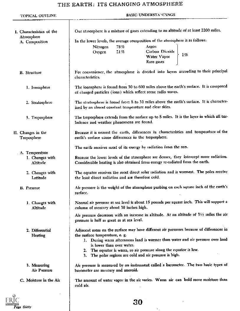
Our atmosphere is a mixture of gases extending to an altitude of at least 2200 miles.
In the lower levels, the average composition of the atmosphere is as follo s:
Nitrogen 78% ArgonOxygen Z I% Carbon Dioxide
Water VaporRare gases
For convenience, the atmosphere is divided into layers according to their principalcharacteristics.
The ionosphere is found from 30 to 600 miles above the earth's surface. It is composedof charged particles ions) which reflect some radio waves.
The stratosphere is found from 8 to 30 miles above the earth's surface. It is character-ized by an almost constant temperature and clear skies.
The troposphere extends from the surface up to 8 miles. It is the layer in which all tur-bulence and weather phenomena are found.
Because it is nearest the earth, differences in characteristics and temperature of theearth's surface cause differences in the troposphere.
The earth receives most of its energy by radiation from the sun.
Because the lower levels of the atmosphere are denser, they intercept more radiation.Considerable heating is also obtained from energy re-radiated from the earth.
The equator receives the most direct solar radiation and is wannest. The poles receivethc least direct radiation and are therefore cold.
Air pressure is the we ght of the atmosphere pushing on each square inch of the earth'ssurface.
Normal air pressure at sea level is about 15 pounds per square inch. This will support acolumn of mercury about 30 inches high.
Air pressure decreases with an increase in altitude. At an altitude of 314 miles the airpressure is half as great as at sea level.
Adjacent areas on the surface may have different air pressures because of differences inthe surface temperature, e. g.
1. During warm afternoons land is warmer than water and air pressure over landis lower than over water.
2. The equator is warm, so air pressure along the equator is low.3. The polar regions are cold and air pressure is high.
Air pressure is measured by an instrument called a barometer. The two basic types ofbarometer are mercury and aneroid.
The amount of water vapor in the air varies. Warm air can hold more moisture thancold air.
30

SUGGESTED ACTIVITIES AND PROCEDURES REFERENCES AND SUPPLEMENTARY INFORMATION
A systematic collection and recorcling of daily weathe con-dibons is recommended throughout the unit. These dailychanges can be used to explain the concepts presented.
A class collection of daily newspaper weather maps is avaluable aid.
Start H-10 at this time. See also ESH 6.13H-2a, 11-4, ESH 6.01 may be used
GSH 16 1, 1632, 1636
GSH 1625
Review the effect of heat energy on gases
ESH 145 6.05 a, b, c, *6.03 d
GSH 2663, 2607, 2605, 5607, 5608, 5609
Explain the construction and pinciples ofeach type.
lion of
Point out that, as a mixture, the composition is subject tochange. For example, around industrial areas and activevolcanic areas the percentage of carbon dioxide will increase.The amount of water vapor also fluctuates greatly. Variousair pollutants are not included in the average composition.
Activity 11-6 should be included to emphasize these factors.
Above the tro sphere there are layers where single gasespredominate.
See Namowitz and Stone pp. 432-35
The figure given for the height of the troposphere is anaverage. It varies from about 3 miles at the poles to about11 miles at the equator.
In the lower levels of the troposphere (sea level to 10000 ft.)pressure decreases about one inch of mercury for each 1000feet of altitude.
See Namowitz and Stone p 455
Page h y-one
TOPICAL OUTLINE BASIC UNDERSTANDINGS
1. RelafiveHumidity
2. Dew Point
3. The WaterCycle
4. Clouds
a. High clouds
b. Middle clouds
c. Low clouds
d. Rain clouds
5. Precipitation
D. Winds
1. Causes
2. Names
5. Examples
E. Air Masses
Page thirty-two
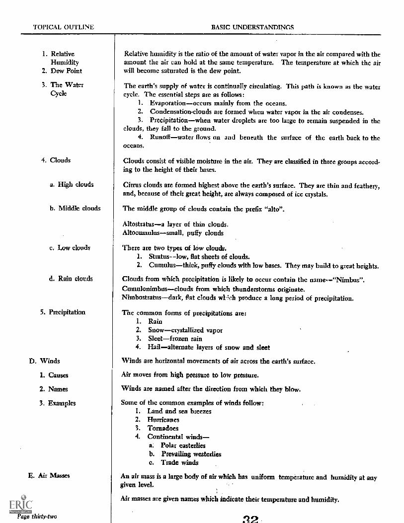
Relative humidity is the ratio of the amount of water vapor in the air compared with theamount the air can hold at the same temperature. The temperature at which the airwill become sal-mated is the dew point.
The earth's supply of water is continually circulating. This path is known as the watercycle. The essential steps are as follows:
1. Evaporationoccurs mainly from the oceans.2. Condensation-clouds are formed when water vapor in the air condenses.3. Precipitationwhen water droplets are too large to remain suspended in the
clouds, they fall to the ground.4. Runoffwater flows on and beneath the surface of the earth back to thc
oceans.
Clouds consist of visible moisture in the air. They are classified in three groups accord.ing to the height of their bases.
Cirrus clouds are formed highest above the earth's surface. They are thin and feathery,and, because of their great height, are always composed of ice crystals.
The middle group of clouds contain the prefix "alto".
Altostratusa layer of thin clouds.Altocumulussmall, puffy clouds
There are two types of low clouds.1. Stratuslow, flat sheets of c ouds.2. Cumulusthick, puffy clouds with low bases. They may build to great heights.
Clouds from which precipitation is likely to occur contain the name"Nimbus".Cumulonimbusclouds from which thunderstorms originate.Nimbostratusdark, Oat clouds wFch produce a long period of precipitation.
The common forms of precipitations are:1. Rain2. Snowcrystallized vapor3. Sleetfrozen rain4. Hailalternate layers of snow and sleet
Winds are horizontal movements of air across the earth's surface.
Air moves from high pressure to low pressure.
Winds are named after the direction from which they blow.
Some of the common examples of winds follow:1. Land and sea breezes2. Hurricanes3. Tornadoes4. Continental winds
a. Polar easterliesb. Prevailing westerliesc. Trade winds
An air mass is a large body of air which has uniform temperature and humidity at anygiven level.
Air masses are given names which indica e their temperature and humidity.

SUGGESTED ACTIVITIES AND PROCEDURES REFERENCES AND SUPPLEMENTARY INFORMATION
- 53 GSH 3620
GSH 2610, 2611, 2613, 2614, 2615, 2616, 2617
ESH 6.09
GSH 3615, 3616ESH 6.04, 6.05
H 36
Narnowitz and Stone pp 48486
The relatively flat bases of clouds indicate the level wheresaturation is reached. Rising air cools because of expansion.The rate of cooling varies according to the moisture content.Saturated air cools at the rate of 1/2°F per 1000 feet. Un-saturated air cools 51/2°F per 1000 feet.
Hailstones are formed in cumulonimbus clouds whereviolent up and down drafts carry the hailstones alternatelyabove and below freezing temperatures. A hailstone iscomposed of layers of snow and sleet.
Land-sea breezes occur because of local pressare differences.During warm days the land absorbs more heat energy. Theair above land is warmer than that over water. Air pressureover laud is less than over water, and a breeze will blowfrom sea to land. The reverse is true at night.
Page thirty-three

1. Formation
2. Names
F. Fronts
1. Warm front
2. Cold front
3. Stationary front
4. Occluded front
G. Low Pressure Areas
H. High Pressure Areas
Pdge thirtrfour
Air masses form over areas having fairly uniform surfaces. They take on the character-
istics of the source region.
Air masses are named according to their properties.
The following are the air masses affecting Buffalo:1. cPcontinental polarIt is formed in Canada and has cool, dry air.2. cTcontinental tropicalIt is formed over the southwest desert and has
warm, dry air.3. mPmaritime polarIt is fonned over the north Pacific or North Atlantic
Ocean and has cool, moist air.4. mTmaritime tropicalIt is formed over the Carribbean Sea and has warm,
moist air.
A front is the boundary between two unlike air masses.
A warm front occurs when a warm air mass displaces a cold air mass.
The following are characteristics of a warm front:1. Cirrus clouds followed by gradually lowering s ratus clouds. Fog may acco
pany a warm front.2. Warm fronts have shallow slopes so the changes are gradual and precipitation
will last several hours.3. The approach of a warm front is indicated by falling barometric pressure.
A cold front occurs when a cold air mass displaces a warm air mass.The following are characteristics of a cold front:
1. A line of cumulus or cumulonimbus clouds indicates the position of the front.2. Precipitation is heavy but of short duration. It usually occurs as thunder
showers.3. The barometric pressure starts rising about the time the front passes.
A stationary front is the boundary between two different air masses, neither of which ismoving, Weather changes associated with a stationary front are minor.
An ocniuded front occurs when a cold front overtakes a warm front.Weather changes are a combination of those associated with warm and cold fronts
Low pressure areas often develop as a result of the meeting of two air masses.
Air will spiral toward the center of a low in a counter clockwise fashion.
Low pressure areas are characterized by rising air. This may lead to condensation and
precipitation.
Clear skies are generally associated with high pressure areas

SUG( S11.,1) ACTIVITWS ANI) PR CEDURLS RENCES AND SUPPLFME "VARY INFORNIA1 I
ESH 6.28, 6.29
ESH 6.36
- 44
H - 26, H - 41, ESH 6.38
35
While air masses assume the temperature and humiditycharacteristics of their source regions, they may be modifiedby the terrain over which they move. The farther theymove from the source, the more severe will be the changes.
Fronts The principal reason for the difference in slopesof warm and cold flonts is the density difference betweenwarm and cold air. Because cold air is denser, it will wedgeunder the warm air and force the warm air out. An advanc-ing warm air mass rides over the dense cold air and tendsto "drag" it along. This results in a shallow slope.
Warm front Typically the warm front precedes thecenter of the low. Therefore air pressure will fall during itspassage. The wind will shift from the southeast to southor southwest.
Additional indications of cold front passage include a windshift to the northwest, a drop in the dew point and a rapidclearing.
An occluded front is found near the center of the low. Inthis area, air is rising as in all lows. In addition warm air isbeing forced upward by advancing cold air. This combina-tion usually results in the most severe frontal type weather.
Fronts are always associated with low pressure areas. Lowsare generally formed as a result of the lifting action of acold, dense air mass on less dense (warm, moist) air. See
ESH p. 180-85
Page th

'TOPICAL OUTLINE BASIC UNDERSTANDINGS
III. Weather aps
A. Symbols
B. *Station Models
C. Isobars
IV. Weather Forecasting
.Maps int:he-ling current weather conditi _Is are3 hours.
Symbols are used to express a great deal of c her information in a limited %pate.
Following are some of the more common symbols:
par .d by thc Weather Biriu ccry
Cold front Warm front
Thunderstorm
Stationa front
0 0Rain Snow
0 !chided front
The observed weather conditions from each reporting station are presen cd as a stationmodel.
Isobars are lines connecting points of equal air pressure.
Weather forecasts are made on the basis of numerous observations, and on the forcaster's knowledge of weather phenomena.

SUGGESTED ACTIVITIES AND PROCEDURES REFERENCE:, ANL SUPPLEMENTARY INFORM/MON
* ESH 6.14
An excellent review of this unit can be presented by usingthe collected daily weather Llaps to explain the basis of theweather bureau's daily forecasts, and to attempt limited,general forecasting by the class.
Complete the discussion of H-10.1-1-9, H-12, H-13, 11-14
The weather map symbols for fronts always point towardthe direction in which the front is moving.
A complete discussion of station models is found on pp.526-27 in Namowitz and Stone
Au explanation of symbols is also found on the back of theU. S. Weather Burean's Sunday weather maps.
Page thirty-seven