
DeWitt County Emergency Response Handbook 1 of 14 Project Manager: Robert Gannon Assistant Project...
14
DeWitt County Emergency Response Handbook 1 of 14 Project Manager: Robert Gannon Assistant Project Manager: Matt Ahrens GIS Analyst: George Caracostis
-
Upload
audrey-mosley -
Category
Documents
-
view
225 -
download
6
Transcript of DeWitt County Emergency Response Handbook 1 of 14 Project Manager: Robert Gannon Assistant Project...

DeWitt CountyEmergency Response Handbook
1 of 14
Project Manager: Robert Gannon
Assistant Project Manager: Matt Ahrens
GIS Analyst: George Caracostis

Introduction DeWitt County is a small, rural county in South
Texas
Northwest of Victoria, TX
4 major cities
(Cuero, Westhoff, Yoakum and Yorktown)
Est. Population of 20,503 people (2013)
Only 7 volunteer fire departments / 910 Sq. miles
2 of 14

Introduction Continued…The Problem:
Increase in chemical fires
Concerns of fires, spills, and emissions from chemical-holding facilities
Lack of access to internet, maps, emergency contacts (Emrich et al, 2011).
Difficulty of communication between emergency response agencies
Response protocol and assignment needed for chemical hazard emergencies (Cova, 1999)
3 of 14
Introduction Continued..
The Solution: Compose a hand held guidebook to distributed to all emergency
response teams in DeWitt County.
The handbook will contain:
Information on facility with Extremely Hazardous Substance (EHS) material and hydrocarbons (H2S).
Map for each EHS/H2S chemical-holding facility containing:
Calculated safe zones for roadblocks
Facility gate access points
Highlighted road route from closest fire department to facility
List of contacts, notification procedures
List of all H2S and other hazardous materials on site
Protective actions to be taken
4 of 14

Data Materials & AnalysisData obtained from client includes:
DeWitt County Tier II and EMS/FD/School data provided by Texas Department of Sate Health Services.
Street Addresses, decimal degree coordinates of chemical facilities
Chemical inventory at facilities
Facility contact information
Texas State Data Center website Shape files for DeWitt County: city boundaries, roads, rivers, lakes
United States Census Bureau Topologically Integrated Geographic Encoding and Referencing (TIGER) files for
road networks, geocoding, address matching – used by US Census Bureau to describe land attributes
We used them to confirm facility locations, gate access and optimum roadblock placement 5 of
14

Analysis Continued…
Software Used:
Cameo Software Suite: Cameo FM, Cameo Chemicals, Aloha and Marplot
Microsoft Excel – Tier II database information
Aloha for threat analysis
ArcGIS 10.2 for final maps and analysis
6 of 14
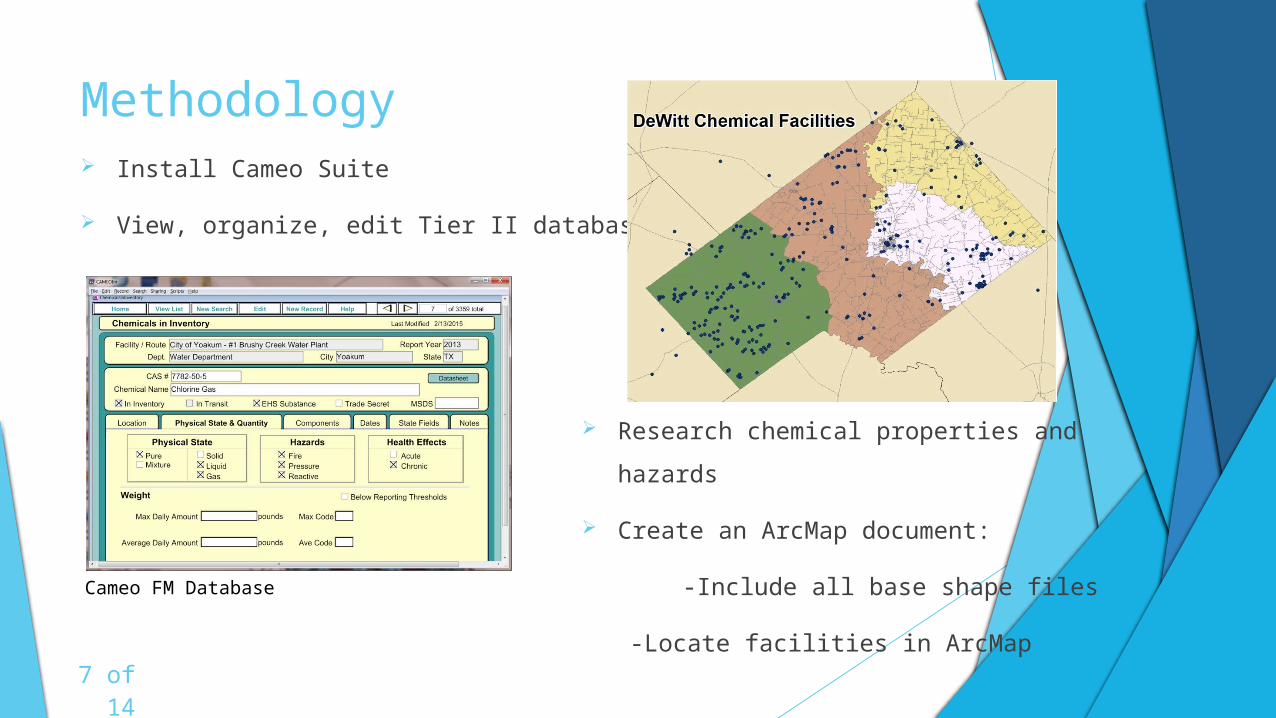
Methodology Install Cameo Suite
View, organize, edit Tier II database
Research chemical properties and hazards
Create an ArcMap document:
-Include all base shape files
-Locate facilities in ArcMap
7 of 14
Cameo FM Database

Methodology Continued… Export Tier II Database:
Join Database files to facilities layer
Series of joins will furnish each mapped facility with necessary chemical and contact information
Create Map for each facility with a threat zone radius, contact information, and emergency protocol (roadblocks, route, gate access)
Facilities.shp
Join Layer Layer Join Field Table Join Field Excel Table File
FacilityRecordID FacilityRecordID
FacilityRecordID ChemicalInvLocations.csv
FacilityRecordID
OtherRecordID
ChemInvMixtures.csv
ContactsLink.csv
ChemicalsInInv.csv
Facilities.shp ContactRecordID ContactRecordID Contacts.csv
Cameo Excel ArcMap
8 of 14
Expected Results & FindingsBy the end of the project, we want to have a fully functioning handbook mapping
Each of the EHS/H2S chemical facilities including
Threat zones in and around the facility
Roadblock locations
Gate access points
Contact information for each facility
List of all hospitals, schools, public/private buildings around facility
Have least cost path for emergency responders
Chemical inventory
Protocol listed in a table next to each map
Information on Classification levels (Alerts, Site Area, General Emergency)
Classification Reporting script for Agencies calling in 911 Dispatch
9 of 14
10 of 14
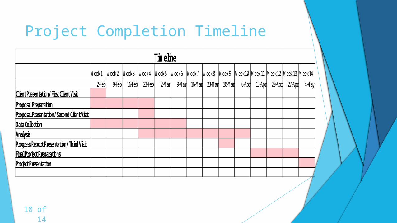
Project Completion Timeline
Week 1 Week 2 Week 3 Week 4 Week 5 Week 6 Week 7 Week 8 Week 9 Week 10 Week 11 Week 12 Week 13 Week 14
2-Feb 9-Feb 16-Feb 23-Feb 2-Mar 9-Mar 16-Mar 23-Mar 30-Mar 6-Apr 13-Apr 20-Apr 27-Apr 4-MayClient Presentation/ First Client VisitProposal PreparationProposal Presentation/ Second Client VisitData CollectionAnalysis Progress Report Presentation/ Third VisitFinal Project PreparationsProject Presentation
Timeline

Budget
Weeks Hours
Pay/Hr.
Total
1-6 Collection (4 hours a week * 6 weeks * 2 consultants)
48 $30.00 $1,440.00
4-10 Analysis ( 10 hours a week * 6 weeks * 2 consultants)
120 $55.00 $6,600.00
Data Collection and Analysis
Project Management
Weeks Hours
Pay/Hr.
Total
4-10 GIS Analyst (15 hours a week * 6 weeks) 90 $36.00 $3,240.00
2-12 Assistant Manager (15 hours a week * 10 weeks)
150 $55.00 $8,250.00
2-12 Project Manager (10 hours a week * 10 weeks) 100 $75.00 $7,500.00Software
Licenses Usage Total
ArcGIS($1,500 annual Std. User License) $1,500/12 * 3 months of use
$375.00
Adobe Creative Cloud ( $599.88 annual cost)
$599.99/12 * 3 months of use
$149.97
Total Project Cost= $27,554.97
Total Cost = $8,040.00
Total Cost = $18,990.00
Total Cost = $524.97
11 of 14
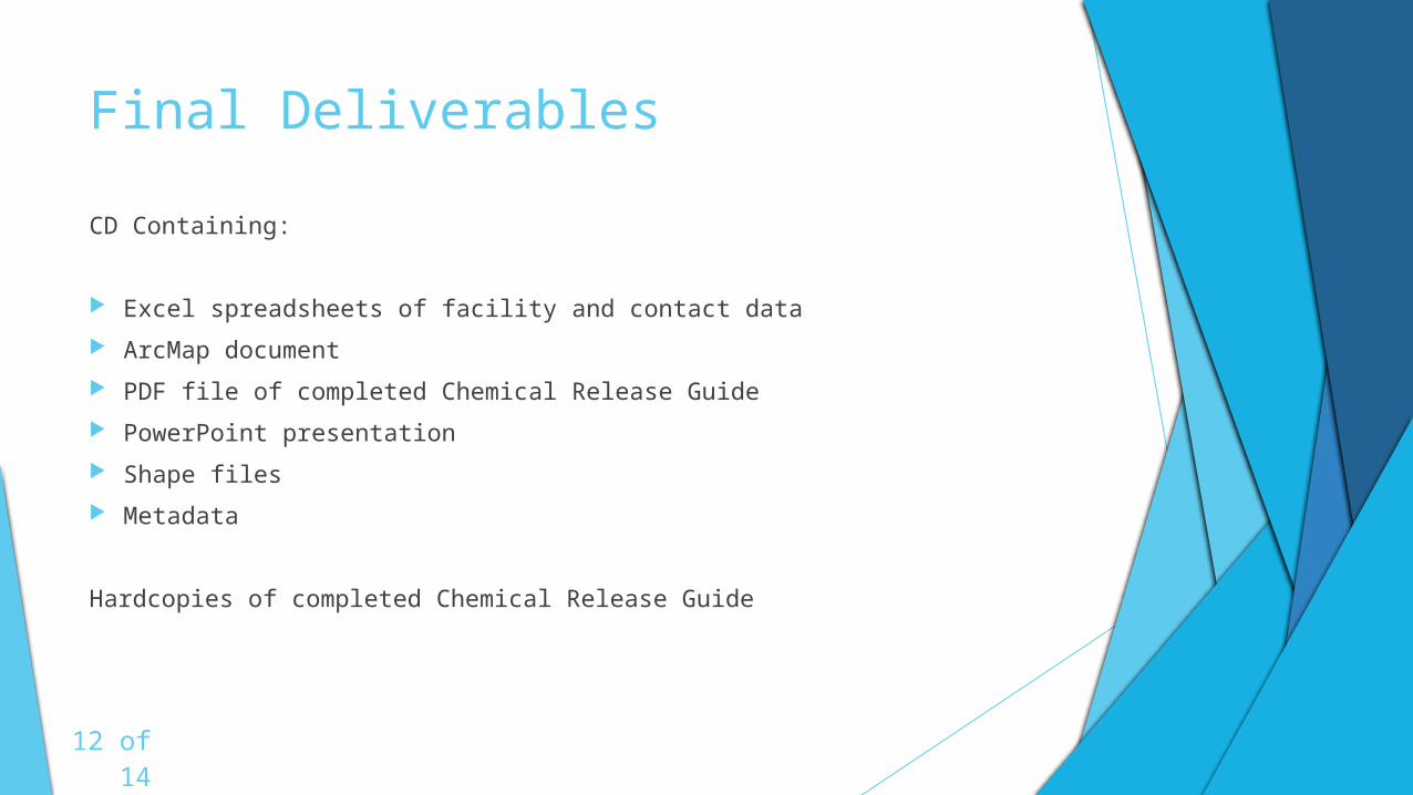
Final Deliverables
CD Containing:
Excel spreadsheets of facility and contact data
ArcMap document
PDF file of completed Chemical Release Guide
PowerPoint presentation
Shape files
Metadata
Hardcopies of completed Chemical Release Guide
12 of 14
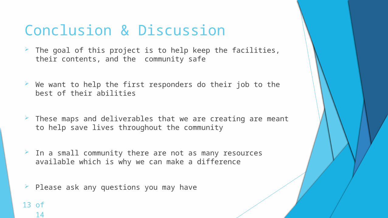
Conclusion & Discussion The goal of this project is to help keep the facilities, their contents,
and the community safe
We want to help the first responders do their job to the best of their abilities
These maps and deliverables that we are creating are meant to help save lives throughout the community
In a small community there are not as many resources available which is why we can make a difference
Please ask any questions you may have
13 of 14

References
Cova, T. J. (1999). GIS in emergency management. Geographical information systems, 2, 845-858.
DeWitt County Profile. (2013). Retrieved February 18, 2015, from http://www.txcip.org/tac/census/profile.php?FIPS=48123
Emrich, C. T., Cutter, S. L., & Weschler, P. J. (2011). GIS and emergency management. The SAGE Handbook of GIS and Society. London, Sage, 321-43
Eagle Ford Shale - Overview, News, Companies, Geology, & More. (n.d.). Retrieved February 18, 2015, from http://eaglefordshale.com/
14 of 14