Development Assessment Unit Meeting - The Hills Shire · The Minutes of the Development Assessment...
126
Development Assessment Unit Meeting Tuesday, 28 February 2012 THE HILLS SHIRE COUNCIL
Transcript of Development Assessment Unit Meeting - The Hills Shire · The Minutes of the Development Assessment...

Development Assessment Unit Meeting Tuesday, 28 February 2012
THE HILLS SHIRE CO
UNC
IL

DEVELOPMENT ASSESSMENT UNIT 28 FEBRUARY 2012
ITEM SUBJECT PAGE ITEM-1 CONFIRMATION OF MINUTES 3
ITEM-2 DA NO. 526/2007/LD/D - AN AMENDMENT TO A SINGLE STOREY DWELLING AND AN INGROUND SWIMMING POOL - RAISE DWELLING HEIGHT BY 250MM, AMEND RETAINING WALLS AND REMOVAL OF THREE TREES - LOT 5 DP 523394 - 17 PELLITT LANE, DURAL
6
ITEM-3 DA NO. 1902/2008/HB/A - SECTION 96AA MODIFICATION TO A LAND & ENVIRONMENT COURT APPROVED RESIDENTIAL CARE FACILITY - LOT 4 DP 32271 - NOS. 71-83 SAMANTHA RILEY DRIVE, KELLYVILLE
28
ITEM-4 DA 1017/2011/ZB - A RESIDENTIAL SUBDIVISION CREATING 33 LOTS INCLUDING NEW ROAD - LOT 48 DP 280025 SANCTUARY DRIVE, BEAUMONT HILLS
52
ITEM-5 DA NO. 110/2012/HA - RETAINING WORKS - LOT 300 DP 1130339 - GLENHAVEN ESTATE RETIREMENT VILLAGE, 15 OLD GLENHAVEN ROAD, GLENHAVEN
97

DEVELOPMENT ASSESSMENT UNIT 28 FEBRUARY 2012
PAGE 3
MINUTES OF THE DEVELOPMENT ASSESSMENT UNIT MEETING HELD AT THE HILLS SHIRE COUNCIL ON TUESDAY, 21 FEBRUARY 2012: PRESENT
Cameron McKenzie Group Manager - Environment & Planning (Chair) Paul Osborne Manager - Development Assessment Andrew Brooks Manager - Subdivision & Development Certification Mark Colburt Manager - Environment & Health Craig Woods Development Monitoring Manager Kristine McKenzie Principal Executive Planner Fletcher Rayner Acting Manager – Forward Planning
APOLOGIES
Stewart Seale Manager - Forward Planning TIME OF COMMENCEMENT 8:30am TIME OF COMPLETION 8:52am ITEM-1 CONFIRMATION OF MINUTES
RESOLUTION
The Minutes of the Development Assessment Unit Meeting of Council held on 14 February 2012 be confirmed.
ITEM-2 DA NO. 1543/2011/HA - OCCUPATION OF UNIT 3 FOR A PLANT AND BUILDING EQUIPMENT HIRE BUSINESS (ACTIVE HIRE) AND USE OF 3 CAR SPACES FOR A WASH BAY AND GAS BOTTLE STORAGE CAGE - LOT 3 SP 34134 - 3/4 VICTORIA AVENUE, CASTLE HILL
RESOLUTION
The application be approved subject to conditions as set out in the report.

DEVELOPMENT ASSESSMENT UNIT 28 FEBRUARY 2012
PAGE 4
ITEM-3 DA398/2012/ZA - SUBDIVISION OF ONE LOT INTO TWO - LOT 7 DP 221937, 11 HENRY STREET, BAULKLHAM HILLS
RESOLUTION
The application be approved subject to conditions as set out in the report with the exception of the Deferred Commencement Condition 1 which shall be amended to read as follows: 1. Deferred Commencement – Preparation of a Conservation Management Plan A1. Pursuant to Section 80(3) of the Environmental Planning and Assessment Act 1979 deferred commencement consent is granted subject to the following: 1. A Conservation Management Plan (CMP) shall be prepared by a suitably qualified consultant and submitted for approval by Council’s Manager – Forward Planning. The CMP is to include as a minimum:
The overall significance of the building and its setting. The significance that any of the various components of the item may have; Identification of conservation policies and management mechanisms within which to undertake any conservation or new works, so as to enable the significance of the place to be retained; and A detailed itemised list and cost of conservation works. In determining the extent of the conservation works the ICOMOS Burra Charter definition and principles relating to conservation are to be adhered to.
A2. The applicant must provide Council with written evidence demonstrating that the matters listed under Part A1 above have been satisfactorily addressed no later than four weeks before the notice of expiry date. B. Upon compliance with the requirements of Part A1, a full consent will be issued subject to the following conditions.
ITEM-4 DA 282/2012/MA - RETAINING WALLS - LOT 2009 DP 1149043 THOMAS BOULTON CIRCUIT, KELLYVILLE
RESOLUTION
That the Development Application be refused for the following reasons.

DEVELOPMENT ASSESSMENT UNIT 28 FEBRUARY 2012
PAGE 5
1. The proposed development has not sufficiently demonstrated compliance with the
objectives associated with the Residential 2(b1) zone contained within BHLEP 2005 in that the proposal has the potential to adversely impact upon privacy to adjoining properties. (Section 79C (1)(a)(i) of the Environmental Planning and Assessment Act, 1979).
2. The proposed development has not adequately demonstrated compliance with the
objectives and development standards contained within BHDCP Part E Section 17 – Balmoral Road Release Area in that the site conditions are proposed to be altered impacting upon landform on the site and potentially adversely impacting upon the privacy and amenity of adjoining property owners. (Section 79C (1)(a)(iii) of the Environmental Planning and Assessment Act, 1979).
3. The proposal is likely to have an adverse impact upon the amenity to adjoining
property owners through the height and location of the proposed works. (Section 79C(1) (b) and (d) of the Environmental Planning and Assessment Act, 1979)
ITEM-5 DA 266/2012/HB - CONSTRUCTION OF A TOWNHOUSE DEVELOPMENT COMPRISING 26 UNITS LOTS D & C DP 440720, LOT B DP 363282, LOT 20 DP 662699, LOT 21 DP 662700, LOT 22 DP 8884 AND PART LOT 10 DP 135884 (NO. 7 WINDERMERE), NOS. 9 - 17 WINDERMERE AVE, NORTHMEAD
RESOLUTION
The application be approved subject to conditions as set out in the report.
END MINUTES

DEVELOPMENT ASSESSMENT UNIT 28 FEBRUARY 2012
PAGE 6
ITEM-2 DA NO. 526/2007/LD/D - AN AMENDMENT TO A SINGLE STOREY DWELLING AND AN INGROUND SWIMMING POOL - RAISE DWELLING HEIGHT BY 250MM, AMEND RETAINING WALLS AND REMOVAL OF THREE TREES - LOT 5 DP 523394 - 17 PELLITT LANE, DURAL
THEME: Balanced Urban Growth
HILLS 2026 OUTCOME/S: BUG 2 Lifestyle options that reflect our natural beauty.
COUNCIL STRATEGY/S: BUG 2.2 Maintain the Shire’s natural and cultural heritage through quality urban planning, development and maintenance.
LODGEMENT DATE: 15 SEPTEMBER 2010
AUTHOR: SENIOR HEALTH & BUILDING SURVEYOR
TONY BROWN
RESPONSIBLE OFFICER: MANAGER DEVELOPMENT ASSESSMENT
PAUL OSBORNE
EXECUTIVE SUMMARY The Section 96 (2) Modification Application seeks to increase the levels of the approved single storey dwelling and swimming pool by 250mm, to construct retaining walls and extend the fill platform to provide an improved and useable area around the dwelling and swimming pool, and to remove three (3) trees. The 2 hectare property is zoned Rural 1 (c) and has several physical and environmental constraints limiting suitable development area. The site has a drainage channel on the western boundary connecting to O’Haras Creek and a 30 metre wide riparian zone exists along the rear property boundary to the north. The site has upon it endangered “epacris purpurascens” flora. Unauthorised piping and filling on the drainage channel next to the proposed driveway has been undertaken. Sandstone rock retaining walls have been constructed to support the building platform near the O’Haras Creek riparian zone. A Building Certificate has since been lodged for these retaining walls and it will be determined following the determination of this Section 96 Modification. One submission has been received to the Section 96 (2) Modification Application. The concerns raised by the objector relate to the three trees to be removed, potential impact from the retaining wall construction on bushfire protection, and the raised building platform. The proposal is considered reasonable and is recommended for approval.

DEVELOPMENT ASSESSMENT UNIT 28 FEBRUARY 2012
PAGE 7
BACKGROUND MANDATORY REQUIREMENTS Applicant: Gregg Ritchie &
Partners Pty Ltd
1. LEP 2005 – Satisfactory.
Owner: Ms R Bouchahine 2. Draft LEP 2010 - Permissible with consent.
Zoning: Rural 1 (c) 3. BHDCP Part C Section 13 - Rural – Satisfactory.
Area: 2.168 Hectares 4. Section 79C (EP&A Act) – Satisfactory.
Existing Development: Vacant land 5. Section 94 Contribution – N/A to Modification.
SUBMISSIONS REASONS FOR REFERRAL TO DAU 1. Exhibition: No.
1. Submission received.
2. Notice Adj Owners: Yes fourteen (14) days.
3. Number Advised: Ten (10). The owner of the subject property also owns the adjoining property.
4. Submissions Received:
One (1)
POLITICAL DONATION – None disclosed.
HISTORY 22/08/2007 Development Consent 526/2007/LD for a dwelling, driveway,
retaining walls and pool approved under delegation. The approved plans included two (2) conservation zones for the permanent protection of the endangered flora species “Epacris purpurascens”, a bushfire buffer zone and a 30 metre creek zone.
04/03/2008 Development Application 877/2008/LA for a tennis court
approved via the Development Assessment Unit. 13/03/2008 Development Consent 877/2008/LA issued for the tennis court. 09/03/2010 A letter was sent to the new owner of the subject property,
following a recent meeting with the new owners and their representatives. This letter was to confirm and clarify the amount of land clearing, tree removal and the extent of fill required to develop the building platforms relative to the approved plans and conditions of both Development Consents 526/2007/LD and 877/2008/LA.

DEVELOPMENT ASSESSMENT UNIT 28 FEBRUARY 2012
PAGE 8
11/03/2010 Section 96 (1) Modification application 526/2007/LD/A was
lodged detailing the exact number of trees required for removal after the owner had a survey locating every tree that would be affected by the construction works.
19/03/2010 Section 96 (1) Modification Application 877/2008/LA/A lodged
for the variation to the condition no. 5 of Development Consent regarding tree removal for the tennis court.
01/06/2010 The Section 96(1) Modification application 526/2007/LD/A and
877/2008/LA/A approved via the Development Assessment Unit.
29/06/2010
Section 96 Modification 526/2007/LD/B lodged for clarification of trees approved to be removed and for additional tree removal affected by the construction process. The applicant advises that a number of trees or their root systems near the building platform would be affected in the construction of the approved works.
28/07/2010
Section 96 Modification application 526/2007/LD/B approved under delegated authority.
13/08/2010
Section 96 Modification application 526/2007/LD/C lodged requesting removal of one (1) tree.
02/09/2010
Section 96 Modification application 526/2007/LD/C approved under delegated authority.
15/09/2010 Subject Section 96 Modification application
526/2007/LD/D lodged. 14/10/2010 Site inspection undertaken with owner and it was noted that
the drainage pipe had been extended over the drainage channel from the drainage easement terminating near the existing driveway at the front of the subject property. The pipe had been extended without Council’s prior approval by approximately 40 metres.
18/10/2010 Letter sent to applicant outlining matters to be addressed or
resolved prior to determination of the Section 96 application. The proposed 1.5 metre increased dwelling level was considered excessive and could not be supported. The location of the retaining walls were to be accurately shown and structural engineer’s details provided for the retaining wall design, and the pool coping level was to be shown.
23/10/2010 Applicant provides justification and amended plans with new
dwelling level at 183.75m A.H.D. and retaining walls shown.

DEVELOPMENT ASSESSMENT UNIT 28 FEBRUARY 2012
PAGE 9
26/10/2010 Council’s Subdivision Control engineer provides comments
advising of requirements relating to the unauthorised piping and filling over the drainage channel to the west of the building platform. It was required that the modification application must be accompanied by a flood study that considered the impact on the flood behaviour regarding the drainage channel and O’Hara’s Creek. The NSW Office of Water are required to approve the works.
02/11/2010 A “Show Cause” letter was sent by the Development Monitoring
team to the owner regarding the unauthorised extension of the Council pipeline.
03/11/2010 Letter sent to applicant advising of concerns regarding the
building platform level at 183.75m AHD and the affect on the conservation zones on this environmentally sensitive property, and advising that the Section 96 (2) should be withdrawn as it could not be supported.
08/11/2010 Meeting on site with owner and Council’s officers to discuss
issues. At the time of inspection it was noted that the overland flow path of the drainage channel had been altered. The owner had prepared a building platform with rock retaining walls formed. Works ceased on site as per Council’s officer’s direction.
10/11/2010 Letter sent to applicant advising of the requirements regarding
the removal and protection of trees. 19/11/2010 Further letter sent to applicant clarifying the parameters of the
amended proposal that may be supported. These were listed as follows: The dwelling slab to remain at R.L. 183.0m The proposed pool coping can be raised to approximately
R.L.182.75m The retaining wall/s behind the pool area are to be provided
to contain the fill relative to a gentle batter from the dwelling and pool coping levels.
The retaining wall/s to support the fill in the vicinity of the driveway and proposed garage are to be designed relative to the dwelling slab level of R.L. 183.0m
Any lateral extension of the filled platform to support the driveway, garage and retaining walls will require an updated flood study as this may affect flood behaviour within the existing overland flow path. The proposal may require referral to the NSW Office of Water for their consideration (also note Council’s letter dated 2/11/2010)
Therefore, the S96 Modification Application can be considered if the level of the building platform is maintained as originally approved and by ensuring that the associated retaining walls located near the “30 metre creek zone” do not create additional impact on an environmentally sensitive area.”

DEVELOPMENT ASSESSMENT UNIT 28 FEBRUARY 2012
PAGE 10
07/12/2010 New amended plans received with the dwelling level changed to
183.25m AHD (an increase in height by 250mm), the pool coping level altered to 182.7m AHD and to 182.70m AHD at the top of the retaining walls.
04/01/2011 Letter sent to applicant requesting a flood study reflective of
the changed extent of filling, and confirming that several issues of concern including reinstating the amount of fill to the west and north (towards O’Hara’s Creek) as per the approved plan. This will ensure flood behaviour is not affected. Following this the four (4) trees requested to be removed can be retained.
24/01/2011 Required information remains outstanding. Applicant asked again for outstanding information.
20/04/2011 Council’s Waterways Management team conduct CCTV
investigation of pipe works within drainage easement and channel. This was due to a separate issue relating to Council’s street drainage system in Valencia Street. The CCTV footage was used to check the construction of the pipe extension and the owner was provided relevant information to aid in the preparation of the flood study.
15/06/2011 In response to enquiry re progress, applicant confirms still
awaiting amended flood report. 11/08/2011 Letter sent to applicant requesting outstanding information to
be provided within fourteen (14) days. 24/08/2011 Flood study received and referred to Subdivision Control
engineer. 06/10/2011 Comments received from Subdivision Control engineer advising
that the flood study did not relate to the retaining walls constructed near the O’Hara’s Creek riparian zone.
25/10/2011 The Tree Management officer advises that the applicant is to
demonstrate how the proposal will not adversely impact on nearby trees. No imported soil or level changes are to occur within the conservation zone.
01/11/2011 Matter referred to the NSW Office of Water for comment in
respect to the retaining wall works near the drainage channel and O’Haras Creek and to consider the flood study.
03/11/2011 Letter sent to applicant advising of the Subdivision Control
engineer’s requirements regarding the pipeline extension and the Tree Management comments regarding tree issues. The applicant was advised to comply with the following: Smaller retaining walls to be shown at the line of the batter
on the approved plans (the original flood study was based on the earthworks terminating in this position).

DEVELOPMENT ASSESSMENT UNIT 28 FEBRUARY 2012
PAGE 11
The topography and overland flow levels in the drainage
channel are to be maintained as shown in the original approved plan.
The retaining walls shown adjacent to the drainage channel
/ driveway can be provided as shown to the point where they meet the rear batter line on the original approved plans (ie in line with the proposed garages north wall). They must then follow from this point in line with the extent of batter shown at the rear of the platform on the approved plan.
The proposed driveway is to be redesigned in the vicinity of
the trees numbered 3 and 3A to allow for their retention. The retaining wall in this area is also to be removed so, for example, it commences where the double wall commences (where section C-C is shown on plan 20516G).
All four (4) trees shown to be removed are now to be
marked for retention. 21/11/2011 A meeting was held on site at the owner’s request to discuss
the engineering issues. The owner, applicant, consulting hydraulic engineers, Council’s and Council officers met and discussed the flooding/engineering issues. The outcome from the meeting was that once the NSW Office of Water had responded further advice would be provided.
05/12/2011 Response received from NSW Office of Water. Council’s
Subdivision Control engineer advises that the Department suggest that the Council pipeline (which has been illegally extended) be extended all the way to O'Haras Creek. These works would also require the Department's concurrence. If these works are not required by Council however, the Department want no further involvement in the matter. The Subdivision Control engineer recommends that since Council did not want the pipe extension that had already been undertaken, a further extension is not warranted in this instance as this would require an encroachment into the riparian zone.
16/12/2011 Tree Management provide conditions including the approval for
removal of the three (3) additional trees. 30/12/2011 Subdivision Control engineer’s conditions received in relation to
proposal and the building platform/retaining walls and the pipe extension.
31/01/2012 Building Certificate 148/2012/AEU lodged for retaining walls
and associated fill. The application will be determined pending the outcome of the Section 96 (2) Modification.

DEVELOPMENT ASSESSMENT UNIT 28 FEBRUARY 2012
PAGE 12
PROPOSAL
The Section 96(2) Modification for Development Application 526/2007/LD/D is for the raising of the dwelling and swimming pool by 250mm, the completion of the construction of sandstone retaining walls (partly constructed) to support a more practical and accessible building platform, and the removal of three (3) additional trees associated with the building platform construction. The property is zoned Rural 1(c). Previous consents have imposed Conservation zones, the proposed work is outside those zones. The applicant advises that the occupants of the new dwelling are of senior age and the retaining walls and ancillary fill will provide a more level and usable space at the rear of the dwelling. The proposed pool, water tank and reasonable private open space will be within this area, and it will provide a more manageable area for bushfire protection and fire fighting purposes. The platform at the rear of the dwelling will, once completed, be formed by overburden from the excavation required for the eastern side of the dwelling. A balance of excavation and filling is achieved. The dwelling, as previously approved, will be centrally located on the property and has an overall length of 44 metres and width of 25 metres. It is proposed that the dwelling will be located approximately 47 metres from the unmade Pellitt Lane boundary. Located 10 metres across from this boundary is the rear boundary of the Valencia Street neighbouring properties. The pool is approved at 10 x 6 metres directly behind the dwelling. The building platform will be formed by excavation up to 2.5 metres on the south-eastern side and generally fill will be retained with two retaining walls of up to 1.8m and 1.2m maximum on the north-western side. This platform near the north-western side of the dwelling includes a driveway that will require retained fill to create suitable access to the dwelling. The driveway is shown on plan from the long access carriageway through the neighbouring property and commencing from Pellitt Lane near Maple Street. The rock retaining walls will be similar to those approved on the neighbouring property at 15 Pellitt Lane. The platform behind the dwelling will have a lawn area to the retaining walls behind. This fill batter will affect the two remaining eucalyptus trees (Blackbutt) in this area. These two trees are tall and slender and are now isolated from other tree/forest support. Another tree (Blackbutt) located near the driveway is dead and requires removal. A separate Development Application (877/2008/LA) has previously been approved for a tennis court, located between the proposed dwelling and the unmade Pellitt Lane (south-eastern) boundary. In the assessment process for the original Development Application consideration was given to an endangered flora species identified to be growing on the property (Epacris purpurascens), protection from bushfire, the sloping land topography, overland stormwater flow from the drainage channel coming from the nearby Spring Street/Valencia Street stormwater system and the O'Hara's Creek riparian zone. In combination with the 'Creek Zone' and Bushfire Asset Protection buffer zone and the limits established by the flood study, the vegetation conservation zone was established for the Epacris specimen. The original plans (and the subsequent tennis court application), were revised by the previous Flora and Fauna Officer to provide protected space around the specimens of Epacris and to provide a site layout to naturally restrict pedestrian traffic near the plants and to the 30 metre wide connective buffer which is aimed to link a broad band of natural regeneration area - from the trees in the southern corner of the block to the dense bushland towards the creek.

DEVELOPMENT ASSESSMENT UNIT 28 FEBRUARY 2012
PAGE 13
The original amended plan received for this Section 96 Modification had the dwelling platform proposed at 184.5m AHD (an increase of 1.5 metres). These plans were subsequently resubmitted with the dwelling and pool levels raised only 250mm. The original plan showed the rear pool area gently sloping down towards the O’Haras Creek riparian zone. The retaining walls in the location and heights shown will comply with the requirement of providing the physical separation or protection to the riparian area. The original proposals complied with the Development Control Plan at the time and this modified proposal complies with the development controls of the current Baulkham Hills Development Control Plan Part C, Section 1 –Rural.
ISSUES FOR CONSIDERATION
1. Compliance with BHLEP 2005 and THLEP 2010
The subject site is zoned Rural 1(c) pursuant to BHLEP 2005. The proposed dwelling is permissible with the consent of Council and the swimming pool and retaining walls are characterised as being ancillary to the dwelling and are also permissible with the consent of Council. It is considered that the development satisfies the "Zone Objectives and Zoning Controls" and is therefore satisfactory. The works are also permissible under the proposed Zone RU6 (Transitional) under Draft THLEP 2010. The objectives for the Rural 1 (c) zone aim: a) to accommodate rural-residential development that is sympathetic to the environment and minimises risks from natural hazards, and (b) to provide for a range of activities that are compatible with the rural-residential character of the locality, and (c) to ensure that development in the area does not unreasonably increase demand for public services and public facilities, and (d) to ensure that development is designed and carried out having regard to adjoining land uses and the natural environment, and (e) to ensure that development is designed and carried out having regard to the rural and heritage character of the surrounding area, and (f) to encourage the preservation of suitable areas for open space purposes. As a result the proposed works are considered permissible, satisfactory and supportable under the provisions of both environmental planning instruments. 2. Issues raised within Submissions. The application was notified for a period of fourteen (14) days in accordance with Council’s notification policy. One (1) submission was received. The objector does not directly adjoin the subject property and cannot see the subject property from their property. It is noted that the directly adjoining neighbours have not made any submissions relating to this application.

DEVELOPMENT ASSESSMENT UNIT 28 FEBRUARY 2012
PAGE 14
ISSUE/OBJECTION COMMENT OUTCOME
No further tree removal should be undertaken. It appears that trees are dying on the two lots (15 and 17 Pellitt Lane) in the O’Haras Creek sanctuary area. The Residents action Group is trying to preserve the O’Haras Creek sanctuary. The objector believes that the owners are not interested in protecting the natural environment around them.
Conditions of development consent require conservation zones and to achieve protection of not only the O’Haras Creek riparian zone but also the natural bushland containing “Epacris purpurascens” an endangered flora species. The subject trees are not within the Conservation zone. Council’s officers have imposed strict conservation zones and ongoing binding conditions to achieve protection of not only the O’Haras Creek riparian zone but also the natural bushland containing “Epacris purpurascens” an endangered flora species. The current owner did not possess the subject property when the original Development Application was considered. For the previous Section 96 the new owner prepared a survey identifying or clarifying every tree that would be affected by the construction works. The identification of construction methods required to build the approved development impacted on some trees that were not originally detailed for removal. Two of the additional three (3) trees require removal due to the filled portion of the dwelling building platform (see Site Plan in Attachment 3). These two remaining eucalyptus trees (Blackbutt) have been kept reasonably clear of fill pending the consideration of the Section 96 Modification Application. These two trees are tall and slender and are isolated from other tree/forest support. They are tending to lean in the direction of the proposed dwelling. The other tree (Blackbutt) recommended for removal, located near the driveway, is dead. The Tree Management officer has provided a condition requiring the replanting of ten (10) trees (see condition 48). They are to be planted within the previously cleared 30m creek zone and maintained until they reach a height of 6 metres. Additional planting is required along or near the Pellitt Lane boundary as detailed within previously imposed conditions. The Flora and Fauna Officer and Tree Management officer have assessed the proposed tree removal and have provided appropriate conditions.
Issue addressed, see new condition no. 48.

DEVELOPMENT ASSESSMENT UNIT 28 FEBRUARY 2012
PAGE 15
ISSUE/OBJECTION COMMENT OUTCOME The owner is putting his family and the residents of Valencia Street in danger from bushfire. The retaining walls limit access in times of fire.
The Rural Fire Service (RFS) have provided comments and conditions for both the original Development Application and the Section 96(2) proposal. No objection was raised by the RFS to the amended proposal subject to their original advice. The combination of the under-scrubbing and clearing already undertaken, the construction of the rock retaining wall barrier and the required “Asset Protection Zones” will provide improved bushfire protection. Improved level access will be available for the RFS to the rear of the building platform.
Issue addressed.
It is not believed necessary to raise the level of the land for the proposed residence.
The proposed 250mm increase in level for the dwelling and pool is considered reasonable. The original plans lodged with this Section 96 Modification Application initially detailed that the building platform was proposed to be raised by 1.5 metres. This was not supported due to the excessive fill required to create the building platform. As shown in Photographs 1 and 4 in Attachment 5, the excavation will provide a physical separation to the conservation zones, as will the rock walls retaining the filled platform. The modest increase in levels of 250mm will improve the occupant’s aspect on the eastern side of the proposed dwelling. Although still having a significant physical barrier to the adjoining conservation zone the height of the required retaining wall for the rock face will be reduced. The increase will also improve access from the driveway and reduce the amount of further bulk excavation.
Issue addressed.
ENGINEERING COMMENTS No objection to the Section 96(2) proposal subject to additional conditions of consent. These include conditions to ensure regulation of the drainage channel works and the works near the O’Haras Creek riparian zone taking account of advice received from the NSW Office of Water. TREE MANAGEMENT AND ENVIRONMENTAL HEALTH & SUSTAINABILITY COMMENTS No objection to the Section 96(2) proposal subject to additional conditions of consent.

DEVELOPMENT ASSESSMENT UNIT 28 FEBRUARY 2012
PAGE 16
CONCLUSION
The proposal has been assessed having regard to Sections 79C and 96(2) of the Environmental Planning & Assessment Act, 1979, Baulkham Hills Shire Local Environmental Plan 2005, Baulkham Hills Development Control Plan Part C, Section 1 – Rural and is considered to be satisfactory.
The concerns raised within the received submission have been assessed as having minimal impacts and as such do not warrant further amendment or refusal of the Section 96(2) Modification Application. Accordingly, approval subject to the modification of the following conditions is recommended.
IMPACTS Financial This matter has no direct financial impact upon Council’s adopted budget or forward estimates. Hills 2026 The social and environmental impacts have been identified and addressed in the report. The proposal offers a reasonable design that does not compromise the character of the locality and the Shire as a whole.
RECOMMENDATION A. The Section 96(2) Modification Application No. 526/2007/LD/D be approved
subject to the amendment to Condition 1 and the addition of conditions 22A, 44, 45 46, 47, 48, 49, 50 and 51 as follows:
1. Development in Accordance with Submitted Plans (as amended) The development being carried out in accordance with the following approved plans and details, as amended in red, stamped and returned with this consent. No work (including excavation, land fill or earth reshaping) shall be undertaken prior to the issue of the Construction Certificate.
REFERENCED PLANS
DRAWING NO. DESCRIPTION SHEET REVISION DATE Survey, site and contours 1/9/06 Drawn SB/RR Site plan 28/6/07 Drawn SB Ground floor plan 2 of 3 17/7/06 20516A Site Plan Including Tree
Removal Survey A March 2010
20517B Tree Replanting Plan B March 2010 20516G Site Plan 1/2 G Dec 2010 20516G Elevations 2/2 G Dec 2010
No works (including excavation) shall be undertaken prior to the release of the Construction Certificate.

DEVELOPMENT ASSESSMENT UNIT 28 FEBRUARY 2012
PAGE 17
PRIOR TO WORKS COMMENCING ON THE SITE 22A. Stormwater Outlet Formation The outlet at the end of the existing stormwater pipeline within the site must be constructed so as to minimise scour and erosion and to retard flows before they reach the downstream watercourse. A detailed design for these works must be submitted to Council for checking before any works are undertaken. The design must also include details for backfilling above the existing pipeline and formation of the overland flow path along its length, generally as per the concept stormwater plan submitted with the development application.
A works as executed plan for the outlet works and the existing drainage pipeline must be submitted once the works are completed.
With the exception of the outlet formation, the stormwater pipeline must not be extended any further towards the downstream watercourse.
PRIOR TO THE ISSUE OF AN OCCUPATION CERTIFICATE 44. Registration of Drainage Easement A 3m wide drainage easement must be created over the existing pipeline and associated stormwater outlet within the subject site prior to an Occupation Certificate being issued. The easement must comply with Council’s standard recitals document, a copy of which can be found on Council’s website, and benefit Council. The easement plan must be submitted to Council, along with the associated fee, for endorsement prior to registration. A copy of the registered easement plan and associated 88B Instrument must be submitted to Council to demonstrate that this condition has been satisfied.
45. Creation and Registration of Restrictions and Positive Covenants a) Creation of Restrictions and Positive Covenants
The submission to Council of all necessary documentation together with payment of the endorsement fee prescribed in Council’s Schedule of Fees and Charges to create the following over the title of the property. The wording must nominate The Hills Shire Council as the authority to release, vary or modify each restriction or positive covenant. Standard wording is available on Council’s website and must be used.
i. Positive Covenant – Pipeline Maintenance
A positive covenant to ensure the ongoing maintenance of the constructed pipeline and stormwater outlet within the site, as per this consent, at the sole expense of the property owner, without limiting Council’s ability to access and utilise the pipeline for the carriage of stormwater in accordance with the separate easement required to be created above.
b) Registration of Request Documents
The request documents endorsed by Council must be registered and a copy of the registered documents submitted to Council before an Occupation Certificate is issued.
GENERAL MATTERS
46. Tree/s to be retained To maintain the treed environment of the Shire, one (1) Angophora costata (Sydney Red Gum) as marked in GREEN on Site Plan prepared by Gregg Ritchie & Partners Pty Limited dated March 2010 is to be retained and protected throughout works.

DEVELOPMENT ASSESSMENT UNIT 28 FEBRUARY 2012
PAGE 18
47. Tree Removal Approval is granted for the removal of three (3) Eucalyptus pilularis (Blackbutt) as marked in RED on Site Plan prepared by Gregg Ritchie & Partners Pty Limited dated March 2010.
All other trees are to remain and are to be protected during all works.
48. Planting Requirements To maintain the treed environment of the shire, Ten (10) advanced 75 Litre replacement trees from the following list are to be planted within the previously cleared 30m creek zone and maintained until they reach a height of 6m:
Eucalyptus pilularis (Blackbutt) Angophora costata (Sydney Red Gum)
49. Protection of Existing Vegetation Care is to be exercised during the construction of the proposed works to ensure natural vegetation and topography on the subject site is not unnecessarily disturbed.
Any excavated material not used in the construction of the subject works is to be removed from the site and under no circumstances is to be deposited in bushland areas.
PRIOR TO WORK COMMENCING ON-SITE 50. Protection of Existing Trees
The trees that are to be retained are to be protected during all works with 1.8m high chain wire fencing which is to be erected at least three (3) metres from the base of each tree and is to be in place prior to works commencing to restrict the following occurring:
Stockpiling of materials within the root protection zone, Placement of fill within the root protection zone, Parking of vehicles within the root protection zone, Compaction of soil within the root protection zone.
All areas within the root protection zone are to be mulched with composted leaf mulch to a depth of not less than 100mm.
The installation of services within the root protection zone is not to be undertaken without consultation with Council’s Tree Management Officer.
Any excavation works required within three (3) metres of these trees shall be undertaken by hand.
Soil level around the base of the Angophora costata (Sydney Red Gum) as marked in GREEN on Site Plan prepared by Gregg Ritchie & Partners Pty Limited dated March 2010 is to be returned to natural ground level.
PRIOR TO ISSUE OF OCCUPATION AND/OR SUBDIVISION CERTIFICATE
51. Landscaping Prior to Issue of Occupation Certificate The landscaping and tree replacement shall be carried out prior to issue of the Final Occupation Certificate. All landscaping is to be maintained at all times in accordance with BHDCP Part D, Section 3 – Landscaping.

DEVELOPMENT ASSESSMENT UNIT 28 FEBRUARY 2012
PAGE 19
ATTACHMENTS
1. Locality Plan 2. Aerial Photograph 3. Site Plan 4. Elevation Plan 5. Site Photographs

DEVELOPMENT ASSESSMENT UNIT 28 FEBRUARY 2012
PAGE 20
ATTACHMENT 1 – LOCALITY PLAN

DEVELOPMENT ASSESSMENT UNIT 28 FEBRUARY 2012
PAGE 21
ATTACHMENT 2 – AERIAL PHOTOGRAPH

DEVELOPMENT ASSESSMENT UNIT 28 FEBRUARY 2012
PAGE 22
ATTACHMENT 3 –SITE PLAN

DEVELOPMENT ASSESSMENT UNIT 28 FEBRUARY 2012
PAGE 23
ATTACHMENT 4 –ELEVATIONS PLAN
NORTHERN ELEVATION
SOUTHERN ELEVATION
RIGHT OR EASTERN ELEVATION

DEVELOPMENT ASSESSMENT UNIT 28 FEBRUARY 2012
PAGE 24
ATTACHMENT 5 –SITE PHOTOGRAPHS
PHOTOGRAPH 1 – Building platform for dwelling, taken November, 2010.
Note excavation and green fencing protecting “Conservation Zone”
PHOTOGRAPH 2 – Taken November, 2011. View across entrance driveway
towards neighbouring Valencia Street, Dural properties.

DEVELOPMENT ASSESSMENT UNIT 28 FEBRUARY 2012
PAGE 25
ATTACHMENT 5 –SITE PHOTOGRAPHS
PHOTOGRAPH 3 – Taken November 2010. Pipe extension located over the drainage channel. This flows towards O’Haras Creek riparian zone
in background.
PHOTOGRAPH 4 – Taken November, 2011. Excavation at eastern edge
of the building platform. One of the conservation zones on left.

DEVELOPMENT ASSESSMENT UNIT 28 FEBRUARY 2012
PAGE 26
ATTACHMENT 5 –SITE PHOTOGRAPHS
PHOTOGRAPH 5 - Taken November 2011. View across drainage channel
to adjoining lot with similar rock retaining walls.
PHOTOGRAPH 6 – Taken November 2011. Sandstone rock retaining wall
as partly constructed.

DEVELOPMENT ASSESSMENT UNIT 28 FEBRUARY 2012
PAGE 27
ATTACHMENT 5 –SITE PHOTOGRAPHS
PHOTOGRAPH 7 – Taken November 2011. The base of the 2 tall, slender
and isolated eucalypts requested for removal.
PHOTOGRAPH 8 – Taken November 2011. The 2 isolated eucalypts in photograph 7 above. The other eucalypt also requested for removal is
in the background between the 2 trees.

DEVELOPMENT ASSESSMENT UNIT 28 FEBRUARY 2012
PAGE 28
ITEM-3 DA NO. 1902/2008/HB/A - SECTION 96AA MODIFICATION TO A LAND & ENVIRONMENT COURT APPROVED RESIDENTIAL CARE FACILITY - LOT 4 DP 32271 - NOS. 71-83 SAMANTHA RILEY DRIVE, KELLYVILLE
THEME: Balanced Urban Growth
HILLS 2026 OUTCOME/S: BUG 2 Lifestyle options that reflect our natural beauty.
COUNCIL STRATEGY/S: BUG 2.2 Maintain the Shire’s natural and cultural heritage through quality urban planning, development and maintenance.
LODGEMENT DATE: 2 AUGUST 2011
AUTHOR: SENIOR TOWN PLANNER
GREG SAMARDZIC
RESPONSIBLE OFFICER: MANAGER DEVELOPMENT ASSESSMENT
PAUL OSBORNE
EXECUTIVE SUMMARY The Section 96AA modification to a Land & Environment Court approved 150 bed residential care proposes the deletion of basement car parking and replacement with at grade parking, the relocation of the approved building 2.168m to the east and design modifications resulting in six (6) additional beds. The proposal maintains (already Court approved) variations to SEPP (Housing for Seniors or People with a Disability) 2004 and SEPP (Sydney Regional Growth Centres) 2006 relating to building height development standards. The maximum height limit within the SEPP for Housing for Seniors or People with a Disability is restricted to 8 metres in residential zones where residential flat buildings are not permitted. The maximum height limit within the Growth Centres SEPP is 9 metres. The variation to the maximum building height of 9.5m remains unchanged from the court approval. The design responds to the site’s topography and would not adversely impact on the envisaged residential character of the locality. A variation is required to BHDCP Part 9 – Section 3 – Landscaping relating to minimum landscaped width. The variation to the minimum 2m landscaped setback to the eastern boundary for a total length of 34m leading to the future road to the rear of the site is considered satisfactory. The proposed perimeter landscaping will provide screening and reduce the visual impact of the built structures when viewed from outside the site and from adjoining allotments. The proposed development, as modified, is considered to be ‘substantially the same’ as originally approved. The proposal is recommended for approval subject to modification of the original development consent conditions.

DEVELOPMENT ASSESSMENT UNIT 28 FEBRUARY 2012
PAGE 29
BACKGROUND MANDATORY REQUIREMENTS Applicant: Owner: Zoning:
Moran Health Care Group P/L Moran Australia (Rouse Hill) P/L R2 Low Density Residential and SP2 Infrastructure
1.
2.
3.
BHLEP 2005 – Complies SEPP (Housing for Seniors or People with a Disability) 2004 – Variation proposed – see report SEPP (Sydney Region Growth Centres) 2006 – Variation proposed – see report
Area: Existing Development:
20,230m² Dwelling, outbuildings and dam
4.
5.
SEPP (Sydney Region Growth Centres) 2006 - Amendment No. 3 – Variation proposed – see report SREP 20 – Hawkesbury Nepean River – Complies
6. BHDCP Part D, Section 3 – Landscaping – Variation proposed – see report
7. North Kellyville DCP – Variation proposed – see report
8. Sections 79C and 96 (EP&A Act) – Complies
9. Section 94 Contribution – Currently $831,227.46
SUBMISSIONS REASON FOR REFERRAL TO DAU 1. Exhibition: 2. Notice Adj Owners: 3. Number Advised:
Yes – fourteen (14) days Yes – fourteen (14) days Twenty-three (23)
1. SEPP 1 Objection lodged. (Same numerical variation as approved by the Land & Environment Court).
4. Submissions Received:
None 2. Variation to SEPP (Housing for Seniors or People with a Disability) 2004.
3. Variation to SEPP (Sydney Regional Growth Centres) 2006 and SEPP (Sydney Regional Growth Centres) 2006 Amendment No. 3.

DEVELOPMENT ASSESSMENT UNIT 28 FEBRUARY 2012
PAGE 30
HISTORY 22/10/2010 Original Development Consent granted by the Land &
Environment Court (Proceedings No. 10344 of 2010).
02/08/2011 Subject Section 96(AA)(1) Modification Application lodged.
01/09/2011 Letter sent to the applicant requesting additional information in relation to engineering details.
07/09/2011 Amended site plan submitted to indicate correct contour levels.
16/09/2011 Additional engineering information submitted.
11/11/2011 Letter sent to the applicant requesting submission of an amended SEPP 1 Objection to building height.
15/11/2011 Amended SEPP 1 Objection submitted.
PROPOSAL The proposal is for a Section 96(AA) modification to a Land & Environment Court approved 150 bed residential care facility. The proposed modification includes the following amendments:
Replacement of the basement car parking with at grade car parking and the deletion of the basement level which results in the reduction of five (5) car parking spaces;
Deletion of the day respite care centre; Deletion of the eastern ward at Level 2; Relocation of the approved building to the east by 2.168m; Modification to the building envelope to the north-western corner of the building; The provision of six (6) additional aged care beds within the approved building
through internal design changes; and The construction of the future local roads and access as required by Council's
planning controls and conditions of the original development consent. The subject application also seeks to modify certain conditions as a result of the proposed amendments. The modification to the building envelope includes relocation of the entire building by 2.168m to the east. This will result in a change to the eastern side setback from 11.835m to 9.667m and to the western side boundary from 6m to 9m.
ISSUES FOR CONSIDERATION 1. Compliance with SEPP (Housing for Seniors or People with a Disability)
2004 The Section 96 Modification Application has been assessed against the provisions of the Seniors Housing SEPP. The proposal is consistent with the aims and objectives of the SEPP. It is noted that the amended proposal continues to comply with relevant design principles, site size, site frontage, floor space ratio, landscaping and parking requirements.

DEVELOPMENT ASSESSMENT UNIT 28 FEBRUARY 2012
PAGE 31
The proposed development, as modified, remains non compliant with the SEPP’s height requirement. The proposed maximum height of 9.5m is the same height approved by the Land & Environment Court. An amended SEPP 1 Objection has been submitted to support the amended design, in particular the relocation of the building closer to the eastern boundary. Clause 40 of the SEPP limits the height of the development to 8m in residential zones where residential flat buildings are not permitted and limits buildings adjacent to a boundary to 2 storeys in height. SEPP 1 Development Standards aims to “provide flexibility in the application of planning controls operating by virtue of development standards in circumstances where strict compliance with those standards would, in any particular case, be unreasonable or unnecessary or tend to hinder the attainment of the objects specified in Section 5(a)(i)of the Act”. In this respect in order to satisfy the requirements of the SEPP the applicant is required to justify why a development standard is unreasonable or unnecessary in the circumstances of the case.
The amended SEPP 1 objection to the provisions of Clause 40 (4) of SEPP Seniors Housing provides the following justification stating that strict compliance with the standard is unnecessary and unreasonable:
The proposal is consistent with the objectives of SEPP Seniors and the objectives of the height development standard under the Growth Centres SEPP.
The proposal is considered to be of good urban design and notwithstanding the SEPP’s aim to set aside local provisions, the design has sought to consider the DCP provisions, particularly in regard to visual and acoustic privacy, solar access, landscaping and stormwater management.
The modified design responds appropriately to the site context which includes
sloping topography and the removal of the upper level on the eastern elevation reduces the building mass along this boundary.
The proposal provides suitable on-site support services and complies with the SEPP requirements for access to local transport, retail and other essential services.
The proposal provides a much needed supply of additional residential aged care
beds with day care to cater for the ageing Australian population in an area that is currently provided with suitable infrastructure.
The proposal has been designed to minimise the impact on the existing and
future streetscape and indeed to be a positive contribution to this part of Samantha Riley Drive which is currently characterised by blank two-metre high timber fences, being the back boundary of housing on the opposite side of Samantha Riley Drive.
The proposal has given due consideration to the potential future road network as
envisaged by the North Kellyville Precinct Plan, which incorporates a road along the site’s northern boundary and a road along part of the site’s western boundary.

DEVELOPMENT ASSESSMENT UNIT 28 FEBRUARY 2012
PAGE 32
Notwithstanding the 8m height limit under subclause 40(4)(a) of the SEPP, the
proposed design has also considered the current and future local planning provisions for adjoining residential land and the provisions of the Growth Centres SEPP. Within the southern adjoining residential area, the Baulkham Hills DCP permits dwellings with a height of up to 7.2m to the uppermost ceiling and 10 metres to the roof ridge. The Growth Centres SEPP provides for an overall building height (to top of roof rather than topmost ceiling) of 9m.
The height of the modified building to the uppermost ceiling varies considerably
across the site due to the sloping topography of the land. Whilst some minor parts of the proposed building would exceed the 8m ceiling height standard under SEPP Seniors, the majority of the building would be within the 8 metre limit and we note that the entire structure would be within the 10m ridge height limit applicable to the adjoining southern land under the DCP for that area. The design of the proposal has sought to locate higher parts of the structure to the centre of the site.
The proposed building will generally appear as two storeys when viewed from
outside the site, particularly from Samantha Riley Drive. The modified proposal includes deletion of the third storey presenting to the eastern elevation which is consistent with other wings of the building which present as two storey building elements.
The building is to be located toward the Samantha Riley Drive frontage and will
be part 2 and part 3 storeys. The south-western part of the Ground Floor Level of this building will be below the existing natural ground level and accordingly, this
street elevation will generally appear as a two storey building. The maximum height of this building will be approximately 9.5m from NGL, some 70m north of the Samantha Riley Drive frontage and approximately 40m from the site’s eastern boundary. This is no greater than previously approved by the Land and Environment Court of NSW. Elsewhere, with the exception of some minor ceiling/roof elements toward the centre of the building, the building height reduces to an uppermost ceiling height of less than 8m from NGL which complies with the SEPP.
In regard to subclause 40(4)(b) of the SEPP, the third storey along the eastern
façade has been removed and now appears as two storeys when viewed from the eastern adjoining site.
The architectural modulation and articulation provided by the L-shape wings,
balcony treatments, textured materials and finishes, pitched roof form and the proposed landscaping, will also significantly break down the visual bulk of the proposed building.
The proposed two and three storey RACF is considered to be compatible with
existing and future urban form in the locality, be a positive contribution to the streetscape and the non-compliance with the height development standard will not result in an unacceptable bulk and scale in this particular instance.
The proposed modifications reduce the height and bulk of the approved building
and move the building slightly away from the western boundary, where the bulk of the additional overshadowing of the approved development was cast.

DEVELOPMENT ASSESSMENT UNIT 28 FEBRUARY 2012
PAGE 33
The modified proposal reduces solar impacts from the approved scenario and
surrounding properties will maintain solar access in accordance with Council’s DCP requirements.
Whilst there is a general easterly outlook from properties on the top of the
ridgeline to north and west of the site, there are no significant views to, from or across the subject site.
The modified proposal incorporates significant front, rear and side boundary
setbacks with landscaped screening along the site boundaries.
Internal open spaces for use by the aged care residents are located centrally to the site or away from side boundaries. Accordingly, there is unlikely to be any adverse visual privacy impacts on existing or potential future surrounding development.
Comment: In accordance with Planning Circular B1 issued 17 March 1989 by the Department of Planning (then known as the Department of Urban Affairs and Planning) an assessment of the applicant’s SEPP 1 objection has been carried out. The following matters are addressed:- a. Whether or not the planning control is a development standard Clause 40(4) of SEPP Housing for Seniors or People with a Disability 2004 is a development standard requiring the height of all buildings to be 8 metres or less if the development is proposed in a residential zone where residential flat buildings are not permitted. b. The underlying objective of the development standard The SEPP does not explicitly state objectives for the building height development standard although the ‘Note’ to subclause 40(4)(b) gives some indication of the intent of the standard being to avoid an abrupt change in the scale of development in the streetscape. There are overriding aims found in the SEPP and these aims relate to the provision of housing that will meet the needs of seniors or people with a disability and be of good design. These aims are achieved by setting out design principles that should be followed to achieve built form that responds to the characteristics of the site and form. Although the proposal exceeds the height requirements, the development is considered to be consistent with the future built environment of the locality. c. Consistency of the development with the aims of the policy and the
objectives of the Environmental Planning & Assessment Act, 1979 (EPA Act)
The proposal for a senior housing development (residential care facility) is considered to be a compatible form of development with the future residential development of the area. The development (in terms of height) as proposed would assist in attaining the objectives specified in Section 5 (a)(i) and (ii) of the EPA Act, in particular the proper management and co-ordination of the orderly and economic use and development of land.

DEVELOPMENT ASSESSMENT UNIT 28 FEBRUARY 2012
PAGE 34
d. Whether compliance with the development standard is unreasonable or
unnecessary in the circumstances of the case Strict compliance with the development standard is considered unreasonable and unnecessary in this case as the development standard has been formulated to accommodate development compatible with the environmental characteristics of the locality. The proposed development does not conflict with the objectives or undermine the aims of the SEPP, nor does it set an undesirable precedent. e. Whether the SEPP 1 objection is well founded The SEPP clause is contained under the heading of ‘development standards – minimum sizes and building height and subclause ‘heights in zones where residential flat buildings are not permitted’. The proposal has been assessed in relation to the headings and the following is considered relevant:
The modified proposal is consistent with the overriding aims of the SEPP as it provides a much need supply of additional aged care housing in an area which is currently well serviced and this level of essential infrastructure and services is likely to improve.
The design responds appropriately to the site topography, streetscape and nature
of existing, approved and future development in the locality.
The proposal is considered to be of a good urban design standard, is not excessive in terms of bulk and scale and provides a positive contribution to the streetscape.
The overshadowing impacts on surrounding premises are within acceptable
standards.
The proposal is unlikely to result in the loss of any significant views.
There is unlikely to be any adverse visual or acoustic privacy impacts.
The proposed perimeter landscaping will provide screening and reduce the visual impact of built structures as viewed from outside the site.
Accordingly, the SEPP 1 objection is supported and no objection is raised to the proposal. It is considered that the amended design and resultant height change to the development is supportable. 2. SEPP (Sydney Regional Growth Centres) 2006 and North Kellyville DCP The proposal will continue to have a maximum height of 9.5m. The maximum height limit within the GC SEPP is 9m. Clause 4.6 of the SEPP permits this development standard to be varied subject to the consent authority being of the opinion that the proposed height will not adversely affect the intended future character of the locality. This issue is discussed under Section 1 of this report in detail. It is considered that the proposed development is satisfactory in relation to the intent of SEPP (Sydney Regional Growth Centres) 2006, SEPP (Sydney Regional Growth Centres) 2006 – Amendment No. 3 and the North Kellyville DCP.

DEVELOPMENT ASSESSMENT UNIT 28 FEBRUARY 2012
PAGE 35
3. Compliance with Baulkham Hills Development Control Plan (BHDCP) Part
D, Section 3 – Landscaping. Clause 3.1 of BHDCP Part D, Section 3 – Landscaping requires that all landscaping widths are to be a minimum of 2 metres. The following objectives with respect to landscaping are: “(i) To provide general design principles to ensure that appropriate landscaping is
provided to complement the type of development proposed. (ii) To ensure that appropriate detail and information is provided on landscape plans.” A driveway with an associated path along the eastern boundary is proposed. Sections of landscaped areas between the path and the boundary achieve a minimum width of 1.2m for a total length of 34m leading to the future road to the rear of the site. The total amount of landscaped areas proposed on the subject site is approximately 12,520m² which exceeds the minimum SEPP (Senior Housing) requirements. There are areas along the eastern boundary that far exceed the 2m width requirement. The applicant has provided a detailed landscape plan which incorporates areas of screen planting upon the site. The proposed landscaping scheme is considered to be satisfactory and will provide satisfactory visual buffers. The proposed variation is considered satisfactory. 4. Compliance with Section 96 of the Environmental Planning & Assessment
Act, 1979 Under the provisions of Section 96 of the Environmental Planning and Assessment (EP&A) Act, 1979, Council may, in response to an application, modify a consent if, the development, as modified, is considered to be substantially the same development as originally approved. The proposed modification includes the deletion of basement car parking and replacement with an at-grade car parking area; deletion of the day respite care centre and eastern ward at Level 2; repositioning of the approved building to the east; modification of the envelope to the north-western corner of the building; and provision of six (6) additional aged care beds. The proposed setbacks remain compliant with the development standards. The proposed modifications, in particular the relocation of the building do not adversely impact on adjoining premises. The overall bulk and scale of the development will be reduced. The deletion of the basement car park will result in a better environmental outcome as a result of reduced excavation works. Accordingly, no objection is raised to the proposal under the provisions of Section 96 of the EP&A Act, 1979.
ENGINEERING COMMENTS
No objection is raised to the proposal subject to modification of the original engineering conditions.

DEVELOPMENT ASSESSMENT UNIT 28 FEBRUARY 2012
PAGE 36
TREE MANAGEMENT COMMENTS No objection is raised to the proposal subject to modification of the original tree protection conditions and additional conditions.
ENVIRONMENTAL HEALTH & SUSTAINABILITY COMMENTS No objection is raised to the proposal. The original health conditions are to remain.
CONCLUSION The proposed modification has been assessed against Sections 79C and 96 of the Environmental Planning and Assessment Act 1979, Baulkham Hills Local Environmental Plan (BHLEP) 2005, SEPP (Sydney Regional Growth Centres) 2006, North Kellyville DCP and Baulkham Hills Development Control Plan (BHDCP) Part D, Section 3 – Landscaping and is considered to be satisfactory. The variation to the maximum building height of 9.5m remains unchanged however an amended SEPP 1 objection has been submitted as a result of the relocation of the building by 2.168m to the east. The design responds appropriately to the site’s topography, streetscape and nature of existing, approved and future development in the locality. The overshadowing impacts on surrounding premises comply with acceptable standards and there are no adverse visual or acoustic privacy impacts. The variation to the minimum 2m landscaped setback to the eastern boundary for a total length of 34m leading to the future road to the rear of the site is considered satisfactory. The proposed perimeter landscaping will provide screening and reduce the visual impact of built structures as viewed from outside the site. As such, approval is recommended subject to modification and deletion of relevant conditions of consent including the addition of a condition to reflect the proposed amendments, as outlined in the recommendation section of this report.
IMPACTS
Financial This matter has no direct financial impact upon Council’s adopted budget or forward estimates. Hills 2026 The social and environmental impacts have been identified and addressed in the report. The proposal offers a reasonable design that does not comprise the character of the locality and the Shire as a whole.
RECOMMENDATION
The Section 96AA Modification Application be approved subject to: 1. Condition No. 1 to be deleted and replaced as follows:

DEVELOPMENT ASSESSMENT UNIT 28 FEBRUARY 2012
PAGE 37
1. Development in Accordance with Submitted Plans The development being carried out in accordance with the following approved plans and details, stamped and returned with this consent except where amended by other conditions of consent.
REFERENCED PLANS AND DOCUMENTS
DRAWING NO. DESCRIPTION SHEET REVISION DATE DA01 Site Plan 1 D 02-09-11
DA03 Ground Floor Plan @ RL 77.00
1 C 13 July 2011
DA04 Level 1 Plan @ RL 80.05 1 C 13 July 2011 DA05 Level 2 Plan @ 83.10 1 C 13 July 2011 DA06 Elevations 1 C 13 July 2011 DA07 Sections 1 C 13 July 2011 DA08 Roof Plan 1 C 13 July 2011 101 Landscape Plan Sheet 1-1 B 20 July 2011 102 Colour Landscape Plan Sheet 1-1 B 20 July 2011 501 Details & Plant Schedules Sheet 1-1 B 20 July 2011 10135.S96.C02 Civil Works Plan 02 B 07/09/2011
No work (including excavation, land fill or earth reshaping) shall be undertaken prior to the issue of the Construction Certificate, where a Construction Certificate is required.
Condition No. 3 to be deleted and replaced as follows: 3. Accessibility and Adaptability The Access Report prepared by Mark Relf of Accessibility Solutions (NSW) P/L dated 20th December2009 must be adhered to at all stages. The development is to be designed according to the report except as otherwise modified by this development consent. Condition No. 4 to be deleted and replaced as follows: 4. Provision of Parking Spaces The development is required to be provided with thirty-seven (37) off-street car parking spaces, one (1) external ambulance bay and one (1) bus space to include sixteen (16) visitor spaces and twenty-one (21) facility staff spaces. These car parking spaces shall be available for off street parking at all times. Condition No. 20 to be deleted and replaced as follows: 20. Compliance with Requirements of NSW Police The proposed development is to be undertaken in accordance with the requirements of the NSW Police - Local Area Command dated 9 July comprising the following:- Lighting to meet minimum Australian Standards. Special attention to be made for
lighting at entry/exit points of the building, car park and access/exit driveways. Ensure vegetation/landscaping is trimmed at all times. Residents with dementia or alzheimer's wear a bracelet or necklace that will enable
the resident to be returned to the facility safely. An external fenced courtyard be provided with walkways for the residents to stroll.
Figure '8'walkways are most successful forms of walkways.

DEVELOPMENT ASSESSMENT UNIT 28 FEBRUARY 2012
PAGE 38
All authorised staff be allocated access cards to provide temporary activation of
security shutters to the lobbies. Use of a CCTV to monitor common areas, lobbies and access/exit driveways. Ensure clean and well maintained areas are kept to include rapid repair of vandalism
and graffiti and replacement of car park lighting. Select materials for construction that are non-porous building surfaces. Use of sensor lights and a security company to monitor the site while construction is
in progress. The storage areas be alarmed to alert staff to potential unauthorised access. When nursing staff are working a shift where only one nurse is on-site, the nurse be
given a mobile panic alarm. The doors to any medicine room/s or cabinets are alarmed as are any doors that give
external access to the street. Condition No. 32A to be added. 32A. Planting Requirements All trees planted as part of the approved landscape plan are to be minimum 75 litre pot size. All shrubs planted as part of the approved landscape plan are to be minimum 200mm pot size. Groundcovers are to be planted at 5/m.
Condition No. 33 to be deleted and replaced as follows: 33. Section 94 Contribution – North Kellyville The following monetary contributions must be paid to Council in accordance with Section 94 of the Environmental Planning and Assessment Act, 1979, to provide for the increased demand for public amenities and services resulting from the development.
Payments comprise of the following:-
Prior to payment of the above contributions, the applicant is advised to contact Council’s Development Contributions Officer on 9843 0268. Payment must be made by cheque or credit/debit card. Cash payments will not be accepted.
This condition has been imposed in accordance with Contributions Plan No. 13.
Council’s Contributions Plans can be viewed at www.thehills.nsw.gov.au or a copy may be inspected or purchased at Council’s Administration Centre.
Condition No. 35 to be deleted and replaced as follows:
Purpose: Senior Housing
Purpose: CreditNo. Of Senior Housing: 156
No. Of Credit: 1 TOTAL S94
Transport Fac ilit ies - Land 485.91$ 1,652.11$ 75,801.96$ 1,652.11$ 74,149.85$ Transport Fac ilit ies - Capital 3,617.37$ 12,299.07$ 564,309.72$ 12,299.07$ 552,010.65$ Water Management - Land 899.86$ 3,059.51$ 140,378.16$ 3,059.51$ 137,318.65$ Water Management - Capital 395.50$ 1,344.70$ 61,698.00$ 1,344.70$ 60,353.30$ Administration 48.46$ 164.75$ 7,559.76$ 164.75$ 7,395.01$ Total 5,447.10$ 18,520.14$ 849,747.60$ 18,520.14$ 831,227.46$

DEVELOPMENT ASSESSMENT UNIT 28 FEBRUARY 2012
PAGE 39
35. Landscape Bond To ensure the public amenity of the streetscape a landscape bond in the amount of $50,000.00 is to be lodged with Council prior to the issue of the Construction Certificate. It shall be refunded 6 months following the issue of the Final Occupation Certificate and the submission to Council of certification from a qualified Landscape Architect or Council’s Tree Management Team that the works have been carried out in accordance with the approved landscape plan.
Condition No. 36 to be deleted and replaced as follows: 36. Preliminary Assessment of Plans A preliminary assessment of the plans submitted with the application has disclosed that the following design and/or construction issues need to be addressed prior to the issue of any Construction Certificate to ensure compliance with the Building code of Australia:
Compliance with the Building Code of Australia Report dated 8 May 2008 ref. J0801 01prepared by Vic Lilli & Partners, except as otherwise modified by this development consent.
Condition No. 39 to be deleted. Condition No. 45 to be deleted and replaced as follows: 45. Engineering Works and Design The design and construction of the following engineering works is required in accordance with the following documents and requirements: a) Council's Design Guidelines Subdivisions! Developments b) Council's Works Specification Subdivisions! Developments c) The North Kellyville Precinct Development Control Plan (December 2008) Any variation from the above requires separate approval from Council. These works require either an Engineering Construction Certificate (ECC) and/ or design certification from either Council or an Accredited Certifier as per Condition 32 from this consent. The following engineering works are required: i. Interim Vehicular Access Road Resurfacing - Samantha Riley Drive In the event that interim vehicular access is required via Samantha Riley Drive, the applicant shall provide road resurfacing on the northern side of Samantha Riley Drive to provide for a tapered eastbound ingress to and tapered westbound egress from the proposed interim driveway. Details are to be submitted to Council's satisfaction prior to issue of a Construction Certificate. ii. Central Median Strip - Samantha Riley Drive In the event that interim vehicular access is required via Samantha Riley Drive, the applicant shall provide a central median strip on Samantha Riley Drive in the vicinity of the proposed interim driveway. The median shall be 600mm in width and must restrict right-hand vehicular movements into and right-hand vehicular movements out-of the site. Details are to be submitted to Council's satisfaction prior to issue of a Construction Certificate.

DEVELOPMENT ASSESSMENT UNIT 28 FEBRUARY 2012
PAGE 40
iii. Interim Vehicular Access: Vehicular access to and from the site onto Samantha Riley Drive is approved on an interim temporary basis. Such access is to be a single combined entry/ exit point at the eastern boundary of the premises. The existing driveway associated with the dwelling on the site must be removed and the existing table drain and swale maintained together with the restoration and turfing of the adjoining footpath area. The design of this access must consider both the interim and future road connection to the 'local street" road along the sites northern boundary. This will include checking the suitability of each proposed access driveway and all internal manoeuvring areas within the site itself to cater for the predicted demand generated by all vehicles entering and leaving the property. This requirement may indicate that an alternate delivery truck access should be considered to the western, or "park street" road, frontage as a future development option. Long term vehicular access to the site must be provided via the road network (aside from Samantha Riley Drive) proposed as part of the North Kellyville Precinct, specifically, the "local street" road along the sites northern boundary that is to be constructed by the applicant in accordance with this consent. To ensure the removal of the temporary access to Samantha Riley Drive upon the "local street" road being constructed a bond to the value of 150% of the cost of the driveway, being $26,250, is required to be paid by the applicant. This bond amount must be confirmed prior to payment. iv. Heavy Duty Crossings The temporary site access/ driveway from Samantha Riley Drive must be a minimum of 6m wide at the boundary splayed to a minimum of 8m wide at the kerb and constructed in accordance with Council's heavy duty crossing/ driveway requirements. v. Stormwater Drainage Discharge The proposed outlet structures must be provided in accordance with the Civil Works Plan (Drawings 10135.S96.C02 Revision B) prepared by Site Plus Pty Ltd dated 07/09/2011. Until full construction of the Future Local Street (see Condition 32) the Applicant must ensure (by way of the onsite detention system) that the discharge from the developed site into the existing watercourse on Lot 3 DP 32271 will not exceed the discharge prior to the development of the site for all storm recurrence intervals from 5 to 100 year storms. Upon full construction of the Future Local Street the drainage system on the developed site must be integrated with the drainage system in the Future Local Street. NOTE: Construction of the Future Local Street will occur upon development of adjoining properties as per Condition 32. vi. Water Sensitive Urban Design (WSUD) Measures Provision of WSUD measures including combination of rainwater tanks, onsite stormwater detention facilities, rain-gardens (bio-retention basins), road-side swales (bio-infiltration) and gross pollutant traps in order to achieve the overall water quality and stream erosion performance objectives from the North Kellyville DCP.

DEVELOPMENT ASSESSMENT UNIT 28 FEBRUARY 2012
PAGE 41
Comprehensive design plans showing full construction details must be submitted, along with a completed design calculation, including MUSIC modelling, with reference to Section 6.1 of the North Kellyville DCP, along with a maintenance schedule prepared by the designer of the WSUD system. Condition No. 60 to be deleted and replaced as follows: 60. Landscaping Prior to Issue of Occupation Certificate The landscaping of the site shall be carried out prior to issue of the Final Occupation Certificate in accordance with the approved plan. All landscaping is to be maintained at all times in accordance with BHDCP Part D, Section 3 – Landscaping and the approved plan.
Condition No. 72 to be deleted. Condition No. 76 to be deleted and replaced as follows: 76. Creation and Registration of Restrictions and Positive Covenants a) Creation of Restrictions and Positive Covenants The submission to Council for endorsement of all necessary documentation together with the relevant endorsement fee prescribed in Councils Schedule of Fees and Charges for the creation of the following over the title of the property: i. Restriction - WSUD Elements Modification A restriction as to user restricting development over or the varying of the finished levels of the WSUD elements and structures and associated components as constructed. ii. Positive Covenant - WSUD Maintenance A positive covenant to ensure the on-going maintenance of the WSUD elements and structures and associated components as constructed. iii. Restriction - Vehicular Access Restricting vehicular access to Samantha Riley Drive upon completion of the 'local street" and "parkstreet" as required under this consent. iv. Positive Covenant - Construction and Dedication of Public Roads and Closure of Temporary Access to Samantha Riley Drive The submission to Council for endorsement of all necessary documentation together with payment of the applicable fee in accordance with Council's adopted schedule of fees and charges for the creation of a positive covenant over the title of the property requiring the construction of the "local street" and "park street" roads along the sites northern and western boundaries respectively, as well as all other bonded works as covered by this consent, in accordance with the following schedule: Upon notice in writing from the Council the applicant will be required to submit to Council for approval an engineering design for these works no later than three (3) months of the date of the notice, An Engineering Construction Certificate is required in accordance with the requirements of Condition 32 from this consent. The works must be completed within six (6) months from the date of which Council issues an Engineering Construction Certificate for the works.

DEVELOPMENT ASSESSMENT UNIT 28 FEBRUARY 2012
PAGE 42
The written notice referred to above will come as a result of Council receiving an Engineering Construction Certificate for the construction of the adjacent proposed road network as part of any development on the adjoining development sites: - Lot 3 DP 32271 to the east of the subject site. - Lot 2 DP 32271 to the north of the subject site. - Lot 5 DP 32271 to the west of the subject site. - Lot C DP 391357 to the west of the subject site. v. Restriction - Occupation of Seniors Living A restriction as to user restricting the use or occupation of any dwellings for housing for older people or people with a disability as per the definition of such included in SEPP (Seniors Living) 2004. b) Registration of Request Documents The endorsed request documents must be lodged with the NSW Land and Property Management Authority and a copy of the registered documents submitted to Council. An updated title search document will not suffice. A copy of the actual endorsed documents must be submitted to satisfy this requirement. Condition No.79 to be deleted and replaced as follows: 79. Operating and Staffing of the 156 Bed Facility Approval is granted for the operating and staffing of the facility in accordance with the details under the submitted "Operational Management Statement" except as otherwise modified by this development consent.
ATTACHMENTS
1. Locality Plan 2. Aerial Photograph 3. Approved Development 4. Proposed Modifications 5. Proposed Landscape Plan

DEVELOPMENT ASSESSMENT UNIT 28 FEBRUARY 2012
PAGE 43
ATTACHMENT 1 – LOCALITY PLAN

DEVELOPMENT ASSESSMENT UNIT 28 FEBRUARY 2012
PAGE 44
ATTACHMENT 2 – AERIAL PHOTOGRAPH

DEVELOPMENT ASSESSMENT UNIT 28 FEBRUARY 2012
PAGE 45
ATTACHMENT 3 – APPROVED DEVELOPMENT

DEVELOPMENT ASSESSMENT UNIT 28 FEBRUARY 2012
PAGE 46

DEVELOPMENT ASSESSMENT UNIT 28 FEBRUARY 2012
PAGE 47

DEVELOPMENT ASSESSMENT UNIT 28 FEBRUARY 2012
PAGE 48
ATTACHMENT 4 – PROPOSED MODIFICATIONS

DEVELOPMENT ASSESSMENT UNIT 28 FEBRUARY 2012
PAGE 49

DEVELOPMENT ASSESSMENT UNIT 28 FEBRUARY 2012
PAGE 50

DEVELOPMENT ASSESSMENT UNIT 28 FEBRUARY 2012
PAGE 51
ATTACHMENT 5 – PROPOSED LANDSCAPE PLAN

DEVELOPMENT ASSESSMENT UNIT 28 FEBRUARY 2012
PAGE 52
ITEM-4 DA 1017/2011/ZB - A RESIDENTIAL SUBDIVISION CREATING 33 LOTS INCLUDING NEW ROAD - LOT 48 DP 280025 SANCTUARY DRIVE, BEAUMONT HILLS
THEME: Balanced Urban Growth
HILLS 2026 OUTCOME/S: BUG 2 Lifestyle options that reflect our natural beauty.
COUNCIL STRATEGY/S: BUG 2.2 Maintain the Shire’s natural and cultural heritage through quality urban planning, development and maintenance.
LODGEMENT DATE: 25 JANUARY 2011
AUTHOR: SUBDIVISION COORDINATOR
BEN HAWKINS
RESPONSIBLE OFFICER: MANAGER – SUBDIVISION AND DEVELOPMENT CERTIFICATION
ANDREW BROOKS
EXECUTIVE SUMMARY The application is for a 33 lot subdivision of the subject site. These lots are intended to be incorporated into the existing community title scheme for the portion of the Rouse Hill Regional Centre development east of Caddies Creek created by the registration of DP 280025. The proposal also includes the full width construction of Bridgewater Crescent and Meadowlands Street between Sanctuary Drive and Drummond Road. The proposal was notified to adjoining and affected properties for 14 days on three separate occasions. There were five submissions received; three when the application was first notified and two when the amended plans were notified. No submissions were received during the third notification period. The concerns raised relate to the impact on trees (which was addressed by amending the subdivision layout) and privacy with respect to the future building on one of the lots created. The proposal is compliant with the Baulkham Hills Local Environmental Plan 2005 and the Draft The Hills Local Environmental Plan 2010. The proposal seeks approval to vary the Baulkham Hills Development Control Plan 2007 with respect to density and lot geometry. The proposed variations are considered satisfactory and are addressed within the report. The proposal is considered to be acceptable and approval is recommended.

DEVELOPMENT ASSESSMENT UNIT 28 FEBRUARY 2012
PAGE 53
BACKGROUND MANDATORY REQUIREMENTS Applicant: Lend Lease GPT
(Rouse Hill) Pty Ltd
1. LEP 2005 – Permissible
Owner: Lend Lease GPT (Rouse Hill) Pty Ltd and Minister Administering the Environment Planning and Assesment Act 1979
2. Draft LEP 2010 – Permissible
Zoning: Residential 2(a) Residential 2(a2)
3. SEPP 32 Urban Consolidation – Satisfactory
Area: 2.794ha 4. SEPP 55 Remediation of Lands – Satisfactory
Existing Development: Vacant land 5. SREP 19 Rouse Hill Development Area – Satisfactory
6. SREP 20 Hawkesbury/ Nepean River – Satisfactory
7. DCP Part E Section 16 Rouse Hill Regional Centre – Satisfactory
8. Section 79C (EPA Act) – Satisfactory
9. Section 94 Contribution – Rouse Hill Regional Centre Planning Agreement in place.
SUBMISSIONS REASONS FOR REFERRAL TO DAU 1. Exhibition: Yes, as nominated
integrated development
1. Objections received.
2. Notice Adj. Owners: Yes, 30 days 2. Variations to Development Control Plan sought.
3. Number Advised: 29
4. Submissions Received:
First notification, three objections. Second notification, one objection and one submission. Third notification, no submissions.
POLITICAL DONATION – None disclosed

DEVELOPMENT ASSESSMENT UNIT 28 FEBRUARY 2012
PAGE 54
HISTORY 26/03/2004 Development Consent DA 1604/2004/HC issued for the master
plan for the Rouse Hill Regional Centre development.
26/09/2006 Development Consent DA 427/2007/HB issued for the Caddies Creek residential precinct plan.
11/12/2007 Development Consent DA 2000/2007/HA issued for the eastern residential precinct plan.
13/07/2010 Development Consent DA 1168/2010/ZB issued for the first stage subdivision of the portion of the Rouse Hill Regional Centre development east of Caddies Creek.
16/12/2010 Development Consent DA 1742/2010/ZB issued for the second and third stage subdivisions of the portion of the Rouse Hill Regional Centre development east of Caddies Creek. The third stage precedes the current proposal.
25/01/2011 Subject application lodged.
09/03/2011 Bushfire safety authority received from the NSW Rural Fire Service.
01/04/2011 Additional information and amended plans received.
12/05/2011 Amended plans received showing a revised road configuration.
16/06/2011 DP 280025 registered, being the first stage subdivision approved pursuant to Development Consent DA 1168/2010/ZB above; creating the subject site.
20/07/2011 Comments from Sydney Water received.
29/11/2011 Further additional information and amended plans received with reduced lot yield and a larger retained area of vegetation.
29/11/2011 Emailed advice received from Sydney Water confirming that the amended plans and reports submitted by the applicant do not alter their previous advice (above).
13/01/2012 Further amended subdivision plan and building envelope plan received consolidating a number of small lots into a single residue lot.
PROPOSAL The proposal seeks to subdivide the subject site to create 33 lots as follows:

DEVELOPMENT ASSESSMENT UNIT 28 FEBRUARY 2012
PAGE 55
1. Proposed lots 150 to 180 are community title residential lots with areas ranging from
455.9m2 to 866.7m2. Each lot has direct frontage and access to either Sanctuary Drive or the proposed roads included below.
2. Proposed lot 181 is a residue lot with an area of 2124m2. The applicant intends to
further develop/ subdivide this lot as part of a later development application. 3. Proposed lot 182 is residue lot with an area of 2168m2. This lot is incapable of being
developed and will serve as an asset protection zone between the proposed lots and the bushfire threat posed by the area of retained vegetation within the existing community association property (Lot 1 DP 280025) south-west of the subject site. It is intended that this lot be annexed to this existing community association property.
The proposed lots will be added to the existing community title subdivision covering the eastern precinct of the Rouse Hill Regional Centre, established via DP 280025. The proposed subdivision plan is shown in Attachment 5. In addition to the subdivision of land the application also includes: 4. The full width construction of Bridgewater Crescent and Meadowlands Street between
Sanctuary Drive and Drummond Road; 5. Localised road widening along the site’s frontage to Drummond Road; 6. The creation of a pedestrian link between Sanctuary Drive and Morgan Place and
between Sanctuary Drive and Bridgewater Crescent; 7. A rain garden (which is a form of bio-retention, a water sensitive urban design
measure) adjacent to Meadowlands Street to treat runoff from the development site prior to discharging to Caddies Creek, via a single stormwater connection/ outlet downstream of the above rain garden;
8. Bulk earthworks, tree removal, the provision of infrastructure services and inter-
allotment stormwater drainage in conjunction with the above; 9. The establishment of an asset protection zone within proposed lot 182 to retain and
protect the existing stand of River Flat Eucalypt Forest, which is a listed endangered ecological community, present on Lot 1 DP 280025 adjacent to the site.
The application is the fourth stage in a proposed five stage community titled residential subdivision of the eastern and Caddies Creek residential precincts within the wider Rouse Hill Regional Centre. The first three stages were approved pursuant to Development Consent DA 1168/2010/ZB and DA 1742/2010/ZB. The first stage has been registered (DP 280025) whilst the second and third stages are under construction. The application also includes a Building Envelope Plan (BEP) setting out the general controls for the subsequent dwelling construction on the individual lots created. This BEP is required to be submitted in accordance with Council’s Development Control Plan. The proposed BEP is shown in Attachment 6.

DEVELOPMENT ASSESSMENT UNIT 28 FEBRUARY 2012
PAGE 56
ISSUES FOR CONSIDERATION 1. Baulkham Hills Local Environmental Plan 2005 (LEP) The site is zoned Residential 2(a2) and Residential 2(a) under the LEP, as shown on the attached zoning map (refer Attachment 2). Subdivision is permissible in the Residential 2(a2) and Residential 2(a) zones as per Clause 14 of the LEP. The objectives of the Residential 2(a2) zone are: “(a) to provide for the development of town-houses, villas, and the like in locations
close to established public transport routes and the main activity centres of the local government area, and
(b) to ensure that building form (including alterations and additions) is in character
with the surrounding built environment and does not detract from the amenity enjoyed by nearby residents or the existing quality of the environment, and
(c) to ensure that any development carried out:
(i) is compatible with adjoining structures in terms of elevations to the street and building height, and
(ii) has regard to the privacy of existing and future residents, and (iii) has regard to the transmission of noise between dwellings, and (iv) minimises energy consumption and utilises passive solar design principles,
and (v) retains significant vegetation, and (vi) incorporates landscaping within building setbacks and open space areas,
and (vii) incorporates adaptable housing to meet the needs of people with
disabilities, and
(d) to encourage a diversity of dwelling types, and (e) to allow people to carry out a reasonable range of activities from their homes,
where such activities are not likely to adversely affect the living environment of neighbours, and
(f) to allow a range of development, ancillary to residential uses, that:
(i) is capable of visual integration with the surrounding environment, and (ii) serves the needs of the surrounding population without conflicting with the
residential intent of the zone, and (iii) does not place demands on services beyond the level reasonably required
for residential use.”

DEVELOPMENT ASSESSMENT UNIT 28 FEBRUARY 2012
PAGE 57
The objectives of the Residential 2(a) zone are: “(a) to make general provision for land to be used for the purposes of housing and
associated facilities, and (b) to provide for development for medium-density housing forms (including
apartment buildings, town-houses, villas and the like) in locations close to the main activity centres of the local government area, and
(c) to allow people to carry out a reasonable range of activities from their homes,
where such activities are not likely to adversely affect the living environment of neighbours, and
(d) to allow a range of developments, ancillary to residential uses, that:
(i) are capable of integration with the surrounding environment, and (ii) serve the needs of the surrounding population without conflicting with the
residential intent of the zone, and (iii) do not place demands on services beyond the level reasonably required for
residential use.” The proposal seeks to create small residential lots in accordance with the master-planning carried out for the regional centre, satisfying objective (a) for the Residential 2(a) zone above. The subdivision is consistent with the established character of the locality. The proposal is therefore considered satisfactory with respect to the zone objectives. Clause 23 of the LEP relates to the development of flood liable land and states: “(1) Consent must not be granted for development of land that, in the opinion of the
consent authority, may be subject to flooding, unless the consent authority has taken into account the following aim of this plan:
to reduce the impact of flooding on owners and occupiers and to reduce private and public losses resulting from flooding, whilst ensuring the environment is conserved and protected.
(2) Despite any other provision of this plan, development must not be carried out on land that is subject to the flood standard, except with development consent.”
The proposed lots are situated above the 1 in 100 year ARI storm event flood level associated with Caddies Creek west of the subject site. Accordingly, the proposal complies with Clause 23 of the LEP. Clause 25 relates to the protection of riparian land near creeks and states: “Consent must not be granted to the carrying out of development within 200 metres of a creek, unless the consent authority is satisfied that the development will not have a detrimental impact on natural ecosystems, flora and fauna, water quality, natural drainage channels, visual amenity, flooding, soil erosion or topographical features.”

DEVELOPMENT ASSESSMENT UNIT 28 FEBRUARY 2012
PAGE 58
The proposed subdivision is consistent with the master-planning carried out for the regional centre, which included the establishment of suitable riparian corridor areas adjacent to Caddies Creek. Consequently, the proposal will not have a detrimental impact on the natural environment or general amenity of the surrounding locality and does not result in any adverse impacts on Caddies Creek west of the site. Accordingly, the proposal complies with Clause 25 of the LEP. Clause 45 of the LEP relates to services and states: “(1) Consent must not be granted for the erection of a building, the carrying out of a
work or a change of building use unless the consent authority is satisfied that adequate arrangements have been made for any provision or augmentation of the following that will be needed because of the carrying out of the proposed development:
(a) a water supply, and sewerage or drainage services, (b) an electricity supply or telephone service, (c) roads.
(2) Consent must not be granted to the carrying out of development for the purpose of apartment buildings, exhibition villages, shop-top housing, town-houses or villas unless the development is able to be connected to a Sydney Water Corporation sewerage system.”
The site is located within an urban release area that has been provided with water, recycled water, sewer, electricity and telecommunication services by the relevant service providers. Water, recycled water, telecommunication and electrical services are available in Sanctuary Drive dissecting the site, whilst a sewer main is located adjacent to the site’s western boundary within the Caddies Creek trunk drainage corridor. Conditions have been recommended below requiring the provision of certification from each service provider confirming that these services have been provided to each lot before a Subdivision Certificate is issued by Council. Accordingly, the proposal complies with Clause 45 of the LEP. Clause 45A of the LEP relates to developer contributions and limits Council’s ability to approve developments on land zoned Residential 2(a2) unless arrangements have been made for the payment of developer contributions concerning regional transport infrastructure. A condition has been recommended below requiring that the applicant liaise with the NSW Department of Planning and Infrastructure in relation to this matter before a Subdivision Certificate is issued by Council, complying with the Department’s accepted practice in relation to these matters. Accordingly, the proposal complies with Clause 45A of the LEP. Clause 55 of the LEP relates to development within the Rouse Hill Regional Centre and states: “Consent must not be granted to the carrying out of development on land within the Rouse Hill Regional Centre unless the Council has taken into consideration: (a) the document entitled Rouse Hill Regional Centre Background Report, as adopted
by the Council, and (b) any recommendations and observations made by the Department, with respect to the future provision of a rail link to and through the Rouse Hill Regional Centre.”

DEVELOPMENT ASSESSMENT UNIT 28 FEBRUARY 2012
PAGE 59
The subject site is located some 700m (approximately) away from the proposed North West Rail Link located on the opposite side of Caddies Creek. Also, the proposal is consistent with the Rouse Hill Regional Centre Background Report. Accordingly, the proposal complies with Clause 55 of the LEP. The subject application is considered satisfactory with respect to the LEP. 2. Draft The Hills Local Environmental Plan 2010 (Draft LEP) The Draft The Hills Local Environmental Plan 2010 (Draft LEP) was placed on public exhibition between 29 March 2011 and 15 May 2011. On 23 August 2011 Council resolved to adopt the Draft LEP. Until such time as it is gazetted, the Draft LEP remains a relevant head of consideration under Section 79C as a draft instrument for development applications Shire-wide. Clause 1.2(2) establishes the particular aims of the Draft LEP. The proposal is consistent with these particular aims. Clause 1.8A of the Draft LEP relates to development applications lodged prior to the commencement of this plan and states: “If a development application has been made before the commencement of this Plan in relation to land to which this Plan applies and the application has not been finally determined before that commencement, the application must be determined as if this Plan had been exhibited but had not commenced.” The application was lodged on 25 January 2011, which was prior to both exhibition and gazettal of the Draft LEP. However, in order to provide a complete assessment the application has been considered against the Draft LEP. Under the Draft LEP, the site is zoned R3 Medium Density Residential, as shown on the attached zoning map (refer Attachment 3). Subdivision is permissible in the R3 Medium Density Residential zone pursuant to Clause 2.6 of the Draft LEP. The objectives of the R3 Medium Density Residential zone are: - To provide for the housing needs of the community within a medium density
residential environment. - To provide a variety of housing types within a medium density residential
environment. - To enable other land uses that provide facilities or services to meet the day to day
needs of residents. - To encourage the development of medium density residential in locations that are
close to public transport routes and centres. The proposal seeks to create (small) residential lots in accordance with the master-planning carried out for the regional centre, satisfying the intent of the objectives above. The subdivision is consistent with the established character of the locality. The proposal is therefore considered satisfactory with respect to the zone objectives.

DEVELOPMENT ASSESSMENT UNIT 28 FEBRUARY 2012
PAGE 60
Clause 4.1 of the Draft LEP states that the size of any lot resulting from a subdivision of land to which this clause applies is not to be less than the minimum size shown on the lot size map. The lot size map indicates that the minimum lot size for this site is 450m2. All of the proposed lots have an area greater than 450m2. Accordingly, the proposal complies with Clause 4.1 of the Draft LEP. Clause 5.14 of the Draft LEP relates to development in and around flood planning areas and is intended to replace Clause 23 and Clause 25 from the current LEP (discussed earlier in this report). As discussed, the proposed lots are situated above the 1 in 100 year ARI storm event flood level associated with Caddies Creek west of the subject site complying with sub-clauses 3(a), 3(b) and 3(c). The proposed subdivision is consistent with the master-planning carried out for the regional centre, which included the establishment of suitable riparian corridor areas adjacent to Caddies Creek. Consequently, the proposal will not have a detrimental impact on the natural environment or general amenity of the surrounding locality and does not result in any adverse impacts on Caddies Creek west of the site, complying with sub-clause 3(d). Accordingly, the proposal complies with Clause 5.14 of the Draft LEP. Clause 6.1 of the Draft LEP relates to developer contributions and limits Council’s ability to approve developments in an urban release area unless arrangements have been made for the payment of developer contributions concerning designated State public infrastructure. The subject site is mapped as being within an urban release area. A condition has been recommended below requiring that the applicant liaise with the NSW Department of Planning and Infrastructure in relation to this matter before a Subdivision Certificate is issued by Council, complying with the Department’s accepted practice in relation to these matters. Accordingly, the proposal complies with Clause 6.1 of the Draft LEP. Clause 6.2 of the Draft LEP relates to services and states: “(1) Development consent must not be granted for development on land in an urban
release area unless the Council is satisfied that any public utility infrastructure that is essential for the proposed development is available or that adequate arrangements have been made to make that infrastructure available when required.
(2) This clause does not apply to development for the purpose of providing,
extending, augmenting, maintaining or repairing any public utility infrastructure.” The site is located within an urban release area that has been provided with water, recycled water, sewer, electricity and telecommunication services by the relevant service providers. Water, recycled water, telecommunication and electrical services are available in Sanctuary Drive dissecting the site, whilst a sewer main is located adjacent to the site’s western boundary within the Caddies Creek trunk drainage corridor. Conditions have been recommended below requiring the provision of certification from each service provider confirming that these services have been provided to each lot before a Subdivision Certificate is issued by Council. Accordingly, the proposal complies with Clause 6.2 of the Draft LEP. The map sheets accompanying the Draft LEP affect the site as follows:

DEVELOPMENT ASSESSMENT UNIT 28 FEBRUARY 2012
PAGE 61
- The site is not heritage affected or within the immediate vicinity of an identified
heritage property. - The site is not affected by road widening or any other form of acquisition. - The site is not affected by the biodiversity mapping, or any other environmentally
sensitive mapping. - The site is located within an urban release area. Accordingly, the proposal is considered satisfactory with respect to the map sheets accompanying the Draft LEP. The subject application is considered satisfactory with respect to the Draft LEP. 3. Baulkham Hills Development Control Plan Part E Section 16 – Rouse Hill Regional Centre of the Baulkham Hills Development Control Plan (DCP) applies to the subject site. An assessment of the lots created with respect to the subdivision standards from the DCP is provided below. The subdivision standards in the DCP must be read in conjunction with design guidelines and associated drawing package for the “Caddies Creek Residential Area” adopted by Council pursuant to Development Consent DA 42/2007/HB.
DEVELOPMENT STANDARD PROPOSED DEVELOPMENT COMPLIANCE Density 15/ha (min.) to 30/ha (max.) DCP Clause 3.1.1
10.42 dwellings/ net hectare (31 residential lots/ 2.794ha)
No; see report
Lot Yield 39 residential lots CCRN Design Guidelines
33 residential lots
No; see report
Minimum Lot Size 400.1m2 DCP Clause 3.1.2 450m2 Draft LEP Clause 4.1
Lot 150 – 866.7m2 Lot 151 – 525.2m2 Lot 152 – 761.7m2 Lot 153 – 536.5m2 Lot 154 – 536.7m2 Lot 155 – 509.3m2 Lot 156 – 499.4m2 Lot 157 – 506.4m2 Lot 158 – 500m2 Lot 159 – 499.9m2 Lot 160 – 500.4m2 Lot 161 – 634.6m2 Lot 162 – 595m2 Lot 163 – 457.5m2 Lot 164 – 463.2m2 Lot 165 – 534.9m2 Lot 166 – 646.1m2 Lot 167 – 471.7m2 Lot 168 – 469.6m2 Lot 169 – 486.7m2 Lot 170 – 455.9m2
Yes Yes Yes Yes Yes Yes Yes Yes Yes Yes Yes Yes Yes Yes Yes Yes Yes Yes Yes Yes Yes

DEVELOPMENT ASSESSMENT UNIT 28 FEBRUARY 2012
PAGE 62
Lot 171 – 469.9m2 Lot 172 – 578.8m2 Lot 173 – 703.8m2 Lot 174 – 832.8m2 Lot 175 – 799.3m2 Lot 176 – 517.3m2 Lot 177 – 550.4m2 Lot 178 – 532m2 Lot 179 – 540m2 Lot 180 – 502.7m2 Lot 181 – 2124m2 Lot 182 – 2168m2
Yes Yes Yes Yes Yes Yes Yes Yes Yes Yes Yes; residue lot Yes; residue lot
Minimum Lot Frontage Detached Dwelling: 9.5m (min.) to 18m (max.) Zero Lot-line Dwelling: 9m (min.) to 15m (max.) DCP Clause 3.2.4
Lot 150 – 43.715m Lot 151 – 17.125m Lot 152 – 9.975m Lot 153 – 17.395m Lot 154 – 17.395m Lot 155 – 16.495m Lot 156 – 16.475m Lot 157 – 17.315m Lot 158 – 17.315m Lot 159 – 17.195m Lot 160 – 17.19m Lot 161 – 27.55m Lot 162 – 21.5m Lot 163 – 15m Lot 164 – 15.455m Lot 165 – 14.4m Lot 166 – 13.955m Lot 167 – 14.865m Lot 168 – 14.815m Lot 169 – 14.61m Lot 170 – 15.045m Lot 171 – 14.895m Lot 172 – 13.815m Lot 173 – 14.64m Lot 174 – 12.68m Lot 175 – 29.28m Lot 176 – 16.085m Lot 177 – 20.8m Lot 178 – 18m Lot 179 – 18m Lot 180 – 17.63m Lot 181 – 62.24m Lot 182 – 112.75m
No; see report No; see report Yes No; see report Yes No; see report No; see report No; see report No; see report No; see report No; see report No; see report No; see report Yes No; see report Yes Yes Yes Yes Yes No; see report Yes Yes Yes Yes No; see report No; see report No; see report No; see report Yes No; see report N/A; residue N/A; residue
Front Building Setback Dwelling House Lot: 3m (primary street) 5.5m (garage setback) DCP Clause 3.2.8
Lots 150 to 180 – 3m (min.) Lots 181 and 182 – N/A
Yes N/A; residue

DEVELOPMENT ASSESSMENT UNIT 28 FEBRUARY 2012
PAGE 63
Rear Building Setback Dwelling House Lot: 4m (single storey) 5m (25m depth) (double storey) 7m (30m depth) (double storey) DCP Clause 3.2.8
Lots 150 to 180 – 4m (min.) Lots 181 and 182 – N/A
Yes N/A; residue
Side Building Setback Detached Dwelling: 1.2m (under 13.5m frontage) 1.5m (over 13.5m frontage) Zero Lot-line Dwelling: 0m DCP Clause 3.2.8
Lots 150 to 180 – 1.5m (min.) Lots 181 and 182 – N/A
Yes N/A; residue
The proposal includes some non-compliance with the above standards as shown. These non-compliances, along with other matters requiring further consideration, are discussed below: Density Target/ Lot Yield Section 3.1.1 from the DCP sets a density target of between 15 and 30 dwellings per net hectare for the part of the Rouse Hill Regional Centre site zoned Residential 2(a2) east of Caddies Creek. This area encompasses the eastern and Caddies Creek residential precincts within the wider Rouse Hill Regional Centre. The proposal seeks approval for the creation of 31 residential allotments from a 2.794ha area with a resultant density of 10.42 dwellings per net hectare; less than the minimum density prescribed by the DCP above. However, the DCP states: “The density standard is an average, which applies across all development subject to the same development application, such that each individual building (or subdivision) proposed within a single application may be higher or lower than the density requirements.” Further, the eastern residential precinct design guidelines approved pursuant to Development Consent DA 2000/2007/HA identify a density within that precinct of between 186 and 216 dwellings, whilst the approved Caddies Creek design guidelines pursuant to Development Consent DA 42/2007/HB identify a total of 39 lots for that precinct. The applicant has submitted the following density table for both precincts demonstrating compliance with the DCP: Stage/ Precinct: Residential Lots: Area: Density: Eastern Precinct (Stage 1) 45 3.5177ha 12.79/ha Eastern Precinct (Stage 2) 54 3.834ha 14.08/ha Eastern Precinct (Stage 3) 46 3.197ha 14.39/ha Caddies Creek Precinct (Stage 4) 32 2.785ha 11.49/ha Eastern Precinct (Stage 5) 41 0.733ha 54.57/ha Total: 218 14.066ha 15.50/ha

DEVELOPMENT ASSESSMENT UNIT 28 FEBRUARY 2012
PAGE 64
It should be noted that the above table does not account for the various multi-dwelling sites within the precinct, including proposed lot 181 created as part of the current subdivision, the development of which will increase the density further. As can be seen, the proposal, when viewed in context with the rest of the eastern and Caddies Creek residential precincts across all five stages, provides for a density of some 15.50 dwellings per net hectare, complying with the DCP and the precinct plan approvals above. As above, the approved Caddies Creek design guidelines identify a total lot yield of 39 lots for the subject site, whilst the current proposal only includes 32 lots. When the application was first lodged it included the creation of 39 lots, as shown on the attached plan (refer Attachment 7). The lot yield was reduced from 39 lots to 32 lots (with proposed lot 181 capable of being developed further as part of a later development application) so that lot 182 could be created as an asset protection zone to protect the existing stand of River Flat Eucalypt Forest present on Lot 1 DP 280025 adjacent to the site. Consequently, the non-compliance with the lot yield envisaged in the precinct plan can be directly attributed to the changes made by the applicant, in response to concerns raised by Council staff as part of their assessment of the proposal, with respect to the protection and retention of the stand of River Flat Eucalypt Forest present. Lot Frontage Variation Proposed lots 150, 151, 153, 155 to 162, 164, 170, 175 to 178 and 180 all have lot frontages that exceed the maximum range established by the DCP, which requires a frontage between 9.5m and 18m for a conventional lot reducing to 9m and 15m for zero lot-line dwelling sites. These non-compliances are as a result of the irregular shape of the parent lot, resulting in a slightly irregular subdivision layout. For example, proposed lot 150 has a frontage of 43.715m, well in excess of the 18m maximum, but necessary due to the shallow depth of this lot, which is 13.39m at its western boundary. Similarly, proposed lot 175 has a frontage of 29.28m but a width of only 14.11m at its rear boundary. The lots created are consistent with the established character of the locality and respond to the specific constraints of the site. With the exception of this minor variation, the proposal is generally consistent with the DCP and the approved precinct guidelines. Each lot is capable of supporting a compliant building footprint within the required setbacks. Secondary Frontage Building Setback Neither the DCP or the design guidelines and associated drawing package for the “Caddies Creek Residential Area” adopted by Council pursuant to Development Consent DA 42/2007/HB include a control relating to the necessary building setback for the secondary frontage on a corner lot. The submitted BEP includes a suggested 2m side building setback control in these instances, affecting lots 162, 177, 178 and 180. This is consistent with the design guidelines and associated drawing package for the eastern residential precinct approved by Council pursuant to Development Consent DA 2000/2007/HA, which was adopted for the first three stages as part of Development Consent DA 1168/2010/ZB and DA 1742/2010/ZB. 4. Issues Raised in Submissions There were five submissions received; three when the application was first notified and two when the amended plans were notified.

DEVELOPMENT ASSESSMENT UNIT 28 FEBRUARY 2012
PAGE 65
One of the two submissions received during the second notification period was from a neighbour who had objected initially, but advised that they were satisfied with the amendments that had been made to the plan, which included the deletion of three lots. No submissions were received during the third notification period. The concerns raised in the first notification period are summarised below:
ISSUE/OBJECTION COMMENT OUTCOME The subdivision plan initially submitted (refer Attachment 7) included seven more lots than is now proposed. Lot 178, as initially proposed, was located on the corner of Drummond Road, Bridgewater Crescent and Meadowlands Street. The objector raised concerns with the inclusion of this lot, namely with respect to the impacts on bushfire, trees, flora, fauna habitat and aboriginal cultural heritage. Finally, the objector was concerned with the impact on the views currently afforded to those residents on the opposite side of Drummond Road. Two other similar objections raising concern solely with proposed lot 178 in its initial location were received.
In response to the concerns raised by Council staff with respect to the impacts of the proposal concerning flora and fauna, namely the conflicting requirements of bushland preservation and the need for an asset protection zone for the dwelling on the former lot 178, the proposal was subsequently amended to the current subdivision layout. This layout addresses the concerns raised by the objectors, who did not object to the amended plans when the application was renotified.
Issue addressed.
The concerns raised in the second notification period are summarised below:
ISSUE/OBJECTION COMMENT OUTCOME Proposed lot 152 adjoins the existing residences in Morgan Place to the north and Redbourne Grange to the west. Concern has been raised with the permitted side and rear building
The building setbacks shown on the building envelope plan are consistent with the approved precinct plan and Part E Section 16 of the DCP applying to the Rouse Hill Regional Centre. The concept of applying an increased setback over and above that required
Issue addressed.

DEVELOPMENT ASSESSMENT UNIT 28 FEBRUARY 2012
PAGE 66
ISSUE/OBJECTION COMMENT OUTCOME setbacks for any dwelling subsequently built on this lot as shown on the submitted building envelope plan (refer Attachment 6). The plan shows a 1.5m side boundary building setback and a 4m rear single storey building setback, increasing to 7m for any second storey element. The objector has requested that these building setbacks be increased to address concerns with the height of the dwelling that will eventually be constructed on this lot, creating issues with respect to privacy, overshadowing and the like. The objector believes that the size of this block (761.7m2) means that this is not an unreasonable request.
by the DCP, as proposed by the objector, is not dissimilar to the approach taken for the adjoining Beaumont Rise subdivision that created the lots immediately west of the subject site, whereby the 6m (minimum) second storey setback required by Part E Section 15 of the DCP applying to the Kellyville/ Rouse Hill Release Area was increased to 8m because of the level difference at the rear of those lots. However, the adjoining Beaumont Rise subdivision differs from the subject proposal in that the lots proposed were located on the high side of the existing properties in Morgan Place. Proposed lot 152 is located on the low side of the existing dwellings in Morgan Place. Further, the applicant does not seek approval for any fill or retaining walls at this interface, meaning that the finished floor level of any dwelling subsequently constructed on lot 152 (unless filling is proposed with the dwelling) will likely be lower than the finished floor level of the existing dwellings in Morgan Place. The site is subject to Part E Section 16 of the DCP applying to the Rouse Hill Regional Centre whilst the existing surrounding properties are subject to Part E Section 15 of the DCP applying to the Kellyville/ Rouse Hill Release Area. At an interface such as this, it is appropriate to compare the two to ensure the interface is appropriately treated. As already discussed, Part E Section 15 of the DCP applying to the Kellyville/ Rouse Hill Release Area requires a side boundary setback of 900mm and a rear boundary setback of 4m to any single storey element, increasing to 6m for the second storey. Conversely, Part E Section 16 of the DCP applying to the Rouse Hill Regional Centre requires a side boundary setback of 1.5m and a rear boundary setback of 4m to any single storey element, increasing to 7m for the second storey. As can be seen, the lots within the subject subdivision are already burdened by greater setback requirements than those adjacent.

DEVELOPMENT ASSESSMENT UNIT 28 FEBRUARY 2012
PAGE 67
ISSUE/OBJECTION COMMENT OUTCOME Consequently, it is not considered appropriate or warranted to further restrict the permissible building setback of proposed lot 152 as requested by the objector.
The same objector also suggested that proposed lot 152 be burdened with “window restrictions” for the rooms at the rear of any future dwelling built on this lot to address concerns with respect to privacy, namely overlooking into their rear yard.
The application seeks approval for the subdivision of land only. Any subsequent dwelling proposed on proposed lot 152 will be subject to a separate application at a later date. The concerns raised by the objector with respect to window locations, sizing and design to address privacy concerns are more relevant to (and can be better addressed at) the dwelling design stage. If the dwelling is the subject of a development application, the objector would be notified of any such application if/ when lodged and would be given the opportunity to comment. If the dwelling is the subject of a complying development application, privacy issues, including the sizing and placement of windows, will be subject to pre-determined standards that are deemed to have addressed privacy concerns.
Issue addressed.
HEALTH COMMENTS No objection subject to conditions relating to contamination and salinity. SUSTAINABILITY COMMENTS The proposal initially sought to create an asset protection zone within Lot 1 DP 280025 located adjacent to the site’s south-western corner to protect the proposed lots adjacent from the bushfire threat posed by the vegetated corridor along Caddies Creek. However, this asset protection zone conflicted with the need to retain and protect the existing stand of River Flat Eucalypt Forest, which is a listed endangered ecological community, present within Lot 1 DP 280025. In response to concerns raised by Council staff with respect to this impact, the applicant amended the proposal to provide for this asset protection zone wholly outside of Lot 1 DP 280025, allowing the retention of the existing stand of River Flat Eucalypt Forest. The amended plan was accompanied by a flora and fauna report prepared by UBM Ecological Consultants Pty Ltd. No objection is raised on biodiversity conservation grounds subject to the imposition of a condition requiring the ongoing retention and protection of the River Flat Eucalypt Forest, including the need for on-going weed management and ground cover planting. TREE MANAGEMENT COMMENTS Council’s Tree Management team have considered the application and granted permission for the removal of those trees affected by the development.

DEVELOPMENT ASSESSMENT UNIT 28 FEBRUARY 2012
PAGE 68
HERITAGE COMMENTS The proposed subdivision is unlikely to impact upon the curtilage of Mungerie House as it is located in excess of 320m from the subject site and is heavily screened by mature vegetation located within and adjacent to Caddies Creek. Recent development in and around the area has identified a number of sites along Caddies Creek which may contain significant Aboriginal or European artefacts. These known sites are unaffected by the proposal. No objection is raised on heritage grounds, subject to the imposition of conditions relating to the preservation of Aboriginal or European sites or relics that may be found during construction. SYDNEY WATER COMMENTS The proposal includes works within, and stormwater connection to, land intended to be acquired by Sydney Water encompassing Caddies Creek west of the subject site. Sydney Water has raised no objection subject to conditions relating to the design and construction of these works. NSW OFFICE OF WATER COMMENTS The proposal includes works within 40m of Caddies Creek, requiring the concurrence of the NSW Office of Water in accordance with the requirements of the Water Management Act 2000. The then NSW Department of Infrastructure Planning and Natural Resources commented on the Rouse Hill Regional Centre master plan development application and provided a “blanket” approval that stated a need for reassessment only where the scope of works within 40m of the two creeks within the study area change. The then NSW Department of Water and Energy commented on the eastern residential precinct plan development application also. These comments stated that the Department’s main interest lies with the riparian corridor along both Caddies Creek and Tributary 3, neither of which formed part of the eastern precinct, and therefore the Department had no interest in that development application or any other related development applications. NSW RURAL FIRE SERVICE COMMENTS The subject site is mapped as bushfire prone land requiring concurrence from the NSW Rural Fire Service under the Rural Fires Act 1997 for the proposed subdivision. The Service raised no objection to the proposed subdivision subject to the imposition of conditions. The concurrence received from the Service constitutes a bush fire safety authority as required under Section 100B of the Rural Fires Act 1997. IMPACTS Financial This matter has no direct financial impact upon Council’s adopted budget or forward estimates.

DEVELOPMENT ASSESSMENT UNIT 28 FEBRUARY 2012
PAGE 69
Hills 2026 The social and environmental impacts have been identified and addressed in the report. The proposal is consistent with the planning principles, vision and objectives outlined in Hills 2026 as the proposal will enable the creation of a range of housing to suit the different needs of people living in our Shire whilst ensuring in future built environment blends with our natural beauty. RECOMMENDATION The application be approved subject to the following conditions: GENERAL MATTERS 1. Approved Plan The development must be carried out in accordance with the approved plans and details listed below, except where amended by other conditions of consent:
Drawing: Description: Prepared: Sheet: Revision: Date:
G313 Subdivision Plan Whelans Insites - G 13/01/2012
SKC157 Building Envelope Plan
Hyder Consulting - 07 12/01/2012
Where a Construction Certificate is required, no work is to be undertaken before it has been issued.
2. Compliance with NSW Office of Water/ NSW Rural Fire Service/ Sydney Water Requirements Compliance with the requirements of the NSW Office of Water throughout all stages of the subdivision in accordance with:
1. The overarching Part 3A Permit approval for the regional centre site as a whole previously issued by the then Department of Infrastructure Planning and Natural Resources pursuant to Development Consent DA 1604/2004/HC.
2. Clause 39A(2)(i) of the Water Management (General) Regulation 2004 with respect to the exemption apply to the subject site.
3. There must be no encroachment into the previously agreed riparian area.
4. Construction access must be located outside of the rehabilitation area.
Compliance with the requirements of the NSW Rural Fire Service throughout all stages of the subdivision as outlined in their letter dated 8 Mach 2011 Ref D11/0151 attached to this consent as Appendix A.
Compliance with the requirements of Sydney Water throughout all stages of the subdivision as outlined in their letter dated 20 July 2011 attached to this consent as Appendix B.
3. House Numbering The lots within the subdivision must be allocated a street address. Council is responsible for providing house numbering. You must apply for house numbering prior to lodging an application for a Subdivision Certificate.

DEVELOPMENT ASSESSMENT UNIT 28 FEBRUARY 2012
PAGE 70
4. Subdivision Certificate Pre-Lodgement Meeting/ Check Prior to the submission of a Subdivision Certificate application a final plan pre-lodgement meeting is required to establish that all conditions have been completed to the satisfaction of Council. Prior to a final plan pre-lodgement meeting a copy of the final plan and 88B Instrument must be submitted for checking.
5. Street Naming Street naming must comply with the naming previously approved by Council for the eastern precinct.
6. Engineering Works – Design and Construction Approval Process The design certification and construction approval of the engineering works nominated in this consent require an Engineering Construction Certificate (ECC) to be obtained prior to the commencement of any works.
An ECC can only be issued by Council.
For Council to issue an ECC the following must be provided:
a) A completed application form.
b) Four copies of the design plans and specifications.
c) Payment of the applicable application and inspection fees.
d) Payment of any required security bonds.
e) Payment of a long service levy.
7. Street Trees Street trees and tree guards must be provided for the section of Sanctuary Drive, Meadowlands Street, Bridgewater Crescent and Drummond Road within or fronting the development site at a rate of two trees per lot frontage. The location of street trees must compliment driveway locations. The species and size of all street trees must comply with Council’s requirements. Street trees can be provided by Council subject to payment of the applicable fee as per Council’s Schedule of Fees and Charges.
8. Upgrading of Existing Water and Sewerage Services Should the development necessitate the installation or upgrade of water or sewerage services within an area that is either heavily vegetated or traversed by a natural watercourse, services must be located in a route that causes the least amount of impact on the natural environment. Excavation by hand or small machinery is required where the ecological impact would otherwise be considered excessive.
9. Recycled Water The subject site must be connected to Sydney Water’s Rouse Hill Recycled Water Scheme, unless written evidence from Sydney Water is submitted advising that this service is not available.
10. Community Association Lot All lots or dwellings within the community scheme must be entitled to utilise the community allotment and share in the costs associated with its upkeep.
11. Separate Application for Park Embellishment A separate development application must be submitted for all works within the open space or park areas created by this subdivision.
12. Separate Application for Residue Lots A separate application must be submitted for any proposed development of the residue lots created by this subdivision.

DEVELOPMENT ASSESSMENT UNIT 28 FEBRUARY 2012
PAGE 71
13. Water Sensitive Urban Design Requirements The Water Sensitive Urban Design (WSUD) elements included in the scope of the subject subdivision must be designed and constructed in accordance with:
1. The Rouse Hill Regional Centre Southern Residential Precinct Stage 4 WSUD report prepared by Hyder Consulting and dated 15 October 2009;
2. The Rouse Hill Regional Centre Caddies Crescent Residential Precinct WSUD report prepared by Hyder Consulting and dated 14 November 2011;
3. The requirements of Sydney Water, with respect to works in or adjacent to Caddies Creek; and
4. The requirements of Council.
The following requirements apply:
Detailed Design Stage (Construction Certificate):
The following environmental targets must be met for the regional centre overall:
1. Gross Pollutants (GP) – 90%
2. Total Suspended Solids (TSS) – 85%
3. Total Phosphorus (TP) – 65%
4. Total Nitrogen (TN) – 45%
The detailed design must ensure that the current developments’ contribution towards overall compliance with the above targets is achieved.
The detailed design of the various WSUD elements must be included with the Construction Certificate documentation submitted to Council for endorsement.
Completion of Works (Subdivision Certificate):
All of the WSUD elements constructed as part of the subject subdivision must be maintained/ managed by Lend Lease GPT (Rouse Hill) Pty Ltd for a period of two years following the issuing of a Subdivision Certificate. At the end of this two year period the WSUD elements within public areas, being roads or drainage reserves, are to be transferred to Council.
14. Water Sensitive Urban Design Handover Process An operations and maintenance plan must be prepared for all WSUD proposals. The operations and maintenance plan must include:
a) The location and type of each WSUD element, including details of its operation and design;
b) A brief description of the catchment characteristics, such as land uses, areas etc;
c) Estimated pollutant types, loads and indicative sources;
d) Intended maintenance responsibility, Council, landowner etc;
e) Inspection method and estimated frequency;
f) Adopted design cleaning/ maintenance frequency;
g) Estimate life-cycle costs;
h) Site access details, including confirmation of legal access, access limitations etc;
i) Access details for WSUD measure, such as covers, locks, traffic control requirements etc;

DEVELOPMENT ASSESSMENT UNIT 28 FEBRUARY 2012
PAGE 72
j) Description of optimum cleaning method and alternatives, including equipment and personnel requirements;
k) Landscape and weed control requirements, noting that intensive initial planting is required upfront to reduce the requirement for active weed removal;
l) A work method statement;
m) A standard inspection and cleaning form.
All constructed WSUD elements within public areas, being roads or drainage reserves, are to be transferred to Council at the end of the project. The following is required in order to facilitate this handover process:
n) The developer will be responsible for the maintenance of the item for a defined maintenance period agreed to by Council. For example, the consultation draft document entitled Managing Urban Stormwater: Urban Design prepared by the SMCMA and the then NSW DECCW suggests that the developer maintain WSUD elements within a subdivision until a given proportion of the dwellings on the lots created, say 80%, are erected and occupied.
o) The operations and maintenance plan for this element (above) is submitted to Council for review/ revision and subsequent approval.
p) Council staff inspects the WSUD measure to confirm that it is being maintained in accordance with the approved maintenance plan.
q) A whole of life assessment is provided for the WSUD measure which is based upon the expenses incurred during the maintenance period, and documentation is provided to confirm these expenses.
r) WAE drawings and any required engineering certifications are provided to Council.
s) Where water quality monitoring has been determined by Council as being required, monitoring results must be submitted to Council for review.
t) Details of all incidents including OHS incidents, public safety, WSUD performance and complaints received should be provided.
If Council determines that the WSUD measure is not complying with the conditions of this approval or monitoring identifies that it is not performing as anticipated, Council may request that alterations be made to the WSUD element prior to transfer.
For the purposes of complying with the above a WSUD treatment system is considered to include all functional elements of the system as well as any landscaped areas directly surrounding the system.
Refer to the consultation draft document entitled Managing Urban Stormwater: Urban Design (October 2007) prepared by the SMCMA and the then NSW DECCW for more information.
15. Compliance with Preceding Master Plan/ Precinct Plan Unless otherwise authorised by this consent, compliance with following preceding level one and level two development approvals over the subject site is required throughout all stages of the subdivision:
1. The Rouse Hill Regional Centre Master Plan “Level 1” approval pursuant to Development Consent DA 1604/2004/HC.
2. The Eastern Residential Precinct Plan “Level 2” approval pursuant to Development Consent DA 2000/2007/HA.
3. The Caddies Crescent Residential Precinct Plan “Level 2” approval pursuant to Development Consent DA 42/2007/HB.

DEVELOPMENT ASSESSMENT UNIT 28 FEBRUARY 2012
PAGE 73
16. Road Opening Permit Should the subdivision/ development necessitate the installation or upgrading of utility services or any other works on Council land beyond the immediate road frontage of the development site and these works are not covered by a separate Engineering Construction Certificate required to be obtained by Council, as outlined elsewhere in this consent, then a separate road opening permit must be applied for and the works inspected by Council’s Restorations Coordinator.
The contractor is responsible for instructing sub-contractors or service authority providers of this requirement. Contact Council’s Construction Engineer if it is unclear whether a separate road opening permit is required or not.
17. Tree Removal Approval is granted for the removal of those trees that are affected by road and drainage works.
All other trees are to remain and be protected during all works and will be assessed as part of future development applications.
18. Planting Requirements All trees planted as part of the approved landscape plan are to be minimum 75 litre pot size. All shrubs planted as part of the approved landscape plan are to be minimum 200mm pot size. Groundcovers are to be planted at 5/m2.
19. Flora and Fauna Requirements The report entitled Ecological Assessment of the Impacts of Bushfire Protection Measures for River-flat Eucalypt Forest Stage 4 Eastern Residential Precinct The New Rouse Hill dated 23 November 2011 prepared by UBM Ecological Consultants Pty Ltd includes recommendations relating to weed management and ground cover planting.
Before a Construction Certificate is issued the following information must be submitted to Council’s Sustainability Officer for approval:
a) A weed control program for the remaining Paperbark Forest; and
b) Planting details (including species list) for the native grasses and flowering forbs that will be used.
Before a Subdivision Certificate is issued the above works must be completed to the satisfaction of Council’s Sustainability Officer. A Subdivision Certificate can be issued prior to these works being carried out subject to the submission of:
c) A $20,000.00 security bond; and
d) A schedule outlining the intended timing of these works, which must be agreed to in advance by Council.
20. Construction Noise Upon receipt of a justified complaint in relation to noise pollution emanating from rock breaking as part of the excavation and construction processes, rock breaking will be restricted to between the hours of 9:00am to 3:00pm, Monday to Friday.
Details of noise mitigation measures and likely duration of the activity will also be required to be submitted to Council within seven days of receiving notice from Council.
21. Contamination Any new information, which comes to light during construction works, which has the potential to alter previous conclusions about site contamination, shall be immediately notified to Council.

DEVELOPMENT ASSESSMENT UNIT 28 FEBRUARY 2012
PAGE 74
22. Stockpiles Stockpiles of topsoil, sand, aggregate, spoil or other material capable of being moved by water must be stored clear of any drainage line, easement, natural watercourse, footpath, kerb or roadside.
PRIOR TO THE ISSUE OF CONSTRUCTION CERTIFICATE 23. Bank Guarantee Requirements Should a bank guarantee be proposed in lieu of works or for another purpose in order to facilitate release of the Subdivision Certificate it must:
a) Have no expiry date;
b) Be forwarded direct from the issuing bank with a cover letter that refers to Development Consent DA 1017/2011/ZB;
c) Specifically reference the items and amounts being guaranteed. If a single bank guarantee is submitted for multiple items it must be itemised.
Should it become necessary for Council to uplift the bank guarantee, notice in writing will be forwarded to the applicant fourteen days prior to such action being taken. No bank guarantee will be accepted that has been issued directly by the applicant.
24. Concept Engineering Design Approval The submitted concept engineering design plans are for DA purposes only and must not be used for construction.
25. Sediment and Erosion Control Plan A sediment and erosion control plan prepared in accordance with Council’s Works Specification Subdivision/ Developments must be submitted. The plan must include:
a) Allotment boundaries;
b) Adjoining roads;
c) Contours;
d) Existing vegetation;
e) Existing site drainage;
f) Critical natural areas;
g) Location of stockpiles;
h) Erosion control practices;
i) Sediment control practices; and
j) A maintenance program for the erosion and sediment controls.
26. Stormwater Discharge to Trunk Drainage Land Stormwater connections to Sydney Water owned trunk drainage land must be approved by Sydney Water.
27. Stormwater Drainage to Natural Watercourse Stormwater connections to a natural watercourse must be approved by the NSW Office of Water.
1. Engineering Works and Design The design and construction of the engineering works outlined below must be provided for in accordance with the following documents and requirements:

DEVELOPMENT ASSESSMENT UNIT 28 FEBRUARY 2012
PAGE 75
a) Council’s Design Guidelines Subdivisions/ Developments
b) Council’s Works Specifications Subdivisions/ Developments
Any variance from these documents requires separate approval from Council.
The works listed below require an Engineering Construction Certificate (ECC) as outlined earlier in this consent. The following engineering works are required:
i. Full Width Road Construction
The full width construction of the roads listed below is required, including footpath paving and other ancillary work to make this construction effective.
Proposed roads must be constructed to the following requirements:
Road Name: Formation:
(Footpath/ Carriageway/ Footpath) (m)
Traffic Loading:
N(ESA)
Bridgewater Crescent
Road Type:
Caddies Creek Precinct Plan Residential Street
DCP Access Place (Amended)
Lots 162 to 165:
3.5m/ 7.5m/ 3.5m (14.5m)
Lots 165 to 177:
3.5m/ 7.5m/ 1m (var.) (12m var.)
5 x 10(5)
Meadowlands Street
Road Type:
Caddies Creek Precinct Plan Park Edge Street
DCP Access Way (Amended)
3.5m/ 7.5m (11m)
5 x 10(5)
The design must incorporate a standard kerb return radius of 7.5m based on a 4m splay corner unless otherwise directed by Council.
On roads where no footpath verge exists, the kerb must be located wholly within the road reserve.
ii. Partial Width Road Construction
The partial width construction of the roads listed below is required, including footpath paving and other ancillary work to make this construction effective.
Road Name: Formation:
(Footpath/ Carriageway/ Footpath) (m)
Traffic Loading:
N(ESA)
Drummond Road Road Type:
Caddies Creek Precinct Plan Residential Street
DCP Access Place (Amended)
3.5m/ 7.5m/ 3.5m (14.5m)
5 x 10(5)
The design must incorporate a standard kerb return radius of 7.5m based on a 4m splay corner unless otherwise directed by Council.
Where partial width construction exists opposite, the completed road must comply with the overall requirements outlined in the table above.

DEVELOPMENT ASSESSMENT UNIT 28 FEBRUARY 2012
PAGE 76
iv. Pathway/ Local Drainage Link
A 5m wide pathway/ local drainage link must be constructed between Sanctuary Drive and Bridgewater Crescent as shown on the approved plan. The design of this pathway/ local drainage link must comply with the above documents and the relevant section of Council’s DCP.
A similar link must be provided between Morgan Place and Sanctuary Drive.
v. Concrete Footpath Paving
The existing 1.5m wide concrete footpath on both sides of Sanctuary Drive fronting the development site must be retained and protected during works in accordance with the DCP and the above documents.
A 1.2m wide (minimum) concrete footpath, including access ramps at all intersections, must be provided on both sides of Bridgewater Crescent in accordance with the DCP and the above documents.
A 1.2m wide (minimum) concrete footpath, including access ramps at all intersections, must be provided on both sides of Meadowlands Street in accordance with the DCP and the above documents.
A 1.2m wide (minimum) concrete footpath, including access ramps at all intersections, must be provided in Drummond Road fronting proposed lots 175 to 177 in accordance with the DCP and the above documents.
vi. Footpath Verge Formation
The grading, trimming, topsoiling and turfing of the footpath verge fronting the development site is required to ensure a gradient between 2% and 4% falling from the boundary to the top of kerb is provided. This work must include the construction of any retaining walls necessary to ensure complying grades within the footpath verge area. All retaining walls and associated footings must be contained wholly within the subject site. Any necessary adjustment or relocation of services is also required, to the requirements of the relevant service authority. All service pits and lids must match the finished surface level.
vii. Gutter Crossings
Gutter crossings to each of the proposed new allotments are required.
ix. Disused Layback/ Driveway Removal
All disused laybacks and driveways must be removed and replaced with full kerb and gutter together with the restoration and turfing of the adjoining footpath verge area.
x. Street Names Signs
Street name signs and posts are required, as approved by Council.
xi. Service Conduits
Service conduits to each of the proposed new allotments, laid in strict accordance with the relevant service authority’s requirements, are required. Services must be shown on the engineering drawings.
xii. Inter-allotment Stormwater Drainage
Piped inter-allotment drainage designed for a 1 in 10 year ARI storm event catering for the entire area of each lot must be provided, with an assumed impervious surface of 80%. Each lot must be uniformly graded to its lowest point where a grated surface inlet pit must be provided. All collected inter-allotment stormwater is to be piped to an approved constructed public drainage system.

DEVELOPMENT ASSESSMENT UNIT 28 FEBRUARY 2012
PAGE 77
xiii. Water Sensitive Urban Design Elements
Water sensitive urban design elements, consisting of a rain garden and a gross pollutant trap, are to be located generally in accordance with the plans and information submitted with the application.
Detailed plans for the water sensitive urban design elements must be submitted to Council for approval. The detailed plans must be suitable for construction, and include detailed and representative longitudinal and cross sections of the proposed infrastructure. The design must be accompanied, informed and supported by detailed water quality and quantity modelling. The modelling must demonstrate a reduction in annual average pollution export loads from the development site in line with the following environmental targets:
- 90% reduction in the annual average load of gross pollutants.
- 85% reduction in the annual average load of total suspended solids.
- 65% reduction in the annual average load of total phosphorous.
- 45% reduction in the annual average load of total nitrogen.
All model parameters and data outputs are to be provided to Council.
These elements must be designed and constructed in accordance with best practice water sensitive urban design techniques and guidelines. Such guidelines include, but are not limited to, the following:
- Water Sensitive Urban Design – Technical Guidelines for Western Sydney, 2004, http://www.wsud.org/tools-resources/index.html; and
- Australian Runoff Quality – A Guide to Water Sensitive Urban Design, 2005, http://www.ncwe.org.au/arq/.
1. Landscape Bond To ensure the public amenity of the streetscape, a $20,000.00 landscape bond must be lodged with Council prior to the issue of a Construction Certificate. It shall be refunded six months following the issue of the Subdivision Certificate and the submission to Council of certification from a qualified landscape architect or Council’s Tree Management team that the works have been carried out in accordance with the approved landscape plan.
2. Detailed Landscape Plan A plan (to scale) for the landscaping of the site in accordance with Part D Section 3 – Landscaping must be prepared by a suitably qualified landscape architect and submitted to Council’s Tree Management team for approval. Details should include the following (at a minimum):
- Site boundaries and dimensions surveyed;
- North point, scale (1:200 desirable);
- Existing and proposed levels;
- All existing trees, grassed areas, landscape features and main structures on the site;
- Plant species, their locations and quantities to be clearly shown on plan;
- A schedule of proposed planting, including botanic name, common name, quantities, expected mature height and staking requirements;
- Details indicating a minimum of 300mm of good quality topsoil to all garden beds;
DEVELOPMENT ASSESSMENT UNIT 28 FEBRUARY 2012
PAGE 78
- Details indicating a minimum of 150mm of good quality topsoil to all open space areas;
- All garden bed areas to be clearly defined by brick, concrete or timber edging with its top edge finishing flush with the surface of adjacent grass areas; and
- The name and contact telephone number of the person who prepared the plan.
A Landscape Management Statement should accompany the landscape plan and provide the intended management and maintenance principles for non-private, community or common open space, including grassed areas, ornamental and native planting, water features, play equipment, outdoor furniture and other facilities.
PRIOR TO WORK COMMENCING ON THE SITE 3. Traffic Control Plan A Traffic Control Plan is required to be prepared in strict compliance with the requirements of AS 1742.3 and the current RTA Traffic Control and Work Sites Manual and submitted to Council for approval. The person preparing the plan must have the relevant RTA accreditation to do so. Where amendments to the approved plan are required, they must be submitted to Council for approval prior to being implemented.
4. Erection of Signage – Supervision of Work In accordance with Clause 98A(2) of the Environmental Planning and Assessment Regulations 2000, a sign is to be erected in a prominent position displaying the following information:
a) The name, address and telephone number of the Principal Certifying Authority (PCA). Where Council is the nominated PCA for the development, the following is to be displayed:
The Hills Shire Council
PO Box 75
CASTLE HILL NSW 1765
Phone (02) 9843 0555
b) The name of the person responsible for carrying out the works;
c) A telephone number on which the person responsible for carrying out the works can be contacted after hours;
d) That unauthorised entry to the work site is prohibited.
This signage must be maintained while the subdivision work is being carried out and must be removed upon completion.
5. Contractors Details In accordance with Section 109E(3) of the Environmental Planning and Assessment Act 1979, the contractor carrying out the subdivision works must have a current public liability insurance policy with an indemnity limit of not less than $10,000,000.00. The policy must indemnify Council from all claims arising from the execution of the works. A copy of this insurance must be submitted to Council prior to works commencing.
6. Sediment and Erosion Control The approved sediment and erosion control measures, including a stabilised all weather access point, must be in place prior to works commencing and maintained during construction and until the site is stabilised to ensure their effectiveness. For major works, these measures must be maintained for a minimum period of six months following the completion of all works.

DEVELOPMENT ASSESSMENT UNIT 28 FEBRUARY 2012
PAGE 79
7. Stabilised Access Point A stabilised all weather access point is to be provided prior to commencement of site works, and maintained throughout construction activities until the site is stabilised. The controls shall be in accordance with the requirements with the details approved by Council or as directed by Council Officers. These requirements shall be in accordance with Managing Urban Stormwater – Soils and Construction produced by the NSW Department of Housing (Blue Book).
8. Stormwater Management – Site Runoff and Detention The applicant shall submit a site plan/ diagram prior to any works commencing on site, of methods to mitigate highly turbid water from leaving the site from a storm or rain event. The site plan/ diagram are to include any constructed surface water flow paths/ channels and onsite detention pits to hold stormwater from the site. The site plan/ diagram will include materials used for sedimentation control and minimising turbid water from leaving the site. The site plan/ diagram will also demonstrate how the water runoff will be directed from the site. If there are no plans to channel/ direct surface water flow, then a statement from the applicant should be addressed to Council’s Environmental Health Officer for assessment.
DURING CONSTRUCTION 9. Standard of Works All work must be completed in accordance with this consent and Council’s Works Specification Subdivisions/ Developments and must include any necessary works required to make the construction effective. All works and public utility relocation must incur no cost to Council.
10. Engineering Construction Inspections Construction inspections are required for the engineering works included in this consent at the completion of the following inspection stages:
a) Prior to commencement of work;
b) Traffic control to AS 1742-3;
c) Bedding of pipes in trenches;
d) Trench backfill within roads;
e) Formwork for concrete structures;
f) Sub-grade proof roller test;
g) Proof roller test for kerb;
h) Sub-base course proof roller test;
i) Base course proof roller test;
j) Prior to placing of fill;
k) Road crossing;
l) Final inspection; and
m) Asphaltic concrete surfacing.
The inspection of works approved by Council can only be carried out by Council. An initial site inspection is required prior to commencement of works. 24 hours notice must be given for all inspections.

DEVELOPMENT ASSESSMENT UNIT 28 FEBRUARY 2012
PAGE 80
11. Subdivision Earthworks – Allotment Topsoil Where earthworks are not shown on the engineering drawings, the topsoil within lots must not be disturbed. Where earthworks are shown, a 150mm deep layer of topsoil must be provided, suitably compacted and stabilised in accordance with Council’s Works Specification Subdivisions/ Developments.
12. Documentation A copy of the following documents must be kept on site and made available upon request:
a) Arborist Report/ Tree Management Plan
b) Bushland Management Plan
c) Waste Management Plan
d) Sediment and Erosion Control Plan
e) Traffic Control Plan
f) Salinity Management Plan
g) Construction Management Plan
13. Working Hours All work associated with the subdivision must be restricted to between the hours of 7.00am and 5.00pm, Monday to Saturday. No work can occur outside the hours specified above or on Sundays or public holidays. The contractor must instruct sub-contractors regarding the hours of work.
14. Engineering Inspections - Rain Gardens The following inspections relating to the rain garden conditioned earlier in this consent must be carried out by a suitably qualified person:
a) Prior to commencement of work;
b) Once the sub-soil drain (permeable pipe) in the base of the rain garden has been laid;
c) Once the drainage layer has been laid;
d) Once the transition layer has been laid;
e) Once the bio-retention media layer has been laid;
f) Once the area surrounding the rain garden has been re-graded, including batters; and
g) Once landscaping has been completed.
Records of inspections undertaken, including the results of these inspections, must be kept and submitted in order to obtain a Subdivision Certificate.
15. Aboriginal Archaeological Sites or Relics If, during activities involving earthworks and soil disturbance, any evidence of an Aboriginal archaeological site or relic is found, all works on the site are to cease and the NSW Department of Environment, Climate Change and Water and the NSW Office of Environment and Heritage must be notified immediately.
16. National Parks and Wildlife Act 1974 Should any artefacts be uncovered in the course of any works, all works should cease and comply with Part 6 of the National Parks and Wildlife Act 1974, in particular Section 87 and 90 regarding permits to destroy.

DEVELOPMENT ASSESSMENT UNIT 28 FEBRUARY 2012
PAGE 81
17. European Sites or Relics If, during the earthworks, any evidence of a European archaeological site or relic is found, all works on the site are to cease and the NSW Office of Environment and Heritage contacted immediately. All relics are to be retained in situ unless otherwise directed by the NSW Heritage Branch.
18. Stormwater Management All existing stormwater pits to the site will be covered with geofabric sediment fencing to prevent sediment runoff into the stormwater system. To prevent sediment contamination the filters will be regularly inspected and replaced during the duration of the works.
PRIOR TO ISSUE OF A SUBDIVISION CERTIFICATE 19. Completion of Subdivision Works A Subdivision Certificate must not be issued prior to the completion of all subdivision works covered by this consent, in accordance with this consent.
20. Compliance with NSW Rural Fire Service Requirements A letter from a qualified bushfire consultant must be submitted confirming that the requirements of the NSW Rural Fire Service have been complied with as outlined in their letter dated 8 March 2011 Ref D11/0151 attached to this consent as Appendix A.
21. Compliance with Sydney Water Requirements A letter from Sydney Water must be submitted confirming that the works have been completed to their satisfaction and that no objection is raised to the issuing of a Subdivision Certificate.
22. Western Sydney Growth Areas – Payment of Special Infrastructure Contribution A special infrastructure contribution is to be made in accordance with the Environmental Planning and Assessment (Special Infrastructure Contribution – Western Sydney Growth Areas) Determination 2011, as in force when this consent becomes operative.
Information about the special infrastructure contribution can be found on the Department of Planning website:
http://www.planning.nsw.gov.au/PlanningSystem/DevelopmentContributionsSystem/tabid/75/language/en-US/Default.aspx
Please contact the NSW Department of Planning and Infrastructure regarding arrangements for the making of a payment.
23. Works as Executed Plans Works as Executed (WAE) plans prepared by a suitably qualified engineer or registered surveyor must be submitted to Council when the engineering works are complete. The WAE plans must be prepared in accordance with Council’s Design Guidelines Subdivisions/ Developments on a copy of the approved engineering plans. An electronic copy of the WAE plans, in “.dwg” or “.pdf” format, must also be submitted.
Where applicable, the plans must be accompanied by pavement density results, pavement certification, concrete core test results and site fill results.
24. Performance/ Maintenance Security Bond A performance/ maintenance bond of 5% of the total cost of the engineering works is required to be submitted to Council. The bond will be held for a minimum defect liability period of one year and may be extended to allow for the completion of necessary maintenance or in the case of outstanding works. The minimum bond amount is $5,000.00. The bond is refundable upon written application to Council along with payment of the applicable bond release fee, and is subject to a final inspection.

DEVELOPMENT ASSESSMENT UNIT 28 FEBRUARY 2012
PAGE 82
25. Final Subdivision Fees All outstanding fees must be paid before a Subdivision Certificate can be issued. The final fees that remain outstanding will be assessed following the submission of written advice confirming all works have been completed.
26. Confirmation of Pipe Locations A letter from a registered surveyor must be provided certifying that all pipes and drainage structures are located within the proposed drainage easements.
27. Removal of Sediment and Erosion Control Measures A $5,000.00 bond must be submitted to Council to ensure the satisfactory removal of all sediment and erosion control measures, including the removal of any collected debris.
28. Section 73 Compliance Certificate A Section 73 Compliance Certificate issued under the Sydney Water Act 1994 must be obtained from Sydney Water confirming satisfactory arrangements have been made for the provision of water and sewer services. Application must be made through an authorised Water Servicing Coordinator. A list can be found by following this link:
http://www.sydneywater.com.au/BuildingDevelopingandPlumbing/SupplierInformation/wsc/waterserv_ext_print.htm
The certificate must refer to the issued consent, all of the lots created and Development Consent DA 1017/2011/ZB.
29. Provision of Electrical Services Submission of a notification of arrangement certificate confirming satisfactory arrangements have been made for the provision of electrical services. This includes the under-grounding of existing electrical services where directed by Council or the relevant service provider. Street lighting is required for new roads and a hinged lighting column is required in any proposed pedestrian pathways links.
The certificate must refer to the issued consent, all of the lots created and Development Consent DA 1017/2011/ZB.
30. Provision of Telecommunication Services Submission of a telecommunications infrastructure provisioning confirmation certificate, issued by the relevant telecommunications provider authorised under the Telecommunications Act, confirming satisfactory arrangements have been made for the provision, or relocation, of telecommunication services including telecommunications cables and associated infrastructure. This includes the under-grounding of aerial telecommunications lines and cables where directed by Council or the relevant telecommunications carrier.
The certificate must refer to the issued consent, all of the lots created and Development Consent DA 1017/2011/ZB.
31. Subdivision Certificate Application When submitted, the Subdivision Certificate application must include:
a) The final plan and administration sheet, along with ten copies of both.
b) The original plus one copy of the 88B Instrument.
c) All certificates and supplementary information as required by this consent.
d) A completed copy of the attached checklist confirming compliance with all conditions.
e) An electronic copy of the final plan on disk in “.dwg” format.

DEVELOPMENT ASSESSMENT UNIT 28 FEBRUARY 2012
PAGE 83
f) One copy of the strata or community titled subdivision plan that includes house/ unit numbering consistent with numbering issued by Council.
g) Two copies of the community or precinct management statement.
Council will not accept a Subdivision Certificate application without all the items listed above.
32. Geotechnical Report (Lot Classification) Submission of a lot classification report, prepared by a suitably qualified geotechnical engineer, following the completion of all subdivision works confirming that all residential allotments are compliant with AS2870 and are suitable for residential development. The lot classification report must be accompanied by a separate table which clearly shows the classification of all lots created as part of the subdivision.
33. Stormwater CCTV Recording All piped stormwater drainage systems and ancillary structures which will become Council assets must be inspected by a CCTV and a report prepared. A hard copy of the report must be submitted along with a copy of the CCTV inspection on either VHS or DVD (in WMA format).
34. Public Asset Creation Summary A completed public asset creation summary form must be submitted with the WAE plans. A blank form can be found on Council’s website.
35. Prior or Concurrent Registration of Preceding Subdivision A Subdivision Certificate cannot be issued for this subdivision before a Subdivision Certificate has been registered with the NSW Land and Property Information for the preceding stage/ subdivision pursuant to Development Consent DA 1742/2010/ZB (Stage 2) unless the two are issued and registered concurrently.
36. Flooding Extent Plan A plan of survey prepared by a registered surveyor must be provided that shows the Probable Maximum Flood (PMF) and 1 in 100 year ARI storm event flood levels associated with the adjacent drainage system. The plan must reflect the WAE plans and clearly indicate the extent of inundation.
37. Final Plan and 88B Instrument The final plan and 88B Instrument must provide for the following. Standard wording is available on Council’s website and must be used.
a) Dedication of Public Roads
The proposed roads within the subdivision must be dedicated as public road at no cost to Council. All lots shown on the final plan must be provided with access to the public road network.
b) Dedication of Road Widening
The plan must provide for the dedication of the proposed public road widening at no cost to Council.
c) Dedication of Local Drainage Link/ Pathway
The proposed local drainage links/ pathways must be dedicated as a drainage reserve at no cost to Council.
d) Drainage Easements – Council
Suitable drainage easements must be created over all stormwater drainage pipelines and structures which convey public stormwater runoff, in accordance with the requirements of Council. Easements are only required for stormwater drainage pipelines and structures that are not located within a public road or drainage reserve (including Sydney Water

DEVELOPMENT ASSESSMENT UNIT 28 FEBRUARY 2012
PAGE 84
owned trunk drainage land). Easement widths must comply with Council’s Design Guidelines Subdivisions/ Developments.
e) Drainage Easements – Inter-allotment/ Private
Inter-allotment drainage easements must be provided to ensure each and every lot is provided with a legal point of discharge. The width of all inter-allotment drainage easements must comply with Council’s Design Guidelines Subdivisions/ Developments and the terms must nominate each lot burdened and benefited.
f) Easement for Repairs (Zero Lot Line Dwellings)
A 1m wide easement for repairs is required over those lots adjacent to the zero-lot line dwellings identified on the approved plan.
g) Restriction – Earthworks
Restricting cut or fill on all residential lots in accordance with DCP Part C Section 3.
h) Restriction – Site Slope 6% or Greater
A restriction must be placed on the title of all lots with a grade of 6% or greater. Where there are no lots that fall into this category this restriction is not required, as determined by the works as executed drawings.
i) Restriction – Flood Levels
Restricting excavation on proposed lots 162 to 165 and 178 to 180 to ensure the floor level of any dwelling or garage erected is a minimum of 500mm above the 1 in 100 year ARI flood level associated with the adjacent drainage system or easement in accordance with the DCP. The terms of the restriction must nominate the required Flood Planning Level (FPL) for each lot along with the source of the flood data relied upon in deriving these values.
j) Restriction – Asset Protection Zone
A restriction must be placed on the title of the proposed lots affected by the proposed asset protection zone to ensure that any dwelling built on the affected lot is located outside of the asset protection zone, which must be shown on the final plan, in accordance with the approved bushfire report and the requirements of both Council and the NSW Rural Fire Service.
k) Positive Covenant – Asset Protection Zone
A positive covenant must be placed on the title of proposed lots affected by the proposed asset protection zone to ensure the ongoing maintenance of the asset protection zone, which must be shown on the final plan, in accordance with the approved bushfire report and the requirements of both Council and the NSW Rural Fire Service.
l) Restriction – Bushfire Construction Requirements
A restriction must be placed on the title of all proposed lots to ensure that any dwelling built on the affected lot is considerate of the bushfire prone nature of the land, in accordance with the approved bushfire report and the requirements of both Council and the NSW Rural Fire Service.
m) Restriction – Salinity
A restriction must be placed on the title of all proposed lots to ensure that any dwelling built on the affected lot is considerate of the saline nature of the site, in accordance with the approved salinity report and the requirements of Council.
38. Landscaping The landscaping of the site must be finalised as per the approved plan. Landscaping must be maintained at all times.

DEVELOPMENT ASSESSMENT UNIT 28 FEBRUARY 2012
PAGE 85
39. Completion of Water Sensitive Urban Design Elements An Occupation Certificate must not be issued prior to the completion of the rain garden conditioned earlier in this consent. The following documentation must be submitted in order to obtain an Occupation Certificate:
a) WAE drawings for the constructed rain garden; and
b) Records of inspections relating to this rain garden, as listed earlier in this consent.
40. Rouse Hill Regional Centre Planning Agreement Contributions for the 32 residential allotments created in this stage, being proposed lots 150 to 181, must be made in accordance with the provisions of the Rouse Hill Regional Centre Planning Agreement dated 29 December 2006.
ATTACHMENTS 1. Locality Plan 2. LEP Zoning Map 3. Draft LEP Zoning Map 4. Aerial Photograph 5. Subdivision Plan 6. Building Envelope Plan 7. Superseded Subdivision Plan 8. Sydney Water Comments 9. Rural Fire Service Comments

DEVELOPMENT ASSESSMENT UNIT 28 FEBRUARY 2012
PAGE 86
ATTACHMENT 1 – LOCALITY PLAN

DEVELOPMENT ASSESSMENT UNIT 28 FEBRUARY 2012
PAGE 87
ATTACHMENT 2 – LEP ZONING MAP

DEVELOPMENT ASSESSMENT UNIT 28 FEBRUARY 2012
PAGE 88
ATTACHMENT 3 – DRAFT LEP ZONING MAP

DEVELOPMENT ASSESSMENT UNIT 28 FEBRUARY 2012
PAGE 89
ATTACHMENT 4 – AERIAL PHOTOGRAPH

DEVELOPMENT ASSESSMENT UNIT 28 FEBRUARY 2012
PAGE 90
ATTACHMENT 5 – SUBDIVISION PLAN

DEVELOPMENT ASSESSMENT UNIT 28 FEBRUARY 2012
PAGE 91
ATTACHMENT 6 – BUILDING ENVELOPE PLAN

DEVELOPMENT ASSESSMENT UNIT 28 FEBRUARY 2012
PAGE 92
ATTACHMENT 7 – INITIAL SUBDIVISION PROPOSAL

DEVELOPMENT ASSESSMENT UNIT 28 FEBRUARY 2012
PAGE 93
ATTACHMENT 8 – SYDNEY WATER COMMENTS

DEVELOPMENT ASSESSMENT UNIT 28 FEBRUARY 2012
PAGE 94
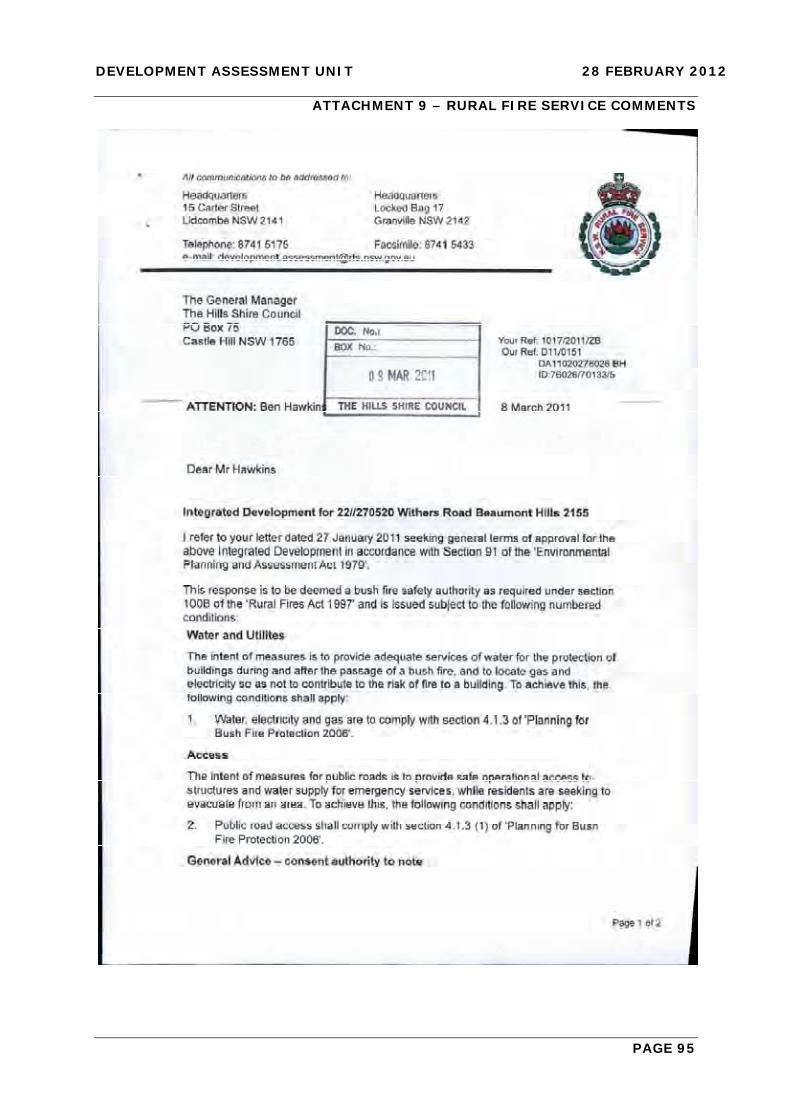
DEVELOPMENT ASSESSMENT UNIT 28 FEBRUARY 2012
PAGE 95
ATTACHMENT 9 – RURAL FIRE SERVICE COMMENTS

DEVELOPMENT ASSESSMENT UNIT 28 FEBRUARY 2012
PAGE 96

DEVELOPMENT ASSESSMENT UNIT 28 FEBRUARY 2012
PAGE 97
ITEM-5 DA NO. 110/2012/HA - RETAINING WORKS - LOT 300 DP 1130339 - GLENHAVEN ESTATE RETIREMENT VILLAGE, 15 OLD GLENHAVEN ROAD, GLENHAVEN
THEME: Balanced Urban Growth
HILLS 2026 OUTCOME/S: BUG 2 Lifestyle options that reflect our natural beauty.
COUNCIL STRATEGY/S: BUG 2.2 Maintain the Shire’s natural and cultural heritage through quality urban planning, development and maintenance.
LODGEMENT DATE: 2 AUGUST 2011
AUTHOR: DEVELOPMENT ASSESSMENT CO-ORDINATOR
ROBERT BUCKHAM
RESPONSIBLE OFFICER: MANAGER DEVELOPMENT ASSESSMENT
PAUL OSBORNE
EXECUTIVE SUMMARY The subject application seeks approval for retaining works on the rear boundary of an approved Seniors Living Development currently under construction. The application has been lodged in response to discussions with Council staff who became aware of the applicant’s intention to build a retaining wall on the boundary after being contacted directly by neighbours who indicated Living Choice were in discussions with them. Council staff advised that in the absence of any detail identifying a retaining wall along the boundary it was considered that the wall does not have consent and consent was required. The application originally detailed a retaining wall up to 3.1m high along the boundary however the applicant sought to amend the application by providing an outcome that primarily comprised lower retaining walls and a landscaped batter. Although the landscaped batter outcome is considered to be an improvement on the original proposal, it is considered that the applicant has not provided a design that ameliorates impacts on neighbours to an acceptable level. Particular concern remains along a portion of the boundary adjoining No. 5 Holland Road where a number of established screening trees are to be removed and a cantilevered turning head is to be constructed. The proposal includes landscaping underneath this structure. Concern is raised in relation to the adequacy of this screening and the ability for the landscaping to survive and be maintained long term. The applicant should consider amending the design to enable the retention of existing conifers that already screen the development site. It is considered that the issues regarding the development interface that have arisen were able to be better resolved when initial discussions were undertaken with Council staff in July 2011 however the developer continued primarily infrastructure construction to a point where opportunities to adequately deal with matter were reduced.

DEVELOPMENT ASSESSMENT UNIT 28 FEBRUARY 2012
PAGE 98
It is noted that construction of the villas adjacent to the boundary have not commenced to date and the applicant should consider amending or deferring construction of these villas to allow an appropriate alternate design outcome. The Development Application was placed on public notification for a period of fourteen (14) days. Two submissions were received during the notification period. The issues raised in the submissions predominately relate to visual and privacy impacts. A Class 1 Appeal has been lodged with the Land and Environment Court in relation to the deemed refusal of the subject application. A Class 4 Appeal has been lodged by an adjoining owner with respect to the subject application seeking a declaration that the preceding Seniors Living approval (280/2010/JP) be declared void and of no affect. These matters have been joined and are subject to Court Appointed Mediation. The proposed development is considered unsatisfactory and is recommended for refusal.
BACKGROUND MANDATORY REQUIREMENTS Applicant: Living Choice
Australia 1. Section 79C (EP&A Act) –
Unsatisfactory.
Owner: Living Choice Australia
2. LEP 2005 – Unsatisfactory.
Zoning: Rural 1(c)
3. Draft LEP 2010 - Unsatisfactory
Area: 13.25 Ha 4. SREP 20 – Hawkesbury Nepean River – Satisfactory
Existing Development: Existing Seniors Living Development (Stage 1) and Seniors Living Development under construction (Stage 2).
5.
6.
BHDCP, Part C, Section 1 – Rural – Satisfactory. BHDCP, Part D, Section 3 – Landscaping – Satisfactory.
SUBMISSIONS REASONS FOR REFERRAL TO DAU 1. Exhibition: Not Required 1. Recommended for Refusal
2. Notice Adj Owners: Yes, 14 days
2. Submissions Received.
3. Number Advised: Six (6)
4. Submissions Received:
Two (2) POLITICAL DONATION – None disclosed

DEVELOPMENT ASSESSMENT UNIT 28 FEBRUARY 2012
PAGE 99
HISTORY 23/09/2010 Development Application 280/2010/JP approved by the Joint
Regional Planning Panel (JRPP) for a Seniors Living Development comprising 97 self contained villas (Stage 2).
27/06/2011 Section 96 Modification approved under Delegated Authority. The modification included: Amendments to Staging The proposal was amended from being constructed in 6 stages to being constructed in 2 stages. Internal floor plan amendments to some dwellings The interal layouts of the Cranbrook and Darlington type dwellings were re-configured. The changes primarily relate to the garage and laundry. Inclusion of an electricity transformer and switch room An electricity transformer room included. Amendment of dwelling finished floor levels Following further investigation by the applicant of the design, in particular compliance with required path and driveway gradients, amendment of dwelling finished floor levels ranging from a reduction of 200mm to an increase of 200mm were proposed. Amendments to condition Nos. 37, 79 and 83 of consent. Condition 37 – Reduction in security bond amounts Condition 79 - Reduction in construction requirements fronting Holland Road. Condition 83 - Remove requirement for heavy duty crossings (A bond was accepted in lieu of construction).
01/07/2011 Correspondence sent to the Private Certifier after Council staff were contacted by neighbours who indicated Living Choice were in discussions with them about the construction of a retaining wall along the rear boundary. Advice was provided that in the absence of any detail identifying a retaining wall along the boundary it is considered that the wall does not have consent and consent was required. Advice was also provided that; “any works in the vicinity of the boundary should cease, and consent should be sought for the wall if a wall is indeed required. Consideration should be given to the interface of the wall with the properties to the north in particular opportunities should be explored to reduce the wall height and provide landscape screening on the development site to lessen the impact of any wall”.

DEVELOPMENT ASSESSMENT UNIT 28 FEBRUARY 2012
PAGE 100
13/07/2011 Meeting with representatives of Living Choice. Advice conveyed
that Development Consent for the wall was required and that site levels adjacent to the boundary should be reduced.
02/08/2011 Subject Development Application lodged for retaining walls up to 3.1 metres in height.
24/08/2011 Letter sent to applicant indicating that retaining walls as proposed are considered inappropriate given the locality’s rural zoning and the limitations in being able to provide adequate screening on the development site. Applicant requested to revisit site levels. Furthermore Council’s Tree Management Team had identified that trees identified to be retained would be impacted. An amended arboricultural assessment was requested that provides details of the trees that will be impacted by the proposed retaining wall and protection measures to ensure the long term viability of the trees. Detailed construction methods for the retaining wall were also to be provided.
09/09/2011 Correspondence received from applicant indicating that site levels could not be reduced given disabled access requirements and installation of site infrastructure.
15/09/2011 Amended arborist report and retaining wall details submitted to Council.
12/10/2011 Further letter sent to applicant advising application still not supported. Advice provided that the aborist report had been reviewed and regardless of construction methods recommended for the proposed retaining wall, the extent of fill within the Tree Protection Zone and Structural Root Zone of trees on adjoining properties would have an adverse impact on those trees.
02/11/2011 Site Meeting undertaken between Council staff, adjoining neighbours and representatives of Living Choice (applicant). The site meeting sought to identify options to deal with the land between the dwellings yet to be constructed on the development site and the interface with the neighbouring properties. It is noted that both neighbours raised concerns regarding the plans and levels but for the purpose of the meeting indicated they would consider the boundary treatment on a “without prejudice” basis. It is understood both adjoining owners preferred a battered landscaped outcome over the proposed retaining walls.
23/11/2011 Amended architectural and landscape plans submitted to Council.
06/12/2011 Amended plans sent to adjoining residents who attended the site meeting.

DEVELOPMENT ASSESSMENT UNIT 28 FEBRUARY 2012
PAGE 101
11/01/2012 Class 4 appeal lodged with the Land and Environment Court to
the subject application by Mr Anthony Rossi (Applicant) the owner of 1A Edgecliff Road, Glenhaven against Living Choice (First Respondent) and Council (Second Respondent). The applicant is seeking 1. A declaration that development consent number
280/2010/JP dated 12 October 2010 is void and of no effect;
2. An Order that Living Choice be restrained from carrying out
any works on until development consent is obtained (if required);
3. Costs; and 4. Interest on costs. This matter is set down for Court Appointed Mediation between the parties on 23 April 2012.
15/02/2012 Class 1 Appeal lodged by the applicant with the Land and Environment Court against the deemed refusal of the subject application. (Received by Council on 21 February 2012)
17/02/2012 Section 96(1A) Modification 280/2010/JP/B lodged to seek deletion of General Condition “C” relating to retaining walls in particular the requirement to obtain development consent for any walls not identified on the approved development application plans.
BACKGROUND The subject application, as amended, seeks approval for works on the rear boundary of an approved Seniors Living Development under construction. The works comprise a part retaining wall, part landscaped batter outcome. The application has been lodged in response to discussions with Council staff who became aware of the applicant’s intention to build a retaining wall on the boundary after being contacted by neighbours who indicated Living Choice were in discussions with them. Council staff advised that in the absence of any detail identifying a retaining wall along the boundary it is considered that the wall does not have consent and consent was required. On 1 July 2011 following discussions with the Certifier for the Seniors Living Development, correspondence was sent to the Principal Certifying Authority that stated, “In the absence of any detail identifying a retaining wall along the boundary it is considered that the wall does not have consent and consent was required”. Advice was also provided that, “any works in the vicinity of the boundary should cease, and consent should be sought for the wall if a wall is indeed required. Consideration should be given to the interface of the wall with the properties to the north in particular opportunities should be explored to reduce the wall height and provide landscape screening on the development site to lessen the impact of any wall”.

DEVELOPMENT ASSESSMENT UNIT 28 FEBRUARY 2012
PAGE 102
This advice was also conveyed verbally to Living Choice representatives on 13 July 2011. An application for the retaining walls was lodged on 2 August 2011. The applicant advised that works on the site had progressed to a point where site levels could not be reduced at the interface with the properties to the north and that there was now limited opportunities to resolve potential impacts on neighbours. The applicant was requested to detail how the levels were arrived at and why no details of retaining walls were identified within the original application. The works proposed differ from the design put forward in the suite of documents considered with Development Application 280/2010/JP. The architectural plans submitted did not convey the applicant’s apparent intended outcome along the northern boundary and in this regard were misleading. Specifically Plan C804.4 Sheet 1.04/P1 provided Cross Sections C and D across the site including the boundary at issue. Neither section identified a retaining wall. It was noted that Section D showed a falling batter from the proposed dwellings to the boundary which would appear to be finished ground level. These plans resulted in a favourable determination by the JRPP however if the actual situation had been identified in the architectural plans assessed by Council’s planning staff, amendments to the scheme consistent with the SEE would have been required to ensure an appropriate transition to the neighbouring properties. A site meeting between the applicant, neighbours and Council staff sought to identify options to deal with the land between the future dwellings yet to be constructed on the development site and the interface with the adjoining properties. It is noted that both parties raised concerns regarding the plans and levels but for the purpose of the meeting indicated they would consider the boundary treatment on a “without prejudice” basis. It is understood both adjoining owners preferred a battered landscaped outcome over the proposed retaining walls. A clear outcome was that any landscaping must protect privacy. A consultant engaged on behalf of one of the objectors was subsequently engaged by the applicant and a landscape batter concept was prepared and now forms part of the amended application. A Class 4 Appeal has been lodged with the Land and Environment Court to the subject application by Mr Anthony Rossi (Applicant) the owner of 1A Edgecliff Road, Glenhaven against Living Choice (First Respondent) and Council (Second Respondent). The applicant is seeking A declaration that development consent number 280/2010/JP dated 12 October 2010
is void and of no effect; An Order that Living Choice be restrained from carrying out any works on until
development consent is obtained (if required); Costs; and Interest on costs. This matter is set down for mediation between the parties on 23 April 2012. A Class 1 Appeal has been lodged for the subject application with the Land and Environment Court against the deemed refusal of the application.

DEVELOPMENT ASSESSMENT UNIT 28 FEBRUARY 2012
PAGE 103
PROPOSAL The Development Application is for the construction of a part landscaped batter, part retaining wall adjacent to the rear boundary of a seniors living development on the subject site. The development site shares a boundary with No. 5 Holland Road and 1A Edgecliff Road, Glenhaven located to the north. The proposal comprises along the north south boundary with No. 5 Holland Road a landscaped batter with low timber retaining walls along parts of the boundary to ensure the protection of trees on No. 5 Holland Road. A cantilevered turning head at a height of approximately 2.5m above existing ground level is to be constructed along the common east west boundary with No. 5 Holland Road. The proposal includes landscaping underneath this structure. The common boundary with No. 1A Edgecliff Road comprises a retaining wall to a height of 600mm and landscaped batter outcome. The concrete retaining wall is to be constructed of coloured blocks. The application includes the removal of forty-one (41) trees on the development site primarily along the common east west boundary with No. 5 Holland Road. Black powder coated steel pool type fencing, 1500mm high, is proposed along the boundary. Landscaping comprises a mix of native species suitable for planting on a batter and for screening purposes. Given the landscaping proposed, the area between the villas and the boundary cannot be used a private open space for future residents. The site is zoned Rural 1(c). The locality is currently characterised by the existing low density residential area to the south rural residential character to the north and the subject seniors living development existing (Stage 1) and under construction (Stage 2). The adjoining sites, No. 5 Holland Road and 1A Edgecliff Road, Glenhaven have been included within land owner nominated sites that the Department of Planning and Infrastructure are reviewing to identify sites, in appropriate locations, that will increase dwelling production in the short term. A report on the owner nominated sites was considered by Council at its meeting of 14 February 2012.
ISSUES FOR CONSIDERATION
1. Compliance with Baulkham Hills LEP 2005 – Zone Objectives The site is zoned Rural 1(c) under Baulkham Hills LEP 2005. The zone objectives seek to maintain the rural character of the locality, accommodate rural-residential development and ensure that development carried out on the land is compatible with the surrounding area. The objectives of the Rural 1(c) are:
“(a) to accommodate rural-residential development that is sympathetic to the environment and minimises risks from natural hazards, and
(b) to provide for a range of activities that are compatible with the rural-
residential character of the locality, and

DEVELOPMENT ASSESSMENT UNIT 28 FEBRUARY 2012
PAGE 104
(c) to ensure that development in the area does not unreasonably increase
demand for public services and public facilities, and (d) to ensure that development is designed and carried out having regard to
adjoining land uses and the natural environment, and
(e) to ensure that development is designed and carried out having regard to the rural and heritage character of the surrounding area, and
(f) to encourage the preservation of suitable areas for open space purposes.”
The proposal is not considered to be consistent with the stated objectives of the zone, in that the proposal does not maintain or have regard for the rural character of the locality or adjoining land uses and the natural environment. Specifically, the proposed works are not considered to be consistent with objectives (d) and (e). In light of the above, the proposed development fails to have regard to the existing predominately rural character of the locality or adjoining land uses and the natural environment. 2. Impact on Adjoining Properties As identified in the ‘background’ section of this report, the proposed works were not identified in the original development application for the Seniors Living Development determined by the JRPP. The subject development application lodged with Council was initially for retaining walls to a height of up to 3.1 metres. This was considered unsatisfactory particularly given the rural character of the locality and the limitations in being able to provide adequate screening on the development site. Furthermore, the Council’s Tree Management Team identified that trees identified to be retained in the vicinity of the walls in the subject proposal would be impacted as works will occur within the drip lines. Subsequently, the applicant amended the proposal to include a landscaped batter which is considered to be an improvement on the original proposal However, concern remains along a portion of the boundary adjoining No. 5 Holland Road where a number of established screening trees are to be removed and a cantilevered turning head is to be constructed. The proposal includes landscaping underneath this structure. Concern is raised in relation to the adequacy of this screening and the ability for the landscaping to survive and be maintained long term. It is noted that construction of the villas adjacent to the boundary has not yet commenced and it is appropriate that the applicant should consider amending or deferring construction of these villas to allow an appropriate alternate design outcome particularly in the location of the proposed turning head. 3. Issues Raised in Submissions The Development Application was placed on public notification for a period of fourteen (14) days. Two submissions were received during the notification period. The issues (summarised) have been addressed within the table below:-

DEVELOPMENT ASSESSMENT UNIT 28 FEBRUARY 2012
PAGE 105
ISSUE/OBJECTION COMMENT OUTCOME
A masonry wall is out of character with the locality.
As discussed in the report it is considered that the proposal will have a significant detrimental impact on adjoining properties and is out of character.
Reason for Refusal.
Existing screen planting and vegetation should be retained.
As a result of the proposed works a number of established screening trees are to be removed and a cantilevered turning head is to be constructed. The proposal includes landscaping underneath this structure. Concern is raised in relation to the adequacy of this screening and the ability for the landscaping to survive and be maintained long term.
Reason for Refusal.
The applicant foreshadowed that the dwellings were to be constructed close to natural existing ground levels.
In the opinion of Council staff, the works carried out differ from the design put forward in the suite of documents considered with Development Application 280/2010/JP. The architectural plans submitted did not convey the applicant’s apparent intended outcome along the northern boundary and in this regard were misleading. Specifically Plan C804.4 Sheet 1.04/P1 provided Cross Sections C and D across the site including the boundary at issue. Neither section identified a retaining wall. It was noted that Section D showed a falling batter from the proposed dwellings to the boundary which would appear to be finished ground level It is also noted that comments provided within the Statement of Environmental Effects such as that identified on page 35 stated: “The proposed development maintains density and placement patterns and scale of form to that of the existing Aged Care Facility. Additionally the conservative elevation is consistent with the scale of built form throughout the locality. The integration of landscape elements amongst generous open spaces reinforce the local character and compliment the transition between the adjoining residential and rural zone’s”.
Issue addressed.

DEVELOPMENT ASSESSMENT UNIT 28 FEBRUARY 2012
PAGE 106
ISSUE/OBJECTION COMMENT OUTCOME These documents resulted in a favourable determination however if the actual situation had been identified in the architectural plans assessed by Council’s planning staff, amendments to the scheme consistent with the SEE would have been required to ensure an appropriate transition to the neighbouring properties.
The issues have arisen through unauthorised filling of the subject site.
It is noted that substantial earthworks have occurred on the development site since its previous use as a nursery. As identified in this report the original approval for the Seniors Living Development (280/2010/JP) was supported by Council staff on the basis that impact on neighbours was minimised and the development graded to finish at natural ground level at the northern boundary (Plan No. C804.4 Sheet 1.04). The building pad levels are not in dispute only the transition from the villas to the boundary.
Issue addressed.
The proposal has a detrimental impact on property values.
This is not a matter for consideration under Section 79C of the EP&A Act, 1979.
Issue addressed.
The Land and Environment Court has adopted a number of principles including an established planning principle that landscaping cannot be relied upon to soften or screen development.
The landscaping proposed along the common north south boundaries of both properties is considered acceptable and will provide a satisfactory outcome. However reliance on landscaping under the proposed turning head is not sufficient to recommend approval in this instance. In addition the applicant has not considered any other meaningful measures to ameliorate privacy impacts on neighbours at this location.
Reason for Refusal.
Inadequate area is available to meaningfully soften the massive elevation of the buildings - even if landscaping was an appropriate ameliorative outcome for the development. The proposed 1500mm high colourbond fencing is also a completely foreign element in the rural character of the locality.
It is noted that boundary fencing for the completed Stage 1 of the development site is grey lapped and capped fencing. The fencing proposed would appear to be ‘pool type’ fencing i.e. transparent. No objection is raised to the fencing.
Issue addressed.

DEVELOPMENT ASSESSMENT UNIT 28 FEBRUARY 2012
PAGE 107
ISSUE/OBJECTION COMMENT OUTCOME It is noteworthy that development for the purposes of retaining walls are permissible with consent in the Residential 2(e) zone however, retaining walls are not elsewhere defined. In circumstances where the development allowed in the 1(c) zone is an inclusive definition (where development not so included is prohibited by sub-clause 4), the question arises as to whether the development proposed by this application is prohibited in the zone.
The proposed development for a retaining wall is ancillary to the approved seniors living development and is permissible with consent.
Issue addressed.
The drawings provide a misrepresentation of the proposed development.
A number of matters raised by an objector’s representative make reference to unit No. 232 and inaccuracies of certain plans. The locations identified are not located adjacent to the subject objector’s property and are considered to provide an accurate representation of the development.
Issue addressed.
TREE MANAGEMENT COMMENTS
The proposal has been amended and an arboricultural assessment provided that details protection measures to ensure the long term viability of the trees. Concern is raised regarding the viability of the landscaping proposed under the cantilevered turning head. The proposed landscaping will not provide an acceptable screening outcome in this location. CONCLUSION The application has been assessed against the relevant heads of consideration under Section 79C of the Environmental Planning and Assessment Act, 1979, the provisions of Sydney Regional Environmental Plan No. 20 – Hawkesbury Nepean River and Baulkham Hills Local Environmental Plan 2005. The key issue for this proposal is the impact of the development on the two adjoining properties and its compatibility with the rural locality. The approved Seniors Living Development has resulted in an unexpected outcome along the common boundary. It is considered that the issues regarding the development interface that have arisen were able to be better resolved when initial discussions were undertaken with Council staff in July 2011 however the developer continued the construction of primarily infrastructure to a point where there options to deal with matter were reduced.

DEVELOPMENT ASSESSMENT UNIT 28 FEBRUARY 2012
PAGE 108
It is noted that construction of the villas adjacent to the boundary has to date not commenced and the applicant should consider amending or deferring construction of these villas to allow an appropriate alternate design outcome. Primarily concern remains in respect to a portion of the boundary adjoining No. 5 Holland Road where a number of established screening trees are to be removed and a cantilevered turning head is to be constructed. This outcome is unacceptable and cannot be supported. Two (2) submissions were received during the public notification period, and the issues raised by objectors have not be satisfactorily addressed by the applicant. Accordingly, the proposed development is recommended for refusal. IMPACTS Financial A Class 4 appeal has been lodged with the Land and Environment Court by an adjoining property owner against the applicant Living Choice and Council. A Class 1 Appeal has been lodged with the Land and Environment Court by the applicant (Living Choice) in relation to the deemed refusal of the subject application.
Council has engaged external solicitors to defend these appeals and the estimated cost is $50,000. This will be provided under Council’s legal budget.
Hills 2026 The impacts have been identified and addressed in the report. However, the proposal is likely to adversely impact on the character of the locality and adjoining neighbours.
RECOMMENDATION
The application be refused for the following reasons: 1. The proposed development is not consistent with the objectives for development
specified in Clause 2 of Baulkham Hills Local Environmental Plan (LEP) 2005. Furthermore, the proposal fails to integrate with the local character of the locality or have regard to the land uses that form the rural and urban environment of the Shire and does not comply with objectives (d) and (e) of the Rural 1(c) zone specified in Clause 13 of the LEP (pursuant to Section 79C(1)(a)(i) of the Environmental Planning and Assessment Act 1979).
2. The likely impacts of the proposal are considered to be unacceptable, including
environmental impacts on both the natural and built environments, and social and economic impacts in the locality, specifically:

DEVELOPMENT ASSESSMENT UNIT 28 FEBRUARY 2012
PAGE 109
a) The development is not compatible with the local character and amenity or existing land uses and activity in the locality.
b) The proposal is not compatible with adjacent land uses and is likely to result
in adverse impacts in terms of privacy and suitable measures have not been proposed to mitigate those impacts.
(Pursuant to Section 79C(1)(b) of the Environmental Planning and Assessment Act1979)
3. The subject site is not considered to be suitable for the proposed development for
the reasons outlined above due to the increase in intensity proposed (Pursuant to Section 79C(1)(c) of the Environmental Planning and Assessment Act
1979). ATTACHMENTS 1. Locality Plan 2. Aerial Photograph 3. Approved Seniors Living Plans 280/2010/JP/A 4. Architectural Plans 5. Landscape Plans

DEVELOPMENT ASSESSMENT UNIT 28 FEBRUARY 2012
PAGE 110
ATTACHMENT 1 – LOCALITY PLAN

DEVELOPMENT ASSESSMENT UNIT 28 FEBRUARY 2012
PAGE 111
ATTACHMENT 2 – AERIAL PHOTOGRAPH

DEVELOPMENT ASSESSMENT UNIT 28 FEBRUARY 2012
PAGE 112
ATTACHMENT 3 – APPROVED SENIORS LIVING PLANS 280/2010/JP/A

DEVELOPMENT ASSESSMENT UNIT 28 FEBRUARY 2012
PAGE 113

DEVELOPMENT ASSESSMENT UNIT 28 FEBRUARY 2012
PAGE 114

DEVELOPMENT ASSESSMENT UNIT 28 FEBRUARY 2012
PAGE 115
ATTACHMENT 4 – ARCHITECTURAL PLANS

DEVELOPMENT ASSESSMENT UNIT 28 FEBRUARY 2012
PAGE 116

DEVELOPMENT ASSESSMENT UNIT 28 FEBRUARY 2012
PAGE 117

DEVELOPMENT ASSESSMENT UNIT 28 FEBRUARY 2012
PAGE 118

DEVELOPMENT ASSESSMENT UNIT 28 FEBRUARY 2012
PAGE 119

DEVELOPMENT ASSESSMENT UNIT 28 FEBRUARY 2012
PAGE 120

DEVELOPMENT ASSESSMENT UNIT 28 FEBRUARY 2012
PAGE 121

DEVELOPMENT ASSESSMENT UNIT 28 FEBRUARY 2012
PAGE 122

DEVELOPMENT ASSESSMENT UNIT 28 FEBRUARY 2012
PAGE 123

DEVELOPMENT ASSESSMENT UNIT 28 FEBRUARY 2012
PAGE 124
ATTACHMENT 5 – LANDSCAPE PLANS

DEVELOPMENT ASSESSMENT UNIT 28 FEBRUARY 2012
PAGE 125

DEVELOPMENT ASSESSMENT UNIT 28 FEBRUARY 2012
PAGE 126