DETECTION - Sensit Technologies · truly essential tool for the locator’s toolbox. ... K an a Cit...
12
DETECTION DETECTION Professional Professional Issue 3 A publication of SENSIT Technologies DAMAGE PREVENTION UTILITY LOCATING: EM, GPR AND ULTRA-TRAC APL
Transcript of DETECTION - Sensit Technologies · truly essential tool for the locator’s toolbox. ... K an a Cit...

DETECTIONDETECTIONProfessionalProfessional
Issue 3 A publication of SENSIT Technologies
DAMAGE PREVENTION
UTILITY LOCATING:EM, GPR AND ULTRA-TRAC APL

Learn more at:www.gasleaksensors.com
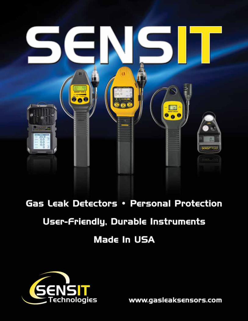
The most versatile gas leak detector available today!
SENSIT® GOLD G2 can be used for gas leak surveys and investigations, leak pinpointing, line purging and confined space applications.
Displays Up To 4 Gases• LEL (%Volume and PPM Optional)• Oxygen• Carbon Monoxide• Hydrogen Sulfide
Selectable Gas Type• Methane (Natural Gas)• Propane
Find Gas Leaks Fast!
SENSIT® GOLD G2 can be used for gas leak surveys and investigations, leak pinpointing, line purging and confined space applications.
Displays Up To 4 Gases• LEL (%Volume and PPM Optional)• Oxygen• Carbon Monoxide• Hydrogen Sulfide
Selectable Gas Type• Methane (Natural Gas)• Propane
The most versatile gas leak detector available today!
Find Gas Leaks Fast!

3
Welcome to 2016! Wow, it seems like just yesterday we were working to finish 2015. Last year was a fantastic year for SENSIT Technologies and I am truly grateful to both our long time, loyal customers as well as the many new ones that were introduced to SENSIT products last year. Everyone at SENSIT knows the importance of their job and how it ultimately can effect yours. I also know that regardless of every effort to build perfect products, there can still be surprises. Our dedicated team in Customer and Technical Services are ready to answer questions and provide product and application support. Equally important, they constantly communicate the trends they hear from you to our engineering team. This process insures continuous improvement to meet our objective of zero defects.
2016 looks to be another exciting year at SENSIT Technologies. We are adding resources toward the development of new innovative products as well as reviewing our legacy products to improve your field experience. Since last fall, we added four new engineers to our global staff as well as hired a new Director of Engineering, Kurt Stefans. These new resources will enable us to meet the pace of changes in deployable technologies for the future.
Another recent hire is Adam Zeciri who is SENSIT’s new Product Manager for our growing Locating Products business. Adam brings more than 15 years of experience in underground utility locating and certifying utility and contractor locate personnel. Significant enhancements have recently been made to our Ultra-Trac APL (acoustic pipe locator). Adam will assist clients in understanding how to implement this unique product to find untraceable underground piping systems. He is also responsible for the feature article in this edition which compares the different technologies available today to locate underground utilities.
Thank you again for your business and taking the time to read Detection Professional. We hope you find the information valuable. Please free to send this edition to others and of course, let us know if you have any suggestions or comments.
All the best,
J. Scott KleppePresident and Chief Executive Officer
J. Scott KleppePresident and Chief Executive Officer
President’s Message
4 DETECTION PROFESSIONAL • Issue 3
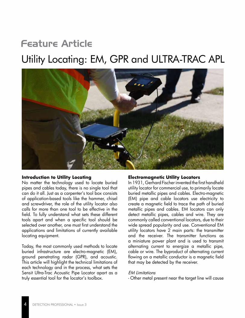
Utility Locating: EM, GPR and ULTRA-TRAC APL
Feature Article
Introduction to Utility LocatingNo matter the technology used to locate buried pipes and cables today, there is no single tool that can do it all. Just as a carpenter’s tool box consists of application-based tools like the hammer, chisel and screwdriver, the role of the utility locator also calls for more than one tool to be effective in the field. To fully understand what sets these different tools apart and when a specific tool should be selected over another, one must first understand the applications and limitations of currently available locating equipment.
Today, the most commonly used methods to locate buried infrastructure are electro-magnetic (EM), ground penetrating radar (GPR), and acoustic. This article will highlight the technical limitations of each technology and in the process, what sets the Sensit Ultra-Trac Acoustic Pipe Locator apart as a truly essential tool for the locator’s toolbox.
Electromagnetic Utility LocatorsIn 1931, Gerhard Fischer invented the first handheld utility locator for commercial use, to primarily locate buried metallic pipes and cables. Electro-magnetic (EM) pipe and cable locators use electricity to create a magnetic field to trace the path of buried metallic pipes and cables. EM locators can only detect metallic pipes, cables and wire. They are commonly called conventional locators, due to their wide spread popularity and use. Conventional EM utility locators have 2 main parts: the transmitter and the receiver. The transmitter functions as a miniature power plant and is used to transmit alternating current to energize a metallic pipe, cable or wire. The byproduct of alternating current flowing on a metallic conductor is a magnetic field that may be detected by the receiver.
EM Limitations - Other metal present near the target line will cause

distortion, causing error in the reading. This could be anything metallic; such as a parallel utility line, a metal building or a vehicle.- EM locating equipment can only be used to locate metallic utilities. It cannot be used to find non-metallic lines unless a tracer wire is present (for plastic or concrete-asbestos pipe, for example) and is metallically continuous.- EM locating equipment cannot tell what type of utility is being located. The operator must verify the utility type by either potholing or tracing the utility line structure to structure.
Ground Penetrating RadarThe first large-scale application for Radio Detection and Ranging (RADAR) was used during World War II by the British and American military, to detect electromagnetic pulses reflected by aircraft. Ground Penetrating Radar (GPR) was first used to determine the depth of a glacier in Austria in 1929. Today, despite its common limitations due to soil conditions, modern use of GPR to locate buried utilities has increased in popularity, due to the ability to find both metallic and non-metallic lines.
Environmental FactorsThe dielectric constant of the media or substrate being scanned determines the amount of signal that is absorbed by the substrate through attenuation. Because soil type determines this factor, soil conditions must be optimal for GPR to work. Soil moisture content greatly affects the GPR signal; in general, dry soil is better than wet. Also known as permittivity, the dielectric constant is frequency dependent for GPR. The higher the frequency, the better the resolution with shallower depth penetration. Conversely, the lower the frequency, the better the depth penetration with lower resolution. The size and material of the target line will also impact the ability to be seen using GPR.
The soil type and moisture content definitely matter for GPR to successfully locate buried pipes. Ranked from best to worst: Air, solid ice, rock, sand, silt,
and finally clay. As shown in the map below, most areas of the United States do not have optimal soil conditions for the effective deployment of GPR.
GPR Limitations- Soil type plays a major role in the ability to find pipes and cables using GPR.- The greater the depth, the greater the target utility size needs to be; smaller pipes and cables will not be found using GPR.- Certain types of pipe materials simply cannot be seen by GPR in any soil type, at any depth.- GPR cannot tell the type or material of the buried utility line. Must be verified by potholing or tracing the utility line structure to structure.
PineBluff
LittleRock
FortSmith
Fayetteville
Yuma
Tucson
Phoenix
San Jose
SanFrancisco
SanDiego
Sacramento
LosAngeles
Fresno
Pueblo
Longmont
Greeley
FortCollins
Denver
ColoradoSprings
Boulder
WaterburyNewHaven
Danbury
Bristol
Bridgeport
Wilmington
Dover
Tampa
Orlando
Miami
Jacksonville
Fort
Lauderdale
Macon
Atlanta
Albany
WaterlooSiouxCity
Omaha
IowaCity
Dubuque
DesMoines Davenport
CedarRapids
Pocatello
IdahoFalls
BoiseCity
Rockford
Chicago
TerreHaute
Muncie
Indianapolis
FortWayne
Evansville
Bloomington
Anderson
Wichita
Topeka
St.Joseph
Lawrence
Owensboro
LouisvilleLexington
Huntington
Shreveport
NewOrleans
Monroe
LakeCharles
Lafayette
BatonRouge
Alexandria
Worcester
Springfield
New Bedford
LowellLawrence
BrocktonBoston
Baltimore
Portland
Lewiston
Bangor
ToledoSouth Bend
LansingGrandRapids
Flint
Detroit
AnnArbor
St.Cloud
Rochester
Minneapolis
La Crosse
GrandForks
FargoDuluth
Springfield
St.Louis
KansasCity
Columbia
Pascagoula
Jackson
Hattiesburg
Biloxi
Missoula
GreatFalls
Billings
Winston-
Salem Raleigh
High Point
Fayetteville
Durham
Charlotte
Bismarck
Portsmouth
Manchester
Trenton
Santa Fe
LasCruces
Albuquerque
Reno
LasVegas
Rochester
NewYork
Buffalo
Wheeling
ParkersburgDayton
Columbus
Cleveland
Cincinnati
Akron
Tulsa
OklahomaCity
Lawton
Salem
Medford
Eugene
PittsburghPhiladelphia
Providence
Newport
Sumter
Spartanburg RockHill
Greenville
Columbia
Charleston
SiouxFalls
RapidCity
Nashville
Memphis
Knoxville
JohnsonCity
Jackson
Clarksville
Chattanooga
SanAntonio
Lubbock
Houston
El Paso
Dallas
CorpusChristi
Austin
SaltLakeCityProvo
Ogden
Logan
Washington
DC
Roanoke
Richmond
NorfolkLynchburg
Burlington
Yakima
Tacoma
Spokane
Seattle
Portland
Bellingham
Sheboygan
Racine
Oshkosh
MilwaukeeMadison
KenoshaJanesville
GreenBay
EauClaire
Appleton
Charleston
Cheyenne
Casper
Tuscaloosa
Montgomery
Mobile
Huntsville
Gadsden
Dothan
Decatur
Columbus
Birmingham
Lincoln
WY
WI
WV
WA
VA
VT
UT
TX
TN
SD
SC
RI
PA
OR
OK
OH
ND
NC
NY
NM
NJ
NH
NV NE
MT
MO
MS
MN
MI
MA
MD
ME
LA
KY
KS
IA
IN
IL
ID
GA
FL
DE
CT
CO
CA
ARAZ
AL
Ground-Penetrating Radar Suitability Map
HAWAII
PUERTO RICO &U.S. VIRGIN ISLANDS0 50 100 150 200 25025
Kilometers0 50 100 150 20025
Kilometers
0 10 20 30 405
Kilometers
USDA-NRCS. 2009. Ground Penetrating Radar Suitability - US (map). Using ArcGIS, Version 9.2 (Environmental Systems Research Institute, Inc., Redlands, Ca.). National Soil Survey Center, Lincoln, Nebraska. Scale 1:1,500,000. Map projection for continental U.S. using Albers Equal Area, North American Datum 1983 (NAD83). Map projection for Hawaii using Hawaii State Plane NAD83. Map projection for Puerto Rico and U.S. Virgin Islands NAD83. USDA-NRCS. 2008. Digital General Soils Map (GSM) version 2. Continental United States, Hawaii, Puerto Rico and U.S. Virgin Islands. Soil Data Mart Source (http://soildatamart.nrcs.usda.gov). December 2008 edition. Soil Survey Staff. 2009. NSSC DATA – Ground Penetrating Radar Suitability Index (GPRSI) [data file] - National Soil Information System (Evaluation Draft - 02/2009). USDA Natural Resource Conservation Service, National Soil Survey Center, Lincoln, Nebraska. (http://soils.usda.gov). Current State and Equivalent, TIGER/Line 2008 (cartographic boundary file, tl_2008_us_state.zip). 2008. U.S. Census Bureau. Available FTP: ftp://ftp2.census.gov/geo/tiger/TIGER2008/. [Accessed on February 20, 2009] Urban Areas (generalized cartographic boundary file, ua99_d00_shp.zip ). 2000. U.S. Census Bureau. Available FTP: http://www.census.gov/geo/cob/bdy/ua/ua00shp/. [Accessed on February 20, 2009] USGS. Analytical Hillshade computed from 1 kilometer National Elevation Dataset (NEDS) using the following parameters: 315 degrees altitude, 45 degrees azimuth, and z factor 1x. Prepared by USDA-NRCS-NSSC, Lincoln, NE.
Water
Not Digitized
International Border
State Line
Interstate Highway
1 Very High
Not Rated
6 Unsuited
5 Very Low
4 Low
3 Moderate
2 High
GPR Index
Urban Areas
Large Water Body
The majority of the United States offers moderate to low GPR feasibility.
Source: USDA-NRCS. 2009. Ground Penetrating Radar Suitability - US (Map).
PineBluff
LittleRock
FortSmith
Fayetteville
Yuma
Tucson
Phoenix
San Jose
SanFrancisco
SanDiego
Sacramento
LosAngeles
Fresno
Pueblo
Longmont
Greeley
FortCollins
Denver
ColoradoSprings
Boulder
WaterburyNewHaven
Danbury
Bristol
Bridgeport
Wilmington
Dover
Tampa
Orlando
Miami
Jacksonville
Fort
Lauderdale
Macon
Atlanta
Albany
WaterlooSiouxCity
Omaha
IowaCity
Dubuque
DesMoines Davenport
CedarRapids
Pocatello
IdahoFalls
BoiseCity
Rockford
Chicago
TerreHaute
Muncie
Indianapolis
FortWayne
Evansville
Bloomington
Anderson
Wichita
Topeka
St.Joseph
Lawrence
Owensboro
LouisvilleLexington
Huntington
Shreveport
NewOrleans
Monroe
LakeCharles
Lafayette
BatonRouge
Alexandria
Worcester
Springfield
New Bedford
LowellLawrence
BrocktonBoston
Baltimore
Portland
Lewiston
Bangor
ToledoSouth Bend
LansingGrandRapids
Flint
Detroit
AnnArbor
St.Cloud
Rochester
Minneapolis
La Crosse
GrandForks
FargoDuluth
Springfield
St.Louis
KansasCity
Columbia
Pascagoula
Jackson
Hattiesburg
Biloxi
Missoula
GreatFalls
Billings
Winston-
Salem Raleigh
High Point
Fayetteville
Durham
Charlotte
Bismarck
Portsmouth
Manchester
Trenton
Santa Fe
LasCruces
Albuquerque
Reno
LasVegas
Rochester
NewYork
Buffalo
Wheeling
ParkersburgDayton
Columbus
Cleveland
Cincinnati
Akron
Tulsa
OklahomaCity
Lawton
Salem
Medford
Eugene
PittsburghPhiladelphia
Providence
Newport
Sumter
Spartanburg RockHill
Greenville
Columbia
Charleston
SiouxFalls
RapidCity
Nashville
Memphis
Knoxville
JohnsonCity
Jackson
Clarksville
Chattanooga
SanAntonio
Lubbock
Houston
El Paso
Dallas
CorpusChristi
Austin
SaltLakeCityProvo
Ogden
Logan
Washington
DC
Roanoke
Richmond
NorfolkLynchburg
Burlington
Yakima
Tacoma
Spokane
Seattle
Portland
Bellingham
Sheboygan
Racine
Oshkosh
MilwaukeeMadison
KenoshaJanesville
GreenBay
EauClaire
Appleton
Charleston
Cheyenne
Casper
Tuscaloosa
Montgomery
Mobile
Huntsville
Gadsden
Dothan
Decatur
Columbus
Birmingham
Lincoln
WY
WI
WV
WA
VA
VT
UT
TX
TN
SD
SC
RI
PA
OR
OK
OH
ND
NC
NY
NM
NJ
NH
NV NE
MT
MO
MS
MN
MI
MA
MD
ME
LA
KY
KS
IA
IN
IL
ID
GA
FL
DE
CT
CO
CA
ARAZ
AL
Ground-Penetrating Radar Suitability Map
HAWAII
PUERTO RICO &U.S. VIRGIN ISLANDS0 50 100 150 200 25025
Kilometers0 50 100 150 20025
Kilometers
0 10 20 30 405
Kilometers
USDA-NRCS. 2009. Ground Penetrating Radar Suitability - US (map). Using ArcGIS, Version 9.2 (Environmental Systems Research Institute, Inc., Redlands, Ca.). National Soil Survey Center, Lincoln, Nebraska. Scale 1:1,500,000. Map projection for continental U.S. using Albers Equal Area, North American Datum 1983 (NAD83). Map projection for Hawaii using Hawaii State Plane NAD83. Map projection for Puerto Rico and U.S. Virgin Islands NAD83. USDA-NRCS. 2008. Digital General Soils Map (GSM) version 2. Continental United States, Hawaii, Puerto Rico and U.S. Virgin Islands. Soil Data Mart Source (http://soildatamart.nrcs.usda.gov). December 2008 edition. Soil Survey Staff. 2009. NSSC DATA – Ground Penetrating Radar Suitability Index (GPRSI) [data file] - National Soil Information System (Evaluation Draft - 02/2009). USDA Natural Resource Conservation Service, National Soil Survey Center, Lincoln, Nebraska. (http://soils.usda.gov). Current State and Equivalent, TIGER/Line 2008 (cartographic boundary file, tl_2008_us_state.zip). 2008. U.S. Census Bureau. Available FTP: ftp://ftp2.census.gov/geo/tiger/TIGER2008/. [Accessed on February 20, 2009] Urban Areas (generalized cartographic boundary file, ua99_d00_shp.zip ). 2000. U.S. Census Bureau. Available FTP: http://www.census.gov/geo/cob/bdy/ua/ua00shp/. [Accessed on February 20, 2009] USGS. Analytical Hillshade computed from 1 kilometer National Elevation Dataset (NEDS) using the following parameters: 315 degrees altitude, 45 degrees azimuth, and z factor 1x. Prepared by USDA-NRCS-NSSC, Lincoln, NE.
Water
Not Digitized
International Border
State Line
Interstate Highway
1 Very High
Not Rated
6 Unsuited
5 Very Low
4 Low
3 Moderate
2 High
GPR Index
Urban Areas
Large Water Body
5
Continued on next page

6 DETECTION PROFESSIONAL • Issue 3
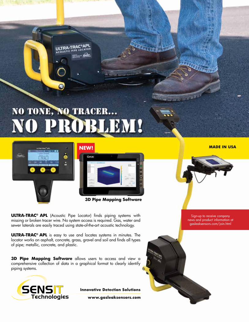
Acoustic Pipe Locator (APL)Originally invented by Gas Technology Institute (GTI), SENSIT Technologies acquired the rights for commercialization and production in 2011. Since the first APL rolled off SENSIT’s production line, many advancements have been made based on input from end users. The latest advancement is the incorporation of a Windows-based tablet to create 3-D image maps of scan data. The APL can be used to find metallic and non-metallic pipes, in any soil type, to depths to 30 feet.
SENSIT Technologies ULTRA-TRAC® Acoustic Pipe Locator (APL) provides an alternative and supplemental method of locating buried pipes. The APL transmits and receives acoustic sound waves and then looks for differences in acoustic impedance in the soil caused by pipes, cables, ducts and other buried infrastructure using a process known as impedance mismatch. The APL is able to locate buried utilities, regardless of material type, broken tracer wire and soil conditions.
The chassis, or foot of the unit, houses the battery, electronic components and send-and-receive sensors. Located near the front of the chassis, the actuator sends a series of sound waves, or ‘pings’ into the ground. To the rear of the chassis, dual matched accelerometers receive the sound waves once they have been reflected from a buried pipe, cable, or duct.
How APL WorksWith the push of the APL’s scan button, twenty-four pings are delivered into the ground at a single location, known as a slice. A series of slices is known as a scan. A scan must consist of at least 5 slices,
to allow internal software to calculate the location of a buried utility line. A pattern will emerge in the survey, identifying the possible location of a buried pipe. The tablet displays this information to the operator on-the-fly in 3-D. Survey data can also be stored for use as a client deliverable, emailed to a supervisor for verification, or stored for record keeping purposes.
APL Limitations- As with GPR and EM, the operator should have a ballpark idea of where the scan should be taken based on system knowledge and surface indicators- As with EM and GPR, the APL cannot tell what type of facility is being located. The operator must verify the utility type by potholing or tracing the utility line structure to structure.
Obstacle (Pipe)
Re�ective Wave Transmitted Wave
Ground Surface
Continued: Utility Locating: EM, GPR and ULTRA-TRAC APL

ConclusionGiven their inherent limitations, a toolbox consisting solely of conventional EM and GPR locating equipment simply cannot find everything on their own, unless the target utility is metallic, or has an unbroken tracer wire for EM, or soil conditions are optimal for the use of GPR. As the USGS soil map shows, in the contiguous United States, optimal soil conditions for effective use of GPR are few and far between. Pairing EM equipment with the APL enables the end user to find both metallic and non-metallic utilities, in a broad range of soil types.
The Sensit APL provides the operator with an essential tool to locate metallic and non-metallic pipes, cables and ducts, regardless of broken tracer wire and soil type. Its ease of operation, coupled with the ability to display and store scan data in 3-D, makes the APL an excellent choice for anyone trying to find buried pipes, cables and ducts. Utility locators, engineers, surveyors, energy companies and municipalities alike, are currently deploying acoustic locating technology with the Sensit APL.
Find out more at GasLeakSensors.com or call us at 1-219-465-2700 to schedule a demo.
7
About the Author
Since 1999, Adam has been mapping and locating subsurface utilities in North America. Utilizing conventional land surveying, GPS/RTK, thermal imaging (IR), subsurface and concrete scanning via ground penetrating radar (GPR), electromagnetic induction (EMI), conventional electromagnetic locating (EM), acoustic locating and SPAR utility surveying technologies, Adam has located and mapped buried infrastructure in the United States.
He has trained utility locators in EM and GPR since 2007 and instructed locator certification courses since 2009. In addition, Adam has supervised and trained gas leak survey, utility locating, infrastructure mapping, corrosion, utility construction and gas leak repair field crews. He recently trained and qualified operators in over 29 different gas construction, maintenance and repair tasks as a senior technical instructor and OQ evaluator.
Adam ZeciriProduct Manager Utility LocatingSENSIT Technologies
This contour map, known as ScanView, can be viewed after every scan to better understand the ground profile. Though a single scan is not an adequate search, it can provide important insight based on the strength of the reflected sound waves.
The APL’s state-of-the-art 3D Pipe Mapping feature allows users to stack several scans together to obtain a 3D map of the underground topography. This 3D map, including axis control and an interpolation feature, improves resolution and provides quicker and more accurate analysis of the surveyed area.

8 DETECTION PROFESSIONAL • Issue 3
Damage PreventionCase Study
The ClientA Natural Gas utility company with 12,000 miles of natural gas pipelines, serving over 500,000 customers in the western United States.
The ChallengeLocating a 3” PVC natural gas pipeline acquired from a railroad company. The line had received several hits from third parties near the survey area.
The client needed to find and mark the line to avoid future incidents. Traditional locating equipment failed to find the line, as no tracer had been used during installation.
Gas Line Locating with ULTRA-TRAC (APL) Acoustic Pipe Locator
SENSIT SolutionULTRA-TRAC® APL was deployed to the survey site. With the assistance of the client, we conducted an acoustic locator survey, in a series of eight foot scans.
To collect the most accurate data for the survey, sixteen acoustic readings were used for each scan. Each “pipe found reading” was marked with white paint
ResultsAfter completing a full series of scans covering a 32x23’ grid area, a pattern developed at 60”, along with an area known to contain fiber optic line. The client used a vacuum excavator to verify the natural gas line location.
ConclusionAs a result of this success and recognizing the savings they could realize through continued deployment of the APL, the client purchased one unit and expressed interest in several more.
Case Study
www.gasleaksensors.com
Innovative Detection Solutions
MADE IN USANEW!
3D Pipe Mapping Software
ULTRA-TRAC® APL (Acoustic Pipe Locator) finds piping systems with missing or broken tracer wire. No system access is required. Gas, water and sewer laterals are easily traced using state-of-the-art acoustic technology.
ULTRA-TRAC® APL is easy to use and locates systems in minutes. The locator works on asphalt, concrete, grass, gravel and soil and finds all types of pipe; metallic, concrete, and plastic.
3D Pipe Mapping Software allows users to access and view a comprehensive collection of data in a graphical format to clearly identify piping systems.
Sign-up to receive companynews and product information atgasleaksensors.com/join.html
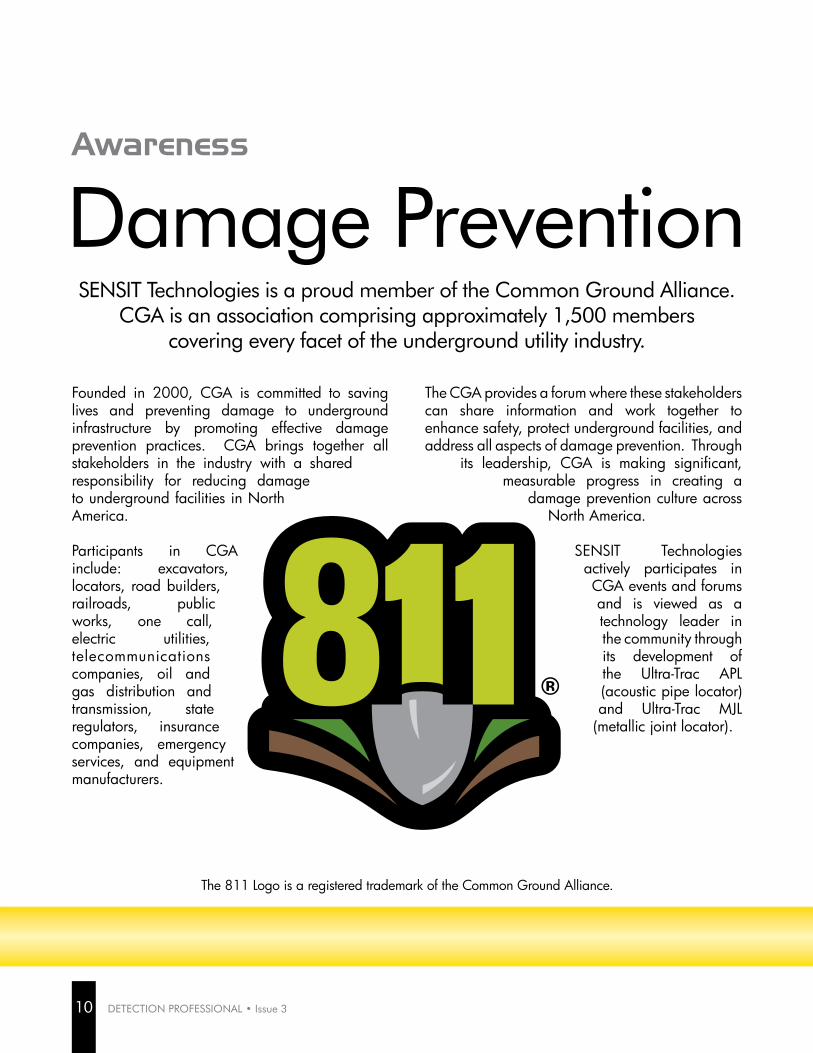
Founded in 2000, CGA is committed to saving lives and preventing damage to underground infrastructure by promoting effective damage prevention practices. CGA brings together all stakeholders in the industry with a shared responsibility for reducing damage to underground facilities in North America.
Participants in CGA include: excavators, locators, road builders, railroads, public works, one call, electric utilities, telecommunications companies, oil and gas distribution and transmission, state regulators, insurance companies, emergency services, and equipment manufacturers.
The CGA provides a forum where these stakeholders can share information and work together to enhance safety, protect underground facilities, and address all aspects of damage prevention. Through
its leadership, CGA is making significant, measurable progress in creating a
damage prevention culture across North America.
SENSIT Technologies actively participates in CGA events and forums and is viewed as a technology leader in the community through its development of the Ultra-Trac APL (acoustic pipe locator) and Ultra-Trac MJL
(metallic joint locator).
Damage PreventionAwareness
SENSIT Technologies is a proud member of the Common Ground Alliance. CGA is an association comprising approximately 1,500 members
covering every facet of the underground utility industry.
The 811 Logo is a registered trademark of the Common Ground Alliance.
10 DETECTION PROFESSIONAL • Issue 3

APWA UNIFORM COLOR CODE*Each color identifies a specific type of utility.
Proposed Excavation
Temporary Survey Markings
Electric Power Lines, Cables, Conduit and Lighting Cables
Gas, Oil, Steam, Petroleum or Gaseous Materials
Communication, Alarm or Signal Lines, Cables or Conduit
Potable Water
Reclaimed Water, Irrigation and Slurry Lines
Sewers and Drain Lines
WHITE
ORANGE
YELLOW
PINK
RED
BLUE
PURPLE
GREEN
*These colors are close approximations of the industry standard.
11