
Design more quickly. - CAD Masters, Inc
2
Project Summary Stretching from the suburbs of Sacramento to the waters of Lake Tahoe, El Dorado County, California, contains more than 1,100 roadway miles spread over some of the state’s most diverse terrain. The El Dorado County Department of Transportation (EDCDOT) manages these roads and highways, per- forming ongoing maintenance, improvements, and construction, while meeting California’s stringent safety and environmental standards. To better serve its constituents, the department recently began to explore building information modeling (BIM), an integrated process that enables civil engineers to create coordinated, accurate digital models of trans- portation infrastructure projects early in the design process. EDCDOT engineers hoped to use these models to more quickly model and analyze multiple design scenarios, thereby minimizing time-consum- ing and costly errors, while improving overall design quality and project completion time. After careful review, the EDCDOT adopted AutoCAD ® Civil 3D ® software—a BIM solution from Autodesk built specifically for civil-engineering design, analysis, and simulation. The Challenge One of the department’s primary projects with the new software was to complete a series of modifica- tions to a road-design project in Cameron Park, a small, but rapidly growing, mountain community in the foothills of the Sierras. Nearby commercial and residential development had resulted in a measur- able increase in traffic congestion, road use, and accidents on one of the town’s roads. The EDCDOT was tasked with widening the road and adding traf- fic signals. Initially, using traditional 2D methods, a consultant created hard copies of the bid set draw- ings. However, during the review process—and with the deadline looming—the department determined that it needed to incorporate significant additional grading and utility work. “Using traditional methods to evaluate the feasibility of those changes would have taken me weeks, if not months,” says Steven McVey, EDCDOT principal engineering technician. “We would not have been able to make our deadline at the end of the 2009 construction season.” Design more quickly. El Dorado County Department of Transportation uses AutoCAD Civil 3D to fast-track roadway redesign. El Dorado County Department of Transportation Customer Success Story AutoCAD ® Civil 3D ® When we were evaluating utility configurations, Civil 3D helped us turn weeks of work into a three-to- four-hour project. It was just a matter of moving the necessary elements until the design was optimized. —Steven McVey Principal Engineering Technician El Dorado County Department of Transportation Preconstruction photo of the project site. Image courtesy of EDCDOT.
Transcript of Design more quickly. - CAD Masters, Inc
Project SummaryStretching from the suburbs of Sacramento to the waters of Lake Tahoe, El Dorado County, California, contains more than 1,100 roadway miles spread over some of the state’s most diverse terrain. The El Dorado County Department of Transportation (EDCDOT) manages these roads and highways, per-forming ongoing maintenance, improvements, and construction, while meeting California’s stringent safety and environmental standards. To better serve its constituents, the department recently began to explore building information modeling (BIM), an integrated process that enables civil engineers to create coordinated, accurate digital models of trans-portation infrastructure projects early in the design process. EDCDOT engineers hoped to use these models to more quickly model and analyze multiple design scenarios, thereby minimizing time-consum-ing and costly errors, while improving overall design quality and project completion time. After careful review, the EDCDOT adopted AutoCAD® Civil 3D® software—a BIM solution from Autodesk built specifically for civil-engineering design, analysis, and simulation.
The ChallengeOne of the department’s primary projects with the new software was to complete a series of modifica-tions to a road-design project in Cameron Park, a small, but rapidly growing, mountain community in the foothills of the Sierras. Nearby commercial and residential development had resulted in a measur-able increase in traffic congestion, road use, and accidents on one of the town’s roads. The EDCDOT was tasked with widening the road and adding traf-fic signals. Initially, using traditional 2D methods, a consultant created hard copies of the bid set draw-ings. However, during the review process—and with the deadline looming—the department determined that it needed to incorporate significant additional grading and utility work. “Using traditional methods to evaluate the feasibility of those changes would have taken me weeks, if not months,” says Steven McVey, EDCDOT principal engineering technician. “We would not have been able to make our deadline at the end of the 2009 construction season.”
Design more quickly.
El Dorado County Department of Transportation uses AutoCAD Civil 3D to fast-track roadway redesign.
El Dorado County Department of TransportationCustomer Success Story
AutoCAD® Civil 3D®
When we were evaluating utility configurations, Civil 3D helped us turn weeks of work into a three-to-four-hour project. It was just a matter of moving the necessary elements until the design was optimized. —Steven McVey
Principal Engineering Technician El Dorado County Department of Transportation
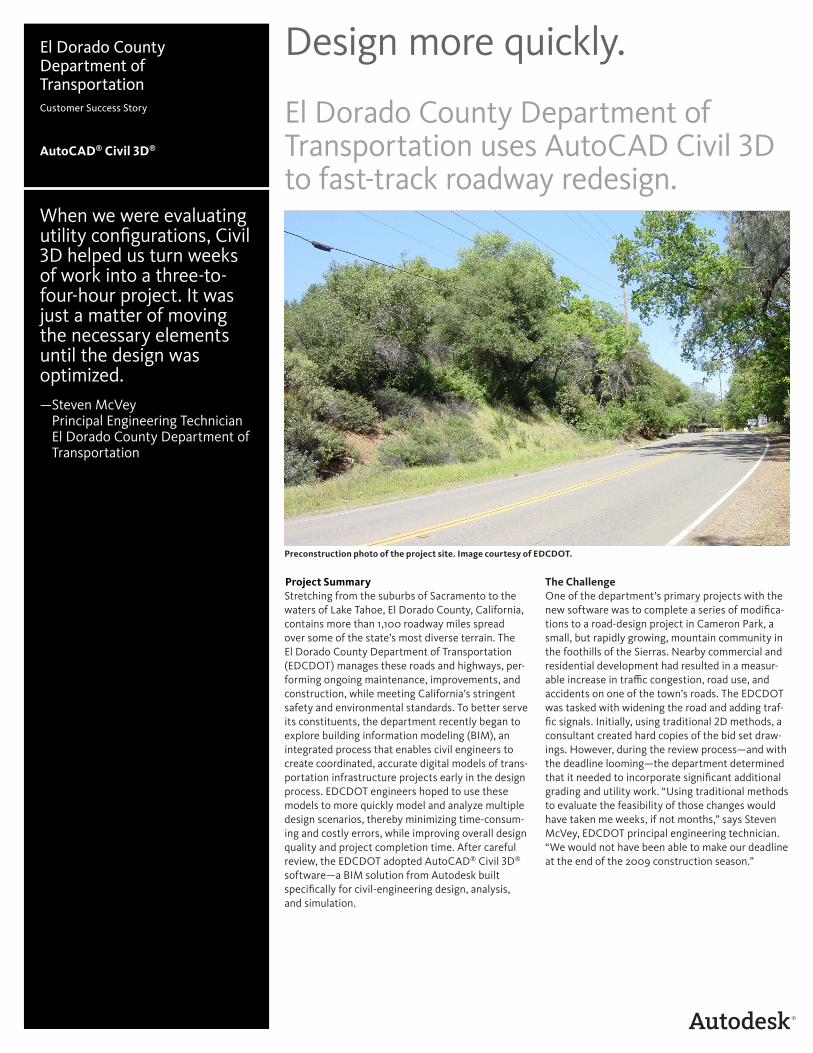
Preconstruction photo of the project site. Image courtesy of EDCDOT.
The SolutionThat is when department engineers decided to accelerate the redesign process with help from Civil 3D. Using the original 2D drawings as a starting point, the engineers more quickly built a 3D model of the existing roadway corridor. The engineers used this model as the foundation for multiple roadway design scenarios.
The dynamic nature of Civil 3D enabled them to adjust design elements within each scenario and more quickly see the impact of those changes on the surrounding right-of-way boundaries, trees, and utilities. As a result, the engineers were better able to select the most effective alternatives quickly. “For example, when we were evaluating utility configurations, Civil 3D helped us turn weeks of work into a three-to-four-hour proj-ect,” says McVey. “It was just a matter of moving the necessary elements until the design was optimized, staying within right-of-way and easements and avoid-ing environmental considerations.”
Make Last-Minute ChangesOnce the department had verified the feasibility of the proposed modifications, a local utility company requested a study of suitable locations for additional utility poles at the site. “We needed to locate the poles as far from the modifications as possible, while avoiding adjacent private property,” says McVey.
If the team members were using a traditional pro-cess, this type of late request would have resulted in unacceptable delays. However, using Civil 3D, the engineers moved the poles within the model to
help determine the best solution. “I could immedi-ately see any conflict with the pole, line, and new grading,” says McVey. When some of the engineers wanted to view cross sections of the proposed loca-tions, McVey automatically generated them from the Civil 3D model.
The model also enabled the engineers to evalu-ate the accuracy of the original 2D plans. In some cases, the engineers used what they learned from the model to tweak the grading to better fit the location. “Civil 3D helped us create a higher-quality design and reassure the County Board that the pro-posed modifications would actually work,” says McVey.
The ResultWith help from Civil 3D, the EDCDOT engineers determined that they could complete the utility relocation within the 2009 construction season and retain the construction schedule for overall project improvements. “We were able to incorporate all of the new design work into the original plans and send them out to bid on schedule,” says McVey. As a result, the EDCDOT completed the utility reloca-tion by the end of the 2009 season, helping enable the project to stay on schedule for construction in early 2010. Many other county Departments of Transportation are seeing similar results, using Civil 3D and other Autodesk BIM solutions to help finish road and highway projects more quickly and afford-ably throughout California.
For more information, visit www.autodesk.com/civil3d.
Civil 3D enabled designers to make changes and more quickly see their impact on right-of-way boundaries and utilities.
Autodesk, AutoCAD, and Civil 3D are registered trademarks or trademarks of Autodesk, Inc., and/or its subsidiaries and/or affiliates in the USA and/or other countries. All other brand names, product names, or trademarks belong to their respective holders. Autodesk reserves the right to alter product and services offerings, and specifications and pricing at any time without notice, and is not responsible for typographical or graphical errors that may appear in this document.
© 2010 Autodesk, Inc. All rights reserved.
Civil 3D helped us create a higher-quality design and reassure the County Board that the proposed modifications would actually work.—Steven McVey
Principal Engineering Technician El Dorado County Department of Transportation
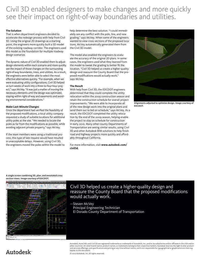
Alignments adjusted to optimize design. Image courtesy of EDCDOT.
A single screen combining 3D, plan, and annotated cross section views. Image courtesy of EDCDOT.