Design and Access Statement Volume I Part 1 of 9 Masterplan CANADA WATER MASTERPLAN Design and...
27
Design and Access Statement Volume I Part 1 of 9 Masterplan May 2018 Allies and Morrison
Transcript of Design and Access Statement Volume I Part 1 of 9 Masterplan CANADA WATER MASTERPLAN Design and...

Design and Access Statement Volume I Part 1 of 9Masterplan
May 2018
Allies and Morrison


DATE ISSUE NOTES
08/05/2018 P01 Planning Issue
Document control register
Copyright © 2018 Allies and Morrison
No part of this document may be reproduced without the prior consent of the client. This document is prepared in support of the Canada Water Masterplan. Allies and Morrison and its collaborators are not responsible for nor shall be liable for the consequences of any use made of this Report other than that for which it was prepared by Allies and Morrison for the Client unless Allies and Morrison provide prior written authorisation for such other use and confirms
in writing that the Report is suitable for it. It is acknowledged by the parties that this Report has been produced solely in accordance with the Client’s brief and instructions and without any knowledge of or reference to any other parties’ potential interests in or proposals for the Project.
Every effort has been made to acknowledge the source of photographs and illustrations; we apologise for any errors or omissions.
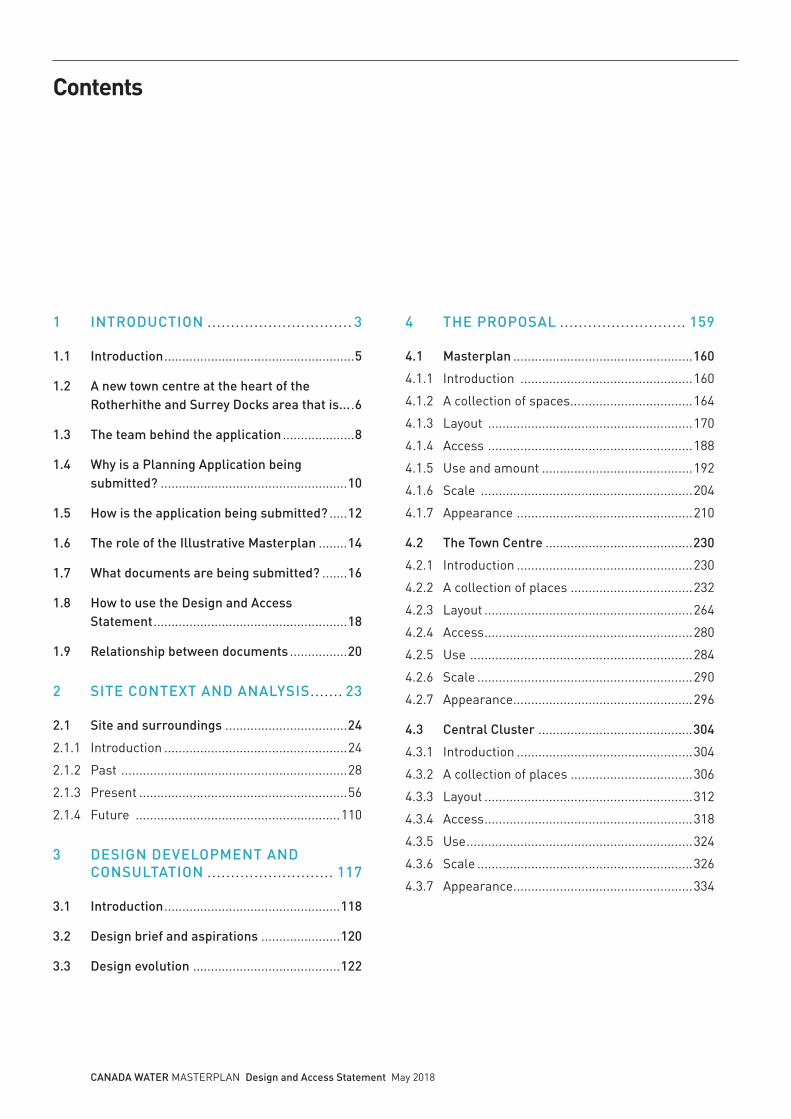
Contents
1 INTRODUCTION ............................... 3
1.1 Introduction .....................................................5
1.2 A new town centre at the heart of the Rotherhithe and Surrey Docks area that is... .6
1.3 The team behind the application ....................8
1.4 Why is a Planning Application being submitted? ....................................................10
1.5 How is the application being submitted? .....12
1.6 The role of the Illustrative Masterplan ........14
1.7 What documents are being submitted? .......16
1.8 How to use the Design and Access Statement ......................................................18
1.9 Relationship between documents ................20
2 SITE CONTEXT AND ANALYSIS ....... 23
2.1 Site and surroundings ..................................24
2.1.1 Introduction ...................................................24
2.1.2 Past ...............................................................28
2.1.3 Present ..........................................................56
2.1.4 Future .........................................................110
3 DESIGN DEVELOPMENT AND CONSULTATION ........................... 117
3.1 Introduction .................................................118
3.2 Design brief and aspirations ......................120
3.3 Design evolution .........................................122
4 THE PROPOSAL ........................... 159
4.1 Masterplan ..................................................160
4.1.1 Introduction ................................................160
4.1.2 A collection of spaces... ...............................164
4.1.3 Layout .........................................................170
4.1.4 Access .........................................................188
4.1.5 Use and amount ..........................................192
4.1.6 Scale ...........................................................204
4.1.7 Appearance .................................................210
4.2 The Town Centre .........................................230
4.2.1 Introduction .................................................230
4.2.2 A collection of places ..................................232
4.2.3 Layout ..........................................................264
4.2.4 Access ..........................................................280
4.2.5 Use ..............................................................284
4.2.6 Scale ............................................................290
4.2.7 Appearance ..................................................296
4.3 Central Cluster ...........................................304
4.3.1 Introduction .................................................304
4.3.2 A collection of places ..................................306
4.3.3 Layout ..........................................................312
4.3.4 Access ..........................................................318
4.3.5 Use ...............................................................324
4.3.6 Scale ............................................................326
4.3.7 Appearance ..................................................334
CANADA WATER MASTERPLAN Design and Access Statement May 2018
4.4 Park Neighbourhood ...................................342
4.4.1 Introduction ................................................342
4.4.2 A collection of places ..................................344
4.4.3 Layout ..........................................................358
4.4.4 Access .........................................................372
4.4.5 Use ...............................................................376
4.4.6 Scale ............................................................386
4.4.7 Appearance .................................................390
5 TALL BUILDINGS ........................ 395
5.1 Introduction .................................................396
5.2 Planning policy and guidance .....................400
5.3 Tall Buildings in London ............................406
5.4 Creating a distinctive place in London – Tall Building Strategy .................................410
5.5 Strategic views ............................................416
5.6 Creating a Major Town Centre ....................418
5.7 Heritage and townscape character ............420
5.8 Design quality .............................................422
5.9 Appearance .................................................426
5.10 Tall Buildings assessment .........................430
6 ACCESS STATEMENT ................... 437
6.1 Introduction .................................................438
6.2 Public Realm access strategy.....................442
6.3 Transport connections ................................448
6.4 Design principles ........................................450
6.5 Appendix 1: References for inclusive design .................455
6.6 Appendix 2: Glossary of terminology .............................460
7 CONCLUSION ............................... 463
CANADA WATER MASTERPLAN Design and Access Statement May 2018

2 CANADA WATER MASTERPLAN Design and Access Statement May 2018

3 CANADA WATER MASTERPLAN Design and Access Statement May 2018
1 INTRODUCTION

4 CANADA WATER MASTERPLAN Design and Access Statement May 2018
Ontario Point
Southwark Park
Greenland Dock
Canada WaterDock
A1
London Bridge Station
Canada Water Station
Surrey Quays Station
A2
Aerial view of Canada Water (© Andrew Holt Photography & Aerial Photography)
Surrey QuaysShopping Centre

5 CANADA WATER MASTERPLAN Design and Access Statement May 2018
1.1 Introduction
The Canada Water Masterplan is an ambitious and transformative project that integrates a new network of pedestrian focused streets, parks, squares and open spaces with the surrounding community, and animates these public spaces with a wide range of activities from workspaces and dwellings to new cafés, restaurants and shops. The area covered by the Planning Application Boundary for the Canada Water Masterplan is 21.26 hectares.
This Design and Access Statement has been prepared by Allies and Morrison on behalf of the applicant BL CW Holdings Ltd (a subsidiary of British Land Company PLC), hereafter referred to as British Land.
This Design and Access Statement has been prepared to support a Hybrid Planning Application for the Canada Water Masterplan. This Design and Access Statement relates to the outline elements of the Development (the Outline Proposals). Separate Design and Access Statements have been prepared for the Detailed Proposals in relation to Plots A1, A2 and K1.
This introduction explains:
• The vision for the Canada Water Masterplan
• The team behind the Masterplan
• Why a Planning Application is being submitted
• How the application is being submitted
• What documents are being submitted
What happens next
Southwark Council will formally consult on our proposals. During the consultation period interested parties have the opportunity to make any representations.
Thank you for taking the time to read our submission.
K1
Rotherhithe Station
The Printworks
6 CANADA WATER MASTERPLAN Design and Access Statement May 2018
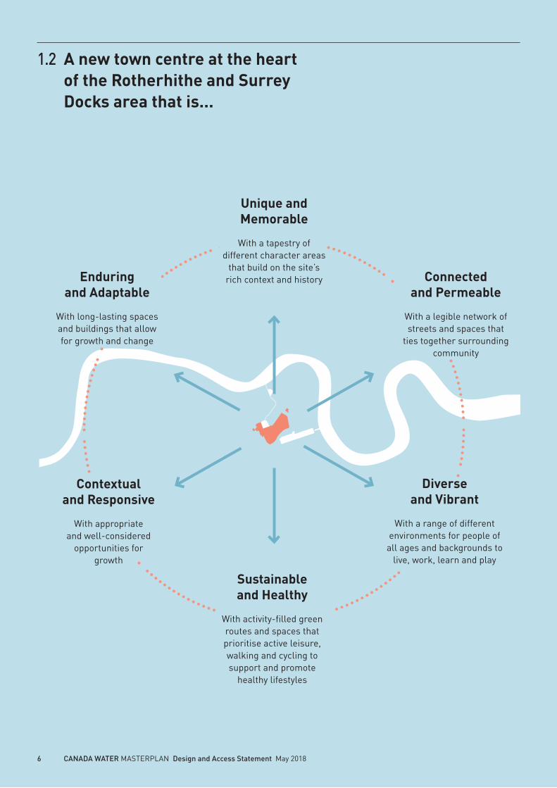
1.2 A new town centre at the heart of the Rotherhithe and Surrey Docks area that is...
Unique and Memorable
With a tapestry of different character areas
that build on the site’s rich context and history Connected
and Permeable
With a legible network of streets and spaces that
ties together surrounding community
Enduring and Adaptable
With long-lasting spaces and buildings that allow for growth and change
Contextual and Responsive
With appropriate and well-considered
opportunities for growth
Diverse and Vibrant
With a range of different environments for people of
all ages and backgrounds to live, work, learn and play
Sustainable and Healthy
With activity-filled green routes and spaces that prioritise active leisure, walking and cycling to support and promote
healthy lifestyles

7 CANADA WATER MASTERPLAN Design and Access Statement May 2018
The vision for the Canada Water Masterplan is to create a vibrant, inclusive, mixed-use urban centre. Comprising a wide range of uses, the Masterplan includes workspace, retail, leisure, community and public spaces, as well as new homes for a range of ages, incomes and life stages.
Place-making is at the heart of this vision, with a Public Realm that brings together a network of carefully considered, locally distinct public squares, parks and streets, each with a clear character, use and identity. The robust and high quality Public Realm will strengthen connections to neighbouring areas, promote an urban environment where the quality of life and the quality of the environment are integral. The spaces will be animated places that people will enjoy, want to spend time and feel safe in.
With an emphasis on health, wellbeing, sports and play, Canada Water will become a distinctive destination that makes a lasting contribution to the people who live, work and visit the area. Nature and the ecology of surrounding green and blue spaces are an important asset to draw into the Public Realm. The Public Realm has been designed to bring us closer together to each other and with nature, helping to create a sociable and sustainable place. British Land have brought these ambitions together in the Social Regeneration Charter, which sets out how the design, delivery and management of the Masterplan can support the existing and future communities to help these thrive.
8 CANADA WATER MASTERPLAN Design and Access Statement May 2018
1.3 The team behind the application
British Land
British Land is one of Europe’s largest publicly listed real estate companies. They own, manage, develop and finance a portfolio of high quality UK commercial property, focused on retail, London offices and residential.
British Land have been involved in discussions with Southwark Council in relation to Canada Water since 2013 and commenced consultation for the Masterplan in 2014. British Land are committed to working closely with Southwark Council, local residents and other key stakeholders to deliver a new town centre for Canada Water.
Allies and Morrison
Allies and Morrison is an architecture and urban planning practice based in Southwark.
Townshend Landscape Architects
Townshend are a landscape architecture practice based in London.
DP9
DP9 is established as one of the leading expert consultancies in planning, development and regeneration in the UK.
Soundings
Soundings act as an impartial voice in the development process to fully and transparently involve communities at each stage of design.
The Canada Water Masterplan team is led by British Land who have assembled a best-in-class team. Together, the team have the skills we need as we carefully consider and develop our proposals for the Canada Water Masterplan.
British Land’s success stories include some of London’s most popular places: Broadgate adjacent to Liverpool Street Station, Regent’s Place in the West End, and Paddington Central close to Paddington Station.
Here at Canada Water we are excited to partner with Southwark Council, the local community and other key stakeholders to deliver a new urban centre. In this unique joint venture Southwark Council has two separate functions as planning authority and freeholder of the majority of the Surrey Quays Shopping Centre and Printworks sites, and is closely involved in the development of the Masterplan.

9 CANADA WATER MASTERPLAN Design and Access Statement May 2018
Access Consultant
David Bonnet Associates
Acoustic Consultant
Sandy Brown
Arboricultural Consultant
Waterman Infrastructure & Environment
Cultural Consultant
Graham Devlin Associates
Daylight and Sunlight Consultant
Gordon Ingram Associates
SINC Consultant
London Wildlife Trust
Environmental and Infrastructure Consultant
Waterman Infrastructure and Environment
Fire Consultant
Olsson Fire and Risk
Legal Consultant
Herbert Smith Freehills
Lighting Consultant
Speirs and Major
Project and Cost Managers
AECOM
Security Consultant
QCIC
Socio-Economic and Housing Consultant
Quod
Sustainability and Energy Consultant
Arup
Townscape, Built Heritage and Visual Assessment Consultant
Tavernor Consultancy
Transport and Logistics Consultant
Arup
Verified Views
Miller Hare
Visualisation
Allies and Morrison, Cityscape Digital, Ninety90 and Pixelflakes
Wind Consultant
RWDI
10 CANADA WATER MASTERPLAN Design and Access Statement May 2018
1.4 Why is a Planning Application being submitted?
The Development requires a large number of changes to be made to the physical environment at Canada Water. These changes constitute development for which Planning Permission is required. This is to be obtained via a submission of an application for Planning Permission to Southwark Council.
The Design and Access Statement that you are now reading sets out the nature of the Development for which Planning Permission is sought.
This particular document has been prepared by Allies and Morrison and is submitted in support of a Hybrid Planning Application for the Canada Water Masterplan. The Hybrid Planning Application is made in relation to land bounded by Surrey Quays Road to the north, Lower Road (A200) to the west, Redriff Road (B205) to the south, Quebec Way to the east (the “Site”).
The Hybrid Planning Application seeks Planning Permissions for detailed development proposals of three Plots: A1, A2 and K1 for which no matters are reserved (“Detailed Proposals”), and outline development proposals for the remainder of the Site, with all matters reserved (Outline Proposal). The Detailed Proposals and Outline Proposal together are referred to as the “Development”.
The Development comprises the comprehensive redevelopment of:
• The Surrey Quays Shopping Centre
• Former Harmsworth Quays Printworks and Surrey Quays Leisure Park sites
• Dock Offices Courtyard
• Former Rotherhithe Police Station
• Land at Roberts Close
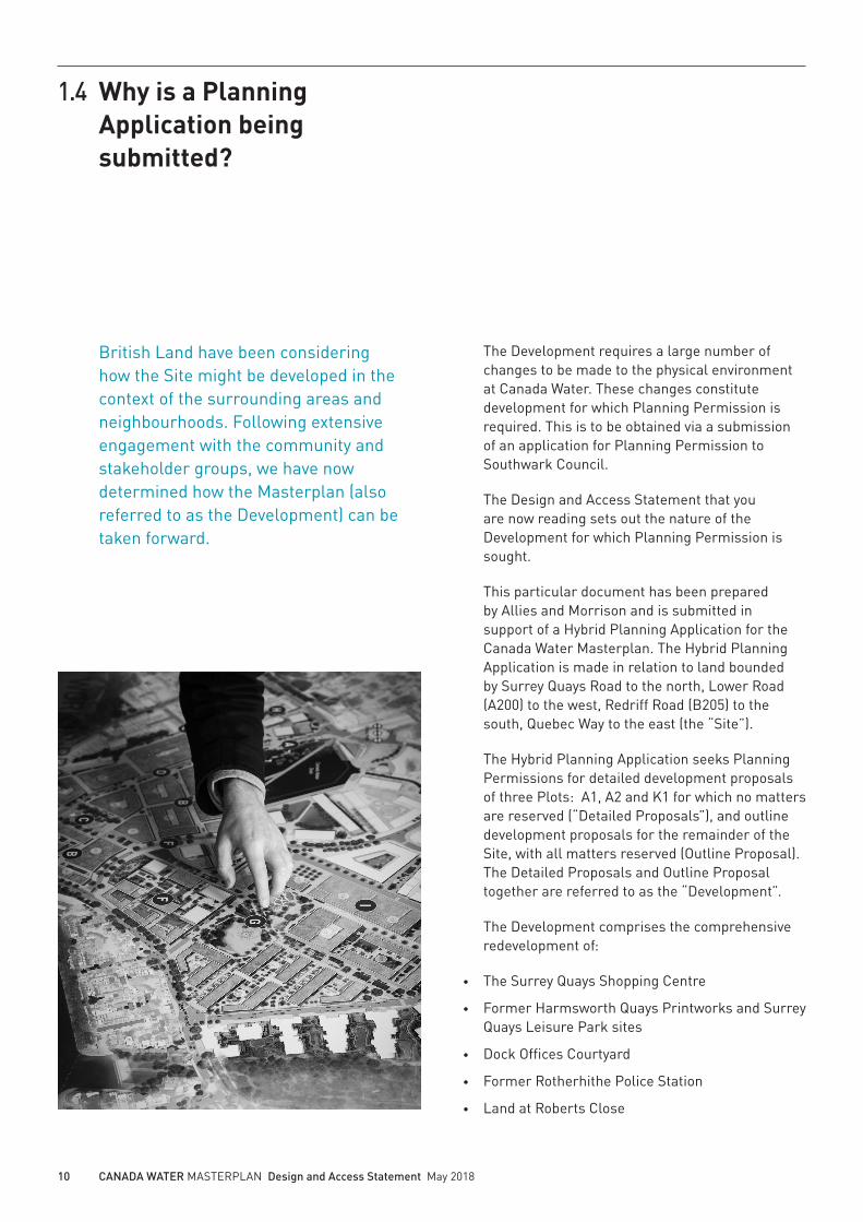
British Land have been considering how the Site might be developed in the context of the surrounding areas and neighbourhoods. Following extensive engagement with the community and stakeholder groups, we have now determined how the Masterplan (also referred to as the Development) can be taken forward.

11 CANADA WATER MASTERPLAN Design and Access Statement May 2018
The Development will provide new retail, office, leisure and community floorspace along with residential dwellings. The Development will also provide significant, high quality Public Realm, including a new Town Square, a new High Street and a public park. The Description of the Development is set out below.
Description of the Development
This Design and Access Statement is part of a Hybrid Planning Application seeking Outline Planning Permission with all matters reserved for the demolition of all existing structures and redevelopment comprising the following mix of uses:
• Retail (A1-A5)
• Workspace (B1)
• Hotel (C1)
• Residential (C3)
• Assisted living (C2)
• Student accommodation (Sui Generis)
• Leisure (including a cinema) (D2)
• Community facilities (including health and education uses) (D1)
• Public toilets (Sui Generis)
• Nightclub (Sui Generis)
• Flexible events space (Sui Generis)
• Energy centre (Sui Generis)
• Interim and permanent petrol filling station (Sui Generis)
• Primary electricity substation (Sui Generis)
• Secondary entrance for Surrey Quays Rail Station
• Park Pavilion
• Landscaping including open spaces and Public Realm, works to the Canada Water Dock, car parking, means of access, associated infrastructure and highways works
• Demolition or retention with alterations of the Press Hall and Spine Building of the Printworks
And seeking detailed planning permission for:
• Plot A1 to provide uses comprising retail (A1-A5), workspace (B1) and residential (C3)
• Plot A2 to provide uses comprising retail (A1-A5), workspace (B1) and a leisure centre (D2)
• Plot K1 to provide residential use (C3)

12 CANADA WATER MASTERPLAN Design and Access Statement May 2018
1.5 How is the application being submitted?
A Hybrid Planning Application is submitted to Southwark Council for approval. The application is made up of a large number of documents and drawings. This section explains the inter-relationship between the various documents submitted.
Outline Proposal
For the majority of the Site the application seeks Planning Permission in outline with all matters reserved. An outline permission does not approve the details of the Outline Proposal, but instead seeks to establish the principles in line with which future more detailed Reserved Matters applications will be considered, in terms of both the general scale of development and the land uses considered appropriate throughout the area of the site relating to the Outline Proposal.
In order to do this, the Outline Proposal sets out parameters for the layout, access, scale, appearance and landscaping of the Development. These are submitted for approval in three Control Documents called the Development Specification, the Parameter Plans and the Design Guidelines.
In order to help stakeholders to understand what sort of development an Outline Planning
Illustrative
Design and Access StatementVolume IMasterplan
Design and Access StatementVolume IIMasterplan Public Realm
Design and Access Statement Volume II Masterplan Public Realm
May 2018
Townshend Landscape Architects
Design and Access Statement Volume I Masterplan
May 2018
Allies and Morrison

13 CANADA WATER MASTERPLAN Design and Access Statement May 2018
Permission might allow to come forward, we have developed a scheme which is ‘indicative’ or illustrative of what could be built in accordance with the parameters to be approved. This is referred to in the application documents as the Illustrative Masterplan.
This scheme is only illustrative, and the actual detail of each part of the proposed Development (known as Development Zones) to be built will come forward only when Reserved Matters applications are made. In short, the Outline Planning Permission would set the rules which future detailed proposals would need to comply with.
The Parameter Plans and Development Specification describe the Development and outline the key elements of the application with regard to layout, access, use, amount, scale, appearance and landscape. The illustrations in this Design and Access Statement where these relate to
the Outline Proposals are consistent with the Parameter Plans but are presented as illustrative for information purposes only. A set of Design Guidelines that establish binding standards for how buildings will form streets and give enclosure to public spaces support the Design and Access Statement and the Parameter Plans.
Within the Design Guidelines there is a Project Glossary which sets out the key terms and definitions for the Hybrid Planning Application.
Detailed Proposals
The Hybrid Planning Application also comprises three further applications which are submitted as Detailed Proposals relating to Plots A1, A2 and K1. The Detailed Proposals seek approval for Access, Appearance, Landscaping, Layout and Scale.
Approved (Development Control documents)
Development Specification Design GuidelinesVolume IMasterplan
Design GuidelinesVolume IIMasterplan Public Realm
Parameter Plans
Development Specification
May 2018
DP9
Parameter Plans and Existing Site Plan
May 2018
Allies and Morrison
Design Guidelines Volume I Masterplan
May 2018
Allies and Morrison
Design Guidelines Volume II Masterplan Public Realm
May 2018
Townshend Landscape Architects

14 CANADA WATER MASTERPLAN Design and Access Statement May 2018
1.6 The role of the Illustrative Masterplan
An Illustrative Masterplan has been developed as part of the Planning Application process to support the Outline Proposal. It has resulted from a thorough assessment and evaluation of the site context described in Chapter 2. It has and will serve three main purposes identified in this section.
The parameters and principles which informed the Illustrative Masterplan have evolved from an understanding of the site context to promote the creation of a specific urban character while preserving the open-ended and dynamic possibilities required to sustain the future health of this new piece of city.
An Illustrative Masterplan has been utilised throughout the pre-application process to encapsulate one potential form of the Development in accordance with the parameters set by the Development Control Documents. This Illustrative Masterplan has been used as a vehicle to visualise the Applicant’s ambitions for the Site. The Development Control Documents from which the Illustrative Masterplan has been produced have evolved from an understanding of the site context to promote the creation of a specific urban character.
During the pre-application consultation stage and throughout this document, a number of plans, images and models have been presented, which provide a representation of one iteration of the Masterplan within the parameters set by the Development Control Documents. This representative version of the Masterplan is known as the Illustrative Masterplan, and this has been important tool in bringing forward the Masterplan as a vehicle from which to test and show the character of the Masterplan within its parameters. Throughout the pre-application and post application stages it fulfils a number of different roles.
Pre-application consultation stage
Throughout the pre-application stage the Illustrative Masterplan has acted as a vehicle for comment, to identify differing views on the potential form and character of the Masterplan. Those comments have been taken into account in the refining of the parameters for the Masterplan. This process is described in Chapter 3.

15 CANADA WATER MASTERPLAN Design and Access Statement May 2018
Environmental StatementVolume I Part 1 Main Chapters
May 2018
Waterman Infrastructure & Environment
Planning Application Form
May 2018
DP9
Pre-application consultation stage
VEHICLE FOR COMMENT AND CONSENSUS
Design documentation stage
INFORMATION SOURCE
Planning determination stage
REPRESENTATION OF DEVELOPMENT CONTROL DOCUMENTS
The role of the Illustrative Masterplan at each stage of the planning process
Design and Access Statement Volume I Masterplan
May 2018
Allies and Morrison
Design documentation stage
During the Masterplan design documentation stage, the Illustrative Masterplan has been used as a source of information to show the type of Development that could come forward in accordance with the parameters set by the Development Control Documents, being an illustration of the Development permitted by them. The Development to be permitted in accordance with the Development Control Documents, together with illustrations of this, is described in Chapter 4.
Planning determination stage
At the planning determination stage the Illustrative Masterplan acts as a visual aid, providing a representation of the Masterplan in accordance with the Development Control Documents, and an illustration of how those documents fit together to set the parameters for future Reserved Matters Applications.

16 CANADA WATER MASTERPLAN Design and Access Statement May 2018
Masterplan Outline Application
1. Planning Application Form
2. Planning Statement
3. Development Specification
4. Parameter Plans and Existing Site Plan
5. Design Guidelines Volume I: Masterplan
6. Design Guidelines Volume II: Masterplan Public Realm
7. Design and Access Statement Volume I: Masterplan
8. Design and Access Statement Volume II: Masterplan Public Realm
9. Transport Assessment
10. Housing Statement
11. Sustainability Strategy
12. Energy Strategy
13. Utilities and Services Infrastructure Strategy
14. Framework Construction Management Plan
15. Illustrative Phasing Plan
16. Statement of Community Involvement
17. Aviation Safeguarding Assessment
18. Radio and Television Interference Assessment
19. Social Regeneration Charter
20. Health Impact Assessment
21. Retail and Leisure Statement
22. Cultural Strategy
23. Equalities Statement
24. Open Space Strategy
25. Arboricultural Survey and Impact Assessment
26. Daylight and Sunlight Report
1.7 What documents are being submitted?
There is a suite of documents submitted for the Hybrid Planning Application. The documents submitted for planning approval for the Outline Proposals are the Development Specification, Parameter Plans and Design Guidelines. These form the Development Control Documents for the Planning Application.
In addition to these documents, a number of technical assessments are submitted to support the Development Control Documents in order to assess the impact of the Outline Proposal and the Detailed Proposals, including the Environmental Impact Assessment.
The adjacent list of application documents for the Canada Water Masterplan provides an overview of the documents submitted in support of the Outline Application and the Detailed Applications for Plot A1, Plot A2 and Plot K1.
Design and Access Statement Volume I Masterplan
May 2018
Allies and Morrison
Design Guidelines Volume I Masterplan
May 2018
Allies and Morrison
Design Guidelines Volume II Masterplan Public Realm
May 2018
Townshend Landscape Architects
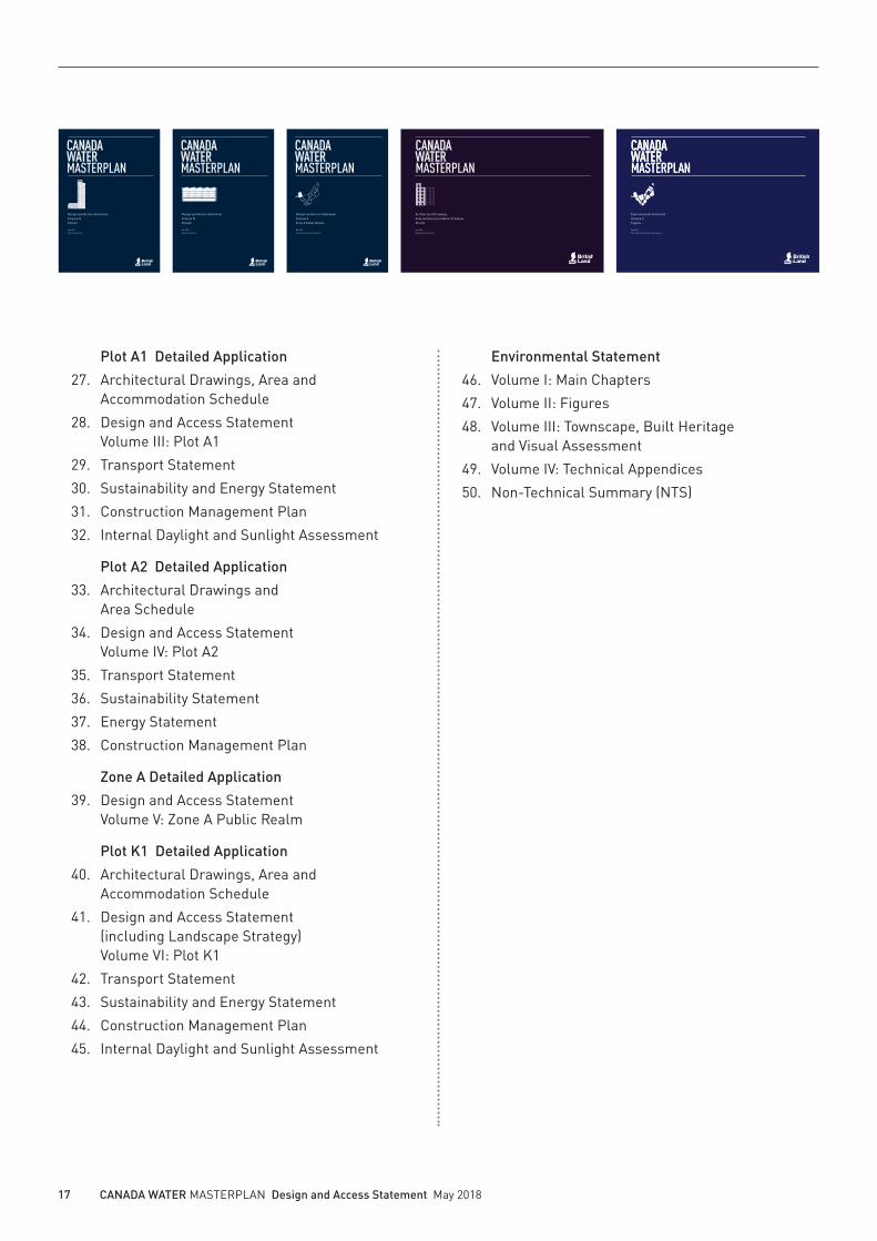
17 CANADA WATER MASTERPLAN Design and Access Statement May 2018
Plot A1 Detailed Application
27. Architectural Drawings, Area and Accommodation Schedule
28. Design and Access Statement Volume III: Plot A1
29. Transport Statement
30. Sustainability and Energy Statement
31. Construction Management Plan
32. Internal Daylight and Sunlight Assessment
Plot A2 Detailed Application
33. Architectural Drawings and Area Schedule
34. Design and Access Statement Volume IV: Plot A2
35. Transport Statement
36. Sustainability Statement
37. Energy Statement
38. Construction Management Plan
Zone A Detailed Application
39. Design and Access Statement Volume V: Zone A Public Realm
Plot K1 Detailed Application
40. Architectural Drawings, Area and Accommodation Schedule
41. Design and Access Statement (including Landscape Strategy) Volume VI: Plot K1
42. Transport Statement
43. Sustainability and Energy Statement
44. Construction Management Plan
45. Internal Daylight and Sunlight Assessment
Environmental Statement
46. Volume I: Main Chapters
47. Volume II: Figures
48. Volume III: Townscape, Built Heritage and Visual Assessment
49. Volume IV: Technical Appendices
50. Non-Technical Summary (NTS)
Design and Access Statement Volume IV Plot A2
May 2018
Allies and Morrison
Design and Access Statement Volume V Zone A Public Realm
May 2018
Townshend Landscape Architects
Design and Access Statement Volume III Plot A1
May 2018
Allies and Morrison
Architectural Drawings,Area and Accommodation Schedule Plot K1
May 2018
Duggan Morris Architects
Environmental StatementVolume IIFigures
May 2018
Waterman Infrastructure & Environment

18 CANADA WATER MASTERPLAN Design and Access Statement May 2018
Purpose of the Design and Access Statement
The format and content of the Design and Access Statement has been based upon the guidance developed by CABE in their publication “Design and Access Statements – How to write, read and use them” and DCLG’s Planning Practice Guidance (2014). This Design and Access Statement has also been prepared in line with the requirements, section 9 of the Town and Country Planning (Development Management Procedure) (England) Order 2015 (as amended), titled “Design and Access Statements”. Based on this the Design and Access Statement needs to:
• Explain the evolutionary process of the development and the thinking behind the final design
• Show how the design of the proposal has taken into account the nature of the surrounding area and how it helps improve the environment
• Show that the Applicant has considered how everyone, including disabled people, people with pushchairs and older people can use the buildings
1.8 How to use the Design and Access Statement
The Design and Access Statement is submitted in a number of volumes for the Outline Proposal and Detailed Proposals. The Design and Access Statement is illustrative and is therefore not submitted for approval. The role of the Design and Access Statement is explained in this section.
Outline Proposal
Design and Access StatementVolume IMasterplan
Design and Access StatementVolume IIMasterplan Public Realm
Design and Access Statement Volume II Masterplan Public Realm
May 2018
Townshend Landscape Architects
Design and Access Statement Volume I Masterplan
May 2018
Allies and Morrison

19 CANADA WATER MASTERPLAN Design and Access Statement May 2018
Volume I is arranged into the following chapters which cover assessment, involvement and evaluation of the design as follows:
Chapter 1: Introduction Explains the vision for Canada Water and the structure of the application
Chapter 2: Site context and analysis Assesses the attributes of the physical, social, economic and planning context which have guided the design proposals
Chapter 3: Design development and consultation Describes community and stakeholder involvement in the process of developing and evaluating the Masterplan
Chapter 4: The proposal Explains the design principles for the Masterplan which underpin the Development Control Documents. The principles are set out for each Character Area and are organised into topic areas or sections on layout, access, use and
amount, scale and appearance. These categories correspond with the structure of the Design Guidelines for the Outline Proposal.
Throughout this chapter, tinted pages provide additional information to explain the design principles, such as scale, typology and precedent studies.
Chapter 5: Tall buildings Explains and assesses the principles of the tall building strategy
Chapter 6: Access Statement Explains the principles incorporated for inclusive access
Chapter 7: Conclusion Summarises the design principles of the Masterplan
Volume II is focussed on the Public Realm design. Volumes III, IV, V, VI and VII address the Detailed Proposals.
WORKING DRAFT – Not for disclosure170 CANADA WATER MASTERPLAN Design and Access Statement 8 February 2018
A flexible framework
The Masterplan is a flexible framework for development and Development Zones are one of the most important ways of ensuring this flexibility. They achieve this firstly by allowing variation in how they can be subdivided into building plots, and secondly, with Limits of Deviation at their edges. These Limits of Deviation allow Development Zones (and their inverse, the main Public Realm) to adjust in position as the Masterplan develops.
Parameter Plans and Design Guidelines provide information about how to work within the Development Zones framework.
Parameter Plan CWM-AAM-MP-ZZ-DR-A-07003 ‘Proposed Development Zones and Public Realm’
Design Guidelines MP 2.1 and MP 2.2
Design Guideline MP 3.1 and MP 3.2
A1
A2
B
M
C
D
E
F
G
H
J
L
K
Main Public Realm
Delivering diverse, generous and high-quality Public Realm is one of the main commitments of the Masterplan. A minimum area of Public Realm has therefore been fixed. The mechanisms used for adjustments of Development Zone boundaries allow movement, but not reductions in the areas and dimensions of the Public Realm.
Parameter Plan CWM-AAM-MP-ZZ-DR-A-07003 ‘Proposed Development Zones and Public Realm’
Design Guidelines MP 3.3 to MP 3.4
P
N
4 The Proposal // Masterplan
WORKING DRAFT – Not for disclosure264 CANADA WATER MASTERPLAN Design and Access Statement 8 February 2018
4 The Proposal // Town Centre
LONG ACRE
Camden, London
• Width: 14m
• Length: 0.5 km
• Building heights: 3-6 storeys
• Footpath width: 2.7-5m
• Trees: no
• Traffic restriction: no
• Traffic lanes: 1 + street parking
OXFORD STREET
Westminster, London
• Width: 25m
• Length: 1.9 km
• Building heights: 4-9 storeys
• Footpath width: 6-9m
• Trees: yes
• Traffic restriction: public transport and taxis during peak hours
• Traffic lanes: 2
DEAL PORTERS WAY
Canada Water, Southwark, London
• Width: 20m
• Length: 0.5 km
• Building heights: 3-6 storeys
• Footpath width: 6m
• Trees: yes
• Traffic restriction: public transport, servicing vehicles and taxis during peak hours
• Traffic lanes: 2
DE
AL
PO
RT
ER
S W
AY
O X F O R D S T R E E T
L O NG A
C R E
SCALE COMPARISON:LONDON HIGH STREETS
This section is a high-level scale comparison of selected London high streets. These examples provide a reference to understand the scale and character proposed for Deal Porters Way as a new London high street.
N0 100m50m
WORKING DRAFT – Not for disclosure171 CANADA WATER MASTERPLAN Design and Access Statement 8 February 2018
Building on the history of the Site
The Site has a rich history. The Masterplan layout incorporates part of that history by following the approximate alignment of the historic Dock Walls and accommodating the footprint of existing landmark buildings or roads such as the Printworks or Surrey Quays Road.
Parameter Plan CWM-AAM-MP-ZZ-DR-A-07003 ‘Proposed Development Zones and Public Realm’
Well-defined spaces
The success of the Public Realm depends, among other things, on the clear definition of its edges. The consistency of building lines facing the Public Realm are critical to achieving a good sense of enclosure.
Given that the majority of public spaces are defined by more than one Development Zone, Parameter Plans and Design Guidelines set out alignments, views, and other relationships between Development Zones to avoid any detrimental impact on the quality of the public realm.
Parameter Plan CWM-AAM-MP-ZZ-DR-A-07004 ‘Proposed Building Lines’
Design Guidelines MP 2.7 to MP 2.14
Design Guidelines MP 3.3 to MP 3.13
4 The Proposal // Masterplan
WORKING DRAFT – Not for disclosure265 CANADA WATER MASTERPLAN Design and Access Statement 8 February 2018
4 The Proposal // Town Centre
Deal Porters Way – illustrative street view Deal Porters Way – typical section
Oxford Street – typical section
Long Acre– typical section
Oxford Street – street view
Long Acre – street view
30m
25m
36m
14m
26m
21m
25m
20m
25m
In the Design and Access Statement each design principle is explained, illustrated and cross-referenced to the relevant Control Document (Parameter Plans, Design Guidelines and Development Specification).
Tinted pages provide additional information to explain aspects of the design principles using scale comparisons, building typology studies and precedent studies.

20 CANADA WATER MASTERPLAN Design and Access Statement May 2018
1.9 Relationship between documents
Design and Access Statement(Illustrative)
Design Guidelines(Approved)
The Design and Access Statement document structure used to describe the Masterplan is mirrored in the document structure used in the Design Guidelines as shown in the adjacent spread. This parallel structure enables clear cross-referencing between the explanation of a design principle in the Design and Access Statement and the relevant parameter plan or design guideline which secures the principle. This also avoids the duplication of illustrative information and enables both documents to be understood together each with a clear purpose.
Each document organises the information into chapters relating to the Masterplan, the Town Centre, the Central Cluster, the Park Neighbourhood and Tall Buildings. In both documents, each chapter is then organised into topic areas or sections on layout, access, use and amount, scale and appearance.
Design and Access Statement Volume I Masterplan
May 2018
Allies and Morrison
Design Guidelines Volume I Masterplan
May 2018
Allies and Morrison

21 CANADA WATER MASTERPLAN Design and Access Statement May 2018
WORKING DRAFT – Not for disclosure WORKING DRAFT – Not for disclosure CANADA WATER MASTERPLAN Design Guidelines May 2018
Contents
1 INTRODUCTION .......................... 3
1.1 Introduction ................................................5
1.3 Why is a Planning Application being submitted? .................................................8
1.4 How is the application being submitted? .10
1.5 Relationship between documents ...........12
1.6 How to use the Design Guidelines ...........14
MP MASTERPLAN ...........................17
MP1 Building type variety .................................22
MP2 Development Zones .................................27
MP3 Building Lines ..........................................32
MP4 Vehicular access ......................................38
MP5 Land use ...................................................41
MP6 Maximum heights.....................................43
MP7 Appearance ..............................................47
TC TOWN CENTRE ..........................55
TC1 Layout .......................................................60
TC2 Access ......................................................64
TC3 Use ...........................................................66
TC4 Scale .........................................................68
TC5 Appearance ..............................................69
TC6 Landmark Building ..................................75
CC CENTRAL CLUSTER ...................79
CC1 Layout .......................................................84
CC2 Access ......................................................85
CC3 Use ...........................................................87
CC4 Scale .........................................................88
CC5 Appearance ..............................................89
PN PARK NEIGHBOURHOOD ............91
PN1 Layout .......................................................96
PN2 Access ......................................................99
PN3 Use .........................................................101
PN4 Scale .......................................................103
PN5 Appearance ............................................104
PN6 Printworks reuse ....................................106
TB TALL BUILDINGS ..................... 111
PROJECT GLOSSARY ................ 121
Contents
1 INTRODUCTION ............................... 3
1.1 Introduction .....................................................5
1.2 A new town centre at the heart of the Rotherhithe and Surrey Docks area that is... .6
1.3 The team behind the application ....................8
1.4 Why is a Planning Application being submitted? ....................................................10
1.5 How is the application being submitted? .....12
1.6 The role of the Illustrative Masterplan ........14
1.7 What documents are being submitted? .......16
1.8 How to use the Design and Access Statement ......................................................18
1.9 Relationship between documents ................20
2 SITE CONTEXT AND ANALYSIS ....... 23
2.1 Site and surroundings ..................................24
2.1.1 Introduction ...................................................24
2.1.2 Past ...............................................................28
2.1.3 Present ..........................................................56
2.1.4 Future .........................................................110
3 DESIGN DEVELOPMENT AND CONSULTATION ........................... 117
3.1 Introduction .................................................118
3.2 Design brief and aspirations ......................120
3.3 Design evolution .........................................122
4 THE PROPOSAL ........................... 155
4.1 Masterplan ..................................................156
4.1.1 Introduction ................................................156
4.1.2 A collection of spaces... ...............................160
4.1.3 Layout .........................................................166
4.1.4 Access .........................................................184
4.1.5 Use and amount ..........................................188
4.1.6 Scale ...........................................................200
4.1.7 Appearance .................................................206
4.2 The Town Centre .........................................226
4.2.1 Introduction .................................................226
4.2.2 A collection of places ..................................228
4.2.3 Layout ..........................................................260
4.2.4 Access ..........................................................276
4.2.5 Use ..............................................................280
4.2.6 Scale ............................................................286
4.2.7 Appearance ..................................................292
4.3 Central Cluster ...........................................300
4.3.1 Introduction .................................................300
4.3.2 A collection of places ..................................302
4.3.3 Layout ..........................................................308
4.3.4 Access ..........................................................314
4.3.5 Use ...............................................................320
4.3.6 Scale ............................................................322
4.3.7 Appearance ..................................................330
WORKING DRAFT – Not for disclosure CANADA WATER MASTERPLAN Design and Access Statement May 2018
4.4 Park Neighbourhood ...................................338
4.4.1 Introduction ................................................338
4.4.2 A collection of places ..................................340
4.4.3 Layout ..........................................................354
4.4.4 Access .........................................................368
4.4.5 Use ...............................................................372
4.4.6 Scale ............................................................382
4.4.7 Appearance .................................................386
5 TALL BUILDINGS ........................ 391
5.1 Introduction .................................................392
5.2 Planning policy and guidance .....................396
5.3 Tall Buildings in London ............................402
5.4 Creating a distinctive place in London – Tall Building Strategy ........................................406
5.5 Strategic views ............................................412
5.6 Creating a Major Town Centre ....................414
5.7 Heritage and townscape character ............416
5.8 Design quality .............................................418
5.9 Appearance .................................................422
5.10 Tall Buildings assessment .........................426
6 ACCESS STATEMENT ................... 433
6.1 Introduction .................................................434
6.2 Public Realm access strategy.....................438
6.3 Transport connections ................................444
6.4 Design principles ........................................446
6.5 Appendix 1: References for inclusive design 451
6.6 Appendix 2: Glossary of terminology .........456
7 CONCLUSION ............................... 459
WORKING DRAFT – Not for disclosure CANADA WATER MASTERPLAN Design and Access Statement May 2018 WORKING DRAFT – Not for disclosure170 CANADA WATER MASTERPLAN Design and Access Statement March 2018
A flexible framework
The Masterplan is a flexible framework for development and Development Zones are one of the most important ways of ensuring this flexibility. They achieve this firstly by allowing variation in how they can be subdivided into building plots, and secondly, with Limits of Deviation at their edges. These Limits of Deviation allow Development Zones (and their inverse, the main Public Realm) to adjust in position as the Masterplan develops.
Parameter Plans and Design Guidelines provide information about how to work within the Development Zones framework.
Parameter Plan CWM-AAM-MP-ZZ-DR-A-07003 ‘Proposed Development Zones and Public Realm’
Design Guidelines MP 2.1 and MP 2.2
Design Guideline MP 3.1 and MP 3.2
A1
A2
B
M
C
D
E
F
G
H
J
L
K
Main Public Realm
Delivering diverse, generous and high-quality Public Realm is one of the main commitments of the Masterplan. A minimum area of Public Realm has therefore been fixed. The mechanisms used for adjustments of Development Zone boundaries allow movement, but not reductions in the areas and dimensions of the Public Realm.
Parameter Plan CWM-AAM-MP-ZZ-DR-A-07003 ‘Proposed Development Zones and Public Realm’
Design Guidelines MP 3.3 to MP 3.4
P
N
4 The Proposal // Masterplan
28 CANADA WATER MASTERPLAN Design Guidelines May 2018
Masterplan
L+/- 3m
+/- 3
m
L
+/- 3
m
+/- 3m
16m
min
.
at n
ew lo
catio
n
L
H
MP2.1 Fixed Development Zone Boundaries
Unannotated Development Zone Boundaries are fixed and must not deviate from their shown location.
Information for the use of the Parameter Plan.
MP2.2 Flexible Development Zone Boundaries
Development Zone Boundaries that are annotated with a limit of deviation (+/-) are flexible and could shift perpendicularly from the shown location by up to the distance indicated.
Shifted Development Zone Boundaries must remain within Planning Application boundaries.
Information for the use of the Parameter Plan.
MP2.3 Public Realm minimum widths
The minimum dimension of the Public Realm must be maintained. Where flexible Development Zone Boundaries are relocated under guideline MP 1.2, the Boundaries of adjacent Development Zones must move in parallel to preserve this minimum.
To safeguard the pedestrian movement network.
MP2.4 Parallel Development Zone Boundaries
Flexible Development Zone Boundaries drawn parallel on the Development Zone Parameter Plan should remain generally parallel when they are moved.
To safeguard the pedestrian movement network.
Fixed Development Zone
Flexible Development Zone Line
Limit of deviation
Flexible Development Zone Lines as drawn on Parameter Plan
Relocated Development Zone Lines
16m
min
.on
Par
am.
Plan
WORKING DRAFT – Not for disclosure170 CANADA WATER MASTERPLAN Design and Access Statement March 2018
A flexible framework
The Masterplan is a flexible framework for development and Development Zones are one of the most important ways of ensuring this flexibility. They achieve this firstly by allowing variation in how they can be subdivided into building plots, and secondly, with Limits of Deviation at their edges. These Limits of Deviation allow Development Zones (and their inverse, the main Public Realm) to adjust in position as the Masterplan develops.
Parameter Plans and Design Guidelines provide information about how to work within the Development Zones framework.
Parameter Plan CWM-AAM-MP-ZZ-DR-A-07003 ‘Proposed Development Zones and Public Realm’
Design Guidelines MP 2.1 and MP 2.2
Design Guideline MP 3.1 and MP 3.2
A1
A2
B
M
C
D
E
F
G
H
J
L
K
Main Public Realm
Delivering diverse, generous and high-quality Public Realm is one of the main commitments of the Masterplan. A minimum area of Public Realm has therefore been fixed. The mechanisms used for adjustments of Development Zone boundaries allow movement, but not reductions in the areas and dimensions of the Public Realm.
Parameter Plan CWM-AAM-MP-ZZ-DR-A-07003 ‘Proposed Development Zones and Public Realm’
Design Guidelines MP 3.3 to MP 3.4
P
N
4 The Proposal // Masterplan
28 CANADA WATER MASTERPLAN Design Guidelines May 2018
Masterplan
L+/- 3m
+/- 3
m
L
+/- 3
m
+/- 3m
16m
min
.
at n
ew lo
catio
n
L
H
MP2.1 Fixed Development Zone Boundaries
Unannotated Development Zone Boundaries are fixed and must not deviate from their shown location.
Information for the use of the Parameter Plan.
MP2.2 Flexible Development Zone Boundaries
Development Zone Boundaries that are annotated with a limit of deviation (+/-) are flexible and could shift perpendicularly from the shown location by up to the distance indicated.
Shifted Development Zone Boundaries must remain within Planning Application boundaries.
Information for the use of the Parameter Plan.
MP2.3 Public Realm minimum widths
The minimum dimension of the Public Realm must be maintained. Where flexible Development Zone Boundaries are relocated under guideline MP 1.2, the Boundaries of adjacent Development Zones must move in parallel to preserve this minimum.
To safeguard the pedestrian movement network.
MP2.4 Parallel Development Zone Boundaries
Flexible Development Zone Boundaries drawn parallel on the Development Zone Parameter Plan should remain generally parallel when they are moved.
To safeguard the pedestrian movement network.
Fixed Development Zone
Flexible Development Zone Line
Limit of deviation
Flexible Development Zone Lines as drawn on Parameter Plan
Relocated Development Zone Lines
16m
min
.on
Par
am.
Plan
Design and Access Statement contents page showing the chapters relating to the Masterplan, the Town Centre, the Central Cluster, the Park Neighbourhood and Tall Buildings
Design and Access Statement design principle and cross-reference to relevant Design Guideline
Design Guidelines contents page showing the chapters relating to the Masterplan, the Town Centre, the Central Cluster, the Park Neighbourhood and Tall Buildings
Key to chapters
Masterplan
Town Centre
Central Cluster
Park Neighbourhood
Tall Buildings


End of Part 1 of 9