Desert Foothills - Scottsdale, Arizona Foothills Character Area - Character Plan Table of Contents...
31
DesertFoothills CharacterPlan June 1999 T H E W E S T ’ S M O S T W E S T E R N T O W N C I T Y O F S C O T T S D A L E A R I Z O N A
Transcript of Desert Foothills - Scottsdale, Arizona Foothills Character Area - Character Plan Table of Contents...
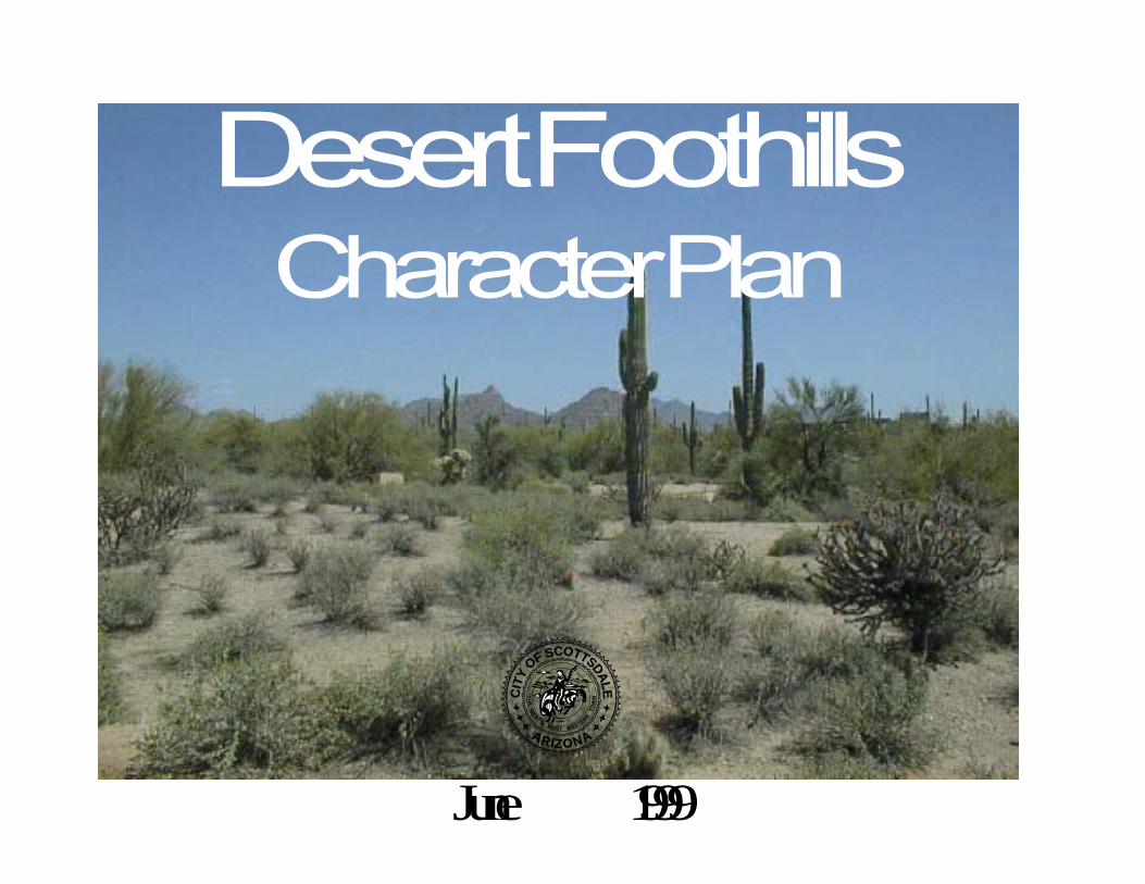
Desert FoothillsCharacter Plan
June 1999
TH
EW
EST’SMOST WESTERN
TO
WNC
ITY
OF SCOTTSDALE
ARIZONA
City CouncilSam Kathryn Campana, MayorCynthia Lukas, CouncilwomanMary Manross, CouncilwomanRobert Pettycrew, CouncilmanDennis Robbins, CouncilmanRichard Thomas, CouncilmanGeorge Zracket, Councilman
Desert FoothillsWorking GroupJohn AleoLes ConklinHoward MyersTony and Marg NelssenSue NoackJane RauBob Sanekoff
Planning CommissionMarilyn Armstrong, Vice-ChairJim BrouhardFred DavidsonBetty DrakeMargaret DunnKeith HolbenHarry Paston, Chairman
Community PlanningDebbi Dollar, Community Planning AdministratorMolly Edwards, Associate Community PlannerDon Hadder, Sr. Community PlannerGary Neiss, Community Planner

Desert Foothills Character Area - Character Plan
Table of Contents
• Character Planning Overview........................................................................................................... Pages i - iii
• Introduction ...................................................................................................................................... Pages 1 - 9
• Rural Desert Character ..................................................................................................................... Pages 10 - 11
• Goals and Strategies ......................................................................................................................... Pages 12 - 21
• Glossary ............................................................................................................................................ Pages 22 - 25
Character Planning Overview
Character Planning
Character planning resulted from the citizen driven CityShape2020 process. The CityShape 2020 Steering Committee’sComprehensive Report proposed changes to Scottsdale’s
General Plan by recommending a three-level, character-based planning approachand Six Guiding Principles all which seekto define the form, function and qualityof future development within the city.The three-level planning approachconsisted of:
• a citywide focus,• Character Areas, and• neighborhoods.
CityShape 2020 saw character planning as one way to maintainthe quality of planning and development in Scottsdale. DuringCityShape 2020 deliberations, there was a significant awarenessof the diversity across Scottsdale, and that the traditionalcitywide general planning did not recognize and celebrate thequality and value of these differences. Also, with much of thecity already developed and maturing while other areas
i
Level 1 - Citywide- Broad citywide gprinciples to guidethe physical develoof the community- Discussion onCommunity Form- Establishment ofCharacter Plan Appr- Creates the overskeleton (economictransportation, etc- Administrative pguidelines
Level 2 - Character Plan(City divided into 10-20character areas)- Vision and Role ofCharacter Area- Strategic Plan forCharacter Area- Focuses onImplementation
Level 3 - Neighborhood Plan- Detailed, specific level ofplanning- Small geographic area- Action Focused(Opportunity, ProblemSolving)
Scottsdale General PlaForm and FunctionGuiding Principles
Preserve Meaningful Open SpaceEnhance NeighborhoodsSupport Economic VitalitySeek SustainabilityAdvance TransportationValue Scottsdale's Unique Lifestyle and Character
emerging, there was a desire to focus planning on the specialneeds that different areas warranted. Character planning,together with the Six Guiding Principles from CityShape 2020,will help plan a future Scottsdale that is just as unique andspecial as the current Scottsdale.

Character Plans
The Purpose of Character Plans is to define, maintain orenhance a desired “character” for an area. “Character” can bethought of as the look, feel and history of a place – thosefactors which set it apart from other areas. For planningpurposes, the character of the area is first identified through anumber of factors such as the topographic setting, the age andstyle of housing, street patterns, predominant landscapingpatterns, land use patterns, dominant unifying open spaces,major barriers on the edges, and similar factors.
Twenty-four possible character areas have been identified andare illustrated on the adjacent map. These areas range fromundeveloped to almost fully developed, open low density tourban, and mostly residential to mostly business types of areas.In some cases there will be overlap between character areassince some areas include strong traits from both adjacent areas.Also, in some cases, areas outside of the city, but adjacent to acharacter area, that influence the character and functioning ofan area, will be included as part of the study.
Each character plan will most likely include a comprehensiveset of policies (as part of the overall Scottsdale General Plan -level 2), goals for the character area, and strategies to promotethe desired character for the area. The specific nature of thegoals and strategies for each character plan will likely differfrom plan to plan since the needs, desires, and character ofeach area will be relatively unique. Character plans involvemore than looking at just the physical layout of development orthe amount of open space to be provided. The emphasis on thephysical character of an area sets character plans apart from
ii
airp
ort
Salt River
104t
h S
T.
96th
ST
.
110t
h S
T.
124t
h S
T.
120t
h S
T.
136t
h S
T.
130t
h S
T.
PIM
A
HA
YD
EN
SC
OT
TS
DA
LE
64th
ST
.
56th
ST
.
McKELLIPS
McDOWELL
THOMAS
INDIAN SCHOOL
McDONALD
CHAPARRAL
INDIAN BEND
McCORMICK PKWY.
DOUBLE TREE
SHEA
CACTUS
THUNDERBIRD
GREENWAY
BELL/FRANK LLOYDWRIGHT BLVD.
OUTER LOOP
BEARDSLEY
JENNY LYNN
CIRCLE MOUNTAIN
HONDA BOW
ROCKAWAY HILLS
DESERT HILLS
JOY RANCH
STAGECOACH PASS
CAREFREE HWY.
DOVE VALLEY
LONE MOUNTAIN
DIXILETA
DYNAMITE
JOMAX
HAPPY VALLEY
PINNACLE PEAK
DEER VALLEY
CAMELBACK
UNION HILLS
��640 ac.
1 m
ile city of scottsdale, arizona
City Boundary
cave
creek
road
Recommended Study BoundaryMcDowell Sonoran Preserve
15
13
2
1 - 16
3
1
2
4
5
6
8
916
7
10
11
12
14B
C
G
E
D
H
A
F
Proposed Character AreasHigh PriorityA. Dynamite FoothillsB. BouldersC. Desert FoothillsD. Sonoran Regional CoreE. Airpark
Future
F. East SheaG. Indian BendH. Downtown
March 1999

prior planning studies and will offer design and characterconcepts that have not really been a part of previous planningstudies. Character plans will also include specificimplementation measures to support the plan. In addition,during the implementation phase there will be ongoingmonitoring and continual citizen involvement.
The character plan is part of the city’s General Plan and will beadministered as City policy with associated guidelines and animplementation plan. Character plans are not zoning or masterplans, particularly for specific parcels. They may recommendstrategies such as area-wide “district overlays” which willprovide guidelines that augment existing regulation, butcharacter plans are not a means to control and regulate specificproperties or proposals. They are not binding regulations,instead they will rely on a variety of other regulatory functionsto achieve the plan and goals. They will not include guaranteesor assurances that are not otherwise provided for in regulationsand processes included in the City code.
Character Planning Process
The typical Character Area planning process will include thefollowing major steps:
• Background research• Goal setting; issue identification; strategy, and concept
development• Review of Draft Policy Plan• Approval and adoption of Character Plan• Implementation
Background research includes collecting a wide range ofinformation and existing plans for the area such asenvironmental conditions, land uses, ownership, demographics,
public facilities and services, and geographic context.
Determining goals and issues is another phase of gatheringinformation. This phase may use the techniques of openhouses, workshops, neighborhood discussions, questionnaires,discussions between city staff, discussion with City Boards andCommissions and City Council, one on one communicationwith interested citizens and property owners or otherstakeholders, and public hearings, to gather the concerns,desires and perceptions of those interested in the particularcharacter area. Each character area study will likely involvesome of these methods at one time or another to best suit thearea being studied.
Goals and strategies to achieve the area’s “vision” will beincluded in a draft character plan. A companion document tothe Character Area Plan will be an Implementation plan. TheImplementation Plan will detail methods and actions to betaken to achieve the goals and strategies outlined in theCharacter Area Plan. The action items of the ImplementationPlan may contain ordinance and guideline changes, integrationwith the city budget, ongoing education and informationprograms and updates. The draft plan will be reviewed andrevised with the Planning Commission providing the ongoingdirection of the process.
The final phase involves the formal public hearing process fora recommended plan. The Planning Commission will holdtwo public hearings (one hearing may be held during thereview of the draft plan to provide further input) beforeforwarding a recommendation to the City Council. Thenthrough the hearing process, City Council will review theCharacter Plan. If the recommended Character Plan isapproved and adopted by the City Council, the implementationplan will get underway.
iii
Page 1Community Planning
IntroductionCharacter Plan
I n t r o d u c t i o nDesert Foothills Character Area - Character Plan
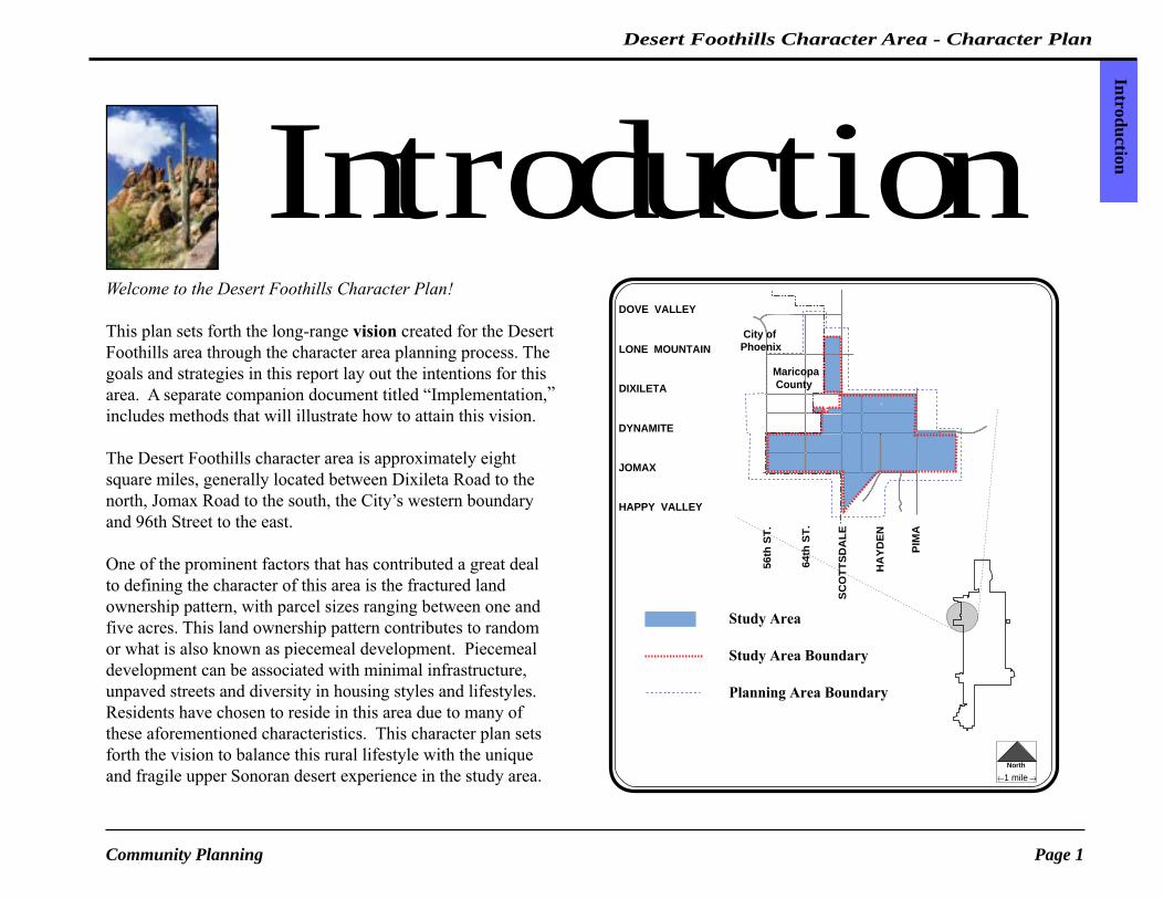
Welcome to the Desert Foothills Character Plan!
This plan sets forth the long-range vision created for the DesertFoothills area through the character area planning process. Thegoals and strategies in this report lay out the intentions for thisarea. A separate companion document titled “Implementation,”includes methods that will illustrate how to attain this vision.
The Desert Foothills character area is approximately eightsquare miles, generally located between Dixileta Road to thenorth, Jomax Road to the south, the City’s western boundaryand 96th Street to the east.
One of the prominent factors that has contributed a great dealto defining the character of this area is the fractured landownership pattern, with parcel sizes ranging between one andfive acres. This land ownership pattern contributes to randomor what is also known as piecemeal development. Piecemealdevelopment can be associated with minimal infrastructure,unpaved streets and diversity in housing styles and lifestyles.Residents have chosen to reside in this area due to many ofthese aforementioned characteristics. This character plan setsforth the vision to balance this rural lifestyle with the uniqueand fragile upper Sonoran desert experience in the study area.
Study Area
Study Area Boundary
Planning Area Boundary
Maricopa County
City ofPhoenix
DIXILETA
LONE MOUNTAIN
DOVE VALLEY
DYNAMITE
JOMAX
HAPPY VALLEY
North
1 mile
HA
YD
EN
PIM
A
64th
ST
.
56th
ST
.
SC
OT
TS
DA
LE

City of ScottsdalePage 2
Desert Foothills Character AreaIn
trod
uctio
n
Desert Foothills Character Area Study Process
Throughout the evolution of the Desert Foothills characterstudy, there has been a tremendous amount of participationfrom the residents and property owners of the area. The initialcontact between Community Planning, the residents andproperty owners was made in early June 1997. At this point intime, a newsletter that addressed many of the common
questions asked about character area plans was circulated to theDesert Foothills residents and property owners. In addition,several articles appeared in the local newspapers discussing theDesert Foothills character area and the long range planningprocess.
In early July 1997, a mail questionnaire was dispersed toapproximately 800 residents, property owners and local interest
of the Desert Foothills area. Thirty-three percent(33%) of these questionnaires were completed andreturned. The intent of the questionnaire was to gaugethe prevailing issues and trends and propagate somethoughts about the future of this area.
While the results of the questionnaire were beingtabulated, a “Background Report” was prepared. Thisdocument essentially tells the story of how the DesertFoothills area has evolved to where it is today. Itincludes the environmental and physical determinants,City policies and regulations, and demographicprojections specific to the Desert Foothills study area.
In late October 1997, both the “Background Report”and questionnaire results were shared with residentsand property owners at a public open house.Approximately 70 participants browsed thequestionnaire results, pictures, charts, maps andgraphics. The “Background Report” andquestionnaire results can be found in the appendices.
October 30, 1997 Desert Foothills Open HouseParticipants review survey results.

Page 3Community Planning
IntroductionCharacter Plan
The open house was followed by a series of neighborhooddiscussions between the Desert Foothills residents, propertyowners, and city staff. These discussion groups provided theopportunity for participants to discuss with each other and citystaff their ideas for preserving the rural identity of the DesertFoothills area.
In early April 1998, a workshop was conductedto summarize the neighborhood discussions andexplore the rural desert vision collaborately as agroup of neighborhoods. Similar to previousphases in the outreach program, all residents,property owners and local interest were invitedand encouraged to participate.
In late April 1998, at the direction of the Mayorand Council, the active character area plans wereplaced on hold pending the outcome of two verydifferent growth initiatives - one proposed by theState legislature and the other by the SierraClub.
During this hiatus, the number of inquiries fromresidents and property owners concerning thestatus of the Desert Foothills character areacontinued to escalate. Many of these inquiriesfocused on preserving the integrity of the sceniccorridors; massing of buildings, scale and color;and enhancing the continuity of the trail systemand natural open space.
In October 1998, due to these intensifying concerns,
January 29, 1998Desert Foothills Property Owners Association
- discussion.
Community Planning made a recommendation to City Councilto reopen the Desert Foothills character area study to furtherexamine these issues and establish a plan that preserves thecharacter of the Desert Foothills area.
After the 1998 holiday season, a working group composed of

City of ScottsdalePage 4
Desert Foothills Character AreaIn
trod
uctio
n
the leadership within the Desert Foothills area began to meet.The intent of this working group was to look at techniques forimplementing the Rural Desert vision and ensuring theirconstituents were kept informed through their outreachprograms (newsletters or association meetings).
The working group focused on how the circulation system, on-site development and public facilities could better be integratedinto the lush Sonoran desert and preserve and/or enhance therural lifestyle.
After the working group deliberations were concluded a draftof the Character Area and Implementation Plans were sharedwith the residents and property owners during an open houseand remote Planning Commission hearing in May 1999. Inaddition, numerous City Boards and Commissions receivedupdates of the character area and discussed the Plan’srecommendations before the Plan was forwarded on to the CityCouncil for adoption in the summer 1999.
The time line on the following page illustrates this extensivepublic outreach process. The public involvement was criticalin the formulation of the vision, goals and strategies and willcontinue to be just as important during the implementationphase of this character area plan.
January - March 1999Desert Foothills Working Group - discussions.

Page 5Community Planning
IntroductionCharacter Plan
Desert Foothills Character Area Community Outreach Program
Jun.
Jul.
Aug
.
Sept
.
Oct
.
Nov
.
Dec
.
Jan.
Feb
.
Mar
.
Apr
.
May
Jun.
1997 1998
PhaseFirst fact sheet dispersed "The Desert Foothills Character Area"
Mail Survey dispersed and responses receivedFirst Open House • survey results & fact sheet • background report & fact sheet
Background Report on City's Web PageInvitations to Participate in neighborhood discussion groupsNeighborhood discussions groups
Invitations to participate in workshop dispersedWorkshop • Rural Desert vision fact sheetNorthern Character Areas placed on-hold Working group forms and meetsUpdate City Boards, Commissionsand City CouncilDraft Character Area andImplementation Plan ReleasedOpen House notificationOpen House/PlanningCommission remote hearingCity Council Recommendation(approval or denial)Implementation
Notifications dispersed to residents, property owners and neighbors of study area
Public meeting held *Community Planning staff is committed to meet with any interested neighborhood or property owners organization during any phase of the study.
Information concerning progress of study released
ongoing *
Surveys received
Jul.
Aug
.
Sept
.
Oct
.
Nov
.
Dec
.
Jan.
Feb
.
Mar
.
Apr
.
May
Jun.
Jul.
Aug
.
Sept
.
Oct
.
Nov
.
1999
ongoing
City of ScottsdalePage 6
Desert Foothills Character AreaIn
trod
uctio
n
Fort McDowellMohave-Apache
Indian Reservation
Salt RiverPima-Maricopa
Indian Community
McDowellMountainRegional
Park
TontoNationalForest
NationalForest
PHOENIX
PARADISEVALLEY
PHOENIXTEMPE
CAVE CREEK
CAREFREE
SCOTTSDALE
CHANDLER
GILBERT
MESA
APACHEJUNCTION
GL
EN
DA
LE
PEORIA
NORTH
17
60
101
87
60
202202
202
202
101
51
10C
ave
Cre
ek R
oad
143
101
10
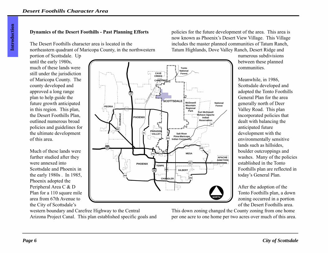
Dynamics of the Desert Foothills - Past Planning Efforts
The Desert Foothills character area is located in thenortheastern quadrant of Maricopa County, in the northwesternportion of Scottsdale. Upuntil the early 1980s,much of these lands werestill under the jurisdictionof Maricopa County. Thecounty developed andapproved a long rangeplan to help guide thefuture growth anticipatedin this region. This plan,the Desert Foothills Plan,outlined numerous broadpolicies and guidelines forthe ultimate developmentof this area.
Much of these lands werefurther studied after theywere annexed intoScottsdale and Phoenix inthe early 1980s . In 1985,Phoenix adopted thePeripheral Area C & DPlan for a 110 square milearea from 67th Avenue tothe City of Scottsdale’swestern boundary and Carefree Highway to the CentralArizona Project Canal. This plan established specific goals and
policies for the future development of the area. This area isnow known as Phoenix’s Desert View Village. This Villageincludes the master planned communities of Tatum Ranch,Tatum Highlands, Dove Valley Ranch, Desert Ridge and
numerous subdivisionsbetween these plannedcommunities.
Meanwhile, in 1986,Scottsdale developed andadopted the Tonto FoothillsGeneral Plan for the areagenerally north of DeerValley Road. This planincorporated policies thatdealt with balancing theanticipated futuredevelopment with theenvironmentally sensitivelands such as hillsides,boulder outcroppings andwashes. Many of the policiesestablished in the TontoFoothills plan are reflected intoday’s General Plan.
After the adoption of theTonto Foothills plan, a downzoning occurred in a portionof the Desert Foothills area.
This down zoning changed the County zoning from one homeper one acre to one home per two acres over much of this area.

Page 7Community Planning
IntroductionCharacter Plan
This in effect stopped the Government Land Office (G.L.O.)parcel lot splitting activity in the area and helped to preservethe desert and washes. As a result of this down zoning, thedeveloper of Bent Tree Estates sued the city. As part of an outof court settlement, the developer was allowed to revert back tothe original county zoning of one home per one acre. In latteryears, the developer of Monterra was also granted one acrezoning due to the precedence established in the Bent Tree suit.
Today, nestled between Phoenix and Scottsdale remainsapproximately four square miles of a county island. Thisgeneral area north of Dynamite, south of Lone Mountain, eastof 56th Street and west of the current City of Scottsdaleboundary was studied in the Black Mountain Area Plan, 1989.This plan mainly serves as an advisory document for thoseresiding and/or developing in this county island and desiring tobe considered for future annexation.
Whether Scottsdale and/or Phoenix annex this land remainsquestionable. The decision ultimately rests in the hands of theresidents and property owners of these lands and theacceptance from City Council. Presently, Scottsdale providesboth water and waster water services to the majority of thisarea, while Rural Metro provides fire protection. The Countyprovides all other services.
Today, the Desert Foothills area is approximately one-thirdbuilt out, however, the number of real estate transactions andbuilding permits are steadily escalating. This growing interestis based in individuals and families who desire a relativelyremote area and the lush upper Sonoran desert. This commonthread of experiencing and living in the desert is what attracts
Land Ownership
Community Planning - mac/gnei
Maricopa County
City ofPhoenix
City ofPhoenix
DIXILETA
LONE MOUNTAIN
DOVE VALLEY
DYNAMITE
JOMAX
HAPPY VALLEY
North
1 mile
HA
YD
EN
PIM
A
64th
ST
.
56th
ST
.
SC
OT
TS
DA
LE
Scottsdale, Arizona
Desert Foothills
State Land in Scottsdale
State Land in Phoenix
Primary Planning Boundary
Contextual Study Boundary

City of ScottsdalePage 8
Desert Foothills Character AreaIn
trod
uctio
n
many families to the area. However, more desert is beingtransformed into homes as more people choose to reside in thearea.
In 1996, in response to the rapid growth being experienced innorth Scottsdale, the City Council appointed the DesertPreservation Task Force to develop a plan to preserve theSonoran Desert. The mission of the Task Force was:
“Recommend implementation of a strategic plan topreserve the Sonoran Desert and retain and enhancethe unique character of our community.”
In April 1997, the Task Force’s Strategic Plan was presented toCity Council. This plan included definitions of meaningfuldesert open space, open space standards, trailrecommendations, and a desert open space system as shown onthe map to the right. This desert open space system will linkto scenic corridors such as the Desert Foothills Scenic Drivealong Scottsdale Road.
The majority of this land in the desert open space system isunder the jurisdiction of the State Land Trust. A relatively newprogram within the State Land department, the ArizonaPreserve Initiative (A.P.I.) allows local governments to requestportions of State lands within their jurisdiction to bereclassified for conservation purposes. This request ifapproved would give the city the opportunity to purchase theland for conservation purposes and remove any potential forfuture development.
Scottsdale submitted their request for this land in late 1998. It
City
Bou
ndar
y
cave
creek
road
C. A. P.
CANAL
airp
ort
TontoNationalForest
CAMP CREEK W
ASH
CAV
E C
RE
EK
WA
SH
McDowellMountainRegionalPark
McDowellMountainRegionalPark
TontoNationalForest
City
Bou
ndar
y
N
City Boundary
city of scottsdale, arizonaNote: Map is for illustration purposesonly and is not to scale.1/99 Dsrtbs2
JENNY LYNN
CIRCLE MOUNTAIN
HONDA BOW
ROCKAWAY HILLS
DESERT HILLS
JOY RANCH
STAGECOACH PASS
CAREFREE HWY.
DOVE VALLEY
LONE MOUNTAIN
DIXILETA
DYNAMITE
JOMAX
HAPPY VALLEY
PINNACLE PEAK
DEER VALLEY
DOUBLE TREE
SHEA
CACTUS
THUNDERBIRD
GREENWAY
BELL/FRANK LLOYDWRIGHT BLVD.
OUTER LOOP
BEARDSLEY
UNION HILLS
PIM
A
HA
YD
EN
SC
OTT
SD
ALE
64th
ST.
56th
ST.
104t
h S
T.
96th
ST.
112t
h S
T.
120t
h S
T.
136t
h S
T.
144t
h S
t.
128t
h S
T.
Conservation Zoning (COS/HC)
RECOMMENDED STUDY BOUNDARY (RSB)FOR THE MCDOWELL SONORAN PRESERVE: 36,400 ACRES
Corridors and Linkages
16,460 Acre Original Recommended Study Boundary Used from 1995 to 1998 for Expenditures of Voter Approved Sales Tax Revenues
19,940 Acre Expanded Recommended Study BoundaryAugust 1998, Resolution No. 5143
Recommended Study Boundary for
Page 9Community Planning
IntroductionCharacter Plan
is anticipated that the State’s review process will take at leastone year. In the meantime, the citizens of Scottsdale havechosen to extend the .2% sales tax to purchase preserve land inthe McDowell Mountains to the lands outlined in the adjacentmap. Whether all or a portion of these lands are preserved inthe future isuncertain. Thesuccess is dependenton the State LandTrust reclassificationof the state lands,additional fundingsources and priorityof land acquisitions.However, ifScottsdale issuccessful inpreserving theselands, the total desertand mountainpreserve would equal35 square miles or theapproximate size ofthe city of Chandler.
In addition to the desert open space system, the PreservationCommission forwarded a series of recommendations for sceniccorridors in late 1998. These recommendations set forth anambitious vision to preserve the integrity of scenic corridors bybanning temporary signs, limiting lights, maintaining views ofdistant mountains, blending infrastructure into the naturaldesert setting and widening the scenic setbacks.
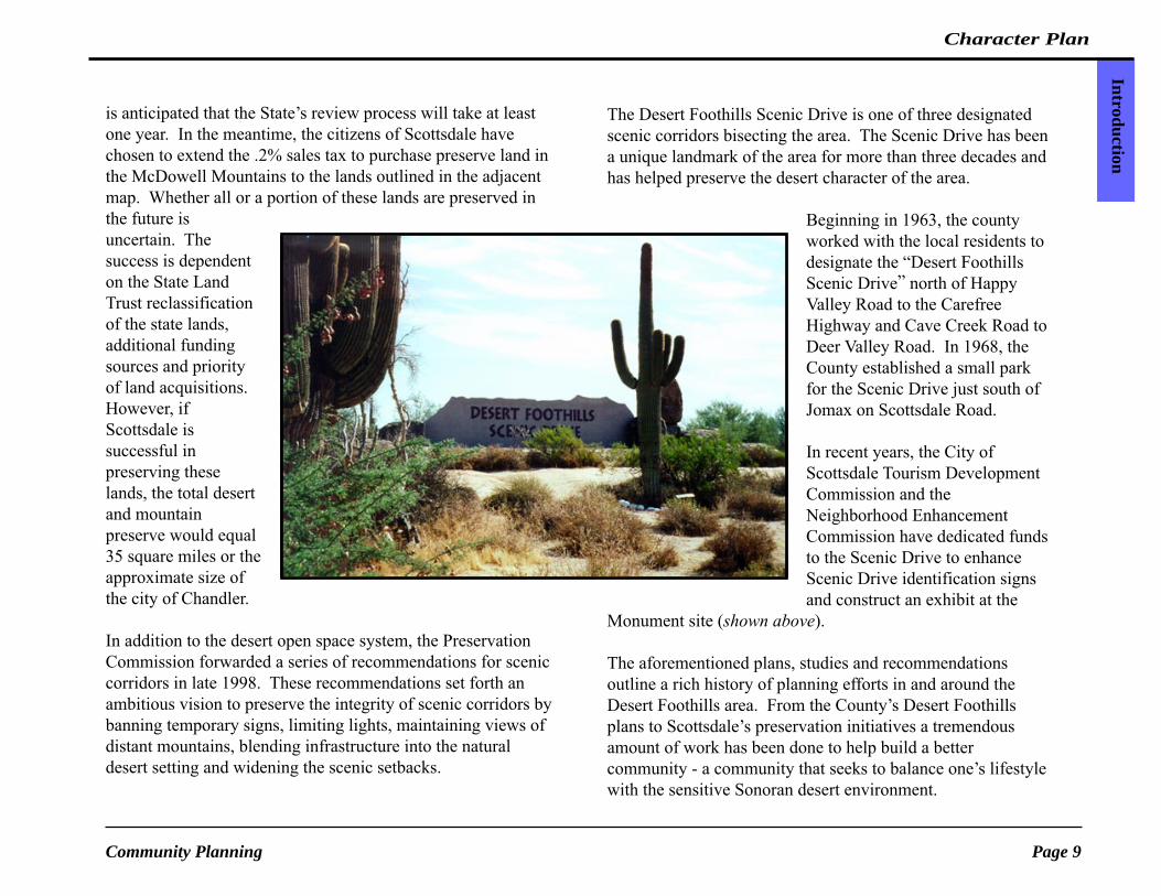
The Desert Foothills Scenic Drive is one of three designatedscenic corridors bisecting the area. The Scenic Drive has beena unique landmark of the area for more than three decades andhas helped preserve the desert character of the area.
Beginning in 1963, the countyworked with the local residents todesignate the “Desert FoothillsScenic Drive” north of HappyValley Road to the CarefreeHighway and Cave Creek Road toDeer Valley Road. In 1968, theCounty established a small parkfor the Scenic Drive just south ofJomax on Scottsdale Road.
In recent years, the City ofScottsdale Tourism DevelopmentCommission and theNeighborhood EnhancementCommission have dedicated fundsto the Scenic Drive to enhanceScenic Drive identification signsand construct an exhibit at the
Monument site (shown above).
The aforementioned plans, studies and recommendationsoutline a rich history of planning efforts in and around theDesert Foothills area. From the County’s Desert Foothillsplans to Scottsdale’s preservation initiatives a tremendousamount of work has been done to help build a bettercommunity - a community that seeks to balance one’s lifestylewith the sensitive Sonoran desert environment.

City of ScottsdalePage 10
Desert Foothills Character AreaR
ural
Des
ert
Cha
ract
er
Desert Foothills - Rural Desert Character
Through an extensive citizen participation process,the residents and property owners of the DesertFoothills area have consistently stated their desireto be “caretakers” of the Sonoran desert andmaintain a Rural Desert character in the DesertFoothills area. The lush upper Sonoran desertvegetation and the rural lifestyle already existing inthe area are key elements which have attractedmany of the residents and property owners to thisunique region of the city. Maintaining undisturbeddesert open space while balancing the qualities ofthe rural lifestyle is crucial to achieving this RuralDesert character.
Defining “rural” can be quite subjective, in part thismay be a result of the independent and diverselifestyles of individuals living in and owning landin these rural areas. One common thread does existwhich binds these diverse lifestyles together, thepreservation and continuity of desert open space.The Palo Verde-Saguaro plant community, one ofthe most scenic and lush plant communities in the Sonoran
Rural Desert Character
Scenery looking east from Lone Mountain & Scottdale Roads

Character Plan
Page 11Community Planning
Rural D
esertC
haracter
desert, can be found throughout the majority of the study area.The dominance and continuity of the Sonoran desert in concertwith the diverse and open pattern of homes are the predominantelements that help define the Rural Desert character in theDesert Foothills area.
Maintaining both functionaland visual linkages throughconnecting undisturbed desertopen space is a key componentin achieving the Rural Desertvision. Functional linkagesexist through shared-use trailsthat provide access to amultitude of non-motorizeduser groups. These linkageswould connect localneighborhoods to a regionalshared-use trail system andother designations such asdesert preserves, vistacorridors and otherjurisdictions. Visual linkages provide important vista andscenic corridors that help to preserve the sense of opennessexperienced in rural areas. These linkages also provideimportant migration, feeding and habitat for the indigenouswildlife.
Equestrian activity is one of the dominant lifestyles foundwithin the Desert Foothills area. The area is comprised of avariety of equestrian facilities, both in residential andcommercial scales. The sensitive integration of these facilitiesinto the natural desert setting and adjacent neighborhoods are
crucial in maintaining the visual dominance of the Sonorandesert.
The study area is predominantly comprised of low residentialdensities, typically one home for each one to five acres.
Residents currently living in theDesert Foothills area are generallywilling to travel longer distances forservices and employment. Thisremote lifestyle is what attractedmany of the residents and propertyowners to this region of the city.However, this lifestyle must bebalanced with air quality issues,infrastructure requirements andsustainable development patternswhich are important to the future ofthe valley. Given these importantconsiderations there needs to be anoverall balance within the city wherebasic services can be provided closeto residential areas in order to reduce
travel distances and to provide a better sense of community.
The delicate balance between one’s lifestyle and the fragileSonoran desert is the underlining theme that defines RuralDesert character in this area. At the present time, DesertFoothills is approximately one-third developed. In the future,there will be other property owners who will one day decide todevelop on their property. Blending this future developmentinto the sensitive Sonoran desert context is crucial to achievingthe Rural Desert vision for the study area.

City of ScottsdalePage 12
Desert Foothills Character AreaG
oals
and
Str
ateg
ies
Three common goals have been identified andrefined through the Desert Foothills publicoutreach process outlined on pages 2-4 of thisplan. The essence of these goals is to balancethe anticipated physical development in the areaand the rural lifestyle of the residents with thesensitive lush upper Sonoran desert.
Presently, approximately one-third of the studyarea is built-out. There continues to be anescalating number of real estate transactionsoccurring through out the area. This growth isbased in individuals who desire to live in arelatively remote area within the upper Sonorandesert. However, as more privately ownedparcels are developed and families move intothe area, there will be many challenges tomaintain the existing character withoutinfringing on one’s private property rights. Thevision, goals and strategies set forth in this plandetail a logical direction to preserve thecharacter of this unique region of the city.
Goals and Strategies
• Preserve the natural, visual qualities of the lush upperSonoran Desert by using desert-sensitive buildingtechniques that retain and blend with the naturaldesert character of the area.
• Promote connected areas of desert open space andtrails through visual and functional linkages within andbetween local neighborhoods and a regional open spacenetwork.
• Identify and celebrate the Rural Desert characterexperienced in the Desert Foothills study area that willresult in or maintain a unique desert communitydistinguished from other parts of Scottsdale and themetropolitan area.

Character Plan
Page 13Community Planning
Goals and
Strategies
• Promote “dark skies” through minimizing outdoorlighting so it is virtually invisible from adjacentproperties.
• Discourage buildings and structures which exceedone story or are visibly taller than the maximummature canopy of the native trees.
The following strategies have been identified to helpachieve each of the plan’s three goals, and thus,promote the Rural Desert character of the DesertFoothills area. The mechanisms to implement thesegoals and strategies are outlined in theimplementation plan.
Goal 1: Preserve the natural, visual qualities ofthe lush upper Sonoran Desert by usingdesert-sensitive building techniques thatretain and blend with the natural desertcharacter of the area.
Strategies:1. Blend all types of buildings and structures into the natural
desert setting by using principles of minimal visualimpact set forth by the Great Sonoran.• Development should blend with the land and
reinforce its natural form. Discourage developmentwhich forces the land into a shape that places thedevelopment in a dominant, overpowering position.
• Encourage the use of colors and non-reflectivebuilding materials that blend into the backgroundhues and textures of the natural desert setting.
• Consider all sides of buildings as part of the wholevisual setting of the neighborhood and naturalenvironment.
• Natural desert landscaping should be retained andused to the greatest extent possible.
Using the principles of minimal visualimpact - desert tone colors, minimalheight of buildings and maintainingnatural desert landscaping help to betterintegrate the built form and maintainthe dominance of the Sonoran desertsetting.
Residence

City of ScottsdalePage 14
Desert Foothills Character AreaG
oals
and
Str
ateg
ies
2. Promote the use of site planning techniques whichminimize the visual impact of development and promotea Rural Desert character.• To maintain the dominance of the desert vegetation,
encourage the use of native landscaping.Discourage turf in areas visible from surroundingproperties or streets. Turf in limited quantities maybe appropriate in schools and associated recreationfacilities.
• Encourage alternatives to solid walls such asvegetation screens, earth berming that fits the natureof the local terrain, split rail fencing and the like.
• To maintain a sense of wide open space, discouragethe use of perimeter walls.
• Where walls are used (i.e. yard enclosures) theyshould undulate with the natural terrain, use deserttone colors to blend into adjacent natural desert andshould provide breaks or gaps for indigenouswildlife migration routes and maintain open vistacorridors.
• Promote building envelopes and constructionenvelopes to minimize disturbance of the naturalsite, to create a sense of openness, and to providemeaningful open space.
• Connect natural areas on adjacent parcels to createmore viable desert open space.
• Designate grading/construction envelopes duringthe development of a site to protect the surroundingnatural desert areas from constructionencroachment.
• Promote building designs that work with the naturalenvironmental terrain. ESLO design guidelines areappropriate benchmarks.
Goal 1, Strategy 2
The use of building and constructionenvelopes preserve the integrity of naturalarea open spaces which maintains the senseof openness experienced in the area.
Perimeter walls are discouraged throughoutthe study area. To create privacy andmaintain sense of security vegetation screensor walls that undulate with terrain and usedesert sensitive colors and buildingmaterials are preferred.
Fence
• Discourage the placement of accessory buildings invisually prominent areas (i.e. adjacent to majorstreets).

Character Plan
Page 15Community Planning
Goals and
Strategies
3. Sensitively integrate infrastructure into the natural desertsetting and rural lifestyle.
Local Residential and Collector Streets:• Preserve the Rural Desert character of local streets
by minimizing the street widths, following thenatural topography and minimize bridging ofwashes.
• Preserve the Rural Desert character while fulfillingthe Environmental Protection Agency’s (EPA)PM10 mandate, by exploring and usingalternative(s) to asphalt that meet EPArequirements.
• Maintain the “dark skies” in the rural desertneighborhoods by discouraging street lights on localand collector streets.Street lights may placed atsignalized intersections tomeet national safetystandards.
• Maintain quiet, slowervehicular speeds bydiscouraging long throughroutes, minimizing the widthsof streets and minimizingconnections to major multi-lane roads.
Goal 1, Strategy 3
Preserve the character of the local streets if andwhen they are improved by minimizing streetwidths, following natural topography,minimizing bridging of washes and exploringalternatives to asphalt that are equestrainfriendly and blend into natural desert.

City of ScottsdalePage 16
Desert Foothills Character AreaG
oals
and
Str
ateg
ies
Scenic Corridors:• Preserve the natural desert character of the Scenic
Corridors by encouraging wider scenic setbacks,maintaining a vertical undulation in the roadway,limiting the number of driveways bisecting thescenic corridors, limiting the number of signalizedintersections, using native vegetation within themedians and minimizing continuous and tallerwalls.
• Minimize visually obstructive infrastructure byusing a consistent color palette and special designsthat blend into the natural desert environment andcreates an identity compatible with the rural desertneighborhoods.
• Encourage and promote the revegetation ofdisturbed areas along scenic corridors.Revegetation should consist of similar native plantspecies and densities in surrounding natural desert.
• Encourage efforts to preserve theDesert Foothills Scenic Drive,Scottsdale’s first Scenic Corridor,which links neighborhoods in andaround the Desert Foothills study area.
Goal 1, Strategy 3 continued
Encourage widerscenic setbacks andrevegetation ofdisturbed areas.
When road profile is improved withmedian, native plant material should beused within median. Natural undulationshould be maintained where it does not posea safety hazard.

Character Plan
Page 17Community Planning
Goals and
Strategies
Drainage Infrastructure• Blend all drainage structures such as box culverts
into the natural desert by using colors, textures andmaterials which reflect the adjacent naturalconditions.
• Encourage the use of undulating, revegetated banksof detention/retention basins. Revegetation ofdetention/retention basins should use native plantspecies appropriate to riparian areas.
Water/Wastewater• Blend or camouflage reservoir sites and pump
stations into the surrounding environment byscreening infrastructure using desert-sensitivecolors and textures and planting appropriatedensities and mixtures of native vegetation.
• Avoid, where possible, the disturbance of sensitivedesert environments with the placement of waterand wastewater infrastructure. Place infrastructurewithin disturbed areas such as existing streetalignments. If desert is disturbed throughconstruction of infrastructure, all disturbed areasshould be revegetated with plant material consistentwith natural preconstruction conditions.
Utilities• Encourage underground placement of electric utility
lines, where feasible, to preserve the visual qualitiesof the area.
• Encourage utility providers to blend all above-ground cabinets and structures with the surroundingnatural environment. If equipment is located along
major streets with a defined color palette, keepconsistent colors and textures and screen withnative vegetation.
• Encourage the co-location of cellular pads onexisting signal and light poles. The cellularequipment should be consistent with the existingcolor and diameter of the existing poles.
Goal 1, Strategy 3 continued
Drainage basins should use undulatingbanks with native riparian vegetation.Washes should be maintained in theirnatural state. Disturbed washes should berevegetated to blend back into naturaldesert.

City of ScottsdalePage 18
Desert Foothills Character AreaG
oals
and
Str
ateg
ies
Goal 2: Promote connected areas of desert openspace and trails through visual andfunctional linkages within and betweenlocal neighborhoods and a regional openspace network.
Strategies:1. Promote a continuous trail system which connects the
local neighborhoods to each other and a regional trailsystem leading into the preserves.• To create a better and safer desert experience
encourage wider trail and street separation.• To preserve the natural vegetation meander the trail
around existing plants, cacti and trees.• Transition the width of trails from
higher use areas such as regionallinkages to lower use areas such asneighborhood loops.
• Encourage a trail system whichconnects to large continuous openspaces. This trail system should notbisect environmentally sensitivehabitats.
• Provide a multitude of access pointsfrom local neighborhoods, scenic andvista corridors to desert and mountainpreserves.
• Encourage public and neighborhoodaccess along the Scenic Corridors byincorporating trails, locations for interpretivedemonstrations and linkages to open spaces internalto neighborhoods.
Trails should transition in width from areasof more intense use along scenic corridors andother continuous areas of open space to localneighborhoods.
Character Plan
Page 19Community Planning
Goals and
Strategies
Goal 2, Strategy 22. Encourage the development of an open space system
which links open space throughout the Desert Foothillsarea to the scenic and vista corridors and preserves.• Encourage wider scenic setbacks along major
streets to minimize impact of adjacent developmentand maintain existing viewsheds.
• Sustain natural flora and fauna resources andsystems through the provision of connected openspaces.
• Encourage the integration of open spaces to ensureopen space connections and maintain a feeling ofopenness throughout the area.
• Preserve and protect unique open spaces, andarchaeological and historical sites.
• Encourage large continuous areas of open space(wash corridors, NAOS, COS) rather than smallfragmented pieces of natural area.
• Seek an open space connection between Phoenix,the Tonto National Forest and the McDowellMountains to provide for wildlife migration andlarge desert vistas.
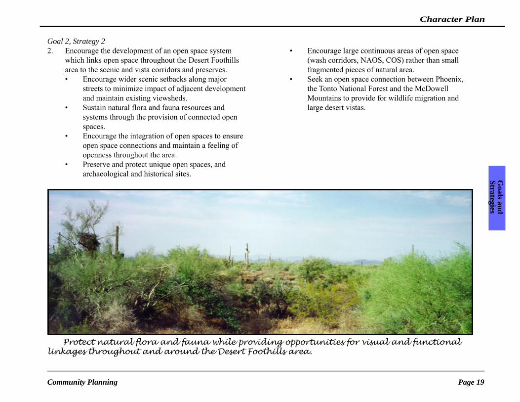
Protect natural flora and fauna while providing opportunities for visual and functionallinkages throughout and around the Desert Foothills area.
City of ScottsdalePage 20
Desert Foothills Character AreaG
oals
and
Str
ateg
ies
3. Promote recreation opportunities to enhance and preserve aRural Desert character through the following strategies:
• Seek opportunities to accommodate low-impactequestrian oriented parks, trailheads and otherrecreational amenities that respond to the needsand demands of the citizens.
• Park design should emphasize the uniqueSonoran Desert environment through minimaldisturbance to the site, desert sensitivearchitecture and construction detailing.
• Specialty parks should be encouraged alongscenic corridors to allow residents and tourists
alike to view andexperience the desert andmountain vistas.• Limit turf to activerecreation areas inassociation with schoolsand specific picnic/openplay spaces, and in areas ofhigh public use.• Use drought tolerant plantmaterial in landscaped
areas.• Use sensitivity in providing lighting systems for
outdoor recreational facilities to ensureparticipant safety and minimize trespass light intoadjacent neighborhoods and streets whilemaintaining the “dark skies”.
Goal 2, Strategy 3
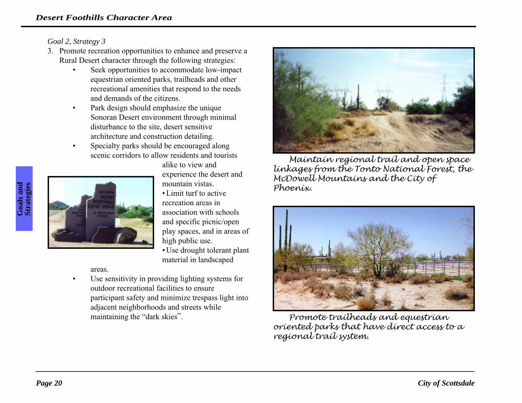
Maintain regional trail and open spacelinkages from the Tonto National Forest, theMcDowell Mountains and the City ofPhoenix.
Promote trailheads and equestrianoriented parks that have direct access to aregional trail system.

Character Plan
Page 21Community Planning
Goals and
Strategies
Goal 3: Identify and celebrate the Rural Desertcharacter experienced in the DesertFoothills study area that will result in ormaintain a unique desert communitydistinguished from other partsof Scottsdale and themetropolitan area.
Strategies:1. Use physical elements within the
improvement/expansion of localinfrastructure to create thematicelements.• Colors, textures and materials used on
infrastructure improvements should blend into thenatural desert environment and reflect the rusticrural identity of the area.
• The design of street signage, signalizedintersections and street lights should beused to reflect the rustic, rural identity ofthe area.
• Public facilities should reflect the color andmaterial palette used in the improved localinfrastructure and adjacent structures.
2. Create gateways that reflect the area’sidentity and highly visible focal points within the studyarea.• City gateways should reflect the area’s identity.
• Significant city entry points and/or milestreets should be used as opportunities tocreate gateways that identify this uniquearea of the city.
3. Scenic corridors should bedesigned to reflect an identity forthe entire length of the corridorand respond to the uniquecharacter the road bisects.• Public improvements shouldconsist of consistent colors andmaterials.• Identification signs should use aconsistent palette throughoutcorridor.• Utility cabinets which cannot beburied should be painted aconsistent color with other streetsigns and signal poles along thecorridor which use colors thatblend with natural desert tones.
4.The design of all nonresidentialstructures should respect theexisting rustic, rural character and
scale of buildings across the area.
Public infrastructure can be used tocelebrate and reflect the unique identity of anarea. These elements should blend into naturaldesert and respond to the rustic rural characterof the area.

City of ScottsdalePage 22
Desert Foothills Character Area
Glo
ssar
y
Boulder FeaturesExposed bedrock clusters produced by the weathering ofgranite or other bedrock in places which have at least onedimension of 15 feet or more across, a height at one pointabove the surrounding terrain of 10 feet or more, and includes aminimum setback of 20 feet around the entire feature. Thelocations of boulder features are designated on maps by theCity.
Building Envelope TechniqueThe area of a site where the building will be located. Atechnique for building which disturbs a minimal area of thebuildable part of a parcel.
City CharterA document which outlines the structure and processes of acity’s government and identifies the powers and limitations.
Construction EnvelopeOne or more specified areas on a lot or parcel within which allstructures, driveways, parking, decks, walks, and improvedfacilities are located. Underground utilities may be locatedoutside the construction envelope.
Cubic Feet per Second (c.f.s.)Measure of flowing water in a watercourse (a river, creek,stream, wash, arroyo, or other channel over which water flowsat least periodically).
DensityUsually: the number of dwelling units per acre in residentialdistricts. Gross density is defined as the total number ofdwelling units divided by the total land area of the site,excluding nothing. Net density is the total number of dwellingunits divided by the net area of the lot or site (excluding roads,public open space, utility rights-of-way, and communityfacilities).
Development ProjectAny development resulting from the approval of a buildingpermit, lot split, preliminary or final plat, rezoning application,grading permit, public or private infrastructure improvement,variance requests, development review, master plans, nativeplant removal, relocation or revegetation, or use permit.
Development Review BoardA process along with criteria to consider the site and
G l o s s a r y

Draft Character Plan
Page 23Community Planning
Glossary
architectural design character and features of development,excluding single family houses. This process is intended toprovide for a basic standard of design quality throughout thecommunity, establish character themes, seek durability inphysical development and seek the desired identity of thecommunity.
Development SiteA specific area within a development project which is proposedfor a specified zone, use, or density, and may be developedseparately from the balance of the development project by aperson other than the master development plan applicant.
Environmentally Sensitive Lands Ordinance (ESLO)is a set of zoning regulations adopted by the City of Scottsdaleto guide future development in the desert and mountain areasof north Scottsdale. The ordinance has a variety of standardsthat are applied to ensure that new construction will becompatible with the natural beauty of the area. The ESLO tookeffect on March 21, 1991 and applies to approximately 134square miles of Scottsdale north of the Central Arizona Projectand APS transmission lines.
General PlanA collection of policies and plans which provide a guide andbaseline for decisions regarding the physical growth andevolution of the city. The General Plan provides acomprehensive, coordinated set of intents and directions for thephysical development of the city including but not limited toland use, transportation, economic conditions, environment,infrastructure, public facilities and physical character.
Government Land Office lots (GLO)The federal government established a program for veteransafter World War II to purchase approximately 2.5 acres offederally owned land at a discounted price. Several hundred ofthese parcels can be found within the Desert Foothills studyarea.
Land SlopeThe ratio of the vertical rise in the land elevation over thehorizontal dimension of the rise.
Natural LandmarksProminent, unique terrain features which due to their characterand location are considered landmarks for the city or for a localregion within the city. Such landmarks may or may not benamed features. These features are indicated on maps of recordat the City and have been designated by the City Council.Historical and archaeological sites shall also be considered aslandmarks. Natural landmarks are included on theenvironmental constraints composite map.
Open SpaceMeaningful Open Space: Open space which due to itssize, function, visibility, accessibility and/or strategiclocation is a community amenity or resource. Open spacewhich can be accessed or can be viewed by the public.Open space which serves to protect a significant ecologicalarea. Meaningful Open Space is divided into threecategories: accessible desert open space consisting ofpublic use areas and public access areas; visual desertopen space consisting of mountain and desert conservationareas, wash corridors and street setbacks, and desert

City of ScottsdalePage 24
Desert Foothills Character Area
Glo
ssar
y
character open space consisting of restored areas such asdetention basins and drainage channels and improvedareas such as parks and golf courses that have a desertcharacter. (Desert Preservation Task Force definition - seeAppendix for further explanation)Natural Area Open Space: Areas of undisturbed naturaldesert with no man-made improvements and approvedrevegetated areas.Developed Open Space: landscape areas, turf areas, parks,golf courses and other recreational facilities excluding anyassociated buildings.
ParcelA legally defined lot, or contiguous group of lots in singleownership or under single control, and considered a unit forpurposes of development and open space calculation.
PathsA shared-use pedestrian, non-motorized, cyclist route or systemwhich is paved.
Preliminary PlatA conceptual plan for a proposed layout of lots, tracts, rights-of-way and easements in a proposed subdivision.
RevegetationReplacing vegetation in an area where vegetation has beenremoved for construction, or due to natural causes. The effort ismade to revegetate to surrounding plant densities and specie.
RSBThe Recommended Study Boundary of the McDowell Sonoran
Preserve, indicative of the land area the city desires toultimately acquire through the Preservation Program.
Scenic CorridorA major roadway which has been so designated on the GeneralPlan in order to minimize the visual intrusion of adjacentdevelopment and maximize the unique character of differentareas of the city.
Special Flood Hazard AreasAre defined by Section 37-17 of Chapter 37 of the ScottsdaleRevised Code (Floodways and Floodplains) are areas havingflood and/or flood related erosion hazards as shown on a FloodHazard Boundary Map or Flood Insurance Rate Map as zoneA, AO. A1-30, AE, A99, AH or E, and those areas identified assuch by the Floodplain Administrator, delineated in accordancewith Section 37-18(b) and adopted by the Floodplain Board.
TrailsA shared-use pedestrian, non-motorized, equestrian, cyclistroute or system which is not paved.
Use PermitsA process with general criteria to consider uses which may becompatible within a district but which may need speciallimitations in order to be considered appropriate for the area.Commercial equestrian ranches use the use permit process.
ViewshedsThe major segments of the natural terrain which are visibleabove the natural vegetation from designated scenic viewpointswhich are shown on the ESLO Special Features maps and are

Draft Character Plan
Page 25Community Planning
Glossary
contained on the environmental constraints composite map.
Vista CorridorA major open space corridor which follows major watercoursesor other features as identified on the General Plan and whichprotect major wildlife habitat, protect distant views, separateland uses, and provide links for trails and paths.
WashUsually a watercourse which flows during/after rainfall events,or intermittently. Washes contain a riparian environment andare used by wildlife.
WatercourseA lake, river, creek, stream, wash, arroyo, or other channel overwhich water flows at least periodically. “Watercourse” includesspecifically designated areas in which substantial flood damagemay occur.
Zoningpolicies regulating the use of land and the physical parametersof development of the land along with procedures for changingthe status of land use and the physical development standards.