DEFENCE - sifti-mission.cnes.fr · Kubik, Christophe Laporte, Françoise Maurel, Gilles Moury,...
36
#79 February 2019 SPACE IN DEMAND DEFENCE SPACE INNOVATION SOCIETY
Transcript of DEFENCE - sifti-mission.cnes.fr · Kubik, Christophe Laporte, Françoise Maurel, Gilles Moury,...
#79February 2019
SPACE IN DEMAND
DEFENCE
S P A C E I N N O V A T I O N S O C I E T Y

I N S I D E
0 5 E D I T O R I A L
0 6 R O U N D U P
All about the next defence spending plan, military
operations in the field and space debris collision risks
1 2 # C O M M U N I T Y
CNES’s followers speak out about the utility of space
1 3 Q & A
Florence Parly, the Minister for Armed Forces, reflects on
space’s role in assuring the nation’s defence
1 6 I N P I C T U R E S
Surveillance supporting action
1 8 I N F I G U R E S
CNES and defence: key figures
1 9C N E S I N A C T I O N
Observation, eavesdropping and secure communications: how
CNES is supporting the defence community
2 7M A T E R I A L S
The future is here with OTOS
2 8 T I M E L I N E
CSO poised to deliver unmatched performance
3 0 H O R I Z O N S
• Jean-Baptiste Paing, MUSIS programme director at DGA
• Virginie Amberg, CSO image quality manager at CNES
• Éric Boussarie, deputy director of instrument systems at CNES
3 3 E T H I C S C O R N E R
If you want peace… by Jacques Arnould
3 4 I N S I G H T S
Exhibitions, books and events produced and supported by
CNES
3 6 S P I N O F F
Automatic image recognition
PARTNERSMentioned in this issue: p. 6/7/15/21/24/25/26/27/30/34/35/36, DGA, the French defence procurement agency; p. 9, AID, the defence innovation agency; p. 11 SatCen, the European Union Satellite Centre; p. 9 DRM, the French military intelligence directorate in Creil; p. 18 European Defence Agency (EDA); p. 18 European Space Agency (ESA); p 21 Joint Staff (EMA); p. 21 COSMOS, the military space surveillance and tracking operations centre; p. 25 ANFR, the national frequencies agency; p. 36 CEA, the French atomic energy and alternative energies commission; IGN, the French national mapping, survey and forestry agency; and ONERA, the French national aerospace research centre.
13 1606
Cover: © CNES / Mira Productions / Parot Rémy, 2018 CNESfrance @CNES CNES
More content in this new issue on line at cnes.fr/cnesmag
WWW.CNES.FR

0 3
3619 27MILITARY SPACE OBSERVATION
European partners in the CSO programme
P. 11
GERMANY(Schwerin agreements, 2002) -> contributing to funding for CSO-3 and providing access to imagery from SAR-Lupe and soon SARah
P. 06
FRANCE-> supplying imagery from
Helios and soon CSO
P. 29
SWEDEN-> providing its ground station
in Kiruna
P. 11ITALY (Turin agreement, 2004) -> providing access to imagery from COSMO-Skymed and soon COSMO-Skymed NG
BELGIUM-> partner in Earth observation and contributing to the Helios
and CSO programmes

0 4
C O N T R I B U T O R S
CNESmag, the magazine of the Centre National d’Etudes Spatiales, 2 place Maurice Quentin. 75039 Paris cedex 01. For all correspondence, write to: 18 avenue Edouard Belin. 31401 Toulouse cedex 9. Tél. : +33 (0)5 61 27 40 68. Internet: http://www.cnes.fr. This review is a member of Communication&Entreprises. Subscriptions: https://cnes.fr/reabonnement-cnesmag. Publication director: Jean-Yves Le Gall. Editorial director: Marie-Claude Salomé. Editor-in-chief: Brigitte Alonzo-Thomas. Proofreading: Céline Arnaud. Editorial staff: Brigitte Alonzo-Thomas, Karol Barthélémy, Liliane Feuillerac. Photos and iconography: Marie-Claire Fontebasso. Photo editor: Nicolas Tronquart. Photo credits: p. 4 CNES/N.Tronquart, D.Letourmy, Mira Porduction/S.Gentet; p. 5 CNES/C.Peus; p. 6 Mira Production/S.Gentet; p. 7 CNES/E.Grimault; p. 8 Ministry for Armed Forces; p. 9 CNES/Photon, M.Regy; p. 10 CNES (top left), French Air Force (bottom); p. 11 Ministry for Armed Forces; p. 13-14 Ministry of Defence-ECPAD-V.Besnard; p.16-17 CNES 2017 Distribution Airbus DS; p. 18 Thales Alenia Space/E.Briot; p. 19 Airbus Defence Space; p. 20 GettyImages; p. 21 CNES/ESA/Arianespace/CSG video and photo department; p. 22 Creative Commons; p. 23 CNES; p. 24 Thales Alenia Space/P.Ridderhof; p. 26 DGA; p. 27 CNES/G.Le Bras; p. 33 J.Arnould; p. 34 CNES/D.Ducros; p. 36 CNES 2018. Illustrations: François Foyard (p. 7/26/35), Robin Sarian (Idix) (p. 7/9/28-29), Jean-Marc Pau (p. 30 à 32). Webmaster: Sylvain Charrier, Mélanie Ramel. Social media: Mathilde de Vos. English text: Boyd Vincent. Design and pre-press: Citizen Press – Camille Aulas, David Corvaisier, Mathilde Gayet, Fabienne Laurent, Alexandra Roy. Printing: Ménard. ISSN 1283-9817. Thanks to: Caroline Amiot-Bazile, Cécile Angelelis, Laurent Boisnard, Gilles Chalon, Philippe Collot, Jean-Pierre Diris, Charles Delauzun, Emline Deseez, Gilles Dorleac, Pascal Faucher, Alain Gleyzes, Amélie Gravier, Daniel Greslou Philippe Kubik, Christophe Laporte, Françoise Maurel, Gilles Moury, Monique Moury, Jean-Gabriel Parly, Pierre Pelipenko, Lionel Perret, Dominique Pradines, Sophie Roelandt, Philippe Steininger.
10-31-2690
SÉBASTIEN GENTETAt Mira Productions, Thierry Gentet has
communicated his passion for space and film to his son Sébastien. They
make documentaries for television and corporate films for CNES, and have
worked together on several multimedia productions including an exciting and compelling film about CSO that bears
Sébastien’s hallmark.
GILLES DORLEACBased in Toulouse, this domain expert on the Security and Defence team smooths daily contacts between CNES’s technical
experts and the military, working with his colleagues to help the armed forces
resolve the many issues they face. Without him, we couldn’t have untangled
the web of military secrecy.
GILLES CHALONCSO project leader Gilles Chalon takes us behind the scenes for the launch. He must
have been feeling a lot of pressure and tiredness in the last days leading up to lift-off, but he answered our questions and got his teams to explain the challenges inherent
in developing the system’s optics and the technical innovations involved. We were also
able to take pictures of the highly secure tasking and command-control centre.
DENYS LETOURMYPhotographer Denys Letourmy joined Spot
Image’s photo lab in 1987. For the past 30 years, he’s been working every day on
stunning pictures of Earth seen from space. Now with Airbus DS Geo, his job has evolved
as analogue cameras and film have given way to all-digital technologies. He gave
us access to the two declassified military images from the Pleiades satellite used in
the In Pictures section.

0 5
E D I T O R I A L
J E A N - Y V E S L E G A L LC N E S P R E S I D E N T
Ever since 4 October 1957, when the world awoke to a beep tone out of the blue, beamed back from Sputnik, space has established itself as a key feature of the military landscape. Only satellites afford the ability to discreetly overfly every country on the planet without transgressing international
regulations, to observe, listen and transmit, bringing a fourth space dimension—after land, sea and air—to theatres
of operations. That’s why more and more nations are today acquiring military space assets to ‘play with the big boys’,
as General Charles de Gaulle once remarked. France is no exception and on 22 February 1986, more than 30 years ago,
the launch of SPOT 1, the nation’s first Earth-observation satellite conceived and developed by CNES, immediately caught
the attention of our armed forces. They subsequently decided to invest in their own space-based observation assets and since
1995, the Helios satellites—recently joined by CSO-1, the first of their successors—are our ‘military eyes’. At the same time,
the Syracuse programme assures secure communication links to our forces deployed on external operations, and soon the
CERES satellites will be boosting our signals intelligence capability. In the final analysis, in response to the all-pervasive
influence of the United States, China and Russia, France’s research laboratories, agencies and manufacturers are enabling
it to assume a pre-eminent role as one of those ‘big boys’.

New team leader The CSO-11 military Earth-observation satellite has begun its reconnaissance mission from its orbital outpost at an altitude of 800 kilometres. It’s the first in a constellation of three satellites set to take over from the Helios 2 system (see p. 28-29). Launched on 19 December atop a Soyuz vehicle from the Guiana Space Centre (CSG), CSO-1 will be monitored throughout its 10-year lifetime from a tasking centre in Toulouse (see opposite). The programme is being led under a longstanding partnership between the French defence procurement agency DGA and CNES. In 2020, CSO-2 will be placed into a 480-kilometre orbit for an identification mission, and in late 2021 CSO-3 will join CSO-1 in the same orbit to further boost the constellation’s revisit capability. This final launch will be performed by the new Ariane 6 vehicle.
1. Composante Spatiale Optique (Optical Space Component)
CSO-1
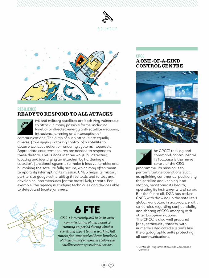
he CPCC1 tasking and command-control centre in Toulouse is the nerve centre of the CSO
programme. Its mission is to perform routine operations such as uplinking commands, positioning the satellite and keeping it on station, monitoring its health, operating its instruments and so on. But that’s not all. DGA has tasked CNES with drawing up the satellite’s global work plan, in accordance with strict rules regarding confidentiality and sharing of CSO imagery with other European nations. The CPCC is also well prepared for cybersecurity threats, with numerous dedicated systems like the cryptographic units protecting all communications.
R O U N D U P
CPCC A ONE-OF-A-KIND CONTROL CENTRE
RESILIENCE READY TO RESPOND TO ALL ATTACKS
0 7
6 FTECSO-1 is currently still in its in-orbit
commissioning phase, a kind of ‘running-in’ period during which a
six-strong expert team is working full time to fine-tune and calibrate hundreds
of thousands of parameters before the satellite enters operational service.
T
ivil and military satellites are both very vulnerable to attack in many possible forms, including kinetic- or directed-energy anti-satellite weapons, intrusions, jamming and interception of
communications. The aims of such attacks are equally diverse, from spying or taking control of a satellite to deterrence, destruction or rendering systems inoperable. Appropriate countermeasures are needed to respond to these threats. This is done in three ways: by detecting, locating and identifying an attacker; by hardening a satellite’s functional systems to make it less vulnerable; and by making the satellite fully secure, which may often mean temporarily interrupting its mission. CNES helps its military partners to gauge vulnerability thresholds and to test and develop countermeasures for the most likely threats. For example, the agency is studying techniques and devices able to detect and locate jammers.
C
1. Centre de Programmation et de Commande-Contrôle
0 8
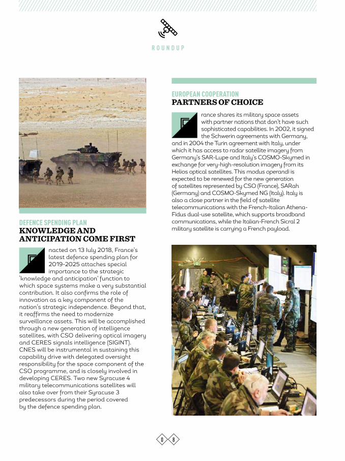
nacted on 13 July 2018, France’s latest defence spending plan for 2019-2025 attaches special importance to the strategic
‘knowledge and anticipation’ function to which space systems make a very substantial contribution. It also confirms the role of innovation as a key component of the nation’s strategic independence. Beyond that, it reaffirms the need to modernize surveillance assets. This will be accomplished through a new generation of intelligence satellites, with CSO delivering optical imagery and CERES signals intelligence (SIGINT). CNES will be instrumental in sustaining this capability drive with delegated oversight responsibility for the space component of the CSO programme, and is closely involved in developing CERES. Two new Syracuse 4 military telecommunications satellites will also take over from their Syracuse 3 predecessors during the period covered by the defence spending plan.
DEFENCE SPENDING PLANKNOWLEDGE AND ANTICIPATION COME FIRST
R O U N D U P
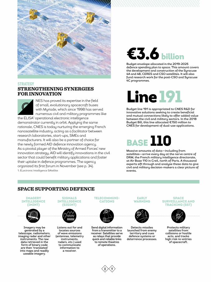
rance shares its military space assets with partner nations that don’t have such sophisticated capabilities. In 2002, it signed the Schwerin agreements with Germany,
and in 2004 the Turin agreement with Italy, under which it has access to radar satellite imagery from Germany’s SAR-Lupe and Italy’s COSMO-Skymed in exchange for very-high-resolution imagery from its Helios optical satellites. This modus operandi is expected to be renewed for the new generation of satellites represented by CSO (France), SARah (Germany) and COSMO-Skymed NG (Italy). Italy is also a close partner in the field of satellite telecommunications with the French-Italian Athena-Fidus dual-use satellite, which supports broadband communications, while the Italian-French Sicral 2 military satellite is carrying a French payload.
EUROPEAN COOPERATIONPARTNERS OF CHOICE
E
F
0 9
NES has proved its expertise in the field of small, evolutionary spacecraft buses with Myriade, which since 1998 has served numerous civil and military programmes like
the ELISA1 operational electronic intelligence demonstrator currently in orbit. Applying the same rationale, CNES is today nurturing the emerging French nanosatellite industry, acting as a facilitator between research laboratories, start-ups, SMEs and manufacturers. It will also be a partner of choice for the newly formed AID defence innovation agency. As a pivotal player of the Ministry of Armed Forces’ new innovation strategy, AID will identify innovations in the civil sector that could benefit military applications and foster their uptake in defence programmes. The agency organized its first forum in November (see p. 34).
STRATEGYSTRENGTHENING SYNERGIES FOR INNOVATION
C
SPACE SUPPORTING DEFENCE
Budget envelope allocated in the 2019-2025 defence spending plan to space. This amount covers the development and construction of the Syracuse 4A and 4B, CERES and CSO satellites. It will also fund research work for the post-CSO and Syracuse 4C programmes.
€3.6 billion
Massive amounts of data—including from satellites—arrive every day at the nerve centre of DRM, the French military intelligence directorate, at Air Base 110 in Creil, north of Paris. A thousand experts sift through and analyse these data to give civil and military decision-makers a clear picture of events.
BASE 110
Line 191 Budget line 191 is appropriated to CNES R&D for innovative solutions seeking to create beneficial and mutual connections likely to offer added value between the civil and military sectors. In the 2018 Budget Bill, this line allocated €150 million to CNES for development of dual-use applications.
Imagery may be generated by a
telescope, radiometers, imaging radar and other
instruments. The raw data retrieved in the form of binary code are then ‘translated’
into maps and readily useable imagery.
IMAGERY INTELLIGENCE
(IMINT)
Listens out for and locates sources
of wave emissions (antennas, telemetry
instruments, radars, etc.) used to communicate information to
a receiver.
SIGNALS INTELLIGENCE
(SIGINT)
Detects missiles launched from enemy
territory and cues defence systems or
deterrence processes.
EARLY WARNING
Protects military satellites from
collisions or hostile acts, and tracks
high-risk re-entries of spacecraft.
SPACE SURVEILLANCE AND
TRACKING (SST)
Send digital information from a transmitter to a
receiver. Satellites serve as relays that provide
quick and reliable links to remote theatres
of operations.
TELECOMMUNI-CATIONS
1. ELectronic Intelligence SAtellite

1 0
R O U N D U P
CAESAR CONJUNCTION ASSESSMENT
t was a dark day for space on 10 February 2009, when the U.S. Iridium 33 telecommunications satellite and the Russian Cosmos 2251, a spent
military satellite, collided, spawning in the process at least 2,000 additional fragments of orbital debris that will pose a threat to operational satellites for centuries to come. This event cast the urgency of mitigating such risks into stark light. In 2014, France set up its CAESAR1 service for satellite operators. This service led by CNES analyses high-risk conjunctions, using the United States’ catalogue of space objects and data from the French GRAVES radar and the TAROT telescope network. When a conjunction (collision) risk is detected, CAESAR communicates an initial evasive action scenario to the satellite’s control centre and works with it to determine the most appropriate manoeuvre in the light of operational constraints, making sure that no additional risks will be created. Since 2016, CAESAR can be accessed through the EU-SST project (see p. 11), funded by the European Commission.
1. Conjunction Analysis and Evaluation Service, Alerts and Recommendations
I
n 14 April 2018, in the province of Homs, French, U.S. and British forces carried out strikes on Syria’s chemical weapons programme in
response to an earlier chemical attack on 7 April 2018 that claimed tens of lives, including civilians, in Douma. This raid would have been impossible without space assets. Accurate weather forecasting and a secure satellite link with forces certainly played a key role, but if the cruise missiles were able to hit their targets after flying several hundred kilometres, it was also down to the digital terrain model (DTM) in their flight computers. DTMs are generated from satellite imagery to provide extremely precise maps of the terrain overflown by a missile en route to its target.
OPERATION HAMILTONMAPPING FOR MISSILES
O
TAROT telescope.

eneral Philippe Steininger took up his post as military advisor to CNES’s President on 1 November 2018. To say he is well qualified for the job would be an understatement. After graduating from France’s Ecole
de l’Air and Ecole de Guerre officer training schools, he served for 15 years as a fighter pilot in the French Air Force, taking part in several external operations. His skills and experience subsequently led him to command the national strategic air forces before becoming Deputy Secretary General for National Security and Defence. An associate research fellow at the IRIS1 international and strategic relations institute, Philippe Steininger is a specialist in defence policies and aerospace. He’s also a space enthusiast who would have loved to follow in the footsteps of Jean-Loup Chrétien, France’s first astronaut. His appointment at CNES is therefore the perfect way to combine his passion for space and his expertise. Working alongside Jean-Yves Le Gall, General Steininger sees himself as a ‘facilitator’ providing guidance to develop future programmes.1. Institut de Relations Internationales et Stratégiques
he Sahel-Sahara strip covers an area as large as Europe. Since 2013, French forces are engaging armed terrorist groups in this theatre of operations. For this mission, they are supported by Reaper drones,
particularly adapted to surveillance in these vast territories. The endurance and intelligence, surveillance and reconnaissance (ISR) capability of these new airborne platforms are a vital asset. Satellites are key to controlling the drones and retrieving the data they collect over great distances.
he space agencies of France, Germany, Italy, Spain and the United Kingdom were joined in
the EU-SST space surveillance and tracking consortium early this year by Poland, Portugal and Romania. With support from SatCen1, the consortium’s members provide assets for conjunction assessments and tracking of re-entries and debris fragmentations. In July 2017, France took over the rotating presidency of EU-SST through CNES, which is contributing to its work via the OCC orbit computation centre’s involvement in providing conjunction assessments. The consortium is also involved in optical observation of high orbits through the TAROT telescope network. France’s GRAVES radar, which detects and classifies objects in low Earth orbit, is a key asset for EU-SST. 1. European Union Satellite Centre
APPOINTMENTPHILIPPE STEININGER, CNES MILITARY ADVISOR
OPERATION BARKHANE SATELLITE-CONTROLLED DRONES
G
T
T
1 1
SPACE DEBRISEUROPE KEEPING CLOSE WATCH
600,000
Number of debris objects larger than one centimetre estimated to
be in low Earth orbit by the United States—every one a potential
danger to spacecraft and civilian populations.

# C O M M U N I T Y
1 2
Every day, CNES engages with you on social networks and you share your thoughts and questions with us. Join the conversation!
CNESfrance @CNES CNES
When I hear folks talking about space and war. #CNESTweetUp
@SPACE_THOMALICE Budding science journalist @loctopusjournal Videographer with a passion for space Member of @cafe_sciences #BananaForScale and #SpreadThePipouness
So, the armed forces can use civil satellites and, conversely, technologies developed by the armed forces can be used in civil applications, like for example weather forecasting—useful for both! Plus GPS/Galileo, geographic data, etc. #CNESTweetUp
@AMAURYPI Mad about astrophysics, scanner, student, pianist — I mess around with code and I like sharing my passion for science.
The 1967 treaty on the peaceful uses of outer space specifies there are no weapons of mass destruction in space. #CNESTweetUp
@STEPHANE SEBILE Space Quotes
@ERIC_GERNEZ Frenchman from Suriname, with a close eye on the region’s news.
#Guyane – Succeeding #Helios, the #CSO satellites: the first in the optical space constellation has been launched from Kourou. Set to deliver very-high-resolution imagery from Sun-synchronous orbit at an altitude of 800 km.
Q & A
MINISTER FOR ARMED FORCES AND PREVIOUSLY CEO OF TOP FRENCH
INDUSTRIAL AND TRANSPORT GROUPS, Florence Parly addresses current and future
challenges facing defence and details the prime position it occupies in the space arena.
FLORENCE PARLY
Q & A
WHAT ARE THE MAIN CHALLENGES FACING THE NATION’S DEFENCE IN THE YEARS AHEAD?
Florence Parly: We live in a world of ever sharper, more unpredictable and more technological threats. As we were painfully reminded recently, terrorism remains at our door. Powers are looking to affirm their positions in any way possible and the arms race is moving into higher gear again. New technologies and digital developments offer great opportunities while at the same time engendering new areas of conflict. Space is obviously instrumental in meeting all of these challenges. We rely on space for the conduct of operations, to surveil, reconnoitre and guide. Both defensive and offensive technologies are emerging in space, as satellites spy or are spied upon. And NewSpace1 is making it easier for new space nations and private players to get into space, which could considerably shift current global power balances.
DOES THAT IMPLY THE ROLE OF MILITARY SPACE IS SET TO CHANGE?
F.P.: Precisely, as space is more than ever a cornerstone of our defence strategy. We clearly need to act and adapt to increasing threats. My first priority is to protect our satellites through the ability to detect and identify unfriendly or even hostile acts in our various operational orbits. We need to have robust tracking and
provided by certain manufacturers. Will we need to go further to protect and defend ourselves, and to deter anybody from approaching our satellites? We’re not ruling anything out.
IS INDEPENDENT ACCESS TO SPACE VITAL TO A NATION’S DEFENCE? IF SO, WHY?
F.P.: Satellites enable us to observe our enemies, understand their methods and find their hideaways. Thanks to space, we can plan our operations, guarantee the safety of our forces and maintain our deterrence posture. To do that, we need to place key assets in orbit. So, the question is simple: do we want to be independent or dependent on others? My clear answer is that strategic independence underpins all of my actions. We need to have full control of our intelligence, operations and deterrence, which means we must also fully control our access to space.
HOW IS THE INCREASING NUMBER OF PLAYERS IN SPACE ACCESS CHANGING THE GAME?
F.P.: Access to space is getting easier and new players are now offering more and more services at lower cost and with shorter lead times. That’s no bad thing, as it means we’ll be able to exploit the scientific and commercial potential of space a lot more than we do today. Many projects, often from the private sector, are emerging to launch constellations of Earth-observation and telecommunications satellites,
1 4
“ FRANCE ALWAYS HAS BEEN AND WILL
CONTINUE TO BE A PIONEER IN SPACE.”
FLORENCE PARLY MINISTER FOR ARMED FORCES
protection for our satellites. This is a priority for me. I know it’s one that President Macron shares, and I will be submitting proposals to him in due course.
HOW CAN WE ANTICIPATE THE NEW THREAT OF SATELLITES BEING MADE TARGETS?
F.P.: What’s clear is that outer space has become a battlefield in its own right. France always has been and will continue to be a pioneer in space. My priority is to track, identify and characterize anything approaching our satellites. For that, I want them to be equipped with detection capabilities. We shall work with our European partners to build a more precise autonomous space surveillance and tracking capability than we have today. And we will call on SST services

1 5
Q & A
with the prospect of ever more services and infinite applications. But it also poses a certain number of issues, notably because useful orbits aren’t infinite and the framework regulating space established 50 years ago hadn’t anticipated all these changes. We’ll therefore need to quickly establish rules governing good practice. And the increasingly broad range of launch offerings is obviously eroding the European launch industry’s business model, so it’s up to us to adapt it to sustain this strategic technology in the long term. DO YOU FEEL MILITARY SPACE ASSETS ARE TODAY AN ADVANTAGE OR A NECESSITY?
F.P.: Let’s take the specific example of Operation Hamilton, where we conducted air strikes in response to the chemical attacks by the Syrian regime. Our space assets proved vital at every step, in planning the mission and locating the regime’s chemical facilities and depots, in guiding our pilots, in assuring our communications and coordination with our American and British allies, and so on. That’s just one example, but I could go on. In a word, today space is crucial to our defence and our space assets are both a priceless advantage and an absolute necessity.
WHAT ROLE DOES AN AGENCY LIKE CNES HAVE TO PLAY IN THIS LANDSCAPE? WHAT ARE YOUR EXPECTATIONS IN RESPONSE TO THE NEW THREATS FACING OUR SATELLITES AND THE SEISMIC SHIFT CREATED BY NEWSPACE?
F.P.: France is fortunate to have in CNES an agency with such unique and precious skills and expertise in space. As space technologies are mostly dual-use in nature, CNES is instrumental in researching and constructing our military space assets. It’s tasked with leading dual-use research programmes on behalf of our defence procurement agency DGA and oversees our military satellites to guarantee their reliability and quality. For example, CSO—the optical space component of the MUSIS programme—is a state-of-the-art intelligence tool that we owe to CNES. To address new threats, CNES is doing invaluable work on the new technologies we’ll need to develop space surveillance and tracking, and I know it will succeed in making the transition being fuelled by emerging ideas, innovations and opportunities. Concerning NewSpace, it’s not necessarily radically new technologies that we’re seeing, but often disruptive methods achieved through industrial integration of proven technologies at a very competitive cost. Such disruptive advances are only possible with strong government investment, as shown with the meteoric rise of Space X, which received significant funding from the U.S. administration in its early stages. NewSpace is transforming
Profile2006-2013 Head of Investment Strategy at Air France, then Senior Vice President, Freight, and Senior Vice President, short-haul services.
2014Chief Operating Officer and then CEO of SNCF Voyageurs, the passenger transport branch of national railway operator SNCF.
2017 Appointed Minister for Armed Forces.
our industrial model and maybe we’ll need to review our relationship with contractors in the future. Be that as it may, the Ministry of Armed Forces knows just how much it owes to the quality of CNES’s work and I will ensure that our relationship remains as prolific and mutually beneficial as it is today.
“FRANCE IS FORTUNATE TO HAVE IN CNES AN AGENCY WITH SUCH UNIQUE AND PRECIOUS SKILLS AND EXPERTISE.”
1. NewSpace or entrepreneurial space encompasses a range of private initiatives driving a paradigm shift in the space industry.
“STRATEGIC INDEPENDENCE UNDERPINS ALL OF MY ACTIONS. WE NEED TO HAVE FULL CONTROL OF OUR INTELLIGENCE, OPERATIONS AND DETERRENCE, WHICH MEANS WE MUST ALSO FULLY CONTROL OUR ACCESS TO SPACE.”
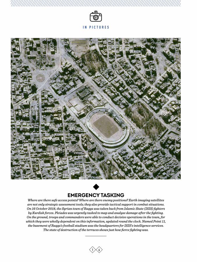
I N P I C T U R E S
EMERGENCY TASKING Where are there safe access points? Where are there enemy positions? Earth imaging satellites are not only strategic assessment tools; they also provide tactical support in combat situations. On 16 October 2018, the Syrian town of Raqqa was taken back from Islamic State (ISIS) fighters
by Kurdish forces. Pleiades was urgently tasked to map and analyse damage after the fighting. On the ground, troops and commanders were able to conduct decisive operations in the town, for
which they were wholly dependent on this information, updated round the clock. Named Point 11, the basement of Raqqa’s football stadium was the headquarters for ISIS’s intelligence services.
The state of destruction of the terraces shows just how fierce fighting was.
1 6

I N P I C T U R E S
LONG-TERM SURVEILLANCELike other strategic sites, North Korea’s Yonbyong nuclear facility is kept under close watch.
Pleiades supplies very-high-resolution imagery in near-real time, which is then combined with other intelligence data. Surveillance is focused on activities in the highest-risk buildings, such
as the 5-MWe reactor producing the plutonium used for nuclear weapons testing, and on the string of construction sites spreading from the north of the city and along the Kuryong River (seen here). Protected by the meander of the river, the radiochemical laboratory at the peak of
the peninsula and the uranium enrichment facility at its southern tip are two key nuclear weapons infrastructures.
1 7
I N F I G U R E S
1 8
12025 years
The CF3I joint imagery training and analysis centre, which in 2018 celebrated its 25th anniversary, offers France’s armed forces a broad spectrum of expertise. The centre trains more than 4,000 officers and non-commissioned officers in imaging techniques and processes, and thousands of images are used there. It also offers expertise to make major leaps in space and imaging technologies for more precise and more responsiveness provision of intelligence.
2022 The CO3D demonstrator project will be geared towards generating digital surface models (DSMs). The challenge for this future constellation of 3D optical minisatellites is to demonstrate the ability to produce high-quality global imagery at low cost through automated processing of vast amounts of data, drawing on the heritage of the stereoscopic imagery provided by Pleiades. In this dual-use programme, CNES is the guarantor of civil and military needs, leading activities designed to assure the performance of the 2D imaging chain and derived 3D products. CO3D could be operational as early as 2022. In another sphere, it will also help the space industry to develop a competitive optical minisatellite concept.
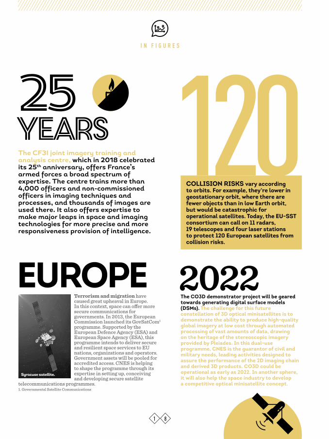
Terrorism and migration have caused great upheaval in Europe. In this context, space can offer more secure communications for governments. In 2013, the European Commission launched its GovSatCom1 programme. Supported by the European Defence Agency (ESA) and European Space Agency (ESA), this programme intends to deliver secure and resilient space services to EU nations, organizations and operators. Government assets will be pooled for accredited access. CNES is helping to shape the programme through its expertise in setting up, conceiving and developing secure satellite
telecommunications programmes.1. Governmental Satellite Communications
COLLISION RISKS vary according to orbits. For example, they’re lower in geostationary orbit, where there are fewer objects than in low Earth orbit, but would be catastrophic for operational satellites. Today, the EU-SST consortium can call on 11 radars, 19 telescopes and four laser stations to protect 120 European satellites from collision risks.
EUROPE
Syracuse satellite.

C N E S I N A C T I O N
SPACEFOR DEFENCE
BE IT FOR OBSERVATION, INTELLIGENCE OR SECURING COMMUNICATIONS, CNES IS WORKING ALONGSIDE THE
MINISTRY OF ARMED FORCES TO CONCEIVE AND MANAGE ULTRA-SOPHISTICATED DUAL-USE SPACE
TOOLS. THE AGENCY’S GOAL IS TO SERVE THE EXACTING NEEDS OF THE MILITARY AT LOWEST COST WHILE
TRANSFERRING ADVANCES IN TECHNOLOGY TO CIVIL APPLICATIONS.
The CSO satellite undergoing testing at Airbus Defence & Space in Toulouse.

C N E S I N A C T I O N
n 1946, CNES was still some years in the future when France’s Ministry of Defence first supplied funding to the Space Research Committee to build ballistic rockets. With
the agency’s inception in 1961, France clearly signalled its space ambitions. More than 30 years later, in 1993, in the light of lessons learned from the Gulf War during which space spectacularly demonstrated its added value for the military, it was decided to give dual oversight responsibility for CNES to the Min-istry of Research and the Ministry of Defence, thus putting space’s relationship with the defence community on a formal footing.Since the 1990s, the French armed forces have relied on space assets to communicate, to gather intelligence, to geolocate and nav-igate, to guide weapons and to forecast weather conditions when planning operations. Today, the military value of space is beyond doubt. Indeed, the 2017 strategic review1 went as far as to state that outer space is now not only employed to support military operations on Earth, but is also a battlefield in its own right—a huge shift in strategic posture.
I
2 0
OBSERVE, LISTEN, TRANSMITFlash points are springing up all over the globe, areas under surveillance are getting ever larger and military command centres find themselves thousands of kilometres from theatres of operations. As a result, intelli-gence and communication have become the keystones of defence. Only satellites offer the capability to conduct intelligence missions discreetly and free from the overflight con-straints of national borders, gathering imagery intelligence (IMINT, see p. 22-23) and signals intelligence (SIGINT, see p. 25-26).IMINT serves to map terrain, surveil regions of interest or characterize targets. Since the SPOT 1 satellite was launched in 1986, CNES has acquired extensive expertise in Earth remote sensing and drawn on this heritage to develop the Helios military satellites and then the Pleiades dual-use system, which brought real innovations now set to be taken a step further with the CSO programme (see p. 28-29).SIGINT consists in detecting, analysing and locating electromagnetic emissions from space. Such data are useful for strategic intelligence and operations planning. The

2 1
ELISA operational demonstrator currently in orbit is paving the way for CERES, the first system of its kind set to enter service for the French military in 2020 (see p. 26).But intelligence is only a prelude to military action. Once operations are underway, sat-ellite telecommunications are obviously cru-cial to success, and they must remain con-fidential. The Syracuse military satellites provide secure and jam-proof communica-tions, while the French-Italian dual-use Ath-ena-Fidus satellite developed by CNES on the French side affords appreciable gains in throughput (see p. 24). WIN-WIN PARTNERSHIPWithin the Ministry of Armed Forces, the Joint Staff (EMA) defines operational requirements while the defence procurement agency (DGA) conducts space programmes, for which it may task CNES with oversight responsibility for identifying the best technological solu-tions in terms of architecture, systems and procedures. From the early design stages of a project, the two partners work together to infuse civil technologies into military satel-lites or vice versa. For example, the Helios 1 military satellite and the SPOT 4 civil satel-lite were in fact very similar, the main differ-ence being a layer of encryption, jam-proof-ing and threat protection on the military version. Building dual-use systems in this way distributes resources and achieves econ-omies of scale. During the R&T and proto-typing phases, costs are shared between the military and its civil partner, and lessons learned benefit both. This is the model that was applied for the Pleiades Earth-obser-vation and Athena-Fidus telecommunica-tions satellites. Obviously, space is a fast-moving sector and CNES takes its mis-sion to nurture new and innovative capabil-ities very seriously.
1. The 2017 strategic national security and defence review set the framework for the 2019-2025 defence spending plan.
… CONTROLLED FROM TOULOUSE
CNES controls military and dual-use satellites operating in low Earth orbit —CSO, Helios, Pleiades and ELISA—from its field centre in
Toulouse, sustaining them and assuring that their instruments perform to the best of their ability. It is
also tasked with detecting and handling orbital collision risks, in close collaboration with the French Air Force’s COSMOS1 military space
surveillance and tracking operations centre. For these missions, CNES’s Digital and Operations
Directorate (DNO) calls on its control centres and global network of tracking stations, mobilizing the
agency’s full range of expertise in orbital mechanics, mission planning, image quality
processing, information technology, networks and security. This directorate is also laying the
groundwork for the future, conducting new mission studies and evolving methods and tools.
1. Centre Opérationnel de Surveillance Militaire des Objets Spatiaux
LOW EARTH ORBIT…
The Soyuz launcher successfully orbited the first CSO satellite from the Guiana Space Centre on 19 December 2018.

2 2
C N E S I N A C T I O N
Satellite imagery is today vital to many applications, and for the military it’s quite simply of paramount importance. Drawing on its extensive expertise in Earth remote sensing, CNES is supplying France’s armed forces with tried-and-tested cutting-edge technologies.
Observation HOW SATELLITE IMAGERY WORKS
erial, terrestrial, maritime or satellite imagery remains the easiest form of intelligence to obtain. But satellite imagery isn’t photographic; rather, it’s a digital representation of the
landscape augmented by specific data which, once processed and analysed, yields a mine of information. “We can use it to compile a map, extract a 3D view, measure lengths and distances or identify features and materials,” says Alain Gleyzes, deputy director of Earth-observation projects at CNES.
THE VALUE OF DUAL USE“Analysing and understanding satellite imagery has become a prerequisite to inform decisions,” confirms Air Brigadier-General Xavier Buisson. “IMINT is capital in all situa-tions, be it when responding to conflicts and natural disasters or combating clandestine
A

2 3
C N E S I N A C T I O N
activities.” CNES has been providing its exper-tise acquired in Earth remote sensing through the SPOT series of satellites to the defence community for decades. The Helios 1 military reconnaissance satellite and SPOT 4, its civil counterpart, are the perfect illustration of what dual use means, as both satellites were built around the same bus. For example, ther-mal infrared imaging is a specific capability featured on Helios 1, where it is useful for tracking human activities, and on SPOT 4 to acquire night imagery that is a precious aid to climatologists.An increasing amount of research work is focusing on dual-use technologies. Since 2011, Pleiades has been serving civil and defence programmes alike with its very high resolution and agility, delivering 50 priority images a day to military users. Each satellite can be tasked to view specific theatres where necessary, offering maximum coverage of operational needs in a single pass. These technologies perfected on Pleiades will ben-efit CSO. For example, enhanced attitude control will make it easier to acquire imagery of a point of interest in burst mode, an extremely useful feature when viewing con-flict zones in particular.
EXPLORING NEW HORIZONSThere are more developments in optical remote sensing to come. New avenues are being explored, in R&D with a 3D optical con-stellation geared towards generating high volumes of digital terrain models (see p. 10)
and through joint initiatives like the prelimi-nary project for a hyperspectral imaging sensor with Singapore. “There’s also work to be done on revisit rates, persistence and associated data processing modes,” explains Alain Gleyzes. “Each leap forward in tech-nology brings with it an exponential increase in data, which demands more processing capacity and the ability to automate search-ing for information in imagery.” As is custom-ary in this day and age, artificial intelligence and big data technologies are being lined up to achieve this. And besides offering new capabilities, optical imagery is spawning a dynamic defence industry that is proving a major plus for France’s trade balance.
900
million pixels A digital Pleiades image covering an area of 20 kilometres on a side contains 900 million pixels. This number will be much higher for CSO, whose
image quality will be unrivalled anywhere in Europe.
Simulated 3D optical image (CO3D) draped over a digital terrain model generated with CO3D.
Simulated elevation map derived from a digital terrain model generated with CO3D.

2 4
C N E S I N A C T I O N
Effective and confidential military communications are vital, which is why CNES and DGA have worked hard to perfect their telecommunications systems. The latest is Syracuse 4, built around leading-edge technologies tailored to the current tense geopolitical climate.
Telecom s MAXIMUM DISCRETION
2006, it worked with the military on Syracuse 3A and Syracuse 3B, the first satellites capable of assuring total data security. Today, the agency is working on the new-generation Syracuse 4 military satellite, which offers jam resistance combined with significantly higher throughput. It’s also anticipating future needs like coded-waveform transmission systems to replace cable networks and relay satellites to replace conventional antennas.With Athena-Fidus (2014), developed in par-tnership with Italy, CNES has demonstrated the utility of dual-use technologies. Comple-menting the military fleet, this satellite uses the Ka band for Internet, civil telecoms stan-dards and user terminals derived from com-mercial-off-the-shelf products. Athena-Fidus is very economical and affords high data rates of up to 3 Gigabits per second.
CHARTING THE FUTURE COURSE FOR TELECOMMUNICATIONSThe game-changer in this landscape is the emergence of NewSpace. The future genera-tion of telecommunications satellites still in the planning stages will feature a greater proportion of electric and digital systems. To this end, CNES and DGA are working on the CASTOR1 programme that is paving the way for future HTS2 milsatcom payloads. “By 2028, which is tomorrow in space, armed forces will be demanding much more connectivity, so
ntelligence is a time-critical commodity that needs to be communicated quickly and without risk of being intercep-ted. This is the role of the tele-communications satellites on
which CNES and the French defence procure-ment agency DGA work together. In response to growing risks, they are deploying extensive technology research efforts at every stage from conception and definition through to production and launch. Systems are then tested in orbit to guarantee they are secure.
RESPONSIVE, FAST AND CONFIDENTIALSatellite telecommunications are obviously a key asset, notably in regions hit by natural disasters when all communications networks are down. “But above all, they’re vital to pro-vide secure communications for high-risk missions like those in the Sahel-Sahara strip (see p. 11),” notes Frigate Captain Mickaël Ulvoa at French Joint Space Command (CIE). “Just as they are for missions like Operation Harpie combating illegal gold panning in French Guiana,” he adds. The common feature of all such situations is the need to ensure responsi-veness, precision and confidentiality, at an affordable cost. CNES was first involved 40 years ago in conceiving the Telecom 1 and Telecom 2 missions, and the Syracuse 1 and Syracuse 2 military satellites; in 2005 and
IAthena-Fidus:
satellite broadband for our armed forces
FILM
The Athena-Fidus satellite being prepped at Thales Alenia Space in Cannes.

C N E S I N A C T I O N
2 5
these future generations will have to provide fully flexible transmission capabilities on home territory and in priority zones,” notes Jean-Pierre Diris, CNES Deputy Directory of tele-communications projects. “The CASTOR project, which is laying the groundwork for future series of all-digital satellites, will be feeding off the momentum created by the commercial sector.” An integrated DGA/CNES project team is already hard at work defining early-stage specifications and overseeing engineering studies and industry R&D deve-lopments. And to stay ahead, CNES is also looking at photonic technologies through the Cusco project, which plans to make optical systems a core element of telecommunica-tions payloads.
1. Capacité strAtégique Spatiale de Télécommunication mObile et Résiliente (mobile and resilient strategic satellite telecommunications capability)
2 High Throughput Satellite
I
With the CERES project, CNES is making a leap in performance and eavesdropping coverage to identify and process electromagnetic signals for military intelligence—a first in Europe.
SIGINT FREQUENCIES UNDER CLOSE SURVEILLANCE
magery isn’t the only useful source of military intelligence. With space-based signals intelligence (SIGINT), the information acquired may not be ‘seen’, but it certainly is heard, what-ever the nature (imagery, voice, coded
messages, electronic beams, etc.) or origin (radar or telemetry instrument, etc.) of the signal. Use of the frequency spectrum is tightly controlled through strict international regulations. In France, frequen-cies are managed and their use monitored by ANFR, the national frequencies agency. Such signals and in particular any unusual ones are key indicators for the military.
DETECTIVE WORK“The first step when detecting a suspect signal is to locate its transmitter, and current technologies allow us to do that,” notes Dominique Pradines, Deputy Director of Radiofrequencies at CNES. Once the signal has been sensed and analysed, a certain amount of detective work is required to find the intruder and understand its intentions. Whether intentional or otherwise, jamming of frequencies is an anomaly and the sheer number of systems oper-ating on Earth is producing an ever-thicker ‘fog’ confusing communications. To enhance the quality of SIGINT, CNES is therefore looking to reduce sound pollution by getting intruders taken down and by helping to improve regulations.The military systematically tracks any drift in
ALL POWER TO DIGITAL
Power is a big deal for satellites’ onboard digital processors. Initiated
in 2012, FAST1 is a project seeking to develop a dual-use, transparent third-generation digital processor now in its qualification phase and
designed to enable less-power-hungry processing while raising
responsiveness, flow and performance, boosting bandwidth
from a few to several tens of Gigahertz. FAST is being combined with Telemak, another CNES R&D project to enhance coverage in Ka
band and provide protection against interference and attacks.
Syracuse 4 is set to benefit from these technologies.
1 Future Advanced Satellite Technologies
FAST

2 6
C N E S I N A C T I O N
frequencies. To support this effort, CNES is focusing on avenues for improvement such as optimizing receiver performance and exploiting research work on antennas. In 2012, it contributed to the ELISA project led by the French defence procurement agency DGA, which consists of a constel-lation of four SIGINT microsatellites testing new radar emission detection technologies in space.
CERES FOR A PERFECT PICTURECERES is the logical extension of ELISA. From 2020, the three minisatellites in this constellation will boost SIGINT performance in low Earth orbit. In today’s tense geopo-litical climate, “the goal of this military constellation is to locate transmitters in other countries,” says Lieutenant Émilie
Picot. “It aims to afford good global cover-age, to see what’s happening in other regions of the world and to detect enemy fleets to give forces on the move a clear picture.” This military tool will draw on the lessons learned from ELISA, but CERES will also enhance performance, improve the quality of SIGINT and increase responsive-ness. CNES is providing oversight support within an integrated project team for certain ground, control and launch operations. Strategically, CERES will put France in the same league as the United States, China and Russia for SIGINT, making it the first European nation to operate such a system.
The CERES satellites.
M A T E R I A L S
2 7
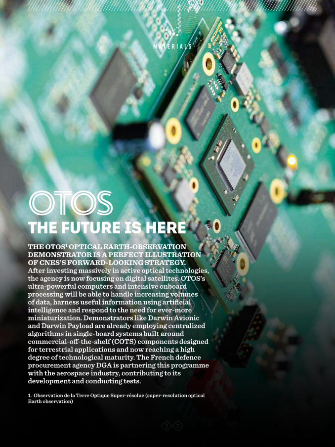
THE OTOS1 OPTICAL EARTH-OBSERVATION DEMONSTRATOR IS A PERFECT ILLUSTRATION OF CNES’S FORWARD-LOOKING STRATEGY. After investing massively in active optical technologies, the agency is now focusing on digital satellites. OTOS’s ultra-powerful computers and intensive onboard processing will be able to handle increasing volumes of data, harness useful information using artificial intelligence and respond to the need for ever-more miniaturization. Demonstrators like Darwin Avionic and Darwin Payload are already employing centralized algorithms in single-board systems built around commercial-off-the-shelf (COTS) components designed for terrestrial applications and now reaching a high degree of technological maturity. The French defence procurement agency DGA is partnering this programme with the aerospace industry, contributing to its development and conducting tests.
1. Observation de la Terre Optique Super-résolue (super-resolution optical Earth observation)
OTOSTHE FUTURE IS HERE
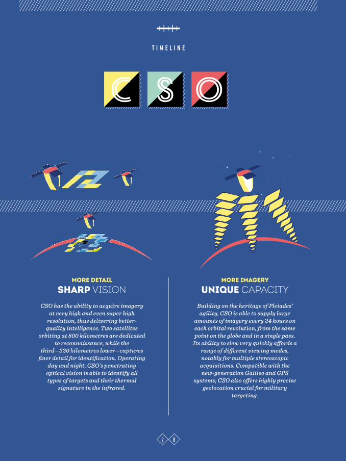
T I M E L I N E
2 8
C os
MORE DETAIL
SHARP VISION CSO has the ability to acquire imagery
at very high and even super high resolution, thus delivering better-quality intelligence. Two satellites
orbiting at 800 kilometres are dedicated to reconnaissance, while the
third—320 kilometres lower—captures finer detail for identification. Operating
day and night, CSO’s penetrating optical vision is able to identify all types of targets and their thermal
signature in the infrared.
MORE IMAGERY
UNIQUE CAPACITY
Building on the heritage of Pleiades’ agility, CSO is able to supply large
amounts of imagery every 24 hours on each orbital revolution, from the same point on the globe and in a single pass.
Its ability to slew very quickly affords a range of different viewing modes, notably for multiple stereoscopic
acquisitions. Compatible with the new-generation Galileo and GPS
systems, CSO also offers highly precise geolocation crucial for military
targeting.
T I M E L I N E
2 9
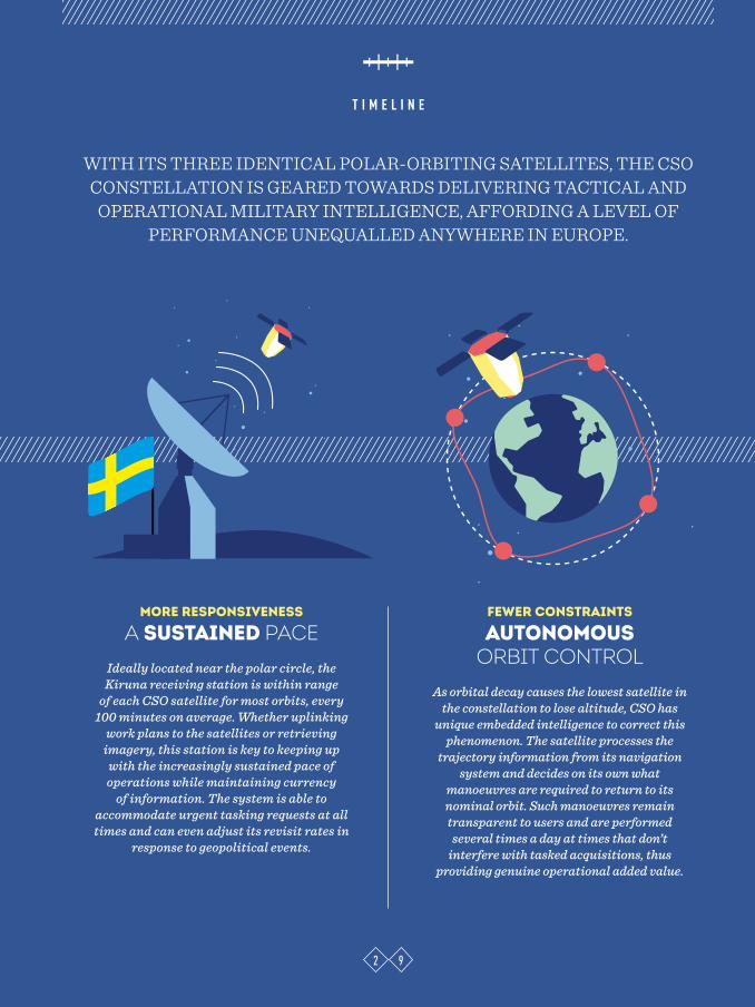
WITH ITS THREE IDENTICAL POLAR-ORBITING SATELLITES, THE CSO CONSTELLATION IS GEARED TOWARDS DELIVERING TACTICAL AND
OPERATIONAL MILITARY INTELLIGENCE, AFFORDING A LEVEL OF PERFORMANCE UNEQUALLED ANYWHERE IN EUROPE.
MORE RESPONSIVENESS
A SUSTAINED PACE
Ideally located near the polar circle, the Kiruna receiving station is within range
of each CSO satellite for most orbits, every 100 minutes on average. Whether uplinking
work plans to the satellites or retrieving imagery, this station is key to keeping up
with the increasingly sustained pace of operations while maintaining currency
of information. The system is able to accommodate urgent tasking requests at all times and can even adjust its revisit rates in
response to geopolitical events.
FEWER CONSTRAINTS
AUTONOMOUS ORBIT CONTROL
As orbital decay causes the lowest satellite in the constellation to lose altitude, CSO has
unique embedded intelligence to correct this phenomenon. The satellite processes the
trajectory information from its navigation system and decides on its own what
manoeuvres are required to return to its nominal orbit. Such manoeuvres remain transparent to users and are performed
several times a day at times that don’t interfere with tasked acquisitions, thus
providing genuine operational added value.

H O R I Z O N S
3 0
Commissioned as a Chief Armaments Engineer at DGA, France’s defence pro-curement agency, Jean-Baptiste Paing has always had his sights on space. From 2007 to 2013, he worked on the ESSAIM and ELISA surveillance demonstrators, then on the preliminary phases of CERES, the operational implementation of those demonstrators. He was sub-sequently appointed MUSIS pro-gramme director in 2016. This gradu-ate of France’s prestigious Ecole Polytechnique admits with a smile he’s “delighted to be back in the exciting world of space”. And he’s back to work on CSO, the Earth-observation system developed through a highly effective partnership between DGA and CNES. “The primary objective with CSO is to
ensure continuity of access to optical imagery for the armed forces. And with the MUSIS part of the programme, agreements with Germany and Italy will also give us access to their radar satel-lites, in exchange for access to our opti-cal component,” he explains. As well as a strategic ‘eye in the sky’, CSO will provide a key capability to support operations. For reasons of official secrecy, we can’t give any examples. But it’s not hard to imagine the benefits of the satellite for gaining knowledge of the terrain before a military engagement, especially in unmapped locations. “As space sensors have improved, satellites have become an everyday tool,” adds Paing. “CSO offers a new way to meet military requirements, with unmatched
capabilities that are open to partners, in line with the vision of a European space defence community. Experience shows that partners are typically interested in the same geographic regions. More precise, agile and responsive than its predecessors, CSO is designed to meet the needs of all users, with the imagery they need, when they need it.” This level of performance is the result of close and longstanding collaboration where CNES delivers innovative tech-nical solutions to serve military require-ments coordinated by DGA. According to this defence expert, the next chal-lenge will be to “develop new synergies so we can capture imagery from the many private sources that exist along-side military programmes”.
JEAN-BAPTISTE PAINGMUSIS programme director, DGA
“CSO offers a new way to meet military requirements, with unmatched capabilities that are also open to partners, in line with the vision of a European
space defence community.”
H O R I Z O N S
3 1
An accomplished mathematician, Virginie Amberg, 40, has really found her vocation in the world of satellite imagery. Radar or optical, “imagery is fascinating,” she says enthusiasti-cally. “It’s a visual representation, but producing it requires expertise in the mathematics of sampling. Our job isn’t to develop the software—we work on the image processing theory behind it.” She’s worked tirelessly at CNES’s Image Quality department for 10 years to “unlock the informative power of imagery and provide users with a directly interpretable product”.It’s a responsibility that calls for care-ful attention to detail at every stage. Working with the various depart-ments at CNES from start to finish
of a project, her team has a deep understanding of how imaging sys-tems work. And each member knows exactly how an image is formed, so they can correct any imperfections. “Even more interesting,” these algo-rithm-based solutions allow some of the constraints of satellite develop-ment to be relaxed: “An acquisition issue can be put right, because users retrieve the imagery after processing, not directly from the satellite,” she explains.Meticulously good at what they do, the team at this specialist unit espe-cially likes working on defence pro-jects, which make the fullest use of a system’s capabilities. Today, CSO’s unparalleled performance is not only
the result of this expertise, it’s also thanks to the relationship of trust the team fosters with the defence author-ities. “We reapply everything we learn from each operational project, which amounts to a wealth of knowledge with Helios and Pleiades, operating at the very limits of resolution. This enables us to continuously improve our methods and meet requirements that had previously been sacrificed due to technological trade-offs. We’re working to achieve the highest levels of performance by the department and the product,” concludes Virginie Amberg, who three days after CSO launched is “on deck” with her team to produce a first set of images as soon as the data comes in.
VIRGINIE AMBERGCSO image quality manager, CNES
“We provide users with a product that’s directly interpretable for each mission…”
3 2
H O R I Z O N S
Space-based observation is an inherently dual civil/military capa-bility that serves a whole host of sectors. “The only limit on its dual use is the strategic restrictions to do with security,” says Éric Boussarie, previously Pleiades project leader and now deputy director, instrument systems at CNES. He sees Earth observation from a broad perspec-tive: “We’re studying all wave-lengths, especially optical and microwave, while working more specifically on certain technologies such as infrared for defence appli-cations.”He describes satellites as “living things, which grow old and need regular calibrating”. His main role is
to manage the performance of the measurement chain. That includes all the instruments needed to deliver precise, reliable measurements and imagery, duly corrected for atmos-pheric effects. Telescopes, mirrors, filters and lasers—his team designs onboard technologies with an opti-mum trade-off between weight, durability and performance. “For the armed forces, the technologies deployed are right at the limit of what can be achieved. Thanks to Pleiades, we’ve been able to develop CSO. And soon, OTOS [see p. 27] will demon-strate the maturity of the technol-ogies needed for the next generation of systems,” he continues. And this is central to what CNES does—push-
ing the technology envelope, which is of real interest to the armed forces.“You often bump into one defence expert or another in the corridor!” adds the deputy director, who also oversees a team dedicated to defence applications. Together, they identify needs and decide which systems to prioritize. Éric Boussarie says it’s a logical and highly effective collaboration: “CNES’s technical expertise is unmatched. In the ser-vice of the nation, we also advise the defence authorities and help sepa-rate the wheat from the chaff, ana-lysing for example the credibility of the solutions offered by NewSpace and their actual feasibility, perfor-mance and cost.”
ÉRIC BOUSSARIEDeputy director, instrument systems, CNES
“We’re at the technical and technological forefront—and we make all our expertise available to the defence community.”

3 3
E T H I C S C O R N E R
peaking in Houston on 12 September 1962, John F. Kennedy confirmed his intent to commit the nation to the Moon race. His vision was enthusiastic:
“We set sail on this new sea because there’s new knowledge to be gained and new rights to be won.” And it was clear-sighted: “[We must] decide whether this new ocean will be a haven of peace or a terrifying new theatre of war.” From the start, the U.S. President recognized the two drivers in the space race: scientists and soldiers—or the lab bench and the sword, as Roger-Maurice Bonnet so elegantly put it. And from the start, he handed the future of space not just to governments but to both those causes at the same time.Was Kennedy overoptimistic when he urged his fellow citizens and all our planet’s inhabitants not to repeat the same mistakes in space that we’ve made on Earth?
COMMON CAUSEEither way, those who drafted the legal texts at the time to prohibit the weaponization of Earth’s orbits, and those who’ve since committed to the principle of free access to space, show the same resolve and
believe this vision possible. In reality—thanks to space and after the tragic conflicts of the first half of the 20th century—Earthlings are relearning how to make common cause and pursue peace. And how far we’ve come: from the Apollo-Soyuz joint mission in 1975 to the no less extraordinary International Space Station!Yet we shouldn’t be too quick to lower our weapons, especially those we use to observe and monitor, so we can better defend ourselves if necessary. As Earthlings, we remain creatures of a physical place. Knowing that place, marking out its boundaries, ensuring those borders are respected and managing the flows of people across them is essential to the survival and, hopefully, peaceful existence of us all. The motto of the French city of Metz, just miles from the border with Germany, tells of a place proud of its identity and its freedom: “If we have peace inside, we have peace outside.”How fascinating is space, which from just another military asset has become a place where some of the values and drivers most essential to our humanity conflict, clash or come together— those that lead to war and those that lead to peace.
S
The military had set their sights on space before the first-ever satellite was launched. And it soon became clear that space was more than just a chance to observe and do science—it was a frontier where humans would
have to choose between peace or war…
IF YOU WANT PEACE…
JACQUES ARNOULD
j. A.
Jacques Arnould, science historian and theologian, CNES ethics officer.

3 4
I N S I G H T S
AIR AND SPACE ACADEMY EUROPEAN COOPERATION France’s Air and Space Academy is calling for a European approach to defence procurement programmes, provided an efficient organization is in place to manage them. Space missions aren’t procurement programmes in the conventional sense, since they involve in-orbit systems with capabilities and services that are shared between participants. Their development through European cooperation should therefore be simpler and advantageous, given the costs involved. Yet the reality of the last 30 years has proved otherwise. The Academy has produced a special edition of its ‘cahiers’ series of books on this issue. After an insightful analysis of the situation, it advocates a whole new approach.
DOCUMENTARYSpace, the new battlefield
In today’s geopolitical climate, this has become a very real prospect. On 18 April 2018, French TV channel La Chaîne Parlementaire (LCP) ran a 12-minute documentary on this issue, which showed how satellites are now a
vital part of military operations and what the armed forces can do to protect them from threats. This informative and well-researched report is available (in French) on YouTube: https://www.youtube.com/watch?v=u_LWHaUgIxk
Cahier no. 43 – Space systems supporting security and defence: a new European approachOn sale at http://www.academie-air-espace.com/
Last November, DGA held the first Defence Innovation Forum in Paris. The event was open to the public, and visitors showed a keen interest in space activities. The many engineers and academics who flocked to the space dedicated to CNES were genuinely curious about our sector, with its inherent focus on innovation and state-of-the-art technology. Featuring prominently was ANGELS, France’s first series-produced nanosatellite (see Cnesmag 77), which proved the star attraction of the exhibition. Built through a partnership between the agency’s Toulouse Space Centre and industrial firm NEXEYA, this demonstrator was partly funded under budget line 191 of the next defence spending plan (see p. 9). Produced at low cost, thanks to new materials and commercial off-the-shelf components, the bus used for this nanosatellite can support payloads designed for military as well as civil roles. A constellation of nanosatellites like ANGELS would have obvious benefits for defence applications, such as observation or electromagnetic surveillance.
EXHIBITION
ANGELS IN THE SPOTLIGHT
LEARN MOREFrance’s 2019-25 defence spending planThe full official text and an executive summary of France’s 2019-25 defence spending plan are available (in French) on the Ministry of Armed Forces website: https://www.defense.gouv.fr

3 5
I N S I G H T S
From GPS to Internet connectivity and climate monitoring, the wide-ranging benefits of space in our daily lives are clear. More discreetly, space contributes to the security of people and the defence of nations. The launch of CSO is a chance for CNES and DGA, France’s defence procurement agency, to shine a light on this vital role played by satellites. Coupled with ground, surface and airborne assets, SPOT, Helios, Pleiades and now CSO have for decades provided the armed forces with the sophisticated capabilities they need to monitor, observe, analyse and act. This video and its four sequences, available in short format on CNES’s website, tell this lesser-known story. The video looks at CSO’s specific features, its exceptional technological performance, the scope for observation it opens up and the place it gives Europe in a realm threatened by militarization. It also looks at the history of military observation, autonomous orbit control—a key advance with CSO—France’s image acquisition and distribution system and exactly how it’s used. Interviews, virtual imagery and illustrations of the ground from above make this short film an exciting and compelling resource, inviting viewers to learn more about our armed forces, their missions and the assets at their disposal.
CSO FROM EVERYANGLE
TUESDAY SPACE TALKSMilitary podcast Every month, CNES organizes its Tuesday Space Talks in partnership with the Bar des Sciences association. In March last year, General De Roquefeuil, then military advisor to CNES’s President, and General Breton from Joint Space Command got together to discuss military space issues. The podcast is available at http://bit.ly/2VUbrLP and a summary at http://bit.ly/2QNeemk.
EARLY 2020 Launch of the second CSO satellite
LATER IN 2020Launch of the CERES constellationLaunch of Syracuse 4A
LATE 2021Launch of the third CSO satellite
2022Launch of Syracuse 4B
DIARYFILM
CSO-1: space-based observation at the
core of military operations
FILM

S P I N O F F
3 6
>90%
More than 90% of features in an image
are correctly identified by the
photo-interpretation method.
ased on deep learning, the image recognition method developed by CNES combines a number of artificial intelligence techniques to build networked algorithms capable of processing complex problems. Early in
2017, CNES’s teams began testing automatic recognition of four different models of military aircraft, as well as civil airliners. “We started by working on the method and how to code it,” explains Céline Angelelis, who heads the agency’s Image Analysis and Algorithms department. “To teach the algorithms to recognize what we want to identify, we fed them with a whole range of images of different types of aircraft in various environments, as soil texture or shadows can change how an object is perceived.” This work has produced real gains in performance and is now being pursued under the Optimom preliminary study contract with DGA. Led by CNES in partnership with CEA, the French atomic energy and alternative energies commission, IGN, the French national mapping, survey and forestry agency, and ONERA, the French national aerospace research centre, this contract aims to test and bring to maturity new features designed to aid use of satellite imagery. End 2018, a first experiment on an undefined zone pitted the algorithms against the Ministry of Armed Forces’ analysts. These capabilities are also opening up new avenues for controlling Earth-observation satellites, for example through the ability to select which images should be beamed back to ground.
AUTOMATIC IMAGE RECOGNITION Interpretation of satellite imagery is undergoing a revolution. CNES is contributing with an automatic and effective artificial-intelligence-based photo-interpretation method it has developed from a study carried out with the French defence procurement agency DGA.
B
EN