DC GIS Steering Committee · DC GIS Steering Committee August 2014 10:00 AM – 12:00 PM 200 I...
56
DC GIS Steering Committee August 2014 10:00 AM – 12:00 PM 200 I Street SE, 5 th Floor Washington, DC 20003 Conference Room: 5009
Transcript of DC GIS Steering Committee · DC GIS Steering Committee August 2014 10:00 AM – 12:00 PM 200 I...

DC GIS Steering Committee
August 2014
10:00 AM – 12:00 PM200 I Street SE, 5th FloorWashington, DC 20003Conference Room: 5009

Agenda Introductions and Establish Quorum Approve Minutes 12/12/2013 DC GIS News OCTO GIS News Systems Update Data Report Training Report CycloMedia – Street Level Imagery Agency Roundtable Future GISSC dates Adjourned

DC GIS News
Tim Abdella

Improve the quality and lower the cost of services provided by the District of Columbia Government; through the District's collective investment and effective application of geospatial data and systems. Reach beyond the DC Government by continuing to make DC GIS data freely and publicly available to the fullest extent possible in consideration of privacy and security.
Internet: http://dcgis.dc.gov
Intranet: http://dcgis.in.dc.gov
DC GIS Mission

DC GIS Institution
• 1995 First ortho‐flight (NCPC)
• 2001 OCTO DC GIS Program
• 2002 Steering Committee Mayoral Order
• 2005 Strategic Plan (Federated Data Model)
• 2009 Executive Order expansion
• 2009 Updated GIS Strategic Plan
• 2010 Esri Enterprise License Agreement
• 2012 GIS Business Plan
• 2014 Open Data, Sensor GIS
• 2015 Sensor Project, Solid SLA
• 2016 Greatest Municipal GIS World‐wide.

What DC GIS Supports
Citywide Applications• 311 Service Requests• Citywide Data Warehouse• DC.gov & Data.dc.gov
Public Safety• 911 Computer Aided Dispatch• I‐Mobile• Fusion Center • MPD data warehouse
Economic Development• Permitting• Historic Preservation• Office of the Surveyor• Office of Planning Tools• Office of Zoning Tools
OCTO ARRA Grants• State Broadband Initiative (SBI)
Education• Attendance Boundaries• We are DCPS’s GIS Support
Environment • Impervious Surface Billing• Watershed protection
Government Operations• Sanitation• Facilities Management
Human Services• Lead Agency Locator• Primary Care Locator
Revenue Generation• Computer Aided Mass Appraisal• Census 2020• Impervious Surface Billing
Enterprise Licensing

Federated Model
• DC GIS is the Hub
• Agencies Contribute
• DC GIS:• Curates Data• Authors Metadata• Maintains Repository• Publishes Services
• Agencies & Citizens –Consume
• Solutions for a better planet
Gartner
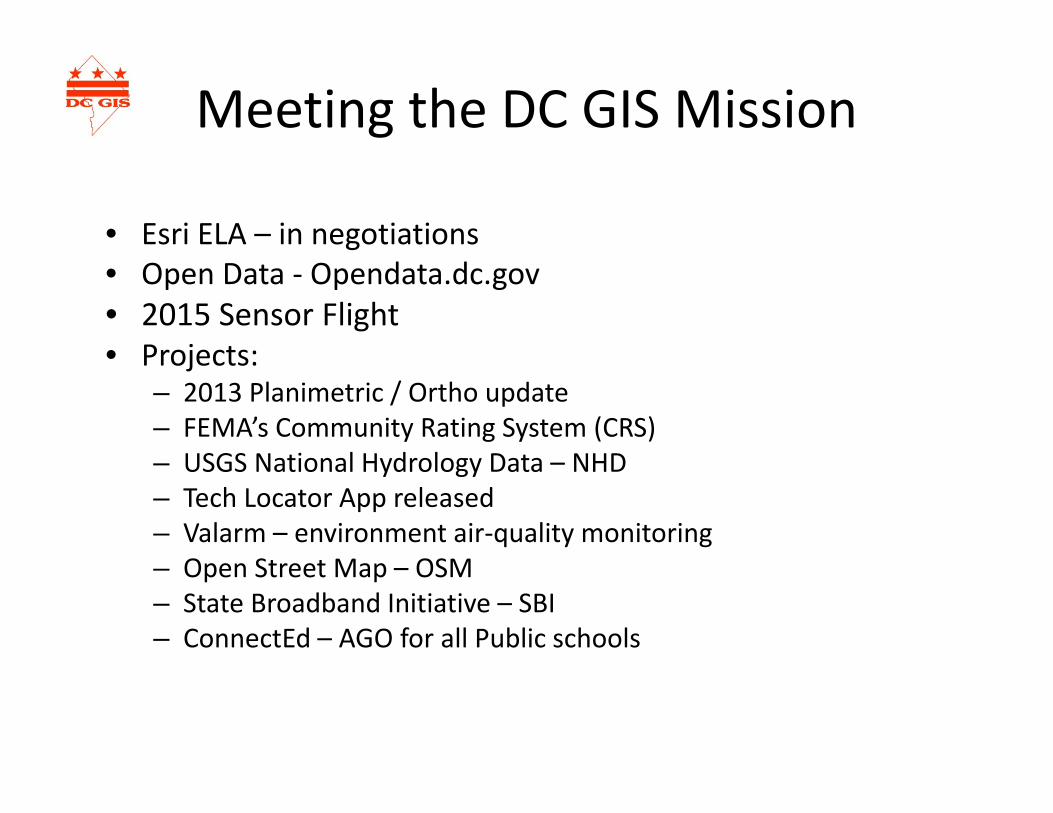
Meeting the DC GIS Mission
• Esri ELA – in negotiations• Open Data ‐ Opendata.dc.gov• 2015 Sensor Flight• Projects:
– 2013 Planimetric / Ortho update– FEMA’s Community Rating System (CRS)– USGS National Hydrology Data – NHD– Tech Locator App released– Valarm – environment air‐quality monitoring– Open Street Map – OSM– State Broadband Initiative – SBI– ConnectEd – AGO for all Public schools

OpenData Executive order
Published on July 21st, 2014 : http://dc.gov/node/871012
The following slides will identify the relevant technical requirements from the Executive Order and highlight if opendata.dc.gov fulfills the requirement using the following system:
Gray = Not ApplicableGreen = ~100%Blue = ~75%Orange = ~50%Red = ~25%
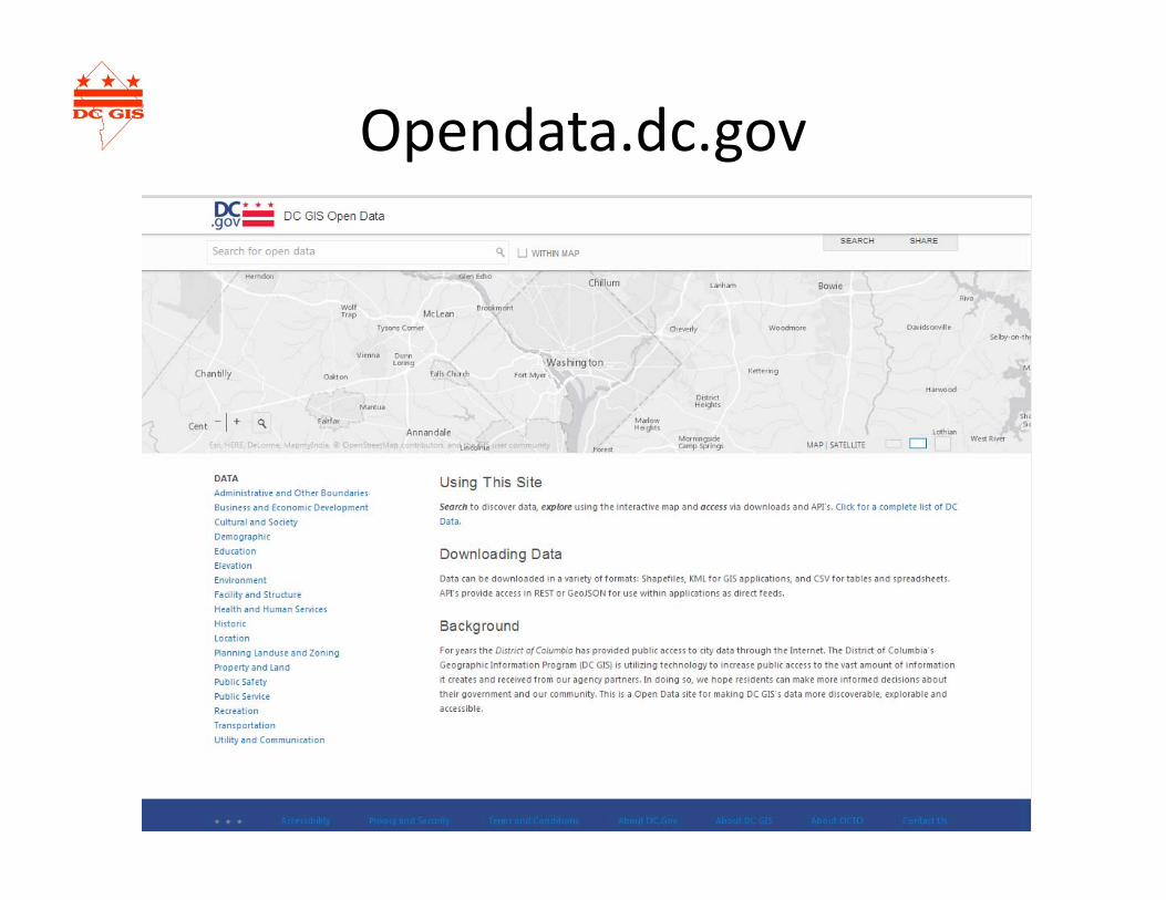
Opendata.dc.gov

Sensor Data?• High Precision multispectral data (3 inch pixel raster)• Oblique Imagery• LiDAR – Light Detection And Ranging
– Captured at 8 points per meter

OCTO GIS News
Tim Abdella
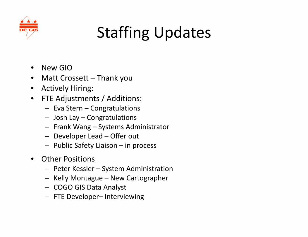
Staffing Updates
• New GIO• Matt Crossett – Thank you• Actively Hiring:• FTE Adjustments / Additions:
– Eva Stern – Congratulations– Josh Lay – Congratulations– Frank Wang – Systems Administrator– Developer Lead – Offer out– Public Safety Liaison – in process
• Other Positions– Peter Kessler – System Administration– Kelly Montague – New Cartographer– COGO GIS Data Analyst– FTE Developer– Interviewing
Reorganization

Vision
• Geospatial‐data Infrastructure Services– Focus on Data– Connect, Curate*, Create – Disseminate – Development resources focused internally– Less agency apps ‐‐> more agency enablement– Educate, Inform and Support– Truly Open Data….
Digital curation is the selection, preservation, maintenance, collection and archiving of digital assets. Digital curation establishes, maintains and adds value to repositories of digital data for present and future use. ‐ wikipedia

Highlights: OCTO GIS Team to Cover
• Migrations / updates:– KMZGT Tool / GME (Google Map Engine)– MAR Maintenance Tools
• Systems• Data• Training

Systems Report
Frank Wang

Key Efforts
• New GIS Systems Administrators:– Frank Wang– Peter Kessler
• Design and implement a new GIS System Architecture
• Develop new GIS Server monitoring approaches
• Migrate Citrix environment to XenApp 6.5
• Migrate DCCentral database to Oracle Grid

Past Architecture
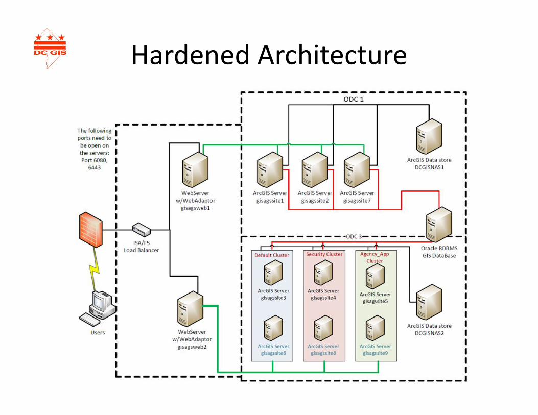
Hardened Architecture

Future Architecture
• Designed from scratch• Follow all best practices• A true reference implementation for Esri• Engage all players:
– DC GIS Staff knowledge– Esri System Architecture Teams– OCTO Technology Teams
• ECIS, CWITS, NOC, DC‐NET, CAB, ARB

Improved monitoring
• Revise sitescope• Install Esri Server Monitor• Weekly IIS log analysis• Goal: higher availability
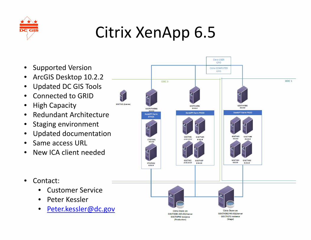
Citrix XenApp 6.5
• Supported Version• ArcGIS Desktop 10.2.2• Updated DC GIS Tools• Connected to GRID• High Capacity• Redundant Architecture• Staging environment• Updated documentation• Same access URL• New ICA client needed
• Contact:• Customer Service • Peter Kessler• [email protected]
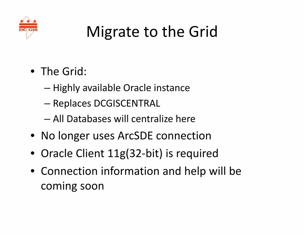
Migrate to the Grid
• The Grid:– Highly available Oracle instance– Replaces DCGISCENTRAL– All Databases will centralize here
• No longer uses ArcSDE connection• Oracle Client 11g(32‐bit) is required• Connection information and help will be coming soon

Data Report
Mario Field

Updated Datasets• Artist in Fellowship Program• Artist Grants in Aid• Arts in Education Program• Building – 3d• Building – 3d roof detail• Broadband Adoption Rate – Tract• Broadband Adoption Rate – Ward• Cama – Condominium• Cama – Commercial• Cama ‐ Residential• Camera• Charter School• DC Circulator Stop• DHS Service Center• DYRS Facility• Early Polling Place• Great Street• Halfway House• Historic District• Historic Landmark Element
• Historic Landmark• Historic Landmark Site• Liquor License• Land Cover ‐ 2011• Mobile Roadway Vending Location• National Park• Notary Public• Parking Beat• Polling Place• Public Housing Area• Public School• Public School – Closed• Public Art• Retail Site Plan• Single Member District• Street Centerline• Street Segment• Street Light• Street Tree• Wireless Hot Spot

Planimetrics 2013 ‐ Summary• Acquisition:
– 10/15/13: P56 Area Acquired– 10/18/13: Remaining DC Area Acquired
• Product:– 6‐inch pixel orthophotography (24‐bit, true color)– Digital Layers: Building, Bridge and Tunnel, Geodetic
Control, Obscured Area, Railroad, Street Centerline, Road, Sidewalk, Wooded Area, Grate, Stair, Swimming Pool
– All digital layers collected to new DC Boundary as defined by the boundary stone effort. (410,000 more sq feet)
– Given the data’s history, had to relax some topology rules– DDOT will get centerline geometry updates (500 records)
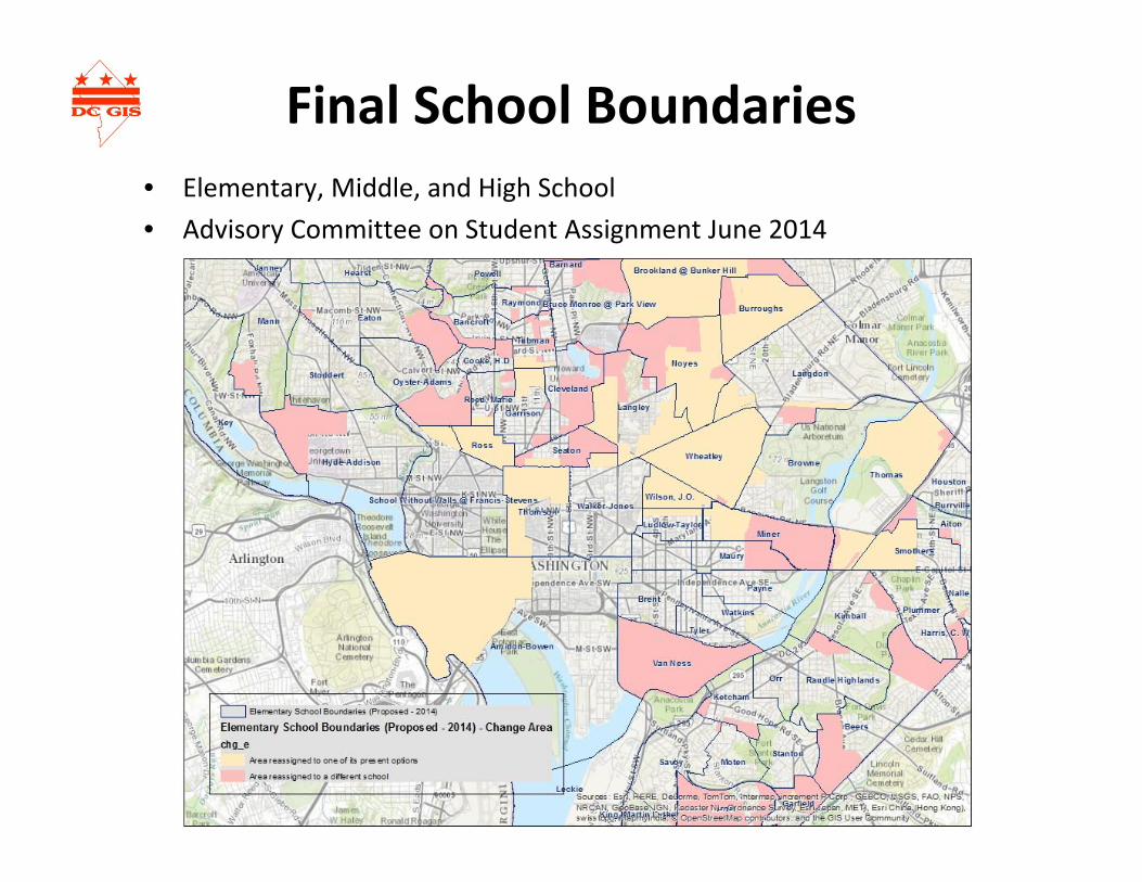
Final School Boundaries• Elementary, Middle, and High School• Advisory Committee on Student Assignment June 2014

3D Buildings• Entity and Roof Detail• Height, Surface area, Slope, and roof type attributes
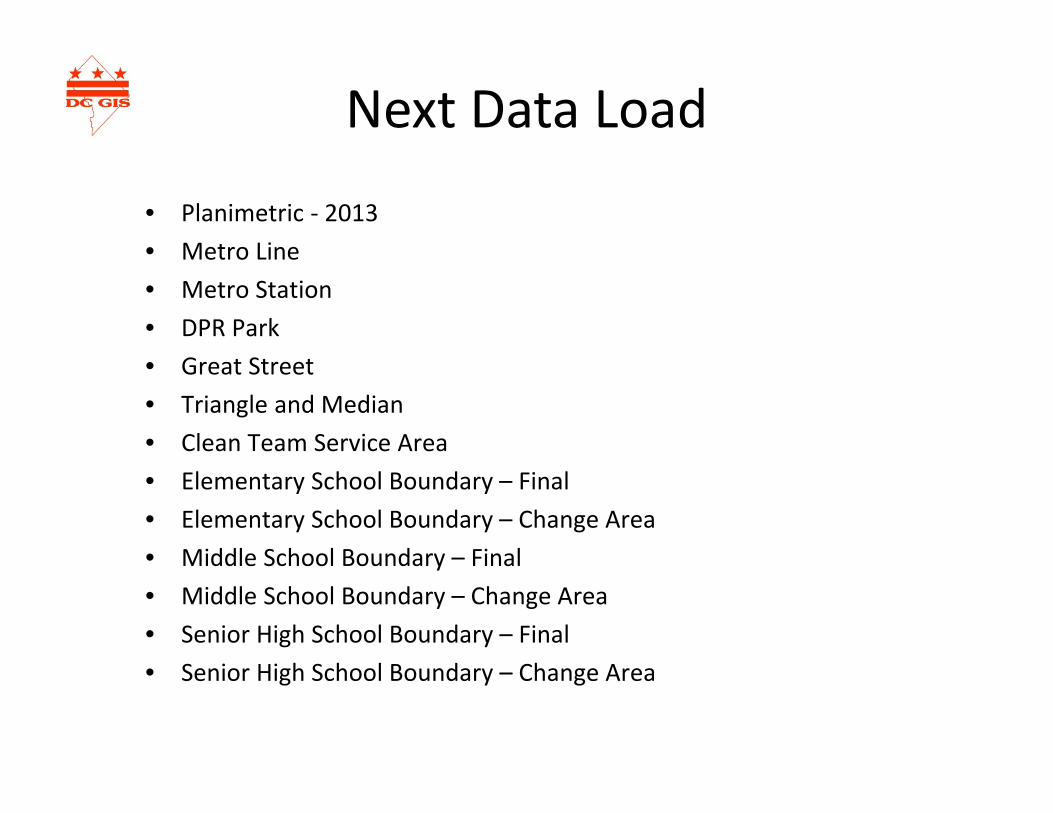
Next Data Load
• Planimetric ‐ 2013• Metro Line• Metro Station• DPR Park• Great Street• Triangle and Median• Clean Team Service Area• Elementary School Boundary – Final• Elementary School Boundary – Change Area• Middle School Boundary – Final• Middle School Boundary – Change Area• Senior High School Boundary – Final• Senior High School Boundary – Change Area

Training Report
Eva Stern

CLD Training Update
• Regular classes FY14: 103• MPD special classes at CLD: 23 • Other special classes not CLD: 13
Total attendees: 139
• OCME, DBH, OSSE, DDOE, CFSA, DDOT, EOM, DOH, Office of Victim Services (EOM), DMPED, HSEMA (Fusion Center), OCP, DCPL, OAG…

Outreach
• Presentation to DC teachers at Carnegie Academy for Science Education (Carnegie Institution for Science)
• Presentation to Anacostia Watershed Steward Academy (with Prince George’s County)
• TAGS/Alice Deal MS
• MapStory Community Leaders

CycloMediaStreet Level Imagery
James GrahamDDOT

Cyclomedia’sGlobespotter:A New Tool For DC Gov
James K. Graham
Immersive GIS Data Collection, Visualization,Creation, Verification, Analysis…

• What is it?• How it’s different than Street View• Brief Demo• Upcoming Training• Contact
Outline

• An interactive, web‐based application that provides access to panoramic street level images.
• Imagery collected Fall 2013 to Summer 2014.• Data captured every 5 meters.• Pedestrian faces and license plates blurred.• For DC Government employee use only.*• Example
*Consultants performing work on active DC Gov contracts excepted.
Globespotter

Globespotter vs Street View
• Locate address • View street‐level imagery• Access “historic” images• Accurate x,y,z measurements • Export point, line, poly (3d)• Overlay GIS Web Services (WFS)• ArcGIS Desktop Plug‐in• Freely extract/derive data
• Locate address • View street‐level imagery• Access “historic” images
Google StreetviewGlobespotter

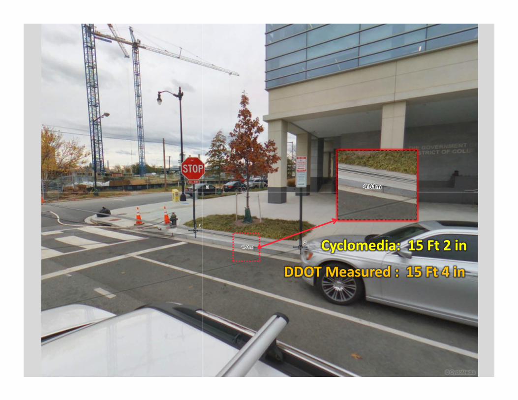
Cyclomedia: 15 Ft 2 in
DDOT Measured : 15 Ft 4 in


Cyclomedia: 8 Ft 7 in
DDOT Measured : 8 Ft 8 in


• First Training: September 2, 2014• Request for training here: http://bit.ly/globespotterdctraining• Request account here: http://bit.ly/globespotterdcaccount
Upcoming Training
José ColónChief Information OfficerDistrict Department of Transportation202‐741‐[email protected]
James GrahamGIS DeveloperDistrict Department of Transportation202‐741‐[email protected]
Contact Info

Future Steering Committee Dates
• November• February• May• August
• December• March• June• September
or

Round Table
Open Forum

Round Table
• James Graham – DDOT– AGO – UFA Group Briefing Book– On Solutions page – Anthony Send link– Needs to be hosted on our servers
• Sheryl Gonzalez ‐MPD– Use MAR Heavily – BI Tools, IBM Cognos– AWARE – integrates many data feeds into single view

Round Table
• Kate Mereand‐sinha– DCRA– Program Staff– How to become more integrated– COO – can provide– Digital Submission for Developers – Project Dox

Round Table
• Gregory Cotten– DGS (Acting CIO)– Archibus – Suit of tools – Poly lining
• Space and lease tools• Hook into HR manual to know where people sit• Hook into Network to know each network location• Will open as a web‐read only solution• Manage land outside of DC as well
– Need more data:• Parcels – VPM and OTR provide this data• Sustainability – Marc Chambers (Energy Usage)….

Round Table
• Susie Cambri – DMHHS– Global Exchange and outlook– Linked to DGS Archibus would be nice– Would like agency data to “be better”
• Quickbase opendata inventory• High Value data

Round Table
• Nina Semwanga ‐ FEMS– DC Google Globe – having issues– Would like mass deploy to all agency machines– All FEMS systems– Getting license issues– Working with MO & Team to document and Fix– DDOE, FEMS, MPD, OUC– Like live data – “buggies are”‐ red SUV’s– NCR‐GDX for data sharing– Live Data feeds from OUC – GeoEvent Processor

Round Table
• Darius Braxton ‐ DDOE– Application updates for WQD Mobile App– Internal meeting scheduled to discuss agency apps
• David Koehler – DPW– Started the transition away from DCGIS to Agency– A little up‐front pain– Nice to have full control over apps– DCGIS still there for support– Apps for trash collection (Xora) is an example

Adjourned
Thank you
Links to past DC GIS Steering Committee Meeting Agendas and Presentations are available at: http://dcgis.dc.gov click on DC GIS Steering Committee Link on the bottom of the page.