Data Day 2012_Freeman_Public Data Mapping
26
Information Technology Division Executive Office for Administration and Finance MAPC Data Day: OLIVER Aleda Freeman Web Mapping Services Manager Office of Geographic Information (aka MassGIS) January 2012
-
Upload
metropolitan-area-planning-council -
Category
Technology
-
view
295 -
download
0
Transcript of Data Day 2012_Freeman_Public Data Mapping

Information Technology DivisionExecutive Office for Administration and Finance
MAPC Data Day:OLIVER
Aleda FreemanWeb Mapping Services ManagerOffice of Geographic Information
(aka MassGIS)
January 2012
04/15/23 2
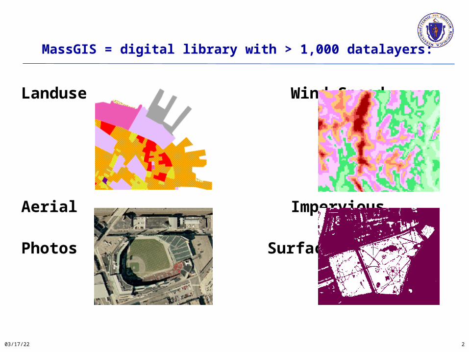
MassGIS = digital library with > 1,000 datalayers:
Landuse Wind Speed
Aerial Impervious
Photos Surface
04/15/23 3
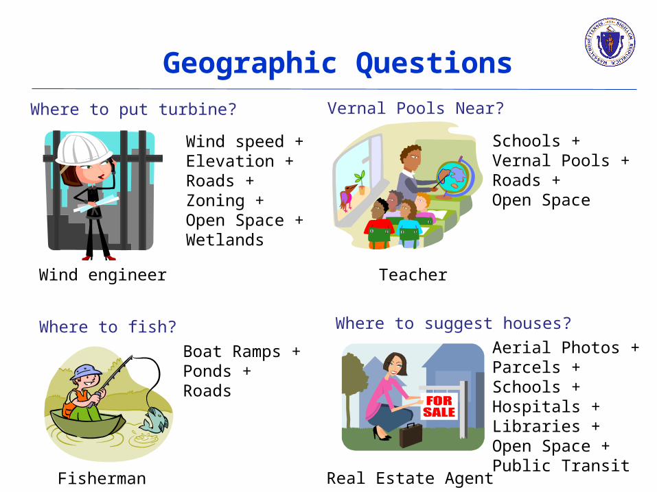
Wind engineer
Where to put turbine?
Wind speed +Elevation + Roads + Zoning + Open Space +Wetlands
Vernal Pools Near?
Schools +Vernal Pools + Roads +Open Space
Teacher
Fisherman Real Estate Agent
Boat Ramps +Ponds +Roads
Where to fish? Where to suggest houses?
Geographic Questions
Aerial Photos +Parcels +Schools +Hospitals +Libraries + Open Space +Public Transit

OLIVER
New version Jan. 10, 2012!
04/15/23 4

OLIVER
04/15/23 5
GeoServer OpenLayers
GeoExt Bing
geocoding
Google Yahoo
maps User
Interface
Library (YUI)

OLIVER
Runs on OpenGeoSpatial Consortium (OGC) standard web mapping services
provided by GeoServer
WMS – Web Map Service
WFS – Web Feature Service
04/15/23 6
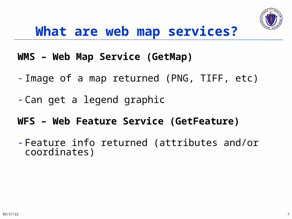
What are web map services?
WMS – Web Map Service (GetMap)
- Image of a map returned (PNG, TIFF, etc)
- Can get a legend graphic
WFS – Web Feature Service (GetFeature)
- Feature info returned (attributes and/or coordinates)
04/15/23 7
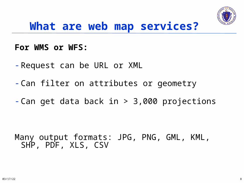
What are web map services?
For WMS or WFS:
- Request can be URL or XML
- Can filter on attributes or geometry
- Can get data back in > 3,000 projections
Many output formats: JPG, PNG, GML, KML, SHP, PDF, XLS, CSV
04/15/23 8

WMS URL Example
http://giswebservices.massgis.state.ma.us/geoserver/wms?VERSION=1.1.1&REQUEST=GetMap&SERVICE=WMS&LAYERS=massgis:GISDATA.TOWNS_POLYM,massgis:GISDATA.SCHOOLS_PT&STYLES=Black_Lines,&BBOX=232325.38526025353,898705.3447384972,238934.49648710093,903749.1401484597&SRS=EPSG:26986&WIDTH=570&HEIGHT=435&FORMAT=image/png
04/15/23 9
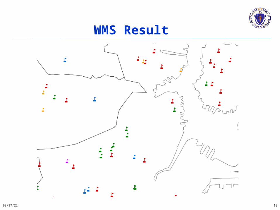
WMS Result
04/15/23 10

WFS URL Example
http://giswebservices.massgis.state.ma.us/geoserver/wfs?request=GetFeature&version=1.0.0&service=WFS&propertyname=TOWN,POP2000&typename=massgis:GISDATA.TOWNS_POLYM&CQL_FILTER=POP2000>100000
04/15/23 11

WFS Result
04/15/23 12

OLIVER initial view
04/15/23 13

OLIVER Basemaps
04/15/23 14
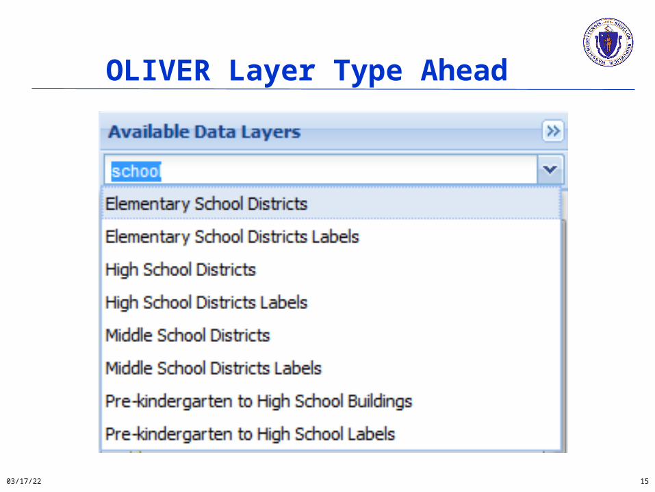
OLIVER Layer Type Ahead
04/15/23 15

OLIVER Change Colors
04/15/23 16
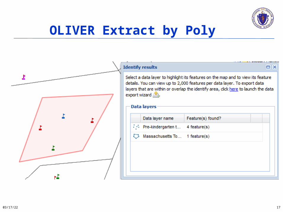
OLIVER Extract by Poly
04/15/23 17

OLIVER Permalink
04/15/23 18
http://maps.massgis.state.ma.us/map_ol/oliver.php?lyrs=Massachusetts%20Towns~massgis:GISDATA.TOWNS_POLY~Orange_Polys|Pre-kindergarten%20to%20High%20School%20Buildings~massgis:GISDATA.SCHOOLS_PT~GISDATA.SCHOOLS_PT::Default&bbox=-71.14295332558095,42.39905184521652,-70.96408217081994,42.47215329489033&coordUnit=m&measureUnit=m&base=TopOSM-MA¢er=-7909641.4148005,5226457.2011292&zoom=13&opacity=0.64,1&baseO=null

OLIVER Print/Save
04/15/23 19

OLIVER Configuration Options
04/15/23 20
- title, datalayer, about text and logos- default layers, default extent- basemap
Previous:
Additional:
- most tools show / hide - QuickZoom dropdowns, linked or unlinked - Draw / Edit tools (including snapping / splitting)
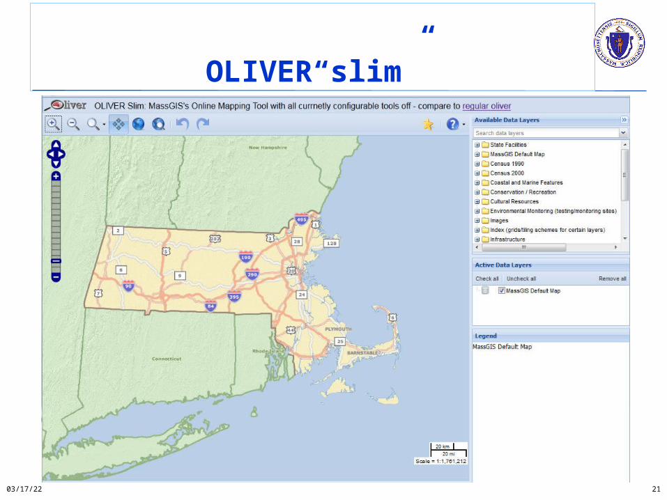
OLIVER“slim”
04/15/23 21
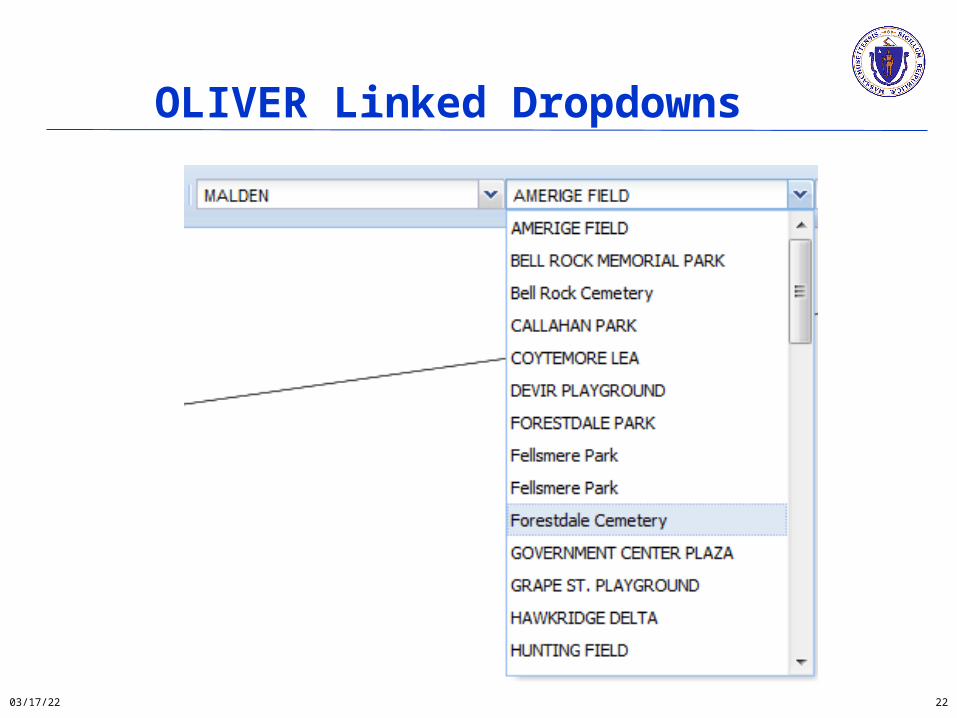
OLIVER Linked Dropdowns
04/15/23 22

OLIVER Draw/Edit
04/15/23 23

OLIVER External WMS
04/15/23 24
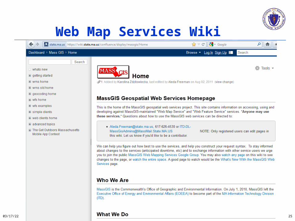
Web Map Services Wiki
04/15/23 25

THANK YOU.
Aleda Freeman
https://wiki.state.ma.us/confluence/display/massgis
617-626-4530