Data Criticism: a Methodology for the Quantitative...
31
Data Criticism: A methodology for the quantitative evaluation of non-textual historical sources with case studies on Silk Road maps and photographs Asanobu KITAMOTO, National Institute of Informatics Yoko NISHIMURA, Toyo Bunko http://dsr.nii.ac.jp/ 2013/9/20 JADH 2013 1
Transcript of Data Criticism: a Methodology for the Quantitative...
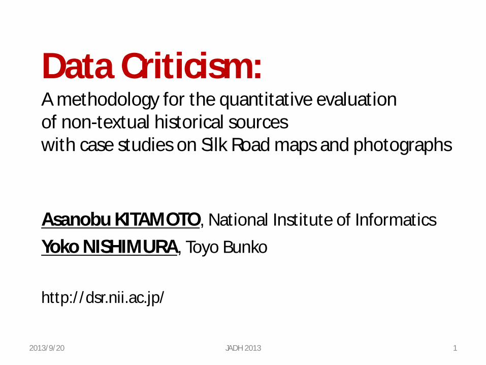
Data Criticism: A methodology for the quantitative evaluation of non-textual historical sources with case studies on Silk Road maps and photographs
Asanobu KITAMOTO, National Institute of Informatics Yoko NISHIMURA, Toyo Bunko http://dsr.nii.ac.jp/
2013/9/20 JADH 2013 1
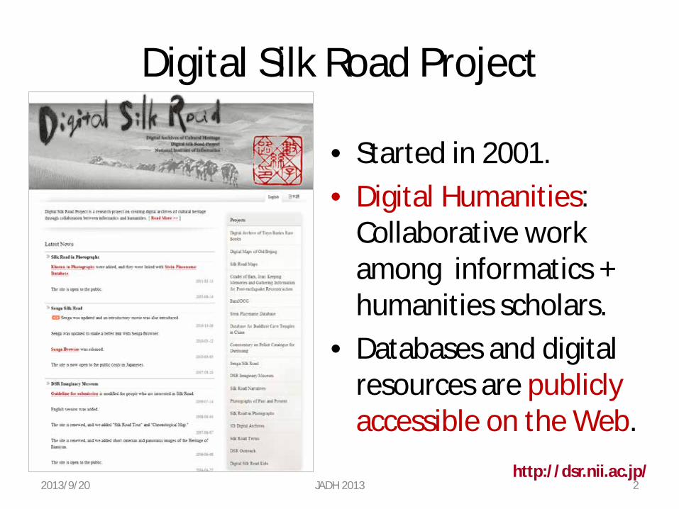
Digital Silk Road Project
• Started in 2001. • Digital Humanities:
Collaborative work among informatics + humanities scholars.
• Databases and digital resources are publicly accessible on the Web.
http://dsr.nii.ac.jp/ 2013/9/20 JADH 2013 2
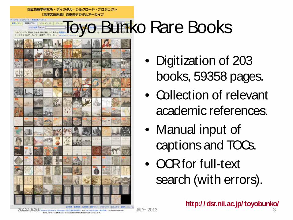
Toyo Bunko Rare Books
• Digitization of 203 books, 59358 pages.
• Collection of relevant academic references.
• Manual input of captions and TOCs.
• OCR for full-text search (with errors).
http://dsr.nii.ac.jp/toyobunko/ 2013/9/20 JADH 2013 3
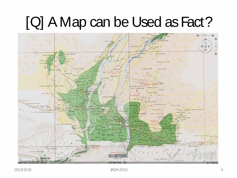
[Q] A Map can be Used as Fact?
2013/9/20 JADH 2013 4
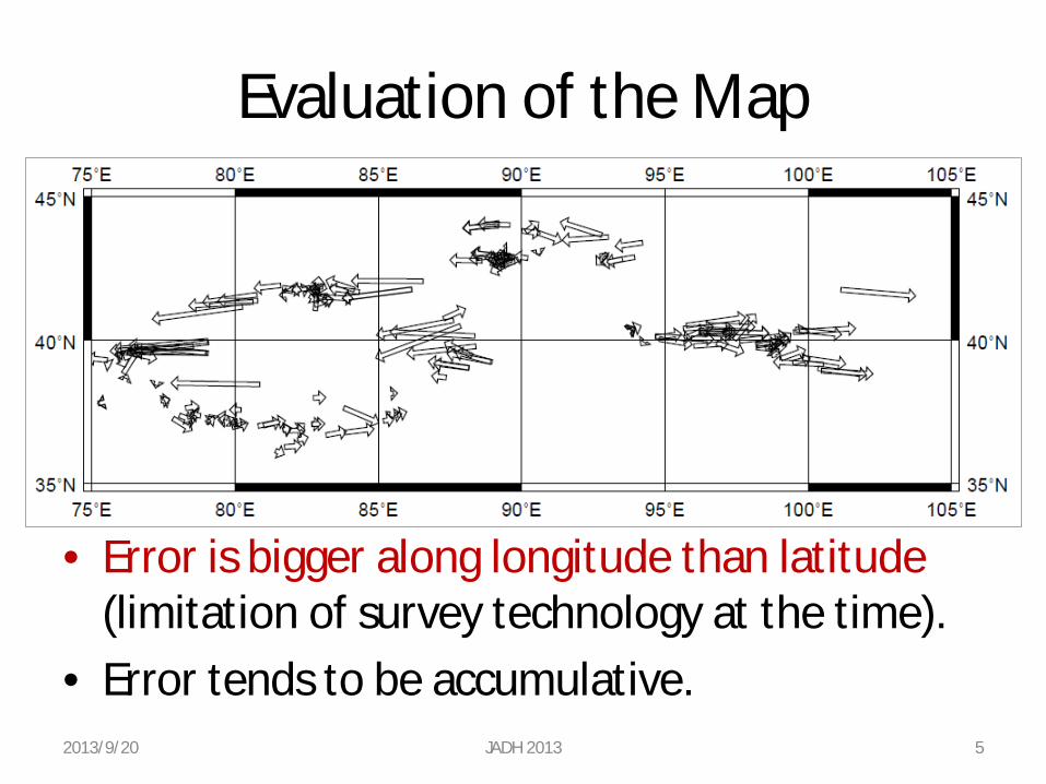
Evaluation of the Map
• Error is bigger along longitude than latitude (limitation of survey technology at the time).
• Error tends to be accumulative. 2013/9/20 JADH 2013 5
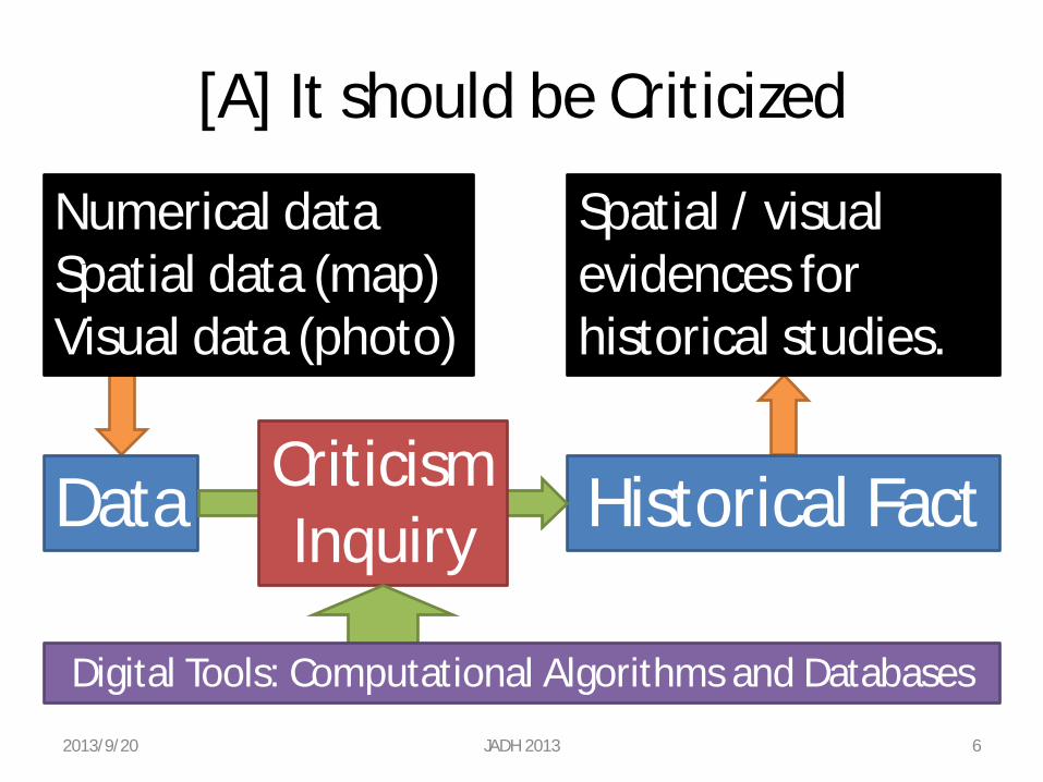
[A] It should be Criticized
2013/9/20 JADH 2013 6
Data Historical Fact Criticism Inquiry
Numerical data Spatial data (map) Visual data (photo)
Spatial / visual evidences for historical studies.
Digital Tools: Computational Algorithms and Databases
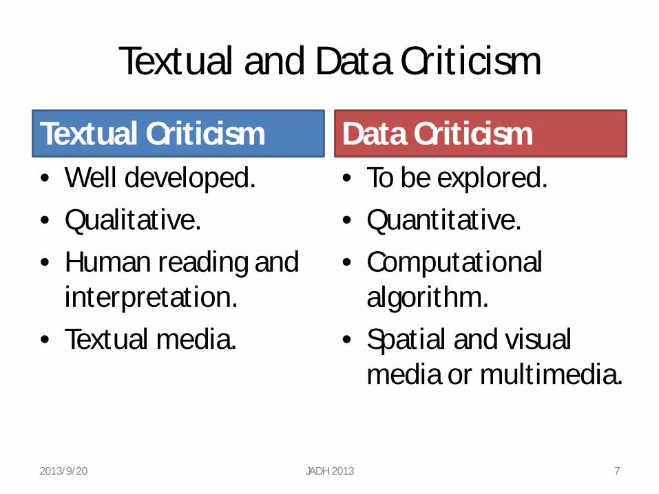
Textual and Data Criticism
Textual Criticism • Well developed. • Qualitative. • Human reading and
interpretation. • Textual media.
Data Criticism • To be explored. • Quantitative. • Computational
algorithm. • Spatial and visual
media or multimedia.
2013/9/20 JADH 2013 7
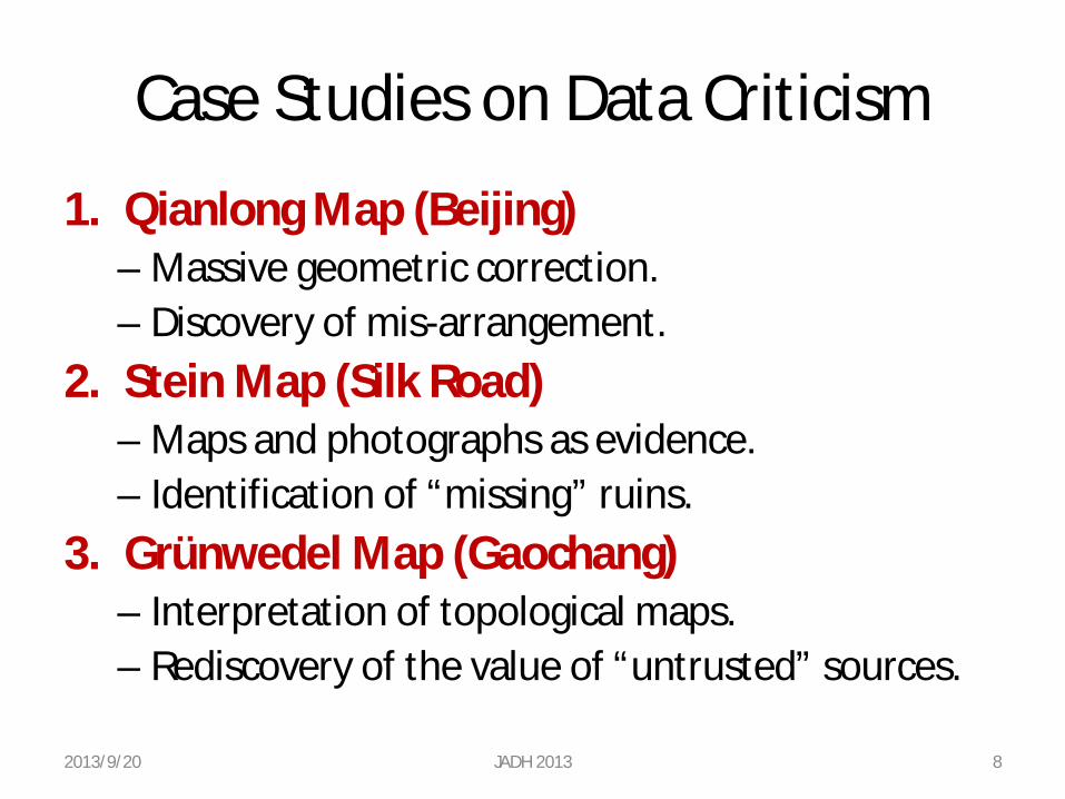
Case Studies on Data Criticism
1. Qianlong Map (Beijing) – Massive geometric correction. – Discovery of mis-arrangement.
2. Stein Map (Silk Road) – Maps and photographs as evidence. – Identification of “missing” ruins.
3. Grünwedel Map (Gaochang) – Interpretation of topological maps. – Rediscovery of the value of “untrusted” sources.
2013/9/20 JADH 2013 8
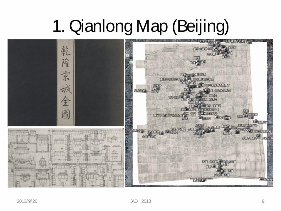
1. Qianlong Map (Beijing)
2013/9/20 JADH 2013 9
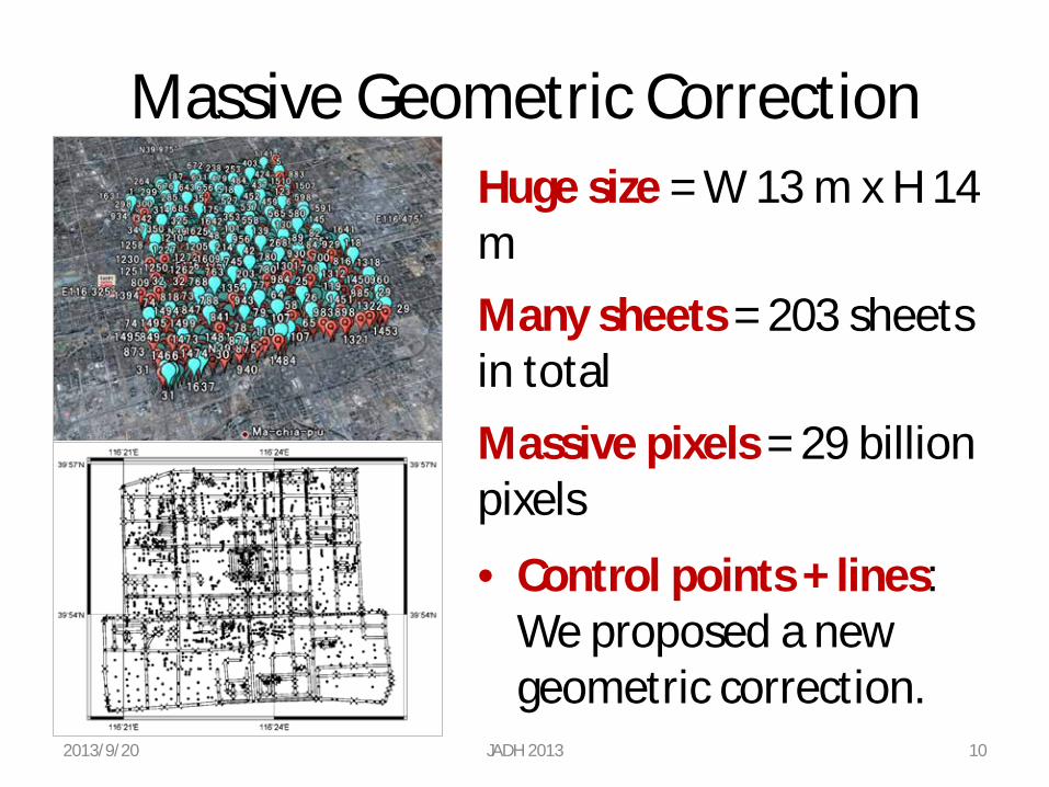
Massive Geometric Correction
• Control points + lines: We proposed a new geometric correction.
Huge size = W 13 m x H 14 m Many sheets = 203 sheets in total Massive pixels = 29 billion pixels
2013/9/20 JADH 2013 10
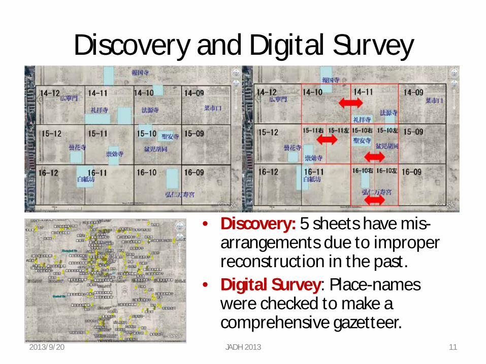
Discovery and Digital Survey
• Discovery: 5 sheets have mis-arrangements due to improper reconstruction in the past.
• Digital Survey: Place-names were checked to make a comprehensive gazetteer.
2013/9/20 JADH 2013 11
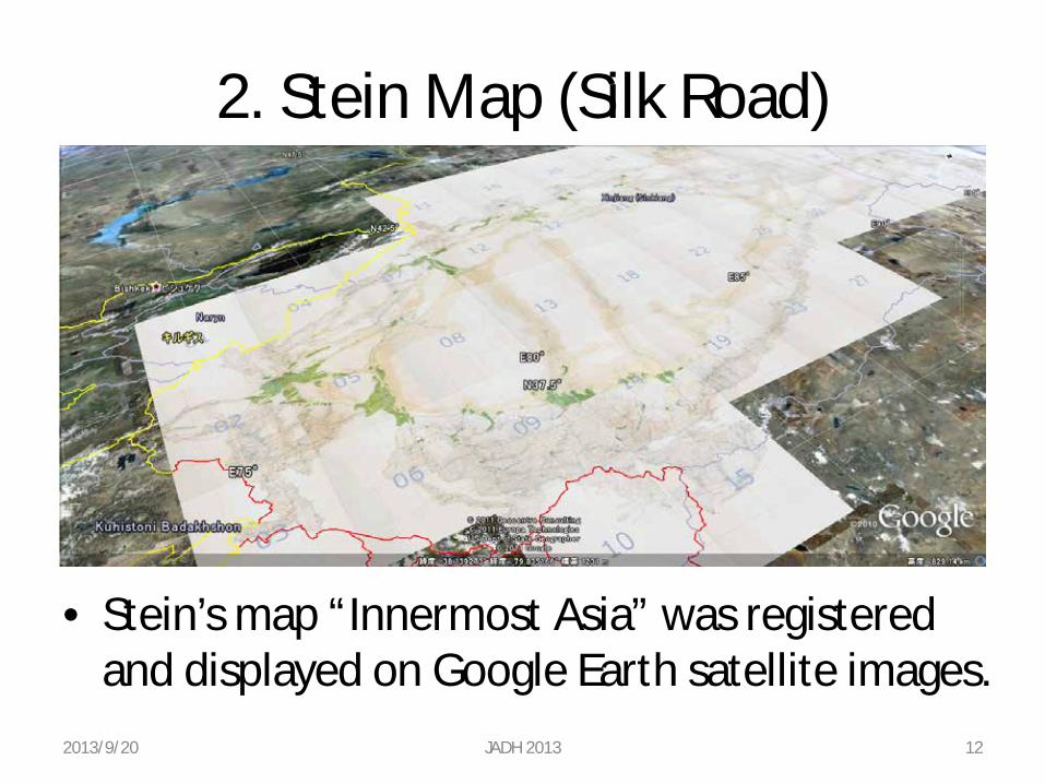
2. Stein Map (Silk Road)
• Stein’s map “Innermost Asia” was registered and displayed on Google Earth satellite images.
2013/9/20 JADH 2013 12
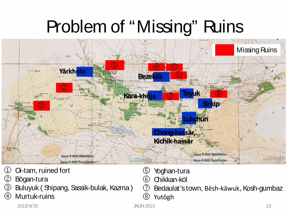
Problem of “Missing” Ruins
①
Yārkhoto ③ ④
Bezeklik ⑤ ⑥
② ⑦ ⑧ Kara-khōja Toyuk
Sirkip
Lukchun
Chong-hassār, Kichik-hassār
① Oi-tam, ruined fort ② Bögan-tura ③ Buluyuk ( Shipang, Sassik-bulak, Kazma ) ④ Murtuk-ruins
⑤ Yoghan-tura ⑥ Chikkan-köl ⑦ Bedaulat’s town, Bēsh-kāwuk, Kosh-gumbaz ⑧ Yutōgh
2013/9/20 JADH 2013 13
Missing Ruins
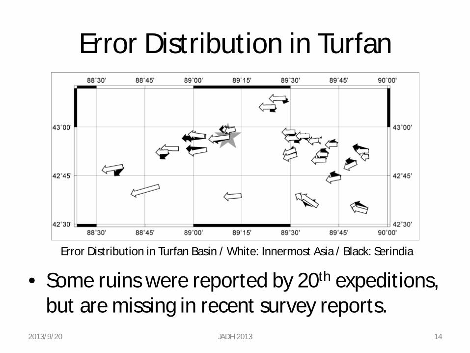
Error Distribution in Turfan Basin / White: Innermost Asia / Black: Serindia
Error Distribution in Turfan
• Some ruins were reported by 20th expeditions, but are missing in recent survey reports. 14 2013/9/20 JADH 2013
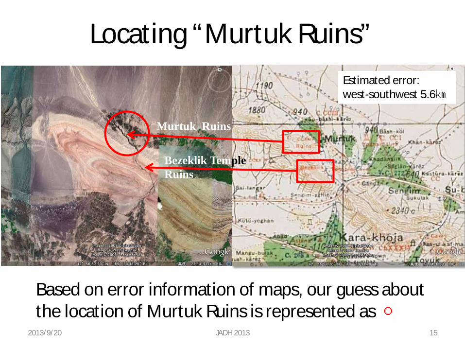
Locating “Murtuk Ruins”
Murtuk Ruins
Bezeklik Temple Ruins
Based on error information of maps, our guess about the location of Murtuk Ruins is represented as ○
Estimated error: west-southwest 5.6㎞
2013/9/20 JADH 2013 15
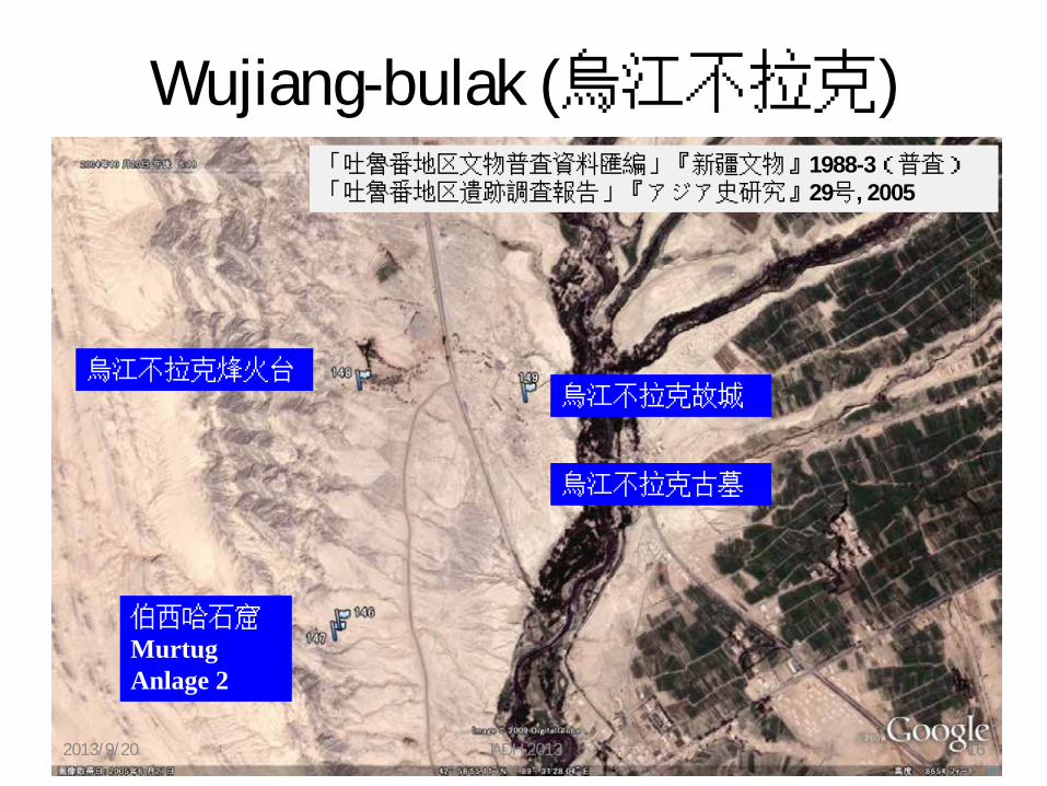
Wujiang-bulak (烏江不拉克)
烏江不拉克故城 烏江不拉克烽火台
伯西哈石窟 Murtug Anlage 2
烏江不拉克古墓
「吐魯番地区文物普査資料匯編」『新疆文物』1988-3(普査) 「吐魯番地区遺跡調査報告」『アジア史研究』29号, 2005
2013/9/20 JADH 2013 16
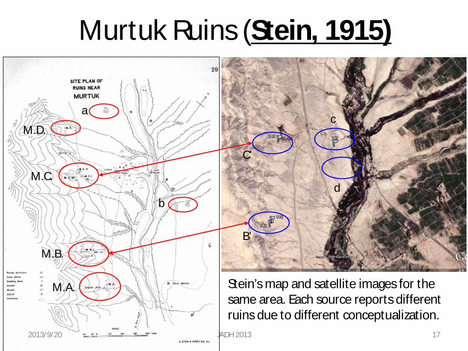
M.D.
M.C.
M.B.
M.A.
a
b
c
d
C’
B’
Murtuk Ruins (Stein, 1915)
Stein’s map and satellite images for the same area. Each source reports different ruins due to different conceptualization.
2013/9/20 JADH 2013 17
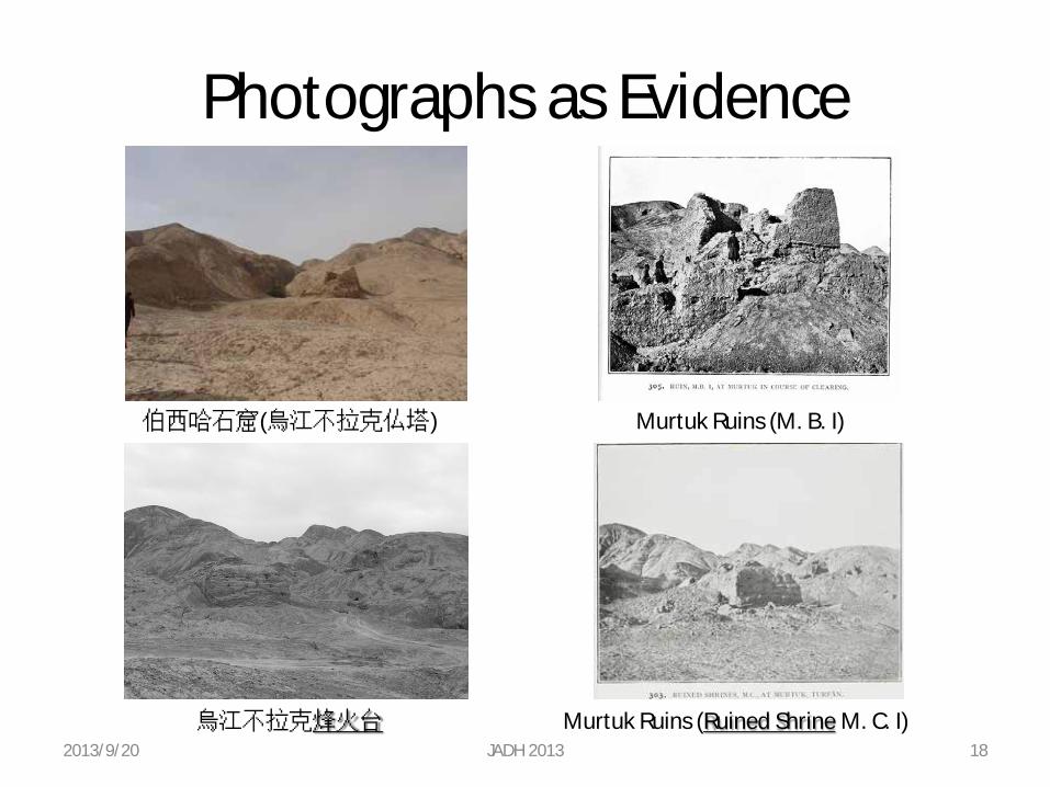
Photographs as Evidence
伯西哈石窟(烏江不拉克仏塔) Murtuk Ruins (M. B. I)
烏江不拉克烽火台 Murtuk Ruins (Ruined Shrine M. C. I) 2013/9/20 JADH 2013 18
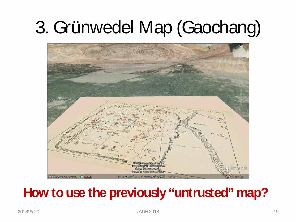
3. Grünwedel Map (Gaochang)
2013/9/20 JADH 2013 19
How to use the previously “untrusted” map?
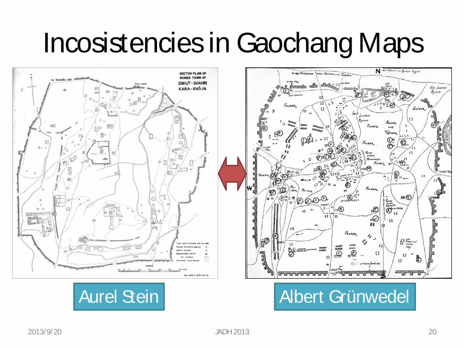
Incosistencies in Gaochang Maps
2013/9/20 JADH 2013 20
Aurel Stein Albert Grünwedel
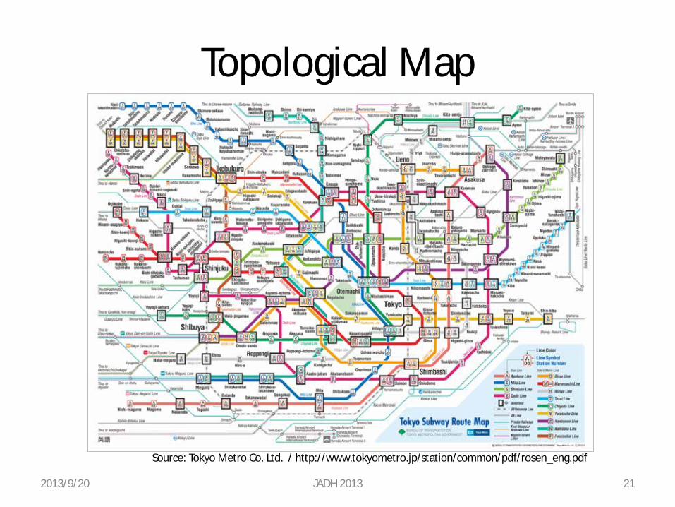
Topological Map
2013/9/20 JADH 2013 21
Source: Tokyo Metro Co. Ltd. / http://www.tokyometro.jp/station/common/pdf/rosen_eng.pdf
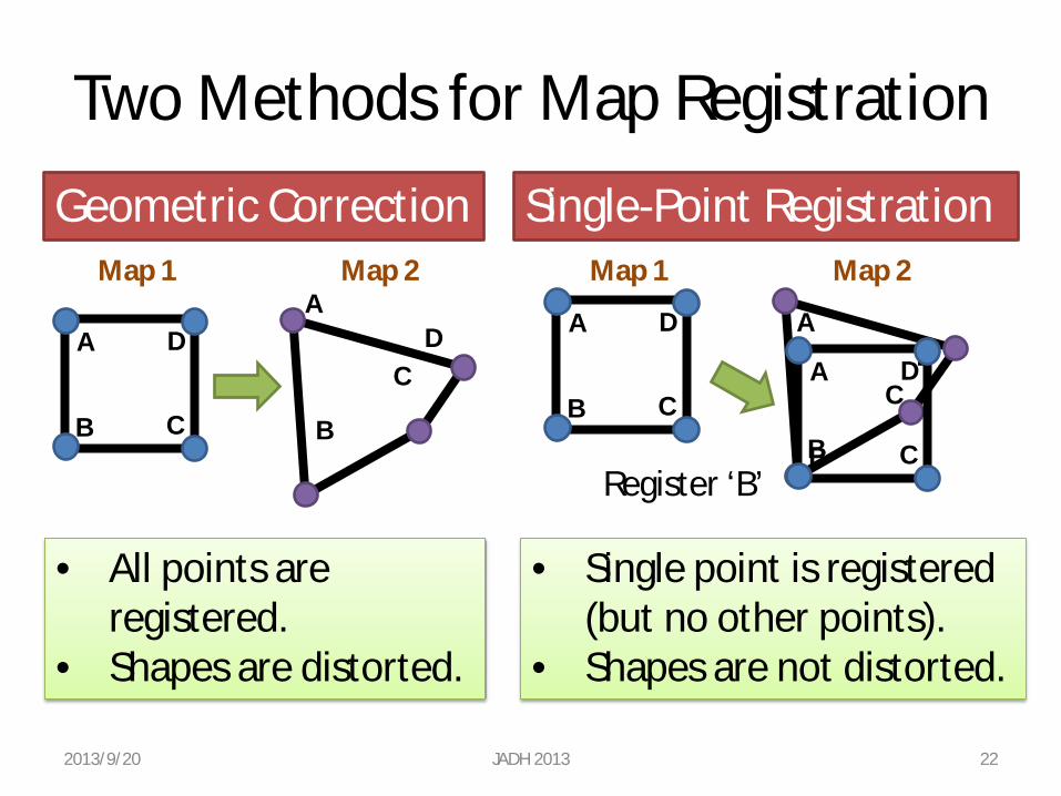
Two Methods for Map Registration
2013/9/20 JADH 2013 22
Geometric Correction Single-Point Registration
A
B C
D A
B
C D A
B C
D A
B
C D A
B C
D
Register ‘B’
• All points are registered.
• Shapes are distorted.
• Single point is registered (but no other points).
• Shapes are not distorted.
Map 1 Map 2 Map 1 Map 2
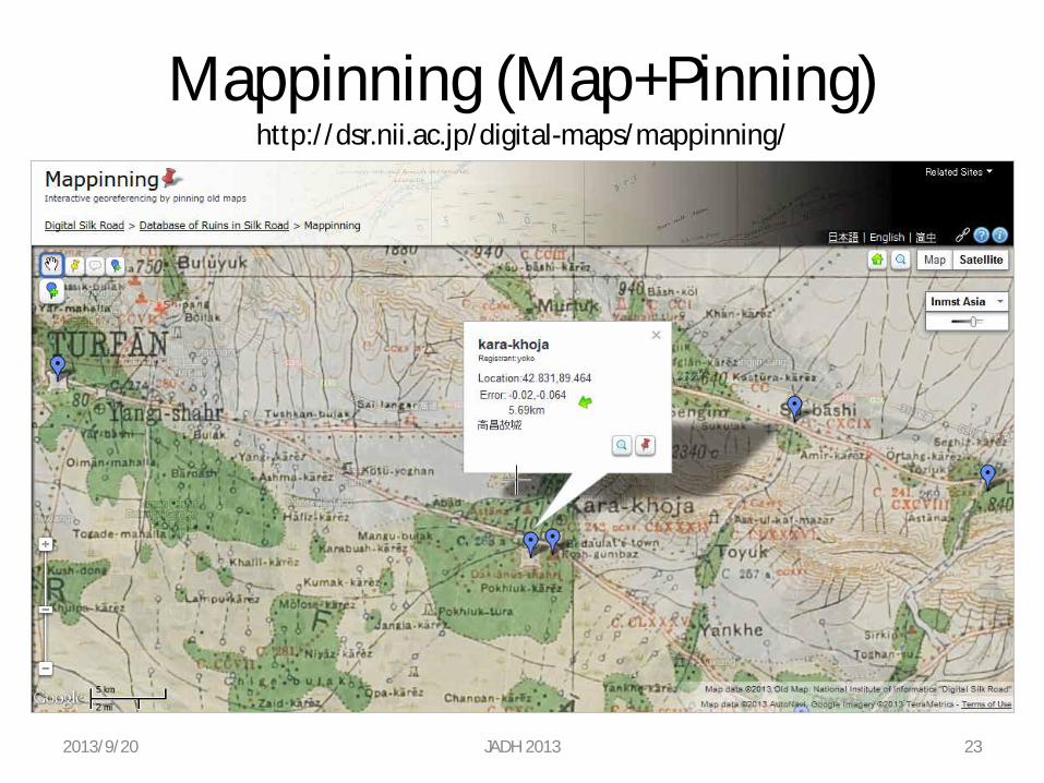
Mappinning (Map+Pinning) http://dsr.nii.ac.jp/digital-maps/mappinning/
2013/9/20 JADH 2013 23
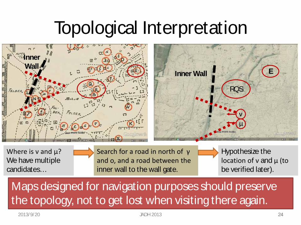
Topological Interpretation
2013/9/20 JADH 2013 24
Inner Wall
Inner Wall E
RQS
Where is ν and μ? We have multiple candidates…
Search for a road in north of γ and ο, and a road between the inner wall to the wall gate.
ν μ
24
Hypothesize the location of ν and μ (to be verified later).
Maps designed for navigation purposes should preserve the topology, not to get lost when visiting there again.
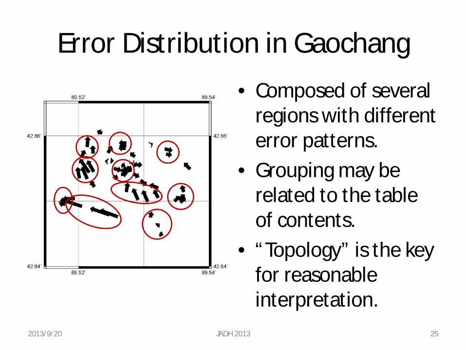
Error Distribution in Gaochang
2013/9/20 JADH 2013 25
• Composed of several regions with different error patterns.
• Grouping may be related to the table of contents.
• “Topology” is the key for reasonable interpretation.
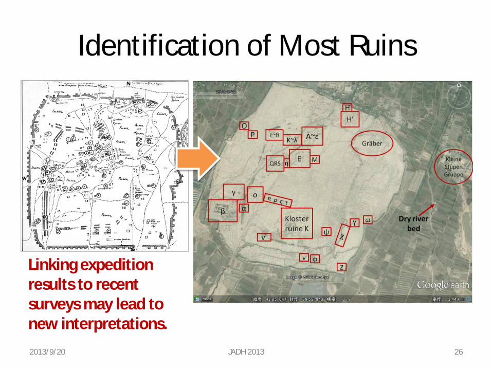
Identification of Most Ruins
2013/9/20 JADH 2013 26
Linking expedition results to recent surveys may lead to new interpretations.
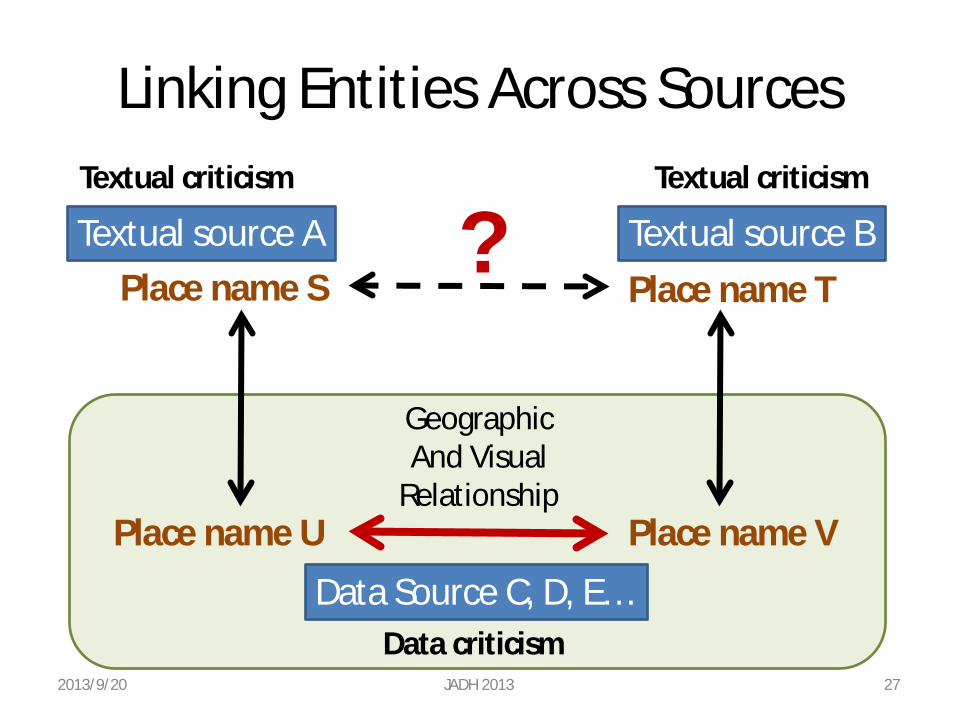
Linking Entities Across Sources
2013/9/20 JADH 2013 27
Textual source A Textual source B Place name S Place name T
Data Source C, D, E…
Place name U Place name V
?
Geographic And Visual
Relationship
Textual criticism Textual criticism
Data criticism
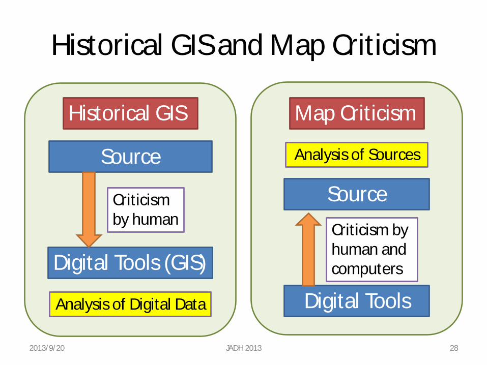
Historical GIS and Map Criticism
2013/9/20 JADH 2013 28
Historical GIS Map Criticism
Source
Digital Tools (GIS)
Criticism by human
Analysis of Digital Data
Analysis of Sources
Source
Digital Tools
Criticism by human and computers
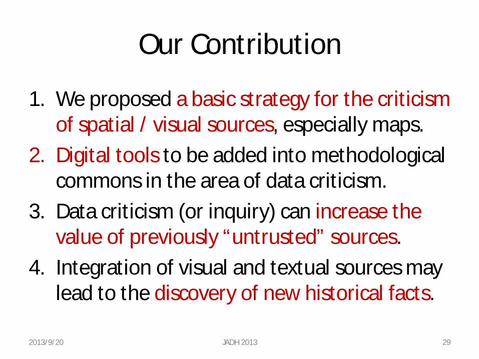
Our Contribution
1. We proposed a basic strategy for the criticism of spatial / visual sources, especially maps.
2. Digital tools to be added into methodological commons in the area of data criticism.
3. Data criticism (or inquiry) can increase the value of previously “untrusted” sources.
4. Integration of visual and textual sources may lead to the discovery of new historical facts.
2013/9/20 JADH 2013 29
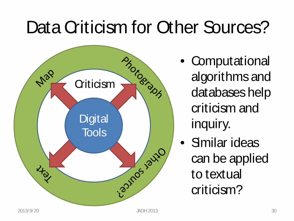
Data Criticism for Other Sources?
• Computational algorithms and databases help criticism and inquiry.
• Similar ideas can be applied to textual criticism?
2013/9/20 JADH 2013 30
Criticism
Digital Tools
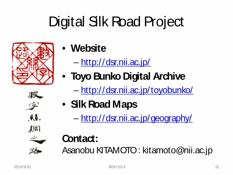
Digital Silk Road Project
• Website – http://dsr.nii.ac.jp/
• Toyo Bunko Digital Archive – http://dsr.nii.ac.jp/toyobunko/
• Silk Road Maps – http://dsr.nii.ac.jp/geography/
2013/9/20 JADH 2013 31
Contact: Asanobu KITAMOTO : [email protected]