DAM REMOVAL - Division on Earth and Life...
19
DAM REMOVAL ENGINEERING ISSUES & OPTIONS Presented by : James G. Mac Broom, P.E. Milone & Mac Broom, Inc. October 2011
Transcript of DAM REMOVAL - Division on Earth and Life...

DAM REMOVAL ENGINEERING ISSUES & OPTIONS
Presented by:
James G. Mac Broom, P.E. Milone & Mac Broom, Inc.
October 2011
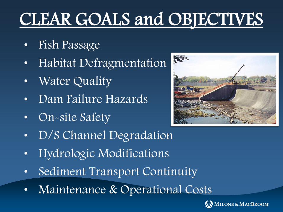
• Fish Passage
• Habitat Defragmentation
• Water Quality
• Dam Failure Hazards
• On-site Safety
• D/S Channel Degradation
• Hydrologic Modifications
• Sediment Transport Continuity
• Maintenance & Operational Costs
CLEAR GOALS and OBJECTIVES

DAM REMOVAL ISSUES
HYDROLOGY • WATERSHED HYDROLOGY • FLOODWATER STORAGE • IMPOUNDMENT DRAWDOWN • DOWNSTREAM IMPACT • WELL IMPACTS
FLUVIAL MORPHOLOGY • Data Collection • CHANNEL MORPHOLOGY/DESIGN (form, function,
process, materials) • CHANNEL EVOLUTION • SITE RESTORATION
ECOLOGY • ANADROMOUS / RESIDENT FISH • AQUATIC HABITAT • HABITAT FRAGMENTATION
• ECOLOGICAL RECOVERY
• VEGETATION
• WILDLIFE
• SPECIES OF SPECIAL CONCERN
HYDRAULICS • CHANNEL HYDRAULICS & SAFETY • FLOODPLAIN HYDRAULICS • SEDIMENT STABILITY/TRANSPORT • FISH PASSAGE • ICE JAMS
WATER QUALITY • CHEMICAL PROPERTIES • PHYSICAL PROPERTIES • (i.e. temperature, turbidity) • PUBLIC HEALTH
SOCIOECONOMIC • OWNERSHIP (Water Rights; Easements)
• CURRENT USES
• RECREATION
• PUBLIC SAFETY
• ECONOMIC ANALYSIS • ARCHEOLOGICAL/HISTORICAL • SENTIMENTAL VALUE
• AESTHETICS
CONSTRUCTION • SEASONAL CONSTRUCTION LIMITS
• CONSTRUCTION ACCESS
• CONSTRUCTION SEQUENCE
• SEDIMENT MANAGEMENT AND DISPOSAL
• WATER CONTROL
ENGINEERING • DATA COLLECTION
• TYPE & CONDITION OF DAM
• SITE LIMITATIONS (Utilities, Topo)
• UPSTREAM & DOWNSTREAM ISSUES
(bridges/structures, tributaries)
• PROJECT PERMITTING
• ALTERNATIVES ANALYSIS
DAM REMOVAL FALLACIES • All Dams Have A lot of Sediment
• All Impounded Sediments Will Erode
• Barren Mud Flats Last Forever
• River Dries Up
• All Upstream Channels Headcut
• All The Fish Die
• Dam Removal Allows Fish Passage
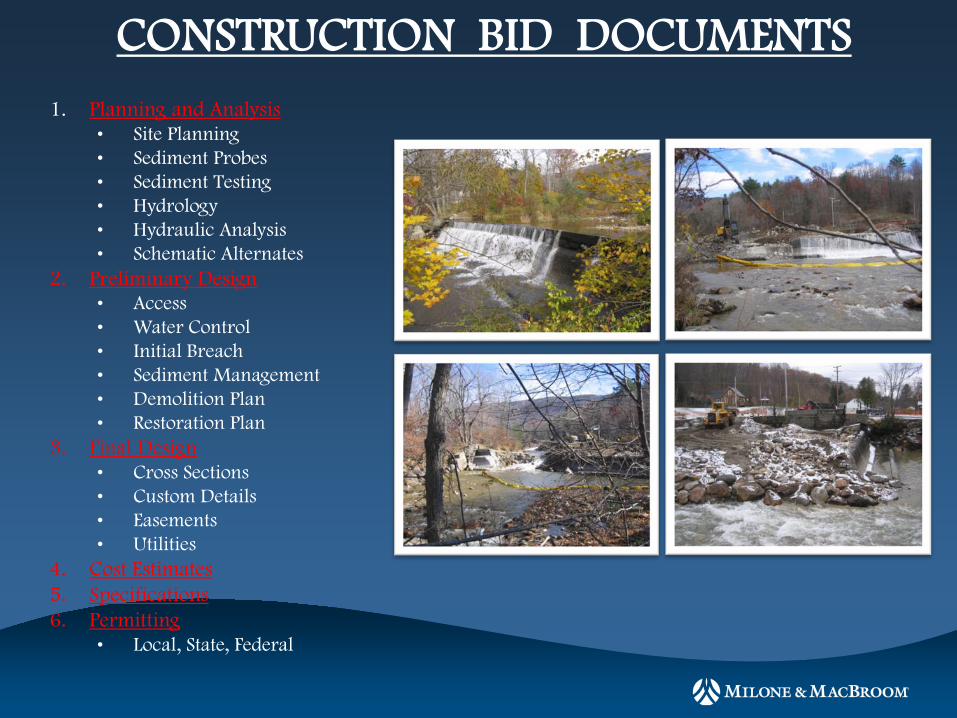
CONSTRUCTION BID DOCUMENTS 1. Planning and Analysis
• Site Planning • Sediment Probes • Sediment Testing • Hydrology • Hydraulic Analysis • Schematic Alternates
2. Preliminary Design • Access • Water Control • Initial Breach • Sediment Management • Demolition Plan • Restoration Plan
3. Final Design • Cross Sections • Custom Details • Easements • Utilities
4. Cost Estimates 5. Specifications 6. Permitting
• Local, State, Federal
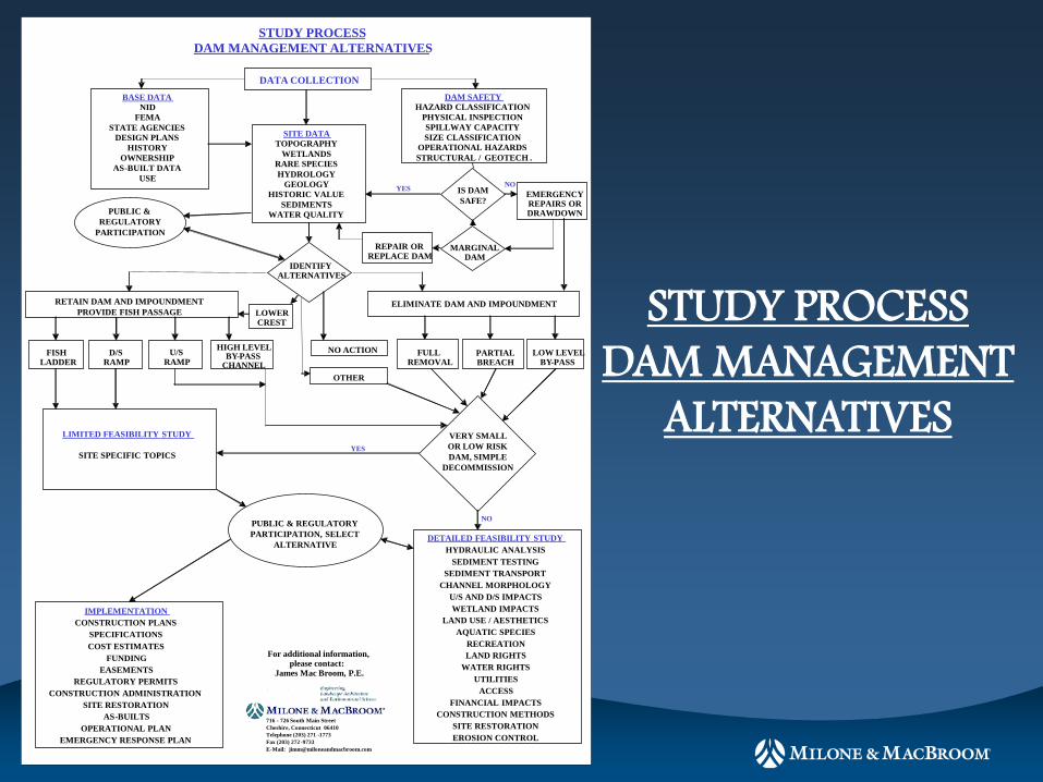
STUDY PROCESS DAM MANAGEMENT ALTERNATIVES
DATA COLLECTION BASE DATA
NID FEMA
STATE AGENCIES DESIGN PLANS
HISTORY OWNERSHIP
AS - BUILT DATA USE
DAM SAFETY HAZARD CLASSIFICATION
PHYSICAL INSPECTION SPILLWAY CAPACITY SIZE CLASSIFICATION
OPERATIONAL HAZARDS STRUCTURAL / GEOTECH .
SITE DATA TOPOGRAPHY
WETLANDS RARE SPECIES HYDROLOGY
GEOLOGY HISTORIC VALUE
SEDIMENTS WATER QUALITY PUBLIC &
REGULATORY PARTICIPATION
IS DAM SAFE?
EMERGENCY REPAIRS OR DRAWDOWN
MARGINAL DAM
REPAIR OR REPLACE DAM
IDENTIFY ALTERNATIVES
ELIMINATE DAM AND IMPOUNDMENT RETAIN DAM AND IMPOUNDMENT PROVIDE FISH PASSAGE LOWER
CREST
FISH LADDER
D/S RAMP
U/S RAMP
HIGH LEVEL BY - PASS
CHANNEL
NO ACTION
OTHER
FULL REMOVAL
PARTIAL BREACH
LOW LEVEL BY - PASS
VERY SMALL OR LOW RISK DAM, SIMPLE
DECOMMISSION
LIMITED FEASIBILITY STUDY
SITE SPECIFIC TOPICS
PUBLIC & REGULATORY PARTICIPATION, SELECT
ALTERNATIVE
IMPLEMENTATION CONSTRUCTION PLANS
SPECIFICATIONS COST ESTIMATES
FUNDING EASEMENTS
REGULATORY PERMITS CONSTRUCTION ADMINISTRATION
SITE RESTORATION AS - BUILTS
OPERATIONAL PLAN EMERGENCY RESPONSE PLAN
DETAILED FEASIBILITY STUDY HYDRAULIC ANALYSIS
SEDIMENT TESTING SEDIMENT TRANSPORT
CHANNEL MORPHOLOGY U/S AND D/S IMPACTS WETLAND IMPACTS
LAND USE / AESTHETICS AQUATIC SPECIES
RECREATION LAND RIGHTS
WATER RIGHTS UTILITIES
ACCESS FINANCIAL IMPACTS
CONSTRUCTION METHODS SITE RESTORATION EROSION CONTROL
YES NO
YES
NO
For additional information, please contact:
James Mac Broom, P.E.
716 - 726 South Main Street Cheshire, Connecticut 06410 Telephone (203) 271 - 1773 Fax (203) 272 - 9733 E - Mail: [email protected]
STUDY PROCESS DAM MANAGEMENT
ALTERNATIVES

FISH PASSAGE OPTIONS
• Dam Removal, Thru Channel
• Full Flow By-Pass Channel • Partial Flow By-Pass
Cannel • Downstream Ramp • Upstream Ramp • Structural Fish Ladder
• Trap and Haul • Elevators
FISH POWER MECHANICAL POWER
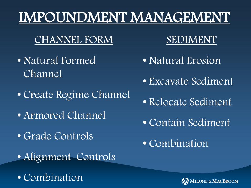
IMPOUNDMENT MANAGEMENT SEDIMENT
• Natural Erosion
• Excavate Sediment
• Relocate Sediment
• Contain Sediment
• Combination
CHANNEL FORM
• Natural Formed Channel
• Create Regime Channel
• Armored Channel
• Grade Controls
• Alignment Controls
• Combination
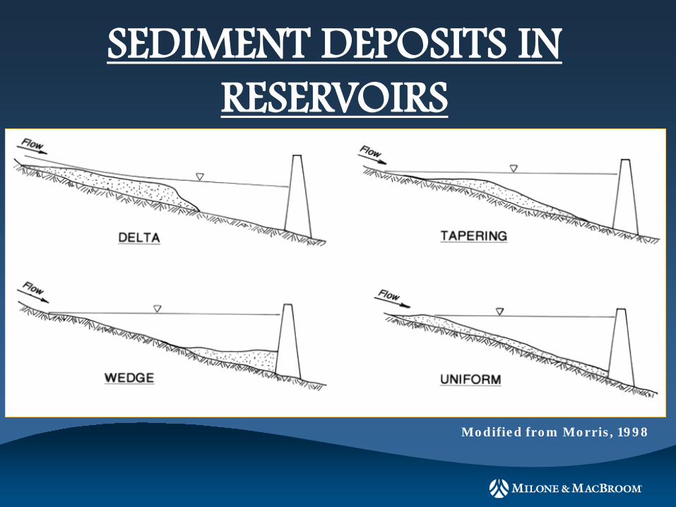
SEDIMENT DEPOSITS IN RESERVOIRS
Modified from Morris, 1998
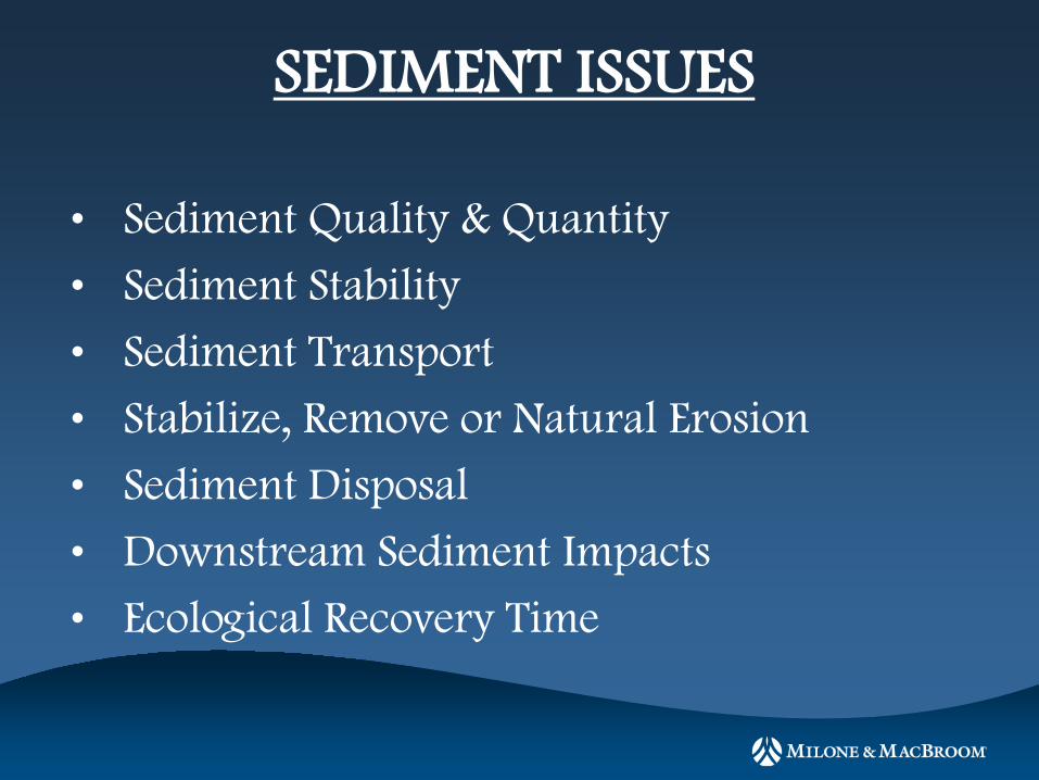
SEDIMENT ISSUES
• Sediment Quality & Quantity
• Sediment Stability
• Sediment Transport
• Stabilize, Remove or Natural Erosion
• Sediment Disposal
• Downstream Sediment Impacts
• Ecological Recovery Time
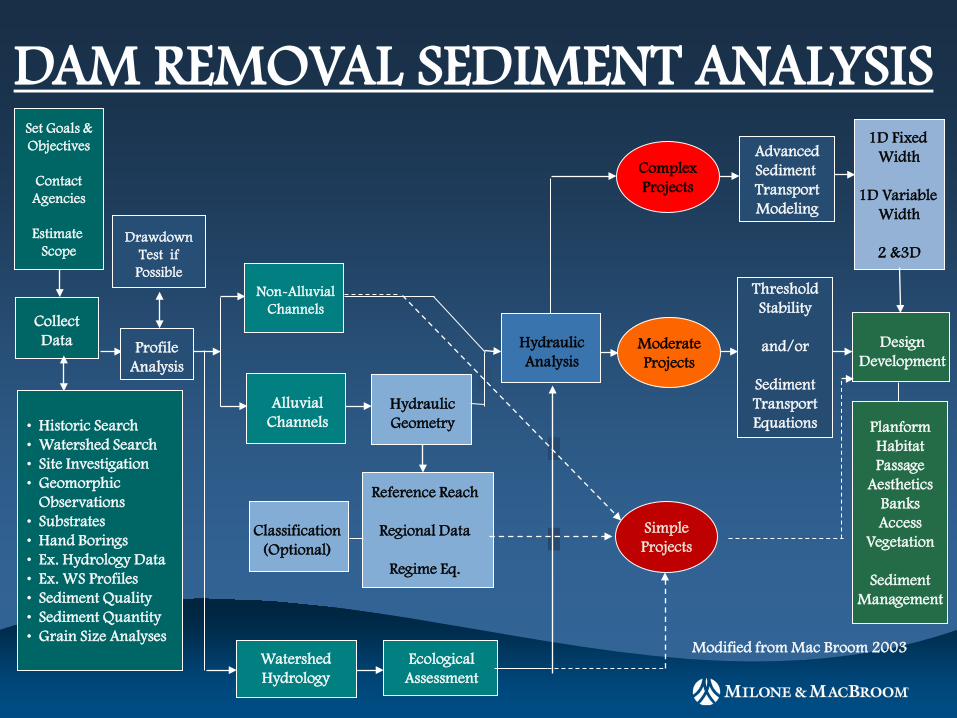
Watershed Hydrology
Ecological Assessment
Non-Alluvial Channels
Alluvial Channels
Collect Data
Set Goals & Objectives
Contact Agencies
Estimate
Scope
• Historic Search • Watershed Search • Site Investigation • Geomorphic Observations • Substrates • Hand Borings • Ex. Hydrology Data • Ex. WS Profiles • Sediment Quality • Sediment Quantity • Grain Size Analyses
Hydraulic Geometry
Classification (Optional)
Reference Reach
Regional Data
Regime Eq.
Planform Habitat Passage
Aesthetics Banks Access
Vegetation
Sediment Management
Design Development
Modified from Mac Broom 2003
Profile Analysis
Drawdown Test if Possible
Threshold Stability
and/or
Sediment Transport Equations
Moderate Projects
Advanced Sediment Transport Modeling
Complex Projects
1D Fixed Width
1D Variable
Width
2 &3D
Hydraulic Analysis
Simple Projects
DAM REMOVAL SEDIMENT ANALYSIS
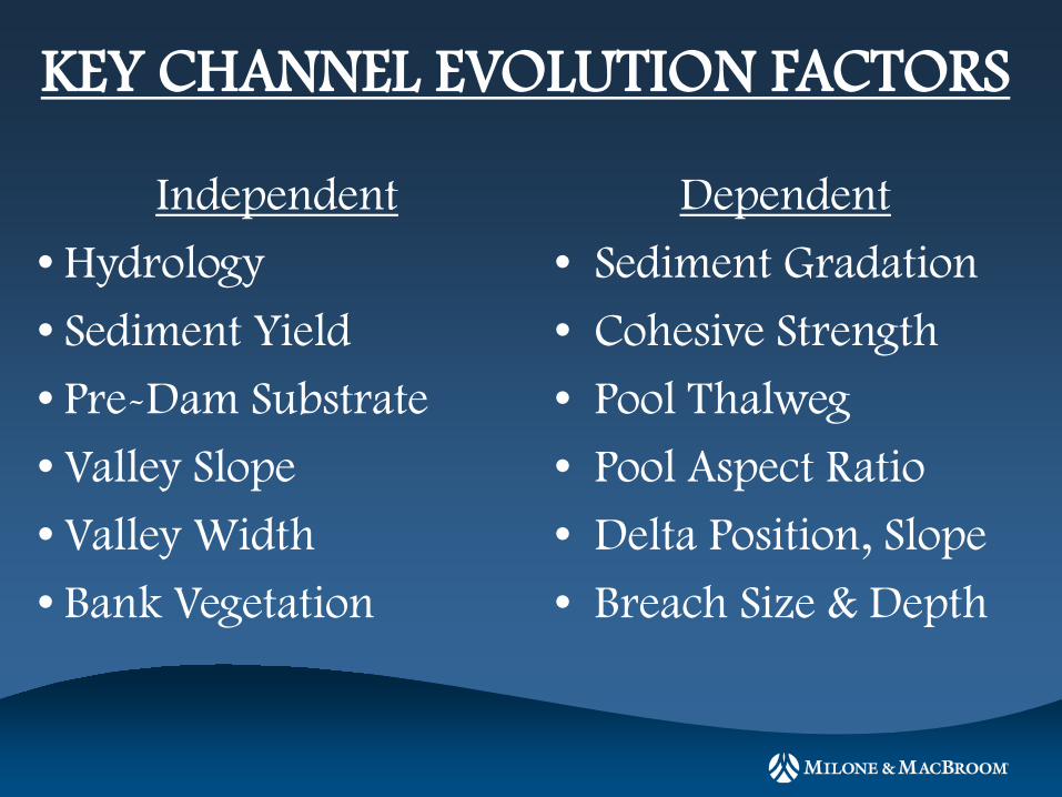
KEY CHANNEL EVOLUTION FACTORS
Independent
• Hydrology
• Sediment Yield
• Pre-Dam Substrate
• Valley Slope
• Valley Width
• Bank Vegetation
Dependent
• Sediment Gradation
• Cohesive Strength
• Pool Thalweg
• Pool Aspect Ratio
• Delta Position, Slope
• Breach Size & Depth
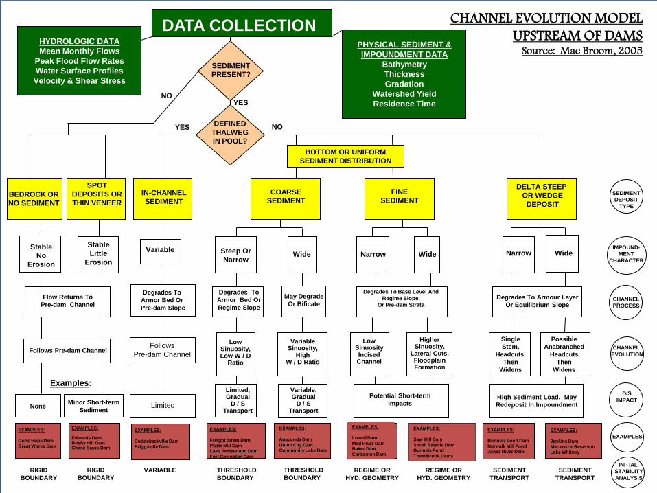
HYDROLOGIC DATA Mean Monthly Flows
Peak Flood Flow Rates Water Surface Profiles Velocity & Shear Stress
CHANNEL EVOLUTION MODEL UPSTREAM OF DAMS
Source: Mac Broom, 2005
DATA COLLECTION
PHYSICAL SEDIMENT & IMPOUNDMENT DATA
Bathymetry Thickness Gradation
Watershed Yield Residence Time
BEDROCK OR NO SEDIMENT
SPOT DEPOSITS OR THIN VENEER
Stable No
Erosion
Stable Little
Erosion
Flow Returns To Pre-dam Channel
Follows Pre-dam Channel
DEFINED THALWEG IN POOL?
COARSE SEDIMENT
Steep Or Narrow
Wide
Degrades To Armor Bed Or Regime Slope
FINE SEDIMENT
Narrow
Wide
Degrades To Base Level And Regime Slope,
Or Pre-dam Strata
DELTA STEEP OR WEDGE
DEPOSIT
Narrow
Wide
Degrades To Armour Layer Or Equilibrium Slope
Low Sinuosity, Low W / D
Ratio
Variable Sinuosity,
High W / D Ratio
Limited, Gradual
D / S Transport
Variable, Gradual
D / S Transport
Low Sinuosity Incised Channel
Higher Sinuosity,
Lateral Cuts, Floodplain Formation
Potential Short-term Impacts
High Sediment Load. May Redeposit In Impoundment
Single Stem,
Headcuts, Then
Widens
Possible Anabranched
Headcuts Then
Widens
Examples:
YES NO
May Degrade Or Bificate
EXAMPLES: Good Hope Dam Great Works Dam
EXAMPLES: Edwards Dam Bushy Hill Dam Chase Brass Dam
EXAMPLES: Freight Street Dam Platts Mill Dam Lake Switzerland Dam Fort Covington Dam
EXAMPLES: Anaconda Dam Union City Dam Community Lake Dam
EXAMPLES: Lowell Dam Mad River Dam Baker Dam Carbonton Dam
EXAMPLES: Saw Mill Dam South Batavia Dam Bunnels Pond Town Brook Dams
EXAMPLES: Bunnels Pond Dam Norwalk Mill Pond Jones River Dam
EXAMPLES: Jenkins Dam Mackenzie Reservoir Lake Whitney
IMPOUND- MENT
CHARACTER
CHANNEL PROCESS
CHANNEL EVOLUTION
D/S IMPACT
None
SEDIMENT DEPOSIT
TYPE
BOTTOM OR UNIFORM SEDIMENT DISTRIBUTION
Minor Short-term Sediment
RIGID BOUNDARY
RIGID BOUNDARY
THRESHOLD BOUNDARY
REGIME OR HYD. GEOMETRY
SEDIMENT TRANSPORT
SEDIMENT TRANSPORT
THRESHOLD BOUNDARY
REGIME OR HYD. GEOMETRY
SEDIMENT PRESENT?
YES NO
Variable
Degrades To Armor Bed Or Pre-dam Slope
Follows Pre-dam Channel
Limited
EXAMPLES: Cuddebackville Dam Briggsville Dam
VARIABLE
IN-CHANNEL SEDIMENT
EXAMPLES
INITIAL STABILITY ANALYSIS

UPSTREAM CHANNEL PREDICTION • Historic Data on Pre Dam Conditions
• Reference Reaches- NCD
• Regime Equations
• Hydraulic Geometry Equations
• Slope – Discharge , Stream Power
• Hydraulic & Sediment Transport Methods
• Extremal Hypothesis
0 50 100 150 200
0.00025
0.00030
0.00035
0.00040
0.00045
Stability CurveQ = 2400 cfs
Total Sediment Concentration = 50 ppm
Base Width, ft
Slop
e
Legend
Stability Curve
Degradation
Aggradation
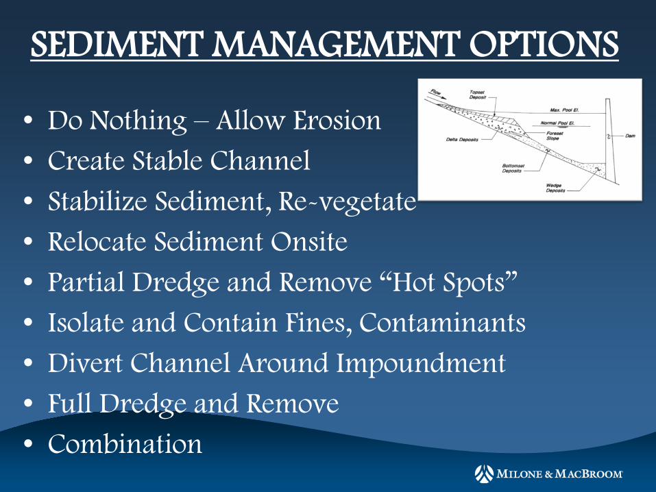
SEDIMENT MANAGEMENT OPTIONS
• Do Nothing – Allow Erosion • Create Stable Channel • Stabilize Sediment, Re-vegetate • Relocate Sediment Onsite • Partial Dredge and Remove “Hot Spots” • Isolate and Contain Fines, Contaminants • Divert Channel Around Impoundment • Full Dredge and Remove • Combination
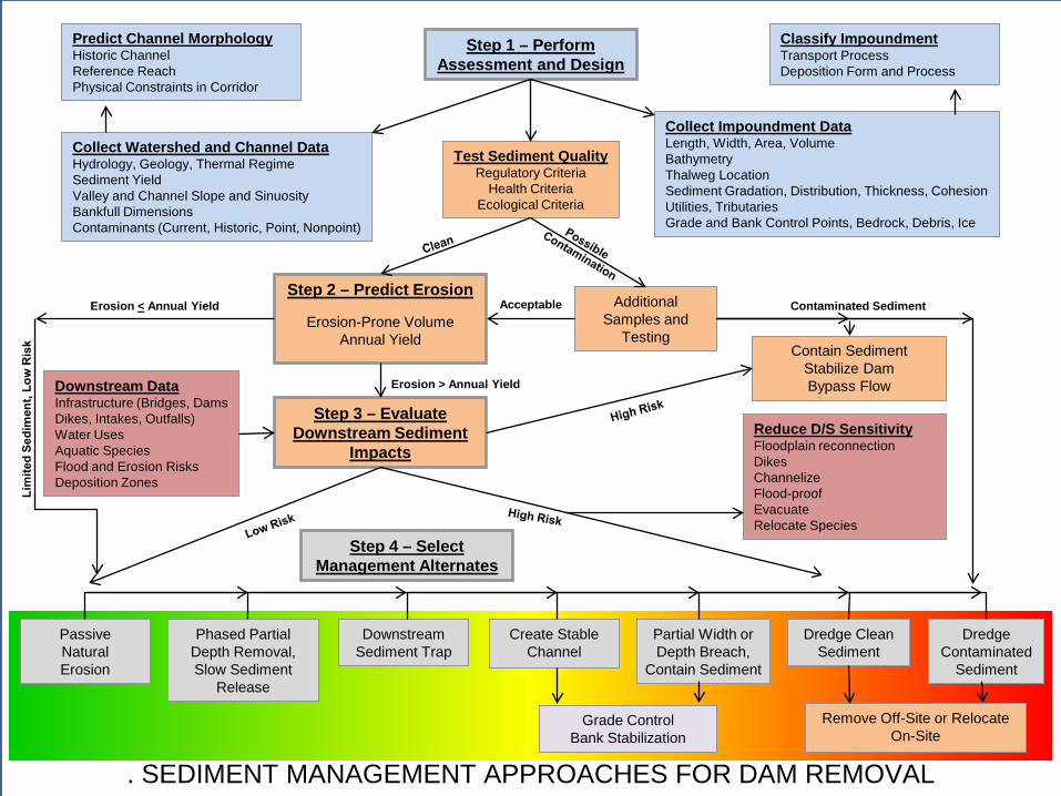
Passive Natural Erosion
Create Stable Channel
Phased Partial Depth Removal, Slow Sediment
Release
Downstream Sediment Trap
Partial Width or Depth Breach,
Contain Sediment
Dredge Clean Sediment
Dredge Contaminated
Sediment
Remove Off-Site or Relocate On-Site
Step 1 – Perform Assessment and Design
Step 2 – Predict Erosion
--------------------------
Erosion-Prone Volume Annual Yield
Collect Impoundment Data Length, Width, Area, Volume Bathymetry Thalweg Location Sediment Gradation, Distribution, Thickness, Cohesion Utilities, Tributaries Grade and Bank Control Points, Bedrock, Debris, Ice
Collect Watershed and Channel Data Hydrology, Geology, Thermal Regime Sediment Yield Valley and Channel Slope and Sinuosity Bankfull Dimensions Contaminants (Current, Historic, Point, Nonpoint)
Additional Samples and
Testing Contain Sediment
Stabilize Dam Bypass Flow
Test Sediment Quality Regulatory Criteria
Health Criteria Ecological Criteria
Reduce D/S Sensitivity Floodplain reconnection Dikes Channelize Flood-proof Evacuate Relocate Species
Step 3 – Evaluate Downstream Sediment
Impacts
Predict Channel Morphology Historic Channel Reference Reach Physical Constraints in Corridor
Classify Impoundment Transport Process Deposition Form and Process
Downstream Data Infrastructure (Bridges, Dams Dikes, Intakes, Outfalls) Water Uses Aquatic Species Flood and Erosion Risks Deposition Zones
. SEDIMENT MANAGEMENT APPROACHES FOR DAM REMOVAL
Step 4 – Select Management Alternates
Acceptable Contaminated Sediment Erosion < Annual Yield
Erosion > Annual Yield
Grade Control Bank Stabilization
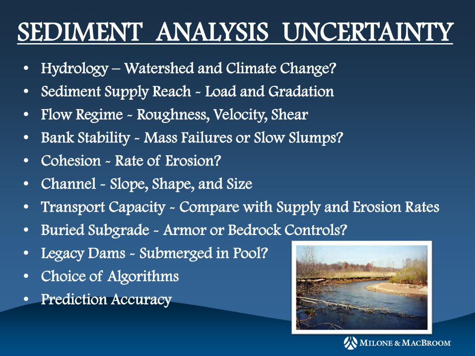
• Hydrology – Watershed and Climate Change?
• Sediment Supply Reach - Load and Gradation
• Flow Regime - Roughness, Velocity, Shear
• Bank Stability - Mass Failures or Slow Slumps?
• Cohesion - Rate of Erosion?
• Channel - Slope, Shape, and Size
• Transport Capacity - Compare with Supply and Erosion Rates
• Buried Subgrade - Armor or Bedrock Controls?
• Legacy Dams - Submerged in Pool?
• Choice of Algorithms
• Prediction Accuracy
SEDIMENT ANALYSIS UNCERTAINTY
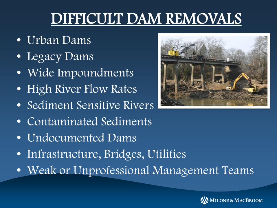
• Urban Dams • Legacy Dams • Wide Impoundments • High River Flow Rates • Sediment Sensitive Rivers • Contaminated Sediments • Undocumented Dams • Infrastructure, Bridges, Utilities • Weak or Unprofessional Management Teams
DIFFICULT DAM REMOVALS

DESIGN DAMS FOR FUTURE REMOVAL
• Permanent Access Roads
• High Capacity Outlet Works
• Sediment Sluices or Bypasses
• Multiple Construction Joints
• Clear Downstream Hazard Areas
• Archive Design Plans
• Construction Photographs