Chapter 3: Native American Cultural Regions of the United States
Upload
treyton-tugmanCategory
view
227download
4
Culture Regions
Urban culture regions Cultural diffusion in the city The cultural ecology of the city Cultural integration and models of the city Urban landscapes
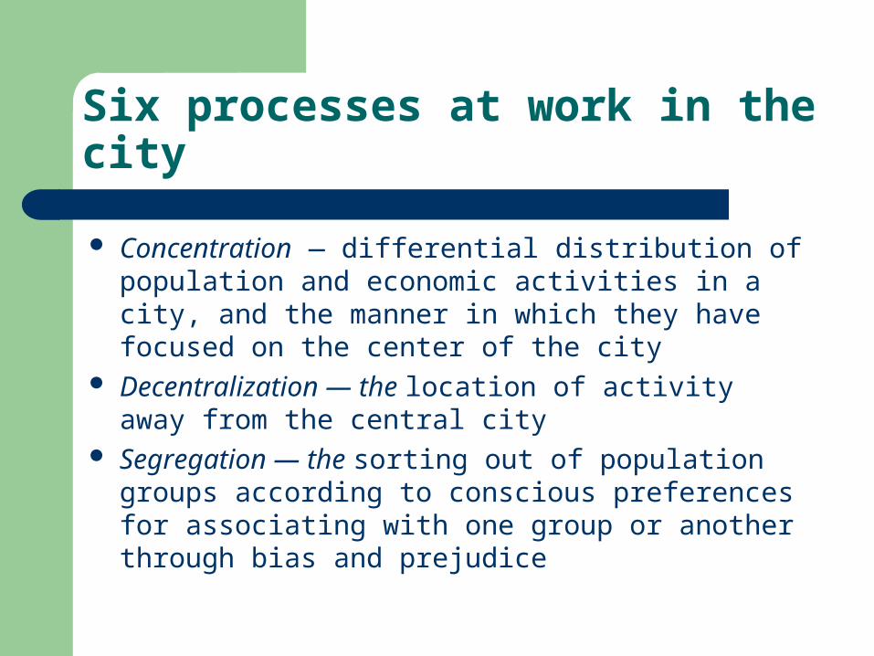
Six processes at work in the city
Concentration — differential distribution of population and economic activities in a city, and the manner in which they have focused on the center of the city
Decentralization — the location of activity away from the central city
Segregation — the sorting out of population groups according to conscious preferences for associating with one group or another through bias and prejudice
Six processes at work in the city
Specialization — similar to segregation only refers to the economic sector
Invasion — traditionally, a process through which a new activity or social group enters an area
Succession — a new use or social group gradually replaces the former occupants
The following models were constructed to examine single cities and do not necessarily apply to metropolitan coalescences so common in today’s world
Concentric zone model
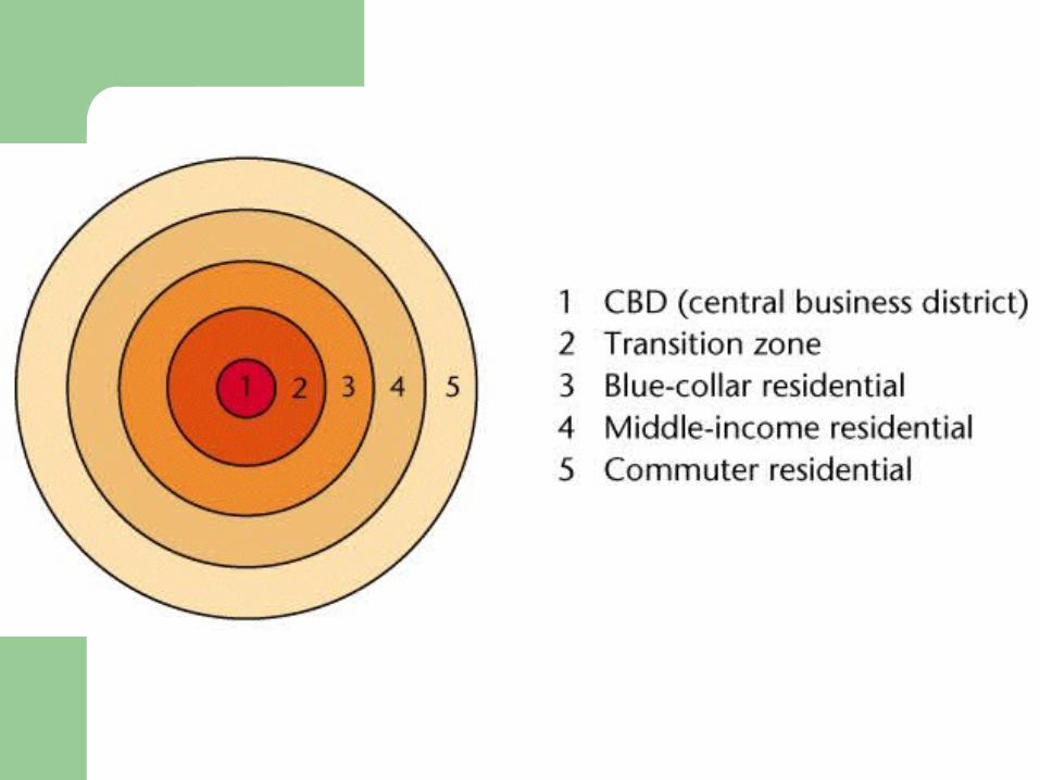
Developed in 1925 by Ernest W. Burgess A model with five zones.
Concentric zone model
A model with five zones.– Zone 1
The central business district (CBD) Distinct pattern of income levels out to the commuters’
zone Extension of trolley lines had a lot to do with this pattern)
Concentric zone model
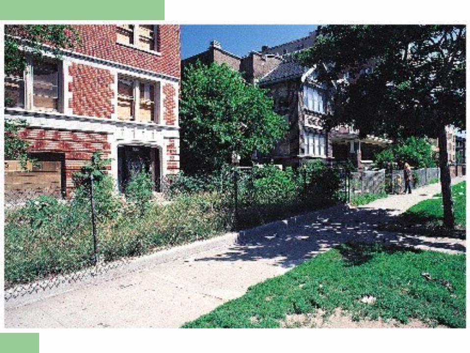
A model with five zones.– Zone 2
Characterized by mixed pattern of industrial and residential land use
Rooming houses, small apartments, and tenements attract the lowest income segment
Often includes slums and skid rows, many ethnic ghettos began here
Usually called the transition zone

Concentric zone model
A model with five zones.– Zone 3
The “workingmen’s quarters” Solid blue-collar, located close to factories of zones 1
and 2 More stable than the transition zone around the CBD Often characterized by ethnic neighborhoods — blocks
of immigrants who broke free from the ghettos Spreading outward because of pressure from transition
zone and because blue-collar workers demanded better housing
Concentric zone model
A model with five zones.– Zone 4
Middle class area of “better housing” Established city dwellers, many of whom moved
outward with the first streetcar network Commute to work in the CBD
Concentric zone model
A model with five zones.– Zone 5
Consists of higher-income families clustered together in older suburbs
Located either on the farthest extension of the trolley or commuter railroad lines
Spacious lots and large houses From here the rich pressed outward to avoid congestion
and social heterogeneity caused by expansion of zone 4
Concentric zone model
Theory represented the American city in a new stage of development– Before the 1870s, cities such as New York had
mixed neighborhoods where merchants’ stores and sweatshop factories were intermingled with mansions and hovels
– Rich and poor, immigrant and native-born, rubbed shoulders in the same neighborhoods
Concentric zone model
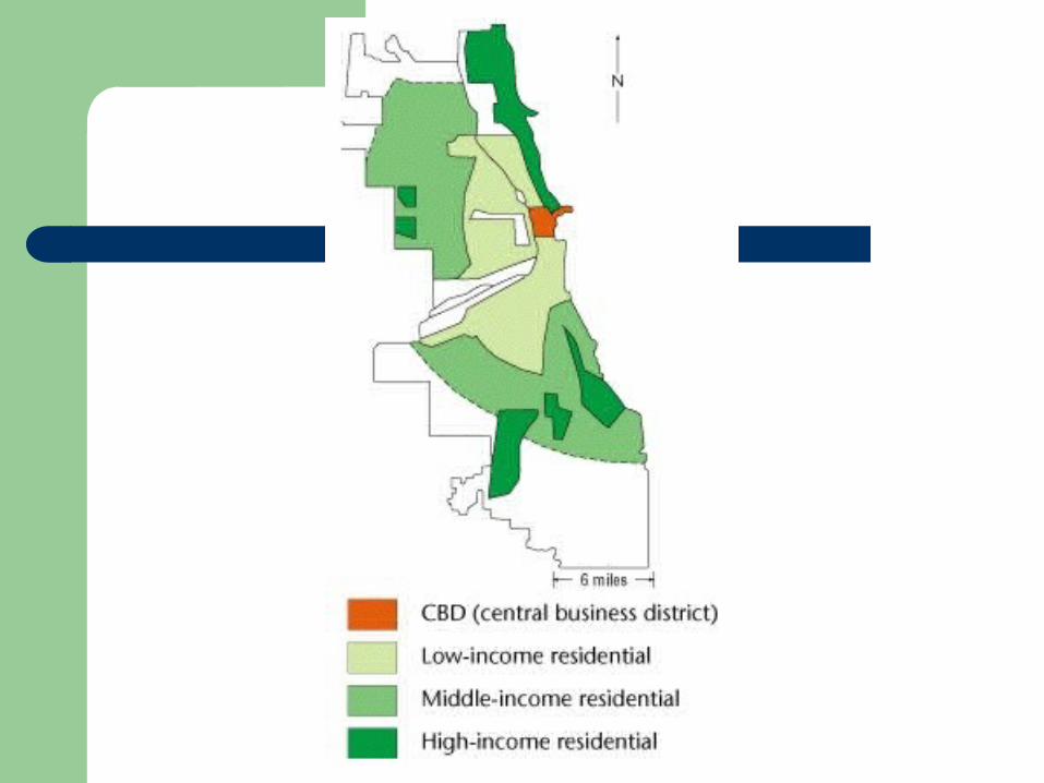
In Chicago, Burgess’s home town, the great fire of 1871 leveled the core– The result of rebuilding was a more explicit social
patterning– Chicago became a segregated city with a
concentric pattern– This was the city Burgess used for his model– The actual map of the residential area does not
exactly match his simplified concentric zones
Concentric zone model
Critics of the model– Pointed out even though portions of each zone
did exist, rarely were they linked to totally surround the city
– Burgess countered there were distinct barriers, such as old industrial centers, preventing the completion of the arc
– Others felt Burgess, as a sociologist, overemphasized residential patterns and did not give proper credit to other land uses
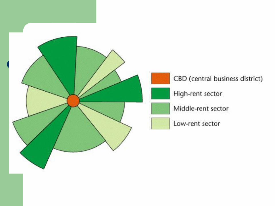
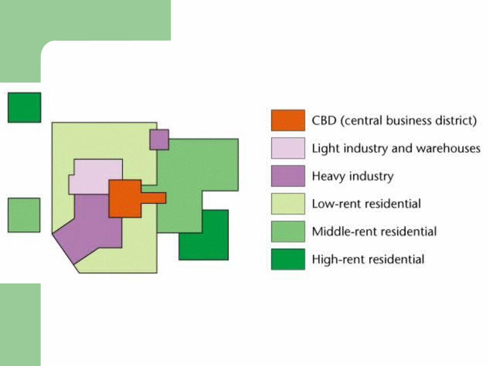
Sector model
Homer Hoyt, an economist, presented his sector model in 1939
Maintained high-rent districts were instrumental in shaping land-use structure of the city
Because these areas were reinforced by transportation routes, the pattern of their development was one of sectors or wedges
Sector model
Hoyt suggested high-rent sector would expand according to four factors
– Moves from its point of origin near the CBD, along established routes of travel, toward another nucleus of high-rent buildings
– Will progress toward high ground or along waterfronts, when these areas are not used for industry
– Will move along the route of fastest transportation– Will move toward open space
Sector model
As high-rent sectors develop, areas between them are filled in
– Middle-rent areas move directly next to them, drawing on their prestige
– Low-rent areas fill remaining areas– Moving away from major routes of travel, rents go from high
to low There are distinct patterns in today’s cities that echo
Hoyt’s model He had the advantage of writing later than Burgess
— in the age of the automobile
Sector model
Today, major transportation arteries are generally freeways– Surrounding areas are often low-rent districts– Contrary to Hoyt’s theory– Freeways were imposed on existing urban pattern– Often built through low-rent areas where land was
cheaper and political opposition was less

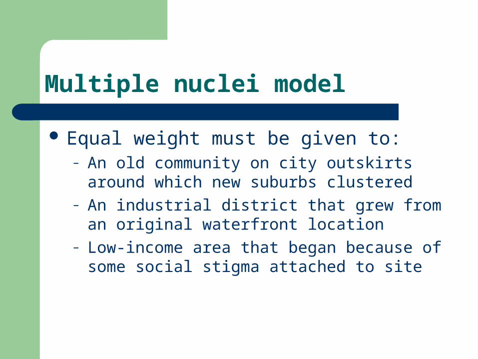
Multiple nuclei model
Suggested by Chauncey Harris and Edward Ullman in 1945
Maintained a city developed with equal intensity around various points
The CBD was not the sole generator of change
Multiple nuclei model
Equal weight must be given to:– An old community on city outskirts around which
new suburbs clustered– An industrial district that grew from an original
waterfront location– Low-income area that began because of some
social stigma attached to site
Multiple nuclei model
Rooted their model in four geographic principles– Certain activities require highly specialized facilities
Accessible transportation for a factory Large areas of open land for a housing tract
– Certain activities cluster because they profit from mutual association
– Certain activities repel each other and will not be found in the same area
– Certain activities could not make a profit if they paid the high rent of the most desirable locations
Multiple nuclei model
More than any other model takes into account the varied factors of decentralization in the structure of the North American city
Many criticize the concentric zone and sector theories as being rather deterministic because they emphasize one single factor
Multiple nuclei theory encompasses a larger spectrum of economic and social possibilities
Most urban scholars feel Harris and Ullman succeeded in trying to integrate the disparate element of culture into workable model
Feminist critiques
Most criticisms of above models focus or their inability to account for all the complexities of urban forms
All three models assume urban patterns are shaped by economic trade-offs between:– Desire to live in suburban neighborhood
appropriate to one’s economic status– Need to live close to the city center for
employment opportunities
Feminist critiques
Models assume only one person is a wage worker — the male head
Ignore dual-income families and households headed by single women
Women contend with a larger array of factors in making locational decisions
– Distances to child care and school facilities– Other important services important for different members of
a family Traditional models that assume a spatial separation
of workplace and home are no longer appropriate
Feminist critiques
Results of a study of activity patterns of working parents– Women living in a city have access to wider array of employment
opportunities– Better able to combine domestic and wage labor than women in
suburbs– Many middle class women choose a gentrified inner-city location to
live Hope this area will offer amenities of suburbs—good schools and
safety Accommodate their activity patterns
– Other research has shown some businesses locate offices in suburbs because they rely on labor of highly educated, middle class women spatially constrained by domestic work
Feminist critiques
Most women seek employment closer to home than men even those without small children
Criticism of models by women– Most families require two real wage earners– Models tend to reflect an urban structure that isolates
women who do not participate in the urban labor market– Raises problems of timing and organization for those who
combine waged and domestic labor– Created by men who shared certain assumptions about
how cities operate, and represent a partial view of urban life
Feminist critiques
Other theories incorporated alternative perspective of female scholars
– Studies using mostly female students, focused on “race,” ethnicity, class, and housing in Chicago
– Emphasized role of landlords in shaping discrimination in the housing market
Study by urban historian Raymond Mohl– Follows the making of black ghettos in Miami between 1940
and 1960– Reveals role of public policy decisions, landlordism, and
discrimination
Apartheid and post-apartheid city
Apartheid —state-sanctioned policies of segregating “races”
Intended effects of these policies on urban form are delineated in next slide
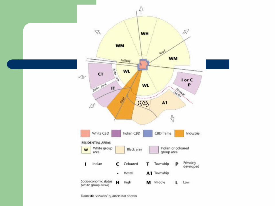
Apartheid and post-apartheid city
Important components of the apartheid state– Policies of economic and political discrimination were
formalized under National Party rule after 1948– Government passed two major pieces of legislation in 1950
First was the Population Registration Act — mandated classification of population into discrete racial groups: white, black, and colored
Second called the Group Areas Act — goal was to divide cities into sections that could be inhabited only by members of one population group
Apartheid and post-apartheid city
Important components of the apartheid state– Government passed two major pieces of
legislation in 1950 Effects of the two acts
– Downtowns were restricted to whites– Areas for non-whites were peripheral, restricted, and often
without urban services—transportation or shopping– Large numbers of non-whites were displaced with little or
no compensation– Buffer zones were created between residential to curtail
contact
Apartheid and post-apartheid city
Model apartheid city most closely resembles the sector model
Cities were artificially divided into discrete areas Non-white populations suffered the consequences Notorious example — Sophiatown in Johannesburg Remains to be seen what form the post-apartheid
will take
The Soviet and post-Soviet city
Cities were shaped by the Bolshevik revolution of 1917– Socialist principles called for the nationalization of
all resources– Economics would no longer dictate land-use—
allocation planners would
New ideals had profound effect on urban form of Soviet cities
The Soviet and post-Soviet city
Soviet policies attempted to create a more equitable arrangement of land uses
– Relative absence of residential segregation according to socioeconomic status
– Equitable housing facilities for most citizens– Relatively equal accessibility to sites for distribution of
consumer items– Cultural amenities located and priced to be accessible to as
many people as possible– Adequate and accessible public transportation
The Soviet and post-Soviet city
The situation outlined above was less than ideal– By the 1970s and 1980s many Soviets realized their
standards of living were well below those in the west– Centralized planning system was not successful
In the late 1980s economic restructuring introduced perestroyka
The post-Soviet city– Market forces are again the dominant force in shaping
urban land uses– Pace and scale of urban change are unprecedented
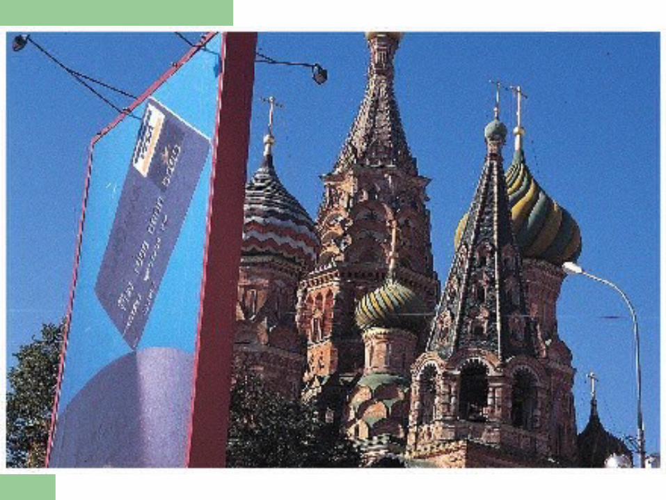

The Soviet and post-Soviet city
The privatization of the housing market —example of Moscow
– Private housing grew from 9.3 percent in 1990 to 49.6 percent in 1994
– Does not mean better housing for all people– Many people cannot afford the high prices– Apartments are particularly expensive in the center of
Moscow– Most people have no choice but to live in communal
apartments from the old Soviet system
The Soviet and post-Soviet city
Cities are taking on the look of Western cities– Downtowns now have most expensive land– Increasingly dominated by retailing outlets of familiar
Western companies– Tall office buildings housing financial activities are replacing
industrial buildings– Processes akin to gentrification are taking place in city
centers displacing residents to peripheral portions of the cities
The outcome of the new changes is not certain and will be continued to be studied
Latin American model
More complex because of influence of local cultures on urban development
Difficult to group cities of the developing world into one or two comprehensive models
Latin American model is shown in next slide
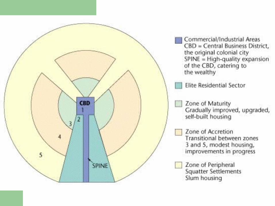
Latin American model
Generalized scheme both sensitive to local cultures and articulates pervasive influence of international forces, both Western and non-Western
In contrast to today’s cities in the U.S., the CBDs of Latin American cities are vibrant, dynamic, and increasingly specialized
– A reliance on public transit that serves the central city– Existence of a large and relatively affluent population
closest to CBD
Latin American model
Outside the CBD, the dominant component is a commercial spine surrounded by
the elite residential sector– These two zones are interrelated and called the
spine/sector– Essentially an extension of the CBD down a major
boulevard– Here are the city’s important amenities — parks, theaters,
restaurants, and even golf courses– Strict zoning and land controls ensure continuation of these
activities, protecting elite from incursions by low-income squatters
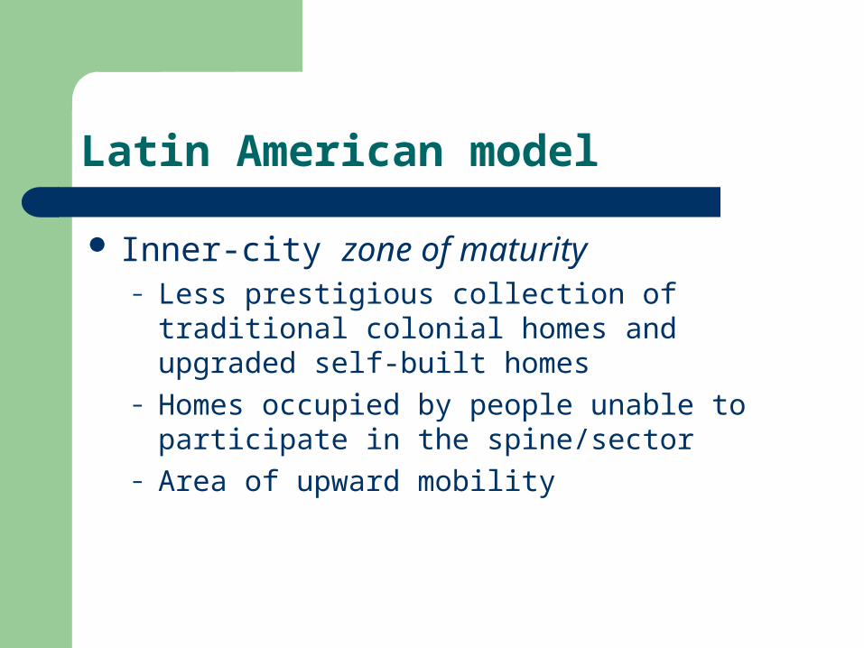
Latin American model
Inner-city zone of maturity– Less prestigious collection of traditional colonial
homes and upgraded self-built homes– Homes occupied by people unable to participate
in the spine/sector– Area of upward mobility
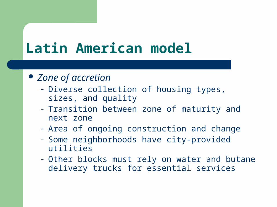
Latin American model
Zone of accretion– Diverse collection of housing types, sizes, and
quality– Transition between zone of maturity and next
zone– Area of ongoing construction and change– Some neighborhoods have city-provided utilities– Other blocks must rely on water and butane
delivery trucks for essential services
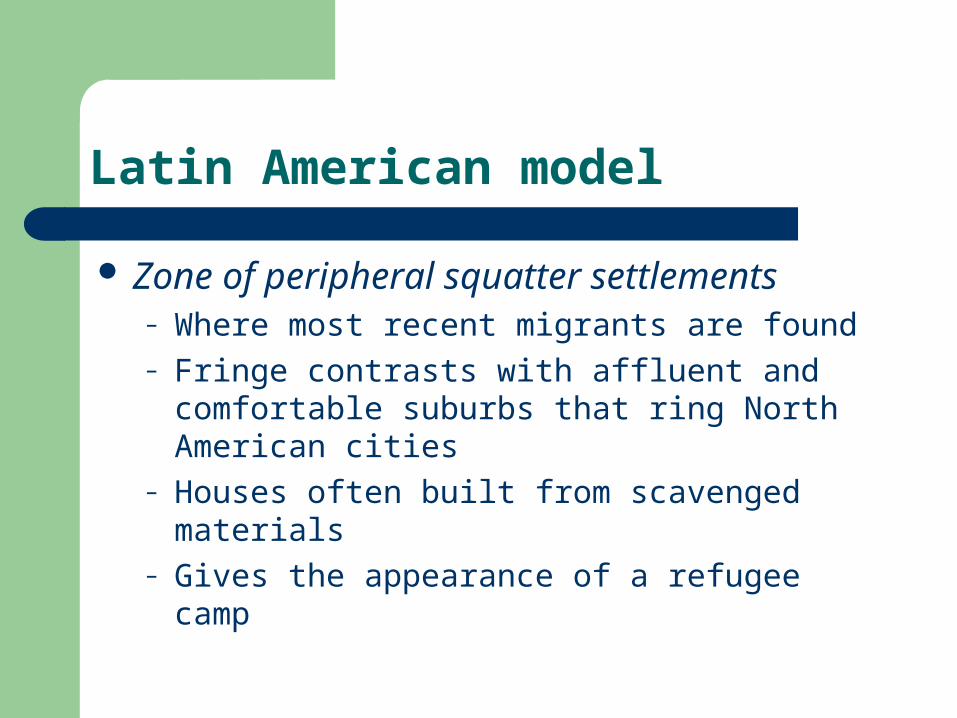
Latin American model
Zone of peripheral squatter settlements– Where most recent migrants are found– Fringe contrasts with affluent and comfortable
suburbs that ring North American cities– Houses often built from scavenged materials– Gives the appearance of a refugee camp
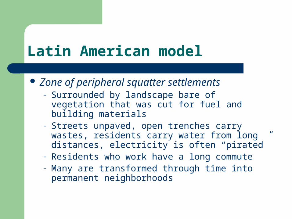
Latin American model
Zone of peripheral squatter settlements– Surrounded by landscape bare of vegetation that
was cut for fuel and building materials– Streets unpaved, open trenches carry wastes,
residents carry water from long distances, electricity is often “pirated”
– Residents who work have a long commute– Many are transformed through time into
permanent neighborhoods

Culture Regions
Urban culture regions Cultural diffusion in the city The cultural ecology of the city Cultural integration and models of the city Urban landscapes
Themes in cityscape study
Landscape dynamics– Because North Americans are a restless people,
settlements are cauldrons of change Downtown activities creeping into residential areas Deteriorated farmland on city outskirts Older buildings demolished for new
– When visual clues are mapped and analyzed, they offer evidence for current of change
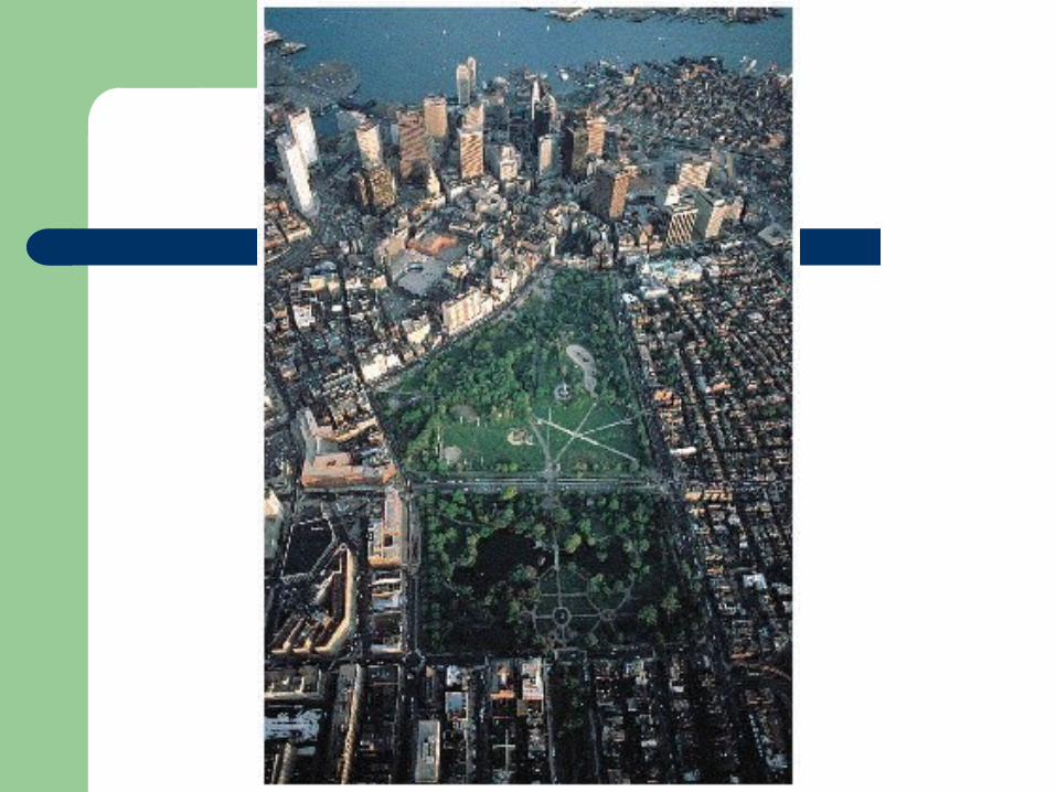
Themes in cityscape study
Equally interesting is to note where change in not occurring– An unchanging landscape conveys an important
message Part of the city is stagnant because it is removed those
forces effecting change in other parts Conscious attempt by local residents to inhibit change Preserve open space by resisting suburban
development. Preserving a historical landmark
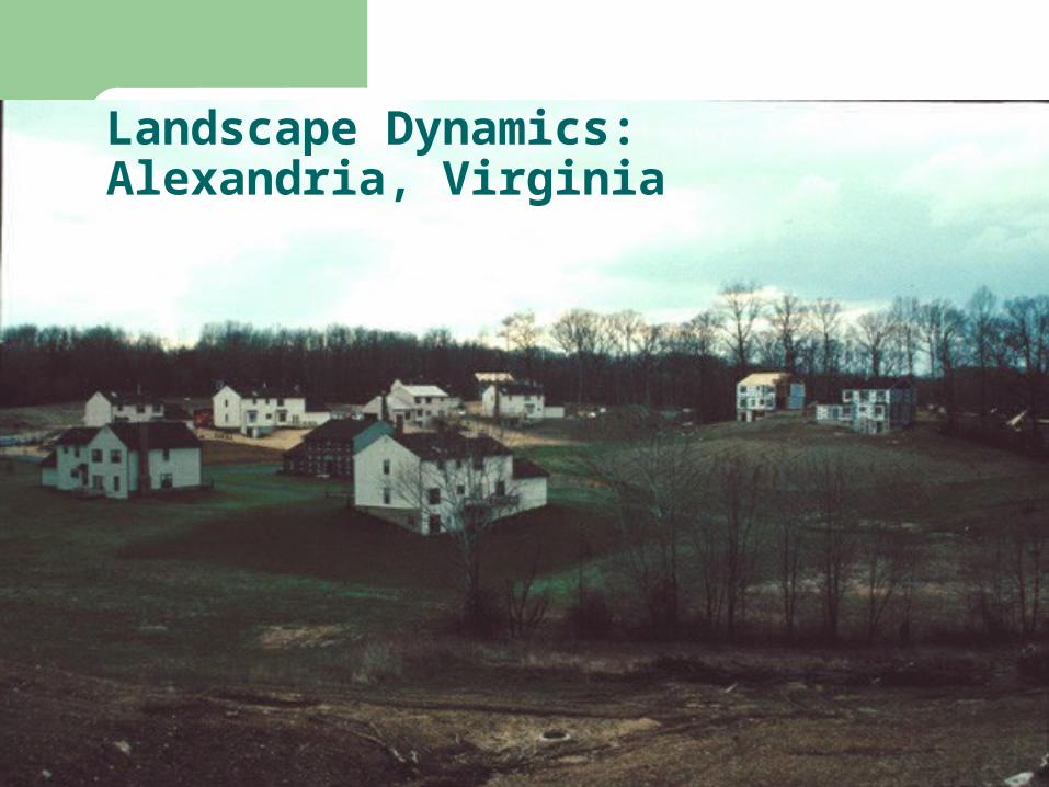
Landscape Dynamics:Alexandria, Virginia
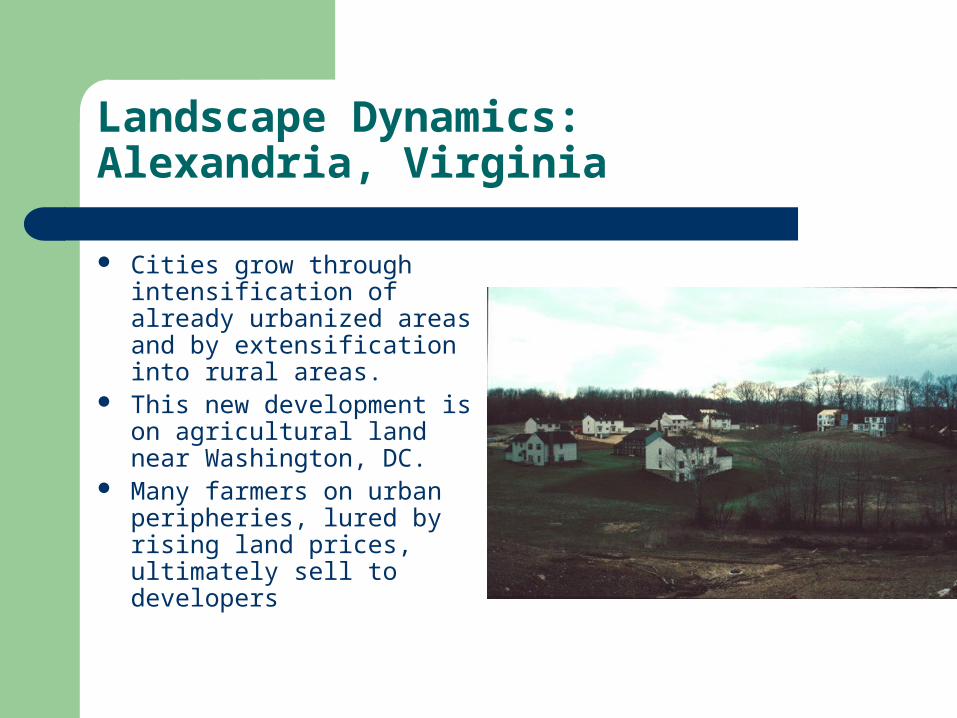
Landscape Dynamics:Alexandria, Virginia
Cities grow through intensification of already urbanized areas and by extensification into rural areas.
This new development is on agricultural land near Washington, DC.
Many farmers on urban peripheries, lured by rising land prices, ultimately sell to developers
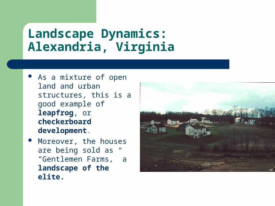
Landscape Dynamics:Alexandria, Virginia
As a mixture of open land and urban structures, this is a good example of leapfrog, or checkerboard development.
Moreover, the houses are being sold as “Gentlemen Farms,” a landscape of the elite.
Themes in cityscape study
The city as palimpsest– Because city landscapes change, they offer a field for
uncovering remnants of the past– Palimpsest
An old parchment used over and over for written messages Before a new message could be written, the old was erased,
but rarely were all previous characters and words completely obliterated
The mosaic of old and new is called a palimpsest — used by geographers to describe visual mixture of old and new in cultural landscapes
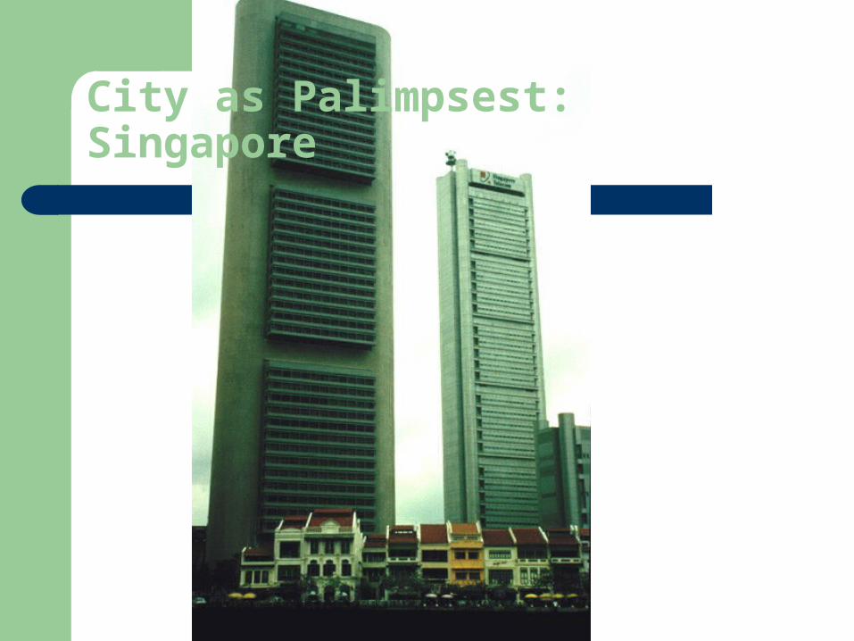
City as Palimpsest: Singapore
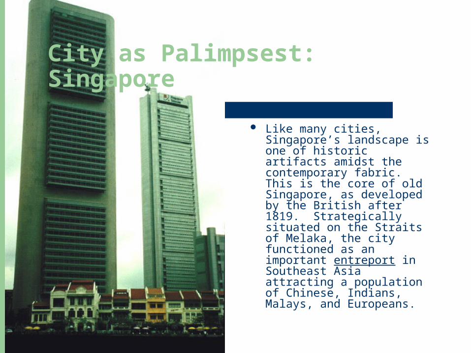
City as Palimpsest: Singapore
Like many cities, Singapore’s landscape is one of historic artifacts amidst the contemporary fabric. This is the core of old Singapore, as developed by the British after 1819. Strategically situated on the Straits of Melaka, the city functioned as an important entreport in Southeast Asia attracting a population of Chinese, Indians, Malays, and Europeans.

City as Palimpsest: Singapore
Trade offices, shophouses, and godowns (warehouses) lined the Singapore river and commercial activity choked the area. After Singapore became independent in 1963-1965, the combination of rapid population growth and aging infrastructure called for a renewal plan. Old housing stock and godowns were razed to be replaced by modern public housing, malls and office buildings.
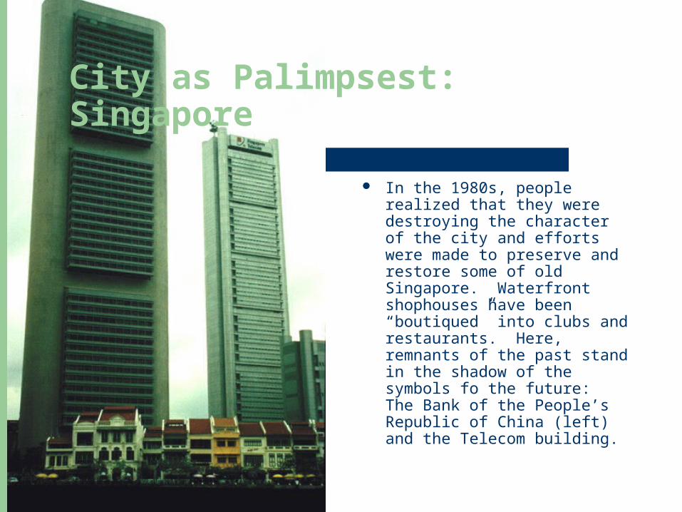
City as Palimpsest: Singapore
In the 1980s, people realized that they were destroying the character of the city and efforts were made to preserve and restore some of old Singapore. Waterfront shophouses have been “boutiqued” into clubs and restaurants. Here, remnants of the past stand in the shadow of the symbols fo the future: The Bank of the People’s Republic of China (left) and the Telecom building.
Themes in cityscape study
Symbolic cityscapes– Landscapes contain more than literal messages about
economic functions Loaded with figurative or metaphorical meaning Subjectivized emotion, memories, and content essential to the
social fabric
– To some, skyscrapers are more than high-rise buildings– Historic landscapes help people define themselves in time
Establish social continuity with the past Codify a forgotten, yet sometimes idealized, past
Themes in cityscape study
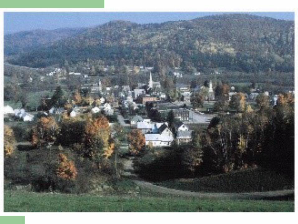
D.W. Minig maintains there are three highly symbolized townscapes in the
United States– The New England village– Main Street of Middle America– California Suburbia– Each is based upon an actual landscape of a particular
region– Each has influenced the shaping of the American scene
over broader areas
Themes in cityscape study
Cultural landscape is important vehicle for constructing and maintaining social and ethnic distinctions
– Conspicuous consumption is a major means for conveying social identity
– Elite landscapes are created through large-lot zoning, imitation country estates, and detailed ornamental iconography
Cultural geographers are interested in how townscapes and landmarks take on symbolic significance
– Question whether idealizations are based on some sort of reality or fabricated from diverse predilections
– Interested in how to assess the impact of symbolic landscapes– Messages inherent in loaded landscapes determine how we treat
our environment-bow it is managed, changed, or protected
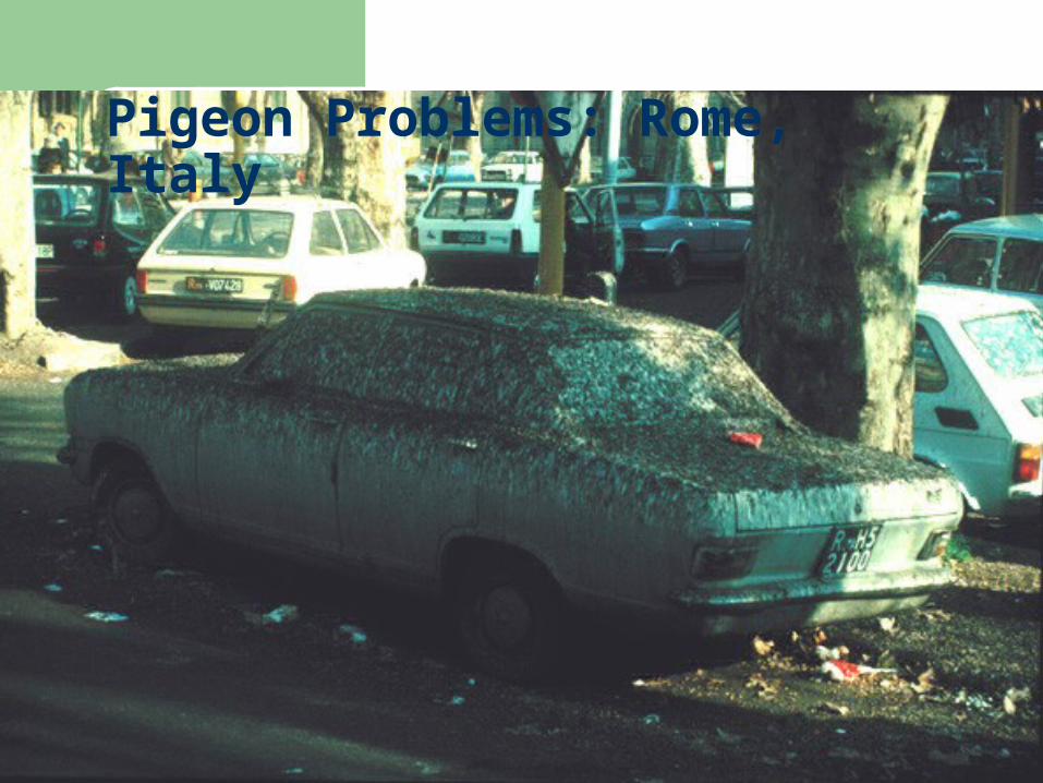
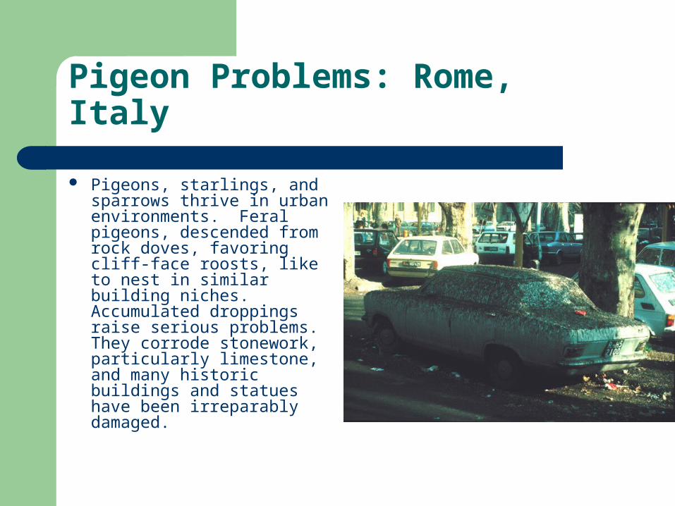
Pigeon Problems: Rome, Italy
Pigeon Problems: Rome, Italy
Pigeons, starlings, and sparrows thrive in urban environments. Feral pigeons, descended from rock doves, favoring cliff-face roosts, like to nest in similar building niches. Accumulated droppings raise serious problems. They corrode stonework, particularly limestone, and many historic buildings and statues have been irreparably damaged.
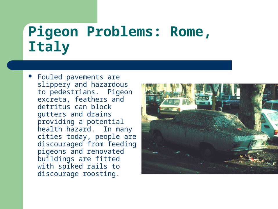
Pigeon Problems: Rome, Italy
Fouled pavements are slippery and hazardous to pedestrians. Pigeon excreta, feathers and detritus can block gutters and drains providing a potential health hazard. In many cities today, people are discouraged from feeding pigeons and renovated buildings are fitted with spiked rails to discourage roosting.
Themes in cityscape study
Perception of the city– Social scientists assume if we know what people
see and react to in the city we can design and create a more humane urban environment
– Kevin Lynch, an urban designer, assumed all residents have a mental map of the city
Figured out ways people could convey their mental map to others
What do people react favorably or negatively to? What do they block out?
Themes in cityscape study
Perception of the city– On the basis of interviews, Lynch suggested five
important elements in mental maps of cities Pathways — threads that hold our maps together Edges — tend to define the extremes of our urban vision Nodes — any place where important pathways come
together Districts — small areas with a common identity Landmarks — reference points that stand out because
of shape, height, color, or historic importance
Themes in cityscape study
Lynch saw some parts of the cities were more legible than others
– Legibility comes when urban landscape offers clear pathways, nodes, district, edges, and landmarks
– Less legible parts of the city do not offer such precise landscape
Lynch found some cities more legible than others– Jersey City is a city of low legibility
Wedged between New York City and Newark Fragmented by railroads and highways
– Residents’ mental maps of Jersey City have large blank areas
Themes in cityscape study
Distinct ethnic, gender, and age variables to mental maps of cities– Often influence everyday behavior– Women feel more vulnerable to crime, especially
rape– Women will tend to avoid certain areas of a city at
night
The new urban landscape
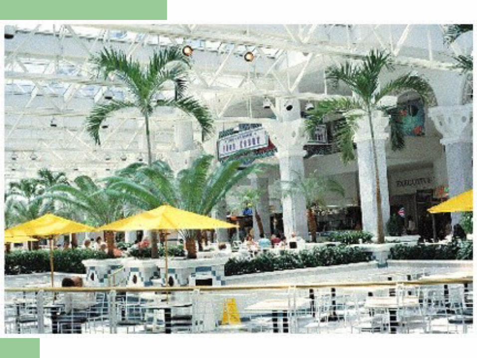
Shopping malls– Most are not designed to be seen from the outside– Retail districts of the 18O0s~and early 1900s cities had
grand architectural displays along the major boulevards– Malls are often located near an off ramp of a major freeway– Close to middle and upper-class residential neighborhoods

The new urban landscape
Shopping malls– Characteristic form of malls of the 1960s
Simple, linear form, with department stores at each end functioning as anchors
Usually had 20 to 30 smaller shops connecting the two ends
– In the 1970s and 1980s, larger malls had a more complex form
– Example: Mall of America in Bloomington, Minnesota– Malls today are often several stories tall and may have 5 or
6 anchor stores, and up to 400 smaller shops
The new urban landscape
Office parks– Office buildings no longer need to be located in
the center city Development of communication technologies Major interstates connect metropolitan areas Cheaper rent in suburban locations Convenience of easy-access parking and privacy of a
separate location
– Being constructed throughout suburban America
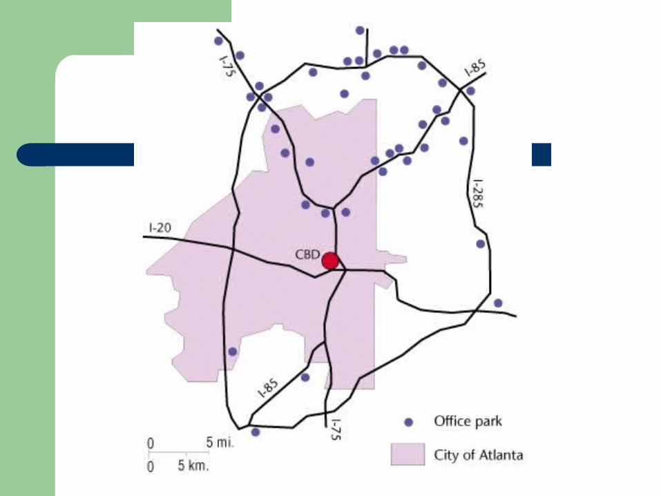
The new urban landscape
Office parks– Next slide shows location of office parks in
metropolitan Atlanta– Many are occupied by regional and national
headquarters of large corporations or local sales and professional offices
– Many offices will locate together and rent or buy space from a land development company to take advantage of economies of scale
The new urban landscape
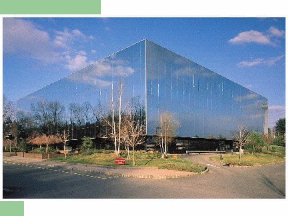
Office parks– The use of the term park points to conscious anti-
urban imagery Tend to be horizontal in shape — three to six stories tall Many are surrounded by a well-landscaped outdoor
space Human-made lakes and waterfalls, jogging paths,
fitness trails, and picnic tables
The new urban landscape
Office parks– Do remove workers from social diversity of an
urban location– Many office parks are located along what have
been called high-tech corridors — areas along limited-access highways
– This new type of commercial landscape is gradually replacing downtowns as the workplace for most Americans
The new urban landscape
Master-planned communities– Many newer residential developments on
suburban fringes are planned and built as complete neighborhoods by private development companies
Include architecturally compatible housing Have a variety of recreational facilities Exploit various land-use restrictions and zoning
regulations to maintain control over land values
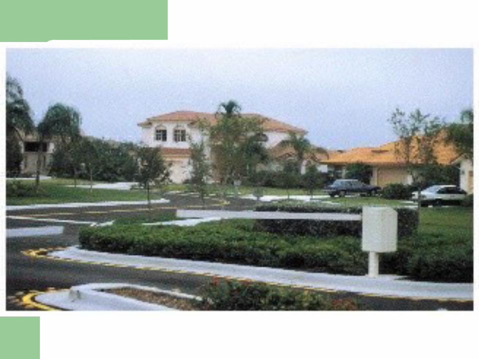
The new urban landscape
Master-planned communities– Example of Weston in south Florida
Covers approximately ten thousand acres Land use is completely regulated within gated area and
also along the road system connecting Weston to the interstate
Shrubbery is planted to shield residents from roadway view
Signs are uniform in style
The new urban landscape
Festival settings– Often gentrification efforts focus on a multiuse
redevelopment scheme built around a particular setting, often one with historical association
– Waterfronts are commonly chosen as focal points– Complexes integrate retailing, office, and entertainment
activities– Knox suggests these developments are “distinctive as new
landscape elements merely because of their scale and their consequent ability to stage — or merely to be — the spectacular”
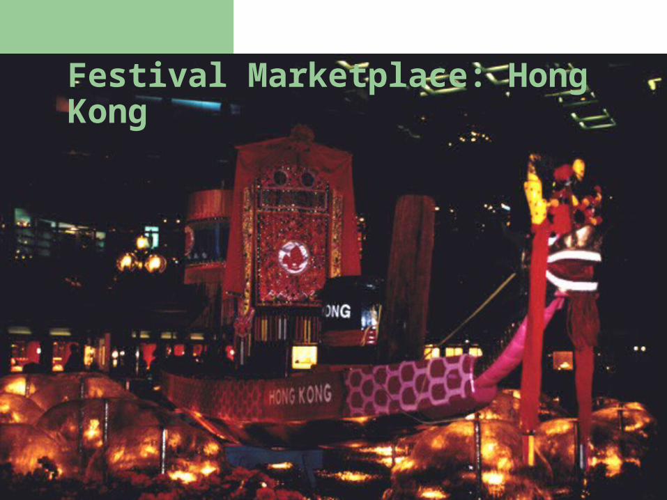
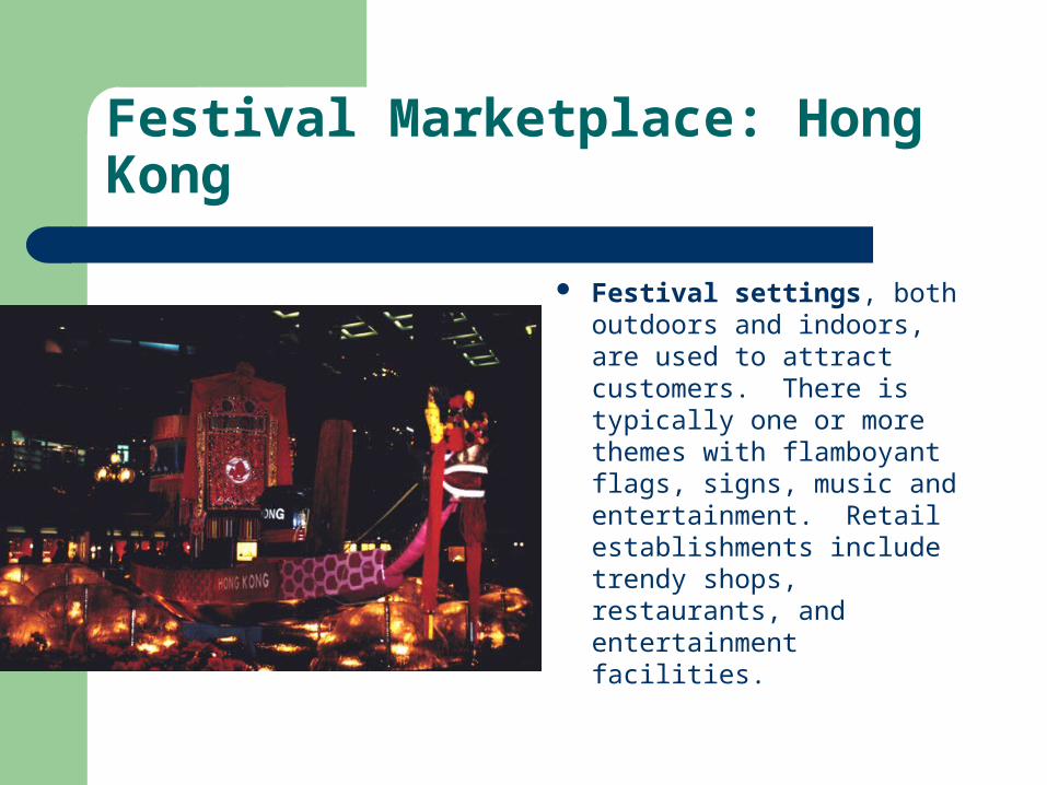
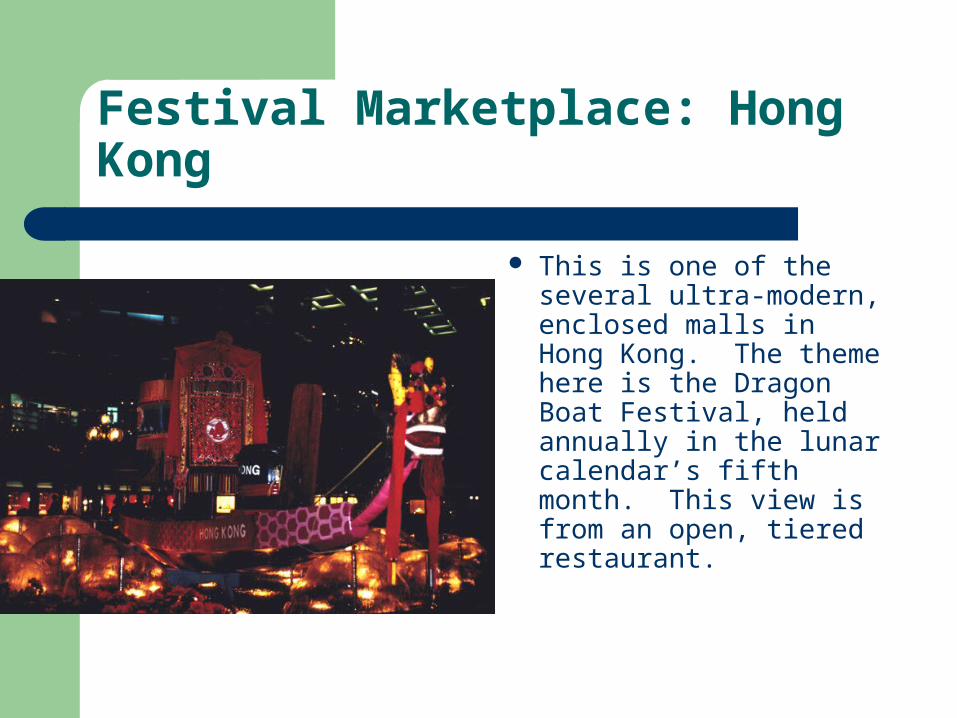
Festival Marketplace: Hong Kong
Festival Marketplace: Hong Kong
Festival settings, both outdoors and indoors, are used to attract customers. There is typically one or more themes with flamboyant flags, signs, music and entertainment. Retail establishments include trendy shops, restaurants, and entertainment facilities.
Festival Marketplace: Hong Kong
This is one of the several ultra-modern, enclosed malls in Hong Kong. The theme here is the Dragon Boat Festival, held annually in the lunar calendar’s fifth month. This view is from an open, tiered restaurant.
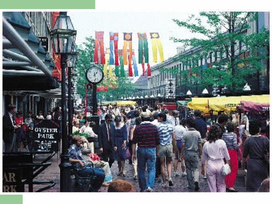
The new urban landscape
Festival settings– Some festival settings serve as sites for concerts,
ethnic festivals, and street performances Also focal points for more informal human interactions
usually associated with urban life In this sense do perform a vital function in the attempt to
revitalize downtowns
– Massive displays of wealth and consumption often stand in contrast to neighboring areas that have received little benefit from these projects
The new urban landscape
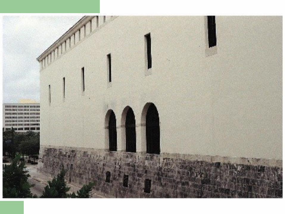
“Militarized” space– Meaning the increasing use of space to set up defenses
against elements of the city considered undesirable– Includes landscaping development that range from:
Lack of street furniture to stop homeless living on the streets Gated and guarded residential communities Complete segregation of classes and races’ within the city
– As Davis says, “cities of all sizes are rushing to apply and profit from a formula that links together clustered development, social homogeneity, and a perception of security”
– Has taken on epic proportions as many big American cities become “militarized” spaces
The new urban landscape
Decline of public space– Related to the increase in “militarized” space– Change in shopping patterns from downtown to
shopping malls– Many city governments have joined with
developers to built enclosed walkways above or below city streets
Provides climate-controlled conditions Provides pedestrians with a “safe” environment to avoid
possible confrontations on the street
The new urban landscape
Decline of public space– Related to the increase in “militarized” space– Change in shopping patterns from downtown to shopping
malls– Many city governments have joined with developers to built
enclosed walkways above or below city streets Provides climate-controlled conditions Provides pedestrians with a “safe” environment to avoid
possible confrontations on the street– Some scholars suggest the Internet is a new forum for
social and political interaction
A New Landmark: London, England
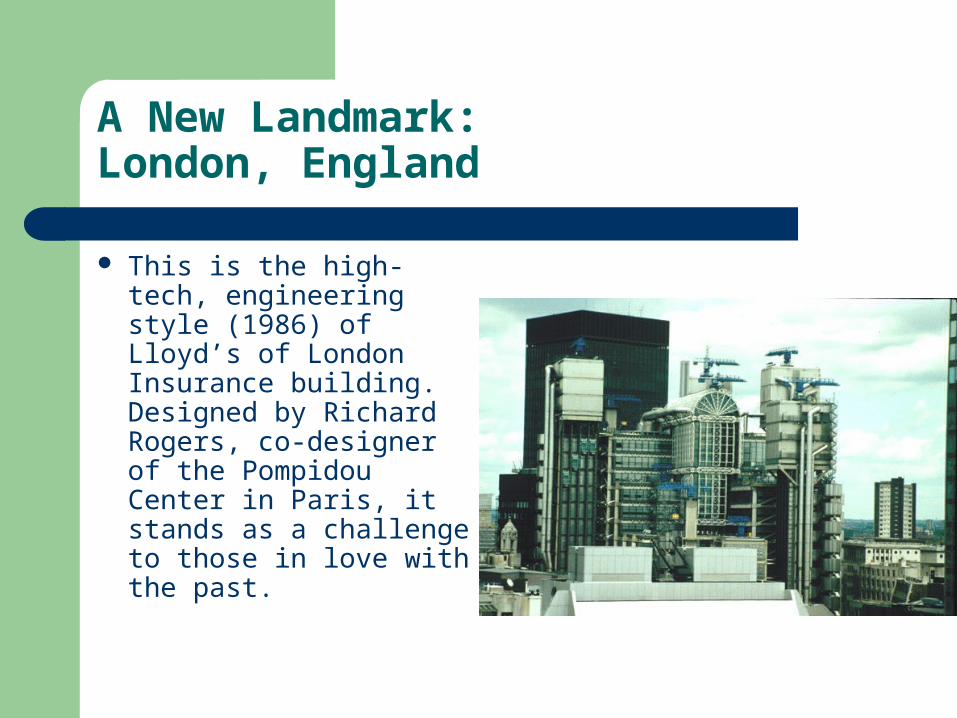
A New Landmark: London, England
This is the high-tech, engineering style (1986) of Lloyd’s of London Insurance building. Designed by Richard Rogers, co-designer of the Pompidou Center in Paris, it stands as a challenge to those in love with the past.
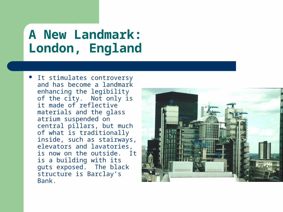
A New Landmark: London, England
It stimulates controversy and has become a landmark enhancing the legibility of the city. Not only is it made of reflective materials and the glass atrium suspended on central pillars, but much of what is traditionally inside, such as stairways, elevators and lavatories, is now on the outside. It is a building with its guts exposed. The black structure is Barclay’s Bank.