CT-1285 Grover's Field, (Goshorn Park) · CAPSULE SUMMARY CT-1285 Grover's Field 310 Calvert Beach...
14
CT-1285 Grover's Field, (Goshorn Park) Architectural Survey File This is the architectural survey file for this MIHP record. The survey file is organized reverse- chronological (that is, with the latest material on top). It contains all MIHP inventory forms, National Register nomination forms, determinations of eligibility (DOE) forms, and accompanying documentation such as photographs and maps. Users should be aware that additional undigitized material about this property may be found in on-site architectural reports, copies of HABS/HAER or other documentation, drawings, and the “vertical files” at the MHT Library in Crownsville. The vertical files may include newspaper clippings, field notes, draft versions of forms and architectural reports, photographs, maps, and drawings. Researchers who need a thorough understanding of this property should plan to visit the MHT Library as part of their research project; look at the MHT web site (mht.maryland.gov) for details about how to make an appointment. All material is property of the Maryland Historical Trust. Last Updated: 10-29-2003
Transcript of CT-1285 Grover's Field, (Goshorn Park) · CAPSULE SUMMARY CT-1285 Grover's Field 310 Calvert Beach...
CT-1285
Grover's Field, (Goshorn Park)
Architectural Survey File
This is the architectural survey file for this MIHP record. The survey file is organized reverse-
chronological (that is, with the latest material on top). It contains all MIHP inventory forms, National
Register nomination forms, determinations of eligibility (DOE) forms, and accompanying documentation
such as photographs and maps.
Users should be aware that additional undigitized material about this property may be found in on-site
architectural reports, copies of HABS/HAER or other documentation, drawings, and the “vertical files” at
the MHT Library in Crownsville. The vertical files may include newspaper clippings, field notes, draft
versions of forms and architectural reports, photographs, maps, and drawings. Researchers who need a
thorough understanding of this property should plan to visit the MHT Library as part of their research
project; look at the MHT web site (mht.maryland.gov) for details about how to make an appointment.
All material is property of the Maryland Historical Trust.
Last Updated: 10-29-2003
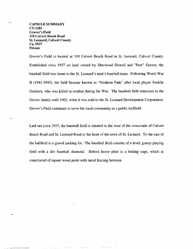
CAPSULE SUMMARY CT-1285 Grover's Field 310 Calvert Beach Road St. Leonard, Calvert County Ca.1937 Private
Grover's Field is located at 310 Calvert Beach Road in St. Leonard, Calvert County.
Established circa 1937 on land owned by Sherwood Dowell and "Pete" Grover, the
baseball field was home to the St. Leonard's men's baseball team. Following World War
II (1941-1945), the field became known as "Goshorn Park" after local player Freddie
Goshorn, who was killed in combat during the War. The baseball field remained in the
Grover family until 1963, when it was sold to the St. Leonard Development Corporation.
Grover's Field continues to serve the local community as a public ballfield.
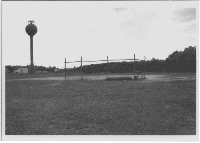
Laid out circa 1937, the baseball field is situated to the west of the crossroads of Calvert
Beach Road and St. Leonard Road in the heart of the town of St. Leonard. To the east of
the ballfield is a gravel parking lot. The baseball field consists of a level, grassy playing
field with a dirt baseball diamond. Behind home plate is a batting cage, which is
constructed of square wood posts with metal fencing between.
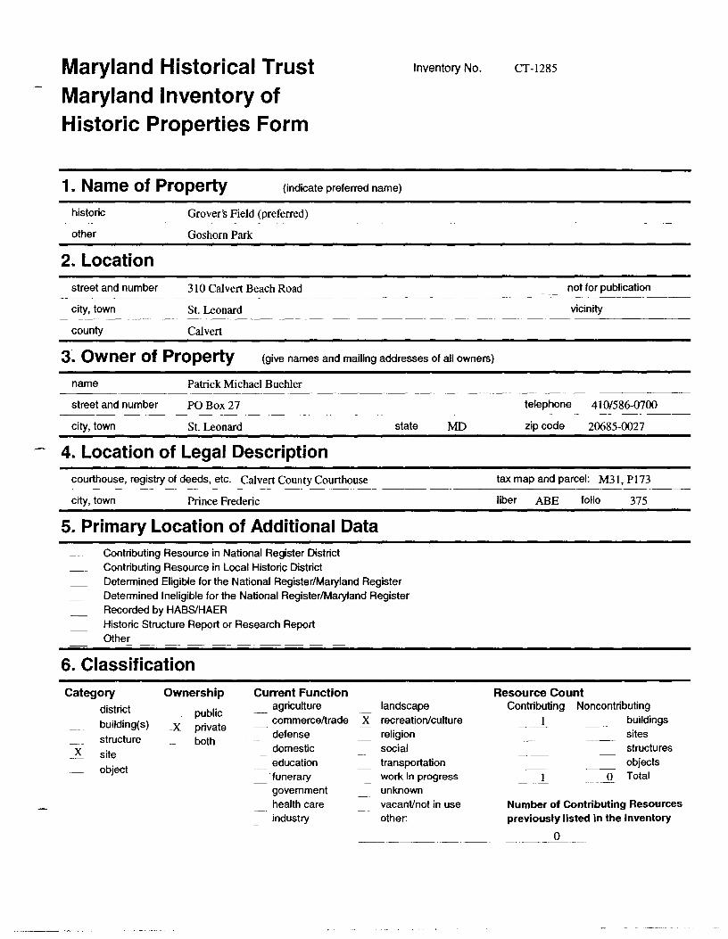
Maryland Historical Trust Maryland Inventory of Historic Properties Form
1. Name of Property (indicate preferred name)
historic Grover's Field (preferred)
other Goshorn Park
2. Location street and number 310 Calvert Beach Road
city, town St. Leonard
county Calvert
Inventory No. CT-1285
not for publication
vicinity
3. Owner of Property (give names and mailing addresses of all owners)
name Patrick Michael Buehler
street and number PO Box 27
city, town St. Leonard
4. Location of Legal Description courthouse, registry of deeds, etc. Calvert County Courthouse
city, town Prince Frederic
5. Primary Location of Additional Data Contributing Resource in National Register District Contributing Resource in Local Historic District
state MD
Determined Eligible for the National Register/Maryland Register Determined Ineligible for the National Register/Maryland Register Recorded by HASS/HAER Historic Structure Report or Research Report Other
6. Classification
Category district
building(s)
structure X site
object
Ownership
public _x_ private
both
Current Function agriculture commerce/trade defense domestic education 'funerary government health care industry
landscape X recreation/culture
religion social transportation work in progress unknown vacant/not in use other:
telephone 410/586-0700
zip code 20685-0027
tax map and parcel: M31, P 173
liber ABE folio 375
Resource Count Contributing Noncontributing __ 1 buildings
sites structures objects
O Total
Number of Contributing Resources previously listed in the Inventory
-- ___ __9 ____ _
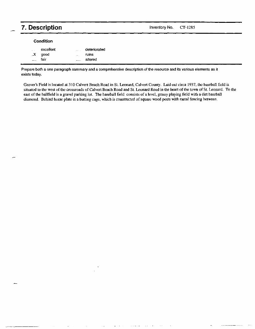
7. Description
Condition
excellent _x_ good
fair
deteriorated ruins altered
Inventory No. CT- I 285
Prepare both a one paragraph summary and a comprehensive description of the resource and its various elements as it exists today.
Grover's Field is located at 310 Calvert Beach Road in St. Leonard, Calvert County. Laid out circa 1937, the baseball field is situated to the west of the crossroads of Calvert Beach Road and St. Leonard Road in the heart of the town of St. Leonard. To the east of the ballfield is a gravel parking lot. The baseball field consists of a level, grassy playing field with a dirt baseball diamond. Behind home plate is a batting cage, which is constructed of square wood posts with metal fencing between.
8. Significance
Period
1600-1699 1700-1799 1800-1899
_x 1900-1999 - 2000-
Areas of Significance
agriculture archeology architecture art commerce communications community planning conservation
Specific dates 1937; 1963
Construction dates 1937
Evaluation for:
National Register
Inventory No. CT-1285
Check and justify below
economics _ health/medicine performing arts education _ industry philospohy engineering _ invention politics/government
_x entertainmenV _ landscape architecture religion
recreation _law science ethnic heritage _ literature _x social history exploration/ _ maritime industry transportation
settlement _military other:
Architect/Builder Unknown
Maryland Register x not evaluated
Prepare a one-paragraph summary statement of significance addressing applicable criteria, followed by a narrative discussion of the history of the resource and its context. (For compliance reports, complete evaluation on a DOE Fonn - see manual.)
Grover's Field is located at 310 Calvert Beach Road in St. Leonard, Calvert County. Established circa 1937 on land owned by Sherwood Dowell and "Pete" Grover, the baseball field was home to the St. Leonard's men's baseball team. Following World War II ( 1941-1945), the field became known as "Goshorn Park" after local player Freddie Goshorn, who was killed in combat during the War. The baseball field remained in the Grover family until 1963, when it was sold to the St. Leonard Development Corporation. Grover's Field continues to serve the local community as a public ballfield.
HISTORY OF GROVER'S FlEW
Baseball parks have traditionally served as an important meeting place for Calvert County residents. As early as the late 19th century, Calvert County residents were playing the game of baseball almost to the complete exclusion of any other team sport, and, by the tum of the 20th century, virtually every community hosted their own local team. (I) When asked about the popularity of baseball, Waters Ross hypothesized that it was due to the fact that in contrast to other team sports such as football, very little equipment was needed other than a ball, a proper mitt for the catcher and maybe the first baseman, who might also substitute a proper glove with a common work glove, and a bat. (2) Baseball teams during the late 19th and early 20th centuries were formed informally by the men of a community and initially played on "resting" agricultural fields, fields that were lying fallow for the season. (3) Team membership was inconsistent, with members playing according to their availability. Each team, however, would have a core of two or three key players who would be well known to the local community and closely identified with the team. (4) Calvert County teams, particularly those in towns located on the Patuxent River side of the county, would often play teams from St. Mary's County, across the Patuxent River, and in some cases, players from St. Mary's County would come over on boats for games. Teams were racially segregated for most of the 20th century, although white and African-American teams would often play one another.
By the second quarter of the 20th century, community baseball teams began to play on baseball fields specifically designated for that purpose by private landowners or those purchased by the baseball teams, themselves. One of the better known baseball fields in Calvert County was Grover's Field (CT-1285), named for Calvert County baseball great and manager of the St. Leonard team Gamer T. "Pete," Grover. Located in St. Leonard, Grover's Field was established following the purchase of an approximately twenty-seven-acre parcel of land on Calvert Beach Road by Sherbert Dowell and Gamer Grover in 1937. (5)
Grover's Field is known for its association with Freddie Goshorn, a local pitcher who played at the field in the late 1930s and is said to have been a candidate for the major leagues. (6) A very popular local player, Goshorn was killed in combat during World War II prompting the naming of the field after him for a period following the war. (7) The field later became known as Grover's Field because of the longtime association with Pete Grover, who coached the local St. Leonard team for years.
Maryland Historical Trust Maryland Inventory of Historic Properties Form
Name Grover's Field (preferred)
Continuation Sheet Number 8 Page l
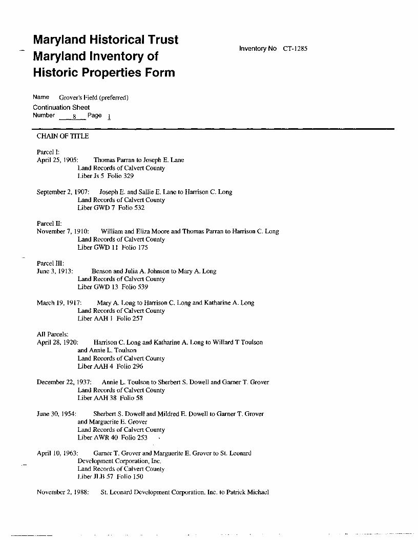
CHAIN OF TITLE
Parcel I: April 25, 1905: Thomas Parran to Joseph E. Lane
Land Records of Calvert County Liber Js 5 Folio 329
September 2, 1907: Joseph E. and Sallie E. Lane to Harrison C. Long Land Records of Calvert County Liber GWD 7 Folio 532
Parcel II:
Inventory No CT-1285
November 7, 1910: William and Eliza Moore and Thomas Parran to Harrison C. Long Land Records of Calvert County Liber GWD 11 Folio 175
Parcel III: June 3, 1913: Benson and Julia A. Johnson to Mary A. Long
Land Records of Calvert County Liber GWD 13 Folio 539
March 19, 1917: Mary A. Long to Harrison C. Long and Katharine A. Long Land Records of Calvert County Liber AAH 1 Folio 257
All Parcels: April 28, 1920: Harrison C. Long and Katharine A. Long to Willard T Toulson
and Annie L. Toulson Land Records of Calvert County Liber AAH 4 Folio 2%
December 22, 1937: Annie L. Toulson to Sherbert S. Dowell and Garner T. Grover
June 30, 1954:
Land Records of Calvert County Liber AAH 38 Folio 58
Sherbert S. Dowell and Mildred E. Dowell to Gamer T. Grover and Marguerite E. Grover Land Records of Calvert County Liber A WR 40 Folio 253
April I 0, 1963: Garner T. Grover and Marguerite E. Grover to St. Leonard Development Corporation, Inc. Land Records of Calvert County Liber JLB 57 Folio 150
November 2, 1988: St. Leonard Development Corporation, Inc. to Patrick Michael
Maryland Historical Trust Maryland Inventory of Historic Properties Form
Name Grover's Field (preferred)
Continuation Sheet Number 8 Page i
ENDNOTES
Buehler Land Records of Calvert County Liber ABE 456 Folio 375
Inventory No CT-1285
1. Waters Ross, interview by Carrie E. Albee, Mutual, Maryland, June 13, 2002. 2. Ross, June 13, 2002. 3. Waters Ross, "Baseball In Southern Calvert County in 1901-1902," Baseball,
Vertical Files, Calvert County Historical Society, Prince Frederick, MD. 4. Ross, June 13, 2002. 5. Calvert County Land Records, Liber AAH 38, Folio 58, Calvert County Courthouse,
Prince Frederick, MD. 6. Samuel Goshorn, telephone interview by Carrie E. Albee, May 28, 2002. 7. Goshorn.
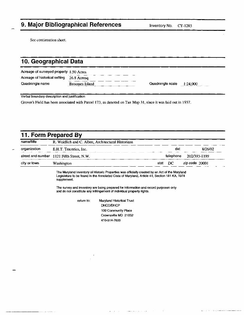
9. Major Bibliographical References Inventory No. CT-1285
See continuation sheet.
10. Geographical Data
Acreage of surveyed property 1.50 Acres --------------~
Acreage of historical setting 26.8 Acresq --------------~
Quadrangle name _B_r_oo_m_e_s_l_sl_a_nd _________ _ Quadrangle scale 1:24 000
Verbal boundary description and justification
Grover's Field has been associated with Parcel 173, as denoted on Tax Map 31, since it was laid out in 1937.
11. Form Prepared By name/title R. Weidlich and C. Albee, Architectural Historians
organization E.H.T. Traceries, Inc. dat 8/26/02
street and number 1121 Fifth Street, N.W. telephone 202/393-1199
city or town Washington stat DC zip code 20001
The Maryland Inventory of Historic Properties was officially created by an Act of the Maryland Legislature to be found in the Annotated Code of Maryland, Article 41, Section 181 KA, 1974 supplement.
The survey and inventory are being prepared for infonnation and record purposes only and do not constitute any infringement of individual property rights.
return to: Maryland Historical Trust
DHCO/DHCP
100 Community Place
Crownsville MD 21032
410-514-7600
Maryland Historical Trust Maryland Inventory of Historic Properties Form Name Grover's Field (preferred) Continuation Sheet
Number __ 9 Page -~-
Ross, Walter, interview by Carrie E. Albee, Mutual, Maryland, June 13, 2002.
Inventory No. CT-1285
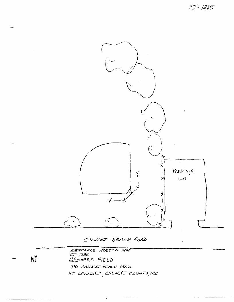
a -\-r--------""'I ! x I P'AfL\c:'.'..-ING
/' LD1
0
------------~.e~c~~:o:~:.~€-S~K.~·~c~·~~c~H;-;M~4~P,--~~~~~~~~~~~~~~ cr-1zss (2,R__o Vcfl.~ 'fl6LJ> Nt BID Ci'U-LJef!!T l!!E~t/ RMI:>
ST. LEoAIAfU>J CALVEeT CCJufl/TlJ,,M.D
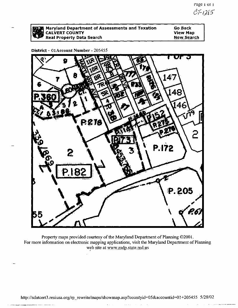
ll Maryland Department of Assessments and Taxation CALVERT COUNTY Real Property Data Search
District - 01Account Number - 205455
rage 1 or 1
61-1Jf5"
Go Back View Map New Search
Property maps provided courtesy of the Maryland Department of Planning ©200 I. For more information on electronic mapping applications, visit the Maryland Department of Planning
w~b site at www.mdp.state.md.us
http://sdatcert3.resiusa.org/rp _rewrite/maps/showmap.asp?countyid=05&accountid=Ol +205455 5/28/02
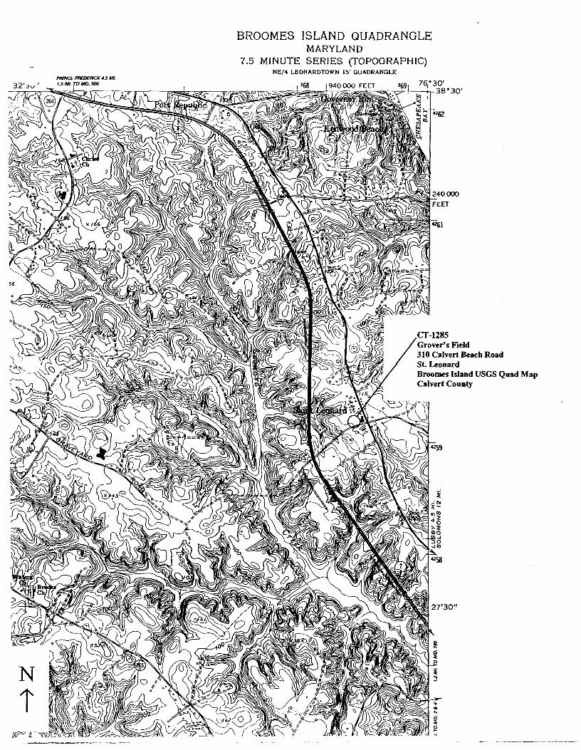
BROOMES ISLAND QUADRANGLE MARYLAND
7.5 MINUTE SERIES (TOPOGRAPHIC) NE/4 LEONARDTOWN 15' QUADRANGLE
Grover's Field 310 Calvert Beach Road St Leonard
Cl'/2-B5 Gl(o V€l2 Is F/€ {_ D
310 C:/ILV€/e.T BCACf/ ~b
CAt...-V€.llT to v/\/ry M"D 61-/r r!(_lie.€1210; M,,q y i.oa z..,
M/J /()1 t,f1 Np Sllfb s11-u r/6U) Lc:c1::.1Nr; /\/w
I
I 6F I