Creating a County ArcMap with Fiscal Year Conservation Practice Locations David Hoover ASTC, Idaho...
31
Creating a County ArcMap with Fiscal Year Conservation Practice Locations David Hoover ASTC, Idaho 2007 DC Meeting
-
Upload
jaeden-stain -
Category
Documents
-
view
219 -
download
0
Transcript of Creating a County ArcMap with Fiscal Year Conservation Practice Locations David Hoover ASTC, Idaho...
Creating a County ArcMap with Fiscal Year Conservation Practice Locations
David HooverASTC, Idaho2007 DC Meeting
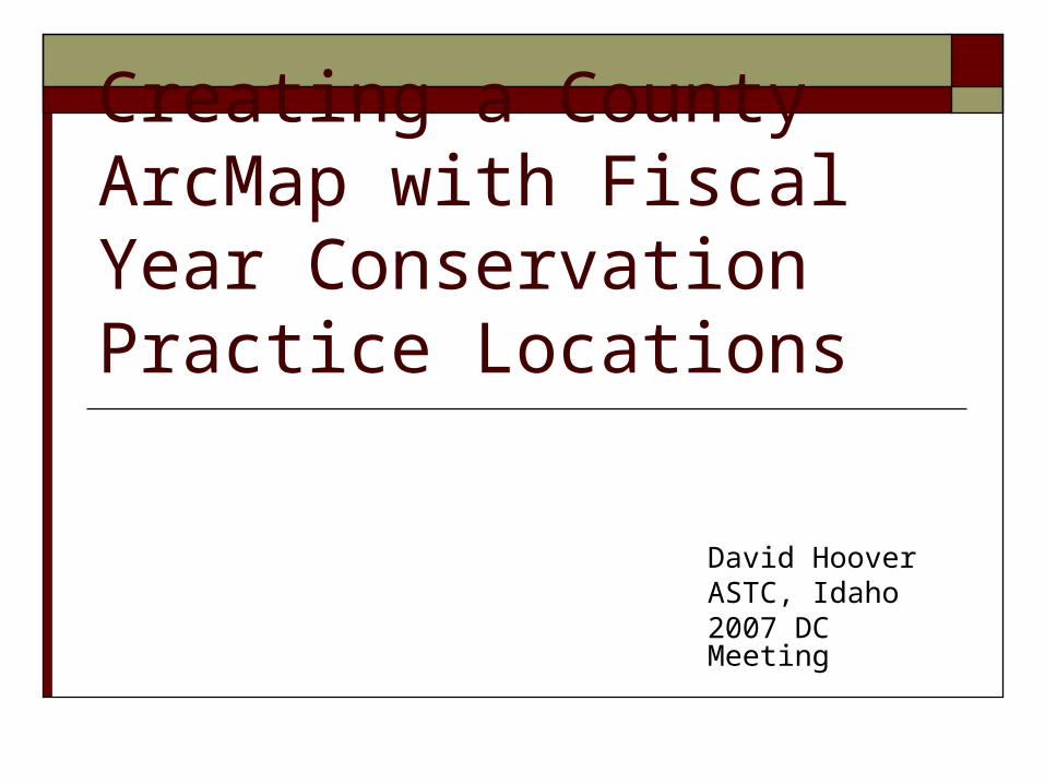
Uses of a Conservation Practice Location Map
District Information
Workload Analysis
Supervisor Information
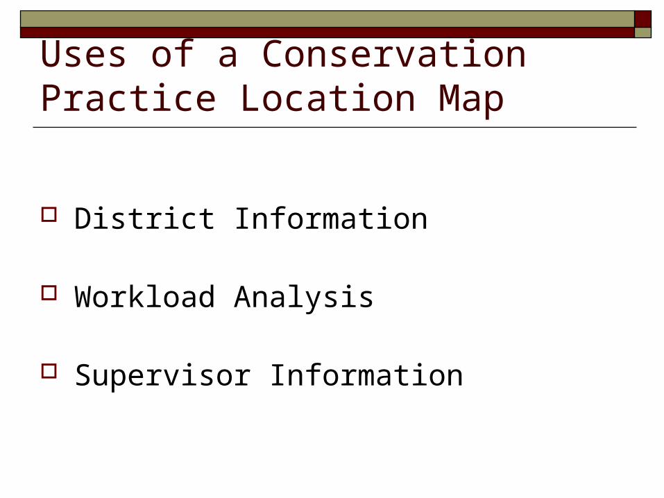
Process Steps
Obtain Practice Data in PRS
Import and Manipulate in Excel
Display in ArcMap

Start PRS
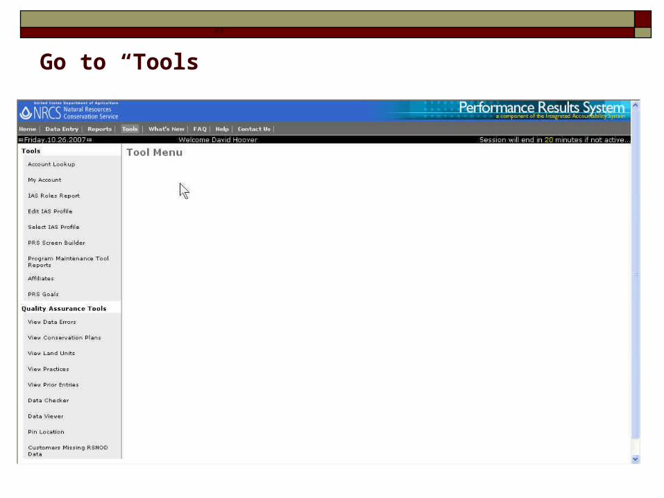
Go to “Tools”

Under “Quality Assurance Tools” go to “Data Viewer 2007”

Under “NCP Reports” go to “Custom Query”
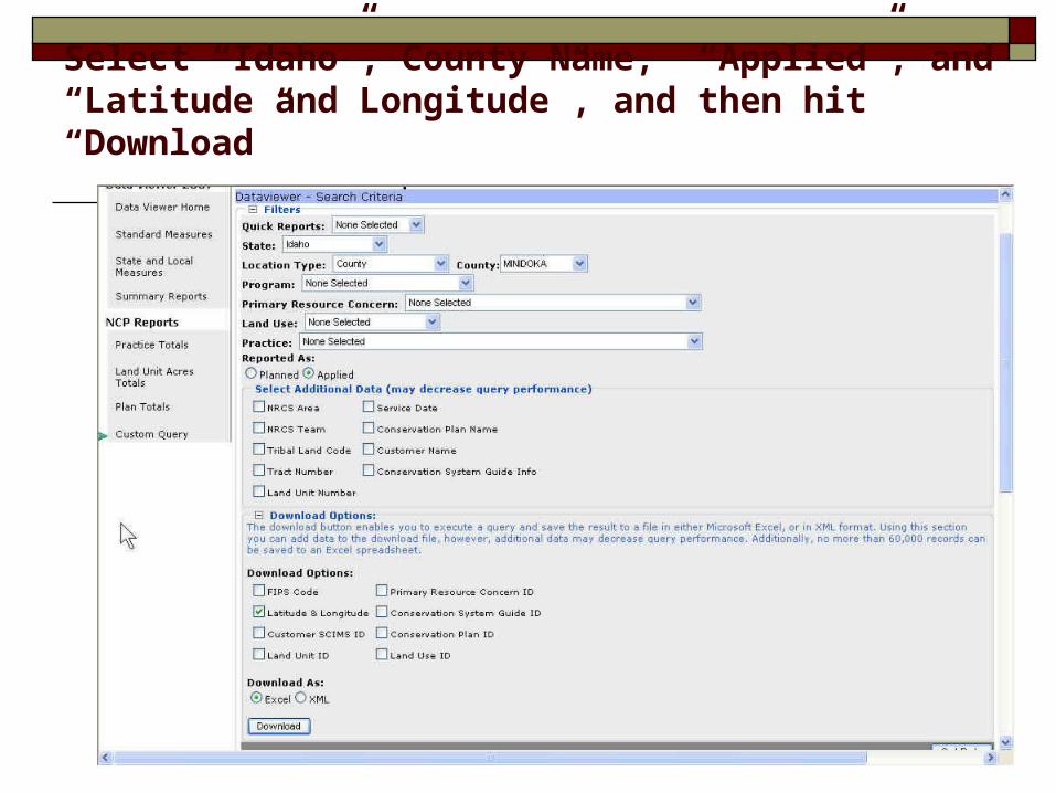
Select “Idaho”, County Name, “Applied”, and “Latitude and Longitude”, and then hit “Download”
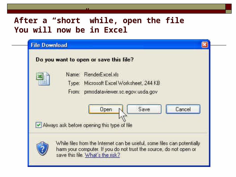
After a “short” while, open the fileYou will now be in Excel

The first Excel screen will be one of a pivot table; you can skip this step and go to the “Sheet2” worksheet
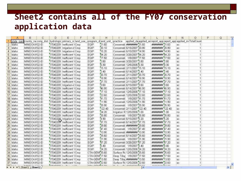
Sheet2 contains all of the FY07 conservation application data

There will also be a column labeled “latlong” but it is
just a single column
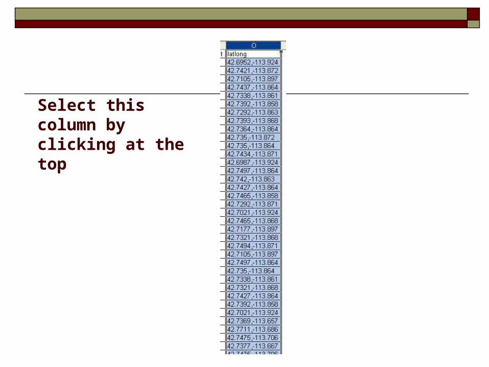
Select this column by clicking at the top

Select Data-Text to Columns to divide this into two columns at the comma delimiter
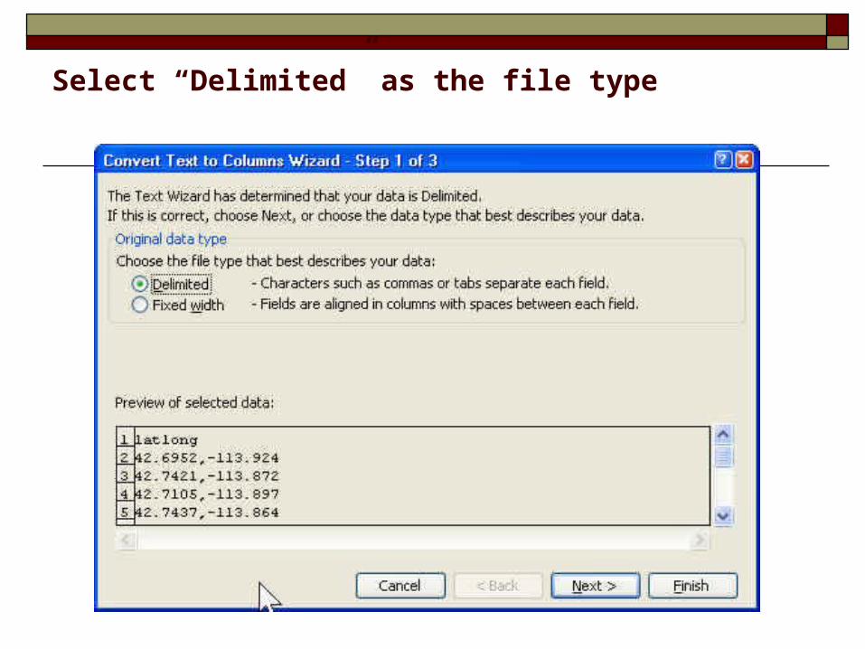
Select “Delimited” as the file type

Check “Comma” and the delimiter type

Accept the defaults and click “Finish”
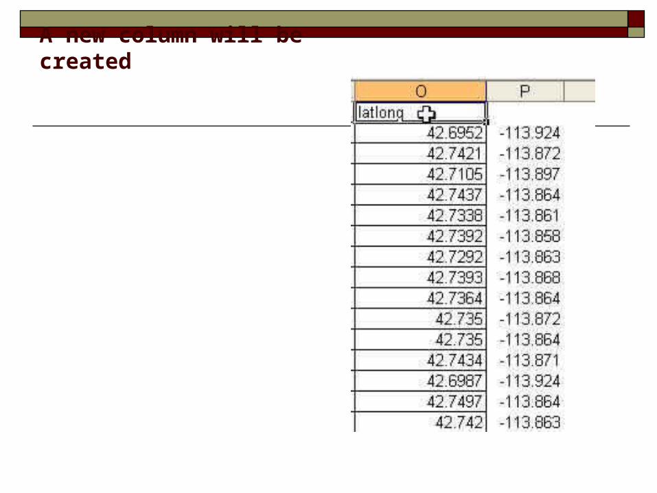
A new column will be created

Type in “lat” and “long” into the header row

Highlight the two columns and select Format-Cells
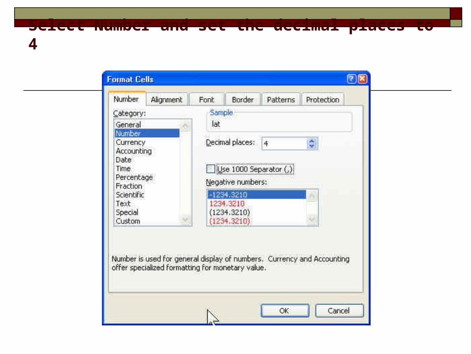
Select Number and set the decimal places to 4

Save the final Excel file under the county name

Start a new ArcMap project Add some basic reference data

Select Tools-Add XY Data
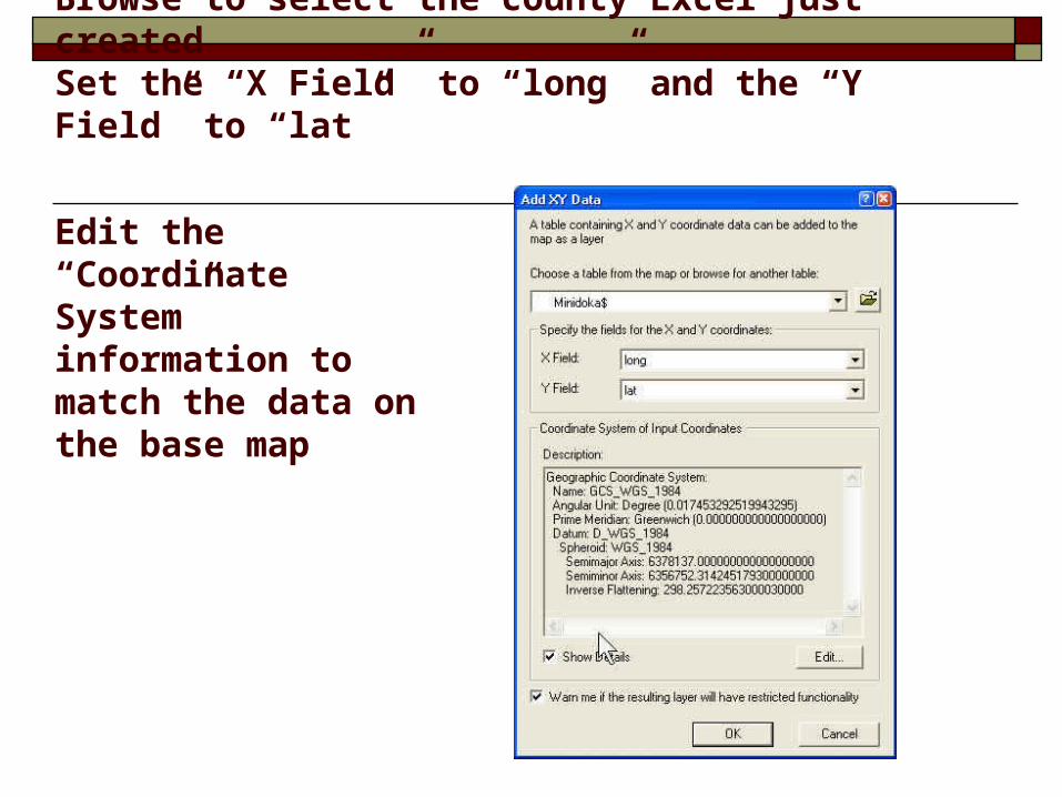
Browse to select the county Excel just createdSet the “X Field” to “long” and the “Y Field” to “lat”
Edit the “Coordinate System” information to match the data on the base map
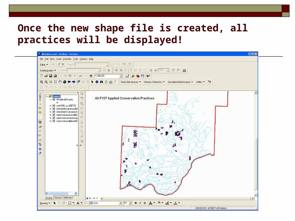
Once the new shape file is created, all practices will be displayed!

Right click on the map layer then select “Open Attribute Table”
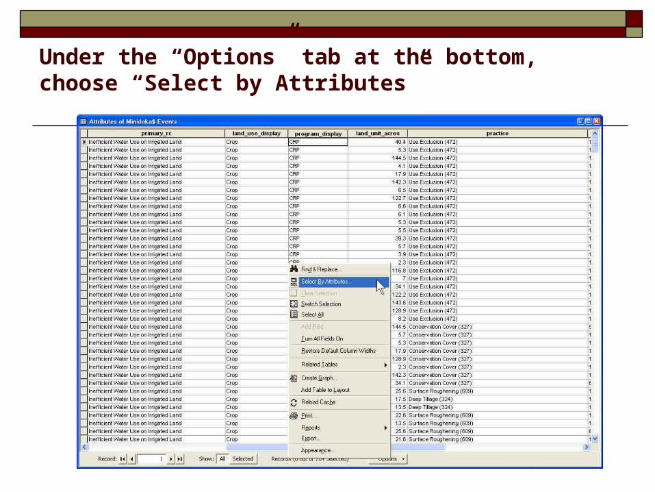
Under the “Options” tab at the bottom, choose “Select by Attributes”
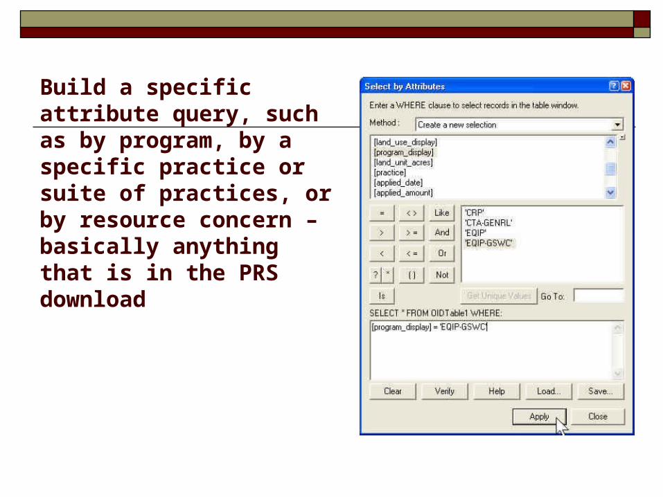
Build a specific attribute query, such as by program, by a specific practice or suite of practices, or by resource concern – basically anything that is in the PRS download

•After the query is made, certain rows in the attribute table will be highlighted. Close the attribute table. Right click on the map layer and select Data-Export Data. Export the selected attribute set to a new shape file and display.

Find this training set on the Idaho NRCS
GIS page.