Contents - Earth Observatory of Singapore AR 2010.pdf · 1 Contents Director’s Message 02...
48
-
Upload
truongdien -
Category
Documents
-
view
221 -
download
4
Transcript of Contents - Earth Observatory of Singapore AR 2010.pdf · 1 Contents Director’s Message 02...


1
ContentsDirector’s Message 02
Management Team 04
Scientifi c Advisory Board 06
Governing Board 07
Tectonics - Earthquakes 09
Tectonics - Tsunamis 15
Volcanoes 21
Climate 27
Technical Offi ce 31
Education & Outreach 32
Artist-in-Residence 34
Sustainability Directorate 35
Retrospective 36
Moving Foward 39
Financial Summary & Staffi ng 42
Working Together 44
During a visit from the Prime Minister’s Research, Innovation and Enterprise Council (RIEC), EOS’ Adam Switzer uses GeoTouch to explain tsunami and typhoon hazards along the Vietnamese coast. Listening (from left to right) are Koh Boon Hwee, Chairman, NTU Board of Trustees; Peter Schwartz, Chairman, Global Business Network; Subramaniam Ramadorai, Vice Chairman, Tata Consultancy Services; and Francis Yeoh, CEO, National Research Foundation.

2
Director’s MessageAs the Earth Observatory accelerates through its
third year, our 2010 Annual Report shows that
we have built a strong platform from which to launch
into 2011 and beyond. Let me highlight some of our
accomplishments in FY2010 and some of the challenges
that lie ahead.
The primary roles of EOS’ science leadership in 2010
were attracting talented young professors to the
Observatory and building a superb infrastructure to
support them and other EOS researchers.
Assistant professors Emma Hill and Wang Xianfeng
joined our ranks this past year. Each won a National
Research Foundation Fellowship – large grants that
aff ord them exceptional fi nancial support (even by
Singaporean standards) to start their research programs.
Several searches for other promising new researchers
also began in 2010 and are proceeding at a speed
commensurate with ensuring that the Observatory
will be second to none as a crucible for scientifi c ideas,
discoveries and impact in the earth sciences.
Throughout the latter half of the year, Charlie Rubin
commuted monthly between the U.S. and Singapore
to get a head start on creating the Division of Earth
Sciences, EOS’ academic connection to the University.
As the founding Head of our fl edgling DES, he
accelerated the construction of offi ces and laboratory
space and led the development of the academic
infrastructure that we will need as teachers and mentors
in the University.
Our major monitoring networks in neighboring
countries became more robust and reliable in 2010.
They continued to develop as collaboration foci and
as platforms for EOS research. Thanks to the eff orts of
our technical staff , instrumentation of lab volcanoes
Mayon and Gede is nearly complete, and the Sumatran
GPS Array (SuGAr) has grown in size and robustness.
New collaborative monitoring eff orts in Myanmar,
Bangladesh and the surrounding region, led by EOS
Technical Director Paramesh Banerjee, will provide
new opportunities to understand the earthquake and
tsunami potential of the eastern fl ank of the Indian-
Asian collision for years to come.
The principal roles of our younger faculty have been to
ramp up their research and teaching programs. Fidel
Costa taught an introductory course for our fi rst cohort
of graduate students and began using the new electron
microprobe (that we operate in partnership with NTU
materials scientists) to understand the movement and
histories of lab-volcano magmas. Recent eruptions
elsewhere provided interesting targets for his research,
as well. His group’s work on the magmas erupted from
Indonesia’s Merapi volcano in 2010 revealed that an
unusual abundance of water in the magma was likely
one of the reasons that the eruption was the volcano’s
largest and deadliest in over a century.
Emma Hill and Huang Zhenhua led eff orts to
understand the devastating Mw
7.8 tsunami earthquake
of October 2010. Analysis of a combination of SuGAr
geodetic data and tsunami fi eld measurements
showed that this unusual event originated on the
Sunda megathrust far from land, out near the trench.
Conventional scientifi c wisdom has been that such
shallow parts of megathrusts are aseismic and not
capable of such earthquakes.
Other EOS principal investigators, with academic homes
in computer engineering, civil engineering and applied
physics, continued to conduct EOS-themed research
in earthquake engineering, climate modeling, and in
instrumentation and data-processing, while carrying
substantial teaching loads in their home divisions.
Despite setbacks in bringing a leader for our climate
program on board, we now have six professors working
full- or part-time on climate related research – in
paleoclimatology, extreme coastal events, climate
downscaling and sea-level change. EOS also took an
active role through 2010 in the long-term intellectual
development of Singapore’s climate-science landscape.
Our interactions with Singaporean and regional
educators, with the media, with government agencies
and with business continued to gain momentum
through FY2010, under the leadership of Sharmini Blok,
Andreas Schaff er and Isaac Kerlow. We responded
to local and international needs for information in
the wake of destructive earthquakes and tsunami
in New Zealand, Sumatra, Myanmar and Japan. We
continued to work with the Ministry of Education and
the National Institute of Education to develop earth-
science materials for Singaporean schools. We began
programs to address climate-related sustainability
issues regionally – in Vietnam, Malaysia, Indonesia and
here at home. Our fi rst writer-in-residence published

3
Director’s Message
his popular book on Sumatran earthquakes and
tsunamis. Professor Kerlow guided his creative team
to completion of their second EOS documentary fi lm,
Mayon: The Volcano Princess, and made good progress
on two other EOS-sponsored artistic projects.
Here on campus, Adam Switzer, Andreas Schaff er and I
taught a large undergraduate course in natural hazards,
and other EOS professors taught their fi rst EOS graduate
courses in their specialties.
As the Earth Observatory evolves through the rest of
2011 and beyond, our opportunities and our impact
will also grow – but so will the challenges. We will need
to respond to external pressures to ramp up to full
strength quickly while maintaining coherence of vision
and quality of research and teaching. We will need to
engage the University and our funders to create an
administrative environment that is more effi cient and
more supportive of the Observatory and the Division,
in our quest to become iconic institutions in Singapore
and in the region. We must strengthen collaborations
with Singapore’s neighbors in ways that serve their
needs as well as our own. We must continue to develop
our strategy for raising competitive and endowment
funding to sustain the Observatory’s research,
education and outreach through coming decades.
This annual report is our opportunity to share with you
our ideas, our discoveries, and our impact on the world
around us. I do hope that you enjoy your time among
these pages.
Kerry Sieh
Director, EOS
August 27, 2011
The Khmers built an empire in Southeast Asia that lasted half a millennium. Its demise remains a mystery. What is not a mystery is that the health of our
societies through the 21st and later centuries will require a solid understanding of how our dynamic planet works and what its limitations are. The Earth
Observatory is one of Singapore’s eff orts to ensure its long-term sustainability.

4
Management Team
Kerry Sieh
Director, EOS
Chris Newhall
Group Leader, Volcano Group
Paul Tapponnier
Group Leader, Tectonics Group

5
Andreas Schaff er
Sustainability Director
Paramesh Banerjee
Technical Director
Woo Kien Young
Corporate Services Director
Sharmini Blok
Education & Outreach Director
(Until April 2011)
The EOS logo refl ects the dynamism of our planet and our
scientifi c observations of the changing Earth. Represented
are the four classical elements: fi re (red for volcanic magma),
air (gray evoking the atmosphere), water (the blue sea), and
earth (brown for terra fi rma).
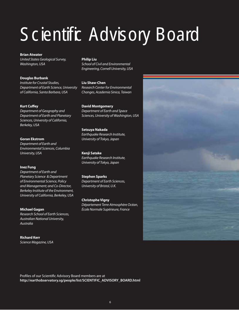
Scientifi c Advisory Board
6
Brian Atwater
United States Geological Survey,
Washington, USA
Douglas Burbank
Institute for Crustal Studies,
Department of Earth Science, University
of California, Santa Barbara, USA
Kurt Cuff ey
Department of Geography and
Department of Earth and Planetary
Sciences, University of California,
Berkeley, USA
Goran Ekstrom
Department of Earth and
Environmental Sciences, Columbia
University, USA
Inez Fung
Department of Earth and
Planetary Science & Department
of Environmental Science, Policy
and Management; and Co-Director,
Berkeley Institute of the Environment,
University of California, Berkeley, USA
Michael Gagan
Research School of Earth Sciences,
Australian National University,
Australia
Richard Kerr
Science Magazine, USA
Philip Liu
School of Civil and Environmental
Engineering, Cornell University, USA
Liu Shaw-Chen
Research Center for Environmental
Changes, Academia Sinica, Taiwan
David Montgomery
Department of Earth and Space
Sciences, University of Washington, USA
Setsuya Nakada
Earthquake Research Institute,
University of Tokyo, Japan
Kenji Satake
Earthquake Research Institute,
University of Tokyo, Japan
Stephen Sparks
Department of Earth Sciences,
University of Bristol, U.K.
Christophe Vigny
Département Terre Atmosphère Océan,
École Normale Supérieure, France
Profi les of our Scientifi c Advisory Board members are at
http://earthobservatory.sg/people/list/SCIENTIFIC_ADVISORY_BOARD.html

7
Governing BoardTan Gee Paw
Chairman,
Public Utilities Board and
Chairman,
EOS Governing Board
Jean-Lou Chameau
President,
California Institute of Technology , USA
Foong Chee Leong
Former Director-General,
Meteorological Services,
National Environment Agency
Lawrence Koe
Director (Projects),
National Research Foundation
Lam Chuan Leong
Ambassador-at-Large,
Ministry of Foreign Aff airs
Kerry Sieh
Director,
Earth Observatory of Singapore
Su Guaning
President Emeritus,
Nanyang Technological University
Tan Gee Keow
Director, Higher Education,
Ministry of Education
Profi les of our Governing Board members are at
http://earthobservatory.sg/people/list/GOVERNING_BOARD.html
The boat that EOS and LIPI researchers use in Sumatra for coral and GPS fi eld work. This photo was taken
during reconnaissance of the Banyak islands following the magnitude 7.8 earthquake of April 2010.

Folded and faulted ancient river sediments along the new highway from Yangon to Mandalay, Myanmar, May 2011. EOS researchers are working with colleagues from Myanmar to understand the great fault that bisects the country from north to south and runs a few kilometers behind this outcrop.
Tectonics • Earthquakes

9
Tectonics • Earthquakes
Asia is home to several of the largest, most seismically active faults in the world, including the Sagaing fault in Myanmar, the Main Frontal Thrust of the Himalayas, the
Sumatran fault, and the Sunda megathrust, which traces a 6,000-kilometre arc from Myanmar to northwest Australia. Tens of
millions of people live near these earthquake faults, vulnerable to a
temblor’s destructive force.
One of the goals of the Tectonics Group is to increase the fundamental knowledge
of these faults and others in the region in order to forecast earthquakes and their
associated tsunamis more reliably.
We are also researching ways to mitigate the damaging effects of
such natural hazards in the future.

Sumatran Tectonic Geodesy
In its fi rst eight years of operation, the Sumatran
GPS Array (SuGAr) has grown to be a network of 40
functioning GPS stations spanning 1,350 kilometres
of the Sumatran plate boundary. Since 2004, 75
earthquakes greater than magnitude 6.0 have occurred
within the network, including seven greater than 7.5.
We are studying the behaviour of a 300-kilometre
Principal Investigator
Asst Prof Emma Hill,
EOS, Nanyang Technological University
(In 2010, Prof Kerry Sieh,
EOS, Nanyang Technological University)
Co-Investigators
Dr Paramesh Banerjee,
EOS, Nanyang Technological University
Prof Kerry Sieh,
EOS, Nanyang Technological University
Collaborators
Dr Lujia Feng, Dr Kenneth MacPherson,
and Dr Ashar Lubis,
EOS, Nanyang Technological University
Dr Danny H. Natawidjaja,
Indonesian Institute of Sciences (LIPI)
Prof Roland Bürgmann & Kelly Wiseman,
Department of Earth and Planetary Science,
University of California-Berkeley, USA
locked section of the fault in the northern Mentawai
Islands that has not experienced a major rupture in
more than 200 years. Another quake of magnitude 8.8
has been forecast to occur there in the coming decades.
Much of our work involves unifying the stories of
individual events into an overarching picture of future
earthquake hazard throughout the region. In 2010,
we collected and began analysing data from three
large earthquakes: one in the Banyak Islands in April
(7.8), one near Simeulue in May (7.2), and one in the
Mentawai Islands in October (7.7).
The October 2010 earthquake produced an outsized
tsunami compared to its magnitude, categorising it
as a “tsunami earthquake”, the fi rst such quake to be
measured by near-fi eld GPS. The combination of high-
rate GPS data captured by SuGAr, and tsunami fi eld
data and modelling (by Zhenhua Huang’s group) for this
earthquake are raising fundamental questions about the
mechanical behaviour of the shallow crust.
What’s more, the staggering number of Sumatran
earthquakes greater than magnitude 4.5 since 2004,
by virtue of their sheer numbers, could be playing a
signifi cant role in tectonic deformation of the region.
Over the next year we’ll also be working to characterise
these smaller quakes. An important goal of doing so will
be to see if episodic, or “slow”, slip events are happening
on the megathrust fault.
10
Tectonics • Earthquakes
The Sumatran GPS Array (SuGAr) is a 40-station GPS network designed to measure crustal deformation along the highly active Sumatran subduction zone.

Principal Investigator
Asst Prof Kusnowidjaja Megawati,
EOS & School of Civil and Environmental Engineering,
Nanyang Technological University
Co-Investigators
Prof Kerry Sieh, Prof Paul Tapponnier,
and Asst Prof Zhenhua Huang,
EOS, Nanyang Technological University
Dr Danny H. Natawidjaja,
Indonesian Institute of Sciences (LIPI)
Prof Kazuki Koketsu,
Earthquake Research Institute, University of Tokyo
Prof Hiroaki Yamanaka,
Tokyo Institute of Technology
The objective of this project, together with the
accompanying project on tsunami simulation led
by Zhenhua Huang, is to develop a system that can
integrate the seismic and tsunami hazard of West
Sumatra. Some studies have assessed tsunami impact
Integrated Seismic and Tsunami Hazard Assessment of West Sumatra, Indonesia
in West Sumatra, but no study has ever considered the
combined eff ects of strong motion and tsunami in cities
facing both types of hazards.
In 2010, we collaborated with University Bung Hatta
in Padang to conduct microtremor measurements to
determine the soil structure underneath Padang and
Pariaman. Based on the results obtained – and available
geological, geophysical and geotechnical information
– we will construct 3D shear-wave velocity structures to
determine the intensity and predominant frequencies
of ground motion for both cities during an earthquake.
This year, we plan to collect an inventory of buildings
in both cities, assess their seismic performance, and
begin modelling human evacuation scenarios.
The end product of our modelling will hopefully give
insights to local and central government agencies
to work out plans to mitigate the effects of an
earthquake and tsunami.
11
Understanding the level of destruction to a coastal city from strong motion is essential, as collapsed buildings would trap inhabitants, and damaged roads and bridges would hamper human evacuation to higher grounds before the ensuing tsunami arrives.Kusnowidjaja Megawati, EOS
Microtremor measurement in Padang, 16 - 26 August 2010.
Tectonics • Earthquakes
Tectonics • Earthquakes
12
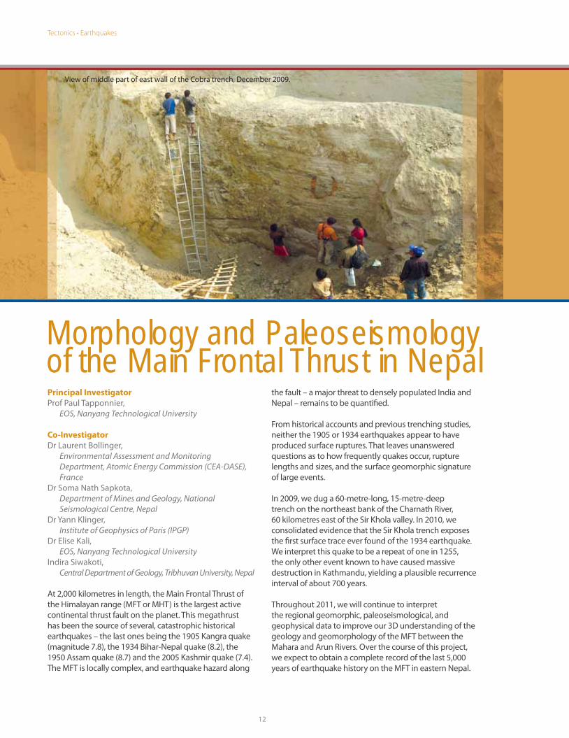
Morphology and Paleoseismology of the Main Frontal Thrust in Nepal
At 2,000 kilometres in length, the Main Frontal Thrust of
the Himalayan range (MFT or MHT) is the largest active
continental thrust fault on the planet. This megathrust
has been the source of several, catastrophic historical
earthquakes – the last ones being the 1905 Kangra quake
(magnitude 7.8), the 1934 Bihar-Nepal quake (8.2), the
1950 Assam quake (8.7) and the 2005 Kashmir quake (7.4).
The MFT is locally complex, and earthquake hazard along
Principal Investigator
Prof Paul Tapponnier,
EOS, Nanyang Technological University
Co-Investigator
Dr Laurent Bollinger,
Environmental Assessment and Monitoring
Department, Atomic Energy Commission (CEA-DASE),
France
Dr Soma Nath Sapkota,
Department of Mines and Geology, National
Seismological Centre, Nepal
Dr Yann Klinger,
Institute of Geophysics of Paris (IPGP)
Dr Elise Kali,
EOS, Nanyang Technological University
Indira Siwakoti,
Central Department of Geology, Tribhuvan University, Nepal
the fault – a major threat to densely populated India and
Nepal – remains to be quantifi ed.
From historical accounts and previous trenching studies,
neither the 1905 or 1934 earthquakes appear to have
produced surface ruptures. That leaves unanswered
questions as to how frequently quakes occur, rupture
lengths and sizes, and the surface geomorphic signature
of large events.
In 2009, we dug a 60-metre-long, 15-metre-deep
trench on the northeast bank of the Charnath River,
60 kilometres east of the Sir Khola valley. In 2010, we
consolidated evidence that the Sir Khola trench exposes
the fi rst surface trace ever found of the 1934 earthquake.
We interpret this quake to be a repeat of one in 1255,
the only other event known to have caused massive
destruction in Kathmandu, yielding a plausible recurrence
interval of about 700 years.
Throughout 2011, we will continue to interpret
the regional geomorphic, paleoseismological, and
geophysical data to improve our 3D understanding of the
geology and geomorphology of the MFT between the
Mahara and Arun Rivers. Over the course of this project,
we expect to obtain a complete record of the last 5,000
years of earthquake history on the MFT in eastern Nepal.
View of middle part of east wall of the Cobra trench, December 2009.

Tectonics • Earthquakes
13
Principal Investigator
Prof Paul Tapponnier,
EOS, Nanyang Technological University
Co-Investigators
Dr Yann Klinger, Institute of Geophysics of Paris (IPGP)
Dr Xiwei Xu,
Institute of Geology, China Earthquake Administration
Dr Jérôme van der Woerd,
Institute of Geophysics of Paris (IPGP)
Dr Haibing Li,
Institute of Geology, Ministry of Land and Resources, China
Dr Jing Liu,
Institute of Tibetan Plateau Research,
Chinese Academy of Sciences
Dr Magali Rizza, EOS, Nanyang Technological University
Dr Marie Etchebes, EOS, Nanyang Technological University
To assess seismic hazard, earthquake recurrence models
need data from repeated earthquake surface ruptures.
But documentation of such repeated events is rare.
The scarcity of data makes it diffi cult to determine
which, if any, of the seismic cycle and recurrence
models is better than another.
Earthquake Ruptures in China: Testing Seismic Fault Behavior Models
Now, commercially available, sub-metric-resolution
satellite images make it possible to map surface
ruptures in fi ne detail over hundreds of kilometres,
especially in regions where vegetation is scarce.
Using QuickBird and GeoEye satellite images, we
are augmenting the available rupture data for the
region extending between the Himalayas and Siberia
and encompassing Tibet and central Asia. Large
earthquakes occur frequently in this region, and its
undisturbed landscape contains many strike-slip
ruptures, both historic and ancient.
In 2010, we unravelled the records of multiple surface
displacements along the Fuyun fault in Xinjiang, China,
180 kilometres of which ruptured in August 1931.
On a trip to the site, we collected surface samples for
cosmogenic isotope dating and two digital elevation
models to help calibrate the satellite images. In 2011,
we plan to do kilometre-scale, ground-based LIDAR
surveys along the rupture. We are also procuring more
satellite images on stretches of the Kunlun and Altyn
Tagh faults in Tibet. Segments on the Altyn Tagh fault
bear spectacular, free-faced traces of large earthquakes
that we infer to be less than a few centuries old.
Surface rupture of 14 Nov 2001, magnitude 7.9 Kokoxili earthquake, Kunlun, China.
The region that extends between the Himalayas and Siberia has become an unmatched ‘museum’ of well-preserved historic and more ancient strike-slip ruptures.Paul Tapponnier, EOS

Tectonics • Tsunamis
Beach sand washed past a grove of dead coconut palms and into a swamp by the December 2004 tsunami, west coast of Nias island. The coconut grove was planted above the sea, but slowly subsided into the intertidal zone due to strain accumulation in the century prior to the great earthquakes of 2004 and 2005. Photo taken January 2005.

Tectonics • Tsunamis
15
As evidenced by recent events in Tohoku, Japan, tsunamis can cause overwhelming
destruction of infrastructure and loss of life. In December 2004, the Indian Ocean tsunami devastated many communities in Indonesia, Sri Lanka, India and Thailand.
The location of large, active undersea faults makes coastal areas in South
and Southeast Asia particularly vulnerable to these deadly waves.
The Tectonics Group not only works to understand how tsunamis are generated and surge onto land but also to fi nd ways
to protect people and property with engineered structures
and evacuation plan scenarios.

Tsunami Hazard Mitigation for West Sumatra
Tectonics • Tsunamis
Principal Investigator
Asst Prof Zhenhua Huang,
EOS & School of Civil and Environmental Engineering,
Nanyang Technological University
Co-Investigator
Prof Kerry Sieh,
EOS, Nanyang Technological University
Asst Prof Kusnowidjaja Megawati,
EOS & School of Civil and Environmental Engineering,
Nanyang Technological University
Prof Yee Meng Chiew, Assoc. Prof Soon Keat Tan and
Assoc Prof Edmond Y. M. Lo,
School of Civil and Environmental Engineering,
Nanyang Technological University
Dr Danny H. Natawidjaja,
Indonesian Institute of Sciences (LIPI)
Asst Prof Adam Switzer,
EOS, Nanyang Technological University
Collaborators
Dr Linlin Li, Yanmei Zhang, & Qiang Qiu,
EOS, Nanyang Technological University
Our work focusses on integrating tsunami science with
engineering measures for tsunami hazard mitigation,
with the West Sumatran coast as our primary case-study
area. We are conducting a systematic study that covers
all aspects of the tsunami hazard, including choosing
appropriate megathrust fault sources, initial tsunami
prediction, tsunami-related debris fl ows, tsunami run-up
and inundation, mitigation by coastal vegetation and
coral reefs, design of vertical tsunami shelters, and plans
for human evacuation.
From our work in 2010, we now have a tsunami-
modelling package capable of simulating the entire
lifespan of a tsunami. We carried out scenario studies for
Painan, Pariaman and the island nation of Mauritius based
on a magnitude 8.9 rupture of the Mentawai section of
the Sunda megathrust. We also conducted a fi eld survey
in the southern Mentawai Islands following the October
2010 earthquake to collect data on tsunami wave height,
inundation and damage throughout the aff ected area.
During a tsunami, fl oating debris causes casualties as
well as the collapse of buildings. In 2011, we plan to
investigate debris fl ow patterns through a series of
laboratory experiments in idealised city models. Later,
numerical models will be developed based on our
experimental results. We are also coupling a sediment
transport model with a tsunami simulation package
to get results with fi ner spatial resolution. Using the
coupled models and high-resolution bathymetric and
topographic data, we will be able to better predict fl ow
fi elds and sediment transport for the cities on the West
Sumatra coast.
16
Tsunami and tectonic devastation on the western coast of Aceh province, January 2005. The December 2004 tsunami cleared vegetation from the islands up to 30 meters
above sea level on parts of this coast. The coastline sank about a meter due to the lurching of the land seaward during the earthquake. Photo by John Galetzka.

Tectonics • Tsunamis
Principal Investigator
Prof Kerry Sieh, EOS, Nanyang Technological University
Co-Investigators
Prof Charles Rubin,
Division of Earth Sciences,
Nanyang Technological University
Dr Patrick Daly,
Asia Research Institute, National University of Singapore
Dr E. Edwards McKinnon,
Asia Research Institute, National University of Singapore
Asst Prof Benjamin Horton,
Department of Earth and Environmental Science,
University of Pennsylvania
Collaborators
Dr Aron J. Meltzner,
EOS, Nanyang Technological University
Asst Prof Adam Switzer,
EOS, Nanyang Technological University
The Aceh region was propelled onto the world stage by the 2004 Indian Ocean earthquake and tsunami, which caused tremendous damage and loss of life. Building a reliable chronology of seismic and tsunami activity in the region is vital for forecasting the frequency and severity of future events Our project combines geological,
A Geoarchaeological Investigation of Paleotsunami and Paleoseismic Activity in Northern Sumatra
archaeological and historical methods to investigate paleotsunami and paleoseismic events, as well as their impact on coastal communities in northern Sumatra. In 2010, we published a paper that documented the two most recent predecessors to the 2004 earthquake - from coral uplifted in 1394 and 1450 AD on Simeulue island, about 100 kilometres off the west coast of Aceh. We are now fi nding evidence on the mainland coast of Aceh for the tsunamis caused by these big earthquakes. East of Banda Aceh, we have one site that contains evidence for two closely timed tsunamis in that time period and two additional sites that may hold such evidence as well.
In 2011, we plan to verify the 1394 and 1450 tsunamis through targeted fi eld studies at three sites, determine whether other tsunamis occurred between 1450 and 2004, and begin mapping historical changes in the coastal geomorphology and ecology around Banda Aceh. These initial paleoseismic and paleotsunami studies suggest that the 2004 tsunami may be the fi rst of a doublet, with another large tsunami to follow in the next half century.
The 2004 event also raises intriguing questions about the eff ects of previous earthquakes and tsunamis on human history in the region. Information on the 14th- and 15th-century tsunamis will help historians better understand the dynamics of trade and settlement in northern Sumatra during that time and how environmental processes might
have infl uenced that activity.
17
Muslim graves that now sit in the intertidal zone in Banda Aceh are
evidence of the slow sinking of the city.

18
More Tectonics Projects
Tectonics
Discrete Element Modelling of Fault Nucleation and Propagation in Collision ZonesPrincipal Investigator
Prof Paul Tapponnier
Most numerical computer modelling of continental
deformation – based on fl uid mechanics or classic fi nite
element methods – fails to include the nucleation and
propagation of faults and the kinematic compatibility
between them. We are addressing this issue with
Discrete Element Methods (DEM), fi rst by developing
and testing codes to reproduce the results of 2D
experiments on sand or plasticine. The fi nal goal will be
to simulate the evolution of large scale faulting in Asia
during the last 50 million years.
Kinematics of the Bengal-Assam SyntaxisPrincipal Investigators
Prof Paul Tapponnier & Dr Paramesh Banerjee
The convergence of mountain ranges in the eastern
Himalayas, known as the Bengal-Assam syntaxis, was
the site of the largest continental earthquake ever
recorded (a magnitude 8.7 in 1950). Straddling four
countries and covered with dense vegetation, the
syntaxis is complex and poorly understood. We plan
to install GPS stations in Bangladesh, Myanmar and
India and start fi eld reconnaissance to bridge the gap
between the major active faults in the region.
Earthquake Geology in MyanmarPrincipal Investigator
Prof Kerry Sieh
The active faults of Myanmar are too poorly understood
to quantify their role in regional neotectonic
deformation or to make realistic estimates of seismic
hazard. In 2010, our fi eld work focussed on paleoseismic
studies of young coastal terraces on two islands of
the western coast, which will yield information on
recurrence and help resolve whether these events
are produced by thrust faults within the accretionary
prism or by the subduction megathrust itself. An east-
west transect of four GPS stations installed in January
2011, with additional ones to come, will enable an
assessment of the distribution of strain across Myanmar.
Neotectonic Studies in Southeast AsiaPrincipal Investigator
Prof Kerry Sieh
We are constructing a smart, GIS-based active-fault map
and database for Southeast Asia. Our three principal
motivations are to compile what is already known, to
reconnoiter poorly known parts of Southeast Asia and
to meet the needs of the Global Earthquake Model
project. We propose to complete during 2011 the
compilation of reliable existing data and to continue
focussing on original investigations in Myanmar,
Indonesia and New Guinea.
Paleoseismology and Paleogeodesy of the Sumatran Subduction ZonePrincipal Investigator
Prof Kerry Sieh
Large sections of the Sunda megathrust have failed
progressively over the past decade in an extraordinary
earthquake sequence. One question of humanitarian
and scientifi c importance is how the remaining patches
might fail in coming decades. We use annually banded
coral microatolls, which preserve precise information
about past relative sea levels, to deduce tectonic
histories centuries into the past. In 2010, we worked
above the 2004, 2005 and 2007 rupture patches – from
Simeulue to the Mentawai Islands – to resolve lingering
questions about the very high hazards we infer for the
near future.
Fundamental Source-to-Site-to-Structure Study of Seismic Impacts and Hazards for Part of Southeast Asia Covering Sumatra, Java and the Malay PeninsulaPrincipal Investigator
Asst Prof Goh Siang Huat
We are developing large-scale 3D computational
models that can perform “source‐to‐site‐to‐structure”
simulations, starting with the rupture on an earthquake
fault, followed by the propagation of the seismic
waves to engineered structures of interest. The study
includes the development of a regional seismo‐tectonic
model and the computational resources to perform
large‐scale wave propagation analyses. The results will

19
Tectonics
provide fundamental insights into the expected ground
motions arising from diff erent scenario earthquakes
and will be useful for assessing the eff ects and hazards
to infrastructure in Singapore and cities in the region.
Development of Standard Procedure for Seismic Hazard and Risk Assessment of Cities in Southeast AsiaPrincipal Investigator
Asst Prof Kusnowidjaja Megawati
The severity of earthquake disasters increases
tremendously when major earthquakes hit densely
populated urban centres. One focus of EOS is to re-
examine seismic hazard of major cities in Southeast
Asia to mitigate regional earthquake catastrophes.
We are developing a standard procedure to assess
seismic hazard and risk levels of urban areas, taking
the Indonesian city of Surabaya as a study case. We are
evaluating the seismic hazard deterministically by fi rst
identifying scenario earthquakes based on geologic
and tectonic evidence, and then by computing the
expected ground motions using a 3D discrete model,
establishing building inventory from satellite photos
and estimating potential loss.
Data Sensing, Communications and Processing for Earth Observation in the Singapore RegionPrincipal Investigator
Assoc Prof Ian McLoughlin
Our team of three computer engineering professors
– comprising sensor, communications and data
processing experts – helps bridge science at EOS with
the research engineers at NTU. This work continues
the team’s role in enhancing the current Sumatran
GPS Array (SuGAr) but also extends the work to
encompass volcanology and climatology. Our 2010
achievements include drastically reducing the power
consumption of platforms for tectonic and seismic
monitoring, developing an inexpensive monitoring
tool for volcanoes, developing a fl at LCD version of the
GeoTouch interactive presentation tool and improving
the reliability of data telemetry for SuGAr like wireless
monitoring systems.
Modelling Submarine Landslide Tsunamis with a Case Study for VietnamPrincipal Investigator
Asst Prof Zhenhua Huang
Submarine earthquakes and landslides are two important
tsunami sources, but tsunami hazard modelling in the
South China Sea has been primarily concerned with
the potential large submarine earthquakes. We are
developing an effi cient and accurate method to model
initial tsunamis generated by submarine landslides
and carrying out a risk analysis of such landslides in
mid-Vietnam. The work we accomplished in 2010
includes development of a deformable landslide model,
verifi cation of the landslide model and code, and
completion of a scenario study for the Vietnam coast.
Hunting the Tsunami Deposits of the AD551 Beirut-Tripoli EarthquakePrincipal Investigator
Asst Prof Adam Switzer
The AD551 Beirut-Tripoli earthquake is reported to have
generated a large tsunami that fl ooded the cities of
Beirut and Tripoli. In 2010, we conducted a pilot study
to investigate whether sandy and bouldery tsunami
deposits associated with this event could be found in
the low-lying coastal plains and coastal platforms of
the Lebanese coast. Although the coastline is primarily
modifi ed or rocky, we have identifi ed two sites that
potentially record the event (and others) in their recent
coastal stratigraphy. In 2011, we plan to excavate and
core in the Akkar delta plain and sample a second site at
Damour.

Photo of Pangrango volcano taken from the top of Gede, EOS lab volcano in Indonesia.
Volcanoes

Volcanoes
21
The volcanoes in Southeast Asia are among the most active on Earth,
having produced some of the most famous explosive eruptions in written and geologic history. In countries such as Indonesia, the
Philippines and Papua New Guinea, many people live in the shadow of active
volcanoes, and the potential for such eruptions puts their safety at risk.
We are studying several volcanoes as natural laboratories, with the goal of developing
tools and acquiring data to improve forecasts and to assess the environmental
and social impact of volcanic events. Information about increased hazards is conveyed to and through collaborating
host-country scientists. Complementing our fi eld research is development of a
searchable, global database of volcanic unrest that will also serve as a useful
tool for better prediction.

Volcanoes
Reconstructing the Plumbing Systems and Dynamics of Magmatic Processes Below Active Volcanoes
Technological advances in volcano monitoring have
greatly improved our ability to measure changes in a
volcanic system before, during and after an eruption.
Still, it remains a challenge to relate external monitoring
signals to the processes occurring deep inside a
volcano.
The chemical compositions and microcrystalline
structures of erupted rocks, however, can reveal the
environmental conditions inside the volcanoes that
produced them. Our approach is to use micro- and
nano-analytical techniques, thermodynamics, and
Principal Investigator
Asst Prof Fidel Costa,
EOS, Nanyang Technological University
Collaborators
Dr Joan Cabato, Tarsilo Girona and Daniel Krimer,
EOS, Nanyang Technological University
kinetic models to reconstruct the plumbing system and
the timeline of magmatic events leading to eruptions.
The main targets are the EOS laboratory volcanoes
of Mayon, Gede and Salak. Our overall goals, along
with others working on the laboratory volcanoes,
are to relate monitoring signals to specifi c magmatic
processes and to gain insights into the variable time
scales – ranging from weeks to decades – of volcanic
unrest.
During the fi rst year of the project, we set up essential
facilities, such as labs for optical microscopy, an electron
microprobe, and a facility for rock cutting and polishing.
At Mayon, we did fi eld work and initial petrological
characterisation of the most relevant eruption
products, and we have started numerical calculations
to understand its constant degassing. At Gede, we have
characterised magma mixing processes and time scales
by analysing a suite of banded pumices. This year, we
will also work on rock samples from the Merapi volcano
in central Java.
Most monitoring work is descriptive, with limited insight into understanding processes. By looking at erupted rocks, we have the tools to reveal the processes. The general goal is to integrate our fi ndings with monitoring data so that we can better forecast future eruptions.Fidel Costa, EOS
22
Calcium distribution map of a basaltic andesite bomb from the 2010 Merapi eruption.

Volcanoes
23
Laboratory VolcanoesPrincipal Investigator
Prof Chris Newhall,
EOS, Nanyang Technological University
MayonCollaborators
Dr Renato Solidum, Mariton Bornas & Staff ,
Philippine Institute of Volcanology and Seismology
(PHIVOLCS)
Asst Prof Fidel Costa, Dr Florian Schwandner, Dr Dannie
Hidayat, Dr Christina Widiwijayanti, and Joey Marcial,
EOS, Nanyang Technological University
Gede-SalakCollaborators
Dr Surono & Staff ,
Center of Volcanology & Geological Hazard Mitigation
(CVGHM)
Asst Prof Fidel Costa, Dr Sasha Belousov, Dr Marina
Belousova, Dr Florian Schwandner, Dr Dannie Hidayat,
Dr Christina Widiwijayanti, Dr Antonius Ratdomopurbo,
Dr Chris Harpel, & Daniel Krimer,
EOS, Nanyang Technological University
EOS has been developing natural volcano laboratories at
Mayon in southeast Luzon in the Philippines and Gede and
Salak in West Java, Indonesia. These three volcanoes span a
wide range of degassing behaviors. Mayon, near the openly
degassing end, tends to produce small, frequent eruptions.
The threat of explosive activity requires costly evacuations
of about 50,000 people for weeks at a time. We aim to
understand the timing, rates and other details of magma
supply and degassing at Mayon and thereby improve
forecasts of future eruptions. In 2010 and the fi rst half of
2011, we constructed fi ve typhoon-resistant instrument
shelters, installed new broadband seismometers and
tiltmeters, installed equipment for continuous monitoring of
sulfur gas, developed and installed a prototype instrument
for continuous CO2 monitoring, helped PHIVOLCS model
its GPS station data, and started numerical modelling of
magma degassing in Mayon’s conduit.
Gede and Salak, toward the other end of the spectrum,
are moderately plugged arc volcanoes that exhibit only
minor degassing yet suggest recent magma and gas
input from depth. Our overall goals are to understand the
inner workings of such volcanoes, especially how their
plugging aff ects eruptions and might contribute to their
relatively frequent collapses. In 2010, we acquired and
tested equipment to upgrade geophysical, geochemical
and hydrologic monitoring of Gede and Salak and installed
some of it in early 2011. Gede showed briefl y but sharply
elevated volcanic seismicity in November-December 2010.
Geologic fi eldwork on Gede and Salak is well underway, and
we’re getting interesting new information about when, how
often and how explosively these volcanoes have erupted.
EOS network for Mayon,
augmenting the existing PHIVOLCS
network and ongoing NIED
station upgrade
Tree killed by pyroclastic fl ow about 1,200 years ago, 12 km from Gede summit.

More Volcano Projects
24
World Organization of Volcano Observatories Database (WOVOdat)
Prof Christopher Newhall (P.I.), Dr Antonius
Ratdomopurbo, and Dr Christina Widiwijayanti, EOS
The members of the World Organization of Volcano
Observatories have collected a wealth of valuable data
on volcanic activity. But lack of standardisation makes it
nearly impossible to do comparative studies of volcanic
unrest – or to search the data during a crisis. We have
begun translating and compiling these myriad data into
a comprehensive database with the goal of making it
freely accessible over the Web.
Exploratory Projects on Volcanoes
Prof Christopher Newhall (P.I.), Dr Alexander Belousov,
Dr Marina Belousova, Dr Florian Schwandner, & Dr
Dannie Hidayat, EOS; Assoc Prof Khin Zaw, University
of Tasmania; Dr Bruce Christenson, GNS Science, New
Zealand; and Herman Patia, Rabaul Volcano
Observatory, Papua New Guinea
Revisiting Deposits of the 1951 Eruption of Mt. Lamington, Papua New Guinea
The 1951 eruption of Mt. Lamington devastated an
area of 230 square kilometres and killed 3,500 people.
The main goal of the project was to understand the
eruptive blast and an associated large landslide. We also
collected evidence on the pre-1951 eruptive history of
the volcano.
Estimating CO2 Emissions from Volcanoes Using Japan’s IBUKI (GOSAT) Satellite
Our aim is to detect and quantify volcanic CO2
emissions from space for the fi rst time. CO2 is the fi rst
early indicator of volcanic unrest, long before SO2
is emitted. The project uses data from Japan’s IBUKI
(GOSAT) satellite, designed to measure greenhouse
gases. Early results are promising.
3D Revisit of Chemistry, Gas Bubbles and Temperature in Pinatubo Caldera Lake
In 2000, the caldera lake of Mt. Pinatubo in the
Philippines showed a high, inverted temperature
gradient, which we speculated was being stabilized by
CO2 bubbles. In 2010, we resurveyed the lake and no
longer found a gradient. We corroborated the idea that decreasing CO
2 fl ux now allows waters heated at the
bottom of the lake to rise and mix.
Sector Collapse of Mt. Iriga, The Philippines
This project near Mayon determined the character and ages of the most recent eruptions of the Iriga volcano and also dated its voluminous gravitational collapse to between 1,500 and 1,650 years ago. The collapse formed a large, horseshoe-shaped crater 2 kilometres in diameter and dammed a valley on its southeastern foot,
forming Lake Buhi.
Collapse of Mt. Popa, Myanmar
At the invitation of Assoc Prof Khin Zhaw of the University of Tasmania, we did a one-week study of Mt. Popa, documenting and dating gravitational collapse of
the volcano.
Inexpensive New Monitoring Tools for Volcanoes
We designed and assembled a low-rate datalogger and tested it with tiltmeters at the volcanoes Mayon in Luzon, the Philippines, and Sinabung in North Sumatra, Indonesia. The datalogger can also be used for other analog sensors such as seismometers, microphones, and microbarographs. We also tested a type of 5.8GHz radio telemetry at Sinabung, which is low-cost, versatile, and requires no frequency license.
Volcanoes

Volcanoes
Coring of Buhi lake at the foot of Iriga volcano, the Philippines, for reconstruction of the volcano’s eruptive history and estimations of paleoclimate.
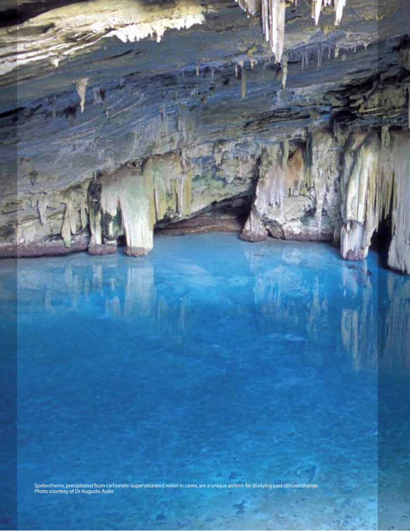
Speleothems, precipitated from carbonate-supersaturated water in caves, are a unique archive for studying past climate change. Photo courtesy of Dr Augusto Auler.
Climate

Climate
27
Over the next decades, changes in average global temperatures will perturb the weather
patterns that we have long relied upon to support agriculture. Warmer oceans and a warming atmosphere will reduce the size
of the polar ice caps, resulting in changing sea levels, which will in turn pose a threat to coastal areas – especially in the Tropics.
Several major drivers of global climate are active in Southeast Asia, yet scientifi c knowledge about them is relatively scant.
Our emerging program of climate research is concentrating on sea-level change,
regional climate monitoring, paleoclimate studies and modelling of past and modern
tropical climates. We aim to conduct research that will lead to better prediction
of regional consequences of climate and sea-level change.

High-Resolution Sea-Level History at Belitung Island, Indonesia, on the Sunda Shelf, Over the Past 8,000 Years
Climate
Coral microatolls preserve high-resolution data on sea-level
change, often to within a few centimeters. What’s more,
precise ages of long‐dead corals can be determined very
precisely using radiometric dating techniques, allowing us
to reconstruct a detailed history of sea-level changes.
At a site west of Borneo, we are collecting an exceptionally
accurate and precise record of sea-level spanning the past
Principal Investigator
Asst Prof Adam Switzer,
EOS, Nanyang Technological University
Co-Investigators
Dr Aron J. Meltzner,
EOS, Nanyang Technological University
Assoc Prof Benjamin P. Horton,
Department of Earth and Environmental Science,
University of Pennsylvania
Assoc Prof Chuan-Chou Shen,
HISPEC Lab, Department of Geosciences,
National Taiwan University
7,000 years. Such records of sea-level change are needed to
validate geophysical and climate models.
In 2010, we collected new relative sea-level data from coral
microatolls on the stable Sunda Shelf. We searched for sites
around Belitung and Mendanau Islands, Indonesia, and
identifi ed three sites with living and multiple generations
of fossil microatolls. We cored ten, which all dated to
between 7,400 and 5,200 years ago. We observed lower
microatolls that could not be collected this year for
logistical reasons but found no higher ones. The lack of
higher microatolls suggests that this marked the highest
sea level in the mid-Holocene.
Already, this record is noteworthy for the extent to which it
contradicts the preferred models of sea-level change due
to glacial melting. Sea-level change is not globally uniform
and is relatively unexplored in the Tropics as compared to
temperate regions. The new data we have collected – and
propose to collect in 2011 – will be critical for calibrating
these models.
28
Slabbing a living coral microatoll at Tanjung Kubu site, Belitung Island, Indonesia. June 2011.
If a large chunk of the Antarctic ice cap snaps off and melts, what would happen to sea levels in the Tropics? Hopefully, this new sea-level curve from Belitung will provide the very data set needed to test such glacial-melting models.Adam Switzer, EOS

Climate
29
Regional Climate Downscale of El Niño and Indian Ocean Dipole
Understanding current regional climate is necessary
for achieving EOS’ objective of addressing climate
change in Southeast Asia. This project aims to elucidate
the impact of large-scale climate patterns – El Niño‐
Southern Oscillation (ENSO) and the Indian Ocean
Dipole (IOD) – on temperature, humidity and rainfall
on the western Maritime Continent, including the
Malay Peninsula, Sumatra, Borneo and Java. We are
using a limited‐area atmospheric model to dynamically
interpolate, or “downscale”, a high-quality climatological
dataset, the Japanese 25‐Year Re‐Analysis (JRA-25).
The downscale will provide present‐day ENSO and
IOD patterns at mesoscale resolution. We also plan to
run simulations to test hypotheses on the infl uence
of terrain, coastline and sea-surface temperature on
climactic conditions in this region.
Principal Investigator
Asst Prof Tieh-Yong Koh,
EOS & School of Physical and Mathematical Sciences,
Nanyang Technological University
Co-Investigators
Prof Shigeo Yoden,
Department of Geophysics, Kyoto University
Dr Jeff Chun-Fung Lo,
Temasek Laboratories,
Nanyang Technological University
Dr Kazuo Saito,
Forecast Research Department,
Meteorological Research Institute, Japan
Composite of rainfall anomaly (mm/day) for El Nino (top panel) and La Nina (bottom panel) years in the period 1982-2002 in June-July-August-September computed from CPC Merged Analysis of Precipitation (CMAP).

30
Geological Records of Environmental Change and Coastal Hazards, South China Sea*
Climate
Principal Investigator
Asst Prof Adam Switzer,
EOS, Nanyang Technological University
Co-Investigators
Assoc Prof Dale Dominey-Howes,
Australian Tsunami Research Centre & Natural Hazards
Research Laboratory, University of New South Wales
Assoc Prof Yongqiang Zong,
Department of Earth Sciences, University of Hong Kong
Prof Zhuo Zheng,
Department of Earth Sciences, Sun Yat-sen University
Guangzhou, China
Dr Craig Sloss,
School of Natural Resource Sciences,
Queensland University of Technology
Dr Kangyou Huang,
Department of Earth Sciences, Sun Yat-sen University
Guangzhou, China
Dr Fengling Yu,
EOS, Nanyang Technological University
The coastal areas of the South China Sea are some of
the most densely populated and rapidly developing
in the world. The majority of people on this coast
live in areas lower than 10 metres above mean sea
level, which makes them vulnerable to typhoons and
storms, as well as less frequent – but more catastrophic
– tsunamis. To adequately plan and manage future
coastal development, it is necessary to understand
regional risk and resolve inconsistency in the historical
records of catastrophic events. This study aims to
construct a geological record of catastrophic marine
inundations in the South China Sea area, including the
Southeast China coast, the Philippines and Vietnam.
That information will help us to estimate the periodicity
of diff erent oceanic hazards and assess the likelihood of
corresponding damage.
*Funded as part of a Singapore National Research
Foundation Fellowship
Adam Switzer and Yu Feng Ling with collaborators from Sun Yat-sen University, drilling on Nanao Island, Southeast China.

Technical Offi ce
Director
Dr Paramesh Banerjee,
EOS, Nanyang Technological University
The Technical Offi ce (TO) is the crucible for
geophysical observation, instrumentation
and data-processing at EOS. From forming
collaborations with scientifi c institutions in
the region, to delivering processed products,
the Technical Offi ce plays a key role in
facilitating scientifi c research at EOS.
The TO maintains and upgrades the Sumatran GPS Array
(SuGAr) in cooperation with the Indonesian Institute of
Sciences (LIPI). The TO also archives and processes the
data from SuGAr, which now consists of 40 GPS stations,
most of which are now telemetered via satellite.
In 2010, our upgrades to the SuGAr enabled faster
responses to and a better understanding of the
earthquakes greater than magnitude 7 in April, May and
October. In addition to our responses to these events,
we established 10 new GPS stations aimed at answering
important scientifi c questions about the behavior of
the Sunda megathrust and Sumatran faults. Ten more
will be installed in 2011. By the end of 2011, all SuGAr
stations will be equipped with satellite telemetry.
The TO is also playing a key role in initiating
collaborative research involving Myanmar, Bangladesh
and India. After signing the necessary MOU in 2010, we
installed four GPS stations in Myanmar in early 2011
and plan to site several more this year. We also have
selected GPS sites in Bangladesh and plan to install four
stations in a north-south transect and four in an east-
west transect.
We expect to sign an MOU with India in 2011, which
will pave the way to install eight stations there. The GPS
stations in this region will measure deformations across
this tectonically complex eastern edge of the India-Asia
collision.
The TO also provides specialised support in
instrumentation, data acquisition and data processing
for other EOS projects. We maintain a ground-based
LIDAR and a pool of surveying and geophysical
instruments. A powerful but low-cost Linux-
based clustered network is a key part of the EOS’
computational facilities. GPS data from SuGAr and other
networks are being telemetered to the TO database and
routinely processed.
While providing state-of-the-art technical support to
the EOS and its collaborating agencies, the TO also
endeavors to carry out innovative experiments and
develop new techniques to facilitate earth science
research in South and Southeast Asia.
Imam Suprihanto and Dudi Prayudi (two of EOS’ Indonesian collaborators)
constructing a GPS station in Pariaman, West Sumatra.
31
Education & OutreachDirector
Sharmini Blok,
EOS, Nanyang Technological University
(Current Interim Director: Andreas Schaff er,
EOS, Nanyang Technological University)
The Education & Outreach (E&O) Offi ce
communicates EOS research to the public
by working with students, teachers, the
media, government and non-governmental
organisations.
It creates materials and provides programmes for schools
and communities to improve basic understanding of
natural hazards such as earthquakes, tsunamis, volcanic
eruptions and climate change. Also, by facilitating
workshops and developing partnerships with local and
international organisations, the E&O offi ce is helping to
build regional capacity for disaster risk reduction.
E&O is collaborating with the Singapore Science
Centre on a permanent exhibit, Our Dynamic Earth,
which will launch early in 2012. This exhibit will cover
basic concepts as well as highlight the dynamic Earth
processes of Southeast Asia.
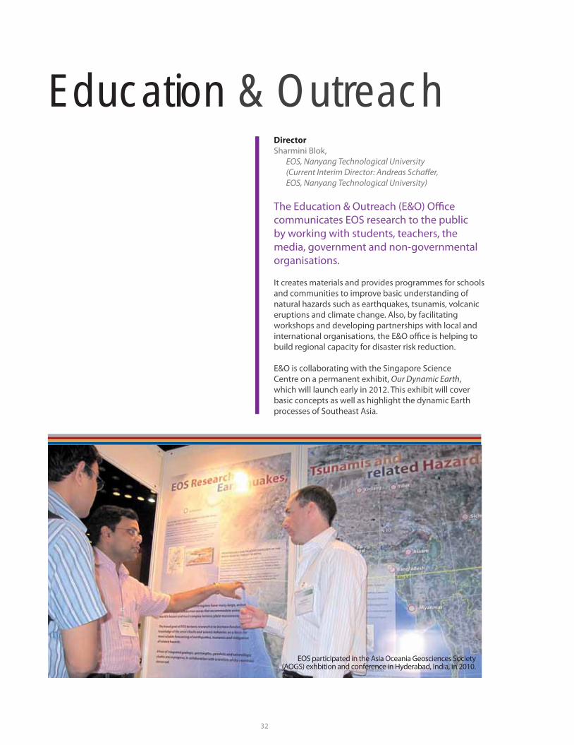
EOS participated in the Asia Oceania Geosciences Society (AOGS) exhbition and conference in Hyderabad, India, in 2010.
32

Education & Outreach
Paul Tapponnier speaks to student contestants during an outdoor segment of the National Science Challenge 2010.
34
Artist-in-ResidencePrincipal Investigator
Prof Isaac Kerlow,
EOS & School of Art, Design and Media,
Nanyang Technological University
EOS’ Artist-in-Residence, Isaac Kerlow,
heads a group of students and research
assistants from NTU’s School of Art, Design
and Media. The group produces fi lms about
EOS research topics and creates artworks
inspired by earth science and environmental
themes.
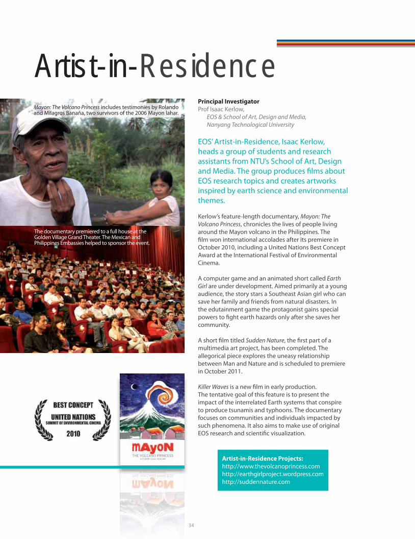
Kerlow’s feature-length documentary, Mayon: The
Volcano Princess, chronicles the lives of people living
around the Mayon volcano in the Philippines. The
fi lm won international accolades after its premiere in
October 2010, including a United Nations Best Concept
Award at the International Festival of Environmental
Cinema.
A computer game and an animated short called Earth
Girl are under development. Aimed primarily at a young
audience, the story stars a Southeast Asian girl who can
save her family and friends from natural disasters. In
the edutainment game the protagonist gains special
powers to fi ght earth hazards only after she saves her
community.
A short fi lm titled Sudden Nature, the fi rst part of a
multimedia art project, has been completed. The
allegorical piece explores the uneasy relationship
between Man and Nature and is scheduled to premiere
in October 2011.
Killer Waves is a new fi lm in early production.
The tentative goal of this feature is to present the
impact of the interrelated Earth systems that conspire
to produce tsunamis and typhoons. The documentary
focuses on communities and individuals impacted by
such phenomena. It also aims to make use of original
EOS research and scientifi c visualization.
Artist-in-Residence Projects:
http://www.thevolcanoprincess.com
http://earthgirlproject.wordpress.com
http://suddennature.com
The documentary premiered to a full house at the Golden Village Grand Theater. The Mexican and Philippines Embassies helped to sponsor the event.
Mayon: The Volcano Princess includes testimonies by Rolando and Milagros Banaña, two survivors of the 2006 Mayon lahar.
34

35
Sustainability Directorate
Climate change is increasingly important to senior executives and policy leaders in Southeast Asia. The Sustainability Directorate tackles regional climate issues of highest priority. We seek to seamlessly integrate relevant climate science into policy and business decisions.Andreas Schaff er, EOS
Director
Andreas Schaff er,
EOS, Nanyang Technological University
In 2010, EOS built the foundations of
a major branch of its organisation, the
Sustainability Directorate, headed by the
former business executive from Monitor
Group, Andreas Schaff er.
The mandate of the group is to integrate climate
science into decision making and thus make EOS
relevant to senior decision makers in business and
policy. For example, the Sustainability Directorate is
planning to host a new initiative of Corporate Leaders
on Climate Change in Southeast Asia. In addition, the
group is conducting economics and policy research to
address issues relevant to stakeholders.
In the future, the Sustainability Directorate will branch
out to address issues related to other natural hazards
such as earthquakes and tsunamis.
In January 2010, the directorate launched its fl agship
workshop series, “Starving Tigers? Impacts of Climate
Change in Southeast Asia”. In response to the success
of the fi rst workshop, we are planning to off er similar
workshops in regional climate-change hotspots,
collaborating with local policy and business leaders as
well as leading climate scientists.
The directorate also designed and sponsored a pilot
project for NTU in 2010 to measure the environmental
footprint of EOS, the building in which it’s housed,
and the School for Physical and Mathematical
Sciences at NTU. The study obtained a baseline
footprint for the three units and served as a
springboard for a new campus-wide sustainability
office.
The “Starving Tigers?” workshop conducted by EOS and the RSIS Centre for Non-Traditional Security (NTS) Studies in January 2010.

36
Retrospective
Getting Results
For more publications and links to papers, go to
http://earthobservatory.sg/publications/overview.html
Costa, F., and D. Morgan (2010), “Time constraints from
chemical equilibration in magmatic crystals”, Timescales
of magmatic processes: from core to atmosphere, eds. A.
Dosseto, S.P. Turner, and J.A. Orman. New York, Wiley-
Blackwell, pp. 125-159.
Lau, A.Y.A., A.D. Switzer, D. Dominey-Howes, J.C.
Aitchison, and Y. Zong (2010), “Written records of
historical tsunamis in the northeastern South China
Sea – challenges associated with developing a new
integrated database”, Natural Hazards and Earth System
Sciences, vol. 10, pp. 1793-1806.
Lin, Y.-N., K. Sieh, and J. Stock (2010), “Submarine
landslides along the Malacca Strait-Mergui Basin shelf
margin: Insights from sequence-stratigraphic analysis”,
Journal of Geophysical Research, vol. 115, B12102.
Macpherson, K., D. Hidayat, and S.H. Goh (2010),
“Receiver function structure beneath a broad-band
seismic station in south Sumatra”, presented at the
Annual Meeting of the American Geophysical Union,
2010.
Megawati, K., and T.-C. Pan (2010), “Ground-motion
attenuation relationship for the Sumatran megathrust
earthquakes”, Earthquake Engineering and Structural
Dynamics, vol. 39, pp. 827-845.
Meltzner, A.J., K. Sieh, H.-W. Chiang, C.-C. Shen, B.W.
Suwargadi, D.H. Natawidjaja, B.E. Philibosian, R.W.
Briggs, and J. Galetzka (2010), “Coral evidence for
earthquake recurrence and an A.D. 1390–1455 cluster
at the south end of the 2004 Aceh–Andaman rupture”,
Journal of Geophysical Research, vol. 115, B10402.
Voight, B., C. Widiwijayanti, G. Mattioli, D. Elsworth,
D. Hidayat, and M. Strutt (2010), “Magma-sponge
hypothesis and stratovolcanoes: Case for a
compressible reservoir and quasi-steady deep infl ux
at Soufrière Hills volcano, Montserrat”, Geophysical
Research Letters, vol. 37, L00E05.
Belousov, A., B. Behncke, and M. Belousova (2011),
“Generation of pyroclastic fl ows by explosive interaction
of lava fl ows with ice/water-saturated substrate”, Journal
of Volcanology and Geothermal Research, vol. 202, pp.
60-72.
Hill, E.M., J.L. Davis, M.E. Tamisiea, R.M. Ponte, and N.T.
Vinogradova (2011), “Using a spatially realistic load
model to assess impacts of Alaskan glacier ice loss on
sea level”, Journal of Geophysical Research, in press.
Jacques, E., T. Kidane, P. Tapponnier, I. Manighetti,
Y. Gaudemer, B. Meyer, J.C. Ruegg, L. Audin, and R.
Armijo (2011), “Normal faulting during the August 1989
earthquakes in Central Afar: sequential triggering and
propagation of rupture along the Dôbi graben”, Bulletin
of the Seismological Society of America, vol. 101, pp. 994-
1023.
Klinger, Y., M. Etchebes, P. Tapponnier, and C. Narteau,
(2011), “Characteristic slip for fi ve great earthquakes
along the Fuyun fault in China”, Nature Geoscience, vol.
4, pp. 389-392.
McLoughlin, I., L.M. Ang, and W.B. Goh (2011),
“Multitouch wall displays for informational interactive
collaborative space”, Digital Urban Planning and
Modelling, eds. S. Müller Arisona, P. Wonka, G.
Aschwanden, and J. Halatsch. Springer, vol. 242.
McLoughlin, I., K.J. Wong, and S.L. Tan (2011), “Data
collection, communications and processing in the
Sumatran GPS Array (SuGAr)”, Proceedings of the World
Congress on Engineering 2011, vol. II, London, U.K.
Pan, T.C., K. Megawati, and K.S. Goh (2011), “Response of
high-rise buildings in Singapore due to a potential giant
earthquake in the Sumatran megathrust”, Journal of
Earthquake Engineering, vol. 15(S1), pp. 90-106.
Wiseman, K., P. Banerjee, K. Sieh, R. Bürgmann, and
D.H. Natawidjaja (2011), “Another potential source
of destructive earthquakes and tsunami off shore of
Sumatra”, Geophysical Research Letters, vol. 38, L10311.

A Year...
May – June
2010
National
Science
Challenge 2010
26 May 2010
Forces of Nature,
special screening of IMAX
movie to mark the start
of collaboration with the
Science Centre Singapore
5-9 July 2010
EOS booth and participation in Asia
Oceania Geosciences Society (AOGS)
in Hyderabad, India
24 Sept 2010
Senior and Lead
Geography Teachers’
Visit to EOS
7 Oct 2010
Premiere of Mayon:
Volcano Princess at
Golden Village Grand
Cinema
27 Nov -
1 Dec 2010
Overseas fi eld
seminar in
Yogyakarta
26 Jan 2011
Tsunami Alert book
talk and launch
12 Mar
2011
Life @ NTU,
open-house
exhibition
showcasing
EOS and
DES
in
Retrospective
37
March 2011
Kerry Sieh using GeoTouch
to explain the March 2011
Japan earthquake and
tsunami to Channel News
Asia

GPS station on the west coast of Sumatra near the equator. The coastal town of Air Bangis is in the background.

New Research Projects for 2011
39
Moving Forward
EARTHQUAKESGEOBOULDER, an Online Research Portal Dedicated to Coastal Boulder StudiesPrincipal Investigator
Asst Prof Adam Switzer
GEOBOULDER is an
online research portal of
environmental data on coastal
boulders and megaclasts. In
coastal settings, their transport
is usually restricted to high-energy wave events such
as cyclones, extratropical storms or tsunamis. The key
objective of GEOBOULDER is to centralize available data
on coastal boulders. With expanded global coverage,
we hope that researchers working after an event will
have a free-access tool where they can fi nd data on pre-
transport settings of mobilized boulders. Modelling with
precise information on pre-event settings is a way to
greatly improve modelling of sediment transport during
modern events and our reconstructions of paleo-events.
TSUNAMISA Preliminary Assessment of Volcanogenic Tsunami Hazard in Southeast AsiaPrincipal Investigator
Asst Prof Adam Switzer
There is an obvious need to
assess the risk of volcanogenic
tsunami events in Southeast
Asia, as the region is
surrounded by densely
populated, economically
important and rapidly developing coastlines. In an initial
step, the historical records of catastrophic volcanogenic
tsunami events throughout the region are being
compiled, assessed and cross-checked to remove errors
and misinterpretations, to refi ne early work and ensure a
robust dataset. This primarily desktop study will provide
a regional synthesis that will guide further geological
investigations and modelling of key identifi ed events.
Real-Time Measurement of Onshore Tsunami FlowsPrincipal Investigator
Asst Prof Zhenhua Huang
In the past, real-time tsunami
measurements have been
focussed on water levels
off shore, and information
about onshore tsunami fl ows
(fl ow depth and run-up) are
usually obtained through post-tsunami surveys. There is
a lack of key information about the tsunami fl ow velocity
and suspended sediment. We are developing a system
for real-time measurements of onshore tsunami fl ows
to collect information about water level, fl ow velocity,
and suspended sediment of such fl ows. The proposed
system will be integrated with the network of existing
EOS GPS stations in West Sumatra.
VOLCANOESLaboratory Volcano: UlawunPrincipal Investigator
Prof Christopher Newhall
Working with Rabaul
Observatory in Papua New
Guinea, we are establishing
a new laboratory volcano
project at Ulawun, an active,
basaltic andesite stratocone
very much like Mayon in The
GGOODDBBP
A
GG
oo
ee
bb
c
AAooHHP
A
TT
aa
tt
AA
ss
pp
RRMMOOTTP
A
II
mm
ff
oo
aa
(
LLUUP
P
WW
OO
GG
aa
pp
bb
vv

Philippines. Ulawun would yield interesting comparisons
with Mayon at the open end of the degassing spectrum,
provide another setting in which to test for magma
convection in the conduit, let us look for why volcanoes
like Mayon or Ulawun can collapse, and open the door
for other collaborations in a third, volcano-rich country.
Understanding Volcanic Unrest at Caldera Systems with the 1983-1985 Deformation and Seismic Crisis at Rabaul, Papua New GuineaPrincipal Investigator
Asst Prof Fidel Costa
We seek to understand the
unrest signals of caldera-
related volcanic systems.
Rabaul caldera showed strong seismic and deformation
activity between 1971 and 1996 before culminating
in a plinian eruption in 1996. This provides a unique
opportunity to determine the causes (e.g., hydrothermal,
tectonic, magmatic) of unrest in caldera systems. We
are using kinetic modelling of crystal zoning patterns to
determine if the time of mafi c intrusion in the plumbing
system coincides with the largest period of unrest or
not. We will also perform numerical models aimed at
reproducing the unrest signals (e.g., deformation) using
the intrusion times obtained from petrology.
Exploratory Projects on VolcanoesPrincipal Investigator
Prof Christopher Newhall
Ongoing
exploratory projects
include a low-cost
instrument project;
and GOSAT, which
aims to detect and
quantify volcanic
CO2 from space.
New projects
include studying
the geologic history of Isarog volcano in southeastern
Luzon, the Philippines; determining the Holocene
eruptive history of Ambang volcano in North Sulawesi,
Indonesia; and responding to InSAR anomalies at Agung
volcano in Bali, Indonesia.
Moving Forward
UUUUSS11aaRRGGP
A
WW
uu
CLIMATETemporally and Spatially Varying Signals in GRACE Measurements of Glacier Melting and Water Storage*Principal Investigator
Asst Prof Emma Hill
GRACE time series are
commonly modelled assuming
constant rates and seasonal
cycles at each location.
However, temporal variations in these parameters
mean that this model is unlikely to provide a good fi t to
the data, and in using it, we are likely to lose valuable
information. We are therefore constructing a stochastic
fi lter for the GRACE data, which will allow for time-
varying rates and seasonal cycles. Resulting time series
for rates and seasonal cycles in surface mass change will
have a wide range of geophysical applications, including
measuring accelerations in rates of glacier melting and
groundwater depletion.
Tracking Hydro-Climate Variation in the Tropical Indo-Pacifi c with Highly Resolved Cave Records*Principal Investigator
Asst Prof Xianfeng Wang
Climate of the
tropical Indo-
Pacifi c, particularly
rainfall, is critical
to the socio-
economic health
of the region.
However, the
current lack of
long and precisely dated paleoclimate records prohibits
a full understanding of the spatio-temporal pattern
of the regional climate variability. This study aims to
reconstruct continuous, well-dated, high-resolution
hydro-climate records covering the last 100,000 years in
the tropical Indo-Pacifi c using cave carbonate samples.
The records will be compared with instrumental
data and other regional and global proxy datasets to
investigate the forcing mechanisms in the regional
climate system and the role of the Tropics in global
climate cycles.
OO
ee
ii
ii
aa
aa
CC
NN
TSSMGWP
A
GG
cc
cc
*Funded by a Singapore National Research Foundation
Fellowship
40
CC
tt
PP
rr
tt
ee
oo
HH
cc

Moving Forward
Combined Statistical Downscaling and Disaggregation of Regional Climate Data Considering Temporal and Spatial VariabilityPrincipal Investigators
Asst Prof Xiaosheng Qin
Asst Prof Sai Hung Cheung
This study aims to develop a
combined downscaling and
disaggregation methodology
for building linkages between
regional climate model
(RCM) outputs and high-
resolution local weather
data and examining the
related uncertainties and
complexities. The large-scale
variables obtained from
RCM projections of future
regional climate can then be
used to drive the statistical relationships and estimate
the smaller-scale temporal and spatial details. The
project outcomes could form the basis for in-depth
hydrological climate-change impact studies and help
enhance collaborative links to local scientifi c partners in
Singapore.
SUSTAINABILITY/ EDUCATION & OUTREACH
Reducing Greenhouse Gas Emissions from Deforestation: Valuation Modelling of Natural Assets in Gunung
Palung National Park, IndonesiaPrincipal Investigator
Andreas Schaff er
The objective of the project is to assess the economic case
for reducing greenhouse gas emissions from deforestation in
Gunung Palung National Park, situated in the administrative
district of Kayong Utara (Kalimantan, Indonesia). Indonesia
is the third largest emitter of greenhouse gases globally,
with approximately 80 percent of emissions stemming from
deforestation. The proposed project will model the long-
term economics underlying current deforestation practices
(e.g., illegal logging and farming, land conversion for palm
oil) and contrast them with the modelled value of forestry
and biodiversity conservation via carbon and biodiversity
credits, ecotourism, sustainable forestry products and
bioprospecting.
Climate Change: Adaptive Capacity or National Competitiveness – A False Choice?Principal Investigator
Andreas Schaff er
Building and
strengthening
national-level
adaptive capacity
is a prerequisite
for Southeast
Asian countries to
reduce the adverse
impacts of climate
change. However,
there is a common framing among decision makers that
investments into climate change adaptation are made
at the expense of enhancing national competitiveness.
A linkage between adaptive capacity and national
competitiveness is poorly understood and explored by
public and private sector decision makers. The objective
of this project is to develop national-level insights
and case studies illustrating how investments into
adaptive capacity in response to climate change could
simultaneously enhance national competitiveness,
which would prove the common framing to be a false
choice.
Education for Disaster Risk Reduction, Mentawai Islands, West Sumatera, IndonesiaPrincipal Investigator
Andreas Schaff er (Interim)
Based on paleoseismology
and geodesy around the
Mentawai patch of the Sunda
megathrust, EOS researchers
have forecast the likelihood of
a devastating earthquake and
its tsunami in the coming decades in the area around
the Mentawai Islands. People in the Mentawai Islands
remain confused about the hazard and unsure of how
to mitigate the risk and thus are highly vulnerable. We
are working with local partners through training and
educational materials and seminars to enhance existing
public education eff orts and foster the development of
new ones.
TT
cc
dd
ff
rr
((
rr
dd
rr
cc
vv
RR
r
BB
ss
nn
aa
iis
ff
AA
rr
ii
RRGGGGffDDVVMMNNii
EERRMMSSP
A
BB
aa
MM
mm
hh
a
41

Financial Summary for Fiscal Year 2010
Categories Budget
(S$)
Actual Expenditure
(S$)
Expenditure On Manpower 6,286,000 5,649,952
Equipment 1,101,631 1,094,222
Other Operating Expenditure 8,067,829 6,105,336
Total 15,455,460 12,849,510
Manpower Summary as of March 31, 2011
General Volcano Group
TectonicsGroup
Climate Group
Total
Management 4.5 1 1 - 6.5
Principal Investigators - 1.25 2.75 1.5 5.5 *
Researchers: Senior Fellow - 6 - - 6
Fellow - 2 8 - 10
Associate - 1 6 - 7
Assistant 4 1 4 - 9
Technical - - - - -
Support: Administration 10 1 1 1 13
Technical 4 - - - 4
Sustainability,
Education & Outreach
4 - - - 4
Total 26.5 13.25 22.75 2.5 65
Financial Summary
6.5
21
32
5.5
42
& Staffi ng for 2010
* 8.5, including Group Leaders and Director

43
Financial Summary & Staffi ng
EOS staff mingle at a monthly birthday celebration in the lounge.
Management· 6.5 Management = Kerry Sieh, Paul Tapponier, Chris Newhall, Andreas Schaffer, Woo Kien Young, Paramesh Banerjee, 0.5 Isaac Kerlow
Volcano Group
· 1.25 Principal Investigators = 1 Fidel Costa, 0.25 Ian McLoughlin
· 6 Senior Research Fellows = Antonius Ratdomopurbo, Christina Widiwijayanti, Dannie Hidayat, Alexander Belousov,
Marina Belousova, Florian Schwandner
· 2 Research Fellows = Christopher Harpel, Joan Cabato
· 1 Research Associate = Alexandre Baguet
· 1 Research Assistant = Sergio Marcial
· 1 Administration = Harpreet Kaur
Tectonics Group
· 2.75 Principal Investigators = 0.5 Adam Switzer , 0.5 Emma Hill, 0.5 Kusnowidjaya Megawati, 0.25 Ian McLoughlin,
0.5 Huang Zhenhua, 0.5 Goh Siang Huat
· 8 Research Fellows = Meya Yanger Walling, Kenneth Macpherson, Li LinLin, Aron Meltzner, Chris Gouramanis, Yu Feng Ling,
Afroz Shah, Manuela Di Mauro
· 6 Research Associates = Zhang Yan Mei, Qiu Qiang, Mudrik Rahmawan Daryono, Maggie Chan, Farzaneh Ahmadi, Jiao Li Qing
· 4 Research Assistants = Linus Ang, Han Xiao Han, Zhu Cheng, Lee Ying Sin
· 1 Administration = Clair Elaine Jerusha Devan
Climate Group
· 1.5 Principal Investigators = 0.5 Adam Switzer, 0.5 Emma Hill, 0.5 Koh Tieh Yong
· 1 Administration = Susan Wee
Support
· 10 Administration = Loh Li Kiang, Carol Jean-Chan Poh Har, Foo Pow Choo, Bu Su Xian, Oh Hwee Hong, May Pea,
Evelyn Tan, Aggie Lee, Jhoanna Jovero, Linda Chua
· 4 Technical = Jeff rey Encillo, Jonah Yong, Daniel Sin, Michael Goh
· 3 Education and Outreach = Liow Hon Sang, James McCaughey, Elaine Chong
· 1 Sustainability = Ding Li
· 4 Research Assistants = Jeannie Loo, David Lee, Nur Aisyah Binte Suhaimi, Muhammad Khadafi
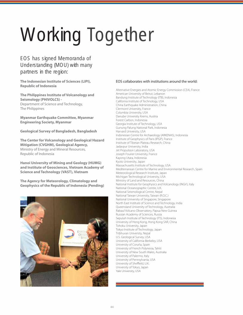
EOS has signed Memoranda of Understanding (MOU) with many partners in the region:
The Indonesian Institute of Sciences (LIPI),
Republic of Indonesia
The Philippines Institute of Volcanology and
Seismology (PHIVOLCS) -
Department of Science and Technology,
The Philippines
Myanmar Earthquake Committee, Myanmar
Engineering Society, Myanmar
Geological Survey of Bangladesh, Bangladesh
The Center for Volcanology and Geological Hazard
Mitigation (CVGHM), Geological Agency,
Ministry of Energy and Mineral Resources,
Republic of Indonesia
Hanoi University of Mining and Geology (HUMG)
and Institute of Geosciences, Vietnam Academy of
Science and Technology (VAST), Vietnam
The Agency for Meteorology, Climatology and
Geophysics of the Republic of Indonesia (Pending)
EOS collaborates with institutions around the world:
Alternative Energies and Atomic Energy Commission (CEA), FranceAmerican University of Beirut, LebanonBandung Institute of Technology (ITB), IndonesiaCalifornia Institute of Technology, USAChina Earthquake Administration, ChinaClermont University, FranceColumbia University, USADanube University Krems, AustriaForest Carbon, IndonesiaGeorgia Institute of Technology, USAGunung Palung National Park, IndonesiaHarvard University, USAIndonesian Centre for Archaeology (ARKENAS), IndonesiaInstitute of Geophysics of Paris (IPGP), FranceInstitute of Tibetan Plateau Research, ChinaJadavpur University, IndiaJet Propulsion Laboratory, USAJoseph Fourier University, FranceKayong Utara, IndonesiaKyoto University, JapanMassachusetts Institute of Technology, USAMediterranean Centre for Marine and Environmental Research, SpainMeteorological Research Institute, JapanMichigan Technological University, USAMinistry of Land and Resources, ChinaNational Institute for Geophysics and Volcanology (INGV), ItalyNational Oceanographic Centre, U.K.National Seismological Centre, NepalNational Taiwan University, Taiwan (R.O.C.)National University of Singapore, SingaporeNorth East Institute of Science and Technology, IndiaQueensland University of Technology, AustraliaRabaul Volcano Observatory, Papua New GuineaRussian Academy of Sciences, RussiaSepuluh Institute of Technology (ITS), IndonesiaUniversity of Hong Kong, Hong Kong SAR, ChinaTohoku University, JapanTokyo Institute of Technology, JapanTribhuvan University, NepalU.S. Geological Survey, USAUniversity of California-Berkeley, USAUniversity of Coruña, SpainUniversity of French Polynesia, TahitiUniversity of New South Wales, AustraliaUniversity of Palermo, ItalyUniversity of Pennsylvania, USAUniversity of Sheffi eld, U.K.University of Tokyo, JapanYale University, USA
44
Working Together