CONTAMINATED LAND STRATEGY 2010 - 2015€¦ · The Council‟s Contaminated Land Strategy 2010 -...
42
CONTAMINATED LAND STRATEGY 2010 - 2015 Part IIA of The Environmental Protection Act 1990 RENFREWSHIRE COUNCIL Environmental Services May 2010
Transcript of CONTAMINATED LAND STRATEGY 2010 - 2015€¦ · The Council‟s Contaminated Land Strategy 2010 -...
CONTAMINATED LAND
STRATEGY
2010 - 2015
Part IIA of The Environmental Protection Act
1990
RENFREWSHIRE COUNCIL
Environmental Services
May 2010

Page 2 of 42
RENFREWSHIRE COUNCIL
ENVIRONMENTAL SERVICES
CONTAMINATED LAND STRATEGY
TABLE OF CONTENTS
Executive Summary .............................................................................................................. 3
1. Introduction .................................................................................................................... 5
2. Characteristics of Renfrewshire ................................................................................... 12
3. Aims and Objectives of the Strategy ............................................................................ 13
4. Priority Actions and Timescales ................................................................................... 16
5. Procedures .................................................................................................................. 19
6. General Liaison ............................................................................................................ 20
7. Programme for Inspection ............................................................................................ 21
8. Communication Strategy .............................................................................................. 23
9. Review Mechanisms .................................................................................................... 26
APPENDIX 1 References .................................................................................................... 29
APPENDIX 2 Statutory Consultees ..................................................................................... 30
APPENDIX 3 Characteristics of Renfrewshire ..................................................................... 31
APPENDIX 4 Procedures .................................................................................................... 39

Page 3 of 42
Executive Summary
The statutory regime for identification and remediation of contaminated land made
under Part IIA of the Environmental Protection Act 1990 came into force in Scotland
from 14th July 2000. This provides the legislative framework for the identification and
remediation of contaminated land and introduced the statutory definition of
contaminated land. The regime is aimed at addressing land which has been
historically contaminated and which poses unacceptable risks to human health or the
wider environment in the current use of the land. The regime adopts a risk based
"suitable for use" approach to remediation, and to an extent applies the "polluter pays"
principle to apportionment of liability.
Duties have been assigned to both local authorities and the Scottish Environment
Protection Agency (SEPA).
In September 2001 Renfrewshire Council published a strategic document outlining its
approach to the use of these powers entitled „Contaminated Land Strategy for
Renfrewshire‟
This document is a review of that original strategy and develops further the way in
which Renfrewshire Council intends to use the powers and duties outlined under Part
IIA to progress this Strategy. Environmental Services has the lead role on behalf of the
Council to manage all aspects of the statutory contaminated land regime and
specifically to take forward the Corporate aims, objectives and priorities contained
within this strategic document. An example is the emerging issues of potentially
significant contamination of residential areas which are being investigated in Linwood
at the site of the former Brediland Chemical Works and Sun Iron Foundry. Some areas
of Linwood which have been identified as being contaminated have been remediated
through the Planning process in the course of redevelopment.
The Scottish Government have issued advice to planning authorities on the
development of contaminated land, in the form of Planning Advice Note 33. Land
contamination where a change of use is concerned will continue to be dealt with under
the planning system and this remains a key mechanism for managing land
contamination as part of land redevelopment and regeneration However, it is
dependent on the extent of redevelopment which is taking place in Renfrewshire. This
in turn is affected by the wider economic conditions prevailing. An example of a site
being remediated using this mechanism is the former Royal Ordnance Factory at
Bishopton, where there are significant areas of contamination which will be addressed
through the proposed redevelopment of the site. This is currently one of the largest
remediation projects in the UK and will extend over a period of at least 15 years.
Renfrewshire Council will take a strategic approach when inspecting its area which
will:
Be rational, ordered and efficient;
Be proportionate to the seriousness of any actual or potential risk;
Seek to ensure that the most pressing and serious problems are located first;
Ensure that resources are prioritised on investigating areas where the Council
is most likely to find contaminated land; and
Page 4 of 42
Ensure that the Council efficiently identifies requirements for the detailed
inspection of particular areas of land.
The Council has also followed a methodology which assesses harm to the following
receptors (as defined in the statutory guidance):
Human Health;
Ecological Systems;
Animals or Crops;
Buildings; and
The Water Environment.
Utilising a risk based prioritisation programme in line with statutory guidance and as
detailed in Chapter 5, the Council will identify areas and sites which require
assessment in more detail. The Council‟s aims in dealing with contaminated land are
as set out in Chapter 3 and in developing a strategic approach the Council will consult
with appropriate stakeholders as outlined in Chapter 6.
It also needs to be recognised that we require to deal with emerging contaminated
land issues which come to our attention. Major remediation projects have arisen in this
way and there is therefore uncertainty concerning similar issues arising in future
There is no current funding to deal with remediation of contaminated land and ensuing
costs which may arise. Consequently there are potential costs and/or liabilities which
cannot currently be quantified with potential effects on the Council‟s own land, and
property as well as on future plans/strategies. In order to comply with the legislation,
the Council will keep a public register containing prescribed information relating to
contaminated land which will be available for free public inspection at all reasonable
times.

Page 5 of 42
1. Introduction
Under Part IIA of the Environmental Protection Act 1990, each local authority has a
responsibility to inspect its area from time to time for the purpose of identifying
contaminated land.
The legislation states that when contaminated land is identified, the local authority
must ensure that the land is managed and dealt with in an acceptable manner.
The legislation also requires the local authority to prepare and publish a strategy to
execute this statutory responsibility and to maintain and carry out regular review of the
strategy. There have been significant changes in the approach to identification and
remediation of contaminated land in the last 10 years, with government guidance
constantly being revised. A revised and refreshed Contaminated Land Strategy has
been developed for the period 2010 to 15, following consultation with other services,
relevant partner organisations and neighbouring Councils.
The existing strategy, as prepared in 2001, was developed to establish the baseline
data & database systems and risk ratings & inspection priorities of sites within the
geographical area of the Council. This work has progressed over the 10 year life of
the existing strategy and it has now been revised and refreshed to reflect a change in
approach to contaminated land issues. This being necessary to ensure that the
Council is prepared for the challenges presented by the increased use of brownfield
sites for development, the increased prominence of contamination issues and the
more critical financial impact which remediation can have on development decisions.
The key revisions in the revised and refreshed Contaminated Land Strategy are:
Increased access (by other Council services and developers) to and use of the
information and data collated during the 10 years of the initial/existing strategy;
A focus on the support of development activities within the Council and the
provision of information and advice to private sector developers;
A recognition of the increasing impact contaminated land remediation has on
development and economic regeneration;
An increased recognition of the Council-wide corporate responsibility for
contaminated land issues associated with Council assets;
A revision of the current rating scheme as historically used and applied to the
sites on the contaminated land register in order to support those sites identified
for development or change of use.
A targeted approach to investigation activities to support practical outcomes
rather than the development of database/archive information;
To assist in the reading of this Strategy please see Appendix 1, for references and
further reading.

Page 6 of 42
1.1 General Policy of Renfrewshire Council
The Council‟s Contaminated Land Strategy 2010 - 2015 is a 5 year strategic document
which is designed to be consistent with the Single Outcome Agreement and the aims,
objectives, priorities and timescales of other Council Plans and policies setting out the
long term vision for the development of Renfrewshire including:
1. Renfrewshire Community Plan which contains five themes outlining how the
Council will work with partners to make Renfrewshire a better place with more
opportunities by 2017. Renfrewshire Council Plan 2008 – 2012 which sets out
the approach to delivering services with the goal of transforming Renfrewshire.
This includes the Council‟s targets up to 2012 with many of the activities in it
making a direct contribution to the aims and targets of the Community Plan.
2. Renfrewshire Local Plan / Local Development Plan which will guide the future
development and the use of land in the towns, villages and rural areas of
Renfrewshire in the long term public interest. In doing this it will:
Provide an up-to-date land use planning framework for the delivery of the Council‟s physical, social and economic programmes in support of the Renfrewshire Community Plan;
Encourage and support regeneration;
Promote sustainable economic and physical development;
Provide a basis for maintaining and enhancing the quality of Renfrewshire‟s natural heritage and built environment;
Identify opportunities for change and development; and
Provide a framework for decision making which will seek to ensure that development and changes in land use are sustainable and take place in suitable locations and provide protection from inappropriate development
3. Structure Plan/Strategic Development Plan which provides a strategic
development planning framework for Glasgow and The Clyde Valley and, among
other things, gives priority to the decontamination of derelict urban land.
4. Local Flood Risk Management Plan/River Basin Management Plan in which improvements to the river environment required by the River Basin Management Plan must be reflected within the Local Flood Risk Management Plan. The Local Flood Risk Management Plan will describe the sustainable catchment based flood risk management measures agreed between Local Authorities, Scottish Water and SEPA and their programming and financing over several 6 year cycles. All Council services must have regard to River Basin management Plans and Flood Risk Management Plan sin carrying out their functions. Joint working between Local Authorities, Scottish Water and SEPA will also be required.
Both the Community and Council Plans are closely linked to the Scottish
Government‟s strategic objectives for Scotland. These objectives being to build
communities which are Wealthier & Fairer, Safer & Stronger, Healthier, Greener &
Smarter. In achieving a Greener Renfrewshire, the Council‟s aim is to improve the
area‟s natural and built environment and use resources in a sustainable way. Greener
Renfrewshire aims to achieve clean and eco-friendly countryside, towns and villages
with people taking pride in their environment. It is also about reducing the impact of

Page 7 of 42
waste and valuing, protecting and improving the natural and built environment
including dealing with contaminated land.
The following diagram shows how the plans link together and how the priorities and
themes cascade down to individual plans and strategies.
1.1.1 Council Regulatory Role
The reviewed Strategy for the Identification of Contaminated Land, will continue to form
the basis for implementation of Part IIA. Within Renfrewshire, this regulatory role is
undertaken on behalf of the Council by Environmental Services. The Strategy outlines
the arrangements and procedures for inspection of land within Renfrewshire. It also
explains the justification for, and transparency in, the decisions on how the land will be
inspected and how subsequent actions are supported by the relevant methodology for
reprioritisation.
While duties have been assigned to both Local Authorities and the Scottish Environment
Protection Agency (SEPA), the primary regulatory role for the Contaminated Land
Regime rests with the Local Authorities. The role is designed to reflect their existing
functions under the statutory nuisance regime, and also complement their responsibility
as planning authorities.
The main role of the Local Authorities under the regime is to:
Complete a „Contaminated Land Strategy‟;
Single Outcome Agreement2009 – 2011
(National)
Renfrewshire Community Plan 2008-2017(Local) ies)
Developed through:Business Plans
Service Improvement Plans
Asset management planning
Capital and revenue budget strategies
Thematic and client based plans
Operational Plans
Individual Development Plans
Council Plan 6 Key Themes: Wealthier and Fairer Healthier Safer and Stronger Smarter Greener Developing our organisation
Page 8 of 42
To cause their areas to be inspected from time to time to identify any contaminated land;
To determine whether a particular site meets the statutory definition of contaminated land;
Establish responsibilities for remediation of the land;
Ensure that appropriate remediation takes place through agreement with those responsible, or if not possible:
o by serving a remediation notice; or
o in certain cases, carrying out the work themselves; or
o in certain cases, through other powers; and
Keep a public register detailing the regulatory action which they have taken under the new regime.
1.1.2 Regulatory Role of the Scottish Environment Protection Agency (SEPA)
The principal role of SEPA with respect to contaminated land as defined in Part IIA is:
To provide advice on contamination of the water environment during the
inspection process;
To undertake inspection and remediation activities on sites that are
radioactively contaminated;
To act as a statutory consultee where the local authority considers that
pollution of the water environment is occurring or is likely to occur;
Provide consultation on Contaminated Land Inspection Strategies to provide
any site specific information SEPA may have which may be of assistance to the
local authority;
Act as the enforcing authority for any land designated as a „special site‟; and
Publish periodic reports on contaminated land.
1.1.3 Contaminated Land: The definition
The Contaminated land provisions of Part IIA of the Environmental Protection Act 1990
came into force in Scotland on 14th July 2000. The Scottish Ministers made the
Environment Act 1995 (Commencement No. 17 and Saving Provision - Scotland)
Order 2000 bringing into force Part IIA of the Environmental Protection Act 1990. Part
IIA was inserted into the 1990 Act by Section 57 of the Environment Act 1995.
The Scottish Ministers, in exercise of the powers conferred upon them by sections
78C, 78E, 78G, 78L and 78R of the Environmental Protection Act, 1990 made the
Contaminated Land (Scotland) Regulations 2000, and published Circular 1/2000 -
Statutory Guidance on Contaminated Land. Subsequently, as a result of the
Contaminated Land (Scotland) Regulations 2005 made under powers conferred by the
Water Environment and Water Services (Scotland) Act 2003, the Statutory Guidance
was updated in the form of Circular SE/2006/44.
Page 9 of 42
The development of this strategy review is in response to the requirements of Part IIA
which requires local authorities to keep up to date their formally adopted and published
Contaminated Land strategy document outlining its approach to its duties.
Section 78 A (2) of the Environmental Protection Act 1990 gives the statutory definition
of contaminated land for the purposes of Part IIA as:
“Any land which appears to the local authority in whose area it is situated to be in such
a condition, by reason of substances in, on or under the land, that:
a) Significant harm is being caused or there is a significant possibility of such
harm being caused; or
b) Significant pollution of the water environment is being caused or there is a
significant possibility of such pollution being caused.”
The definition forms the foundation of the anticipated role of Part IIA thus enabling the
identification and remediation of land on which contamination is causing unacceptable
risk to human health or the wider environment. The definition does not necessarily
include all land where contamination is present, even though the contamination may
be relevant in the context of other legislation.
1.1.4 Pollution Linkages and Risk Assessment Principles
Before a Local Authority can make a judgement that any land appears to be
contaminated land, it must first identify a pollutant linkage. This means that each of the
following has to be identified:
A contaminant;
A pathway; and
A relevant receptor.
A contaminant is defined in the Statutory Guidance as:
“a substance which is in, on or under the land which has the potential to cause harm or to cause pollution to the water environment”.
A receptor is defined in the Statutory Guidance as:
a) A living organism, a group of living organisms, an ecological system or a piece
of property which:
i. is in a category listed in Table A ,in Chapter A of the Statutory Guidance: as a type of receptor, and
ii. is being, or could be, harmed by a contaminant, or
b) The water environment where it is being, or could be, polluted by a
contaminant.
A pathway is one or more routes or means by, or through, which a receptor:
a) is being exposed to, or affected by, a contaminant, or
b) could be so exposed or affected.
Where land appears to be contaminated on the basis that pollution of the water
environment is being caused, a significant pollution linkage where the water
environment forms the receptor has to be identified.

Page 10 of 42
This approach recognises that harm to health and the environment arises not from the
mere presence of contaminating substances in land, but from their movement along a
pathway to where they can cause harm to a receptor. Unless all three elements of a
pollutant linkage are identified for any piece of land that land should not be identified as
contaminated land. It is also possible that there may be more than one pollution linkage
on any given piece of land.
1.1.5 Significant Pollution Linkage
In order to define an area of land as being contaminated there must be:
a) a pollutant linkage for the piece of land; and
b) that pollutant linkage either:
i. is resulting in significant harm being caused to the receptor in the pollution linkage, or
ii. presents a significant possibility of significant harm being caused to that receptor, or
iii. is resulting in significant pollution of the water environment being caused or there is a significant possibility of such pollution being caused, or
iv. is likely to result in such pollution.
Descriptions of significant harm and conditions for there being a significant possibility of
significant harm are listed in the Statutory Guidance.
Consideration must also be given to the time-scale within which the harm might occur
(e.g. if the current use of the land is due to change) and the vulnerability of the
receptors.
1.1.6 Suitable for Use
The suitable for current use approach recognises that the risks presented by
contamination will vary dependent upon the use of the land and other wider natural and
built factors. The suitable for use approach consists of three elements:
1. Ensuring land is suitable for its current use;
2. Ensuring land is made suitable for any new use, as planning permission is given for that new use; and
3. Limiting requirements for remediation to the work necessary to prevent unacceptable risks to human health and or the environment in relation to the current use or future use of the land for which planning permission is being sought.
1.2 Strategy Development
Within the Council, implementation of Part IIA including preparation of the original
Strategy and this review document is the responsibility of Environmental Services.
A Corporate Working Group has been formed within the Council consisting initially of
representatives from Environmental Services, Corporate Services, Housing and
Property Services, Chief Executive and Planning and Transport. This document has
also been the subject of consultation with all relevant stakeholders as specified in
Chapter 6, and detailed in Appendix 2.

Page 11 of 42
While undertaking the review, cognisance was taken of recent legislative changes and
experiences gained while investigating potentially contaminated land sites. This
updated strategy will also inform neighbouring authorities, statutory and non-statutory
consultees of our future intentions. Ensuring consistency with wider Council aims and
objectives is a key aspect of the review process and will be taken into account in future
strategy development.

Page 12 of 42
2. Characteristics of Renfrewshire
The characteristics of Renfrewshire play an important part in influencing the priorities
of this strategy and are explained in greater detail in Appendix 3.
These characteristics are summarised as follows:
Geographical location
Population distribution
Council owned land
Geology
Key water resources/protection issues
Protected locations
Known information on contamination
Past and current industrial activity in Renfrewshire
Legal controls on development
Page 13 of 42
3. Aims and Objectives of the Strategy
Contamination of land has a major impact on the local environment and Renfrewshire
Council‟s policy aim of ensuring a healthy, sustainable environment by improving,
protecting and sustaining the environment will be upheld in the aims and objectives of
this Strategy. These aims and objectives are also in line with the National Outcomes
contained within the Single Outcome Agreement agreed by the Council and its
partners in relation to living longer, healthier lives and valuing and enjoying our built
and natural environment and protecting it and enhancing it for future generations.
We have identified those locations within the Council‟s area with the highest potential
to be contaminated as defined under Part IIA. This has been achieved and some
prioritisation of potential sites has been undertaken. However, work is ongoing to
refine the assessment.
As a result of the reprioritisation process, Renfrewshire Council will investigate sites at
which intrusive work may be required. These locations will be selected based on the
Council‟s programme for inspection as detailed in Chapter 7.
In the meantime, in order to assist development, and avoid the potential for blight
associated with Part IIA procedures, the Council, in conjunction with other local
authorities, has produced guidance (Land Contamination and Development
Management Summary Guidance and Checklists) on how to address the issue of
contaminated land when submitting planning applications or building warrant
proposals. This document can found on the Council‟s website
www.renfrewshire.gov.uk.
3.1 Aims of the Strategy
The Council‟s aims are:
To ensure compliance with Part IIA of the Environmental Protection Act 1990 to
protect human health and the wider environment.
To tackle the issue of contaminated land across Renfrewshire by ensuring that
land which is contaminated is restored to a condition which is suitable for use.
To secure the remediation of contaminated land as defined under Part IIA of
the Act.
To promote the development of communities which are greener by protecting
and enhancing the natural and built environment and by supporting the Building
Better Communities Programme.
To support the Transforming Renfrewshire initiative by ensuring that the
extensive electronic data we hold concerning potentially contaminated sites is
shared with other services to permit a more integrated approach.
To encourage voluntary remediation of land identified as potentially
contaminated land and to support development of such sites
To achieve these aims, the Council has adopted the “strategic approach” to the
identification of land that merits detailed inspection, which is consistent with the
principles of risk assessment.

Page 14 of 42
Land for which the Council has responsibilities as a landowner, lessee or polluter has
been incorporated into the inspection process.
3.2 Overall objectives of the strategy
The overall objectives of the strategy are:
To seek to bring damaged land back into beneficial use.
To continue to objectively prioritise the inspection of sites based on (so far as
reasonably practicable) robust, publicly available data sources.
To continue to provide an auditable path to prioritisation.
To continue to inspect sites in a cost effective manner, identifying, where
reasonable, all previous work prior to undertaking any further investigation.
To maintain a database of all relevant data pertaining to potentially
contaminated sites.
To address liability issues associated with the Council‟s existing and former
land holdings.
To seek to ensure that the cost burdens faced by individuals, companies and
society as a whole are proportionate, manageable and economically
sustainable.
To evaluate additional information on possible evidence of contamination
brought to the Council‟s attention.
To maintain efficient liaison and information arrangements with other Council
Services and external stakeholders.
To undertake a periodic review of assumptions and an inspection of priorities.
To continue to work with relevant internal and external stakeholders to improve
their understanding of Part IIA and how it interacts with the services they
provide.
To continue to enhance, improve and update the methodology used to identify
potentially contaminated sites in a strategic manner as required by the
legislation.
All the above aims and objectives are linked into the agreed outcome of the
Renfrewshire Council Plan and Renfrewshire Community Plan to tackle the issue of
contaminated land across Renfrewshire by carrying out required investigations and
undertaking agreed actions to restore contaminated land sites. They are also
consistent with the service priorities contained with the Service Improvement Plan for
Environmental Services. One of the key tasks assigned to Environmental Services
within the Improvement Plan is the implementation of the Council‟s Contaminated
Land Strategy.
The aims and objectives are also subject to adequate resource availability. The
Council‟s Strategy is not exempt from such a constraint, and therefore its
implementation needs to be considered in this context. This is particularly relevant
when undertaking intrusive site investigations and/or remedial works.

Page 15 of 42
The Council has at its disposal a small, but specialist, team of officers to deal with land
contamination issues. However, the scale of many of the projects in which we are
involved has resulted in the Council employing the services of external consultants to
work alongside our own officers to assist in taking forward many of these complex
issues. We would intend to build upon this expertise and develop our in-house skills, at
the same time promoting and enhancing our links with external partners and
stakeholders to deliver the aims and objectives stated above.
Page 16 of 42
4. Priority Actions and Timescales
4.1 Priorities
The Council‟s priorities when dealing with contaminated land are to ensure we set a
direction towards our approach to this Strategy based on a number of key themes
including the protection of human health and the environment, partnership working and
future planning developments and opportunities. This approach will also take full
cognisance of and link into the healthier and greener agendas contained within the
Community and Council Plans and we will work towards the overall objectives of the
Strategy by maximising any opportunities to:
minimise risks to human health by ensuring the understanding of health based
risk assessments where potentially contaminated land is developed or
identified;
protect and enhance the natural and built environment by ensuring the
undertaking of risk assessments which protect the water environment,
designated ecosystems and property;
work with other Council Services, stakeholders and SEPA to prevent further
contamination of land;
encourage voluntary remediation by working with developers and others to
ensure that where land is restored, it is to acceptable standards;
encourage the re-use of brownfield sites; and
continue to liaise with BAE Systems, SEPA and NHS Greater Glasgow & Clyde
regarding the complex environmental assessments for the remediation and
development at ROF Bishopton.
Continue to explore and pursue sources of potential funding to enable
investigation and remediation in support of this Strategy.
Notwithstanding the above priorities, there are certain circumstances in which
Renfrewshire Council may consider it to be appropriate to provide enhanced
timescales for inspection and assessment whilst ensuring compliance with the
Statutory Guidance in relation to its inspection duty. These include:
1. Critical or emergency situations requiring accelerated action under Part IIA.
Where these situations arise, similar standards of investigation, assessment
and monitoring will be undertaken as detailed previously, involving statutory
consultees (as appropriate) and appointed technical advisors, albeit in an
accelerated fashion; and
2. Sites important for the implementation of major projects aligned to Council
strategies and involving Council owned property. Where sites are identified for
development through appropriate Council strategies and plans and are also
considered as potentially contaminated land sites under this Strategy, early
prioritisation and subsequent inspection/assessment works may be undertaken
to progress these sites.

Page 17 of 42
4.2 Key Challenges
4.2.1 Strategy Actions
The original strategy was produced, adopted and published by October 2001 and
requires to be reviewed periodically.
While the overall approach has remained broadly consistent since 2000, this 2010
revision reflects changes in the legislation and statutory guidance. It will be published
following Council approval and will be reviewed periodically to reflect any significant
changes. It is intended to further develop and refine our liaison arrangements with
other Council Services and stakeholders. We will also update our modelling and
database to reflect relevant changes or information received and develop a framework
arrangement for procuring external support when it is required.
4.2.2 Significant Issues
There are two significant contaminated land issues which are currently being
addressed, namely:-
Royal Ordnance Factory Site, Bishopton where we have been liaising with
internal and external stakeholders over the last 10 years to facilitate the
proposed redevelopment of the site. This is one of the largest brownfield sites
in the UK. It is anticipated that the remediation and redevelopment of the site
will continue over a 15 year period with an ongoing requirement being placed
on BAE to submit detailed documentation etc. over this period to demonstrate
that remediation will be undertaken in accordance with statutory
requirements.
Former Sun Iron Foundry and Brediland Chemical Works site in Linwood
where tarry material emerging from the ground resulted in initial site
investigations which now require to be undertaken in more detail. The further
investigations planned will indicate if any remediation is required, and this will
not be known until later this year (2010). Future potential liabilities for
remediation costs cannot be determined until the further site investigation is
concluded. This former industrial site also impinges on the major community
infrastructure redevelopment at Linwood Sports Centre and the site
investigation for this part of the site is currently being assessed.
4.2.3 Challenges
The key challenges affecting contaminated land within Renfrewshire are as follows:-
Funding; There is no specific funding currently available to deal with
remediation of contaminated land and the associated costs may be significant.
This can affect the Council‟s own land and property; future infrastructure
investment and there may be liabilities arising from former Council property. In
addition, the legislation allows for Councils to take responsibility for sites where
the original polluter no longer exists or cannot be found.
Redevelopment & Economic Activity; Land contamination, where a change of
use is concerned, will continue to be dealt with under the planning system

Page 18 of 42
and this remains a key mechanism for managing land contamination as part
of land redevelopment and regeneration. Whilst this continues to be the
principal mechanism for remediating contaminated land it is dependent on the
extent of redevelopment which is taking place in Renfrewshire. This in turn is
dependent on the wider economic conditions prevailing.
Uncertainty over future emerging issues and liabilities; While the approach set
out above will the principal mechanism for dealing with land contamination, it
needs to be recognised that we require to deal with emerging contaminated
land issues which are brought to the attention of the Council, e.g. through
concerns raised by the public or other stakeholders. Major remediation
projects have arisen in this way, however, there is an element of uncertainty
regarding issues which may come to our attention in the future.

Page 19 of 42
5. Procedures
A detailed set of procedures to deliver this strategy have been developed and these
have been developed and included as Appendix 4. They cover a range of activities
which can be summarised as follows:
Internal management arrangements for inspection and identification
Sites with past Council involvement
Cross boundary sites
Information management
Other regulatory regimes
Assessment methods and prioritisation

Page 20 of 42
6. General Liaison
6.1 Consultees
Renfrewshire Council recognises that effective interaction with SEPA is essential in
securing successful implementation of Part IIA. Liaison occurs as follows:
Consultation with SEPA when reviewing the contaminated land strategy;
Obtaining relevant datasets from SEPA (as required);
Liaising with SEPA in relation to special sites and sites potentially contaminated
by radioactivity;
Providing SEPA with the necessary information for inclusion in the State of
Contaminated Land report; and
Liaison with SEPA if there is significant pollution or the significant possibility of
significant pollution of the water environment.
If Renfrewshire Council identifies contaminated land that may be a potential special
site, a written request will be made to SEPA for any supporting information.
Information received will be reviewed, collated and added to the council database
before further investigations are instigated. Liaison with SEPA will continue throughout
this process and appropriate interaction will take place on a site-by-site basis. SEPA
will be notified, in writing, prior to any designation of a special site.
A number of parties (listed in Appendix 2) , together with officers from Legal Services,
Planning and Transport, Housing and Property Services were contacted as part of the
review process, which took place during 2009/10 and relevant comments have been
incorporated in this document.
Page 21 of 42
7. Programme for Inspection
Inspection of land will be a progressive activity and whilst ensuring compliance with the
Statutory Guidance in relation to inspection duties and as detailed in section 5.6.1,
prioritisation procedures will be implemented which are risk based and will focus on
the considerations of particular potential pollutant linkages or sensitive exposure
scenarios or areas where there may be relevant problems. The Council however,
reserves the right to prioritise sites identified under local and national strategic plans.
7.1 Arrangements for Carrying Out Detailed Inspection
Land which has been identified in the prioritisation and risk assessment stages
(Stages 1 and 2) as having a possible pollution linkage and was redeveloped before
2000, will in due course have a detailed inspection undertaken. This is in order to
obtain sufficient information to identify the actual presence of one or more
contaminants, receptors and pathways.
Liaison will be established with the appropriate person(s) and also the relevant
statutory consultee(s) in order to collate and assess any documentary information on a
specific area of land.
The detailed inspection may include a site walk over and initially, in some cases,
limited sampling or, if deemed necessary, a full intrusive site investigation.
If at any stage during the detailed inspection process and based on information
obtained it becomes apparent that there is no longer a reasonable possibility that a
particular pollutant linkage exists, the Council will not undertake any further inspection
of the land for that pollutant linkage.
Land which has been identified as being contaminated and falls within the “special
site” description prescribed in the Contaminated Land (Scotland) Regulations 2000 will
be designated as a special site for which SEPA is the enforcing authority.
The Council are required to seek advice from SEPA when making a decision on
whether contaminated land should be designated as a special site. Close liaison will
be required over any possible special sites to ensure consistency of approach and
opinion between SEPA and the Council.
7.2 Powers of Entry
Under Section 108 of the Environment Act 1995, the Council has been granted the
power to authorise a person to exercise specific powers of entry. Any detailed
inspection of land carried out through use of this power by the Council will be an
“inspection using statutory powers of entry”.
Detailed inspection may include any or all of the following:
a) the collation and assessment of documentary information, or other information
from other bodies;
b) a visit to the particular area for the purposes of visual inspection and, in some
cases, limited sampling (for example of surface deposits); or
c) intrusive investigation of the land (for example by exploratory excavations).

Page 22 of 42
At least seven days notice will be given of proposed entry onto any premises, unless
there is an immediate risk to human health or the environment. Where a site is likely
to be a special site, the Council will consider authorising a SEPA official to exercise the
above powers on behalf of the Council. However before using the powers of entry,
informal contact will initially be made.

Page 23 of 42
8. Communication Strategy
8.1 Risk Communication
People‟s perceptions of the risks involved in contaminated land may well differ to that
of an expert assessment. In communicating with the public and various stakeholder
groups the Council will address these perceptions and also the wider issues posed by
contaminated land, which may be different for various interested parties. Some people
for instance are more likely to be concerned if vulnerable sections of the public, such
as young children are exposed to contamination from land. Others, depending on their
level of familiarity and knowledge of contamination, may perceive certain contaminants
as more alarming than others.
Any risk communication concerning contaminated land will therefore need to cover:
Environmental impact to air, water and land;
Health considerations;
Economic impact;
Social impact; and
Visual intrusiveness.
The Council will also take into account the fact that people‟s perceptions may be
influenced by their personal values, life experience, culture and background.
The importance of concise and accurate communication when dealing with land
contamination issues cannot be overstated and the methods employed as outlined in
this section of the strategy will at all times be in line with the Council‟s Communication
Strategy.
8.2 Communication with Owners, Occupiers and others
During the investigation into potential contaminated sites and certainly before any
designation under Part IIA, Renfrewshire Council will be required to establish who:
is the landowner;
is in occupation of all or part of the land; and/or
appears to be an „appropriate person (s)‟ to bear responsibility or is liable for
any remediation action that may be necessary
The requirement to communicate throughout the investigation process from site
identification to possible designation and remediation is seen as a key element in both
risk communication and effecting suitable remediation to land contamination issues. At
as early a stage as possible, the stakeholder group will be identified from within the
local community and is likely to constitute landowners, regulatory bodies, Council
members, community council members and members of the public. At all times, the
Council will undertake to communicate responsibly and accurately.
The method of communication with interested parties will have regard to current
guidance. We have now had practical experience in implementing effective

Page 24 of 42
communication strategies regarding contaminated land. For example, the successful
Royal Inch Crescent remediation project,which was recently completed.
8.3 When to Communicate
The Council will begin the communication process as early as possible.
Communication is a two way process and the earlier the public is brought into the
dialogue the better. Early communication will help to build trust and understanding
and allow people to express their own concerns whilst giving the Council the
opportunity to explain the process and technical aspects of risk assessment and
management.
Communicating too late will serve only to alienate people making them feel that they
cannot influence any outcome and encourage them to view the process merely as a
public relations exercise.
Controlling debate at an early stage, particularly when issues may be debated in the
media and among key groups, will greatly enhance the Council‟s credibility and
position within the discussion. Communication with all the people concerned should
continue on a regular basis along with the monitoring of the effectiveness of this
process.
8.4 Who to Communicate With
The Council will identify different stakeholders for example residents, elected members
and others who may be affected by contaminated land.
The Council has recognised that it will be beneficial to target and build communication
links with representative selected stakeholders.
8.5 What to Communicate
Renfrewshire Council‟s objectives are to establish itself as open, accessible, listening
and responsive. The risk assessment process will be explained to stakeholders so
that they can raise any concerns that they may have whilst allowing them to feel they
are a part of the process. The Council will not assume that the information is too
difficult or too specialist for the person in the street. Where appropriate however, plain
English non-technical summaries (NTS) and frequently asked questions (FAQ) will be
provided to assist in the interpretation of technical documents.
8.6 How to Communicate
Communication is most effective as a two way process which respects the views of all
participants.
Renfrewshire Council will use different approaches depending on whether:
a) Gathering information and views from interested parties,
b) Considering informal ways of sharing information, or
c) Looking for a more formal means of generating public participation.
Communication takes time and has resource and budget implications. Use may be
made of some or all of these methods:

Page 25 of 42
Surveys and questionnaires;
Media monitoring;
Briefings;
Public Information material; and/or
Website.
8.7 Summary
Renfrewshire Council will manage the risk communication process to ensure that the
following issues are addressed:
1. The need for two way communication.
2. The need to create openness, trust and understanding.
3. The need to show flexibility.
4. That the Council understand and are aware of the perceptions and concerns of
stakeholders.
5. All communications will be in accordance with the Council‟s Communication
Strategy.
Page 26 of 42
9. Review Mechanisms
This strategy document outlines the general approach to be taken in inspecting land in
Renfrewshire for contamination. This section will describe instances when inspections
will occur outside this general inspection framework, circumstances under which
previous inspection decisions will be reviewed and measures taken to ensure the
strategy remains effective and up-to-date.
9.1 Triggers for Undertaking Inspection
Triggers for undertaking inspection outside the general inspection framework will
include:
a) Unplanned events – e.g. if an incident such as a spillage has occurred;
b) Introduction of new receptors – e.g. if housing is to be built adjacent to a
potentially contaminated site, designation of a new protected ecosystem,
persistent trespass onto a site by unauthorised persons;
c) Supporting voluntary remediation – e.g. a potentially appropriate person
wishing to undertake clean up before their land has been inspected by the local
authority; and/or
d) Identification of localised health effects which appear to relate to a particular
area of land.
As detailed in Section 4.1, where sites identified for development through appropriate
Council strategies and plans are also considered as potentially contaminated land
sites, inspection may be undertaken.
Responding to information from other statutory bodies, owners, occupiers, or other
interested parties. Although these occurrences may trigger non-routine inspections, if
this strategy is to prove effective, they must not be allowed to significantly interfere
with the milestones laid down in the general inspection framework. It will be important
to consider this issue in all strategy reviews.
9.2 Triggers for Reviewing Inspection Decisions
In addition there may be occasions where the findings of previous inspection decisions
should be reviewed. This might occur, for example, if there were:
a) Significant changes in legislation;
b) Establishment of significant case law or other precedent; and/or
c) Revision of guideline values for exposure assessment.
It is important therefore that all decisions are made and recorded in a consistent
manner that will allow efficient review.
9.3 Reviewing the Strategy
Part IIA of the EPA 1990 requires that the Council inspect its area from “time to time”
for the purpose of identifying land which may fall within the statutory definition of
contaminated land. The frequency at which re-inspection takes place is not prescribed

Page 27 of 42
as appropriate inspection frequencies are likely to vary significantly depending on local
circumstances. Renfrewshire Council will review this Strategy no later than 2015.
Appendices
Appendix 1 References
Appendix 2 Consultees
Appendix 3 Characteristics of Renfrewshire Appendix 4 Procedures

Page 29 of 42
APPENDIX 1 References
Legislation
Environment Act 1995
Environmental Protection Act 1990 Part IIA.
Contaminated Land (Scotland) Regulations 2000 (SSI 2000 No. 178)
Contaminated Land (Scotland) Regulations 2005 (SSI 2005 No. 658)
The Radioactive Contaminated Land (Scotland) Regulations 2007 (SSI 2007 No. 179)
Scottish Government/Executive Publications – www.scotland.gov.uk
Contaminated Land Inspection Strategies: Advice for Local Authorities July 2001
Environmental Protection Act 1990: Part IIA Contaminated Land, Statutory Guidance:
Edition 2, Paper SE/2006/44, May 2006
The Radioactive Contaminated Land (Scotland) Regulations 2007 Statutory Guidance,
March 2008
Planning Advice Note PAN 33: Development of Contaminated Land, October 2000
Scottish Vacant & Derelict Land Survey 2008
SEPA Publications/Data – www.sepa.org.uk
Part IIA State of Contaminated Land Report
Framework for Local Authority – SEPA Liaison under Part IIA of Environmental
Protection Act 1990 (Contaminated Land)
Aquifer and Groundwater Vulnerability Mapping
Renfrewshire Council Publications / Data – www.renfrewshire.gov.uk
Renfrewshire Council Plan 2008 – 2012
Renfrew Community Plan 2008 – 2017
Renfrewshire Council Local Plan
Structure Plan / Strategic Development Plan
Sites of Historical & Architectural Interest
Sites of Special Nature Conservation Importance
Contaminated Land Planning Guidance (Land Contamination and Development
Management Summary Guidance and Checklists)
Page 30 of 42
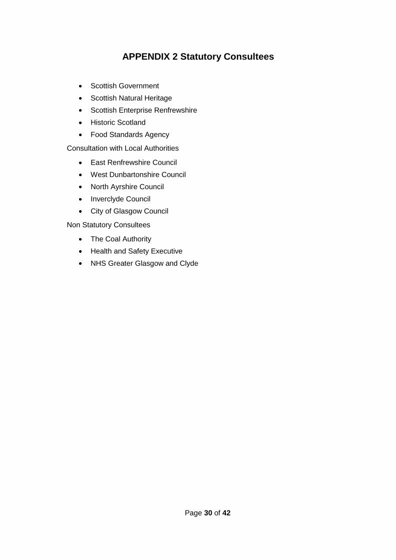
APPENDIX 2 Statutory Consultees
Scottish Government
Scottish Natural Heritage
Scottish Enterprise Renfrewshire
Historic Scotland
Food Standards Agency
Consultation with Local Authorities
East Renfrewshire Council
West Dunbartonshire Council
North Ayrshire Council
Inverclyde Council
City of Glasgow Council
Non Statutory Consultees
The Coal Authority
Health and Safety Executive
NHS Greater Glasgow and Clyde
Page 31 of 42
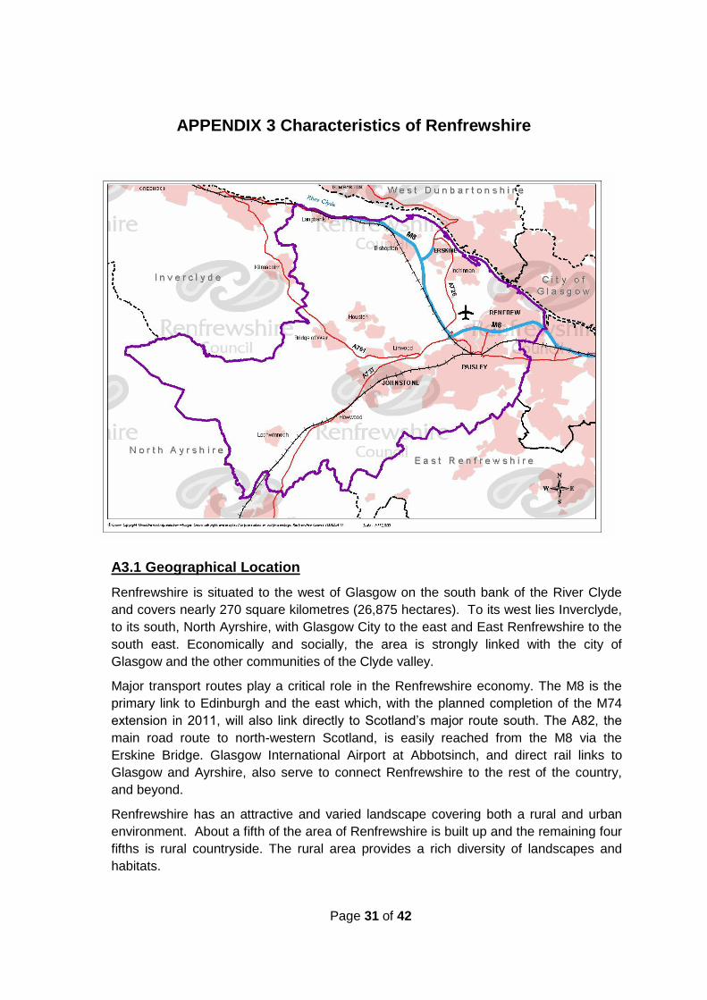
APPENDIX 3 Characteristics of Renfrewshire
A3.1 Geographical Location
Renfrewshire is situated to the west of Glasgow on the south bank of the River Clyde
and covers nearly 270 square kilometres (26,875 hectares). To its west lies Inverclyde,
to its south, North Ayrshire, with Glasgow City to the east and East Renfrewshire to the
south east. Economically and socially, the area is strongly linked with the city of
Glasgow and the other communities of the Clyde valley.
Major transport routes play a critical role in the Renfrewshire economy. The M8 is the
primary link to Edinburgh and the east which, with the planned completion of the M74
extension in 2011, will also link directly to Scotland‟s major route south. The A82, the
main road route to north-western Scotland, is easily reached from the M8 via the
Erskine Bridge. Glasgow International Airport at Abbotsinch, and direct rail links to
Glasgow and Ayrshire, also serve to connect Renfrewshire to the rest of the country,
and beyond.
Renfrewshire has an attractive and varied landscape covering both a rural and urban
environment. About a fifth of the area of Renfrewshire is built up and the remaining four
fifths is rural countryside. The rural area provides a rich diversity of landscapes and
habitats.

Page 32 of 42
The land in the east and north of Renfrewshire, adjacent to the main towns, is relatively
flat and much of it is given over to agricultural uses. The land rises to the Gleniffer
Braes in the south and the Renfrewshire Hills in the west.
A3.2 Population distribution
Estimates from the General Register Office for Scotland show the population of
Renfrewshire in mid 2008 to be some 170,000 making it the 9th largest local authority in
Scotland in terms of population.
Paisley, with an estimated population of some 75,000, is its largest town. The former
Royal Burgh of Renfrew lies to the north of Paisley and the town of Johnstone lies to the
west. Also located west of Paisley are the communities of Houston and Erskine, and to
the north and west the small towns and villages of Bishopton, Inchinnan, Bridge of Weir,
Kilbarchan, Howwood and Lochwinnoch.
TOWN Estimated POPULATION 2007
Paisley 74,640
Erskine/Inchinnan/Bishopton 22,170
Renfrew 20,170
Johnstone 16,020
Bridge of Weir/Houston/Langbank/Brookfield 12,800
Linwood 8,320
Elderslie 4,540
Lochwinnoch & Howwood 4,480
Kilbarchan 3,330
Source – Renfrewshire Council estimates based on General Register Office for Scotland - Small Area Population
Estimates 2007
Looking to the future, the General Register office for Scotland in their 2006 based
population projections forecast a decline in the population of Renfrewshire ranging
between 1.8% - 2.6% by 2031, with a likely decrease in all age groups from 0–65yr
and increases in the older age groups (particularly the over-75s).
A3.3 Council owned Land
The Council and its predecessors own or have owned significant land and property
holdings within Renfrewshire. The portfolio of Council owned land currently includes:
13,400 Council Houses;
517 operational properties including:
o 164 Education and Social Work establishments;
o 12 depots and yards;
o 10 leisure centres and pools;
o 34 council offices;
o 16 libraries;
o 280 miscellaneous properties (e.g. car parks, parks, cemeteries); and
Page 33 of 42
550 non operational sites (e.g. commercial/industrial units that the Council
leases out for rent).
A3.4 Geology
A3.4.1 Bedrock (solid geology)
Renfrewshire is underlain by two broad groups of geological strata. In the east and
central parts of the region, bedrock consists mainly of cyclical lower Carboniferous
siltstones, mudstones and limestones. These extend from Erskine, through Johnstone
and Paisley to the Council boundary in the east.
The remainder of the district in the west is underlain by the extrusive igneous rocks or
lavas of the Clyde Plateau Volcanic Formation.
A3.4.2 Superficial deposits (drift geology)
The north east corner of the district (north and east of Johnstone) in the vicinity of
Renfrew, is underlain by sand and gravel deposits of both marine and fluvial origin.
Isolated patches of boulder clay exist in the Erskine area in association with more
extensive glaciomarine deposits composed of clay and silt. West of Erskine, the
superficial deposits become much thinner and bedrock is generally at or near surface.
Only isolated sand and gravel deposits occur in the west of the region, in association
with the River Gryfe.
The town of Johnstone is the southern extent of the sand and gravels which are
dominant to the south of the River Clyde. These give way to perhaps the largest
continuous layer of boulder clay within Renfrewshire extending from Johnstone,
through Paisley to Barrhead in East Renfrewshire.
West of Johnstone, bedrock is believed to be at or near surface for most of the central
and western parts of the region. Only in the extreme west, on Queenside Muir, is
there significant coverage of the bedrock, with peat.
A3.4.3 Hydrogeology
The hydrogeology of Renfrewshire is a reflection of its climate and geology and may
also be influenced by the extensive areas of urban development and historical
industrial activity. The general characteristics of the superficial and bedrock aquifers
within Renfrewshire are indicated on the aquifer maps available on the SEPA website:
http://www.sepa.org.uk/water/monitoring_and_classification/assessment_tools/interpre
tation_of_the_maps.aspx
The Carboniferous strata are moderately permeable. These are fractured or
potentially fractured rocks that do not have a high primary permeability. However,
although these formations seldom produce large quantities of water for abstraction,
they are important for local supplies and in supplying base flow to rivers.
The igneous rocks are classified as weakly permeable and are formations of generally
low permeability that do not widely contain groundwater in exploitable quantities.

Page 34 of 42
However, some formations can locally yield water supplies in sufficient quantities for
private/domestic use.
Inland waters within Renfrewshire fall within the Cart Catchment comprising of the
White Cart Water, Levern Water, Black Cart Water and the River Gryfe. Rural and
urban issues affect this catchment which is an important water source for a number of
reservoirs in its upper levels.
A3.5 Key Water Resources/Protection Issues
The Renfrewshire area does not include any aquifers designated as major sources of
drinking water and has a very limited distribution of land considered as being highly
vulnerable to groundwater pollution as defined by SEPA‟s Groundwater vulnerability
map (follow web link in Section A3.4.3).
This situation is liable to change as the monitoring and management measures
required by the Water Framework Directive are implemented by SEPA. SEPA are
tasked with bringing about the core objectives of the Directive, namely, the
achievement of „good‟ status in all water bodies by 2015. Accordingly protection and
improvement of the water environment from contaminated land and development will
require liaison with SEPA and co-operation with upstream and downstream
neighbouring authorities.
Scottish Water provides the majority of drinking water for premises within
Renfrewshire. However, the Council has records of 104 private water supplies serving
158 domestic and commercial premises, 9 of which are classed as Type A (supplying
50 or more people or providing water for a commercial activity). Private water supplies
occur predominantly in the more rural western parts of the Council area and the water
sources include boreholes, surface waters and springs. These supplies are regulated
by staff from the Public Health team within Environmental Services, under the Private
Water Supplies (Scotland) Regulations, 2006.
The physical characteristics of Renfrewshire influence the priorities of the Strategy, as
priority will be given to those urban areas where there is likely to be both the largest
concentration of human health receptors and the greatest potential for land
contamination due to historical contaminative activity.
Priorities will tie into the broad policy framework of Renfrewshire Council. The
environmental characteristics of the Renfrewshire area are captured by our GIS model
in the classification of surface water features and the inclusion of all locally and
nationally important ecological sites.
A3.6 Protected Locations
A3.6.1 Natural Environment
The rural area of Renfrewshire provides a rich diversity of landscapes and habitats. A
number of sites have been designated as internationally important for wildlife including
the Inner Clyde and the Black Cart at Inchinnan.

Page 35 of 42
8 Sites of Special Scientific Interest (SSSI) and 3 Local Nature Reserves have been
designated within Renfrewshire. Also, 117 Sites of Importance for Nature Conservation
(SINCs) have been identified by the Council.
There are three Special Protection Areas (SPAs), designated under the EU Birds
Directive, within Renfrewshire, namely the Inner Clyde Estuary, Black Cart and
Renfrewshire Heights (a large area of moorland to the south of Greenock).
The recreational potential of the more remote uplands has been recognised through
the creation of the Clyde Muirshiel Regional Park which covers the Renfrewshire Hills
in the west of Renfrewshire and also extends into Inverclyde and North Ayrshire. The
Gleniffer Braes Country Park covers the hills to the south of Paisley and extends into
East Renfrewshire.
More information on sites within Renfrewshire identified as having special nature
conservation importance can be found on the Council‟s website:
http://www.renfrewshire.gov.uk/ilwwcm/publishing.nsf/Content/pt-cl-natureconserv
A3.6.2 Built Environment
Renfrewshire also has a rich heritage of historic architecturally important buildings.
Over 550 of our buildings are included in the List of Buildings of Architectural and
Historic Merit. There are 8 Conservation Areas in Renfrewshire, 3 of which (Oakshaw
in Paisley, Kilbarchan and Ranfurly in Bridge of Weir) are designated as Outstanding
Conservation Areas. Nearly half of the Listed Buildings lie within Conservation Areas
and Renfrewshire Council itself owns over 50 listed buildings, bridges and monuments.
Of the many sites of cultural and historical significance within the Council area, 18
have been designated as Scheduled Ancient Monuments by Historic Scotland.
More information on historical or architectural interest can be found on the Council‟s
website:
http://www.renfrewshire.gov.uk/ilwwcm/publishing.nsf/Content/Navigation-pt-
ListedBuildingsandConservationAreasHomePage
A3.7 Known Information on Contamination
Analysis of historical mapping, historical land use mapping and collation of information
from various sources including in-house knowledge has assisted the Council in
identifying areas of land potentially contaminated as a result of historical activities.
A3.7.1 Updated information on Contamination
Renfrewshire Council launched the original inspection strategy in 2001. At that time,
approximately 2,950 hectares of land (around 11% of the Council area) was identified
as having the potential to be contaminated land based on a combination of former
uses and activities, and the presence of potential pathways and receptors.

Page 36 of 42
A3.8 Past and Current Industrial Activity in Renfrewshire
A3.8.1 Historical Industry
Renfrewshire‟s prominence as an industrial centre dates from the middle of the 18th
century when Paisley became the centre of a home-based spinning and weaving
industry. Weaving, including the manufacture of the famous „Paisley‟ shawls remained
an important domestic industry until the middle of the 19th century. Power loom
weaving existed for a time, notably in Johnstone and Paisley, and many of
Renfrewshire‟s most successful textile industries such as spinning, bleaching and
dyeing soon changed from domestic to factory production.
These characteristic textile finishing works were located along the Black Cart, beside
the many small streams flowing from the Gleniffer Braes to the White Cart and in other
areas where an abundant water supply was available. However this industry suffered
a decline after the First World War and then again following the Second World War.
The manufacture of sewing thread expanded greatly during the late 19th century with
the combining of Coats and Clark to form the largest thread manufacturing concern in
the world, and this industry retained a significant presence in Paisley until the 1980s.
Apart from the significance of the thread industry itself, the skills developed in servicing
this and the county‟s other textile related industries established firm foundations for the
increasingly important engineering industries which developed as weaving declined.
The establishment of numerous foundries and engine works made Paisley and
Johnstone centres of general engineering, with Johnstone specialising in machine tool
production and Paisley offering a range of specialisms including various types of textile
machinery; equipment for coal mines, oil and sugar refineries; for woodworking, and
also for the shipbuilding industry including local yards at Paisley and Renfrew.
Babcock and Wilcox, established at Renfrew in 1895 and noted for the manufacture of
boilers, long remained the largest single employer in Renfrewshire.
Networks of former railway lines, stations and storage facilities are evident in the
urbanised parts of Renfrewshire, which provided the necessary transport infrastructure
to enable large scale industrial development. Historically, several of the towns within
the district also had their own gas works, which tended to appear upon connection to
the rail network and subsequently closed as the energy networks improved. However,
because of their central position in towns, many of these sites have already been
redeveloped, in some cases some considerable time ago. Old transport networks and
industrial sites present a particular challenge when dealing with the possibility of
contaminated land.
Coal, ironstone and oil shale have all been historically worked in Renfrewshire
particularly in the vicinity of Paisley, Linwood and Johnstone. However, the
comparative lack of coal and iron resources saved the county from any large scale
development of mines and blast furnaces and from the more unpleasant landscape
features associated with them.
Rural parts of the district remained largely tied to agriculture with localised quarrying
for raw materials such as clay and stone to supply local industry.
Page 37 of 42
The abundance of pure water which encouraged the textile industries has led in later
days to the establishment of paper mills along the Black Cart and tanneries on the
River Gryfe.
Other industries within Renfrewshire included furniture making at Lochwinnoch and
elsewhere; starch and corn flour works; soap works; brick works; jam and preserves
manufacturing in Paisley; an extensive rubber industry principally at Inchinnan and
Paisley; the manufacture of railway rolling stock and motor cars at Linwood; and
munitions works, most notably at Bishopton but also at a number of other sites during
the First and Second World Wars.
As well as having been one of Scotland‟s most heavily industrialised counties,
Renfrewshire has also been one of the most diverse.
A3.8.2 Current Land use characteristics
Current land use in the Renfrewshire area reflects the growing trend in much of the
west of Scotland where significant regeneration is taking place. As traditional heavy
industry has declined, much of the vacant and derelict land left behind has been used
to provide residential, commercial and light industrial development sites.
The Scottish Vacant and Derelict Land Survey (2008) shows Renfrewshire Council as
the authority with the 5th largest percentage, (by area), of Derelict and Urban Vacant
land in Scotland at 941 hectares. Derelict land is land so damaged by development
that it is incapable of further development without rehabilitation and can be viewed as
a constraint on future development. It is worth noting that approximately 875 hectares
of the total is accounted for by the Royal Ordnance Factory site at Bishopton, of which
708 hectares is the subject of development proposals that include plans for the
remediation of the site.
Over the last few decades there has been a marked decline in the manufacturing
sector although in areas such as Erskine and Inchinnan we have seen an expansion of
new high-technology companies. The expansion of Glasgow Airport, with its
associated distribution services, together with the major retail and leisure development
at Braehead in Renfrew, have contributed to a broadening of the industrial base and to
giving Renfrewshire a relatively more diverse industrial structure.
The current financial position nationally, however, has been reflected locally in a
marked reduction in the number of former brownfield sites being redeveloped.
A3.9 Legal controls on development
A3.9.1 Pre Contaminated Land Regime
Before 2000, land contamination would either be dealt with via the Planning system
when a planning application was submitted, or using statutory nuisance provisions of
Part III of the Environmental Protection Act 1990 where a nuisance was being caused
or was likely to occur or recur. This resulted in little control over most types of land
contamination. Consequently planning conditions generally only considered the risks,
where known, to the proposed development and end users, and may not have
Page 38 of 42
addressed risks to surface waters, groundwater or ecosystems. Additionally, there was
limited knowledge of the history of many sites which were redeveloped.
A3.9.2 Post Contaminated Land Regime
Following the introduction of the Regime in 2000, Planning Advice Note (PAN) 33 –
Development of Contaminated Land - was revised and introduced updated planning
procedures which complemented the objectives of Part IIA. Historical mapping was
purchased which provided more detail concerning potential contamination. Now,
Planning and Transport, using GIS, are able to identify potential land contamination as
a possible development constraint and consult with Environmental Services to ensure
any remediation which may be required is undertaken. The current planning control
mechanism is outlined in Appendix 4 (section A4.5.1)

Page 39 of 42
APPENDIX 4 Procedures
A4.1 Internal Management Arrangements for Inspection and Identification
As outlined in Section 1.2 the implementation of Part IIA of the Environmental
Protection Act 1990 within Renfrewshire is the responsibility of Environmental Services
within which assigned Officers fulfil the statutory duties.
A4.1.1 Council Members
The Council and its elected members are ultimately responsible for the implementation
of the Contaminated Land Strategy and any subsequent revisions, amendments and
issues raised concerning the identification and remediation of contaminated land under
Part IIA of the Environmental Protection Act 1990.
A4.2 Sites with past Council involvement
Sites where Renfrewshire Council (and our predecessors) may be the „appropriate
person‟ as a consequence of previous historical contaminative use or activities or
through ownership (current and past) may be subject to early prioritisation and early
inspection/ assessment whilst ensuring compliance with the Statutory Guidance in
relation to inspection duties.
A4.3 Cross Boundary Sites
Where suspected contaminative sites are identified within the Strategy which are partly
contained within another Local Authority boundary, contact will be made with the
appropriate authority to discuss the appropriate way to progress this site.
Where another Local Authority approaches Renfrewshire Council regarding a site or
suspected site which partly intrudes into their boundaries, similar levels of discussion
will be initiated to discuss the appropriate way forward.
A4.4 Information Management
A4.4.1 General Principles
All information relating to studies and investigations undertaken is held electronically
and accessed using an archived system which links into the Council‟s Geographic
Information System (GIS).
A4.4.2 Public Register Information
Renfrewshire Council is obliged to maintain a public register containing details
prescribed in Schedule 4 of the Contaminated Land (Scotland) Regulations, 2000.
This register will be available at all reasonable times for free public inspection at the
offices of Environmental Services, Renfrewshire House, Cotton Street, Paisley PA1
1HY.
Copies of the register can be made available on request for which a reasonable
charge will be made.
Page 40 of 42
Before including any information on the register the Council will consider whether that
information should be excluded on the basis that:
a) its inclusion would be against the interests of national security; or
b) the information is commercially confidential.
Inspection information not placed on the Public Register will be subject to the
disclosure requirements of The Environmental Information (Scotland) Regulations,
2004.
A4.4.3 Other Inspection Information
This type of information refers to information collated by the Council during its
inspection duties in relation to contaminated land issues and which is not classed as
Public Register Information. This will include information details relating to such
matters as present and former land uses, harmful or polluting contaminants, the
location of receptors and any other information of a type that will assist in the Council‟s
inspection duties in order to identify contaminated land within Renfrewshire.
A4.4.4 Provision of Information to SEPA
The Council will provide SEPA with information on contaminated land in accordance
with the current legislative requirements and any current extant protocols.
A4.4.5 Complaints and Requests for Information
Complaints from members of the public, businesses and voluntary organisations will
be logged and responded to in accordance with Environmental Services procedures.
Requests for information under the Freedom of Information (Scotland) Act, 2002, are
addressed directly by a specified Freedom of Information officer, who coordinates and
collates responses, within Renfrewshire Council.
A4.4.6 Information Gaps
The ongoing implementation of the Strategy may highlight gaps in information and
where these cannot be remedied timeously they will be addressed as part of the
review process.
A4.5 Other Regulatory Regimes
The contaminated land regime under Part IIA of the Environmental Protection Act 1990
complements other legislation and is primarily used where existing legislation does not
apply. Examples of other legal controls that touch on land contamination are set out
below.
A4.5.1 Planning & Building Standards
Where contaminated land is subject to development proposals, its treatment is dealt
with under the planning system. This system is a key mechanism for managing land
contamination as part of land redevelopment and regeneration. In addition to
considering risks from existing contamination the Council also considers any potential

Page 41 of 42
risk from development work and/or a proposed use to contaminate a site or the
surrounding area. The historical mapping information referred to in Appendix 3 (section
A3.9.2) is used to ensure that Environmental Services are automatically consulted
where potential land contamination is identified as a possible constraint to the
proposed development.
Where any new development is taking place it will be the responsibility of the
developer to carry out any necessary remediation work and for it to be undertaken to
the satisfaction of the Council.
The Scottish Government has issued advice to Planning Authorities on the
development of contaminated land in the form of Planning Advice Note 33. In addition,
as detailed in Chapter 3, this Council has produced a guidance document for
developers dealing with the redevelopment of potentially contaminated sites.
Changes to the planning system which are likely to be implemented during 2010 mean
that a substantial proportion of small-scale householder developments, previously
covered by planning control, will be permitted development and therefore fall outwith
the scope of the development management process. In order to ensure that all new
developments are adequately assessed in respect of contaminated land, it has been
necessary to introduce consultation procedures with Building Standards which will
continue to be engaged in the assessment of smaller scale development proposals.
This consultation procedure will seek to ensure that where a Building Warrant is
sought which involves groundworks on potentially contaminated land, Environmental
Services will be consulted. This is to ensure that new pollutant linkages are not
created.
Other regimes which may have implications for land contamination, or which may
overlap with Part IIA include food safety, health and safety, landfill tax and waste
management licensing, major accident hazards, water pollution, statutory nuisance
and Pollution Prevention and Control (PPC).
A4.6 Assessment Methods and Prioritisation
The assessment and prioritisation of potentially contaminated land will be undertaken
in a phased programme consisting of two stages:
Stage 1. Prioritisation
Stage 2. Risk Assessment
A4.6.1 Prioritisation & Risk Assessment
To support the identification of contaminated land, a semi automated GIS prioritisation
model (known as the S57 Core Tools Model) has been used. This model is supported
by a Land Quality Management database for storing site specific information. The
model draws information from a variety of sources - those listed below are not
exhaustive - which can be divided into 3 distinct datasets:
Source datasets e.g. historical land-use, SEPA data, local authority data –
geological, historical records, maps;

Page 42 of 42
Pathway datasets e.g. British Geological Survey drift, solid and manmade
geological data, Mine entry data supplied by the Coal Authority; and
Receptor Datasets e.g. Ordnance Survey maps and local authority information
on population & building use, SEPA surface waters quality records, Scottish
Natural Heritage and Historic Scotland receptors.
The Council will continue to use this model as a means of driving the inspection
process. From time to time the Model can be rerun to take account of new legislation
and directives that affect the priority scoring. At this time the process of inspection
remains unchanged from the original strategy and is based on:
Identification of potentially contaminated sites using a rational, robust and
efficient methodology based on the principles of risk assessment. This is
achieved by adopting a transparent and auditable GIS based model and
associated Land Quality Management Database;
Prioritisation of potentially contaminated land sites using a rational, robust and
efficient methodology based on the principles of risk assessment. The
methodology employed by the S57 model assesses significant harm where it is
causing human health effects, ecological system effects, animal or crop effects,
building effects and where the water environment may be significantly polluted.
This may require some adjustment to incorporate sites that are potentially
contaminated by radioactivity as a consequence of recent legislative changes
and an appropriate update will be made to the Methodology statement;
The Model uses up to date publicly available data to identify sources, pathways
and receptors thus prioritising these categories through a series of risk ranking
scores that scales potential risk according to the severity of source, efficiency
of pathway and sensitivity of receptor. Full details of the methodology employed
to achieve prioritisation can be obtained from the Environmental Quality
Section, Renfrewshire Council, Renfrewshire House, Cotton Street Paisley;
Undertaking a Phase I investigation of prioritised contaminated land sites
involving desk studies, site walkover, collection of physical data (if appropriate)
and development of Conceptual Site Model. The completion of this phase will
involve a risk based assessment being undertaken to establish if it is likely that
a contaminant is actually present and a receptor is actually or likely to be
present and linked to the contaminant;
Undertaking a Phase II investigation which is likely to involve staged ground
investigation works and further refinement of the risk assessment and
conceptual site model in a cost effective manner. These works require to be
designed and planned around the Conceptual Site Model established by the
risk assessment in Phase I. Upon completion of these ground investigations,
risk assessment and evaluation on the evidence provided will identify what, if
any, actions are necessary; and
Liaison with SEPA where there is significant pollution or the significant
possibility of significant pollution of the water environment, if the site is likely to
be determined a special site or is suspected of being radioactively
contaminated.