Contacts - Newcastle
74
Transcript of Contacts - Newcastle

Contacts: Head of Development Management Tel 0191 211 5629 Team Manager Urban Design and Conservation Tel 0191 277 7190 Write to: Development Management Environment and Regeneration Directorate Civic Centre Barras Bridge Newcastle upon Tyne NE1 8PH Email: [email protected] Website: www.newcastle.gov.uk March 2011 If you need this information in another format or language, please phone the conservation team on 0191 277 7191 or email [email protected]
Summerhill Management Plan – adopted April 2007 1
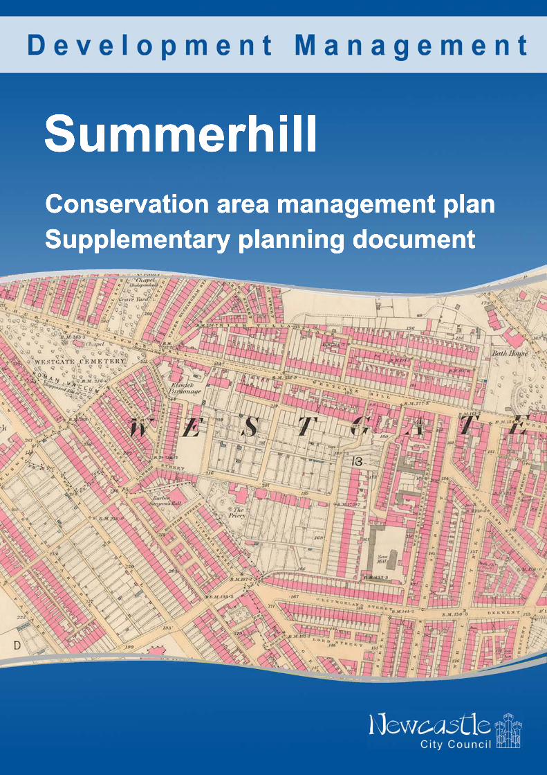
Summerhill Conservation Area Management Plan Supplementary Planning Document Prepared by the North of England Civic Trust on behalf of Newcastle City Council in 2007 Adopted April 2007 Updated by Newcastle City Council in March 2011

Summerhill Management Plan – adopted April 2007 2
Contents 1 Introduction, aims and context
1.1 Introduction 1.2 Aims of the Management Plan 1.3 Context of the Management Plan
2 Introduction, heritage audit, significance and characteristics, and
vulnerabilities in the conservation area.
2.1 Introduction to the Summerhill Conservation Area 2.2 Heritage audit 2.3 Significance and characteristics 2.4 Vulnerabilities
3 Development issues
3.1 Introduction 3.2 Development issues within the conservation area
4 Transport issues
4.1 Introduction 4.2 Westgate Road 4.3 Elswick Road 4.4 Culs-de-sacs and road closures 4.5 Residential parking
5 Planning procedures within Summerhill Conservation Area
5.1 Introduction 5.2 Control of works to unlisted flats, dwelling houses and
commercial properties within Summerhill Conservation Area 5.3 Listed buildings 5.4 Works to trees 5.5 Advertisements 5.6 Urgent works and repairs notices 5.7 Article 4 Directions 5.8 Enforcement
Summerhill Management Plan – adopted April 2007 3
6 Heritage at risk
6.1 Introduction 6.2 The Barber Surgeons Hall, Houston Street 6.3 Seddons, Swinburne Place
7 Public realm
7.1 Introduction 7.2 Roads, footpaths and verges 7.3 Public car parking and hard standings 7.4 Street furniture 7.5 Signage
8 Future management
8.1 SWOT analysis 8.2 Key points
9 Future management – protection and enhancement of the Summerhill
Conservation Area Appendix 1 Context of the management plan – planning policy context
Acknowledgements The Ordnance Survey map data used in this publication is provided by Newcastle City Council under licence from the Ordnance Survey in order to fulfil its public function as a planning authority. Persons viewing this mapping wishing to use Ordnance Survey data should contact Ordnance Survey Copyright. Photographs used in this document are copyright of Newcastle City Council unless stated otherwise. Aerial photographs are copyright of:
i) Cities Revealed® aerial photography ©The Geoinformation Group.
ii) Air Images 1999.

Summerhill Management Plan – adopted April 2007 4
Section1: Introduction, aims and context This document was first adopted by the council as a supplementary planning document (SPD) in 2007. It has been updated for accuracy in March 2011. Only minor alterations have been made; there are no material amendments. 1.1 Introduction
Swinburne Place Winchester Terrace Summerhill Conservation Area was designated in 1970. It was extended in February 1988 to include Elswick Road and in October 1992 to include the Barber Surgeon’s Hall and Westgate Hill Cemetery. A conservation area is defined by the Planning (Listed Buildings and Conservation Areas) Act 1990, section 69 (1)(a) as being ‘an area of special architectural or historic interest the character or appearance of which it is desirable to preserve or enhance’. A management plan is the next step after the designation process and the preparation of the character statement. The plan provides guidance through policy statements to enable the effective management of change and secure the preservation and enhancement of the character and appearance the conservation area. This is in accordance with the Planning (Listed Buildings and Conservation Areas) Act 1990 s.71 and s.72; s.71 that specifically requires the local planning authority to formulate and publish proposals for the preservation and enhancement of their conservation areas and to submit these proposals for public consideration. The Character Statement (adopted as Supplementary Planning Guidance in April 2001) provides a comprehensive assessment of the visual character and appearance of the conservation area and defines what elements are of merit, what the key issues are, what opportunities exist for its preservation and enhancement

Summerhill Management Plan – adopted April 2007 5
and which elements detract from the appearance of the conservation area. Its purpose is to provide a benchmark for assessing the impact of development proposals on the character and/or appearance of the conservation area. The Management Plan is based on advice from English Heritage (Guidance on the Management of Conservation Areas, August 2000) and was in accordance with national best value performance indicators at the time of writing. 1.2 Aims of the Management Plan The Management Plan is based on the Summerhill Conservation Area Character Statement. It has four objectives: 1. To establish and define the significance of the conservation area as a whole and of the individual elements which contribute to that significance, building on the Character Statement. 2. To assess and define the threats and opportunities within the area and how these impact on the significance of the individual elements and of the conservation area as a whole. 3. To provide a benchmark in assessing and managing change. 4. To provide policy guidance to ensure that the character and appearance of the conservation area will be maintained through the effective management of change and that those opportunities to enhance the character and appearance are maximised. 1.3 Context of the Management Plan Planning Policy Context The Management Plan will form a Supplementary Planning Document (SPD) to the Local Development Framework (LDF). In accordance with the Town and Country Planning (Local Development) (England) Regulations 2004, a Sustainability Appraisal, a Statement of Community Involvement and a Screening Determination were produced concurrently with this guidance. Appendix 1 details the particular policies and planning guidance that are relevant to the Management Plan.


Summerhill Management Plan – adopted April 2007 8
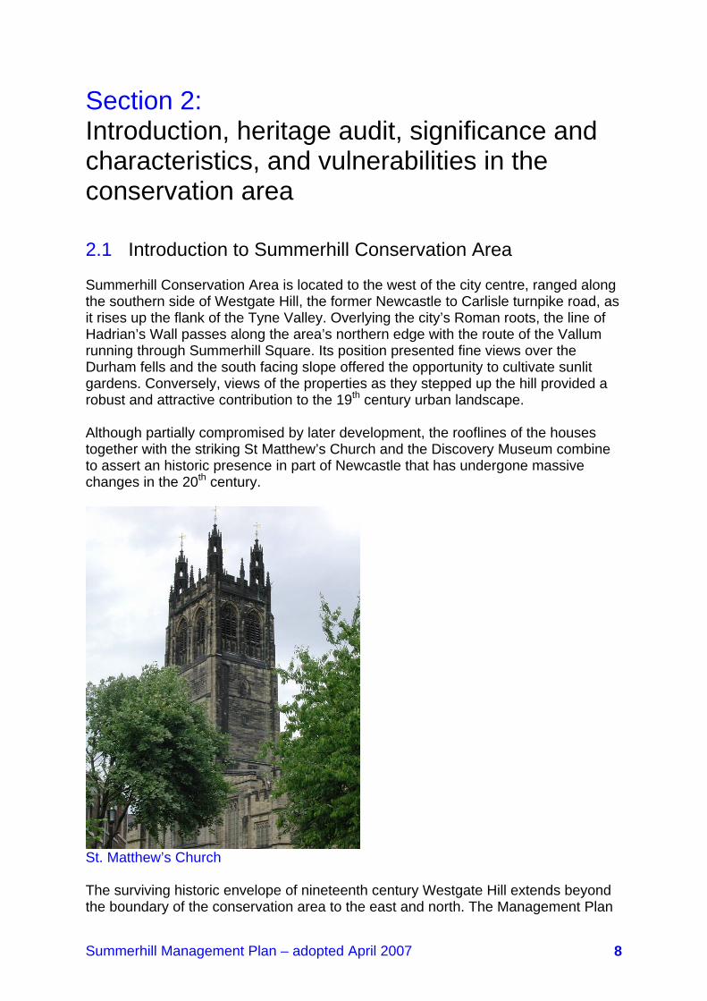
Section 2: Introduction, heritage audit, significance and characteristics, and vulnerabilities in the conservation area 2.1 Introduction to Summerhill Conservation Area Summerhill Conservation Area is located to the west of the city centre, ranged along the southern side of Westgate Hill, the former Newcastle to Carlisle turnpike road, as it rises up the flank of the Tyne Valley. Overlying the city’s Roman roots, the line of Hadrian’s Wall passes along the area’s northern edge with the route of the Vallum running through Summerhill Square. Its position presented fine views over the Durham fells and the south facing slope offered the opportunity to cultivate sunlit gardens. Conversely, views of the properties as they stepped up the hill provided a robust and attractive contribution to the 19th century urban landscape. Although partially compromised by later development, the rooflines of the houses together with the striking St Matthew’s Church and the Discovery Museum combine to assert an historic presence in part of Newcastle that has undergone massive changes in the 20th century.
St. Matthew’s Church The surviving historic envelope of nineteenth century Westgate Hill extends beyond the boundary of the conservation area to the east and north. The Management Plan

Summerhill Management Plan – adopted April 2007 9
offers the opportunity to recommend the re-appraisal of the boundary to see if an amendment would help to conserve and protect the historic townscape. 2.2 Heritage Audit 1. Conservation area status: Designated 1970, boundaries amended in February 1988 and October 1992 2. Listed buildings: Grade II* -1 Grade II - 80 Local List - 4 3. Park and Garden of Special Historic Interest: Westgate Hill Cemetery designated a Grade II Park and Garden of Special Historic Interest on 05
November 2003
Entrance to Westgate Hill Cemetery

Summerhill Management Plan – adopted April 2007 10
2.3 Significance and characteristics 2.3.1 Historic development pattern Physical evidence of early ribbon development along Westgate Road that pre-dates the surviving 19th century layout of the conservation area can be found with three 18th century properties: number 198 Westgate Road (a house or workshop slightly set back from the road), 2 and 3 Swinburne Place (a house) and 5 Swinburne Place (also a house). Further up the hill, Summerhill House and its grounds were built for Mr Barber (an Irish book-seller) and was rebuilt for Hadwin Bragg as a double bow fronted house, also in the 18th century. The northern part of the Bragg rebuild survives behind the former Big Lamp brewery on Summerhill Street and can be glimpsed from Westgate Hill. Occasional roadside development interspersed with fields and nurseries characterised this western approach to the walled city until Summerhill emerged in the first quarter of the 19th century, starting with 2, 3 and 4a Swinburne Terrace followed by Ravensworth Terrace in 1823 and culminating with the final part of Summerhill Terrace (1 to 6) in the early 1860s. This coincided with the rapid expansion of urban Tyneside that was a consequence of the massive growth of coal, manufacturing and shipbuilding industries, creating wealth for some and a huge rise in the town’s population to work in the factories and to service and administer the newly formed businesses in its wake. The wealthy moved away from the tumult, poor hygiene, disease and effluent at the heart of the industrial areas to the then urban fringe, upwind of the manufacturing processes. The demand for fine fashionable new houses combined with gardens and a rural hinterland led to the development of the historic core of Summerhill. The character of the area is dominated by terraces of large brick-built late-Georgian houses ranged around the open Square. Unlike the planned squares of London, Edinburgh and Dublin where large communal gardens provided a formal landscaped setting to the surrounding properties, Summerhill is the product of lengths of terraces gradually being developed around a pre-existing nursery that was converted in the mid-19th century into a series of town gardens. This development arrangement underlies the relationship of buildings to space whereby all of the properties overlooking the Square have their own garden areas, albeit some with former links to the town gardens. The design requirements and sensitivities exerted by the early developers resulted in a degree of uniformity and ensured an overall consistency of high quality appearance that is still substantially evident. The town gardens that were developed in the Square reflected the late eighteenth and 19th century love of gardening, a period when many new ideas and plants arrived from all over the world. They provided places for leisure and relaxation in attractive surroundings that were much removed from the nearby intensively developed urban area. Longstaffe-Gowan describes in his book ‘The London Town Garden’ the importance of gardening in the physical and social development of 19th century London, a phenomenon that eventually dominated Victorian society across the nation. The Square was a typical and, from the garden patterns displayed on Oliver’s map of 1831, an outstanding example of this movement. In 1905 the eastern half of the Square was developed to provide bowling greens and a tennis court together with a pavilion; and the western half was purchased by the council in 1935/6
Summerhill Management Plan – adopted April 2007 11
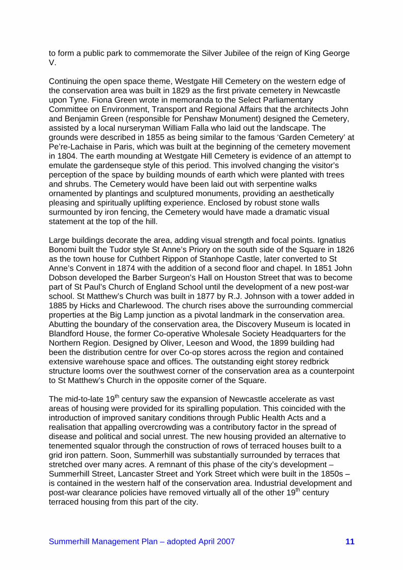
to form a public park to commemorate the Silver Jubilee of the reign of King George V. Continuing the open space theme, Westgate Hill Cemetery on the western edge of the conservation area was built in 1829 as the first private cemetery in Newcastle upon Tyne. Fiona Green wrote in memoranda to the Select Parliamentary Committee on Environment, Transport and Regional Affairs that the architects John and Benjamin Green (responsible for Penshaw Monument) designed the Cemetery, assisted by a local nurseryman William Falla who laid out the landscape. The grounds were described in 1855 as being similar to the famous ‘Garden Cemetery’ at Pe’re-Lachaise in Paris, which was built at the beginning of the cemetery movement in 1804. The earth mounding at Westgate Hill Cemetery is evidence of an attempt to emulate the gardenseque style of this period. This involved changing the visitor’s perception of the space by building mounds of earth which were planted with trees and shrubs. The Cemetery would have been laid out with serpentine walks ornamented by plantings and sculptured monuments, providing an aesthetically pleasing and spiritually uplifting experience. Enclosed by robust stone walls surmounted by iron fencing, the Cemetery would have made a dramatic visual statement at the top of the hill. Large buildings decorate the area, adding visual strength and focal points. Ignatius Bonomi built the Tudor style St Anne’s Priory on the south side of the Square in 1826 as the town house for Cuthbert Rippon of Stanhope Castle, later converted to St Anne’s Convent in 1874 with the addition of a second floor and chapel. In 1851 John Dobson developed the Barber Surgeon’s Hall on Houston Street that was to become part of St Paul’s Church of England School until the development of a new post-war school. St Matthew’s Church was built in 1877 by R.J. Johnson with a tower added in 1885 by Hicks and Charlewood. The church rises above the surrounding commercial properties at the Big Lamp junction as a pivotal landmark in the conservation area. Abutting the boundary of the conservation area, the Discovery Museum is located in Blandford House, the former Co-operative Wholesale Society Headquarters for the Northern Region. Designed by Oliver, Leeson and Wood, the 1899 building had been the distribution centre for over Co-op stores across the region and contained extensive warehouse space and offices. The outstanding eight storey redbrick structure looms over the southwest corner of the conservation area as a counterpoint to St Matthew’s Church in the opposite corner of the Square. The mid-to-late 19th century saw the expansion of Newcastle accelerate as vast areas of housing were provided for its spiralling population. This coincided with the introduction of improved sanitary conditions through Public Health Acts and a realisation that appalling overcrowding was a contributory factor in the spread of disease and political and social unrest. The new housing provided an alternative to tenemented squalor through the construction of rows of terraced houses built to a grid iron pattern. Soon, Summerhill was substantially surrounded by terraces that stretched over many acres. A remnant of this phase of the city’s development –Summerhill Street, Lancaster Street and York Street which were built in the 1850s – is contained in the western half of the conservation area. Industrial development and post-war clearance policies have removed virtually all of the other 19th century terraced housing from this part of the city.

Summerhill Management Plan – adopted April 2007 12
The second half of the 20th century has seen little change to the residential character of the conservation area. Change of use to multiple occupation and conversion of houses to offices has had an impact, particularly the latter with a tendency to merge garden areas, and a general increase in traffic flows and demand for parking. Demolitions have resulted in the formation of uncomfortable pockets of open space and infill development has inserted new housing into the area. Its close proximity to the city centre has resulted in the area becoming an increasingly popular place to live. 2.3.2 Buildings The built fabric of the conservation area reflects its age and the socio-economic development of the city. It includes fragments of the ribbon development that predates the explosive urban expansion of the early to mid-19th century; a cluster of fine late-Georgian terraces; a number of working class terraces and the wonderful landmarks of St Matthew’s Church and the Barber Surgeon’s Hall representing the work of three remarkable Tyneside architects – John Dobson, Robert James Johnson and William Searle Hicks.
Winchester Terrace: Welsh slate roofs, timber windows, stone dressings and red brick all feature strongly in the conservation area. The principal elevations of the houses are predominantly brick faced with sandstone detailing, some subsidiary elevations and off-shots being built using shaped rubble. Generally the brickwork is precise and well executed and was clearly meant to be left exposed as a decorative finish. Roofs are almost universally covered in Welsh slate with one or two in clay pantiles. Chimney stacks and pots make a remarkable contribution to the skyline and the character of the conservation area. Many original details survive to add historic depth and aesthetic interest to the houses. They

Summerhill Management Plan – adopted April 2007 13
include elegant timber sliding sash windows with traditional slender frames and glazing bars; long arched stairwell windows; surviving crown and coloured glass; original panelled doors set in a variety of attractive surrounds; iron balconies, handrails and front railings; and furniture such as boot scrapers and coal hole covers. The commercial buildings overlooking the Big Lamp junction introduce different materials and scale with a building line to the back of pavement. They lead past the former brewery to St Matthew’s Church, squeezed into the earlier street pattern, with only its west elevation and tower being clearly visible. In addition to being of great architectural beauty in its own right, the church makes a dramatic visual contribution to the wider townscape being positioned towards the top of the hill overlooking the city centre and beyond. The Barber Surgeon’s Hall introduces a fine Classical building into the area that has undergone a number of changes of uses without seriously damaging its external appearance. 2.3.3 Landscape The conservation area is well endowed with green space and mature landscapes. They include the park and its containing belts of trees, particularly along the southern and eastern perimeters; the bowling greens; Westgate Cemetery where the volume of trees creates a sylvan environment that is of great potential amenity value; gardens with mature trees that provide attractive settings to buildings and frame and channel views; and street trees that generally soften edges and occasionally contain space. Some recent tree planting in public spaces and gardens has enhanced the residential character of the area without diminishing its historic significance. The mature landscapes that reflect and respect the historic character of the area add to its sense of history in the same way as styles of architecture and the presence of original surfaces. They all combine to establish the special character of the area and all must be protected and enhanced.
Summerhill Bowling Club
Summerhill Management Plan – adopted April 2007 14
2.4 Vulnerabilities Major issues to threaten the intrinsic character of the conservation area are the removal of important historic details from buildings, including windows and doors, and their substitution by inappropriate modern replacements; the loss of chimney pots that make an important contribution to the historic silhouette of the roof lines, particularly medium and distant views of the area; the loss of the historic containment of gardens, backyards and open spaces; increasing pressures for car parking leading to the formation of hard standings in garden areas; buildings at risk; and the condition and appearance of the public realm. The proposed development of large sites close to the conservation area, principally Science Central to the north, Blandford Square to the east, and the George Street triangle and an expansion of Newcastle College to the south will impact on its setting and the character of the area. Associated economic uplift could bring additional pressures to bear, such as a heightened demand for office space within a tranquil and extremely attractive environment.

Summerhill Management Plan – adopted April 2007 15
Section 3: Development issues 3.1 Introduction Summerhill Conservation Area does not contain large areas of undeveloped land. However, the area is surrounded to the north, east and west by substantial development sites that are being promoted by the City Council and by the private sector. The potential impact of these sites on the conservation area could be significant and consideration of that impact should form part of development briefs and design proposals.
New development in the conservation area The most recent development in the conservation area has been the construction of two blocks of flats, Nomad’s social housing to the south of Summerhill Terrace (numbers 13 to 17) and the adjacent Blandford Court. Both bring additional housing into the area, adding to the residential mix, and are a pastiche of the adjacent historic terraces. Unfortunately, although they incorporate some of the signatures of the nearby buildings such as heavy eaves, string courses and lintels; the boxy porches, shape and ratio of windows to brickwork and diminutive chimneys detract from their contribution to the character of the conservation area. This is particularly true of Blandford Court, which rises to five floors cutting against the grain of development in the area that tends to fall and rake with the gradients that cut across the site.
Summerhill Management Plan – adopted April 2007 17
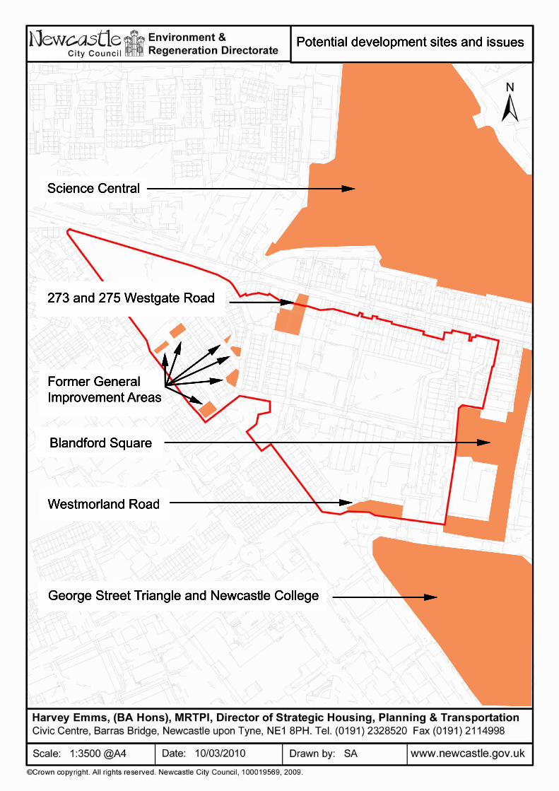
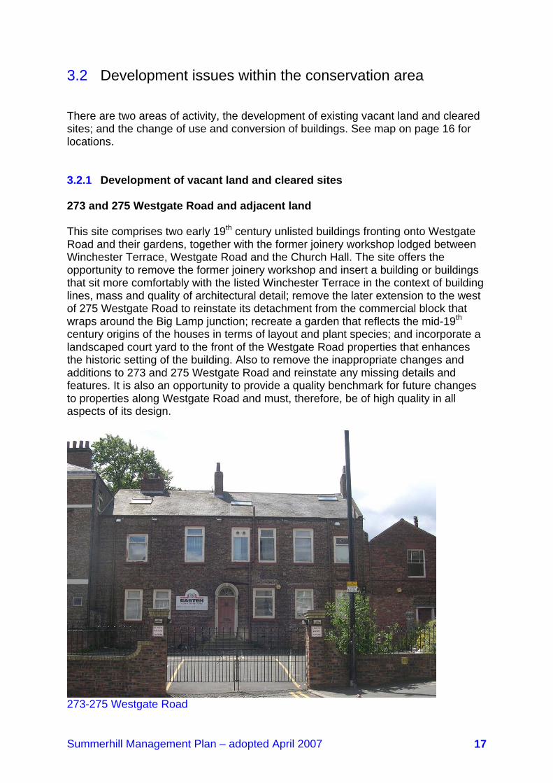
3.2 Development issues within the conservation area There are two areas of activity, the development of existing vacant land and cleared sites; and the change of use and conversion of buildings. See map on page 16 for locations. 3.2.1 Development of vacant land and cleared sites 273 and 275 Westgate Road and adjacent land This site comprises two early 19th century unlisted buildings fronting onto Westgate Road and their gardens, together with the former joinery workshop lodged between Winchester Terrace, Westgate Road and the Church Hall. The site offers the opportunity to remove the former joinery workshop and insert a building or buildings that sit more comfortably with the listed Winchester Terrace in the context of building lines, mass and quality of architectural detail; remove the later extension to the west of 275 Westgate Road to reinstate its detachment from the commercial block that wraps around the Big Lamp junction; recreate a garden that reflects the mid-19th century origins of the houses in terms of layout and plant species; and incorporate a landscaped court yard to the front of the Westgate Road properties that enhances the historic setting of the building. Also to remove the inappropriate changes and additions to 273 and 275 Westgate Road and reinstate any missing details and features. It is also an opportunity to provide a quality benchmark for future changes to properties along Westgate Road and must, therefore, be of high quality in all aspects of its design.
273-275 Westgate Road

Summerhill Management Plan – adopted April 2007 18
The former General Improvement Area A number of properties in the Summerhill Street, York Street and Lancaster Street neighbourhood were demolished in the 1960s and 70s as part of General Improvement Area environmental works. The objective was to create a ‘green space’ and additional car parking at the end of terraces. Because of the way that they were designed and detailed, this has led to a street pattern interspersed with spaces that lack form, appear abandoned and generally detract from the historic layout and character of the area. The voids require attention in order to ensure that they make a positive contribution to the quality of the environment.
Looking south along York Street Westmorland Road The south west corner of the conservation area has been the subject of radical change with the demolition of houses fronting onto Westmorland Road and the subsequent construction of the George Street roundabout, the development of the flat-roofed St Anne’s Primary School and the construction of Blandford Court and the Nomad social housing scheme. An area of open land bounded by Blandford Court and St Anne’s Primary School sits behind the verge of Westmorland Road. The development of the George Street triangle offers the opportunity to look at the design of Westmorland Road and its intersections and roundabouts with the possibility that a slight reconfiguration could facilitate the development of the open land, reintroducing a built frontage that has been lost and containing an edge of the conservation area that has become open and interspersed with loosely connected modern buildings. Note: it appears that this piece of land is currently in use by the school; this is considered to be an appropriate use, although some landscaping to Westmorland Road may be welcomed.

Summerhill Management Plan – adopted April 2007 19
3.2.2 Change of use and conversion of buildings A number of houses have been converted into flats and offices although there have been several examples of this trend being reversed. It is possible that this trend will continue, reflecting a growing demand in both sectors. The consequence of such conversions includes increased pressure on the area’s services and infrastructure, particularly car parking, and can result in changes to the appearance of buildings and their surrounding space. Listed Building Consent, planning permission and the existing Article 4 Direction requirements put into place processes that are designed to ensure that changes are controlled in a way that preserve and enhance the character and appearance of the conservation area. It is important that the original residential character of the area is not compromised by conversions. This includes the formation of car parks in rear yards that involves the demolition of walls; the removal of garden divisions and the creation of easily maintained, bland, swards of grass; and the sanitised effect that inappropriate new doors, windows, paths, signage and lighting has on old buildings. 3.2.3 Development of Neighbouring Sites Science Central
Aerial photo of the now cleared Science Central site The former Newcastle and Scottish Brewery site located to the north of the conservation area will be one of the physical hubs of Science Central. The Science Central Partnership of the City Council, One North East and Newcastle University has appointed project managers to progress the master planning of the site. Science Central is designed to deliver scientific research, teaching and business facilities

Summerhill Management Plan – adopted April 2007 20
together with commercial and residential uses. The bland, massive former Brewery buildings on Corporation Street currently loom over the conservation area providing an unpleasant visual backdrop and inappropriate setting to the wider historic envelope of Westgate Hill. The future development of the site offers the clear opportunity to develop structures and spaces along its southern edge that reflect the scale of buildings and generous disposition of green spaces in the conservation area. The layout and massing of buildings and the shape and content of spaces along this boundary will be critical to the future wellbeing of Summerhill. Whilst not anticipating or welcoming a pastiche of the nineteenth century buildings, a well designed modern reflection of the scale of Summerhill to the north of Westgate Road will provide a sensitive transition between the surviving and immensely valuable cluster of historic buildings and spaces and the more robust, modern and dramatic developments that will be delivered in Science Central. A further issue to address will be access. The Big Lamp junction is historically important in that it still substantially retains its nineteenth century built arrangement. Any access into the Science Central site at this point will need to respect this arrangement and Westgate Hill Cemetery, a Grade II Park and Garden of Special Historic Interest. Note: the Brewery buildings referred to above have been demolished, leaving a considerably large empty site, and an outline planning application for the whole site was submitted in February 2011. Blandford Square
Looking across Blandford Square to the Discovery Museum The council’s Blandford Square development site is located to the east of the conservation area. It comprises the range of car parks that sit between St James Boulevard and Discovery Museum and its neighbouring properties leading to Westgate Road. The council approved the contents of a development brief in July 2000 that included in its overall remit the inclusion of the CWS Engineering works to the north and the Europa Car Hire depot to the south of Discovery Museum. This brief is currently under review. The comprehensive development of the combined site will impact on the conservation area and its wider historic envelope. This

Summerhill Management Plan – adopted April 2007 21
envelope includes the buildings between the CWS Engineering Works and Westgate Road that are attractive mid-to-late 19th century commercial properties that still retain many interesting original features and cobbled links to inner courtyards. The brief identifies the site as being a key development opportunity and envisages a range of mixed uses including hotel/leisure, offices, culture, residential and ancillary or specialist retail. It proposes the development of a new public square in front of Discovery Museum with the possibility of underground car parking. The setting of the conservation area will be affected by this development, particularly if the CWS Engineering site is included. The CWS site will introduce a visual transition between the powerful mass of Discovery Museum and Summerhill Terrace. As such its scale should step between the two and certainly not cramp, dominate and turn its back onto the terrace. It is important to maintain the historic building line along Blandford Square which offers the opportunity to create a subsidiary open courtyard between the back of the new development and Summerhill Terrace. The development over the car park along the northern side of the Square should introduce elements that reflect the scale and shape of the historic built frontage that might be included in an extension to the conservation area. The brief proposes that a new pedestrian link is provided into the conservation area to the north of Discovery Museum and through the existing gap between numbers 12 and 13 Summerhill Terrace. Any such link should be designed with care and be designed to a high standard from a palette of appropriate natural materials as referred to in Section 7. George Street Triangle and Newcastle College This site is located immediately to the south of the conservation area. It is currently occupied by a range of commercial and industrial buildings that are of little architectural significance. There is the prospect that the site might be comprehensively redeveloped. Should this be that case, the development should be designed along its northern edge to respect the scale of buildings in the conservation area as a transition to larger structures to the south where the site dips down the slope of the valley. In respect of all of the above development sites, it is important to ensure that medium and long views to and across the conservation area or views of the Tyne Valley and Durham hills from the conservation area are not compromised by inappropriately positioned high buildings that obscure or diminish the important visual contribution that the roof lines of Summerhill and the silhouette of St Matthew’s Church makes to the urban landscape.
Summerhill Management Plan – adopted April 2007 22
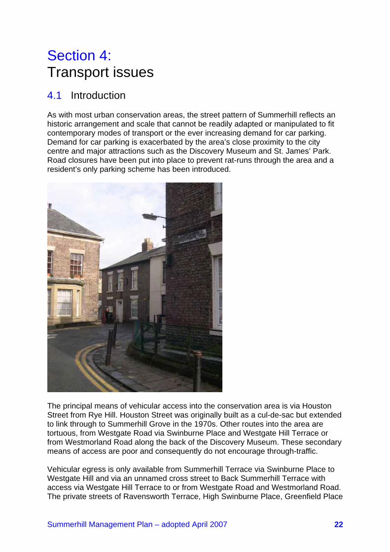
Section 4: Transport issues 4.1 Introduction As with most urban conservation areas, the street pattern of Summerhill reflects an historic arrangement and scale that cannot be readily adapted or manipulated to fit contemporary modes of transport or the ever increasing demand for car parking. Demand for car parking is exacerbated by the area’s close proximity to the city centre and major attractions such as the Discovery Museum and St. James’ Park. Road closures have been put into place to prevent rat-runs through the area and a resident’s only parking scheme has been introduced.
The principal means of vehicular access into the conservation area is via Houston Street from Rye Hill. Houston Street was originally built as a cul-de-sac but extended to link through to Summerhill Grove in the 1970s. Other routes into the area are tortuous, from Westgate Road via Swinburne Place and Westgate Hill Terrace or from Westmorland Road along the back of the Discovery Museum. These secondary means of access are poor and consequently do not encourage through-traffic. Vehicular egress is only available from Summerhill Terrace via Swinburne Place to Westgate Hill and via an unnamed cross street to Back Summerhill Terrace with access via Westgate Hill Terrace to or from Westgate Road and Westmorland Road. The private streets of Ravensworth Terrace, High Swinburne Place, Greenfield Place

Summerhill Management Plan – adopted April 2007 23
and Swinburne Place are accessed separately from Westgate Hill. Pedestrian access is unrestricted. The principal transport issues are:
• Westgate Road, a principal city centre east-west through route, which although currently outside the conservation area, links into the area through a number of side lanes.
• Elswick Road, a secondary traffic distributor that links into Westgate Road at
the Big Lamp junction.
• Culs-de-sacs and road closures.
• Residential parking 4.2 Westgate Road
View down Westgate Road Lanes leading off Westgate Road were the only means of accessing the early phase of Summerhill (Thomas Oliver’s Maps of 1831 and 1844). The lanes still provide the only way in to properties on Ravensworth Terrace, High Swinburne Place, Greenfield Place and Swinburne Place and the most direct means of entering Westgate Hill Terrace. The condition of the lanes is generally poor with the surfaces including uneven and potholed tarmac, concrete and damaged kerbs. Westgate Hill Terrace has been upgraded with stone kerbs and whin setts on the east side and stone kerbs and flags on part of the western side. This illustrates the impact that modest refurbishment works can make. In terms of traffic movement, the lanes are narrow and egressing onto the busy Westgate Road is difficult due to the volume of traffic

Summerhill Management Plan – adopted April 2007 24
and kerbside parking. The extension of footpaths into the carriageway at these junctions in compliance with the council’s standards for sightlines and junction designs will improve safety and enhance the setting of the conservation area. A scheme along these lines is programmed to be undertaken through Ward Stewardship funding. 4.3 Elswick Road Elswick Road leads off Westgate Road at the Big Lamp junction. A historically significant crossroads, it continues to be dominated by the fine, tightly knit late 19th century commercial and public buildings that line the eastern side of the intersection and the rising ground of the heavily landscaped Westgate Hill Cemetery to the west. Elswick Road is contained along its northern edge by the stone boundary wall of the Cemetery. The southern side continues to be fronted by commercial properties built in the mid-nineteenth century with the building line perforated by junctions with Summerhill Street, Lancaster Street and York Street. Environmental works undertaken as part of a General Improvement Area scheme in the 1970s led to the demolition of properties and the creation of extended areas of paving over closed junctions and lay-bys changing the traditional appearance of the road corridor. The former crisp southern edge has been converted to a looser arrangement with some tree planting to decorate the street. Elswick Road is clearly subordinate to Westgate Road but is heavily trafficked at rush hour. 4.4 Culs-se-sacs and road closures The properties along the northern side of Summerhill Square are accessed by a series of culs-de-sacs that reflects the sequence of development. Road closures have been introduced at the junction of Summerhill Terrace with Blandford Court and Victoria Street with Westmorland Road in order to prevent rat-runs. As mentioned above, the junctions of York Street and Lancaster Street with Elswick Road were closed and paved over to reduce traffic flow through the neighbourhood and create a safe pedestrian-dominant commercial and retail frontage. 4.5 Residential parking Parking in the area is primarily on-street. Some back yards accommodate car parking resulting in the occasional unfortunate demolition of walls to create open areas. Limited off-street parking was created as part of the Summerhill General Improvement Area scheme. A permit holders only parking scheme relating to adopted highways was introduced throughout a large part of Summerhill three years ago. This comprises the availability of one resident’s permit per vehicle registered to a dwelling and one visitor’s permit per dwelling. A business permit scheme operates

Summerhill Management Plan – adopted April 2007 25
for non-residential occupants. The scheme has resulted in the reduction of both signage clutter and the volume of extraneous traffic entering the area. This has enhanced the character of Summerhill. The expansion of the scheme to other parts of the conservation area will build upon this success. The scheme will require periodic monitoring to ensure that it meets the council’s and residents’ aspirations.

Summerhill Management Plan – adopted April 2007 26
Section 5: Planning procedures in Summerhill Conservation Area 5.1 Introduction Stricter planning controls than usual are exerted in the conservation area to ensure that local character is strengthened and not diminished. The council has a duty to make sure that developments and change will preserve or enhance its character and appearance. In addition to the normal methods of control, planning permission, Listed Building Consent and Conservation Area Consent, the council has introduced an Article 4 Direction over part of the conservation area. An Article 4 Direction takes away certain permitted development rights, covering possible changes that could harm the special character of the area. This section looks at the impact of planning controls, the statutory powers enabling the council to take action to instigate repairs when it becomes evident that a listed building is falling into decay and investigates the possibility of extending Article 4 controls. Demolitions, alterations, extensions and other works affecting the character or appearance of properties in the Conservation Area will probably require planning permission, Listed Building Consent or Conservation Area Consent. The council generally requires more detail than usual with applications submitted for listed building consent, full planning permission and conservation area consent for buildings within the conservation area. Written guidelines describing the extent and kind of detailed information required when submitting an application are available from the council. The guidance below outlines current planning requirements and is not a precise statement of the law. It is always advisable to discuss any proposals within Summerhill Conservation Area with Development Management at the earliest opportunity. 5.2 Control of works to unlisted flats, dwelling houses and commercial properties within Summerhill Conservation Area 5.2.1 Flats Residents living in a flat in Summerhill Conservation Area will need planning permission to extend their property. Planning permission will also be needed for alterations to a flat that would materially alter the appearance of the building. For example, the installation of roof lights.

Summerhill Management Plan – adopted April 2007 27
5.2.2 Dwelling Houses In the first instance you should check whether works require permission in the council’s Living in a Conservation Area guide, which is available at www.newcastle.gov.uk/hes or on request from Development Management. For full, up-to-date guidance on what requires permission you should check the Government’s Planning Portal, as the legislation may have changed. 5.2.3 Unlisted Commercial Properties Commercial properties are governed by normal planning controls and most external alterations which materially affect the external appearance of the building, such as the replacement of timber sash windows with uPVC or the installation of a satellite dish, will require planning permission. 5.2.4 Demolition Conservation Area Consent is required to totally or substantially demolish most buildings within the conservation area. Conservation Area consent is also required to totally or substantially demolish a gate, fence, wall or railing over 1 m high where it is next to a highway (including a public footpath or bridleway) or public open space, or over 2 m high anywhere else. For more information contact Development Management. 5.3 Listed Buildings 5.3.1 Owners’ responsibilities Buildings are listed to protect them from demolition or unsympathetic alterations. The protection given by this legislation applies to the whole of all listed buildings, including their exteriors and interiors and to any objects or structures fixed to them or forming part of their curtilage area, (unless it is a freestanding building, object or structure that was constructed after 01 July 1948). The main effect of listing is that before any work affecting the character of a listed building can be carried out it is necessary to apply to the council for Listed Building Consent. This consent is required in addition to any other planning or building regulation approvals which may also be needed. Listed buildings cannot be demolished completely or in part, extended or altered in any way that would change its appearance and character, without the written agreement of the council in the form of a Listed Building Consent. It is a criminal offence to carry out work to a listed building without first obtaining consent, other than minor like-for-like repairs, and could lead to imprisonment and/or
Summerhill Management Plan – adopted April 2007 28
a very heavy fine. The council could also serve a listed building enforcement notice requiring the building to be restored to its former state. Contact should be made with Development Management for advice on whether listed building consent is required or likely to be obtained for any proposed work. For considered advice, it is helpful to provide architectural drawings. 5.3.2 Works and alterations to listed buildings requiring consent. Listed building consent is required for any alteration that affects the character and appearance of a listed building. For example, consent would normally be needed for any of the following alterations. External:
• Adding an extension.
• Changing the roof pitch or roof covering materials.
• Inserting roof lights.
• Removing, altering or adding dormer windows.
• Altering or removing chimney stacks or pots.
• Rebuilding walls in different materials.
• Covering the existing walls surface in any way, such as render, cladding, paint etc.
• Changing the size of a door, window or other opening.
• Forming new openings, for any reason, including full balanced flues or
ventilators.
• Altering and replacing window frames and doors.
• Removing any features, such as door cases and balustrade etc.
• Changing the material and shape of rainwater goods.
• Adding any new features such as porches and signs etc.
• Adding satellite antennae and dishes.
• Adding security alarm boxes or closed circuit TV cameras.
• Adding external floodlights.
Summerhill Management Plan – adopted April 2007 29
Internal:
• Altering the plan by removing or adding walls or forming new openings.
• Taking out or altering staircases, fireplaces, decorative plasterwork, panelling, shutters, doors, architraves, skirting etc.
• Installing new ceilings, partitions, secondary glazing etc.
• Filling in cellars.
• Removing or replacing floors of floor finishes.
• The obliteration of wall painting, decorative tiles, mosaics etc.
This list is not exhaustive and advice should always be sought from the Planning and Transportation Division before carrying out any works to a listed building. 5.3.3 Repairs to listed buildings requiring consent Repairs involving replacement with identical features do not require listed building consent if they are for a small area or the work is carried out in situ. Great care must be taken to match the material, construction, moulding and colour of the original feature. When undertaking alterations or repairs to historic buildings it is advisable to seek the advice of an architect or surveyor who is particularly knowledgeable about restoration techniques and the legislation relating to listed buildings. Before carrying out repairs, clarification should be sought from Development Management that the work does not need listed building consent. 5.4 Works to Trees It is the character and appearance of a conservation area as a whole that the council is required to preserve and enhance, not just that of the buildings within it. A major element in the character and appearance of Summerhill Conservation Area are the trees, gardens and open spaces within it. Therefore, ill-considered works to trees may not only lead to the loss of the trees themselves but also ruin the appearance of the area surrounding them and spoil the setting of any buildings nearby. All trees with a trunk diameter of 75mm, measured at 1.5m above ground level within the conservation area are protected. Any works to them including pruning and felling will require a written notification to the council six weeks before the works start. There are exemptions:
• Trees that are dead, dying or that have become dangerous.

Summerhill Management Plan – adopted April 2007 30
• Pruning of fruit trees in accordance with good horticultural practice events or control a legal nuisance.
If in doubt, clarification should be sought from Development Management that prior notification is not required. 5.5 Advertisements Additional planning procedures apply to the display of advertisements within the conservation area. In particular prohibiting the use of advertising hoardings around building sites, and the use of captive balloons for advertising. Residents should contact Development Management for more information. 5.6 Urgent Works and Repair Notices Keeping historic buildings repaired and, where possible, in use, is the key to their preservation. The council can take action to make sure that listed buildings are kept in a good state of repair to ensure their preservation when it becomes evident that a building has fallen into decay. Urgent Works Notices to secure emergency or immediate repairs to stop deterioration can be served on the unoccupied parts of both listed and unlisted buildings in the conservation area. An Urgent Works Notice is a statement of the council’s intent to carry out works itself if the owner does not and to reclaim the cost from the owner. It is hoped that such notices are sufficient to encourage owners to repair the buildings or to put them onto the market. Repairs Notices, requiring works reasonably necessary for the proper preservation of a building, can be served on listed buildings. The service of a Repairs Notice can be the first step towards compulsory purchase, but the service of most notices persuade owners to sell the building concerned rather than allowing the procedure to run its course. Much more work can be specified in a repairs notice than in an Urgent Works Notice. 5.7 Article 4 Direction In April 1988 the council introduced an Article 4(1) Direction across part of the conservation area under the provisions of The Town and Country Planning Order 1977. The Direction covers areas of otherwise permitted development to ensure that possible changes could be controlled in a way that made certain they would not damage the character of the conservation area. The Direction removes the following permitted development rights:

Summerhill Management Plan – adopted April 2007 31
Class I.1
• Roof alterations including replacement of roof coverings, for example slate with concrete tiles
• Changes to and the insertion of dormer windows.
• Fixing cladding to the fronts of buildings.
Class I.2A
• The installation, alteration or replacement of a satellite antenna. Class I.4
• The conversion of front gardens into vehicular hard standings. Class II
• This covers sundry minor operations such as the construction or alteration of any means of enclosure, creating an access onto a highway and painting the exterior of any building
The Direction covers both listed and unlisted buildings as follows:
• The Coach House, Summerhill Grove
• Numbers 1-8 (inclusive), Summerhill Grove
• St Anne's Convent, Summerhill Grove
• Numbers 1-10 (inclusive), Winchester Terrace
• Numbers 209, 269, 271, 273/275, Westgate Road
• Numbers 5, 7/8, 9, 10, 11, 12 Ravensworth Terrace
• Numbers 1 -4 (inclusive) High Swinburne Place
• Numbers 1 -6 (inclusive), Greenfield Place
• Numbers 4a and 4-9 (inclusive), Swinburne Place
• Numbers 1 -12 (inclusive), Summerhill Terrace
• Harry Wood Ltd., 195 Westgate Road. Of the above, only 7 and 8 Ravensworth Terrace, 1-6 Summerhill Terrace and 195, 209, 271,273/275 Westgate Road are unlisted.

Summerhill Management Plan – adopted April 2007 32
There is the opportunity to reassess the current Article 4(1) Direction with a view to extending its boundaries and/or its provisions. Alternatively, the Council could consider making an Article 4(2) Direction to address issues that it now recognises as being relevant to managing change that it is unable to through the normal planning process. Unlike an Article 4(1) Direction, an Article 4(2) Direction can be issued by the Council without referral to the Secretary of State for the Environment. Because Article 4 Directions are seen to be adding extra controls, they do not attract fees. Changes to the Article 4 Direction are considered in Section 9. Note: in light of recent changes to the Town and Country Planning (General Development) Order 1995 (as amended), which has altered the types of development that are now classed as “permitted”, it may be doubly worthwhile reviewing the existing Direction. 5.8 Enforcement Failure to comply with any of the planning procedures above could lead to a prosecution by the council. It is therefore advisable to consult Development Management before proceeding with any works which might affect the character and appearance of the conservation area.

Summerhill Management Plan – adopted April 2007 33
Section 6: Heritage at risk 6.1 Introduction There are currently two buildings at risk in the conservation area – the Barber Surgeon’s Hall, Houston Street (grade II) and 2/3 Swinburne Place (unlisted). Although not included on English Heritage’s National Register of Buildings at Risk, they are included on the Council’s Buildings at Risk Register, in poor condition and are declining to a point where the cost and practicality of restoration and repair will become increasingly difficult to achieve. They will require monitoring to make sure that they do not become unsound and under threat and the owners should be encouraged to undertake whatever works are necessary to ensure their future. Planning permission has been granted for the refurbishment of 2/3 Swinburne Place (2004/2799/01/DET), and a scheme is currently being implemented. Other buildings that might be vulnerable to risk will be monitored to ensure that any necessary appropriate action can be taken to prevent their loss. 6.2 The Barber Surgeon’s Hall, Houston Street The Hall was built by John Dobson in 1851 to replace an earlier hall on Manors that was demolished to make way for the Edinburgh railway. The building is Grade II listed and is one of the most interesting buildings in the conservation area. It is a modestly sized Classical building that was designed to obey the laws of artistic order and symmetry, creating a palatial appearance with rusticated quoins, moulded panels and heavy cornice guttering. It was extended in the late 19th century and inscribed ‘St Paul’s Church School’ under the three central windows to proclaim its new role. Interestingly, its medical origins can be traced through the inscription ‘De Prescintia Dei’ and the carvings of the snake entwined around the staff over the three central windows. The building is no longer part of the school and is now in private ownership and used for storage. Although the stonework is sound, the building is becoming dilapidated and concerns will inevitably arise over its future. Part of its original site has been lost with the construction of the link from Houston Street to Summerhill Road. A stone wall was constructed along the new boundary, linking to an orange brick wall that substantially obscures views of the building. The survival of the Hall is of great importance to the social history of the city, the preservation of its stock of historic buildings and the contribution that it makes to the character of the conservation area. Its restoration and economic revival must be undertaken with care and consideration given its condition and its immediate setting. It is currently crowded by the uncomfortably close presence of the modern primary school and the brick wall.

Summerhill Management Plan – adopted April 2007 34
6.3 2/3 Swinburne Place This building is sandwiched between 2 and 4 Swinburne Place. It dates from the latter decades of the eighteenth century when it was built as a semi-detached house. Although extremely dilapidated and with changes, it retains some historic features, including six over six sash windows, and the alterations appear retrievable. It represents a surviving example of the pre-Summerhill Square ribbon development on Westgate Road. Its condition is parlous but its careful restoration, including the possible removal of paint over the brickwork, will preserve an important building. Its loss will damage the quality and historic depth of the built fabric of the area. Note: this building has been restored and is no longer considered to be at risk.

Summerhill Management Plan – adopted April 2007 35
Section 7: Public realm 7.1 Introduction The public realm is the space that interweaves throughout the area, linking spaces and buildings and providing the routes that give pedestrians and vehicles access to houses, amenities and services. Well designed and properly maintained, it can bind the area together and reinforce the sense of place and the special character of Summerhill. Conversely, if poorly conceived and cared for it can fragment and diminish the overall quality of the environment and lend an air of neglect that is unwelcoming and undermines efforts to encourage property owners to repair and maintain buildings in a sensitive manner. Public realm includes paths; roads; verges; public car parking areas; street furniture; and signage and interpretation. For the purpose of this section, it does not include the park. 7.2 Roads, footpaths and verges Aberdeen granite, Caithness stone, Whinstone setts, chips and kerbs are used throughout Summerhill with substantial areas of the original surfaces surviving to make a significant contribution to the character of the area. Latterly, Yorkstone has been used during the implementation of improvement schemes. The effects of time can be seen with undulations and wear showing the outcome of many decades of use. A particularly fine example is a rutted radius kerb at the back 12 Summerhill Terrace. The preservation of details such as this provides visual clues to the age of the area and reinforces its character.
Well preserved early street surface Some roads have been covered with tarmac obscuring the original surface. It is unlikely that the surfacing involved reconstruction, indeed partial delamination has exposed setts indicating that original dressings survive beneath the tarmac and could be retrieved in the future. It is important to ensure that surviving 19th century surfaces are retained and maintained properly. Furthermore, it is vital that any repairs and reinstatements are undertaken in a way that replicates the appearance of the historic surface. This includes the introduction of new road furniture such as
Summerhill Management Plan – adopted April 2007 36
utility covers where rebated tops permit the introduction of appropriate materials. New paths, roads and hard standings should utilise natural materials that are commensurate in quality and appearance to Summerhill’s historic palette. This will ensure that the treatment of roads and footpaths is given the same degree of attention and care as the repair and restoration of the buildings. Verges tend to be forgotten. They are sometimes uncomfortable strips of land that are difficult to maintain using machinery. Planting with appropriate ground cover will reduce the maintenance to occasional weeding and pruning. Alternatively, verges can be hard surfaced using stone chips. 7.3 Public car parking and hard standings Most public parking in the area is on-street. The environmental works undertaken in the 60s and 70s introduced off-street parking bays set into areas of concrete-flagged paving. The bays are formed in concrete block paviours. Some bays have been introduced into carriageways, such as along the east side of Winchester Terrace. At the time, it was probably thought that the new materials introduced variety and colour into the street scene. This approach is typical of its period. The off-street bays and the surrounding flagging look jaded and untidy. Some of the trees that were planted in the paved areas have been vandalised and not replaced and the tree pits allowed to become weed strewn. Regardless of the long term future of the bays and their associated spaces, minor repairs and tidy-up works will improve their appearance and reinforce the council’s commitment to enhancing the appearance of the conservation area. The on-street block paviour bays in Winchester Terrace conflict with the original appearance of the road and diminish the setting of the listed buildings. It is possible that the original surface was removed to permit the construction of the bays, but it should be a long term objective to replace the block paving with an appropriate material when the opportunity arises. 7.4 Street furniture Street furniture comprises street lighting, bollards, waste bins, telephone kiosks and post boxes. 7.4.1 Street lighting Street lighting is mixed in terms of style and height ranging from replica Victoriana style in Winchester Terrace, wall mounted in Swinburne Place and on the Coach House, swan neck in the back lane between York Street and Drybeck Court, side bracketed in Summerhill Terrace to post top. Five metre high post top units are most frequently used, although higher columns have recently been introduced. They tend to be painted black, although some are undecorated and retain a galvanised finish. The disparate range of street lights creates a fragmented appearance. The council entered into a PFI arrangement to provide and maintain its street lighting in 2004. The 25-year contract includes the gradual replacement of lights other that those that are ‘deemed to comply’, in other words that have been installed within the

Summerhill Management Plan – adopted April 2007 37
last ten years. The contractor is obliged to provide ‘white’ light whenever renewals are undertaken in conservation areas rather than standard low pressure sodium orange light. This will create a more traditional night-time atmosphere and appearance. It is anticipated that all of the lighting columns throughout the conservation area, other than along Summerhill Terrace that are ‘deemed to comply’, will be replaced by mid-2009 as part of the council’s rolling programme of area renewals. The replacement columns will be six metres high and the lanterns will resemble the units along Summerhill Terrace. The renewal programme will result in continuity of style and the introduction of ‘white’ light. Summerhill’s Conservation Area status means that Development Management will be consulted before the renewals start, giving the Council the opportunity to decide whether it wishes to commit additional resources to change the type of street lighting unit. 7.4.2 Bollards Bollards have been introduced in the area to protect pedestrians and footpaths and to block-off vehicular access. They vary in appearance and material content with concrete bollards throughout the former GIA, steel tubes at the northern end of Westgate Hill Terrace and more ornamental units throughout the rest of the area. The ornamental bollards are simply designed and painted black, although many are in a state of decorative disorder. Bollards throughout the conservation area should be of a consistently high standard, to a single design and well maintained. The existing ornamental units fulfil that role. 7.4.3 Waste bins Waste bins have been introduced into the area to help keep Summerhill tidy and are of a standard design used throughout the city. It is unfortunate that they are manufactured in GRP as they have a relatively dull finish compared to lighting columns, bollards and fences that are painted gloss black. The positioning of any new waste bins should be flexible and should respond to a balance between user requirements, the setting of listed buildings and historic spaces. Generally, they should be placed against walls, structures and beside landscaping where they will become visually connected subsidiary elements reducing the adverse visual impact of free-standing clutter. 7.4.4 Telephone kiosks and post boxes A traditional red pillar box is located at the southern end of Victoria Street and a modern telephone kiosk is positioned at the northern end of York Street. Both provide a valuable service and should be retained, the post box adding a splash of colour and a familiar icon into the street scene.

Summerhill Management Plan – adopted April 2007 38
7.5 Signage Signage includes traffic signs, street signs and information boards. Traffic signs have proliferated following the re-organisation of traffic circulation and the subsequent control vehicular access through parts of the area. It is important that the minimum number and size of signs should be used consistent with road safety and traffic management needs. Support poles should be avoided wherever wall mounting can be achieved and full advantage should be taken of permitted flexibility in the size, siting and colour of traffic signs. This extends to line marking where a lighter touch can be used in conservation areas. Support columns should be painted black to conform to the approach being taken with all other street furniture in Summerhill. Signs should be well maintained and kept clean and redundant signage removed immediately to avoid confusion and clutter and give clear information regarding access into the conservation area from Westgate Road. Street signs should be fixed to walls. Some street signs add to the quality of the area, such as the inscription carved on the first floor cill course on number 1 York Street and the original plate sign on 14 Victoria Street, and should be preserved. Information boards have been erected in the park. They are fixed onto timber posts that are painted white. They are in a poor condition, unsightly, and with crudely applied additions. They detract from the extensive improvement works undertaken in the park, including the installation of attractive metal railings around the perimeter of the open space. Their replacement by signs that are designed to fit the family approach taken to street furniture with additional information about the historic importance of the area and the town gardens that formerly occupied the site will enhance the appearance, character and understanding of the area and reinforce the distinctive identity of Summerhill. Intellectual access and educational understanding of the history and importance of the area can be facilitated by the careful introduction of well designed information panels in consultation with local residents.

Summerhill Management Plan – adopted April 2007 39
Section 8: Future management 8.1 SWOT Analysis 8.1.1 Strengths
• Topography of the area that adds drama through stepped rooflines.
• Fine medium and distant views towards the conservation area of rooflines and the tower of St Matthew’s Church.
• Views from parts of the conservation area over the south scarp of the Tyne
Valley and of St Mary’s Cathedral spire.
• Sense of discovery and surprise for people who do not know the area.
• Interesting 19th century layout and land use pattern that includes a square, cranked streets, a variety of house types, fine individual buildings, attractive commercial buildings at the Big Lamp junction and the Cemetery.
• Good quality family homes.
• Surviving group of substantial late Georgian and Victorian terraces and semi-
detached houses grouped around the square displaying a degree of built uniformity but with interesting differences in terms of style and details:
Ravensworth Terrace High Swinburne Place Swinburne Place Greenfield Place Summerhill Terrace Winchester Terrace Summerhill Grove
• Preservation of fine internal and external details and original features
including windows, doors and ironmongery.
• Westgate Hill Terrace that twists behind Summerhill Terrace adding interest and variety.
• Survival of parts of the early ribbon development along Westgate Road.
• Substantially intact arrangement of early working class terraces of housing
and their surviving carriageways to the west of the Square:
Summerhill Management Plan – adopted April 2007 40
Summerhill Street York Street Lancaster Street
• Preservation of St Matthew’s Church, the Barber Surgeon’s Hall and St
Anne’s Convent.
• Survival of substantial lengths of original road and path surfaces.
• Open, landscaped, green spaces.
• Open space in the Square that provides landscaped green space together with formal and informal recreational facilities.
• An air of tranquillity.
• Sense of community and belonging.
• Mature gardens and mature trees.
8.1.2 Weaknesses
• Loss of part of the original building fabric including widespread disappearance of garden railings and gates.
• Occasional loss of original architectural details and the intermittent
introduction of inadequate modern replacements. Widespread introduction of uPVC windows and modern doors.
• Painting of stonework.
• Poor quality extensions.
• Partial demolition of terraces to create car parking areas damaging the
historic layout pattern and introducing voids.
• Removal of back yard walls to create car parks and the widespread reconstruction of rear boundary walls to a variety of designs and in different materials damaging their original uniformity.
• Design consequences of change of use to offices – both internal and external
space.
• Erosion of gardens to provide car parking bays.
• Introduction of inappropriate fencing around garden areas and open space.
• Overlaying of original surfaces with tarmac and poor quality reinstatements.

Summerhill Management Plan – adopted April 2007 41
• Proliferation of poorly maintained traffic signs and poor quality of the signage
in the park.
• Buildings at risk: Barber Surgeon’s Hall
• Haphazard approach to the landscaping of the park.
• Future of the Bowling Club.
• Views to the north dominated by Newcastle and Scottish Brewery. Note: these buildings have since been demolished.
• Management and decline of Westgate Cemetery.
• Lack of design guidance relating to the proper restoration and care of historic
buildings. 8.1.3 Opportunities
• Retrieval of lost architectural details and encouragement of the appropriate maintenance and repair of historic fabric.
• Prevention of further loss of historic features and details through an extension
of the Article 4 Direction remit.
• Repair and reuse of buildings at risk.
• Reinstatement of lost walls, fences and gates.
• Introduction of a coordinated range of street furniture commensurate to the quality of the conservation area.
• Rationalisation and maintenance of traffic signage.
• Improvement of the appearance of the entrances into the conservation area,
particularly off Westgate Road.
• Gradual upgrading of back lane walls and rear extensions through the development process to re-introduce uniformity and high quality materials.
• Replacement of missing or poor modern chimney stacks and chimney pots,
an integral part of the 19th century rooflines.
• Removal of inappropriate extensions to historic buildings and recreate their original settings.

Summerhill Management Plan – adopted April 2007 42
• Introduction of a scale and design of development on neighbouring parts of the Science Central, Blandford Square and George Street triangle sites that improves the setting of the conservation area.
• Promotion of the conservation of the Cemetery to preserve its monuments
and built fabric, regain lost landscape features and create a managed wildlife resource for the community.
• Reappraisal the boundary of the conservation area to ensure the preservation
of the 19th century historic envelope of Summerhill. 8.1.4 Threats
• Further loss of architectural details and inappropriate use of modern replacements and materials.
• Inappropriate ‘makeovers’ and poor maintenance putting historic fabric at risk.
• Development of adjacent sites in a manner that compromises the setting of
the conservation area.
• Development of an access into the Science Central site that adversely affects the appearance and configuration of the Big Lamp junction.
• Erosion of gardens to provide car parking.
• Changes of use and developments that exceed the area’s car parking
capacity leading to greater demands for off-street parking.
• Erosion of gardens to provide protected/ private car parking.
• Loss of historic surfaces through poor maintenance and insensitive patch repairs.
• Further degradation of the Cemetery.

Summerhill Management Plan – adopted April 2007 43
8.2 Key Points 8.2.1 Summerhill Square North Side Terraces – Ravensworth Terrace, High Swinburne Place, Greenfield Place and Swinburne Place
Greenfield Place
• Encourage the appropriate maintenance and repair of the interiors and
exteriors of the listed buildings. Replace missing architectural features and details.
• Retain and enhance the external appearance of the historic elevations and
seek to achieve the removal of inappropriate modern extensions and reinstate lost original architectural features and details.
• Encourage the return the back gardens to their historic shape and the
reinstatement of lost gardens.
• Encourage the removal of modern fences and the reinstatement of lost railings and gates styled upon the surviving length to the front of 5 - 7 High Swinburne Place.
• Encourage the conversion of vehicular hard standings back into gardens.
• Encourage the sensitive maintenance and repair of historic surfaces and
avoid the introduction of modern materials. Reveal and repair the historic surfaces of the links between Westgate Road and the north side terraces together with the Square.
Summerhill Management Plan – adopted April 2007 44
• Encourage the painting of timberwork in colours that are appropriate to the
date of the construction of properties. This includes the painting of window frames a colour appropriate to the date of the construction of the property rather than post-war polar white.
• Monitor the ‘residents only’ parking arrangements.
• Undertake a photographic record to provide a reference point to monitor
incremental erosion of the historic fabric and changes to the appearance of buildings and curtilage space and create a photographic archive of architectural features and fixings.
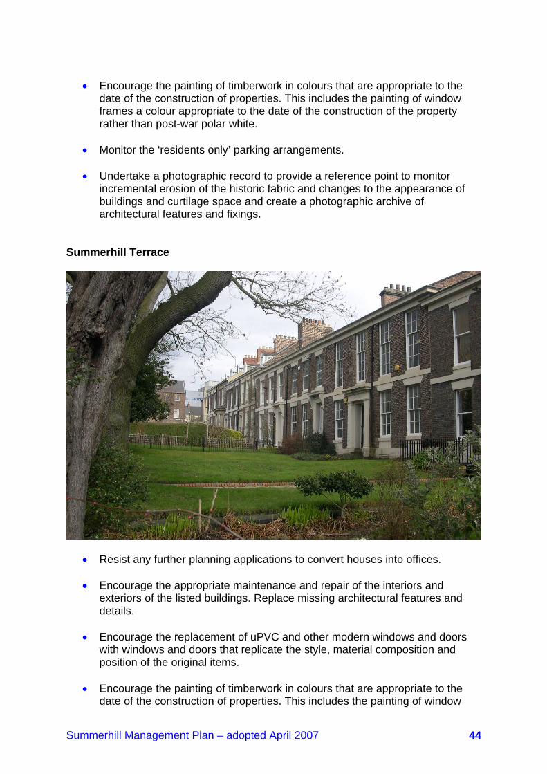
Summerhill Terrace
• Resist any further planning applications to convert houses into offices. • Encourage the appropriate maintenance and repair of the interiors and
exteriors of the listed buildings. Replace missing architectural features and details.
• Encourage the replacement of uPVC and other modern windows and doors
with windows and doors that replicate the style, material composition and position of the original items.
• Encourage the painting of timberwork in colours that are appropriate to the
date of the construction of properties. This includes the painting of window

Summerhill Management Plan – adopted April 2007 45
frames a colour appropriate to the date of the construction of the property rather than post-war polar white.
• Encourage the removal of paint from stonework.
• Encourage the replacement of inappropriate and incongruous lightweight
modern garden fencing with robust metal railings styled upon mid-19th century designs.
• Reintroduce railings between gardens and at the ends of the terrace and
encourage property owners, particularly where converted to offices, to lay-out and plant the front gardens to reflect a 19th century domestic arrangement.
• Encourage the replacement of post-war backyard walls to re-introduce their
historic uniform appearance and to seal openings that have been created to form off-street car parking.
• Investigate the formation of a footpath link from Westmorland Road to
Summerhill Terrace.
• Undertake a photographic record to provide a reference point to monitor incremental erosion of the historic fabric and changes to the appearance of buildings and curtilage space and create a photographic archive of architectural features and fixings.
Summerhill Grove
St. Anne’s Convent, Summerhill Grove
• Encourage the appropriate maintenance and repair of the interiors and
exteriors of the listed buildings. Replace missing architectural features and details.

Summerhill Management Plan – adopted April 2007 46
• Encourage the replacement of uPVC and other modern windows and doors with windows and doors that replicate the style, material composition and position of the original items.
• Encourage the painting of timberwork in colours that are appropriate to the
date of the construction of properties. This includes the painting of window frames a colour appropriate to the date of the construction of the property rather than post-war polar white.
• Encourage the removal of paint from stonework.
• Reduce the volume of built clutter that now links the houses and simplify its
appearance so that it assumes a subordinate visual role.
• Re-bed surviving and replace any missing coping stones that surmount the dwarf wall along the northern side of the carriageway opposite St Anne’s Court. Cultivate and maintain the landscape strip behind the dwarf wall.
• Resist any planning applications to convert the houses into offices.
• Undertake a photographic record to provide a reference point to monitor
incremental erosion of the historic fabric and changes to the appearance of buildings and curtilage space and create a photographic archive of architectural features and fixings.
Winchester Terrace
• Encourage the appropriate maintenance and repair of the interiors and exteriors of the listed buildings. Replace missing architectural features and details.

Summerhill Management Plan – adopted April 2007 47
• Protect surviving examples of 19th century coloured glass.
• Encourage the replacement of later windows and doors with windows and doors that replicate the style, material composition and position of the original items.
• Encourage the painting of timberwork in colours that are appropriate to the
date of the construction of properties. This includes the painting of window frames a colour appropriate to the date of the construction of the property rather than post-war polar white.
• Encourage the removal of paint from stonework.
• Encourage the replacement of missing iron railings and gates to the front of
and between the properties styled upon mid to late-19th century designs.
• Where the opportunity arises and resources permit, remove the tarmacadam road dressing and the raised concrete block paviour parking area to expose the original stone surface.
• Encourage the Bowling Club to rake the profile of the new brick wall along the
eastern edge of Winchester Terrace to match the surviving lengths of 19th century wall.
• Encourage the replacement of post-war backyard walls to re-introduce their
historic uniform appearance.
• Undertake a photographic record to provide a reference point to monitor incremental erosion of the historic fabric and changes to the appearance of buildings and curtilage space and create a photographic archive of architectural features and fixings.
The Park and Bowling Club
Bowling Club, with views over the city
Summerhill Management Plan – adopted April 2007 48
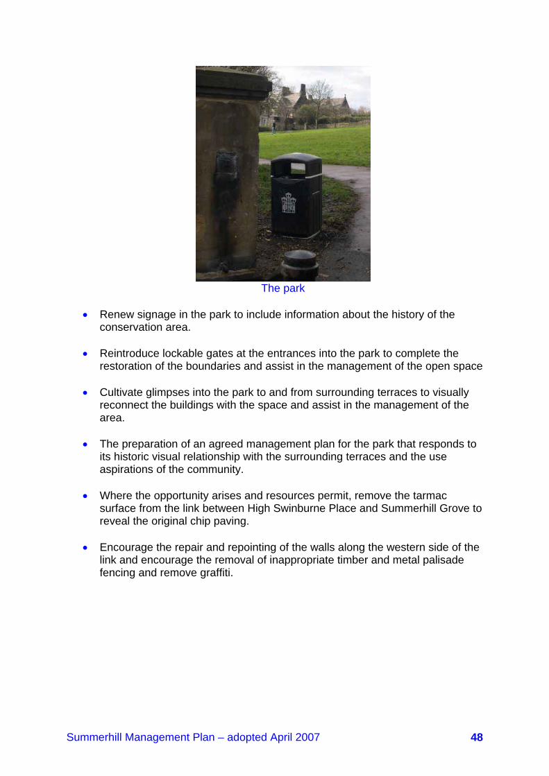
The park
• Renew signage in the park to include information about the history of the
conservation area.
• Reintroduce lockable gates at the entrances into the park to complete the restoration of the boundaries and assist in the management of the open space
• Cultivate glimpses into the park to and from surrounding terraces to visually
reconnect the buildings with the space and assist in the management of the area.
• The preparation of an agreed management plan for the park that responds to
its historic visual relationship with the surrounding terraces and the use aspirations of the community.
• Where the opportunity arises and resources permit, remove the tarmac
surface from the link between High Swinburne Place and Summerhill Grove to reveal the original chip paving.
• Encourage the repair and repointing of the walls along the western side of the
link and encourage the removal of inappropriate timber and metal palisade fencing and remove graffiti.

Summerhill Management Plan – adopted April 2007 49
8.2.2 Elswick Road to Westmorland Road Elswick Road and top of Summerhill Street
• Resist any changes to surviving 19th century shop fronts and encourage their proper repair and maintenance and promote the upgrading or replacement of poor modern shop fronts.
• Address the cleared sites through short-term enhancement pending
redevelopment.
• Where the opportunity arises and resources permit, resurface the paved areas at the junctions of York Street, Lancaster Street and Summerhill Street in natural materials and replace the concrete bollards.
• Undertake a photographic record to provide a reference point to monitor
incremental erosion of the historic fabric and changes to the appearance of buildings and curtilage space and create a photographic archive of architectural features and fixings.
York Street, Lancaster Street and Summerhill Street
York Street York Street
• Encourage the appropriate maintenance and repair of the interiors and exteriors of the listed buildings and the exteriors of all other properties. Replace missing architectural features and details.
• Encourage the replacement of uPVC and other modern windows and doors
with windows and doors that replicate the style, material composition and position of the original items.
• Encourage the painting of timberwork in colours that are appropriate to the
date of the construction of properties. This includes the painting of window
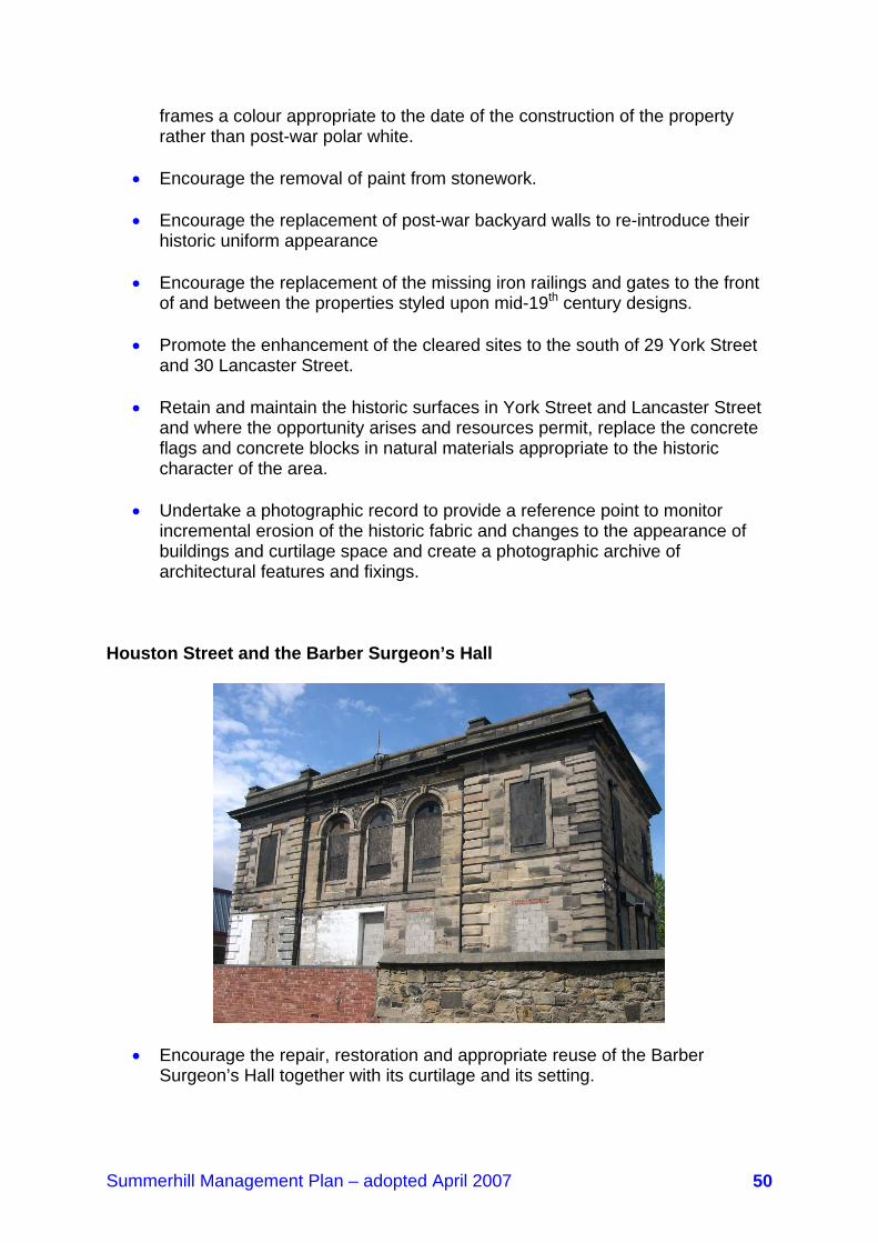
Summerhill Management Plan – adopted April 2007 50
frames a colour appropriate to the date of the construction of the property rather than post-war polar white.
• Encourage the removal of paint from stonework.
• Encourage the replacement of post-war backyard walls to re-introduce their
historic uniform appearance
• Encourage the replacement of the missing iron railings and gates to the front of and between the properties styled upon mid-19th century designs.
• Promote the enhancement of the cleared sites to the south of 29 York Street
and 30 Lancaster Street.
• Retain and maintain the historic surfaces in York Street and Lancaster Street and where the opportunity arises and resources permit, replace the concrete flags and concrete blocks in natural materials appropriate to the historic character of the area.
• Undertake a photographic record to provide a reference point to monitor
incremental erosion of the historic fabric and changes to the appearance of buildings and curtilage space and create a photographic archive of architectural features and fixings.
Houston Street and the Barber Surgeon’s Hall
• Encourage the repair, restoration and appropriate reuse of the Barber Surgeon’s Hall together with its curtilage and its setting.
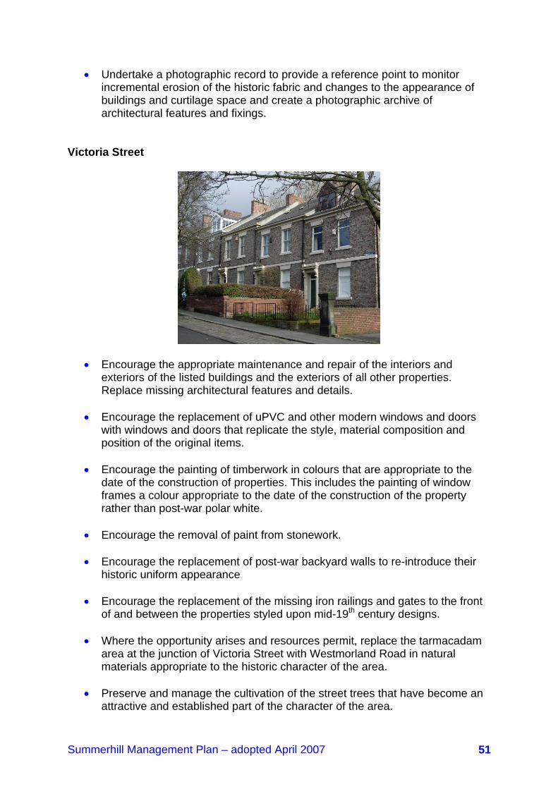
Summerhill Management Plan – adopted April 2007 51
• Undertake a photographic record to provide a reference point to monitor incremental erosion of the historic fabric and changes to the appearance of buildings and curtilage space and create a photographic archive of architectural features and fixings.
Victoria Street
• Encourage the appropriate maintenance and repair of the interiors and exteriors of the listed buildings and the exteriors of all other properties. Replace missing architectural features and details.
• Encourage the replacement of uPVC and other modern windows and doors
with windows and doors that replicate the style, material composition and position of the original items.
• Encourage the painting of timberwork in colours that are appropriate to the
date of the construction of properties. This includes the painting of window frames a colour appropriate to the date of the construction of the property rather than post-war polar white.
• Encourage the removal of paint from stonework.
• Encourage the replacement of post-war backyard walls to re-introduce their
historic uniform appearance
• Encourage the replacement of the missing iron railings and gates to the front of and between the properties styled upon mid-19th century designs.
• Where the opportunity arises and resources permit, replace the tarmacadam
area at the junction of Victoria Street with Westmorland Road in natural materials appropriate to the historic character of the area.
• Preserve and manage the cultivation of the street trees that have become an
attractive and established part of the character of the area.
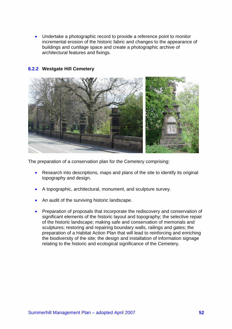
Summerhill Management Plan – adopted April 2007 52
• Undertake a photographic record to provide a reference point to monitor
incremental erosion of the historic fabric and changes to the appearance of buildings and curtilage space and create a photographic archive of architectural features and fixings.
8.2.2 Westgate Hill Cemetery
The preparation of a conservation plan for the Cemetery comprising:
• Research into descriptions, maps and plans of the site to identify its original topography and design.
• A topographic, architectural, monument, and sculpture survey.
• An audit of the surviving historic landscape.
• Preparation of proposals that incorporate the rediscovery and conservation of
significant elements of the historic layout and topography; the selective repair of the historic landscape; making safe and conservation of memorials and sculptures; restoring and repairing boundary walls, railings and gates; the preparation of a Habitat Action Plan that will lead to reinforcing and enriching the biodiversity of the site; the design and installation of information signage relating to the historic and ecological significance of the Cemetery.

Summerhill Management Plan – adopted April 2007 53
Section 9: Future management – protection and enhancement of Summerhill Conservation Area This element of the Management Plan provides guidance on the conservation of the historic fabric of Summerhill Conservation Area and is to be read in conjunction with the planning procedures contained within Section 5 of the Management Plan. 9.1 Alterations and extensions These should not dominate an existing building’s scale or alter the composition of its main elevations. Any alterations, including partial demolition, should respect an existing building and its materials. All new work should complement the old in quality, texture and colour, as well as method of construction. Artificial wall claddings and coatings or artificial roof slates will not be allowed on any elevation. 9.2 Materials Planning permission will include conditions to ensure that traditional materials appropriate to a particular building or site are used. Historically, the predominant building materials and finishes within Summerhill Conservation Area are natural sandstone and brick. 9.3 Roofs The roof is one of the most important parts of the property as it makes the building wind and watertight and brings harmony to the townscape. This particularly relevant in Summerhill, where the roofline can be seen from medium and long distance views. The original roof material, ridge tiles and hip tiles should be retained and repaired or replaced on a like-for-like basis. Within the conservation area, Welsh slate is the predominant roofing material. Imitation slates are poor in quality and appearance compared to natural slate and detract from the character of a building and will not be allowed on any buildings within the conservation area. 9.4 Dormer windows and roof lights The conversion of loft space that leads to the installation of inappropriate dormer windows and roof lights has a negative impact on the appearance of a building and detract from the character of a roofscape. Dormer windows on terraces that did not incorporate such features as part of the original design will normally not be
Summerhill Management Plan – adopted April 2007 54
permitted. Where dormers formed part of the original design, any alterations or repairs must replicate the original pattern, and any new dormers on such terraces must replicate the established historic appearance, scale and material content. Roof lights will generally only be permitted on rear elevations and must be in a ‘conservation style’ in terms of design, materials and size. 9.5 Masonry, brickwork and pointing When repairing a building in the conservation area, the original character of masonry and/or brickwork walls should be maintained by paying particular attention to the size, shape, colour and surface texture of any new materials and to the style, colour, texture and composition of the pointing. 9.6 Windows and doors Windows and doors are important components of a building and any alteration or replacement can significantly alter the character and appearance of a property. Wherever possible, the original windows and doors should be retained and repaired in order to keep the integrity of the original design so preserving the character and proportions of the property. Imitation replacement window styles and inappropriate replacement window materials (such as uPVC) are poor alternatives to traditional single pane, timber, vertical sliding sash windows. Mock sliding sash windows generally have heavy top opening casements for the opening section, while uPVC Windows have thicker, cruder frames than timber windows. These unsuitable styles and materials adversely impact on the proportions and the overall appearance of a window and a building. The character of a house is then changed, which has a detrimental impact on the overall appearance of the conservation area. 9.7 Chimney stacks and other architectural details The shape, height and variety of chimney stacks and other architectural details on buildings in the conservation area contribute greatly to the local character and should be retained and wherever possible missing chimney pots should be replaced. 9.8 Rainwater goods Original rainwater goods such as gutters on brackets, downcomers and hoppers contribute to the character and appearance of buildings in the conservation area. uPVC rainwater goods attached to fascia boards have a negative impact on the appearance of a traditional house. Wherever possible, original rainwater goods should be retained and repaired or replaced on a like-for-like basis.

Summerhill Management Plan – adopted April 2007 55
9.9 Colour and painting It is unlikely that rendering was used as a traditional finish in the conservation area. Where buildings have been rendered, they should be painted in muted stone colours. Stone detailing, which would not have been painted, should remain undecorated. The painting of external timberwork should reflect the palette of colours that were available and fashionable when properties were built. Brilliant or polar white was not used until after the Second World War. 9.10 Aerials, satellite dishes and alarm boxes Aerials, satellite dishes and alarm boxes can have a detrimental impact on the appearance of a building. Where possible they should be situated inside or to the rear of a building. 9.11 Gardens, grounds and trees The original pattern of gardens and grounds and the presence of trees contribute greatly to the character of the conservation area and should be retained and managed. 9.12 Boundary Treatments Original boundary treatments such as walls and railings play an important part in the character and appearance of the Conservation Area and should be retained and maintained or reinstated wherever possible. Where reinstated or replaced, original walls and railings should be replicated in terms of material, proportions and design. 9.13 Advertisements All advertisements within the conservation area should be sympathetic to its historic character. New advertisement displays will be strictly controlled and the removal of inappropriate signs pursued. There will be a presumption against internally illuminated projecting fascia signs and advertising above ground floor level. Advertisement hoardings of any description will not be appropriate. 9.14 New buildings There is little scope for new buildings within the conservation area. Any new buildings in the conservation area should be designed with reference to their surroundings and their impact on the character and appearance of the conservation area. Special attention should be paid to height, bulk, and materials (style and colour) proportions of openings and detailing of roofs, windows and doors.

Summerhill Management Plan – adopted April 2007 56
9.15 Energy conservation It is important to promote and encourage energy conservation. This can be achieved through a variety of measures. However, it is important that any works are undertaken sensitively in order to preserve that character of the area and the architectural merit of historic buildings. 9.16 Undoing damage The council will use opportunities created through planning applications or other proposals within the conservation area to negotiate improvements which remove unsympathetic alterations or additions from existing buildings and which secure the proper repair or restoration of buildings, other structures and the landscape. 9.17 Article 4 Directions As outlined in Section 5, the council introduced an Article 4(1) Direction across part of the conservation area in April 1988. The Direction was designed to cover areas of permitted development where changes could be controlled in a way to ensure that they did not adversely impact upon the character of the conservation area. Generally they covered changes to roofs, including the insertion of dormer windows, cladding the front of buildings, the installation of satellite antennae, the conversion of gardens into hard standings and some minor building operations. The Direction was geographically selective and substantially limited to the area’s portfolio of listed buildings. It is clear that apparently minor alterations to the other properties throughout the Summerhill has eroded the overall character of the conservation area. This is particularly relevant in connection with changes to windows and doors where originals have been taken out and replaced by poorly designed replacements, often in uPVC, and fixed in positions that reduce the traditional modelling of elevations creating a bland, two dimensional appearance. Other changes, including the replacement of Welsh slate roofs with artificial and concrete tiles; the loss of chimney stacks and pots; threats to gardens through the formation of hard standings; rendering brickwork and painting stonework; and the loss of original front and rear boundary walls could further erode the 19th century character of the conservation area. The Town and Country Planning (General Permitted Development) Order 1995 empowers local planning authorities to introduce Article 4(2) Directions without reference to the Secretary of State. It is proposed that the council will consider the introduction of an Article 4(2) Direction to cover the following activities that are normally permitted development:
Summerhill Management Plan – adopted April 2007 57
• Alterations to, installation, or replacement of external doors and their
casements and all windows.
• The provision of a hard surface.
• The erection, construction, improvement or alteration (including demolition) of a fence, gate wall or other means of enclosure.
• The alteration of a roof, including roofing material.
• The erection, alteration or removal of a chimney including works to chimney
pots.
• Rendering any elevation and the painting of stonework. It is suggested that the Article 4(2) Direction is issued to cover the following properties:
• to 28 Victoria Street • The Victoria public house • 148 Westmorland Road • The Barber Surgeon’s Hall • to 33 Summerhill Street • St Matthew’s Church and Church Hall, Summerhill Street • to 24 Summerhill Street • and 12 Summerhill Grove • to 25 Lancaster Street • 2 to 30 Lancaster Street • 4 to 34 York Street • 3 to 29 York Street • to 33 Elswick Road • 1 to 25 Blandford Court • 13 to 17 Summerhill Terrace
Any amendment to the existing Article 4 Direction would be the subject of a further and separate consultation process. 9.18 Conservation area boundary Section 69(2) of the Planning (Listed Buildings & Conservation Areas) Act 1990 places a duty on the council to regularly review the extent of conservation area coverage and to designate new coverage if appropriate. The last time the boundary was reviewed was in 1992 (the second time since designation in 1970) and so a review in the near future would be timely. English Heritage guidance suggests that, in particular, review should take place where there is increasing pressure for change or a recognised threat. A review in the near future would therefore take account of the level of development activity on the periphery of the existing boundary expected

Summerhill Management Plan – adopted April 2007 58
in coming years. Therefore the council intends to review the boundary in 2008 when it will be the subject of a separate consultation exercise. Note: it is now proposed that this exercise should take place in 2011/12. In reviewing boundaries, conservation areas should be seen to justify their status, ensuring the concept is not devalued by designations without special interest. It suggests the use of consistent local standards to ensure this. These are set out in paragraph 4.155 of the UDP. Other guidance for assessing the boundary will include that in PPS 5 and criteria in Conservation Area Management published by the English Historic Towns Forum. A procedure for modifying conservation area boundaries is not set out in the legislation, but guidance suggests the same process as for designation, i.e. a committee decision, an advertisement in a local newspaper and the London Gazette, and other statutory notifications. In practice, a more collaborative approach should be taken in line with modern standards of public involvement, and English Heritage guidance suggests the involvement of the local community in decisions about designation and management of conservation areas 4.19 Design guidance The conservation area contains an outstanding collection of buildings that were substantially built between 140 – 185 years ago. The materials, design styles and methods of construction all contribute to the special character of the area. Their proper maintenance and repair is vital to their wellbeing and that of the wider area. A design guide will help owners and residents understand the way properties were built in the 19th century and the significance of original internal and external treatments and details. Information contained in a design guide would help encourage and inform the process of gradual maintenance that could prevent the eventual need for replacement. The Summerhill Society, whose membership includes a range of conservation-related architectural and building skills and experience, has suggested that it could prepare a design guide that would assist residents and owners maintain their properties in a way that respects the character of buildings and the sensitivity of their historic fabric. Any such guide would be advisory, providing a reference for good design practice and building techniques. The council will discuss the possible preparation and role of a design guide with the Summerhill Society. 4.20 Funding conservation works The repair, maintenance and restoration of the fabric of old buildings can be very expensive. The enhancement of the public realm, including the replacement and upgrading of street furniture, the use of natural materials, revealing hidden surfaces

Summerhill Management Plan – adopted April 2007 59
and the reinstatement of historic landscapes adds a premium to normal maintenance costs. A dedicated fund would help the council undertake conservation-led works within the public realm and act as seed funding to attract grants from outside bodies. It might also enable the council to offer practical support to property owners, encouraging them to properly maintain their buildings and replace lost details and features. The extensive developments that are programmed to take place to the north, east and south of the conservation area could be the subject of Section 106 agreements to lever money into a conservation area fund. The developments will benefit from the preservation and enhancement of the conservation area, providing a neighbourhood that is attractive and of historic significance and that makes a subtle and sensitive contribution to the regeneration of the wider area. The council will consider the viability of this proposal.

Summerhill Management Plan – adopted April 2007 60

Summerhill Management Plan – adopted April 2007 61
Appendix 1:
Policy Context of the Management Plan The Management Plan is a Supplementary Planning Document, meaning it is treated as a material consideration when determining planning applications. A1.1 Newcastle Unitary Development Plan (UDP) Under the Planning and Compulsory Purchase Act 2004 a selected number of the Unitary Development Plan (UDP) policies have been saved until such a time as they are superseded by LDF policies. Therefore the Management Plan supplements the following saved UDP policies: Housing H2 Protection of Residential Amenity H3 Protection of Mature Housing Stock/ Large Traditional Dwellings H4 High Quality Design and Landscaping in New Housing Development Sustainable Development SD2.1 Regular Review of Protection of Natural Assets and Built Heritage SD2.2 Management of Natural Assets and Built Heritage to Conserve and Enhance their Value Built Form and Landscape EN1.1 New Development to Meet High Standards of Design EN2 Appearance of the City EN2.1 Protection of Views into and out of the City EN3 Protection of Areas of Greatest Value and Retention of Trees Open space and recreation OS1.4 Protection of open space Nature Conservation NC1.1 Protection of Sites of Nature Conservation Importance (SNCI) and Sites of
Local Conservation Interest (SLCI) NC1.5 Protection of wildlife corridors

Summerhill Management Plan – adopted April 2007 62
Conservation of historic environment C1 Preservation and protection of built heritage C2 Listed Buildings C4 Archaeology Traffic management T2 Traffic management T2.2 Introduction of traffic calming in residential areas T5.4 Development of cycle routes “Trees Newcastle” A Tree Strategy for Newcastle upon Tyne - provides a policy for the protection, care and management of trees in Newcastle, approved 19 June 2002. The strategy can be viewed at: http://www.newcastle.gov.uk/core.nsf/a/conservetrees - see in particular Part 3: Management Guidelines, which includes a guide to pruning. “Green spaces…your spaces” Newcastle’s Green Space Strategy, approved by Executive November 2004.

Summerhill Management Plan – adopted April 2007 63
A1.2 Planning Policy Statement 5: Planning for the Historic Environment A1.2.1 On 23 March 2010, subsequent to formal consultation on the draft PPS for the Historic Environment (previously known as PPS15), the Government issued PPS5 which replaced Planning Policy Guidance (PPG) 15: Planning and the Historic Environment and PPG 16: Archaeology and Planning with immediate effect. A1.2.2 PPS5 is a much shorter policy statement than the two PPGs, but is accompanied by a considerably more detailed practice guide; produced by English Heritage and endorsed by the Department for Communities and Local Government (DCLG) and the Department for Culture, Media and Sport (DCMS) it is not policy, but it suggests ways of interpreting and implementing the policies in the PPS. A1.2.3 A key feature of the new PPS is that it refers throughout to “heritage assets”. These are defined as both formally designated assets and assets that are considered by the Local Planning Authority (LPA) to be of “historic interest”. Formally designated assets include the familiar selection of Listed Buildings, World Heritage Sites, Scheduled Monuments, Conservation Areas, Marine Wreck Sites, Registered Parks and Gardens and Registered Battlefields. Assets identified by the local authority as being of “historic interest” include locally listed buildings but also extend to other elements of the historic environment that the LPA identifies as of interest – this is most likely to be relevant to sites of archaeological interest, although it may apply equally to previously undervalued or unappreciated buildings or structures. The identification of historic interest must be clearly justified by the LPA and should be raised with applicants and developers at as early an opportunity as possible – preferably at pre-application stage. A major effect of this change in terminology is that the tests for demolition/substantial harm and enabling development are now required to be applied to locally listed buildings and sites as well as to those that are statutorily designated. A1.2.4 In addition, rather than “historic fabric”, the PPS refers frequently to “significance”, which is defined as “the value of a heritage asset to this and future generations because of historic interest. That interest may be archaeological, architectural, artistic or historic”. This is likely to open a variety of interesting debates over what is significant and what is not, and also how one defines what will be of historic interest to future generations. English Heritage’s “Conservation Principles” sets out English Heritage’s position on the issues of identifying and valuing significance and provides a useful starting point for LPAs.

Summerhill Management Plan – adopted April 2007 64
A1.2.5 Summary of PPS5 HE1: Heritage assets and climate change Keeping heritage assets in use is inherently sustainable and minimises the waste of materials and energy. Local Planning Authorities (LPAs) and applicants should mitigate and adapt to climate change through the re-use and/or appropriate modification of heritage assets; negative impacts should be avoided by finding feasible alternatives – harm should be weighed against public benefit. HE2: Evidence base for plan-making LPAs should maintain or have access to a Historic Environment Record (HER) and other public documents about heritage assets, and use this information to make assessments about the local historic environment to inform plan and decision making. LPAs should also use this evidence to identify potential future assets, for example sites of potential archaeological interest. HE3: Regional and local planning approaches Regional Spatial Strategies and Local Development Frameworks should set a positive proactive strategy for the conservation and enjoyment of the historic environment and consider quality, local distinctiveness, investment, enhancement and assets at risk. HE4: Permitted development and Article 4 Directions LPAs should consider using Article 4 Directions to protect the historic environment. HE5: Monitoring indicators LPAs should monitor the impacts of their decisions on the historic environment. HE6: Information requirements for applications for consent affecting heritage assets Applicants for planning consents should submit an assessment/ description of the significance of the asset – and, where archaeological interest is identified, a desk based assessment and potentially also a field evaluation – with the application prior to validation. HE7: Policy principles guiding the determination of applications for consent relating to all heritage assets LPAs should use all available evidence to identify and assess the significance of the affected element of the historic environment to inform decision-making; this includes identifying relevant sections of the community for whom the asset may hold particular significance.

Summerhill Management Plan – adopted April 2007 65
It is desirable to sustain and enhance the significance and positive contribution of heritage assets and for new development to contribute positively to the historic environment. When considering an application for loss of significance, existing loss due to deliberate neglect should not be taken into account as justification for further loss. HE8: Additional policy principles guiding the consideration of applications for heritage consent Where LPAs identify a non-designated heritage asset, they must be able to justify their decision based upon criteria set out in the annex to the PPS. There is a general presumption that such assets should be identified at the pre-application stage, or as soon as practicable, and brought to the attention of the applicant. This is of particular relevance to sites of potential archaeological interest. HE9: Additional policy principles guiding the consideration of applications for consent relating to designated heritage assets There is a presumption in favour of the conservation of designated heritage assets; where substantial harm or loss of significance is proposed the application should be refused unless the public benefits will outweigh the harm or unless the applicant can demonstrate, with evidence, that there is no viable alternative. This approach applies equally to sites of archaeological interest that are not formally designated but are deemed by the LPA to be of historic interest. The PPS acknowledges that not all elements of world heritage sites or conservation areas are of significance and therefore may not be worthy of conservation, and recommends that LPAs should identify those elements. HE10: Additional policy principles guiding the consideration of applications for development affecting the setting of a designated heritage asset Applications that preserve positive elements of the setting of an asset or better reveal the significance of the asset should be treated favourably; LPAs should also identify opportunities to improve the setting of assets through development. HE11: Enabling development The benefits of enabling development should outweigh the disbenefits of departing from the local development plan; LPAs should require justification for enabling development against the criteria in English Heritage’s guidance. HE12: Policy principles guiding the recording of information related to heritage assets Where loss of significance has been justified, records should be taken and made publicly available; the ability to record is not itself justification for loss.

Summerhill Management Plan – adopted April 2007 66
Appendix 2:
Legislative framework of the Management Plan: planning procedures The council has a duty to only allow developments in a conservation area that preserve or enhance its character or appearance. Demolitions, alterations, extensions and other works affecting the character or appearance of properties in a conservation area will probably require Planning Permission and Listed Building Consent or Conservation Area Consent. The council generally requires more detail than usual with applications submitted for Planning Permission, Listed Building Consent and Conservation Area Consent for buildings within a conservation area. Written guidelines as to the extent and kind of detailed information required are available from the council’s Development Management Service. It is always advisable to discuss any proposals within Northumberland Gardens Conservation Area with the conservation team at the earliest opportunity. A2.1 Unlisted buildings: householder development within Summerhill Conservation Area Permitted development rights, i.e. the right to make certain types of minor alterations without needing to apply for planning permission, relating to household development have recently changed. On 01 October 2008 new legislation was introduced by the Government aimed at making development rights more straightforward and easier to understand; further changes were made in April 2010. The full extent of the changes are available to view on the Planning Portal website at: www.planningportal.gov.uk. The council’s ‘Living in a Conservation Area’ guide also provides useful information and is available at www.newcastle.gov.uk/hes. If you require advice on whether you may require planning permission for any work proposed please contact the Development Management Service by telephone on 0191 232 8520, via email at [email protected] or in writing to Newcastle City Council, Development Management Service, Civic Centre, Barras Bridge, Newcastle upon Tyne, NE1 8PH.
Summerhill Management Plan – adopted April 2007 67
A2.2 Demolition Conservation Area Consent is required to totally or substantially demolish most buildings within a conservation area. Residents should contact Development Management for more information. Conservation Area Consent is also required to totally or substantially demolish a gate, fence, wall or railing over 1m high where it is next to a highway (including a public footpath or bridleway) or public open space; or over 2m high elsewhere. Residents should contact Development Management for more information. A2.3 Listed buildings A2.3.1 Owners’ Responsibilities Buildings are listed to protect them from demolition or unsympathetic alterations. The protection afforded by this legislation applies to the whole of a listed building i.e. both exterior and interior, regardless of its grade and to any object or structure fixed to it or forming part of the land comprised within its curtilage unless it is a free-standing building, object or structure that has been erected since 01 July 1948. The main effect of ‘listing’ is that before any work affecting the character of a listed building can be carried out it is necessary to apply to the local planning authority for Listed Building Consent. This is required in addition to any planning or building regulation approvals, which may also be needed. There are circumstances when it is necessary to alter a listed building to suit a new use for example, but it cannot be demolished completely or in part, extended or altered in any way, which would change its character without the written agreement of the council in the form of Listed Building Consent. It is a criminal offence to carry out work to a listed building, other than straightforward repairs, without first obtaining consent and it could lead upon conviction to a period of imprisonment and/ or a very heavy fine. The council may also serve a listed building enforcement notice requiring the building to be restored to its former state. For advice on whether Listed Building Consent is required or likely to be obtained for proposed work, contact should be made with Development Management. For considered advice it is helpful to provide scaled plans. A2.3.2 Works and alterations to listed buildings requiring consent Listed Building Consent is required for any alteration, which affects the character of a listed building. For example, consent would normally be needed for any of the following alterations. External: • Adding an extension or rebuilding walls in different materials.

Summerhill Management Plan – adopted April 2007 68
• Changing the roof pitch or roof covering materials.
• Inserting roof lights, removing, altering or adding dormer windows, adding solar panels or other micro-generation equipment.
• Altering or removing chimney stacks and pots.
• Covering existing wall surfaces e.g. with render, cladding or paint.
• Changing the size of door, window or other openings.
• Altering window frames or doors, replacement with different types, including replacement of single-glazing with double-glazing.
• Removing historic features e.g. door cases, chimney breasts.
• Forming new openings for any reason, including boiler flues. • Changing the material of any rainwater goods. • Adding any feature including porches, signs, satellite dishes, security alarm boxes, CCTV cameras or external floodlights.
• Inserting cavity wall insulation. • Works to boundary walls. • Works to buildings in the grounds that were present in 1948 and at the time of listing.
Internal: • Altering the plan by removing or adding walls or forming new openings. • Taking out or altering original features including staircases, fireplaces, decorative plasterwork, panelling, shutters, doors, architraves and skirting boards.
• Installing new ceilings, partitions, doors and secondary glazing. • Filling in cellars, or digging out cellars to increase usable floor space.
• Removing or replacing floors or floor finishes.
• The obliteration of wall paintings, decorative tiles and mosaics.
• Installing new ducting, waste pipes and openings associated with new bathrooms.

Summerhill Management Plan – adopted April 2007 69
• Inserting damp proof courses or tanking systems.
Some works that require Listed Building Consent may also require Planning Permission or Building Regulations approval. You should check with the council before you apply for consent. A2.3.3 Repairs to listed buildings requiring consent Repairs involving replacement with identical features do not require Listed Building Consent if they are for a small area or the work is carried out in situ. Great care should be taken to match the material, construction, moulding and colour of the original feature. In undertaking works of alteration or repair to historic buildings it is advisable to seek the advice of an architect or surveyor who is particularly knowledgeable about restoration techniques and the legislation relating to listed buildings. Prior to carrying out repairs please seek clarification from Development Management that the work does not need Listed Building Consent. If you would like further information on listed buildings, the council has produced a guide called Listed Buildings, a Guide for Owners and Occupiers, which is available at www.newcastle.gov.uk/hes. A2.4 Works to trees All trees in the conservation area are protected. Most of the trees within the conservation area are protected by Tree Preservation Orders (TPOs). This requires permission to be obtained from the council for any work to these trees, including pruning. Unauthorised work or damage to a TPO tree, including its roots, is a criminal offence and is subject to a fine of up to £20,000 per incident. The council still requires six weeks notice in writing before felling or cutting back any tree in a conservation area, even if it is not specifically protected by a Tree Preservation Order. In giving notice it is necessary to specify precisely what works need to be carried out. Residents should contact the Landscape and Ecology team for more information. A2.5 Advertisements There are currently no commercial premises within the conservation area, which reinforces the estate’s original residential use. Applications for changes of use within the conservation area will be determined on their individual merits, but the council will discourage any applications that would result in a detrimental change to the character or appearance of the area.

Summerhill Management Plan – adopted April 2007 70
A2.6 Enforcement The failure to comply with any of the special planning procedures listed above could lead to prosecution by the council. It is therefore advisable to consult the Council’s Development Management Service before proceeding with any works which might affect the character and appearance of a conservation area (see Section 4.4).