Concurrent session 7 hec rts
26
Real Time Simulation Model (HEC‐RTS) Sam Crampton, P.E., CFM
-
Upload
sikandar-ali -
Category
Documents
-
view
37 -
download
0
Transcript of Concurrent session 7 hec rts
Real Time Simulation Model (HEC‐RTS)
Sam Crampton, P.E., CFM

Real Time Simulation
• Publicly available* software from HEC
• PC version of CorpsWater Management System (CWMS)
• Recently implemented by Dewberry for a major hydro power project
• First private implementation of HEC‐RTS
* Not fully released at this time

Why RTS?
• Has an interface to receive and process real‐time and forecast meteorological data for real time hydrologic and hydraulic simulations
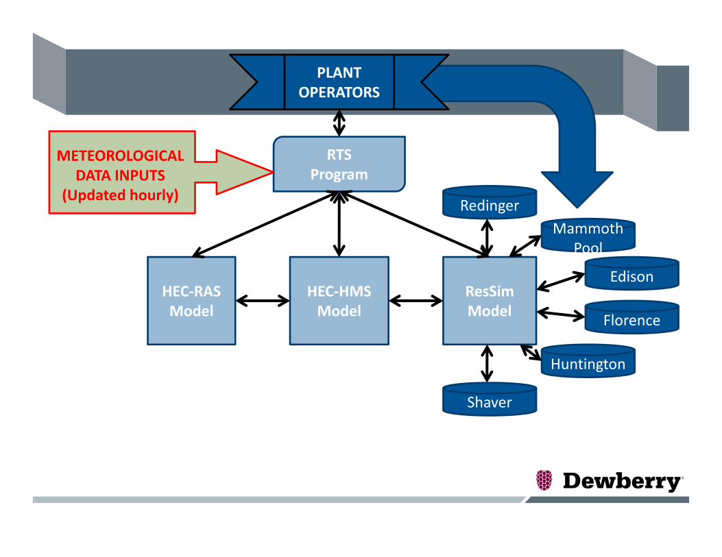
• Provides a system to integrate different models including:– HEC‐HMS, rainfall‐runoff model to develop hydrographs– HEC‐ResSim, reservoir operation model (spillway releases, pumped storage, power generation, operating rules etc)
– HEC‐RAS, hydraulics model to predict river stages– HEC‐FIA, flood impact analysis (not implemented in this project)

Implementing for Large Scale Hydro Power
• Project area:– 1,640 square mile watershed
– 9 power houses– 6 major reservoirs– 54 miles of diversion tunnels
– 160 miles of open channel

HEC‐RTS Setup for Hydro Power project
• HEC‐RTS simulation runs every 6 hours automatically– 2 weeks of “lookback” using observed data– 1 week of “forecast” using weather forecast services
• Uses HEC‐HMS, HEC‐ResSim and HEC‐RAS models– These models can be accessed through HEC‐RTS interface
• HEC‐HMS includes snowmelt modeling• Scripts written that allow inclusion of diversions and outage schedule without having to open the RTS model
• Custom reports are generated and sent to the Managers and Operators as an email attachment for decision support.
HEC‐HMSModel
ResSimModel
HEC‐RASModel
RTSProgram
Edison
Mammoth Pool
Redinger
Florence
Huntington
Shaver
METEOROLOGICAL DATA INPUTS
(Updated hourly)
PLANT OPERATORS

RAS
ResSim
HMS
Weather Data
GageInterp
MFP
Inundation Mapping
Model Sequence
Observed and Future Precipitation, Snowpack, and Temperature
Custom Report Generator
• Meteorological Forecast Processor – Processing gridded precipitation and temperature data for real time and forecasted conditions
• HEC‐HMS – Development of real‐time hydrographs using forecasted and observed data
• HEC‐ResSim – Simulation of reservoir operations using flows delivered by HEC‐HMS
• HEC‐RAS – Simulation of river stages, rate of rise in river and duration
• RAS Mapper – Real time mapping of inundation
• Custom Report Generator –Decision support for reservoir operations
HEC‐RTSObserved stream flow information
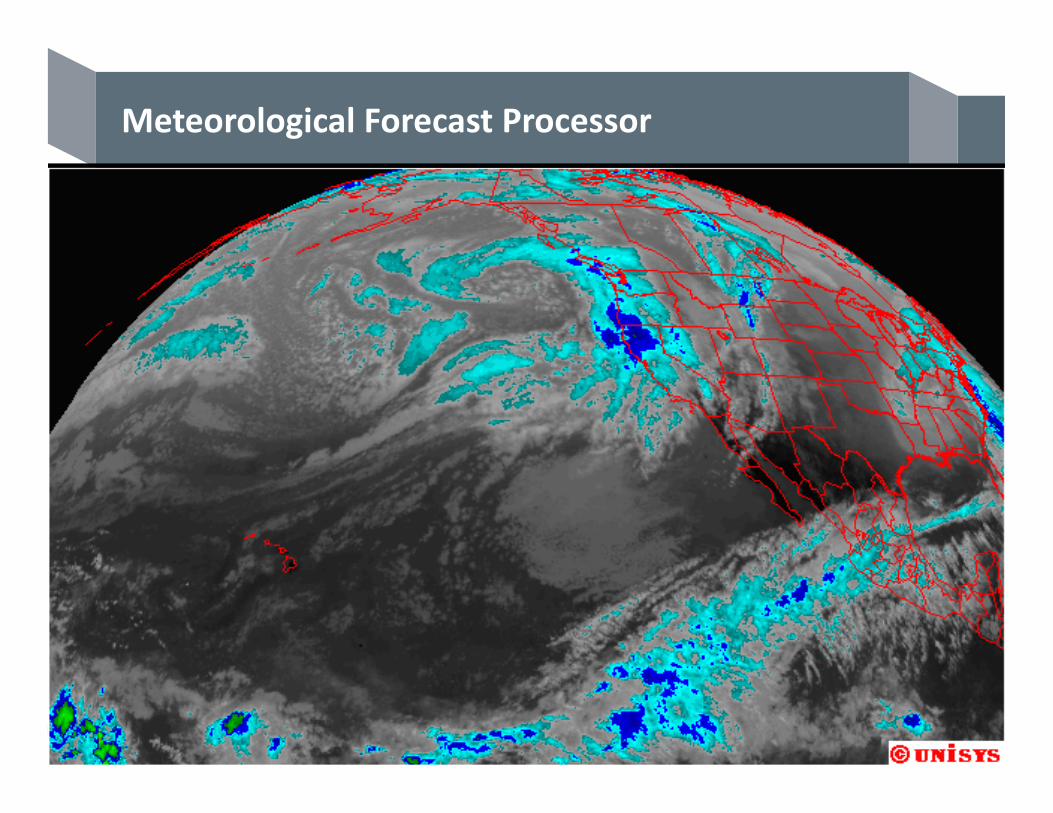
Meteorological Forecast Processor

Snowmelt and Temperature Considerations
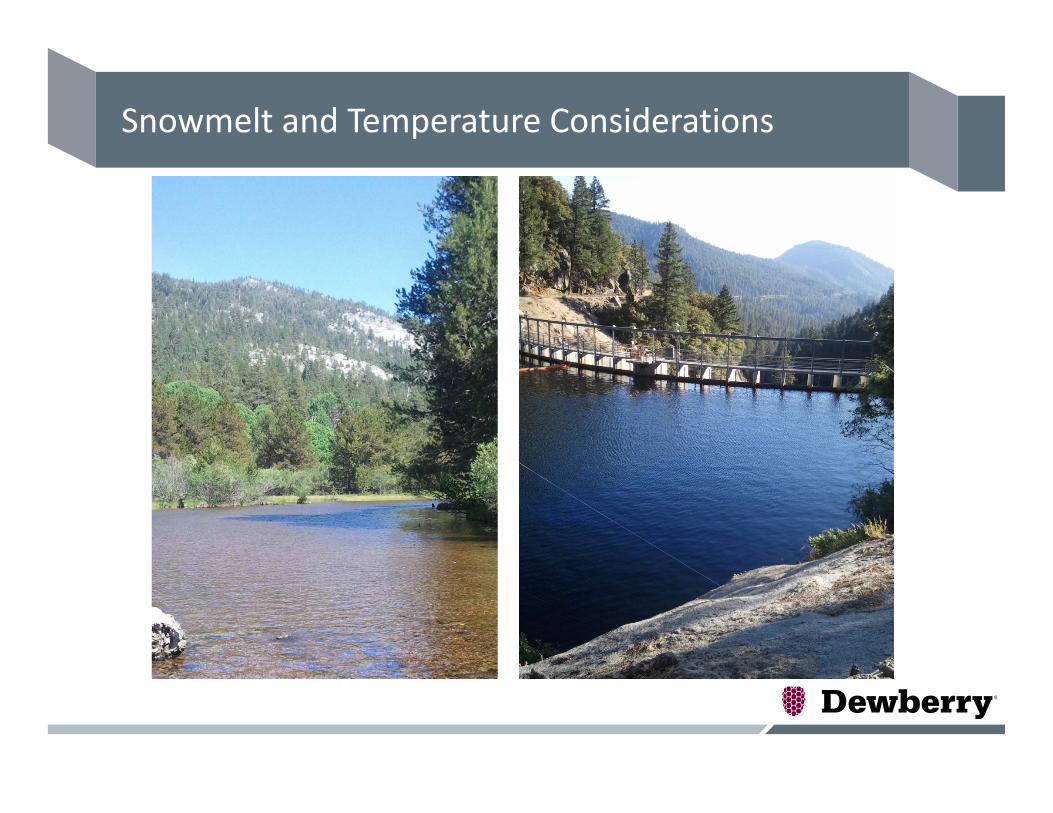
Snowmelt and Temperature Considerations
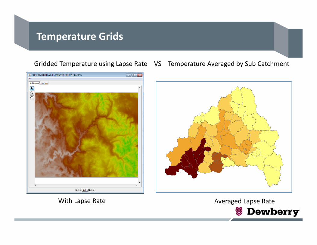
Temperature Grids
Gridded Temperature using Lapse Rate VS Temperature Averaged by Sub Catchment
Averaged Lapse RateWith Lapse Rate
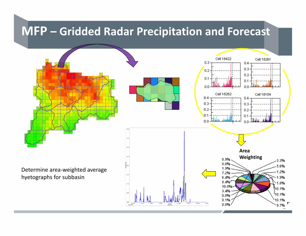
Area Weighting
Determine area‐weighted average hyetographs for subbasin
MFP – Gridded Radar Precipitation and Forecast
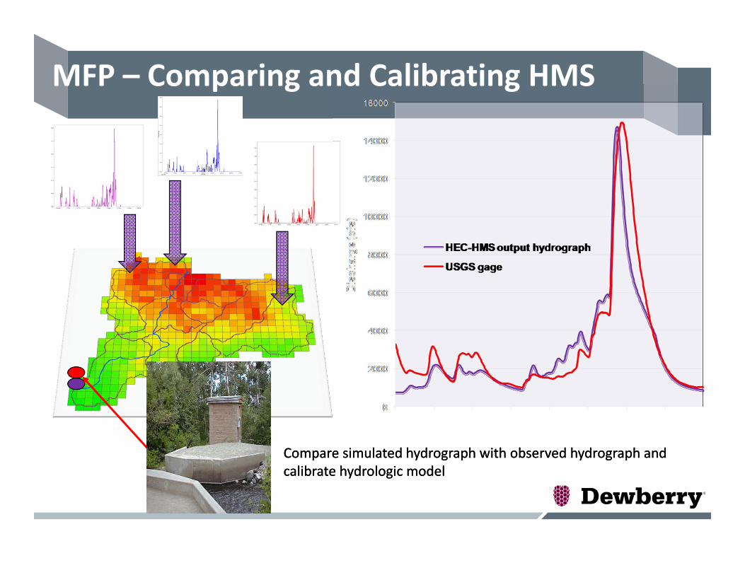
Compare simulated hydrograph with observed hydrograph and calibrate hydrologic modelCompare simulated hydrograph with observed hydrograph and calibrate hydrologic model
MFP – Comparing and Calibrating HMS
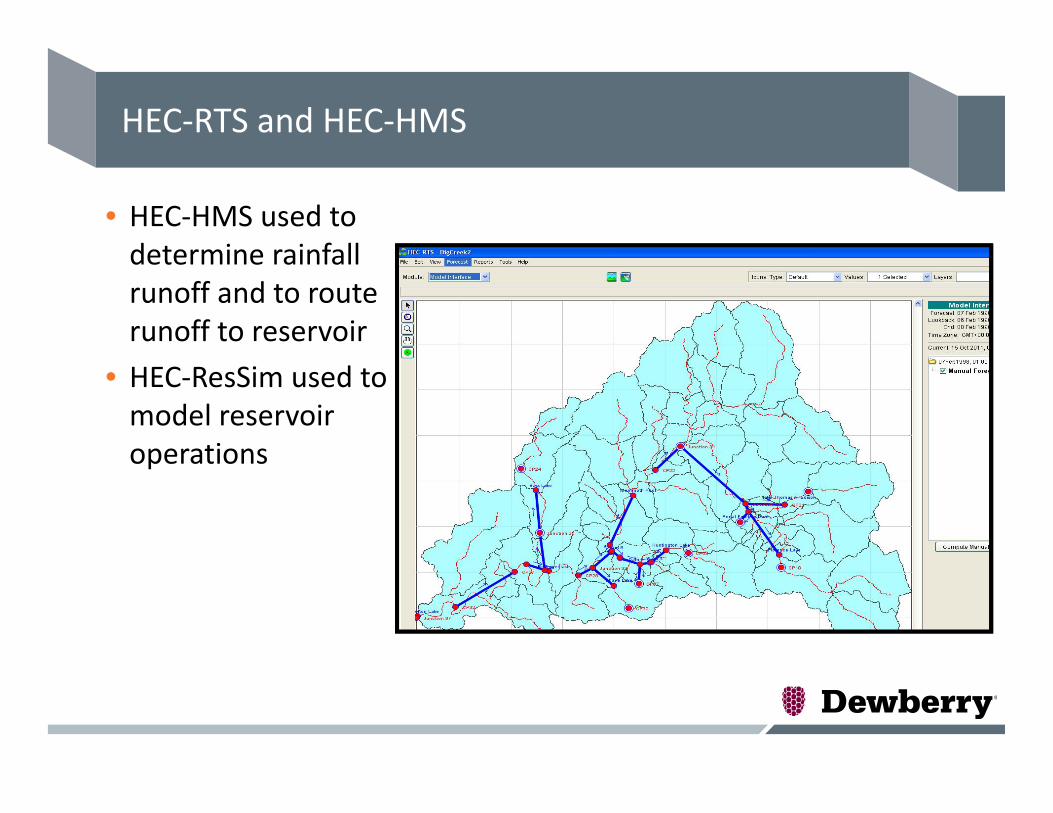
HEC‐RTS and HEC‐HMS
• HEC‐HMS used to determine rainfall runoff and to route runoff to reservoir
• HEC‐ResSim used to model reservoir operations
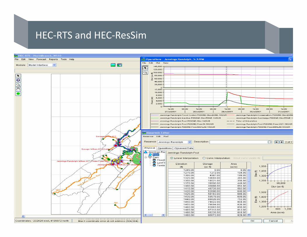
HEC‐RTS and HEC‐ResSim

Data Management
• Data management is very important
• Input data have to be in a correct format and in a correct folder directory
• Time‐series and Grids have to be in a DSS format
• DSS files for – Temperature– Precipitation– Snowgrids

HEC‐RTS
• Data Acquisition• Data Visualization• Watershed Setup• Model Interface

Watershed Setup
• Assign Program Sequence
• Add Model Alternatives

Model Interface
1) Create Model Alternative 2) Create Forecast Alternative
Model Interface
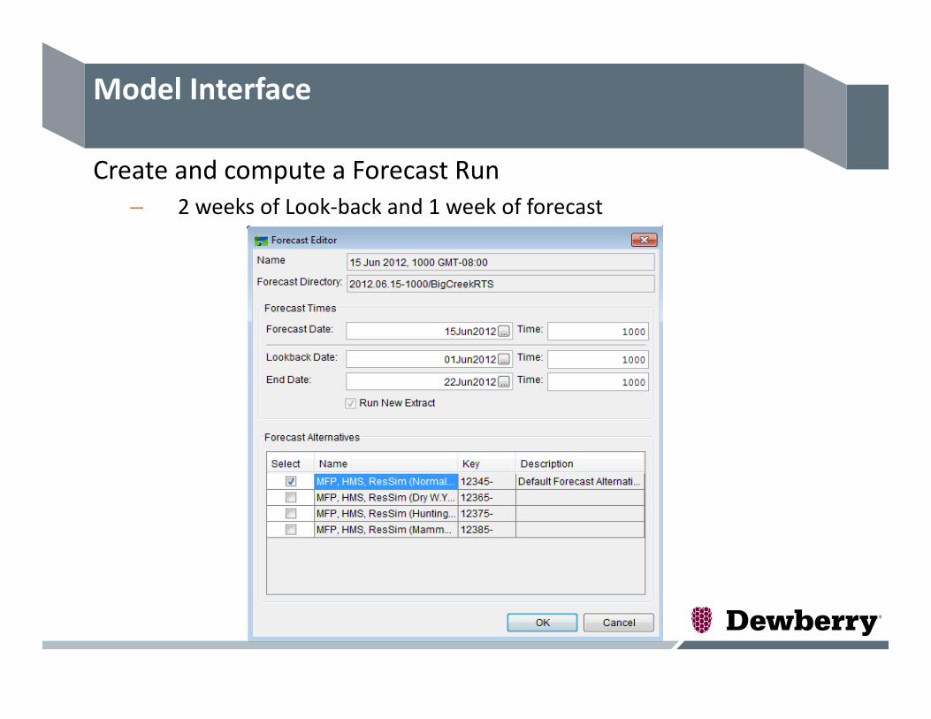
Create and compute a Forecast Run– 2 weeks of Look‐back and 1 week of forecast
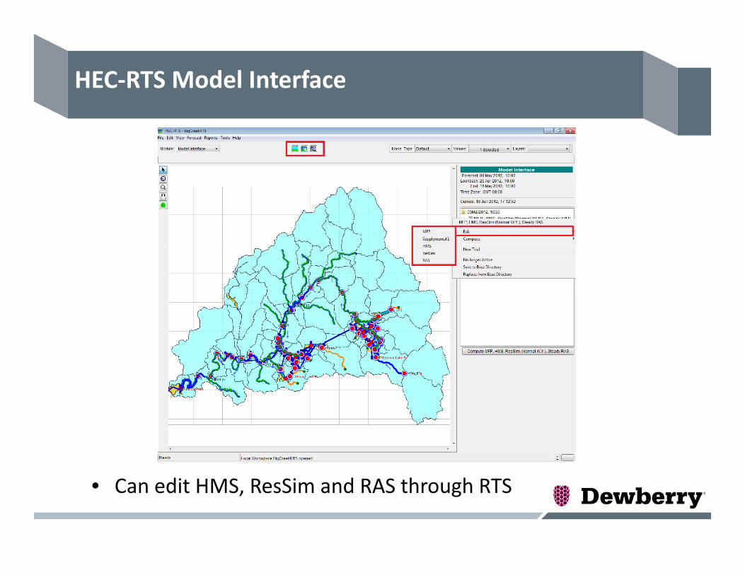
HEC‐RTS Model Interface
• Can edit HMS, ResSim and RAS through RTS

HEC‐RTS Model Interface ‐ Results
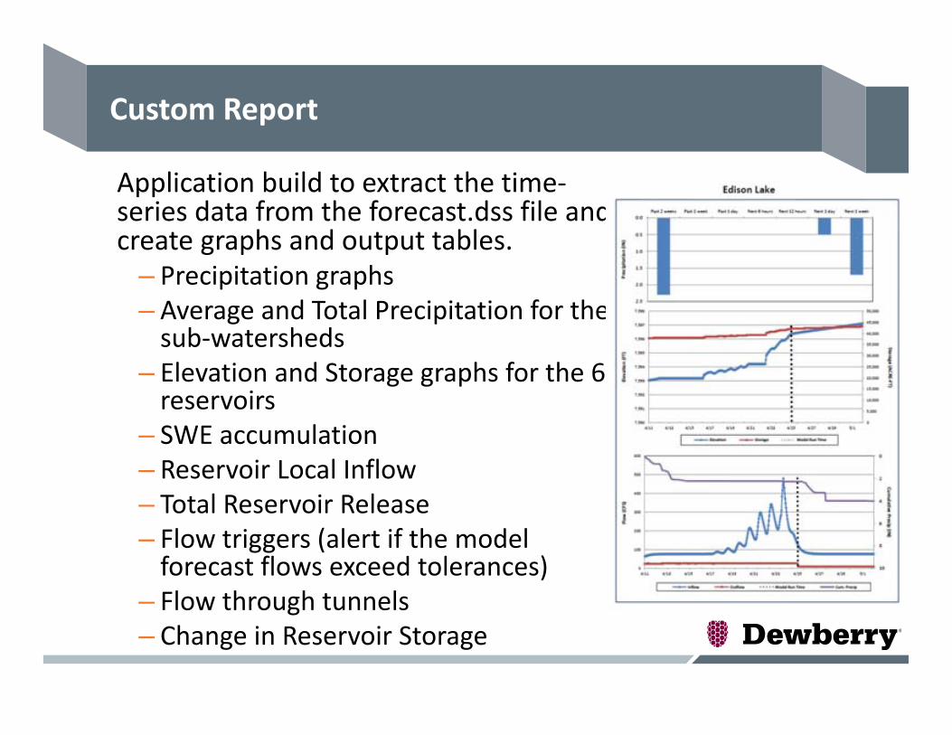
Custom Report
Application build to extract the time‐series data from the forecast.dss file and create graphs and output tables.
– Precipitation graphs– Average and Total Precipitation for the sub‐watersheds
– Elevation and Storage graphs for the 6 reservoirs
– SWE accumulation– Reservoir Local Inflow– Total Reservoir Release– Flow triggers (alert if the model forecast flows exceed tolerances)
– Flow through tunnels– Change in Reservoir Storage
Challenges
• Current version of RTS does not take forecast temperature grids so a supplemental program added to transfer the forecast temperature grids to the forecast.dss file
• Snowmelt modeling requires temperature and 5 snow‐related grids (SWE, Cold Content, Liquid Water, ATI Melt and Cold Content ATI)
• Application built to transfer the 5 snow‐related grids after the end of each simulation
• Scripts written to update diversion and outage schedule without opening the RTS model
• Application built to generate a custom report that is used for decision support
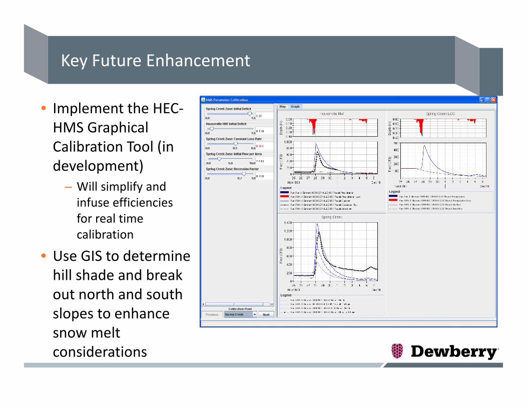
Key Future Enhancement
• Implement the HEC‐HMS Graphical Calibration Tool (in development)
– Will simplify and infuse efficiencies for real time calibration
• Use GIS to determine hill shade and break out north and south slopes to enhance snow melt considerations

Questions???