Collaboration Opportunities Urban Foresters & Emergency Managers Urban Tree Risk Management &...
16
Collaboration Opportunities Urban Foresters & Emergency Managers Urban Tree Risk Management & Vegetation Risk Management
-
Upload
lionel-ferdinand-oliver -
Category
Documents
-
view
221 -
download
4
Transcript of Collaboration Opportunities Urban Foresters & Emergency Managers Urban Tree Risk Management &...

Collaboration Opportunities
Urban Foresters & Emergency ManagersUrban Tree Risk Management
& Vegetation Risk Management
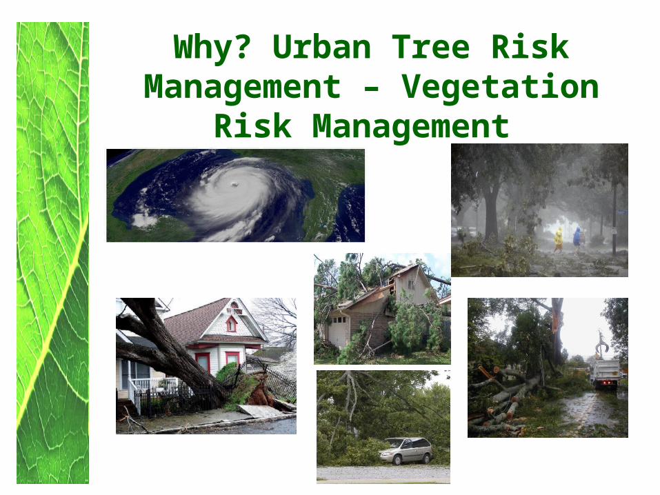
Why? Urban Tree RiskManagement – Vegetation
Risk Management

• Impede 911 and Emergency Response
The Need?
• Structural Damage & Impede access to Critical Infrastructure facilities

• Emergency Management Costs
The Need?

Get Connected with local Emergency
Manager
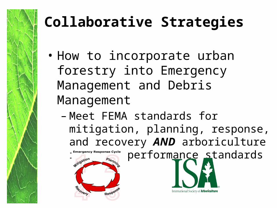
Collaborative Strategies
• How to incorporate urban forestry into Emergency Management and Debris Management – Meet FEMA standards for mitigation,
planning, response, and recovery AND arboriculture industry performance standards
The Big Picture
Regional
County
Community
State
Structure Data
General
Detail
Urban Forester Involvement
Partnership/Planning
Hands on Implementation
Vegetative
Tree Risk

Opportunities
Examples• Comprehensive Plan• Hazard Mitigation Plan• Emergency Response Plan and Exercises• Debris Management Plan• Vegetative Risk Management (the New
link)• UF Management Plan• Tree Risk Management Plan(s)

Risk Mitigation Results• Reduced claims as they relate to trees by 72%
• Reduced work order complaints and/or request for services by over 55%
• Reduced 911 and overtime expenditures for tree cleanup by over 69%
Five year period 2001-2006Columbus, Georgia (R. Barker)

Mitigation/Planning
• Identifying critical infrastructure to include vegetation at critical facilities – Evaluate and mitigate as necessary
• GIS mapping – Identify potential high debris and hazard areas. Where is the highest potential for vegetative removal and your hazard areas ranked from highest to lowest
• Debris estimation – Utilizing street segments and random sampling after an event and other methods
• Exercises- Utilize UTRI data & model for disaster exercises – prioritized response for Public Works personnel and prioritization of resources
Mitigation/Planning
· Natural and Hazard Mitigation planning – Mitigate by pruning/removal and scheduled inspections of identified areas
· Debris Management Plan – Utilize UTRI GIS tool to identify staging areas for debris that is closest to the areas with most potential for debris (Canopy % by street segment)
· Local ordinances – Analyze and development of ordinances such as tree planting requirements on major corridors and emergency routes

Response
• Identifying critical infrastructure- Prioritize response to high hazard areas and routes
• Staging areas for debris – Utilize UTRI tool• Debris estimation - Identifying high hazard
areas and utilizing street segments for random sampling in debris estimation models
Recovery
• Debris management protocol - High Hazard areas will most likely produce highest amounts of debris. Plan accordingly
• Insect/disease and invasive species separation and management protocol – Utilize a VRMP and the UTRI model to develop and opportunity to include these protocols
• Pruning and/or removal- as determined by identified areas and based off of evaluation and inspection

Recovery
• Replanting – BMPs for planting the right tree in the right spot
• Education – Proper pruning and planting – (See FEMA BMP’s Examples: Pre-emptive Pruning: Tree Trimming as a Damage Reduction Measure and others )

Who Works With & Manages Community Trees
• For a comprehensive list of “Who Works With and Manages Community Trees” – See the Society of Municipal Arborists www.urban-forestry.com website and look for the BMP series Green Communities are $mart Communities
• Links too!

Collaboration Opportunities
Urban Foresters & Emergency ManagersUrban Tree Risk Management
& Vegetation Risk Management