Cluster 1: Geographic Literacy
97
Cluster 1: Geographic Literacy SOC 20S Ms. Smaluck Unit 1
-
Upload
cassandra-wooten -
Category
Documents
-
view
36 -
download
0
description
Cluster 1: Geographic Literacy. SOC 20SMs. Smaluck Unit 1. Land Connections. Topography 3 distinct Landforms in North America Metallic Minerals Drainage Impervious THE CANADIAN SHIELD. - PowerPoint PPT Presentation
Transcript of Cluster 1: Geographic Literacy

Cluster 1: Geographic
Literacy
SOC 20S Ms. Smaluck Unit 1

Land Connections
1. Topography
2. 3 distinct Landforms in North America
3. Metallic Minerals
4. Drainage
5. Impervious
6. THE CANADIAN SHIELD

• Topography: is the natural, which includes vegetation and soil, and the human created features of the landscape.

Landforms
3 Types of landforms in North America
1. Shield – a large area of Precambrian rock that forms the core of a continent.
2. Highland – areas of high elevation containing mountains and plateaus.
3. Lowland – area of low elevations containing plains and hills.


- Metallic Minerals: a mineral that yields a metal when processed, such as, iron, gold, uranium, silver.
- Drainage: the process by which water is removed from an area by flowing out of depressions in the land such as rivers and lakes.
- Impervious: a quality of substance that does not allow water to pass through it.

A. The Canadian Shield

General Facts
• Underlies more than half of Canada and parts of the United States.
• Some of the worlds oldest rocks are located in it, near Great Slave Lake.
• Today most of the Shield has a relatively flat landscape with rounded hills and rock.

Types of rocks found in the Shield
• Mostly made up of igneous and metamorphic.
• Rocks contain great quantities of valuable minerals, such as lead, gold, nickel, copper, making this the storehouse of Canada’s metallic minerals.
• Recent years, diamonds have also been found where ancient volcanoes once existed.

Mineral ores mined in Canadian Shield
- First smelted, (a process of melting the rock), to remove waste materials, this is usually done in the shield region.
- Then the concentrated minerals are shipped to factories in Canada and other parts of the world to be manufactured into various product.

Activity not well suited for
• Farming/ agriculture because it has very thin soils.
• Most of the “loose” soil/sediments were removed by the glaciers during the Ice Age.

Activity suited for
• Besides mining!
• Recreation or tourism because of its scenic rivers, waterfalls, lakes, and vast forests, which attracts people who wish to “get back to nature”.

Drainage pattern affected by
• The action of the glaciers
• As they moved, the scraping and gouging action created depressions in the bedrock, which filled with water when the glaciers melted, creating the numerous lakes in the region, because of the impervious bedrock.
• Glaciers also deposited the sand, gravel and clay they were carrying, which damned rivers, creating some swamps and lakes, while other rivers were forced to flow in different directions.
• Result is a very disorganized pattern of winding rivers, lakes and swamps.

Shield’s plentiful water flows are;
• An excellent source of water-generated energy (hydro-electricity)
• Hydro-electric generating stations have been built where the rivers come from the “higher” shield onto the “lower” Hudson bay Lowlands.
• Energy from these stations is transmitted by power lines to places both on and off the shield.

B. The Lowlands
1. Interior Plains
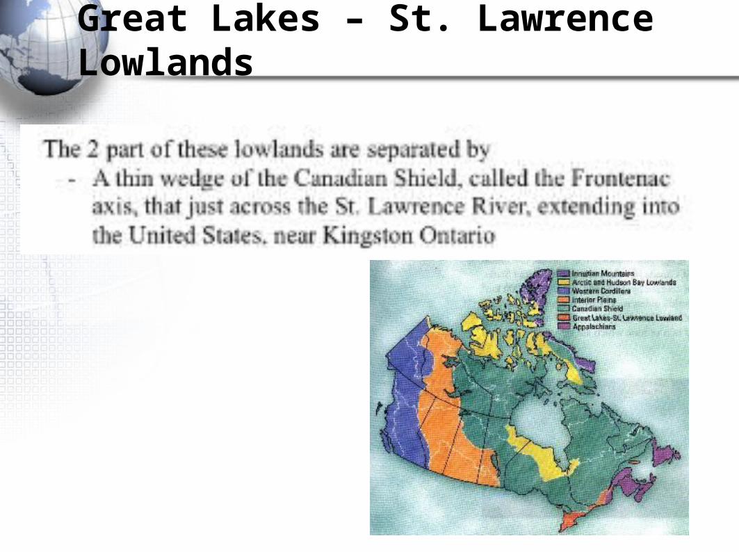
2. Great Lakes – St. Lawrence Lowlands
3. Hudson Bay – Arctic Lowlands
4. Coastal Lowlands

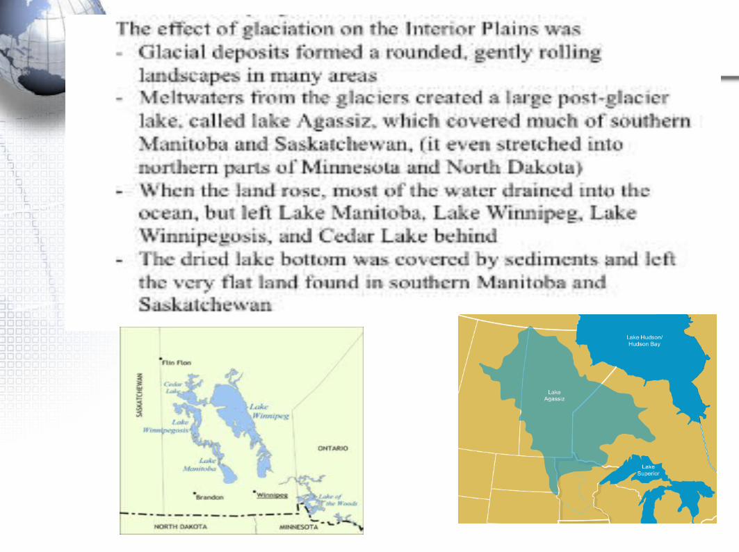
The Interior Plains


Great Lakes – St. Lawrence Lowlands


Hudson Bay – Arctic Lowlands


The Coastal Lowlands


C. The Highlands
1. Appalachian Mountains
2. Innuitian Mountains
3. Western Cordillera


The Appalachian Mountains


The Innuitian Mountains
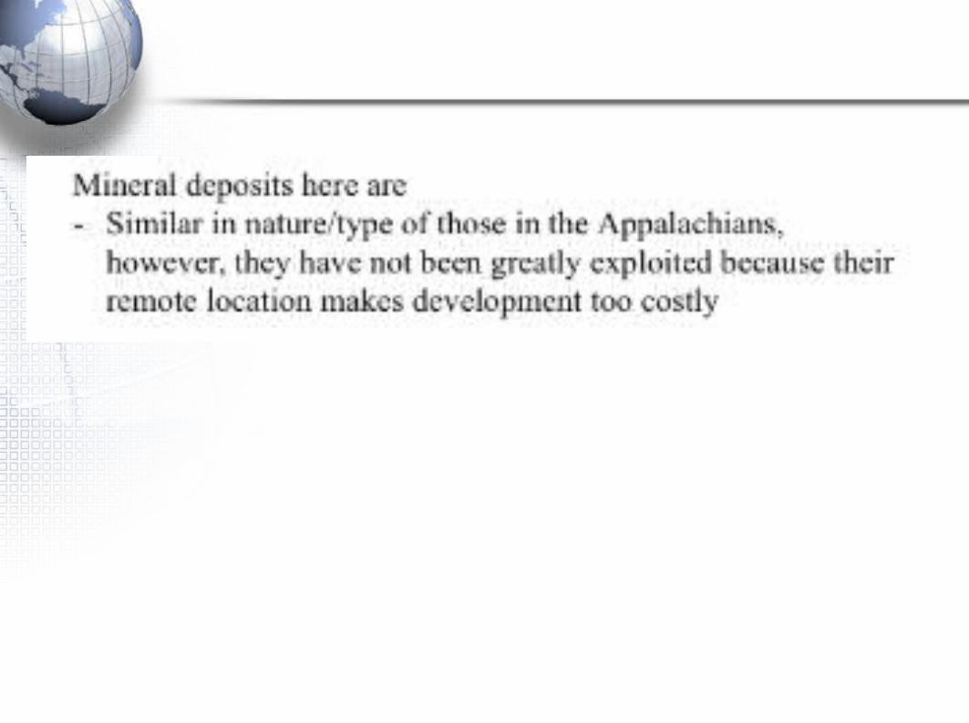

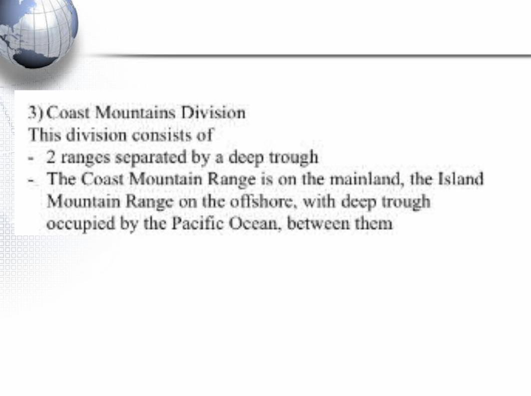
The Western Cordillera


3 Major Divisions


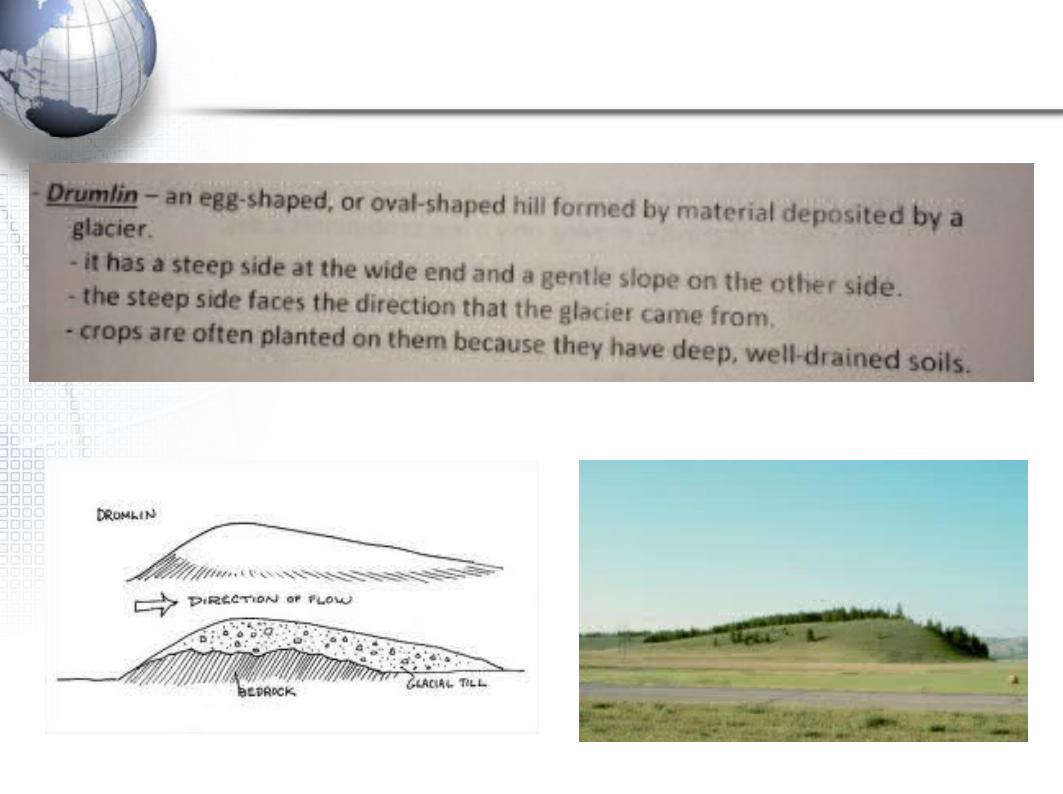
Glaciation and the Landscape


2 Types of Glaciers

Alpine

Continental


Soil


4 Main Parts/Components of Soil
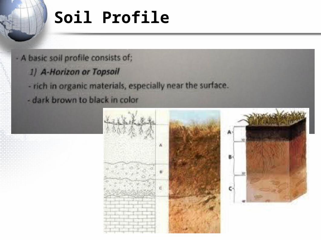
Soil Profile

Soil Profile

Loam

Soil Formation


Vegetation


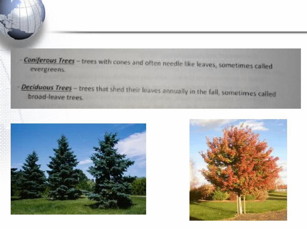

Vegetation Regions in Canada