CLIFF AVENUE PLAZA MULTI-TENANT RETAIL …...casual attire, shoes & accessories, plus tuxedo...
9
CLIFF AVENUE PLAZA MULTI-TENANT RETAIL STRIP CENTER FOR SALE | SIOUX FALLS, SD LAKEPORT COMMONS MULTI-TENANT INVESTMENT PROPERTY 5000-5018 SERGEANT ROAD, SIOUX CITY, IA 51106 101 S. Reid Street, Suite 201, Sioux Falls, SD 57103 | 605.323.2820 Information herein is deemed reliable, but not guaranteed. INVESTMENT PROPERTY FOR SALE
Transcript of CLIFF AVENUE PLAZA MULTI-TENANT RETAIL …...casual attire, shoes & accessories, plus tuxedo...
CLIFF AVENUE PLAZA MULTI-TENANT RETAIL STRIP CENTER FOR SALE | SIOUX FALLS, SD
LAKEPORT COMMONS MULTI-TENANT INVESTMENT PROPERTY5000-5018 SERGEANT ROAD, S IOUX C ITY, IA 51106
101 S. Reid Street, Suite 201, Sioux Falls, SD 57103 | 605.323.2820Information herein is deemed reliable, but not guaranteed.
INVESTMENT PROPERTY FOR SALE
LAKEPORT COMMONS MULTI-TENANT INVESTMENT OPPORTUNITY | LLOYD COMPANIES INFORMATION DEEMED RELIABLE BUT NOT GUARANTEED. | 2
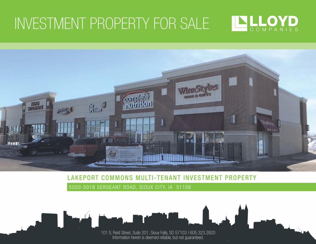
LAKEPORT COMMONS MULTI-TENANT INVESTMENT OPPORTUNITY | SIOUX CITY, IA
Lloyd Companies is pleased to present the opportunity to acquire
an investment property located at the Lakeport Commons Shopping
Center in Sioux City, IA. The site consists of a 10,960 square foot
retail building, which is currently 100% leased to five tenants.
The tenants include Complete Nutrition, Firehouse Subs, Men’s
Warehouse, The UPS Store and Winestyles.
JORDAN RIEFFENBERGER, CCIMDIRECTOR OF COMMERCIAL REAL ESTATE
Investment Summary
Pricing $3,712,302
Net Operating Income $250,580
Cap Rate 6.75%
Year Built 2007
Total Building Size 10,960 Square Feet
Site Size 1.26 Acres / 54,997 SF
Current Occupancy 100%
LAKEPORT COMMONS MULTI-TENANT INVESTMENT OPPORTUNITY | LLOYD COMPANIES INFORMATION DEEMED RELIABLE BUT NOT GUARANTEED. | 4
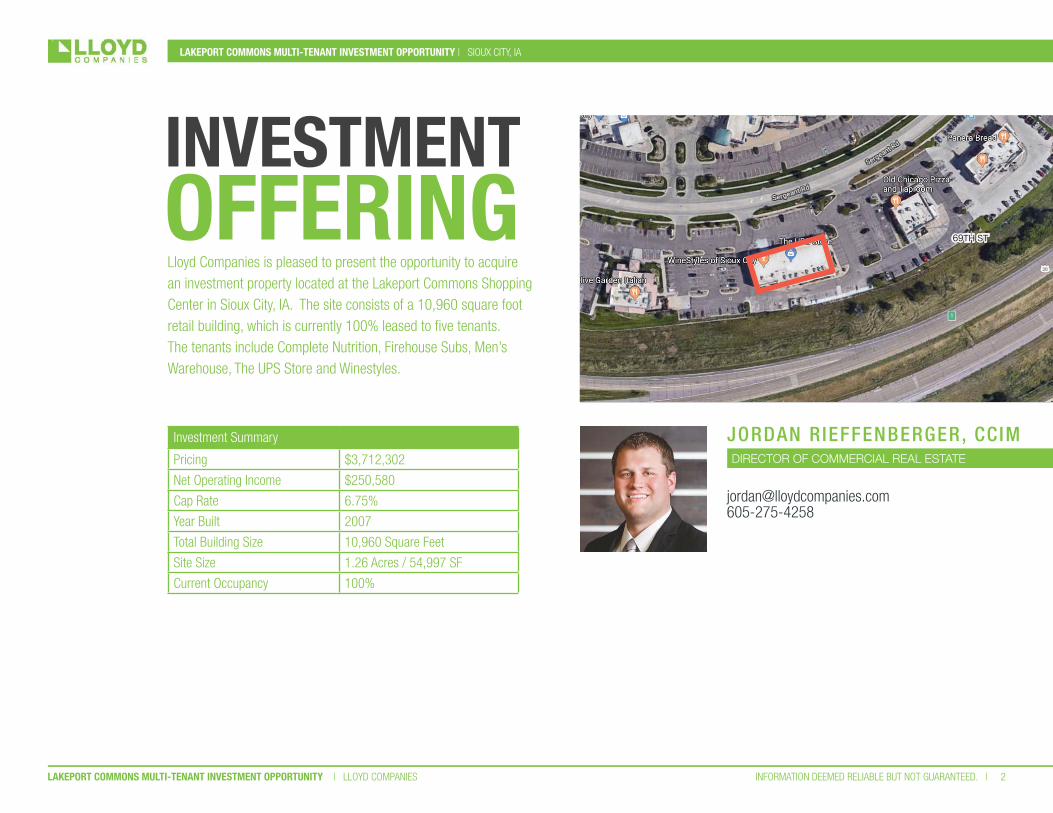
FINANCIAL OVERVIEW
LAKEPORT COMMONS MULTI-TENANT INVESTMENT OPPORTUNITY
Occupancy Rate: 100% (Fully Leased)
Sales Price: $3,712,302
Cap Rate: 6.75%
Net Rentable Area (NRA): 10,960 RSF
Price / SF: $338.71
Lot Size: 1.26 Acres / 54,997 SF
Year Built: 2007
LAKEPORT COMMONS MULTI-TENANT INVESTMENT OPPORTUNITY | LLOYD COMPANIES INFORMATION DEEMED RELIABLE BUT NOT GUARANTEED. | 5
TENANT OVERVIEW | SIOUX CITY, IA
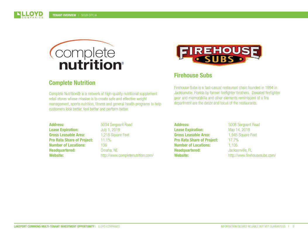
Complete Nutrition
Complete Nutrition® is a network of high-quality nutritional supplement
retail stores whose mission is to create safe and effective weight
management, sports nutrition, fitness and general health programs to help
customers look better, feel better and perform better.
Firehouse Subs
Firehouse Subs is a fast-casual restaurant chain founded in 1994 in
Jacksonville, Florida by former firefighter brothers. Donated firefighter
gear and memorabilia and other elements reminiscent of a fire
department are the decor and focus of the restaurants.
Address: Lease Expiration: Gross Leasable Area: Pro Rata Share of Project: Number of Locations:Headquartered:Website:
Address: Lease Expiration: Gross Leasable Area: Pro Rata Share of Project: Number of Locations:Headquartered:Website:
5004 Sergeant Road
July 1, 2019
1,215 Square Feet
11.1%
136
Omaha, NE
http://www.completenutrition.com/
5008 Sergeant Road
May 14, 2019
1,945 Square Feet
17.7%
1,105
Jacksonville, FL
http://www.firehousesubs.com/
LAKEPORT COMMONS MULTI-TENANT INVESTMENT OPPORTUNITY | LLOYD COMPANIES INFORMATION DEEMED RELIABLE BUT NOT GUARANTEED. | 6
TENANT OVERVIEW | SIOUX CITY, IA
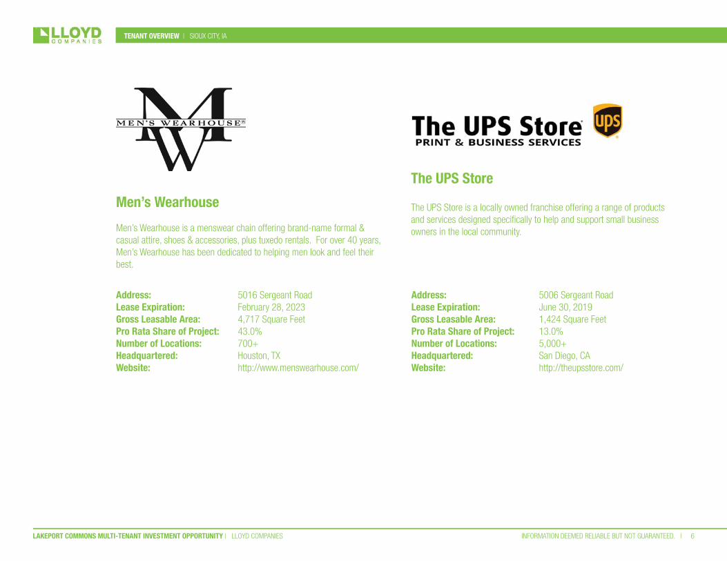
Men’s Wearhouse
Men’s Wearhouse is a menswear chain offering brand-name formal &
casual attire, shoes & accessories, plus tuxedo rentals. For over 40 years,
Men’s Wearhouse has been dedicated to helping men look and feel their
best.
The UPS Store
The UPS Store is a locally owned franchise offering a range of products
and services designed specifically to help and support small business
owners in the local community.
Address: Lease Expiration: Gross Leasable Area: Pro Rata Share of Project: Number of Locations:Headquartered:Website:
Address: Lease Expiration: Gross Leasable Area: Pro Rata Share of Project: Number of Locations:Headquartered:Website:
5016 Sergeant Road
February 28, 2023
4,717 Square Feet
43.0%
700+
Houston, TX
http://www.menswearhouse.com/
5006 Sergeant Road
June 30, 2019
1,424 Square Feet
13.0%
5,000+
San Diego, CA
http://theupsstore.com/
LAKEPORT COMMONS MULTI-TENANT INVESTMENT OPPORTUNITY | LLOYD COMPANIES INFORMATION DEEMED RELIABLE BUT NOT GUARANTEED. | 7
TENANT OVERVIEW | SIOUX CITY, IA
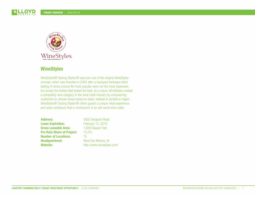
WineStyles
WineStyles® Tasting Station® was born out of the original WineStyles
concept, which was founded in 2002 after a backyard barbeque blind
tasting of wines proved the most popular were not the most expensive,
but simply the bottles that tasted the best. As a result, WineStyles created
a completely new category in the wine retail industry by empowering
customers to choose wines based on taste, instead of varietal or region.
WineStyles® Tasting Station® offers guests a unique retail experience
and warm ambiance that is reminiscent of an old-world wine cellar.
Address: Lease Expiration: Gross Leasable Area: Pro Rata Share of Project: Number of Locations:Headquartered:Website:
5002 Sergeant Road
February 15, 2019
1,659 Square Feet
15.2%
15
West Des Moines, IA
http://www.winestyles.com/
LAKEPORT COMMONS MULTI-TENANT INVESTMENT OPPORTUNITY | LLOYD COMPANIES INFORMATION DEEMED RELIABLE BUT NOT GUARANTEED. | 8
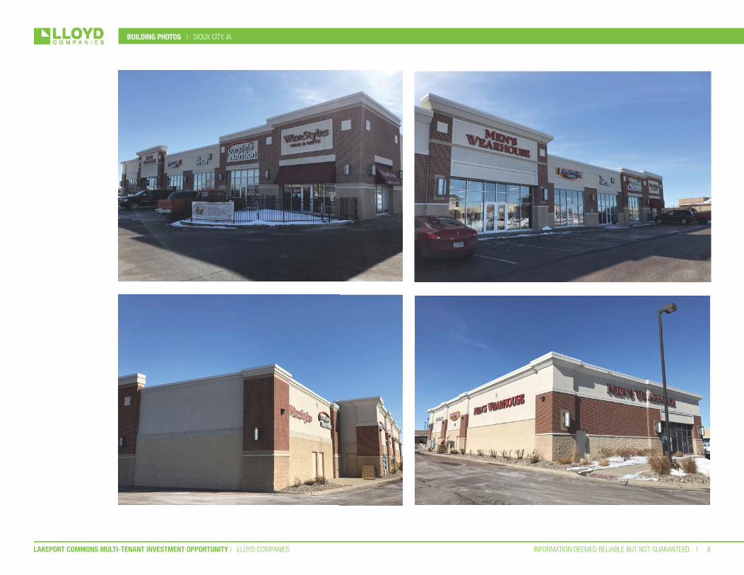
BUILDING PHOTOS | SIOUX CITY, IA
LAKEPORT COMMONS MULTI-TENANT INVESTMENT OPPORTUNITY | LLOYD COMPANIES INFORMATION DEEMED RELIABLE BUT NOT GUARANTEED. | 9
LAKEPORT COMMONS MULTI-TENANT INVESTMENT OPPORTUNITY | SIOUX CITY, IA
UGE
UGE
UGE
UGE
UGE
20' Utility Easement
15.00' Utility Easement
70.00'DEDICATED
R.O.W.
37.00'B/CURB
toB/CURB
CONCRETE PAVEMENT W/ INTREGAL CURB
30.00' Perpetual
Access Easement
16.50'
10''SA10''SA
10''SA10''SA
10''SA10''SA
10''SA10''SA
10''SA
10''SA
10''SA
10''SA
10''SA
10''SA
10''SA
10''SA
10''SA
SA
6''SA
8''SA8''SA
8''SA8''SA
8''SA8''SA
8''SA
20' Utility
Easement
15.00' Utility
Easement
T T T T T T T TT
TT
TT
TT
TT
TT
TT
T
T
T
T
T
T
T
T
T
T
T
T
T
T
T
T
T
T
T
T
T
T
T
T
T
T
T
T
T
T
T
T
T
T
T
T
T
T
T
T
T
T T
TT
TT
TT
T
T
S GAS GAS GAS GASGAS
GASGAS
GASGAS
GAS
GAS
GAS
GAS
GAS
GAS
GAS
GAS
GAS
GAS
GAS
GAS
GAS
GAS
GAS
GAS
GAS
GAS
GAS
54''ST54''ST
54''ST54''ST
54''ST54''ST
54''ST
54''ST
54''ST
54''ST
54''ST
54''ST
54''ST
24''ST
24''ST
ST
ST
ST
ST
ST
24''ST
2''W 12''W 12''W12''W
12''W12''W
12''W
12''W
12''W
12''W
12''W
12''W
12''W
12''W
12''W
12''W
12''W
12''W
12''W
12''W
12''W
12''W
12''W
S
71.1'
SA
SA
SA
UGE UGE UGE UGE UGE UGE UGE UGE UGEUGE
UGEUGE
UGEUGE
UGEUGE
UGE
UGE
UGE
UGE
UGE
UGE
UGE
UGE
UGE
UGE
UGE
UGE
UGE
UGE
U
UGE UGE UGE UGE UGEUGE
UGEUGE
UGEUGE
UGE
UGE
UGE
UGE
UGE
UGE
UGE
UGE
UGE
UG
ST
ST
ST
ST
ST
ST
GAS
ASPHALT
ASPHALT
Access toPublic Street
Access toPublic Street
6''SA
6''SA
6''SA
ST
ST
ST
ST
ST
ST
ST
ST
ST
ST
ST
ST
ST
ST
ST
ST
ST
ST
ST
ST
ST
ST
STSTSTST
81.3'
77.2'
14.7'
64.7'
23.6'
59.4'
60.0'
83.3'
24''ST
S75°39'37"W 106.75'
18.72'
S19°09'20"E 41.00'
N05°41'41"W
167.55'
N02°03'32"W
41.00'
N84°18'18"E 90.40'
N05°41'41"W
207.43'
77.22'
S73°10'51"W 95.94'
S18°22'12"E 174.80'
S67°36'04"W 87.26'
ASPHALT PARKING W/ CONCRETE CURB & GUTTER
S23°12'11"E 221.54'
Rad=848.67' Len=224.56' Chord=223.90' - N74°25'49"E
S84°18'18"W 87.57'
STST
ST
163.2'
74.4'
62.5'
117.4'
ASPHALT PARKING W/ CONCRETE CURB & GUTTER
ASPHALT PARKING W/ CONCRETE CURB & GUTTER
ASPHALT PARKING W/ CONCRETE CURB & GUTTER
CONCRETE WALK
CONCRETE PATIO
LANDSCAPE
LANDSCAPE
LANDSCAPE
LAND
SCAPE
DUMPSTER
ENCLOSURE
(BLOCK WALL)
LANDSCAPE
LANDSCAPE
LANDSCAPE
LANDSCAPE
LANDSCAPE
GRASS
GRASS
GRASS
CONCRETE WALK
CONCRETE WALK
CO
NC
RETE W
ALK
LANDSCAPE
CONCRETE
LANDSCAPE
1134
26
26
31
WEST LINE,OUTLOT 6
WEST LINE,OUTLOT 7
EAST LINE,OUTLOT 7
EAST LINE,OUTLOT 6
LAND
SCAPE
GASGAS
GASGAS
GASGAS
GASGAS
GAS GAS GAS
GAS
GAS
T
T
T
T
T
T
T
T
T
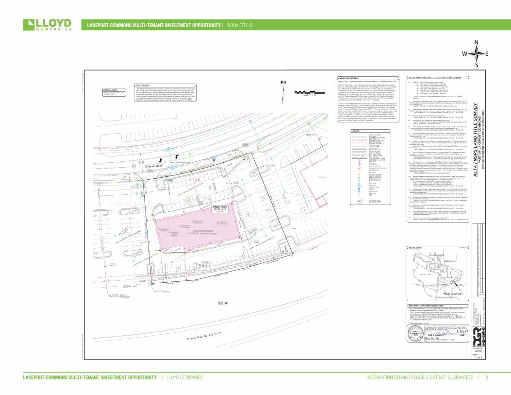
Subject Parcel54,997 Sq.Ft.
1.26 Ac.
26
26
ALT
A /
NSP
S LA
ND
TIT
LE S
UR
VEY
PAR
T O
F LA
KEP
OR
T C
OM
MO
NS
5002
-501
6 SE
RG
EAN
T R
OA
D, S
IOU
X C
ITY,
IOW
A, 5
1106
Sheet1 of 1P:
\02\
267\
018\
DW
G\2
6701
8_A
LTA
.DW
G
REVISIONS
Plot
Dat
e:3/
20/2
017
1:58
:09
PM
6115
Whi
sper
ing
Cre
ek D
rive
Siou
x C
ity, I
A 5
1106
(712
) 266
-155
4w
ww
.dgr
.com
Dra
wn
By:
DA
L A
ppro
ved:
DA
L
Project No.267018
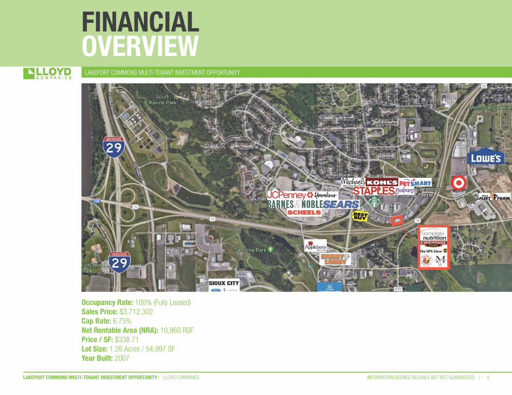
Outlots 6 and 7, Lakeport Commons, an addition to Sioux City, Woodbury County, Iowa;
EXCEPT that portion of said Outlot 6 described as follows: Beginning at the southwestcorner of said Outlot 6; thence North 05°41'41" West along the west line of said Outlot 6for a distance of 167.55 feet; thence North 02°03'32" West along said west line for adistance of 41.00 feet to the northwest corner of said Outlot 6; thence easterly along thenorth line of said Outlot 6 and along a non-tangent curve to the left having a radius of848.67 feet, for a distance along the arc of 87.85 feet, the chord of which bears North84°58'33" East a distance of 87.81 feet; thence South 05°41'41" East for a distance of207.43 feet to the south line of said Outlot 6; thence South 84°18'18" West along saidsouth line for a distance of 90.40 feet to the Point of Beginning.
AND ALSO EXCEPT that portion of said Outlot 7 described as follows: Beginning at thesoutheast corner of said Outlot 7; thence South 62°31'23" West along the southeast line ofOutlot 7 for a distance of 71.24 feet; thence South 67°36'04" West along said southeastline for a distance of 87.26 feet; thence North 23°12'11" West for a distance of 221.54 feetto the northwest line of said Outlot 7; thence northeasterly along the northwest line of saidOutlot 7, and along a non-tangent curve to the left having a radius of 848.67 feet, for adistance along the arc of 130.74 feet, the chord of which bears North 62°26'12" East adistance of 130.61 feet to the northeast corner of said Outlot 7; thence South 30°14'06"East along the northeast line of said Outlot 7 for a distance of 229.11 feet to the southeastcorner of said Outlot 7 and to the Point of Beginning
PARCEL DESCRIPTION TITLE COMMITMENT IA17137775, SCHEDULE B-II, Exceptions:
Regular stalls (9' x 20') 67Handicap stalls 3
PARKING DATA
LEGEND
SA
ST
OHE
T T
UGE
W
GAS
FO FO
The underground utilities shown hereon are approximate. Utilities have been located fromfield survey information and existing drawings. The Surveyor makes no guarantees thatthe underground utilities shown comprise all such underground utilities in the area, eitherin service or abandoned. The Surveyor further does not warrant that the undergroundutilities shown are in exact location indicated although the Surveyor does certify that theyare located as accurately as possible from information available. The Surveyor has notphysically located the underground utilities. One-Call Locate Request No. 551701020
UTILITY DATA
TV TV
OHCATV OHCATV
To Circle Point Ventures, LLC, First Dakota National Bank Fidelity National TitleInsurance Company and Professional Title Company:This is to certify that this map or plat and the survey on which it is based were madein accordance with the 2016 Minimum Standard Detail Requirements forALTA/NSPS Land Title Surveys, jointly established and adopted by ALTA andNSPS, and includes Items 1, 4, 7(a)(b1), 8, 9 & 11 of Table A thereof. The field workwas completed on March 9, 2017.
Date of Map: March 20, 2017
ALTA/ASCM SURVEYORS CERTIFICATE
11. Rights of re-entry of the State of Iowa as contained in:(a). filed August 11, 1978, in Roll 81, Image 385(b). filed October 16, 1978, in Roll 83, Image 656(c). filed February 20, 1980, in Roll 97, Image 2156(d). filed July 16, 1980, in Roll 102, Image 186(e). filed filed April 3, 1987, in Roll 184, Image 1893(f). filed December 6, 2004, in Roll 667, Image 774(g). filed March 31, 2005, in Roll 673, Image 3557
- SUBJECT PROPERTY BORDERS PRIMARY ROAD NO. U.S. 20-75 AS SHOWN HEREON.
12. Resolution of the Woodbury County Board of Supervisors, #6332, recorded on May 12, 1977 onRoll 62, Image 2118, contains provisions and regulations governing the use of certain lands designatedas Flood Hazard Area...
- SUBJECT PROPERTY IS NOT LOCATED IN A FLOOD HAZARD AREA.
13. Resolution of the Woodbury County Board of Supervisors, #6333, recorded on May 12, 1977 onRoll 62, Image 2120, contains provisions and regulations governing the issuance of building permits...
- AFFECTS PROPERTY BUT IS UNLOCATABLE AND/OR BLANKET IN NATURE.
17. Subject to the Donner Park Urban Renewal Project Area...- AFFECTS PROPERTY BUT IS UNLOCATABLE AND/OR BLANKET IN NATURE.
18. Plat of Survey, filed December 28, 2004 in Roll 669, Image 1250...- SUBJECT PROPERTY IN CONTAINED ENTIRELY WITHIN THE BOUNDARY OF THEPARCEL SHOWN ON THE PLAT OF SURVEY.
19. Ordinance No. 2004-000395, filed May 5, 2004 in Roll 642, Image 1190, Records of WoodburyCounty, Iowa. Regarding rezoning to zone classification BG (General Business Zone)...
- AFFECTS PROPERTY BUT IS UNLOCATABLE AND/OR BLANKET IN NATURE.
21. Assessment Agreement filed January 21, 2005 in Roll 671, Image 2782 Records of WoodburyCounty, Iowa., by and between the City of Sioux City, Iowa, an Iowa municipal corporation andLakeport Commons, L.L.C...
- AFFECTS PROPERTY BUT IS UNLOCATABLE AND/OR BLANKET IN NATURE.
23. Development Agreement by and between Lakeport Commons, L. L. C., an Iowa limited liabilitycompany and City of Sioux City, Iowa filed November 22, 2004 in Roll 665 Image 2226 Records ofWoodbury County, Iowa.
(a). Certificate of Completion filed October 2, 2007 Roll 693 Image 11397 Records of WoodburyCounty, Iowa.
- AFFECTS PROPERTY BUT IS UNLOCATABLE AND/OR BLANKET IN NATURE.
24. Plat and Dedication of Lakeport Commons, an Addition to the City of Sioux City, WoodburyCounty, Iowa filed May 16, 2005 in Plat Envelope 690 A & B, Docket No. 18368 Records ofWoodbury County, Iowa
- SUBJECT PROPERTY IS CONTAINED ENTIRELY WITHIN THE BOUNDARY OF THEADDITION SHOWN ON THE PLAT, PLATTED EASEMENTS ARE SHOWN HEREON.
26. Underground Electric and Gas Easement filed May 16, 2005 in Roll 674, Image 6901 Records ofWoodbury County, Iowa, grants to MidAmerican Energy Company, an Iowa corporation, its successorsand assigns, a perpetual right-of-way easement, for the purpose of constructing, reconstructing,operating, maintaining and removing underground wires and cables for the transmission anddistribution of electric energy and for communication and electrical controls, and a pipeline for naturalgas including the necessary appurtenances under and on a portion of subject property, together with theright of ingress and egress.
- AFFECTS SUBJECT PROPERTY AND IS SHOWN HEREON.
29. Operation and Easement Agreement filed May 24, 2005, at Roll 675 Image 2002 Records ofWoodbury County, Iowa executed by and between Lakeport Commons, L.L.C., an Iowa limitedliability company and Kohl's Department Stores, Inc., a Delaware corporation.
(a). First Amendment filed September 15, 2006, in Roll 686 Image 6171.(b). Second Amendment filed June 12, 2007 in Roll 691 Image 8402.(c). Third Amendment filed December 27, 2007, Roll 691 Image 6282.- AFFECTS PROPERTY BUT IS UNLOCATABLE AND/OR BLANKET IN NATURE
30. Memorandum of Developer Rights Agreement dated March 11, 2005, filed May 24, 2005 in Roll675 Image 2052 Records of Woodbury County, Iowa by and between Kohl's Department Stores, Inc.,and Lakeport Commons, LLC.
- AFFECTS PROPERTY BUT IS UNLOCATABLE AND/OR BLANKET IN NATURE.
31. Declaration of Easements, Covenants and Restrictions filed July 19, 2005, in Roll 677 Image 1401Records of Woodbury County, Iowa.
- PERPETUAL ACCESS EASEMENT FROM EXHIBIT B AFFECTS SUBJECT PROPERTYAND IS SHOWN HEREON
32. Declaration of Use Restriction filed September 15, 2006 in Roll 686 Image 6201 Records ofWoodbury County, Iowa.
- AFFECTS PROPERTY BUT IS UNLOCATABLE AND/OR BLANKET IN NATURE.
33. Plat of Survey filed June 29, 2007 in Roll 692 Image 1309 Records of Woodbury County, Iowa.- SUBJECT PROPERTY IS THE SAME AS THE BOUNDARY OF THE PARCEL SHOWNON THE PLAT OF SURVEY.
34. Restrictions of ingress and egress along Highway Right of Way.- SUBJECT PROPERTY BORDERS PRIMARY ROAD NO. U.S. 20-75 AS SHOWN HEREON
VICINITY MAP NO SCALE
103
/20/
2017
REV
ISED
TIT
LE C
OM
MIT
MEN
T IT
EMS
TO R
EFLE
CT
OB
JEC
TIO
N L
ETTE
R.
3/20/17333
LAKEPORT COMMONS MULTI-TENANT INVESTMENT OPPORTUNITY | LLOYD COMPANIES INFORMATION DEEMED RELIABLE BUT NOT GUARANTEED. | 10
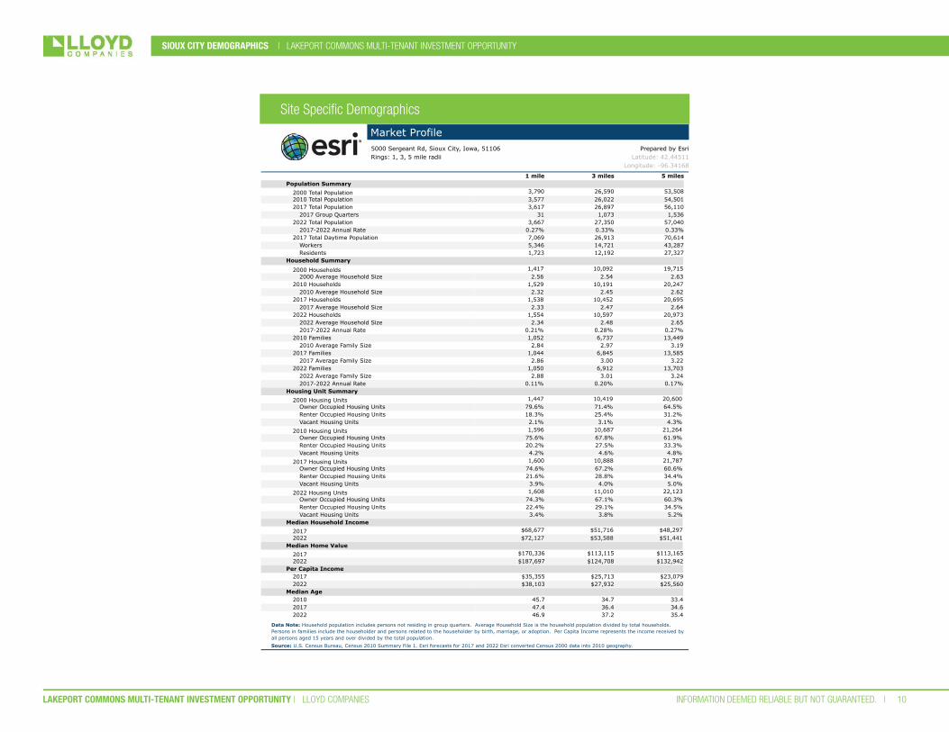
SIOUX CITY DEMOGRAPHICS | LAKEPORT COMMONS MULTI-TENANT INVESTMENT OPPORTUNITY
Site Specific Demographics