Class Opener: How are Satellites classified? What country launched the first satellite?
45
Class Opener: How are Satellites classified? What country launched the first satellite?
-
Upload
marianna-byrd -
Category
Documents
-
view
219 -
download
0
Transcript of Class Opener: How are Satellites classified? What country launched the first satellite?

Class Opener: How are Satellites classified? What country launched the first satellite?

Satellite Orbits and Uses
Grade 11 PhysicsNIS, Taldykorgan
Mr. Marty

Objectives:• describe motion of spacecraft– Derive the expression for escape velocity.– Calculate energy changes in the gravitational field
for spacecraft leaving the Earth and the solar system
• show an understanding of geostationary orbits and their application
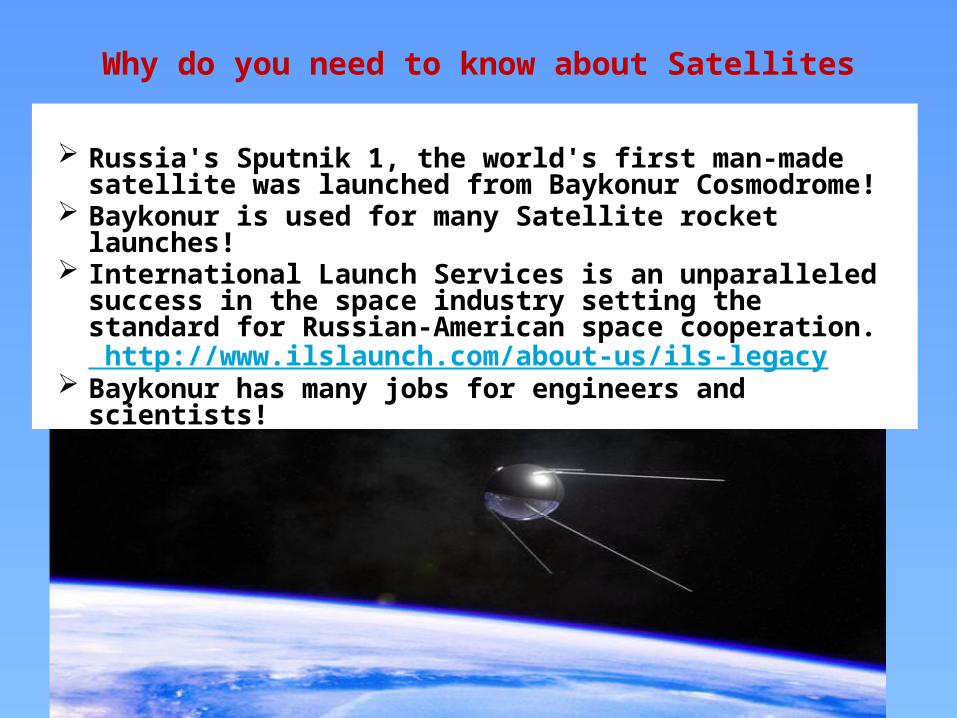
Why do you need to know about Satellites
Russia's Sputnik 1, the world's first man-made satellite was launched from Baykonur Cosmodrome!
Baykonur is used for many Satellite rocket launches! International Launch Services is an unparalleled success in
the space industry setting the standard for Russian-American space cooperation. http://www.ilslaunch.com/about-us/ils-legacy
Baykonur has many jobs for engineers and scientists!
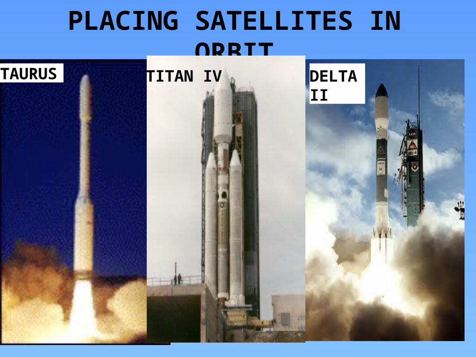
PLACING SATELLITES IN ORBITDELTA IITAURUS TITAN IV

TYPES OF ORBITS
• LEO Low Earth Orbit, Polar• MEO Medium Earth Orbit,
polar and elliptical • HEO High Earth Orbit,
geostationary
• GEO Geosynchronous Orbit

Low-Earth-Orbit (LEO = Polar) Altitude (600 to 1600 km) Revolution time: 90 min - 3
hours. Advantages:
Reduces transmission delay Eliminates need for bulky
receiving equipment. Disadvantages:
Smaller coverage area. Shorter life span (5-8 yrs.)
than GEOs (10 yrs). Subdivisions: Little, Big, and
Mega (Super) LEOs.

Hubble Telescope Classification: LEO Orbit: 375 miles, 600 km. Revolution time: 100 min. Speed: 7600 m/s Concerns: Orbit decay
from gravity and solar output. During “solar maximum”, the densities at all altitudes are enhanced, and the drag effects on satellites are much larger than during times of solar minimum.

Geosynchronous-Earth-Orbit (GEO)
Orbit is synchronous with the earths rotation.
From the ground the satellite appears fixed.
Altitude is about 36,000 km.
Coverage to 40% of planet per satellite.
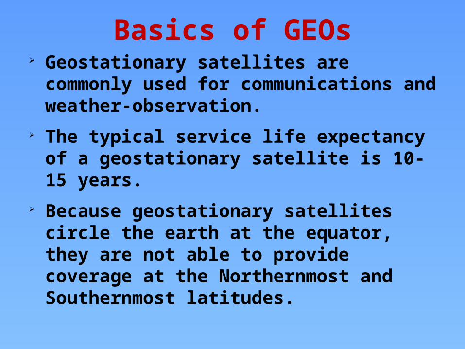
Basics of GEOs Geostationary satellites are commonly used for
communications and weather-observation. The typical service life expectancy of a geostationary
satellite is 10-15 years. Because geostationary satellites circle the earth at
the equator, they are not able to provide coverage at the Northernmost and Southernmost latitudes.

Information on Geostationary Satellites
• For a satellite to be in a particular orbit, a particular velocity is required or a given height above Earth ‘r0+h’.
• Telecommunications satellites remain above one given point on the Earth’s surface, so are called geostationary– broadcast television, forecast the weather.
• Spy Satellites move in a polar orbit so that they can perform sweeps of the surface.– spy on enemy forces

• Located along the equatorial plane.• About 36000 km above the earth• Has Geo-synchronous orbit• Period of 1436 minutes• Good coverage from remote areas• Has wide field of view ~ 50 degrees• Has low resolution• Provides continuous data ~ 15-30
min.• Not very suitable for vertical
soundings
• Near polar orbiting• 800 to 900 km above the earth• Has Sun-synchronous orbit• Period of 101 minutes• Excellent coverage at the poles• Has relatively narrow field of
view• Has high resolution• Passes vary with latitude• Very suitable for vertical
soundings
GEO = Geosynchronous LEO = PolarSummary of SATELLITE ORBITS
12
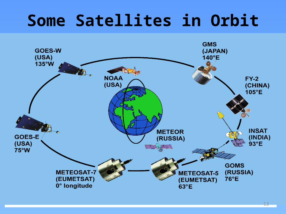
Some Satellites in Orbit
13

Geostationary Orbit Communications satellites orbit
• These satellites are 36000 km above the surface and have R= 42,000km.
• These satellites are positioned to orbit at rate of earths rotation and are always above the same part of the earth.
• Used for TV broadcasts and mobile phones
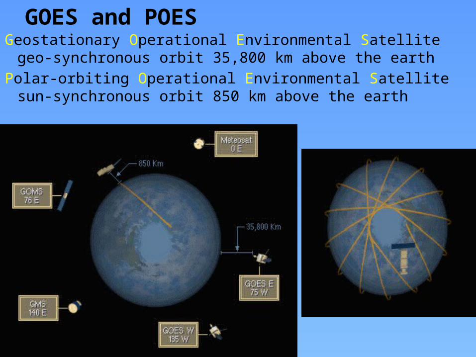
GOES and POESGeostationary Operational Environmental Satellite
geo-synchronous orbit 35,800 km above the earthPolar-orbiting Operational Environmental Satellite sun-
synchronous orbit 850 km above the earth

The GOES SpacecraftGOES-8 Spacecraft
GOES I-M DataBook

GOES I-M DataBook
GOES
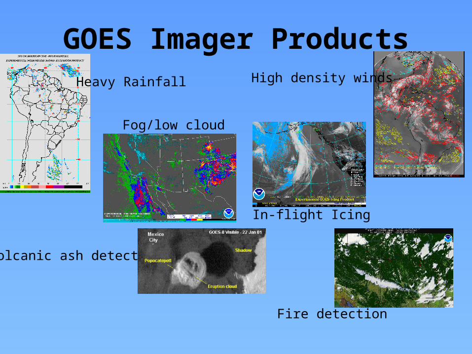
GOES Imager ProductsHeavy Rainfall High density winds
Fog/low cloud
In-flight Icing
Volcanic ash detection
Fire detection
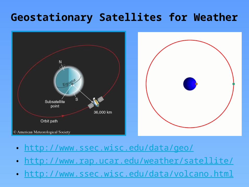
Geostationary Satellites for Weather
• http://www.ssec.wisc.edu/data/geo/• http://www.rap.ucar.edu/weather/satellite/• http://www.ssec.wisc.edu/data/volcano.html
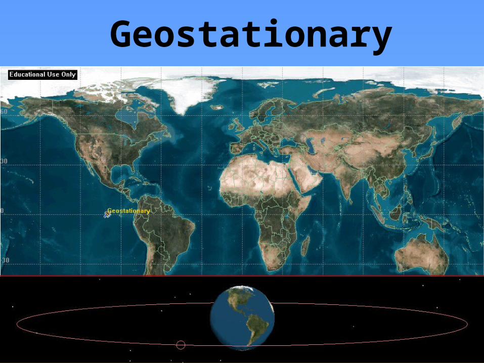
Geostationary

24/27 Satellites Used GPSGlobal Positioning System
GPS Receiver Used in Search and Rescue Missions
GPS satellites orbit Earth in 12 hours

Ground Tracks: Westward Regression
0 30-30-60-90-120
ABC
A - time zero B - after one orbit C - after two orbits
60

Ground tracks: Inclination to equator
60
30
0
30
60
45N
45S
Inclination = 45 degrees Eccentricity ~ 0

Ground Track of Geostationary orbit with 450 angle to equator
Ground Track Slides Courtesy of Major David French
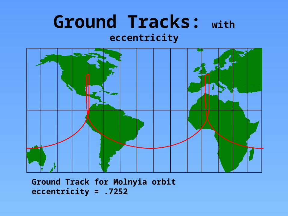
Ground Tracks: with eccentricity
Ground Track for Molnyia orbit eccentricity = .7252

Geosynchronous
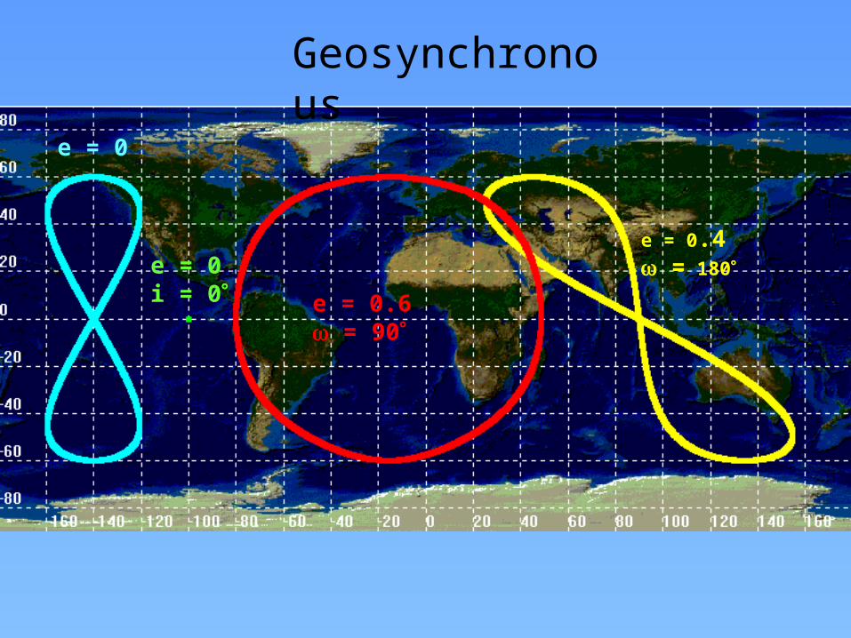
e = 0
e = 0i = 0°
Geosynchronous
e = 0.4w = 180°
e = 0.6w = 90°

METEOROLOGICAL SATELLITES• For monitoring the environment, there are
three types namely the:– Weather satellites, GEO– Meteorological climate research, Polar orbit– Earth Resource satellites (ERS) – Research and Development satellites (R&D).
28

29
Orbit of a Polar-Orbiting
Satellite
http://coastwatch.glerl.noaa.gov/modis/modis.cgi/modis?region=s&page=1
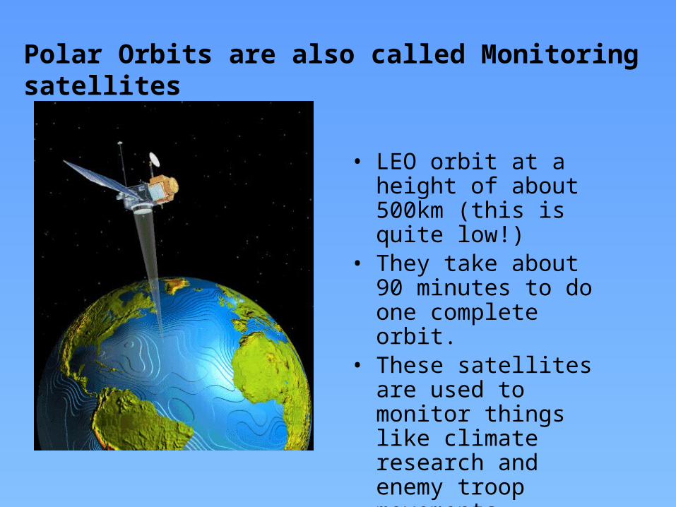
• LEO orbit at a height of about 500km (this is quite low!)
• They take about 90 minutes to do one complete orbit.
• These satellites are used to monitor things like climate research and enemy troop movements.
Polar Orbits are also called Monitoring satellites
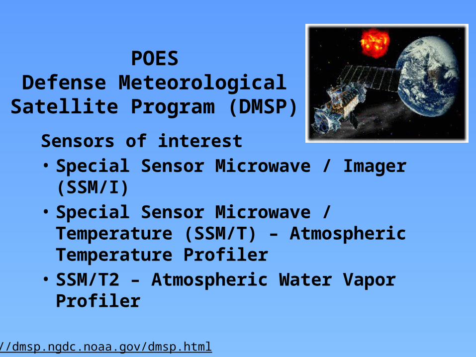
POESDefense Meteorological
Satellite Program (DMSP)Sensors of interest• Special Sensor Microwave / Imager (SSM/I) • Special Sensor Microwave / Temperature
(SSM/T) – Atmospheric Temperature Profiler
• SSM/T2 – Atmospheric Water Vapor Profiler
http://dmsp.ngdc.noaa.gov/dmsp.html

Conical Scanning –SSM/I
Polar Satellite Products for the Operational Forecaster – COMET CD
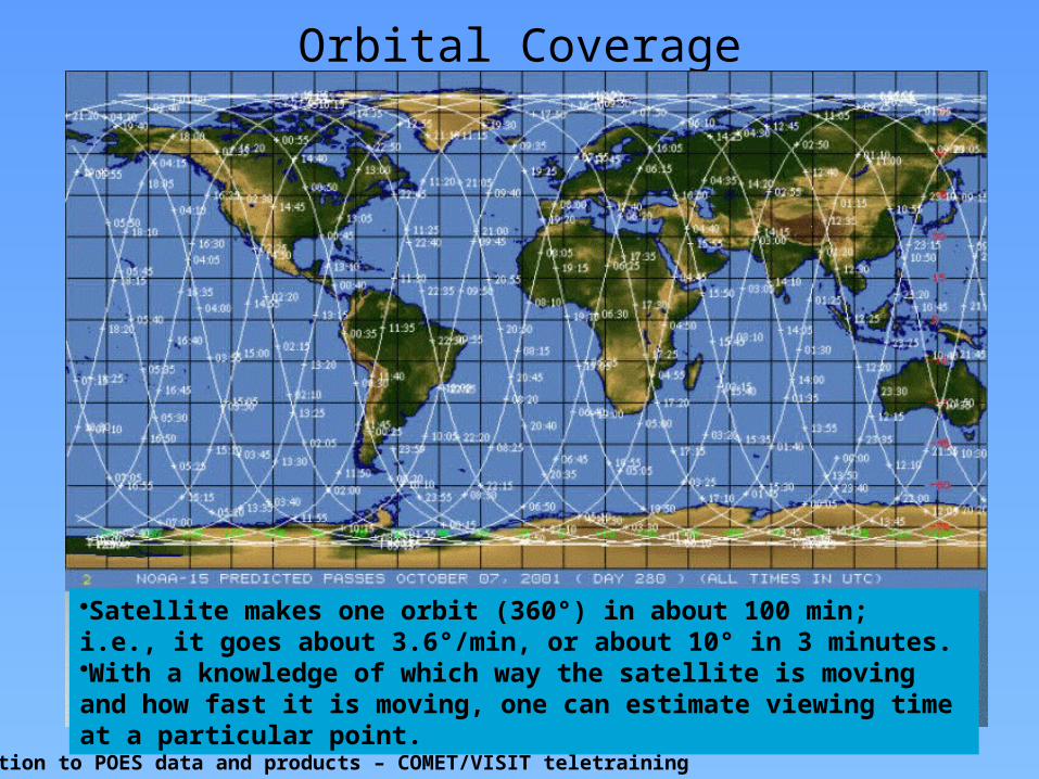
Orbital Coverage
Introduction to POES data and products – COMET/VISIT teletraining
•Satellite makes one orbit (360°) in about 100 min; i.e., it goes about 3.6°/min, or about 10° in 3 minutes.•With a knowledge of which way the satellite is moving and how fast it is moving, one can estimate viewing time at a particular point.

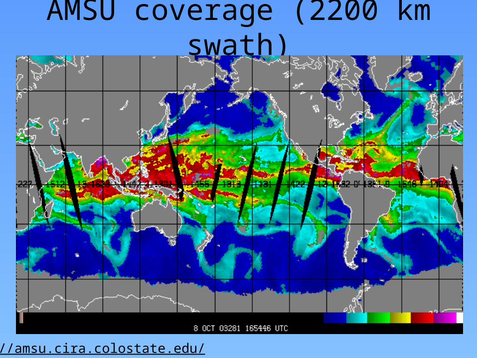
SSMI coverage (1400 km swath)
Example from NOAA’s Marine Observing Systems Team Web Pagehttp://manati.orbit.nesdis.noaa.gov/doc/ssmiwinds.html
swath

AVHRR Products• Sea Surface Temperature
(SST) • Normalized Difference
Vegetation Index (NDVI)• Atmospheric aerosols• Volcanic Ash detection• Fire detection
SST
NDVIAerosols
Fires
Volcanic Ash

AMSU/SSMI Products
• Total Precipitable Water (TPW)• Cloud Liquid Water (CLW)• Rain rate• Snow and Ice cover
TPW
CLW
Rain rate
Snow cover
Ice cover
http://amsu.cira.colostate.edu/
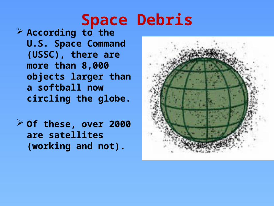
Space Debris According to the U.S. Space
Command (USSC), there are more than 8,000 objects larger than a softball now circling the globe.
Of these, over 2000 are satellites (working and not).

Diagram of Kepler’s Second Law• Equal Areas in Equal times: The line joining the
planet to the Sun sweeps out equal areas in equal times as the planet travels around the ellipse.

ORBIT CLASSIFICATIONSEccentricity
Eccentricity = c/a
e = 0.75
e = .45
e = 0

ORBITAL ELEMENTSKeplerian Elements: Inclination
Orbital Plane
Equatorial Plane
Inclination ( i )
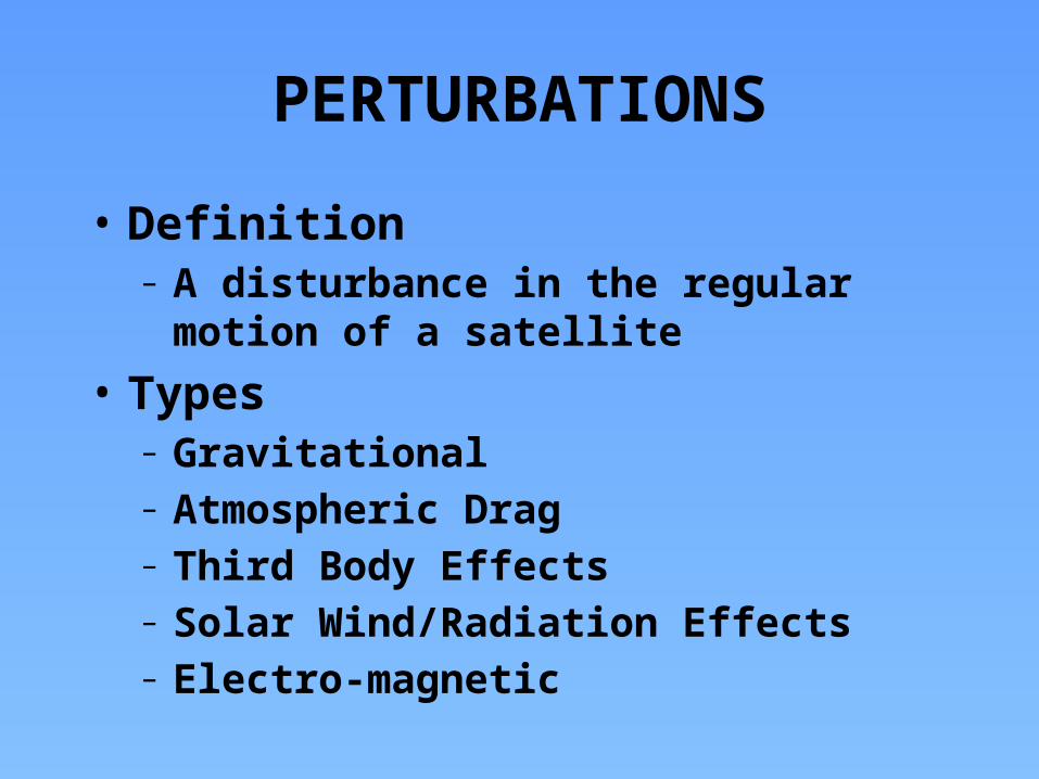
PERTURBATIONS
• Definition– A disturbance in the regular motion of a
satellite• Types
– Gravitational– Atmospheric Drag– Third Body Effects– Solar Wind/Radiation Effects– Electro-magnetic
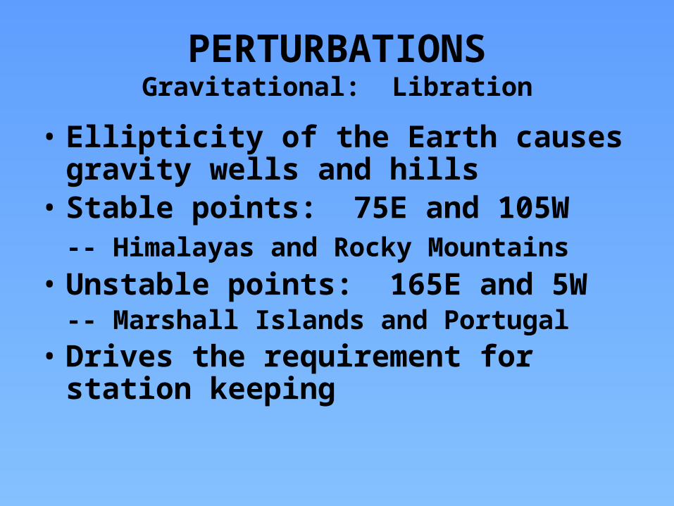
PERTURBATIONSGravitational: Libration
• Ellipticity of the Earth causes gravity wells and hills
• Stable points: 75E and 105W-- Himalayas and Rocky Mountains
• Unstable points: 165E and 5W-- Marshall Islands and Portugal
• Drives the requirement for station keeping

PERTURBATIONSElectro-Magnetic
• Interaction between the Earth’s magnetic field and the satellite’s electro-magnetic field results in magnetic drag

References:• http://coastwatch.glerl.noaa.gov/modis/modis.cgi/modis?region=s
&page=1
• http://www.ssec.wisc.edu/data/geo/• http://www.rap.ucar.edu/weather/satellite/• http://www.ssec.wisc.edu/data/volcano.htmlSpace Systems Loral, 1996 : GOES I-M DataBook
Can be found online at: http://rsd.gsfc.nasa.gov/goes/text/goes.databook.html
NOAA KLM User’s Guide http://www2.ncdc.noaa.gov/docs/klm/index.htm
NOAA/NESDIS Office of Satellite Operations: http://www.oso.noaa.gov/goes/index.htm
NOAA/NESDIS Office of Satellite Data Processing and Distribution http://www.osdpd.noaa.gov/