Clairtrell Area Context Plan - Toronto · City of Toronto Urban Development Services 4 1....
22
Clairtrell Area Context Plan Urban Development Services City Planning March 2005
Transcript of Clairtrell Area Context Plan - Toronto · City of Toronto Urban Development Services 4 1....

Clairtrell AreaContext Plan
Urban Development ServicesCity Planning
March 2005


Contents
○ ○ ○ ○ ○ ○ ○ ○ ○ ○ ○ ○ ○ ○ ○ ○ ○ ○ ○ ○ ○ ○ ○ ○ ○ ○ ○ ○ ○ ○ ○ ○ ○ ○ ○ ○ ○ ○ ○ ○ ○ ○ ○ ○ ○ ○ ○ ○ ○ ○ ○ ○ ○ ○ ○ ○ ○ ○ ○ ○
○ ○ ○ ○ ○ ○ ○ ○ ○ ○ ○ ○ ○ ○ ○ ○ ○ ○ ○ ○ ○ ○ ○ ○ ○ ○ ○ ○ ○ ○ ○ ○ ○ ○ ○ ○ ○ ○ ○ ○ ○ ○ ○ ○ ○ ○ ○ ○ ○ ○ ○ ○ ○ ○ ○ ○ ○ ○ ○ ○
1. Introduction ..................................................................................................................... 4
2. Development Structure ........................................................................................ 6
2.1 Streets ........................................................................................................................ 72.1.1 Sheppard Avenue and Bayview Avenue ................................................ 82.1.2 Local Streets .......................................................................................... 9
2.2 Parks and Open Space ........................................................................................... 102.2.1 Parks2.2.1.1 Bayview/Sheppard Urban Transit Square ...................................... 102.2.1.2 Parkland Dedications ...................................................................... 102.2.2 Private Open Space and Amenity Areas ............................................. 112.2.3 Pedestrian Link ................................................................................... 12
3. Building Massing and Height ....................................................................... 13
3.1 Grade Related Buildings ........................................................................ 153.2 Mid-Rise Buildings ................................................................................ 163.3 Sheppard Avenue and Bayview Avenue Buildings ................................ 173.4 All Souls’ Church and Institutional Uses ............................................. 18
4. Parking and Servicing .......................................................................................... 19
5. Transportation Demand Management .............................................. 20
6. Implementation ........................................................................................................ 21
Clairtrell Area Context Plan

○ ○ ○ ○ ○ ○ ○ ○ ○ ○ ○ ○ ○ ○ ○ ○ ○ ○ ○ ○ ○ ○ ○ ○ ○ ○ ○ ○ ○ ○ ○ ○ ○ ○ ○ ○ ○ ○ ○ ○ ○ ○ ○ ○ ○ ○ ○ ○ ○ ○ ○ ○ ○ ○ ○ ○ ○ ○ ○ ○
○ ○ ○ ○ ○ ○ ○ ○ ○ ○ ○ ○ ○ ○ ○ ○ ○ ○ ○ ○ ○ ○ ○ ○ ○ ○ ○ ○ ○ ○ ○ ○ ○ ○ ○ ○ ○ ○ ○ ○ ○ ○ ○ ○ ○ ○ ○ ○ ○ ○ ○ ○ ○ ○ ○ ○ ○ ○ ○ ○
City of Toronto Urban Development Services
4 1. Introduction
1. Introduction
The purpose of the Context Plan is to provide general development guidelines for the ClairtrellArea’s potential redevelopment. The lands are bounded to the south by Sheppard Avenue, to theeast by Bayview Avenue, to the north by Spring Garden Avenue, and include lands fronting onthe west side of Clairtrell Road. Through OPA 517, which came into effect in 2002, this areawas identified as a key development area within the Bayview Node of the Sheppard East SubwayCorridor Secondary Plan.
The Context Plan builds on the area-specific objectives and requirements of the SecondaryPlan, and includes development, urban design and open space guidelines and diagrams. It isintended to be a framework for Council’s evaluation of development applications in this area,including zoning amendments and site plan approval. The Context Plan is also intended to bea guide for public improvement projects in the area, such as streetscape initiatives.
Aerial photo of Context Plan area and surrounding lands, showing main existing land uses
and features
2003 Aerial Photo

○ ○ ○ ○ ○ ○ ○ ○ ○ ○ ○ ○ ○ ○ ○ ○ ○ ○ ○ ○ ○ ○ ○ ○ ○ ○ ○ ○ ○ ○ ○ ○ ○ ○ ○ ○ ○ ○ ○ ○ ○ ○ ○ ○ ○ ○ ○ ○ ○ ○ ○ ○ ○ ○ ○ ○ ○ ○ ○ ○
○ ○ ○ ○ ○ ○ ○ ○ ○ ○ ○ ○ ○ ○ ○ ○ ○ ○ ○ ○ ○ ○ ○ ○ ○ ○ ○ ○ ○ ○ ○ ○ ○ ○ ○ ○ ○ ○ ○ ○ ○ ○ ○ ○ ○ ○ ○ ○ ○ ○ ○ ○ ○ ○ ○ ○ ○ ○ ○ ○
Clairtrell Area Context Plan
1. Introduction 5
This area is envisioned to be a new mixed use neighbourhood where people can live andwork, and should be designed to have a distinct identity while being integrated with thelarger community.
Recognizing the proximity of Bayview station on the Sheppard subway line, as well as surfacetransit, development should be transit-supportive through: intensification within the densitypermissions of the Secondary Plan; the provision of high quality development; the creation ofan enhanced pedestrian environment; and the use of transit-supportive parking standards.
Redevelopment of the lands in the Context Plan area provides the opportunity to create aneighbourhood that:
• Is predominantly a residential neighbourhood, which also includes, where appropriate, amix of uses including retail, office and institutional uses, with higher-order retail andcommercial uses oriented toward Bayview Avenue and Sheppard Avenue;
• Increases the number of residents and employees living and working close to the Bayviewsubway station;
• Contains a range of built forms, with the higher density uses located along BayviewAvenue and Sheppard Avenue and a transition in height to the north and west;
• Has a public road network, including pedestrian walkways;
• Contains a high quality public realm, meeting Council’s goals for a beautiful City;
• Creates opportunities for the provision of community facilities and open space;
• Incorporates community identity elements associated with the local area; and
• Incorporates high quality urban design.
New development within the Clairtrell area
should be transit-supportive
○ ○ ○ ○ ○ ○ ○ ○ ○ ○ ○ ○ ○ ○ ○ ○ ○ ○ ○ ○ ○ ○ ○ ○ ○ ○ ○ ○ ○ ○ ○ ○ ○ ○ ○ ○ ○ ○ ○ ○ ○ ○ ○ ○ ○ ○ ○ ○ ○ ○ ○ ○ ○ ○ ○ ○ ○ ○ ○ ○
○ ○ ○ ○ ○ ○ ○ ○ ○ ○ ○ ○ ○ ○ ○ ○ ○ ○ ○ ○ ○ ○ ○ ○ ○ ○ ○ ○ ○ ○ ○ ○ ○ ○ ○ ○ ○ ○ ○ ○ ○ ○ ○ ○ ○ ○ ○ ○ ○ ○ ○ ○ ○ ○ ○ ○ ○ ○ ○ ○
City of Toronto Urban Development Services
Public Realm Diagram
6 2. Development Structure
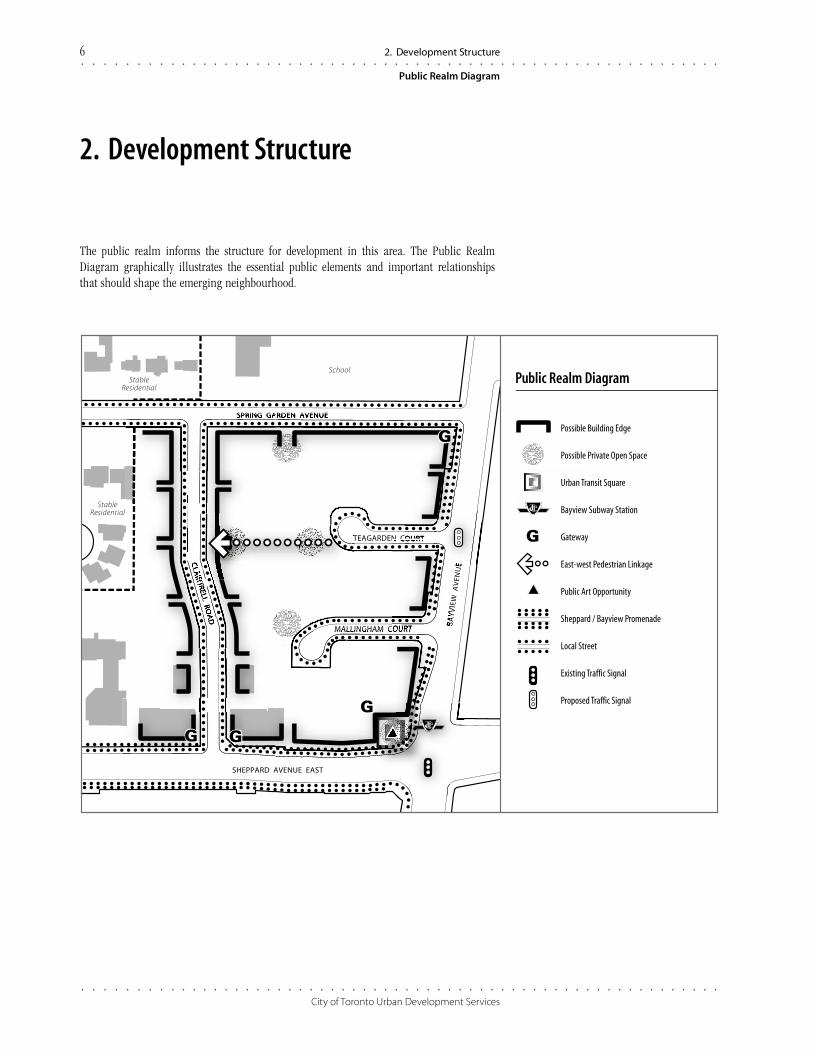
2. Development Structure
The public realm informs the structure for development in this area. The Public RealmDiagram graphically illustrates the essential public elements and important relationshipsthat should shape the emerging neighbourhood.
TEAGARDEN COURT
MALLINGHAM COURT
BA
YV
IEW
AV
ENU
E
SPRING GARDEN AVENUE
SHEPPARD AVENUE EAST
SchoolStable
Residential
StableResidential
Possible Building Edge
Possible Private Open Space
Urban Transit Square
Bayview Subway Station
Gateway
East-west Pedestrian Linkage
Public Art Opportunity
Sheppard / Bayview Promenade
Local Street
Existing Traffic Signal
Proposed Traffic Signal
Public Realm Diagram
○ ○ ○ ○ ○ ○ ○ ○ ○ ○ ○ ○ ○ ○ ○ ○ ○ ○ ○ ○ ○ ○ ○ ○ ○ ○ ○ ○ ○ ○ ○ ○ ○ ○ ○ ○ ○ ○ ○ ○ ○ ○ ○ ○ ○ ○ ○ ○ ○ ○ ○ ○ ○ ○ ○ ○ ○ ○ ○ ○
○ ○ ○ ○ ○ ○ ○ ○ ○ ○ ○ ○ ○ ○ ○ ○ ○ ○ ○ ○ ○ ○ ○ ○ ○ ○ ○ ○ ○ ○ ○ ○ ○ ○ ○ ○ ○ ○ ○ ○ ○ ○ ○ ○ ○ ○ ○ ○ ○ ○ ○ ○ ○ ○ ○ ○ ○ ○ ○ ○
Clairtrell Area Context Plan
2. Development Structure 7
2.1 Streets
An example of how the streetscape within
the new community could be developed
Taller and mid-rise buildings are encouraged
to have a 2 storey base building along the
street frontage with setbacks and gardens
Guidelines
• The primary pedestrian network is, andwill remain, sidewalks along the publicstreets. Sidewalks should be provided onboth sides of all streets.
• Street trees and other streetscape elementsshould be used to enhance publicsidewalks, provide a unified communitycharacter and provide environmentalbenefits. Landscaping along streets shouldconsist of high-branching deciduous treesevenly spaced along the street frontage, aswell as massed shrub plantings and treeplantings within the landscaped frontsetbacks lining the streets.
• The number and width of curb cuts shouldbe kept to a minimum to reduce pedes-trian/ vehicular conflicts. Curb cuts anddriveways shall be discouraged on Bayviewand Sheppard Avenues.
• Any new streets, lanes and mews should bedeveloped in accordance with City policy.
2.1 Streets
The existing public streets in the Context Plan area are to be maintained and will provideboth vehicular and pedestrian access. Sidewalks and walkways will facilitate pedestriantravel throughout the new neighbourhood and to the surrounding area. The network ofstreets, sidewalks and walkways is illustrated in the Public Realm, and Building Height andStructure Diagrams.
Distinctive, high quality streetscape design and elements should be provided to enhance andsupport the neighbourhood character and image.
The road network consists of the following streets that serve transportation needs andstrengthen and provide structure to this new community’s emerging character and identity:
• Sheppard Avenue and Bayview Avenue;
• Local Streets: Teagarden Court, Mallingham Court, Clairtrell Road, Spring Garden Avenue;and
• New Streets, Lanes and Mews.
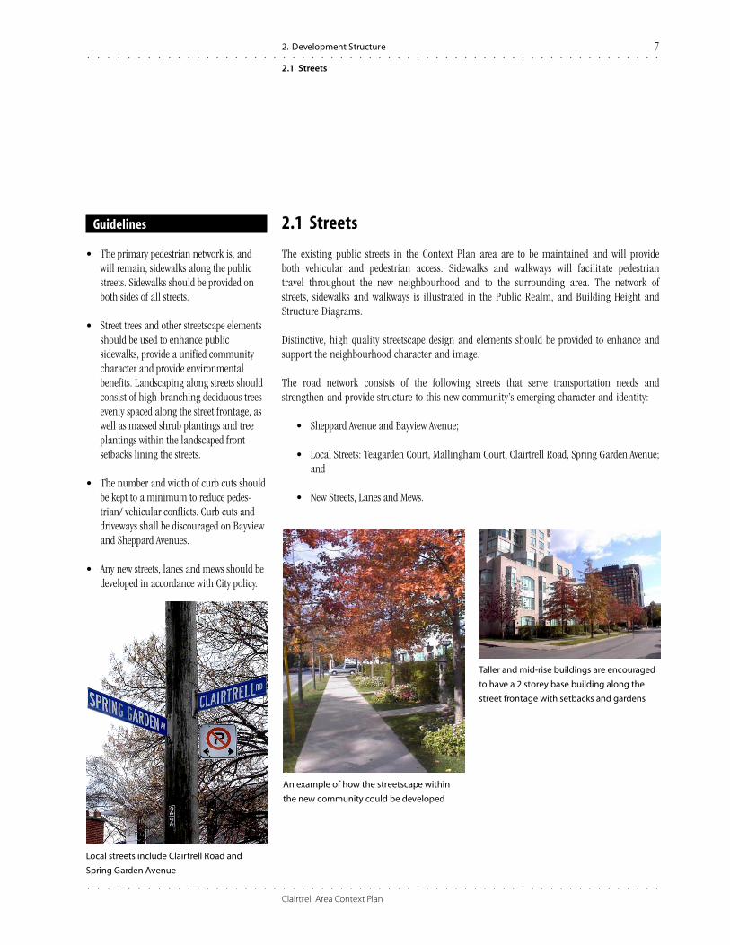
Local streets include Clairtrell Road and
Spring Garden Avenue

○ ○ ○ ○ ○ ○ ○ ○ ○ ○ ○ ○ ○ ○ ○ ○ ○ ○ ○ ○ ○ ○ ○ ○ ○ ○ ○ ○ ○ ○ ○ ○ ○ ○ ○ ○ ○ ○ ○ ○ ○ ○ ○ ○ ○ ○ ○ ○ ○ ○ ○ ○ ○ ○ ○ ○ ○ ○ ○ ○
○ ○ ○ ○ ○ ○ ○ ○ ○ ○ ○ ○ ○ ○ ○ ○ ○ ○ ○ ○ ○ ○ ○ ○ ○ ○ ○ ○ ○ ○ ○ ○ ○ ○ ○ ○ ○ ○ ○ ○ ○ ○ ○ ○ ○ ○ ○ ○ ○ ○ ○ ○ ○ ○ ○ ○ ○ ○ ○ ○
City of Toronto Urban Development Services
8 2. Development Structure
2.1 Streets
2.1.1 Sheppard Avenue and Bayview Avenue
New development near the Bayview subway station creates an opportunity to transformSheppard Avenue and Bayview Avenue into “main streets” in the Context Plan area. Buildingsalong Sheppard Avenue and Bayview Avenue will be encouraged to accommodate retail usesand other “public” people places at grade through their design.
The streetscape is anticipated to be attractive and comfortable for pedestrian travel and otheroutdoor activities. The distinctive urban streetscape includes double row tree plantings, alandscaped median and a generous urban boulevard featuring street furniture, pedestrianlighting and decorative pavement. Enhanced streetscaping should be provided at the northwestBayview/Sheppard intersection, to complement the gateway building and the Urban TransitSquare contemplated for that intersection (see also sections 2.2.1.1 and 3.3 below).
Guidelines
• The Sheppard Avenue Streetscape MasterPlan should guide streetscape design alongthis portion of Sheppard Avenue andBayview Avenue.
• Pedestrian amenity features such asbenches, weather protection and canopiesshould be provided along Sheppard Avenueand Bayview Avenue to encouragepedestrian comfort.
• Special consideration should be made forpedestrian movements across SheppardAvenue and Bayview Avenue.
• Bicycle parking should be provided in themunicipal right-of-way along the BayviewAvenue and Sheppard Avenue frontages.
Cross section of Sheppard Avenue showing central landscaped median, street trees, and
building massing as per OPA 392
Enhanced pedestrian amenities and
streetscape improvements can support
transit initiatives
The enhanced streetscape along
Sheppard Avenue and Bayview
Avenue includes a double row
planting of trees, decorative light
fixtures and street furniture.
Retail uses at grade will animate
this pedestrian promenade

○ ○ ○ ○ ○ ○ ○ ○ ○ ○ ○ ○ ○ ○ ○ ○ ○ ○ ○ ○ ○ ○ ○ ○ ○ ○ ○ ○ ○ ○ ○ ○ ○ ○ ○ ○ ○ ○ ○ ○ ○ ○ ○ ○ ○ ○ ○ ○ ○ ○ ○ ○ ○ ○ ○ ○ ○ ○ ○ ○
○ ○ ○ ○ ○ ○ ○ ○ ○ ○ ○ ○ ○ ○ ○ ○ ○ ○ ○ ○ ○ ○ ○ ○ ○ ○ ○ ○ ○ ○ ○ ○ ○ ○ ○ ○ ○ ○ ○ ○ ○ ○ ○ ○ ○ ○ ○ ○ ○ ○ ○ ○ ○ ○ ○ ○ ○ ○ ○ ○
Clairtrell Area Context Plan
2.1.2 Local Streets
Local streets will provide vehicular, pedestrian, and bicycle access to existing and new develop-ment as well as to the stable residential area to the north and west.
2. Development Structure 9
2.1 Streets
Guidelines
Teagarden Court• Teagarden Court is proposed to be
signalized when a planned TTC bus loopintegrated with a new residential buildingon the east side of Bayview is constructed.New development with frontage on toBayview Avenue should coordinate accessesto enable vehicles and pedestrians to utilizethis signal.
• Teagarden Court should not be connectedthrough to Clairtrell Road for vehicles buta pedestrian connection should bepursued. The future signalization of theSheppard/Teagarden/bus loop intersectionwill provide a new pedestrian crossingopportunity and link the neighbourhoodmore directly with Bayview Village Mall.
• Consideration may be given to establishinga pedestrian and vehicular link betweenTeagarden and Mallingham Courts toenable new developments with frontage onBayview Avenue to take advantage of theplanned traffic signal at Teagarden Court.
Mallingham Court• Mallingham Court will continue to operate
as a vehicular access point for existing andnew development. Turning restrictions maybe necessary in the future to ensure thecontinued efficient operation of BayviewAvenue once the Mallingham Court landsare redeveloped.
Spring Garden Avenue• Spring Garden Avenue is expected to retain
its function as a local street providingaccess to the community and school. Local street cross section showing mid-rise buildings
Local streets should be tree-lined with
setbacks and gardens to promote
predominently “green” character
New development will take access from
existing local streets

○ ○ ○ ○ ○ ○ ○ ○ ○ ○ ○ ○ ○ ○ ○ ○ ○ ○ ○ ○ ○ ○ ○ ○ ○ ○ ○ ○ ○ ○ ○ ○ ○ ○ ○ ○ ○ ○ ○ ○ ○ ○ ○ ○ ○ ○ ○ ○ ○ ○ ○ ○ ○ ○ ○ ○ ○ ○ ○ ○
○ ○ ○ ○ ○ ○ ○ ○ ○ ○ ○ ○ ○ ○ ○ ○ ○ ○ ○ ○ ○ ○ ○ ○ ○ ○ ○ ○ ○ ○ ○ ○ ○ ○ ○ ○ ○ ○ ○ ○ ○ ○ ○ ○ ○ ○ ○ ○ ○ ○ ○ ○ ○ ○ ○ ○ ○ ○ ○ ○
City of Toronto Urban Development Services
2.2 Parks and Open Space
2.2.1 Parks
2.2.1.1 Bayview/Sheppard Urban Transit Square
The public open space at the northwest corner of Bayview Avenue and Sheppard Avenue, whichcontains a subway entrance, should be retained and enhanced. This open space is a forecourtto the Bayview subway station and adjacent building (see also related built form guidelines,section 3.3).
Guidelines
• The proposed Urban Transit Square shouldprovide direct and convenient pedestrianaccess to Bayview subway station, BayviewAvenue, Sheppard Avenue, and adjacentdevelopments.
• The proposed Urban Transit Square shouldbe of high quality design and execution,and may include upgraded pavingmaterials, lighting, furniture, plantings,and other decorative features.
• Public Art is encouraged as a significantcomponent of the Urban Transit Square.
Bayview Station landscape feature Bayview Station’s interior includes public art
2.2.1.2 Parkland Dedications
Required parkland dedication contributions should be directed to acquiring parkland that will
service the local area.
2.2 Parks and Open Space
10 2. Development Structure
○ ○ ○ ○ ○ ○ ○ ○ ○ ○ ○ ○ ○ ○ ○ ○ ○ ○ ○ ○ ○ ○ ○ ○ ○ ○ ○ ○ ○ ○ ○ ○ ○ ○ ○ ○ ○ ○ ○ ○ ○ ○ ○ ○ ○ ○ ○ ○ ○ ○ ○ ○ ○ ○ ○ ○ ○ ○ ○ ○
○ ○ ○ ○ ○ ○ ○ ○ ○ ○ ○ ○ ○ ○ ○ ○ ○ ○ ○ ○ ○ ○ ○ ○ ○ ○ ○ ○ ○ ○ ○ ○ ○ ○ ○ ○ ○ ○ ○ ○ ○ ○ ○ ○ ○ ○ ○ ○ ○ ○ ○ ○ ○ ○ ○ ○ ○ ○ ○ ○
Clairtrell Area Context Plan
2. Development Structure 11
2.2 Parks and Open Space
2.2.2 Private Open Space and Amenity Areas
Private outdoor open space provides recreational opportunities, visual amenity and, whereappropriate, physically accessible open space that complements and enhances the local area.
All development should include open space. The location, amount and design of the openspace will respond to the type of development (residential, employment, institutional) and beof consistently high quality. Publicly accessible open spaces are encouraged to be located alongthe Bayview Avenue, Sheppard Avenue, Clairtrell Road and Spring Garden Avenue frontages,and along the pedestrian link between Clairtrell Road and Bayview Avenue (see section 2.2.3).
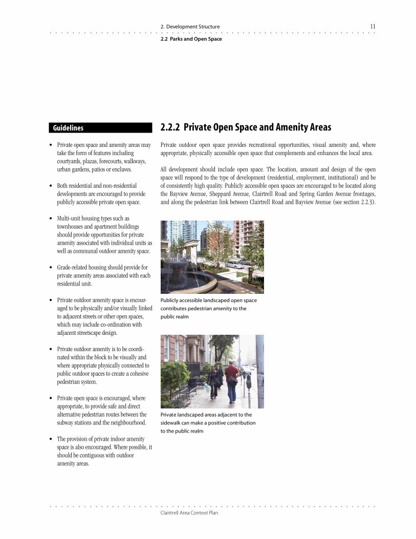
Private landscaped areas adjacent to the
sidewalk can make a positive contribution
to the public realm
Publicly accessible landscaped open space
contributes pedestrian amenity to the
public realm
Guidelines
• Private open space and amenity areas maytake the form of features includingcourtyards, plazas, forecourts, walkways,urban gardens, patios or enclaves.
• Both residential and non-residentialdevelopments are encouraged to providepublicly accessible private open space.
• Multi-unit housing types such astownhouses and apartment buildingsshould provide opportunities for privateamenity associated with individual units aswell as communal outdoor amenity space.
• Grade-related housing should provide forprivate amenity areas associated with eachresidential unit.
• Private outdoor amenity space is encour-aged to be physically and/or visually linkedto adjacent streets or other open spaces,which may include co-ordination withadjacent streetscape design.
• Private outdoor amenity is to be coordi-nated within the block to be visually andwhere appropriate physically connected topublic outdoor spaces to create a cohesivepedestrian system.
• Private open space is encouraged, whereappropriate, to provide safe and directalternative pedestrian routes between thesubway stations and the neighbourhood.
• The provision of private indoor amenityspace is also encouraged. Where possible, itshould be contiguous with outdooramenity areas.

○ ○ ○ ○ ○ ○ ○ ○ ○ ○ ○ ○ ○ ○ ○ ○ ○ ○ ○ ○ ○ ○ ○ ○ ○ ○ ○ ○ ○ ○ ○ ○ ○ ○ ○ ○ ○ ○ ○ ○ ○ ○ ○ ○ ○ ○ ○ ○ ○ ○ ○ ○ ○ ○ ○ ○ ○ ○ ○ ○
○ ○ ○ ○ ○ ○ ○ ○ ○ ○ ○ ○ ○ ○ ○ ○ ○ ○ ○ ○ ○ ○ ○ ○ ○ ○ ○ ○ ○ ○ ○ ○ ○ ○ ○ ○ ○ ○ ○ ○ ○ ○ ○ ○ ○ ○ ○ ○ ○ ○ ○ ○ ○ ○ ○ ○ ○ ○ ○ ○
City of Toronto Urban Development Services
2.2.3 Pedestrian Link
An east-west, open-air pedestrian link is to be provided to connect Clairtrell Road with BayviewAvenue, generally in alignment with Teagarden Court. This open space will provide convenient,comfortable and direct mid-block pedestrian and bicycle access to and from Bayview Avenue.This link is to align with the Teagarden Court/ Bayview Avenue intersection, which is to be sig-nalized and will facilitate pedestrian access across Bayview Avenue (see Structure Diagram forapproximate location of east-west pedestrian linkage and future signalized intersection).
This link is to be landscaped, animated by adjacent uses and connected visually, and whereappropriate, physically with adjacent development. Publicly accessible open spaces, andbuilding courtyards and building entrances, may border the walkway.
Guidelines
• The link should be a minimum widthof 6 m.
• The portion of the route within theTeagarden Court right-of-way should beco-ordinated with a sidewalk alongTeagarden Court.
• The walkway should be tree-lined,landscaped and lighted.
• Privacy fencing and low decorativefencing along the walkway should bedesigned and located to balance privacyneeds of adjacent development with safetyand comfort of pedestrians using thepublic walkway.
• Buildings along the walkway will beoriented to face the walkway with doorsand windows to animate and overlook thewalkway to provide “eyes on the walkway.”Buildings located along the east-west
walkway should face the route providning
animated facades and entrances that
overlook the pedestrian area
Private open space may be located along
public walkways and bicycle routes providing
amenity and “eyes on the path”
The east-west open space/pedestrian
linkage will be wide, lighted and intensely
landscaped
12 2. Development Structure
2.2 Parks and Open Space

○ ○ ○ ○ ○ ○ ○ ○ ○ ○ ○ ○ ○ ○ ○ ○ ○ ○ ○ ○ ○ ○ ○ ○ ○ ○ ○ ○ ○ ○ ○ ○ ○ ○ ○ ○ ○ ○ ○ ○ ○ ○ ○ ○ ○ ○ ○ ○ ○ ○ ○ ○ ○ ○ ○ ○ ○ ○ ○ ○
○ ○ ○ ○ ○ ○ ○ ○ ○ ○ ○ ○ ○ ○ ○ ○ ○ ○ ○ ○ ○ ○ ○ ○ ○ ○ ○ ○ ○ ○ ○ ○ ○ ○ ○ ○ ○ ○ ○ ○ ○ ○ ○ ○ ○ ○ ○ ○ ○ ○ ○ ○ ○ ○ ○ ○ ○ ○ ○ ○
Clairtrell Area Context Plan
3. Building Massing and Height 13
General
3. Building Massing and Height
Guidelines
• Buildings should generally be locatedparallel to and be oriented to face thepublic street, and address the public street.
• Generally, a 2 to 6 m setback from thestreet should be provided to allow forgardens and landscaped areas between thepublic sidewalk and the building.
• Porches and low stoops are encouraged forresidential building entrances.
• Buildings should relate to surroundingexisting development in a way thatminimizes potential impacts on theadjacent residential neighbourhood,including “like to like” building orienta-tion, and setback relationships similar toexisting setbacks.
• Building step backs and reduced heightsfor portions of buildings, as well asincreased building setbacks and intensifiedlandscaping, will be encouraged tomediate transitions between differentbuilding types and forms.
·• Balconies and decks facing the adjacentstable residential area should be designedin a sensitive manner.
• Canopies should be provided at buildingentrances to provide weather protection,where appropriate.
Buildings can be designed to be integrated
with the local topography, hiding service
areas and absorbing changes in grade
Buildings should face and take their address
from a street
In accordance with Official Plan policies, the massing of new buildings is intended to:
• Frame and support the neighbourhood streets and open spaces at a scale that balancesbuilding height and form with street width;
• Provide adequate transition to adjacent stable residential areas to the north and westoutside the Secondary Plan area, and to lower density lands within the context plan area,through appropriate and compatible heights, scale, setbacks, siting, and sensitive buildingdesign;
• Provide adequate sunlight/skyview for St. Gabriel’s School yard on the north side of SpringGarden Avenue, through appropriate yard setbacks and building step backs as may beneeded to prevent undue overshadowing of the school yard;
• Support the Sheppard Avenue and Bayview Avenue streetscape initiatives; and
• Ensure a proper response to pedestrian scale.
Appropriate landscaped setbacks and
building stepbacks are needed to create a
transition between ground-related housing
and mid-rise buildings
Buildings will have a well-defined base that
aligns with adjacent streets and open spaces

○ ○ ○ ○ ○ ○ ○ ○ ○ ○ ○ ○ ○ ○ ○ ○ ○ ○ ○ ○ ○ ○ ○ ○ ○ ○ ○ ○ ○ ○ ○ ○ ○ ○ ○ ○ ○ ○ ○ ○ ○ ○ ○ ○ ○ ○ ○ ○ ○ ○ ○ ○ ○ ○ ○ ○ ○ ○ ○ ○
○ ○ ○ ○ ○ ○ ○ ○ ○ ○ ○ ○ ○ ○ ○ ○ ○ ○ ○ ○ ○ ○ ○ ○ ○ ○ ○ ○ ○ ○ ○ ○ ○ ○ ○ ○ ○ ○ ○ ○ ○ ○ ○ ○ ○ ○ ○ ○ ○ ○ ○ ○ ○ ○ ○ ○ ○ ○ ○ ○
City of Toronto Urban Development Services
A variety of generalized building types, including grade-related, mid-rise, and Bayview/Sheppard Avenue buildings, have been organized into the Building Height and StructureDiagram to meet these principles. The Building Height and Structure Diagram also provides arange of generalized heights appropriate in the Context Plan area, in metres and in storeys.
Building Height and Structure Diagram
14 3. Building Massing and Height
TEAGARDEN COURT
MALLINGHAM COURT
BA
YV
IEW
AV
ENU
E
SPRING GARDEN AVENUE
SHEPPARD AVENUE EAST
SchoolStable
Residential
StableResidential
Possible Building Edge
Possible Private Open Space
Existing Buildings
Building Heightand Structure Diagram
Base Building3–6 storeys
11–20 m
Sheppard / Bayview Buildings12–14 storeys
38–44 m
Sheppard / Bayview Buildings12–14 storeys
38–44 m
Grade Relatedto
Mid RiseBuilding6 storeys
20 m
Grade Relatedto
Mid RiseBuilding8 storeys
26 mGrade RelatedBuilding4 storeys
14 m
Grad
e Re
late
d Bu
ildin
g3
stor
eys
11 m
14 storeys14 storeys
3 storeys 3 storeysGateway Building
14–15 storeys42.5 m

○ ○ ○ ○ ○ ○ ○ ○ ○ ○ ○ ○ ○ ○ ○ ○ ○ ○ ○ ○ ○ ○ ○ ○ ○ ○ ○ ○ ○ ○ ○ ○ ○ ○ ○ ○ ○ ○ ○ ○ ○ ○ ○ ○ ○ ○ ○ ○ ○ ○ ○ ○ ○ ○ ○ ○ ○ ○ ○ ○
○ ○ ○ ○ ○ ○ ○ ○ ○ ○ ○ ○ ○ ○ ○ ○ ○ ○ ○ ○ ○ ○ ○ ○ ○ ○ ○ ○ ○ ○ ○ ○ ○ ○ ○ ○ ○ ○ ○ ○ ○ ○ ○ ○ ○ ○ ○ ○ ○ ○ ○ ○ ○ ○ ○ ○ ○ ○ ○ ○
Clairtrell Area Context Plan
3.1 Grade Related Buildings
3. Building Massing and Height 15
3.1 Grade Related Buildings
Grade related buildings are generally 2 to 4 storeys and commonly take the form oftownhouses, stacked townhouses, and, on the east side of Clairtrell Road, walk-upapartment buildings.
This building type has been located along the west boundary of the site on either side ofClairtrell Road near the existing neighbourhood as transition buildings to the low scale, stableresidential area to the north and west. The area along the south side of Spring Garden Avenue,east of Clairtrell Road, may develop with either grade related or mid-rise buildings or buildingpodiums for taller buildings, in the range of 3-6 storeys.
The buildings should be developed in a manner that respects the existing stable residentialneighbourhood.
Guidelines
• Townhouses should be designed anddeveloped in accordance with the City’sInfill Townhouse Guidelines.
• The height of new buildings on the westside of Clairtrell Road abutting existinglow density residential uses to the west willbe limited to 3 storeys in height as stated inthe Secondary Plan policy, and will belimited by a 45 degree angular plane.Buildings are to be set back 9.5 m from theexisting low density residential lots.
• Below-grade building entrances arediscouraged.
Townhouses or other low rise building forms
are proposed adjacent to the residential
neighbourhoods to the north and to the west
Porches and front yard landscaping are
encouraged to enhance residential
neighbourhoods
Grade related buildings and the base or
podium for taller buildings share similar
characteristics
○ ○ ○ ○ ○ ○ ○ ○ ○ ○ ○ ○ ○ ○ ○ ○ ○ ○ ○ ○ ○ ○ ○ ○ ○ ○ ○ ○ ○ ○ ○ ○ ○ ○ ○ ○ ○ ○ ○ ○ ○ ○ ○ ○ ○ ○ ○ ○ ○ ○ ○ ○ ○ ○ ○ ○ ○ ○ ○ ○
○ ○ ○ ○ ○ ○ ○ ○ ○ ○ ○ ○ ○ ○ ○ ○ ○ ○ ○ ○ ○ ○ ○ ○ ○ ○ ○ ○ ○ ○ ○ ○ ○ ○ ○ ○ ○ ○ ○ ○ ○ ○ ○ ○ ○ ○ ○ ○ ○ ○ ○ ○ ○ ○ ○ ○ ○ ○ ○ ○
City of Toronto Urban Development Services
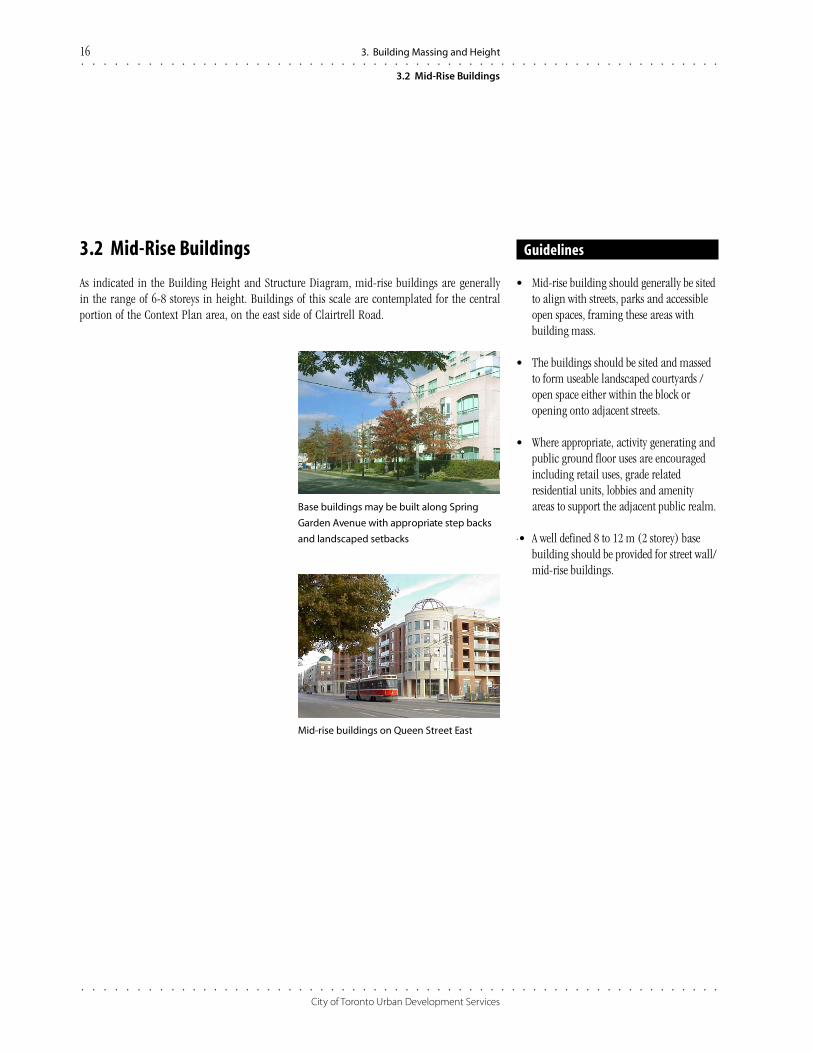
3.2 Mid-Rise Buildings
As indicated in the Building Height and Structure Diagram, mid-rise buildings are generallyin the range of 6-8 storeys in height. Buildings of this scale are contemplated for the centralportion of the Context Plan area, on the east side of Clairtrell Road.
Guidelines
• Mid-rise building should generally be sitedto align with streets, parks and accessibleopen spaces, framing these areas withbuilding mass.
• The buildings should be sited and massedto form useable landscaped courtyards /open space either within the block oropening onto adjacent streets.
• Where appropriate, activity generating andpublic ground floor uses are encouragedincluding retail uses, grade relatedresidential units, lobbies and amenityareas to support the adjacent public realm.
·• A well defined 8 to 12 m (2 storey) basebuilding should be provided for street wall/mid-rise buildings.
Base buildings may be built along Spring
Garden Avenue with appropriate step backs
and landscaped setbacks
Mid-rise buildings on Queen Street East
3.2 Mid-Rise Buildings
16 3. Building Massing and Height

○ ○ ○ ○ ○ ○ ○ ○ ○ ○ ○ ○ ○ ○ ○ ○ ○ ○ ○ ○ ○ ○ ○ ○ ○ ○ ○ ○ ○ ○ ○ ○ ○ ○ ○ ○ ○ ○ ○ ○ ○ ○ ○ ○ ○ ○ ○ ○ ○ ○ ○ ○ ○ ○ ○ ○ ○ ○ ○ ○
○ ○ ○ ○ ○ ○ ○ ○ ○ ○ ○ ○ ○ ○ ○ ○ ○ ○ ○ ○ ○ ○ ○ ○ ○ ○ ○ ○ ○ ○ ○ ○ ○ ○ ○ ○ ○ ○ ○ ○ ○ ○ ○ ○ ○ ○ ○ ○ ○ ○ ○ ○ ○ ○ ○ ○ ○ ○ ○ ○
Clairtrell Area Context Plan
3.3 Sheppard Avenue and Bayview Avenue Buildings
3. Building Massing and Height 17
Buildings on Bayview Avenue and on
Sheppard Avenue will have a 2 storey podium
or base
3.3 Sheppard Avenue and Bayview Avenue Buildings
Buildings generally in the range of 12 to 14 storeys (and 14-15 storeys on the site at the north-west Bayview/Sheppard intersection) will be located in the easternmost part of the Context Planarea. These buildings will have their address and main building entrances on Sheppard Avenueand on Bayview Avenue. Buildings along Sheppard Avenue and Bayview Avenue should bemassed and sited to create a street wall that frames the street at a pedestrian scale and providesenough space to create a generous landscaped promenade in keeping with the Secondary Planand the Sheppard Avenue Master Streetscape Plan.
Development at the northwest Bayview/Sheppard intersection should be in the general range of14-15 storeys in height. The future corner building should be designed with distinctive builtform features and complementary streetscape that reinforce the building’s role as a visual“gateway” into the community from Highway 401, and the location’s importance along theSheppard subway line (see also 2.2.1.1 – Bayview/Sheppard Urban Transit Square).
Guidelines
• A 5 m building setback should be providedto accommodate on-site landscaping thatis to be integrated with the emergingstreetscape.
• The expression of a 2 storey base buildingis encouraged along Bayview and SheppardAvenues. The upper parts of the buildingthat rise above the base should step backfrom the street edge of the base building.
• A further step back is encouraged at the6 storey height to reinforce the built formobjectives of the Sheppard East SubwayCorridor Secondary Plan.
• Street-related retail and service uses areencouraged at grade level, with individualentrances directly accessible at grade fromthe adjacent streets, for buildings havingfrontage on Bayview Avenue and SheppardAvenue.
• Where a building fronting on BayviewAvenue or Sheppard Avenue is to bedeveloped with entirely residential uses, theportion of the building fronting on thearterial should be designed with grade-related units having direct pedestrianaccess from the adjacent right-of-way, andflexible uses such as live/work spaces are tobe encouraged at grade level.
A “gateway building” can create an entrance
or sense of arrival through its massing
and design

○ ○ ○ ○ ○ ○ ○ ○ ○ ○ ○ ○ ○ ○ ○ ○ ○ ○ ○ ○ ○ ○ ○ ○ ○ ○ ○ ○ ○ ○ ○ ○ ○ ○ ○ ○ ○ ○ ○ ○ ○ ○ ○ ○ ○ ○ ○ ○ ○ ○ ○ ○ ○ ○ ○ ○ ○ ○ ○ ○
○ ○ ○ ○ ○ ○ ○ ○ ○ ○ ○ ○ ○ ○ ○ ○ ○ ○ ○ ○ ○ ○ ○ ○ ○ ○ ○ ○ ○ ○ ○ ○ ○ ○ ○ ○ ○ ○ ○ ○ ○ ○ ○ ○ ○ ○ ○ ○ ○ ○ ○ ○ ○ ○ ○ ○ ○ ○ ○ ○
City of Toronto Urban Development Services
3.4 All Souls’ Church and Institutional Uses
The All Souls’ Church and associated residential building (“North Yorkers for the Disabled”)occupies a large parcel of land with frontage on both Clairtrell Avenue and Bayview Avenue.The site has a split land use designation of Residential Density 5 (2.0 FSI) and Mixed Use (3.0FSI) in the Sheppard East Subway Corridor Secondary Plan. In addition to its role as a place ofworship, the existing Church is also a meeting place for a range of community activities.
There are several possible development scenarios, which may include among others thecontinued use, expansion, or relocation of the Church and its associated residential building,or the development of the site with institutional or other types of uses, or a combination ofuses. The following guidelines are intended to be applied to the All Souls’ Church and otherinstitutional-type uses within the Context Plan area.
Guidelines
• Buildings should occupy a highly visibleand accessible location.
• Civic and/or institutional buildings shouldbe designed as neighbourhood landmarks.
• Building façades should address the streetor open space frontage with an appropriatedegree of interest and animation, andinclude glazing and a main door tothe street.
• The building footprint should be mini-mized. Multi-storey building designis encouraged.
• Built form, massing, design and architec-ture should be based on a strong expres-sion or interpretation of the site /community heritage.
• Should the existing church facility eitherremain or be expanded as part of thefuture redevelopment of the site, opportu-nities to visually and functionally connectthe church use with the surroundingneighbourhood should be explored toenhance the facility’s identity withinthe community.
The 51 Division Building is a good example of
an institutional building
18 3. Building Massing and Height
3.4 All Souls’ Church and Institutional Uses

○ ○ ○ ○ ○ ○ ○ ○ ○ ○ ○ ○ ○ ○ ○ ○ ○ ○ ○ ○ ○ ○ ○ ○ ○ ○ ○ ○ ○ ○ ○ ○ ○ ○ ○ ○ ○ ○ ○ ○ ○ ○ ○ ○ ○ ○ ○ ○ ○ ○ ○ ○ ○ ○ ○ ○ ○ ○ ○ ○
○ ○ ○ ○ ○ ○ ○ ○ ○ ○ ○ ○ ○ ○ ○ ○ ○ ○ ○ ○ ○ ○ ○ ○ ○ ○ ○ ○ ○ ○ ○ ○ ○ ○ ○ ○ ○ ○ ○ ○ ○ ○ ○ ○ ○ ○ ○ ○ ○ ○ ○ ○ ○ ○ ○ ○ ○ ○ ○ ○
Clairtrell Area Context Plan
General
4. parking and Servicing 19
Guidelines
• Parking lots and service areas should be coordinated and organized for each developmentblock, wherever possible, to limit their visual impacts on the public realm. Shared parkingand servicing areas are encouraged. Paved areas should be minimized and landscapingshould be maximized.
• Underground parking is encouraged. The extent of surface parking and service areas shouldbe minimized, especially where parking may be visible to the street.
• Above grade parking, where provided, should be faced with habitable rooms adjacent tostreets, parks and accessible open spaces.
• Access to parking, automobile drop off areas and servicing areas should be designed tominimize car-pedestrian conflict. The number and size of curb cuts should be kept to aminimum to reduce potential conflict points. Vehicular access points should be co-ordinatedand consolidated where possible.
• Bicycle parking should be provided in new developments and on the Bayview Avenue andSheppard Avenue public rights-of-way where appropriate.
• Driveways, ramps, and service areas, etc. should be sited and designed in a manner so as tominimize impacts on the streetscape and on neighbouring properties.
• Garbage storage areas should be provided internal to the buildings where possible. If garbagestorage areas are to be provided outside, they are to be sited and designed in a manner thatminimizes impact on adjacent publicly accessible areas, including streets, and designed tominimize impacts on adjacent properties.
• Curbside garbage pick-up is encouraged for grade-related residential units.
• Ventilation areas and utilities such as hydro and gas meters and transformers provided inconjunction with new development should be sited and screened in a manner that minimizesimpacts on adjacent public areas.
4. Parking and Servicing
Shared entrances and servicing courts within
a block are encouraged
Sufficient parking and servicing facilitiesshould be provided to serve new developmentand be oriented in such a way to havea minimal physical and visual impact onpublic streets and open spaces. Parkingrequirements will be supportive of transit.The amount of parking required should meetthe essential demand of each developmentwithout encouraging discretionary auto use.Minimum and maximum parking require-ments may be used to support this goal.
Underground parking is encouraged
Service areas should be located and designed
to support and enhance streetscape and
open space initiatives

○ ○ ○ ○ ○ ○ ○ ○ ○ ○ ○ ○ ○ ○ ○ ○ ○ ○ ○ ○ ○ ○ ○ ○ ○ ○ ○ ○ ○ ○ ○ ○ ○ ○ ○ ○ ○ ○ ○ ○ ○ ○ ○ ○ ○ ○ ○ ○ ○ ○ ○ ○ ○ ○ ○ ○ ○ ○ ○ ○
○ ○ ○ ○ ○ ○ ○ ○ ○ ○ ○ ○ ○ ○ ○ ○ ○ ○ ○ ○ ○ ○ ○ ○ ○ ○ ○ ○ ○ ○ ○ ○ ○ ○ ○ ○ ○ ○ ○ ○ ○ ○ ○ ○ ○ ○ ○ ○ ○ ○ ○ ○ ○ ○ ○ ○ ○ ○ ○ ○
City of Toronto Urban Development Services
5. Transportation Demand Management
Existing and future development, especially commercial, is strongly encouraged to implementmeasures to minimize peak hour vehicle trips. Carpool programs, parking supply controls andpricing, flexible work schedules, and employer subsidized transit fares are among the measuresthat could be employed to reduce the traffic generated by commercial development in the areaand its impact on the surrounding community and the environment. All developments areexpected to provide bicycle parking for residents and visitors and provide parking at ratios thatencourage transit-riding households to locate in this area. Innovative ways to reduce auto useamong building occupants, such as partnerships with car sharing organizations or rentalcompanies, are encouraged.
As the Context Plan area is designated as a key development area in OPA 392, the transporta-tion monitoring policies apply. This monitoring will include periodic traffic counts todetermine the extent of traffic infiltration into the stable residential area and identify potentialmitigating measures if required.
General
20 5. Transportation Demand Management
○ ○ ○ ○ ○ ○ ○ ○ ○ ○ ○ ○ ○ ○ ○ ○ ○ ○ ○ ○ ○ ○ ○ ○ ○ ○ ○ ○ ○ ○ ○ ○ ○ ○ ○ ○ ○ ○ ○ ○ ○ ○ ○ ○ ○ ○ ○ ○ ○ ○ ○ ○ ○ ○ ○ ○ ○ ○ ○ ○
○ ○ ○ ○ ○ ○ ○ ○ ○ ○ ○ ○ ○ ○ ○ ○ ○ ○ ○ ○ ○ ○ ○ ○ ○ ○ ○ ○ ○ ○ ○ ○ ○ ○ ○ ○ ○ ○ ○ ○ ○ ○ ○ ○ ○ ○ ○ ○ ○ ○ ○ ○ ○ ○ ○ ○ ○ ○ ○ ○
Clairtrell Area Context Plan
General
6. Implementation 21
6. Implementation
This Context Plan is intended to guide the preparation of future regulatory planningmechanisms, including zoning by-laws and site plan approvals. The Context Plan sets outspecific guidelines and approaches that fulfill the overall objectives of the Secondary Plan.
Innovative, high quality development, designed to respect the adjacent community, streetsand open spaces and buildings within the block will be encouraged. The design of eachdevelopment application will be evaluated on its own merits to address site-specific conditionssuch as site topography and access opportunities. To achieve the density objectives of theSecondary Plan and to implement the Context Plan guidelines, comprehensive developmentsare encouraged, where possible.