
CitySDK Workshop Feedback
15
MISSION EXCELLENCE | CUSTOMER SERVICE EXCELLENCE | ORGANIZATIONAL EXCELLENCE | WORKFORCE EXCELLENCE 18F Beta #CitySDK #HackforChange @USCENSUSBUREAU
-
Upload
tyrone-grandison -
Category
Government & Nonprofit
-
view
54 -
download
0
Transcript of CitySDK Workshop Feedback

MISSION EXCELLENCE | CUSTOMER SERVICE EXCELLENCE | ORGANIZATIONAL EXCELLENCE |
WORKFORCE EXCELLENCE
18F Beta#CitySDK #HackforChange
@USCENSUSBUREAU

MISSION EXCELLENCE | CUSTOMER SERVICE EXCELLENCE | ORGANIZATIONAL EXCELLENCE |
WORKFORCE EXCELLENCE
CitySDK Workshop#PIF #CitySDK #HackforChange
@USCENSUSBUREAU

THE FEEDBACK
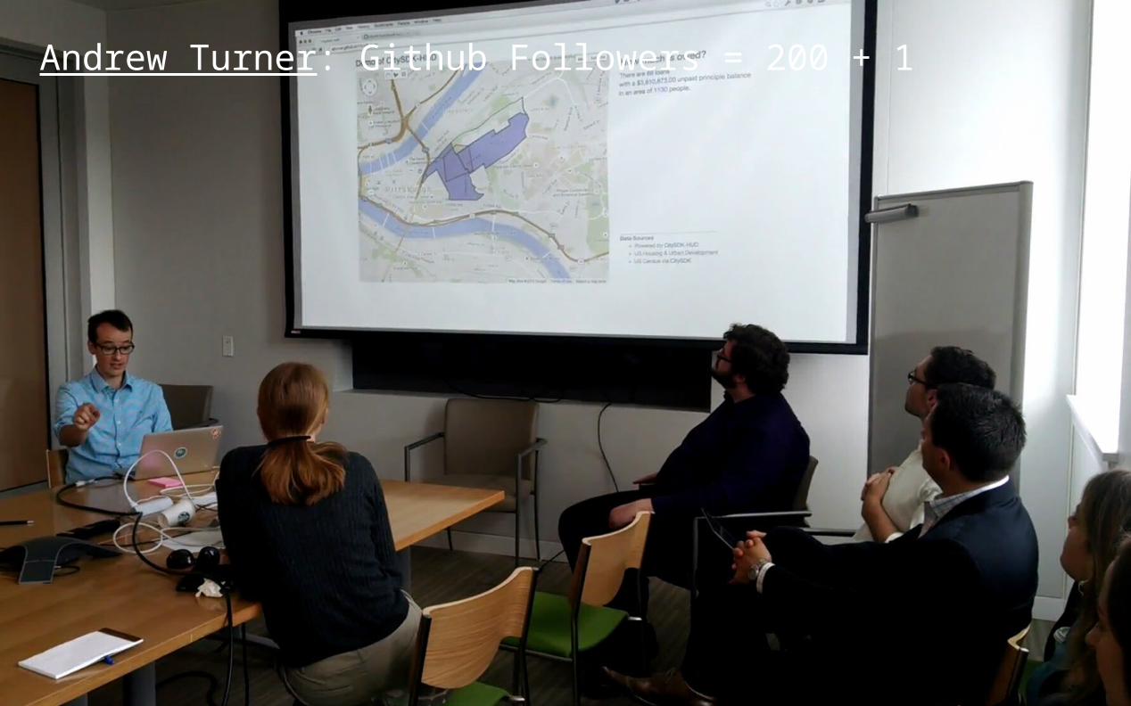
During development:
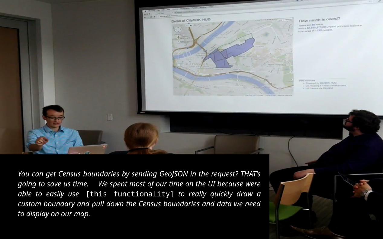
You can get Census boundaries by sending GeoJSON in the request? THAT’s going to save us time.
At the end of the session:
We spent most of our time on the UI because were able to easily use [this functionality] to really quickly draw a custom boundary and pull down the Census boundaries and data we need to display on our map.
Andrew Turner: Github Followers = 200 + 1
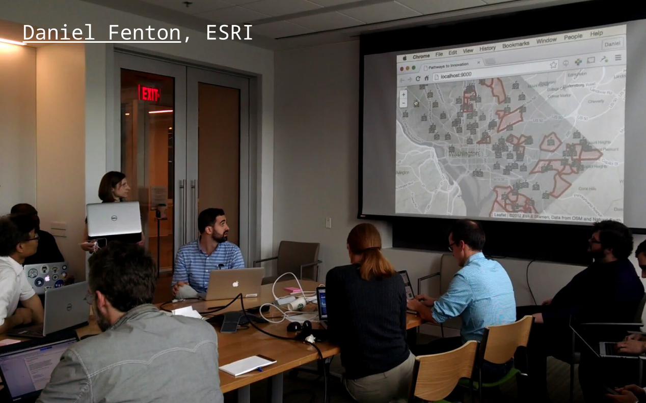
Daniel Fenton, ESRI
It was really nice that you guys abstracted the
bringing together of geographic [boundaries] and the
Census variables. Trying to make these calls
separately and then put them together is probably
not the most efficient way of doing things... [this
way] it was easy.
Daniel Fenton, ESRI
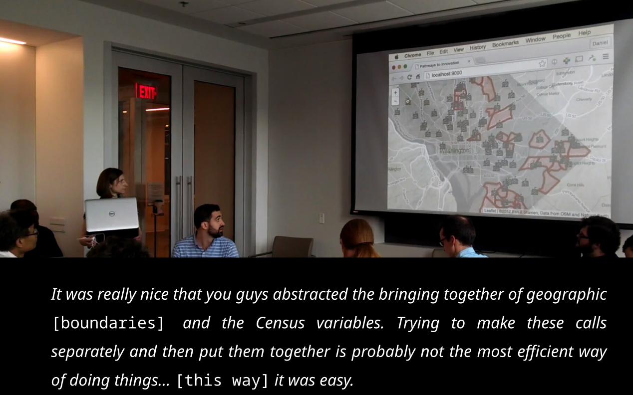
It was really nice that you guys abstracted the bringing together of
geographic [boundaries] and the Census variables. Trying to make
these calls separately and then put them together is probably not
the most efficient way of doing things... [this way] it was easy.
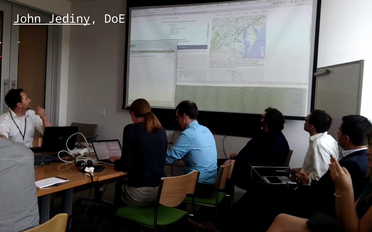
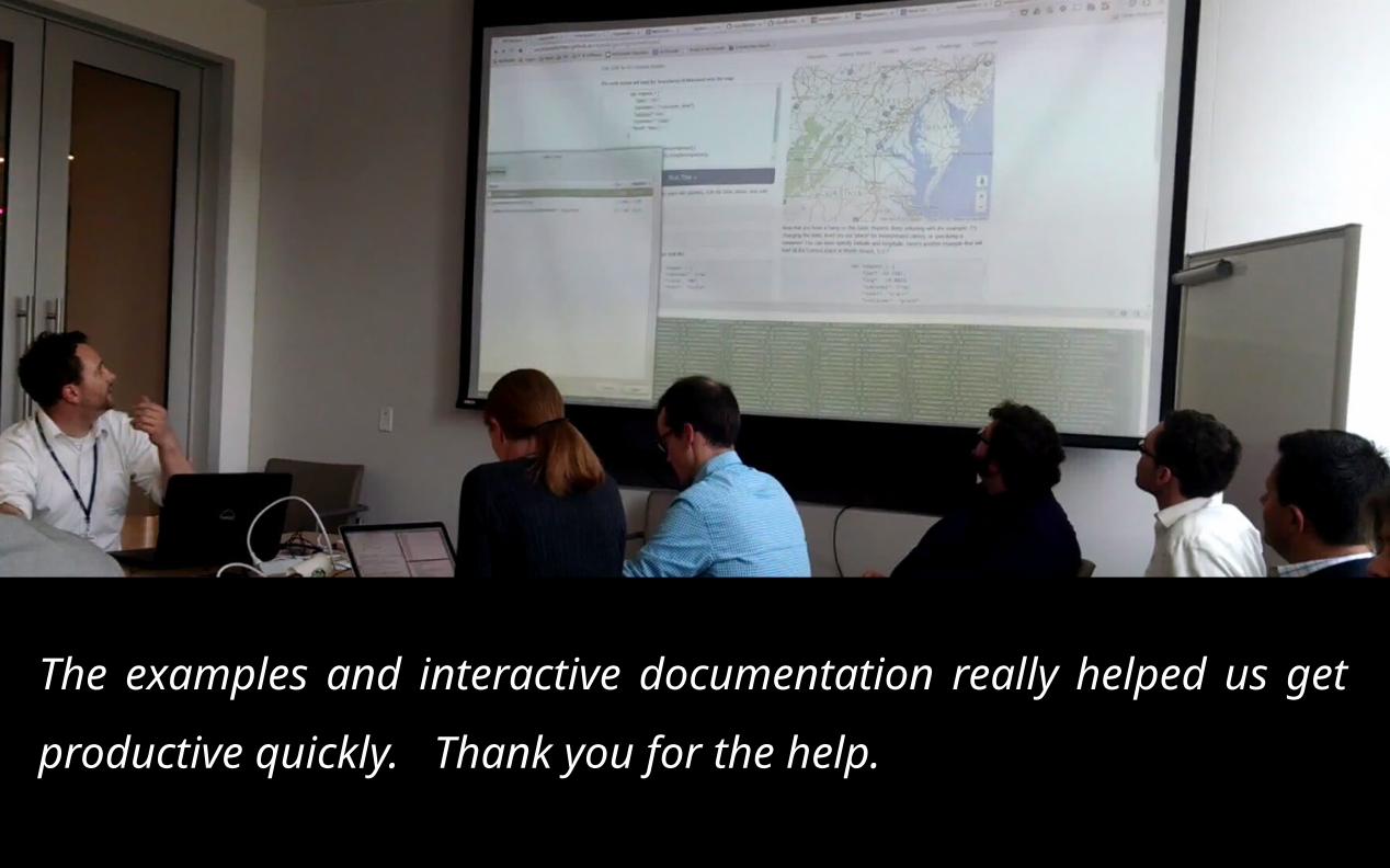
John Jediny, DoE
Daniel ?
The examples and interactive documentation really helped
us get productive quickly. Thank you for the help.
You can get Census boundaries by sending GeoJSON in the request? THAT’s going to save us time. We spent most of our time on the UI because were able to easily use [this functionality] to really quickly draw a custom boundary and pull down the Census boundaries and data we need to display on our map.
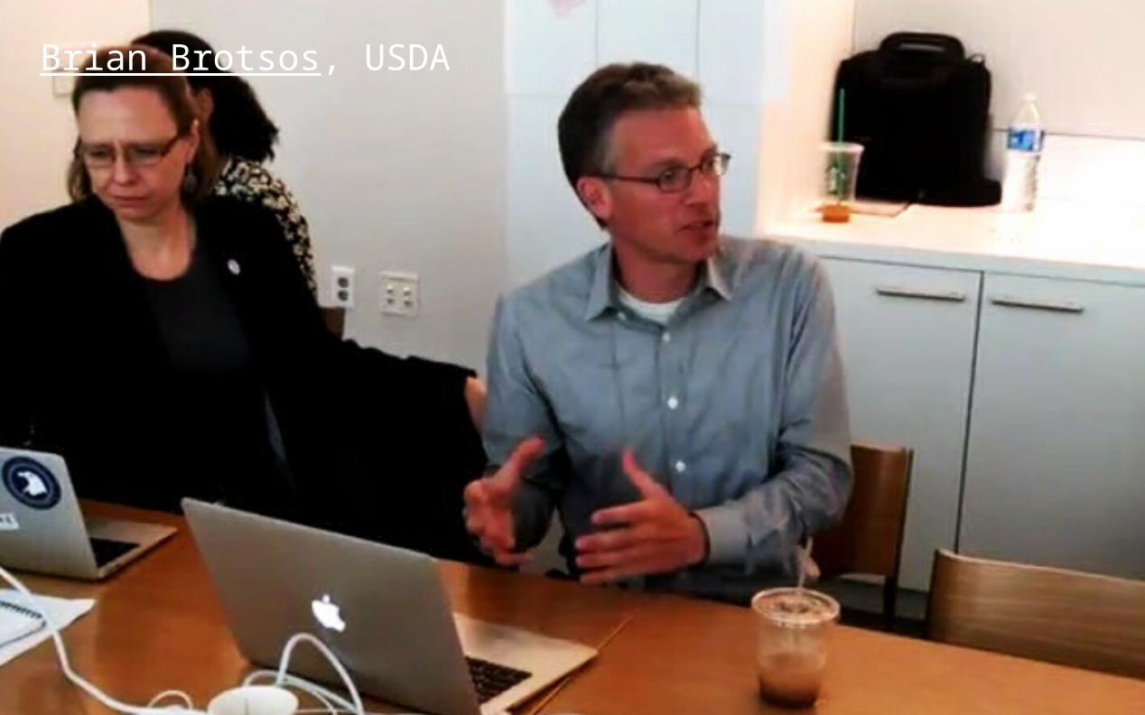
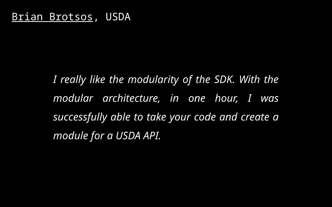
Brian Brotsos, USDA
Brian Brotsos, USDA
I really like the modularity of the SDK.
With the modular architecture, in one
hour, I was successfully able to take your
code and create a module for a USDA API.
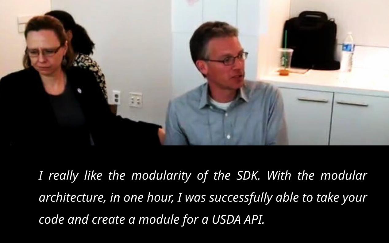
I really like the modularity of the SDK. With the
modular architecture, in one hour, I was successfully
able to take your code and create a module for a
USDA API.
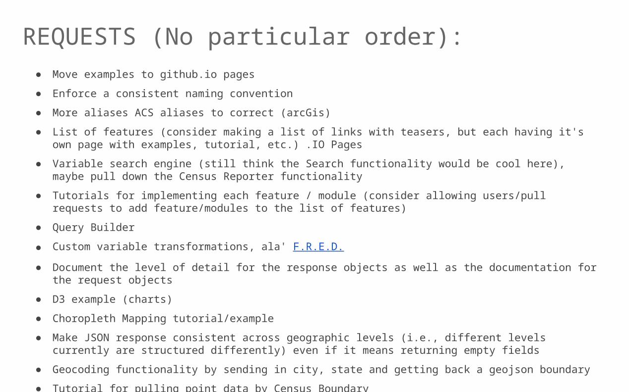
● Move examples to github.io pages
● Enforce a consistent naming convention
● More aliases ACS aliases to correct (arcGis)
● List of features (consider making a list of links with teasers, but each having it's own page with examples, tutorial, etc.) .IO Pages
● Variable search engine (still think the Search functionality would be cool here), maybe pull down the Census Reporter functionality
● Tutorials for implementing each feature / module (consider allowing users/pull requests to add feature/modules to the list of features)
● Query Builder
● Custom variable transformations, ala' F.R.E.D.
● Document the level of detail for the response objects as well as the documentation for the request objects
● D3 example (charts)
● Choropleth Mapping tutorial/example
● Make JSON response consistent across geographic levels (i.e., different levels currently are structured differently) even if it means returning empty fields
● Geocoding functionality by sending in city, state and getting back a geojson boundary
● Tutorial for pulling point data by Census Boundary
REQUESTS (No particular order):