City of Arab, Alabama Regs 2016.pdf · 5 drainage, water, sewerage, and capital improvements such...
77
1 City of Arab, Alabama Subdivision Regulations Arab Planning Commission 740 North Main St Arab, Alabama 35016 (256) 586-5968 Adopted December 20, 2016
Transcript of City of Arab, Alabama Regs 2016.pdf · 5 drainage, water, sewerage, and capital improvements such...
1
City of Arab, Alabama
Subdivision Regulations
Arab Planning Commission
740 North Main St
Arab, Alabama 35016
(256) 586-5968
Adopted December 20, 2016

2
Table of Contents
Article I
1. Purpose, Policy, and Title
2. Authority and Jurisdiction
Article II
1. Usage
2. Definitions
Article III
Approval of Subdivision Plats
1. Approval of Subdivision Plats Required
2. Approval not Acceptance
3. General Procedure
4. Submission of Sketch Plan
5. Submission of Preliminary Plat
6. Submission of Final Plat
7. Land Conveyance Among Family
Article IV
Minimum Standards for Subdivisions and Other Developments
1. Purpose, Applicability, and Standards Reference
2. Suitability, Conformance, and Naming
3. Blocks
4. Lots
5. Easements
6. Streets
7. Storm Drainage
8. Storm Water Detention
Article V
Required Improvements
1. Improvements
2. Permanent Reference Points
Article VI
Assurance for Completion and Maintenance of Improvements
1. Completion of Improvements
2. Methods of Guarantee
3. Time Limits
4. Inspection, Acceptance, and Maintenance of Improvements

3
5. Issuance of Building Permits and Certificates of Occupancy
6. Release of Guarantee
7. Consumer Protection
1. Interpretation
Article VII
General Provisions
2. Conflict with Public and Private Provisions
3. Separability
4. Saving Provisions
5. Reservations and Appeals
6. Amendments
7. Conditions
8. Resubdivision of Land
9. Vacation of Plats
10. Violations
11. Penalties and Civil Enforcement
1. General
2. Conditions
3. Procedures
Article VIII
Variances
4. Special Requirements for Non-Residential Subdivision
5. Experimental Subdivisions
1. Sample Certificates
2. Street Designs
3. Preliminary Plat Checklist
4. Final Plat Checklist
5. Land Conveyance Among
Immediate Family
Appendices
4
1. Purpose, Policy and Title
Article I
The purpose of this regulation is to establish procedures and standards for the
development and subdivision of real estate within the Subdivision Jurisdiction of the City
of Arab, Alabama. These regulations are adopted for the following purposes:
• To protect and provide for the public health, safety, and general welfare of the
City
• To guide the future growth and development of the City in accordance with the Comprehensive Plan
• To provide for adequate light, air and privacy; to secure safety from fire, flood
and other danger and to prevent overcrowding of the land and undue congestion
of population
• To protect the character, social, and economic stability of all parts of the city and
to encourage the orderly and beneficial development of all parts thereof,
• To protect and conserve the value of the land, buildings, and improvements upon
the land and to minimize the conflicts among the uses of land and buildings,
• To guide public and private policy and action in order to provide adequate and
efficient transportation, water, sewage disposal, schools, parks, playgrounds,
recreation, and other public requirements and facilities
• To provide the most beneficial relationship between the uses of land and buildings
and the circulation of traffic throughout, having particular regard to the avoidance
of congestion in the streets and highways, and the pedestrian traffic movements
appropriate to the various uses of land and buildings, and to provide for the proper
location and width of streets and building lines
• To establish reasonable standards of design and procedures for subdivisions and
re-subdivisions for orderly layout and use of land and to insure accurate legal
descriptions and monumenting of subdivided land
• To insure public facilities are available with sufficient capacity to serve the
proposed subdivision
• To prevent the pollution of air, streams, and ponds; to assure the adequacy of
drainage facilities; to safeguard the water table; and to encourage the wise use and
management of natural resources in order to preserve the integrity, stability and
beauty of the community and the value of the land, and
• To preserve the natural beauty and topography of the City and to insure
appropriate development with regard to these natural features.
It is hereby declared to be the policy of the City to consider the subdivision of the land
and the subsequent development of the subdivided plat as subject to the control of the
City pursuant to the Comprehensive Plan of the City of Arab for the orderly, planned,
efficient, and economical development of the City. Land to be subdivided shall be of
such character that it can be used safely for building purposes without danger to health
or peril from fire, flood or other menace, and land shall not be subdivided until available
public facilities and improvements exist and proper provision has been made for
5
drainage, water, sewerage, and capital improvements such as schools, parks, recreation
facilities, transportation facilities and improvements.
The existing and proposed public improvements shall conform to and be properly related
to the proposals shown in the Comprehensive Plan of the City of Arab; and it is intended
that these regulations shall supplement and facilitate the enforcement of the provisions
and standards contained in building and housing codes, Zoning Ordinances,
Comprehensive Plan, and Land Use Plan of the City of Arab.
Approval of a subdivision plat shall be considered an amendment to the City of Arab
Comprehensive Plan and as such shall be approved by no less than six (6) members of the
Planning Commission.
Title:
These regulations shall hereafter be known and referred to as the Subdivision Regulations
of the City of Arab, Alabama.
2. Authority and Jurisdiction Authority
By authority of Resolution # of the Planning Commission of the City of Arab,
Alabama (hereinafter referred to as “Planning Commission”) adopted pursuant to the
powers and jurisdictions vested through Title II, Article II Sections 11-52-30 through 11-
52-36, inclusive, of the 1975 Code of Alabama, the Planning Commission does hereby
exercise the power and authority to review, approve, and disapprove plats for subdivision
within the Subdivision Jurisdiction of the City of Arab.
Jurisdiction
A) From and after the effective date hereof, these regulations shall
govern the subdivision of all land located in the City of Arab,
Alabama, and in addition shall govern the subdivision of land
within the three mile police jurisdiction of the City of Arab,
Alabama.
B) Any owner of land, which lies within the area of jurisdiction,
who wishes to divide or resubdivide such land into two (2) or
more lots, sites, or divisions, for the purpose, whether immediate
or future, of sale or building development, shall submit to the
Planning Commission a plat of the subdivision, which shall
conform to the minimum requirements set forth in these
regulations, for approval.

6
C) No applicant shall proceed with improvements or installation of
utilities in a subdivision until such subdivision plat shall have
been granted Preliminary Plat approval by the Planning
Commission.
D) No applicant shall proceed with the sale of lots or erection of
buildings, excluding public utility structures, within a
subdivision until such subdivision plat shall have been granted
Final Plat approval entered in writing on the plat and signed by
the Chairman of the Planning Commission and recorded in the
office of the Marshall County Probate Judge.
E) No building permit or certificate of occupancy shall be issued for
any parcel or plat of land which was created by subdivision after
the effective date of, and not in conformity with, the provisions
of these Subdivision Regulations, and no excavation of land or
construction of any public or private improvements shall take
place or be commenced except in conformity with the
regulations.
Article II
Definitions
1. Usage
For the purpose of these regulations, certain numbers, abbreviations, terms, and words
used herein shall be used, interpreted, and defined as set forth in this section. Unless the
context clearly indicates to the contrary, words used in the present tense include the
future tense; words used in the plural number include the singular; the word “herein”
means “in these regulations”; and the word “regulations” means “these regulations”. A
“person” includes a corporation, a partnership, and in incorporated association of persons
such as a club; “shall” is always mandatory; a “building” includes a “structure” and
includes any part thereof; “used” or “occupied” as applied to any land or building shall be
construed to include the words “intended, arranged, or designed to be used or occupied.
2. Definitions
AASHTO- American Association of State Highway and Transportation Officials
Administrative Officer- the person appointed by the Governing Body to administer and
enforce these regulations.
Alley – a public right-of-way primarily designed to serve as a secondary access to the
side or rear of those properties whose principal frontage is on some other street.
Applicant- the owner of land proposed to be subdivided, or his representative. Consent
shall be required from the legal owner of the premises.
Block- a tract of land bounded by streets, or by a combination of streets and public parks,
cemeteries, railroad right-of-way, shorelines of waterways, or boundary lines of
municipalities.
Bond- see improvement guarantee
7
Building- any structure built for the support, shelter, or enclosure of persons, animals,
chattels, or moveable property of any kind, and includes any structure.
Building Setback Line- a line parallel to the property line in front of which no structure
may be erected.
City- the City of Arab, Alabama, together with its subdivision jurisdiction.
City Clerk- the duly designated Clerk of the City of Arab, Alabama
City Council- the City Council of the City of Arab, Alabama
City Engineer- the duly designated Engineer of the City of Arab, Alabama
City Specifications- all construction specifications, which have been adopted by the
Governing Body or as, required by the Planning Commission and all utility departments.
Collector Street- see Street, Collector.
Comprehensive Plan- a comprehensive plan for development of the City, prepared and
adopted by the Planning Commission, pursuant to State law, and including any part of
such plan separately adopted and any amendment to such plan or parts thereof.
Condominium Development- Real estate, portions of which are designated for separate
ownership and the remainder of which is designated by common ownership solely by the
owners of those portions. This development type is hereby subject to the same
development reviews and procedures as a conventional subdivision. Condominium
developments shall submit a plat(s) that adhere(s) to the requirements established in this
document.
Corner Lot- a lot that occupies the interior angle at the intersection of two (2) street lines.
The street line forming the least frontage shall be deemed the front of the lot except
where the two (2) street lines are equal, in which case the owner shall be required to
specify which is the front.
Crosswalk- a public right-of-way ten (10) feet or more in width between property lines,
which provides pedestrian access to adjacent properties.
Cul-De-Sac- a local street with only one outlet and having an appropriate terminal for the
safe and convenient reversal of traffic movement.
Dedication- the transfer of property from private to public ownership.
Developer- the owner of land proposed to be subdivided, or his representative. Consent
shall be required from the legal owner of the premises.
Depth of Lot- the mean horizontal distance between the front and rear lot lines.
Double Front Lot- a lot having frontage on two (2) non-intersecting streets as
distinguished from a corner lot.
Easement- a grant by the property owner of use, by the public, or corporation, or
person(s) of a strip of land for specified reasons or as created by operation of law.
Escrow- a deposit of cash with the local government in lieu of an amount required and
still in force on a performance or maintenance bond.
Final Plat- a plat of a tract of land that meets the requirements of these regulations and is
in a form or recording in the office of the Probate Judge of Marshall County, Alabama.
Flood- An overflow of lands not normally covered by water that results in significant
adverse effects in the vicinity.
Floodway- the natural channel and the portion of the flood plain along the channel that
must be retained solely for the passage of floodwaters to prevent an undue increase in
flood heights upstream. For the purposes of these regulations, the Firm designates the
areas included in the floodway. Along other small streams and drainage channels land
8
lying within twenty-five (25) feet horizontal distance of the top of the banks shall be
considered to be within a floodway, unless the developer demonstrates to the Planning
Commission that a lesser distance, but not less than ten (10) feet, is adequate.
Land Subject to Flood- for the purposes of these regulations, land subject to flood shall
be considered all land located within the geographic area subject to flooding on Firm
Maps.
Group Development- a development comprising two (2) or more structures, built on a
single lot, tract, or parcel of land, and designed for occupancy by separate families, firms,
or other enterprises, and the land is not subdivided into the customary streets and lots.
Governing Body- the Mayor and the City Council of the City of Arab, Alabama.
Hardship- an unusual situation on the part of an individual property owner, which will
not permit him to enjoy the full utilization of his property, which is given to others within
the City. A hardship exists only when it is not self-created.
Health Department- Marshall County Health Department
High Density- those residential zoning districts in which the density is equal to or greater
than one dwelling unit per 7,200 square feet.
Improvement Guarantee- any form of security including a cash deposit, surety bond,
collateral, property, or instrument of credit in an amount and form satisfactory to the
Governing Body. The Governing Body shall approve all bonds wherever a bond is
required by the regulations.
Lot- a tract, plot, or portion of a subdivision or other parcel of land intended as a unit for
the purpose, whether immediate or future, of transfer of ownership or for building
development.
Low Density- those residential zoning districts in which the density is equal to or less
than one dwelling unit per 15,000 square feet.
Medium Density- those residential zoning districts in which the density is between
10,500 and 15,000 square feet per dwelling unit.
Monument- a permanent object serving to indicate a limit or to mark a boundary.
Nonresidential Subdivision- a subdivision whose intended use is other than residential,
such as commercial or industrial. Such subdivision shall comply with the applicable
provisions of these regulations.
Open Space- any land either publicly or privately owned which is designated as being
permanently undeveloped and used for recreation, conservation, or preservation.
Owner- any person, group of persons, firm or firms, corporation or corporations, or any
other legal entity having legal title to or sufficient proprietary interest in the land sought
to be subdivided under these regulations.
Owner’s Engineer- the engineer or land surveyor registered and in good standing with the
State Board of Registration of Alabama who is the agent in his professional capacity of
the owner of land which is proposed to be subdivided or which is in the process of being
subdivided.
Planned Unit Development- the use of land and density of buildings and structures
different from those, which are allowed as of right within the zoning district in which the
land is situated.
Planning Commission- shall mean the Planning Commission of the City of Arab,
Alabama.

9
Preliminary Plat- a tentative plan of the complete proposed subdivision submitted to the
Planning Commission for its consideration.
Probate Judge- shall mean the Judge of Probate of Marshall County, Alabama
Registered Engineer- an engineer properly licensed and registered in the state.
Registered Land Surveyor- a land surveyor properly licensed and registered in the State.
Restrictive Covenant- a written agreement imposed in a deed by the seller upon the buyer
of the real estate to do, or refrain from doing, certain things. Such restrictive covenant
recorded in the public record and run with the land and is binding upon the property
owners, his successor and assignees.
Re-subdivision- a change in a map of an approved or recorded subdivision plat if such
change affects any street layout on such map or area reserved thereon for public use, or
any lot line; or if it affects any map or plan legally recorded prior to the adoption of any
regulations controlling subdivisions.
Road, Dead End- a road or portion of a street with only one (1) vehicular-traffic outlet.
Setback- the distance between a building and the street line nearest thereto.
Sidewalk- a walkway constructed for use by pedestrians.
Single Tier Lot- a lot that backs upon a street, a physical barrier, or a residential or non-
residential use, and to which access from the rear of the lot is usually prohibited.
Sketch Plat- a sketch preparatory to the preparation of the preliminary plat (or
subdivision plat in the case of a minor subdivision) to enable the sub divider to save time
and expense in reaching general agreement with the planning commission as to the form
of the plat and the objectives of these regulations.
Street Hierarchy- a dedicated and accepted public right-of-way for vehicular traffic that
affords the principal means of access to abutting property.
B. Arterials-to carry traffic and move intra-city and inter-city traffic.
C. Major Thoroughfares- the collecting traffic from residential, commercial,
or industrial streets and carrying it to the arterials. They may perform an
additional function by also serving abutting residential, commercial, or
industrial property and serve as citywide routes providing access to inter-
city arterials.
D. Collectors- the primary function is to collect traffic from local streets and
move it to an arterial while also providing substantial service to abutting
land use.
E. Local- streets comprise the remainder of the street system and have the
primary function of servicing abutting land use, providing access to and
from individual lots. Through traffic should be stringently discouraged on
these streets.
F. Marginal Access- A service road that runs parallel to a major street,
generally an arterial. Its purpose is to separate through from local traffic,
and to provide access to abutting properties.
G. Street, loop- a circular or semi-circular road designed around landscaped
green space or a rain garden, with outlets that begin and end on the same
road. The green space shall not count toward the open space requirement
for a conservation subdivision. A one-way loop street can be used as an
alternative to the cul-de-sac.

10
Structure- Anything constructed or erected that requires rigid and permanent location on
or attachment to the round; including, but not limited to, buildings, signs, towers,
monuments, statues, and walls; but not including telephone and other utility poles,
overhead wires, retaining walls and terrace walls, wire fences, and any other thing less
than three feet in height.
Sub divider- any person who directly or indirectly, sells, leases, or develops, or offers to
sell, lease or develop, or advertises for sale, lease, or development, any interest, lot,
parcel site, unit, or plat in a subdivision, and who is directly or indirectly controlled by or
under direct, or indirect common control with any of the foregoing.
Subdivision- shall mean the division of a lot, tract or parcel of land into two (2) or more
lots, plats, sites, or other divisions of land for the purpose, whether immediate or future,
of sale or of building development. It includes resubdivision and, when appropriate to
the context, relates to the process of subdividing or to the land or territory being
subdivided. It shall include all divisions of land involving the dedication of a new street
or a change in existing streets.
Subdivision Jurisdiction- the territorial jurisdiction of the City of Arab Planning
Commission over the subdivision of land including all land located in the corporate limits
and all land lying within three miles of the corporate limits of the City and not located in
any other municipality or its territorial jurisdiction.
A. Subdivision Major- all subdivisions not classified as minor subdivisions,
including but not limited to subdivisions of four (4) or more lots, or any
size subdivision requiring any new streets or extension of the local
governmental facilities, or the creation of any public improvements.
B. Subdivision Minor- any subdivision containing not more than three (3)
lots fronting on an existing street, not involving any new street or road, or
the extension of municipal facilities, or the creation of any public
improvements, and not adversely affecting the remainder of the parcel or
adjoining property, and not in conflict with any provision or portion of the
Comprehensive Plan, Zoning Ordinance, or these regulations.
C. Subdivision Family- The division of a lot, tract, or parcel of land into two
(2) or more lots, plats, sites or other divisions of land, whether described
by metes and bounds or by any other description, for the purpose of
establishing a residential use to be occupied by legally related immediate
family members (spouse, child, parent, grandparent, sibling or step-related
individuals of the same status). Proof of legal relation shall be the unique
responsibility of the applicant.
Thoroughfare Plan-an element of the Comprehensive Plan.
Width of Lot- the mean horizontal distance between the side lot lines.
Zoning Ordinance- the official Zoning Ordinance of the City of Arab, Alabama
11
Article III
Approval of Subdivision Plats
1) Approval of Subdivision Plats Required- Effect of Non-
Compliance
From and after the date of filing a copy of these regulations with the Probate Judge of
Marshall County, no subdivision plat of land within the plating jurisdiction, as defined in
Article I shall be filed or recorded until it shall have been submitted to and approved by
the Planning Commission of the City of Arab, and such approval entered in writing on the
plat by the Planning Commission Chairman. The Probate Judge, upon receipt of a copy of
these regulations, shall not thereafter file or record a plat of a subdivision of land located
within the platting jurisdiction, as defined herein, without the approval of such plat as
required herein. No street shall be accepted and maintained by the City nor shall any street
lighting, water, or sewer be extended to or connected with any subdivision of land, nor
shall any permit be issued by an administrative agent or department of the City of Arab for
the construction of any building or other improvement requiring a permit, upon any land
concerning which a plat is required to be approved, unless and until the requirements set
forth in these regulations have been complied with and the same has been approved by the
Planning Commission.
2) Approval Not Acceptance
The approval of a plat by the Planning Commission shall not be deemed to constitute or
affect the formal acceptance for maintenance by the City of Arab of any street or other
public utility line, or other facilities serving the subdivision.
3) General Procedure
Classification of Subdivisions. Whenever any subdivision of land is proposed, before
any contract is made for the sale of any part thereof, and before any permit for the
erection of a structure in such proposed subdivision shall be granted, the subdividing
owner or his authorized agent shall apply for and secure approval of such proposed
subdivision in accordance with the following procedure, which includes basically one (1)
step for a minor subdivision and two (2) steps for a major subdivision:
(1) Minor Subdivision
(a) Sketch Plat (optional)
(b) Final Subdivision Plan
(2) Major Subdivision
(a) Sketch Plan (optional)

12
(b) Preliminary Plat
© Construction Plans
(d) Final Subdivision Plat Official Submission Dates. For the purpose of these regulations, for both major and
minor subdivisions, the date of the regular meeting of the Planning Commission at which
the public hearing on plat approval, including any adjourned date thereof, is closed, shall
constitute the official submittal date of the plat at which the statutory period required for
formal approval or disapproval of the plat shall commence to run.
4) Submission of Sketch Plan
The procedure for obtaining Sketch Plan concurrence is as follows: Discussion of Requirements. Before preparing the sketch plan for a subdivision, the
applicant should discuss with the Administrative Officer the procedure for adoption of a
subdivision plat and the requirements as to general layout of streets and for reservations
of land, street improvements, drainage, sewerage, water, and similar matters, as well as
the availability of existing services. The Administrative Officer shall also advise the
applicant, where appropriate, to discuss the proposed subdivision with those officials who
must eventually approve these aspects of the subdivision plat coming within their
jurisdiction. There are no formal submission requirements for sketch plan review, but the
quality of comments received will depend on the quality of the submission. Application Procedure- Whenever any subdivision of a tract of land is proposed to be
made, the applicant may submit to the Secretary of the Planning Commission at least ten
(10) calendar days prior to a regularly scheduled meeting, three (3) copies of a sketch
plan of the proposed subdivision together with a sketch vicinity map and any other data
which will convey his intentions as to the proposed layout and type of development. The
applicant may appear at the regularly scheduled meeting of the Planning Commission to
discuss the proposed subdivision and become familiar with the application of the
regulations affecting the land to be subdivided. This procedure is not mandatory and
does not require formal application or fee. The procedure is however, recommended for
persons interested in receiving approval of minor subdivisions. Sketch Plan Requirements- A sketch plan, if submitted, shall be drawn at an approximate
scale of one inch to 200 feet and shall show the tentative street layout, approximate right-
of-way width, lot arrangements, the location of the nearest water and sewer lines, utility
lines, water courses, existing structures, total acres, approximate number of lots,
adjoining streets, north point, tract boundary, and proposed use of land. Classification. Tentative classification of the sketch plan shall be made at the time of
review at the regularly scheduled meeting of the Planning Commission as to whether the
subdivision is a major or minor subdivision as defined in Article II of these regulations.
Subsequent to the approval by the Planning Commission, the applicant may proceed
directly to the filing of any application for approval of a final subdivision plat, as

13
provided in these regulations, if classified as a minor subdivision; and if classified as a
major subdivision, the applicant must first file an application for approval of a
preliminary plat, as provided in these regulations, before filing for final subdivision plat
approval.
Concurrence of Sketch Plat- After reviewing and discussing the sketch plan, the Planning
Commission will advise the applicant of the specific changes or additions, if any, it will
require in the layout and the character and extent of required improvements and
reservations which it will require as a prerequisite to the approval of the subdivision plat.
The Planning Commission may require additional changes as a result of further study of
the subdivision in final form. Said approval shall constitute authorization to prepare and
submit a preliminary plat in the case of a major subdivision and a final subdivision plat in
the case of a minor subdivision. Submission of Site Development Report- A Site Development Report shall be submitted
to the City at the time of the Sketch Plan submittal. The Site Assessment report shall
provide a professional description of the existing conditions of the property proposed for
development, including topography, geology, geotechnical subsurface characteristics,
vegetation, structures, historical uses, endangered species and critical habitats, historical
landmarks, cultural resources, cemeteries and grave sites, adjacent land uses and owners,
floodways, floodplains, wetlands, water bodies, public rights-of-way, easements and
other pre-existing site characteristics. The Site Development Report shall include the
names and qualifications of all site investigators and methods utilized in the site
investigation. The Site Assessment Report shall also describe the proposed development,
professional conclusions as to the proposed development’s impact to the subject property,
and plan for mitigating hazards and adverse impacts to environmental features.
5) Submission of Preliminary Plat and Construction Plans The procedure for obtaining Preliminary Plat and Construction Plans approval is as
follows: Application Procedure. Based upon the approval of the Planning Commission of the
Sketch Plan (optional) the applicant shall file an application for approval of a preliminary
plat. The application shall:
(1) Be made of forms available at the office of the Administrative Officer;
and
(2) Be accompanied by a filing fee, payable to the City Clerk to cover the cost
of advertising and administration; in addition the applicant shall be
responsible for the cost of all engineering and reviews performed by the
City.
(3) Fee is waived for any existing platted lots that are consolidated into a
single lot.
14
(4) Be accompanied by at least three (3) sets of prints of the proposed
subdivision prepared in accordance with the requirements of the
subdivision regulations
(5) Preliminary Plat must be submitted to the Planning Commission Secretary
or City Clerk at least fifteen (15) calendar days prior to a regularly
scheduled meeting.
(6) Construction Plans may be submitted with Preliminary Plat, however,
simultaneous review requires submission twenty-five (25) calendar days
prior to regularly scheduled meeting. Acceptable Review of Construction
Plans by the City Engineer prior to the Public Hearing does not constitute
final approval. Changes required as result of Public Hearing will be
required for Preliminary Plat and Construction Plans. If Preliminary Plat
is denied after Public Hearing, the Acceptable Review of the Construction
Plans is voided.
(7) Preliminary Plats and Construction Plans submitted which do not
generally include all information shown on the Checklist for Preliminary
Plat and Construction Plans may be returned to Developer’s Engineer as
incomplete. Incomplete submittals will result in subdivision being
removed from the Planning Commission’s agenda and moved to the next
month’s agenda. Any scheduled Public Hearing will be conducted but it
will be noted at the Public Hearing that the subdivision will not be
considered at that meeting.
Public Hearing -The Planning Commission shall hold a public hearing on the
Preliminary Plat of a major subdivision. In the event of a minor subdivision,
the public hearing shall be held on the Final Plat. Notice of such public
hearing shall be sent to all adjoining landowners and to owners of land within
300 feet of land contained within the preliminary plat by registered mail as
their names appear upon the plats in the Marshall County Tax Assessor’s
Office. Such notice shall be sent at least ten (10) days prior to the date of the
public hearing. Any plat submitted to the Planning Commission shall contain
the names and addresses of all persons to who notices of a public hearing shall
be sent. Incomplete listing of affected property owners may result in an
additional Public Hearing. The cost of any such Public Hearing shall be
charged to the Developer.
Preliminary Approval-After the Planning Commission has reviewed the
preliminary plat and construction plans, any City recommendations and
testimony and exhibits submitted at the public hearing, the applicant shall be
advised of any required changes and/or additions. One (1) copy of the
proposed preliminary plat shall be returned to the applicant with the date of
approval, or disapproval and the reasons therefore accompanying the plat and
the Planning Commission shall retain one copy. Planning Commission will
not issue “conditional or contingent” approvals. Preliminary Plats and

15
Construction Plans must be complete prior to consideration of the Planning
Commission. Before the Planning Commission approves a preliminary plat
showing park reservation or land for other local government use proposed to
be dedicated to the City, the Planning Commission may obtain concurrence of
the park or land reservation from the City Council. The approval of the
preliminary plat shall not be deemed final acceptance but rather an expression
of approval of the layout as submitted on the preliminary plat.
Effective Period of Preliminary Approval- The approval of a preliminary plat
shall be effective for a period of one (1) year at the end of which time final
approval on the subdivision must have been obtained from the Planning
Commission, although the plat need not yet be signed and filed with the
Probate Judge. Any plat not receiving final approval within the period of time
set forth herein shall be null and void, and the applicant shall be required to
resubmit a new plat for preliminary approval subject to all new zoning
restrictions and subdivision regulations and filing fees.
Zoning Regulations. Every plat shall conform to existing zoning regulations
and subdivision regulations applicable at the time of final approval, except
that any plat which has received preliminary approval shall be exempt from
any subsequent amendments to the Zoning Ordinance rendering the plat non-
conforming as to bulk or use, provided that final approval is obtained within
the one-year period.
Resubmission of Preliminary Plat. The planning commission shall not
consider, for a period of twelve (12) months, a preliminary plat that has been
resubmitted for approval after Planning Commission disapproval, unless the
applicant has complied with the Planning Commission’s required changes
and/or additions. Any resubmission shall be subject to a public hearing.
Preliminary Plat Requirements. The Preliminary Plat shall be prepared by a
registered land surveyor and shall be clearly and legibly drawn at a convenient
scale of not less than one (1) inch equals one hundred (100) feet, and the
sheets shall be numbered in sequence if more than one (1) sheet is used. The
sheet size shall be of such size as is acceptable for filing in the Office of the
Probate Judge of Marshall County. The Preliminary Plat shall show the
following:
(1) Name of owner of record with deed book and page number.
(2) Proposed name of subdivision, date, north point, scale, and location.
(3) Name and seal of registered land surveyor.
(4) Vicinity map showing location of the subdivision with names of adjacent
subdivisions.

16
(5) Exact boundaries of the tract of land being subdivided, shown with bearings and
distances.
(6) Names and addresses of the owners of land immediately adjoining the tract of
land being subdivided, as their names appear on the plats in the County Tax
Assessor’s Office and their addresses appear on the tax records of Marshall
County.
(7) Wooded areas, marshes, floodways and any other conditions affecting the site.
(8) The location of existing streets, buildings, water courses, transmission lines,
sewers, culverts and drainpipes, water mains, jurisdiction lines, and any public
utility easements on and adjacent to the tract being subdivided.
(9) Proposed streets and alleys, rights-of-way, and street names.
(10) Proposed rights-of-way or easements, locations, widths, and purposes of
rights-of-way or easements.
(11) Proposed lot lines with bearings and distances and lot and block numbers.
(12) Required minimum building setback lines.
(13) Proposed parks, school sites, or other public open spaces, if any.
(14) Zoning classifications, on both the land to be subdivided and any
adjoining lands.
(15) Site data:
(a) Acreage in total tract.
(b) Smallest lots size.
(c) Total number of lots.
(d) Linear feet in streets.
(16) Water bodies and Watercourses. If a tract being subdivided contains a water
body, or portion thereof, lot lines shall be so drawn as to distribute the entire
ownership of the water body among fees of adjacent lots. The Planning
Commission may approve the fees of adjacent lots. The Planning Commission
may approve an alternative plan whereby the ownership of and responsibility for
safe maintenance of the water body is so placed that it will not become a City
responsibility. No more than twenty-five percent (25%) of the minimum area of
a lot shall be required.
Construction. At the time of submission of the Preliminary plat, the applicant shall
also submit Construction Plans for all required improvements. All plans shall meet
17
the minimum standards of design and general requirements for the construction of
public improvements as set forth in these regulations. Construction Plans shall be
drawn at a scale of not less than one (1) inch equals fifty (50) feet, map sheets shall
be of the same size as the Preliminary Plat. A Registered Engineer shall prepare and
sign all Construction Plans. The Construction Plans shall include the minimum
requirements:
(1) Street plan containing the following information:
(a) Location of all proposed and existing streets or rights-of-way in or
adjacent to the subdivision.
(b) Width of existing and proposed rights-of-way.
(c) Street names.
(d) Plan and profile of all streets, showing natural and finished grades drawn
to a scale of not less than one (1) inch equals fifty (50) feet horizontal and
one (1) inch equals ten (10) feet vertical.
(e) Cross-sections of proposed streets at a minimum of 50’ stations.
(f) Horizontal and vertical curve data for the centerline of each street: Delta,
T, R, PT, PC, PI, VPT, VPC, VPI and K-value.
(g) Location of all required sidewalks and crosswalks.
(h) Site distance table indicating, at minimum, location, direction, site
distance, controlling element, design speed and AASHTO guideline
citations.
(i) Signed statement from Engineer of Record that new street intersections
meet all applicable AASHTO minimum design standards.
(j) Roadway signage plan clearly indicating signage type, dimensions and
location.
(k) Roadway striping plan including location and placement of all proposed
permanent striping and pavement markers, as required.
(2) Storm Drainage Plan containing the following information:
(a) Location of proposed drainage ways, streams, and ponds in the
subdivision.
(b) Topography at one-foot contour intervals, existing and finished contours
required.

18
(c) Location, size, and invert elevations of proposed drainage structures
including culverts, bridges, pipes, drop inlets, and top elevations of head
walls, etc., showing details on Drainage Plan, including pipe schedule.
(d) Show construction details of typical manholes, connections, and other
drainage structures proposed.
(e) Area of land contributing run-off to each drainage structure along with
run-off calculations of each area and drainage calculations for each
drainage structure and drainage ditch.
(f) Location of easements and rights-of-way for drainage ways and
maintenance access thereof.
(g) Typical cross sections of each drainage way and profile.
(h) Direction of water flow throughout subdivision.
(i) Calculated hydraulic gradeline during design storm event shall be
indicated on profiles stormwater drainage structures.
(3) Sanitary Sewer Plan containing the following information:
(a) Location and size of all existing and proposed sewers in the subdivision
and tie-points of the subdivision. Location of sewer laterals.
(b) Direction of flow of each sewer line.
(c) Location of each manhole and other sewage system appurtenances
including lift stations, oxidation ponds, treatment plants, etc.
(d) Show construction details of typical manholes, connections, lift stations,
oxidation ponds, treatment plants, and other sewage structures and
appurtenances proposed.
(e) Plan and profile of sewer system indicating pipe materials, rim and pipe
invert elevations, pipe lengths, percent grade and known subsurface
obstructions.
(4) Water Distribution Plan containing the following information:
(a) Location and size of water distribution system including pipes, valves,
fittings, service laterals, meters, hydrants, high-pressure pumping
equipment, etc.
(5) Electric Distribution Plan containing the following information:
(a) Location of all poles or subsurface facilities as necessary to serve each lot
or parcel of land within the subdivision.

19
(b) Where electrical systems are required for operation of water and/or sewer
system appurtenances, plans shall include a details of the electrical system,
including location of required primary and secondary services,
transformers, breakers, grounding, conduits, auxiliary generators, etc.
(6) Erosion Control (Best Management Practices) Plan containing the following
information:
(a) Limits of proposed ground disturbance and total area of disturbance
(b) Location of erosion control devices including temporary and permanent
seeding, silt fencing, hay bales, check dams, inlet protection, sodding, rip-
rap, temporary sedimentation ponds, etc.
(c) Where erosion control plan shall be modified during construction
activities and per specific phases of construction, a separate erosion
control plan shall be submitted for each phase of construction.
(7) Supporting Documentation
(a) Supporting documentation may be required at the City’s discretion and as
deemed necessary to aid in a proper evaluation and review of the
construction plans. Supporting documentation may include, without
limitation, geotechnical subsurface investigation with report
recommendations, traffic studies, product submittal data, calculations,
reports, financial evaluations, environmental studies, agency permits, title
opinions, or other information deemed appropriate for consideration of the
plan submittal.
(8) Letter of approval from the appropriate municipal, county, or state department or
agency concerned with the approval of 1-7 above. It shall be the responsibility of
the applicant to provide the Planning Commission with the letter of approval
prior to the Planning Commission’s approval of the Preliminary Plat including
any ALDOT permits that may be required.
6) Submission of the Final Plat In accordance with these Regulations, no street shall be accepted and maintained by the
City nor shall any street lighting, water, or sewer be extended to or connected with any
subdivision of land as defined herein, nor shall any permit be issued by an administrative
agent or department of the City for the construction of any building or other improvement
requiring a permit upon any land concerning which a plat is required to be approved
unless and until the final plat has been approved by the Planning Commission of the City
of Arab, Alabama. Applicant Procedure and Requirements. Following the approval of the sketch plat in the
case of a minor subdivision (optional), or of the preliminary plat in the case of a major
subdivision, the applicant, if he wishes to proceed with the subdivision, shall file with the

20
Planning Commission an application for final approval of a subdivision plat. The
application shall:
(1) Be made on forms available at the Office of the Administrative Officer.
(2) Be accompanied by the original tracing, and three (3) black or blue line prints of
the plat.
(3) Comply in all respects with the Preliminary Plat, as approved, except for minor
modifications not altering the design of the subdivision.
(4) Be presented to the Secretary of the Planning Commission at least fifteen (15)
calendar days prior to a regularly scheduled meeting.
(5) Be submitted within one (1) year of the date of preliminary plat approval.
(6) Be accompanied by a performance bond in a form satisfactory to the City
Attorney and in an amount established by the Planning Commission upon
recommendation of the City Engineer. Vested Rights. No vested rights shall accrue to any plat by reason of preliminary or final
approval until the actual signing of the plat by the Chairman of the Planning
Commission. The Chairman of the Planning Commission shall deem all requirements,
conditions, or regulations adopted by the Planning Commission applicable to the
subdivision or on all subdivisions generally a condition for any subdivision prior to the
time of the signing of the final plat. Where the Planning Commission has required the
installation of improvements prior to signing of the final plat, the Planning Commission
shall not modify the conditions set forth in final approval. Signing and Recording of Final Plat
(1) Signing of Plat
(a) When an improvement guarantee is required, the Chairman of the
Planning Commission shall endorse approval on the plat after the
guarantee has been approved by the City of Arab and all the conditions of
the resolution pertaining to the plat have been satisfied.
(b) When installation of improvements is required, the Chairman of the
Planning Commission shall endorse approval on the plat after all
conditions of the resolution have been satisfied and all improvements
satisfactorily completed. There shall be written evidence that the required
public facilities have been installed in a manner satisfactory to the City of
Arab as shown by a certificate signed by the City Engineer and
Administrative Officer that the necessary improvements have been
accomplished and accepted.
21
(2) Recording of Plat
(a) The Chairman will sign the original tracing. The original tracing will be
returned to the applicant’s engineer.
(b) It shall be the responsibility of the Applicant to file the plat with the Office
of the Probate Judge within thirty (30) days of the date of signature.
Simultaneously with the filing of the plat, the Applicant shall submit to the
Administrative Officer a reproducible and three (3) copies of the recorded
plat. Final Plat Requirements. The final plat shall be prepared by a registered land surveyor
and shall be clearly and legibly drawn at a convenient scale of not less than one (1) inch
equals one hundred (100) feet. The Final Plat, as submitted for approval, shall be
prepared in ink on suitable permanent Mylar reproducible. The sheet size shall be of
such size as is acceptable for filing in the Office of Probate Judge of Marshall County,
but shall not exceed twenty-four by thirty six (24 x 36) inches. The Final Plat shall show
the following:
(1) Name of subdivision, north point, scale and location.
(2) The relation of the land so platted to the Government Survey. The “point of
beginning” as referred to in the written description shall be so indicated.
(3) Sufficient data to determine readily and reproduce on the ground the location,
bearing, and length of every street line, lot line, boundary line, block line, and
minimum building setback line whether straight or curved. This shall include the
radius, central angle, point of tangency, tangent distance, and arcs and chords.
(4) The names and location of adjoining subdivisions and streets, with reference to
recorded plats by record name.
(5) The exact position of the permanent monuments shall be indicated on the plat by
a small circle “o”.
(6) Streets and alleys, rights-of-way, and street names.
(7) Rights-of-way or easements, including location, widths, and purposes of rights-
of-way or easements.
(8) If any portion of the land being subdivided is subject to flooding, as depicted on
the FIA Community Map for the City of Arab, the limits of such land shall be
shown.
(9) Lot lines and lot and block numbers.
(10) Minimum building setback lines. In the instance of double frontage lots, the
direction the building fronts will be clearly indicated.

22
(11) Parks, school sites, or other public open spaces, if any.
(12) All dimensions should be to the nearest one-hundredth (1/100) of a foot and
angles within plus or minus five (5) seconds.
(13) The following endorsements, dedications, and certificates shall be placed on the
Final Plat (see Appendix I for sample certificates):
(a) Registered Surveyor’s Certificate and Description of Land Platted.
(b) Dedication.
(c) A notary’s Acknowledgment of the Dedication Certificates referred to in “b”.
(d) A Certificate of Approval by the Arab Electric Co-Op.
(e) A Certificate of Approval by the Water Board of the City of Arab.
(f) A Certificate of Approval by the Sewer Board of the City of Arab.
(g) A Certificate of Approval by the Marshall County Gas District.
(h) A Certificate of Approval by the City Engineer of the City of Arab.
(i) A Certificate of Approval by the Planning Commission of the City of Arab.
(j) A Certificate of Approval by the Marshall County Health Department (if septic
tanks and/or wells are necessary).
(k) Any restrictions and/or special notations as may be required by other sections of
these regulations.
The above certificates shall be lettered or typed on the final plat in such a manner as
to insure that said certificates would be legible on any prints made there from.
Certifications are shown in Appendix.
Engineering Plan. At the time of Final Plat approval, the applicant shall also submit an
engineering plan, or “as built” plan, giving details of construction and locations of the
improvements which have been installed. The primary purpose of the engineering
plan is to provide the City with a record of location, size, and design of underground
utilities for the City’s use in the course of maintaining such improvements. If the
installation of improvements is completed under an improvement guarantee, the
applicant shall submit the engineering plan to the City upon request of release of the
improvement guarantee.
23
7) Land Conveyance Among Family
The following requirements shall apply to the conveyance of land among immediate
family members.
(a) For the purposes of this section the definition of Immediate Family Member shall
mean spouse, son, stepson, daughter, stepdaughter, mother, father, grandparent,
grandchildren, sister, brother, mother-in-law, father-in-law, brother-in-law, son-
in-law and daughter-in-law.
(b) Upon request of the applicant, the Planning Commission is authorized, but not
mandated, to approve conveyances of land among immediate family members
when all the provisions of this Section are met. Such conveyances shall not
exceed one (1) parcel for each individual family member.
(c) In order to be considered by the Planning Commission the land to be conveyed
must meet the following criteria.
(1) The subject parcel has not resulted from a previous division without
hearing and plat approval by the Planning Commission.
(2) The division of land will result in parcels that conform to all design
standards of these Regulations and conform to all applicable zoning
standards for the zoning district in which the lot(s) are located.
(3) Each lot must have unrestricted access to a paved public street or road.
(4) No street or utility improvements or construction is required to serve the
resulting parcels.
(5) The division of land will not have the effect of denying adjoining parcels
direct access to a public right-of-way or result in the creation of parcels of
unusual or irregular shape.
(d) An application for immediate family land conveyance shall be made on Form
_Appendix V_, as required by Article _III_ of these Regulations. The applicant
shall, upon submission of the application, include a filing fee as set forth in the
Planning Commission’s current fee schedule, a copy of which is available at the
office of Arab City Hall. The following documents shall be presented to the
Planning Commission in order to qualify for consideration as land conveyance
among immediate family members.
(1) A notarized statement certifying to the family relationship of the parties
involved in the land conveyance.

24
(2) A survey of the subject property indicating the boundary of the entire
parcel and the lots to be transferred to other family members certified by a
land surveyor licensed to practice in the State of Alabama.
(3) A copy of a recorded deed for all necessary rights-of-way and easements
as required by the City.
(e) Any further or subsequent subdivision of the same land shall require the recording
of a subdivision plat in full compliance with these Regulations.
(f) The Planning Commission shall hold a public hearing on the proposed immediate
family land conveyance prior to the approval or disapproval of said land
conveyance.
ARTICLE IV
MINIMUM STANDARDS FOR SUBDIVISIONS
AND OTHER DEVLEOPMENTS
1. Purpose, Applicability, & Standards
This Article sets out the minimum requirements and standards for construction of land
development projects, including general principals of design and layout and requirements
for such public facilities as streets and utilities. All persons proposing construction
within the public rights-of-way, or within easements dedicated to the City of Arab shall
perform all construction in accordance with these requirements and standards. Unless
otherwise specially set forth herein, all of the materials, methods of construction, and
workmanship for the work covered in reference to street construction and storm drainage
construction shall conform to the latest standard specifications of the Alabama
Department of Transportation. Design criteria and standards for streets and traffic control
not specifically set forth herein shall conform to the latest edition of the AASHTO Policy
on Geometric Design of Highways and Streets and the U.S. Manual on Uniform Traffic
Control Devices, as appropriate. 2. Suitability of the Land
Land physically unsuitable for subdivision or development because of flooding, poor
drainage, steep slopes, rock formations or other such features that may endanger health,
life or property, aggravate erosion, increase flood hazard, or necessitate excessive
expenditures of public funds for supply and maintenance of services shall not be
approved for subdivision or development unless adequate methods are formulated by the
Developer and recommended by the City Engineer for solving the problems created by
unsuitable land conditions. Unsuitable land shall be set aside for other uses.

25
Conformance to Adopted Plans and Standards All proposed subdivisions and development projects shall conform to:
1) The City Comprehensive Plan and development policies in
effect at the time of submission to the Planning
Commission.
2) The City of Arab’s Zoning Ordinance, building and
housing codes, and all other applicable local laws and
regulations.
3) All requirements of the Marshall County Health
Department and other State agencies having jurisdiction of
the development. In subdivisions or developments related to any State or U.S. numbered highway, the
Planning Commission shall require a copy of the approval from the Alabama Department
of Transportation. Name of Subdivision or Development Project
The name of each subdivision or Development Project must have the approval of the
Planning Department. The name shall not duplicate nor closely approximate the name of
an existing subdivision in the area.
3. Blocks
a. Length:
1) Residential Blocks- Blocks shall be at least 400 feet but not more than
2,200 feet in length except, as the Planning Commission considers
necessary to secure efficient use of land or desired features of street
pattern. Blocks along arterial streets shall be no less than 1,000 feet in
length.
2) Non-residential Blocks- Blocks for other than residential use shall be of
such length and width as may be suitable for the prospective use,
including adequate provision for off-street parking and service.
b. Width:
1) Blocks shall be wide enough to allow two (2) rows of lots, except where
reverse frontage lots on arterial streets are provided, or when prevented by
topographic conditions or size of the property or for lots along the
periphery of the subdivision, in which case the Planning Commission may
approve a single row of lots.

26
2) Pedestrian ways or crosswalks, not less than 10 feet wide, may be required by
the Planning Commission through the center of blocks more than 800 feet long
where deemed essential to provide circulation or access to schools, playground,
shopping centers, transportation, or other community facilities.
4. Lots Minimum Area of Lots:
Lot dimensions shall be not less than the requirements of the zoning district in which they
are located and the requirements of the County Health Department. In cases where
requirements conflict, the greater requirement shall govern. All residential lots shall have
an area of at least 9,500 square feet. Additional lot area is required when:
1) Public water but not public sewer serves a lot. In such case, the lot shall be not
less than 15,000 square feet, or as required by the County Health Department.
2) Public water and sewer is not provided. In such case, said lot shall be not less
than 20,000 square feet, or as required by the County Health Department. Minimum Lot Dimensions:
All residential lots shall meet the Zoning requirements
All residential lots shall have a minimum width at the building line of 60 feet and a
minimum width, at the street line of 35 feet. Corner lots shall have an extra width of 15
feet to permit adequate setback from side streets. The minimum lot depth of single-tier
lots shall be 125 feet. All other lots shall be a minimum of 100 feet in depth. Estate type
lots that contain five (5) acres or more must have a frontage width of at least 100 feet. Arrangement: Insofar as practical, side lot lines shall be at right angles to straight street lines or radial to curved street lines.
City Limits and Lot Lines: Corporate boundary lines shall not divide lots. All proposed
lots shall be within city limits and shall be annexed if necessary prior to submission of
Preliminary Plat. Double and Reverse Frontage Lots: Double frontage and reverse frontage lots should be avoided except where specifically required to provide separation of residential development from an arterial street or to overcome specific disadvantages of topography and orientation of property.
Street Frontage: Residential lots shall not be platted to front directly on the right-of-way
of an arterial street or major highway.

27
Adequate Building Sites: Each lot shall contain a site large enough for a proposed building
that will meet all building setback requirements and not be subject to flood or periodic
inundation. Depth and Width: Depth and width of properties reserved or lay out for commercial and industrial purposes shall be adequate to provide for off-street parking and loading for the use contemplated. 5. Easements Utility and other easements shall be provided as follows:
a. Utility Easements. Except where alleys are provided for the purpose, the Planning
Commission may require easements with appropriate width as determined by the
respective Utility, for poles, wires, conduits, storm and sanitary sewers, gas, water
mains, or other utility lines on each side of the common rear lot liens and along
side lots lines if necessary or advisable in the opinion of the Planning
Commission. An easement of 20 feet shall be provided around the perimeter of
subdivision, where no easement of at least 10 feet exists adjacent to the
subdivision property line.
b. Water Course and Drainage Easements. When a subdivision is traversed by an
existing or proposed water course, drainage way, channel, or stream, there shall
be provided a drainage easement or right-of-way conforming substantially with
the lines of such existing or planned drainage way. The width of such drainage
easement or right-of-way shall be sufficient to contain the ultimate channel and
maintenance way for the tributary area upstream but shall not be less than 15 feet
in width.
1) Drainage easements off the street right-of-way shall be clearly defined on
plat and deed of the individual property owner, and such property owner
shall keep the easement free of obstructions and maintain that part of the
easement within the property owner’s boundary line so that free and
maximum flow is maintained at all times.
c. Overlapping Easements. Easements for water and sanitary sewers and drainage
purposes shall not overlap unless approved by the City of Arab’s Utility
Departments. 6. Streets
1) Street Names. Proposed streets, which are obviously in alignment with others
existing and named, shall bear the assigned name of the existing streets. In no case
shall the name of proposed streets duplicate or be phonetically similar to existing
street names, irrespective of the use of the suffix, street, avenue, boulevard, drive,

28
place, court, etc. Street names and numbers are subject to the approval of the
Planning Commission and Emergency Management Agency as well as E911.
2) Vacating a Street or Easement. No street or easement may be vacated unless such
action is submitted to and approved by the Governing Body. The Governing Body
may request a study and recommendation by the Planning Commission before taking
such action.
3) Access
A publicly approved street meeting the requirements of this Article shall serve every
development and every lot within a subdivision. All developments and every
subdivision shall have access to the public street system via a paved roadway.
a. When land is subdivided into larger parcels than ordinary
building lots, such parcels shall be arranged and designed so as
to allow for the opening of future streets and to provide access to
those areas not presently served by streets.
b. No subdivision or development shall be designed in a way that
would completely eliminate street access to adjoining parcels of
land. Where determined by the Planning Commission it is
desirable to extend the street, the street will be extended to the
adjoining property and a temporary turnaround will be
constructed.
c. Plats Straddling Municipal Boundaries. Whenever access to the
subdivision is required across land in another local government,
the Planning Commission may request assurance from the City
Attorney that access is legally established, and from the City
Engineer that the access road is adequately improved, or that an
improvement guarantee has been duly executed and is sufficient
in amount to assure the construction of the access road.
4) Relation to Present and Future Street System
a. The street pattern within a development or subdivision shall
provide for the continuation or appropriate projection of the
existing street pattern at the same or greater width, but in
no case less than the required minimum width in the section
of the community involved, unless the Planning
Commission deems such extension undesirable.
b. Subdivisions, that include an existing street or road with
prescriptive or dedicated right of way that does not
conform to the minimum right-of-way requirements of this
Article, shall provide additional width along one or both
sides of such street or road so that the minimum right-of-

29
way required by this Article is established. Subdivisions
abutting only one side of such street or road shall provide a
minimum of one-half measured from the center of the
existing right-of-way, of the right-of-way required by this
Article.
c. Where an arterial street or major road adjoins or is included
in a residential subdivision, the responsible jurisdiction and
Planning Commission will deny access to the arterial street.
Lots that abut the arterial shall be provided with another
means of access, such as (1) platting reverse frontage lots,
(2) platting a separate street parallel to the arterial, or (3)
platting a loop street or cul-de-sac.
d. Subdivision streets that intersect an arterial street shall do
so at intervals of not less than 800 feet or as required by the
authority having jurisdiction over the street or road,
whichever is greater.
5) General Design Considerations
Streets shall be related appropriately to the topography. Minor (local) streets
should be curved wherever possible to avoid conformity of lot appearance and the
rigid rectangular street grid. All streets shall be arranged so as to obtain as many
as possible of the building sites at, or above, the grades of the streets. Grades of
streets shall conform as closely as possible to the original topography. A
combination of steep grades and curves shall be avoided.
All streets shall be properly integrated with the existing and proposed
system of thoroughfares as established in the Comprehensive Plan.
All thoroughfares shall be properly related to the specific traffic generators
such as industries, business districts, schools, churches, and shopping centers;
to population densities, and to the pattern of existing and proposed land uses.
Proposed streets shall generally be extended to the boundary lines of the tract to be
subdivided, unless prevented by topography or other physical conditions, or unless
in the opinion of the Planning Commission such extension is not necessary or
desirable for the coordination of future development of adjacent tracts. Such
streets may be required to have a temporary turnaround constructed.
In business and industrial developments, the streets and other access ways shall be
planned in connection with the grouping of buildings and the provision of alleys,
truck loading and maneuvering areas, and walks and parking areas so as to
minimize conflict of movement between the various types of traffic, including
pedestrian.

30
6) Design Standards- Streets All streets shall comply with the design, construction, inspection and quality control
requirements of this Article.
A. Minimum width of right-of-way.
Minimum width of right-of-way measured from lot line to lot line shall be as follows:
Minimum Right-of-Way Width
Arterial Street 120 feet
Collector Street 80 feet
Local Street with Side Ditches 60 feet Residential/Local Street with Curb 50 feet
Alleys 20 feet
B. Minimum width of pavement measured from face of curb to face of curb (or edge
of pavement to edge of pavement for side ditch section) shall be as follows:
Minimum Pavement Width Street Classification With Curb and Gutter Side Ditch
Section
1 Arterial Street 60 feet 60 feet or per
Transportation
Plan 2. Collector Street 29 Feet 28 Feet
3. Local Street 25 Feet 22 Feet
Alleyways where approved in resident areas shall have a minimum pavement width of 12
feet. Alleys in commercial developments shall have a minimum pavement width of 20
feet. C. Horizontal alignment of streets.

31
1) Where a defection angle in the alignment of a street occurs, the radius of
curvature of the center line of said street shall be not less than the following:
Horizontal Alignment Street Classification Minimum Radius of Curvature of Center Line
Arterial Street per DOT Requirements
Collector Street 550 Feet
(40 MPH Design Speed)
Local Street 175 Feet
(25 MPH Design Speed)
If Design Speeds are to be increased or decreased, adjust radius of curvature according to
AASHTO.
Centerline radiuses of less than 100 feet are unacceptable.
2) Curved streets shall have a minimum tangent of 100 feet at intersections as measured
from the centerline of cross streets. A tangent of at least 200 feet in length shall be
introduced between reverse curves on collector streets, and 100 feet on local streets.
3) Adjoining street intersections within subdivision shall be spaced at least 200 feet apart
measured from edge of right-of-way to edge of opposing right-of-way. Street jogs with
centerline offsets of less than 150 feet shall not be allowed.
4) The centerline of no more than two streets shall intersect at any one point. All streets
shall intersect at no less than 75 degrees, and as near a right angle as possible. The angle of
intersection is to be measured at the intersection of the street centerlines.
5) Intersecting streets shall provide an uninterrupted line of sight from the center point of
the intersection for not less than the minimum sight distance. Corner sight distance is
measured form a point of the street 15.0 feet from the edge of the pavement of the
adjacent street and measured from a height of 3.75 feet on the street to an object 4.5 feet
above the surface of the adjacent street.
Design Speed Minimum Corner Sight Distance
(MPH) (Feet)
25 250
40
400
55
550

32
All banks shall be graded and all vegetation, including trees, shall be removed to provide
adequate corner sight distance. 6) Islands and medians at intersections shall be subject to individual approval by the
Planning Commission. Islands shall be designed, located, and landscaped not to obstruct
minimum sight distances.
7) All street intersections shall have a radius of curvature of not less than 25 feet.
8) Intersections shall be designed with a flat grade wherever practical. In hilly or rolling
areas, at the approach to an intersection, a leveling area shall be provided having not
greater than a five percent (5%) rate at a distance of fifty (50) feet, measured from the
nearest right-of-way line of the intersecting street.
9) Property lines at street intersections shall be rounded with a minimum radius of twenty
(20) feet.
D. Design Speed
Horizontal curves and super-elevation shall be designed in accordance with the following
minimum design speeds.
Design Speeds
Street Classification Minimum Design Speed
Arterial Street 55 MPH
Collector Street 45 MPH
Local Street 35 MPH
E. Vertical alignment of streets.
1) The maximum grade and vertical curve allowed for a street shall be as follows:
Vertical Alignment
Street Maximum Maximum
Classification Grade Curve
Arterial Street 8 Percent 10 Degrees
Collector 10 Percent 15 Degrees
Local Street 15 Percent 20 Degrees
2) All streets shall have a minimum grade of 1.0%. Proper drainage shall be
provided at the low point in vertical curves.
3) All changes in grades shall be connected by a vertical curve so constructed as to
afford a minimum sight distance, said sight distance being measured from the
driver’s eyes, which are assumed to be 3.5 feet in height above the pavement
surface, to an object 6 inches high on the pavement. The minimum sight distance
shall be as follows:
33
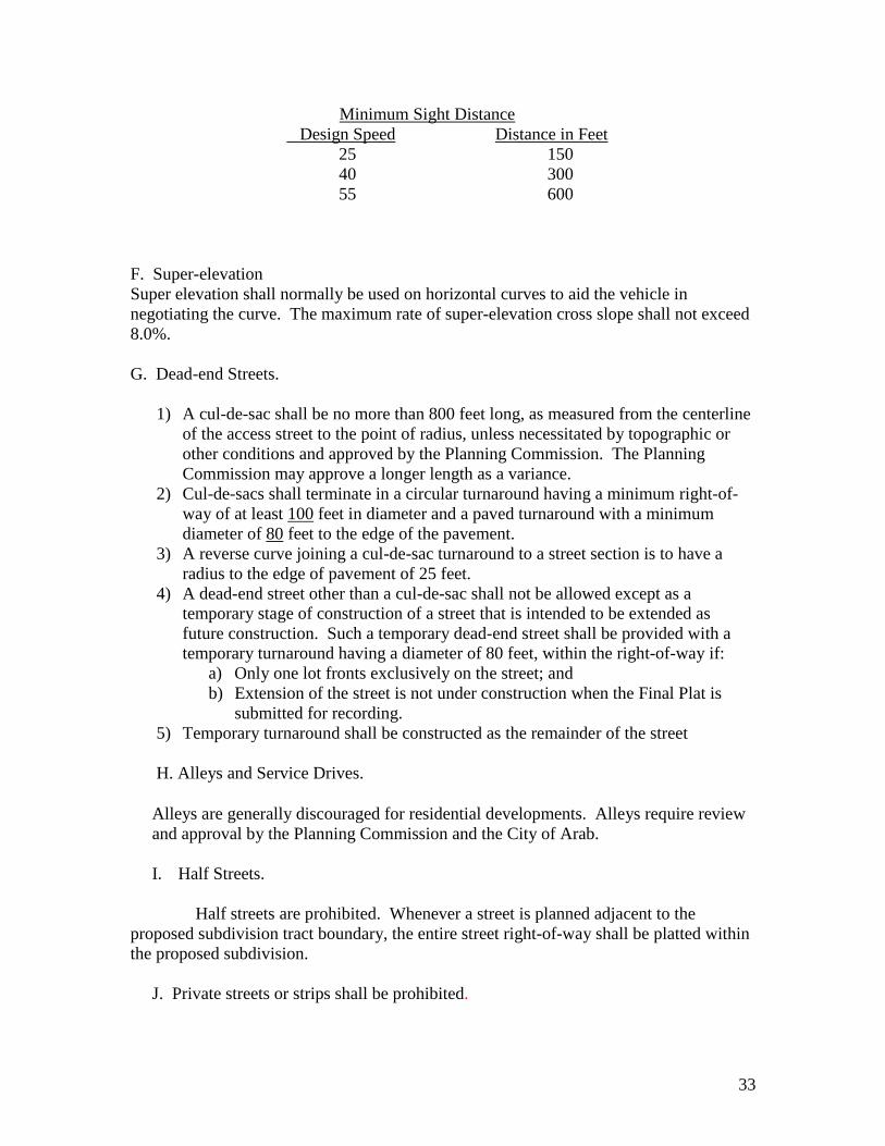
Minimum Sight Distance
Design Speed Distance in Feet
25 150
40 300
55 600 F. Super-elevation
Super elevation shall normally be used on horizontal curves to aid the vehicle in
negotiating the curve. The maximum rate of super-elevation cross slope shall not exceed
8.0%.
G. Dead-end Streets.
1) A cul-de-sac shall be no more than 800 feet long, as measured from the centerline
of the access street to the point of radius, unless necessitated by topographic or
other conditions and approved by the Planning Commission. The Planning
Commission may approve a longer length as a variance.
2) Cul-de-sacs shall terminate in a circular turnaround having a minimum right-of-
way of at least 100 feet in diameter and a paved turnaround with a minimum
diameter of 80 feet to the edge of the pavement.
3) A reverse curve joining a cul-de-sac turnaround to a street section is to have a
radius to the edge of pavement of 25 feet.
4) A dead-end street other than a cul-de-sac shall not be allowed except as a
temporary stage of construction of a street that is intended to be extended as
future construction. Such a temporary dead-end street shall be provided with a
temporary turnaround having a diameter of 80 feet, within the right-of-way if:
a) Only one lot fronts exclusively on the street; and
b) Extension of the street is not under construction when the Final Plat is
submitted for recording.
5) Temporary turnaround shall be constructed as the remainder of the street
H. Alleys and Service Drives.
Alleys are generally discouraged for residential developments. Alleys require review
and approval by the Planning Commission and the City of Arab.
I. Half Streets.
Half streets are prohibited. Whenever a street is planned adjacent to the
proposed subdivision tract boundary, the entire street right-of-way shall be platted within
the proposed subdivision.
J. Private streets or strips shall be prohibited.
34
7) Street Construction Standards
a. Typical Cross-Section and Clearing and Grubbing
Typical street sections shall conform to those shown on the typical sections in the
Appendix. All areas within the limits of the proposed roadway shall have all
vegetation, trees, stumps, large rocks, topsoil, and other objectionable material
removed. Material not suitable for embankment shall be properly disposed of off-site.
The entire limits of the right-of-ways shall be cleared, including all trees.
b. Embankment
Prior to any embankment being placed, the cleared and grubbed natural ground shall
be thoroughly compacted with mechanical rollers. Unstable material shall be
excavated and replaced with suitable, properly compacted material. Embankment
material shall be placed in loose uniform lifts 12 inches, or less, and compacted by
mechanical roller. Moisture content of embankment material shall normally be
within 3% of optimum moisture. Frozen or other unsuitable materials shall not be
used for embankment.
Embankments serving as temporary or permanent water impoundment structures may
warrant special design considerations and additional quality control procedures are
performed during construction. The City reserves the right to require submission of
supporting geotechnical, environmental, or engineering data as deemed appropriate
for design review and construction quality verification.
c. Sub-grade
1) Finish grades shall conform to the lines, grades, and cross-sections shown
in the Plans approved by the Planning Commission.
2) Grading operations shall be conducted in a manner to minimize dust
conditions. If necessary, and/or as directed by the City of Arab,
Developer shall wet roadways under construction to control dust.
3) All soft or yielding areas within sub-grade (and embankments) shall be
removed and replaced with suitable compacted material.
4) A minimum of ninety eight (98) percent compaction is required in
accordance with ASTM D698 (SPD)
d. Street Base.
1) Street Base material shall conform to the following specifications:

35
Street Base
Dense Aggregate, Base
Industrial-Commercial Residential
Streets Streets
(ALDOT 825B) 8 inches 6 inches
2) For streets without curbs, the base shall extend at least 6 inches beyond the
edge of pavement.
3) Compaction of base material shall be one hundred (100) percent per
ASTM D698 (SPD). Test shall be performed at 250-foot intervals with a
minimum of two (2) tests per street. Test results shall be recorded and
certified by a qualified field technician.
4) For street improvements that include a widening of less than 8-ft in width,
ALDOT 424C bituminous base shall be utilized in lieu of ALDOT 825B
base and in thicknesses as recommended by a professional engineer with
competence in geotechnical and roadway pavement design.
e. Pavement Surfacing
The following are minimum requirements for paving. Thicknesses and specific
mixtures of bituminous pavements shall be recommended by a professional engineer
with competence in geotechnical design and roadway pavement design, and based upon
a subsurface exploratory field investigation. Recommendations shall be presented in a
summary report format, signed and sealed by a professional engineer. The Planning
Commission may require more stringent designs if they deem necessary due to type
and use of proposed street. All work and materials shall conform to the Alabama
Department of Transportation’s Standard Specifications for Highway Construction.
See Typical Sections in Appendix.
1) Hot bituminous concrete binder shall be placed on prepared base. Binder
shall be 2 inches thick minimum. Binder shall be ALDOT 424B.
2) Hot bituminous concrete wearing surface shall be placed on approved
binder layer. Wearing surface shall be 1-inch thick minimum. Wearing
surface shall be ALDOT 424A.
3) Placement of asphalt or concrete paving shall be performed only after
subsurface utilities have been tested and accepted by the respective Utility.
4) The City may require asphalt testing during construction of major
subdivision roadways for quality assurance. When required, test reports
shall be signed by a qualified field technician and submitted to the City.
f. Curb and Gutter.
1) Curb and gutter shall be required on all new streets in residential
subdivisions where the average frontage of lots is less than 125 feet, or the
minimum lot size is 22,000 square feet or more. Valley gutters may be used

36
in residential developments where the minimum lot size is less than 10,000
square feet and the average frontage of lots is less than 60 feet.
2) All multi-family type developments shall be required to provide curb and
gutter on all streets.
3) Curb and gutter or valley gutter, where applicable, shall be provided on
both sides of new streets. Valley gutters shall not extend across any street.
Where curb and gutter are not required, a 60-foot street right-of-way with
approved drainage facilities will be required.
4) Curbing along streets shall meet the following standards:
a) Developer’s Engineer or surveyor shall set line and grade.
b) One-half inch expansion joints of pre-molded bit mastic
expansion joint material shall be provided at all radius points
and at intervals not to exceed 50 feet in the remainder of the
curb and gutter.
c) Curb and gutter shall be set true to line and grade and
finished by skilled workers to the section shown on the
Construction Plans. Finish shall be light broom and all edges
shall be smoothed with radius tool.
d) Inferior workmanship or construction methods resulting in
unsightly curb and gutter will be cause for rejection of the
finished work.
e) All curbing shall be backfilled with topsoil and grassed. g. Sidewalks
Sidewalks required for all residential developments where the average lot size is
0.25 acres (11,000 square feet) or less.
1) All multi-family developments, regardless of lot size, shall be required to install
sidewalks.
2) Concrete curbing is required for all streets where sidewalks are required.
3) Sidewalks shall be provided as follows:
Street
Local Street
R-1 Zoning
Not Required
R-2 Zoning
One Side
(4 Feet Wide)
R-3 Zoning
Both Sides
(5 Feet Wide)
Collector or
Arterial Street
One Side
(5 Feet Wide)
One Side
(5 Feet Wide)
One Side
(5 Feet Wide)
Commercial Both Sides (5 Feet Wide)
4) Where sidewalks are required on one side only, those shall generally be located on
the north or east side of the street.
5) Sidewalks shall be backfilled and grassed.
6) Sidewalks shall be constructed per the details shown in the Appendix II.

37
7) Sidewalks and curb ramps shall at minimum meet all applicable requirements of,
and amendments to, the Americans with Disabilities Act of 1990 (ADA) and the
Proposed Guidelines for Pedestrian Facilities in Public Rights-of-Way
(PROWAG), as published by the United States Access Board. Where a conflict
exists between ADA and PROWAG standards, the more stringent requirement shall
govern.
h. Residential Driveways.
All residential driveways to lots shall be located at points affording maximum site
distance. Driveways shall not be less than 10 feet, nor greater than 20 feet in width,
measured at the right-of-way line. Driveways shall be located so that the curb cuts are
a minimum of 5 feet from the nearest edge of any street drainage inlet and 50 feet from
the corner radius point.
Driveways accommodating public sidewalks shall comply with the Americans with
Disabilities Act of 1990 (ADA) and the Proposed Guidelines for Pedestrian Facilities
in Public Rights-of-Way (PROWAG), as published by the United States Access Board,
along that portion of the driveway also serving as a public sidewalk or accessible route.
Where a conflict exists between ADA and PROWAG standards, the more stringent
requirement shall govern.
i. Commercial and Industrial Entrances.
1) Entrances shall not exceed 35 feet nor be less than 24 feet in width
measured at the right-of-way line. Radiuses at entrances shall not be less
than 15 feet.
2) The number of entrances to each site shall be limited on the basis of street
frontage and a minimum distance of 150 feet between each entrance. For
street frontage less than 300 feet, a maximum of 2 entrances will be
allowed. For street frontage greater than 1,000 feet, a maximum of 5
entrances will be allowed.
3) The minimum distance from any opening to corner radius points shall be
50 feet.
j. Traffic Control.
Traffic control plan shall be prepared and implemented during construction
for public safety. Traffic control plan shall conform to the latest edition of the
Manual on Uniform Traffic Control Devices (MUTCD).
k. Location of Utilities in Streets
38
Utilities placed underground shall be placed within the right-of-way or dedicated
easements. All new utilities shall meet the minimum required material and
construction standards of the respective Utility
1) All utilities located beneath pavement shall be installed
within steel or concrete encasement if required by the
Utility, and the ditch backfilled with graded crushed stone
and thoroughly compacted before any pavement or base is
installed.
2) The minimum covers for all utilities crossing, or placed
within paved streets shall be 36 inches.
3) Open cut of finished paved streets shall not be allowed.
Utility lines and/or services shall be properly bored and
cased under all finished streets. Directional borings greater
than 3 inches shall require a minimum of 60 inches of
cover and special approval from the City of Arab.
4) All utility manholes and valve boxes shall be brought to the
finished grade within the roadway section. Depressions in
the street around these manholes will not be accepted.
5) Digging out trench and re-compacting trench.
Evidence of any trench settlement within finished streets
shall be repaired by repaving the full width of damaged
street section shall repair damages to street sections as a
result of trench settlement.
7. STORM DRAINAGE
1) GENERAL REQUIREMENTS
The Planning Commission shall not approve any development that does not appear to
make adequate provision for storm or floodwater runoff. The storm water drainage
system shall be separate and independent of any sanitary sewer system. An adequate
drainage system, including necessary ditches, pipes, culverts, drains, inlets, bridges, etc.,
shall provide for the proper drainage of all surface water. Such drainage facilities shall
be located in the road right-of-way where feasible, or in perpetual unobstructed
easements of appropriate width, and shall be constructed in accordance with the standards
in these regulations.
All drainage facilities shall be large enough to accommodate potential runoff from its
entire upstream drainage area, whether inside or outside the subdivision or development.
To the extent practicable, stormwater facilities installed as part of a phased development
shall be designed and constructed to meet the requirements of all subsequent phases of
the development.

39
The Developer or his authorized agent shall review the effect of each subdivision and
development on existing downstream drainage facilities outside the area of the
subdivision. Where it is anticipated that the additional runoff incident to the development
will overload an existing downstream drainage facility, the Developer shall be
responsible for all necessary improvements to those downstream drainage facilities.
No subdivision shall be approved unless adequate drainage will be provided to the natural
drainage watercourse or an existing facility.
2) FLOOD WAYS AND OTHER AREAS OF POOR DRAINAGE
Areas subject to flooding or periodic inundation shall not be developed or subdivided
unless the Developer provides an adequate plan to show that the area may be improved in
such a manner as to prevent flooding; or filled to an elevation sufficient to place all
streets and lots at a minimum of 2 feet above the maximum probable flood elevation.
Minimum floor elevations shall be provided for all buildings and structures within the
affected areas. The plat of such subdivision shall provide for an overflow zone along the
bank of any stream or watercourse, in a width that shall be sufficient in times or periods
of high water to contain or move the water. No fill or any structure shall be erected or
placed in the overflow zone therein. The boundaries of the overflow zone will be subject
to approval by the Planning Commission. Fill shall not restrict any waterway or result in
any increase in flood heights along the floodway.
Development of land within Floodways or otherwise poor drainage areas must comply
with the City of Arab Flood Damage Prevention Ordinance. Application procedures are
outlined in Article 3 of that Ordinance. The required information may be made of part of
the Construction Plans, and if so Developer’s Engineer shall denote special designs and
information on Plans for compliance with Ordinance.
3) FLOODPLAIN DISTRICTS, FLOOD HAZARD AREAS, OR WETLANDS
Any and all portion of lands proposed for development or subdivision which are
depicted, platted, or otherwise shown or described on any federally published map or
other document, such as HUD’s Flood Hazard Boundary Maps, Flood Insurance Rate
Maps (FIRM), etc., shall be shown on the Drainage Plans and all Plats. Land within
these special Districts, Boundaries, Areas, etc., shall not be platted, nor approved for
residential use, or other building sites, or any development. Such areas shall not be
used in computing the area of any affected lot. Development within these areas is
prohibited.
4) DRAINAGE EASEMENTS
a. Where a subdivision is traversed by an existing or proposed water course,
drainage way, channel, or stream, there shall be provided a drainage easement or
right-of-way conforming substantially with the lines of such existing or planned
drainage way. The width of such drainage easement or right-of-way shall be

40
sufficient to contain the ultimate channel and maintenance way for the tributary
area upstream but shall not be less than 15 feet in width.
1) Where topography of other conditions are such as to make impractical the
inclusion of drainage facilities within street rights-of-way, perpetual
unobstructed easements at least fifteen feet in width for such drainage
facilities shall be provided across property outside the street lines and with
satisfactory access to the street. Easements shall be indicated on the final
plat. Drainage easements shall be carried from the street to the natural
watercourse or to other drainage facilities.
2) Low-lying lands along watercourses subject to flooding or overflowing
during storm periods, whether or not included in areas for dedication, shall
be preserved and retained in their natural state as drainage ways. Minor
improvements may be allowed.
5) PLANS AND SYSTEM DESIGN
a. A complete Drainage Plan with existing and proposed contours showing the
proposed drainage facilities and their sizes, locations, and the areas to be drained
shall be submitted. All existing drainage structures shall be shown on the Plan.
Drainage Plan shall be prepared and sealed by a Professional Engineer registered
in the State of Alabama and shall contain the minimum information:
1) Topography map of proposed developed areas.
2) Existing and proposed contours at 1-foot intervals.
3) Existing drainage system.
4) Proposed drainage system, including onsite and offsite drainage areas.
5) Structure location, type and size, and slope.
6) Pre and Post Development runoff rates.
7) All offsite drainage, draining onto the proposed development, show area in
acres and runoff quantities in c.f.s.
b. Design calculations shall be submitted in report form in a Stormwater
Management Plan which shall be signed and sealed by a Professional Engineer
registered in the State of Alabama. The Stormwater Management Plan shall
indicate the formula used, along with the coefficient of runoff, the time of
concentration, the rainfall intensity, the discharged velocity, and the source of all
data used. Drainage calculations shall include a map such as a USGS Quadrangle
Map, or site development plan, outlining the areas and showing the acreage of all
onsite and offsite drainage basins contributing flow through the project for both
the Pre and Post Development conditions. Maximum Pre and Post development
runoff rates shall be clearly indicated where a site exhibits multiple runoff exit
points.
c. Design calculations shall include calculations for the runoff peak rate of discharge
for the 25-year, 24-hour storm to determine the configurations and sizes of pipes.

41
d. Runoff peak rate of discharge for drainage areas up to 200 acres in size may be
calculated using the Rational Method (Q = CIA). Rainfall intensities shall not be
less than those shown by applicable rainfall curves for the general areas of the
City of Arab and North Alabama. Runoff coefficients used for Pre and Post
Development activity conditions for the Rational Method shall be consistent with
local conditions. Generally, runoff coefficients shall be in the following ranges:
RUNOFF COEFFICIENTS (C)
AREA COEFFICIENTS
Business 0.7 to 0.95
Residential
Single Family 0.3 to 0.50
Multi-Family Units 0.6 to 0.75
Industrial 0.6 to 0.90
Parks and Playgrounds 0.2 to 0.35
Pastures and Woodlands
(Depending on Slope) 0.1 to 0.6
SURFACES
Asphalt or Concrete 0.7 to 0.95
Roofs 0.8 to 0.95
Lawns (Depending on Slope) 0.1 to 0.35
e. Should other methods of drainage calculation be used, the design calculations
shall clearly note method and reference all applicable coefficients used in the
calculations.
f. The controlled release of storm water runoff shall be required for all
developments or construction in order to prevent any increase in the
predevelopment rate of runoff. No increase in post development runoff allowed.
Where controlled release is required, such releases shall prevent any increase in
the predevelopment rate of runoff of less frequent storms up to and including the
50-year storm.
6) PIPED SYSTEMS AND CULVERTS
a. The design of piped storm water collection systems shall be based upon a
minimum conveyance of the peak rate of discharge associated with a 25-year
storm.
b. Design runoff and hydraulic capacity shall determine pipe size. The minimum
allowable pipe diameter shall be 18 inches under a street and 15 inches under a
driveway or any side drain.
c. Minimum Clearances:
42
Minimum clearance shall be 1 foot between the bottom of the roadway base and
the exterior crown of the culvert, and a minimum of 6 inches between underground
utilities and exterior crown of culverts for pipes 48 inches in diameter and less. Pipes
greater than 48 inches require 2 feet of cover.
d. Trench Construction.
1) Pipe shall be placed in excavated trench to the line and grade shown on the
Plans. The maximum width of the trench shall not exceed the outside bell
diameter of the pipe plus 2.0 feet. Pipe shall be installed and bedded per
manufacturer’s instructions or as specified in the “Design and
Construction of Sanitary Storm Sewers” as prepared by the ASCE Manual
of Practice No 37.
e. Trench Backfill.
1) Material used for trench backfill shall consist of clean, small diameter,
uniform material and shall be free of large rock, frozen material, or other
unsuitable material. All backfill material shall be placed in no more than 12”
lifts and mechanically compacted to 95% density. Backfill shall be placed
uniformly on each side of the pipe.
f. Storm Drain Pipes.
Storm drainpipes within pavement areas of roadway prism shall be constructed
of Class III reinforced concrete or aluminized Type II corrugated metal culvert.
Storm drain pipes underneath driveways shall be concrete or aluminized Type
II corrugated metal. The Planning Commission must approve all other types of
culvert material.
g. Concrete Pipe:
1) Reinforced concrete pipes shall conform to the requirements of AASHTO
M-170 for circular pipe and AASHTO M-206 for arch pipe.
2) Concrete pipe shall be Class III reinforced minimum.
3) Flat bottom and circular pipe sections shall be laid in a prepared trench
with the socket ends pointing upstream. Sections shall be joined in
accordance with manufacturer’s recommendations. Joints shall be
prepared or treated per manufacturer’s recommendation. All joints and
handle holes shall be sealed with bitumastic.
h. High Density Polyethylene Pipe (HDPE)
1) Use only in areas not under driveways, roadways and parking lots, or as
allowed by the Planning Commission.
2) HDPE pipe shall be corrugated exterior and smooth wall interior, Type S,
conforming to ASTM F2306 and AASHTO M294.

43
3) Bell and spigot joints shall be required. Bells shall cover at least two (2)
full corrugations on each section of pipe. The bell and spigot joint shall
have an “O” ring rubber gasket meeting ASTM F477. Gasket shall be
factory installed I the spigot end. Pipe joints shall be per AASHTO M294.
4) Installation shall strictly conform to manufacturer’s instructions.
5) Pipe shall be similar to ADS (N12)
6) All end treatments for HDPE shall be of concrete construction
i. Corrugated Aluminum or Steel Pipe.
1) Metal pipe shall be fully coated inside and out.
2) Bituminous coated corrugated steel pipe, aluminum pipe and pipe arches
shall conform to the requirements of AAS14 to M-167 and AASHTO M-
196 respectively, and comply with the Alabama Department of
Transportation’s Standards and Specifications.
3) Corrugated aluminum or steel pipe and pipe arches sections shall be laid in
a prepared trench with outside laps of circumferential joints pointing
upstream and with longitudinal joints at the sides. Coupling bands,
fastened by 2 or more bolts, shall join the sections. The space between
adjoining sections shall be not more than the width of 1 corrugation.
4) All damaged spots in bituminous coating that expose the base metal shall
be recoated with asphalt before the structure is backfilled.
5) Use of metal pipe in areas of acidic soils or other corrosive areas is
prohibited.
Any single drainage structure requiring 20 square feet or more of end area requires
a special design drawing be submitted for approval.
All storm pipes shall maintain a minimum velocity of 3.0 fps, but shall not exceed a
velocity that would damage or erode the pipe. Velocity of the flow in storm water
pipes shall be calculated using accepted engineering standards.
j. Development storm drain outlet systems shall connect to a public storm water
system or to a free-flowing stream. The Developer shall be required to provide
evidence of acceptable capacity in the receiving system, pipe, stream, etc. to
receive additional flow proposed.
k. The maximum continuous length of storm water pipe shall be 250 feet. Accesses
to pipe shall be provided for cleaning and inspection purposes. Accesses may be
in the form of inlets, junction boxes, or end treatments.
l. Culverts and street cross drains shall extend to where the crown of the pipe
intersects the street embankment slope and shall have concrete construction end
treatments (headwalls, flared end sections, etc).

44
7) OPEN CHANNELS AND DITCHES
Use of side ditches along streets in developments with lots on average size of less
than 29,000 square feet is prohibited.
Side ditches shall be intercepted at intersections and routed through pipe and drainage
structures. Turning or routing ditches around street intersections is not acceptable.
Intersection of drainage ditches at 90 degrees is unacceptable. Intersections shall
form smooth radius at approximately 45-degree angles.
a. All storm water channels shall be designed to carry at least the 25-year frequency
storm with 1 foot of freeboard.
b. The minimum grade or slope for all unpaved ditches shall be 1.0%; paved ditches
shall have a minimum of 0.3% grade.
c. All storm water channels must be designed to convey flows that prevent dwelling
flooding, property damage, or public access and/or utility interruption. Channels
shall not create a traffic hazard or create erosion problems.
d. Any storm drainage channel that extends outside of the street right-of-way shall
be located within a 15-foot wide easement minimum.
e. In cases in which a subdivision or development is traversed by a stream, there
shall be provided an easement extending at least 10 feet from each side of the
stream bank.
f. All drainage easements, natural ditches and drainage areas shall be grassed and/or
riprapped as necessary to control erosion. If riprap is used it shall be sized in
relation to the anticipated outlet velocity.
g. Maximum velocity in unpaved channels shall not exceed 6.0 feet per second.
Lesser velocities may be required in areas of silty soil.
h. Open ditches shall have a minimum of 4 to 1 slope and flat bottom. The
width of the ditch shall be determined by existing conditions. V-bottom ditches or
other special designs will be permitted in special cases and only if approved by
the Planning Commission.
i. Depth of open ditches shall be kept to minimum for safety considerations.
8) HEADWALLS
a. Headwalls or flared end sections are required at the inlet and outlet on all
streets cross drains and storm drainpipes.
b. Headwalls are to be pre-cast concrete, stone masonry with reinforced
concrete footings, or cast-in-place reinforced concrete with reinforced
concrete footings.
c. Flared end sections shall be pre-cast concrete.
d. Riprap shall be placed at the downstream ends of culverts and pipes as
needed to control or prevent erosion of the ditch at the outlet of the pipe.

45
e. Where pipe exit velocities exceed the maximum recommended velocity
for various ditch or channel sections, the headwall shall be of a special
design to dissipate or control this exit velocity.
9) INLETS AND PIPE ACCESS
a. Inlets, catch basins, and junction boxes may be pre-cast concrete units,
cast-in-place reinforced concrete; of adequate size to accommodate pipe
and storm water flows. See Appendix for Standard Details.
b. All exposed concrete shall have a light broom finish, all corners or edges
properly rounded. Unsightly work and poor workmanship will be
rejected.
c. Metal frames and grates shall be suitable for the use intended. Grate
openings shall be properly sized for inflow of storm water and interception
capacity per the Federal Highway Administration’s “Design of Highway
Pavements”.
d. Drainage within curb-and-gutters or valley gutters shall be limited to a
maximum distance as follows: 400 feet on grade up to 7 percent; 300 feet
on grades from 7 to 10 percent; 250 feet on grade over 10 percent. Such
drainage shall be intercepted by inlets to a piped system or to street cross
drains or culverts.
10) SPECIALS
Any bridge section or box culvert, cast-in-place or pre-cast, requires detailed
drawings and design calculations to be submitted for approval. These units
shall be designed with a hydraulic capacity of a 100-year storm. Units shall be
complete with headwalls, wing walls, barrier, or guardrails, etc.
11) MAINTENANCE
Before any traffic is allowed over any storm drain, the pipe(s) shall be
properly backfilled to protect the structure from damage or displacement. All
pipe and drainage structures shall be thoroughly cleaned and maintained as
necessary during construction and prior to the work being accepted. Any
damage of displacement that may occur due to traffic or erosion shall be
repaired or corrected at the Developer’s expense. The Developer’s obligation
to clean and repair pipes ceases after expiration of the Maintenance Bond and
formal acceptance by the City.
8. STORM WATER DETENTION
a. Storm water detention facilities providing for the storage and controlled
release of runoff shall be required for any development activity that will
increase the peak rate of discharge at post development for a 10-year
frequency storm.

46
b. All storm water detention facilities shall be designed to control the runoff
volumes associated with 10-year, 25-year and 50-year frequency storms.
c. Detention shall be provided such that the peak rate of flow from the site after
development will not exceed the corresponding flow that would have been
created by the same return frequency storms prior to development. The
detention volume required shall be that necessary to handle the runoff of a 50
year storm from the proposed development less than volume discharged
during the same duration at the approved release rate.
d. The Planning Commission reserves the right to require a 100-year design
storm event in unique circumstances where such event could significantly and
adversely impact environmentally sensitive areas, critical infrastructure, or
areas of special jurisdictional authority.
e. Reservoir routing methods shall be used for detention facility design for areas
greater than 200 acres.
f. Principal outlets or control structures such, as weirs shall be constructed of
reinforced concrete with watertight joints. Outlet pipes shall be at least 6
inches in diameter. Outlet pipes shall be properly screened. Riser pipes, if
used, shall be at least 8 inches in diameter.
g. The 50-year ponding limits of a detention facility shall not encroach upon a
public street.
h. Detention facility shall have a spillway or overflow opening to accommodate
500-year storm.
i. All dry reservoirs, wet weather ponds, permanent lakes, or open channels shall
be located no closer than 30 feet to any building and the maximum ponding
elevation shall be at least 2 feet below the lowest sill (or floor) elevation of
any building. Special considerations shall be given to safety and
accessibility to small children in the design of open ponds. Facilities
located within residential areas especially are fenced. The entire reservoir
area of dry reservoirs and open channels shall be seeded and mulched, sodded,
or adequately lined.
j. Detention in parking lots is limited to a maximum depth of 8 inches. In no
case should the maximum limits of ponding be designed closer than 10 feet to
any building. The maximum ponding elevation shall be at least 1.0 foot
below the lowest sill elevation of the building.
k. Every detention reservoir shall be enclosed with a drainage easement. The
drainage easement shall extend 10 feet beyond the maximum anticipated
ponding limits.
l. Detention facilities shall be built in conjunction with the storm sewer
installation and/or grading. Since these facilities are intended to control
increased runoff they must be partially or fully operational soon after the
clearing of vegetation. Silt and debris resulting from construction shall be
removed periodically from the detention area and control structure in order to
maintain full storage capacity.
m. The responsibility of maintenance of the detention facilities in subdivision
projects shall remain with the Developer until such time as applicable escrows
are released. Upon release of escrows, the perpetual maintenance

47
responsibility shall be vested in the Trustees of the subdivision, by virtue of
the trust indenture.
1. Improvements
ARTICLE V
REQUIRED IMPROVEMENTS
Approval of the final plat shall be subject to the installation of the improvements and
utilities hereinafter designated and satisfactorily completed in the accordance with the City
of Arab specifications and standards.
a. Streets and Alleys. After the applicant has installed sewer and water utilities, the
applicant shall construct curbs and gutters and shall surface, or cause to be
surfaced roadways to the widths prescribed in these regulations. All road
pavement, shoulders, drainage, improvements and structures, curbs, turnarounds,
and sidewalks shall conform to all construction standards and specifications
adopted by the Planning Commission and the City of Arab, and shall be
incorporated into the constructions plans required to be submitted for plat
approval. (See Appendix II for Street Sections.)
b. Curbs and Gutters. Standard approved type curbs with gutters shall be placed on
both sides of new streets within the area of jurisdiction of these regulations in
accordance with the City specifications. Subdivisions where the minimum lot size
is twenty two thousand (22,000) square feet or more will not be required to install
standard curb and gutter. The development of any multi-family dwelling units,
regardless of lots size, will be required to install standard curb and gutter. (See
Appendix II for Curb Section detail.)
c. Pedestrian Accesses. The Planning Commission may require, in order to facilitate
pedestrian access from the roads to schools, parks, playgrounds, or other nearby
roads, perpetual unobstructed easements at least ten (10) feet in width. Easements
shall be indicated on the plat.
d. Street Lighting. Street lighting shall be provided in all residential
subdivisions.
1. Lights shall be provided at all intersections and spaced at a
maximum distance of 600 feet between intersections.
2. Locations shall be shown on the Electrical Plan.
3. Lights that extend over cart ways shall have a minimum
height of 30 feet.
4. The standard installation shall be a 250-watt high-pressure
sodium bulb. Other fixtures may be substituted on approval
of Arab Planning Commission.
5. Details of the light standards or poles shall be submitted as
part of the Electrical Plan.
48
6. Required street lighting fixtures shall be provided by the
developer and installed by the servicing Utility or by an
approved contractor.
e. Guarantees Against Faulty Materials
Final approval of street improvements shall be granted and streets accepted
for maintenance by the City of Arab after one of the following is completed:
1. At least 80% of the homes in the approved sector are
completed, or
2. A period of 3 years from the recording of the final plat has
passed, and said developer shall maintain the
aforementioned street for a period of one year after the final
seal coat is applied.
When this requirement is fulfilled one or both of the following provisions shall prevail:
1. In any case in which the Planning Commission and/or the
City Council may have reasonable doubt concerning the
stability or proper construction of any improvement
required herein, the City Council may require a
maintenance bond for up to five (5) years for street
construction maintenance and one (1) year for sewer lines
and facilities. This bond shall be in cash or made by a
surety company authorized to do business in the State of
Alabama.
2. The City Clerk shall secure from all developers a letter or
statement in which said developer shall agree to maintain
backfill to the level of finished grade and to maintain
improvements located thereon or therein of any excavation
or fill which has been made in connection with the
installation of improvements; and such letter or statement
shall be binding on the developer for a period of one (1)
year after acceptance of such improvements by the City of
Arab. f. Neighborhood Recreation Areas
1. Recreation Standards – The Planning Commission shall
require that land be reserved for Neighborhood Parks in
locations designated in the Comprehensive Plan or
otherwise where such the reservations would be appropriate
as determined by the Planning Commission. Each
reservation shall be of suitable size, dimension, topography,
and general character and shall have adequate road access,
for the particular purposes envisioned by the Planning
Commission. The area shall be shown and marked on the
plat, “Reserved for Park and/or Recreation Purposes”. The

49
Planning Commission may refer such proposed
reservations to the City of Arab official or department in
charge of parks and recreation for recommendation. The
developer shall dedicate all such recreation areas to the
local government as a condition of final subdivision plat
approval.
2. Size of Neighborhood Parks- Land reserved for recreation
purposes shall be equal to five (5) percent of the gross
subdivided area. In general, land reserved for
neighborhood park purposes shall be a minimum of five (5)
acres and will not exceed 10 acres to assure facility
development. When the dedication of land involves an area
of less than (5) acres, the recreation area shall be located at
a suitable location on the edge of the subdivision so that
additional land may be added at such time as the adjacent
land is subdivided. If, in the opinion of the Planning
Commission, the subdivided area is adequately served by
existing public recreational facilities, this requirement may
be waived.
3. Recreation Sites- Land reserved for recreation purposes
shall be of a character and location suitable for use as a
playground, playfield, or for other recreation purposes, and
shall be relatively level and dry. A recreation site shall
have a total frontage on one (1) or more streets of at least
two hundred (200) feet.
4. Alternative Procedure- Where, with respect to a particular
subdivision, the reservation of land required pursuant to
this section does not equal the percentage of total land
required to be reserved in Section (2), the Planning
Commission may accept a cash payment in lieu of land
reservation of an amount equal to two hundred dollars
($200) multiplied by the number of lots.
The Planning Commission must approve this alternative procedure. Cash payments shall
be placed in a Neighborhood Park Improvement Fund to be established by the City
Council. Such deposit shall be used by the City of Arab for improvement of a
neighborhood park, playground, or recreation area including the acquisition of property.
Such deposit must be used for facilities that will be actually available to and benefit the
persons in said subdivision and be located in the general neighborhood of the subdivision.
50
g. Sanitary Facilities
General Requirements. All plans shall be designed, approved, and installed in
accordance with the rules, regulations, and standards of the Arab Sewer Board.
Sanitary sewers shall be provided where a public sanitary sewerage system is
reasonably accessible as determined by the Planning Commission. Individual
disposal systems shall be used in instances where no public sanitary sewerage
system is available providing approval is received from the State and County
Health Department.
(a) Sanitary sewer plans shall be made by a registered professional engineer in accordance
with an acceptable method of design using good engineering practices as approved by the
City Engineer and the Arab Sewer Board.
(b) Sewers shall be installed to serve each lot and service connection laterals shall be
installed to the future right-of-way line or easement line. Each lot shall have a unique
service connection lateral. Service laterals serving more than one individual lot are
prohibited. Service laterals shall be installed only upon the lots served and shall not
encroach onto adjacent lots unless approved by the Planning Commission. Service
connections shall have a minimum pipe size of four (4) inches and a minimum slope of one
(1%) percent.
h. Water Facilities
1) General Requirements:
(a) Necessary action shall be taken by the applicant to extend the public water
supply system capable of providing domestic water use and fire protection.
(b) Where a public water main is accessible, the applicant shall install adequate
water facilities (including fire hydrants) subject to the specifications of the Arab
Water Works Board. All water mains shall be at least six (6) inches in diameter.
(c) To facilitate the above, the location of all fire hydrants and all water
supply improvements shall be shown in the construction plans.
i. Fire Hydrants.
Fire hydrants shall be required for all subdivisions. Fire hydrants shall be
located no more than 500 feet apart in residential and non-residential
subdivisions. To eliminate any open cuts of finished streets, all underground
utilities for fire hydrants, together with the fire hydrants themselves and all
other supply improvements, shall be installed before any paving of a street.
j. Drainage and Storm Sewers
(A) General Requirements. The Planning Commission shall not approve of any plat or
subdivision that does not make adequate provision for storm or floodwater run-off
channels or basins. The storm water drainage system shall be separate and independent
of any sanitary sewer system. When calculations indicate that curb capacities are

51
exceeded at a point, no further allowance shall be made for flow beyond that point, and
basins shall be used to intercept flow at that point.
(B) Nature of Storm Water Facilities
1) Location. The applicant may be required by the Planning Commission to carry
away by pipe or open ditch any spring or surface water that may exist either previously to
or as a result of the sub division. Such drainage facilities shall be located in the road
right-of-way where feasible, or in perpetual unobstructed easements of appropriate width,
and shall be constructed in accordance with the construction standards and specifications
of the City of Arab.
2) Accessibility to Public Storm Sewers. Where a public storm sewer is
accessible, the applicant shall install storm sewer facilities, or if no outlets are within a
reasonable distance, adequate provision shall be made for the disposal of storm water,
subject to the specifications of the City of Arab.
3) Accommodation of Upstream Drainage Areas. A culvert or other drainage
facility shall in each case be large enough to accommodate potential run-off from its
entire upstream drainage area, whether inside or outside the subdivision. Developer’s
constructions standards and specifications assuming conditions of maximum potential
watershed development permitted by the Zoning Ordinance
4) Effect on Downstream Drainage Areas. The Developer’s Engineer shall also
study the effect of each subdivision on existing downstream drainage facilities outside the
area of the subdivision. The Developer’s Engineer shall issue with the Stormwater
Management Plan an “Adverse Effects Letter”, stating the proposed development will not
have an adverse impact on any downstream drainage facilities or structures on adjacent
properties. Adverse Effects Letter shall be dated and signed by the Developer’s
Engineer. The Adverse Effects Letter shall include the following text:
All stormwater facilities have been designed per the requirements of the City
of Arab. The proposed improvements of stormwater collection and
management system shall not cause, directly or indirectly, adverse
stormwater runoff effects to adjacent properties for the applicable design
storm events.
5) Areas of Poor Drainage. Whenever a plat is submitted for an area, which is
known to have poor drainage evidenced by inundation, or slow moving runoff, the
Planning Commission may consider for approval these areas provided the
Applicant/Developer shows on the Drainage Plan details of raising building sites and
proposed streets to an elevation of at least two (2) feet above the inundated area.
However, the inundated area is not to be filled nor the work proposed should adversely
impact or worsen the poor drainage area. Development of extremely poor drainage are
discouraged. No building sites shall be allowed within these areas. These areas require
special application considerations per Arab’s Flood Prevention Ordinance.
52
6) Floodway Areas. The Planning Commission may, when it deems it necessary
for the health, safety, or welfare of the present and future population of the area and
necessary to the conservation of water, drainage, and sanitary facilities, prohibit the
subdivision of any portion of the property that lies within the floodway of any stream or
drainage course. These floodway areas shall be preserved from any and all destruction or
damage resulting from clearing, grading, or dumping of earth, waste material, or stumps.
Floodway areas are subject to the City of Arab’s Flood Prevention Ordinance.
C) Dedication of Drainage Easements Beyond Subdivisions
1) When a proposed drainage system will carry water across private land outside
the subdivision, appropriate drainage rights must be secured by the applicant and
indicated on the plat.
2) The applicant shall dedicate, either in simple fee or by drainage or
conservation easement to a distance to be determined by the Planning Commission.
k. Street Signs.
The applicant shall deposit a fee as prescribed by the City Council to the City Clerk for
each required street sign within the subdivision. One street sign will be required for each
intersection.
l. Oversize Facilities. The governing body may participate in the cost of “oversize”
improvements within a subdivision, if in its judgment such oversized improvements are
necessary to serve large areas of land not in the subdivision, and if the cost of such
oversize improvements is an unreasonable burden on the applicant.
m. Utilities
UNDERGROUND INSTALLATION REQUIREMENTS. All power and communication
circuits within a subdivision shall be placed underground. The sub- divider shall be
responsible for making arrangements with the appropriate utility authority for facilities to
be placed underground as a condition to the approval of the subdivision plat. Provided,
however, that underground wiring shall not be required if the Planning Commission finds
one or more of the following conditions:
a) Underground installation would be out of character with the area.
b) Underground installation would exceed three and one-half (3-½) times the
aerial construction costs as determined by an actual cost survey made separately
by the power and communications authorities and provided in a report to the
Planning Commission.
All utility facilities existing and proposed throughout the subdivision shall be shown
on the Preliminary Plat. Easements centered on rear and/or side lot lines shall be
provided for utilities (private and municipal); such easements shall be at least ten (10)
53
feet wide. Proper coordination shall be established between the applicant and the
applicable utility companies for the establishment of utility easements. Easements
shall be indicated on the plat.
n. Bridges. Bridges of primary benefit to the applicant, as determined by the Planning
Commission, shall be constructed at the full expense of the applicant without
reimbursement from the City of Arab. The sharing expense for the construction of
bridges not of primary benefit to the applicant as determined by the Planning
Commission, will be fixed by special agreement between the City Council and the
applicant.
o. Widening and Realignment of Existing Road. Where a subdivision borders an existing
narrow road or when the Comprehensive Plan or zoning setback regulations indicate
plans for realignment or widening a road that would require use of some of the land in
the subdivision, the applicant shall be required to dedicate such areas for widening or
realignment of such roads. Such roads and streets shall be dedicated by the applicant to
the full width as required by these subdivision regulations. Land reserved for any road
purposes may not be counted in satisfying yard or area requirements of the Zoning
Ordinance whether the land is to be dedicated to the City in fee simple or an easement is
granted to the City of Arab.
ARTICLE VI
ASSURANCE FOR COMPLETION AND MAINTENANCE OF
IMPROVEMENTS
1. Completion of Improvements
Prior to Final Plat approval, the applicant shall complete, in a manner satisfactory to
the Planning Commission and the City Engineer, all improvements shown in the
approved Construction Plans and as required in these regulations, specified in the
final subdivision plat, and as approved by the Planning Commission and to dedicate
same to the City of Arab free and clear of all liens and encumbrances on the property
and public improvements thus dedicated.
2. Methods of Guarantee
In lieu of requiring the completion of all improvements prior to final plat approval,
the City may, at its discretion accept a performance bond with a Surety to secure to
the City 100% of the actual construction and installation of such improvements, or a
letter of credit from a F.D.I.C. bank. The performance bond, or F.D.I.C. bank letter of
credit for the construction and installation of improvements shall be in accordance
with the preliminary plat and construction plans approved by the Planning
Commission.
54
a. Security Bond. The applicant shall obtain a security bond from a
surety bonding company authorized to do business in the State of
Alabama. The bond shall be payable to the city and shall be in an
amount sufficient to cover the entire cost, as estimated by the
applicant and approved by the City engineer, of installing all
contracted improvements. The duration of the bond shall be until
such time as the improvements are accepted by the City, or,
b. Cash. The applicant shall deposit cash, or other instrument
readily convertible into cash at face value, either with the City or
in escrow with a bank. The use of any instrument other than cash
and, in the case of an escrow account, the bank with which the
funds are to be deposited, shall be subject to the approval of the
Planning Commission. The amount of the deposit shall be at
least equal to the cost as estimated by the applicant and approved
by the City Engineer of installing all required improvements.
Interest accrued shall be payable to the applicant. In the case of
an escrow account, the applicant shall file with the Planning
Commission an agreement between the financial bank and
himself guaranteeing the following:
1) That the funds of said escrow account shall be held in trust until released by
the Planning Commission and may not be used or pledged by the applicant as
security in any other matter during that period;
2) And that in the case of failure on the part of the applicant to complete said
improvements, then the bank shall immediately make the funds in said account
available to the City for use in the completion of those improvements.
3) Land or Other Property: The applicant may offer as a guarantee land or other
property, including corporate stocks or bonds. The value of any such property shall
be at least equal to the cost, as estimated by the applicant and approved by the City
Engineer, of the installation of all contracted improvements. The County Assessor
shall establish the value of any property so used and, in so doing, shall take into
account the likelihood of a decline in the value of said property during the
guarantee period. The Planning Commission shall retain the right to reject the use
of any property when the value of such property will be unusually difficult to sell,
or for other reason such as will inhibit the Planning Commission from exchanging
the property for a sufficient amount of money to complete the required
improvements.
When property is offered as an improvement guarantee, the applicant shall:
1) Execute an agreement with the trustee, when it is not the Planning
Commission, instructing the trustee to release the property to the City in
case of default. The agreement shall also state that the property may be
released only upon consent of the Planning Commission. The agreement
shall be placed on file with the Planning Commission.

55
2) File with the Planning Commission an affidavit affirming that the property
to be used as a guarantee is free and clear of any encumbrances or liens at
the time it is put in trust.
3) Execute and file with the Planning Commission an agreement stating that
the property to be placed in trust, as an improvement guarantee will not be
used for any other purpose or pledged as a security in any other matter
until the Planning Commission releases it.
3. Time Limits
Deadline. Prior to the granting of final plat approval, the applicant and the Planning
Commission shall agree upon a deadline for the completion of all required
improvements, such deadline not to exceed 12 months from the date of final plat
approval. The Planning Commission shall have the power to extend that deadline for
one (1) additional year where the applicant can present substantial reason for doing
so.
Failure to be Accepted. If any portion of the required improvements shall fail to be
accepted for dedication in compliance with these regulations within the allocated time
period, either for reason of incompletion or for reason of substandard construction then
the Planning Commission shall take the following action:
Where improvements have been guaranteed under Methods of Guarantee of this
ordinance, the Planning Commission shall declare whatever security has been pledged as
a guarantee to be forfeited. Where the Planning Commission is not already in possession
of said guarantee, it shall immediately take the actions necessary to obtain it. Upon
receipt of these securities, the Planning Commission shall use them, or receipts from their
sale if that be necessary, to finance the completion of contracted improvements or the
rebuilding of such improvements to the proper specifications. Unused portions of these
securities shall be returned to the applicant, bonding company, or crediting institution, as
it is appropriate.
4. Inspections, Acceptance and Maintenance of Improvements
A) Inspection of Improvements
a) The Engineering Department shall provide for inspection of required improvements
during construction and certify their satisfactory completion.
b) The city engineer or a duly designated representative may enter during all reasonable
hours any proposed or existing development and construction. These persons may make
inspection of the required public improvements, including storm drainage and detention
facilities for the purpose of determining plan requirements or compliance with the
regulations.
c) If the engineering department finds upon inspection that any of the required
improvements have not been constructed in accordance with the approved construction

56
plans, the sub divider shall be responsible for compliant remedial construction of the
improvements.
d) Wherever the cost of improvements is covered by a performance bond, the subdivider
and the bonding company shall be severally and jointly liable for completing the
improvements according to required specifications.
B) Acceptance of Public Improvements
a) The City Council may accept dedication of required improvements after the
Engineering Department certifies that the following criteria have been satisfied.
1) The Engineering Department has certified that all required asphalt and compaction test
results have been submitted and improvements have been satisfactorily completed, and
has submitted a certificate stating such.
2) The sub divider’s engineer or surveyor has certified to the Engineering Department,
through the submission of an “as-built” plan of the subdivision, that the layout and
construction of all public improvements are in accordance with the approved construction
plans.
b) A performance bond may be reduced upon actual dedication of public
improvements and then only to ratio that the public improvements dedicated
bear to the total public improvements for the plat. In no event shall a
performance bond for partially completed improvements be reduced below
twenty-five percent (25%) of the principal amount.
C) Maintenance of Improvements.
a) The subdivider shall be required to maintain all improvements until acceptance of
the required improvements by the City.
b) The subdivider shall file a repair and maintenance bond with the
recommendation of the Planning Commission and approval by the City Council
for the repair and maintenance of the public improvements. The amount of the
repair and maintenance bond shall be fifteen percent (15%) of the total cost of all
public improvements.
c) The repair and maintenance bond shall comply with all statutory requirements and
be reviewed by the City Attorney as to form, sufficiency, and manner of
execution as set forth in these Regulations.
d) The repair and maintenance bond shall remain in full force for a period of twenty-
four (24) months after the Engineering Department certifies to the City Council
substantial completion of the subdivision.
5. Issuance of Building Permits and Certificates of Occupancy
Where an improvement guarantee has been required for a subdivision, no certificate of
occupancy for any building in the subdivision shall be issued prior to the completion of
the improvements and dedication of it to the City, as required in the Planning
Commission’s final approval of the subdivision plat.

57
No building permit shall be issued for the final ten percent (10%) of lots in a subdivision,
or if ten percent (10%) were less than two (2), for the final two (2) lots of a subdivision,
until all public improvements required by the Planning Commission for the plat have
been fully completed and dedicated to the City.
6. Release of Guarantee
Upon acceptance, in accordance with these regulations of the dedication of the final
portion of improvements, the City shall authorize the release of the remaining portion of
the improvement guarantee.
7. Consumer Protection
l) No building permit or certificate of occupancy shall be granted or issued if an
applicant or his authorized agent shall have violated any federal, state, or local law
pertaining to consumer protection of real estate land sales, promotion, or practices,
or any applicable conflicts of interest legislation with respect to the lot or parcel of
land which is the subject of the permit or certificate, until so ordered by a court of
competent jurisdiction.
2) With respect to said lot or parcel of land, in the event a building permit or
certificate of occupancy has been granted or issued, it shall be subject to revocation
by the municipality until so ordered otherwise by a court of competent jurisdiction,
provided that in no event shall the rights of intervening innocent third parties in
possession of a certificate of occupancy be prejudiced by any such revocation.
ARTICLE VII
GENERAL PROVISIONS
1. Interpretation
In their interpretation and application, the provisions of these regulations shall be held to
be the minimum requirements for the promotion of the public health, safety, and general
welfare.
2. Conflict with Public and Private Provisions
Public Provisions. The regulations are not intended to interfere with, abrogate, or annul
any other ordinance, rule or regulation, statute, or other provision of law. Where any
provision of these regulations imposes restriction different from those imposed by any
other provision of these regulations or any other ordinance, rule or regulation, or other
provision of law, whichever provisions are more restrictive or impose higher standards,
shall control.
Private Provisions. These regulations are not intended to abrogate any easement,
covenant, or any other private agreement or restriction, provided that where the
58
provisions of these regulations are more restrictive or impose higher standards or
regulations than such easement, covenant, or other private agreement or restriction, the
requirements of these regulations shall govern. Where the provisions of the easement,
covenant, or private agreement or restriction impose duties and obligations more
restrictive, or higher standards than the requirements of these regulations, or
determinations of the Planning Commission or the City in approving a subdivision or in
enforcing these regulations, and such private provisions are not inconsistent with these
regulations or determinations there under, then such private provisions shall be operative
and supplemental to these regulations and determinations made there under.
3. Separability
If any part or provision of these regulations or application thereof to any person or
circumstances is adjudged invalid by any court of competent jurisdiction, such judgment
shall be confined in its operation to the part, provisions, or application directly involved
in all controversy in which such judgment shall have been rendered and shall not affect or
impair the validity of the remainder of these regulations or the application thereof to other
persons or circumstances. The Planning Commission hereby declares that it would have
enacted the remainder of these regulations even without any such part, provision, or
application.
4. Saving Provisions
These regulations shall not be construed as abating any action now pending under, or by
virtue of, prior existing subdivision regulations, or as discontinuing, abating, modifying, or
altering any penalty accruing or about to accrue, or as affecting the liability of any person,
firm or corporation, or as waiving any right of the City under any section or provision
existing at the time of adoption of these regulations, or as vacating or annulling any rights
obtained by any person, firm, or corporation, by lawful action of the City except as shall
be expressly provided for in these regulations.
5. Reservations and Appeals
Upon the adoption of these regulations according to law, the Subdivision Regulations of
the City of Arab, Alabama, adopted April 30, 1991, as amended, are hereby repealed
except as to such sections expressly retained herein.
6. Amendments
For the purpose of providing the public health, safety, and general welfare, the Planning
Commission may from time to time amend any article, section, sub-section, or provision
imposed by these subdivision regulations. Prior to adoption of any amendment (or
amendments), a public hearing shall be held by the Planning Commission in accordance
with Title 11, Chapter 52, and Article II Section 11-52-31 of the Code of Alabama.
Following its adoption, the Planning Commission to the Probate Judge of Marshall
County shall certify a copy of the amendment.

59
7. Conditions
Regulation of the subdivision of land and the attachment of reasonable conditions to land
subdivision is an exercise of valid police power delegated by the state to this City. The
applicant has the duty of compliance with reasonable conditions laid down by the Planning
Commission for design, dedication, improvement, and restrictive use of the land so as to
conform to the physical and economical development of the City and to the
safety and general welfare of the future owners in the subdivision and of the community
at large.
8. Resubdivision of Land
Procedure for Resubdivision
For any change in a map of an approved or recorded subdivision plat, if such change
affects any street layout shown on such map, or area reserved thereon for public use,
or any lot line, or if it affects any map or plan legally reached prior to the adoption of
any regulations controlling subdivisions, such parcel shall be approved by the
Planning Commission by the same procedure, rules, and regulations as for a
subdivision.
Procedure for Subdivision Where Future Resubdivision is Indicated Whenever a parcel of land is subdivided and the subdivision plat shows one or more lots
containing more than one acre of land and there are indications that such lots will
eventually be resubdivided into small building sites, the planning Commission may
require that such parcel of land allow for the future opening of streets and the ultimate
extension of adjacent streets. Easements providing for the future opening and extension
of such streets may be made a requirement of the plat.
9. Resubdivision of Plats
a. Any plat or any part of any plat may be vacated by the owner of the premises, at
any time before the sale of any lot therein, by a written instrument, to which a
copy of such plat shall be attached, declaring the same to be vacated.
b. The Planning Commission shall approve such an instrument in like manner as
plats of subdivisions. The Governing Body may reject any such instrument that
abridges or destroys any public rights in any of its public uses, improvements,
streets, or alleys.
c. Such an instrument shall be executed, acknowledged or approved, and recorded or
filed, in like manner as plats of subdivisions; and being duly recorded or filed
shall operate to destroy the force and effect of the recording of the plat so vacated,
and to divest all public rights in the streets, alleys, and public grounds, and all
dedications laid out or described in such plat.
d. When lots have been sold, the plat may be vacated in the manner herein provided
by all the owners of lots in such plat joining in the execution of such writing.
60
10. Violations
a) It shall be the duty of the Administrative Officer to enforce these
regulations and to bring to the attention of the City Attorney any violations
or lack of compliance herewith.
b) No owner, or agent of the owner, of any parcel of land located in a
proposed subdivision shall transfer or sell any such parcel before a plat of
such subdivision has been approved by the Planning Commission, in
accordance with the provisions of these regulations, and filed with the
Probate Judge of Marshall County.
c) The subdivision of any lot or any parcel of land, by the use of metes and
bounds description for the purpose of sale, transfer, or lease with the intent
of evading these regulations, shall not be permitted. All such described
subdivisions shall be subject to all of the requirements contained in these
regulations.
d) No building permit shall be issued for the construction of any building or
structure located on a lot or plat subdivided or sold in violation of the
provisions of these regulations.
11. Penalties and Civil Enforcement
Whoever, being the owner or agent of the owner of any land located within a subdivision,
transfers or sells or agrees to sell or negotiates to sell any land by referenced to or
exhibition of or by other use of a plat of a subdivision, before such plat has been
approved by the Planning Commission and recorded or filed in the Office of the Probate
Judge of Marshall County, shall forfeit and pay a penalty of one hundred dollars ($100)
for each lot or parcel so transferred or sold or agreed or negotiated to be sold; and the
description of such lot or parcel by metes and bounds in the instrument of transfer or
other document used in the process of selling or transferring shall not exempt the
transaction from such penalties or from the remedies herein provided. The City may
enjoin such transfer or sale or agreement by action for injunction brought in any court of
equity jurisdiction or may recover the same penalty by a civil action in any court of
competent jurisdiction.
61
ARTICLE VIII
VARIANCES
1. General
Where the Planning Commission finds that extraordinary hardships or practical
difficulties may result from strict compliance with these regulations and/or the purposes
of these regulations may be served to a greater extent by an alternative proposal, it may
approve variances to these subdivision regulations so that substantial justice may be done
and the public interest secured, provided that such variance shall not have the effect of
nullifying the intent and purpose of these regulations; and further provided the Planning
Commission shall not approve variances unless it shall make findings based upon the
evidence presented to it in each specific case that:
A. The granting of the variance will not be detrimental to the public safety,
health, or welfare or injurious to other property;
B. The conditions upon which the request for a variance is based are unique to
the property for which the variance is sought and are not applicable generally
to other property.
C. Because of the particular physical surroundings, shape, or topographical
conditions of the specific property involved, a particular hardship to the
owner would result, as distinguished from a mere inconvenience, if the
strict letter of these regulations is carried out;
D. The variances will not in any manner vary the provisions of the Zoning
Ordinance, Comprehensive Plan, or other adopted plans, policies, and
regulations of the City.
2. Conditions
In approving variances, the Planning Commission may require such conditions as will, in
its judgment, secure substantially the objectives of the standards or requirements of these
regulations.

62
3. Procedures
The applicant shall submit a petition for any such variance in writing at the time when the
preliminary plat is filed for the consideration of the Planning Commission. The petition
shall state fully the grounds for the application and all of the facts relied upon by the
petitioner. The variance, if approved by the Planning Commission, shall become part of
the official record of the Planning commission and shall be noted on the final plat.
4. Special Requirements for Non-Residential Subdivisions
a. General Procedural Requirements. It is recognized that the applicant, in
creating non-residential subdivisions, faces unique problems of lot design not
normally encountered in residential subdivisions. For this reason, the initial
emphasis of the Planning Commission shall be upon street layout and block
arrangement. Generally, the procedural requirements shall be for the applicant
to follow the regular procedure outlined in Article III and to show the entire
tract to be subdivided with necessary improvements and as many parcels as he
cares to show but must include at least two parcels. Then, from time to time, as
prospective buyers express interest in lots sized to their required specifications,
and following informal discussions with the Planning Commission if the
applicant so requests, the applicant shall submit directly at a regular meeting of
the Planning Commission an amendment to the approved final subdivision plat
for approval. Regular procedural requirements of the Planning Commission
following receipt of a final subdivision plat shall then apply. A two hundred
dollar ($200.00) fee to cover advertising and administrative costs of a Public
hearing shall accompany this application. Subsequent Public Hearings may be
held at the discretion of the Planning Commission.
b. Other Special Requirements. In addition to the principles and standards in
these regulations which are appropriate to the planning of all subdivisions, the
applicant shall demonstrate to the satisfaction of the Planning Commission that
the street, parcel, and block pattern proposed is specifically adapted to the uses
anticipated and takes into account other uses in the vicinity. The following
principles and standards shall be observed.
1. Proposed non-residential street layout, blocks and parcels shall
be suitable in area and dimensions to the types of development
anticipated.
2. Streets carrying non-residential traffic, especially truck traffic
shall not normally be extended to the boundaries of adjacent
existing or potential residential areas, not connected to streets
intended for predominantly residential traffic, but shall be
63
connected insofar as is possible to arterials, major thoroughfares,
or collector streets so designated on the City of Arab Land Use
Plan in such a way that the number of intersections with such
arterials, major thoroughfares, or collectors shall be minimized.
3. Street rights-of-way and pavement shall be adequate and in
accordance with Section 5-4 to accommodate the type and
volume of traffic anticipated to be generated thereon; curb radii
at driveway intersections shall be at least 25 feet.
4. The applicant shall insure that the non-residential subdivision as
a whole may be self-sufficient with regard to providing necessary
off-street parking. The subdivision, at his discretion, may make
parking self-sufficiency a requirement of individual lots.
5. With respect to physical improvements, special requirements
may be imposed by the Planning Commission with the advice of
the City Engineer within the non-residential subdivision.
6. Every effort shall be made to protect adjacent residential areas
from potential nuisance from the non-residential subdivisions,
including the provision of extra depth in parcels backing up on
existing or potential residential development and provisions for a
permanently landscaped buffer strip when necessary.
5. Experimental Subdivisions
The Planning Commission may waive, vary, or modify the standards and requirements of
these regulations if, in its judgment, an unusual or experimental subdivision might prove
of considerable merit toward:
a. The use of unusual materials in constructing required improvements.
b. A new or untried design concept in the Arab area that appears promising.
Special attention may be given to experimental subdivisions, which are related to low-
cost housing design in an effort to provide housing for lower income families. The
Planning Commission shall require the sub divider to provide a written proposal stating
the nature of the experiment and cost-benefit study following the implementation of it.
Conditions. In granting variances, modifications, and approval for experimental
subdivisions, the Planning Commission may require such conditions as will, in its
judgment, secure substantially the objectives of the standards or requirements so varied,
modified, or approved.

64
APPENDIX I
SAMPLE CERTIFICATES
A. SURVEYOR’S CERTIFICATE AND
DESCRIPTION OF LAND PLATTED STATE OF ALABAMA
COUNTY OF MARSHALL
I, (name of surveyor), a registered Engineer-Surveyor of Arab, Alabama, hereby certify
that I have surveyed the property of the (name of company of proprietor), a (corporation
of proprietor), situated in the City of Arab, Marshall County, Alabama and described as
follows:
(Insert Legal Description)
And that the plat or map contained hereon is a true and correct map showing the
subdivision into which the property described is divided giving the length and bearings of
the boundaries of each lot and its number and showing the streets, alleys and public
grounds and giving the bearings, lengths, width, and name of the streets, said map further
shows the relation of the land so platted to the Government Survey, and that permanent
monuments have been placed at point marked thus (0) as hereon shown.
WITNESS my hand this the day of,___________________
Name of Surveyor
Registration #
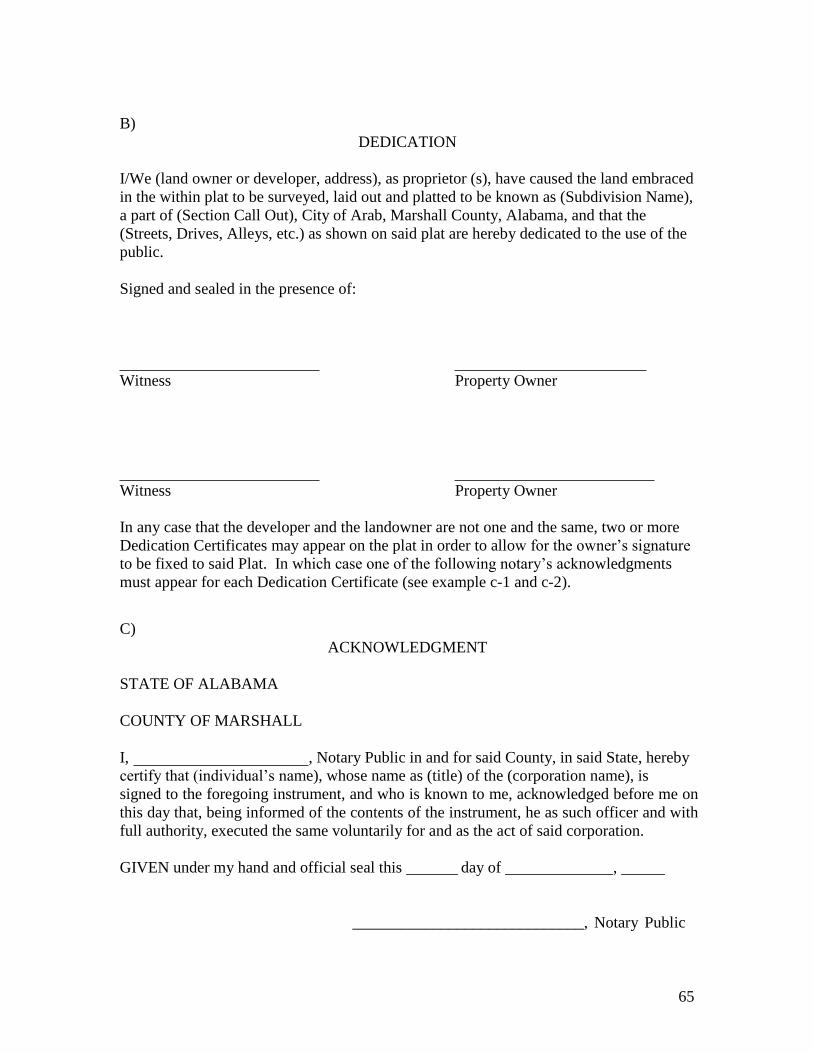
65
B)
DEDICATION I/We (land owner or developer, address), as proprietor (s), have caused the land embraced
in the within plat to be surveyed, laid out and platted to be known as (Subdivision Name),
a part of (Section Call Out), City of Arab, Marshall County, Alabama, and that the
(Streets, Drives, Alleys, etc.) as shown on said plat are hereby dedicated to the use of the
public.
Signed and sealed in the presence of:
Witness Property Owner
Witness Property Owner
In any case that the developer and the landowner are not one and the same, two or more
Dedication Certificates may appear on the plat in order to allow for the owner’s signature
to be fixed to said Plat. In which case one of the following notary’s acknowledgments
must appear for each Dedication Certificate (see example c-1 and c-2).
C)
ACKNOWLEDGMENT STATE OF ALABAMA
COUNTY OF MARSHALL
I, , Notary Public in and for said County, in said State, hereby
certify that (individual’s name), whose name as (title) of the (corporation name), is
signed to the foregoing instrument, and who is known to me, acknowledged before me on
this day that, being informed of the contents of the instrument, he as such officer and with
full authority, executed the same voluntarily for and as the act of said corporation.
GIVEN under my hand and official seal this day of ,
_____________________________, Notary Public

66
D) ACKNOWLEDGEMENT
STATE OF ALABAMA
COUNTY OF MARSHALL
I, , a Notary Public in and for said county, in said State,
hereby certify that (owner’s name), whose name is signed to the foregoing instrument,
and who is known to me, acknowledged before me on this day that, being informed of the
contents of the instrument, executed the same voluntarily.
GIVEN under my hand and official seal this day of , .
NOTARY PUBLIC
E)
CERTIFICATE OF APPROVAL BY THE ARAB ELECTRIC CO-OP The undersigned, as authorized by the Arab Electric Co-Op of the City of Arab,
Alabama, hereby approved the within plat for the recording of same in the Probate Office
of Marshall County, Alabama, this day of , .
Arab Electric Co-op
City of Arab, Alabama F)
CERTIFICATE OF APPROVAL BY THE WATER BOARD The undersigned, as authorized by the Water Board of the City of Arab, Alabama, hereby
approved the within plat for the recording of the same in the Probate Office of Marshall
County, Alabama, this day of , .
Water Board
City of Arab, Alabama
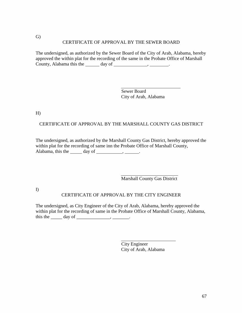
67
G)
CERTIFICATE OF APPROVAL BY THE SEWER BOARD The undersigned, as authorized by the Sewer Board of the City of Arab, Alabama, hereby
approved the within plat for the recording of the same in the Probate Office of Marshall
County, Alabama this the day of , .
Sewer Board
City of Arab, Alabama
H)
CERTIFICATE OF APPROVAL BY THE MARSHALL COUNTY GAS DISTRICT
The undersigned, as authorized by the Marshall County Gas District, hereby approved the
within plat for the recording of same inn the Probate Office of Marshall County,
Alabama, this the day of , .
Marshall County Gas District
I)
CERTIFICATE OF APPROVAL BY THE CITY ENGINEER The undersigned, as City Engineer of the City of Arab, Alabama, hereby approved the
within plat for the recording of same in the Probate Office of Marshall County, Alabama,
this the day of , .
City Engineer
City of Arab, Alabama

68
J)
CERTIFICATE OF APPROVAL BY THE PLANNING COMMISSION
The within plat of (Subdivision Name), Marshall County, Alabama is hereby approved by
the Planning Commission of the City of Arab, Alabama, this the day of
, .
PLANNING COMMISSION FOR THE
CITY OF ARAB, ALABAMA
Chairman
K)
CERTIFICATE OF APPROVAL BY THE MARSHALL COUNTY HEALTH
DEPARTMENT
The undersigned as authorized by the Marshall County Health Department, Alabama
hereby approved the within plat for the recording of same in the Probate Office of
Marshall County, Alabama, this the day of , .
Health Officer
Marshall County, Alabama
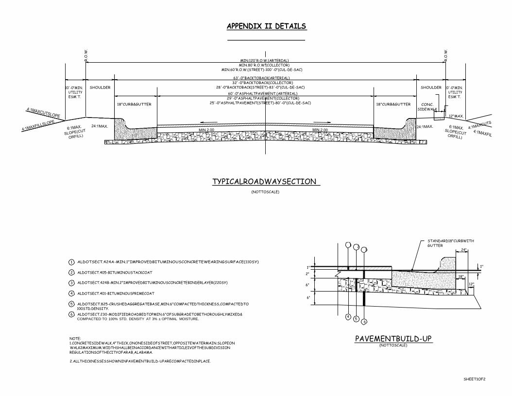
R.O
.W.
R.O
.W.
APPENDIX II DETAILS
MIN.120'R.O.W.(ARTERIAL) MIN.80'R.O.W.(COLLECTOR)
MIN.60'R.O.W.(STREET)-100'-0"(CUL-DE-SAC)
10'-0"MIN. UTILITY ESM'T.
SHOULDER
18"CURB&GUTTER
63'-0"BACKTOBACK(ARTERIAL) 32'-0"BACKTOBACK(COLLECTOR)
28'-0"BACKTOBACK(STREET)-83'-0"(CUL-DE-SAC)
60'-0"ASPHALTPAVEMENT.(ARTERIAL) 29'-0"ASPHALTPAVEMENT(COLLECTOR)
25'-0"ASPHALTPAVEMENT(STREET)-80'-0"(CUL-DE-SAC)
18"CURB&GUTTER
SHOULDER
CONC. SIDEWALK
10'-0"MIN.
UTILITY ESM'T.
12"MAX.
TYPICALROADWAYSECTION
(NOTTOSCALE)
STANDARD18"CURBWITH 1
2 GUTTER 3 24"
1 ALDOTSECT.424A-MIN.1"IMPROVEDBITUMINOUSCONCRETEWEARINGSURFACE(110SY)
1"
2 ALDOTSECT.405-BITUMINOUSTACKCOAT 2"
3 ALDOTSECT.424B-MIN.2"IMPROVEDBITUMINOUSCONCRETEBINDERLAYER(220SY) 6"
4 ALDOTSECT.401-BITUMINOUSPRIMECOAT 6"
5 ALDOTSECT.825-CRUSHEDAGGREGATEBASE,MIN.6"COMPACTEDTHICKNESS,COMPACTEDTO 100STD.DENSITY.
6 ALDOTSECT.230-MODIFIEDROADBEDTOPMIN.6"OFSUBGRADETOBETHOROUGHLYMIXED&
COMPACTED TO 100% STD. DENSITY AT 3% ± OPTIMAL MOISTURE. 4
5 6
18"
1"
12"
NOTE: 1.CONCRETESIDEWALK,4"THICK,ONONESIDEOFSTREET,OPPOSITEWATERMAIN.SLOPEON WALK2MAXIMUM.WIDTHSHALLBEINACCORDANCEWITHARTICLEIVOFTHESUBDIVISION REGULATIONSOFTHECITYOFARAB,ALABAMA.
2.ALLTHICKNESSESSHOWNINPAVEMENTBUILD-UPARECOMPACTEDINPLACE.
PAVEMENTBUILD-UP (NOTTOSCALE)
SHEET1OF2

APPENDIX II DETAILS
NOTES:
SIDEWALKDETAIL (NOTTOSCALE)
1.MAX.RUNNINGGRADEFORSIDEWALKSHALLBE5.00
2.SIDEWALKSINDRIVEWAYAREASSHALLHAVEMIN.6"THICKNESS.
SHEET2OF2

69
APPENDIX III
SUBDIVISION RECORD
PRELIMINARY PLAT
CHECKLIST
Name Of Subdivison
Location
Owner
Address
Telephone
Agent
Address
Telephone
Surveyor
Address
Telephone
Date submitted for preliminary approval
CHECKLIST
Deed book and page of record of the legal owner.
Date, north point, scale.
Caption – location by quarter section, township, range, city, county, state.
Acreage subdivided.
Vicinity map.
Exact length and bearing of the exterior boundaries of the tract.
Location of existing physical features on the property and adjoining properties.
Names of adjacent subdivisions.
Names and addresses of record owners of adjoining land.
Proposed minimum building setback lines.

70
Names, locations, width, dimensions of existing and proposed streets, alleys,
easements, parks, rights-of-way and other open spaces, reservations, lot lines
and building lines.
Dimensions and area in acres of all proposed lots and bearings of respective sides.
Lot and block numbers; smallest lot size, total number of lots.
Dimensions should be to nearest 1/100 of a foot and angles within plus or minus 5
seconds.
Profiles of streets where required; linear feet in streets.
ADEM permit applied for if greater than one acre.
Contours where required.
Zoning classifications.
Construction plans of proposed utility layouts, sewer, water, electricity, street
plans, and storm drainage.
Sponsor transmits construction plans to Water, Electric, Sanitary and Health
Departments for review and approval.
Conforms to general requirements and minimum standards of design.
One copy of preliminary plat retained by Planning Commission.
Approved (date) for construction, subject to following modifications:
Variances granted:
Disapproved: (date) for following reasons:
Signed:
Secretary of Planning Commission

71
APPENDIX IV
SUBDIVISON RECORD
FINAL PLAT APPROVAL
CHECKLIST
Name of Subdivision
Location
Zoning District
Owner
Address
Telephone
Preliminary approval granted
Submitted for final approval
(date)
(date)
CHECKLIST
Plat submitted in triplicate, original and two prints.
Plat submitted within one year of preliminary approval.
Scale not less than 1” = 100’ and on sheets 24” by 36”.
Dimensions of angles within plus or minus 5 seconds.
Primary control points and “ties” to same.
Tract boundary lines and vicinity map.
Right-of-way lines of streets, easements and other rights-of-way.
Bearings of property lines and engineering data to locate all lines including radii,
angles, arcs, central angles of all curves.
Name and right-of-way width of each street or other right-of-way.
Location, dimensions and purposes of any easements.
Number identify each lot or site and block numbers.
Purpose for which sites other than residential lots are dedicated or reserved.
Minimum and maximum building setback on all lots and other sites.
Location and description of monuments.
Names of record owners of adjoining non-platted land.
Reference to recorded subdivision plats of adjoining platted land by record name,
date and number.
Certification by surveyor as to accuracy of survey and plat.
Certification of title showing that applicant is the landowner.
Statement by owner dedication streets, easements or rights-of-way and any sites
for public use.
Title, scale, north point and date.
Certificate for approval by the Planning Commission.
Certificate of approval by City Engineer.
Certificates of approval by: Electric, Water, Sewer, Gas Departments.
Certificate of Approval by Health Dept (if septic tanks and/or wells are necessary)

72
Any restrictions and/or special notations as may be required by other sections of
these regulations.
Flooding as depicted by FIA Community Map checked.

73
APPENDIX V
APPLICATION FOR LAND CONVEYANCE AMONG IMMEDIATE FAMILY
MEMBERS PLANNING COMMISSION
1. Date ,
2. Name of Property Owner(s)
Address:
3. Names of Immediate Family Members:
Phone Number:
Fax Number:
Present Address:
Phone Numbers:
4. Name of Registered Land Surveyor:
Address:
Registration Number:
5. Location of Property:
Number of Acres:
6. Utility Service
Phone Number(s)
Fax Number:
Zoning District:
Water: Yes No
Sewer: Yes No Name of Utility:
Name of Utility:
On site septic disposal: Yes No
Health Department Review: Yes No Date of Review:
Signature of Applicant
FOR TOWN USE ONLY Application received by: on
Application Fee $
Application reviewed by Subdivision Administrator on
Copies transmitted for staff review on
Public notices mailed on
Planning Commission hearing date
, 20
, 20
. 20
Action taken by Planning Commission , 20_
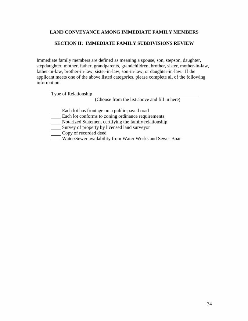
74
LAND CONVEYANCE AMONG IMMEDIATE FAMILY MEMBERS
SECTION II: IMMEDIATE FAMILY SUBDIVISIONS REVIEW
Immediate family members are defined as meaning a spouse, son, stepson, daughter,
stepdaughter, mother, father, grandparents, grandchildren, brother, sister, mother-in-law,
father-in-law, brother-in-law, sister-in-law, son-in-law, or daughter-in-law. If the
applicant meets one of the above listed categories, please complete all of the following
information.
Type of Relationship
(Choose from the list above and fill in here)
Each lot has frontage on a public paved road
Each lot conforms to zoning ordinance requirements
Notarized Statement certifying the family relationship
Survey of property by licensed land surveyor
Copy of recorded deed
Water/Sewer availability from Water Works and Sewer Boar

75