Chris Parrish, Oregon State Univ.
16
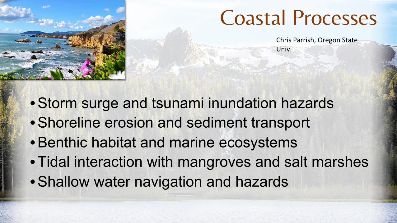
Coastal Processes Chris Parrish, Oregon State Univ. • Storm surge and tsunami inundation hazards • Shoreline erosion and sediment transport • Benthic habitat and marine ecosystems • Tidal interaction with mangroves and salt marshes • Shallow water navigation and hazards
Transcript of Chris Parrish, Oregon State Univ.
Coastal ProcessesChris Parrish, Oregon State Univ.
•Storm surge and tsunami inundation hazards•Shoreline erosion and sediment transport•Benthic habitat and marine ecosystems•Tidal interaction with mangroves and salt marshes•Shallow water navigation and hazards
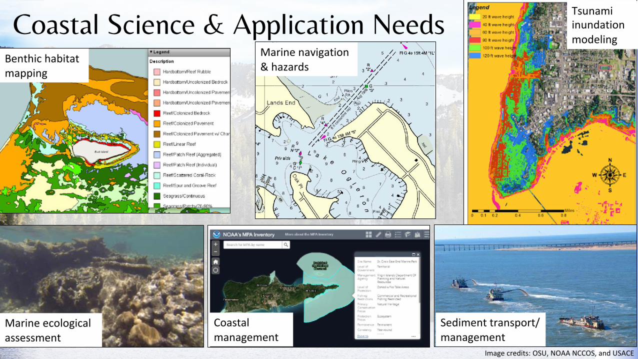
Coastal Science & Application NeedsBenthic habitat mapping
Marine navigation & hazards
Tsunami inundation modeling
Marine ecological assessment
Coastal management
Sediment transport/ management
Image credits: OSU, NOAA NCCOS, and USACE

Coastal Processes Scope of Study for STV
• Topics within scope• Coastal geomorphology and
geologic hazards• Inundation (e.g., storm surge and
tsunami)• Marine ecosystems• Sediment erosion, transport, and
deposition• Marine archaeology• Marine navigation• Relative sea level rise
(subsidence + eustatic SLR)

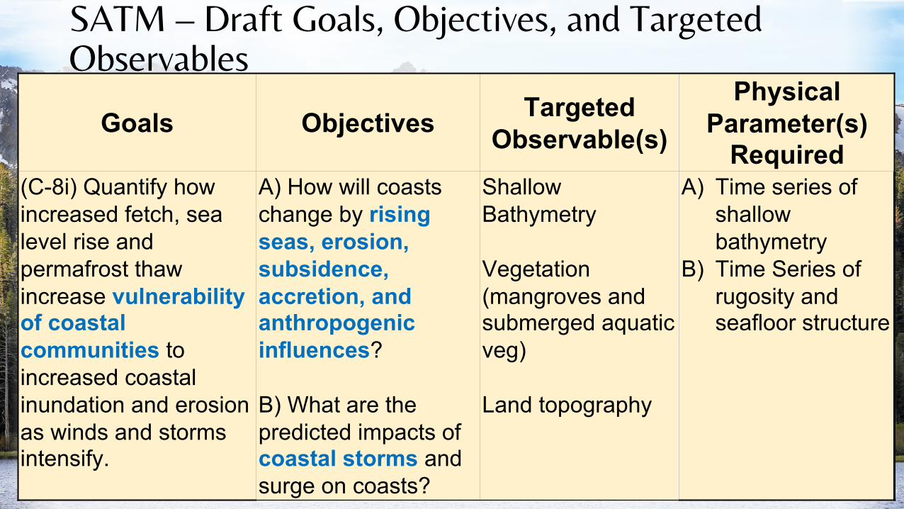
SATM – Draft Goals, Objectives, and Targeted Observables
Goals ObjectivesTargeted
Observable(s)
Physical Parameter(s)
Required(S-1) How can large-scale geological hazards be accurately forecast in a socially relevant timeframe?
(S-1d) Forecast, model, and measure tsunami generation,propagation, and run-up for major seafloor events.
Shallow Bathymetry
Vegetation (mangroves & submerged aquatic veg)
Land topography
A) Seafloor height, relative to a known vertical datum (orthometric or tidal)
B) Seafloor rugosity
From Decadal Survey

SATM – Draft Goals, Objectives, and Targeted Observables
Goals ObjectivesTargeted
Observable(s)
Physical Parameter(s)
Required(E-1) What are the structure, function, and biodiversity of Earth’s ecosystems, and how and why are they changing in time and space?
(STV) What are current and predicted threats to marine ecosystems and coastal/benthic habitats (e.g., coral reef, saltmarsh, mangroves, seagrass, oyster reefs, etc.)?
Shallow Bathymetry
Vegetation (mangroves, submerged aquatic veg)
A) Time series of shallow bathymetry
B) Time series of rugosity and seafloor structure
SATM – Draft Goals, Objectives, and Targeted Observables
Goals Objectives Targeted Observable(s)
Physical Parameter(s)
Required(C-8i) Quantify how increased fetch, sea level rise and permafrost thaw increase vulnerability of coastal communities to increased coastal inundation and erosion as winds and storms intensify.
A) How will coasts change by rising seas, erosion, subsidence, accretion, and anthropogenic influences?
B) What are the predicted impacts of coastal storms and surge on coasts?
Shallow Bathymetry
Vegetation (mangroves and submerged aquatic veg)
Land topography
A) Time series of shallow bathymetry
B) Time Series of rugosity and seafloor structure

SATM – Draft Goals, Objectives, and Targeted Observables
Goals Objectives Targeted Observable(s)
Physical Parameter(s)
RequiredSupport safety of marine navigation in nearshore areas
Where are shoals, reefs and other hazards to marine navigation, and how are they changing with time?
Shallow bathymetry
Time series of shallow bathymetry

Space-based Shallow Bathymetric Mapping• Growing interest since 1970s; estimate bathymetry from spectral image bands• Based on wavelength-dependent, exponential attenuation of downwelling irradiance
with depth (Beer-Lambert Law)• Dozens of approaches in published literature• Requires reference bathymetry (“seed depths”)
Jerlov Curves: Kd vs. λ
d
1
KA
ttenu
atio
n C
oeffi
cien
t, )1- 0.1
(m Water TypeIIAIBIIIII
Diff
use
1357
0.01310 350 375 400 425 450 475 500 525 550 575 600 625 650 675 700
Wavelength (nm)
Stumpf algorithm
green
blue
transform
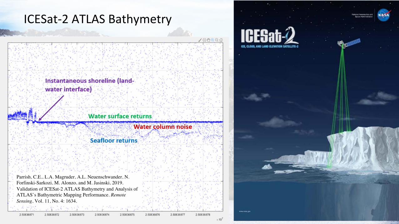
ICESat-2 ATLAS Bathymetry
Parrish, C.E., L.A. Magruder, A.L. Neuenschwander, N. Forfinski-Sarkozi, M. Alonzo, and M. Jasinski, 2019. Validation of ICESat-2 ATLAS Bathymetry and Analysis of ATLAS’s Bathymetric Mapping Performance. Remote Sensing, Vol. 11, No. 4: 1634.

Active-Passive Fusion Based Approaches
Forfinski-Sarkozi, N.A., and C.E. Parrish, 2019. Active-Passive Spaceborne Data Fusion for Mapping Nearshore Bathymetry. Photogrammetric Engineering and Remote Sensing, Vol. 85, No. 4, pp. 281-295.

• Data lacking in many coastal areas
• Nautical charts obsolete in many areas (IHO)
• Shore-adjacent areas (0-5 m) generally the most critical gap
• Spatial accuracies and resolutions don't meet all science and application needs

Existing Standards Docs
Science Data Requirements
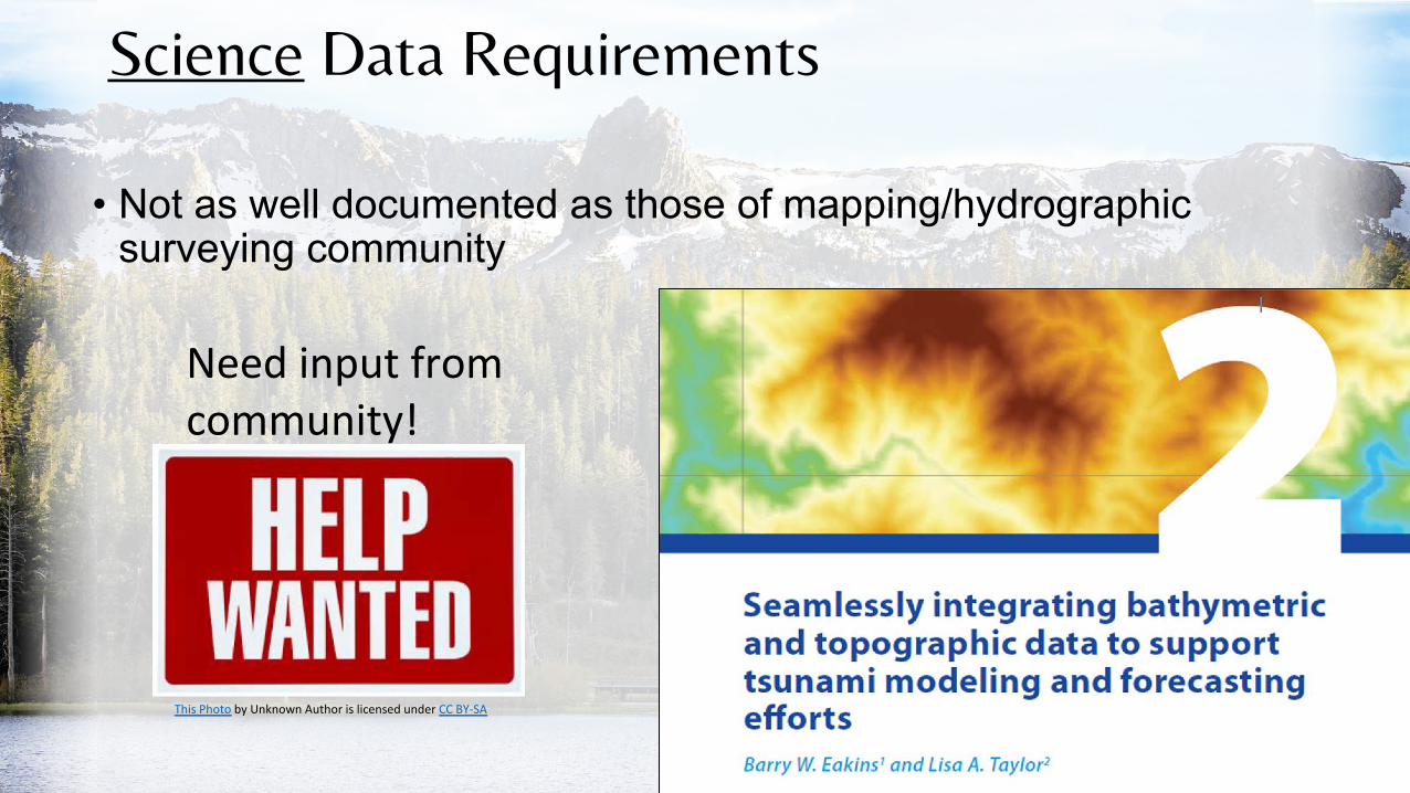
• Not as well documented as those of mapping/hydrographic surveying community
Need input from community!
This Photo by Unknown Author is licensed under CC BY-SA


Science and Appl ications Level 3 or4
Product
Goa ls Objectives Targeted
Observable(s) Physical Parameter(s)
Requ ired
Area of Interest Coverage
(%) Smallest Feature Resolut ion
(m)
Horizon tal Vert ical
(E-1 ) What are the structure, function, and biodiversity of Earth's ecosystems , and how and why are they changing in time and space?
(STY) What are current and predicted threats to marine ecosystems and coastal/benthic habitats (e.g., coral reef , saltmarsh , mangroves , seagrass , oyster reefs, etc.)?
Shallow Bathymetry
Vegetation (mangroves & submerged aquat ic veg)
Land topography
A) Time series of shallow bathymetry
Time series of bathymetry DEMs (2D grid)
Coral reefs, saltmarsh , mangroves , seagrass beds, oyster reefs and other priority habitat areas worldwide
30% 100%
5m 0.5m
1m 0.25 m
B) Time series of rugosity and seafloor structure
Time series of gridded seafloor rugosity
30% 100%
5m 0.5m
1m 0.25m
AspirationThreshold
Coastal Processes
• Charge to Community:• Come prepared to discuss your product gaps/needs• If possible, please identify published papers, reports that we can cite in
justifying the needs• “T” in SATM = Traceability
• Need references!