Chapter 4: Weather - Sacred Heart Science - Homeroomshcsdearbornscience.weebly.com/uploads… ·...
57
CHAPTER 4: WEATHER 4.1 Water in the Atmosphere
Transcript of Chapter 4: Weather - Sacred Heart Science - Homeroomshcsdearbornscience.weebly.com/uploads… ·...

CHAPTER 4: WEATHER
4.1 Water in the Atmosphere

Review of the Water Cycle• Evaporation turns liquid water into water vapor. • Condensation turns water vapor back into liquid water droplets, which form clouds.
• Precipitation falls from the clouds, and then goes back into the ground and bodies of water.

Review of the Water Cycle

Humidity • Humidity: measure of the amount of water vapor in the
air. • Warm air can hold more water vapor.
• Relative humidity: percentage of water vapor that is actually in the air compared to the maximum amount that could be held

Humidity • Relative humidity: percentage of water vapor that is actually in the air compared to the maximum amount that could be held.
• Measured with a psychrometer.

CHAPTER 4: WEATHER
4.2 Clouds

Condensation• Clouds form when water vapor in the air condenses to form liquid water or ice crystals. • Water condenses at cooler temperatures: it begins at
the dew point. • Particles must be present in the atmosphere, such as
dust or salt, for condensation to occur.
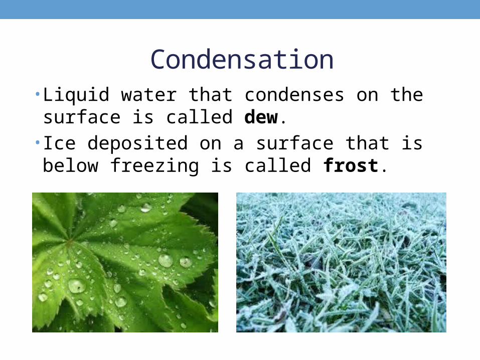
Condensation• Liquid water that condenses on the surface is called dew.
• Ice deposited on a surface that is below freezing is called frost.

Types of Clouds• Cirrus clouds:
• Wispy and feathery • High altitudes and low temperatures• Made of ice• Fair weather

Types of Clouds• Altocumulus/altostratus clouds:
• Medium altitudes• Indicate precipitation

Types of Clouds• Cumulus clouds:
• Puffy, cotton-like clouds• Short clouds indicate fair weather• Stacked cumulonimbus clouds produce storms

Types of Clouds• Cirrocumulus clouds:
• Small, cotton ball clouds• Indicate a storm is on the way

Types of Clouds• Stratus clouds:
• Cover all or most of the sky • Dull and gray • If precipitation falls from them, then they are
nimbostratus clouds.
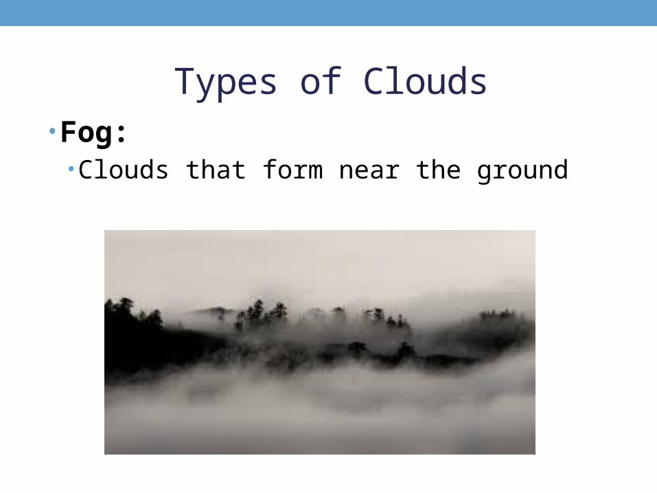
Types of Clouds• Fog:
• Clouds that form near the ground

CHAPTER 4: WEATHER
4.3 Precipitation

Precipitation• Precipitation: any form of water that falls from clouds and reaches Earth’s surface. • Rain• Sleet • Freezing rain • Snow• Hail

Rain • Most common type• Smaller drops make drizzle• Smallest drops make mist • Measured using a rain gauge: open ended tube that collects rain.
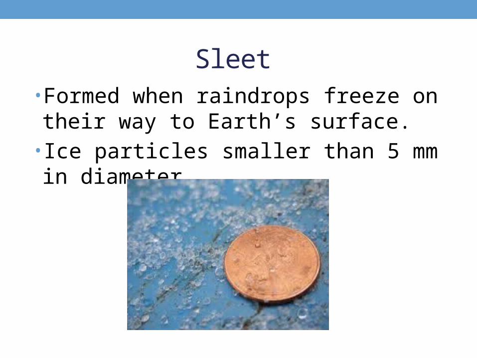
Sleet • Formed when raindrops freeze on their way to Earth’s surface.
• Ice particles smaller than 5 mm in diameter.

Freezing Rain • Raindrops fall as liquid water, but freeze when they touch the cold surface.

Snow• Formed when water vapor in a cloud changes right into ice crystals.
• Measured by using a measuring stick or by melted collected snow to see the water’s depth.

Hail• Pellet of ice larger than 5 mm in diameter.• Contains layers of ice.• Forms inside cumulonimbus clouds during storms.

Floods• Flood: overflowing of water in a dry area• many occur when the volume (amount) of water in a river increases so much that the river overflows.

Floods• Can uproot trees, remove boulders, wash away buildings, etc.
• Controlled by: • Dams: barrier across a river to redirect its flow• Levees: embankment built along a river to prevent
flooding on the land.

Droughts • Drought: long period of scarce rainfall or dry weather.
• Reduces groundwater amounts• Results in a water shortage

Droughts
• Usually caused by dry weather systems.
• Can cause crop failure and famine.
• Water conservation and preservation help prepare for these.

CHAPTER 4: WEATHER
4.4 Air Masses

Air Masses• Air mass: huge body of air in the lower atmosphere that has similar temperature, humidity, and air pressure.

Air Masses• There are four main types of air masses:
• Tropical: warm masses that form in the tropics; low air pressure
• Polar: cold masses that form near the poles; high air pressure
• Maritime: form over oceans; very humid• Continental: form over land; less humid

Air Masses• Maritime polar: cool, humid air form in the N. Atlantic; pushed to sea by westerly winds.
• Continental polar: form over Canada/Alaska; bitterly cold and low humidity.
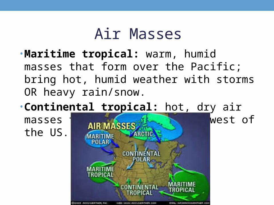
Air Masses• Maritime tropical: warm, humid masses that form over the Pacific; bring hot, humid weather with storms OR heavy rain/snow.
• Continental tropical: hot, dry air masses that form in the Southwest of the US.

Air Masses• Prevailing westerlies push air from west to east in the US. • Jet streams are bands of high-speed winds that blow
from west to east. • A front is a boundary where air masses meet; storms can develop at fronts.

Cold Fronts• Cold air is dense and sinks; warm air is less dense and
rises. • A cold front is when cold air slides underneath warm air. • Clouds, heavy rain, and snow are possible, as well as
thunderstorms.

Cold Fronts

Warm Fronts• A fast-moving warm air mass moves over a cold mass.
• Weather can be rainy or cloudy for several days.

Occluded Fronts• Warm air mass is caught between two cold masses.
• The warm mass rises, and the cold masses mix. • Temperatures get much cooler; clouds and precipitation may occur.

Occluded Fronts

Stationary Fronts• Warm and cold masses meet, but do not move. • Water vapor condenses into rain, snow, fog, or clouds.

Cyclones• A cyclone is a swirling center of low air pressure. • Cyclones and low pressure systems are associated with clouds, wind, and precipitation.

Anticyclones• An anticyclone is a high-pressured center of dry air.
• Causes dry, clear weather.

CHAPTER 4: WEATHER
4.5 Storms

Storms• Storm: violent disturbance in the atmosphere. • Sudden change of air pressure.

Winter Storms• Most precipitation is formed as snow all year round.
• In the winter, it is cold enough (0 C or 32 F) for the snow to remain snow.

Thunderstorms• Thunderstorm: small storm often accompanied by precipitation, thunder, and lightning.
• Form in cumulonimbus clouds.• Hot, humid afternoons/evenings

Thunderstorms• Positive and negative charges build up, releasing in lightning – sudden spark or discharge of energy between clouds and the ground.
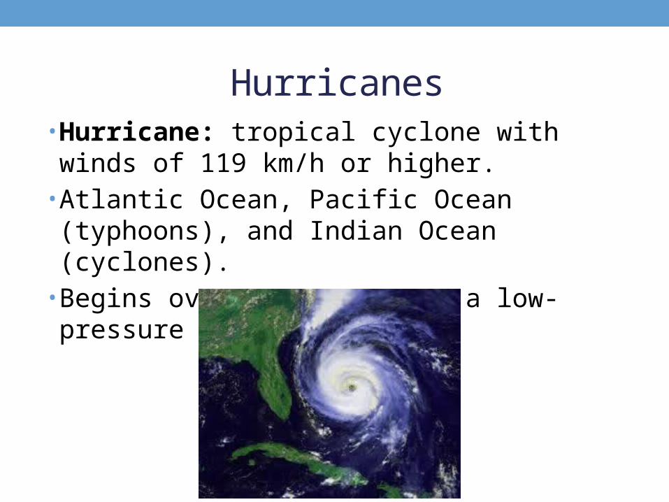
Hurricanes• Hurricane: tropical cyclone with winds of 119 km/h or higher.
• Atlantic Ocean, Pacific Ocean (typhoons), and Indian Ocean (cyclones).
• Begins over warm water as a low-pressure area.

Hurricanes• Gets energy from warm air over water• As warm air rises, more air is pulled into the system with
high winds and heavy rains. • Strongest around the center, which is called the eye.

Hurricanes• Can last a week or more.• Over land, it begins to weaken without warm air to gain energy from.
• Storm surge: a dome of water that sweeps across the coast

Tornadoes • Tornado: rapidly whirling, funnel-shaped cloud that reaches down from a t-storm. • Over water – waterspout
• Touch the ground for 15 minutes or less; winds can approach 500 km/h.
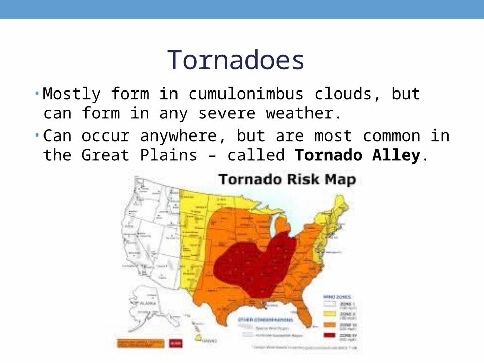
Tornadoes • Mostly form in cumulonimbus clouds, but can form in any
severe weather. • Can occur anywhere, but are most common in the Great
Plains – called Tornado Alley.
CHAPTER 4: WEATHER
4.6 Predicting the Weather

Predicting the Weather• The first step is to collect data-
• Making observations: watching the clouds can tell a great deal about the future weather.
• Gathering data: using balloons, satellites, radar, and surface instruments.
• Interpreting information: maps, charts, computers, and technology help prepare forecasts.

Using Technology • Automated weather stations: gather info for temperature, air pressure, relative humidity, rainfall, and wind speed/direction.
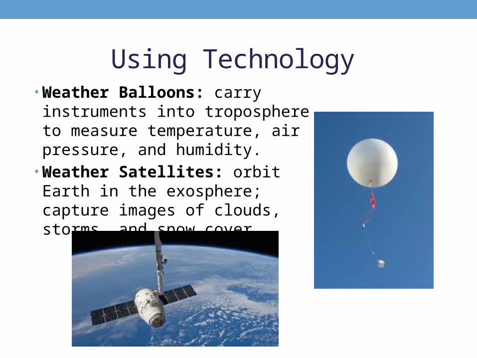
Using Technology • Weather Balloons: carry instruments
into troposphere to measure temperature, air pressure, and humidity.
• Weather Satellites: orbit Earth in the exosphere; capture images of clouds, storms, and snow cover.
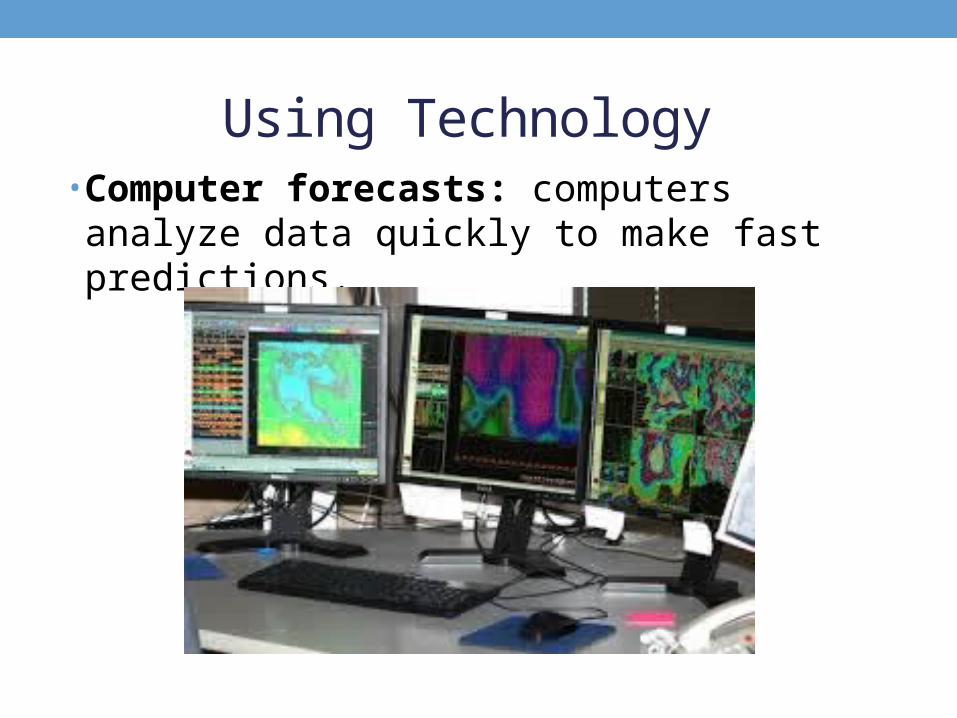
Using Technology • Computer forecasts: computers analyze data quickly to make fast predictions.

Weather Service Maps• Curved lines connect places with similar conditions of temp/air pressure.
• Isobars: lines joining places on the map that have the same air pressure.
• Isotherms: lines joining places that have the same temperatures.

Weather Service Maps

Weather Forecasts• The “butterfly effect” – a small change in the weather today can lead to a big change in the weather next week.
• This makes it extremely difficult to predict weather far in the future.