Chapter 4 Transportation
21
Village of Bellevue Comprehensive Plan - Transportation 4-1 Chapter 4 Transportation Summary A transportation system should be designed for all modes of transportation. The Village has been increasing the amount of sidewalks and trails. Design techniques, such as traffic calming, can reduce the speed of traffic and make the Village safer for pedestrians and bicyclists. The Village should coordinate future transportation projects with State and County projects to reduce costs. Bellevue uses several tools to prioritize and fiscally plan future improvements The Village has created a Pedestrian, Bicycle & Safe Routes to School Plan which acts as the main planning document for pedestrian and bicycle infrastructure. Introduction A transportation system allows the movement of goods and people in a local, regional, national, and international context and through a variety of modes. A good transportation system should be designed for the efficient movement of people and goods in a safe manner. Transportation systems can influence the growth of a community. High traffic areas, such as highways, provide good locations for industry and businesses. Trail systems provide recreation opportunities for people and add to the livability and desirability of a community. Sidewalks provide residents access to parks, neighborhoods, and businesses. The Transportation chapter will inventory and evaluate local modes of transportation and identify future transportation needs in the Village of Bellevue. Modes of Transportation The movement of people and goods is accomplished through a variety of transportation modes. These modes include cars, trucks, railroads, public transportation, ships, airplanes, bicycles, and walking. Generally, each mode fits a particular need. Automobiles: Function as the dominant mode for the movement of people. Trucks: Provide for the rapid movement of goods and products over interstates and highways. Airplanes: Move people and lightweight products quickly over long distances. Railroad: Functions primarily for the movement of bulk commodities over long distances. Ships: Functions primarily for the movement of bulk commodities nationally and globally. Bicycles: Typically move people over shorter distances within a community. Walking: Provide for the movement of people within a community.
Transcript of Chapter 4 Transportation

Village of Bellevue Comprehensive Plan - Transportation 4-1
Chapter 4
Transportation
Summary
� A transportation system should be designed for all modes of transportation. � The Village has been increasing the amount of sidewalks and trails. � Design techniques, such as traffic calming, can reduce the speed of traffic and make the Village
safer for pedestrians and bicyclists. � The Village should coordinate future transportation projects with State and County projects to
reduce costs. � Bellevue uses several tools to prioritize and fiscally plan future improvements � The Village has created a Pedestrian, Bicycle & Safe Routes to School Plan which acts as the
main planning document for pedestrian and bicycle infrastructure.
Introduction A transportation system allows the movement of goods and people in a local, regional, national, and international context and through a variety of modes. A good transportation system should be designed for the efficient movement of people and goods in a safe manner. Transportation systems can influence the growth of a community. High traffic areas, such as highways, provide good locations for industry and businesses. Trail systems provide recreation opportunities for people and add to the livability and desirability of a community. Sidewalks provide residents access to parks, neighborhoods, and businesses. The Transportation chapter will inventory and evaluate local modes of transportation and identify future transportation needs in the Village of Bellevue.
Modes of Transportation The movement of people and goods is accomplished through a variety of transportation modes. These modes include cars, trucks, railroads, public transportation, ships, airplanes, bicycles, and walking. Generally, each mode fits a particular need. Automobiles: Function as the dominant mode for the movement of people. Trucks: Provide for the rapid movement of goods and products over interstates and highways. Airplanes: Move people and lightweight products quickly over long distances. Railroad: Functions primarily for the movement of bulk commodities over long distances. Ships: Functions primarily for the movement of bulk commodities nationally and globally. Bicycles: Typically move people over shorter distances within a community. Walking: Provide for the movement of people within a community.

Village of Bellevue Comprehensive Plan - Transportation 4-2
Existing Transportation System
Streets and Highways Bellevue’s main transportation infrastructure consists of Interstate (I) 43; State Trunk Highways (STH) 29 and 172; US Highway (USH) 141; County Truck Highways (CTH) JJ, XX, V, O, and GV; and local streets. These streets and highways are the primary means of reaching the Village’s residential, commercial, institutional, and other destinations (see Figure 4-1).
Functional Classification System A component of a street and highway system is the functional classification network. This network is typically based on traffic volumes, land uses, road spacing, and system continuity (see Figure 4-2). The four general functional classifications are freeways, arterials, collectors, and local streets. These classifications are summarized below. Freeways: Freeways are controlled-access highways that have no at-grade intersections or driveway connections. I-43 is an example of a freeway in Bellevue. Arterials: Principal and minor arterials carry longer-distance vehicle trips between activity centers. These facilities are designed to provide a very high amount of mobility and very little access. Main Street and Monroe Road (CTH GV) are examples of arterial streets in Bellevue. Collectors: Collectors link local streets with the arterial street system. These facilities collect traffic in local areas, serve as local through routes, and directly serve abutting land uses. Verlin Road is an example of a collector street in Bellevue. Locals: Local roads and streets are used for short trips. Their primary function is to provide access to abutting land uses, and traffic volumes and speeds are relatively low. Jen Rae Road is an example of a local street in Bellevue. The current street pattern in Bellevue enables some vehicle trips to occur on the local and collector streets because some are well connected. However, the Village also contains cul-de-sacs, horseshoe roads, and other streets that do not provide connections to surrounding streets. The East River, creeks, a railroad, and I-43 also create barriers to these connections. This lack of street connectivity in many parts of the Village forces motorists to use the arterial streets at some point during nearly every vehicle trip and this concentration of traffic can create barriers to other transportation modes such as walking, bicycling, and transit.
Figur
e 4-1
Trans
porta
tion N
etwor
k
Draw
n By:
Tim H
ennig
, GIS
Coord
inator
Inspe
cted B
y: An
drew
Visse
rs, C
ommu
nity D
evelo
pmen
t Dire
ctor
File:
Q:\C
ommu
nity D
evelo
pmen
t\Com
prehe
nsive
Plan
Map
s\4-1_
Trans
porat
ionNe
twork
.mxd
Date:
May
4, 20
121 i
n = 1
miles
Scale
:
Lege
nd
Coun
ty Hi
ghwa
y
Inters
tate H
ighwa
y
Multi-
Use T
rail
State
High
way
U.S.
/ Stat
e High
way
U.S.
High
way
Railro
adTra
il
Loca
l Roa
d
Discla
imer:
This
map w
as pr
oduc
ed fo
r the e
xclus
ive us
e of th
e offic
ials o
f the V
illage
ofBe
llevu
e. Th
e data
pres
ented
has b
een c
ompil
ed fro
m va
rious
sourc
es, e
ach o
fwh
ich in
trodu
ces v
arying
degre
es of
inac
curac
ies or
inco
nsist
encie
s. Su
chdis
crepa
ncies
in da
ta are
inhe
rent. T
he Vi
llage
of B
ellev
ue as
sume
s no l
iability
for its
use o
r acc
uracy.
Ques
tions
or co
mmen
ts reg
arding
the c
artog
raphic
comp
ositio
n of th
is ma
pinc
luding
, but
not li
mited
to, e
rrors,
omiss
ions,
corre
ction
s, an
d/or u
pdate
ssh
ould
be di
rected
to th
e map
autho
r: Tim
Hen
nig, G
IS C
oordi
nator
, Villa
ge of
Bell
evue
, (920
) 468
-5225
.Co
pyrig
ht 20
12 V
illage
of B
ellev
ue G
ISTh
is ma
p was
prod
uced
using
Bell
evue
's en
terpri
se ge
ograp
hic in
forma
tion s
ystem
(G
IS).
Pleas
e visit
Bell
evue
GIS
web
page
at:
http:/
/www
.villa
geofb
ellev
ue.or
g/dep
artme
nts/pu
blic-w
orks/g
is.htm
l
Note:
This
map
is fo
r gen
eral re
feren
ce
and
gene
ral pl
annin
g purp
oses
only.
It is
not in
tende
d for
detai
led pl
annin
g.
µ0
10.5
Mile

Figur
e 4-2
Func
tiona
l Clas
sifica
tion
Draw
n By:
Tim H
ennig
, GIS
Coord
inator
Inspe
cted B
y: An
drew
Visse
rs, C
ommu
nity D
evelo
pmen
t Dire
ctor
File:
Q:\C
ommu
nity D
evelo
pmen
t\Com
prehe
nsive
Plan
Map
s\4-1_
Func
tiona
lClas
sifica
tion.m
xd
Date:
May
4, 20
121 i
n = 1
miles
Scale
:
Discla
imer:
This
map w
as pr
oduc
ed fo
r the e
xclus
ive us
e of th
e offic
ials o
f the V
illage
ofBe
llevu
e. Th
e data
pres
ented
has b
een c
ompil
ed fro
m va
rious
sourc
es, e
ach o
fwh
ich in
trodu
ces v
arying
degre
es of
inac
curac
ies or
inco
nsist
encie
s. Su
chdis
crepa
ncies
in da
ta are
inhe
rent. T
he Vi
llage
of B
ellev
ue as
sume
s no l
iability
for its
use o
r acc
uracy.
Ques
tions
or co
mmen
ts reg
arding
the c
artog
raphic
comp
ositio
n of th
is ma
pinc
luding
, but
not li
mited
to, e
rrors,
omiss
ions,
corre
ction
s, an
d/or u
pdate
ssh
ould
be di
rected
to th
e map
autho
r: Tim
Hen
nig, G
IS C
oordi
nator
, Villa
ge of
Bell
evue
, (920
) 468
-5225
.Co
pyrig
ht 20
12 V
illage
of B
ellev
ue G
ISTh
is ma
p was
prod
uced
using
Bell
evue
's en
terpri
se ge
ograp
hic in
forma
tion s
ystem
(G
IS).
Pleas
e visit
Bell
evue
GIS
web
page
at:
http:/
/www
.villa
geofb
ellev
ue.or
g/dep
artme
nts/pu
blic-w
orks/g
is.htm
l
Lege
ndFu
nctio
nal C
lassif
icatio
n Sys
temUr
ban I
nterst
ateUr
ban F
reewa
yUr
ban P
rincip
al Ar
terial
Urba
n Coll
ector
Urba
n Mino
r Arte
rial
Rural
Majo
r Coll
ector
Loca
lUr
ban F
uture
Major
Coll
ector
Urba
n Futu
re Mi
nor A
rteria
lUr
baniz
ed Ar
ea (C
ensu
s 200
0)Ru
ral Ar
eaNo
te: T
his m
ap is
for g
enera
l refer
ence
a
nd ge
neral
plan
ning p
urpos
es on
ly.
I
t is no
t inten
ded f
or de
tailed
plan
ning.
µ0
10.5
Mile

Village of Bellevue Comprehensive Plan - Transportation 4-5
Pedestrian and Bicycle Facilities Despite its population and physical size, the Village of Bellevue has a limited amount of sidewalks and on-street bicycle lanes. The Village does contain a portion of the East River Trail and other trails that connect to the East River Trail along Allouez Avenue. The East River Trail tends to follow the meander of the river, which makes the trail very appealing for recreational trips but impractical for work commutes and other transportation trips. The Village’s existing pedestrian and bicycle system is shown in Figure 4-3.
Transit The northwest portion of Bellevue is currently served by Green Bay Metro Transit (GBMT) Route 14 and 18. The routes provide service to local businesses and residential areas as well as provide access to the Green Bay Metropolitan Area Monday through Saturday. To accommodate bicyclists, all GBMT buses are equipped with bike racks.
Specialized Transportation Services for the Elderly and Disabled (ADA Paratransit) Bellevue’s inclusion in the Green Bay Metro service area allows the Village to be served by Metro’s paratransit provider. Metro’s paratransit service allows clients in Bellevue to be picked up at their homes and taken directly to their destinations in vehicles that accommodate wheelchairs, scooters, and riders who do not require mobility devices. Trips can be scheduled for pick-up Monday through Saturday. There is no service on Sundays and some holidays. Other options for medical transportation include non-emergency Medical Assistance (MA) transportation service that is coordinated by LogistiCare. Brown County also has medical appointment drivers who act as volunteer caregivers to escort seniors and physically disabled adults to and from medical appointments. The volunteers are used only when other options are not available.
Rail Transportation Bellevue contains one active rail line that runs through the center of the Village. Train traffic on this line is relatively low, and the line does not serve any destinations in Bellevue.
Air Transportation Austin Straubel International Airport is approximately six miles west of Bellevue (see Figure 4-4). Commercial service is currently provided by Delta Airlines, American Eagle Airlines, United Airlines, and Continental Airlines. Charter service based in Green Bay is provided by Executive Air and Jet Air Group (Titletown Jet Centre). The Village’s economy is not significantly affected by the airport at this time.

Figur
e 4-3
Exist
ing Tr
ails a
nd Si
dewa
lks
Draw
n By:
Tim H
ennig
, GIS
Coord
inator
Inspe
cted B
y: An
drew
Visse
rs, C
ommu
nity D
evelo
pmen
t Dire
ctor
File:
Q:\C
ommu
nity D
evelo
pmen
t\Com
prehe
nsive
Plan
Map
s\4-3E
xistin
gTrai
ls.mx
d
Date:
May
4, 20
121 i
n = 1
miles
Scale
:
Lege
ndSid
ewalk
Multi-
Use T
rail
Discla
imer:
This
map w
as pr
oduc
ed fo
r the e
xclus
ive us
e of th
e offic
ials o
f the V
illage
ofBe
llevu
e. Th
e data
pres
ented
has b
een c
ompil
ed fro
m va
rious
sourc
es, e
ach o
fwh
ich in
trodu
ces v
arying
degre
es of
inac
curac
ies or
inco
nsist
encie
s. Su
chdis
crepa
ncies
in da
ta are
inhe
rent. T
he Vi
llage
of B
ellev
ue as
sume
s no l
iability
for its
use o
r acc
uracy.
Ques
tions
or co
mmen
ts reg
arding
the c
artog
raphic
comp
ositio
n of th
is ma
pinc
luding
, but
not li
mited
to, e
rrors,
omiss
ions,
corre
ction
s, an
d/or u
pdate
ssh
ould
be di
rected
to th
e map
autho
r: Tim
Hen
nig, G
IS C
oordi
nator
, Villa
ge of
Bell
evue
, (920
) 468
-5225
.Co
pyrig
ht 20
12 V
illage
of B
ellev
ue G
ISTh
is ma
p was
prod
uced
using
Bell
evue
's en
terpri
se ge
ograp
hic in
forma
tion s
ystem
(G
IS).
Pleas
e visit
Bell
evue
GIS
web
page
at:
http:/
/www
.villa
geofb
ellev
ue.or
g/dep
artme
nts/pu
blic-w
orks/g
is.htm
l
Note:
This
map
is fo
r gen
eral re
feren
ce
and
gene
ral pl
annin
g purp
oses
only.
It is
not in
tende
d for
detai
led pl
annin
g.
µ0
10.5
Mile

Austin StraubelInternational Airport
Port ofGreen Bay
Village ofBellevue
Port and Airport FacilitiesFigure 4-4
µ0 21 Miles
Drawn By: Tim Hennig, GIS Coordinator
Inspected By: Andrew Vissers, Community Development DirectorFile: Q:\Community Development\Comprehensive Plan Maps\Figure 4-4_PortandAirportFacilities.mxdDate: May 4, 2012 1 in = 2 milesScale:
Disclaimer:This map was produced for the exclusive use of the officials of the Village ofBellevue. The data presented has been compiled from various sources, each ofwhich introduces varying degrees of inaccuracies or inconsistencies. Suchdiscrepancies in data are inherent. The Village of Bellevue assumes no liabilityfor its use or accuracy.Questions or comments regarding the cartographic composition of this mapincluding, but not limited to, errors, omissions, corrections, and/or updatesshould be directed to the map author: Tim Hennig, GIS Coordinator, Village of Bellevue, (920) 468-5225.Copyright 2012 Village of Bellevue GISThis map was produced using Bellevue's enterprise geographic information system (GIS). Please visit Bellevue GIS webpage at: http://www.villageofbellevue.org/departments/public-works/gis.html

Village of Bellevue Comprehensive Plan - Transportation 4-8
Truck Transportation Because Bellevue contains a few industrial developments and commercial activity is concentrated largely in the west half of the Village, much of the heavy truck traffic in the Village is attributable to trucks passing through on STH 172 and I-43. However, many businesses and industries within the Village rely on truck trips to import and export goods. These trips typically occur on state and county highways but trucks occasionally need to travel on Village streets to reach their destinations. In Bellevue, trucks are allowed on Interstate, State, Local, and County Highways.
Water Transportation The Village does not currently rely on the Port of Green Bay to import or export goods. The port’s location is shown in Figure 4-4.
Future Transportation System Bellevue’s land use patterns and transportation system are largely oriented toward motorized vehicles, but the Village does contain a few areas where land uses are mixed and people can reach their destinations without a car. This section of the Transportation chapter will identify ways to provide an efficient, safe, and multi-modal transportation system over the next 20 years.
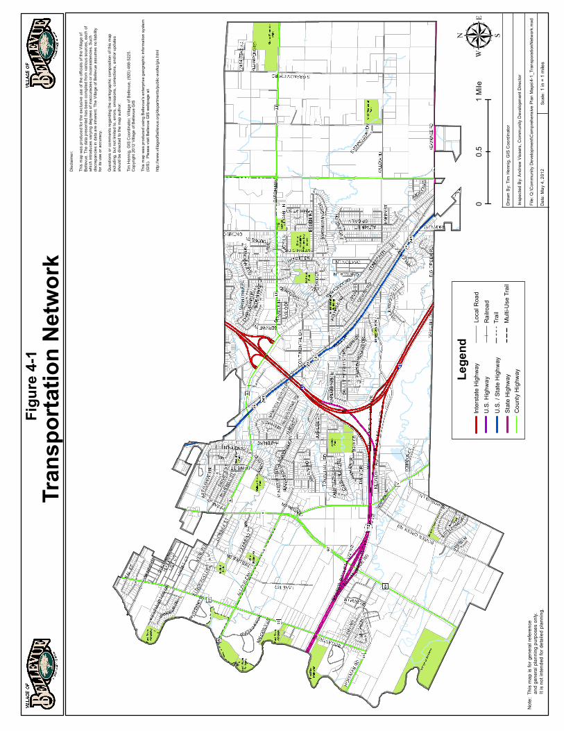
Local Street Connectivity Interstate, arterial, and collector roads are designed with different levels of limited access. The main purpose of these types of roads is to get vehicles through areas while maintaining traffic flow and speed. Local streets provide residents access to their homes, schools, businesses, and other nearby trips. When local streets are not well connected, problems related to traffic
Figure 4-5 Figure 4-6
Village of Bellevue Comprehensive Plan - Transportation 4-9
congestion, high traffic volumes, and vehicle/pedestrian safety can become issues. Figure 4-5 and 4-6 illustrate the benefits of street connectivity. In Figure 4-5, the area is dominated by cul-de-sacs which provide only three options for travel from the upper left corner to the lower right corner. In Figure 4-6, the grid pattern of streets now provided nine options to travel between the same points. Well-connected streets provide more options for vehicles, bicyclists, and pedestrians to avoid congested and busy areas. Barriers to street connectivity in Bellevue are the Interstate and highways, water, railroad tracks, some and topographic issues.
Street Widths Many communities tend to construct relatively wide streets in wide rights-of-way to conform to standards that have been observed for many decades. However, these street widths are often not necessary (especially in residential neighborhoods) and can encourage vehicles to travels at higher rates of speed. Wider streets are designed to accommodate traffic and on-street parking but in some areas, the amount of on-street parking is quite minimal, especially in residential areas were new homes tend to have large driveways. Wider streets also cost more to construct and creates more impervious surface. The Village should evaluate the need for specific streets widths based on road function and land use.
Traffic Calming Techniques Traffic calming techniques are designed to reduce the negative effects between motor vehicles and pedestrians/bicyclists. The techniques listed below are from the Federal Highway Administration and the Pedestrian and Bicycle Information Center. These techniques can be used in residential neighborhoods, business areas, and long continuous streets. Curb Extensions: Also known as bulb-outs or bump-outs, curb extensions extend the sidewalk or curb line out into the parking lane, which reduces the effective street width. Curb extensions significantly improve pedestrian crossings by reducing the pedestrian crossing distance, visually and physically narrowing the roadway, improving the ability of pedestrians and motorists to see each other, and reducing the time that pedestrians are in the street.
Crossing Islands: Also known as center islands, refuge islands, or pedestrian islands. These are raised islands placed in the center of the street at intersections to help protect crossing pedestrians from motor vehicles. Center crossing islands allow pedestrians to deal with only one direction of traffic at a time, and they enable them to stop partway across the street and wait for an adequate gap in traffic before crossing the second half of the street.

Village of Bellevue Comprehensive Plan - Transportation 4-10
Chicanes: Chicanes create horizontal diversion of traffic and can be gentler or more restrictive depending on the design. Shifts in travel lanes can be created by shifting parking from one side to the other or by building landscaped islands.
Mini-Circles: These are raised circular islands constructed in the center of residential street intersections (generally not intended for use where one or both streets are arterial streets). They reduce vehicle speeds by forcing motorists to maneuver around them. Mini-circles have been found to reduce motor vehicle crashes by an average of 90 percent in some cities.
Speed Humps/Speed Tables/Raised Pedestrian Crossings: Speed humps are paved and usually 3 to 4 inches high at their center and extend the full width of the street with height tapering near the drain gutter to allow unimpeded bicycle travel. They are designed to reduce vehicle speed. Speed tables are flat-topped speed humps. Raised pedestrian crossings are similar to speed tables but are used for the entire intersection and enhance the pedestrian environment.
Gateways: A gateway is a physical or geometric landmark that indicates a change in environment from a higher speed arterial or collector road to a lower speed residential or commercial district. They often place a higher emphasis on aesthetics and are frequently used to identify neighborhood and commercial areas within a larger urban setting.
Village of Bellevue Comprehensive Plan - Transportation 4-11
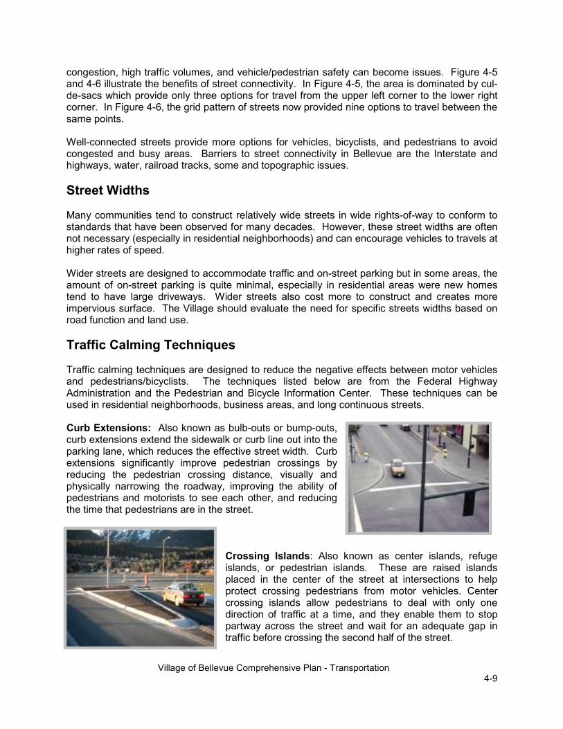
Landscaping: The careful use of landscaping along a street can provide separation between motorists and pedestrians, reduce the visual width of the roadway (which can help to reduce vehicle speeds), and provide a more pleasant street environment for all. This can include a variety of trees, bushes, and/or flowerpots, which can be planted in the buffer area between the sidewalk or walkway and the street.
Bike Lanes: Bike lanes are portions of roadway that have been designated by striping, signing, and pavement markings for the preferential or exclusive use of bicyclists. Bike lanes make bicyclists more visible to motorists.
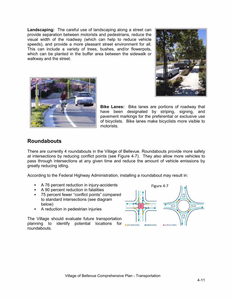
Roundabouts There are currently 4 roundabouts in the Village of Bellevue. Roundabouts provide more safety at intersections by reducing conflict points (see Figure 4-7). They also allow more vehicles to pass through intersections at any given time and reduce the amount of vehicle emissions by greatly reducing idling. According to the Federal Highway Administration, installing a roundabout may result in:
� A 76 percent reduction in injury-accidents � A 90 percent reduction in fatalities � 75 percent fewer “conflict points” compared
to standard intersections (see diagram below)
� A reduction in pedestrian injuries The Village should evaluate future transportation planning to identify potential locations for roundabouts.
Figure 4-7

Village of Bellevue Comprehensive Plan - Transportation 4-12
Avoid Expanding Streets to Four or More Lanes Although it is unlikely that most of the Village’s streets will be considered for widening in the future, some two-lane streets might be seen as candidates for widening as traffic levels rise over the next 20 years. However, street widening has proven to not be an effective long-term method of relieving traffic congestion, so the Village may save the millions of dollars that would be necessary to expand these streets to four lanes. One way to move traffic efficiently while minimizing barriers to pedestrian and bicycle travel and encouraging people to drive at appropriate speeds is to construct a system of two-lane arterial boulevards (see Figure 4-8) or three-lane arterial streets (see Figure 4-9) that are complemented by an interconnected collector and local street system, mixed land uses, and efficient traffic control techniques at intersections (such as roundabouts). Street interconnectivity and the mixing of land uses make walking and bicycling viable transportation options and help to avoid forcing traffic onto a system of relatively few large arterial streets. Building narrower arterial streets instead of the standard wide arterial streets will also help to make the Village’s thoroughfares more attractive.
Pedestrian and Bicycle Facilities Because many of the Village’s streets do not include sidewalks on either side, many activities that normally occur on sidewalks are occurring in the driving areas. On an average day, a person can see residents walking on the Village’s streets, neighbors talking to one another in front of their homes while being avoided by passing vehicles, and people doing other activities that should occur outside of the street.
Economic � Biking and walking can reduce traffic, parking needs, and energy consumption � Biking and walking reduces health care costs Social � Walking helps students and adults decompress after a long day � Walking creates community interaction and connectedness. � The elderly are more likely to walk to nearby services and socialize in their
community. It also offers them more independence. Safety � Pedestrians separated from motorized traffic
Figure 4-9: Three-lane streets work well when arterial corridors contain driveways
Figure 4-8: Two-lane boulevards are ideal for streets that have little or no direct driveway access

Village of Bellevue Comprehensive Plan - Transportation 4-13
� Appropriate signage and markings make motorists aware of possible pedestrian or bicyclist traffic
Health � Biking and walking are easy ways to get short sessions of exercise. � Active children tend to remain active. � Biking and walking helps fight obesity.
Village of Bellevue Pedestrian, Bicycle & Safe Routes to School Plan The purpose of the Village’s Pedestrian, Bicycle & Safe Routes to School Plan is to improve the health and safety of children by promoting biking and walking to school. The Plan addresses the four “E’s”: Education, Encouragement, Engineering, and Enforcement, to take a comprehensive look at how encourage children to become more active.
The Plan evaluates background information to help assess the current state of pedestrian and bicycle transportation in Bellevue. It, first, assesses the current infrastructure, then identifies needs, and, finally, makes recommendations for policies and actions to achieve the identified needs. Recommendations are made for engineering projects within a timeframe of one (1) year, short term, medium term, and long term. The recommendations identify specific projects, type of facility, estimated cost, and possible funding sources. The Plan also includes a tool to estimate the relative safety of bicyclists on trails (paths) that run parallel to streets. This “Sidepath Suitability Index” is designed to enable the Village to rate the safety of existing parallel paths, determine if a new path would be an appropriate option, and identify methods of making existing or planned paths as safe as possible. To assess the suitability of placing a path along a road segment, the following factors are considered:
1. Intersection Traffic 2. Path Continuity 3. Curb Cuts 4. Pedestrian Use 5. Crosswalks 6. Separation between Intersections and Sidepaths
Two examples of a Sidepath Suitability Index evaluation are found in the Appendix of the Plan. Overall, the Village’s Pedestrian, Bicycle & Safe Routes to School Plan acts as the main planning document for pedestrian and bicyclist infrastructure in Bellevue.
Future Transit Service in Bellevue Since mass transit requires a dense commercial and residential development pattern and streets that frequently interconnect for the service to be attractive and efficient, the current land use and street patterns in Bellevue make providing additional transit service very difficult. To make mass transit an attractive and economically feasible transportation option for other parts

Village of Bellevue Comprehensive Plan - Transportation 4-14
of Bellevue, the Village needs to establish the population densities, pedestrian system, street network, and land use pattern recommended in the Land Use and Transportation chapters of the comprehensive plan. Once these features are in place, Bellevue should work with Green Bay Metro and the Brown County Planning Commission to design additional cost effective bus routes that serve the Village.
Specialized Transportation Services for the Elderly and Disabled As long as Bellevue participates in the Green Bay Metro system, the Village’s elderly and disabled residents will have access to the service offered by Metro’s paratransit provider. Although there are other companies in Brown County that offer the same service, Metro’s paratransit provider is able to offer clients a very low per-trip rate that is largely subsidized by Metro. The Metro paratransit provider is also obligated to pick up and drop off clients within time limits specified in a contract with Metro (which is based on standards in the Americans with Disabilities Act), so the service is very reliable. Retaining access to this service will be very important in the future as Bellevue’s population continues to age and destinations, such as medical clinics, continue to rely on Metro’s paratransit provider to transport clients to and from their facilities.
Freight Rail The rail line that runs through the center of Bellevue currently carries relatively few trains, and none of these trains serve any Bellevue destinations. Rail lines are attractive for some businesses and industries that use or produce products that are difficult or expensive to transport by truck. At the same time, abandoned rail lines make excellent bicycle and pedestrian trails. The Village should monitor activity on the rail line and contact the Wisconsin Department of Natural Resources if the line is proposed for abandonment in the future. If abandonment is proposed by the railroad, the Village should urge the DNR to purchase the right-of-way to enable the rail bed to be converted to a multi-use trail.
Passenger Rail The Green Bay Metropolitan Area does not currently have access to passenger rail service, but a high speed passenger rail line is planned to be extended to Brown County in the future through the Midwest Regional Rail Initiative (MRRI). If this service is implemented, it will provide another means for Bellevue residents to travel throughout the Midwest without using their personal vehicles. Although the current state administration does not support construction and maintenance of a high-speed rail service, the state, and local rail supporters continue to plan.
Air Transportation Austin Straubel International Airport will continue to provide air service to people traveling to and from Bellevue, and the expansion of Bellevue’s population and commercial bases over the life of the plan could increase the demand for passenger and freight service at the airport. Therefore,

Village of Bellevue Comprehensive Plan - Transportation 4-15
Bellevue should work with representatives of the airport over the next 20 years to support the retention and, if possible, expansion of air carriers that offer passenger and freight service.
Truck Transportation The Village does not currently have a formal system of truck routes because nearly all of the existing heavy truck trips occur on the county and state highways. However, as the commercial and other truck-generating land uses are mixed into the Village over the next 20 years, the Village should consider identifying streets where heavy trucks are allowed to travel. These truck routes should be designed to minimize impacts on residential areas and inform truck drivers of the most efficient routes into and out of the Village. Once this system is identified, the Village should mark the truck routes with street signs that distinguish them from the other Village streets. One method of doing this would be to paint the truck route street signs a unique color to allow them to be easily identified by truck drivers. This approach has been used by the Village of Ashwaubenon for many years to enable truckers to determine if they can drive on certain streets before they unknowingly enter them illegally, and it has proven to be successful.
Water Transportation To ensure that Bellevue’s current and future interests are considered by Port of Green Bay representatives, the Village should participate in the port’s plan implementation process. Participating in this process will enable the Village to inform the port planners of its intentions to utilize the port over the next 20 years and ensure that modifications to the port’s policies and facilities are consistent with the Village’s long-term economic development strategy.
Neighborhood Electric Vehicles Neighborhood Electric Vehicles or NEVs are vehicles that are capable of traveling at speeds of around 25 mph and have an approximately 40-mile driving range between charges. They come with safety features like headlights, turn signals and seat belts. An NEV can be operated on roads where the posted speed limit is 35mph or less. As energy costs rise, more area governments are creating ordinances to allow and regulate the use of NEVs on roads. NEVs can be used for personal transportation and as a utility vehicle. Bellevue has an ordinance allowing NEVs on certain streets in the Village.
Parking Requirements Parking is needed or required for most land uses. Often, the minimum parking requirements specified in a community’s code are more than enough to meet the daily needs of the land use.

Village of Bellevue Comprehensive Plan - Transportation 4-16
Parking lots create large amounts of impervious surfaces that create runoff and require stormwater management through the construction of storm sewers, ditches, and ponds. By looking at ways of reducing parking lot areas, less infrastructure is needed and water quality is improved. Listed below are several examples of ways the Village can look at ways of reducing the amount of parking spaces required in development.
1. Allow shared parking based on peak hours of existing and proposed businesses. 2. Higher building densities and sidewalks promote walking and reduce the need for
parking. 3. Create trade-offs for reduced parking such as reduce the number of parking stalls in
exchange for bicycle racks. 4. Consider centralized parking versus individual parking lots. 5. Construct a portion of the required parking as long as the concept shows where parking
can be expanded if needed. 6. Use the Village code as a maximum requirement
State, Regional, and other Transportation Plans The Wisconsin Department of Transportation has several state and regional transportation plans that were reviewed to ensure consistency. Overall goals in these plans are consistent with the Village’s overall transportation goals. The plans reviewed relate to the freeway system, rail, state highways, airport, bicycle, and pedestrian transportation. The Wisconsin Department of Transportation has updated its long-range plan titled Connections 2030 Long Range Multi-modal Transportation Plan in 2009. The plan identifies trends and challenges that will pose difficulties as the department plans for Wisconsin’s future transportation needs. Wisconsin’s growing and aging population, rising costs, and increasing traffic congestion support the need for transportation alternatives such as transit. Land use and commuting patterns, as well as substantial projected increases in freight truck traffic, also need to be considered. Statewide, the trends and challenges listed below will affect the Village of Bellevue. Trends
� Wisconsin’s population is growing and aging � Wisconsin’s travel patterns are influenced by fuel cost, land use, mode choice and other
factors � Wisconsin’s economy will continue growing through 2030 � Energy, environmental, and transportation policies are increasingly in the spotlight
Challenges
� Transportation infrastructure is aging � Transportation system will experience increased use � Transportation system needs continue to exceed available resources � Lack of coordination and cooperation leads to system inefficiencies � Driver behavior continues to be a safety concern
Additional plans that include the Village of Bellevue or include transportation infrastructure unique to the Bellevue area include:
Village of Bellevue Comprehensive Plan - Transportation 4-17
Midwest Regional Rail Initiative (MRRI) The MRRI incorporates nine Midwestern state DOTs that have been working together since 1996 to develop a 3,000 mile high-speed rail system for the region. Chicago will serve as the hub of the system. About 90 percent of the Midwest's population will be within a one hour car ride to a Midwest Regional Rail System station and/or 30 minutes of a feeder bus station. The Bellevue Comprehensive Plan acknowledges the MRRI and recommends that Village residents use the passenger rail service, when established, as an alternative to their personal vehicles.
Brown County Six (6) Year County Highway Improvement Plan 2012-2017
The Brown County Highway Department maintains a Six (6) Year County Highway Improvement Plan that is reviewed and updated annually. Highway and bridge improvements are planned and programmed based on the following criteria: � Pavement conditions � Vehicle accident safety concerns � Traffic congestion and delay problems � Street expansion to accommodate increased traffic due to growth All County highways are field inspected yearly. Planned roadway projects are grouped into reconstruction and asphalt reconditioning. The Village should work closely with the Brown County Highway Department so that local street projects can be coordinated at the same time in order to maximize efficiency and minimize costs.
Wisconsin DOT Six (6) Year Highway Improvement Program Northeast Region 2011-2016
The Wisconsin DOT (WisDOT) maintains a Six (6) Year County Highway Improvement Program for each region in the state. The WisDOT has divided its budget into major highway development projects and state highway rehabilitation projects. The purpose of the project is to increase travel time savings, have fewer accidents and decreased vehicle operating costs. The Village should work with the WisDOT to coordinated local projects with WisDOT projects in the community. State Airport Plan
The Wisconsin State Airport System Plan 2020 recognizes Austin Straubel International Airport as an important component of the state’s airport system, and the Bellevue plan recommends that the Village work with representatives of the airport over the next 20 years to support the retention and, if possible, expansion of air carriers that offer passenger and freight service.
Regional Waterway Plans
The Port of Green Bay provides a unique state-of-the-art facility that most communities do not have access to. The Port connects with trucking and railroads to distribute good and within a 400 mile radius.

Village of Bellevue Comprehensive Plan - Transportation 4-18
Although not directly impacted by the Port of Green Bay, the importance of Bellevue’s participation in future planning may assist in economic development in the area.
Road Expenditure Planning With infrastructure comes maintenance. A sound transportation plan should be able to foresee and responsibly plan for upcoming expenses. Two ways of doing this is by participating in the PASER program and creating Capital Improvement Programs (CIP). The Village of Bellevue does both. Pavement ratings can be used for planning maintenance and budgets for local roadways. In 2001, a state statute was passed that requires municipalities and counties to assess the physical pavement condition of their local roads. A common method of doing this is referred to as Pavement Surface Evaluation and Rating or PASER. PASER rates roadways from Failed (needs total reconstruction) to Excellent (no visible stress). PASER allows for better allocation of resources, a better understanding of pavement conditions, and allows for long term planning. The Village of Bellevue maintains a CIP that prioritizes and creates cost estimates for municipal improvement projects including streets. Each year the plan is reviewed and revised as needed. Maintaining a CIP allows the Village to effectively plan for future transportation expenditures and needs.
Funding to Help Develop the Village’s Transportation System To help the Village fund the development of its multi-modal transportation system, the Village should continue to apply for transportation grants from various sources over the next several years. The most common programs used by municipalities are identified below.
WisDNR Stewardship Program
The Wisconsin’s Stewardship Program provides funding for the construction of a community’s bicycle and pedestrian system. Applications are accepted yearly on May 1st. The Village would be responsible for up to 50% of project costs.
Local Roads Improvement Program (LRIP)
The Local Roads Improvement Program was established to assist local units of government in improving seriously deteriorating county highways, municipal streets in cities and villages, and town roads. Cities and villages apply for funding through the Municipal Street Improvement Program (MSI, formerly known as MSIP). Only work on existing county trunk highways, city and village streets, and town roads under the authority of the local unit of government are eligible for funding.
Statewide Enhancement Program
The Wisconsin DOT offers enhancement funds for transportation-related projects that are within the right-of-way of highways controlled by the state. These funds could be used to implement enhancement projects along STH 29 and possibly along STH 172 and I-43.

Village of Bellevue Comprehensive Plan - Transportation 4-19
Hazard Elimination and Safety (HES) Program
The Village should consider applying for grants from the Hazard Elimination and Safety (HES) Program administered by WisDOT to correct existing or potential transportation safety problems. Other grant programs through WisDOT’s Bureau of Transportation Safety should also be investigated by the Village to address safety issues.
CMAQ Program
CMAQ was created in 1993 to encourage transportation alternatives that improve air quality. It includes efforts to enhance public transit, construct bicycle and pedestrian facilities, improve traffic flow, and promote vehicle and fuel technologies that decrease emissions. Funding has typically gone to projects in the southeastern part of the state where there is an 11 county ozone non-attainment and maintenance area. If Brown County is ever designated as an air quality non-attainment area, the Village should consider seeking funds from the Congestion Mitigation and Air Quality (CMAQ) Program administered by WisDOT to implement projects that could improve the area’s air quality. Local Transportation Enhancement (TE), Bicycle and Pedestrian Facilities Program (BPFP) and STP-Discretionary (STP-D) programs
These programs have been collectively funded under the Statewide Multi-modal Improvement Program (SMIP). The TE program promotes projects that “enhance” the surface transportation system. There are 12 federally eligible categories, with bicycle and pedestrian categories typically making up almost two-thirds of Wisconsin projects awarded. The STP-D program funded projects such as bicycle and pedestrian facilities that foster alternatives to single-occupancy vehicle travel.
The Bicycle and Pedestrian Facilities Program (BPFP) that was primarily used to fund bicycle planning related activities. Safe Routes to School (SRTS) Program
The most recent federal transportation act, SAFETEA-LU, added a new bicycle and pedestrian program called Safe Routes to School (SRTS). The program addresses a long-term trend away from children bicycling and walking to school to being transported by car or bus. The trend has not only been part of the increasing levels of traffic congestion and air pollution, but also linked to child health and obesity problems. SRTS is an effort to reverse these trends by funding bicycle and pedestrian infrastructure, planning and promotional projects. Projects must be within two miles of a kindergarten to 8th Grade school. Funding is currently on a two-year cycle. Community Development Block Grants-Public Facilities for Economic Development (PFED)
The PFED program funds public facilities that help retain and increase employment and increase economic development. Eligible PFED projects include the installation, repair, or replacement of public water systems (including wells, water towers, and distribution

Village of Bellevue Comprehensive Plan - Transportation 4-20
systems) and sanitary sewer systems (including collection systems and treatment plants); storm drainage systems; streets; sidewalks; curb and gutter; parking; street lights; and streetscape.
Transportation Goals, Objectives, and Recommendations Goal 1: Design and maintain a multi-modal transportation system that provides for the ease of movement within and through the Village of Bellevue. Objectives
1. Increase the connectivity of streets, trails, and sidewalks to improve transportation efficiency
2. Design transportation infrastructure that incorporates all modes of transportation Recommendations
1. Support development concepts such as mixed use development and higher densities that are conducive to multi-modal transportation systems including transit systems.
2. Continue to maintain and identify future east/west and north/south corridors to ensure unrestricted routes and route options through the Village.
3. Minimize cul-de-sacs where they eliminate street connections. 4. Develop multi-modal connections to main traffic generators in the Village (schools,
parks, residential areas, commercial areas, etc.) 5. Continue to evaluate possible local streets where heavy trucks would be allowed to
travel and sign appropriately. 6. Coordinate the development of the Village’s multi-modal transportation system with
Brown County, WisDOT, Green Bay Metro, and the Green Bay/De Pere School Districts to ensure connectivity and a cohesive vision.
Goal 2: Ensure safe infrastructure for vehicles, bicycles, and pedestrians. Objectives
1. Reduce vehicle, bicycle, and pedestrian accidents 2. Provide safe options for residents who do not have access to vehicles
Recommendations
1. Utilize the Village’s Pedestrian, Bicycle & Safe Routes to School Plan as the main planning guide for pedestrian and bicycle infrastructure.
2. Evaluate new developments and reconstruction projects for safety concerns and incorporate traffic calming measures, street widths, and pavement markings where identified as needed.
3. Identify safety concerns in the Village and evaluate options to mitigate these concerns in the short term or when an area is reconstructed.
4. Consider creating an Advisory Committee that can provide input on vehicle, bicycle, and pedestrian safety needs and concerns.
5. Continue to work with the Wisconsin Department of Transportation and Brown County Highway Department to ensure that all of the bridges, overpasses, and other transportation structures in the Village have adequate pedestrian and bicycle facilities when they are constructed or reconstructed.
6. Minimize barriers to pedestrians and bicyclists.

Village of Bellevue Comprehensive Plan - Transportation 4-21
7. Designate public rights-of-way at or near the end of the cul-de-sacs for multi-use paths where appropriate and consistent with the Village’s Pedestrian, Bicycle & Safe Routes to School Plan
Goal 3: Create and maintain the Village’s transportation infrastructure in a fiscally responsible manner. Objectives
1. Minimize the costs of maintenance and new construction to residents 2. Research alternative funding sources
Recommendations
1. Consider evaluating the existing policy requiring bicycle parking facilities for new multi-family, institutional, commercial, and industrial development.
2. Consider bicycle facility incentives, such as reduced parking 3. Evaluate new construction and reconstruction of streets, trails, and sidewalks for
appropriate grant opportunities to offset costs. Coordinate projects with grant cycles. 4. Explore the use of Tax Incremental Financing Districts to fund infrastructure projects. 5. Coordinate Village transportation infrastructure projects with the Brown County Six
(6) Year County Highway Improvement Plan and the Wisconsin DOT Six (6) Year Highway Improvement Program Northeast Region to reduce costs were potential projects meet.
6. Continue to use tools such as PASER Ratings, Capital Improvement Plans, and other long-term planning tools to help manage transportation infrastructure projects and costs.
7. Create a Bellevue Transportation Plan that addresses State and County projects that will affect the Village, Special Emphasis areas, future road corridors, multi-jurisdictional planning opportunities
8. Evaluate proposed road widths during new and reconstruction projects Goal 4: Participate in transportation planning for facilities outside Bellevue that may provide a benefit to the Village. Objectives
1. Increase Village awareness to future development plans so that the Village may incorporate these plans into community strategies.
Recommendations
1. Continue to monitor the progress of the Midwest Regional Rail Initiative (MRRI).
2. Work with representatives of the Austin Straubel International Airport to support the retention and, if possible, expansion of air carriers that offer passenger and freight service and seek ways to promote the proximity to the airport to enhance economic development.
3. Ensure that Bellevue’s current and future interests are considered by Port of Green Bay representatives and seek ways to promote the proximity to the port to enhance economic development
4. Support the development of passenger rail and private bus service that serves the area