CFIT – Controlled Flight into Terrain - IATA · CFIT – Controlled Flight into Terrain A Study...
81
CFIT – Controlled Flight into Terrain A Study of Terrain Awareness Warning System Capability and Human Factors in CFIT Accidents 2005-2014 1st Edition
Transcript of CFIT – Controlled Flight into Terrain - IATA · CFIT – Controlled Flight into Terrain A Study...

CFIT – Controlled Flight into TerrainA Study of Terrain Awareness Warning System Capability and
Human Factors in CFIT Accidents 2005-2014
1st Edition

ISBN 978-92-9229-421-2© 2016 International Air Transport Association. All rights reserved.Montreal—Geneva
NOTICEDISCLAIMER. The information contained in this publication is subject to constant review in the light of changing government requirements and regula-tions. No subscriber or other reader should act on the basis of any such information without referring to applicable laws and regulations and/or without taking appropriate professional advice. Although every effort has been made to ensure accuracy, the International Air Transport Association shall not be held responsible for any loss or damage caused by errors, omissions, misprints or misinterpretation of the contents hereof. Furthermore, the International Air Transport Association expressly disclaims any and all liability to any person or entity, whether a purchaser of this publication or not, in respect of anything done or omitted, and the consequences of anything done or omitted, by any such person or entity in reliance on the contents of this publication.
© International Air Transport Association. All Rights Reserved. No part of this publication may be reproduced, recast, reformatted or trans-mitted in any form by any means, electronic or mechanical, including photocopying, record-ing or any information storage and retrieval sys-tem, without the prior written permission from:
Senior Vice PresidentAirport, Passenger, Cargo and SecurityInternational Air Transport Association
800 Place VictoriaP.O. Box 113
Montreal, QuebecCANADA H4Z 1M1

1st Edition 2016 i
Table of Contents
Acronyms ............................................................................................................................................................... v
Abstract ............................................................................................................................................................. vii
Introduction ............................................................................................................................................................ viii
Terrain Awareness Technology Survey (Appendix A) ........................................................................ 1 Section 1—
Definitions .................................................................................................................................................. 2 Section 2—
2.1 Terrain Awareness and Warning System (TAWS) .........................................................................................................2
2.2 Controlled Flight into Terrain ....................................................................................................................................................2
2.3 Accident ...............................................................................................................................................................................................2
2.4 Fatality ................................................................................................................................................................................................. 3
2.5 Data Source ...................................................................................................................................................................................... 3
Trends ......................................................................................................................................................... 4 Section 3—
Why does CFIT occur? ............................................................................................................................. 5 Section 4—
Analysis of Accidents............................................................................................................................... 6 Section 5—
Human Factors Models ........................................................................................................................... 7 Section 6—
6.1 Dupont Human Performance.................................................................................................................................................... 7
6.2 Pilot Competencies Model ......................................................................................................................................................... 7
Accident number 1 .................................................................................................................................... 9 Section 7—
7.1 Sequence of events....................................................................................................................................................................... 9
7.2 Terrain Avoidance and Warning System .......................................................................................................................... 10
7.3 Key Human Factors findings ................................................................................................................................................... 10
Accident Number 2 .................................................................................................................................. 11 Section 8—
8.1 Sequence of events.......................................................................................................................................................................11
8.2 Weather ..............................................................................................................................................................................................11
8.3 Terrain Avoidance and Warning System .......................................................................................................................... 12
8.4 Key Human Factors findings ................................................................................................................................................... 12
Accident Number 3 ..................................................................................................................................14 Section 9—
9.1 Sequence of events...................................................................................................................................................................... 14
9.2 Weather ............................................................................................................................................................................................. 15
9.3 Terrain Avoidance and Warning System .......................................................................................................................... 15
9.4 Key Human Factors Findings ................................................................................................................................................. 16

A Study of Terrain Awareness Warning System Capability and Human Factors in CFIT Accidents 2005-2014
ii 1st Edition 2016
Accident Number 4 ............................................................................................................................... 18 Section 10—
10.1 Sequence of Events ..................................................................................................................................................................... 18
10.2 Weather ............................................................................................................................................................................................. 18
10.3 Terrain Awareness Warning System .................................................................................................................................. 19
10.4 Key Human Factors Finding ................................................................................................................................................... 19
Accident Number 5 ................................................................................................................................. 21 Section 11—
11.1 Sequence of Events ..................................................................................................................................................................... 21
11.2 Weather .............................................................................................................................................................................................22
11.3 Terrain Awareness and Warning System.........................................................................................................................22
11.4 Key Human Factors findings ................................................................................................................................................. 23
Accident number 6 ................................................................................................................................ 25 Section 12—
12.1 Sequence of events .................................................................................................................................................................... 25
12.2 Weather ............................................................................................................................................................................................ 26
12.3 Terrain Awareness and Warning System........................................................................................................................ 26
12.4 Key Human Factors findings ................................................................................................................................................. 26
Accident number 7 ................................................................................................................................ 28 Section 13—
13.1 Sequence of events .................................................................................................................................................................... 28
13.2 Weather ............................................................................................................................................................................................ 29
13.3 Terrain Awareness and Warning System........................................................................................................................ 29
13.4 Key Human Factors findings ................................................................................................................................................. 30
Accident number 8 .................................................................................................................................31 Section 14—
14.1 Sequence of events ..................................................................................................................................................................... 31
14.2 Terrain Avoidance and Warning System .......................................................................................................................... 31
14.3 Key Human Factors findings ................................................................................................................................................. 32
Accident number 9 ................................................................................................................................ 34 Section 15—
15.1 Sequence of events .................................................................................................................................................................... 34
15.2 Weather ............................................................................................................................................................................................ 36
15.3 Terrain Avoidance and Warning System ......................................................................................................................... 36
15.4 Key Human Factors findings .................................................................................................................................................. 37
Consolidated Analysis of EGPWS Information ............................................................................... 39 Section 16—
16.1 Consolidated Human Performance Analysis ................................................................................................................. 41
Consolidated Conclusions .................................................................................................................. 45 Section 17—
Recommendations ................................................................................................................................ 46 Section 18—
18.1 Recommendations from CFIT analysis.............................................................................................................................. 47
18.2 Recommendations reproduced from survey analysis (Appendix A) ................................................................ 48

Table of Contents
1st Edition 2016 iii
Appendix A ............................................................................................................................................. 49 Section 19—
19.1 Executive summary ..................................................................................................................................................................... 49
19.2 Terrain Awareness Technology Survey ............................................................................................................................ 49
19.3 Survey Summary .......................................................................................................................................................................... 50
19.3.1 Question 1 ................................................................................................................................................................................. 50
19.3.2 Question 2 ................................................................................................................................................................................. 51
19.3.3 Question 3 ................................................................................................................................................................................. 51
19.3.4 Question 4 ................................................................................................................................................................................ 52
19.3.5 Question 5 ................................................................................................................................................................................ 52
19.3.6 Question 6 ................................................................................................................................................................................ 54
19.3.7 Question 7 ................................................................................................................................................................................ 55
19.3.8 Question 8 ................................................................................................................................................................................ 55
19.3.9 Question 9 ................................................................................................................................................................................ 55
19.3.10 Question 10 .............................................................................................................................................................................. 57
19.3.11 Question 11 ............................................................................................................................................................................... 59
19.3.12 Question 12 .............................................................................................................................................................................. 64
19.3.13 Question 13 .............................................................................................................................................................................. 65
19.3.14 Question 14 .............................................................................................................................................................................. 65
19.4 Regional analysis on key questions .................................................................................................................................... 66

A Study of Terrain Awareness Warning System Capability and Human Factors in CFIT Accidents 2005-2014
iv 1st Edition 2016
INTENTIONALLY LEFT BLANK

1st Edition 2016 v
Acronyms
AAL Above Airport Level
ACTF Accident Classification Task Force
AGL Above Ground Level
ALAR Approach and Landing Accident Reduction
AMDB Airport Mapping Database
ANSP Air Navigation Service Provider
APV Approach Procedures with Vertical Guidance
ATC Air Traffic Control
ATSU Air Traffic Services Unit
CFIT Controlled Flight into Terrain
CRM Crew Resource Management
CVR Cockpit Voice Recorder
DH Decision Height
EAFDM European Authorities coordination group on Flight Data Monitoring
EFB Electronic Flight Bag
EGPWS Enhanced Ground Proximity Warning Systems
ELISE Exact Landing Interference Simulation Environment
FAF Final Approach Fix
FDA Flight Data Analysis
FDM Flight Data Monitoring
FDR Flight Data Recorder
FMS Flight Management System
FOBN Flight Operations Briefing Notes
FOQA Flight Operations Quality Assurance
FSF Flight Safety Foundation
GADM Global Aviation Data Management
GPWS Ground Proximity Warning System
ICAO International Civil Aviation Organization
ILS Instrument Landing System
IMC Instrument Metrological Conditions
IOSA IATA Operational Safety Audit

A Study of Terrain Awareness Warning System Capability and Human Factors in CFIT Accidents 2005-2014
vi 1st Edition 2016
LOC-I Loss of Control Inflight
MDA Minimum Descent Altitude
OEM Original Equipment Manufacturer
OM Outer Marker
PBN Performance Based Navigation
PF Pilot Flying
PM Pilot Monitoring
PNF Pilot not flying
PANS OPS Procedures for Air Navigation Services — Aircraft Operations
ROPS Runway Overrun Prevention System
SAAFER Situational Awareness & Alerting For Excursion Reduction
SMS Safety Management System
SOP Standard Operating Procedure
TAWS Terrain Awareness and Warning System
TOD Top-of-Descent
VMC Visual Metrological Conditions

1st Edition 2016 vii
Abstract
The IATA Accident Database shows that CFIT is not the most frequent of accident categories. However, the
poor survivability of these accidents, means that CFIT accounts for a substantial number of fatalities: a total
of 1,346 from 67 CFIT accidents during this period (2005-2014). A CFIT accident during this period meant that
hull loss was experienced 99% of the time and fatalities occurred in 88% of those accidents. Therefore, this
report was commissioned to see if there are commonalities with these accidents and if lessons could be
learned from the findings.
The study finds that, where fitted, the GPWS/EGPWS performed as designed but not always in a manner that
could have prevented the accident. Poor pilot response was found to contribute to the CFIT accidents with a
functioning terrain warning system. In these cases, the system provided adequate time to react to a hazard,
but the flight crew delayed their response or made an inadequate avoidance maneuver.
Multiple human performance deficiencies and undesirable behaviors were indicated in all accidents under
review and these constituted by far the largest group of factors in the accident set. Situational Awareness
was found to be deficient in all cases, which is to be expected. Poor crew resource management and sub-
optimal interaction between the pilots was also a frequent contributing factor, as was procedural non-
compliance.
The objective of this study is to create recommendations for industry that can help mitigate CFIT accidents. A
total of sixteen recommendations have been made.
Full analysis follows.

A Study of Terrain Awareness Warning System Capability and Human Factors in CFIT Accidents 2005-2014
viii 1st Edition 2016
Introduction
Throughout the history of aviation, controlled flight into terrain (CFIT) has been a major cause of fatal
accidents. In response to this concern, the aviation industry developed the ground proximity warning systems
(GPWS), which warned pilots if the aircraft was in proximity to terrain. This system became a mandatory
installation for large aircraft in 1974 and it is evident that since then, the number of CFIT accidents has
reduced significantly.
Although GPWS was very successful, it was limited in that it was only able to detect terrain directly below the
aircraft. If there is a sharp change in terrain, GPWS does not detect the aircraft closure rate until it is too late
for evasive action. To overcome this limitation, a more advanced technology, known as Enhanced Ground
Proximity Warning (EGPWS) was introduced. This technology combines a worldwide digital terrain database
with an accurate navigation system, ideally using the Global Positioning System. The aircraft’s position is
compared with a database of the Earth's terrain; if there is a discrepancy, pilots receive a timely caution or
warning of terrain hazards. This enhanced system provides a warning in advance of steeply rising ground and
also extends the warning area almost to the runway threshold, overcoming the limitations of GPWS. The
EGPWS is also widely known as Terrain Awareness Warning System or TAWS. EGPWS/TAWS systems are a
critical component during low visibility operations and during approach and landing.
The IATA Accident Database shows that while CFIT is not the most frequent of accident categories, the poor
survivability of CFIT accidents means that it continues to account for a substantial number of fatalities – a
total of 1,346 from 67 CFIT accidents during this period 2005-2014. This equates to 88% of CFIT accidents
incurring fatalities. Therefore, this report was commissioned to see if there are commonalities with these
accidents and if lessons could be learned from the findings.
A limiting factor for this study, was the number of accidents that had sufficiently detailed reports (in English)
to support comprehensive study. In total, nine (9) CFIT accidents were selected for analysis. Both jet and
turboprop transport airplanes were included. The desire was to understand if there are identifiable human
factors issues within these accidents and, as a secondary investigation, the effects of degraded GPWS
/EGPWS/TAWS (if any).
Each accident report was analyzed for evidence of the functioning of the terrain warning system (if installed),
to determine whether it operated as designed. Further analysis attempted to determine what role the system
software standard, accuracy of the terrain and runway databases, or the absence of GPS position information
and geometric altitude, played in the genesis of the accidents.
The reports were also analyzed for contributory human performance factors and two separate models were
used to categorize these factors. The first model is the Dupont Human Factors model, which identifies 12
separate precursors. The second model is the ICAO Pilot Competencies Model, an example of which is given
in ICAO Manual of Evidence-based Training. The analysis examines deficiencies in these competencies, as
recorded in the accident reports.

Introduction
1st Edition 2016 ix
Full analysis details can be found in the section “Consolidated Human Performance Analysis” below.
Multiple human performance deficiencies and undesirable behaviors were indicated in all of the accidents
and these constituted by far the largest group of factors in the accident set. Situational Awareness was found
to be deficient in all cases but this should hardly be a surprise. Poor crew resource management and sub-
optimal interaction between the pilots was also a frequent contributing factor, as was procedural non-
compliance. Because of the limitations of the data source it is likely that some human conditions have not
been identified in every accident, including for example stress, fatigue and complacency.
Airline processes and regulatory oversight are not the main focus of this document. For the purpose of this
report, the acronym TAWS is considered as identical to EGPWS and both terms appear interchangeably. The
recommendations from this study may be found at the end of this report.

A Study of Terrain Awareness Warning System Capability and Human Factors in CFIT Accidents 2005-2014
x 1st Edition 2016
INTENTIONALLY LEFT BLANK

1st Edition 2016 1
Terrain Awareness Technology Survey Section 1—(Appendix A)
CFIT mitigations primarily rely upon terrain awareness technologies, such as GPWS/EGPWS. The latest
iterations of these technologies provide pilots with real-time terrain information, not only below the aircraft
but all around it with Enhanced Ground Proximity Warning System (EGPWS). This enhanced equipment has
a forward looking terrain awareness function and is available for most aircraft types. GPWS has been
mandated by ICAO standards (Annex 6 Part 1). In order for these systems to be most effective, it is essential
that the accompanying software is up-to-date.
IATA created a survey to assess the use of available terrain warning technologies and how frequently the
software/database is updated. This survey, which included 14 mandatory questions, was sent to IATA
member airlines. Between January and May 2016, 157 airlines had responded. Appendix A presents the
analysis of the survey responses.

A Study of Terrain Awareness Warning System Capability and Human Factors in CFIT Accidents 2005-2014
2 1st Edition 2016
Definitions Section 2—
2.1 Terrain Awareness and Warning System (TAWS)
A terrain awareness and warning system (TAWS) aims to prevent controlled flight into terrain (CFIT)
accidents. The actual systems in current use are known as ground proximity warning (GPWS) system and
enhanced ground proximity warning (EGPWS). Strictly speaking, the term TAWS encompasses all systems
which warn of terrain. However, the term TAWS is often used to refer to second-generation EGPWS systems
as opposed to first generation GPWS systems.
For the purpose of this document, this usage (TAWS equals EGPWS) is employed.
2.2 Controlled Flight into Terrain
In-flight collision with terrain, water, or obstacle without indication of loss of control.
2.3 Accident
An occurrence associated with the operation of a manned aircraft, which takes place between the time any
person boards the aircraft with the intention of flight until such time as all such persons have disembarked
and the primary propulsion system is shut down, in which:
1. A person is fatally or seriously injured as a result of:
Being in the aircraft, or
Direct contact with any part of the aircraft, including parts which have become detached from the
aircraft, or
Direct exposure to jet blast,
2. The aircraft sustains damage or structural failure which:
Adversely affects the structural strength, performance or flight characteristics of the aircraft, and
Would normally require major repair or replacement of the affected component,
or
3. The aircraft is missing or is completely inaccessible.

Definitions
1st Edition 2016 3
2.4 Fatality
A passenger or crewmember who is killed or later dies from injuries resulting from an operational accident.
Injured persons who die more than 30 days after the accident are excluded.
2.5 Data Source
This report is focused on the commercial air transport industry; it uses accident data from Global Aviation
Data Management (GADM) accident database over the period of 2005-2014. Heavy use was made of the final
reports produced by the relevant investigative body on each of the accidents. The data set for accident
analysis only includes aircraft over 5,700 kg maximum take-off weight, which were engaged in commercial
operations according to the IATA definition.
The final reports used in this analysis are as follows:
Table 0.1. Accidents used in this report
Accident Number Date of Accident GPWS/TAWS Issues? HF Issues Identified
1 3 February 2005 Not Known Not Known
2 7 May 2005 Yes (TAWS fitted) Yes
3 3 May 2006 No Yes
4 24 August 2008 Yes Yes
5 12 May 2010 No Yes
6 28 July 2010 No Yes
7 20 August 2011 Yes (TAWS fitted) Yes
8 13 April 2013 No Yes
9 14 August 2013 No Yes

A Study of Terrain Awareness Warning System Capability and Human Factors in CFIT Accidents 2005-2014
4 1st Edition 2016
Trends Section 3—
For purposes of comparison, 2015 saw an all-time low in CFIT accidents, with only one, well below the
average for 2010 to 2014. Figure 0.1 below indicates the percentage of all CFIT accidents and the yearly rate
over the past ten years.
Figure 0.1. Distribution of CFIT accidents
While air travel remains one of the safest modes of transport, controlled flight into terrain (CFIT) continues to
remain the second leading cause of commercial aircraft fatal accidents (loss of control in-flight being the
leading cause).
The factors leading to CFIT events can be varied. They can include: loss of situational awareness, loss of
terrain awareness, non-adherence to procedures, conduct of improvised approach procedures in instrument
meteorological conditions (IMC) and operations in areas of low cloud base and/or poor visibility. IATA
Accident database shows that there were 67 CFIT events involving commercial aircraft operators between
2005 and 2014. The report found that the approach phase accounted for 32 (47.7%), while landing accounted
for 11 (16.4%) percent of these CFIT accidents.

1st Edition 2016 5
Why does CFIT occur? Section 4—
It seems somewhat unbelievable that an aircraft capable of a safe flight can be flown into terrain, water, or
obstacle while under the control of the pilot. While CFIT accidents are often the product of a chain of events,
the investigation of these nine CFIT accidents has identified the following:
● CFIT can occur during most phases of flight, but is more common during the approach-and landing
phase.
● Non-precision approaches were associated with CFIT accidents.
● Inappropriate action by the flight crew was cited as a contributing factor. This refers to the flight crew
continuing descent below the minimum descent altitude (MDA) or decision height without adequate
visual reference
● Lack of positional awareness, resulting in an accident.
● Failure in CRM (cross-check, communication, coordination, leadership etc.) was cited as a contributing
factor.
● Pilots have either failed to respond or delayed their response to ground proximity warnings
● Non-adherence to Standard Operating Procedures (SOPs)
● The use of early Ground Proximity Warning System (GPWS) equipment
Overall, when compared with the total number of accidents recorded in the GADM accident database over
the period, the likelihood of a CFIT accident occurring is very low. However, when CFIT accidents did occur,
99% resulted in hull loss and 88% incurred fatalities.

A Study of Terrain Awareness Warning System Capability and Human Factors in CFIT Accidents 2005-2014
6 1st Edition 2016
Analysis of Accidents Section 5—
The sections giving a precis of the events for each accident are extracted and summarized from the official
accident reports. Some accidents are presented in more detail than others are; this generally reflects the
scope, content and detail of the original reports. The analysis is similarly dependent on the available
information. This study contains information, which was subjected to a careful process of de-identification.

1st Edition 2016 7
Human Factors Models Section 6—
In order to categorize the findings of the study, it was considered appropriate to use two different human
factors models, as follows:
6.1 Dupont Human Performance
The concept developed by Gordon Dupont, in 1993, formed part of a training program for human performance
in aircraft maintenance. It identifies twelve common human error conditions that can act as precursors to
accidents or incidents. The model has since become foundational for human factors training in maintenance,
as exemplified in UK CAA CAP 715.
The model does not provide a comprehensive list of human errors. To gain an insight into the potential
variety, see ICAO Circular 240-AN/144, which lists over 300 such precursors. However, the model is now
used in many areas of aviation (not just maintenance), from ground service providers to air traffic controllers,
as it is a very useful tool to introduce the key concepts of human error. The original list of precursors can be
seen in many formats and is reproduced here:
Lack of communication; Lack of teamwork; Lack of knowledge; Lack of awareness; Lack of assertiveness;
Lack of resources; Fatigue; Pressure; Complacency; Stress; Distraction and Norms
6.2 Pilot Competencies Model
The following list outlines a human factors model in use in the ICAO Procedures for Air Navigation Services -
Training (PANS-TRG: 9868), in IATA's MPL Implementation guide and in the IATA Evidence Based Training
Implementation guide:
Competency; Application of Procedures; Communication; Aircraft Flight Path Management, automation;
Aircraft Flight Path Management, manual control; Leadership and Teamwork; Problem Solving and Decision
Making; Situational Awareness; Workload Management.
As may be seen, there are some commonalities in the two models and these have been identified in the
following charts, by color coding. Carrying out this exercise highlights that there are indeed fundamental
differences in the approaches - hence the use of two models in the following analysis.

A Study of Terrain Awareness Warning System Capability and Human Factors in CFIT Accidents 2005-2014
8 1st Edition 2016
Table 0.2. Dupont Human Factors Model
Lack of communication Lack of teamwork Lack of knowledge
Lack of awareness Lack of assertiveness Lack of resources
Fatigue Pressure Complacency
Stress Distraction Norms
Table 0.3. ICAO Pilot Competencies Model
Application of Procedures
Identifies and applies procedures in accordance with published
operating instructions and applicable regulations, using the appropriate
knowledge.
Communication Demonstrates effective oral, non-verbal and written communications, in
normal and non-normal situations.
Aircraft Flight Path
Management, automation
Controls the aircraft flight path through automation, including
appropriate use of flight management system(s) and guidance.
Aircraft Flight Path
Management, manual control
Controls the aircraft flight path through manual flight, including
appropriate use of flight management system(s) and flight guidance
systems.
Leadership and Teamwork Demonstrates effective leadership and team working.
Problem Solving and Decision
Making
Accurately identifies risks and resolves problems. Uses the appropriate
decision-making processes.
Situational Awareness Perceives and comprehends all of the relevant information available and
anticipates what could happen that may affect the operation.
Workload Management Manages available resources efficiently to prioritize and perform tasks in
a timely manner under all circumstances.
1st Edition 2016 9
Accident number 1 Section 7—
7.1 Sequence of events
On February 3, 2005, a jet aircraft operating a scheduled passenger domestic flight was destroyed, when it
impacted a mountain during descent. All 105 on board were killed. The flight crew were approaching the
destination airport in extremely low visibility, during a snowstorm. The flight was normal until it failed to
maintain flight level 130 during the VOR/DME approach (VHF omnidirectional range (VOR) and distance
measuring equipment (DME)). The accident investigation report revealed that the aircraft did not proceed to
the VOR as instructed by air traffic control (ATC) and descended below the minimum assigned altitude prior
to being established on any segment of the approach. As a result, the aircraft collided with a mountain. The
cause of descending below the assigned altitude could not be determined due to the non-availability of the
flight data recorder (FDR) and Cockpit Voice Recorder (CVR) data read outs.
Although, ATC had cleared the aircraft to FL130 for VOR approach to runway 29 and instructed them to
maintain VFR, it was reported that the aircraft did not adhere to the minimum altitude of the VOR/DME
approach. The aircraft was in continuous descent until the time of impact, at about 9960 feet and had not
leveled out at FL130, as required for that approach. There was no recorded sudden loss of altitude before
collision of the aircraft with the mountain. The aircraft was evidently under control of the pilot until the time of
the accident.
The airport as indicated in the investigation report had meteorological conditions compatible with Special
VFR: visibility reported at the time of accident was two kilometers with snow and the ceiling was broken at
2,200 feet. The aircraft hit the mountain at approximately 9960 feet. Under the prevailing weather conditions
it appears that the flight crew did not see the mountain in time to take appropriate action to clear it.
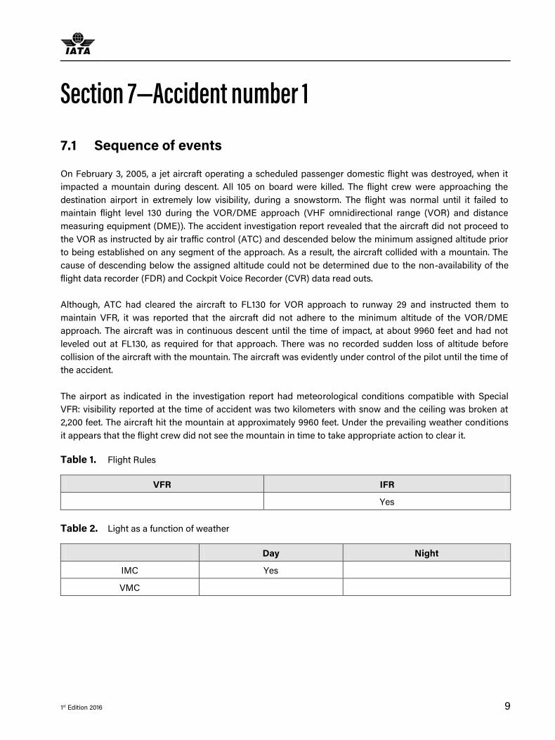
Table 1. Flight Rules
VFR IFR
Yes
Table 2. Light as a function of weather
Day Night
IMC Yes
VMC

A Study of Terrain Awareness Warning System Capability and Human Factors in CFIT Accidents 2005-2014
10 1st Edition 2016
7.2 Terrain Avoidance and Warning System
The aircraft was equipped with Ground Proximity Warning System (GPWS) which should have provided
warning to the flight crew while coming close to terrain. This would have been recorded on the CVR. Due to
non-availability of CVR, it could not be confirmed if the warning occurred or what action the flight crew took.
Table 3. Terrain Warning Systems
Fitted
TAWS No
GPWS Yes
GPS system Not determined
GPWS warning given Not determined (but likely)
7.3 Key Human Factors findings
This accident contains inadequate data and evidence due to the non-availability of the Flight Data Recorder
(FDR) and Cockpit Voice Recorder (CVR) data. Therefore, no assessment of human factors can be made.

1st Edition 2016 11
Accident Number 2 Section 8—
8.1 Sequence of events
On May 7, 2005, a domestic scheduled passenger flight twin turboprop aircraft was being operated on an
instrument flight rules (IFR). The aircraft impacted terrain on the north-western slope of a heavily timbered
ridge, approximately 11 km north-west of the destination airport. At the time of the accident, the flight crew
was conducting an area navigation global navigation satellite system (RNAV (GNSS)) non-precision
approach to runway 12. The aircraft was destroyed by the impact forces and an intense, fuel-fed, post-impact
fire. There were no survivors from the 13 passengers and two pilots.
It was reported that the maneuvering of the aircraft resulted in the aircraft departing from the descent path
and not adhering to the descent points identified on the Jeppesen approach chart for a constant angle
approach. However, it was not until the aircraft passed the final approach fix that it descended below the
minimum safe altitude of 2,060 feet.
It was reported that the aircraft was fitted with ground proximity warning system (GPWS) technology.
However, due to a lack of information from the cockpit voice recorder (CVR), the accident investigation was
unable to determine if the GPWS functioned as designed.
Table 4. Flight Rules
VFR IFR
Yes
The accident investigation report identified a range of contributing safety factors relating to the flight crew of
the aircraft, installation of the TAWS; airline's processes, regulatory oversight of the airline by the Civil
Aviation Safety Authority, RNAV (GNSS) approach design and chart presentation.
8.2 Weather
At the time of the accident, the weather conditions would not permit aircraft to be operated under visual flight
rules but only under instrument flight rules (IFR) in instrument meteorological conditions (IMC). The weather
condition was described as overcast, with broken low cloud with a base between 500 and 1,000 ft. above
mean sea level (AMSL). It was reported that the aircraft probably entered the low cloud at about 3,000 ft. and
was in IMC for most of the final 90 seconds of flight. The aircraft impacted terrain at about 1,210 ft. As the
cloud base was as low as 500 ft. at the time of the accident, then it is likely that the terrain below the aircraft
would have been obscured by clouds.

A Study of Terrain Awareness Warning System Capability and Human Factors in CFIT Accidents 2005-2014
12 1st Edition 2016
Table 5. Light as a function of weather
Day Night
IMC Yes
VMC
According to the accident investigation report, this CFIT accident would have been avoided if an Enhanced
Ground Proximity Warning System (EGPWS), and not just GPWS, had been fitted. The aircraft was operated
under the control of the flight crew and was flown unintentionally into terrain, probably with little or no prior
awareness by the flight crew of the aircraft’s proximity to terrain.
Table 6. Terrain Warning Systems
Fitted
TAWS No
GPWS Yes
GPS system Yes
GPWS warning given Yes (probably) 25s before impact
8.3 Terrain Avoidance and Warning System
There was no evidence that the GPWS was not functioning as designed. Simulation by the GPWS
manufacturer indicated that the flight crew should have received a one (1) second ‘terrain terrain’ alert about
25 seconds prior to impact, followed by a second ‘terrain terrain’ alert and a continuous ‘pull up’ warning for
the final five (5) seconds of flight. However, research has shown that the alerts and warnings in the final five
(5) seconds of flight would not have been sufficient for the flight crew and aircraft to effectively respond to
the GPWS annunciations. A terrain awareness and warning system (TAWS) if fitted, would have provided
advantages over the fitted GPWS. Enhanced situational awareness from colored terrain information on a
continuous terrain display in the cockpit would have provided more timely alerts and warnings. Had the
aircraft been fitted with EGPWS/TAWS, it is possible that the accident would not have occurred.
8.4 Key Human Factors findings
During the approach, the aircraft descended below the minimum safe altitude for the aircraft’s position on the
approach. The aircraft’s high rate of descent, and the descent below the segment minimum safe altitude,
were not detected and/or corrected by the flight crew before the aircraft collided with terrain. Neither pilot
had received human factors management training.

Accident Number 2
1st Edition 2016 13
While the investigation was complicated by an inoperative CVR, no witnesses, and the extent of destruction
of the aircraft, it was determined that the flight crew probably experienced a very high workload during the
approach and probably lost situational awareness of the aircraft’s position along the approach path.
Dupont HF model: Lack of Knowledge; Lack of Awareness; Pressure;
Pilot competencies model: Application of Procedures; Situational Awareness; Workload Management;
Aircraft Flight Path Management (manual)
Table 7. Flight Crew Performance
Dupont Pilot Competencies
Lack of Knowledge Application of Procedures
Lack of awareness Situational Awareness
Pressure Workload Management;
Aircraft Flight Path Management (manual)
Leadership and Teamwork

A Study of Terrain Awareness Warning System Capability and Human Factors in CFIT Accidents 2005-2014
14 1st Edition 2016
Accident Number 3 Section 9—
9.1 Sequence of events
On 2 May 2006, a jet aircraft was carrying out a scheduled international passenger flight at night, under
instrument meteorological conditions (IMC) and crashed into the sea, while performing the approach. All 113
occupants on board were killed. As the aircraft was destroyed due to the impact and sank, it was impossible
to determine the exact point of impact.
Pre-flight briefing of the crew was conducted on the day of departure under the guidance of the Captain and
the crew passed the pre-flight medical examination. The crew’s pre-flight rest period exceeded 24 hours but it
was difficult to take adequate rest during the day before the night flight, due to circadian rhythms. No
conversations recorded on the CVR the pilots mentioned that they had not got enough sleep.
The crew obtained the weather data for the takeoff, landing and alternate aerodromes, which met the
requirements for IFR flights. The airplane takeoff weight and the center of gravity were within the FCOM
limitations.
Takeoff, climb and cruise were uneventful. On first contact, the approach controller and the crew discussed
the observed and forecast weather, and as a result the crew decided to return to departure airport. After the
decision had been made, the crew again asked the controller for the latest weather and the controller replied
that visibility was 3,600 meters and the cloud ceiling 170 meters. The crew then decided to continue the flight
to destination airport.
The next communication with the approach controller was as the airplane was descending to an altitude of
3,600 m, tracked by arrival tower radar. The approach controller cleared further descent to 1,800 m and
reported the weather at arrival airport, which was above the aerodrome minima. Then the crew was cleared
for descent to 600 m on aerodrome QNH, before making the turn onto final. The crew reported gear down, on
glideslope and ready for landing and were cleared for landing by the controller. However, about 30 seconds
later, the controller advised the crew of the cloud ceiling at 100 m and instructed them to stop their descent,
make a right turn and climb to 600 m. No further contact was made with the aircraft and shortly thereafter it
impacted the sea and was destroyed.
The accident was classified as CFIT and the investigation found that during the execution of the climb
maneuver the pilot flying made inappropriate nose-down pitch inputs. The resulting descent was not properly
observed, reported or corrected by the monitoring pilot and there was no adequate response to the EGPWS
warnings prior to impact.

Accident Number 3
1st Edition 2016 15
Table 8. Flight Rules
VFR IFR
Yes
9.2 Weather
Before the accident, the weather conditions at the destination airport were unstable. At the time of the
accident, meteorological conditions were extremely variable and did not correspond to the meteorological
minima of the subject runway, due to a low cloud ceiling. The flight crew was informed of the weather
changes by the air traffic controller (ATC) in a timely manner.
It is to be noted that the inaccuracies committed by the ATC while reporting the weather were not directly
connected with the cause of the aircraft accident, but they influenced the initial decision of the flight crew to
return to the departure airport.
The tower controller gave instruction to the flight crew to abort the descent and perform a right-hand
climbing turn to 600 m. This instruction, which was given after the cloud ceiling decreased below the
established minima for the runway, did not fully comply with the provisions of the controller's operational
manual. However, the investigating authority concluded that it did not directly influence the outcome of the
flight. According to the Aeronautical Information Publication (AIP) of the State, the controller had a right to
refuse the landing. It should be noted that a number of AIP items contradict each other and are ambiguous.
Table 9. Light as a function of weather
Day Night
IMC Yes
VMC
9.3 Terrain Avoidance and Warning System
The aircraft was fitted with Enhanced Ground Proximity Warning System (EGPWS). It was reported that after
the activation of the EGPWS warning, the two pilots made control inputs simultaneously. The take-over
button was not pressed by either of the flight crew. The control inputs by the captain and the co-pilot, both in
roll and pitch were not coordinated and made in opposite directions. The DUAL INPUT warning was not
activated because of its lower priority compared to the EGPWS warning. Before the airplane collided with the
water, the flight crew had almost completed retraction of the wing high-lift devices in several steps (the slats
were still moving). Neither of the flight crew was monitoring the aircraft descent parameters or following the
Flight Crew Operating Manual (FCOM) requirements for actions after EGPWS warning activation, as
delineated in "Emergency Procedures” section of the Quick Reference Handbook (QRH).

A Study of Terrain Awareness Warning System Capability and Human Factors in CFIT Accidents 2005-2014
16 1st Edition 2016
Table 10. Terrain Warning Systems
Fitted
TAWS Yes
GPWS N/A
GPS system NK
GPWS warning given Yes
9.4 Key Human Factors Findings
The information about weather changes below the established meteorological minima caused a negative
overreaction by the flight crew. The emotional reaction of the flight crew to the ATC’s information could have
led to an increase in the psycho-emotional strain of the flight crew during the final stage of flight.
Along with the inadequate control inputs of the flight crew, the contributing factors to development of the
abnormal situation into a catastrophic situation were also the lack of necessary monitoring of the aircraft
descent parameters (pitch attitude, altitude, vertical speed) by the co-pilot and the absence of proper
reaction by the flight crew to the EGPWS warning.
It was also reported that both pilots were tired and stressed, conditions which would have degraded their
performance capabilities. The pilot flying disengaged the autopilot during the climb, probably because he
believed it was not following his commands, and then made significant and sustained inappropriate control
inputs in pitch, roll and yaw. This resulted in the aircraft entering a steep descent and accelerating rapidly,
exceeding flap limit speeds and triggering the master warning. The pilot monitoring was aware of the speed
excursion but apparently failed to observe the descent rate. He made some additional flight control inputs
without informing the pilot flying. The EGPWS generated appropriate alerts and warnings prior to impact, but
the aural warnings competed for attention with the continuous repetitive chime (CRC) of the master warning
and a lengthy radio message from ATC. No adequate recovery was established in time to avoid the impact.
Dupont HF model: Lack of communication; Lack of resources (training); Lack of knowledge; Lack of
awareness; Lack of teamwork; Distraction; Fatigue; Norms
Pilot competencies model: Application of procedures; Communication; Aircraft Flight Path Management
(manual control); Situational Awareness; Workload Management; Leadership and Teamwork.

Accident Number 3
1st Edition 2016 17
Table 11. Human Performance issues/precursors
Dupont Pilot Competencies
Lack of communication Application of Procedures
Lack of resources (training) Communication
Lack of knowledge Aircraft Flight Path Management (manual control)
Lack of awareness Situational Awareness
Lack of teamwork Leadership and Teamwork
Distraction Workload Management
Fatigue
Norms

A Study of Terrain Awareness Warning System Capability and Human Factors in CFIT Accidents 2005-2014
18 1st Edition 2016
Accident Number 4 Section 10—
10.1 Sequence of Events
On 24 August, 2008, a commercial jet aircraft was flying a scheduled passenger flight at night in visual
meteorological conditions with a total of 90 occupants. The aircraft flew into terrain and was destroyed by fire
and 64 of the 85 passengers on board died. Shortly after take-off, the flight crew reported that the cabin
would not pressurize and they decided to return back to the departure airport. While they were descending
for visual approach, about 10 km from the airport, radar contact with the airplane was lost. The airplane
collided with the ground, was catastrophically damaged on impact and burnt.
The flight trajectory analysis showed that when the aircraft was turning left, the flight crew lost visual contact
with both the runway and ground references. The flight crew failed to report this to ATC, nor make the
decision to continue the flight using Instrument Flight Rules.
The pilot in command decided to make a visual straight-in approach, without taking into account the aircraft
position with reference to the runway in terms of altitude, distance and descent profile. The flight crew did not
follow the published instrument flight rules for visual approach. Performing flight in the visual maneuvering
area the flight crew did not maintain the established minimum descent altitude required by the visual
approach pattern.
Furthermore, the flight crew did not maintain the established minimum descent altitude before the final turn
for the landing course, and lost visual contact with the runway and/or ground references. In addition, the
flight crew did not exercise a missed approach from any point of the visual approach when they lost visual
contact with the runway and/or ground references in accordance with the established IFR missed approach
pattern.
Table 12. Flight Rules
VFR IFR
Yes
10.2 Weather
The weather was favorable for the flight at the departure airport and at the destination airport and did not
impede flight operations.

Accident Number 4
1st Edition 2016 19
Table 13. Light as a function of weather
Day Night
IMC
VMC Yes
10.3 Terrain Awareness Warning System
Terrain Awareness Warning System (TAWS) was installed on the aircraft and was functioning correctly. The
turn back was performed in level flight (without descending). In this case there would be no triggering of the
TAWS warning. The system activates if the aircraft descends with a certain vertical speed or if the level flight
is over an elevating terrain. The elevation of the accident site is 10 m lower than the elevation of the airport.
Table 14. Terrain Warning Systems
Fitted
TAWS Yes
GPWS N/A
GPS system Yes
GPWS warning given Yes
10.4 Key Human Factors Findings
The cause of the accident was loss of visual reference during a night time visual approach and descent below
the minimum descent altitude (MDA). Numerous ground proximity alerts and warnings were ignored, prior to
the impact.
A combination of the following factors contributed to the accident:
● Deviation from SOP and pilot flying/pilot monitoring (PF/PM) task sharing principles;
● Non-adherence to visual approach rules - failure to maintain visual contact with the runway and/or
ground references and to follow prescribed procedures after visual contact was lost;
● Loss of altitude control during the visual approach;
● Non-adherence to procedures after the GPWS alerts and warnings activated;
● The flight crew lost visual contact with the runway and/ or its ground references and failed to inform ATC
that visual contact with runway was lost.

A Study of Terrain Awareness Warning System Capability and Human Factors in CFIT Accidents 2005-2014
20 1st Edition 2016
Analysis of the flight crew’s actions during the approach and their answers during subsequent interviews
suggest that they were not properly trained for visual approaches. The pilot in command (PIC) elected to
conduct a visual approach when an instrument approach was available, although the pressurization failure
which led to the air return did not imply any need for haste. During the descent the PIC failed to recognize
that there was insufficient distance in which to descend and slowdown in order to make a straight in
approach. The pilots did not utilize the precision approach path indicator (PAPI) system to provide approach
slope information.
Dupont HF model: Lack of knowledge; Lack of awareness; Lack of resources (training); Complacency;
Norms
Pilot competencies model: Application of procedures; Aircraft Flight Path Management (automation);
Aircraft Flight Path Management, manual control; Problem Solving & Decision Making; Situational
Awareness.
Table 15. Human Performance issues/precursors
Dupont Pilot Competencies
Lack of knowledge Application of procedures
Lack of awareness Aircraft Flight Path Management (automation)
Lack of resources (training) Aircraft Flight Path Management (manual control)
Complacency Problem Solving & Decision Making
Norms Situational Awareness

1st Edition 2016 21
Accident Number 5 Section 11—
11.1 Sequence of Events
The subject jet aircraft was operating a scheduled international flight on May 12th 2010 to an airport which
had no instrument landing system available. At this airport, the subject runway had non-precision VOR and
NDB approaches available. However, according to a NOTAM in effect, the VOR signal may have been
unreliable. Of the 104 passengers and crew on board, there was a sole survivor. During final approach
towards runway 09, the flight crew initiated go-around and commenced the missed approach procedure with
the knowledge and confirmation of the destination tower. During the missed approach phase, the aircraft
responded to the flight crew’s inputs, velocity and altitude increased above the minimum descent altitude
(MDA), then the aircraft descended dramatically until it collided with the ground about 1200 meters from the
threshold of the runway and 150 meters right of the runway center line. The impact and the subsequent post-
impact fire caused complete destruction of the aircraft.
The cockpit voice recorder (CVR) indicated a general lack of adherence to procedures during the flight and
ineffective communications between the pilots. There were apparent differences in expectations between the
PF and PNF during the final approach, especially regarding the flight management modes engaged. Neither
of the pilots recognized that the final descent was commenced too early and therefore the aircraft was
consistently below the required approach slope. Poor communications were exacerbated by a non-
operational radio call from another aircraft to the Captain shortly before MDA, which distracted him and
inhibited communications at a critical phase of flight.
The EGPWS ‘too low, terrain’ alert prompted the Captain to command a go-around, which was duly initiated
by the pilot flying but thereafter the procedures for go-around were not followed. The autopilot was
disengaged and due to inadequate nose-up pitch input, the aircraft rapidly accelerated. The investigation
concluded that this induced a somatogravic illusion of excessive rotation and the pilots both made large flight
control inputs on their sidesticks. The Captain pressed the sidestick push button, thereby disabling the other
sidestick, and applied significant nose-down inputs, in spite of numerous EGPWS alerts and warnings, until
the aircraft struck the ground.
The investigation concluded that the accident resulted from
● The lack of a common action plan during the approach and a final approach continued below the MDA
without required visual reference.
● The inappropriate application of flight control inputs during a go-around and on activation of TAWS
warnings.
● The lack of monitoring and controlling of the flight path.

A Study of Terrain Awareness Warning System Capability and Human Factors in CFIT Accidents 2005-2014
22 1st Edition 2016
These events can be explained by the following factors:
● Limited CRM on approach that degraded further during the missed approach. This degradation was
probably amplified by numerous radio communications during the final approach and the crew’s state of
fatigue,
● Aircraft control inputs typical of somatogravic perceptual illusions,
● Non adherence to the company operation manual, SOP and standard phraseology.
In addition, the investigation committee found the following as contributing factors to the accident:
● Weather conditions reported to the crew did not reflect the actual weather situation in the final approach.
● Inadequacy of training received by the crew.
● Radio frequency congestion due to use by both air and ground movements control.
11.2 Weather
The weather conditions reported to the flight crew did not reflect the actual weather situation at the time of
the accident.
Table 16. Light as a function of weather
Day Night
IMC Yes
VMC
11.3 Terrain Awareness and Warning System
TAWS performance was not a factor in this accident. The approach was continued below the Minimum
Descent Altitude of 620 feet but the crew still did not have the runway in sight. At an altitude of 280 feet the
GPWS sounded ('too low terrain'). The captain then instructed the co-pilot to execute a go-around, after
which he informed the tower controller. The aircraft began to climb, reaching an altitude of 450 feet above
ground level. The aircraft then nosed down, causing the captain to take priority over the flight controls and
the aircraft was fully under the captain's control who applied a sharp nose down input. The captain did not
verbally state that he was taking control. He applied both pitch-up and pitch-down inputs on his stick, until
the airplane impacted the ground.
Accident Number 5
1st Edition 2016 23
Table 17. Terrain Warning Systems
Fitted
TAWS Yes
GPWS N/A
GPS system NK
GPWS warning given Yes
11.4 Key Human Factors findings
The sequence of events leading to the accident showed a lack of crew coordination, a lack of cross-checking
and deviations from procedures. The investigation identified ‘significant procedural drift’ which impacted
upon flight path management and flight strategy. The Captain as PNF did not monitor the flight path. For
example, it is possible he was not aware of the selection of the glide path angle on the FCU before crossing
TW locator. Similarly, the PF’s callout “overhead TW” did not prompt the Captain to monitor the altitude, or
detect that the aircraft was lower than specified in the procedure. During the go-around, he did not call out
any deviations of flight parameters. This lack of monitoring may be explained by distraction from
communication with the crew of another aircraft. The approach to a familiar airport may have also induced a
degree of complacency, potentially exacerbated by fatigue following a long night flight after a daytime rest
period. The element of surprise from the loss of visual references at MDA and the activation of the “TOO LOW
TERRAIN” alert hampered the PNF in returning to the control loop during the missed approach. Overall, the
management of tasks during the approach deteriorated very quickly.
The communication between the two crew members was limited from the initial approach onwards and as a
result they no longer shared the same action plan. Inaccuracies in the terms used to define the approach
strategy (‘managed’ or ‘selected’ guidance modes) were symptomatic of the loss of coordination. The radio
communication from another aircraft also distracted the Captain and deprived the crew of the opportunity to
restore coordination.
The Captain’s callouts and answers to the co-pilot suggest that the activation of the “TOO LOW TERRAIN”
warning had startled him. His actions did not correspond to what is required in such a situation. On several
occasions the co-pilot had to urge the Captain to perform the tasks normally assigned to the PNF. The
investigation found no evidence that the relief pilot made any intervention during the approach and
concluded that he was probably looking outside.
The various flight modes available to the crew to perform the non-precision approach, combined with weak
CRM and poor briefing, increased the risk of errors and misunderstanding.
Analysis of a previous flight operated by the same crew showed similarities to the accident flight, with an
unstabilized approach and a loss of situational awareness during go-around. The investigation found that

A Study of Terrain Awareness Warning System Capability and Human Factors in CFIT Accidents 2005-2014
24 1st Edition 2016
analysis of the earlier flight had not been performed before the crash and the crew had not been given the
opportunity to review and learn from what happened.
The previous go-around and the accident flight revealed some apprehension on the part of PF with regard to
the go-around maneuver, and possibly on the part of the Captain as well. In addition, during the go-around
neither pilot made callouts in relation to deviation of flight parameters, indicative of inadequate monitoring.
The approach was conducted with the autopilot engaged until the go-around was initiated on both flights but
could not determine whether this behavior was specific to this crew or more generally adopted through
training.
Dupont HF model: Lack of communication; Lack of teamwork; Lack of knowledge; Lack of awareness; Lack
of assertiveness; Distraction; Fatigue; Complacency
Pilot competencies model: Application of procedures; Communication; Aircraft Flight Path Management
(automation); Aircraft Flight Path Management (manual control); Leadership & Teamwork; Situational
Awareness; Workload Management
Table 18. Human Performance issues/precursors
Dupont Pilot Competencies
Lack of communication Application of procedures
Lack of teamwork Communication
Lack of knowledge Aircraft Flight Path Management (automation)
Lack of awareness Aircraft Flight Path Management (manual control)
Lack of assertiveness Leadership & Teamwork
Distraction Situational Awareness
Fatigue Workload Management
Complacency

1st Edition 2016 25
Accident number 6 Section 12—
12.1 Sequence of events
On 28 July 2010, a jet passenger aircraft was scheduled to fly a domestic sector at night. The aircraft was on
approach to destination airport in poor weather conditions (monsoon rain and low visibility) when the
airplane impacted a mountain about 10 nm north of the airport at a height of about 1000 feet above the
city/airport. Air traffic controllers reportedly lost contact with the flight crew during its attempt to land in
dense fog and heavy rain. This accident was categorized as CFIT and there were 152 fatalities reported.
The ILS to a circling approach was flown normally but the Captain twice requested for a right-hand
downwind for runway 12, which was refused by ATC. The aircraft was levelled at 2,500 feet and continued on
the localiser towards the airfield. The pilots eventually established visual contact with the runway, and ATC
also had sight of the aircraft before it was turned to the right to join downwind for runway 12. At the same
time the selected altitude was changed to 2,300 feet, contrary to SOP, which required the circling minima to
be maintained until base leg. The Captain engaged NAV mode to follow the previously inserted waypoints, as
opposed to using heading (HDG) mode as required by his procedures. The FO queried the Captain as to
whether he was visual or not and the Captain abruptly replied that he was.
When 3.5 miles right of the runway the Captain selected the heading left to parallel the runway downwind but
did not engage HDG mode, so the aircraft continued in NAV mode towards the selected waypoint. This took
them close to a restricted area and ATC instructed a left turn. Shortly thereafter an EGPWS ‘terrain ahead’
alert activated and the FO pointed out terrain to the Captain, advising him to turn left. The Captain became
‘jittery’, displaying confusion, frustration and anxiety. He continued to turn the heading selector to the left but
failed to engage HDG mode and therefore the aircraft did not respond. When he finally did engage HDG, the
selected heading was to the right of the aircraft’s actual heading and it began to turn right towards higher
ground.
Further EGPWS alerts and warnings activated and the FO advised the need to pull up but did not take control
or initiate the necessary recovery action. The Captain advanced the thrust and disengaged the autopilot but
his subsequent actions appeared confused and contradictory and after a brief climb, the aircraft began to
descend further. It impacted hills at approximately 2,800 feet QNH almost 10 miles north of the runway,
heading northwest.
Table 19. Flight Rules
VFR IFR
Yes

A Study of Terrain Awareness Warning System Capability and Human Factors in CFIT Accidents 2005-2014
26 1st Edition 2016
12.2 Weather
The weather at the destination was cloudy and the wind favoured runway 12 for landing. On first contact with
ATC, the flight crew was advised that they would be cleared for the ILS approach to runway 30, with visual
circling to land on runway 12. The published visual circling minima for that particular aircraft was 2,510 feet on
QNH. As pilot flying the Captain instructed the FO to insert waypoints into the FMS to create a left-hand
downwind circuit for runway 12, contrary to the SOP for a visual circling approach.
Table 20. Light as a function of weather
Day Night
IMC
VMC Yes
12.3 Terrain Awareness and Warning System
The aircraft was equipped with an Enhanced Ground Proximity Warning System. A global terrain database
with 100% coverage was installed and functional within the EGPWS. The captain did not respond to 21
EGPWS warnings related to approaching rising terrain and pull up.
Table 21. Terrain Warning Systems
Fitted
TAWS Yes
GPWS N/A
GPS system Yes
GPWS warning given Yes
12.4 Key Human Factors findings
The investigation report identified the following human performance considerations:
● From the outset of the flight, the Captain quizzed the FO in a ‘harsh’ manner, which intimidated the FO
and hindered effective communication and CRM thereafter.
● The Captain showed signs of anxiety, preoccupation, confusion and geographical disorientation in
various phases of flight, especially after commencement of descent.
● The Captain descended below circling minima while tracking out to the downwind leg, contrary to the
procedure which required him to maintain 2,510 feet.

Accident number 6
1st Edition 2016 27
● There was no appropriate response to the first ‘terrain ahead’ alert.
● During the last 70 seconds, there were multiple EGPWS alerts and warnings, including 15 ‘pull up’
warnings and several warnings from the FO, with no appropriate response; in fact the aircraft began to
descend.
● The FO was clearly aware of the imminent danger but took no remedial action.
Dupont HF Model: Lack of Communication; Lack of Knowledge; Lack of Awareness; Lack of Teamwork;
Lack of Assertiveness; Pressure; Stress.
Pilot competencies model: Application of procedures; Communication; Aircraft Flight Path Management
(automation); Leadership & Teamwork; Situational Awareness; Workload Management.
Table 22. Human Performance issues/precursors
Dupont Pilot Competencies
Lack of Communication Application of procedures
Lack of Knowledge Communication
Lack of Awareness Aircraft Flight Path Management (automation)
Lack of Teamwork Leadership & Teamwork
Lack of Assertiveness Situational Awareness
Pressure Workload Management
Stress

A Study of Terrain Awareness Warning System Capability and Human Factors in CFIT Accidents 2005-2014
28 1st Edition 2016
Accident number 7 Section 13—
13.1 Sequence of events
On 20 August 2011, the subject jet aircraft was operating a non-scheduled domestic flight with 4 crew
members and 11 passengers on board. The approach to runway 35 was flown in daylight but with low cloud
and drizzle in the vicinity. The aircraft struck a hill approximately one mile from the runway and was
destroyed. Eight of the eleven passengers and all four crew members were killed.
The aircraft was destroyed by impact forces and a subsequent post-crash fire. The flight crew had initiated a
go-around just two (2) seconds before impact. At this time, the flaps were set to position 40, the landing gear
was down and locked, the speed was 157 knots and the final landing checklist was complete.
The Captain was the pilot flying (PF) and he and the dispatcher discussed the deteriorating weather
conditions at Resolute Bay during the course of the flight. It was agreed that the flight should continue to
destination. The aircraft’s GPS navigation systems were programmed to intercept the inbound course to join
the ILS/DME approach and ATC instructed the crew to report at 10 miles final. At 10 miles the crew began to
configure for landing and speed was reduced.
Shortly thereafter the pilots engaged in a lengthy discussion about navigation of the aircraft, with the FO
clearly uncomfortable with the indications. The Captain appeared to be confused by conflicting information
and the FO continued to express his concern that aircraft was not on the desired track and that there was a
hill to the right of the approach course. Eventually the FO stated his belief that the approach should be
discontinued until they could resolve the navigation anomalies but the Captain replied that he intended to
continue the approach. The FO acknowledged his decision and the discussion ended. However, as the
aircraft passed 1,000 feet above touchdown the FO again made several statements with regard to the
navigation and potential corrective actions.
30 seconds later the FO stated ‘I don’t like this’ and immediately afterwards a GPWS ‘sink rate’ alert activated.
The FO twice called ‘go-around’ as the GPWS annunciated ‘minimums’ and finally the Captain announced
‘go-around thrust’. As the go-around was initiated the aircraft collided with terrain 1 mile to the east of the
airfield. The investigation found that a significant compass error was present, which misled the Captain to
believe that the aircraft was converging with the ILS localizer when in fact it was slowly diverging due to an
undetected flight mode change.
Table 23. Flight Rules
VFR IFR
Yes

Accident number 7
1st Edition 2016 29
13.2 Weather
In the hours before the accident, the weather at the destination airport was variable, with fluctuations in
visibility and cloud ceiling. Forty minutes before the accident, the visibility was ten (10) miles in light drizzle,
with an overcast ceiling at 700 feet above ground level. A weather observation taken shortly after the
accident, reported visibility of five miles in light drizzle and mist with an overcast ceiling of 300 feet.
Table 24. Light as a function of weather
Day Night
IMC Yes
VMC
13.3 Terrain Awareness and Warning System
The aircraft was equipped with a ground proximity warning system (GPWS). This is an older generation
GPWS based on 1970’s technology. This system only provides warnings for terrain immediately below the
aircraft. When the aircraft is configured for landing (as was the case in this accident) the tolerance limit for
the safety warnings is desensitized to prevent nuisance warnings as the aircraft approaches the ground for
landing. The first GPWS aural alert ‘sink rate’ was annunciated 4.1 seconds before impact. At 2.6 seconds
before impact, the aural alert ‘minimums’ was annunciated.
The aircraft was scheduled to have EGPWS installed at the next major maintenance check. This generation of
terrain awareness equipment provides an aural as well as visual warning of terrain in front of the aircraft. In
this occurrence, the crew’s situational awareness would have been enhanced had the aircraft been equipped
with EGPWS.
Table 25. Terrain Warning Systems
Fitted
TAWS No
GPWS Yes
GPS system No
GPWS warning given Yes

A Study of Terrain Awareness Warning System Capability and Human Factors in CFIT Accidents 2005-2014
30 1st Edition 2016
13.4 Key Human Factors findings
Shared situational awareness, communication, workload management, problem solving and decision making
are all integral components of CRM. The crew did not successfully employ any of these practices, therefore
their CRM was found to be ineffective. Investigation report findings included:
● Late initiation of descent led to the aircraft turning onto final approach 600 feet above the glideslope,
thereby increasing the crew’s workload.
● The mental models of the two pilots differed significantly during the approach, with the Captain believing
the aircraft was converging with the localizer whereas the FO understood that it was not.
● The pilots did not maintain a shared situational awareness and did not effectively communicate their
respective perception.
● The FO was task saturated and had less time and cognitive capacity to communicate his concerns.
● Due to attentional narrowing and task saturation, the Captain did not have a high level overview of the
situation.
● SOP adaptations resulted in ineffective communications, increased workload and contributed to the
breakdown of shared situational awareness.
Dupont HF Model: Lack of Awareness; Lack of Communication; Lack of Teamwork; Lack of Resources; Lack
of Assertiveness; Pressure; Norms
Pilot competencies model: Application of Procedures; Communication; Aircraft Flight Path Management
(automation); Leadership & Teamwork; Problem Solving & Decision Making; Situational Awareness;
Workload Management.
Table 26. Human Performance issues/precursors
Dupont Pilot Competencies
Lack of Awareness; Application of Procedures
Lack of Communication Communication
Lack of Teamwork Aircraft Flight Path Management (automation)
Lack of Resources Leadership & Teamwork
Lack of Assertiveness Problem Solving & Decision Making
Pressure Situational Awareness
Norms Workload Management

1st Edition 2016 31
Accident number 8 Section 14—
14.1 Sequence of events
The aircraft was operating a scheduled domestic passenger flight with 2 pilots, 5 cabin crew and 101
passengers onboard. The FO was designated as pilot flying (PF) and the Captain as pilot monitoring. The
flight was uneventful in climb, cruise and descent and joined the VOR/DME non-precision approach to
runway 09, in cloud and rain.
Passing 1,300 feet, the aircraft was cleared to land and at 900 feet the Captain said that he had the approach
lights in sight, whereas the FO did not. The approach was continued and following the altitude auto-callout
‘minimum’, the FO disengaged the autopilot - the minimum descent altitude for the approach was 465 feet.
Passing 300 feet, the view from the cockpit reportedly went ‘totally dark’ and the CVR recorded the sound of
heavy rain on the windscreens. At 150 feet the FO said that he could not see the runway and the Captain took
over the controls. As the altitude auto-callout ‘twenty’ (20 feet radio altitude) annunciated, the Captain called
for a go-around.
The aircraft impacted the sea surface and came to rest partially submerged on rocky coastline close to the
airport perimeter. All on board survived although there were numerous injuries, 4 of them serious. The
investigation concluded that the aircraft entered heavy rainfall from a thunderstorm on short final and lost
virtually all visibility. The operator’s SOP stated that whenever visual reference was lost below MDA, a go-
around should be initiated.
Table 27. Flight Rules
VFR IFR
In use (against SOP) Yes
Table 28. Light as a function of weather
Day Night
IMC Yes
VMC
14.2 Terrain Avoidance and Warning System
The aircraft was equipped with EGPWS. However, examination of the flight data recorder (FDR) and CVR
information indicated that no EGPWS warnings occurred during the accident sequence. Also, after further
examination of the FDR data, it was indicated that the aircraft did not enter the EGPWS alert/warning

A Study of Terrain Awareness Warning System Capability and Human Factors in CFIT Accidents 2005-2014
32 1st Edition 2016
envelope during the approach. The final approach phase of the flight profile was outside the envelope.
Therefore, there was no EGPWS ‘terrain’ warning.
Table 29. Terrain Warning Systems
Fitted
TAWS Yes
GPWS N/A
GPS system No (not pertinent)
GPWS warning given No
It was only when the EGPWS annunciated a 20 ft. height alert that the pilot in command called for a go-
around but, just one second later, the aircraft impacted the water. The report indicates that the captain’s go
around decision came far too late.
14.3 Key Human Factors findings
The investigation identified a number of human performance factors:
● On final approach, the crew was faced with a high workload and in such circumstances good CRM and
good situational awareness were required to identify and communicate any unsafe conditions. Although
both pilots had undergone CRM training, their CRM was not effective in identifying and managing risks
during this approach.
● During the last part of the approach neither of the pilots could see the runway and according the
operator’s procedures, this required an immediate go-around.
● Once the autopilot was disengaged, the rate of descent increased to more than 1,000 feet per minute.
This was outside of the operator’s stabilized approach criteria and required an immediate go-around.
● The go-around was initiated too late to be successful.
Dupont HF Model: Lack of Awareness; Lack of Communication; Lack of Teamwork; Lack of Assertiveness;
complacency
Pilot competencies model: Application of Procedures; Communication; Aircraft Flight Path Management
(manual control); Leadership & Teamwork; Problem Solving & Decision Making; Situational Awareness.

Accident number 8
1st Edition 2016 33
Table 30. Human Performance issues/precursors
Dupont Pilot Competencies
Lack of Awareness Application of Procedures
Lack of Communication Communication
Lack of Teamwork Aircraft Flight Path Management (manual control)
Lack of Assertiveness Leadership & Teamwork
Complacency Problem Solving & Decision Making
Situational Awareness

A Study of Terrain Awareness Warning System Capability and Human Factors in CFIT Accidents 2005-2014
34 1st Edition 2016
Accident number 9 Section 15—
15.1 Sequence of events
On August 14, 2013, a scheduled cargo flight crashed short of runway 18 during a localizer non-precision
approach. The Captain and FO were fatally injured, and the airplane was destroyed by impact forces and
post-crash fire. The flight was operating on an instrument flight rules flight plan, and night visual
meteorological conditions (VMC) prevailed at the airport; variable instrument meteorological conditions with
a variable ceiling were present north of the airport on the approach course at the time of the accident.
A notice to airmen (NOTAM) in effect at the time of the accident indicated that runway 06/24, the longest
runway at the airport and the one with a precision approach, would be closed from 0400 to 0500 CDT.
Because of the flight’s scheduled arrival time only the shorter runway 18 with a non-precision approach was
available to the crew. Forecast weather at arrival airport indicated that the low ceilings upon arrival required
an alternate airport, but the dispatcher did not discuss the low ceilings, the single-approach option to the
airport, or the reopening of runway 06/24 about 0500 with the flight crew. Further, during the flight,
information about variable ceilings at the airport was not provided to the flight crew.
The captain was the pilot flying, and the first officer was the pilot monitoring. Before descent, while on a
direct-to-arrival leg of the flight, the captain briefed the localizer runway 18 non-precision profile approach,
and the first officer entered the approach into the airplane’s flight management computer (FMC). The
intended method of descent (a “profile approach”) used a glidepath generated by the FMC to provide vertical
path guidance to the crew during the descent from the final approach fix (FAF) to the decision altitude, as
opposed to the step-down method (“dive and drive”) that did not provide continuous vertical guidance. When
flown as a profile approach, the localizer approach to runway 18 had a decision altitude of 1,200 ft. mean sea
level (msl), which required the pilots to decide at that point to continue descending to the runway if the
runway was in sight or execute a missed approach.
As the airplane neared the FAF, the air traffic controller cleared the flight for the localizer 18 approach.
However, although the flight plan for the approach had already been entered in the FMC, the captain did not
request and the first officer did not verify that the flight plan reflected only the approach fixes; therefore, the
direct-to-arrival leg that had been set up during the flight from departure airport remained in the FMC. This
caused a flight plan discontinuity message in the FMC flight plan, which rendered the glideslope generated
for the profile approach meaningless. The controller then cleared the pilots to land on runway 18, and the first
officer performed the Before Landing checklist. The airplane approached the FAF at an altitude of 2,500 ft.
msl, which was 200 ft. higher than the published minimum crossing altitude of 2,300 ft.
Had the FMC been properly sequenced and the profile approach selected, the autopilot would have engaged
the profile approach and the airplane would have begun a descent on the profile glidepath to the runway.
This did not occur but neither pilot recognized that the flight plan was incorrect. Further, because of the
meaningless FMC glidepath, the vertical deviation indicator (VDI), which is the primary source of vertical path
correction information, would have been pegged at the top of its scale (a full-scale deflection), indicating the

Accident number 9
1st Edition 2016 35
airplane was more than 200 ft. below the (meaningless) glidepath. Once again, neither pilot recognized the
meaningless information even though they knew they were above, not below, the glideslope at the FAF.
When the autopilot did not engage in profile mode, the captain changed the autopilot mode to vertical speed
mode but did not brief the first officer of the mode change. Further, by selecting vertical speed mode, the
approach essentially became a “dive and drive” approach. In a profile approach, a go-around is required upon
arrival at the decision altitude (1,200 ft.) if the runway is not in sight; in a “dive-and-drive” approach, the pilot
descends the airplane to the minimum descent altitude (also 1,200 ft. in the case of the localizer approach to
runway 18) and levels off. Descent below the minimum descent altitude is not permitted until the runway is in
sight and the aircraft can make a normal descent to the runway. A go-around is not required for a “dive and
drive” approach until the airplane reaches the missed approach point at the minimum descent altitude and
the runway is not in sight. Because the airplane was descending in vertical speed mode without valid vertical
path guidance from the VDI, it became even more critical for the flight crew to monitor their altitude and level
off at the minimum descent altitude.
About 7 seconds after completing the Before Landing checklist, the FO noticed that the Captain had switched
to vertical speed mode; shortly thereafter, the Captain increased the vertical descent rate to 1,500 feet per
minute (fpm). The FO made the required 1,000-ft. above-airport-elevation callout, and the captain noted that
the decision altitude was 1,200 ft. msl but maintained the 1,500 fpm descent rate. Once the airplane
descended below 1,000 ft. at a descent rate greater than 1,000 fpm, the approach would have violated the
stabilized approach criteria defined in the flight operations manual and would have required a go-around. As
the airplane descended to the MDA, the FO did not make the required callouts regarding approaching and
reaching the MDA but the Captain did not arrest the descent.
At about 250 ft. above ground level, an enhanced ground proximity warning system (EGPWS) “sink rate” alert
was triggered. The Captain began to adjust the vertical speed in accordance with trained procedure, and he
reported the runway in sight about 3.5 seconds after the “sink rate” caution alert. The airplane continued to
descend at a rate of about 1,000 fpm. The FO then confirmed that she also had the runway in sight. About 2
seconds after reporting the runway in sight, the Captain further reduced the commanded vertical speed, but
the airplane was still descending rapidly on a trajectory that was about 1 nautical mile short of the runway.
Neither pilot appeared to be aware of the airplane’s altitude after the FO’s 1,000-ft. callout. The cockpit voice
recorder then recorded the sound of the airplane contacting trees followed by an EGPWS “too low terrain”
alert.
The investigation determined that the probable cause of this accident was the flight crew’s continuation of an
unstabilized approach and their failure to monitor the aircraft’s altitude during the approach, which led to an
inadvertent descent below the MDA and subsequently into terrain.
According to the investigation report, contributing to the accident were:
(1) The flight crew’s failure to properly configure and verify the flight management computer for the profile
approach;
(2) The Captain’s failure to communicate his intentions to the FO once it became apparent the vertical
profile was not captured;

A Study of Terrain Awareness Warning System Capability and Human Factors in CFIT Accidents 2005-2014
36 1st Edition 2016
(3) the flight crew’s expectation that they would break out of the clouds at 1,000 feet above ground level due
to incomplete weather information;
(4) The FO’s failure to make the required minimums callouts;
(5) The Captain’s performance deficiencies likely due to factors including, but not limited to, fatigue,
distraction, or confusion, consistent with performance deficiencies exhibited during training; and
(6) The FO’s fatigue due to acute sleep loss resulting from her ineffective off-duty time management and
circadian factors.
Table 31. Flight Rules
VFR IFR
Yes
15.2 Weather
Forecast weather at destination airport indicated that the low ceilings upon arrival required an alternate
airport, but the dispatcher did not discuss the low ceilings, the single-approach option to the airport, or the
closure of runway 06/24 with the flight crew. Furthermore, during the flight, information about variable
ceilings at the airport was not provided to the flight crew. The investigation revealed that VMC was officially
reported over the airport at the time of the accident.
Table 32. Light as a function of weather
Day Night
IMC
VMC Yes
15.3 Terrain Avoidance and Warning System
The aircraft was equipped with EGPWS, which provided two types of alerts: caution and warning. These
alerts include “sink rate,” “don’t sink,” “too low terrain,” and “terrain ahead” alerts, among others. The warning
alerts call attention to terrain or obstacles and also issue a command to the pilot; these alerts include the
“pull up,” “terrain, terrain, pull up,” “terrain ahead, pull up,” and “obstacle ahead, pull up” alerts.
It was reported that at about 250 ft. above ground level, an EGPWS “sink rate” alert was triggered. The
Captain began to adjust the vertical speed in accordance with company procedure. The airplane continued to
descend at a rate of about 1,000 fpm. The First Officer (FO) confirmed the runway in sight. About 2 seconds
after this, the Captain further reduced the commanded vertical speed, but the airplane was still descending
rapidly on a trajectory that was about 1 nautical mile short of the runway. Neither pilot appeared to be aware

Accident number 9
1st Edition 2016 37
of the airplane’s altitude after the FO’s 1,000-ft. callout. The cockpit voice recorder then recorded the sound of
the airplane contacting trees followed by an EGPWS “too low terrain” alert.
The investigation determined that a later version of the EGPWS software (than that used on the accident
airplane) would have improved the terrain clearance floor alert envelope and provided earlier alerts. However,
its effect on the outcome of this accident is unknown because it cannot be determined how aggressively the
pilots would have responded to an earlier “too low terrain” alert.
An automated “minimums” and/or altitude above terrain alert would have potentially provided the flight crew
with additional situational awareness upon their arrival at the minimum descent altitude and made them
aware that their continued descent would take them below the minimum descent altitude.
Table 33. Terrain Warning Systems
Fitted
TAWS Yes
GPWS N/A
GPS system Not indicated
GPWS warning given Yes
15.4 Key Human Factors findings
The investigation identified several areas in which communication was lacking, both before and during the
flight, which played a role in the development of the accident scenario:
● Before departure, the dispatcher and the flight crew did not verbally communicate with each other
concerning runway closure.
● The captain’s failure to communicate his intentions to the first officer once it became apparent that the
vertical profile was not captured;
● The first officer’s failure to make the required minimums callouts;
● The captain’s performance deficiencies likely due to factors including, but not limited to, fatigue,
distraction and confusion
● The first officer’s fatigue due to acute sleep loss resulting from ineffective off-duty time management and
circadian factors.
● Errors were likely the result of confusion over why the profile did not engage, the captain's belief that the
airplane was too high, and his lack of compliance with standard operating procedures.
● The captain's belief that they were high on the approach and his distraction from the captain's flying
duties likely contributed to his failure to adequately monitor the approach.

A Study of Terrain Awareness Warning System Capability and Human Factors in CFIT Accidents 2005-2014
38 1st Edition 2016
The investigation determined that the probable cause of this accident was the flight crew’s continuation of an
unstabilized approach and their failure to monitor the aircraft’s altitude during the approach, which led to an
inadvertent descent below the minimum approach altitude and subsequently into terrain.
Dupont HF model: Lack of communication; Lack of teamwork; Lack of knowledge; Lack of awareness; Lack
of Resources; Fatigue
Pilot competencies model: Application of procedures; Communication; Aircraft Flight Path Management
(automation); Leadership & Teamwork; Situational Awareness.
Table 34. Human Performance issues/precursors
Dupont Pilot Competencies
Lack of Communication Application of Procedures
Lack of teamwork Communication
Lack of Knowledge Aircraft Flight Path Management (automation)
Lack of awareness Leadership & Teamwork
Lack of Resources Situational Awareness
Fatigue

1st Edition 2016 39
Consolidated Analysis of EGPWS Section 16—Information
The terrain awareness and warning capabilities of the aircraft involved in the foregoing accidents ranged
from 1970’s technology to the latest generation of EGPWS, and therefore the strengths and weaknesses of
the systems exposed by the accidents were equally varied. Furthermore, the stated intention of the study to
determine more detail regarding software standards, terrain and runway databases, GPS input and geometric
altitude was largely frustrated by the absence of such information from the majority of accident investigation
reports.
There was no evidence that GPWS/EGPWS on any of the accident aircraft malfunctioned or performed in any
way other than as designed. This highlights one common inherent design weakness, more significant in
GPWS logic but nevertheless a factor with EGPWS as well. Terrain alerting and warning functions are, of
necessity, less protective in the very final segment of an approach. Clearly the ultimate goal of the approach
is to make contact with the surface and therefore the systems must allow for that condition. GPWS achieves
this by reducing the sensitivity of the Mode 2 terrain functions when the aircraft senses that it is in the
landing configuration and EGPWS by creating a terrain clearance floor (TCF) which slopes down towards the
surface in the vicinity of runways within the database. These features prevent nuisance warnings on every
landing but in some cases prevent the systems from warning pilots in time to initiate an escape maneuver.
This is illustrated in Accident 2, where it was reported that there would have been insufficient time for the
flight crew and aircraft to effectively respond to the GPWS annunciations. Furthermore, in Accident 8, in
which the aircraft impacted the sea close to the runway without ever penetrating the EGPWS alert or warning
envelopes.
The issue of ‘nuisance warnings’ is also a significant factor for operators and pilots whose network requires
them to operate under VFR in mountainous terrain. For them ‘normal’ operations may often take the aircraft
into the alerting and warning envelopes of EGPWS or GPWS, without any breach of VFR or any unacceptable
reduction in margins of safety (in terms relative to the demands of the operation). A proliferation of warnings
when the aircraft is not in imminent danger of terrain contact is likely to lead pilots to either switch the
systems off or to simply ignore the warnings – in both cases rendering the system effectively useless. The
same is true of terrain awareness displays, whether associated with warnings or not, in that the displays will
frequently be yellow or even red in close proximity to the aircraft during routine operations. Two separate
accidents illustrate this factor, both operating in mountainous regions, the first with no terrain awareness
system and the second with a simple display but no warning logic. The two accidents bear a disturbing
similarity.
In one of the accidents, the investigators considered it possible that the Captain had experienced GPWS
warnings on the same approach, when he previously flew it in VMC. This hypothesis was supported by
subsequent evidence from other pilots who reported that they could not fly the approach without
encountering warnings, even though ground contact was not an imminent risk. Once again, ‘nuisance’
warnings may have played a part in the genesis of a CFIT accident, by conditioning pilots to expect them. The

A Study of Terrain Awareness Warning System Capability and Human Factors in CFIT Accidents 2005-2014
40 1st Edition 2016
design of approaches, especially modern GNSS approaches which can offer previously impossible instrument
guidance to runways in challenging terrain, should always take account of the warning logic of the
GPWS/TAWS equipment likely to be installed on the aircraft using them – and vice versa.
As part of the commissioned brief for this report, the following questions were posed for each accident under
analysis:
● Which GPWS/EGPWS software version was in use?
● Were the terrain and runway databases updated?
● Was the GPS wired to EGPWS/EGPWS and enabled?
● Was the geometric altitude function activated?
The following table gives this information for each accident, where available:
Table 35. GPWS/EGPWS information
# Software Version Database Up to
Date
GPS Wired and
Enabled
Geometric Altitude
Function Activated
1 NK NK NK NK
2 Sundstrand MK VI
Software version 024
TDB version 440 PACIFIC
N/A N/A (GPWS fitted) N/A (GPWS fitted)
3 N/A – no GPWS system fitted
(not required)
N/A N/A N/A
4 TAWS/RMI SANDEL ST3400 Not recorded
but not
considered an
issue (pilots did
not follow
protocols)
Not recorded but
not considered an
issue (pilots did
not follow
protocols)
Not recorded but not
considered an issue
(pilots did not follow
protocols)
5 Not recorded but not considered
an issue (pilots did not follow
protocols)
Not recorded
but not
considered an
issue (pilots did
not follow
protocols)
Not recorded but
not considered an
issue (pilots did
not follow
protocols)
Not recorded but not
considered an issue
(pilots did not follow
protocols)
6 Honeywell
965-0976-003-206-206
Not recorded
but not
considered a
factor (pilots did
not follow
protocols)
Not recorded but
not considered a
factor (pilots did
not follow
protocols)
Not recorded but not
considered a factor
(pilots did not follow
protocols)

Consolidated Analysis of EGPWS Information
1st Edition 2016 41
# Software Version Database Up to
Date
GPS Wired and
Enabled
Geometric Altitude
Function Activated
7 Sundstrand Mk II GPWS
Software not recorded
GPWS – no
terrain database
GPWS GPWS
8 Honeywell EGPWS
965-1690-055
Not recorded
but aircraft did
not enter
warning
envelope
Not recorded but
aircraft did not
enter warning
envelope
Not recorded but aircraft
did not enter warning
envelope
9 965-0976-003-218-218
Not latest but not considered a
factor as sink rate was too fast
and even enhanced warnings
would have been to compressed
No.
“Although it
cannot be said
for certain that
these upgrades
would have
prevented the
crash… can say
for certain that it
would have
provided the
crew with a
greater
opportunity for
avoiding the
crash.”
Due to nuisance
alerts, no Mode 2
or terrain look-
ahead alerts were
generated
Yes
16.1 Consolidated Human Performance Analysis
Human performance deficiencies were identified in the investigations of all the accidents and human factors
overwhelmingly dominated the lists of causes and contributory factors. The study set out to analyze these
deficiencies against two separate models, Dupont and the Pilot Competencies, as described at the outset. All
of the accidents had identifiable factors from both models; indeed some accidents appeared to include
deficiencies in virtually all of the Pilot Competencies together with many of the Dupont precursors.
The graph below shows the number of accidents from the accidents, in which each of the markers from the
Pilot Competencies Model was found to be deficient:

A Study of Terrain Awareness Warning System Capability and Human Factors in CFIT Accidents 2005-2014
42 1st Edition 2016
Chart 1 – Pilot competencies precursors
It is perhaps not surprising that the pilots in every accident exhibited deficient Situational Awareness: had
they been more aware of the situation it seems likely that they would have taken more appropriate action to
avoid terrain. It is disappointing to see that the pilots in all accidents were also deficient in the application of
their procedures but on the other hand this may be encouraging, in that procedural compliance is possibly
indicated as a significant factor in the mitigation of CFIT risk. Leadership and teamwork was also identified in
most (7) of the accidents, supporting a view that CRM in general and communication in particular, are vital
for the avoidance of CFIT.
The next graph illustrates the same information for the Dupont precursors:
Chart 2 – Dupont precursors
8
6 5 5
7
3
8
5
0123456789
Nu
mb
er
of
ma
rke
rs
Deficient Pilot Competencies
6
8
3
1
6
4
3
2
6
4
3
3
0 1 2 3 4 5 6 7 8 9
Lack of communication
Lack of awareness
Fatigue
Stress
Lack of teamwork
Lack of assertiveness
Distraction
Lack of knowledge
Lack of resources
Complacency
Norms
Dupont
Pressure

Consolidated Analysis of EGPWS Information
1st Edition 2016 43
Once again Lack of Awareness tops the table, appearing in all of the accidents and reflecting the deficient
Pilot Competency of Situational Awareness. There is no Dupont marker that corresponds to the Pilot
Competency of Application of Procedures so we cannot see a correlation but Lack of Communication appears
in 6 accidents. Lack of knowledge was reported in almost all accidents and is indicative of a paucity of
training and various flying skills. Lack of Teamwork, Lack of resources and Lack of Assertiveness were
identified in half of all accidents (4 each) and these two markers are in some ways related. If the Captain in
particular is not a ‘team player’ and fails to respect colleagues and their opinions, the FO may become
isolated and feel unable to intervene, even to save their own life. This risk is exacerbated by a steep authority
gradient in the cockpit. Norms featured as a marker in 37% of the accidents, when pilots developed and
employed their own processes, either when they found that the promulgated process was inefficient,
ineffective or difficult, or when there was no applicable process for them to employ.
Stress, Pressure, Fatigue, Complacency and Distraction each appeared in 3 or fewer of the accidents but these
conditions are sometimes difficult to identify from investigation reports. Unless the CVR records specific and
attributable voice characteristics, or the individual mentions that they are affected by a condition, it may be
that the condition goes unnoticed in the investigation.
If we look at the total number of human performance deficiencies in the precursors to each accident, we see
a high number, as can be seen on the following chart.
Chart 3 – combined precursors
It is worthy of note that neither model specifically addresses markers for Monitoring and/or Cross-checking,
although Lack of Awareness and Situational Awareness respectively could be taken to include those
competencies. Deficiencies in monitoring and cross-checking were apparent in several of the accidents. It is
3
8
5
8 7 7
5 6
5
6
5
7
6 7
6 5
0
2
4
6
8
10
12
14
16
Accident 2 Accident 3 Accident 4 Accident 5 Accident 6 Accident 7 Accident 8 Accident 9
Competencies/Dupont Combined
Dupont Pilot competencies

A Study of Terrain Awareness Warning System Capability and Human Factors in CFIT Accidents 2005-2014
44 1st Edition 2016
precisely these functions, functions we know humans perform quite poorly, that the GPWS/EGPWS seeks to
augment in CFIT prevention.
Accidents with a greater number of markers from one model also appear to have a similarly greater number
from the other model – total markers per accident varied from 8 to 15 but the variation between models was
never greater than 2. This may indicate that the two models identify similar human performance deficiencies
but it may also be a reflection of the amount of information available from the accidents reports upon which
the study was based. These varied from a few pages to well over one hundred.

1st Edition 2016 45
Consolidated Conclusions Section 17—
The sample size of just 9 accidents is too small to produce any statistically meaningful conclusions in terms
of mathematical trends but there are some unmistakable commonalities between the factors which
contributed to each accident. These factors were analyzed using two separate human factors models and the
results were very similar in the areas in which the models overlap.
1. There is no evidence that the GPWS/EGPWS fitted to any of the accident aircraft malfunctioned or
functioned in a manner other than as it was designed.
2. The current forms of GPWS/EGPWS are not best suited to VFR operations in mountainous terrain due to
the persistent proximity of terrain.
3. For ‘normal’ commercial transport operations the terrain awareness and warning capability of EGPWS is
superior in CFIT prevention terms to the simple ‘look down’ functionality of GPWS, in that it provides a
much earlier and more complete awareness of the terrain.
4. ‘Nuisance’ GPWS/EGPWS warnings can erode the benefits of the systems, either through the
consequent need to desensitize the system’s warning logic shortly before landing, or by conditioning
pilots to expect and disregard alerts and warnings.
5. The design of approaches must take account of the prevailing warning logic of terrain awareness and
warning systems to avoid ‘nuisance’ warnings.
6. Human performance deficiencies are identifiable in all of the CFIT accidents reviewed and constitute by
far the largest contribution to the accident causes.
7. The two human performance models used produced similar results in many respects.
8. Lack of Awareness (Dupont) and Situational Awareness (Pilot Competencies) were identified as deficient
in all of the accidents.
9. Some degree of procedural non-compliance (Application of Procedures), either intentional or inadvertent,
was identified in all of the accidents – it is probably reasonable to conclude therefore that procedural
compliance is a strong CFIT mitigating factor.
10. If confronted with a situation for which no procedure has been provided, or when the procedure is
(rightly or wrongly) considered to be inappropriate, pilots may develop their own procedures, which risk
becoming normalized into routine behavior (Norms).
11. Both models indicated that poor CRM, and especially poor communication, was a factor in many of the
CFIT accidents reviewed.
12. The combination of a Captain with poor teamwork skills and an under-assertive FO is not conducive to
good CRM and increases CFIT risk – in several accidents the FO was aware that terrain contact was
imminent when the Captain apparently was not.
13. Monitoring and cross-checking are not specifically addressed by either of the models used but
deficiencies in those functions are identified as factors in several of the CFIT accidents.

A Study of Terrain Awareness Warning System Capability and Human Factors in CFIT Accidents 2005-2014
46 1st Edition 2016
Recommendations Section 18—
Because this study focused on CFIT accidents its findings are related to the ‘causes’ and ‘contributory factors’
of CFIT; the ‘what not to do’ rather than the best practices. In order to identify those best practices in CFIT
avoidance, it might be beneficial to study near-misses to determine what prevented them from becoming
accidents, and to examine operators with a long operational history in challenging environments who have
learnt how best to mitigate CFIT risk. It is therefore suggested that further investigation is carried out to
review cases studies on near misses to identify errors and corrective actions. It may also be useful to work
with industry to study and identify best practices.
In many cases aircraft equipment standards are dictated not by best practice but by regulation. It is
recommended that states ensure that regulations require operators under their jurisdiction to install the most
effective CFIT prevention technology on their aircraft, with due regard to the size and type of aircraft and the
nature of the operating environment. This would need to be driven by legislation at ICAO.
It is clear from the foregoing analysis that poor CRM frequently contributed to CFIT accidents. It is
recommended that states review the relevant regulations and assess the implementation of operator CRM
programs, with due regard for the local operational and cultural influences, and offer assistance to operators
with the design and delivery of CRM training.
CFIT near misses offer operators the opportunity to learn and develop appropriate mitigations prior to an
accident, and the best medium for gathering this data is Flight Data Analysis (FDA). It is recommended that
operators implement a comprehensive FDA program which specifically facilitates the detection and analysis
of CFIT precursors, and to use the derived knowledge to develop mitigations and inform pilot training
programs.
Situational awareness was found to be deficient in all of the accidents analyzed. It is recommended that
operators increase training on maintaining situational awareness at all times, especially when close to the
ground, and provide pilots with appropriate language and procedures to communicate, and respond to,
positional concerns without delay.
Procedural non-compliance is a common factor in CFIT accidents. It is recommended that operators promote
and enforce a culture of universal compliance with policies and procedures, unless unusual circumstances
directly affecting safety dictates otherwise. Such situations also need to be trained.
Emergency checklists are essential tools that flight crews use to respond to serious and time-critical
situations. The lists must be well designed and clear; and adherence to these lists must be trained.
SOPs for communication between pilots on approach frequently give no special authority for the pilot not
flying to command a go-around, and this is of particular concern when the pilot not flying is the more junior
crew member. It is recommended that operators devise and implement Policies to allow the “Emergency

Recommendations
1st Edition 2016 47
authority” for pilots not in command to take control in emergency situation should be encouraged and
enforced.
‘Nuisance’ warnings have the potential to exacerbate CFIT risk for the reasons described above. It is
recommended that system manufacturers review the warning logic to ensure that the frequency of nuisance
warnings is minimized, without unduly compromising the systems terrain awareness and warning
capabilities.
Most terrain awareness systems currently available are incompatible with VFR operations in mountainous
terrain. It is recommended that system manufacturers work with such operators to develop systems and
software which can more effectively protect their aircraft from CFIT risk.
‘Nuisance’ warnings can also be inherent in the design of approach procedures, especially those using
satellite based guidance to provide instrument approaches in challenging terrain. It is recommended that air
navigation services providers work with terrain awareness system manufacturers to ensure that airspace and
approach design minimizes the risk of undue warnings.
However, it needs to be borne in mind that if the obstacles environment is already as challenging as to
require an approach outside the standard parameters, adding constrains to the approach to avoid warnings,
could increase the distance from standard approaches. This needs to be considered in the overall safety
assessment.
In summary, the following recommendations are offered for consideration:
18.1 Recommendations from CFIT analysis
Recommendation 1: IATA to carry out or commission further investigation to review case studies on near
misses, in order to identify errors and corrective actions.
Recommendation 2: IATA to work with industry to study and identify best practices.
Recommendation 3: IATA Operations to work with ICAO to explore enhanced legislation on the mandated
use of CFIT preventive technologies.
Recommendation 4: Commission IATA Flight Operations Group to review current CRM training and
implementation to explore potential enhancements
Recommendation 5: GADM to continue to actively promote FDA services and carry out analysis to identify
CFIT precursors, which may feed into operators’ training programs.
Recommendation 6: IATA to encourage operators to review training programs with regard to situational
awareness and enhance where necessary.

A Study of Terrain Awareness Warning System Capability and Human Factors in CFIT Accidents 2005-2014
48 1st Edition 2016
Recommendation 7: IATA to encourage operators to review training programs with regard to non-
compliance with SOPs, with emphasis on adherence to emergency checklists in all situations.
Recommendation 8: IATA to encourage operators to devise and implement procedures that allow PNF to
easily and quickly initiate a go-around when circumstances dictate.
Recommendation 9: IATA to encourage TAWS system manufacturers to review warning logic to ensure that
the frequency of nuisance warnings is minimized, without unduly compromising the system’s capabilities.
Recommendation 10: IATA to encourage TAWS system manufacturers to develop systems and software
which can more effectively protect aircraft from CFIT risk.
Recommendation 11: IATA Infrastructure to lobby air navigation services providers to work with TAWS
manufacturers to ensure that airspace and approach design minimizes the risk of nuisance warnings.
18.2 Recommendations reproduced from survey analysis (Appendix A)
In appendix A, the results of the survey and associated analysis can be seen. For information, the
recommendations from that analysis are as follows:
Recommendation A1: encourage operators to fit aircraft with systems capable of aircraft position reference
connected to EGPWS/EGPWS
Recommendation A2: encourage operators to ensure that a single department has overall control and
responsibility for the updating of terrain databases.
Recommendation A3: encourage operators to ensure that terrain databases are updated as and when
issued by the EGPWS manufacturer (OEM).
Recommendation A4: encourage operators to ensure that there is a formal process for updating EGPWS
software versions.
Recommendation A5: ask the NASIA regional office to urge operators in the region to ensure that there is a
formal process for updating EGPWS software.
Recommendation A6: through the regional offices (and by distribution of this report) remind operators to
have a formal process for updating EGPWS software.

1st Edition 2016 49
Appendix A Section 19—
19.1 Executive summary
This analysis looks at the implementation of EGPWS technology and how GPS data is integrated into the
system. The main findings are that, as expected, EGPWS is very important as a mitigation against CFIT
accidents, that timely updating of terrain databases to be encouraged, that there should be a very clear
process or procedure for updating and that there should be clear ownership of that process within each
airline.
The recommendations are as follows:
Recommendation 1: encourage operators to fit aircraft with systems capable of aircraft position reference
connected to EGPWS/EGPWS
Recommendation 2: encourage operators to ensure that a single department has overall control and
responsibility for the updating of terrain databases.
Recommendation 3: encourage operators to ensure that terrain databases are updated as and when issued
by the EGPWS manufacturer (OEM).
Recommendation 4: encourage operators to ensure that there is a formal process for updating EGPWS
software versions.
Recommendation 5: ask the NASIA regional office to urge operators in the region to ensure that there is a
formal process for updating EGPWS software.
Recommendation 6: through the regional offices (and by distribution of this report) remind operators to have
a formal process for updating EGPWS software.
19.2 Terrain Awareness Technology Survey
The IATA 2015 Safety Report showed that CFIT was far from the most frequent of accident categories in the
10 year period from 2005–2015 but the poor survivability of CFIT accidents (18% of occupants) means that it
continues to account for a substantial number of fatalities. During the time under review in the accompanying
study to this appendix (2005 – 2014), there were a total of 1,346 fatalities as a result of the 67 CFIT accidents.
The fatality rate was 88%.
CFIT mitigations primarily rely upon terrain awareness technologies, such as GPWS/EGPWS. The latest
iterations of these technologies provide pilots with real-time terrain information, not only below the aircraft
but all around it with Enhanced Ground Proximity Warning System (EGPWS). This enhanced equipment has
a forward looking terrain awareness function, is available for most aircraft types. GPWS has been mandated
by ICAO standards (Annex 6 Part 1). In order for these systems to be most effective, it is essential that the
accompanying software is up-to-date.

A Study of Terrain Awareness Warning System Capability and Human Factors in CFIT Accidents 2005-2014
50 1st Edition 2016
IATA has designed a survey to assess the use of available terrain warning technologies and how frequently
the software/database is updated. This survey, which included 14 mandatory questions, was sent to IATA
member airlines. Between January and May 2016, 157 airlines had responded. This report presents the
analysis of the survey responses.
Pleases refer to Appendix B to see the actual questions, as presented to the respondents.
19.3 Survey Summary
19.3.1 Question 1
Question 1 asked who completed the survey. The answers were as follows (percentage and actual number of
respondents):
Avionics Engineer 47.1% 74
Engineering Management 25.5% 40
Other (please specify) 27.4% 43
In the “other” category, there were a total of 43 but 3 identified as avionic engineers with slightly different
titles. The full breakdown is as follows:
Flight Operations 10
Maintenance Engineer 6
Pilot 13
Safety Manager 7
Technical Services Engineer 4
Technical Services Engineer (Avionics) 3
Total 43
The responses to this question give a broad view that various engineering departments are heavily involved
in the maintenance and management of EGPWS as would be expected. If we take the total number of
engineering related fields that responded, we see that 127 (80%) of the respondents are from engineering
departments, with rest being made up as follows:
Flight Operations 10
Pilot 13
Safety Manager 7

Appendix A
1st Edition 2016 51
19.3.2 Question 2
Question 2 was to collect name of the company and was designed to ensure that the region was correct and
that any duplicates were identified. Survey participants were assured that confidentiality would be
maintained, so analysis for this question was intentionally not carried out.
19.3.3 Question 3
This question identified the region where the carrier was based and produced the following results. Of the 157
total responses to this question, the distribution of the survey participants were as follows:
Response Percent Response Count
Africa (AFI) 8.9% 14
Asia Pacific (ASPAC) 28.7% 45
Commonwealth of Independence States (CIS) 2.5% 4
Europe (EUR) 27.4% 43
North America (NAM) 6.4% 10
North Asia (NASIA) 3.2% 5
Latin America and the Caribbean (LATAM) 12.1% 19
Middle East and North Africa (MENA) 10.8% 17
Total 100% 157
As can be seen, the highest response was from ASPAC with 45 responses (28.7%), followed by Europe with
43 responses (27.4%). It should be noted that this was an international survey but was conducted in English.
Although the international language of aviation is English, there may be some reticence to work in English if it
is a second (or third) language.
If we plot this against the global figures, for traffic, we can see how the response rates compare to the
number of flights in each region. The results look like this:
SURVEY Response GLOBAL Traffic
Africa (AFI) 8.90% 3.38%
Asia Pacific (ASPAC) 28.70% 16.59%
Commonwealth of Independence States (CIS) 2.50% 3.22%
Europe (EUR) 27.40% 21.73%
North America (NAM) 6.40% 30.14%
North Asia (NASIA) 3.20% 11.60%
Latin America and the Caribbean (LATAM) 12.10% 8.75%
Middle East and North Africa (MENA) 10.80% 4.60%
Total 100.00% 100.00%

A Study of Terrain Awareness Warning System Capability and Human Factors in CFIT Accidents 2005-2014
52 1st Edition 2016
Again, as response rates were quite low, we do not see any correlation between regional traffic versus global
traffic and response rates to questionnaire.
The data displayed graphically looks like this:
19.3.4 Question 4
To get an idea of the sort of operation, question 4 asked if the respondent was involved in long haul, or short
haul. This question allowed the participants to check more than one answer and hence the numbers are
higher than the number of survey respondents. The distribution of the 157 total respondents are as illustrated
below:
Response Percent Response Count
Long Haul 56.7% 89
Short Haul 93.0% 146
This means that almost half (49.7%) operate both long and short haul routes.
19.3.5 Question 5
This question asked about the sphere of operations for the airline. The respondents were asked to record
which geographical areas they operated into and to record all such areas. This question allowed the
8.9%
28.7%
2.5% 27.4%
6.4%
3.2%
12.1%
10.8%
Region of Respondent
Africa (AFI)
Asia Pacific (ASPAC)
Commonwealth of IndependenceStates (CIS)
Europe (EUR)
North America (NAM)
North Asia (NASIA)
Latin America and the Caribbean(LATAM)
Middle East and North Africa (MENA)

Appendix A
1st Edition 2016 53
participants to check more than one answer and hence the numbers exceed the total number of survey
responses, as seen below. It should be noted that the areas of choice were the IATA geographical areas, as
follows:
Africa; Asia Pacific; Commonwealth of Independent States; Europe; North America; North Asia; Latin
America and the Caribbean and the Middle East and North Africa.
The results of the 157 total respondents were as follows:
Response Percent Response Count
Africa (AFI) 31.2% 49
Asia Pacific (ASPAC) 54.8% 86
Commonwealth of Independent States (CIS) 19.7% 31
Europe (EUR) 65.6% 103
North America (NAM) 46.5% 73
North Asia (NASIA) 28.0% 44
Latin America and the Caribbean (LATAM) 36.9% 58
Middle East and North Africa (MENA) 40.8% 64
Given the totals seen above (508 regions from 157 respondents), it is clear that there are considerable
overlaps, which one would expect from the international nature of modern airline operations. The largest
incident of regional operations is Europe, with 65.6% of all polled airlines having operations there. This is
followed by Asia Pacific (86 airlines; 54.8%), then North America (73 airlines; 46.5%). Represented
graphically, the results are as follows:
AFI ASPAC CIS EUR NAM NASIA LATAM MENA
Series1 31.2% 54.8% 19.7% 65.6% 46.5% 28.0% 36.9% 40.8%
0.0%
10.0%
20.0%
30.0%
40.0%
50.0%
60.0%
70.0%
Region of Operation

A Study of Terrain Awareness Warning System Capability and Human Factors in CFIT Accidents 2005-2014
54 1st Edition 2016
19.3.6 Question 6
Question six set about trying to establish the manufacturers of the EGPWS system and the aircraft types they
were fitted to. Upon analysis, there was found to be no correlation or conclusions to be drawn from the
equipment fitted or which airframe type it was fitted in. Therefore, the only analysis presented here is
concerned with the distribution of equipment fitted.
Bearing in mind that there were 157 respondents and each had a mixed fleet, the total number of fleet types
fitted was 396, with the break down as follows:
ACSS 9.1% 36
Allied Signal 0.3% 1
Honeywell 80.6% 319
Jeppesen 0.3% 1
Rockwell Collins 6.1% 24
Thales 3.5% 14
Universal Avionics 0.3% 1
396
And graphically, we see it as follows:
36
1
319
1
24
14
1
0 50 100 150 200 250 300 350
ACSS
Allied Signal
Honeywell
Jeppesen
Rockwell Collins
Thales
Universal Avionics
ACSS Allied Signal Honeywell JeppesenRockwellCollins
ThalesUniversalAvionics
Series1 36 1 319 1 24 14 1
EGPWS Manufacturer

Appendix A
1st Edition 2016 55
We can see that the biggest majority of equipment fitted across all aircraft types is Honeywell, with over 80
percent of the fleets fitted with this equipment. As there was no investigation into incidents or correlation
with events, there are no conclusions to be drawn from this and this merely represents a snapshot of
manufacturers. No conclusions are drawn or implied.
19.3.7 Question 7
This question asked for the model number of the equipment fitted and it was broken down by fleet. There is
no meta-data from this question, so no analysis has been made. However, for those that are interested, the
data collected may be may be viewed on request.
19.3.8 Question 8
This question asked for the software version of the equipment fitted and it was also broken down by fleet. The
intention of this question was to prepare the respondents for the following questions on software updates
and currency. Therefore, there is no meta-data from this question and no analysis has been made. However,
for those that are interested, the data collected may be may be viewed on request.
19.3.9 Question 9
This question inquired whether or not the terrain warning system receive aircraft position reference directly
from a GNSS receiver. As can be seen from the table below, the majority of respondents (over 75%) indicate
that the system did indeed receive position reference. An analysis of the “Other” category, revealed a similar
picture, with the majority either in the process of fitting GPS or having it embodied in another system.
Examples of this are using the GPS vertical position in the EGPWC to compute a blended vertical position
from all available sensors, EGPWC is fitted with internal GPS mercury card, The EGPWS receives GPS data
via MMR to ADIRS (the GPS signal is not directly fed into the EGPWS) and the global position received from
the MMR.
Yes No Count
A310/A300 9 7 16
A320 Series 45 17 62
A330 32 12 44
A340 13 5 18
A350 7 2 9
A380 9 4 13
B707 1 0 1

A Study of Terrain Awareness Warning System Capability and Human Factors in CFIT Accidents 2005-2014
56 1st Edition 2016
Yes No Count
B737 Series 40 14 54
B777 33 7 40
B787 16 3 19
B757 12 5 17
B767 19 5 24
B747 Classic 3 0 3
B744 14 0 14
B717 4 0 4
Bombardier C series 2 0 2
Embraer E170/E175/E190/E195 11 4 15
BAE 146 2 1 3
MD11 3 0 3
MD80 1 4 5
MD90 1 2 3
F70 2 1 3
F100 2 2 4
Bombardier CRJ Series 3 0 3
Bombardier Dash 7 0 0 0
Bombardier Dash 8 8 1 9
Embraer ERJ 135/145 1 1 2
ATR42 9 2 11
ATR72 19 6 25
321 (75.3%) 105 (24.6%) 426
As can be seen, the majority (75.3%) of systems are using aircraft position reference. This is a positive trend,
as EGPWS/TAWS combine with a worldwide digital terrain database and on-board computers compare
current location with a database of terrain. The terrain display gives pilots a visual orientation to high and low
points near the aircraft. Having a high rate of aircraft connected to GNSS is an improvement in safety.
However, this rate can always be improved and this forms the first recommendation to come from this survey.
Recommendation 1: encourage operators to fit aircraft with systems capable of aircraft position reference
connected to EGPWS/TAWS

Appendix A
1st Edition 2016 57
19.3.10 Question 10
Question 10 asked which department was responsible for updating the terrain database. As this question as
not correlated to any other incident data, it does not really tell us very much about the efficacy (or otherwise)
of any particular department carrying out this function. Therefore, for information purposes, it is an ‘interest
only’ type of question.
Not surprisingly, the majority of companies opted to have the Engineering department to update, with 54.4%,
as follows:
Engineering 87 54.4%
Flight Operations 25 15.6%
Maintenance 30 18.8%
Technical Services 18 11.3%
160 100.0%
Graphically, these figures looks like this:
87
25
30
18
Updating of terrain database
Engineering
Flight Operations
Maintenance
Technical Services

A Study of Terrain Awareness Warning System Capability and Human Factors in CFIT Accidents 2005-2014
58 1st Edition 2016
Technical services is often either a sub-division of Engineering or is the name that the company gives to the
Engineering department. If we add these two together, we find that the percentage increases to 65.5%.
Engineering/Technical Services 105 65.6%
Flight Operations 25 15.6%
Maintenance 30 18.8%
160 100.0%
Which now looks like this:
As stated above, there is no correlation in this survey with failures or incidents, so it is not possible to
comment on the efficacy of any one department. However, Engineering (or Technical Services) Departments
have robust programs in place for the tracking of maintenance, life-limited parts, mandatory inspections,
recurrent inspections etc. Therefore, they will already be well-placed to monitor changes and schedule
updates.
What is possibly more interesting, is that a number of airlines listed two (or more) departments responsible
for the updating of terrain databases. Without further interrogation of respondents, it is difficult to know the
full role of each department and who has overall control. However, all of them listed Engineering has being
involved in the updates. This would seem to suggest that Engineering Department would take the lead and
monitor/ call out updates.
105
25
30
Updating of terrain database
Engineering/Technical Services Flight Operations Maintenance

Appendix A
1st Edition 2016 59
The percentages of single ownership/responsibility versus multiple looks like this:
It is clear from the survey that in the majority of cases (93.4%) a single department takes full responsibility
and ownership. Having such an arrangement is highly recommended. A basic understanding of human
factors informs us that unless a single entity has overall control and responsibility, a system is prone to errors.
That is, if two systems monitor and track independently, there is an increased chance that certain functions
will be missed. Therefore, it is strongly recommended that, even where two or more departments are involved
in the update of terrain databases, a single department has overall control and responsibility.
Recommendation 2: encourage operators to ensure that a single department has overall control and
responsibility for the updating of terrain databases.
19.3.11 Question 11
This question asked how frequently the terrain database was updated by the respondent’s system. That is,
are the updates required by the OEM installed into the aircraft promptly? In the majority of cases (64.8%), it
was found that the respondents updated the terrain database as soon as they became available (see table
below ~ 71* plus 16* = 87/131 total responses equals 64.8%). The responses look like this:
141
10
0
20
40
60
80
100
120
140
160
Single department responsible More than one department involved
Responsibility for updating database

A Study of Terrain Awareness Warning System Capability and Human Factors in CFIT Accidents 2005-2014
60 1st Edition 2016
Hard Time As soon as
OEM Updates
Operator
Specific
As Time Permits Other
Annually,
unless
technical issue
3 As
required
2 updated if
required
16 As time
permits
10 Being
evaluated
due to cost
1
During major
maintenance
3 as soon
as OEM
updates
69 No set time 2
Every 3 - 5
months
1
Every 12 - 24
months
1
Every 12
months
6
Every 2 months 1
Every 3 months 3
Every 4 months 3
Every 6 - 12
months
1
Every 6 months 1
Every month 8
31 71* 16* 10 3
Total 131
For the sake of simplicity, these responses were categorized into 4 categories: ‘hard time’; ‘as soon as OEM
updates’; ‘operator's specific need’ and ‘as time permits’. These categories look like this:
Hard Time 31 23.7%
As Soon as OEM Updates 71 54.2%
Operator's Specific Need 16 12.2%
As Time Permits 10 7.6%
Other 3 2.3%
131 100%

Appendix A
1st Edition 2016 61
And graphically:
However, this needs a little explanation. The category “Hard Time” was created to encapsulate all the
respondents that had a fixed time for installation. This ranges from ‘every month’ to every 1-2 years. The point
of this is that the periodicity as based on a calendar date, which means that any updates will not be
incorporated until the next scheduled update. Further break down of this category is as follows:
Hard Time
Annually, unless technical issue warrants 3
During major maintenance 3
Every 3 - 5 months 1
Every 12 - 24 months 1
Every 12 months 6
Every 2 months 1
Every 3 months 3
Every 4 months 3
Every 6 - 12 months 1
Every 6 months 1
Every month 8
31
31
71
16
10
3
0
10
20
30
40
50
60
70
80
Hard Time As Soon as OEMUpdates
Operator's SpecificNeed
As Time Permits Other
Database Updates

A Study of Terrain Awareness Warning System Capability and Human Factors in CFIT Accidents 2005-2014
62 1st Edition 2016
As can be seen, the first category actually allows the respondent to react to a technical need but this is not
defined, so there is still a chance that important updates may be missed until the next annual check. Given
that some OEMs issue updates every 3 months, it might be useful to see what number of respondents would
capture these updates in a timely manner. Therefore, if we count all of the respondents that update at least
every three months, we see this:
Every month 8 8.08%
Every 2 months 1 1.01%
Every 3 months 3 3.03%
All OEM updates 71 71.72%
Updates are evaluated and incorporated if required 16 16.16%
99 100.0%
That is, a total of 99 respondents will capture OEM updates in a timely manner. This equates to 75.6% of the
total number of respondents to this question (131 total), which looks like this:
8
1 3
71
16
Updated within 3 months
Every month
Every 2 months
Every 3 months
All OEM updates
Updates are evaluated andincorporated if required

Appendix A
1st Edition 2016 63
And we can show the total number of respondents updating within 3 months against the others as:
During major maintenance 3
As time permits 10
Being evaluated due to cost 1
No set time 2
Annually, unless technical issue warrants 3
Every 3 - 5 months 1
Every 12 - 24 months 1
Every 12 months 6
Every 4 months 3
Every 6 - 12 months 1
Every 6 months 1
Total over 3 months 32 24.4%
Total updating within 3 months 99 75.6%
Grand Total 131 100%
The breakdown of those that update in a period greater than 3 months, is as follows:
The important factor to consider here is that the manufacturer issues updates every three months. In order to
ensure that the operator’s terrain database is always up to date, these updates should be incorporated as
3
10
1 2 3
1
1
6
3
1 1
More than three months
During major maintenance
As time permits
Being evaluated due to cost
No set time
Annually, unless technical issuewarrants
Every 3 - 5 months
Every 12 - 24 months
Every 12 months

A Study of Terrain Awareness Warning System Capability and Human Factors in CFIT Accidents 2005-2014
64 1st Edition 2016
soon as is practical. It may be more practical to only incorporate updates that are applicable to the operation
but these should be assessed and incorporated as soon as possible, to ensure that the latest data is available
to pilots.
Recommendation 3: encourage operators to ensure that terrain databases are updated as and when issued
by the EGPWS manufacturer (OEM).
19.3.12 Question 12
This questions asks if the organisation has a formal process for updating the software version of the EGPWS.
This is a key question with regard to safety, as software updates for these systems (as with any system) may
contain critical safety updates or operational improvements. The analysis is very simple here, as the question
is framed for a simple YES/NO response, as follows:
Yes 117 87.3%
No 17 12.7%
Total responses 134 (85.3% of respondents)
This is a disappointing number, as wherever there is no formal process, there is margin for error. That is,
where there is no formal process and no clear lines of responsibility, updates can be overlooked. Basic
human factors theory tells us that if we rely on informal processes, with no clear guidelines (or rules) the
system will be prone to errors.
Shown graphically (including those that did not respond, marked as unknown), the chart looks like this:
117
17
23
Formal process for updates
Yes
No
Unknown

Appendix A
1st Edition 2016 65
Recommendation 4: encourage operators to ensure that there is a formal process for updating EGPWS
software versions.
19.3.13 Question 13
This question sought to find out if the software of the EGPWS system was updated regularly. Unfortunately,
the question was phrased in such a way that it was not clear to respondents and the majority assumed that it
was referring to the terrain databases updates. There were 13 responses that were possibly answering the
intended question but without further interrogation, it is not possible to make any assumptions.
From further research, it would appear that any software updates to the actual EGPWS system are either
controlled by service bulletin or are mandatory from the manufacturer. The majority of manufacturers will
incorporate software updates in the latest terrain database updates, so the periodicity will depend on the
answers to question 11.
19.3.14 Question 14
The final question sought data on the types of warnings that the system provides. There is no analysis to be
done on this question but the results are as follows:
Does the GPWS installed provide warnings of the following circumstances:
Answer Options Yes No Response Count
excessive descent rate 129 4 133
excessive terrain closure rate 129 3 132
excessive altitude loss after take-off or go-around 124 6 130
unsafe terrain clearance while not in landing
configuration
127 4 131
gear not locked down 112 12 124
flaps not in landing configuration 118 8 126
excessive descent below the instrument glide path 125 4 129
answered question 134
skipped question 23

A Study of Terrain Awareness Warning System Capability and Human Factors in CFIT Accidents 2005-2014
66 1st Edition 2016
And graphically:
19.4 Regional analysis on key questions
There follow some analysis on some of the key questions in the survey, by region. The first such question is
concerning the aircraft positioning data being linked to the EGPWS/TAWS system via the GNSS, which as
addressed in Question 9. “Does your terrain warning system receive aircraft position reference directly from a
GNSS receiver?”
excessivedescent
rate
excessiveterrainclosure
rate
excessivealtitude
loss aftertake-off orgo-around
unsafeterrain
clearancewhile not in
landingconfigurati
on
gear notlockeddown
flaps not inlanding
configuration
excessivedescent
below theinstrumentglide path
Yes 129 129 124 127 112 118 125
No 4 3 6 4 12 8 4
0
20
40
60
80
100
120
140
Does the Ground Proximity Warning System installed on your fleet provide warnings of the following circumstances:
Yes
No

Appendix A
1st Edition 2016 67
When extracted regionally, the results looks like this:
As can be seen, the values for Europe, ASPAC, NASIA and CIS are reasonably high and show good rates. The
relatively lower rates for AFI, NAM, LATAM and MENA would seem to suggest that some attention is needed
in these areas.
The second key question concerns the formal process for updating the terrain database. As we saw above,
this is a key component in ensuring that the latest terrain is correctly uploaded and in a timely fashion.
88.2%
11.8%
64.2%
35.8%
82.5%
17.5%
82.5%
17.5%
68.9%
31.1%
62.2%
37.8%
60.0%
40.0%
80.0%
20.0%
0.0%
10.0%
20.0%
30.0%
40.0%
50.0%
60.0%
70.0%
80.0%
90.0%
100.0%
Yes No Yes No Yes No Yes No Yes No Yes No Yes No Yes No
Europe AFI ASPAC CIS NAM LATAM MENA NASIA
Does your terrain warning system receive aircraft position reference directly from a GNSS receiver?

A Study of Terrain Awareness Warning System Capability and Human Factors in CFIT Accidents 2005-2014
68 1st Edition 2016
When we look at the data regionally, we see this:
From this, we can see that the rates are generally good for all regions, with the exception of NASIA. As before,
we must exercise caution in analyzing these results, as the numbers for NASIA on this question were
particular low, with just four responses.
We can however, recommend to the regional office that they follow up with the carriers ask the region for
further information and urge them to ensure that there is a formal process.
In addition, a general reminder may be issued, reminding that it is very important to update the database in a
timely manner and that the best way to do this is to have a formal process/procedure for doing so.
Recommendation 5: ask the NASIA regional office to urge operators in the region to ensure that there is a
formal process for updating EGPWS software.
Recommendation 6: through the regional offices (and by distribution of this report) remind operators to have
a formal process for updating EGPWS software.
92%
8%
73%
27%
91%
9%
100%
0%
89%
11%
81%
19%
88%
13%
50% 50%
0%
20%
40%
60%
80%
100%
120%
Yes No Yes No Yes No Yes No Yes No Yes No Yes No Yes No
Europe AFI ASPAC CIS NAM LATAM MENA NASIA
Does your maintenance department have a formal process for updating the software version of the EGPWS?