CENTRAL SDAT - brikbase.org · CENTRAL SDAT Creating Louisiana ... To protect its natural resources...
54
CENTRAL SDAT Creating Louisiana’s Newest City A Sustainable Design Assessment Team Report Central, Louisiana April 16–18, 2007
Transcript of CENTRAL SDAT - brikbase.org · CENTRAL SDAT Creating Louisiana ... To protect its natural resources...
CENTRAL SDATCreating Louisiana’s Newest City
A Sustainable Design
Assessment Team Report
Central, LouisianaApril 16–18, 2007

A Sustainable Design
Assessment Team Report
CENTRAL SDATCreating Louisiana’s Newest City
Central, LouisianaApril 16–18, 2007
Erica L. R. Gees, AIA, Team Leader
Wayne Feiden, AICP, Planning and Land Use
Jeff Wilson, Education
Curtice R. Griffin, Natural Resources
David Markley, Transportation
Erin Simmons, AIA Center for Communities by Design


3Central SDAT Report
EXECUTIVE SUMMARY
This report is the result of an AIA Sustainable Design
Assessment Team (SDAT) visit to Central, La., in April
2007. During a series of roundtable charrettes with com-
munity members, strengths, weaknesses, opportunities,
and threats were identified and a vision for the future
discussed. This report summarizes those discussions
and provides recommendations for achieving that vision
based on the areas we were asked to study.
Overall Analysis
Although the current pressures—sprawl development, traffic congestion, reduced
housing affordability for younger residents—evident in Central today are common to
any town or city across America, the city is in its embryonic stage, with the enviable
position of having a nearly clean slate and the ability and the public support to shape
its own future. With a sustainable vision for the future, decisions made today by city
residents will have the capacity to sustain and nourish future inhabitants for many
generations to come.
The collective vision for Central is founded on a sense of history and tradition; the strength
of a caring, devout community; a priority commitment to quality schools and education;
and an appreciation for rural Louisiana’s natural beauty, with some of the largest trees
in the state. Central has taken bold steps to become the master of its own destiny; now
it will need to be just as bold in translating that vision into a physical reality.
Key Recommendations
The following recommendations are developed in more detail in each section of the report.
Natural Resources
To protect its natural resources and inhabitants a two-fold “design with nature” approach
is required. Action items should include the restoration of natural floodways, an increase
in natural vegetative cover and vegetative swales along roadways, and a reduction in the
extent of impermeable surfaces and building development footprint in all new construction.
“Tell me who your friends are and I will tell
you who you are.”
Anonymous
“Show me your city, and I will tell you what the
cultural aims of its population are.”
Eliel Saarinen
4 Central SDAT Report
Supporting and allowing for the natural processes present in a floodplain will mitigate the
level of unpredictability of severe storms. A land-use master plan should protect flood-prone
areas from further development and support sustainable restorative development strategies
in developable areas. Sustainable stormwater management will be critical to Central’s future.
This report makes three critical recommendations to address Central’s current conditions:
• Develop a floodplain mitigation plan
• Implement sustainable development strategies
• Protect valued scenic and cultural sites
Transportation
Central is delineated by water on most of its boundaries; therefore, existing bridges
and roadways characterize the gateway experience into the city from most directions.
As Central’s name implies, many roads lead to or through the city, creating congestion
that is bad today and expected to get worse as the city grows. This report presents three
primary recommendations to effectively address congestion and support the city’s desire
to maintain quality neighborhoods without stifling or preventing economic growth:
• Develop a set of near- and long-term transportation improvements
• Partner with existing initiatives to tailor current and future roadway designs
to match Central’s vision, specifically matching land-use types
• Develop an implementation plan
These recommendations also present a wonderful opportunity to give the city a unique
“signature” character as these gateways are one’s first contact with the city.
Planning, Land Use, and Livability
Historically cities grow organically from a small settlement to a greater urban center
for some or all of the following reasons: sociocultural, religious, political, or eco-
nomic necessity. For Central the desire to maintain control of its education system
and preserve traditional values became the driving impetus for autonomy. As growth
is inevitable, the city will feel the pressure to increase its tax base to provide desired
amenities. The following recommendations will support the need for growth without
compromising the values of the community:
5Central SDAT Report
• Create a sense of place through a defined “downtown triangle”
• Balance jobs and housing in downtown
• Adopt zoning and subdivision regulations
• Create a set of design standards for downtown
Schools and Education
The desire to control the quality of Central’s schools
is the driving force that created the city. As the city
continues to maintain its student focus, it has the
opportunity to become a significant leader in educa-
tion in the state. This will attract new residents to the
city, requiring a strategy to address increased enroll-
ment. The following recommendations should be
Central’s priority:
• Address the physical needs of the current school building inventory
• Evaluate the location and placement of the elementary and upper schools
• Adopt best practices for all new construction
• Set aside land for future neighborhood elementary schools
Community Livability and Sustainability
Preserving a rural lifestyle with needed economic growth will require a delicate bal-
ancing act. The following recommendations will help Central grow over time without
betraying its roots:
• Create a sense of place, reinforcing the idea of Central as a sanctuary
• Foster the development of a Central vernacular—landscape and architectural
• Embrace livable community strategies and incorporate them into the zoning bylaws
• Provide housing affordability for all household types and age groups
• Consider “passive survivability” as a design criteria for all municipal buildings
• Ensure economic development above all is sustainable
“Sustainability—Meet the needs of the future without
compromising the ability of future generations to
meet their needs.”
U.N. Commission of Environment
(Bruntland Commission, 1984)
6 Central SDAT Report
THE SUSTAINABILITY STORY
Here’s a story that shows one way the concept of sustainability in community planning
works. In the mid-1990s a senior graduates from Central High School. He’s interested
in education. After graduation he relocates to New Orleans and enrolls at a university
to undertake a degree program, which he finishes four years later. While working on
his master’s degree and a certification to teach public school in his field, an adviser
helps him search for places to work in Louisiana. One day an extraordinary opportunity
appears: as luck would have it, the position for which he’s trained so diligently opens
at Central High.
At his interview with the principal, he’s delighted to find he is still remembered as
a talented, serious student and a former school booster. He’s a natural for the job. Sure,
he may have some unusual ideas about how to go about teaching his subjects but who
would be a better opportunity for the community than this young man? He’s obviously
already applied himself and takes his career seriously. Over the next seven years, this
young but talented teacher sharpens his teaching skills, proves his abilities, and wins
over students and parents with the attention and high expectations he brings to his
craft. Where he once could have been mistaken for a student, he notices he’s developed
a voice of authority that he can use with integrity in many different situations. He can
discipline students because he has their respect, and he can speak convincingly to par-
ents and administration of how to improve the lives of students, even when there are
tough choices to be made. Besides his subject, one thing he surely knows is how schools
and education worked positively in his own life.
He meets his fiancée in Baton Rouge, where he lives. They’ve discussed starting a family,
building on the security of his successful teaching career in Central. Soon it will be
time to buy a house. Inevitable questions arise: What can they afford? How far will
their salaries go toward buying a dream home in Central, compared to the Baton Rouge
apartments they rent? How much worse will traffic become for him, reverse-commuting
to Central from his place near Louisiana State University, compared to driving the
mile or so from a new planned development in the city? What amenities are nearby in
Central? Does he agree with the city’s plans as it prepares to ask for taxes that will
make possible the next generation of school facilities? He hears there is a plan to inte-
grate the new high school with a community performing arts center, a town hall meeting
place, and the new walkable retail district nearby. He occasionally runs into parents
and students from the new city center mixed-use area while taking care of business at
city hall. He knows all about the riverwalk and bike trails the city and the Recreation

7Central SDAT Report
and Park Commission for the Parish of East Baton Rouge (BRAC) have created along
the Amite River, which are one of his fiancée’s favorite places to spend a Sunday after-
noon after church. He’s considered helping a friend start a business in Central, and he’s
researched how the planning commission reviews and approves applications.
Sustainability affects his decision to move to Central. The city’s smart plan for transfor-
mation and good management of its challenges that began years ago are finally bringing it
all home. What once may have appeared like a string of unusually conservative decisions
by the community, mixed with a few extraordinarily bold, ahead-of-their-time decisions,
now fall effortlessly into place. It’s true that our teacher may not stay in Central for the
rest of his teaching career but along the way the decision for him not to do so has become
more difficult. Central believed in him, and he’s finding the means to pass on the favor.
Sustainability shows up in his decision, and his decision echoes and reinforces the unfold-
ing pattern of success in the schools and the city.
Passing on the “good life” to others begins with the simple idea of paying attention to
what really works. But knowing what seems to work now may be subtly and perhaps
deceptively different from knowing what will really work in the long run. When it
comes to planning a city, there is no simple predictive formula that will identify and
guarantee the appropriate sustainable patterns that will work everywhere. In the midst
of changing conditions that are driven by statewide reactions to natural disaster, by the
many opportunities and challenges afforded by new technology, and by waves of eco-
nomic forces that are reaching across the oceans before they lap at Central’s doorsteps,
the uncertainties are real. The challenge to planners is all the more daunting when one
realizes how those social and economic forces often interact in subtle ways, creating
strong motives and incentives where none existed before, and creating confusion where
oftentimes generations-old patterns obviously can no longer hold.
But there are patterns that will survive and that will continue to be shaped by underly-
ing ideas that work in the long run. One of these is the concept of community in its
deepest, most caring sense. And people who have held on to this idea all along, or who
are rediscovering or reinventing it in its latest, most up-to-date forms, are teaching
themselves to know it when they see it. They are recognizing its power in their social
arrangements, in their self-governing, and in their efforts to plan for their neighbor’s
families, for the community’s children, and for their own interests. This is all connected
to that sense of service and living “the good life.” They energize it when members of
the community learn to place their faith in each other the way that school principal did
in that young student who returned as a teacher. The pattern continues when the teacher
returns that faith with service to his community, strengthening it, making it better,
8 Central SDAT Report
finding himself with responsibility to express it as one informed voice among many,
helping to pass on a tradition that’s tied to the place that is loved, valued, and that its
people are willing to work to protect. The community steers this process as they tell
this story to themselves. We’re telling it to each other right now.
The first part of this story, up until the meeting of the fiancée, is true. How the rest turns
out depends on Central.
9Central SDAT Report
INTRODUCTION
In January 2006 Central, La., submitted a proposal to the AIA for an SDAT to assist
the town and its citizens in addressing key issues facing the community. The issues
included creating an identity for the newly incorporated city, preserving the city’s rural
lifestyle and beauty, developing a response to increasing pressures of development and
traffic congestion, and addressing the ongoing threat of natural hazards and flooding.
The proposal also emphasized the need to consider the integration of education, eco-
nomic development, infrastructure, and livability as they affect these issues.
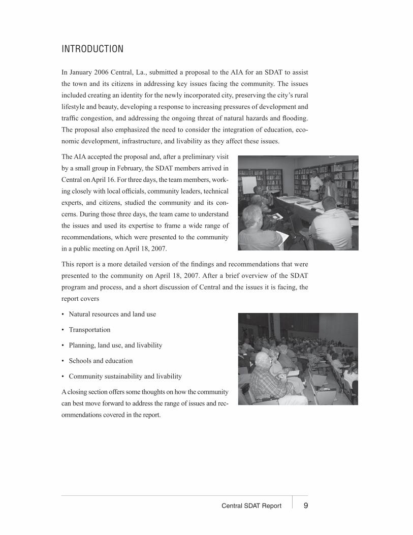
The AIA accepted the proposal and, after a preliminary visit
by a small group in February, the SDAT members arrived in
Central on April 16. For three days, the team members, work-
ing closely with local officials, community leaders, technical
experts, and citizens, studied the community and its con-
cerns. During those three days, the team came to understand
the issues and used its expertise to frame a wide range of
recommendations, which were presented to the community
in a public meeting on April 18, 2007.
This report is a more detailed version of the findings and recommendations that were
presented to the community on April 18, 2007. After a brief overview of the SDAT
program and process, and a short discussion of Central and the issues it is facing, the
report covers
• Natural resources and land use
• Transportation
• Planning, land use, and livability
• Schools and education
• Community sustainability and livability
A closing section offers some thoughts on how the community
can best move forward to address the range of issues and rec-
ommendations covered in the report.

10 Central SDAT Report
What Is the SDAT Program?
The SDAT program is an interdisciplinary community assistance program that focuses
on principles of sustainability. Launched in 2005, the program represents an exciting new
chapter in the AIA’s history of supporting communities with volunteer design expertise.
The SDAT program is modeled on the AIA’s Regional and Urban Design Assistance Team
(R/UDAT) program. While the R/UDAT program provides communities with specific
design solutions, the SDAT program provides broad assessments to help frame future
policies or design solutions in the context of sustainability and helps communities plan the
first steps of implementation. The SDAT program is based on an understanding of design
as a process that
• Is integrative, holistic, and visual
• Is central to achieving a sustainable relationship among humans, the natural
environment, and the place
• Gives three-dimensional form to a culture and a place
• Achieves balance among culture, environment, and economic systems
The SDAT program is grounded in the AIA design assistance team values, which call
for a multidisciplinary approach, objectivity of the participating team members, and
broad public participation.
Why Is the SDAT Program Valuable?
Many communities are immobilized by conflicting agendas, politics, personalities, or
even an overabundance of opportunities. Many communities have not yet taken stock
of their current practices and policies within a sustainability framework, while others
have identified issues of concern but desire assistance in developing a plan of action to
increase sustainability. The SDAT process ensures that alternative solutions are given
a fair hearing and that options are weighed impartially. The SDAT process
• Informs the community of opportunities and encourages them to take action to
protect local and regional resources
• Helps the community understand the structure of the place at various scales and
contexts—from regional resources to the neighborhood scale
11Central SDAT Report
• Explores and articulates the larger contexts and interactions of ecological, sociological,
economic, and physical systems
• Visualizes potential futures
• Recognizes and describes the qualities of a place by preserving the best elements
of the past, addressing the needs of the present, and planning for the needs of future
generations
• Identifies and describes choices and consequences
• Connects plans and actions
• Advances the principles of quality sustainable communities
• Helps the community define the roles of various stakeholders
• Develops a roadmap for the implementation of more sustainable policies and practices
The key to SDAT success is diversity and participation; the process involves multiple
disciplines and multiple stakeholders. The SDAT process includes not only the expert
team but also government agencies and officials, private businesses, schools and stu-
dents, community members, and other parties as appropriate.
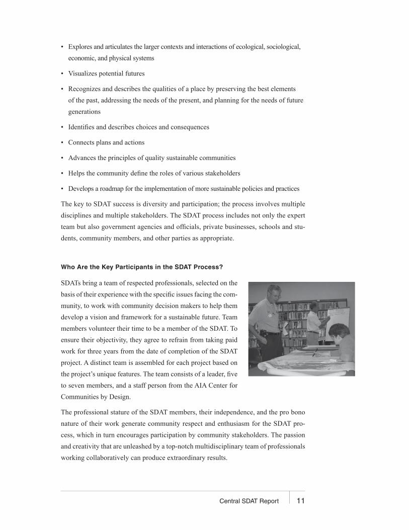
Who Are the Key Participants in the SDAT Process?
SDATs bring a team of respected professionals, selected on the
basis of their experience with the specific issues facing the com-
munity, to work with community decision makers to help them
develop a vision and framework for a sustainable future. Team
members volunteer their time to be a member of the SDAT. To
ensure their objectivity, they agree to refrain from taking paid
work for three years from the date of completion of the SDAT
project. A distinct team is assembled for each project based on
the project’s unique features. The team consists of a leader, five
to seven members, and a staff person from the AIA Center for
Communities by Design.
The professional stature of the SDAT members, their independence, and the pro bono
nature of their work generate community respect and enthusiasm for the SDAT pro-
cess, which in turn encourages participation by community stakeholders. The passion
and creativity that are unleashed by a top-notch multidisciplinary team of professionals
working collaboratively can produce extraordinary results.

12 Central SDAT Report
Local Steering Committee
The steering committee is the SDAT project’s key organizing group. It is responsible
for assembling local and regional information, organizing the preliminary meeting and
SDAT visit, and generating local media coverage during the entire project. After the
SDAT visits, the steering committee typically evolves into a group that is dedicated to
implementing the SDAT recommendations.
Local Technical Committee
The local technical committee is the SDAT project’s technical support
group, including local design professionals, environmental professionals,
economists, and others whose skills and experience parallel those of the
SDAT members and who bring with them detailed knowledge of local
conditions, issues, and information resources. Their presence magnifies
the effectiveness of the team.
Citizens
In the end, the citizens of the community are the critical players, both for their insights
and observations during the team visit and their support for the new directions that
emerge from the SDAT process.
On behalf of the Central SDAT and the AIA, it is hoped this report will be a useful guide
to the Central community as it charts its future for the coming years and generations.

13Central SDAT Report
CENTRAL TODAY
History
Central is in the northeast portion of East Baton Rouge Parish, in the region known as
Central. The city boundaries, as defined by the Amite and Comite rivers on the east and
west respectively and a zone defined by Greenwell Springs Port Hudson Road to the
north, encompass approximately 62 square miles of a flood-prone plain.
When European settlers arrived in the 1800s they encountered a region of pine woods
inhabited by the Amite and Choctaw Indians. The early economy consisted of cotton,
sweet potatoes, and pine mills. In 1853 the Greenwell Springs Resort was built to take
advantage of the renowned mineral springs. This became a popular destination for many
people escaping yellow fever epidemics in cities. The 10 springs’ healing and therapeutic
properties were reputed to cure almost any ailment. The resort also became an entertain-
ment source for the community and provided employment for many area residents.
During the Civil War the Greenwell Springs Resort served as a refuge from war-torn Baton
Rouge, as well as a military headquarters and an infirmary. Later postwar reconstruction
saw the progressive dismantling of the resort as local residents recovered the wood to
rebuild their destroyed homes. By 1910 a grand new hotel and a bottling company were
built, only to close their doors the following year. The 1920s saw these buildings con-
verted into a tuberculosis hospital, and today the site houses a state psychiatric facility.
When Standard Oil was built in 1909, this began a shift from a predominantly agricultural
to a more industrial economy as the Central region became a suburb of Baton Rouge;
traces of this legacy can be seen today.
During the 1800s Central’s children were educated in the many one-room schoolhouses
scattered throughout the area. By 1895 the residents joined together to build a central-
ized school, calling it “Central School.” This same desire for quality education for the
area’s children would again, a century later, be the driving force to incorporate as a city.
In 2005 Governor Blanco approved Central’s incorporation, and in 2006 the Central
Community School District was created.
14 Central SDAT Report
Demographics: Country Living in the City
This primarily rural suburb of East Baton Rouge had a population of approximately 27,000
residents at the time of incorporation. Growth in the wake of hurricanes Katrina and Rita
has bumped the population up to 30,000; this trend is expected to continue. The excellent
high school and middle school and the 28 community churches are the center of Central’s
social and civic life. Residents take great pride in their “Mayberry” kind of town. This
upper-middle class community has an annual median income of $51,000.
The East Baton Rouge Area Chamber of Commerce anticipates a steady growth in jobs,
population, and the overall economy. Industry is expected to expand in traditional manu-
facturing sectors. And new businesses such as high-end hotels, film production studios,
and retail centers have begun to spring up in the region, partly in response to the recent
population increase. Although Central’s population is dependent on Baton Rouge’s job
base, with many people commuting to jobs, the city has a small sector of locally owned
small businesses.
Trends
Louisiana population shifts after Katrina and Rita have increased Central’s rate of sprawl
development. As populations continue to move away from the flood-prone coastal regions,
the city will continue to see growth. In addition to its location in a zone safe from hur-
ricane disaster, the city offers a high quality of life and excellent schools, making it an
attractive area for families. The availability of land and ease of development for subdivi-
sions also adds to the appeal. Its central location and proximity to state highways further
add to the appeal of what was once a Baton Rouge suburb.
Why They Needed Help
With its new designation as a city, Central now has the opportunity to shape its future
and take control of its destiny. Its proximity to Baton Rouge, readily developable land,
and an excellent school system make the city vulnerable to endless, soulless sprawl.
The current real estate market has begun to price younger families out of Central, which
will reduce chances of social sustainability. This rapid growth also precludes a healthier
organic growth rate, critical to any new city.
15Central SDAT Report
Although Central is better situated than Louisiana’s coastal communities, 75 percent of
its area is still in a floodplain and prone to backwater flooding, and as much as 30 percent
of the city has been inundated during significant storms, such as the flood of 1983.
Central’s location, straddling major vehicular access corridors, also creates a transpor-
tation bottleneck through the city, affecting morning and evening rush hours without
providing any economic benefits. The current congestion is only expected to get worse
as the region grows.

16 Central SDAT Report
NATURAL RESOURCES AND LAND USE
Strengths
Central is rich in many scenic and natural resources, including green forests, open
fields, abundant wildlife, flowing rivers, unique cultural sites, and many recreational
opportunities. These abundant natural resources account for the community’s rural
character—one of the things most cherished by Central’s residents. Conserving this
rural character is of vital importance to everyone who lives in Central.
Weaknesses
For natural resources, Central’s greatest weaknesses include the absence of a compre-
hensive floodplain management plan and an integrated smart growth plan to protect the
community’s natural resources while promoting sustainable development that preserves
Central’s rural character and meets the community’s needs.
Opportunities and Actions
A comprehensive flood mitigation plan that includes policies and ordinances to guide
development in hazard-prone areas will substantially reduce the risk and potential of
future communitywide flood losses. Similarly development of an integrated smart
growth plan will protect Central’s rural character while promoting sustainable devel-
opment that meets the community’s needs. Establishing greenways along the Amite
and Comite rivers will help to protect these environmentally important river systems,
preserve important cultural sites, and provide networks for people and wildlife.
Threats
Without strong land-use planning, economic losses and hardships caused by flooding
will increase greatly as development expands in flood-prone areas, and the community’s
rural character will be lost with continuing development of traditional, single-family
residential housing on large lots.

17Central SDAT Report
Recommendations
Community members and the SDAT identified several opportunities to protect Cen-
tral’s rural character and natural resources. These include developing plans and associ-
ated policies and ordinances for
• Floodplain management
• Sustainable development strategies
• Protection of valued scenic resources and cultural sites
Floodplain Management
A large portion of Central is in flood-prone areas. This poses substantial community-
wide risks and potential for future flood losses. These flood-prone areas also place
major constraints on where future development can occur. Sometimes referred to as
the 100-year floodplain, the base flood has a 1 percent chance of occurring in any given
year Although a 100-year flood sounds remote, keep in mind that over the life of an
average 30-year mortgage, a home located in the 100-year flood zone (A or V zone) has
a 26 percent (one in four) chance of being inundated by the base flood over the life of
the mortgage. The same home has less than a 1 percent chance of fire damage during
the same period. Further, since 1965, the Baton Rouge Parish has declared nine flood
disasters, and the 1983 flood was the most devastating. Records kept by the Central Fire
Department estimated that 30 percent of Central was flooded, with 350 homes affected.

18 Central SDAT Report
Major access roads were closed due to flooding, hindering access by emergency vehi-
cles, and eight subdivisions were isolated by floodwaters. Newspapers reported that
numerous houses in the Winchester subdivision were flooded within two or three feet
of their rooftops. One subdivision resident said he had built his house two feet above
the 1977 flood level and still got at least two feet of water in his house. Another resident
of the subdivision said his house was built in 1979 above the 100-year floodplain, but
still was flooded. Flooding also occurred in the nearby Cimarron subdivision, and some
residents in the back part of the subdivision who had been flooded before later gave up
their homes as part of a buy-out program, recognizing that the danger of future flooding
was too great to remain.
Development of a floodplain mitigation plan for Central will not only contribute to
maintaining the community’s rural character but also reduce future economic losses and
hardships caused by flooding. Further, to participate in the National Flood Insurance
Program (NFIP), Central must develop, adopt, and enforce a floodplain management
ordinance that regulates development in the community’s floodplain. The NFIP’s two
fundamental objectives are to ensure that new buildings will be free from flood damage
and prevent new developments from increasing flood damages. The NFIP’s basic pur-
pose is not to prohibit floodplain development but to guide development in floodplain
areas so as to greatly lessen the economic loss and social disruption caused by impend-
ing flood events.
The Federal Emergency Management Agency’s Flood Mitigation Assistance (FMA)
provides funding to assist states and communities in implementing measures to reduce
or eliminate long-term risk of flood damage to buildings, manufactured homes, and
other structures insurable under the NFIP. The FMA was created as part of the National
Flood Insurance Reform Act of 1994 (42 U.S.C. 4101) with the goal of reducing or
eliminating claims under the NFIP. The FMA is a predisaster grant program.
Planning is FMA’s foundation. The Federal Emergency Management Agency (FEMA)
encourages communities to identify ways to reduce their risk of flood damage by prepar-
ing a flood mitigation plan. Communities that have flood mitigation plans can request
approval of their plans from their FMA state point of contact and FEMA. Communities
with approved plans are eligible to apply for FMA project grants. Plans must assess flood
risk and identify actions to mitigate identified risks. Two types of grants are available to
communities: planning grants and project grants.
19Central SDAT Report
Although a community must maintain a set of flood-
way, general, and specific standards to participate and
maintain eligibility for the NFIP, Central should con-
sider adopting higher floodplain regulatory standards
to better meet its floodplain-management and open-
space goals. A comprehensive land-use plan should
specify where development should and should not
occur in the community. This will enable Central to
guide land use away from flood-prone areas, perhaps
using these areas for greenways, parks, golf courses,
backyards, or natural areas. A set of local measures
such as zoning and subdivision ordinances, however,
will need to be developed to guide and regulate land
use in Central, including
• Zoning ordinances. In a zoning ordinance, flood-
plains can be designated as zoning districts in
which development is completely prohibited or
allowed only if the development is constructed
to minimize flood damage (per the requirements
of the NFIP and local floodplain management
ordinances). Some types of flood districts are
dedicated for recreation, public use, conservation,
or cluster developments that keep houses out
of floodplains. Often the flood zone designation
takes the form of an overlay or combining zone.
• Subdivision ordinances. These regulations
determine how land will be broken down into
individual lots. They also state how homes
should be sited in relation to the floodplain
(preferably outside) and set construction and
location standards for the infrastructure that will
service the subdivision.
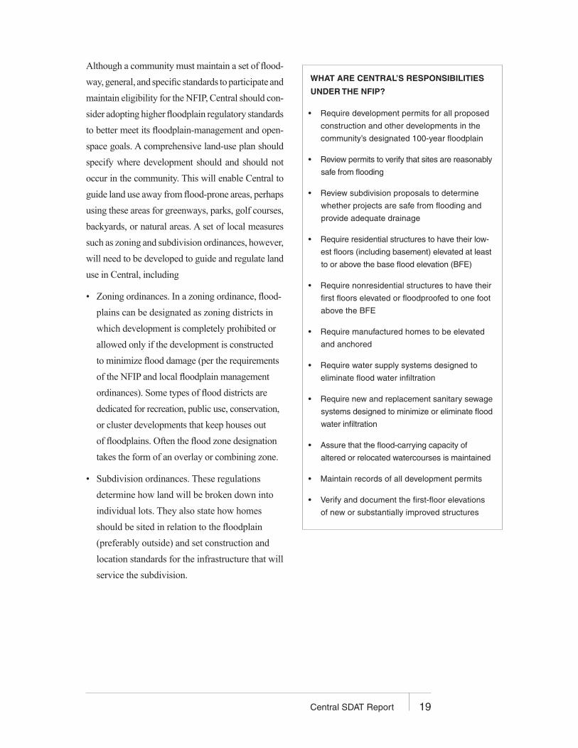
WHAT ARE CENTRAL’S RESPONSIBILITIES
UNDER THE NFIP?
• Require development permits for all proposed
construction and other developments in the
community’s designated 100-year floodplain
• Review permits to verify that sites are reasonably
safe from flooding
• Review subdivision proposals to determine
whether projects are safe from flooding and
provide adequate drainage
• Require residential structures to have their low-
est floors (including basement) elevated at least
to or above the base flood elevation (BFE)
• Require nonresidential structures to have their
first floors elevated or floodproofed to one foot
above the BFE
• Require manufactured homes to be elevated
and anchored
• Require water supply systems designed to
eliminate flood water infiltration
• Require new and replacement sanitary sewage
systems designed to minimize or eliminate flood
water infiltration
• Assure that the flood-carrying capacity of
altered or relocated watercourses is maintained
• Maintain records of all development permits
• Verify and document the first-floor elevations
of new or substantially improved structures
20 Central SDAT Report
• Building codes. Flood protection standards should be incorporated into the local
building code. At a minimum they should ensure that the structure’s lowest floor
is built above the BFE and that the foundation will withstand flood forces.
• Floodplain management ordinances. These floodplain ordinances go beyond
the minimum standards required by the NFIP (e.g., more restrictive floodways,
freeboard above the BFE, riparian setbacks).
• Stormwater management regulations. These require developers to build on-site detention
basins to handle the increased runoff caused by new developments with large impervious
areas (e.g., subdivisions, shopping malls). Stormwater is not allowed to leave the property
at a rate higher than its predeveloped condition. In addition stormwater regulations can
address the problem of sedimentation, which can fill in channels and lakes, reducing their
ability to carry or store floodwaters. One way to keep sediment from entering nearby
streams and rivers is to require sediment traps at new construction sites.
• Postdisaster recovery ordinances. This ordinance establishes a recovery organization
that authorizes a variety of pre- and postevent planning and regulatory powers and
procedures related to disaster recovery and reconstruction.
• Wetlands protection. Wetlands can store large amounts of floodwaters, slow and
reduce downstream flows, and protect shorelines from erosion. Efforts to preserve
wetlands, especially smaller ones not covered by a U.S. Army Corps of Engineers
404 (wetlands) permit, can aid a community’s efforts to decrease flood damages.
Given Central’s high vulnerability to natural disasters, the community should also develop an
approved hazard mitigation plan as required by the national postdisaster Hazard Mitigation
Grant Program (HMGP). This is required if a community is to receive HMGP funds after
a disaster has occurred. The program covers losses caused by flooding and other causes.
Sustainable Development Strategies
As a result of Central’s great schools, green forests, open fields, and flowing rivers, its
population is expected to increase substantially in coming years. Unplanned growth
could damage Central’s abundant natural resources and rural character, features that
residents cherish most about their community. Developing a comprehensive land-use
plan that incorporates smart-growth techniques would provide the opportunity to pro-
tect the community’s natural resources while promoting sustainable development that
preserves Central’s rural character and meets the community’s needs.

21Central SDAT Report
Smart growth is not “no growth”; rather it is a principle of land development that
emphasizes mixing land uses, increases the availability of a range of housing types
in neighborhoods, takes advantage of compact design, and fosters distinctive and
attractive communities. It preserves open space, farmland, natural beauty, and critical
environmental areas; strengthens existing communities; provides a variety of transpor-
tation choices; makes development decisions predictable, fair, and cost effective; and
encourages community and stakeholder collaboration in development decisions.
A critical component of smart growth is to identify areas that are appropriate for develop-
ment and those that should be protected and preserved. Good candidates for development
include downtowns, village centers, areas adjacent to these centers, brownfields, and sites
with access to transportation and other infrastructure.
The first step is to conduct a communitywide comprehensive planning process to iden-
tify locations within Central that are appropriate for development and areas that should
remain open space. Following the identification of these areas, the community must
ensure that zoning and other incentives will result in development consistent with these
plans. Where and how Central chooses to implement smart growth should be explicitly
reflected in the zoning and subdivision regulations that dictate future growth.
Many tools can be used to implement a smart-growth plan, including
• Traditional neighborhood design (TND). TND, also known as “new urbanism,”
“neo-traditional,” or village-style development, includes a variety of housing types,
a mix of land uses, an active center, a walkable design, and often a transit option
within a compact neighborhood scale area, either as infill in an existing developed
area or as a district-scale project.
• Open space residential design (OSRD). OSRD is an approach to residential devel-
opment that promotes open-space preservation based on environmental and social
priorities. It features partnership in development design between municipal officials
and developers that provides innovative flexible incentives for highest marketability,
mixed housing types and land uses, and minimal disturbance to the natural terrain.
This tool is especially relevant to Central where much of its residential development
22 Central SDAT Report
has been single-family homes on large-sized lots. The environmental and social ben-
efits derived from OSRD make it attractive to community residents, while economic
incentives such as the addition of valuable amenities to enhance marketing and sales
and the streamlining of the plan review process ultimately benefit developers.
• Low-impact development (LID). LID is a more sustainable land development
pattern that results from a site planning process that first identifies critical natural
resources, then determines appropriate building envelopes. LID also incorporates
a range of best management practices that preserve the land’s natural hydrology.
• Inclusionary zoning. Inclusionary zoning requires a portion of the housing units in
certain real estate developments to be reserved as affordable to low- and moder-
ate-income households. It is an effective tool that can be used by municipalities to
ensure that adequate affordable units are included in the normal course of real estate
development.
Ten principles express the characteristics of smart-growth development that protects
a community’s natural resources, promotes social and economic health, and meets the
needs of community residents:
1. Redevelop first. Revitalizing existing neighborhoods doesn’t require expensive
new infrastructure or consume forest and fields, and finds new uses for historic
buildings and underutilized brownfield sites.
2. Concentrate development. Compact development conserves land and fosters vibrant
and walkable districts. More compact development saves the public sector millions
of dollars by reducing the costs of public services.
3. Be fair. The benefits and burdens of development should be equitably shared by all.
Transparent and predictable permitting will result in cost-effective and fair outcomes.
4. Restore and enhance the environment. The conservation, protection, and restoration of
water, land, and cultural resources provides a high quality of life and ecological health.
5. Conserve natural resources. Renewable energy and efficient use of building materials
and water contribute to a healthier environment, limit waste, and are cost-effective.
6. Expand housing opportunities. Expanding the number, affordability, and diversity
of housing units will ensure that people of all abilities, income levels, and ages
have appropriate housing options.
7. Provide transportation choice. Opportunities for public transit, walking, and biking
should be expanded.

23Central SDAT Report
8. Increase job opportunities. Connecting people with jobs in their communities and
close to homes and transportation infrastructure will expand the local economy.
9. Foster sustainable businesses. Great potential exists for new, innovative industries
and for resource-based industries to contribute to the state’s social, economic, and
environmental health.
10. Plan regionally. Economic development, water, transportation, and housing are regional
in nature; they don’t stop at the town boundary. Regional planning recognizes this and
results in intermunicipal coordination and better outcomes.
Protection of Valued Scenic Resources and Cultural Sites
The Amite and Comite rivers, with their extensive floodplains, riparian forests, and
scenic roadways provide an important opportunity to establish greenways along these
two rivers. Greenways are corridors of protected public land established along rivers,
stream valleys, ridges, abandoned railroads, scenic roads, and other linear features.
Greenways often link recreational, cultural, and ecological features while improv-
ing network pathways for people and wildlife. Greenways also function as buffers to
protect forests, wetlands, grasslands, and rivers and provide a multitude of benefits
for people, wildlife, and the economy. Establishing greenways along the Amite and
Comite rivers would link people with the outdoors, provide recreational opportunities
for people and natural corridors for wildlife, and protect these environmentally impor-
tant river systems and lands. Incorporating the Greenwell Springs Historic site into
the greenway would also help protect this important cultural site and provide a unique
tourism destination.
There are many different sources of funds for the acquisition, development, and man-
agement of greenway facilities. To maximize the amount of financial support for any
greenway project, local public-sector funds should be combined with funds from state,
federal, and private-sector sources. The Transportation Efficiency Act of the 21st Century,
and its predecessor, the Intermodal Surface Transportation Efficiency Act, is the single
largest source of federal funding for greenway and other bicycle and pedestrian projects
in the United States. It is administered through the U.S. Department of Transportation
and provides up to 80 percent of the cost of developing and constructing facilities such
as greenways, rail trails, sidewalks, and bike lanes. Opportunities also exist to designate
the Amite and Comite rivers as wild and scenic rivers under the federal Wild and Scenic
Rivers Act.
24 Central SDAT Report
TRANSPORTATION
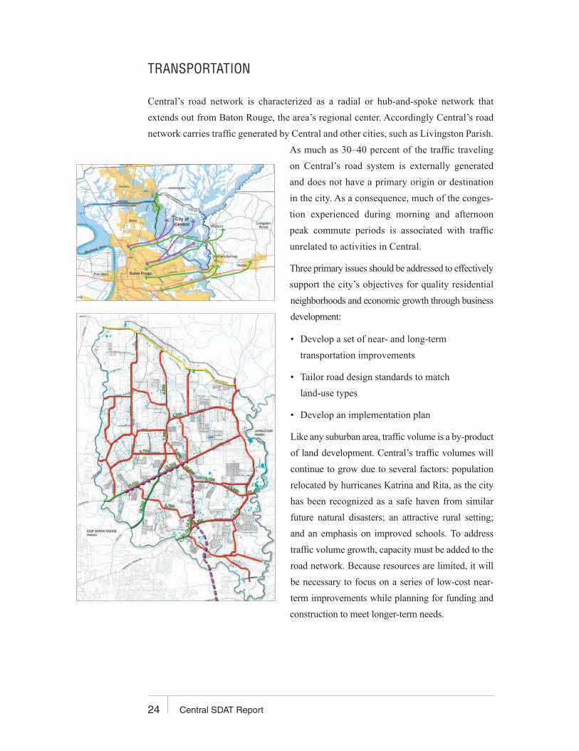
Central’s road network is characterized as a radial or hub-and-spoke network that
extends out from Baton Rouge, the area’s regional center. Accordingly Central’s road
network carries traffic generated by Central and other cities, such as Livingston Parish.
As much as 30–40 percent of the traffic traveling
on Central’s road system is externally generated
and does not have a primary origin or destination
in the city. As a consequence, much of the conges-
tion experienced during morning and afternoon
peak commute periods is associated with traffic
unrelated to activities in Central.
Three primary issues should be addressed to effectively
support the city’s objectives for quality residential
neighborhoods and economic growth through business
development:
• Develop a set of near- and long-term
transportation improvements
• Tailor road design standards to match
land-use types
• Develop an implementation plan
Like any suburban area, traffic volume is a by-product
of land development. Central’s traffic volumes will
continue to grow due to several factors: population
relocated by hurricanes Katrina and Rita, as the city
has been recognized as a safe haven from similar
future natural disasters; an attractive rural setting;
and an emphasis on improved schools. To address
traffic volume growth, capacity must be added to the
road network. Because resources are limited, it will
be necessary to focus on a series of low-cost near-
term improvements while planning for funding and
construction to meet longer-term needs.

25Central SDAT Report
Transportation Improvements
Near-Term Improvements
The community indicated a preference for reducing
stops and keeping traffic flowing smoothly, as opposed
to improving overall speed (reducing delay). Near-term
improvements should focus on continuing to build on
the improvements and technology initiated by the par-
ish by making spot improvements to decrease stops and
keep traffic moving at controlled intersections. This can
be accomplished by selectively adding auxiliary lanes
(dual left-turn lanes and exclusive right-turn lanes), refin-
ing traffic signal timings, and enhancing street marking.
A good example of these kinds of improvements was near
the Wal-Mart, where intersection widening and auxiliary
lanes improved traffic throughflow and enhanced the
site’s accessibility to adjacent land uses.
Another approach that might be suited to Central is
building roundabouts, which when properly designed
can dramatically reduce vehicle stops, delay, and queues.
Roundabouts typically merge conflicting traffic flows at
conflict points. This is in contrast to traffic signals that
require one or more conflicting traffic movements to
stop while other movements move safely.
Initial assessments of candidate locations where round-
abouts may be an appropriate solution are shown in Fig-
ure 3. Careful analysis must be performed to ensure that
this solution is applied properly and such a design does
not result in impacts greater than the problems the city
is attempting to resolve. Roundabouts also can serve as
a signature design element that can be constructed as
entryways and focal points to distinguish Central from
adjacent communities.
Figure 3. Possible Roundabout Locations

26 Central SDAT Report
Long-Term Improvements
To effectively address longer-term needs and carefully focus on priorities,
it will be necessary to conduct a comprehensive transportation study. This
study should identify intermediate and long-term travel demands, identify
alternative corridor and road segment capacity/corridor improvements,
evaluate and select a set of preferred solutions, and develop a program
for funding these improvements. It is critical to adopt such a plan so that
impending land development does not foreclose road network right-of-way
opportunities or artificially increase their cost. While it is premature for the
SDAT to make specific recommendations regarding new corridor improve-
ments, it is recommended that no new bridge improvements beyond those
already programmed be pursued because this will only permit traffic vol-
umes to increase, adding congestion to the already impacted road network.
Road Classification System
A road classification system should be developed as part of the comprehensive transpor-
tation planning study. This road hierarchy should match state and federal definitions to
enhance funding opportunities from outside public sources and should balance the need
for accessibility on local streets and through-volume capacity on arterials and major
throughways. To this end, road cross-sections should be developed to blend and serve
adjacent land uses with smaller, lower-speed roads with a high level
of accessibility in residential areas and larger streets with more limited
accessibility in commercial, institutional, and industrial settings.
Road design standards should also reflect Central’s rural character with
appropriate landscaping, consolidation of driveways in commercial
areas, and sidewalks to establish opportunities for pedestrian and bicycle
circulation. On existing major through-streets outside commercial areas,
efforts should be developed to create shoulders that can provide refuge
for disabled vehicles and opportunities for nonmotorized travel.
These design standards should be coupled with development guidelines
that will serve as incentives for private development to construct or sub-
stantially contribute to road improvements affected by their development.
27Central SDAT Report
Providing density incentives, reducing building setbacks, and providing standards that are
complementary to quality development with appropriate landscaping on one-way roads
can be constructed at limited cost to the city.
Road system continuity, particularly in residential areas, is another issue that should
be addressed as part of citywide transportation planning. Policies to encourage road
system continuity must be carefully developed to verify that the adjacent neighbor-
hood streets have adequate capacity to provide safe traffic movement while minimiz-
ing impacts on wetlands and other natural amenities. Even in areas where a general
purpose traffic connection may be inappropriate, emergency vehicle access should
be provided. It is recommended that the fire department use its standards in defining
the need for multiple connections to the major roadway network to ensure the safe
response of fire, police, and emergency medical services as the city grows.
Nonmotorized transportation improvements also should be considered as part of the
citywide transportation plan, with a separate plan element. Initially trails can be devel-
oped as part of greenways, tourist and recreational features, and park expansion and
development. As roads are reconstructed, appropriate provisions for primary bike
routes, pedestrian, and equestrian trails should be considered.
Implementation Plan
Currently the need and desire for major transportation improvements substantially
exceeds Central’s resources. Accordingly the most important element of the trans-
portation planning process is development of a capital facilities element to fund the
construction of these increasingly expensive facilities. Improvements can be care-
fully prioritized, with the knowledge of costs and a realistic assessment of resources.
Resources can be substantially enhanced by partnering with private development,
adjacent parishes, the state, and federal agencies. The transportation plan must iden-
tify special programs where local funds can be leveraged to construct transportation
improvements that are compatible with broader community goals.
Although traffic may not be the most important aspect of the city’s future, it is one of the
most tangible aspects of day-to-day life and will therefore require the attention of city
leadership. With proper planning, the transportation system can be the glue that holds

28 Central SDAT Report
various key aspects of a healthy community together. The keys to Central achieving
these objectives are
• Development of a comprehensive transportation plan
• Creation of design standards and incentives that support quality land use and
economic development compatible with Central’s rural character
• Careful prioritization of transportation improvements with a supporting financial
plan that includes incentives and partnerships with others who benefit

29Central SDAT Report
PLANNING, LAND USE, AND LIVABILITY
Strengths
Central’s strengths, as identified by the community during the AIA SDAT public meet-
ings, include the people, the schools, and the natural environment. Specific strengths
mentioned include the schools, shared heritage and values, open space, neighborhoods,
country atmosphere, trees and tree cover, diverse natural habitats, rivers, natural areas,
lots of water, ability to influence future growth, and caring people. Interestingly, we
heard very little emphasis on the built environment.
Weaknesses
Community members identified Central’s weaknesses as traffic and the lack of a town
center and supporting services. Specific issues mentioned include traffic congestion;
dilapidated buildings; lack of housing, shopping, entertainment, health care, and jobs;
no main street or downtown; no mass transit; the need to drive to go anywhere; and the
lack of connectedness.
Opportunities and Actions
Community members identified several opportunities to improve the built environment.
These include developing curbs, gutters, sidewalks, and sewers with streets; retaining
and preserving green space; preserving woodland as new housing is developed; man-
aging growth to achieve a balance between growth and conservation; developing even
better schools; and attracting retirement communities.
Threats
Community members support additional growth but all expressed concern about risks
from new development. These concerns include uncontrolled growth that could result
from improved schools and a more attractive community, increased traffic from wider
roads, uncontrolled growth, increased taxes and resulting oversized government, and
an increase in crime.
30 Central SDAT Report
During the AIA SDAT public meetings, community members identified long-term and
short-term actions to help improve Central. We heard a focus on schools, downtown,
and building a sense of place:
• Get a Central ZIP code that matches city boundaries (short-term action)
• Enhance city gateways with signage and visual improvements (short-term action)
• Clean up junk cars, junk signs, and weeds along city roads (short-term action)
• Develop a town center/downtown that will serve now and in the future
• Increase parks and recreation spaces, especially fields and river recreation
• Become the number one school district in the state
• Ensure traffic is manageable
• Ensure the community has a range of housing types and costs (single-family homes,
senior housing, high-end market, starter homes, quality apartments, condominiums,
assisted living residences)
• Improve health care facilities within the city
• Develop a conference center to tie in with the park
Downtown Sense of Place and Vision
Central is a rural, people-focused community. Values, schools, and a sense of place are
the building blocks that tie the community together. Central residents embrace growth
that builds community character and maintains the existing rural character and natural
resources. They want a strong vibrant downtown that builds a sense of place, accom-
modates community growth, provides services to residents, reduces car trips outside
the city, reduces sprawl, provides a range of housing, and creates local jobs and eco-
nomic development.
Central’s current commercial development pattern exemplifies the complaint made
about many communities—“there is no there there.” Residents have an opportunity
to guide future development and create a sense of place because commercial develop-
ment is limited and existing buildings are of an ephemeral nature.

31Central SDAT Report
Central does not need a downtown that is simply a modified strip center. It needs
a mixed-use destination that will house residents, reduce sprawl, provide jobs, reduce
the need for residents to drive outside the community, and provide services and a sense
of place. Central needs to take steps to halt sprawl and preserve its rural areas, resulting
in a true downtown where residents work, shop, live, and gather. Central needs to build
a downtown with a “there there.”
Downtown Central Design Principles
The following guiding principles can help create a strong, vibrant, and sustainable
downtown Central:
• Downtown must include a strong retail component. Fifty years ago, most retail sales
took place in downtowns. Today with regional malls, power centers, and strip commercial
commanding most retail dollars, downtowns rely more heavily on entertainment, culture,
and civic life. Retail remains an important component of successful downtowns, part
of the critical mix it takes to make a downtown thrive.
• Downtown must include all aspects of hospitality and entertainment, including food
and drink, hotels, and service. These services are the lifeblood of healthy down-
towns. They draw customers who spend money in multiple establishments.
• To attract retail, a portion of downtown must be adjacent to high-volume roads
(ideally more than 15,000 cars a day).
• Downtown cannot become so dominated by the focus on high-traffic streets that
pedestrians do not enjoy their visits. These types of areas exclude pedestrians and
have no character. No downtown can survive as a downtown if they do not provide
a pleasant pedestrian experience.
• Locate City Hall downtown and make downtown the center of government and
civic life. Other civic improvements (e.g., a new post office, veterans’ monuments,
small urban park, arts complex, senior or youth centers) also should be located
downtown.
• Increase downtown activities that add vitality to adjacent businesses and downtown.
Example activities include Cooking for Central, farmers markets, sidewalk sales,
and festivals.
• To the extent practical, office use should be directed to downtown. No nondown-
town areas of Central should be zoned to allow office use outside of downtown
or extremely limited mixed-use areas, to concentrate the demand downtown.

32 Central SDAT Report
• Senior housing, assisted living residences, and nursing homes should be strongly
encouraged above the first floor in the downtown business district and on any floor
in the adjacent residential areas. Seniors drive less than other adult populations
and own fewer cars and they can provide foot traffic for area businesses. Providing
senior housing downtown can help seniors to stay in their homes longer, avoiding
the stress and cost that occurs when seniors can no longer maintain themselves in
their suburban car-oriented homes.
• To keep downtown vibrant, a substantial amount of housing should be in and adjacent
to downtown. For a city the size of Central, a minimum of 12,000 people should be
living in or within 0.5 miles (preferably within 0.25 miles) of downtown. Ideally, there
should be 20,000 people living within 0.5 miles of downtown. Housing is the single most
important ingredient in keeping many downtowns lively, especially in the evenings and
weekends. Housing, and the resulting pedestrian activity, also are essential to main-
taining a safe feel to downtown at night. Housing should be allowed and encouraged
in every building downtown, above the first floor. Downtown housing is the most effec-
tive way to transfer travel modes from automobile to foot, thereby reducing overall
vehicle trip generation, traffic congestion, and commercial parking demands.
• Link downtown to schools. Both attract visitors and together they create a healthy synergy.
• Design is critical in the downtown. People visit downtown because they want to and
because there is a “there there,” not because downtowns are the most convenient
areas to show. Design is part of what makes downtowns attractive for these visitors.
Central has the opportunity to build on the historic southern commercial and mixed-
use vernacular that makes historic southern cities so desirable. Design standards with
teeth related to building detailing, windows, doors, articulations, and street trees,
is critical. The city should provide clear standards so that developers don’t have to
worry about review boards having excessive discretion. In the commercial core, resi-
dential use should not be allowed on buildings’ first floor to avoid any break in the
commercial core. Buildings should be built up to the sidewalks and frame the streets,
should be attractive and well designed, and should be a minimum of two to three
stories in height. Lastly, property owners should be allowed and encouraged to build
porches over the sidewalks.
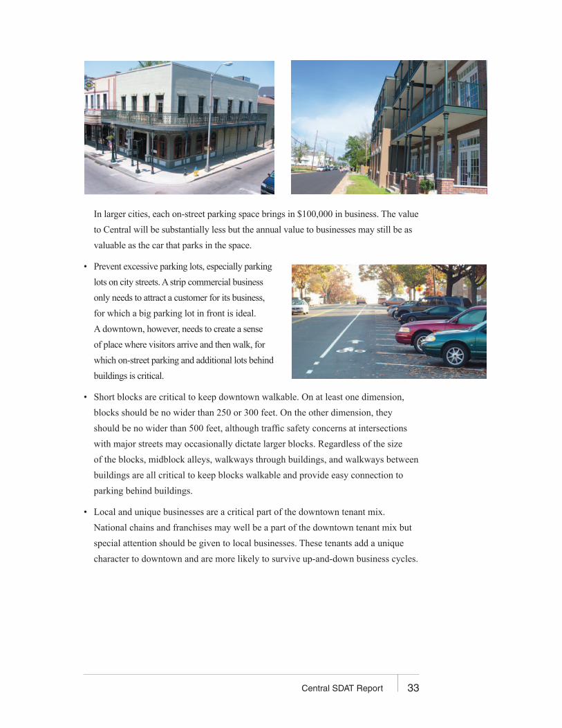
• Maximize on-street parking, ideally using back-in angle parking, in the downtown.
On-street parking spaces are the most valuable spaces to businesses and their customers.
33Central SDAT Report
In larger cities, each on-street parking space brings in $100,000 in business. The value
to Central will be substantially less but the annual value to businesses may still be as
valuable as the car that parks in the space.
• Prevent excessive parking lots, especially parking
lots on city streets. A strip commercial business
only needs to attract a customer for its business,
for which a big parking lot in front is ideal.
A downtown, however, needs to create a sense
of place where visitors arrive and then walk, for
which on-street parking and additional lots behind
buildings is critical.
• Short blocks are critical to keep downtown walkable. On at least one dimension,
blocks should be no wider than 250 or 300 feet. On the other dimension, they
should be no wider than 500 feet, although traffic safety concerns at intersections
with major streets may occasionally dictate larger blocks. Regardless of the size
of the blocks, midblock alleys, walkways through buildings, and walkways between
buildings are all critical to keep blocks walkable and provide easy connection to
parking behind buildings.
• Local and unique businesses are a critical part of the downtown tenant mix.
National chains and franchises may well be a part of the downtown tenant mix but
special attention should be given to local businesses. These tenants add a unique
character to downtown and are more likely to survive up-and-down business cycles.

34 Central SDAT Report
• Management of downtown must support the needs of downtown businesses and resi-
dents. Downtown advocates, shared marketing efforts, coordination on late business
hours, a voice in local government, and the like are all critical to the success of any
downtown. Programs like the National Trust for Historic Preservation’s Main Street
Program help create models for successful downtowns.
• In addition to design standards, downtown requires a totally different zoning approach
than other areas of town. Downtown zoning is similar in many respects to traditional
neighborhood development (TND) zoning but much stronger. Downtown is the heart of
the city and interacts with the city and the surrounding neighborhoods more than a TND.
There is no need for frontage, minimum lot size, or minimum frontage downtown. Instead,
use maximum setbacks (10’) and minimum heights (25–30’), also known as build-to lines.
Parking is the lifeblood of rural cities but too much parking is their death. Encourage or
require shared parking and consider not requiring any parking requirements for downtown
uses, or at least have dramatically less stringent requirements. Market conditions will dic-
tate that some housing be provided, and on-street parking will house much of the need.
Encourage narrow buildings with parking behind the buildings and anchor buildings that
might absorb an entire parking lot. Off-street parking is a critical resource; it just shouldn’t
dominate. Consider adopting minimum density provisions. For downtown to succeed,
a large population is required. If housing is developed at densities of less than eight dwell-
ing units per acre (20–30 is ideal), it will be very hard to achieve the necessary population.
• Consider what financial tools are needed to make downtown succeed. Infrastructure
necessary to support the downtown may be funded in part with some combination
of special assessments on the property owners who benefit from the project, tax incre-
ment financing (TIF), and investment of a portion of expected sales tax receipts.
Any new downtown development will create a positive net flow of money to the city.
Even if the city needs to forgo a portion of the taxes to make the project work, it will
still bring in more money than if the downtown redevelopment was never to occur.
• Install a landmark now to help identify what will become downtown. Currently
visitors to the city don’t know when they have arrived at the city’s center—there
is no gateway to downtown or landmark to make a visitor think, “I’m somewhere
special or different now.” Eventually, downtown will be a beautiful and vibrant area
with signature architecture. Until then, artwork or some other point symbol that
grabs people’s attention should be installed.
35Central SDAT Report
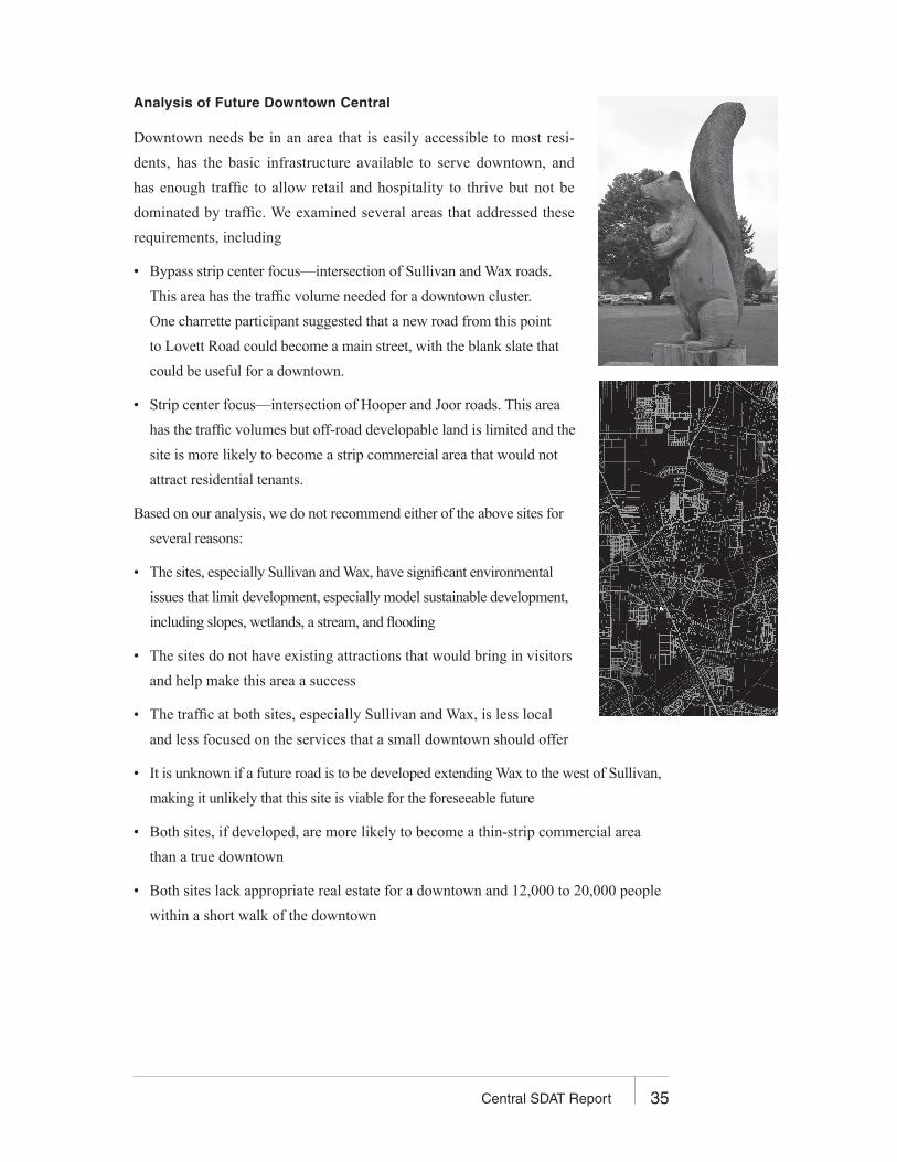
Analysis of Future Downtown Central
Downtown needs be in an area that is easily accessible to most resi-
dents, has the basic infrastructure available to serve downtown, and
has enough traffic to allow retail and hospitality to thrive but not be
dominated by traffic. We examined several areas that addressed these
requirements, including
• Bypass strip center focus—intersection of Sullivan and Wax roads.
This area has the traffic volume needed for a downtown cluster.
One charrette participant suggested that a new road from this point
to Lovett Road could become a main street, with the blank slate that
could be useful for a downtown.
• Strip center focus—intersection of Hooper and Joor roads. This area
has the traffic volumes but off-road developable land is limited and the
site is more likely to become a strip commercial area that would not
attract residential tenants.
Based on our analysis, we do not recommend either of the above sites for
several reasons:
• The sites, especially Sullivan and Wax, have significant environmental
issues that limit development, especially model sustainable development,
including slopes, wetlands, a stream, and flooding
• The sites do not have existing attractions that would bring in visitors
and help make this area a success
• The traffic at both sites, especially Sullivan and Wax, is less local
and less focused on the services that a small downtown should offer
• It is unknown if a future road is to be developed extending Wax to the west of Sullivan,
making it unlikely that this site is viable for the foreseeable future
• Both sites, if developed, are more likely to become a thin-strip commercial area
than a true downtown
• Both sites lack appropriate real estate for a downtown and 12,000 to 20,000 people
within a short walk of the downtown
36 Central SDAT Report
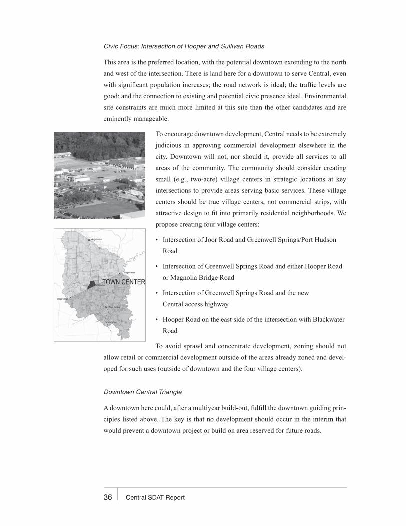
Civic Focus: Intersection of Hooper and Sullivan Roads
This area is the preferred location, with the potential downtown extending to the north
and west of the intersection. There is land here for a downtown to serve Central, even
with significant population increases; the road network is ideal; the traffic levels are
good; and the connection to existing and potential civic presence ideal. Environmental
site constraints are much more limited at this site than the other candidates and are
eminently manageable.
To encourage downtown development, Central needs to be extremely
judicious in approving commercial development elsewhere in the
city. Downtown will not, nor should it, provide all services to all
areas of the community. The community should consider creating
small (e.g., two-acre) village centers in strategic locations at key
intersections to provide areas serving basic services. These village
centers should be true village centers, not commercial strips, with
attractive design to fit into primarily residential neighborhoods. We
propose creating four village centers:
• Intersection of Joor Road and Greenwell Springs/Port Hudson
Road
• Intersection of Greenwell Springs Road and either Hooper Road
or Magnolia Bridge Road
• Intersection of Greenwell Springs Road and the new
Central access highway
• Hooper Road on the east side of the intersection with Blackwater
Road
To avoid sprawl and concentrate development, zoning should not
allow retail or commercial development outside of the areas already zoned and devel-
oped for such uses (outside of downtown and the four village centers).
Downtown Central Triangle
A downtown here could, after a multiyear build-out, fulfill the downtown guiding prin-
ciples listed above. The key is that no development should occur in the interim that
would prevent a downtown project or build on area reserved for future roads.
37Central SDAT Report
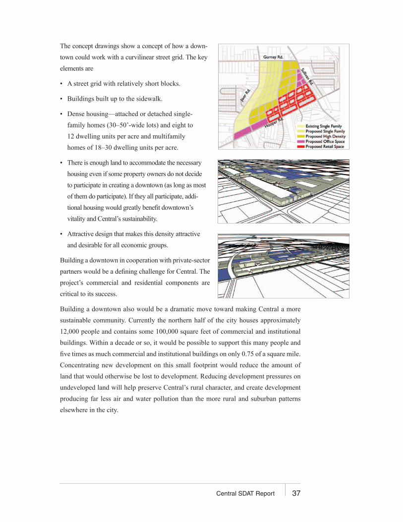
The concept drawings show a concept of how a down-
town could work with a curvilinear street grid. The key
elements are
• A street grid with relatively short blocks.
• Buildings built up to the sidewalk.
• Dense housing—attached or detached single-
family homes (30–50’-wide lots) and eight to
12 dwelling units per acre and multifamily
homes of 18–30 dwelling units per acre.
• There is enough land to accommodate the necessary
housing even if some property owners do not decide
to participate in creating a downtown (as long as most
of them do participate). If they all participate, addi-
tional housing would greatly benefit downtown’s
vitality and Central’s sustainability.
• Attractive design that makes this density attractive
and desirable for all economic groups.
Building a downtown in cooperation with private-sector
partners would be a defining challenge for Central. The
project’s commercial and residential components are
critical to its success.
Building a downtown also would be a dramatic move toward making Central a more
sustainable community. Currently the northern half of the city houses approximately
12,000 people and contains some 100,000 square feet of commercial and institutional
buildings. Within a decade or so, it would be possible to support this many people and
five times as much commercial and institutional buildings on only 0.75 of a square mile.
Concentrating new development on this small footprint would reduce the amount of
land that would otherwise be lost to development. Reducing development pressures on
undeveloped land will help preserve Central’s rural character, and create development
producing far less air and water pollution than the more rural and suburban patterns
elsewhere in the city.
38 Central SDAT Report
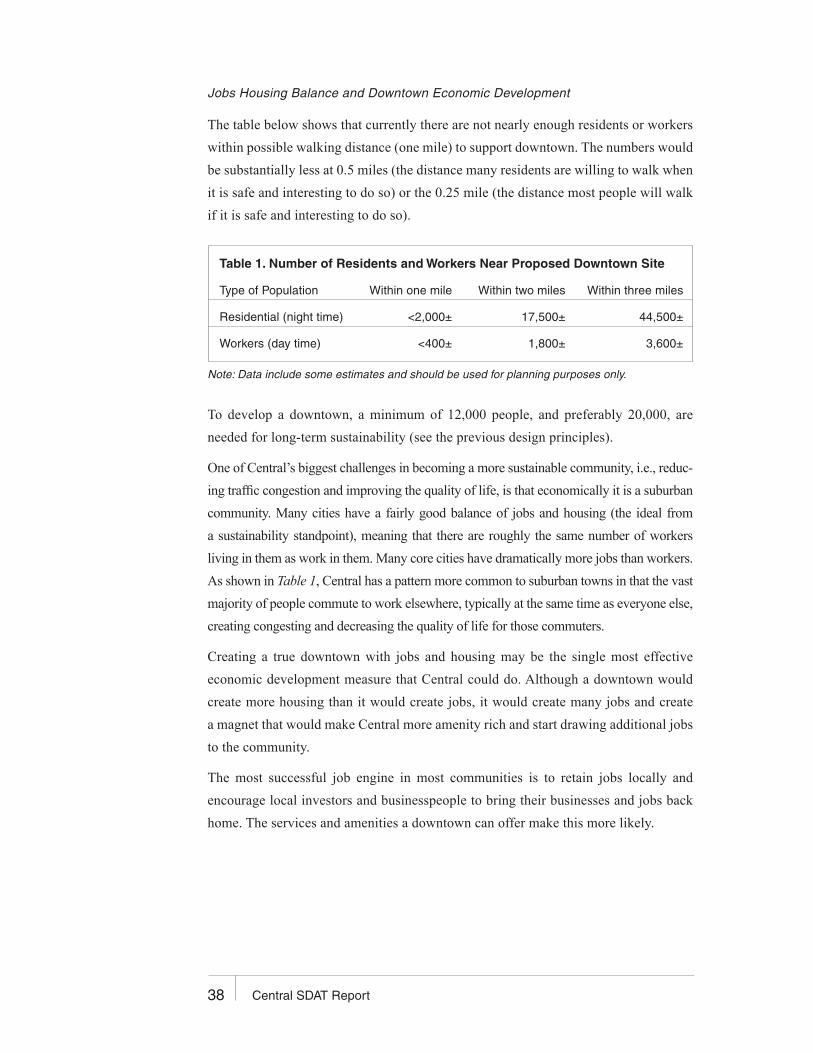
Jobs Housing Balance and Downtown Economic Development
The table below shows that currently there are not nearly enough residents or workers
within possible walking distance (one mile) to support downtown. The numbers would
be substantially less at 0.5 miles (the distance many residents are willing to walk when
it is safe and interesting to do so) or the 0.25 mile (the distance most people will walk
if it is safe and interesting to do so).
Table 1. Number of Residents and Workers Near Proposed Downtown Site
Type of Population Within one mile Within two miles Within three miles
Residential (night time) <2,000± 17,500± 44,500±
Workers (day time) <400± 1,800± 3,600±
To develop a downtown, a minimum of 12,000 people, and preferably 20,000, are
needed for long-term sustainability (see the previous design principles).
One of Central’s biggest challenges in becoming a more sustainable community, i.e., reduc-
ing traffic congestion and improving the quality of life, is that economically it is a suburban
community. Many cities have a fairly good balance of jobs and housing (the ideal from
a sustainability standpoint), meaning that there are roughly the same number of workers
living in them as work in them. Many core cities have dramatically more jobs than workers.
As shown in Table 1, Central has a pattern more common to suburban towns in that the vast
majority of people commute to work elsewhere, typically at the same time as everyone else,
creating congesting and decreasing the quality of life for those commuters.
Creating a true downtown with jobs and housing may be the single most effective
economic development measure that Central could do. Although a downtown would
create more housing than it would create jobs, it would create many jobs and create
a magnet that would make Central more amenity rich and start drawing additional jobs
to the community.
The most successful job engine in most communities is to retain jobs locally and
encourage local investors and businesspeople to bring their businesses and jobs back
home. The services and amenities a downtown can offer make this more likely.
Note: Data include some estimates and should be used for planning purposes only.

39Central SDAT Report
Downtown Housing Options
Central has a relatively small amount of diversity in the type of housing. Eighty-five
percent of Central’s housing is owner-occupied. Approximately 80 percent of Central’s
housing is in single-family home subdivisions. Many Central residents, however, are
sensitive to the need for housing for Central’s service sector and retail employees (e.g.,
Wal-Mart employees who might not otherwise be able to live in the community) and
for their own sons and daughters starting independent households and possibly other-
wise unable to live in town.
There are three basic ways the community can lower the price of housing for those in
the greatest need:
• Lower the price of land. Typically this is done by providing developers with a greater
allowable density of housing as long as some of the homes are set aside for lower-cost
households. Many communities tie this to a deed restriction to ensure that homes
designed for lower-income residents remain affordable to those new lower-income
residents even when they come back on the market. In the downtown, allowing den-
sity of up to 30 dwelling units per acre will lower the cost of land per unit, whether
or not affordable deed restrictions are required.
• Provide smaller homes. The smaller the home, the lower the cost, all other factors
being equal. When developers get the same number of units per acre, regardless
of house size, there is a tendency to want to sell the largest house the market will
support. Incentives for smaller living units, whether it be encouraging apartments
upstairs from commercial space in the downtown or allowing accessory (“mother-
in-law”) apartments can encourage the market to create more lower-cost units.
• Subsidize housing. Low-income housing tax credits is the largest federal program
for creating affordable housing. Tax incentives allow developers to create affordable
units, typically in mixed-income buildings. Downtown should not all be subsidized
units but a portion of the units can and should be subsidized. This will help quickly
get housing density up to what is necessary to maintain a downtown.
Immediate Next Steps to Create the Downtown Central Triangle
The most important step to creating a downtown is a shared community vision. The vision
must be realistic, considering market realities and infrastructure costs, but should include
the big dream for the future. Central has one opportunity to do it right.
Central will want to consider some or all of the following first steps to create a downtown:
• Consult Downtown Triangle property owners to gauge their interest and support for
developing or selling their properties for a downtown. Lack of current interest does not
mean the interest will not develop as the project proceeds and becomes a proven project.
• Identify full environmental and site constraints. Although the site lacks the environ-
mental limitations of the other candidate sites, it may contain some limited wetlands,
an oil well, and some historic structures. All of these site limitations can be addressed
but they must first be understood.
• Implement a business calling program to understand the needs of likely business
tenants and identify some of those tenants. Interview Central residents who own any
retail, hospitality, service, or office use in Central or elsewhere to understand their
interest and what they would need to move their business downtown. Interview other
desirable businesses in the Baton Rouge area to find out what they want and need.
• Do not be constrained by current market demand. On the one hand, it is critical to
understand existing market demand, both through a business calling program and
the kind of more detailed market analysis that prospective tenants and possibly the
city might undertake. On the other hand, a local market analysis only looks at exist-
ing commercial models. There are companies that specialize in market analysis for
market niches that are not currently in the area but are thriving in other markets.
• Add the Downtown Triangle to the comprehensive plan currently being written
by the Moore Planning Group.
40 Syracuse SDAT Report
41Central SDAT Report
• Adopt zoning, subdivision regulations, and design guidelines consistent with the above
guiding principles. Zoning should use build-to lines (maximum 10-foot setbacks and
a minimum height of 30 feet) and a maximum height of 65 feet or more. Commercial
(retail or other) should be required on the first floor in the commercial core area, with
any other commercial or residential use allowed above the first floor, all by right.
Adjacent to the commercial core, there should be a dense residential housing district
with some mixed use allowed and with the same dimensional standards. Housing
density is critical for downtown. With extensive on-street parking, consider not requir-
ing any off street parking or only minimal requirements and leave it to the market.
Consider not creating any maximum housing density. Street design within subdivisions
should include 11-foot travel lanes, at least six-foot-wide concrete sidewalks, granite
or concrete curbs, tree belts, on-street back-in angle parking, no dead-end streets, and
a maximum of one curb cut per block face. Design standards should be created either
as part of zoning or as a separate set of regulations. Most of the work for drafting these
standards has already been completed in the applicable sections of the Louisiana Speaks
Pattern book and the pattern book should be used to create the final standards.
• Include a focus on public spaces such as pocket parks, landmark features, and urban
amenities. A large park is not needed but small comfortable pockets for people to
meet and see other people is critical.
• Make the intersection of Hooper and Sullivan much more pedestrian friendly, espe-
cially creating a connection between downtown and the current middle school site
and the current commercial areas on Sullivan. See the Transportation section of this
report for more details.
42 Central SDAT Report
SCHOOLS AND EDUCATION
An Opportunity Seized
Central’s independence poises its school system to emerge as Louisiana’s highest-
performing school district (the Central school system already ahead of Zachary, La.,
academically.)
Physical Needs
Central’s four public school facilities need varying levels of rehabilitation. Tear down
the middle school. The deferred maintenance at the middle school is striking and, given
the extent of the problem, the school should be torn down. It is probably affecting stu-
dent outlook; addressing this is a dire need. A new high school could be built adjacent
to its original location, next to the stadium. The existing building housing the high
school could then be reconfigured into the new middle school. The two elementary
schools are serviceable but are nearing the end of their useful life cycle (they were built
in the 1960s–1970s eras). As such, the community needs to initiate a dialogue to decide
whether these schools should be renovated or rebuilt.
Locations
The placement of Central’s elementary schools represents a planning challenge. Central’s
citizens don’t often move so neighborhoods go through cycles of having many school-
age children to none, and then back again. Small neighborhood facilities can allow some
children to walk safely to school but Central covers a large, sparsely settled area of 60
square miles. With few schools overall, locating facilities near the town center makes
sense. The city should consider land swaps with developers to enable school relocations.
There may be opportunities to use large, presently open land tracts as multiple school
campuses (clusters), sharing resources such as athletic fields, libraries, theaters, and
each others’ “flex spaces.”
Construction Best Practices
There is a revolution under way in materials and systems available for use in building
construction. When designing and building schools, best practices by architects and engi-
neers should be mandatory and should feature high-performance buildings and energy
alternatives. The full exploration of green standards and site-specific opportunities
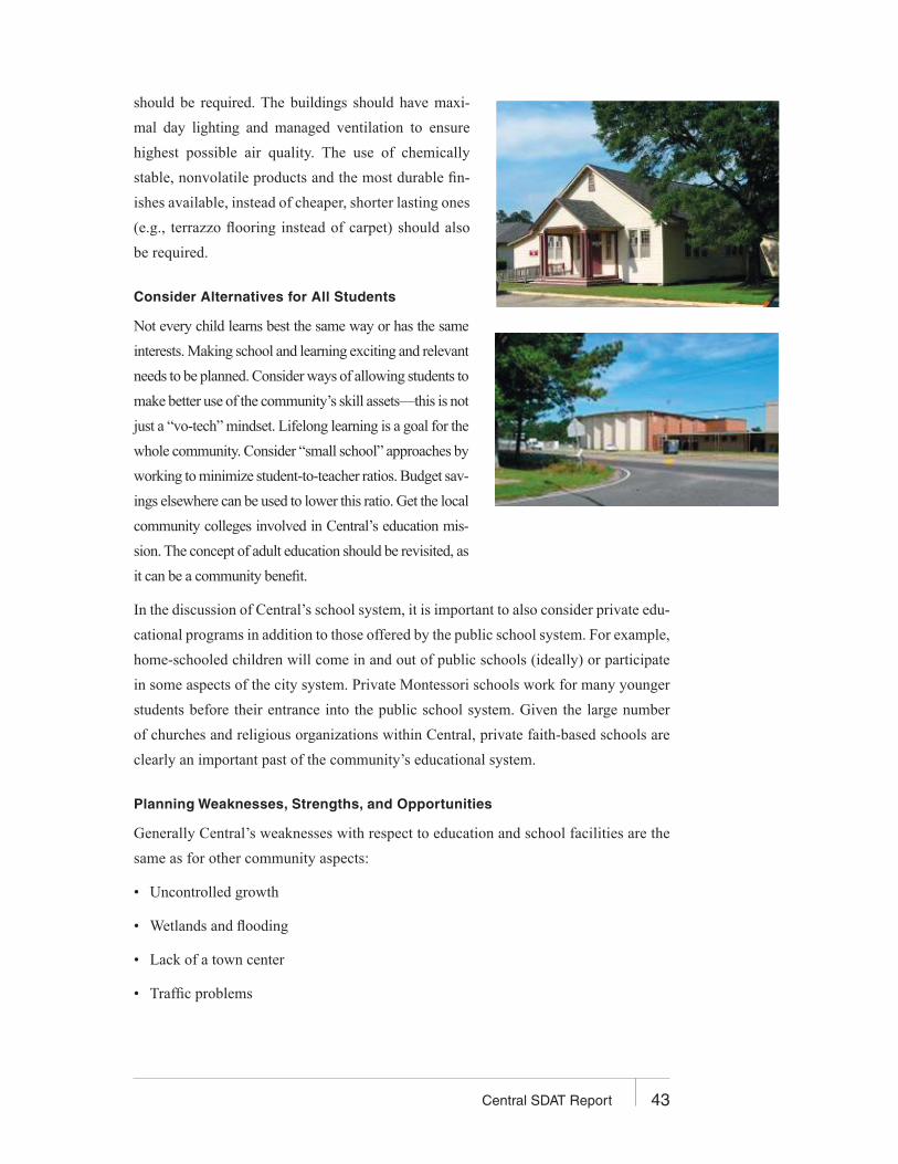
43Central SDAT Report
should be required. The buildings should have maxi-
mal day lighting and managed ventilation to ensure
highest possible air quality. The use of chemically
stable, nonvolatile products and the most durable fin-
ishes available, instead of cheaper, shorter lasting ones
(e.g., terrazzo flooring instead of carpet) should also
be required.
Consider Alternatives for All Students
Not every child learns best the same way or has the same
interests. Making school and learning exciting and relevant
needs to be planned. Consider ways of allowing students to
make better use of the community’s skill assets—this is not
just a “vo-tech” mindset. Lifelong learning is a goal for the
whole community. Consider “small school” approaches by
working to minimize student-to-teacher ratios. Budget sav-
ings elsewhere can be used to lower this ratio. Get the local
community colleges involved in Central’s education mis-
sion. The concept of adult education should be revisited, as
it can be a community benefit.
In the discussion of Central’s school system, it is important to also consider private edu-
cational programs in addition to those offered by the public school system. For example,
home-schooled children will come in and out of public schools (ideally) or participate
in some aspects of the city system. Private Montessori schools work for many younger
students before their entrance into the public school system. Given the large number
of churches and religious organizations within Central, private faith-based schools are
clearly an important past of the community’s educational system.
Planning Weaknesses, Strengths, and Opportunities
Generally Central’s weaknesses with respect to education and school facilities are the
same as for other community aspects:
• Uncontrolled growth
• Wetlands and flooding
• Lack of a town center
• Traffic problems

44 Central SDAT Report
On the other hand, Central can boast the following significant strengths as it approaches
education and school facility planning needs:
• A clean planning slate
• Historically great schools
• New control of local destiny
• Rural orientation, available land
• Active stakeholders
• Natural resources
• Excellent Louisiana planning resources
The Central school system also has great opportuni-
ties for a synergy with Central’s community needs:
• A new Central high school near a designated
town center
• A chance to capitalize on existing city excitement
over high school sports and performing arts
• Stadium and planned “tailgating” facility
• New school location
• More Little League (baseball) fields
• Performing arts center/community theater
• An auditorium for town hall meetings
• Opportunities for ecology-related programs
(i.e., green roofs, eco-agriculture, and nature
trails (for biology and science classes)
How Schools Affect Demographics and the Tax Base
Good schools attract young families to a community but the cost of educating children
can exceed the additional taxes new young residents pay. As a result, there can be a dis-
connect between the needs of the older citizens and the needs of young families, with
older citizens faced with increased taxes to accommodate the needs of a growing school
system while simultaneously facing a paucity of the resources they need to remain within
the community (i.e., plan to site nursing homes, hospitals and clinics, and assisted living
facilities). Facilities for older citizens that help diversify the local economy and create
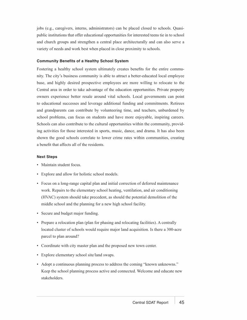
45Central SDAT Report
jobs (e.g., caregivers, interns, administrators) can be placed closed to schools. Quasi-
public institutions that offer educational opportunities for interested teens tie in to school
and church groups and strengthen a central place architecturally and can also serve a
variety of needs and work best when placed in close proximity to schools.
Community Benefits of a Healthy School System
Fostering a healthy school system ultimately creates benefits for the entire commu-
nity. The city’s business community is able to attract a better-educated local employee
base, and highly desired prospective employees are more willing to relocate to the
Central area in order to take advantage of the education opportunities. Private property
owners experience better resale around vital schools. Local governments can point
to educational successes and leverage additional funding and commitments. Retirees
and grandparents can contribute by volunteering time, and teachers, unburdened by
school problems, can focus on students and have more enjoyable, inspiring careers.
Schools can also contribute to the cultural opportunities within the community, provid-
ing activities for those interested in sports, music, dance, and drama. It has also been
shown the good schools correlate to lower crime rates within communities, creating
a benefit that affects all of the residents.
Next Steps
• Maintain student focus.
• Explore and allow for holistic school models.
• Focus on a long-range capital plan and initial correction of deferred maintenance
work. Repairs to the elementary school heating, ventilation, and air conditioning
(HVAC) system should take precedent, as should the potential demolition of the
middle school and the planning for a new high school facility.
• Secure and budget major funding.
• Prepare a relocation plan (plan for phasing and relocating facilities). A centrally
located cluster of schools would require major land acquisition. Is there a 300-acre
parcel to plan around?
• Coordinate with city master plan and the proposed new town center.
• Explore elementary school site/land swaps.
• Adopt a continuous planning process to address the coming “known unknowns.”
Keep the school planning process active and connected. Welcome and educate new
stakeholders.
46 Central SDAT Report
COMMUNITY LIVABILITY AND SUSTAINABILITY
The Sanctuary: Central’s Sense of Place
Central is just beginning to write its history but the collective will that drove residents
to begin anew runs deep. Creating the elusive yet unmistakable Central style will be
something that evolves organically over time.
The first act as a community is to define and cel-
ebrate boundaries. Central’s advantage is the fact
that it already has some natural gateways. Part
of creating a sense of place is differentiating one
place from another. Subtle yet discernable clues
throughout Central will reinforce for residents and
visitors what the community values. These could be as simple as street signs with
the Central crest on them, lighting, street furniture, trash and recycling receptacles,
planters at gateways and downtown, sidewalk paving, benches, trees, signage on busi-
nesses, or a series of pubic spaces. Just as a speed limit sign tells drivers to adjust
accordingly, so clues will remind people they are somewhere special, whether they live
in Central or are just visiting. Those clues will also affect how the city presents itself
and say something about the community to newcomers and visitors. With time this will
become part of Central’s vernacular.
It goes without saying that Central would greatly benefit by incorporating the AIA’s 10
principles for livable communities in the comprehensive plan and all design standards:
1. Design on a human scale
2. Provide choices for all residents
3. Encourage mixed-use development
4. Create and preserve the urban and village center
5. Vary transportation options
6. Build vibrant public spaces
7. Create neighborhood identities
8. Protect environmental resources
9. Conserve the natural landscape
10. Support, as a community, the value and importance of design
“People cannot maintain their spiritual roots and
their connections to the past if the physical
world they live in does not also sustain these
roots.”
Christopher Alexander, Pattern Language
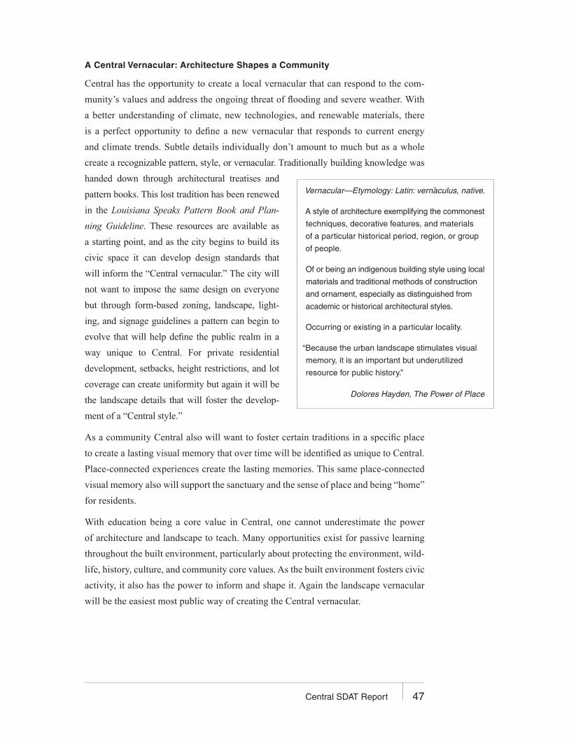
47Central SDAT Report
A Central Vernacular: Architecture Shapes a Community
Central has the opportunity to create a local vernacular that can respond to the com-
munity’s values and address the ongoing threat of flooding and severe weather. With
a better understanding of climate, new technologies, and renewable materials, there
is a perfect opportunity to define a new vernacular that responds to current energy
and climate trends. Subtle details individually don’t amount to much but as a whole
create a recognizable pattern, style, or vernacular. Traditionally building knowledge was
handed down through architectural treatises and
pattern books. This lost tradition has been renewed
in the Louisiana Speaks Pattern Book and Plan-
ning Guideline. These resources are available as
a starting point, and as the city begins to build its
civic space it can develop design standards that
will inform the “Central vernacular.” The city will
not want to impose the same design on everyone
but through form-based zoning, landscape, light-
ing, and signage guidelines a pattern can begin to
evolve that will help define the public realm in a
way unique to Central. For private residential
development, setbacks, height restrictions, and lot
coverage can create uniformity but again it will be
the landscape details that will foster the develop-
ment of a “Central style.”
As a community Central also will want to foster certain traditions in a specific place
to create a lasting visual memory that over time will be identified as unique to Central.
Place-connected experiences create the lasting memories. This same place-connected
visual memory also will support the sanctuary and the sense of place and being “home”
for residents.
With education being a core value in Central, one cannot underestimate the power
of architecture and landscape to teach. Many opportunities exist for passive learning
throughout the built environment, particularly about protecting the environment, wild-
life, history, culture, and community core values. As the built environment fosters civic
activity, it also has the power to inform and shape it. Again the landscape vernacular
will be the easiest most public way of creating the Central vernacular.
Vernacular—Etymology: Latin: vernaculus, native.
A style of architecture exemplifying the commonest
techniques, decorative features, and materials
of a particular historical period, region, or group
of people.
Of or being an indigenous building style using local
materials and traditional methods of construction
and ornament, especially as distinguished from
academic or historical architectural styles.
Occurring or existing in a particular locality.
“Because the urban landscape stimulates visual
memory, it is an important but underutilized
resource for public history.”
Dolores Hayden, The Power of Place

48 Central SDAT Report
Housing Affordability—Alternatives for All Ages
An important priority for the city should be to ensure there is a variety of housing types,
with opportunities for singles, couples, families with children, and group households.
As a policy, be certain to accommodate all ages, from infants to the very old; inde-
pendent to infirm. Set the scale to meet the needs
of each age group and make certain that each age
group can easily and spontaneously interact on a
regular basis. Each neighborhood should include
a well-mixed variety of people. Adopting this
vision will also keep Central more affordable for
all. Many successful alternative home ownership
models, such as cohousing and in-law apartments, can provide affordable housing for
nontraditional households. These models will need to be included in the city’s bylaws
and design standards. Broadening the population base can reduce the burden on schools
and provide a more socially sustainable community.
Passive Survivability
Global warming is changing the face of weather, and although Central is inland from
the coast it is still subject to the whims of Mother Nature. Increased development will
only exacerbate the situation as larger areas are built up, reducing the region’s overall
capacity to absorb stormwater. Central’s strong desire for quality and durability can be
translated into communitywide support of a green building policy for all public con-
struction. Taking green building one step further to include off-grid alternative energy
supplies would provide an invaluable service for the community during emergency
situations, specifically for fire, police, and emergency shelters. Green building strate-
gies can also be another aspect of Central’s vernacular.
Economic Development
As Central grows over time it will feel the fiscal pressures common to most cities.
Within a sustainable framework the city can implement specific growth policies that
support economic development without compromising the quality of life cherished by
the community. Economically, less can be more. The growing desire for the benefits
of economic sustainability around the country has created a shift in thinking in many
communities, which most developers can support. Any growth should continually bal-
ance the need for fiscal solvency with the need for a strong civic center and vibrant
neighborhoods.
“A simple social intercourse created when people
rub shoulders in public is one of the most essen-
tial kinds of social ‘glue’ in society.”
Christopher Alexander, A Pattern Language

49Central SDAT Report
Effective and proven sustainable approaches to economic development include the follow-
ing regulatory and market-based tools:
• Solid zoning and comprehensive land-use planning bylaws and design guidelines
that support Central’s vision and provide developers with a clear road map to
project approval. These by-laws also should incorporate smart-growth strategies.
• Environmental protection and greenway zone development guidelines. Incorporate
flood mitigation guidelines in all bylaws that include stormwater swales, increased
tree planting, and reduced impermeable surfaces. (See details in Natural Resources.)
• Private-sector involvement in public-private partnerships. This includes partnership
development and market-based tax incentives.
• Economic incentives that encourage growth and development that is consistent with
the city’s overall sustainable vision for its future.
• Green building programs can support Central’s desire for sustainability and provide
an extra level of survivability during storms. All public buildings should embrace
passive climate control as well as alternative energy back-up power. The city should
require underground utilities in the downtown center and all new development
throughout the community.
• Local commerce is supported through mixed-use zoning and design guidelines.
Village centers and downtown business districts are conducive to small locally
owned businesses. Signage and lighting in design guidelines should give equal
visibility to small-scale and large-scale businesses.
• Creation of an eco-industrial park as an opportunity zone within a city. This could
be coupled with a model vocational learning program for area students and craftsmen.
50 Central SDAT Report
MOVING FORWARD
The SDAT process has confirmed an existing consensus of core values that define
Central and a set of priorities for residents as their city begins to take shape. Central
is about education but, above all, it is about people and the care and respect they have
for each other.
All cities start as towns and grow organically one step at a
time. Civic leaders should not be afraid to put the brakes
on when needed; and should be selective and regularly
reconfirm the roots of the city’s core values and vision.
What are the city’s essential values and how do they trans-
late into the built environment and sense of place? How
does the built environment continue to support and foster
those values for all citizens of Central? It is important to
create and acknowledge a visible history of Central; that is
the glue that will bind citizens to the city over time. The continued presence in the built
environment of the city’s core values will assist in its future development.
Think Regionally, Act Locally
Central should partner with other cities and towns in the region to work as a region and avoid
unnecessary duplication of larger-scale services, while maintaining each city’s individual
identity. The city should work with parish and state government to control traffic and road-
way development to protect the city’s core and the vitality of Central’s neighborhoods. As
the East Baton Rouge Area Chamber moves ahead with its 2007 agenda, Central must stay
connected as a key player in the region, especially in regard to
• Student achievement in public schools
• Regional workforce solutions
• State transportation funding
• Small business resource center
• Business recruitment
“Vision is not seeing things as they are
but as they will be.”
Anonymous
“Without common land no social system
can survive.”
Christopher Alexander,
The Pattern Language

51Central SDAT Report
Complete the Comprehensive Plan
• Plan for the future in a big way and set aside public land now for future neighborhood
schools, public parks, and civic space. This will be a critical tool in maintaining the
country feel for future generations.
• Envision a walkable downtown commercial core and a civic center with tree-lined
boulevards and a vibrant mix of activities.
• Plan for connected greenways and set aside land for community-supported agriculture.
Develop Zoning Ordinances and Design Standards
The necessity of these bylaws cannot be underestimated. Once a road is in place or
building is built, its permanence is virtually insurmountable. A community should not be
afraid to support growth it wants, or to say no to growth that does not meet its goals.
Cultivate the “Central Vernacular”
The most beloved areas of Central are defined by tree-lined streets and shady wooded areas.
Trees take a long time to grow. Tree planting is one of the most accessible character-defining
activities the citizens of Central can undertake now for future generations. An annual Greening
Central event would be an excellent way to landscape the vast stretches of open roadways and
create a living history that connects residents to their civic space. A specially planted tree is
always remembered, often through generations. Just as Central Cooks has become a hallmark
event, this too can become part of the city’s collective history.
Central will face many challenges in the coming months and years as it begins to give form
to its vision in the comprehensive plan and development of bylaws. The start of the new
school year for the newly formed Central School District will also bring its challenges.
The not-in-my-backyard syndrome, the “tragedy of the commons,” and transboundary
impacts are all threats to local sustainability that could emerge in Central’s future.
All of the topics addressed in this report are interdependent in their impact on Central’s
future and interconnected in their solutions. For Central to move ahead with its vision,
it will need to continue taking action in a bold way. Cultivating “sustainable thinking”
will be critical to long-term success. Some aspects of strategic sustainable thinking

52 Central SDAT Report
have been embraced by leaders and citizens in other towns and cities. Taken as a whole
these have proven very successful in communities around the globe:
• Challenge conventional thinking and practice. Don’t be afraid to think outside
of the box; don’t feel the need to always stay inside the lines.
• Consider the community’s long-and short-term well-being when making decisions
or plans. They are equally important.
• When making decisions about core issues think strategically, think sustainably.
• Always consider the interdependent nature of problems and their solutions.
• Proceed cautiously with all decisions and be prepared for surprises. Things are not
always as simple as they appear.
• Limits and constraints can provide limitless creative innovation and solutions.
• The means and the ends are forcibly interconnected and neither should compromise
each other or the bigger picture.
• Central’s view of sustainability will be a reflection of its own needs as well as
a more global universal goal.
• Sustainability is an open-ended proposition, ever evolving and adaptable to the
situation at hand.
The SDAT hopes this report will assist Central in fulfilling its new potential as a city.
Cities are born of a deep humanity and desire for civic intercourse. Current trends can
easily efface the humanity of a city as it loses sight of its roots with often mechanized
responses to pragmatic needs and fiscal responsibilities. It is our hope the Central spirit
will remain true to its core values over time and resist those pressures that can so easily
erode foundations or vision.

The American Institute of Architects
Center for Communities by Design
1735 New York Avenue NW
Washington, D.C. 20006-5292
www.aia.org