Carlton in Lindrick - Bassetlaw District Council · Carlton in Lindrick CA Extension: Designation...
2
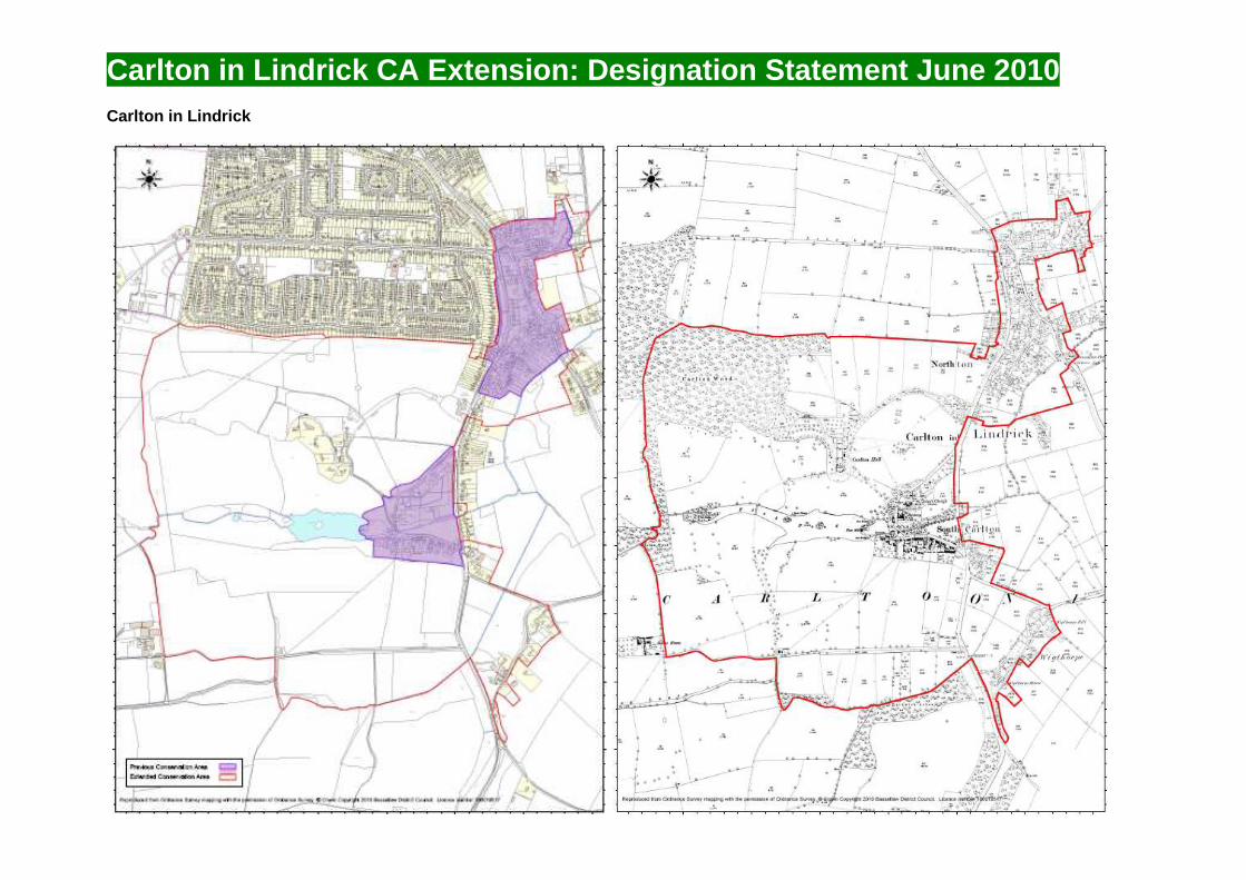
Carlton in Lindrick CA Extension: Designation Statement June 2010 Carlton in Lindrick
Transcript of Carlton in Lindrick - Bassetlaw District Council · Carlton in Lindrick CA Extension: Designation...
Carlton in Lindrick CA Extension: Designation Statement June 2010
Carlton in Lindrick

Carlton in Lindrick CA Extension: Designation Statement June 2010
Enclosure map for Carlton and Wigthorpe from the late 18th century (source: Notts County Archives, 2010).
Left: remnants of Carlton Hall, which was demolished in the 1950s, including former outbuildings and parkland. Top: Toll Bar Cottage, a local interest building on the Carlton Road at Wigthorpe (source: BDC, 2010).
Carlton in Lindrick
Carlton in Lindrick lies approximately 3 miles to the north of Worksop Town Centre (1.5 miles from the modern Worksop suburb of Gateford) and previously contained two separate conservation areas designated in July 1973 (South Carlton) and June 1979 (North Carlton). These Conservation Areas were drawn tightly around the main built forms of the respective townships. The wider landscape is dominated by the historic development and influence of large halls/estates at South Carlton, Wigthorpe, Gateford, Wallingwells and Hodsock (North Carlton may also have had such a hall in the Saxon/early Medieval period although no evidence of this remains).
To the south of South Carlton is Wigthorpe, a small hamlet of 9-10 residences and associated outbuildings/farm buildings, including 2 Grade II listed buildings and 4 local interest buildings. It is also likely that the Grade II listed Wigthorpe Hall (the home of Robert Ramsden from the 1870s) is built on the site of one of the 6 halls within ‘Carletone’ mentioned in Domesday. To the west of Wigthorpe is a Scheduled Monument (classed as a deserted medieval village). Wigthorpe is therefore currently only half its previous size.
To the west of South Carlton is situated the parkland and former outbuildings to Carlton Hall, an early 17th Century Hunting Lodge built by the influential Clifton family (Sir Gervaise Clifton was the High Sheriff of Nottinghamshire on several occasions). Although the main part of the house was demolished in the 1950s, most of the parkland (including the
lake, lawns, trees and trackways), numerous outbuildings and lodge house still survive. The Ramsden family occupied the Hall during the 18th and 19th Centuries.
Between South and North Carlton is an area which includes the 1830s Grade II listed school built by Robert Ramsden (owner of Carlton Hall at the time and who was later made High Sheriff of Nottinghamshire), the grade II listed former junior school and school house (now private residences), the former police house and the current post office. To the west of Ramsden School, a burial ground for the Plymouth Brethren (Robert Ramsden was one such follower) still survives intact, connected to Carlton Hall by a tree-lined avenue.
At North Carlton around The Green, allotments that were allocated following the enclosure act of 1767 are still in use today. Several cottages dating to the time of the Enclosure Act also still exist outside the current Conservation Area.
In addition to the above areas, Archaeological features are clearly visible in fields to the west of Tinkers Hill adjoining the Caudle Dyke. Ridge and furrow ploughing and building platforms have been identified by the County Council’s Archaeology Team. The ridge and furrow in particular is rare this close to the settlement (ridge and furrow usually only survives away from built up areas). Evidence also exists of a water meadow approximately 150m to the east of the former infant school.
The amalgamation of north and south areas, as well as extensions to include Wigthorpe and the parkland to the west formerly of Carlton Hall are considered to protect areas considered to be of special architectural or historic interest.