CARIBE WAVE 2017 Volume 2 Final Report · PDF fileCARIBE WAVE 2017 Volume 2 Final Report . 1...
26
Limited distribution ICG/CARIBE EWS- Prov. June 2017 English only INTERGOVERNMENTAL OCEANOGRAPHIC COMMISSION (of UNESCO) CARIBE WAVE 2017 Volume 2 Final Report
-
Upload
truongliem -
Category
Documents
-
view
215 -
download
3
Transcript of CARIBE WAVE 2017 Volume 2 Final Report · PDF fileCARIBE WAVE 2017 Volume 2 Final Report . 1...
Limited distribution
ICG/CARIBE EWS- Prov. June 2017
English only
INTERGOVERNMENTAL OCEANOGRAPHIC COMMISSION
(of UNESCO)
CARIBE WAVE 2017
Volume 2 Final Report
1
Table of Contents Summary 2
1. Background 4
2. Exercise Concept 7
2.1 Purpose 7
2.2 Objectives 7
2.3 Type of Exercises 8
3. Exercise Outline 10
3.1 General 10
3.2 Master Schedule (Exercise Script) 12
3.3 Actions in the Case of a Real Event, and False Alarms 13
3.5 Registrations Procedure 13
3.6 Status of Sea Level Stations during Exercise 18
3.7 Tsunami forecasting using Tweb 20
3.8 Resources 21
3.9 Media Arrangements 21
4. Post-Exercise Evaluation 23
5. References 24
Appendix A. List of Acronyms 25
2
Summary
Around three quarters of a million people from Bermuda thru Brazil and across the entire
Caribbean basin participated in the CARIBE WAVE 17 tsunami exercise held on March 21,
2017. This represents an increase of 125% from 2016 (342,000 participants). This level of
participation makes CARIBE WAVE exercise again the largest international tsunami drill in the
world. The participants in the sixth annual regional exercise hailed from 32 nations and 15
territories* of the UNESCO Intergovernmental Coordination Group for Tsunamis and other
Coastal Hazards for the Caribbean and Adjacent Regions (CARIBE EWS).
Registered participants included designated CARIBE EWS Tsunami Warning Focal
Points (TWFPs) and National Tsunami Warning Centers (NTWCs), as well as emergency and
preparedness organizations, K-12 Schools, government agencies, colleges and universities,
healthcare and hotels, critical facilities, among others.
Each country chose one of the three CARIBE WAVE 2017 scenarios: Costa Rica, Cuba
or Northern Lesser Antilles. Over 65 simulated international and domestic messages were
disseminated by the Pacific Tsunami Warning Center (PTWC).
Sirens, emails, emergency alert systems, text messages, media outlets, NOAA weather
radio, and social media were used for local dissemination. In addition to the communication
tests, exercises were conducted at various levels of magnitude and sophistication including
seminars, tabletop exercises, video/web conferencing, drills and full scale exercises as for the
French Antilles with mobilization of aid forces from Europe.
Thru the exercise it has been possible to validate the issuance of tsunami products from
the PTWC, the receipt and dissemination of tsunami products within the countries,
familiarization with the PTWC messages and the readiness of the Caribbean and Adjacent
Regions to respond to a tsunami.
Planning for CARIBE WAVE 17 has taken over a year and was coordinated by a task
team led by Lt. Col. Patrick Tyburn of France and facilitated by the US NWS Caribbean

3
Tsunami Warning Program. TsunamiZone.org was used for the registration of the participants.
Information and supporting documents were and will remain posted on http://caribewave.info.
The exercise was conducted under the framework of the CARIBE EWS which was established
by UNESCO IOC in 2006 after the devastating Indian Ocean Tsunami and the recognition of the
high tsunami threat in the Caribbean.
_____________________________________________________________________________
* Antigua and Barbuda, Aruba, Bahamas, Barbados, Belize, Brazil, Colombia, Costa Rica, Cuba, Curacao, Dominica, Dominican
Republic, France (Martinique, Guadeloupe, St. Barthelemy, St. Martin), Grenada, Guatemala, Guyana, Haiti, Honduras, Jamaica,
Mexico, Netherlands (Bonaire, Saba and Sint Eustatius), Nicaragua, Panama, Saint Kitts and Nevis, Saint Lucia, Saint Vincent
and the Grenadines, Sint Maarten, Suriname, Trinidad and Tobago, United Kingdom (Anguilla, British Virgin Islands, Bermuda,
Cayman Islands, Montserrat and Turks and Caicos), United States (Puerto Rico and the US Virgin Islands) and Venezuela
(Bolivarian Republic of).
4
1. Background
The UNESCO IOC Intergovernmental Coordination Group for the Tsunami and Other
Coastal Hazards Warning System for the Caribbean and Adjacent Regions at its eighth session
(ICG/CARIBE EWS-VIII, Port of Spain, Trinidad and Tobago, 29 April - 1 May 2013), decided
to conduct exercises named CARIBE WAVE on an annual basis leaving each Member State to
define its level of participation. At its Eleventh Session in Cartagena de Indias, Colombia, 5-7
April 2016, the ICG/CARIBE-EWS, recommended that Exercise CARIBE WAVE 17 take place
on 21 March 2017, with three hypothetical tsunami scenarios generated by earthquakes: off the
Caribbean coast of Costa Rica (Plafker and Ward, 1992), off the southeastern coast of Cuba
(Calais and Lepinay, 1991), and East of the Northeastern Lesser Antilles (Hayes et al., 2013).
Historical tsunami records from sources such as the National Oceanic and Atmospheric
Administration’s (NOAA) Centers for Environmental Information (NCEI) show that 4,400
people have been killed as a result of almost 75 tsunamis have been observed in the Caribbean.
Potential sources for tsunamis in the region include faults, steep slopes offshore, subaerial and
submarine volcanoes. The region east of the Azores Islands and portions of the continental slope
off the US and Canadian coast are particularly vulnerable to subsea landslides, which could also
reach the Caribbean and Adjacent Regions.
Recognizing the need for an early warning system especially after the lessons learned
from the 2004 Indian Ocean tsunami, the Intergovernmental Coordination Group for the
Tsunami and other Coastal Hazards Warning System for the Caribbean and Adjacent Regions
(ICG/CARIBE EWS) was established in 2005 as a subsidiary body of the IOC-UNESCO with
the purpose of providing assistance to all Member States of the region to establish their own
early warning system. The main objective of the CARIBE EWS is to identify and mitigate the
hazards posed by local, regional and distant tsunamis. The ultimate goal is to create a fully
integrated end-to-end warning system comprising four key components: monitoring and
detection systems, hazard assessment, tsunami related services (dissemination), and community

5
preparedness, readiness and resilience.
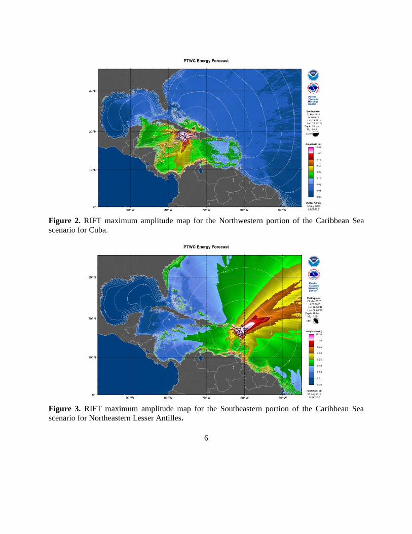
The 2017 exercise provided simulated threat tsunami messages from the PTWC triggered
by three hypothetical earthquakes: a 7.9 Mw with an epicentre at 9.37°N, 82.54°W, off the
Caribbean coast of Costa Rica (Fig. 1), in the southern Caribbean Sea, a 8.2 Mw with an
epicentre at 19.625°N, 76.35°W, off the southeastern coast of Cuba (Fig. 2), in the northwestern
portion of the Caribbean Sea, and a 8.5 Mw with an epicentre at 16.96°N, 60.69°W, East of the
Northeastern Lesser Antille (Fig. 3). The three scenarios were based on referenced events, which
occurred on April 22, 1991, February 11, 1775, and February 8, 1843 (www.ngdc.noaa.gov/)
respectively.
At the national level, each member state was responsible for defining its level of
participation, which could include issuing warnings or other alerts to its own citizens. These
alerts could be based either on the TWFP’s own analysis of the situation or the messages and/or
graphical products received from the PTWC.
Figure 1. RIFT maximum amplitude map for the Southern Caribbean Sea based on the scenario
for Costa Rica.
6
Figure 2. RIFT maximum amplitude map for the Northwestern portion of the Caribbean Sea
scenario for Cuba.
Figure 3. RIFT maximum amplitude map for the Southeastern portion of the Caribbean Sea
scenario for Northeastern Lesser Antilles.

7
2. Exercise Concept
2.1 Purpose
The purpose of the exercise was to improve Tsunami Warning System effectiveness
along the Caribbean coasts. The exercise provided an opportunity for emergency management
organizations (EMOs) throughout the region to exercise their operational lines of
communications, review their tsunami response procedures, and promote tsunami preparedness.
Regular exercising of response plans is critical to maintain readiness for an emergency. This is
particularly true for the Caribbean and Adjacent regions, where tsunamis are infrequent but can
be of very high impact. Every emergency management organization was encouraged to
participate.
2.2 Objectives
Each organization was asked to develop their objectives for the exercise. However, there
were three principal overarching objectives. First, exercise and evaluate operations of the
CARIBE EWS Tsunami Warning Systems, specifically validate the issuance from the PTWC
and receipt of tsunami products by CARIBE EWS Tsunami Warning Focal Points (TWFPs)
and/or National Tsunami Warning Centers (NTWCs). Second, evaluate enhanced PTWC
products and to provide further feedback on the national procedures for implementation of these
products. Third, validate and improve the operational readiness of the TWFPs, and/or the
National Disaster Management Office (NDMO) to respond to a local/regional source tsunami,
before, during and after the exercise, to ensure that appropriate tools and response plan(s) have
been developed, including public education materials. Additionally, validate that the
dissemination of warnings and information/advice by TWFPs, and NTWCs, to relevant in-
country agencies and the public is accurate and timely. Also, validate the organisational
decision-making process (tsunami response plans) about public warnings and evacuations.
8
Likewise, evaluate the status of implementation of the Tsunami Ready program of the CARIBE
EWS.
2.3 Type of Exercises
The exercise was carried out such that communications and decision making at various
organizational levels were exercised and conducted without disrupting or alarming the general
public. A majority of National and local Offices of Emergency Management (OEM) extended
the exercise down to the level of testing local notification systems such as the Emergency Alert
System (EAS), sirens and loudspeakers.
According to the registrations and Member States reports, 747,326 people throughout the
Caribbean and Adjacent Regions participated in the exercise. This represents an increase of
125% participation from 2016 (332,814 participants), 2015 and 2014 (~191,000 participants) and
fifteen-fold increase (50,000 participants) since 2013 (IOC Caribe Wave 16, Volume 2: Final
Report, June 2016). This level of participation makes again the CARIBE WAVE exercise the
largest international tsunami drill in the world. The participants in the sixth annual regional
tsunami exercise hailed from 32 nations and 15 territories. It represented a participation rate of
100% of all the Member States of the UNESCO Intergovernmental Coordination Group for
Tsunamis and other Coastal Hazards for the Caribbean and Adjacent Regions (CARIBE EWS)
which provided the framework. Participants included all officially designated CARIBE EWS
Tsunami Warning Focal Points (TWFPs), International, State, Territorial and Local Emergency
Management Organizations, Schools and Universities, Governmental Agencies, Private
Organizations, Health Facilities, Members of the Media, as well as Communities, Individuals
and Families.
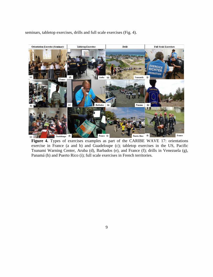
Exercises were conducted at various scales of magnitude and sophistication. Exercises
simulated the development, training, testing, and evaluation of Disaster Plans and Standard
Operating Procedures. The following types of exercises were reported to have been conducted:
9
seminars, tabletop exercises, drills and full scale exercises (Fig. 4).
Figure 4. Types of exercises examples as part of the CARIBE WAVE 17: orientations
exercise in France (a and b) and Guadeloupe (c); tabletop exercises in the US, Pacific
Tsunami Warning Center, Aruba (d), Barbados (e), and France (f); drills in Venezuela (g),
Panamá (h) and Puerto Rico (i); full scale exercises in French territories.
10
3. Exercise Outline
3.1 General
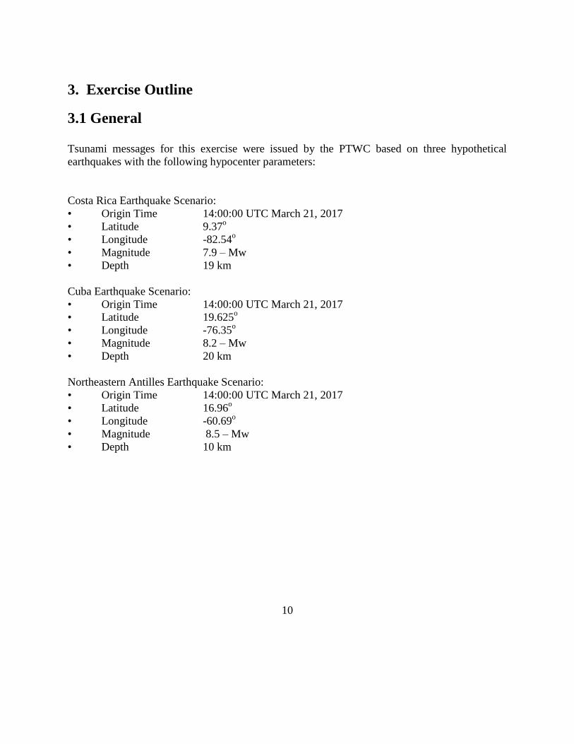
Tsunami messages for this exercise were issued by the PTWC based on three hypothetical
earthquakes with the following hypocenter parameters:
Costa Rica Earthquake Scenario:
• Origin Time 14:00:00 UTC March 21, 2017
• Latitude 9.37o
• Longitude -82.54o
• Magnitude 7.9 – Mw
• Depth 19 km
Cuba Earthquake Scenario:
• Origin Time 14:00:00 UTC March 21, 2017
• Latitude 19.625o
• Longitude -76.35o
• Magnitude 8.2 – Mw
• Depth 20 km
Northeastern Antilles Earthquake Scenario:
• Origin Time 14:00:00 UTC March 21, 2017
• Latitude 16.96o
• Longitude -60.69o
• Magnitude 8.5 – Mw
• Depth 10 km
11
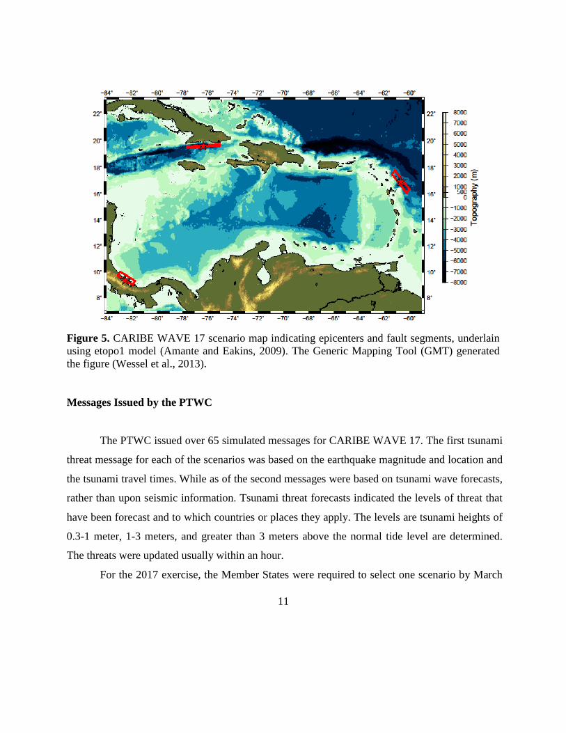
Figure 5. CARIBE WAVE 17 scenario map indicating epicenters and fault segments, underlain
using etopo1 model (Amante and Eakins, 2009). The Generic Mapping Tool (GMT) generated
the figure (Wessel et al., 2013).
Messages Issued by the PTWC
The PTWC issued over 65 simulated messages for CARIBE WAVE 17. The first tsunami
threat message for each of the scenarios was based on the earthquake magnitude and location and
the tsunami travel times. While as of the second messages were based on tsunami wave forecasts,
rather than upon seismic information. Tsunami threat forecasts indicated the levels of threat that
have been forecast and to which countries or places they apply. The levels are tsunami heights of
0.3-1 meter, 1-3 meters, and greater than 3 meters above the normal tide level are determined.
The threats were updated usually within an hour.
For the 2017 exercise, the Member States were required to select one scenario by March
12
10, 2017, and those who did not select any scenario, got messages for the scenario that the Caribe
Wave organizers selected for them. For the exercise, only the TWPFs/ NTWCs received the
simulated products for the chosen scenario. All simulated products (text and graphical) were
disseminated through email to the corresponding TWFPs and NTWCs. Further dissemination was
the responsibility of the corresponding national and local authorities.
The PTWC also issued live over all standard broadcast channels (WMO/AWIPS IDs
WECA41 PHEB/TSUCAX) the initial dummy message to start the exercise at 1400 UTC on
March 21, 2017.
3.2 Master Schedule (Exercise Script)
The initial dummy message for the three scenarios was issued by the CARIBE EWS
Tsunami Service Provider (PTWC) on March 21, 2017 at 1400 UTC. This was to test
communications with TWFPs and NTWCs, and to start the exercise. The transmission methods
used to send the dummy message were GTS - WIS (WMO Information System), EMWIN,
AISR, NWWS, Email, Fax and AWIPS (Advanced Weather Interactive Processing System),
using header IDs WECA41 PHEB/TSUCA. All simulated products (text and graphical) were
disseminated only thru email to TWFPs and NTWCs. Seven threat messages were issued for
Costa Rica scenario and nine threat messages were issued each for the Cuba and Northeastern
Lesser Antilles scenarios. The graphic enhanced products were included in the second threat
message. The TWFPs reportedly used a variety of methods to receive the Dummy message, with
Fax and Email being the most common (Fig. 6).

13
Figure 6. Methods that the CARIBE EWS TWFPs/NTWCs used to receive the Dummy message
by the PTWC.
3.3 Actions in the Case of a Real Event, and False Alarms
No significant real events and false alarms were reported by the Member States and
Territories during the exercise. No actions were thus required.
3.5 Registrations Procedure
As for the 2016 exercise, the CARIBE EWS teamed up with TsunamiZone.org for online
registration. The link used for the registration was http://www.tsunamizone.org/register/. Under
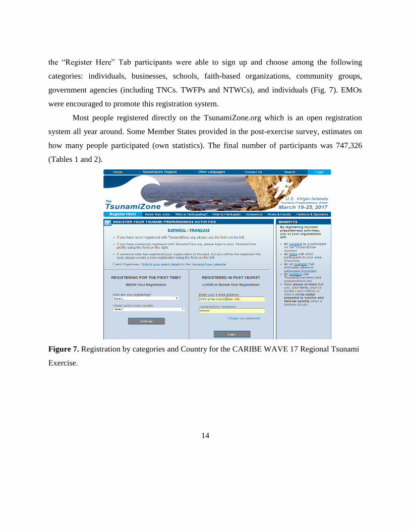
14
the “Register Here” Tab participants were able to sign up and choose among the following
categories: individuals, businesses, schools, faith-based organizations, community groups,
government agencies (including TNCs. TWFPs and NTWCs), and individuals (Fig. 7). EMOs
were encouraged to promote this registration system.
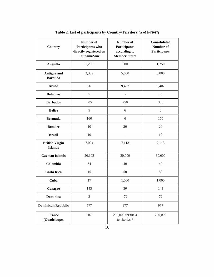
Most people registered directly on the TsunamiZone.org which is an open registration
system all year around. Some Member States provided in the post-exercise survey, estimates on
how many people participated (own statistics). The final number of participants was 747,326
(Tables 1 and 2).
Figure 7. Registration by categories and Country for the CARIBE WAVE 17 Regional Tsunami
Exercise.

15
Table 1. List of registrants and participants by Categories on TsunamiZone.org (as of 5/2/2017)
Category Number of Participants
Individuals/Families 1,181
Childcare and Pre-Schools 4,523
K-12 Schools and Districts 133,520
Colleges and Universities 42,855
Government* 231,548
Businesses 1,415
Hotels and Other Lodgings 443
Healthcare 5,818
Senior Facilities/Communities 170
Disability/AFN Organizations 306
Non-Profit Organizations 2,023
Neighborhood Groups 53
Preparedness Organizations 25,617
Faith-based Organizations 14,060
Museums, Libraries, Parks, etc. 70
Volunteer/Service Clubs 801
Youth Organizations 0
Volunteer Radio Groups 343
Science/Engineering Organizations 387
Media Organizations 35
Other 5,130
Total 470,298
*This includes TWFPs and TNCs
16
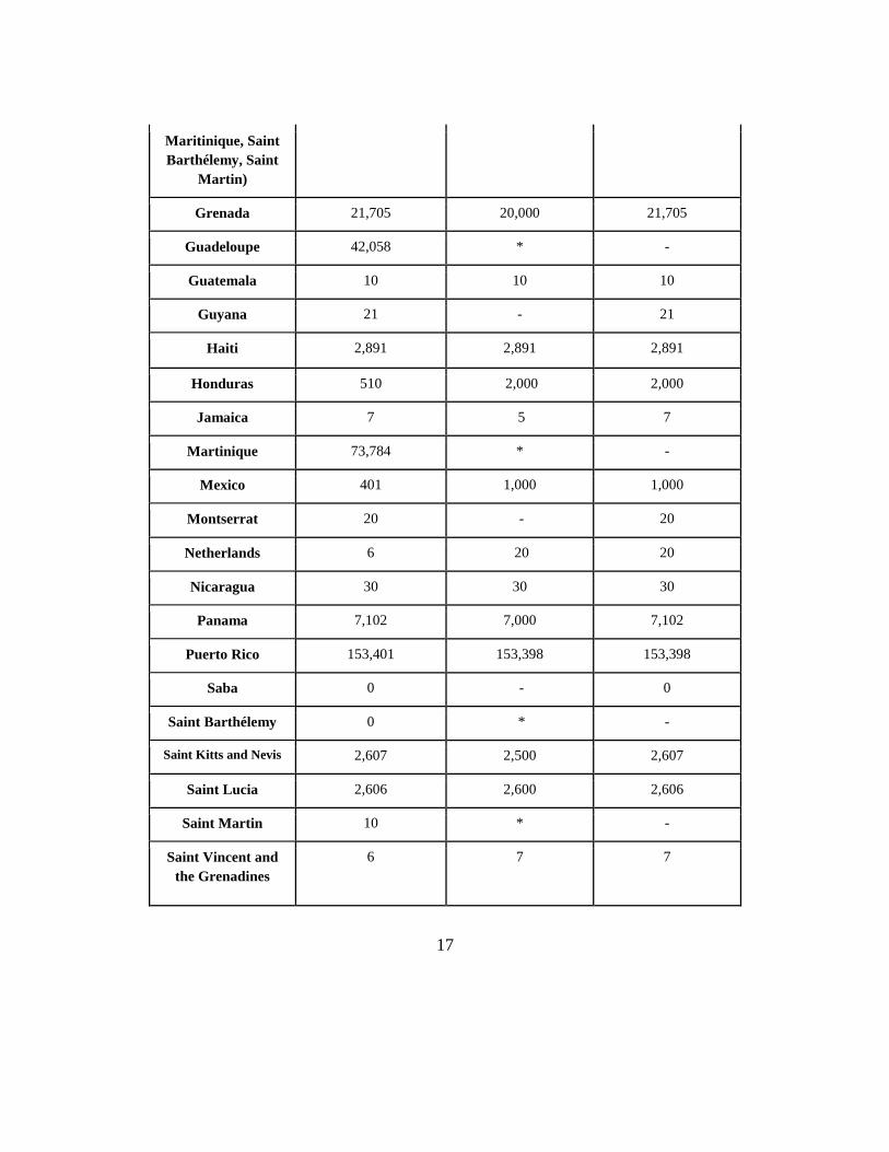
Table 2. List of participants by Country/Territory (as of 5/4/2017)
Country
Number of
Participants who
directly registered on
TsunamiZone
Number of
Participants
according to
Member States
Consolidated
Number of
Participants
Anguilla 1,250 600 1,250
Antigua and
Barbuda
3,392 5,000 5,000
Aruba 26 9,407 9,407
Bahamas 5 - 5
Barbados 305 250 305
Belize 5 6 6
Bermuda 160 6 160
Bonaire 10 20 20
Brazil 10 - 10
British Virgin
Islands
7,024 7,113 7,113
Cayman Islands 20,102 30,000 30,000
Colombia 34 40 40
Costa Rica 15 50 50
Cuba 17 1,000 1,000
Curaçao 143 30 143
Dominica 2 72 72
Dominican Republic 577 977 977
France
(Guadeloupe,
16 200,000 for the 4
territories *
200,000
17
Maritinique, Saint
Barthélemy, Saint
Martin)
Grenada 21,705 20,000 21,705
Guadeloupe 42,058 * -
Guatemala 10 10 10
Guyana 21 - 21
Haiti 2,891 2,891 2,891
Honduras 510 2,000 2,000
Jamaica 7 5 7
Martinique 73,784 * -
Mexico 401 1,000 1,000
Montserrat 20 - 20
Netherlands 6 20 20
Nicaragua 30 30 30
Panama 7,102 7,000 7,102
Puerto Rico 153,401 153,398 153,398
Saba 0 - 0
Saint Barthélemy 0 * -
Saint Kitts and Nevis 2,607 2,500 2,607
Saint Lucia 2,606 2,600 2,606
Saint Martin 10 * -
Saint Vincent and
the Grenadines
6 7 7

18
St Eustatius 20 - 20
Sint Maarten 500 1,900 1,900
Suriname 20 - 20
Trinidad and
Tobago
11,234 11,100 11,234
Turks and Caicos 35 35 35
U.S. Virgin Islands 2,135 2,135 2,135
Venezuela 116,086 283,000 283,000
TOTAL 470,298 743,602 747,326
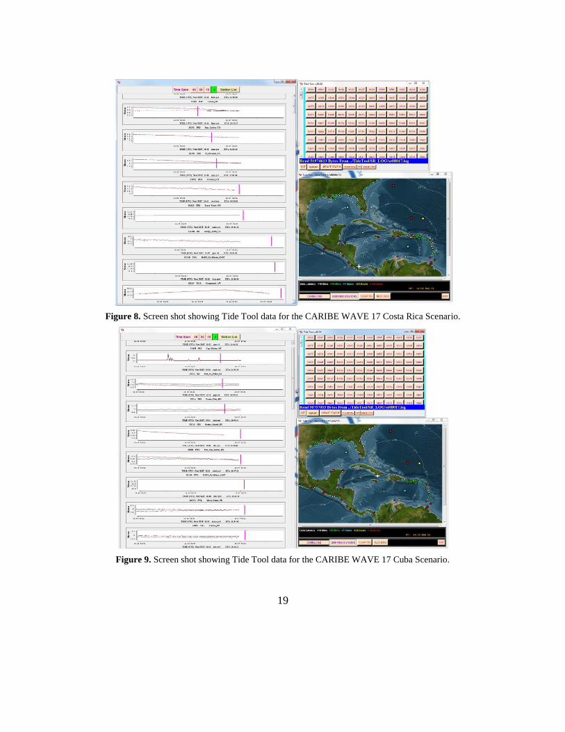
3.6 Status of Sea Level Stations during Exercise
A full analysis of sea level status was completed by the CTWP as part of the CARIBE
WAVE 17 Regional Tsunami Exercise. This analysis permitted the evaluation of sea level data
that would have been available in the case of a real event at the time of the exercise. The PTWC
provided forecasted maximum wave heights for a number of stations in the simulated bulletins,
45 for Costa Rica, 68 for Cuba, and 81 for Northeastern Lesser Antilles. Of these, 47 (55%) were
reporting to the IOC Sea Level facility during the exercise time frame. In the case of Tide Tool
(Fig. 8, 9 and 10), 45 out of 83 stations had data available. Of the 17 stations that should be
available on the NOAA Tides and Currents for the Caribe/Central America, 9 stations (62%) had
data. In the case of the DART, 6 of 7 in the Caribbean/Gulf and Atlantic had data streaming thru
the National Buoy Center. A complete summary for the stations’ sea level data availability can
be found in the Supplement.
19
Figure 8. Screen shot showing Tide Tool data for the CARIBE WAVE 17 Costa Rica Scenario.
Figure 9. Screen shot showing Tide Tool data for the CARIBE WAVE 17 Cuba Scenario.
20
Figure 10. Screen shot showing Tide Tool data for the CARIBE WAVE 17 Northeastern Lesser Antilles Scenario.
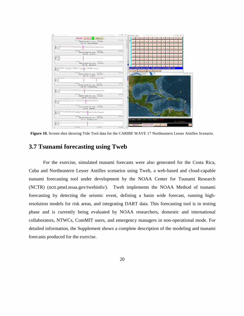
3.7 Tsunami forecasting using Tweb
For the exercise, simulated tsunami forecasts were also generated for the Costa Rica,
Cuba and Northeastern Lesser Antilles scenarios using Tweb, a web-based and cloud-capable
tsunami forecasting tool under development by the NOAA Center for Tsunami Research
(NCTR) (nctr.pmel.noaa.gov/twebinfo/). Tweb implements the NOAA Method of tsunami
forecasting by detecting the seismic event, defining a basin wide forecast, running high-
resolution models for risk areas, and integrating DART data. This forecasting tool is in testing
phase and is currently being evaluated by NOAA researchers, domestic and international
collaborators, NTWCs, ComMIT users, and emergency managers in non-operational mode. For
detailed information, the Supplement shows a complete description of the modeling and tsunami
forecasts produced for the exercise.

21
3.8 Resources
Although EMOs had notice of the exercise and some elected to set up a special dedicated
shift to allow normal core business to continue uninterrupted, it was requested that realistic
resource levels be deployed in order to reflect some of the issues that are likely to be faced in a
real event. This year the exercise chair was Patrick Tyburn; while Silvia Chacón and Natalia
Zamora (Costa Rica), Bladimir Moreno (Cuba), and Valerie Clouard (Northeastern Lesser
Antilles) were the scientific experts that helped in the determination of the scenarios for the
exercise. The CTWP coordinated the exercise for CARIBE EWS.
3.9 Media Arrangements
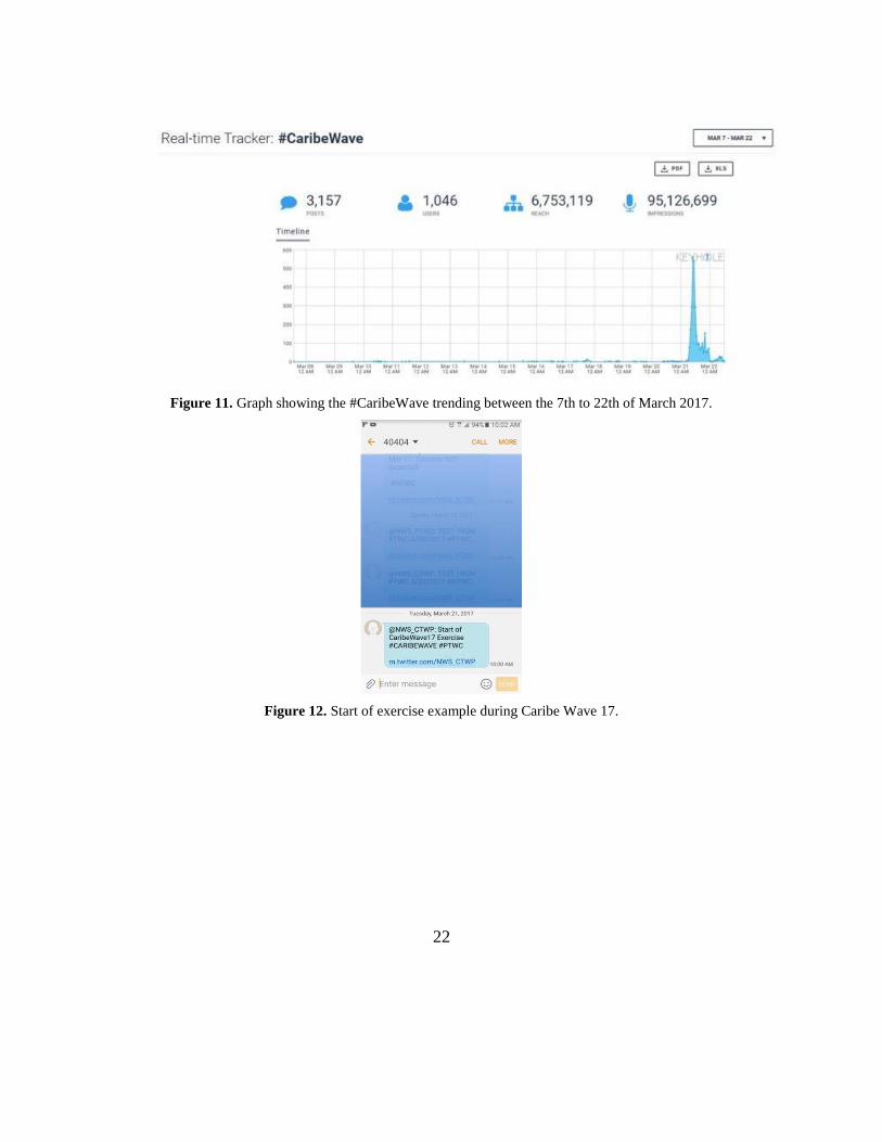
One advantage in conducting exercises is that it provides a venue to promote awareness
of the exercise topic. The exercise offered an opportunity to partner with the media and
disseminate more broadly information on the warning system. Fifty eight percent of the
CARIBE EWS Member States and Territories indicated that the news media participated
and covered the exercise. Exercise messages were disseminated and community participation
was also encouraged through social media outlets such as Facebook and Twitter. The hashtag
#CaribeWave was suggested to be used by participants. Hashtracking services indicated
#CaribeWave had 3,157 tweets the month of March with a peak during the exercise (Fig. 11).
During the exercise, users with US carrier providers received Tweets as text messages (Fig. 12).
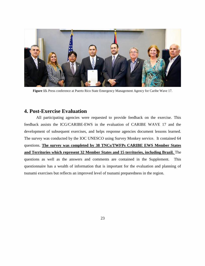
News of press releases (Fig. 13) and media outputs can be found in the IOC Caribe Wave 17,
Volume 3: Media Report, May 2017.
22
Figure 11. Graph showing the #CaribeWave trending between the 7th to 22th of March 2017.
Figure 12. Start of exercise example during Caribe Wave 17.
23
Figure 13. Press conference at Puerto Rico State Emergency Management Agency for Caribe Wave 17.
4. Post-Exercise Evaluation All participating agencies were requested to provide feedback on the exercise. This
feedback assists the ICG/CARIBE-EWS in the evaluation of CARIBE WAVE 17 and the
development of subsequent exercises, and helps response agencies document lessons learned.
The survey was conducted by the IOC UNESCO using Survey Monkey service. It contained 64
questions. The survey was completed by 38 TNCs/TWFPs CARIBE EWS Member States
and Territories which represent 32 Member States and 15 territories, including Brazil. The
questions as well as the answers and comments are contained in the Supplement. This
questionnaire has a wealth of information that is important for the evaluation and planning of
tsunami exercises but reflects an improved level of tsunami preparedness in the region.
24
5. References
1. Amante, C. and Eakins, B. W., 2009, ETOPO1 1 Arc-Minute Global Relief Model:
Procedures, Data Sources and Analysis: NOAA Technical Memorandum NESDIS NGDC-24, p.
19.
2. Calais, E., and de Lepinay, B. M., 1991, From transtension to transpression along the
northern Caribbean plate boundary off Cuba: implications for the Recent motion of the Caribbean
plate: Tectonophysics, v. 186, no. 3, p. 329-350.
3. Hayes, G. P., McNamara, D. E., Seidman, L., and Roger, J., 2013, Quantifying potential
earthquake and tsunami hazard in the Lesser Antilles subduction zone of the Caribbean region:
Geophysical Journal International, v. 196, no. 1, p. 510-521.
4. Intergovernmental Oceanographic Commission, Exercise Caribe Wave 16, A Caribbean
and Adjacent Regions Tsunami Warning Exercise, Volume 2: Final Report, June 2016.
5. Intergovernmental Oceanographic Commission, Exercise Caribe Wave 17, A Caribbean
and Adjacent Regions Tsunami Warning Exercise, April 2017, Volume 3: Media Report.
6. National Centers for Environmental Information, accessed September 22, 2015
http://www.ngdc.noaa.gov/hazard/tsu_db.shtml.
7. Plafker, G. and Ward, S.N., 1992. Backarc thrust faulting and tectonic uplift along the
Caribbean Sea coast during the April 22, 1991 Costa Rica earthquake. Tectonics, 11(4), p. 709–
718.
8. Wessel, P., W. H. F. Smith, R. Scharroo, J. F. Luis, and F. Wobbe, 2013, Generic
Mapping Tools: Improved version released, EOS Trans. AGU, 94, p. 409-410.

25
Appendix A. List of Acronyms
Acronym Definition ATFM Alaska Tsunami Forecast Model AWIPS Advanced Weather Interactive Processing System CDEMA Caribbean Emergency Management Agency CEPREDENAC Centro de Coordinación para la Prevención de los Desastres Naturales en América
Central CTWP US National Weather Service Caribbean Tsunami Warning Program EAS Emergency Alert System EMO Emergency Management Organization EMWIN Emergency Management Weather Information Network FUNVISIS Fundación Venezolana de Investigaciones Sismológicas GTS Global Telecommunication System ICG CARIBE
EWS Intergovernmental Coordination Group for the Tsunamis and Other Coastal Hazards
Warning System for the Caribbean and Adjacent Regions INETER Instituto Nicaragüense de Estudios Territoriales IOC Intergovernmental Oceanographic Commission NGDC National Geophysical Data Center (renamed to National Centers for Environmental
Information - NCEI) NOAA National Oceanic and Atmospheric Administration NTWC US National Tsunami Warning Center (renamed from West Coast and Alaska
Tsunami Warning Center on Oct. 1, 2013) NTHMP National Tsunami Hazard Mitigation Program NWS National Weather Service PRSN Puerto Rico Seismic Network PTWC Pacific Tsunami Warning Center RIFT Rapid Inundation and Forecasting of Tsunamis TIB Tsunami Information Bulletin TWC Tsunami Warning Center TWFP Tsunami Warning Forecast/Focal Point
UNESCO United National Educational, Scientific, and Cultural Organization
WC/ATWC West Coast and Alaska Tsunami Warning Center (renamed to NTWC on Oct. 1,
2013) WFO Weather Forecast Office
WMO World Meteorological Organization