Cameroon - Transport Sector Support Programme - … · They cover a surface area of 28,995 km ²...
19
PROJECT: TRANSPORT SECTOR SUPPORT PROGRAMME PHASE 1: BATSCHENGA-NTUI–YOKO ROAD IMPROVEMENT PROJECT COUNTRY: REPUBLIC OF CAMEROON SUMMARY OF THE COMPREHENSIVE RESETTLEMENT PLAN (CRP) Project Team Team Members Joseph Kouassi N’GUESSAN, Chief Transport Engineer OITC.1/CMFO Jean-Pierre KALALA, Chief Socio-economist OITC.1/CDFO Modeste KINANE, Senior Environmentalist ONEC.3 Jean Paterne MEGNE EKOGA, Transport Economist OITC.1 J. BISSAKONOU, Socio-economist OSHD.2/CMFO Samuel MBA, Transport Engineer OITC.1 José Yaovi Didier TONATO, Chief Urban Development Specialist OITC.0 Pierre Hassan SANON, Consulting Socio- economist, ONEC.3 Sector Division Manager J.K. KABANGUKA OITC.1 Sector Director A. OUMAROU OITC Regional Director M. KANGA ORCE
-
Upload
truongdien -
Category
Documents
-
view
213 -
download
0
Transcript of Cameroon - Transport Sector Support Programme - … · They cover a surface area of 28,995 km ²...

PROJECT: TRANSPORT SECTOR SUPPORT PROGRAMME
PHASE 1: BATSCHENGA-NTUI–YOKO ROAD IMPROVEMENT PROJECT
COUNTRY: REPUBLIC OF CAMEROON
SUMMARY OF THE COMPREHENSIVE RESETTLEMENT PLAN (CRP)
Project Team
Team Members
Joseph Kouassi N’GUESSAN, Chief Transport
Engineer OITC.1/CMFO
Jean-Pierre KALALA, Chief Socio-economist OITC.1/CDFO
Modeste KINANE, Senior Environmentalist ONEC.3
Jean Paterne MEGNE EKOGA, Transport
Economist OITC.1
J. BISSAKONOU, Socio-economist OSHD.2/CMFO
Samuel MBA, Transport Engineer OITC.1
José Yaovi Didier TONATO, Chief Urban
Development Specialist OITC.0
Pierre Hassan SANON, Consulting Socio-
economist, ONEC.3
Sector Division
Manager J.K. KABANGUKA OITC.1
Sector Director A. OUMAROU OITC
Regional Director M. KANGA ORCE

1
SUMMARY OF THE COMPREHENSIVE RESETTLEMENT PLAN (CRP)
Project Name: Transport Sector Support Programme - Phase 1:
Batschenga-Ntui-Yoko Road Improvement
Project No.: P-CM-DB0-012
Country : Cameroon
Department : OITC Division: OITC-1
INTRODUCTION
At the request of Cameroonian authorities, the African Development Bank will support the
implementation of the “Transport Sector Support Programme,” Phase 1 of which consists in
constructing the 200.4-km-long Batschenga-Ntui-Yoko road.
From an environmental and social perspective, the project is classified in Category 1, taking
into consideration the nature of the works to be carried out, the size and scale of the project,
and its potential direct and indirect impacts.
The implementation of the Batschenga-Ntui-Yoko road construction project requires
expropriation for reasons of public interest buildings, lands, crops and trees along the road
right-of-way (road and easements). It will also affect the livelihoods of people leaving in the
right of way. In accordance with the policy of the African Development Bank on Involuntary
Resettlement, the Government of Cameroon should develop a Comprehensive Resettlement
Plan (CRP) for the compensation and resettlement of Project Affected Persons (PAPs). This
Plan aims to: (i) minimize involuntary displacement as much as possible; (ii) avoid, as far as
possible, the destruction of property; and (iii) compensate affected persons for the loss of
residential plots, farmlands, buildings and equipment, as well as loss of income.
This document summarizes the Comprehensive Resettlement Plan (CRP). It also defines the
principles and arrangements for implementing measures designed to compensate and resettle
project affected persons, and establish an approximate budget and an indicative timetable for
its implementation.
1. PROGRAMME DESCRIPTION AND RATIONALE, PROGRAMME AREA AND
PROGRAMME IMPACT AREA
1.1 Project Description and Rationale
As part of its strategy to strengthen its national road network, the Government of Cameroon intends to
develop the approximately 595-km-long Batschenga-Ntui-Yoko-Tibati-Ngaoundéré road in 3 phases.
Phase 1 covers the section between Batschenga-Ntui-Yoko, with a total length of 203.7 km; Phase 2
covers the stretch between Yoko-Doumé Tibati, with a total length of about 180 km; Phase 3 covers
section between Tibati-Mambal-Lewa-Ngaoundere, with a total length of about 214 km.
Phase 1 of this important programme will focus on the construction of the 200.4-km-long Batschenga-
Ntui-Yoko road, including the construction of the bridge on River Sanaga at Nachtigal. The overall
objective of Phase 1 is to contribute to the expansion and modernization of the road network with a
view to supporting economic diversification in Cameroon. The specific objectives are to: (i) improve
the conditions for the transport and movement of goods and persons in Batschenga-Ntui-Yoko to
enable the development and exploitation of the potential of the grand Mbam-Sanaga agricultural basin;
and (ii) strengthen the governance of the sector.

2
The project consists of the following components:
No. Component Name and
Amount in UA Million
Description
A
ROAD WORKS
(218.511)
A.1- Development of the approximately 200.7-km-long Batschenga-Yoko road, with a
7-metre-wide carriageway, coated with a 5-cm-thick layer of bituminous concrete +
Construction of a 400-metre-long double girder bridge on River Sanaga;
A.2 - Actions and measures for mitigating adverse impacts on the environment;
A.3 – Awareness-raising concerning environmental protection, road safety, prevention
of AIDS, sexually transmitted diseases and malaria; and
A.4 - Control and supervision of road works.
B
ANCILLARY
DEVELOPMENT WORKS
(10.12)
B.1- Development of 120 km of rural roads;
B.2 – Development of 15 km of urban roads;
B.3.- Rehabilitation of socio-economic infrastructure (warehouses, health centres,
classrooms, security fencing around schools, youth development centre);
B.3- Support for women-specific and entrepreneurial activities; and
B.4 – Control and supervision of ancillary works.
C
URBAN DEVELOPMENT
(2.40)
C.1- Formulation of the national urban development programme;
C.2- Feasibility study for the establishment of urban planning agencies;
C.3- Development/update of urban planning documents (+POS + PIP + PEP); and
C.4-Support for the re-organization and building of the institutional and technical
capacity of municipal services.
D
ROAD SECTOR
INSTITUTIONAL SUPPORT
(1.22)
D.1- Preparation of a priority programme for the development and security of transport
infrastructure in Cameroon, in line with the 2035 vision;
D.2- Support for road maintenance mechanisms through a review of weighing stations
and the axle-load control system existing in Cameroon;
D.3- Organizational and skills audit of the AfDB – WB Unit; and
D.4- Strategic Social and Environmental Assessment.
E
PROJECT MANAGEMENT
(1.11)
D.1- Support of the functioning of the Road Project Monitoring Coordination Unit;
D.2 - Monitoring and evaluation of socio-economic and environmental impacts;
D.3- Accounting and financial audit of the project; and
D.4- Technical audit of the project.
The Batchenga - Ntui - Yoko road project has been divided into four (4) separate lots as follow:
Lot I: Batschenga - Natchinga - Ntui (24.8 km) including the bridge over the River Sanaga.
Lot II: Ntui-Nguila - Mankin (96.8 km)
Lot III: Mankin - Mangai - Yoko (82.1 km)
Lot IV: Ancillary works.
Costing a total of UA 233.351 million, the project will be co-financed by the Government of
Cameroon, the African Development Bank (AfDB) and the Development Bank of Central African
States (BDEAC). The French Development Agency (AFD) will finance the construction of the bridge
on the Sanaga.
1.2 Main characteristics of the direct and extended project impact areas
Geographic and administrative situation
The project covers the Lekié Division with headquarters at Monatélé and the Mbam-et-Kim Division
whose headquarters is Ntui. The two divisions belong to the Centre Region whose headquarters is
Yaoundé. They cover a surface area of 28,995 km ².

3

4
Demography
According to the figures for 2012, the direct impact area (Lékié and Mbam-et-Kim/Batschenga, Ntui
and Yoko Divisions) has a population of 489 000, representing an average density of 14.46 inhabitants
per km². These aggregate data conceal a wide disparity between the Lékié Division, which is densely
populated, and the sparsely populated Mbam-et-Kim Division.
Spanning the territory of the Centre and Adamawa Regions, the extended project impact area is home
to a population estimated in 2010 at 4.4 million inhabitants, or 22.6% of Cameroon’s population, and
covers an area of 131 000 km², corresponding to 27% of the country’s surface area. The population of
the Centre Region is 75% urban, ranking the region second in the country after the Littoral. As for the
Adamawa Region, 60% of its population lived in rural areas in 2010, depending mostly on the primary
sector.
The population of the area is very young: nearly 41% of the inhabitants are under 14 and 49% are aged
between 15 and 49.
The direct project impact area is home to a multitude of indigenous peoples on account of its
geographical location at the crossroads of cultures and traditions. The area is inhabited by the Eton, the
Peul (Fulbe), the Mboum, the Gbaya, the Douro Us, the Koutine, Baboute, Nyem-Nyem, the Tikar,
etc.
This population is predominantly Christian (Catholics, Protestants, Evangelicals, Lutherans, Seventh
Day Adventists, Gallicans, Jehovah's Witnesses and members of the Full Gospel Mission) from
Batschenga up to Tibati, but from Tibati Muslims are in the majority including the Hausa, Fulani and
the Fulbe.
Access to basic infrastructure and services
The situation in terms of access to basic infrastructure and social services in the project area cause for
concern, as shown by the following presentation:
Drinking water: in the project area, the number of infrastructure remains inadequate
and, overall, the water flow is extremely low due either to the drying-up of surface
water bodies in the dry season or lack of maintenance. It is important to note that in
several villages many of the existing boreholes are out of order and the inhabitants are
without water, especially in the villages after Yoko where water is increasingly scarce.
Access to clean water remains a major problem even in the best-supplied urban
centres, especially as the boreholes that should have mitigated this problem have never
been fully operational.
Electricity: in the project area, electricity connection is uneven although there is a
medium-voltage line between Batschenga and Ntui. The unavailability of medium-to-
low voltage transformers accounts for the lack of electricity in the villages. Other
urban areas within the project area are supplied electricity by ACTIS-Sonel, which
operates thermal power plants.
Education: In Batchenga, there are ten primary schools and one secondary school.
Many people wish the opening of a technical college as well as private schools. In
Ntui, there are 19 public schools, two high schools (one general education and one
technical) and a general education teachers training college (ENIEG). Most teachers
serving in these institutions are resident in Yaoundé and shuttle between their place of
residence and their place of work. Due to the poor state of National Road 15 (RN15)
and the malfunction of the ferry, means of transport is scare and costs have escalated.
This has led to irregular appearance of teachers in classrooms. In the Yoko Commune,
there four full cycle French-language primary schools, two of which are public
schools and two denominational schools, as well as two kindergartens.

5
Health: the project area is covered by two district hospitals (HD) (Ntui and Yoko),
integrated health centres (CSI), a number of sub-divisional healthcare centres (CMA)
and urban dispensaries. In Batchenga there are three health centers. The area covered
by the “Batschenga” Project also runs from the Mbam River where filariasis is
endemic. The most widespread type of filariasis is Onchocerciasis or river blindness,
caused by Onchocerca volvula.
On these aspects, people interviewed did not fail to emphasize the unpleasantness of everyday life:
difficult access to drinking water, frequent power cuts, bad roads, lack of jobs for young people. The
land issue is a recurring concern.
Organization and management of local affairs
The inhabitants of the project area are organized in villages and cantons. Each village is headed by a
village chief ranking as third-degree chief. Several villages make up a canton headed by a second-
degree chief. The land belongs to the community (clan). Land occupation is the most common mode
of property access. Tenure is characterized by the coexistence of the traditional or “customary” and
“modern” tenure systems. Property rights are governed by the 1972 Constitution, as amended in 1996,
which establishes the basic principles for the protection of individual rights, including property rights.
Socio-economic activities
In the project area, agriculture is the mainstay of the population. The inhabitants practise the slash-
and-burn shifting cultivation method without fertilizer. Polycropping is the most widespread farming
system. Agricultural tools remain rudimentary and labour is provided essentially by the family. The
most important crops, by commune, are:
Batschenga Commune: Agriculture is by far the main activity in this area. Agricultural
production is diversify, including tubers such as cassava, yams and a wide range of
vegetables;
Ntui Commune: cocoa is the most important crop (60.26%) and food crops include
amaranth and black nightshade (20.51%), cassava (12.82%), maize (1.28%) and fruits
and various vegetables (5.13%); and
Yoko Commune: vegetables and fruits are the most important crops (29.08%),
followed by cocoa (21.28%) and cassava (27.66%), black nightshade, amaranth and
other minor vegetables (12.77%), and maize (9.22%).
Food processing is performed by most households since it adds value to food products. The processing
activity is focused on cassava which farmers transform into more conservable cassava chips or flour
(lasting up to one year). Fishing is practised in the Sanaga and Afamba rivers, as well as in other rivers
and swamps, some of which are far from the villages. Fish commonly caught are: carp, silure,
snakefish, threadfin, red-tail fish, catfish and studfish. Sometimes the catch includes crustaceans such
as crabs. Logging remains the main industrial activity in the project area. This is attributable to the
huge forest potential of the Centre Region (40% of the surface area is covered by forest). In addition to
these activities, it is worth noting that there is a small and medium-sized enterprise (SME) engaged in
sand extraction. Bauxite and sapphire exploitation projects are on-going
2. POTENTIAL IMPACTS
Given that the potential impacts on the human and the natural environment are presented in full in the
Environmental and Social Impact Assessment (ESIA), this section will deal with the impacts on the
human environment in terms of expropriation for the release of the right-of-way and works
implementation, while ensuring that the nuisance arising therefrom is reduced to the minimum.
Special attention will be paid to vulnerable people to ensure they their situation does not become more
precarious.
6
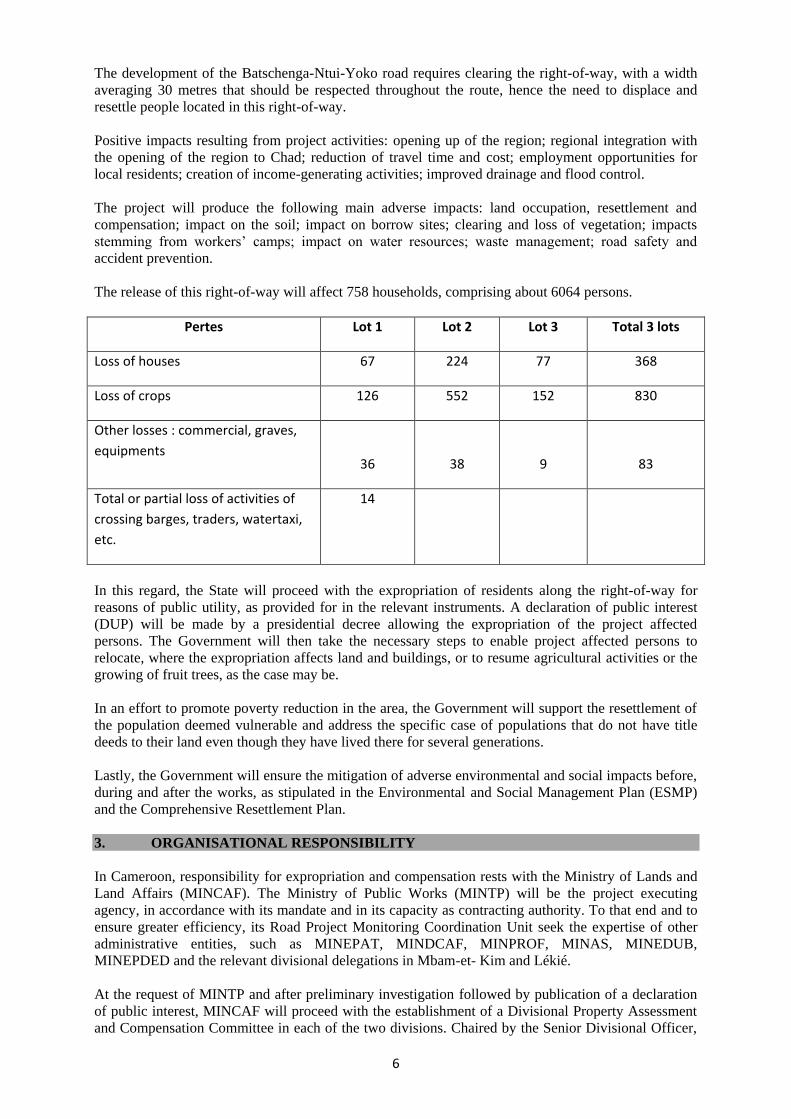
The development of the Batschenga-Ntui-Yoko road requires clearing the right-of-way, with a width
averaging 30 metres that should be respected throughout the route, hence the need to displace and
resettle people located in this right-of-way.
Positive impacts resulting from project activities: opening up of the region; regional integration with
the opening of the region to Chad; reduction of travel time and cost; employment opportunities for
local residents; creation of income-generating activities; improved drainage and flood control.
The project will produce the following main adverse impacts: land occupation, resettlement and
compensation; impact on the soil; impact on borrow sites; clearing and loss of vegetation; impacts
stemming from workers’ camps; impact on water resources; waste management; road safety and
accident prevention.
The release of this right-of-way will affect 758 households, comprising about 6064 persons.
Pertes Lot 1 Lot 2 Lot 3 Total 3 lots
Loss of houses 67 224 77 368
Loss of crops 126 552 152 830
Other losses : commercial, graves,
equipments
36
38
9
83
Total or partial loss of activities of
crossing barges, traders, watertaxi,
etc.
14
In this regard, the State will proceed with the expropriation of residents along the right-of-way for
reasons of public utility, as provided for in the relevant instruments. A declaration of public interest
(DUP) will be made by a presidential decree allowing the expropriation of the project affected
persons. The Government will then take the necessary steps to enable project affected persons to
relocate, where the expropriation affects land and buildings, or to resume agricultural activities or the
growing of fruit trees, as the case may be.
In an effort to promote poverty reduction in the area, the Government will support the resettlement of
the population deemed vulnerable and address the specific case of populations that do not have title
deeds to their land even though they have lived there for several generations.
Lastly, the Government will ensure the mitigation of adverse environmental and social impacts before,
during and after the works, as stipulated in the Environmental and Social Management Plan (ESMP)
and the Comprehensive Resettlement Plan.
3. ORGANISATIONAL RESPONSIBILITY
In Cameroon, responsibility for expropriation and compensation rests with the Ministry of Lands and
Land Affairs (MINCAF). The Ministry of Public Works (MINTP) will be the project executing
agency, in accordance with its mandate and in its capacity as contracting authority. To that end and to
ensure greater efficiency, its Road Project Monitoring Coordination Unit seek the expertise of other
administrative entities, such as MINEPAT, MINDCAF, MINPROF, MINAS, MINEDUB,
MINEPDED and the relevant divisional delegations in Mbam-et- Kim and Lékié.
At the request of MINTP and after preliminary investigation followed by publication of a declaration
of public interest, MINCAF will proceed with the establishment of a Divisional Property Assessment
and Compensation Committee in each of the two divisions. Chaired by the Senior Divisional Officer,

7
the Committee will comprise representatives of the land registry, energy and water, agriculture, and
roads services, as well as the relevant Member of Parliament, the Mayor and traditional authorities.
Locally, senior divisional officers will ensure the smooth conduct of the expropriation,
compensation and resettlement operation in conjunction with sub-divisional officers, mayors and
village chiefs of the communities crossed.
To ensure better ownership of the project and its facilities by the population living along the road, the
Government will promote the support of these inhabitants before, during and after the works through
information and awareness campaigns, and their involvement in the project. These initiatives could be
carried out by locally-based NGOs under the responsibility of the relevant divisional services.
Pursuant to the statutory provisions on expropriation (particularly Law No. 85-09 of 4 July
1985), the main stages for implementing the plan for the resettlement of project affected
persons are: ( i) the declaration of public interest; (ii) prior investigation; (iii) land-holding
investigation and assessment of the compensation value; (iv) compensation of affected
persons; (v) resettlement of expropriated persons on their new site; (vi) requisitioning of the
right-of-way; and (vii) monitoring of the CRP implementation.
Responsibility for implementing the CRP shall be assumed by the Cameroonian State,
particularly the Ministry of Public Works (MINTP), which must ensure compliance with the
relevant Bank rules, procedures and policies in force.
4. COMMUNITY PARTICIPATION
4.1 Public consultation
The population of the project area was informed at the preliminary design (APS) and detailed
engineering study (APD) phases of the project. At the preliminary design phase, consultation sessions
were held with the residents from February 17 to 1 March 2012 in 87 villages located in the direct
impact area of the road. Residents were briefed on the conduct of the stages of the project and the
consultant identified, in consultation with residents, local and regional authorities, a series of ancillary
development works that had been proposed to ensure that the project addresses the social demands of
the area.
During the APD phase and prior to holding public consultations, the delegation had a briefing meeting
with the senior divisional officers of the divisions affected by the project. Then consultations sessions
were held with the residents from 17 July to 29 July 2013, coupled with the drawing up of
expropriation inventories that lasted up to 4 August 2013.
Under the responsibility of senior divisional officers of the divisions affected by the project,
considering the people’s sensitivity about the loss of their property in some villages deemed "hesitant"
in consenting to the project, these awareness and information campaigns were chaired by sub-
divisional officers to ensure that the situation did not get out of hand. The meetings were attended by
local authorities, community leaders and representatives of various population groups comprising
representatives of women, farmers, herders and young people.
For the most part, these meetings took place in the village public square after the people had been
informed by the village chief. The meeting began with a presentation by the sub-divisional officer.
After stating the objectives of the public consultation, he introduced the project and its activities, and
then the consultant responsible for carrying out the study began the discussion by presenting to them
the plan of the project area. This plan uses colours and drawing to highlight the landmarks of the
various areas concerned, in such a manner as to facilitate understanding for a public that is non-literate
or not conversant with map reading. The fruitful and frank exchanges between the visiting team and
the people produced interesting outcomes.

8
The following table summarizes meetings held as part of the public consultations that preceded the
preparation of this Comprehensive Resettlement Plan.
Date of Meeting Venue of Public Consultation
17 July 2013 Meeting with the Senior Divisional Officer of Mbam-et- Kim at Ntui
18 July 2013 Meeting with the Sub-Divisional Officer of Ntui
20, 21 July 2013 Awareness and information sessions held between village chiefs and the Sub-
Divisional Officer of Ntui
27 July 2013 Meeting with the Sub-Divisional Officer of Yoko
27 July 2013 Meeting with the Deputy Mayor of Yoko
29 July 2013 Meeting with the First Deputy of the Senior Divisional Officer of Djerem at
Tibati
From 22 July to 4 August 2013 Inventories of the property and persons affected by the project
In addition, in accordance with the African Development Bank’s policy and the regulations of
Cameroon, ads were placed in the press.
Lastly, preference was given to the participatory approach during preparatory and appraisal
missions conducted by the African Development Bank in November 2013 and June 2014,
respectively.
4.2 Briefing of project affected persons
During the census conducted from July to August 2013, project affected persons (PAPs) were
identified and identification cards established. On this occasion, they were briefed on the current
compensation process.
The PAPs expressed concerns about the impacts of expropriations. Regarding the expropriation of
homes and businesses, the respondents said they wished to be relocated in the same village. Their
worry concerned the expropriation of farmland. They expressed fears that compensation from the State
would be inadequate or take too long to come, which would have an adverse impact on their income
and consequently their living standards.
It is noteworthy that as part of the Batschenga-Ntui-Yoko road construction project, a Consultation
and Dialogue Plan (PCD) will be developed and implemented to support the implementation of the
Comprehensive Resettlement Plan (CRP). This Plan provides for public consultation in two phases:
A phase of public consultation through plenary meetings; and
A phase of individual consultation forming part of the implementation of the CRP for
compensation.
The participatory approach will be used in order to involve all affected persons, including heads of
households, heads of businesses and landowners, as well as professional associations, civil society and
local authorities. These activities will take place along the road section.
The Consultation and Dialogue Plan (PCD) aims mainly to inform the people and involve them in the
implementation of the CRP and the Environmental and Social Management Plan (ESMP), in
accordance with national procedures and those of the AfDB on involuntary resettlement and
environmental and social assessment.
As part of the PCD implementation, two types of facilitation and support structures will be set up: the
Facilitation Committee (COFAC) and Local Committees (COLOC).
5. INTEGRATION WITHIN HOST COMMUNITIES
The persons affected by the project will not need to go far from their place of residence since land is
available; but will only need to move back. The low population density of the area guarantees the

9
availability of land. The administrative and traditional authorities have agreed to facilitate the
movement of the affected persons backwards, a little deeper into their land from the road’s statutory
right-of-way.
Therefore, there will be no problem of integration with host communities
6. SOCIO-ECONOMIC STUDIES
6.1 Characteristics of project affected persons
A total of 758 households affected by the project were identified, with a total population of 6064 individuals and an average size of about 8 persons per household. This households are generally
headed by a male, with only 10.5% that are head by a female (78 out of 758 households). This
significant proportion of displaced persons in the two communes is due to the narrow state of the road
and the high number of houses adjacent to it.
Results of the census can be presented as follow:
Lot Number of farmers partially
expropriated
Number of children below 15
Number of vulnerable people
Lot 1 126 268 18
Lot 2 552 896 46
Lot 3 152 308 18
Housing and rental situation of households: housing occupancy in the study area shows a high
majority of rural households in the project area; (85%) own their homes. Only 7% of them are tenants,
compared with 8% housed rent-free.
Housing type and building materials: in the project area, more than 75% of the homes are built in non-
durable materials (mud and sand: 51%; other materials: 25%) and 23% have a cement floor, while of
all the households surveyed, only 1% are built with modern materials and none of the respondent
households is tiled.
The survey also shows that a large majority of rural households in the project area have simple latrines
as toilets (84%), while 13% have improved latrines and only 2% have flush toilets. Therefore, the
sanitation situation in the area is very precarious.
Vulnerable households: the following main categories affected by the loss of their property are poor or
may become poor: physically or mentally disabled persons; sick people, especially people living with
HIV/AIDS or other serious or incurable diseases; senior citizens and elderly persons, especially when
they live alone; households headed by women; households headed by persons with little or no
resources; widows and orphans, etc.
At the time of implementation of the CRP, special steps must be taken to ensure that households
receive special assistance, namely: assistance during the compensation procedure (e.g., provide
additional explanations on the process, ensure that the documents are understood, accompany the
person to the bank to help cash the compensation check); assistance during the period following the
payment to ensure the security of the compensation; assistance during reconstruction: provision of a
bricklayer and materials, and even taking over the reconstruction, etc.; assistance during the period
following the resettlement; medical assistance, if necessary, at critical times, especially during the
relocation and the transition coming immediately after; assistance in filling out forms and other
documents; assistance in formulating petitions.
10
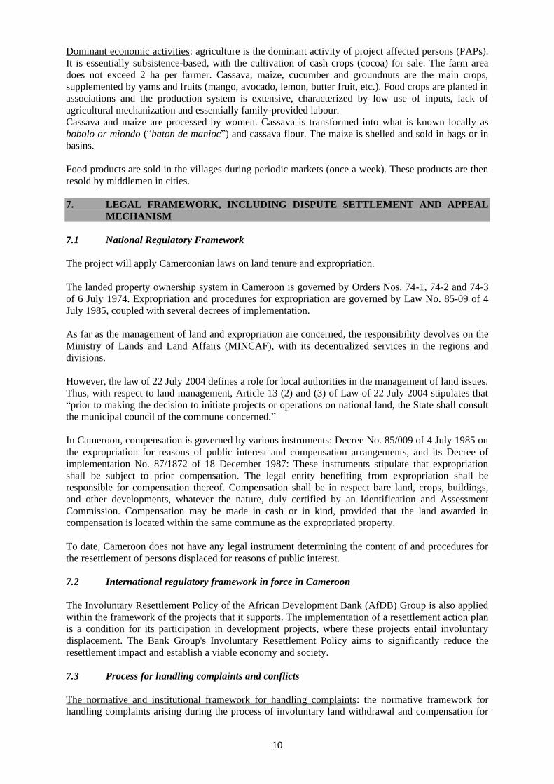
Dominant economic activities: agriculture is the dominant activity of project affected persons (PAPs).
It is essentially subsistence-based, with the cultivation of cash crops (cocoa) for sale. The farm area
does not exceed 2 ha per farmer. Cassava, maize, cucumber and groundnuts are the main crops,
supplemented by yams and fruits (mango, avocado, lemon, butter fruit, etc.). Food crops are planted in
associations and the production system is extensive, characterized by low use of inputs, lack of
agricultural mechanization and essentially family-provided labour.
Cassava and maize are processed by women. Cassava is transformed into what is known locally as
bobolo or miondo (“baton de manioc”) and cassava flour. The maize is shelled and sold in bags or in
basins.
Food products are sold in the villages during periodic markets (once a week). These products are then
resold by middlemen in cities.
7. LEGAL FRAMEWORK, INCLUDING DISPUTE SETTLEMENT AND APPEAL
MECHANISM
7.1 National Regulatory Framework
The project will apply Cameroonian laws on land tenure and expropriation.
The landed property ownership system in Cameroon is governed by Orders Nos. 74-1, 74-2 and 74-3
of 6 July 1974. Expropriation and procedures for expropriation are governed by Law No. 85-09 of 4
July 1985, coupled with several decrees of implementation.
As far as the management of land and expropriation are concerned, the responsibility devolves on the
Ministry of Lands and Land Affairs (MINCAF), with its decentralized services in the regions and
divisions.
However, the law of 22 July 2004 defines a role for local authorities in the management of land issues.
Thus, with respect to land management, Article 13 (2) and (3) of Law of 22 July 2004 stipulates that
“prior to making the decision to initiate projects or operations on national land, the State shall consult
the municipal council of the commune concerned.”
In Cameroon, compensation is governed by various instruments: Decree No. 85/009 of 4 July 1985 on
the expropriation for reasons of public interest and compensation arrangements, and its Decree of
implementation No. 87/1872 of 18 December 1987: These instruments stipulate that expropriation
shall be subject to prior compensation. The legal entity benefiting from expropriation shall be
responsible for compensation thereof. Compensation shall be in respect bare land, crops, buildings,
and other developments, whatever the nature, duly certified by an Identification and Assessment
Commission. Compensation may be made in cash or in kind, provided that the land awarded in
compensation is located within the same commune as the expropriated property.
To date, Cameroon does not have any legal instrument determining the content of and procedures for
the resettlement of persons displaced for reasons of public interest.
7.2 International regulatory framework in force in Cameroon
The Involuntary Resettlement Policy of the African Development Bank (AfDB) Group is also applied
within the framework of the projects that it supports. The implementation of a resettlement action plan
is a condition for its participation in development projects, where these projects entail involuntary
displacement. The Bank Group's Involuntary Resettlement Policy aims to significantly reduce the
resettlement impact and establish a viable economy and society.
7.3 Process for handling complaints and conflicts
The normative and institutional framework for handling complaints: the normative framework for
handling complaints arising during the process of involuntary land withdrawal and compensation for

11
victims is the one relating to expropriation for reasons of public interest, to which should be added the
laws and regulations governing judicial organization in Cameroon, namely:
Decree No. 73/51 of 10 February 1973 relating to the defence of the State in court, as
amended by Decree No. 73/648 of 18 October 1973;
Law No. 2006/015 of 29 December 2006 relating to judicial organization;
Law No. 2006/016 of 29 December 2006 to determine the organization and
functioning of the Supreme Court;
Law No. 2006/017 of 29 December 2006 to determine the organization, powers and
functioning of Regional Courts of Auditors; and
Law No. 2006/022 of 29 December 2006 to determine the organization and
functioning of Administrative Tribunals.
Disputes relating to involuntary withdrawal of land: the involuntary withdrawal of land and the
consequent compensation may lead to complaints or disagreements that may, if appropriate solutions
are not provided, adversely impact relations between the stakeholders of a public utility project and the
schedule of project activities.
In the first instance, latent conflicts that could cause victims to sue the State before competent courts
are identified below. Secondly, attention is focused on the normative and institutional framework for
handling complaints relating to involuntary withdrawal of land and compensation thereof.
Types of complaints and conflicts to be settled: in practice, complaints and conflicts may arise at
various times in the project cycle:
Before Resettlement
Complaints and disputes may relate to the following issues:
Errors in property identification and assessment;
Disagreement over land boundaries either between the affected person and the
expropriation agency or between two neighbours;
Conflict over property ownership (two or more affected persons claiming ownership
of the same property);
Disagreement on the assessment of a plot of land or other property;
Inheritance, divorce and other family issues, resulting in conflicts between heirs or
members of the same family, over the ownership or partial ownership of a given
property;
Disagreement on resettlement measures, for example, the type of proposed housing or
the characteristics of the resettlement plot; and
Disagreement on collective measures for certain categories of people: herders,
fishermen and gold washers.
During the Resettlement
Complaints and disputes may relate to the following issues:
Moving problems;

12
Poor allocation of houses (errors relating to the size, neighbourhood not provided);
and
Delay in implementing collective actions for certain categories of people: farmers,
fishermen, and gold washers.
After Resettlement
Complaints and disputes may relate to the following:
Lack of houses;
Lack of services (water, school, health);
Soil fertility; and
Specific difficulties pertaining to certain professions (gold washers, herders).
8. INSTITUTIONAL FRAMEWORK
8.1 Institutional Responsibility
In view of the country's institutional framework relating to development, resettlement is managed by
the Ministry of Public Works (MINTP) through the Road Project Monitoring Coordination Unit set up
within the Ministry for that purpose. This Unit coordinates the project, while the relevant divisional
services ensure its implementation. Thus, before the works, the senior divisional officer, sub-divisional
officers and the relevant divisional services are mobilized alongside the company and control mission
to facilitate the resettlement of expropriated persons.
Several institutions are involved in one way or another in involuntary resettlement. Public
administrations, regional and local authorities, and civil society organizations (CSOs) are involved in
the process. The description of public structures is based on Decree No. 2011/408 of 9 December 2011
relating to the organization of the Government. These are: Ministry of Land and Land Affairs
(MINCAF); Ministry of Housing and Urban Development (MINHDU); Ministry of Agriculture and
Rural Development (MINADER); Ministry of Economy, Planning and Regional Planning
(MINEPAT); Ministry of Water and Energy (MINEE); Ministry of Territorial Administration and
Decentralization (MINATD); Ministry of Social Affairs (MINAS); Ministry of Labour and Social
Affairs; city councils; locally-based civil society organisations (CSOs); local professional
organizations; traditional chiefdoms; and the Identification and Assessment Commission.
8.2 PAPs
These are persons affected by the project on the project site. They are represented in the Monitoring
Committee whose composition and roles have been defined above.
9. ELIGIBILITY
9.1 Eligibility criteria for project affected persons
Eligible persons are men and women negatively affected by the implementation of the project who are
located within the 30-metre right-of-way. By definition, a person is considered to be adversely
affected by the project if, as a result of the project, that person loses sources of income, rights of
ownership, use or other rights on a building, a portion of land or any other movable or immovable
property, in whole or in part, permanently or temporarily.
13
In brief, within the purview of the requirements of Cameroonian law and the Bank, these people are
those who:
a. Have legal rights to land, including customary and traditional rights;
b. Do not have legal rights to land at the time of the census but have recognized rights of
enjoyment or certain claims to the land or property; and
c. Occupy land although they have no legal right to it.
Persons thus affected shall be entitled to indemnification and compensation, that is, they will be
entitled to measures that will help to mitigate any damage caused. Such measures may be
indemnification or compensation based on their status of occupancy of the affected area,
rehabilitation, relocation allowance, or disturbance allowance.
Formally recognized rightful claimants of persons deceased during the time lapse between the
property and the distribution of benefits and compensation shall also be eligible for compensation.
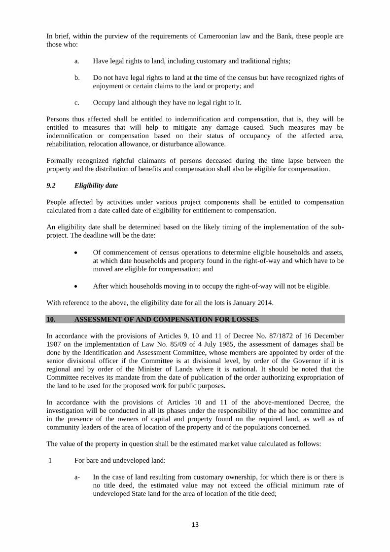
9.2 Eligibility date
People affected by activities under various project components shall be entitled to compensation
calculated from a date called date of eligibility for entitlement to compensation.
An eligibility date shall be determined based on the likely timing of the implementation of the sub-
project. The deadline will be the date:
Of commencement of census operations to determine eligible households and assets,
at which date households and property found in the right-of-way and which have to be
moved are eligible for compensation; and
After which households moving in to occupy the right-of-way will not be eligible.
With reference to the above, the eligibility date for all the lots is January 2014.
10. ASSESSMENT OF AND COMPENSATION FOR LOSSES
In accordance with the provisions of Articles 9, 10 and 11 of Decree No. 87/1872 of 16 December
1987 on the implementation of Law No. 85/09 of 4 July 1985, the assessment of damages shall be
done by the Identification and Assessment Committee, whose members are appointed by order of the
senior divisional officer if the Committee is at divisional level, by order of the Governor if it is
regional and by order of the Minister of Lands where it is national. It should be noted that the
Committee receives its mandate from the date of publication of the order authorizing expropriation of
the land to be used for the proposed work for public purposes.
In accordance with the provisions of Articles 10 and 11 of the above-mentioned Decree, the
investigation will be conducted in all its phases under the responsibility of the ad hoc committee and
in the presence of the owners of capital and property found on the required land, as well as of
community leaders of the area of location of the property and of the populations concerned.
The value of the property in question shall be the estimated market value calculated as follows:
1 For bare and undeveloped land:
a- In the case of land resulting from customary ownership, for which there is or there is
no title deed, the estimated value may not exceed the official minimum rate of
undeveloped State land for the area of location of the title deed;

14
b- In the case of a normal transaction under ordinary law, or acquisition of public land,
the estimated value will be equal to the purchase price plus various acquisition costs;
and
c- In the case of public land assigned for use, the estimated value may not exceed one-
fifth of the official value of undeveloped State land in the locality.
2 For crops, the value will be determined according to the scale laid down by Decree No.
2003/418/PM of 25 February 2003 fixing the rates of compensation to be allocated to owners
whose planted crops and trees are destroyed in the public interest. However, pursuant to the still-
binding relevant provisions of Order No. 58/MINAGRI of 13 August 1981, expert commissions
have all powers of appraisal and may allocate a lump sum, taking into account the actual damage
suffered by the property owner.
3 For buildings and other developed property, the value will be determined by the
Identification and Assessment Committee pursuant to Decree No. 2006/3023/PM of 29
December 2006. Order No. 832N.15.1/ MINUH/DOOO of 20 November 1987 laying down
the bases for calculating the market value of buildings simply concerned the determination of
the value of buildings and other developed property.
At the end of the investigation, assessment reports showing the value of the property in question will
be forwarded to the Minister of Lands, for the ultimate approval of the President of the Republic at the
behest of the Prime Minister, Head of Government.
Under Article 17 of Decree No. 87/1872 of 16 December 1987 referred to above, the compensation to
be paid by the expropriating public entity shall be established by the expropriation decree that will not
only list the persons affected but also determine the public authority responsible for authorizing the
corresponding appropriations.
Regarding graves, the State shall not pay any compensation because they are not property. Graves
affected will be moved (exhumation, burial with attendant ceremonies). MINTP will entrust this task
to an appropriately qualified enterprise that will act under the guidance of a special graves assessment
commission. The costs will be borne by the national counterpart.
Electricity (AES-SONEL), telephone and water networks will be shifted by accredited companies
under the supervision of the management unit and the control of the control mission (MDC). The
expenses will be borne by the project.
Lastly, public buildings affected will be rehabilitated by the project in conjunction with the relevant
services and authorities.
In the context of assistance to vulnerable persons, the project may consider, on a case-by-case basis,
the possibility of clearing and levelling the new resettlement sites off the road.
It is worth noting that under the provisions of Section 9 of Law No. 66/LF-4 of 10 June 1966, a
resettlement allowance may be granted by the administration within limits of a quarter of the value of
buildings and facilities.
Three forms of compensation may thus be distinguished:
a- Compensation: This is the payment in cash or in kind commensurate with the value of
property lost at full replacement cost (homes, shelters and crops), to replace them. The cash
payment is calculated based on instruments in force, possibly with adjustments for inflation to
obtain the full replacement value. The payment in kind (land against land, that is to say land to
replace the lost land, provision of agricultural inputs to increase production and equipment
loans) could have the advantage of minimizing the inflation variable on compensation;

15
b- Resettlement assistance may take the form of transport allowances in the case of
moving, or relocation allowances. These are a kind of compensation allocated to
affected persons, be they owners or not, to compensate them for the inconvenience
caused by the relocation to make way for the project. They need help at this
transitional stage in compensation for the damage suffered.
c- The disturbance allowance is paid to those who lose resources or sources of income
temporarily or permanently during project implementation.
The resettlement assistance and disturbance allowances are also considered as rehabilitation. They are
separate from the compensation paid for lost property.
In any event, the affected persons will be consulted to determine the form of compensation that suits
them best, and guarantees them better well-being than their previous state.

16
11. IDENTIFICATION OF POSSIBLE RESETTLEMENT SITES, CHOICE OF SITE(S),
SITE PREPARATION AND RESETTLEMENT
Under the project, houses belonging to the families concerned will be moved within the same village
and be substantially enhanced (houses built with sustainable materials, sanitation facilities, roofing,
etc.). Land issues were not raised in the community. No specific resettlement site is required.
Access to a new plot will be facilitated by the right of use and full enjoyment granted to all members
of the various villages to settle and build where they want, as long as the host plot is contiguous to the
one previously occupied. Stricto sensu, individual private management does not exist as far as
traditional land management methods are concerned, especially for building plots.
12. HOUSING, INFRASTRUCTURE AND SOCIAL SERVICES
PAPs will not have to be relocated on a specific relocation site. Therefore there are no particular
measures to be taken in this regard.
13. ENVIRONMENTAL PROTECTION
Environmental protection will be ensured in accordance with the Environmental and Social
Management Plan (ESMP) contained in the Environmental and Social Impact Assessment.
14. IMPLEMENTATION SCHEDULE
The following table shows the general planning of the implementation of these various steps:
No. Steps Activities Implementation
Period
01 Preliminary Investigation Checking the legitimacy of the declaration of land to be
in the public interest and effective occupation by owners
July – August 2014
02 Declaration of land to be in the
public interest
Publication of the decree declaring the right-of-way to be
in the public interest/Establishment of the committee
responsible for investigating plots and assessing the value
of property to be expropriated / Information and raising
awareness of the affected population
August 2014
03 Parcel survey Inventory of land owners for all real estate, intangible
and agricultural property located in the right-of-way /
Valuation of the property
September to end
December 2014
04 Compensation of affected
persons
Signing of final agreements with PAPs/Actual payment
of compensation to expropriated persons
From January 2015
05 Resettlement of affected persons
in their new site
Moving / Identification of resettlement land /
Construction of new building
After payment of
compensation
06 Requisition of the right-of-way
by the company recruited
Checking of evictions / Beginning of clearing, effective
release of the right-of-way and earthmoving works
After PAP take-off
07 Monitoring of implementation
of CRP and evaluation
This involves stating the actual status of implementation
of the CRP and assessing its impact.
From January 2015
to the end of the
project

17
15. COSTS AND BUDGET
15.1 CRP Cost
The budget, including all resettlement and local development measures, costs related to the
implementation and monitoring/evaluation of the operation stands at CFAF 1 702 700 000, that is,
EUR 2 595 749.
This cost is broken down as follows:
Item
Amount
(in million CFAF)
Lot 1 Lot 2 Lot 3 Total 3 lots
Indemnification for homes 222 405,4 126,3 753,7
Indemnification for crops 34,6 129 17,8 181,4
Other indemnification : commercial, graves, equipment, etc 20,2 106 5,5 131,7
crossing barges, traders, watertaxi, etc. at the bridge on the Sanaga River
40 40
S/Total per Lot 316,8 640,4 149,6 1106,8
Contengencies and or updating of the unit rates 30% 95,5 192,2 44,9 332,6
S/Total Indemnisation 412,3 832,6 194,5 1439,4
Monitoring of the implementation of the RAP * 75,7 143,8 43,8 263,3
Total cost of the RAP (in million CFAF) 488 976,4 238,3 1702,7
* This line covers the following activities: Capacity building at the municipal level; Communication
activities; Support vulnerable people (NGOs, travel expenses, etc.); operation for 1 year; Monitoring
and evaluation.
15.2 Financing Plan
Institution Amount (in CFAF)
Government of Cameroon 1 702 700 000
16. MONITORING AND EVALUATION
Project monitoring and evaluation will include internal and external monitoring, AfDB supervision
missions, a mid-term review and a final evaluation incorporating the completion report of the
implementing agencies.
The AfDB/WB Road Projects Monitoring and Implementation Unit (CSPR) will be responsible for
monitoring the implementation of CRP and its evaluation. The environmental expert who is a member
of the Unit will be particularly responsible for this dimension. In addition, the management unit may
bring on board experts from other relevant government departments.
Specifically, the monitoring and evaluation should help ensure that:
Benefits/compensations previously earmarked have been paid;
The resettlement is taking place as agreed;
Support for vulnerable groups is appropriately conducted;
All complaints are considered and the deliberations made known;
18
The timeframe for the implementation of the Compensation and Resettlement Plan
(CRP) is respected; and
Resettlement does not cause negative impacts or that they are well managed. This will
include ensuring that the PAPs are well integrated in their host populations and their
standard of living has not deteriorated.
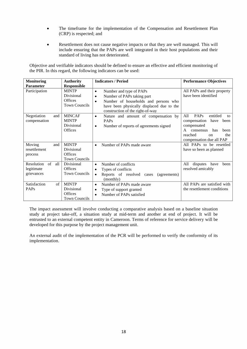
Objective and verifiable indicators should be defined to ensure an effective and efficient monitoring of
the PIR. In this regard, the following indicators can be used:
Monitoring
Parameter
Authority
Responsible
Indicators / Period Performance Objectives
Participation MINTP
Divisional
Offices
Town Councils
Number and type of PAPs
Number of PAPs taking part
Number of households and persons who
have been physically displaced due to the
construction of the right-of-way
All PAPs and their property
have been identified
Negotiation and
compensation
MINCAF
MINTP
Divisional
Offices
Nature and amount of compensation by
PAPs
Number of reports of agreements signed
All PAPs entitled to
compensation have been
compensated
A consensus has been
reached on the
compensation due all PAP
Moving and
resettlement
process
MINTP
Divisional
Offices
Town Councils
Number of PAPs made aware All PAPs to be resettled
have so been as planned
Resolution of all
legitimate
grievances
Divisional
Offices
Town Councils
Number of conflicts
Types of conflicts
Reports of resolved cases (agreements)
(monthly)
All disputes have been
resolved amicably
Satisfaction of
PAPs
MINTP
Divisional
Offices
Town Councils
Number of PAPs made aware
Type of support granted
Number of PAPs satisfied
All PAPs are satisfied with
the resettlement conditions
The impact assessment will involve conducting a comparative analysis based on a baseline situation
study at project take-off, a situation study at mid-term and another at end of project. It will be
entrusted to an external competent entity in Cameroon. Terms of reference for service delivery will be
developed for this purpose by the project management unit.
An external audit of the implementation of the PCR will be performed to verify the conformity of its
implementation.