Building the City. Examples for and from Vienna
16
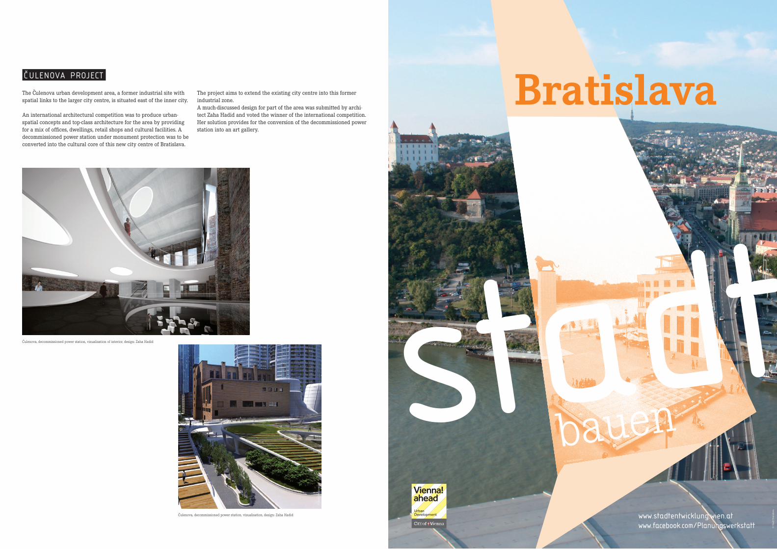
bauen stadt Bratislava © Stadt Bratislava © Stadt Bratislava www.facebook.com/Planungswerkstatt www.stadtentwicklung.wien.at C ˇ ULENOVA PROJECT © Stadt Bratislava The C ˇ ulenova urban development area, a former industrial site with spatial links to the larger city centre, is situated east of the inner city. An international architectural competition was to produce urban- spatial concepts and top-class architecture for the area by providing for a mix of offices, dwellings, retail shops and cultural facilities. A decommissioned power station under monument protection was to be converted into the cultural core of this new city centre of Bratislava. The project aims to extend the existing city centre into this former industrial zone. A much-discussed design for part of the area was submitted by archi- tect Zaha Hadid and voted the winner of the international competition. Her solution provides for the conversion of the decommissioned power station into an art gallery. C ˇ ulenova, decommissioned power station, visualisation of interior, design: Zaha Hadid C ˇ ulenova, decommissioned power station, visualisation, design: Zaha Hadid © Stadt Bratislava
Transcript of Building the City. Examples for and from Vienna
bauenstadt
Bratislava
© Stadt Bratislava
© S
tadt
Bra
tisla
va
www.facebook.com/Planungswerkstattwww.stadtentwicklung.wien.at
C ULENOVA PROJECT
© S
tadt
Bra
tisla
va
The Culenova urban development area, a former industrial site with spatial links to the larger city centre, is situated east of the inner city.
An international architectural competition was to produce urban-spatial concepts and top-class architecture for the area by providing for a mix of offices, dwellings, retail shops and cultural facilities. A decommissioned power station under monument protection was to be converted into the cultural core of this new city centre of Bratislava.
The project aims to extend the existing city centre into this former industrial zone.A much-discussed design for part of the area was submitted by archi-tect Zaha Hadid and voted the winner of the international competition. Her solution provides for the conversion of the decommissioned power station into an art gallery.
Culenova, decommissioned power station, visualisation of interior, design: Zaha Hadid
Culenova, decommissioned power station, visualisation, design: Zaha Hadid
© S
tadt
Bra
tisla
va

BratislavaOUTLINE OF CITY DEVELOPMENT OVER TIME
The city of Bratislava covers a territory of approx. 368 square kilome-tres and is situated in the southwestern part of Slovakia, at the foot of the Little Carpathians and on the Danube, which flows through Bratis-lava from west to south. Bratislava has around 426,000 inhabitants.
The centre of Bratislava, the old city (Staré Mesto), comprises the small historic city core and the organically grown adjoining quarters, which formed the surrounding suburbs in the Middle Ages.
The demolition of all fortifications in the 18th century was followed by urban expansion and the redesign of the city in the Baroque style.
In the 19th century, the industrial revolution gradually endowed the city with a new face. Regular steamship service on the Danube was taken up in 1818; in 1848, the city was connected to the railway net-work and thus to Vienna.
After the First World War, Bratislava was characterised by a major inflow of newcomers, and large-scale factory quarters and upscale residential areas came into being. This development continued after the Second World War. Numerous villages were incorporated, and an architectural and economic modernisation push was initiated. In many areas, historically grown structures and buildings were lost and frequently replaced by extensive prefab housing estates.
As a result of the political and economic changes after the indepen-dence of Slovakia in 1993, urban development was increasingly taken over by private investors. In recent years, efforts to resume active control of urban development were again intensified, leading to the creation of the position of Chief City Architect and the preparation of a new urban development plan.
Bratislava, city development over time
© S
tadt
Bra
tisla
va
© S
tadt
Bra
tisla
va
© S
tadt
Bra
tisla
va
© S
tadt
Bra
tisla
va
© S
tadt
Bra
tisla
va
© S
tadt
Bra
tisla
va
Bratislava in the 1960s
© S
tadt
Bra
tisla
va
CURRENT CHALLENGES AND OBJECTIVES OF URBAN DEVELOPMENT
One of the key issues of urban development in Bratislava lies in the redevelopment of brownfield sites adjoining the old city centre. After 1989, these areas and buildings were mostly sold to private investors, causing the city to lose valuable development zones close to the inner city. It is thus a current task of urban design to recover control over large-scale urban development projects. This necessitates co-operation between the municipal administration, architects and investors as well as intensified involvement of the general public.
Another key concern of future urban development lies in improving the spatial and functional qualities of the city. This can only be done by enhancing the attractiveness of inner-city open spaces and resolv-ing the traffic problem through investments, e.g. in public transport. In conjunction with the thermal rehabilitation of residential buildings, this is to result in improved environmental conditions, especially of air quality.
Interior of Design Factory, a former construction-industry production hall
Design Factory, a former construction-industry production hall
EUROVEA PROJECT
Originally, Bratislava was connected to the Danube via a promenade on the right bank and parks on the left bank of the river. Over the 20th century, however, the city was progressively cut off from the Danube due to river training, the construction of the satellite town Petrzalka and the construction of the “New Bridge”. The river prome-nades were curtailed; a new flood protection wall moreover blocked the view of the river.
In recent years, efforts were increasingly undertaken to improve this part of the city. This resulted in the development of the EUROVEA project on an area occupied by the old river port, an urban wasteland
adjoining the historic centre, with the aim of bringing the city once more close to the river and making the Danube come alive for the population.
EUROVEA was conceived as a modern shopping, office, residential and leisure centre. Its core is formed by a spacious square with the new building of the Slovak National Theatre. It is adjoined by a new promenade along the bank of the Danube, complemented by a new, two-hectare riverside park with a panoramic bridge jutting out across the water. The project was completed in 2010.
Old Port urban development area on right bank of the Danube
EUROVEA, Danube riverside promenade
EUROVEA, warehouse conversion

Brno
© Norbert Aepli
© M
ilosl
av B
ousk
a
bauenstadtwww.facebook.com/Planungswerkstattwww.stadtentwicklung.wien.at
On an area of 42 hectares in the Bohunice district, a modern universi-ty campus was built between 2006 and 2010 for the Faculty of Science and Engineering of Masaryk University. A shopping and restaurant centre, housing for students and teachers, sports facilities and cultural institutions will be created on another 16 hectares in the immediate vicinity of the campus. A key role regarding the functionality of this project and its open spaces is to be assumed by the planned Botanical Garden of the Faculty of Science.
CAMPUS BOHUNICE PROJECT
Bohunice Campus, figure-ground diagram
© S
tadt
Brn
o
© S
tadt
Brn
o
Bohunice Campus
© S
tadt
Brn
o
Bohunice Campus, Masaryk University
© S
tadt
Brn
o
Bohunice Campus, aerial view

Brno
OUTLINE OF CITY DEVELOPMENT OVER TIME
Brno is situated at the point of transition from the South Moravian plains to the Central Moravian mountains, at the foot of the Spilberk and Petrov hills and at the confluence of the rivers Svratka and Svitava.
The old city is encircled by the Ring Boulevard constructed in the mid-19th century, which encompasses numerous impressive buildings and parks.
The city’s industrial tradition goes back to the textile manufactories established in the last third of the 18th century and the creation of several railway connections as of 1836. In consequence, the city extend-ed gradually along the axes radiating from the centre like the spokes of a wheel.
In the 19th century, Brno evolved into the leading industrial hub of the Austro-Hungarian monarchy. Big industrial sites occupied outlying suburbs and formerly rural environs.
Another burst of growth followed after the First World War, partly due to suburb incorporation. The period from 1918 to 1938 was the heyday of modernism. As early as in 1928, the winning competition entry for an urban master plan provided for the modification of the railway hub and a relocation of the main station.
During the Socialist era, Brno was one of the country’s leading indus-trial cities. Urban development was stepped up by building numerous prefab housing projects to accommodate the constantly rising popula-tion north of the city centre, while workplaces were mainly situated in the eastern and southern suburbs.
After the revolution of 1989, economic, political and social changes posed new challenges for urban development. 1994 saw the adoption of an urban development plan that provided for the development of the city in the southern direction and strove to balance the disparities accumulated over the previous decades.
© S
tadt
Brn
o
© S
tadt
Brn
o
© S
tadt
Brn
o
© S
tadt
Brn
o
© D
anie
l Fis
er
Villa Tugendhat, architect: Ludwig Mies van der Rohe (example of modernism)
Master plan of 1994
CURRENT CHALLENGES AND OBJECTIVES OF
URBAN DEVELOPMENT
As key projects for the future of the city, the urban development plan currently underway inter alia provides for the modification and refurbishment of the railway hub (Europoint Brno project) – including the relocation of the main station – and in this connection also for the further development of the southern municipal territory in order to curb suburbanisation.
Additional challenges for urban development include the following:
• Elimination of functional gaps and upgrading of public spaces and recreation areas in the large-scale, monofunctional housing estates at the urban periphery.
• Revalorisation of inner-city sites and active brownfield development (mostly former industrial areas).
• As a reaction to the massive traffic problems of recent decades, public transport and bicycle traffic are to be especially promoted while individual motorised traffic is to be reduced.
• The promotion of the economic development of the city and its positioning as a venue of research, development, education and innovation are key objectives for Brno’s future (in keeping with the urban development strategy – “Brno City Strategy”).
Key development axes of Brno
JIŽNÍ CENTRUM BRNO
(BRNO SOUTH CENTER) PROJECT
The relocation of the main station eliminates the barrier between the historic city centre and the adjoining area to the south, allowing for the development of the “South Center” on an abandoned former industrial area.
On a surface of 100 hectares, it is planned to build an urban centre with administrative, cultural and entertainment facilities as well as shops and flats. New traffic axes as well as new tram and bus links will connect this quarter to the rest of the city.
South Center urban development zone, land use plan
South Center urban development zone, model

Ljubljana
© Miran Kambic
© M
iran
Kam
bic
bauenstadtwww.facebook.com/Planungswerkstattwww.stadtentwicklung.wien.at
ŠMARTINSKA PROJECT
The Smartinska city quarter in the north-eastern part of Ljubljana was developed in the 1980s as a large-scale industrial zone. The area covers a surface of 228 hectares and is situated between the city centre, the main railway station and the motorway ring.
The economic changes after 1991 brought about an exodus of many industrial enterprises. This was followed by largely uncontrolled de-velopment: part of the area was put to diverse new uses, while other
plots remained vacant. 2006 saw the first restructuring efforts by local enterprises. In co-operation with the municipal administration, an international design competition was then organised in 2007. The winner of the competition, Hosoya Schaefer Architects from Zurich (Switzerland), was duly commission to prepare a master plan. The objective lies in complementing the historic inner city of Ljubljana with a new urban centre.
© H
osoy
a Sc
haef
er A
rchi
tect
s
Smartinska, visualisation
Smartinska, master plan
© H
osoy
a Sc
haef
er A
rchi
tect
s

Ljubljana
OUTLINE OF CITY DEVELOPMENT OVER TIME
The city of Ljubljana with its approx. 280,000 inhabitants is situated at the heart of Slovenia, in the area of the “Ljubljana Gate”, on a terri-tory of around 275 square kilometres. The layout of the modern city is star-shaped. From the historic nucleus, the city evolved along the main traffic axes, with large green zones in-between.
A particularly strong influence on the modern cityscape was exerted by the effects of two earthquakes. After earth tremors in 1511, the city was rebuilt in the Renaissance style, followed by an almost complete Baroque refurbishment.
In the mid-19th century, the connection of Ljubljana to the Vienna-Trieste railway line triggered a modernisation push.
After the second earthquake in 1895, a new plan for a modern Lju-bljana was designed. Numerous landmark buildings were erected. The implementation of this plan was continued after the First World War. In the wake of the Second World War, Ljubljana grew into a hub of industry. Big industrial zones linked to new, large-scale settlement areas sprang up at the urban periphery.
In conjunction with the political and economic changes after 1991, ur-ban development began to stagnate. The city core lost vibrancy, while the residential zones at the periphery continued to grow unchecked.
At the moment, efforts are being undertaken to resume control of urban development. The vision “Ljubljana 2025” and the adapted urban development plan lay down key guidelines and thematic focuses of future urban development.
Philharmonic Hall
© S
tadt
Lju
blja
na
Ljubljana, historic city centre with oldest settlement cores (Roman settlement, medieval city)
CURRENT CHALLENGES AND OBJECTIVES
OF URBAN DEVELOPMENT
A major challenge of current urban development is posed by the space-gobbling urban sprawl around the city proper. Since 1995, Ljubljana has lost over 20,000 inhabitants to neighbouring munici-palities, causing the number of commuters to rise and individual motorised traffic to increase dramatically.
Shopping malls and leisure facilities were built around the centre, and companies have likewise increasingly migrated to peripheral locations.
For this reason, the most important objectives of urban development in Ljubljana are the following:
• Revitalising the historic city centre by upgrading public space and enlarging pedestrian zones.
• Promoting mixed-use projects in the inner city to boost the attractiveness of these locations.
• Improving public transport, bicycle traffic and walking routes to curb individual motorised traffic.
© S
tadt
Lju
blja
na
Master plans 2007 – 2011
This joint project proposed by the city administration together with enterprises active in and around the city aims at the social and eco-nomic upgrading of Ljubljana’s inner-city locations by rendering public space more attractive. Thus investments go to the redesign of squares, streets and green zones as well as to improving the accessibility and design of riverbanks and the enlargement of pedestrian zones. The construction of seven new (pedestrian) bridges creates additional walking and biking routes. Individual motorised traffic is curbed, while public transport is promoted.
PROJECT FOR SQUARES AND RIVERBANKS
Redesigned Congress Square
© M
iran
Kam
bic
Mesarski Most – a new bridge across Ljubljanica River
© M
iran
Kam
bic
Landscape design on Koseze Pond
© M
iran
Kam
bic

Zagreb
© Konrad Zielinski
© S
tadt
Zag
reb
bauenstadtwww.facebook.com/Planungswerkstattwww.stadtentwicklung.wien.at
BORONGAJ UNIVERSITY CAMPUS PROJECT
The former Borongaj barracks zone is to house a university campus on a total surface of 93 hectares. The campus is to accommodate not only university facilities but also other scientific institutions and will act as a hub of public life with leisure offerings, large park areas, museums and exhibition spaces. The site is directly connected to the railway line. Mobility on the campus will be by electric buses and bikes or
on foot. Renewable energy forms will be used extensively, and public transport in the immediate and wider environs of the campus will be stepped up. The objective lies in networking technological and eco-logical knowledge and creating a model project of sustainable urban development.
Master plan of Borongaj University Campus
© S
tadt
Zag
reb

Zagreb
OUTLINE OF CITY DEVELOPMENT OVER TIME
Zagreb covers an area of approx. 641 square kilometres and is the third-largest city of the Danube region after Vienna and Budapest. It is situated at the foot of the Medvednica Mountains on both banks of the Sava River. The city with currently around 793,000 inhabitants devel-oped from the older settlements Kaptol and Gradec, which today form the old city core called “Upper Town”.
The period of strongest growth took place in the mid-19th century with the construction of the “Lower Town” as a modern city centre following a regular grid pattern. A railway connection to Budapest and the main station were built; landmark buildings and the “Green Horse-shoe”, a U-shaped ensemble of parks, emerged. The city also expanded towards the west, east and south along the main access roads.
In the first half of the 20th century, Zagreb grew further in all direc-tions; however, the railway line continued to bisect the city.
After the Second World War, the rise of the industrial sector in Zagreb attracted many newcomers from rural regions. In the 1950s, the city spread across the Sava River. The intense growth of the peripheral zones continued into the 1980s, inter alia in the form of typically Socialist quarters such as Novi Zagreb.
With the exception of a brief increase after Zagreb’s designation as the capital of Croatia, population figures have been stagnating since the mid-1980s. Urban renewal and the further development of existing settlement areas are key issues of the present.
© S
tadt
Zag
reb
© S
tadt
Zag
reb
© S
tadt
Zag
reb
© S
tadt
Zag
reb
© S
tadt
Zag
reb
© S
tadt
Zag
reb
Zagreb city centre
The Sava River likewise acts as a separator. Large tracts of land close to the river have not yet been developed. Integrating this landscape into the urban fabric and creating a connecting element between the city quarters to the north and south are other major tasks.
A key strategic approach lies in the promotion of sustainable mobility. This calls for a strengthening of public transport and bicycle traffic, the upgrading of walking routes across the city and the reduction of individual motorised traffic.
CURRENT CHALLENGES AND OBJECTIVES OF URBAN DEVELOPMENT
The two central challenges of urban development lie in preparing adequate planning instruments to facilitate decision-making processes and in improving the spatial and functional qualities of the city.
Structurally, the inner city is the historic and cultural core of Zagreb. However, it is faced with dwindling population figures, demographic ageing, an old building stock, a decreasing number of shops and grow-ing traffic problems. These issues require solutions based on strategic measures.
Zagreb is strongly marked by the bisecting effect of the railway line. Suggestions have been voiced to relocate and lower or raise the rail-way tracks to interlink the city quarters to the north and south.
Overview of current urban development areas
ZAGREB RIVERFRONT PROJECT
The Zagreb Riverfront project is to emerge in the zone around Jadran Bridge, at the end of Savska Street, the oldest link between city core and Sava River.
It is planned to build residential and office buildings on an extensive area along the southern riverbank. A small number of high-rises are to strike visual accents. The city is thus brought closer to the river, which in its turn is better integrated into the life of the local population.
On the northern riverbank, an intermodal terminal is to emerge in a zone already today occupied by a transport hub. This terminal will enable passengers to change easily from one means of transport to another (railway/tram/bus/taxi), thus giving greater prominence to public transport.
Zagreb Riverfront, visualisation of intermodal terminal, northern bank of Sava River
Zagreb Riverfront, intermodal terminal, northern bank of Sava River Zagreb Riverfront, visualisation of development concept, southern bank of Sava River
Zagreb Riverfront, development concept, southern bank of Sava River
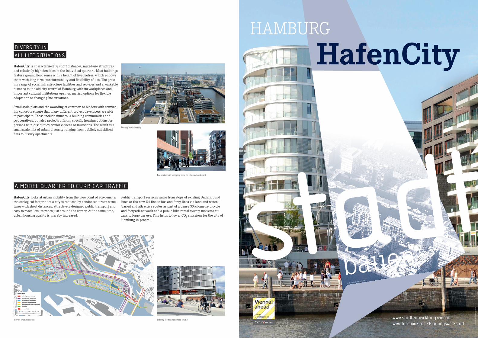
HAMBURG
HafenCity
© HafenCity Hamburg GmbH
© H
afen
City
Ham
burg
Gm
bH
bauenstadtwww.facebook.com/Planungswerkstattwww.stadtentwicklung.wien.at
DIVERSITY IN
ALL LIFE SITUATIONS
HafenCity is characterised by short distances, mixed-use structures and relatively high densities in the individual quarters. Most buildings feature ground-floor zones with a height of five metres, which endows them with long-term transformability and flexibility of use. The grow-ing range of social infrastructure facilities and services and a walkable distance to the old city centre of Hamburg with its workplaces and important cultural institutions open up myriad options for flexible adaptation to changing life situations.
Small-scale plots and the awarding of contracts to bidders with convinc-ing concepts ensure that many different project developers are able to participate. These include numerous building communities and co-operatives, but also projects offering specific housing options for persons with disabilities, senior citizens or musicians. The result is a small-scale mix of urban diversity ranging from publicly subsidised flats to luxury apartments.
Density and diversity
Pedestrian and shopping zone on Überseeboulevard
© E
LBE&
FLU
T
A MODEL QUARTER TO CURB CAR TRAFFIC
HafenCity looks at urban mobility from the viewpoint of eco-density: the ecological footprint of a city is reduced by condensed urban struc-tures with short distances, attractively designed public transport and easy-to-reach leisure zones just around the corner. At the same time, urban housing quality is thereby increased.
Public transport services range from stops of existing Underground lines or the new U4 line to bus and ferry lines via land and water. Varied and attractive routes as part of a dense 30-kilometre bicycle and footpath network and a public bike rental system motivate citi-zens to forgo car use. This helps to lower CO
2 emissions for the city of
Hamburg in general.
Bicycle traffic concept
© H
afen
City
Ham
burg
Gm
bH
Priority for non-motorised traffic
© H
afen
City
Ham
burg
Gm
bH©
Haf
enCi
ty H
ambu
rg G
mbH
© H
afen
City
Ham
burg
Gm
bH
© H
afen
City
Ham
burg
Gm
bH
30 % Wohnfläche
9 % gewerbliche und öffentlichkeits-bezogene Nutzfläche im Erdgeschoß
13 % Fläche für Bildung, Wissenschaft, Kultur, Freizeit, Hotel und Sonstiges
48 % Bürofläche
30 % residential
9 % commercial and public ground-floor uses
13 % education, science, culture, retail, leisure, hotel, other
48 % offices
© E
LBE&
FLU
T
© H
afen
City
Ham
burg
Gm
bH
© H
afen
City
Ham
burg
Gm
bH
HAMBURG
HafenCity
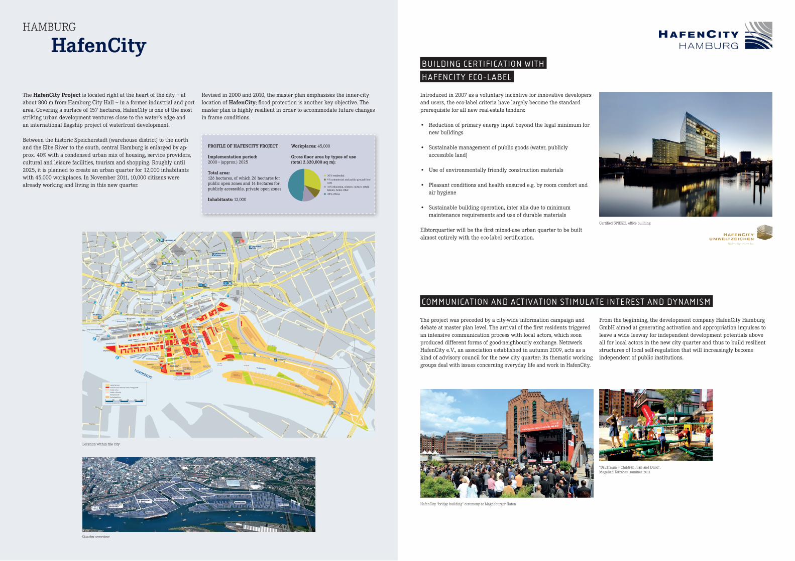
The HafenCityProject is located right at the heart of the city – at about 800 m from Hamburg City Hall – in a former industrial and port area. Covering a surface of 157 hectares, HafenCity is one of the most striking urban development ventures close to the water’s edge and an international flagship project of waterfront development.
Between the historic Speicherstadt (warehouse district) to the north and the Elbe River to the south, central Hamburg is enlarged by ap-prox. 40% with a condensed urban mix of housing, service providers, cultural and leisure facilities, tourism and shopping. Roughly until 2025, it is planned to create an urban quarter for 12,000 inhabitants with 45,000 workplaces. In November 2011, 10,000 citizens were already working and living in this new quarter.
Revised in 2000 and 2010, the master plan emphasises the inner-city location of HafenCity; flood protection is another key objective. The master plan is highly resilient in order to accommodate future changes in frame conditions.
PROFILEOFHAFENCITYPROJECT
Implementationperiod:2000 – (approx.) 2025
Totalarea: 126 hectares, of which 26 hectares for public open zones and 14 hectares for publicly accessible, private open zones
Inhabitants:12,000
Workplaces:45,000
Grossfloorareabytypesofuse(total2.320,000sqm):
Quarter overview
Location within the city
BUILDING CERTIFICATION WITH
HAFENCITY ECO-LABEL
Introduced in 2007 as a voluntary incentive for innovative developers and users, the eco-label criteria have largely become the standard prerequisite for all new real-estate tenders:
• Reduction of primary energy input beyond the legal minimum for new buildings
• Sustainable management of public goods (water, publicly accessible land)
• Use of environmentally friendly construction materials
• Pleasant conditions and health ensured e.g. by room comfort and air hygiene
• Sustainable building operation, inter alia due to minimum maintenance requirements and use of durable materials
Elbtorquartier will be the first mixed-use urban quarter to be built almost entirely with the eco-label certification.
Certified SPIEGEL office building
From the beginning, the development company HafenCity Hamburg GmbH aimed at generating activation and appropriation impulses to leave a wide leeway for independent development potentials above all for local actors in the new city quarter and thus to build resilient structures of local self-regulation that will increasingly become independent of public institutions.
COMMUNICATION AND ACTIVATION STIMULATE INTEREST AND DYNAMISM
The project was preceded by a city-wide information campaign and debate at master plan level. The arrival of the first residents triggered an intensive communication process with local actors, which soon produced different forms of good-neighbourly exchange. Netzwerk HafenCity e.V., an association established in autumn 2009, acts as a kind of advisory council for the new city quarter; its thematic working groups deal with issues concerning everyday life and work in HafenCity.
HafenCity “bridge building” ceremony at Magdeburger Hafen
“BauTraum – Children Plan and Build”, Magellan Terraces, summer 2011

MALMÖ Västra Hamnen
© Malmö stad
© M
alm
ö st
ad
bauenstadtwww.facebook.com/Planungswerkstattwww.stadtentwicklung.wien.at
NEEDS OF
FUTURE RESIDENTS
Some agreements under the Creative Dialogue directly affect the needs of people regarding their future housing environment. Façade height was limited to 25 m, which was considered a “human scale”. Special attention was paid to ensuring a healthy indoor climate. Archi-tectural diversity was likewise given priority: thus the Bo01 quarter alone involved contributions by 20 separate developers and over 30 international architectural studios. A recommended rent ceiling for the Flagghusen quarter of approx. 1,300 krona (approx. € 130.-) per sq m and year (as per 2008) met the growing demand for affordable housing.
© M
alm
ö st
ad
Buildings should reflect a human scale.
© M
alm
ö st
ad
Small-scale diversity of developers and architects for the Bo01 quarter
Different forms, colours and resident needs, example of Flagghusen
© M
alm
ö st
ad
Public space is understood as the lifeline and place of encounter of the new urban quarter and is used by all citizens of Malmö. Most of the coveted waterfront is publicly accessible and offers a range of parks, leisure facilities as well as attractive streetscapes and squares for all inhabitants. For the internal sections of the quarter, the provisions of the Creative Dialogue likewise stipulate certain requirements to be met:
Thus buildings should be planned and designed to enable residents to experience a safe environment. A certain portion of the project area must be left free for green zones to upgrade public space in the imme-diate environs of residential buildings. Existing ecologically valuable areas were chosen as the points of departure in selecting these green zones. This approach is moreover to contribute towards biodiversity.
PUBLIC SPACE FOR ALL
© M
alm
ö st
ad
Public space in the immediate environs of residential buildings
© M
alm
ö st
ad
The open spaces are used by all citizens of Malmö.Skate park on former slipway
© M
alm
ö st
ad

MALMÖ
VästraHamnenTHE PROJECT
The VästraHamnen (“Western Harbour“) Project is situated north-west of Malmö, directly on the Öresund, the strait between Denmark and Sweden. This former port and industrial zone covers 175 hectares and connects the medieval city with the sea. From 2000 to 2025, pre-existing structures will be transformed and developed into an urban quarter for 10,000 to 12,000 residents with 20,000 places for work and study. In January 2011, more than 4,500 persons were already living in this project.
The VästraHamnenProject pursues the goal of creating an urban quarter that satisfies all areas of human life, with a special focus on multifaceted housing and studying. While reflecting the density and structural fabric of the Malmö city centre, this project is at the same time a national flagship venture of sustainable urban development. The Bo01 quarter is Sweden’s first climate-neutral neighbourhood.
The starting signal for the transformation of the harbour area was given in 2001 by organising the European housing exhibition Bo01 with the motto “City of Tomorrow”. The involvement of multiple stakeholders and the pursuit of sustainability criteria were and still are given priority in the further development of this area (Flagghusen, Fullriggaren).
© M
alm
ö St
ad
© M
alm
ö st
ad
© M
alm
ö st
ad
© M
alm
ö St
ad
© M
alm
ö st
ad©
Mal
mö
stad
PROFILEOFVÄSTRAHAMNENPROJECT
Implementationperiod:2000 – 2025
Totalarea:175 hectares, of which 18 hectares for public green zones
Inhabitants:10,000 – 12,000
StudentsatMalmöUniversityCollege:10,000
Workplaces:10,000
Grossfloorareaofindividualcityquarters:Bo01 202,000 sq mFullriggaren 83,000 sq mFlagghusen 64,000 sq m Kappseglaren 44,000 sq m
Gesamt: 393,000 sq m
Public open space at the water’s edge – length of coastline: 8 km
Structural plan, status: October 2011
Utilisation of existing buildings, status: October 2011
Bo01
Turning Torso
Flagghusen
Kappseglaren
Dockan
Universitetsholmen
Fullriggaren
© M
alm
ö st
ad
Old city with St. Peter’s Church
Location within the city
THE CREATIVE DIALOGUE
The Creative Dialogue unites public administrators, developers, archi-tects and citizens. A common exchange of knowledge and experience focuses on social, economic and ecological sustainability and high archi-tectural quality to identify novel solutions and reduce production costs. Sustainable urban development is to become an affordable standard.
The Creative Dialogue is part of the Building-Living Dialogue initiated by the National Board of Housing, Building und Planning. Participating projects must exceed legal requirements and establish sustainable processes in construction and real-estate management by 2025, espe-cially with regard to the aspects of environment, energy and resource consumption.
Creative Dialogue book
Flagghusen quarter: Creative Dialogue 2004–2007
Many stakeholders – varied concerns
BO01 – ECOLOGICALLY SUSTAINABLE ENERGY SUPPLY
The climate-neutral urban quarter Bo01 is entirely supplied with local, renewable energy generated on the basis of wind, solar heat and biogas, which is produced through local waste management. Electrical power is mainly generated through wind and, to a smaller degree, with a photovoltaic installation. Heating and cooling are ensured by means of solar collectors, heat pumps and groundwater as well as seawater.
Photovoltaic installation on residential building
Urban villa
Interaction of different local, renewable energy sources

MUNICH Central RailwayLands
© Stadt München
© S
tadt
Mün
chen
bauenstadtwww.facebook.com/Planungswerkstattwww.stadtentwicklung.wien.at
S-BAHN FOR SUSTAINABLE TRANSPORT DEVELOPMENT
The CentralRailwayLandsProject tries to minimise car use. City-friendly traffic and transport development creates excellent precondi-tions for urban condensation.
The CentralRailwayLands are characterised by very good connec-tions to the S-Bahn urban rail network: practically all lines connect Laim with Munich Main Station. Shorter intervals and the construc-tion of the new Hirschgarten S-Bahn station respond to the rising number of passengers. Attractive footpaths and cycleways – such as
the superordinate east-west link along the railway tracks, the hook-up to the S-Bahn stations and links with established neighbourhoods – will ensure better accessibility of the new city quarters.
Traffic and transport concept
© S
tadt
Mün
chen
Donnersbergerbrücke S-Bahn station
© S
tadt
Mün
chen
© S
tadt
Mün
chen
© S
tadt
Mün
chen
Bike parking at Pasing station
© S
tadt
Mün
chen
VENTILATION CORRIDORS FOR A HEALTHY URBAN CLIMATE
The findings of the environmental analysis underpinning the plans for the CentralRailwayLands demand that the main ventilation corridor from the western direction into the city centre be kept unob-structed to ensure the inflow of fresh air and prevent the formation of heat islands. The planned development zones will be supplied with cooler, more oxygen-rich air via wide green caesuras extending towards the railway line as well as by new parks and climate exchange paths.
Additional positive effects on the urban climate will be attained by reducing the formerly very pronounced soil sealing as well as by infiltration concepts and intensive greening of streetscapes and roofs.
Ramified green space concept
Nymphenburg Süd, housing along green link with palace park

40 % Wohnfläche
55 % Kern- und Mischfläche
1 % Schulen
1 % Sonstige soziale Infrastruktur
1 % Sonderfläche
2 % Gewerbefläche
40 % residential
55 % core and mixed
1 % schools
1 % other social infrastructure
1 % special
2 % commercial
MUNICH
CentralRailwayLands
The CentralRailwayLandsProject extends from the Main Station at the heart of Munich over nearly 8 km (via the Laim urban rail – “S-Bahn” – station) west to the Pasing station. The decommissioning of railway installations and storage areas and their relocation to the urban periphery liberated a plot of 178 hectares for development. From 2004 to 2020, this area is to be transformed into an urban quarter for 16,500 inhabitants and 21,000 workplaces.
As an exemplary project of the Munich urban development concept “Perspective Munich”, the CentralRailwayLands reflect the “com-pact, urban, green” motto. The high-quality inner-city development standard demanded by the Perspective is attained through compact built structures with low land consumption in order to create at-tractive dwellings and new workplaces as well as new public green spaces. The mix of housing, work and leisure offerings is implemented in differentiated, area-specific planning concepts adapted to each single sub-location’s characteristics.
The planning process rests on a sound foundation, since the co-opera-tion between the Bavarian capital Munich and the railway operator Deutsche Bahn AG is regulated by a framework agreement. The Main Station-Laim-Pasing project group manages collaboration on an over-arching basis comprising multiple sub-areas and companies; a multi-tiered urbanistic competition was jointly organised in 1998/99.
PROFILEOFCENTRALRAILWAYLANDSPROJECT
Implementationperiod: 2004 – 2020
Totalprojectarea:178 hectares, of which 38 hectares for public green and compensation areas
Residents: 16,500
Workplaces: 21,000
Grossfloorareabytypesofuse(total1.521,000sqm):
© S
tadt
Mün
chen
Position within the city
© S
tadt
Mün
chen
Skate bowl in Hirschgarten park extension
© S
tadt
Mün
chen
© S
tadt
Mün
chen
Arnulfpark, public open space
Aerial photograph, general view
MUNICH MIX REFLECTS
“SOCIALLY JUST LAND USE” PRINCIPLE
The Munich mix provides for a wide range of income groups and corresponding housing options in all new development zones. A key role is played by municipal housing policy, whose task it is to ensure socially balanced urban development. Moreover, all residential loca-tions of the project will feature differentiated building and housing typologies.
The fundamental principle of “socially just land use” is embodied in the urban planning contracts for the CentralRailwayLands. Of the dwellings built, 30 % will accordingly be subsidised housing including at least 20 % for subsidised rental flats for lower-income groups and a maximum of 10 % for rental and owner-occupied flats for lower- and middle-income groups eligible for subsidisation.
Subsidised housing, Nymphenburg Süd
© S
tadt
Mün
chen
© S
tadt
Mün
chen
Subsidised housing, Birkatweg / Am Hirschgarten
VIBRANT PUBLIC SPACES FROM DAY ONE
All sub-areas will boast quarter hubs with squares, retailers, bars, restaurants and cultural facilities. The external effect engendered by the shops, restaurants and public services in the buildings, e.g. a medical centre, will create a vibrant urban feel.
Under the terms of the framework agreement, the small-scale social infrastructure, green zones and access roads to sub-areas are to be
financed by the property owners shortly before completion of the flats; thus publicly useable space with visible new communication options and ambiance quality will be available right from the beginning.
Pasing Arcade housing project©
Sta
dt M
ünch
enNymphenburg Süd neighbourhood centre, shops and medical centre
© S
tadt
Mün
chen
Restaurant in former Pasing railway station building
© S
tadt
Mün
chen

STOCKHOLM Hammarby Sjöstad
© Stockholm City Planning Administration
© S
tock
holm
City
Pla
nnin
g A
dmin
istr
atio
n
bauenstadtwww.facebook.com/Planungswerkstattwww.stadtentwicklung.wien.at
USE OF ECOLOGICAL CONSTRUCTION MATERIALS
In selecting construction materials, special attention is paid to healthy and eco-friendly options. Recycled substances should be used as far as feasible. All materials employed must be officially notified before
construction work can begin and are monitored throughout the entire construction period by means of ecological quality checks.
Use of eco-friendly construction materials and integration of solar installations
© S
tock
holm
City
Pla
nnin
g A
dmin
istr
atio
n
NETWORKING OF PUBLIC GREEN ZONES
According to the open space concept, 25 to 30 sq m of green space per flat must be available within a radius of 300 m; of this, at least 15 sq m must be in interior courtyards. A green network permeates the urban quarter and creates links with the environs: the two big
parks are connected by a green corridor along the main access route. Green bridges bring the Nacka nature park into the city. Existing ecologically valuable areas are preserved and upgraded.
Public open space
© S
tock
holm
City
Pla
nnin
g A
dmin
istr
atio
n

76 % Wohnfläche
21 % Gewerbefläche
3 % Schulen
76 % residential
21 % commercial
3 % schools
STOCKHOLM
HammarbySjöstad
The HammarbySjöstad (Hammarby Sea City or Lake City) Projectis situated approx. 3 km south of the city centre around two canals, whose confluence produces Hammarby Lake. A total of 11,000 flats and 300,000 sq m of offices and commercial premises for 24,000 inhabitants and 10,000 workplaces are to emerge on this 160-hectare former industrial and harbour site. At the moment, the project – of which roughly 130 hectares have already been developed – has 14,000 inhabitants.
The project development for HammarbySjöstad was initiated in connection with the Swedish capital’s bid to host the 2004 Olympic Games, with the City of Stockholm opting for a sustainable resource management solution. Hence the environmental impact of the new urban quarter was to be only half of that typical of comparable new development areas of Stockholm in the early 1990s. Starting with the first plans, the municipal administration imposed strict regulations for
the ecological standards of buildings, technical infrastructure, traffic and transport. Due to the so far systematic implementation of these objectives, the project is considered a flagship example of eco-oriented urban development.
PROFILEOFHAMMARBYSJÖSTADPROJECT
Implementationperiod:1994 – 2017
Totalarea:160 hectares, of which 30 hectares for public open zones; on top of this, an additional 40 hectares are water surface
Inhabitants: 24,000
Workplaces:10,000
Grossfloorareabytypesofuse(total1.440,000sqm):
Urban quarters Lugnet, Sickla Udde and Sickla Kaj
© S
tock
holm
City
Pla
nnin
g A
dmin
istr
atio
n
Canalside building
© S
tock
holm
City
Pla
nnin
g A
dmin
istr
atio
n
© S
tock
holm
City
Pl
anni
ng A
dmin
istr
atio
n
© Stockholm City Planning Administration
© S
tock
holm
City
Pla
nnin
g A
dmin
istr
atio
n
Master plan
© S
tock
holm
City
Pla
nnin
g A
dmin
istr
atio
n
CAD: Sanna Norrby
THE HAMMARBY MODEL
With the Hammarby Model, a special ecological closed-loop model with an integrated concept for energy, waste and water was devel-oped to create a housing environment based on sustainable resource use that minimises energy consumption and waste production while maximising recycling volumes. The success of this approach was determined by the fact that stakeholders who normally are involved during different project phases compiled a joint concept already be-fore commencing the planning process. The ambitious environmental objectives are to be attained mainly through planning, infrastructure and construction standards, being only to a minor degree dependent on the residents’ behaviour patterns.
The Hammarby Model – an integrated approach to energy, waste and water management
Automated waste disposal system
The automated disposal system separates waste and feeds combustible waste via an underground pipe network into a thermal power plant that generates electricity and heat for the urban quarter. The heat produced by wastewater purification is likewise used for room heating.
Some buildings additionally feature solar collectors and photovoltaic installations. The goal lies in producing half of the energy demand with-in the quarter itself. Moreover, water consumption should not exceed 100 litres per capita and day and thus attain a level corresponding to half the average Swedish citizen’s daily demand. An equally important objective is to reduce the load of heavy metals and non-biodegradable substances in the wastewater. Precipitation water is locally infiltrated or introduced into Lake Hammarby.
REDUCTION OF INDIVIDUAL
MOTORISED TRAFFIC
80% of trips within HammarbySjöstad are to be taken by public transport, on foot or by bike. The traffic concept provides for a com-bination of fast and attractive public transport with car-sharing and a well-developed cycleway network. The Tvärbanan light rail line and several ferry services connect HammarbySjöstad to neighbouring city quarters. The streets and local car parks offer 0.7 parking slots per housing unit.
Access by public transport – ferry service