Bordering Lands Subject to Flooding: How to Determine ...
44
Bordering Lands Subject to Flooding: How to Determine Their Extent and Meet Performance Standards Thomas Maguire, MassDEP Wetlands Program MACC Fall Conference October 2017
Transcript of Bordering Lands Subject to Flooding: How to Determine ...
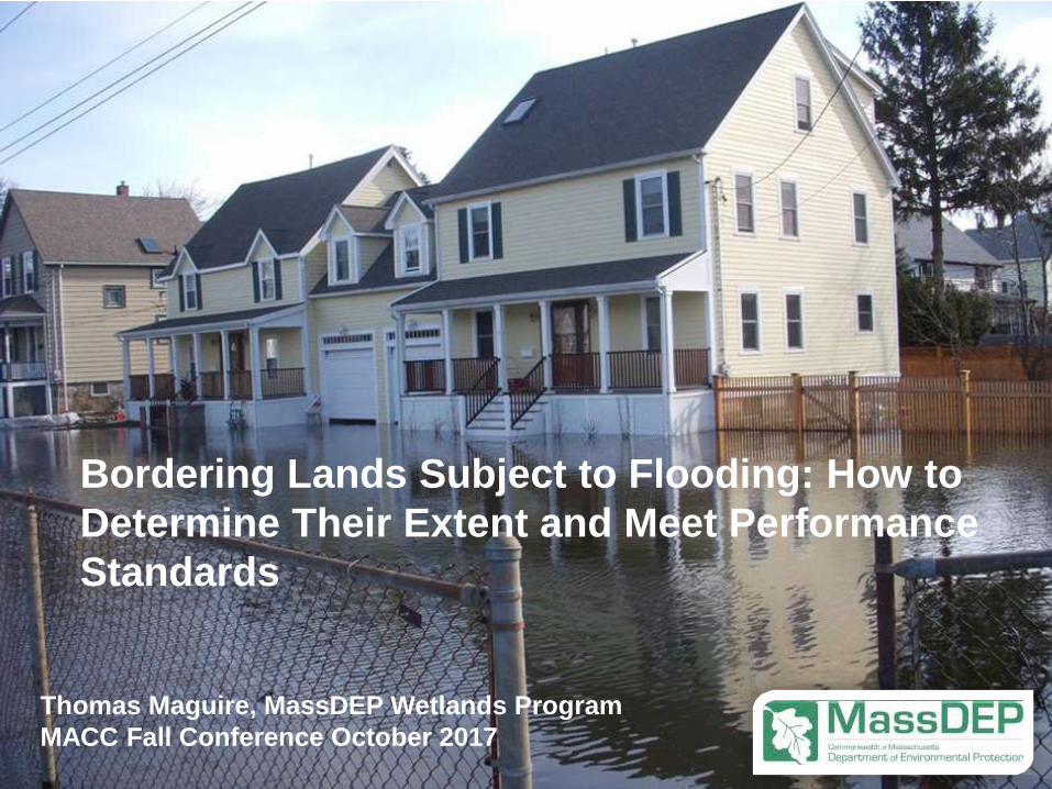
Bordering Lands Subject to Flooding: How to
Determine Their Extent and Meet Performance
Standards
Thomas Maguire, MassDEP Wetlands Program
MACC Fall Conference October 2017
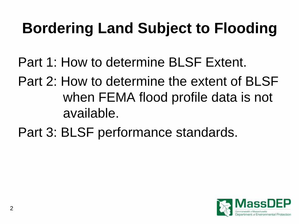
Bordering Land Subject to Flooding
Part 1: How to determine BLSF Extent.
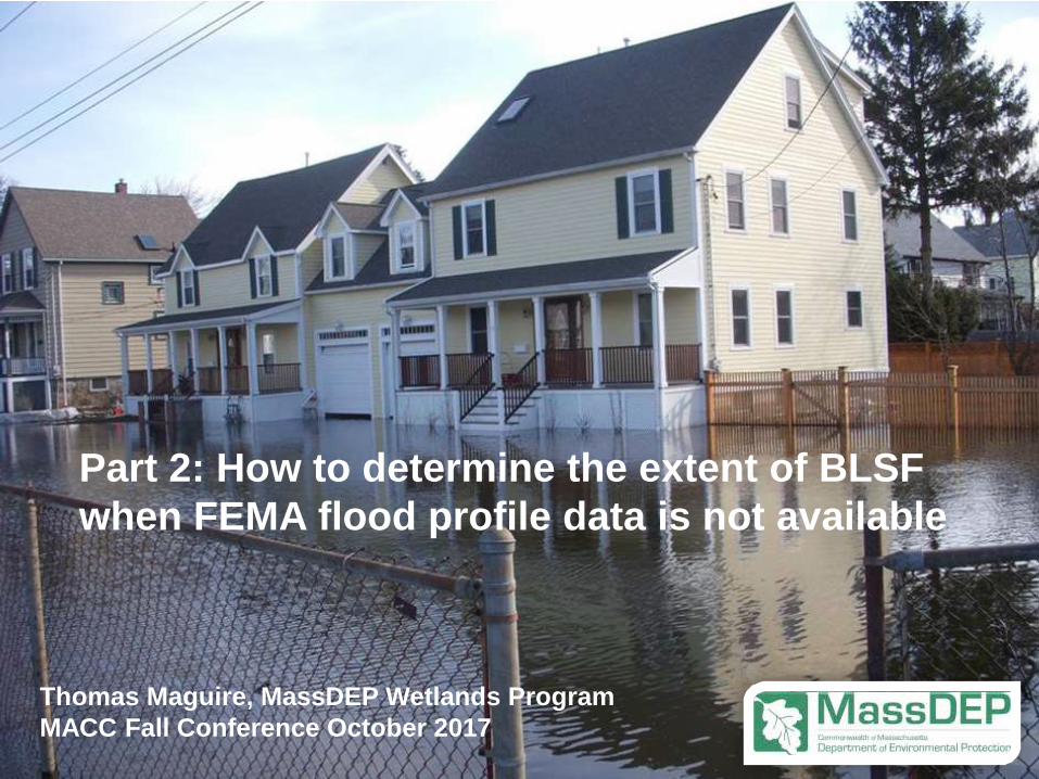
Part 2: How to determine the extent of BLSF
when FEMA flood profile data is not
available.
Part 3: BLSF performance standards.
2
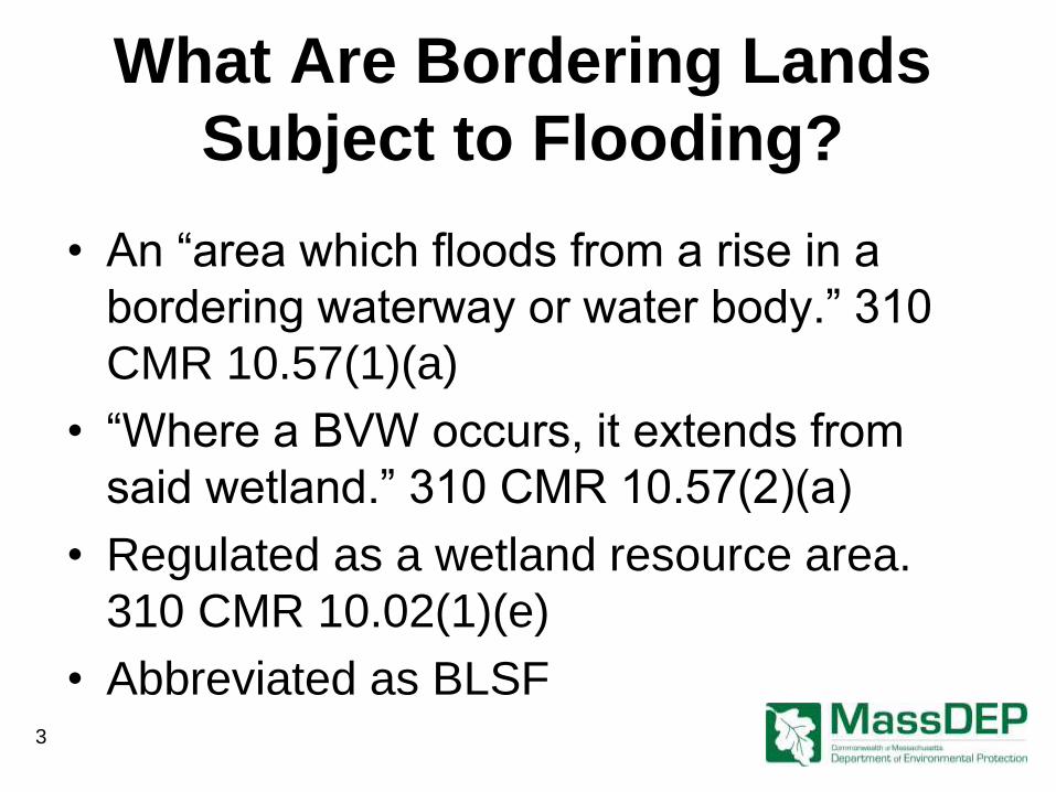
What Are Bordering Lands
Subject to Flooding?
• An “area which floods from a rise in a
bordering waterway or water body.” 310
CMR 10.57(1)(a)
• “Where a BVW occurs, it extends from
said wetland.” 310 CMR 10.57(2)(a)
• Regulated as a wetland resource area.
310 CMR 10.02(1)(e)
• Abbreviated as BLSF
3
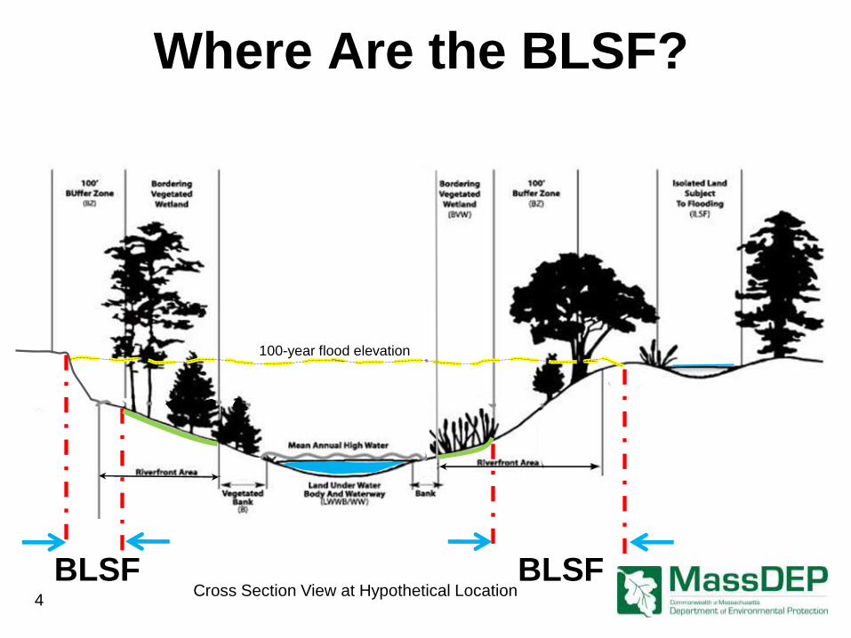
BLSF
Where Are the BLSF?
4
BLSF
100-year flood elevation
Cross Section View at Hypothetical Location
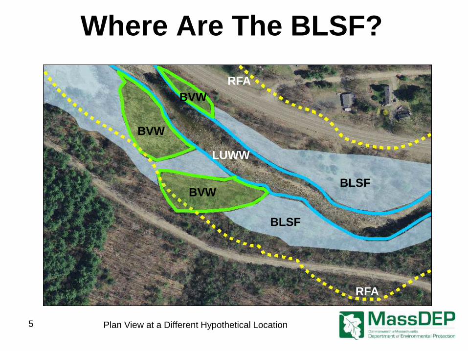
Where Are The BLSF?
BVW
BLSF
RFA
5 Plan View at a Different Hypothetical Location
LUWW
RFA
BLSF
BVW
BVW
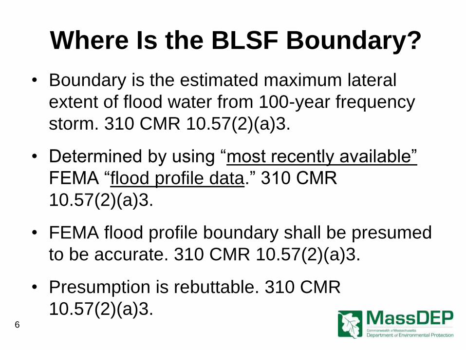
Where Is the BLSF Boundary?
• Boundary is the estimated maximum lateral
extent of flood water from 100-year frequency
storm. 310 CMR 10.57(2)(a)3.
• Determined by using “most recently available”
FEMA “flood profile data.” 310 CMR
10.57(2)(a)3.
• FEMA flood profile boundary shall be presumed
to be accurate. 310 CMR 10.57(2)(a)3.
• Presumption is rebuttable. 310 CMR
10.57(2)(a)3. 6
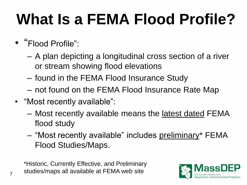
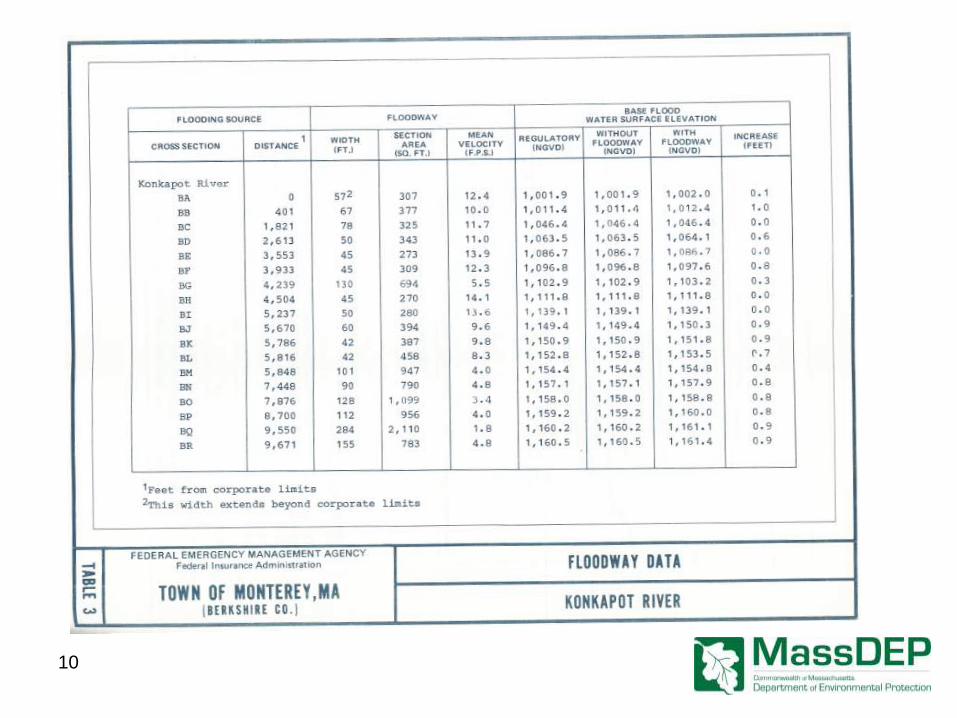
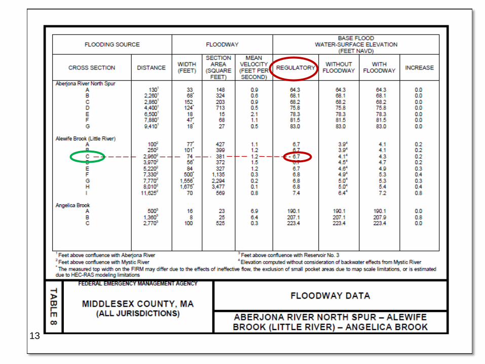
What Is a FEMA Flood Profile?
• “Flood Profile”:
– A plan depicting a longitudinal cross section of a river
or stream showing flood elevations
– found in the FEMA Flood Insurance Study
– not found on the FEMA Flood Insurance Rate Map
• “Most recently available”:
– Most recently available means the latest dated FEMA
flood study
– “Most recently available” includes preliminary* FEMA
Flood Studies/Maps.
7
*Historic, Currently Effective, and Preliminary
studies/maps all available at FEMA web site
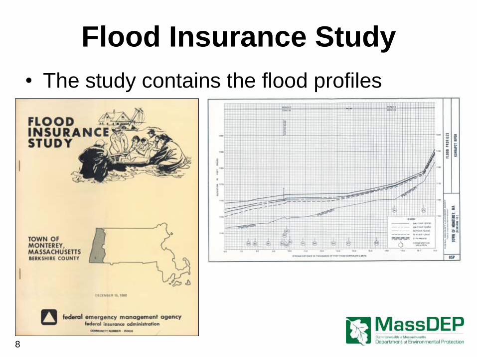
Flood Insurance Study
• The study contains the flood profiles
8
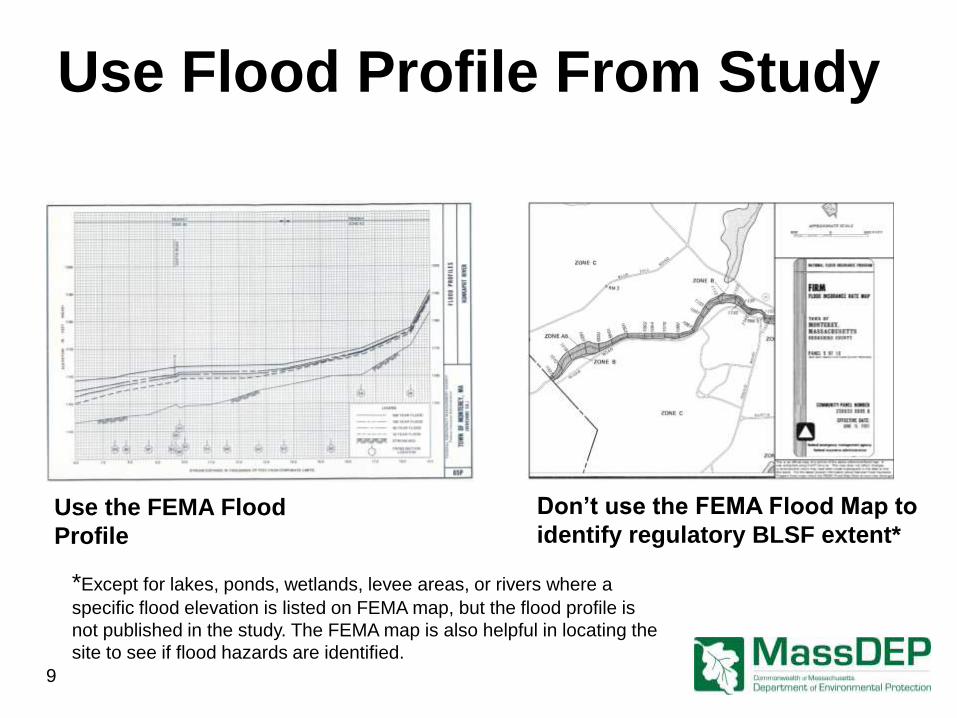
Use Flood Profile From Study
Use the FEMA Flood
Profile
Don’t use the FEMA Flood Map to
identify regulatory BLSF extent*
*Except for lakes, ponds, wetlands, levee areas, or rivers where a
specific flood elevation is listed on FEMA map, but the flood profile is
not published in the study. The FEMA map is also helpful in locating the
site to see if flood hazards are identified.
9
10
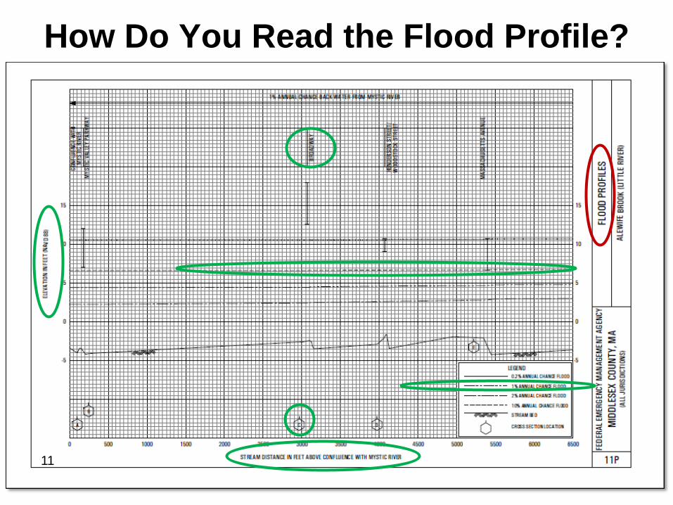
How Do You Read the Flood Profile?
11
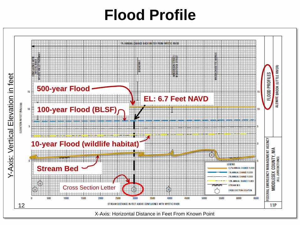
Flood Profile
Stream Bed
100-year Flood (BLSF)
EL: 6.7 Feet NAVD
10-year Flood (wildlife habitat)
12
500-year Flood
Cross Section Letter
X-Axis: Horizontal Distance in Feet From Known Point
Y-A
xis
: V
ert
ical E
levation in f
eet
13
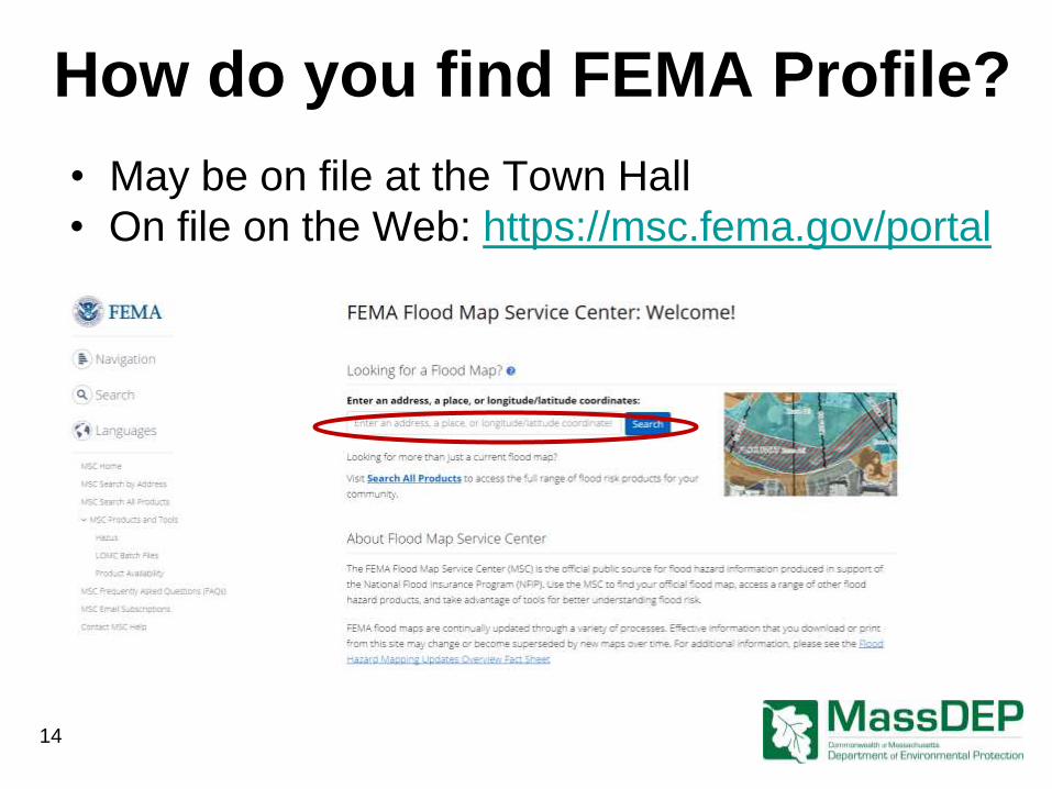
How do you find FEMA Profile?
• On file on the Web: https://msc.fema.gov/portal
• May be on file at the Town Hall
14
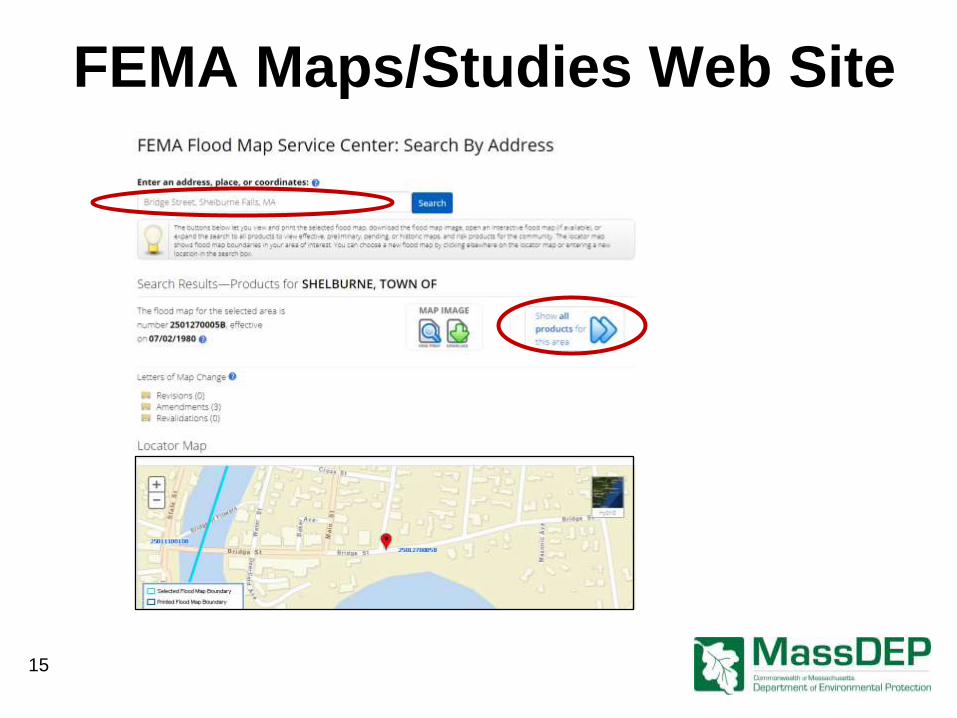
FEMA Maps/Studies Web Site
15
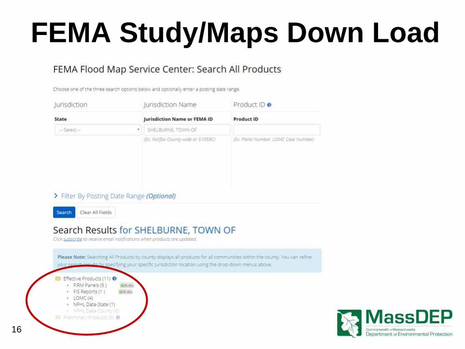
FEMA Study/Maps Down Load
16
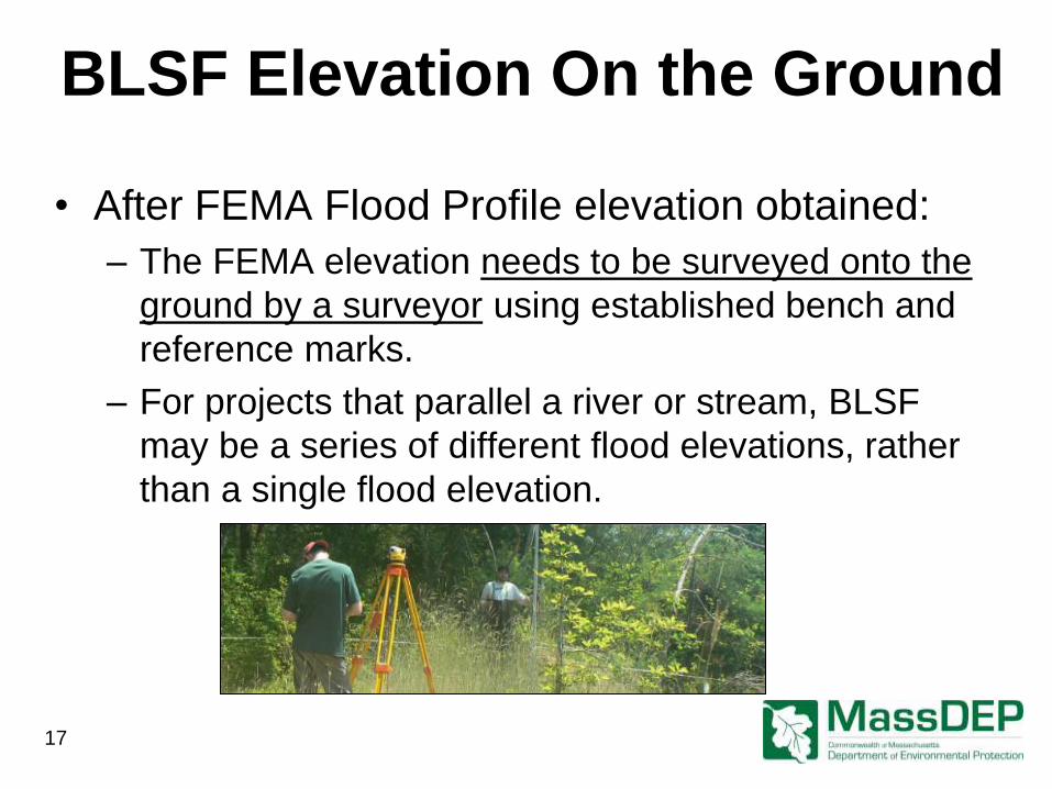
BLSF Elevation On the Ground
• After FEMA Flood Profile elevation obtained:
– The FEMA elevation needs to be surveyed onto the
ground by a surveyor using established bench and
reference marks.
– For projects that parallel a river or stream, BLSF
may be a series of different flood elevations, rather
than a single flood elevation.
17
Part 2: How to determine the extent of BLSF
when FEMA flood profile data is not available
Thomas Maguire, MassDEP Wetlands Program
MACC Fall Conference October 2017
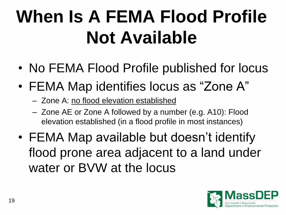
When Is A FEMA Flood Profile
Not Available
• No FEMA Flood Profile published for locus
• FEMA Map identifies locus as “Zone A” – Zone A: no flood elevation established
– Zone AE or Zone A followed by a number (e.g. A10): Flood
elevation established (in a flood profile in most instances)
• FEMA Map available but doesn’t identify
flood prone area adjacent to a land under
water or BVW at the locus
19
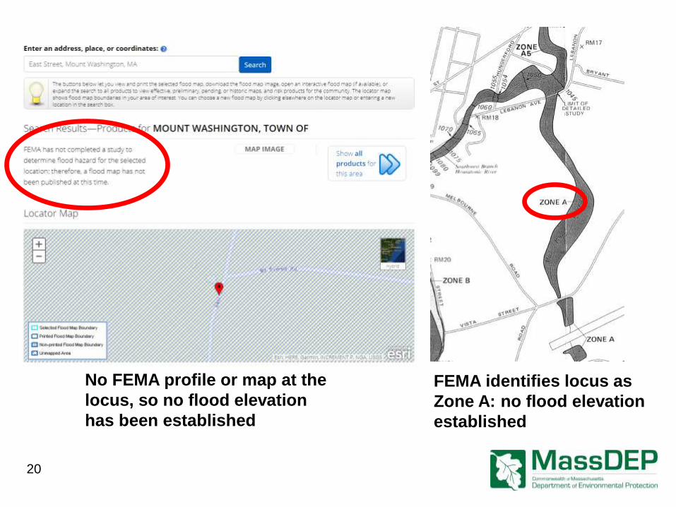
No FEMA profile or map at the
locus, so no flood elevation
has been established
FEMA identifies locus as
Zone A: no flood elevation
established
20
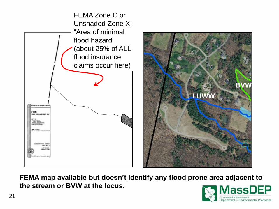
FEMA map available but doesn’t identify any flood prone area adjacent to
the stream or BVW at the locus.
21
FEMA Zone C or
Unshaded Zone X:
“Area of minimal
flood hazard”
(about 25% of ALL
flood insurance
claims occur here)
BVW
LUWW
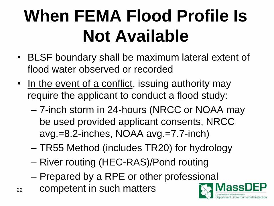
When FEMA Flood Profile Is
Not Available • BLSF boundary shall be maximum lateral extent of
flood water observed or recorded
• In the event of a conflict, issuing authority may
require the applicant to conduct a flood study:
– 7-inch storm in 24-hours (NRCC or NOAA may
be used provided applicant consents, NRCC
avg.=8.2-inches, NOAA avg.=7.7-inch)
– TR55 Method (includes TR20) for hydrology
– River routing (HEC-RAS)/Pond routing
– Prepared by a RPE or other professional
competent in such matters 22
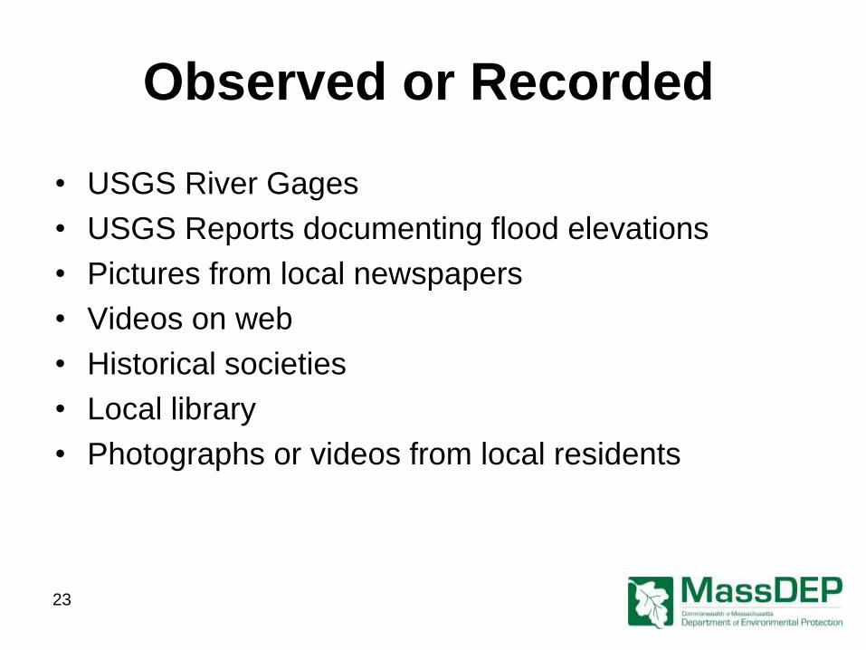
Observed or Recorded
• USGS River Gages
• USGS Reports documenting flood elevations
• Pictures from local newspapers
• Videos on web
• Historical societies
• Local library
• Photographs or videos from local residents
23
24
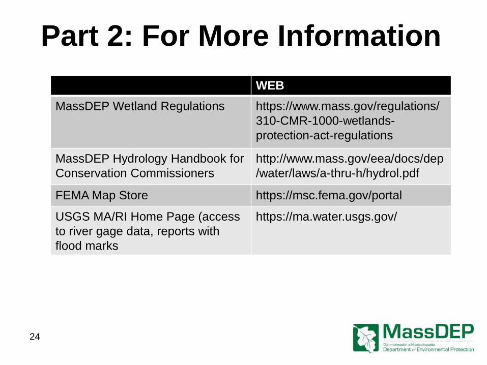
Part 2: For More Information
WEB
MassDEP Wetland Regulations https://www.mass.gov/regulations/
310-CMR-1000-wetlands-
protection-act-regulations
MassDEP Hydrology Handbook for
Conservation Commissioners
http://www.mass.gov/eea/docs/dep
/water/laws/a-thru-h/hydrol.pdf
FEMA Map Store https://msc.fema.gov/portal
USGS MA/RI Home Page (access
to river gage data, reports with
flood marks
https://ma.water.usgs.gov/
Part 3: Bordering Lands Subject to Flooding
Performance Standards
Thomas Maguire, MassDEP Wetlands Program
MACC Fall Conference October 2017
Flood Prone Areas Extend to
Multiple Resource Areas
26
Where Do the Inland Wetland
Regulations Address Flooding?
• Bank: 310 CMR 10.54(4)(a)2.
• Land Under Water: 310 CMR 10.56(4)(a)1.
• Riverfront Area: 310 CMR 10.58(4)(a)
• Bordering Vegetated Wetlands: 310 CMR
10.55(4)(b)
• BLSF: 310 CMR 10.57(4)
• ILSF: 310 CMR 10.57(4)(b)*
*Not Addressed by this Presentation
27

Bank, LUW, and RFA Flood Control Interest Performance Standards
• Bank: Work shall not impair “the water carrying
capacity of the existing channel within the Bank”
310 CMR 10.54(4)(a)2.*
• Land Under Water: Work shall not impair “the
water carrying capacity within the defined
channel.” 310 CMR 10.56(4)(a)1.*
• Riverfront area: Work shall met performance
standards for all other resource areas within
Riverfront Area. 310 CMR 10.58(4)(a)
*Coincides with FEMA Floodway Regulation:
No Flood Rise 28
29
Water Carrying Capacity
FEMA Floodway
Land Under Water
BVW
BLSF (based on elevation,
not FEMA Zones)
• 310 CMR 10:56(1):
− “ land under water, in
conjunction with banks, serves
to confine floodwater within a
definite channel during the most
frequent storms.”
− “Filling within this channel blocks
flow which in turn causes
backwater and overbank
flooding.”
BVW Flood Control Interest Performance Standards
• Issuing authority may issue an Order which
results in loss of up to 5,000 square feet of BVW
when said area is replaced in accordance with
the following: – surface of replacement area shall be equal to the lost area;
– the ground water and surface elevation of the replacement area shall be
approximately equal to lost area;
– the replacement area shall have an unrestricted hydraulic connection to the
same water body or waterway;
– the replacement area shall be located within same general area or reach of the
lost area;
– At least 75% of the replacement area shall be re-established in hydrophytic
plants;
– replacement area shall be provided in a manner consistent with all other General
Performance Standards for each resource area.
30
31
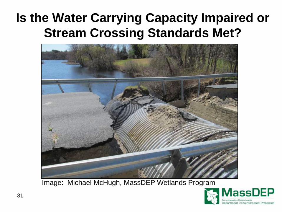
Image: Michael McHugh, MassDEP Wetlands Program
Is the Water Carrying Capacity Impaired or
Stream Crossing Standards Met?
BLSF Performance Standards
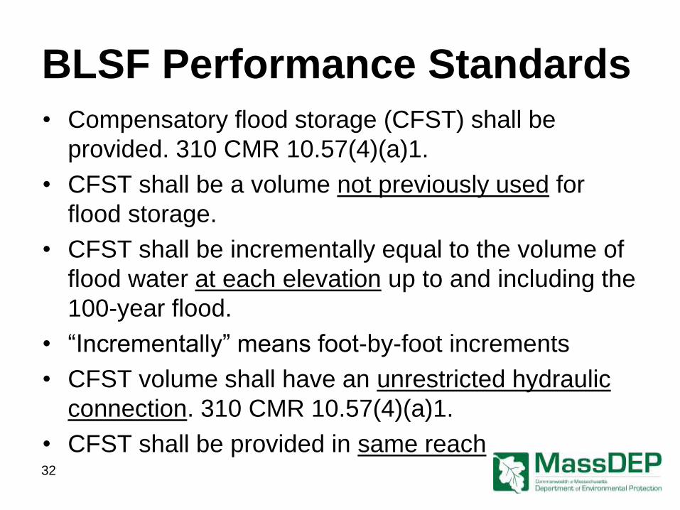
• Compensatory flood storage (CFST) shall be
provided. 310 CMR 10.57(4)(a)1.
• CFST shall be a volume not previously used for
flood storage.
• CFST shall be incrementally equal to the volume of
flood water at each elevation up to and including the
100-year flood.
• “Incrementally” means foot-by-foot increments
• CFST volume shall have an unrestricted hydraulic
connection. 310 CMR 10.57(4)(a)1.
• CFST shall be provided in same reach
32
BLSF Performance Standards
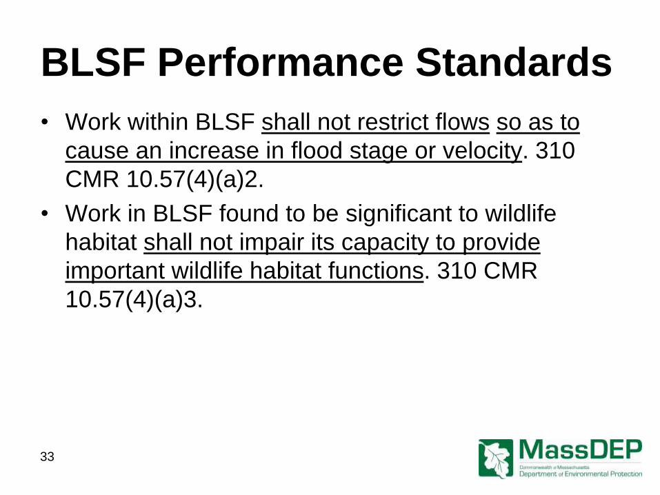
• Work within BLSF shall not restrict flows so as to
cause an increase in flood stage or velocity. 310
CMR 10.57(4)(a)2.
• Work in BLSF found to be significant to wildlife
habitat shall not impair its capacity to provide
important wildlife habitat functions. 310 CMR
10.57(4)(a)3.
33
Compensatory Flood Storage Fill and Cut Table
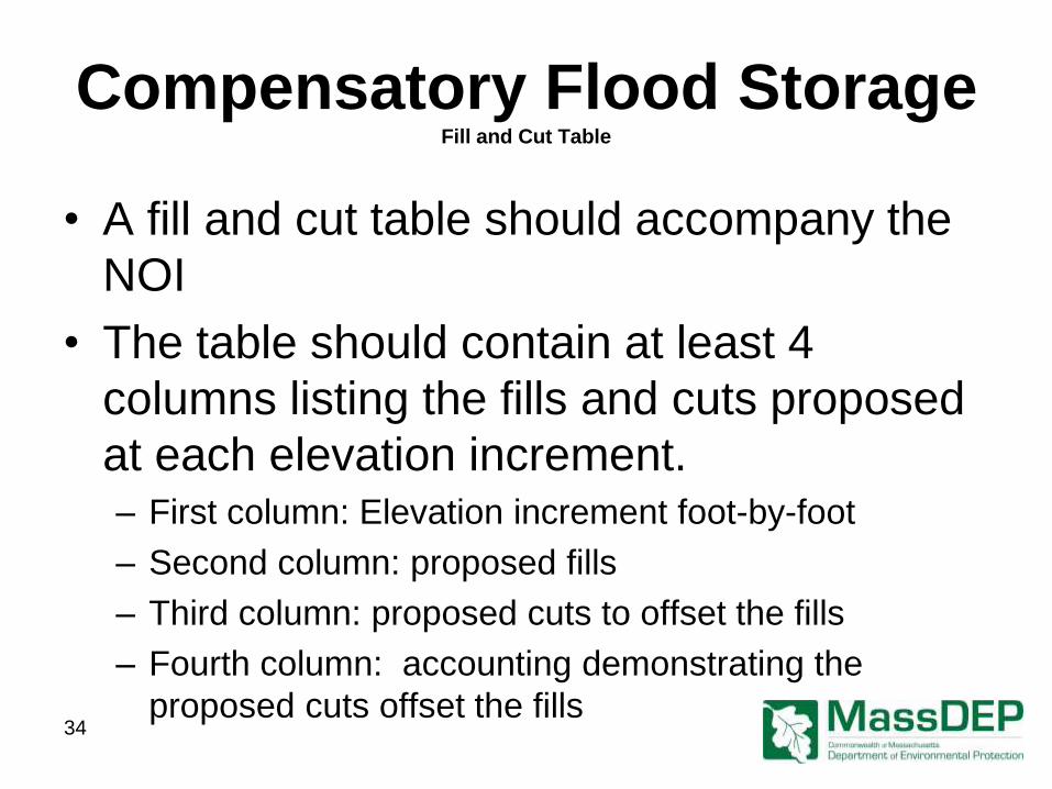
• A fill and cut table should accompany the
NOI
• The table should contain at least 4
columns listing the fills and cuts proposed
at each elevation increment. – First column: Elevation increment foot-by-foot
– Second column: proposed fills
– Third column: proposed cuts to offset the fills
– Fourth column: accounting demonstrating the
proposed cuts offset the fills 34
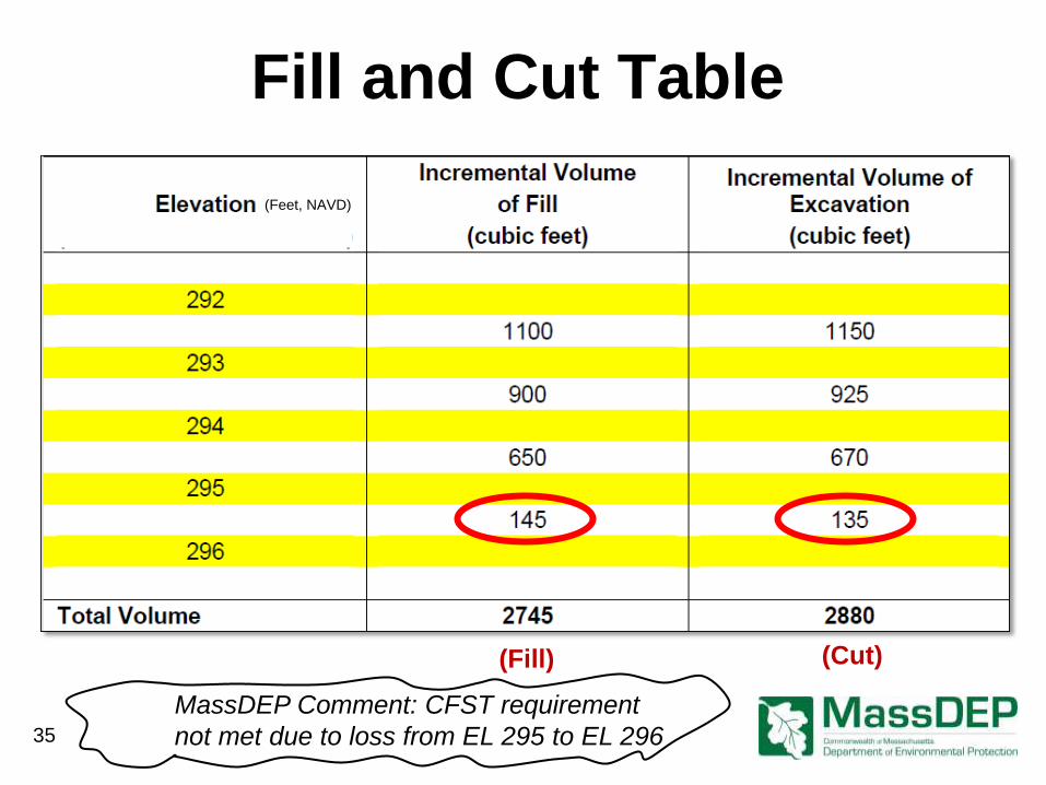
(Cut) (Fill)
(Feet, NAVD)
Fill and Cut Table
MassDEP Comment: CFST requirement
not met due to loss from EL 295 to EL 296 35
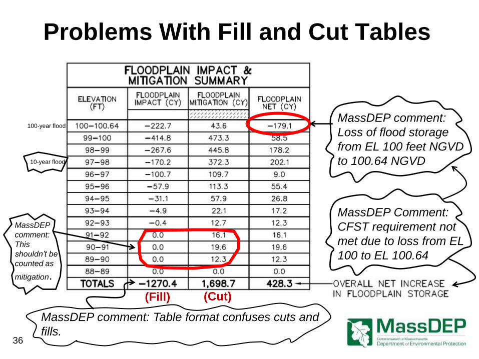
Problems With Fill and Cut Tables
MassDEP comment:
Loss of flood storage
from EL 100 feet NGVD
to 100.64 NGVD
MassDEP comment: Table format confuses cuts and
fills.
MassDEP Comment:
CFST requirement not
met due to loss from EL
100 to EL 100.64
(Fill) (Cut)
MassDEP
comment:
This
shouldn’t be
counted as
mitigation.
100-year flood
10-year flood
36
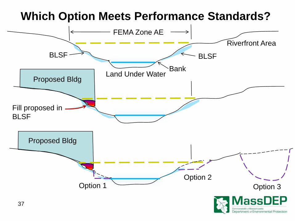
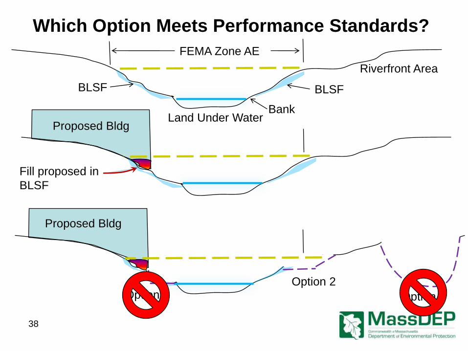
Land Under Water
FEMA Zone AE
Bank
Riverfront Area
Proposed Bldg
Fill proposed in
BLSF
Proposed Bldg
BLSF BLSF
Option 1 Option 2
Option 3
Which Option Meets Performance Standards?
37
Land Under Water
FEMA Zone AE
Bank
Riverfront Area
Proposed Bldg
Fill proposed in
BLSF
Proposed Bldg
BLSF BLSF
Option 1 Option 2
Option 3
Which Option Meets Performance Standards?
38
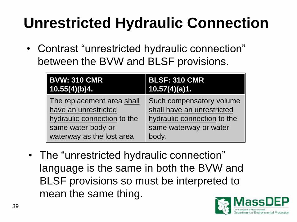
Unrestricted Hydraulic Connection
• Contrast “unrestricted hydraulic connection”
between the BVW and BLSF provisions.
Hydraulic Restriction
BVW: 310 CMR
10.55(4)(b)4.
BLSF: 310 CMR
10.57(4)(a)1.
The replacement area shall
have an unrestricted
hydraulic connection to the
same water body or
waterway as the lost area
Such compensatory volume
shall have an unrestricted
hydraulic connection to the
same waterway or water
body.
• The “unrestricted hydraulic connection”
language is the same in both the BVW and
BLSF provisions so must be interpreted to
mean the same thing. 39
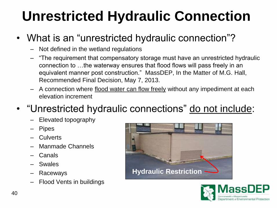
Unrestricted Hydraulic Connection
• What is an “unrestricted hydraulic connection”? – Not defined in the wetland regulations
– “The requirement that compensatory storage must have an unrestricted hydraulic
connection to …the waterway ensures that flood flows will pass freely in an
equivalent manner post construction.” MassDEP, In the Matter of M.G. Hall,
Recommended Final Decision, May 7, 2013.
– A connection where flood water can flow freely without any impediment at each
elevation increment
• “Unrestricted hydraulic connections” do not include: – Elevated topography
– Pipes
– Culverts
– Manmade Channels
– Canals
– Swales
– Raceways
– Flood Vents in buildings
40
Hydraulic Restriction
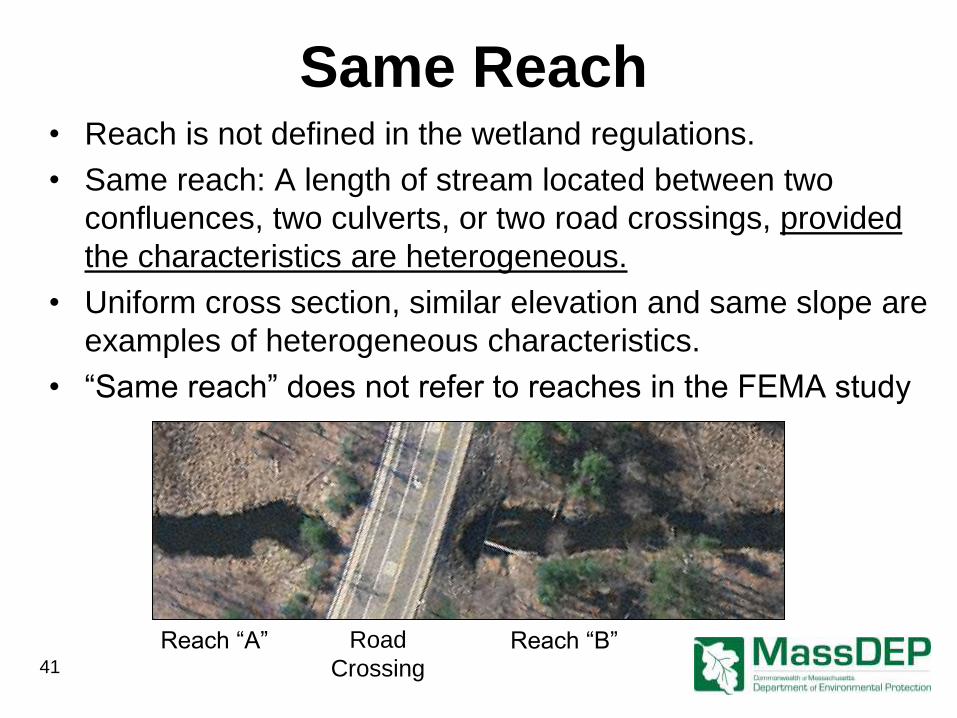
Same Reach • Reach is not defined in the wetland regulations.
• Same reach: A length of stream located between two
confluences, two culverts, or two road crossings, provided
the characteristics are heterogeneous.
• Uniform cross section, similar elevation and same slope are
examples of heterogeneous characteristics.
• “Same reach” does not refer to reaches in the FEMA study
Reach “A” Reach “B” Road
Crossing 41
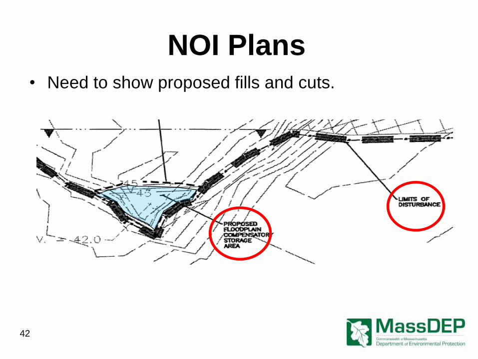
NOI Plans
• Need to show proposed fills and cuts.
42
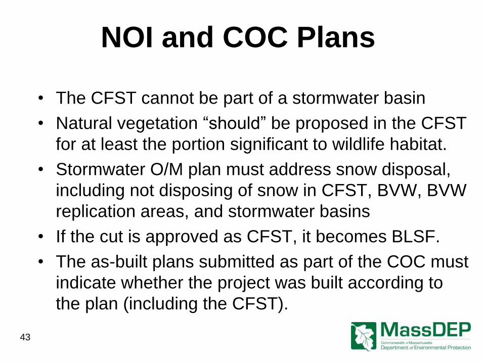
NOI and COC Plans
• The CFST cannot be part of a stormwater basin
• Natural vegetation “should” be proposed in the CFST
for at least the portion significant to wildlife habitat.
• Stormwater O/M plan must address snow disposal,
including not disposing of snow in CFST, BVW, BVW
replication areas, and stormwater basins
• If the cut is approved as CFST, it becomes BLSF.
• The as-built plans submitted as part of the COC must
indicate whether the project was built according to
the plan (including the CFST).
43
44
WEB
MassDEP Wetland Regulations https://www.mass.gov/regulations/
310-CMR-1000-wetlands-
protection-act-regulations
MassDEP Hydrology Handbook for
Conservation Commissioners
http://www.mass.gov/eea/docs/dep
/water/laws/a-thru-h/hydrol.pdf
END
Part 3: For More Information