BOOKLET NUVit Seminar 'Borrowed Size' (September 3, 2015)
44
f u t u r e i n v e s t m e n t s c u r r e n t i n v e s t m e n t s VITALITY M O B I L I T Y L I V E A B I L I T Y N E T W O R K S L A N D U S E BRUSSELS, SEPTEMBER 3, 2015 SEMINAR BOOKLET BORROWED SIZE NUVit
-
Upload
vereniging-deltametropool -
Category
Documents
-
view
217 -
download
2
description
The NUVit (Networking for Urban Vitality) seminar on Borrowed Size consisted of several presentations and a reflection on the NUVit case studies. ------------------------------------------------------------------ The initiative ‘Networking for Urban Vitality’ (NUVit) brings together European case studies and practical experience from integrated infrastructure and spatial development. The goal of NUVit is to deliver a proven toolbox for authorities to use in order to optimize economic, social and environmental vitality of urban regions from the perspective of multimodal transport infrastructures. ----------------------------------------------------------------- More information about NUVit at http://nuvit.eu/ More information on the seminar at http://www.deltametropool.nl/nl/nuvit_borrowed_size
Transcript of BOOKLET NUVit Seminar 'Borrowed Size' (September 3, 2015)

futu
re in
vest
men
tscurrent investm
ents
VITALITY
MOBILITY
LIVEABILITY
N
ETW
ORK S L
A ND USE
BRUSSELS, SEPTEMBER 3, 2015
SEMINAR BOOKLET
BORROWEDSIZE
NUVit

PROGRAMME 4
NUVit 5
BORROWED SIZE 9
NUVit CASE STUDIES 13
01 RAIL BALTIC CORRIDOR 14
02 T.OP LIMBURG 18
03 LINKÖPING HIGH SPEED RAIL LINK 22
EUROPEAN METROPOLITAN AREAS 27
04 SCANDINAVIAN 8 MILLION CITY 28
05 CDT GRAND PARIS EST NOISY-CHAMPS 32
06 COURTINE CONFLUENCE 36
PARTICIPANTS 41
2

The NUVit community welcomes you to this Brussels seminar. In this seminar we will delve into the theme of Borrowed Size with several presentations and a reflection on the NUVit case studies.
The initiative ‘Networking for Urban Vitality’ (NUVit) brings together European case studies and practical experience from integrated infrastructure and spatial development. The NUVit goal is to deliver a proven toolbox for authorities to use in order to optimize economic, social and environmental vitality of urban regions from the perspective of multimodal transport infrastructures.
More information about NUVit is available at: http://nuvit.eu/
3

PROGRAMME
Morning programme
09.30 Registration and coffee
09.45 Welcome and introduction on NUVit Roadmap by Jos Arts (Rijkswaterstaat)
10.00 NUVit in Practice: presentation of the progress and achieved results of the case studies: - Linköping High Speed Rail Link (Sweden) - T.OP Limburg (Flanders) - Rail Baltic Corridor (Estonia) 11.00 Coffee break
11.15 Synthesis on the NUVit case studies by Ton Venhoeven
11.45 Questions and discussion
Afternoon programme
12.30 Informal lunch
13.30 Introduction by Jos Arts
13.45 Presentation ‘In Tandem for Competiveness: Borrowed Size for the Eurodelta’ by Henri de Groot, Frank van Oort, Martijn Smit
14.30 Coffee break 14.45 Presentation: Borrowed Size for European Metropolitan Areas by Paul Gerretsen Areas: - Scandinavian 8 million city (Sweden) - CDT Grand Paris Est Noisy-Champs (Île de France) - Courtine Confluence (Avignon)
15.30 Discussion and reflections on borrowed size
16.30 Drinks
4

NUVitNETWORKING FOR URBAN VITALITY
5

NETWORKING FOR URBAN VITALITY (NUVit)
The NUVit initiative will deliver a proven toolbox for authorities to optimize economic, social and environmental vitality of urban regions from the perspective of multimodal transport infrastructures. In addition, it will sustain the developed knowledge through a network of experts and practitioners that apply the NUVit concept in cases.
CHALLENGE
Achieving a smart green and integrated transport system is key to sustaining and further developing the economic, social and environmental vitality of urban Europe (“urban vitality”). Within this context the challenge for transport infrastructure and spatial planning authorities is to deliver the next generation of infrastructure and mobility governance, design, management and operation that would enable optimal accessibility, liveability and vitality across the geographical scales: from the local daily urban system to the wider EU regions that cluster metropolitan areas.
The Networking for Urban Vitality concept concerns the integration of multi-modal mobility, infrastructure- and spatial planning. This enables the synergetic integration of spatial development with investments in infrastructure (across all relevant scale levels: local, regional and corridor) in order to achieve the highest added (asset) value. Best practices across Europe show that by implementing this integrated NUVit approach significant benefits can be achieved in accelerating infrastructure delivery, environmental and spatial quality, investment climate, mobility network resilience and stakeholder commitment.
These best-practices, however, are scattered across the Member States and have had little knowledge exchange between each other. For this reason, a network has been established in 2010 around a selected number of cases, as an in-kind effort of various transport infrastructure & spatial planning agencies together with research organisations. This network has delivered a clear innovation roadmap as well as a first case inventory, in which a selection of them has been deconstructed following the conceptual NUVit model.
REGIONAL / DAILY URBAN SYSTEM (DUS) LEVEL
LOCAL LEVEL
EU CORRIDOR LEVEL
addressing and linking scales
source: MUST
6

OBJECTIVES
Various public and private parties involved in the cases acknowledge a clear need for practical tools and approaches to provide them with consistency across the geographical scales they are concerned with. Already the conceptual model has been applied to some cases Linköping (SE), Randstad-Rhein/Ruhr Corridor (NL-DE), Rail Baltic Corridor (EE) and T.OP Limburg (BE) with appreciation of the authorities involved and showing great potential regarding cost-efficiency to society, social and economic revenues and achieving sustainability objectives.
This partial success deserves to be followed-up and has led to the main objectives of the initiative:
1. bring together practical experiences from integrated infrastructure and spatial development show cases (some ten cases relating to road-, rail-and waterways as well as slow transport modalities and spatial development) across Europe;
2. transform the conceptual NUVit model and the insights from showcases into a proven, practical toolbox for authorities to use when planning maintenance and development of their multimodal transport infrastructure networks within the relation between mobility, land use and liveability;
3. show the potential benefits (duration, budget, public support and urban vitality) for multimodal transport infrastructure planning by validating the practical toolbox in living lab environments;
4. show more effective and efficient cooperation between national, regional and local authorities and their multi-stakeholders on the optimal planning, design, construction and operation of infrastructure works (innovative governance approaches for public-private partnerships, public-public cooperation and stakeholder involvement);
5. build and disseminate a concrete track record of real cases across Europe;
6. raise awareness and stimulate policy dialogues within the member states and the EC about the NUVit approach regarding integrated investments for multimodal transport infrastructure and spatial development at regional, national, cross-border and European levels.
7. create a durable and self-sustaining network of practitioners that has been established during the NUVit initiative.
PROJECT CONCEPTS
The innovativeness of the NUVit conceptual model is the integration of six dimensions of mobility, land use and infrastructure planning in such a way that synergy is created. It goes beyond a local SUMP (sustainable urban mobility plan) as regional and (inter)national mobility and infrastructure networks and broader spatial opportunities are taken into account as well. The NUVit concept offers both short-term project benefits (duration, budget, and public support) and long-lasting benefits in terms of enhanced quality of infrastructure (network resilience, spatial quality of the surrounding area, investment climate). Vitality is the heart of the model as an integrated approach towards the six dimensions with the capacity to reveal synergetic aspects that may go beyond the sectorial project scope.
7

Spatial dimension: Spatial concepts with synergetic effects on accessibility. Examples are multi-model corridors, transit oriented development and area-oriented approaches. Critical aspects are the ability to deal with scale issues, the role of transport analysis and spatial design.
Network dimension: Multimodal network optimization at various spatial scales: corridors at (inter)national level, daily urban systems at metropolitan level and landscaping at local level.
Time dimension: This dimension aims at linking the stages in a full life-cycle of places and infrastructures (this also relates to renewal, redevelopment, circular economy/cradle-to-cradle and asset management), examining changing lifestyles and their linkages to mobility, and strategy development for transitions towards multimodality and integration with land use.
Value dimension: This dimension gives an overview of state-of the- art models and approaches to assess value - e.g. Social Cost- Benefit Analysis, Life-Cycle Assessment, Environmental Assessment - to create value and capture value in combined infrastructure and spatial development projects.
Institutional dimension: This comprises analysing existing organizational and institutional frameworks which leads to an overview of proven governance approaches – regarding public-public and public-private partnerships, stakeholder engagement – at all levels for the implementation toolbox.
Implementation dimension: Finally, a critical aspect in innovation is the deployment and implementation. Therefore, in the NUVit conceptual model explicit attention is paid to the implementation of the framework and toolbox developed. This dimension includes making an inventory of implementation issues and drivers in order to tackle implementation barriers.
PROLOGUE
BASIC FRAMEWORK
1. SPATIAL
spatial integrative concepts
6IMPLEMENTATION
drivers, barriers, dissemi-nations, communication
5INSTITUTIONAL
institutions, governance, organisation
4VALUE
instruments for value creation & capturing
3TIME
time linkages & strategy developement
2NETWORK
multi-modal network & multi-scalar optimalisation
VITALITY
economic, environmental and social vitality
the NUVit conceptual model
source MUST
8

BOR-ROWEDSIZE
9

IN TANDEM FOR COMPETITIVENESS.
Synergies between Metropolitan, Agglomeration, Infrastructure and Network policies in the ABC-region (MAIN)
Henri de Groot, Frank van Oort, Martijn Smit
The ABC-regionThe ABC region is defined within the cities of
Amsterdam(NL), Brussels (BE) and Cologne (GE). According to Richard Florida (2007), this is the scale of the megaregion that defines the future of metropolitan economic functioning. It is on this scale, it is argued, that agglomeration economies are most optimally present; infrastructure, housing and real estate have high returns on investment; and firms and employees profit from economic density via higher productivity and wages. Larger is better.
Capitalisation on agglomeration economies are subject to debate for long already, with paradoxically ever larger scales of economic interaction in competitive city-regions (Glaeser 2012) co-evolving with smaller scales of governance, from municipalities to self-organizing citizens (Barber2013). This fuels our research question: which instruments and investments should be applied on which spatial scales to accommodate economic growth and competitiveness in the ABC-region, with evolving economic growth (up-scaling) and governance (down-scaling) paradigms and without large metropolitan cities?
Agglomeration Economies in Cities and Urban Networks
Agglomeration economies are persistently related to city size and density: a rule of thumb nowadays is that doubling the city size raises productivity with approximately 5%. This is mainly due to better opportunities of firms for matching (on the labour market), sharing (on subcontracting markets) and learning (from competitors and knowledge institutes). Two intervention views of this agglomeration premium in regions like the ABC-region recently emerged: (a) create larger metropolitan economies in a Europe where such cities are scarce (OECD 2015a,b, Hemel 2015), or (b) connect existing medium-sized cities better with each other in order for them to function as a larger agglomeration: a so-called borrowed size scenario (Van Oort et al. 2015a). It has been shown that proximate cities, like the Randstad cities in The
Netherlands, The Flemish cities in Belgium and the Ruhr-region cities in Germany, can use each’ others economic complementary specializations in order to profit from sharing, learning and matching opportunities – equally as larger cities do.
Physical Connectivity and MoreOriginally coined by William Alonso (1973)
for exactly the ABC-region (“in certain European urban patterns, such as those of Germany and the Low Countries, whose cities, quite small by our standards, apparently achieve sufficient scale for the functioning of a modern economy by borrowing size from one another”, p.200), the main precondition according to Alonso is physical accessibility and connectivity by road and rail, for public and private transport. Also in present day policy thinking about borrowed size in the Netherlands (REOS), physical transport linkages between the largest urban regions (Northwing Randstad, Southwing Randstad, Eindhoven) are usually envisioned. Also on the scale of the ABC region, intercity connections come first to mind when thinking about individual cities borrowing size from each other. But in Van Oort et al. (2015a,b) it is argued that there should also be something substantial to be borrowed, like complementary economic knowledge, tradeable products or skilled labour not available in one’s own region, and that institutional and cultural circumstances mould the degree of integration and cooperation capitalizing on borrowed size. Borrowed performance and borrowed functions thus, facilitated by cognitive proximity. Complex terminology – but the fact that the ABC-region is not an optimal functional unit (yet) shows that barriers for development may be multiple and severe, and not just infrastructural.
Multilevel GovernanceThe increased-density versus borrowed-size
discussion is partly artificial. Density in fact is not easy to increase in the polycentric structure of medium-sized cities in the ABC-region – and in fact in most of Europe’s urban landscape (Dijkstra et al.2013). Doubling city sizes means that the already full cities cannot deal anymore with agglomeration disadvantages, like congestion, pollution, crime and inequality. The polycentric reality actually calls for borrowed size solutions. The larger cities do have an attraction function for higher educated sorting themselves in cities though (OECD 2015b).
This means that multiple stakeholders should be involved simultaneously in fostering urban sorting
10

processes and borrowed size. Network facilitators like Rijkswaterstaat care for infrastructural connections within and between nodes of the network, cities care for labour, housing and amenities markets, provinces care for natural amenities and regional accessibility, and nations care for institutional embedding. Policy often has to “go with the flow” as many determinants are exogenous – but basic spatial and economic conditions have to be met, like accessibility, clusters, diversification, working- and living environments, and amenities. In the ABC-region, borrowing size may also be cross-border in nature, but there is a large difference between potential and actual borrowing functions and performance, indicating that large cultural and institutional differences hamper integration (Van Oort et al. 2015b). Multilevel governance is needed for both urban sorting and borrowed size policies, as not one scale of policy has a monopoly on development and investment issues over other scales.
Towards a Research and Investment Agenda Networking for Urban Vitality
There are future development opportunities in the ABC-regions, as learning-sharing-matching opportunities seem present in both localized urban scales and in borrowed-size scales. Connectivity between cities is a crucial precondition – but not sufficient on its own for capitalizing on growth opportunities without the other conditions of complementarities, cultural and institutional embedding. This leads to suggestions for the research and investment agenda Networking for Urban Vitality that integrates different scales and stakeholders:
1. Identify borrowed functions and urban-density functions (“form follows function”),
2.Identify borrowed and density based performances (knowledge, value-chains, subcontracting, markets),
3. Identify and build on local (governance) buzz for global (economic) pipelines positions,
4. Make strategic planning for international nodes and their connectedness,
5. Facilitate value-capturing in nodes and ports (as this is currently not always the case),
6. Optimize physical connections and integration across borders,
7. Manage land-use and transit bottlenecks in all modalities on all spatial scales,
8. Adapt economic hubs to labour- and housing market dynamics,
9. Manage economic and technical transitions in ports and hubs (like commodity trade, bio-fuels, circular production, etc.) and assess its consequences for mainport and metropolitan economies,
10. Create physical space for hub-development in cities,
11. Make integral and interregional assessments of corridor development,
12.Enable interregional governance and cooperation, and cultural exchange (and do it),
13. Balance private and public investments
These issues can and should be taken up simultaneously (e.g. solving bottlenecks as short-term no-regret investments in larger borrowed-size strategies), on various spatial scales simultaneously (Witte et al. 2013).
References:Alonso, W. (1073), Urban zero population growth.
Daedalus 102: 191-206.Barber, B. (2013), If mayors ruled the world.
Dysfunctional nations, rising cities. London: Yale University Press.
Dijkstra, L., E. Garcilazo & P. McCann (2013), The economic performance of European cities and city regions: myths and realities. European Planning Studies 21: 334-354.
Florida, R., T. Gulden & C. Mellander (2007), The rise of the mega-region. Cambridge Journal of Regions, Economy and Society 1: 459-476.
Hemel, Z. (2015), Maak Amsterdam twee maal zo groot. Trouw (17-6-2015), p.2-3.
OECD (2015a), The metropolitan century. Understanding urbanisation and its consequences. Paris: OECD.
OECD (2015b), Governing the city. Paris: OECD.Van Oort, F., E. Meijers, M. Thissen, M.
Hoogerbrugge & M. Burger (2015a) , De concurrentiepositie van Nederlandse steden. Van agglomeratiekracht naar netwerkkracht. Den Haag: Platform31.
Van Oort, F., A. Weterings, L. Nedelkoska & F. Neffke (2015b), Ruimte geven aan economiche vernieuwing. Een onderzoek naar arbeidsmobiliteit en skill-gerelateerdheid in Nederland. Den Haag: Ministerie van I&M.
Witte, P., F. van Oort, B. Wiegmans & T. Spit (2013), “Capitalising on spatiality in European transport corridors”. Journal of Economic and Social Geography (TESG) 104: 510-517.
11

12

NUVIT CASE-
STUDIES
01 RAIL BALTIC CORRIDOR
02 T.OP LIMBURG
03 LINKÖPING HIGH SPEED RAIL LINK
13

Private transport market stakeholders in the area of Rail Baltica
Rail Baltic Growth Corridor
North Sea - Baltic Corridor
14

01RAIL BALTIC
CORRIDORTHE TRANS-EUROPEAN RAILWAY, LINKING HELSINKI – TALLINN – RIGA –
KAUNAS – WARSAW AND CONTINUING ON TO BERLIN
15

DESCRIPTION
Following the regain of independence of the Baltic States in the 90s, an idea about connecting the Baltic States to “the heart of Europe” was born. The idea intended to renew direct connections to the railway network of Europe by building a new European standard 1435 mm wide railway in the Baltic States and connecting such metropoles as Tallinn – Riga – Kaunas – Warsaw – Berlin (and pro-longing the route to Venice in the future). Indirectly this route includes also Finland, since the planning incorporates an idea to build an underwater tun-nel, which could connect Tallinn and Helsinki by train. Another idea is to open a rail ferry between these cities thus enlarging the impact of the project to the Scandinavian countries as well.
Rail Baltica will support the wider EU goals of parity of access to services and infrastructure of EU Member States and development of sustaina-ble modes of transportation, improved balance and interoperability between different means of transportation.
BUDGET
COSTSThe Rail Baltica project is estimated to require an investment of € 3.7bn (AECOM 2011). The project will be jointly funded by the three Baltic nations. European Union funds will account for approxi-mately 85% of the financing.
BENEFITSThe building will ensure independence to the trans-port system of the Baltic States and mobility of its inhabitants by using a safe, modern, fast and environmentally friendly transport mode which could in turn create a potential for new develop-ment, jobs and increased competitiveness.
PARTNERS
Republic of Lithuania, European Parliament, Council of the European Union, Ministries res-ponsible for Transport in Poland, Lithuania, Latvia, Estonia, Finland and former EU Vice-President, Transport Commissioner Siim Kallas.
BACKGROUND INFORMATION
LOCATIONPoland, Lithuania, Latvia, Estonia, Finland, “Rail Baltica” axis (Warsaw-Kaunas-Riga-Tallinn-Helsinki), A section of the “North Sea – Baltic” Rail freight corridor No 8 (Rotterdam – Kaunas).
STATUSThe part of the railway line in the Baltic states is expected to be completed by 2024. The line bet-ween Tallinn, Riga and Kaunas is expected to be operational by 2025 with the Warsaw link to be completed in 2030.
SURFACE AREAThe total length of Rail Baltica is planned to be 729 km.
SOURCEShttp://www.rail-baltica.lthttp://www.rail-baltica.comhttp://railbaltica.info/enhttp://www.rbgc.eu/frontpage.html
AIMS
The Global Project “Rail Baltica” has two main goals:The first goal is to develop the missing high-qual-ity physical infrastructure and logistical railway connections for passenger and freight transport between Finland, the Baltic States and other EU countries,The second goal is the full implementation of prin-ciples of intermodality, interoperability, reliability, safety, security, re-balancing of transport modes in favour of the most environmentally friendly ones on the long term.
16

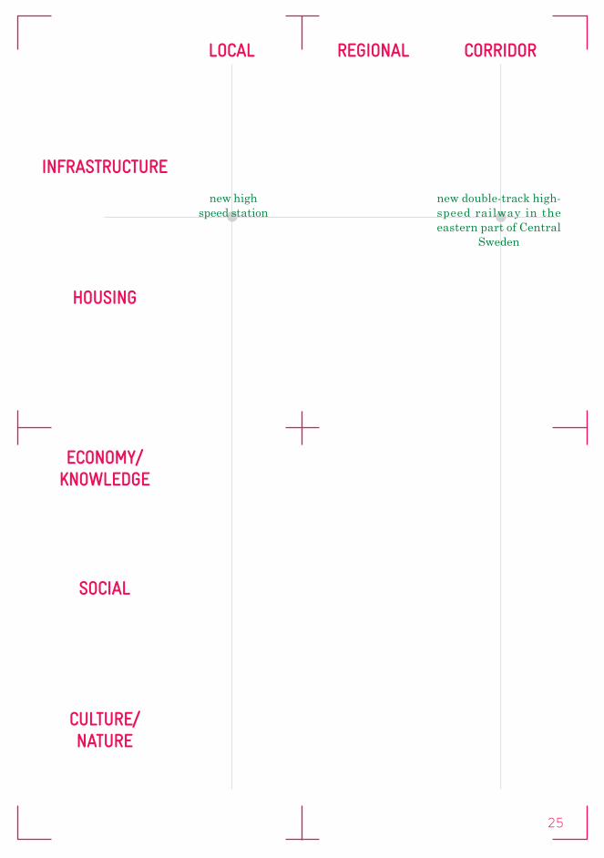
LOCAL REGIONAL CORRIDOR
INFRASTRUCTURE
HOUSING
ECONOMY/KNOWLEDGE
SOCIAL
CULTURE/ NATURE
design and construction of railway lines:
Poland, Lithuania, Latvia, Estonia
(re)construction of stations:
Tallinn, Pärnu, Riga (Central & Airport)
technical design of freight terminals:
Maardu
17

action programmes for three core strategies, RE-MINE Limburg Port, RE-MINE Limburg Park, and RE-MINE Limburg City
region surrounding City of Genk
18

02T.OP LIMBURG
LANDSCAPE METROPOLIS
19

DESCRIPTION
The scheduled closure of Ford Genk (BE), one of Limburg’s main economic engines and Flanders’ fourth largest industrial site, will drastically alter the economic and societal setting of the region. Just as happened in the 1970s after the closures of the mines.
To meet this challenge and to preserve employment levels in Limburg, a regional investment plan was drawn up. With the start of the execution phase in 2014, a territorial perspective was added: the Limburg Territorial Development Programme (T.OP Limburg). In doing so, the authorities have recognized that economic redevelopment and spatial reorganization could serve to reinforce each other, and thus create new opportunities.
BUDGET
COSTS
BENEFITS
PARTNERS
Spatial Development Department Flanders.RE-MINE Limburg Port: Key partners are the City of Genk, Enterprise Flanders, Public Waste Agency of Flanders, Hasselt University. Other partners are the City of Hasselt and municipality Bilzen. RE-MINE Limburg Park: Key partners are the Visit Flanders and Flemish government agency for nature and forestry. Other partners are the Flemish Land Company and Flanders Heritage Agency. RE-MINE Limburg City: Key partners are the Provence of Limburg, Hasselt University. Other partners are the Housing Policy, City Policy and Knowledge Centre for Flemish Cities.
BACKGROUND INFORMATION
LOCATIONCentral Limburg (Area surrounding the city of Hasselt and Genk).
STATUSIn development.
SURFACE AREA
SOURCESwww.toplimburg.ruimtevlaanderen.be
AIMS
T.OP Limburg aims to develop the region into a multi-productive landscape metropolis. The partners envision realizing this ambition at a grand scale and in its broadest sense. Action programmes are being implemented for three core strategies that foster constructive relationships between spatial design and the (future development of the) economy in the Limburg region:The first action programme is to support the transition towards a circular economy by gradually developing the region into a multi-productive network (RE-MINE Limburg Port).The second action programme is to support the leisure economy by transforming and connecting the existing landscape structures into a scenic open space network at the regional scale (RE-MINE Limburg Park).The third action programme is to improve liveability and regional qualities by smart densification, better connectivity, and defragmentation of the residential fabric (RE-MINE Limburg City).
20

LOCAL REGIONAL CORRIDOR
INFRASTRUCTURE
HOUSING
ECONOMY/KNOWLEDGE
SOCIAL
CULTURE/ NATURE
Region Genk: hub for circular economy
regional landscape park for Flanders,
connecting the tourist hot spots and landscpae features
current investment projects: Terhills,
Circuit Zolder, de Wijers, ...
new concepts and stategies
for densification in relation to
defragmentation
new concepts and stategies for mobility
new concepts and stategies for
interaction
reactivating the old coalmine track
strategic sites and investment projects: Thor site, Centrum
Zuid, Ford site, Corda campus...
21

high speed track in Linköping
city structure 2030, focus on Linköping and Norrköping
22

03LINKÖPING
HIGH SPEED RAIL LINK
LINKING AMBITIONS FOR VITAL NETWORKS, ECONOMY AND URBAN CONDITIONS
23

DESCRIPTION
Sweden has the ambition for a High Speed Train net-work between Stockholm Gothenburg and Malmö. Planning for the first section of this network, The Eastern Link started 22 years ago. The Eastern Link needs to shorten travel time in order to com-pete with air travel. Recently especially the pas-sage of Linköping has been discussed intensively. It seemed the spatial ambition of the municipality could only be met by placing the tracks in a tunnel. This tunnel is however not financially covered and alternative models are being developed.
BUDGET
COSTSState and private investment in excess of SEK 400 billion (€ 45 billion) by 2035 including: SEK 150 billion on two high-speed lines and SEK 70 billion on infrastructure and public transport in the major cities
BENEFITS
Create up to 100,000 new homes, create 13,000 new jobs a year until 2035 and strengthen long-term con-ditions for growth, business and the environment
PARTNERS
Trafikverket.
BACKGROUND INFORMATION
LOCATIONRegion Linköping.
STATUSAim and direction planning.
SURFACE AREAOstlänken will be approximately 150 km long.
SOURCEShttp://www.trafikverket.se/en/startpage/Projects/Railway-construction-projects1/Ostlanken---East-Link-project/http://www.nyteknik.se/nyheter/fordon_motor/jarnvag/article3885647.ece
AIMS
The current national administration renewed the ambition for the entire high-speed network. Together with other ambitions, such as housing, public transport in metropolitan areas, jobs, etc., these ambitions are discussed with the regions and municipalities after which binding agreements are made. The Swedish administration wants to strengthen long-term conditions for growth, business and the environment by means of these investments. Major challenges will lie in the linkage between the different scales and the time horizons. Some of the most crucial appear to be: The national perspective on the economic structure and the role of the High Speed Network, opportunities to stimulate contacts and exchanges within and between cities and re-gions. How can the new high-speed rail enhance development in the various regions and cities, and how can station structures be designed in order to facilitate interplay between cities and regions?
24
LOCAL REGIONAL CORRIDOR
INFRASTRUCTURE
HOUSING
ECONOMY/KNOWLEDGE
SOCIAL
CULTURE/ NATURE
new double-track high-speed railway in the eastern part of Central
Sweden
new highspeed station
25

26

EUROPEANMETRO-POLITAN AREAS
04 SCANDINAVIAN 8 MILLION CITY
05 CDT GRAND PARIS EST NOISY-CHAMPS
06 COURTINE CONFLUENCE
27

12 T H E S C A N D I N AV I A N 8 M I L L I O N C I T Y
Freight train forecast for 2030 with double-tracking throughout the corridor.
Fehmarn Belt corridor during extension 2021
Fehmarn Belt link
Ny Storstrømsbro
Freight trains
9�30
Freight trains
30�64
Freight trains
27�37
Freight trainsnow�xx
Freight trains
38�84
Freight trains
15�93
Köpenhamn
Göteborg
Hamburg
Oslo
CURRENT CAPACITY UTILISATION
= Number of trains per day 2030
Capacity problems
Lack of capacity
Good capacity
New train system for passenger journeys – reduced journey times
InterCityX needs to be complemented by other InterCity systems on the Oslo–Gothenburg, Gothenburg–Copenhagen and Copenhagen–Hamburg sections.
The cost of upgrading the entire Oslo– Hamburg route is estimated at 23 billion euro, of which 18.3 billion is included in current national plans.
Track capacity utilisation will be high, e specially around cities, and further capacity e nhancements in the form of additional tracks should be prepared.
It is important that infrastructure expansion i s coordinated between the countries, with regard to both timescale and technical standard.
freight train forecast for 2030 with
double-tracking throughout the corridor.
28
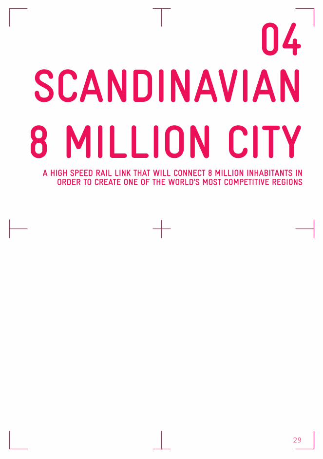
04SCANDINAVIAN 8 MILLION CITY
A HIGH SPEED RAIL LINK THAT WILL CONNECT 8 MILLION INHABITANTS IN ORDER TO CREATE ONE OF THE WORLD’S MOST COMPETITIVE REGIONS
29

DESCRIPTION
The region between Oslo, Stockholm and Copenhagen is already in the world’s top league when it comes to an educated and skilled work-force, and represents one of the most dynamic and innovative regions in Europe. Scandinavian cities have, however, small and rather dispersed popula-tions, with notable concentrations only around the metropolitan areas of Oslo, Gothenburg, Malmö, Copenhagen and Stockholm. In a world where re-gions increase in size to attract talent and be more competitive globally, this is a challenge.
BUDGET
COSTSThe cost of upgrading the entire Oslo–Hamburg route is estimated at 23 bn euro, of which 18.3 bn is included in current national plans.
BENEFITS- Higher productivity and competitive edge- Easier access to skills and talents- Reduced costs in logistics- Increased access to suppliers and customers- Greater influence due to overall increased size- New possibilities for cooperation and innovation across a wide range of areas
PARTNERS
Lead Partner: Business Region Göteborg ABPartners: Oslo kommune, Västra Götalandsregionen, Region Halland, Region Skåne, Göteborg Stad, Helsingborg stad, Trafikverket, Akershus fylke-skommune, Østfold fylkeskommune, Statens veg-vesen, København kommune, Region Hovedstaden.
BACKGROUND INFORMATION
LOCATIONNorway, Sweden, Denmark.
STATUSThe project is organized in three workpackages:1. upgrading the existing network to the double-track standard, 2. focussing on financing models to build separate tracks for high speed rail,3. external communications and lobbying activities.
SURFACE AREA97.600 km of railways.
SOURCEShttp://www.8millioncity.comhttps://ec.europa.eu/growth/tools-databases/regional-innovation-monitor/support-meas-ure/s%C3%B6dra-sverige/scandinavian-8-mil-lion-city-%E2%80%93-corridor-innovation-and-co-operation
AIMS
The goal for 2025 – not so distant future – is a high speed rail link that will physically connect these 8 million inhabitants and contribute to making this region one of the world’s most competitive.The project goals to explore the potential of cooper-ation, jobs can be created and innovation milieus can be enhanced. Cooperation over long distances requires an appropriate infrastructure, both for passengers and freight. Whilst Europe and the world have been expanding their green infrastruc-ture to stimulate growth, e.g. through massive in-vestment in High Speed Rail, such investment has progressed slowly in Scandinavia.
30

LOCAL REGIONAL CORRIDOR
INFRASTRUCTURE
HOUSING
ECONOMY/KNOWLEDGE
SOCIAL
CULTURE/ NATURE
new railways for high speed trains
(investigation)
a new InterCity concept, linking
intermediate regions to the large
labour markets
possible transfer points between High Speed Rail
and InterCity
31

50/299 - Contrat de Développem
ent Territorial Noisy-Cham
ps – 5 septembre 2013
TITRE 1 : Projet stratégique de développement durable
Figure 30: Les grands objectifs du Contrat de Développem
ent Territorial Noisy-Champs, Carte Algoé
42/299 - Contrat de Développement Territorial Noisy-Champs – 5 septembre 2013
TITR
E 1
: Pro
jet s
trat
égiq
ue d
e dé
velo
ppem
ent d
urab
le
Figure 23 : Le territoire du CDT (en bleu) et le réseau Grand Paris Express (en rose), dans le cadre du projet du Nouveau Grand Paris, source iledefrance2030.fr
Figure 24: La gare de Noisy-Champs dans le nouveau réseau de transport,
Source Iledefrance2030.fr, compléments Algoé
Noisy-Champs
Tracé création ligne 15Tracé création ligne 16Tracé extension ligne 11Tracé RER A
strategic projects for a sustainable development
future mobility in the Île-de-France region (2013-2030)
32

05CDT GRAND PARIS EST
NOISY-CHAMPSTHE SUSTAINABLE DEVELOPMENT MODEL FOR THE METROPOLIS OF GREATER PARIS
33
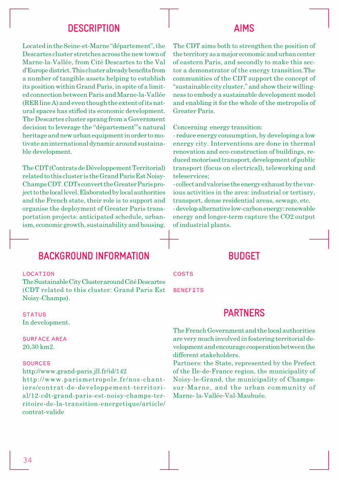
DESCRIPTION
Located in the Seine-et-Marne “département”, the Descartes cluster stretches across the new town of Marne-la-Vallée, from Cité Descartes to the Val d’Europe district. This cluster already benefits from a number of tangible assets helping to establish its position within Grand Paris, in spite of a limit-ed connection between Paris and Marne-la-Vallée (RER line A) and even though the extent of its nat-ural spaces has stifled its economic development. The Descartes cluster sprang from a Government decision to leverage the “département”’s natural heritage and new urban equipment in order to mo-tivate an international dynamic around sustaina-ble development.
The CDT (Contrats de Développement Territorial) related to this cluster is the Grand Paris Est Noisy-Champs CDT. CDTs convert the Greater Paris pro-ject to the local level. Elaborated by local authorities and the French state, their role is to support and organise the deployment of Greater Paris trans-portation projects: anticipated schedule, urban-ism, economic growth, sustainability and housing.
BUDGET
COSTS
BENEFITS
PARTNERS
The French Government and the local authorities are very much involved in fostering territorial de-velopment and encourage cooperation between the different stakeholders.Partners: the State, represented by the Prefect of the Ile-de-France region, the municipality of Noisy-le-Grand, the municipality of Champs-sur-Marne, and the urban community of Marne- la-Vallée-Val-Maubuée.
BACKGROUND INFORMATION
LOCATIONThe Sustainable City Cluster around Cité Descartes (CDT related to this cluster: Grand Paris Est Noisy-Champs).
STATUSIn development.
SURFACE AREA20,30 km2.
SOURCEShttp://www.grand-paris.jll.fr/id/142http:/ /www.parismetropole.fr/nos-chant-iers/contrat-de-developpement-territori-al/12-cdt-grand-paris-est-noisy-champs-ter-ritoire-de-la-transition-energetique/article/contrat-valide
AIMS
The CDT aims both to strengthen the position of the territory as a major economic and urban center of eastern Paris, and secondly to make this sec-tor a demonstrator of the energy transition.The communities of the CDT support the concept of “sustainable city cluster,” and show their willing-ness to embody a sustainable development model and enabling it for the whole of the metropolis of Greater Paris.
Concerning energy transition:- reduce energy consumption, by developing a low energy city. Interventions are done in thermal renovation and eco-construction of buildings, re-duced motorised transport, development of public transport (focus on electrical), teleworking and teleservices;- collect and valorise the energy exhaust by the var-ious activities in the area: industrial or tertiary, transport, dense residential areas, sewage, etc. - develop alternative low-carbon energy: renewable energy and longer-term capture the CO2 output of industrial plants.
34

LOCAL REGIONAL CORRIDOR
INFRASTRUCTURE
HOUSING
ECONOMY/KNOWLEDGE
SOCIAL
CULTURE/ NATURE
increasing the level of output and diversify
available habitat
create new activities from the Cité Descartes and
accompany people into employment
- complete territorial coverage
- link the Noisy-Champs RER A station to metro lines 15, 16 and 11 before 2025
implementing an ambitious
development policy for equipment and services
protect the resources of the territory and
enhance their access for inhabitants
and visitors.
- FCBA, a sustainable development centre in the timber and cellulose industry - Efficacity will be
the first R&D centre dedicated to urban energy efficiency
Disneyland Paris and Pierre & Vacances
are jointly investing €800 million in
the construction of Villages Nature, an eco-tourism resort
Val d’Europe shopping mall is planning to extend further over an additional 17,000 m² by 2016
35

the update reference plan
economic clusters in Avignon
36

06COURTINE
CONFLUENCETHE NEW DEVELOPMENTS WILL MAKE COURTINE CONFLUENCE
THE CENTRAL LOCATION OF THE GRAND AVIGNON REGION
37

DESCRIPTION
The Avignon TGV station is located in an urbanized neighbourhood Courtine Confluence about five kilometers from the city center. The station was purposefully built outside of the core to allow for the quicker passage of high speed trains through Avignon. There is a rail link from Avignon TGV to the center, a five minute ride.
The urban project Courtine Confluence has been the subject of reflections and productions since the early 90s. After the opening of the TGV station in 2001, a reference plan has been formalized and several proposed projects which were gradually abandoned. Developments have also been suspended due to the great flood of 2003. In 2012, the reference plan was updated.
Due to the TGV station, the new development of Courtine Confluence is seen as an upcoming central location for the whole region of Grand Avignon.
BUDGET
COSTS
BENEFITS
PARTNERS
The Territorial Workshop Courtine Confluence was held on November 19, 2014 at the University of Avignon. It brought together one hundred local development actors: elected officials of the city and Grand Avignon, technicians, entrepreneurs and heads of institutions. Organised around plenary meetings and studio work, the workshop allowed everyone to express their views on the opportunities and potential of this strategic site, but also on the issues that have to be addressed collectively to ensure the success of the urban project.
The project’s steering committee is chaired by Jean-Marc Roubaud, president of Grand Avignon and Cécile Helle, Mayor of Avignon.
BACKGROUND INFORMATION
LOCATIONAvignon, France
STATUSStation was built in 2001, the new development plan: study
SURFACE AREA6 km2
SOURCEShttp://www.gmfus.org/blog/2013/10/31/uneven-geography-france%E2%80%99s-high-speed-railht tp : / /www. lamarse i l la ise . f r /vauc luse /economie/36579-avignon-600-hectares-a-amenager-pour-le-projet-courtine-confluencehttp://www.grandavignon.fr/travaux-et-projets/projets/projet-courtine-confluence/
AIMS
Anxious to develop these potentials, the city of Avignon and the Grand Avignon Region wish to initiate the implementation of the ambitious urban project for the area Courtine Confluence and position it as a major project for the region. In addition, the ambition is to invest in this new area, which is a gateway to the river and landscape, and to create the conditions for the whole region to profit.
38

LOCAL REGIONAL CORRIDOR
INFRASTRUCTURE
HOUSING
ECONOMY/KNOWLEDGE
SOCIAL
CULTURE/ NATURE
- urban mixed use zone (ZAC) around the station (30 hectares)- mixed zones, 6000
inhabitants (Crillones and Gigognan, 70 hectares)
Metropolitan Public Park (major cultural facility,e.g.a theater)
39

40

PARTICI-PANTS
41

SURNAME NAME FUNCTION ORGANISATION
van Acker Maarten Assistant Professor Antwerpen UniversityArts Jos Strategic advisor RijkswaterstaatBildgen-Berthold Claire Intern Vertretung des Landes Nord- rhein-Westfalen bei der Europäischen Union Broesi Robert Partner MustBrokvist Fredrik Long-term planner TrafikverketChorus Paul Policy advisor Spatial Provincie Noord-Holland Planning Decates Felice Representative of the The House of the Dutch Provinces Randstad Region Dooghe David Project leader Deltametropolis AssociationEngelen Paul Representative of the The House of the Dutch Provinces province of Limburg Faith-Ell Charlotta Senior Technical WSP Sweden Director of EIA and SEA Gau Doris Connection Person of Benelux Union North Rhine-Westphalia Geerts Els Policy Officer Spatial Development Department FlandersGerretsen Paul Director Deltametropolis Association Gijbels Eva EU representative The House of the Dutch Provinces province of Noord-Holland Goris Maarten Advisor Spatial Development Department FlandersHanekamp Tertius Owner TemahHauw Nicolas Policy Officer Polis NetworkHolmlund Tomas International Trafikverket coordinator, process manager van Holten Liesbeth Senior consultant Provincie Utrecht environmental quality van Huut Harry Director Rijkswaterstaat - Dienst Zuid- Deltaprogramma HollandIngo Susanne development strategist TrafikverketJarine Yasmina Policy Officer Benelux Union Kalle Heikki Business Development Hendrikson & Ko Manager Linssen Raymond Consultant Rijkswaterstaat sustainable Mobility Van Looy Jeroen Strategic cross-border Spatial Development Department spatial and urban Flanders policy developerMarolda Maria Cristina Policy Officer European Commissionvan Oort Frank Endowed Professor of Erasmus University Urban and Regional Economics Orav Indrek Board member Rail Baltic joint venture companySander Henrik Owner Orange Edge
42

Schuch Einar Regional Director, Trafikverket Region Ost Snippe Jasper Project leader / Advisor RijkswaterstaatStooker Wim Representative of the The House of the Dutch Provinces province of Noord- Holland Thoele Helmut Senior designer Provincie Zuid-HollandVanautgaerden Liesl Project manager Spatial Development Department T.OP Limburg FlandersVenhoeven Ton Director Venhoeven CSWißen Bodo Representative Vertretung des Landes Nord- Nordrhein-Westfalen rhein-Westfalen bei der Europäischen Union
43