
Bonshaw Solar Project
67
The business of sustainability 0450869_Final July 2018 Bonshaw Solar Farm Preliminary Environmental Assessment GAIA Australia
Transcript of Bonshaw Solar Project

The business of sustainability
0450869_Final
July 2018
Bonshaw Solar Farm
Preliminary Environmental Assessment
GAIA Australia

This disclaimer, together with any limitations specified in the report, apply to use of this report. This report was prepared in accordance with the contracted scope of services for the specific purpose stated and subject to the applicable cost, time and other constraints. In preparing this report, ERM relied on: (a) client/third party information which was not verified by ERM except to the extent required by the scope of services, and ERM does not accept responsibility for omissions or inaccuracies in the client/third party information; and (b) information taken at or under the particular times and conditions specified, and ERM does not accept responsibility for any subsequent changes. This report has been prepared solely for use by, and is confidential to, the client and ERM accepts no responsibility for its use by other persons. This report is subject to copyright protection and the copyright owner reserves its rights. This report does not constitute legal advice.
Prepared by: Eliza Collison
Position: Project Manager
Signed:
Date: 13 July 2018
Approved by: Paul Douglass
Position: Partner
Signed:
Date: 13 July 2018
Bonshaw Solar Project
Preliminary Environmental Assessment
GAIA Australia
July 2018
0450869_Final
www.erm.com

CONTENTS
1 INTRODUCTION
1.1 OVERVIEW 1
1.2 SITE LOCATION 1
1.3 PURPOSE OF THE REPORT 2
1.4 THE PROPONENT 2
2 PROJECT DESCRIPTION
2.1 PROJECT DESIGN 4
2.2 PROJECT TIMEFRAME 5
2.3 CAPITAL INVESTMENT 5
3 PERMISSIBILITY AND STRATEGIC PLANNING
3.1 COMMONWEALTH LEGISLATION 7
3.1.1 ENVIRONMENTAL PROTECTION AND BIODIVERSITY CONSERVATION
ACT 1999 7
3.1.2 NATIVE TITLE ACT 1993 7
3.2 NEW SOUTH WALES LEGISLATION 8
3.2.1 ENVIRONMENTAL PLANNING AND ASSESSMENT ACT 1979 8
3.2.2 OTHER NSW LEGISLATION 9
3.3 PLANNING POLICIES 10
3.3.1 STATE ENVIRONMENTAL PLANNING POLICY (STATE AND REGIONAL
DEVELOPMENT) 2011 10
3.3.2 STATE ENVIRONMENTAL PLANNING POLICY (INFRASTRUCTURE) 2007 11
3.3.3 STATE ENVIRONMENTAL PLANNING POLICY NO. 44 – KOALA HABITAT
PROTECTION 11
3.3.4 STATE ENVIRONMENTAL PLANNING POLICY NO 33 (HAZARDOUS AND
OFFENSIVE DEVELOPMENT) 11
3.4 LOCAL PLANNING INSTRUMENTS 12
3.4.1 INVERELL LOCAL ENVIRONMENT PLAN 12
3.5 DRAFT NSW LARGE-SCALE SOLAR ENERGY GUIDELINE 2017 12
4 PRELIMINARY ENVIRONMENTAL ASSESSMENT
4.1 BIODIVERSITY 14
4.1.1 APPROACH 14
4.1.2 VEGETATION COMMUNITIES AND HABITATS 14
4.1.3 FLORA 16
4.1.4 FAUNA 17
4.1.5 WETLANDS AND WATERCOURSES 18
4.2 HERITAGE 21
4.3 VISUAL 24
4.4 NOISE 27
4.5 TRAFFIC AND TRANSPORT 27
4.6 SOIL AND WATER ASSESSMENT 27
4.7 HAZARDS AND RISKS 28
4.7.1 BUSHFIRE RISK 28
4.7.2 ELECTROMAGNETIC FIELDS 28
4.7.3 CONTAMINATED LAND 28

CONTENTS
4.7.4 SOCIAL AND ECONOMIC ISSUES 29
4.8 DECOMMISSIONING AND REHABILITATION 29
5 JUSTIFICATION AND ALTERNATIVES
5.1 STRATEGIC JUSTIFICATION 30
5.1.1 NATIONAL 30
5.1.2 STATE 30
5.1.3 LOCAL 31
5.2 ALTERNATIVES CONSIDERED 31
6 STAKEHOLDER ENGAGEMENT
6.1 STAKEHOLDER IDENTIFICATION 33
6.2 SURROUNDING COMMUNITY 37
6.3 INVERELL SHIRE COUNCIL 37
6.4 ELECTRICITY DISTRIBUTOR 37
7 CONCLUSION
8 REFERENCES
LIST OF TABLES
TABLE 1.1 CADASTRE DETAILS OF THE PROJECT AREA 1
TABLE 3.1 IDENTIFIED MATTERS OF NATIONAL ENVIRONMENTAL SIGNIFICANCE 7
TABLE 3.2 OTHER NSW LEGISLATION 9
TABLE 3.3 INVERELL LEP 2012 MAPPING 12
TABLE 4.1 PRELIMINARY ASSESSMENT OF ENDANGERED ECOLOGICAL
COMMUNITIES LIKELY TO OCCUR WITHIN THE PROJECT AREA 16
TABLE 4.2 PRELIMINARY ASSESSMENT OF ABORIGINAL ARTEFACTS 22
TABLE 6.1 STAKEHOLDER IDENTIFICATION AND CONSULTATION 34
LIST OF FIGURES
FIGURE 1.1 SITE LOCALITY 3
FIGURE 2.1 INDICATIVE PROJECT LAYOUT 6
FIGURE 3.1 INVERELL LEP ZONING MAP 13
FIGURE 4.1 VEGETATION COMMUNITIES 19
FIGURE 4.2 ENVIRONMENTAL FEATURES 20
FIGURE 4.3 HERITAGE ITEMS 23
FIGURE 4.4 MAPPED POTENTIAL DWELLINGS 25
FIGURE 4.5 SITE VISIBILITY ANALYSIS 26
ANNEXES
ANNEX A LEP MAPPING
ANNEX B PMST SEARCH
ANNEX C NSW WILDLIFE ATLAS ONLINE DATABASE SEARCH
ANNEX D BUSHFIRE PRONE LAND
ANNEX E CONTAMINATED LAND SEARCH
ANNEX F AHIMS SEARCH

ENVIRONMENTAL RESOURCES MANAGEMENT AUSTRALIA 0450869/FINAL/13 JULY 2018
1
1 INTRODUCTION
1.1 OVERVIEW
GAIA Australia (GAIA) is proposing to develop a large scale solar photovoltaic
(PV) generation facility and associated infrastructure with a capacity of 500 MW
at Bonshaw in the Inverell Shire of New South Wales (NSW) (referred to as the
Bonshaw Solar Farm) (the ‘Project’), shown in Figure 1.1.
The Project will have a Capital Investment Value (CIV) greater than $30 Million
AUD, and as such the Project is deemed State Significant Development (SSD) in
accordance with clause 20 of Schedule 1 of the State Environmental Planning
Policy (State and Regional Development) 2011 and will be assessed under Part 4 of
the Environmental Planning and Assessment Act 1979 (EP&A Act). GAIA is
requesting Secretary’s Environmental Assessment Requirements (SEARs) for
the preparation of an Environmental Impact Statement (EIS) to accompany the
SSD application.
The proposed infrastructure includes PV units, battery storage, two site office
options and overhead/underground cabling between allotments, substation
and switchyard. The solar farm site is located on approximately 1097 hectares
(ha) (the Project Area) and is proposed to connect directly to Transgrid’s
existing Dumaresq Substation, further discussed in Section 2.1.
1.2 SITE LOCATION
The proposed Bonshaw Solar Farm is located in the Inverell Local Government
Area (LGA) approximately 16 km south of Bonshaw and 66 km north of
Inverell. The Project Area, as shown in Figure 1.1, is approximately 1097 ha with
elevations ranging from 329 m to 500 m Australian Height Datum (AHD).
Cadastre details involved in the Project Area are outlined in Table 1.1
Table 1.1 Cadastre Details of the Project Area
Lot Numbers DP Number
Part Lot 200 DP 879480
Part Lot 1, Lot 2 DP 1039185
Part Lot 29, Lot 27 DP 750075
All landholders in the Project Area have been consulted and provided in
principle support to be finalised with landholder agreements. Based on
indicative design and imminent lease agreements between GAIA and the
project landholders, no subdivision is proposed on the lots identified within the
project boundary. Should it be required, subdivision will be addressed within
the environmental impact statement (EIS) and will be the subject of further

ENVIRONMENTAL RESOURCES MANAGEMENT AUSTRALIA 0450869/FINAL/13 JULY 2018
2
consultation with the NSW Department of Planning and Environment (DP&E)
and Inverell Shire Council.
Proposed access to the site is via Bruxner Highway (three access points) and
Glenrock Road (one access point) as discussed in Section 2.1. Bruxner Highway
is a regional road north of the Project Area becomes a State Road East of
Tenterfield. Glenrock Road and Rocky Creek Road are local roads east and west
of the Project Area respectively. Connection of the Bonshaw Solar Farm will be
to the 330 kV TransGrid Dumaresq Substation located on the boundary of the
Project Area (shown in Figure 2.1).
1.3 PURPOSE OF THE REPORT
Environmental Resources Management Australia Pty Ltd (ERM) has been
engaged by GAIA to prepare a Preliminary Environmental Assessment (PEA)
for the Project to accompany a request to Department of Planning and
Environment (DP&E) for SEARs in relation to the proposal. The SEARs will
identify the requirements for the EIS that will be prepared to accompany the
SSD application.
Specifically, this report has been prepared to:
describe the key components of the Project;
identify the applicable planning provisions;
identify and assess the expected environmental impacts associated with the
Project;
provide sufficient justification for the Project compared to alternative
options;
outline consultation proposed; and
obtain the SEARs to proceed with the development application process.
1.4 THE PROPONENT
GAIA Australia (GAIA AU) was established in 2015 to take the load in
renewable energy developments in Australia, with a clear target and vision to
become an active large scale solar farm developer in NSW. GAIA AU is
partnered with GAIA Korea, a renowned infrastructure developer in Korea
with a focus on renewable energy development sector in Australia.
GAIA is committed to working closely with all stakeholders to ensure success
in this project and providing environmental and economic benefit to
Australia. GAIA AU as a company is committed to the principles of social
responsibility and will apply these principles through the whole process of
development from planning to operation.

Service Layer Credits: © 2018 MicrosoftCorporation © 2018 HERESource: Esri, DigitalGlobe, GeoEye, Earthstar
DUMARESQ RIVER
Back
Creek
Road
Riverton Road
Rocky CreekRo
ad
Bruxner Highway
Beardy R iv erRoad
Glenrock RoadLot 27
DP750075
Lot 2DP1039185
Part Lot29 DP750075
Part Lot 1DP1039185Part Lot
200 DP879480
Source: Imagery - ESRI World Imagery 2016Cadastre - NSW DCDB and QLD DCDB
20/06/20180450869m_BS_PEA_G001_R1.mxd
A4
This figure may be based on third party data or data which has notbeen verified by ERM and it may not be to scale. Unless expresslyagreed otherwise, this figure is intended as a guide only and ERM doesnot warrant its accuracy.
Client:Drawn By:
Drawing No:Date: Drawing Size:
Reviewed By:
Bonshaw, NSW
GAIA AustraliaGR ECCoordinate System: GDA 1994 MGA Zone 56
Site Locality 1.1
0 0.5 1 1.5 2km [N
LegendMain RoadLocal RoadSite BoundaryCadastral Land Parcels
QLDSite Location
Bonshaw
NSW

ENVIRONMENTAL RESOURCES MANAGEMENT AUSTRALIA 0450869/FINAL/13 JULY 2018
4
2 PROJECT DESCRIPTION
2.1 PROJECT DESIGN
The Project will involve the construction, operation and maintenance of a solar
PV generation facility and associated infrastructure with a capacity of up to
500 MW, supplying electricity to the national electricity grid. The actual
footprint of the development is approximately 700 ha within the Project Area.
The proposed potential development footprint is shown in Figure 2.1. This area
would be refined by further detailed investigations, assessments, planning and
design during the EIS phase.
The Project would include:
a network of PV modules in a fixed or tracking arrangement;
a site office (two proposed options);
three potential access tracts from Bruxner Highway and one from Glenrock
Road;
underground or overhead cabling for connection between arrays and
inverters and transformers;
parking and internal access tracks;
perimeter security fencing;
battery storage; and
two grid connection options to the 330 kV TransGrid Dumaresq Substation,
on the boundary of the Project Area.
The proposed locations of supporting infrastructure and site access points are
shown in Figure 2.1 and grid connection options in Error! Reference source not
found.. The location within the Project Area of the PV modules, cabling, battery
storage and substation and switchyard infrastructure is subject to further
detailed design during the preparation of the EIS.
It is anticipated that a battery storage system (BSS) will be installed as part of
the project, with this location being as close to the Dumaresq Substation as
possible to minimise losses. The specific technology, MW rated capacity and
MWh of storage for the proposed BSS will be determined during the detailed
design stage of the project. This is likely to be driven by commercial and
financial considerations along with government policy given the current focus
on ensuring reliability of renewable energy. The BSS will be located in a secure
compound and further assessed within the EIS.

ENVIRONMENTAL RESOURCES MANAGEMENT AUSTRALIA 0450869/FINAL/13 JULY 2018
5
2.2 PROJECT TIMEFRAME
The proposed development will be undertaken in stages including:
site preparation involving access roads, security fencing, office buildings and
foundations;
construction of supporting structures, cables, PV modules, substation and
switchyard;
connection to the grid and monitoring system setup;
operation; and
decommissioning at the end of the operational life, involving the removal of
all above ground infrastructure and returning the site to its existing land
capability.
The site preparation and construction is expected to take approximately 9-12
months.
There will be two stages involved with the construction. Stage 1 has a proposed
capacity of 200 MW capacity, commencing construction mid-2019. Stage 2 is an
addition 300 MW, construction is planning to commence 2021. The project is
likely to be operational for approximately 25 years.
2.3 CAPITAL INVESTMENT
Based on the Projects initial design and costs associated with numerous similar
large-scale solar photovoltaics within NSW (Australian Renewable Energy
Agency, n.d.) the estimated gross capital expenditure cost of the proposal
would be approximately $700 million AUD.

Service Layer Credits: Source: Esri,DigitalGlobe, GeoEye, Earthstar Geographics,CNES/Airbus DS, USDA, USGS, AeroGRID,

ENVIRONMENTAL RESOURCES MANAGEMENT AUSTRALIA 0450869/FINAL/13 JULY 2018
7
3 PERMISSIBILITY AND STRATEGIC PLANNING
3.1 COMMONWEALTH LEGISLATION
3.1.1 Environmental Protection and Biodiversity Conservation Act 1999
A referral to the Commonwealth Department of Environment and Energy
(DoEE) is required for projects that are likely to significantly impact matters of
national environmental significance protected under the Environment Protection
and Biodiversity Conservation Act 1999 (EPBC Act). Matters of national
environmental significance (MNES) are listed in Table 3.1.
A search of MNES was undertaken on 2 March 2018 using the EPBC Act
Protected Matters Search tool of the Project Area with a 5 km buffer. The search
results are presented in Annex B and summarised in Table 3.1. The results are
discussed in Section 4.1 and 4.2.
Consultation will be undertaken with DoEE, once baseline ecological
information is available, during the preparation of the EIS to determine whether
MNES are likely to be impacted.
Table 3.1 Identified Matters of National Environmental Significance
MNES Result
World Heritage Properties None
National Heritage Places None
Wetlands of International Importance (listed under the
Ramsar Convention)
3
Listed Threated Species 35
Listed Threated Ecological Communities 4
Listed Migratory Species 11
Commonwealth Marine Areas None
The Great Barrier Reef Marine Park None
Nuclear actions (including uranium mines) N/A
A water resource, in relation to coal seam gas
development and large coal mining development
N/A
3.1.2 Native Title Act 1993
The Native Title Act 1993 provides a legislative framework for the recognition
and protection of common law native title rights. Native title is the recognition
by Australian law that Indigenous people had a system of law and ownership
of their lands before European settlement. Where that traditional connection to
land and waters has been maintained and where government acts have not
removed it, the law recognises this as native title.
One active Native Title claim (Comeroi People #NC2011/006) is currently
registered within the LGA, located on the western side of Rocky Creek Road
adjacent to the Project Area. The Project Area is not included in this Native Title
claim and it does not present any significant constraints on the future
development of the Project Area.

ENVIRONMENTAL RESOURCES MANAGEMENT AUSTRALIA 0450869/FINAL/13 JULY 2018
8
3.2 NEW SOUTH WALES LEGISLATION
3.2.1 Environmental Planning and Assessment Act 1979
The principal NSW planning legislation is the Environmental Planning and
Assessment Act 1979 (EP&A Act). The EP&A Act provides a system of
environmental planning and assessment administered by the NSW Department
of Planning and Environment (DP&E). The EP&A Act establishes when and
how a development or activity is to be assessed and who is the relevant
approval or determining authority.
Section 4.36 (2) of the EP&A Act states that “a State environmental planning policy
may declare any development, or any class or description of development, to be State
significant development”.
Part 2 Clause 8 of the State Environmental Planning Policy (State and Regional
Development) 2011 (State and Regional Development SEPP) states that:
(1) Development is declared to be State significant development for the purposes
of the Act if:
(a) the development on the land concerned is, by the operation of an
environmental planning instrument, not permissible without
development consent under Part 4 of the Act, and
(b) the development is specified in Schedule 1 or 2.
Schedule 1 and 2 of the State and Regional Development SEPP contains an
extensive list of developments that are considered State Significant
Development (SSD). Schedule 1 Cl 20 identifies the following as SSD:
Electricity generating works and heat or co-generation
Development for the purpose of electricity generating works or heat or their co-
generation (using any energy source, including gas, coal, biofuel, distillate, waste,
hydro, wave, solar or wind power) that:
(a) has a capital investment value of more than $30 million, or
(b) has a capital investment value of more than $10 million and is located in an
environmentally sensitive area of State significance.
The project is a development for the purpose of electricity generation using a
solar energy source, and it is understood to have a capital investment value
(CIV) of more than $30 million. Based on a desktop assessment, the Site is not
located in an environmentally sensitive area of State Significance (as defined in
the State and Regional Development SEPP).
Permissibility of the project is given under clause 34 (7) of the Infrastructure
SEPP as detailed further below.

ENVIRONMENTAL RESOURCES MANAGEMENT AUSTRALIA 0450869/FINAL/13 JULY 2018
9
The project meets both the requirements of clause 8 of the State and Regional
Development SEPP as it is not permissible without development consent and is
development specified in Schedule 1. Therefore, the project is SSD for the
purposes of the EP&A Act.
3.2.2 Other NSW Legislation
Other applicable NSW legislation relevant to the Project is described in Table
3.2.
Table 3.2 Other NSW Legislation
Legislation Relevance to Project
Roads Act 1993 The Roads Act 1993 addresses authorities, function and
regulation of activities relating to the use and type of
roads.
Approval under section 138 of the Roads Act is required
to impact or carry out work on or over a public road.
Section 4.42 of the EP&A Act provides that an approval
under section 138 of the Roads Act cannot be refused if
it is necessary for carrying out SSD that is authorised by
a development consent. Consultation with the Roads
and Maritime Services (RMS) and Inverell Shire Council
will be undertaken to determine access and necessary
upgrading of access points to the proposed project.
Biodiversity Conservation Act
2016
The NSW Biodiversity Conservation Act 2016 (BC Act)
commenced on 25 August 2017, which repealed the
following:
NSW Threatened Species Conservation Act 1995;
sections of the NSW National Parks and Wildlife Act
1974 (NPW Act); and
NSW Native Vegetation Act 2003.
The purpose of the BC Act is to maintain a healthy,
productive and resilient environment for the greatest
well-being of the community, now and into the future,
consistent with the principles of ecologically sustainable
development. Section 4.1 provides an assessment of
biodiversity impacts.
Heritage Act 1977 The Heritage Act 1977 is administered by the Office of
Environment and Heritage (OEH) and aims to protect
the natural and cultural heritage of NSW. It provides
blanket protection for surface and sub-surface relics and
for heritage items of state significance listed on the State
Heritage Register. The Act defers to local planning
instruments under the EP&A Act for the protection of
items of local significant. Section 4.2 provides an
assessment of heritage impacts.

ENVIRONMENTAL RESOURCES MANAGEMENT AUSTRALIA 0450869/FINAL/13 JULY 2018
10
Legislation Relevance to Project
Water Management Act 2000 The Project Area is covered by the NSW Border Rivers
Unregulated and Alluvial Water Sharing Plan (WSP)
and therefore the provisions of the Water Management
Act 2000 apply.
Part 4.41 of the EP&A Act lists authorisations not
required for State significant development. Included in
this list is:
(g) a water use approval under section 89, a water
management work approval under section 90 or an
activity approval (other than an aquifer interference
approval) under section 91 of the Water Management Act
2000.
The Project will not interfere with the aquifer and hence
will not require approval under this Act. Section 4.6
provides a preliminary soils and water assessment.
Protection of the Environment
Operations Act 1997
The Protection of the Environment Operations Act 1997
(POEO Act) is the primary piece of legislation regulating
pollution control and waste disposal in NSW. Schedule
1 of the POEO Act defines scheduled activities for which
an Environmental Protection Licence is required. Solar
energy generation does not fall under the definition of
electricity generation under Clause 17 of Schedule 1 of
the POEO Act.
Rural Fire Act 1997 The NSW Rural Fires Act 1997 (RF Act) aims to prevent,
mitigate and suppress bush and other fires in local
government areas of the NSW. Section 63(2) of the RF
Act requires the owners of land to prevent the ignition
and spread of bushfires on their land. Under Part 4.41 of
the EP&A Act, a bush fire safety authority under Section
100B of the RF Act is not required for SSD that is
authorised by a development consent. Section 4.8.1
assess the risk and mitigation measures of bushfire.
Dangerous Goods (Road and Rail
Transport) Act 2008
The Dangerous Goods (Road and Rail Transport) Act 2008
regulates the transport of dangerous goods by road and
rail in order to promote public safety and protect
property and the environment. The Project will involve
the transportation of the storage batteries which are
likely to be defined as dangerous goods.
3.3 PLANNING POLICIES
3.3.1 State Environmental Planning Policy (State and Regional Development) 2011
As stated in Section 3.1.1, the State and Regional Development SEPP identifies
development that is SSD. Schedule 1, Cl 20 includes:
Development for the purpose of electricity generating works or heat or their co-
generation (using any energy source, including gas, coal, biofuel, distillate, waste,
hydro, wave, solar or wind power) that:
(a) has a capital investment value of more than $30 million.

ENVIRONMENTAL RESOURCES MANAGEMENT AUSTRALIA 0450869/FINAL/13 JULY 2018
11
The project is a development for the purpose of electricity generation using a
solar energy source, and will have a capital investment value of more than $30
million.
3.3.2 State Environmental Planning Policy (Infrastructure) 2007
The Infrastructure SEPP provides development controls for infrastructure and
services. Clause 34 (7) of the SEPP provides provisions for development that is
permitted with consent. Clause 34 (7) states:
Solar energy systems
Except as provided by subclause (8), development for the purpose of a solar energy
system may be carried out by any person with consent on any land.
Subclause (8) limits the use of photovoltaic electricity generating systems in
residential zones. The Site is not within a residential zone and, therefore, is not
affected by this subclause.
3.3.3 State Environmental Planning Policy No. 44 – Koala Habitat Protection
The objectives of State Environmental Planning Policy No 44 Koala Habitat
Protection (SEPP 44) is to conserve and manage areas of natural vegetation that
provide habitat for koalas to ensure a permanent free-living population over
their present range and reverse the current trend of koala population decline.
Inverell Shire is a local government listed in Schedule 1 of SEPP 44 and therefore
the SEPP applies. If the Site is deemed to be core koala habitat, there must be a
plan of management prepared in accordance with Part 3 of SEPP 44.
3.3.4 State Environmental Planning Policy No 33 (Hazardous and Offensive
Development)
State Environmental Planning Policy No 33 (Hazardous and Offensive
Development) (SEPP 33) presents a systematic approach to planning and
assessing proposals for potentially hazardous and offensive development for
the purpose of industry or storage.
A screening assessment is likely to be required for the battery storage on-site.
Based on the outcomes and project refinement, if it is deemed to be potentially
hazardous, a Preliminary Hazard Analysis will be undertaken.

ENVIRONMENTAL RESOURCES MANAGEMENT AUSTRALIA 0450869/FINAL/13 JULY 2018
12
3.4 LOCAL PLANNING INSTRUMENTS
3.4.1 Inverell Local Environment Plan
The Project Area is situated within the Inverell Shire and hence the Inverell Local
Environmental Plan 2012 (Inverell LEP) applies. The Project Area is zoned RU1
Primary Production under the Inverell LEP (Figure 3.1). The objectives of the
zone are:
To encourage sustainable primary industry production by maintaining and
enhancing the natural resource base.
To encourage diversity in primary industry enterprises and systems appropriate for
the area.
To minimise the fragmentation and alienation of resource lands.
To minimise conflict between land uses within this zone and land uses within
adjoining zones.
Development for the purpose of electricity generation is not specified in item 2
or 3 of the Inverell LEP and is therefore ‘Prohibited’. As stated in Section 3.3.2,
permissibility of the solar energy development is provided by way of Clause 34
(7) of the Infrastructure SEPP.
The Inverell LEP 2012 provides various land use mapping (refer Annex A) Table
3.3 details mapping attributes of the Project Area.
Table 3.3 Inverell LEP 2012 Mapping
Inverell LEP 2012
Mapping Attribute
Relevance to Project Area
Land Zoning Zoned RU1 Primary Production. All developments not specified
in Item 2 or 3 are prohibited.
Minimum Lot Size 200 ha
Heritage The Project Area is not mapped as containing a heritage item.
Designated Buffer Area The Project Area is not mapped as being a designated buffer area.
3.5 DRAFT NSW LARGE-SCALE SOLAR ENERGY GUIDELINE 2017
The aim of the Draft Large-Scale Solar Energy Guideline is to provide the
community, industry and regulators with guidance on the planning framework
for the assessment and approval of large-scale solar energy development
proposals under the EP&A Act.
The guideline also outlines the key assessment issues for State significant solar
energy projects, such as land use conflict, biodiversity and visual impacts. It
also seeks to encourage genuine and early consultation with the community
and stakeholders, consistent with best practice engagement principles.
The draft Guideline was on exhibition until 16th February 2018 and has been
considered in the development of this PEA.

Service Layer Credits: Source: Esri,DigitalGlobe, GeoEye, Earthstar Geographics,CNES/Airbus DS, USDA, USGS, AeroGRID,
DUMARESQRIVER
Back Creek Road
Rocky Creek Road
Riverton Road
BeardyRiv erRoadBruxner HighwayGlenrock Road
RU1
RU1
E1
Source: Imagery - ESRI World Imagery 2016Cadastre - NSW DCDB and QLD DCDBZoning - NSW LPI March 2018
20/06/20180450869m_BS_PEA_G004_R2.mxd
A4
This figure may be based on third party data or data which has notbeen verified by ERM and it may not be to scale. Unless expresslyagreed otherwise, this figure is intended as a guide only and ERM doesnot warrant its accuracy.
Client:Drawn By:
Drawing No:Date: Drawing Size:
Reviewed By:
Preliminary Environmental AssessmentBonshaw, NSW
GAIA AustraliaGR ECCoordinate System: GDA 1994 MGA Zone 56
Inverell LEP Zoning Map 3.1
0 0.5 1km [N
LegendSite Boundary
Planning ZoneE1 National Parks and Nature ReservesRU1 Primary Production

ENVIRONMENTAL RESOURCES MANAGEMENT AUSTRALIA 0450869/FINAL/13 JULY 2018
14
4 PRELIMINARY ENVIRONMENTAL ASSESSMENT
4.1 BIODIVERSITY
4.1.1 Approach
This preliminary assessment is based on a combination of regional vegetation
mapping, GIS techniques, inspection of aerial photographs and knowledge of
the habitat requirements for threatened species. No field investigations were
undertaken to inform this preliminary assessment. Further clarification via
field surveying would be required for a more accurate analysis.
The following online database searches were undertaken:
EPBC Protected Matters Search – this search provides general guidance on
matters of national environmental significance (MNES) and other matters
protected by the EPBC Act. It should be noted that the results are based on
predictive modelling and not verified by mapping or known records of
species. It should be considered in conjunction with other desktop and field
survey (if required) (refer to Annex B);
NSW Wildlife Atlas Online Database search – this search provides a list of
flora and fauna species that have been recorded within a 5km radius of the
Project Area. It lists all species including those listed under the BC Act and
EPBC Act (refer to Annex C); and
A search of the NSW Vegetation Information System (VIS) database was
undertaken to identify the most relevant regional vegetation mapping data
for the study area. This was imported into GIS to identify those vegetation
types present in the Project Area. The regional vegetation mapping is
considered indicative until adequate ‘ground truthing’ and more refined
vegetation surveys are undertaken.
The BioBanking Credit Calculator will be required to be used to identify
seasonal surveys required and will be based on the PCT types identified within
the Project Area.
4.1.2 Vegetation Communities and Habitats
The native vegetation of the Inverell Shire regional mapping (2009) (VIS ID
3794) has mapped the following 18 vegetation communities (Figure 4.1) within
the Project Area:
Yellow Box - Blakely’s Red Gum grassy open forest of Nandewar Bioregion;
Derived grassland of low fertility soils of New England Tablelands and
Nandewar Bioregions;

ENVIRONMENTAL RESOURCES MANAGEMENT AUSTRALIA 0450869/FINAL/13 JULY 2018
15
White Cypress Pine - Silver-leaved Ironbark grassy woodland of Nandewar
Bioregion;
Poplar Box grassy woodland of Brigalow Belt South Bioregion;
Derived grassland of highly fertile soils of Nandewar and Brigalow Belt
South Bioregions;
Derived grassland of intermediate fertile soils of Brigalow Belt South
Bioregion and western Nandewar Bioregion;
White Cypress Pine - Silver-leaved Ironbark shrub/grass open forest of
Brigalow Belt South and Nandewar Bioregions;
Silver-leaved Ironbark - White Cypress Pine - Red Ash shrubby woodland
of Nandewar Bioregion;
White Cypress Pine - Silver-leaved Ironbark - Tumbledown Red Gym
shrubby open forest of Nandewar and Brigalow Belt South Bioregions;
Cypress Pine - Tumbledown Red Gum - Caley’s Ironbark shrubby woodland
of Nandewar and New England Tablelands Bioregions;
Black Cypress Pine - White Box - Silver-leaved Ironbark shrubby open forest
of the northern Nandewar Bioregion;
Blakely’s Red Gum - Rough-barked Apple grassy open forest of Briglow Belt
South, Nandewar and New England Tablelands Bioregions;
Bracteate Honey Myrtle riparian shrubland of Brigalow belt south and
Nandewar bioregions;
River Oak - River Red Gum - Weeping Bottlebrush riparian woodland of
Brigalow Belt South and Nandewar bioregions;
Black Cypress Pine - Orange Gun - CommonFringe-myrtle heathy woodland
of New England Tablelands Bioregion;
Black Cypress Pine - Tumbledown Red Gum - Caley’s Ironbark shrubby
open forest of Nandewar and new England tablelands bioregions;
Grey box - narrow-leaved ironbark shrub/grass open forest of Nandewar
and New England tablelands bioregions; and
Urban and cropping.
These vegetation communities as described by Peacock et. al. (2009) indicate
that the Project Area may contain areas of Endangered Ecological Community
(EEC) protected under both the BC Act and the EPBC Act as indicated in Table
4.1. Detailed vegetation surveys would be required to confirm the presence and
condition of all Plant Community Types (PCT) within the Project Area.

ENVIRONMENTAL RESOURCES MANAGEMENT AUSTRALIA 0450869/FINAL/13 JULY 2018
16
Table 4.1 Preliminary Assessment of Endangered Ecological Communities likely to
occur within the Project Area
Listed Ecological
Communities
Legislation Source Preliminary Likelihood
of Occurrence EPBC Act BC Act PMST BioNET
Natural Grasslands
on basalt and fine-
textured alluvial
plains of northern
New South Wales
and southern
Queensland
CE - PMST - Some potential based on
known regional
distribution of this
community. To be
confirmed following field
survey.
New England
Peppermint
(Eucalyptus nova-
anglica) Grassy
Woodlands
CE - PMST - Some potential based on
known regional
distribution of this
community. To be
confirmed following field
survey.
Weeping Myall
Woodlands
E - PMST - Some potential based on
known regional
distribution of this
community. To be
confirmed following field
survey.
White Box-Yellow
Box-Blakely’s Red
Gum Grassy
Woodland and
Derived Native
Grassland
CE EEC PMST BioNET There is a high likelihood
that at least some of the
vegetation communities
mapped (VIS ID 3794)
will constitute this EEC.
CE = Critically Endangered; E = Endangered; EEC = Endangered Ecological Community
4.1.3 Flora
The NSW Wildlife Atlas search confirms one threatened flora species known to
occur within 2 km to the Project Area (Figure 4.2) and will need to be considered
during the design phases of any future development proposal:
Silky Swainson-pea (Swainsona sericea) is listed as a Vulnerable under the BC
Act and has been recorded 19 km South East of Bonshaw along the roadside
(dated 2003).
The EPBC Protected Matters Search identified an additional ten threatened flora
species that may occur within the search area, including:
Velvet Wattle (Acacia pubifolia) – Vulnerable;
Astrotricha roddii – Endangered;
Ooline (Cadellia pentastylis) – Vulnerable;
Callistemon pungens – Vulnerable;

ENVIRONMENTAL RESOURCES MANAGEMENT AUSTRALIA 0450869/FINAL/13 JULY 2018
17
Bluegrass (Dichanthium setosum) – Vulnerable;
Ovenden’s Ironbark (Eucalyptus caleyi subsp. ovendenii) – Vulnerable;
McKie’s Stringybark (Eucalyptus mckieana) – Vulnerable;
Narrow-leaved Peppermint, Narrow-leaved Black Peppermint (Eucalyptus
nicholii) – Vulnerable;
Belson’s Panic (Homopholis belsonii) – Vulnerable;
Wandering Pepper-cress (Lepidium peregrinum) – Endangered;
Torrington Beard-heath (Leucopogon confertus) – Endangered;
a leek-orchid (Prasophyllum sp. Wybong) – Critically Endangered;
Heath Wrinklewort (Rutidosis heterogama) – Vulnerable;
Austral Toadflax (Thesium austral) – Vulnerable; and
Tylophora linearis – Endangered.
Field surveys are required to confirm the presence of threatened flora within
the Project Area. It is important to note that some of these species have specific
seasonal survey requirements.
4.1.4 Fauna
The NSW Wildlife Atlas search confirms one threatened fauna species known
to occur within or immediately adjacent to the Project area (Figure 4.2) and will
need to be considered during the design phases of any future development
proposal:
Grey-crowned Babbler (eastern subspecies) (Pomatostomus temporalis) is
listed as Vulnerable under the BC Act and was recorded within the south
east corner of the Project Area in 2010.
A number of species have also been recorded within 2 km of the Project area and may potentially occur on the Project Area, these include: The Diamond Firetail (Stagonopleura guttata), Speckled Warbler (Chthonicola sagittata), Brown Treecreeper (Climacteris picumnus victoriae), Little Lorikeet (Glossopsitta pusilla), Koala (Phascolarctos cinereus), Turquoise Parrot (Neophema pulchella), Glossy Black-Cockatoo (Calyptorhynchus lathami), Border Thick-tailed Gecko (Uvidicolus sphyrurus), Brush-tailed Rock-wallaby (Petrogale penicillata), Eastern False Pipistrelle (Falsistrellus tasmaniensis) and Greater Broad-nosed Bat (Scoteanax rueppellii).
The EPBC Protected Matters Search identified a number of Commonwealth
listed species (birds, mammals, fish and reptiles) that may occur within the
Project Area (refer to Annex B). The potential for these species to occur within
the Project Area will be confirmed following detailed field survey and
confirmation of PCT and habitats available.

ENVIRONMENTAL RESOURCES MANAGEMENT AUSTRALIA 0450869/FINAL/13 JULY 2018
18
Field surveys are required to confirm the presence of threatened fauna or their
habitats within the Project Area. It is important to note that some of these
species have specific seasonal survey requirements.
4.1.5 Wetlands and Watercourses
There are a number of lower order (Category 1, 2 and 3) ephemeral
watercourses located within the Project Area that flow into a Category 4
watercourse, Dumaresq River, to the north of the Project Area. The Department
of Industry ecommends a vegetated riparian zone (VRZ) adjoining channels of
watercourses based on the order if the watercourse (NSW Office of Water,
2012). These guidelines will be followed, noting that where a watercourse does
not exhibit the features of a defined channel with bed and banks, the office of
water may determine that the watercourse is not waterfront land for the
purposes of the WM Act. Consultation with the Department of Industry will
occur during the process of the EIS.
A desktop review has identified a number of dams throughout the Project Area.
Beady River, Little Oaky Creek, Little Limestone Creek and Dumaresq River
are all classified as Key Fish Habitat.
Assessment of impact on key fish habitat would be required as part of the EIS.
However, under Section 4.41 of the EP&A Act, approvals under Section 201, 205
and 219 of the Fisheries Management Act 1994 are not required for SSD projects.
The Project Area is within the Darling Endangered Ecological Community as
listed under the Fisheries Management Act 1994. A preliminary assessment of the
potential impacts must be made (7 part test). If the impacts are likely to be
significant a species impact statement must be prepared.

Service Layer Credits: Source: Esri,DigitalGlobe, GeoEye, Earthstar Geographics,CNES/Airbus DS, USDA, USGS, AeroGRID,
DUMARESQRIVER
Rocky Creek Road
Back Creek Ro adRiverton Road
Bruxner HighwayBeardy River Road
Glenrock Road
500600
600
400
400
500
500
400
400
400
400
400
600
500
600
400
400
400
400 400
400
500
500
500
400
600
500500
400
Source: Imagery - ESRI World Imagery 2016Vegetation Mapping - NSW OEH
20/06/20180450869m_BS_PEA_G006_R2.mxd
A4
This figure may be based on third party data or data which has notbeen verified by ERM and it may not be to scale. Unless expresslyagreed otherwise, this figure is intended as a guide only and ERM doesnot warrant its accuracy.
Client:Drawn By:
Drawing No:Date: Drawing Size:
Reviewed By:
Preliminary Environmental AssessmentBonshaw, NSW
GAIA AustraliaGR ECCoordinate System: GDA 1994 MGA Zone 56
Vegetation Communities 4.1
0 0.5 1km [N
LegendWatercourseContours (100m)Site Boundary
PNVPF ClassBlack Cypress Pine - Orange Gum - Common Fringe-myrtleheathy woodland of New England Tablelands BioregionBlack Cypress Pine - Tumbledown Gum - Narrow-leavedIronbark open forest of Nandewar and New EnglandTablelands BioregionsBlack Cypress Pine - Tumbledown Red Gum - Caley'sIronbark shrubby open forest of Nandewar and New EnglandTablelands BioregionsBlakely's Red Gum - Rough-barked Apple grassy open forestof Brigalow Belt South, Nandewar and New EnglandTablelands BioregionsBracteate Honey Myrtle riparian shrubland of Brigalow BeltSouth and Nandewar BioregionsCypress Pine - Tumbledown Red Gum - Caley's Ironbarkshrubby woodland of Nandewar and New EnglandTablelands BioregionsDerived grassland of highly fertile soils of Nandewar andBrigalow Belt South BioregionsDerived grassland of intermediate fertile soils of BrigalowBelt South Bioregion and western Nandewar BioregionDerived grassland of low fertility soils of New EnglandTablelands and Nandewar BioregionsGrey Box - Narrow-leaved Ironbark shrub/grass open forestof Nandewar and New England Tablelands BioregionsPoplar Box grassy woodland of Brigalow Belt South BioregionRiver Oak - River Red Gum - Weeping Bottlebrush riparianwoodland of Brigalow Belt South and Nandewar BioregionsRough-barked Apple - Blakely's Red Gum - Yellow Boxgrassy open forest or woodland of New England TablelandsBioregionTea-tree riparian shrubland of New England Tablelands andNandewar BioregionsUrban and croppingWhite Cypress Pine - Northern Smooth-barked Apple - DirtyGum shrub/grass open forest of Nandewar and Brigalow BeltSouth BioregionsWhite Cypress Pine - Silver-leaved Ironbark - TumbledownRed Gum shrubby open forest of Nandewar and BrigalowBelt South BioregionsWhite Cypress Pine - Silver-leaved Ironbark grassy woodlandof Nandewar BioregionWhite Cypress Pine - Silver-leaved Ironbark shrub/grassopen forest of Brigalow Belt South and Nandewar BioregionsWhite Cypress Pine - White Box - Silver-leaved Ironbarkshrubby open forest of Nandewar and Brigalow Belt SouthBioregionsYellow Box - Blakely's Red Gum grassy open forest ofNandewar Bioregion
2 km

Service Layer Credits: Source: Esri,DigitalGlobe, GeoEye, Earthstar Geographics,CNES/Airbus DS, USDA, USGS, AeroGRID,
!(
!(
")
")
")
")")")
")
")
!(
!(
")
")
!(
!( !(
")!(")
!(
!(
")
")")
")
")
")
")")
")
")
!(
!(
!(!(
!(
")")")
")")
")
")")")")
")")")
")
") ")
DUMARESQ
RIVER
RockyCreek Road
Riverton Road
BeardyRiv erRoad
Bruxner Highway
Glenrock Road
600
600
400
500
400
400
400
400
400 400
600
500
400
600
400
400
500
500
400
600
500
400
500
Source: Imagery - ESRI World Imagery 2016Cadastre - NSW DCDB and QLD DCDBSpecies Records - Atlas Records (April 2018)
19/06/20180450869m_BS_PEA_G005_R2.mxd
A4
This figure may be based on third party data or data which has notbeen verified by ERM and it may not be to scale. Unless expresslyagreed otherwise, this figure is intended as a guide only and ERM doesnot warrant its accuracy.
Client:Drawn By:
Drawing No:Date: Drawing Size:
Reviewed By:
Preliminary Environmental AssessmentBonshaw, NSW
GAIA AustraliaGR ECCoordinate System: GDA 1994 MGA Zone 56
Environmental Features 4.2
0 0.5 1km [N
LegendWatercourseContours (100m)Site Boundary
Common Name!( Border Thick-tailed Gecko!( Brown Treecreeper (eastern subspecies)!( Brush-tailed Rock-wallaby!( Diamond Firetail!( Dusky Woodswallow!( Eastern Bentwing-bat!( Eastern False Pipistrelle!( Glossy Black-Cockatoo!( Greater Broad-nosed Bat!( Grey-crowned Babbler (eastern subspecies)") Heath Wrinklewort") Koala") Little Lorikeet") Narrow-leaved Black Peppermint") Ovenden's Ironbark") Rodd's Star Hair") Scarlet Robin") Silky Swainson-pea") Speckled Warbler") Squirrel Glider") Turquoise Parrot") Varied Sittella
2 km

ENVIRONMENTAL RESOURCES MANAGEMENT AUSTRALIA 0450869/FINAL/13 JULY 2018
21
4.2 HERITAGE
As part of this assessment, a desktop review of the heritage values which have
the potential to impact the Project Area have been identified. No consultation
with the local Aboriginal community or review of previous assessments to
inform a detailed predictive model have been undertaken at this preliminary
stage.
The review has been limited to matters identified in the following online
resources accessed on Tuesday 6 March 2018:
Australian Heritage Database register search, including: World Heritage
List, National Heritage List, Commonwealth Heritage List, National Trust
Register, Register of the National Estate (archive);
NSW State Heritage Inventory - includes items listed on the State Heritage
Register (SHR) and provides a list of places and items of State Significance
made under the Heritage Act. Heritage Council approval is required for
works proposed to an item on the SHR;
Inverell LEP 2012 - Schedule 5 and Conservation Areas (Locally listed items);
Historic Heritage Information Management System (HHIMS) search;
Aboriginal Heritage Information Management System (AHIMS);
Schedule 14 of the National Parks and Wildlife Act; and
Native Title Search.
The Project Area is not listed on Local, State or National Heritage registers and
presents no initial red flags to the future development of the Project Area
although this should be confirmed by a historical literature review and ground
truthing any potential heritage sites.
One active Native Title claim (Comeroi People #NC2011/006) is currently
registered within the LGA, and is located on the western side of Rocky Creek
Road adjacent to the Project Area. The Project Area is not included in this Native
Title claim and does not present any significant constraints on the future
development of this Project Area.
An extensive AHIMS register search was conducted for each allotment on 5
March 2018 which identified two known Aboriginal artefacts located within the
Project Area. The artefacts were recorded in in allotments 2//1039185 and
29//750075, described in Table 4.2 . Figure 4.3 shows the locations of artefacts
recorded on the Project Area and within a 2 km radius.

ENVIRONMENTAL RESOURCES MANAGEMENT AUSTRALIA 0450869/FINAL/13 JULY 2018
22
Table 4.2 Preliminary Assessment of Aboriginal Artefacts
The proposed activity is not exempt from the National Parks and Wildlife Act 1974
or National Parks and Wildlife Regulation 2009. As a minimum requirement, an
Aboriginal Cultural Heritage Due Diligence Assessment will be undertaken
prior to the proposed works. In the absence of an accepted industry code of
practice, this is carried out in accordance with the Due Diligence Code of Practice
for the Protection of Aboriginal Objects in New South Wales (DECCW 2010). The
Due Diligence Assessment will determine whether or not Aboriginal objects
are, or are likely, to be present in the Project Area, whether the proposed
activities are likely to harm Aboriginal objects (if present).
Aboriginal consultation is not required under the Due Diligence Code, however
it is recommended that consultation with local Aboriginal stakeholders
(including Moombahlene Local Aboriginal Land Council and traditional owner
groups) is carried out in accordance with Aboriginal Cultural Heritage
consultation requirements for proponents (DECCW 2010). These requirements
apply to all activities throughout NSW that have the potential to harm
Aboriginal objects or places and that require an Aboriginal Heritage Impact
Permit. Gaining buy-in from local Aboriginal stakeholders early is critical to
ensuring project success.
Site ID Description Cultural
Significance
Scientific
Significance
Public
Significance
11-3-0083 Artefact on Open
Site
Moderate-High Low-Moderate Low
11-3-0084 Artefact on Open
Site
Moderate-High Moderate Low
Source: (OzArk EHM, 2011)

Service Layer Credits: Source: Esri,DigitalGlobe, GeoEye, Earthstar Geographics,CNES/Airbus DS, USDA, USGS, AeroGRID,
$8$8
$8
$8
$8
$8
#$8
$8
$8
DUMARESQRIVER
Bruxner Highway
Rocky Creek Road
Riverton Road
Back Creek Roa d
Bea rdy R iver Road
Glenrock Road
400
500600
600
400
400
500
400
400
500
400
400
600
500
500
600
400
400
400
400
500
400
500
500
400
600
500
11-3-0093
11-3-008411-3-0083
11-3-0080
11-3-0066
11-3-0065
11-3-006411-3-0063
11-3-0047
11-3-0041
Source: Imagery - ESRI World Imagery 2016Heritage Records - AHIMS Search April 2018
20/06/20180450869m_BS_PEA_G003_R3.mxd
A4
This figure may be based on third party data or data which has notbeen verified by ERM and it may not be to scale. Unless expresslyagreed otherwise, this figure is intended as a guide only and ERM doesnot warrant its accuracy.
Client:Drawn By:
Drawing No:Date: Drawing Size:
Reviewed By:
Preliminary Environmental AssessmentBonshaw, NSW
GAIA AustraliaGR ECCoordinate System: GDA 1994 MGA Zone 56
Heritage Items 4.3
0 0.5 1km [N
LegendHeritage Items$8 Artefact# Art (Pigment or Engraved)
WatercourseContours (100m)Site Boundary
2 km

ENVIRONMENTAL RESOURCES MANAGEMENT AUSTRALIA 0450869/FINAL/13 JULY 2018
24
4.3 VISUAL
The Project Area is approximately 16 km south of Bonshaw and 66 km north of
Inverell. Whilst having low visibility from town residences the Project Area is
visible from Bruxner Highway and approximately 24 non-involved
surrounding rural residences (refer to Figure 4.4). The closest rural residence is
approximately 80 m north of the Project Area.
Figure 4.5 displays the potential residences within a 2 km boundary of the
Project Area. A site visibility analysis was undertaken utilising contour data to
assess the theoretical visibility of the Project Area from potential residences.
The site visibility analysis does not include consideration of visual barriers such
as vegetation. Impacts beyond a 2 km boundary may occur and will be assessed
during the EIS. Visual impacts will be limited, where possible, through detail
design.
Solar farms are not considered to be reflective. PV panels are designed to reflect
as little light as possible (generally around 2% of the light received) to maximise
their efficiency, absorb sunlight and concert it to electricity (NSW Department
of Industry, 2016). Minimising the light reflected from solar panels will be
considered during the design of the Project and assessed in the EIS. Where
appropriate, vegetation buffers may be used to minimise visual impacts to
sensitive receptors.
A visual impact assessment will be prepared as part of the EIS to investigate
impacts and mitigation measures.

Service Layer Credits: Source: Esri,DigitalGlobe, GeoEye, Earthstar Geographics,CNES/Airbus DS, USDA, USGS, AeroGRID,
$8
$8$8$8$8
$8
$8$8
$8
$8$8
$8$8
$8
$8$8$8$8$8
$8$8$8$8$8$8$8
$8
$8$8
$8$8 $8
$8$8
$8$8
$8$8
Lot 27DP750075
Lot 2DP1039185
Lot 29DP750075
Lot 29DP750075
Lot 1DP1039185
Lot 200DP879480
Lot200
DP879480
Bruxner HighwayRoc
ky Creek RoadBack CreekR oad
Riverton Road
BeardyRiv er Road
Glenrock Road
Lot 56750075
Lot 52750075
Lot 40750075
Lot 12CVE239
Lot 13CVE239Lot 10
CVE193Lot 1
D35267
Lot 6777460
Lot 5777460
Lot 10786586
Lot 7777460
Lot 18750075
Lot 11039185
Lot 1777438
Lot 66750075
Lot 3772175
Lot 73021152292
Lot 2442109
Lot 9753275
Lot 9753275
Lot 2342109
Lot 2777460
Lot 3777460Lot 8
786586
Lot 9786586
Lot 1777460
Lot 5632280
Source: Imagery - ESRI World Imagery 2016Cadastre - NSW DCDB and QLD DCDB
10/07/20180450869m_BS_SM_G002_R2.mxd
A4
This figure may be based on third party data or data which has notbeen verified by ERM and it may not be to scale. Unless expresslyagreed otherwise, this figure is intended as a guide only and ERM doesnot warrant its accuracy.
Client:Drawn By:
Drawing No:Date: Drawing Size:
Reviewed By:
Bonshaw, NSW
GAIA AustraliaGR ECCoordinate System: GDA 1994 MGA Zone 56
Mapped Potential Dwellings within 2km 4.4
0 1 2km [N
LegendPotential Dwelling Status$8 Involved Stakeholder$8 Non-Involved Stakeholder
Involved Stakeholder PropertyNon-Involved Stakeholder PropertySite 2 km BufferSite BoundaryCadastral Boundary

Service Layer Credits: © 2018 MicrosoftCorporation © 2018 HERESource: Esri, DigitalGlobe, GeoEye, Earthstar
$8$8
$8$8$8$8$8
$8
$8
$8
$8
$8$8$8$8$8
$8$8$8$8
$8$8
$8$8$8
$8
$8
$8$8
$8
$8
$8
$8
$8
$8
$8 $8
$8$8
$8
DUMARESQ RIVER
Back
Creek
Road
Riverton Road
Rocky CreekRo
ad
Bruxner Highway
Glenrock Road
Lot 27DP750075
Lot 2DP1039185
Part Lot29 DP750075
Part Lot 1DP1039185Part Lot
200 DP879480
Source: Imagery - ESRI World Imagery 2016Cadastre - NSW DCDB and QLD DCDB
20/06/20180450869m_BS_PEA_G009_R1.mxd
A4
This figure may be based on third party data or data which has notbeen verified by ERM and it may not be to scale. Unless expresslyagreed otherwise, this figure is intended as a guide only and ERM doesnot warrant its accuracy.
Client:Drawn By:
Drawing No:Date: Drawing Size:
Reviewed By:
Preliminary Environmental AssessmentBonshaw, NSW
GAIA AustraliaGR ECCoordinate System: GDA 1994 MGA Zone 56
Site Visibility Analysis 4.5
0 1 2km [N
Legend$8 Potential Dwelling
Main RoadLocal RoadSite BoundarySite 2 km Buffer
Proportion of Site Visible1 - 20%20 - 40%40 - 60%60 - 80%> 80%Cadastral Land Parcels
QLD
NSW

ENVIRONMENTAL RESOURCES MANAGEMENT AUSTRALIA 0450869/FINAL/13 JULY 2018
27
4.4 NOISE
Noise impacts for the Project will be associated with construction noise as well
as operational noise primarily from the inverters, substation / switching
station. A Noise Impact Assessment will be undertaken as part of the EIS and
will take into consideration the NSW Interim Construction Noise Guideline 2009
and NSW Environment Protection Authority – Noise Policy for Industry (NPI,
2017), October 2017. Mitigation measures will be adopted during construction
and operation to reduce the risk of adverse noise impacts. These will be
detailed in the EIS.
4.5 TRAFFIC AND TRANSPORT
A traffic and transport assessment will be undertaken in the EIS, taking into
consideration environmental issues associated with transport of equipment to
site, site construction vehicles and operational traffic impacts. These impacts
are primarily limited to the construction phase.
To connect allotments separated by roads, overhead or underground cabling is
required. Further project refinement will define if infrastructure will pass over
or under roadway and the implications assessed in the EIS.
The assessment will also consider potential impacts on local and regional roads
including the road network and intersection operations, road safety and
structural pavement integrity of roads and bridges. The preferred transport
route to service the transport of solar infrastructure will be selected and
assessed during the EIS stage.
The proposed access locations from Bruxner Highway and Glenrock Road to
the Project Area will also be investigated throughout the environmental
assessment.
Consultation will be undertaken with Roads and Maritime Services, local
councils and landholders in regards to transport of infrastructure and any
potential impacts to local traffic.
4.6 SOIL AND WATER ASSESSMENT
A soil and water assessment will be undertaken to assess impacts associated
with the proposed solar farm construction and operation. There are a number
of lower order (Category 1 and 2) ephemeral watercourses located within the
Project Area that flow into a Category 4 watercourse, Dumaresq River, to the
north of the Project Area. Beady River, Little Oaky Creek, Little Limestone
Creek and Dumaresq River are all classified as Key Fish Habitat. A desktop
review has identified a number of dams and drainage lines throughout the
Project Area.

ENVIRONMENTAL RESOURCES MANAGEMENT AUSTRALIA 0450869/FINAL/13 JULY 2018
28
Potential risks include erosion and sedimentation during construction
including the establishment of access trails and either overhead or underground
cabling across the Project Area. The footprint of the Project within the broader
Project Area will be further refined during detailed design as part of the EIS and
will take into consideration identified environmental values. Management
measures will be clearly defined to adequately manage potential erosion and
sedimentation impacts during construction.
4.7 HAZARDS AND RISKS
4.7.1 Bushfire Risk
The NSW Rural Fire Service (RFS) Bush Fire Prone Land online mapping tool
indicates that the site is within a designated bush fire prone area (refer
Annex D). The EIS will consider relevant requirements of the RFS Guideline –
Planning for Bushfire Protection 2006.
Under draft rules released by Standards Australia, AS/NZS 5139:2017 Electrical
installations – Safety of battery systems for use with power conversion equipment,
lithium ion batteries are classed as “Fire hazard level 1”. These standards will
be considered and consultation with RFS undertaken during the preparation of
the bushfire hazard assessment.
4.7.2 Electromagnetic Fields
Electromagnetic fields (EMF) are produced whenever electricity or electrical
equipment is in use. Powerlines, electrical wiring, household appliances and
electrical equipment all produce power frequency EMF.
EMF is not considered to cause or contribute to any adverse health effects at
levels below the recognised guidelines (Energy Networks Association, 2016).
The design and operation of the Project will be undertaken in accordance with
the guidelines to comply with recognised international EMF exposure
guidelines. The Project will also comply with the National Health and Medical
Research Council standards for electro-magnetic fields.
A qualitative assessment based on published data will be undertaken on the
effects of EMF as part of the EIS.
4.7.3 Contaminated Land
A search of the contaminated land record register identified that the Project
Area is not listed as a contaminated site on the EPA Contaminated Sites
recorded under the Commonwealth Contaminated Land Management Act 1997
(refer to Annex E). Due to the current land use, it is considered unlikely that

ENVIRONMENTAL RESOURCES MANAGEMENT AUSTRALIA 0450869/FINAL/13 JULY 2018
29
contamination is present within the Project Area and therefore no detailed
investigation is likely to be required. If contamination is identified during
construction, it will be managed in accordance with a Construction
Environmental Management plan and relevant guidelines.
4.7.4 Social and Economic Issues
The proposed Project will provide additional employment opportunities and
demand for local goods and services throughout the Inverell Shire, particularly
during the construction phase, including local contracting and manufacturing
services utilised during construction such as earthworks, cabling, civil works
and increased demand for accommodation for the construction workforce.
The EIS will assess potential social and economic impacts of the proposal.
4.8 DECOMMISSIONING AND REHABILITATION
In accordance with the Draft NSW Large-Scale Solar Energy Guideline a post
approval Decommissioning and Rehabilitation Management Plan will be
prepared.

ENVIRONMENTAL RESOURCES MANAGEMENT AUSTRALIA 0450869/FINAL/13 JULY 2018
30
5 JUSTIFICATION AND ALTERNATIVES
5.1 STRATEGIC JUSTIFICATION
5.1.1 National
International Paris Agreement on Reducing Greenhouse Gas Emissions
Under the International Paris Agreement, Australia has committed to reducing
greenhouse gas emissions by 26 to 28 per cent below 2005 levels by 2030. To
deliver on this commitment, the Australian Renewable Energy Target (RET)
was formed. The proposed project is consistent with the aims of the
International Paris Agreement and will assist Australia in reaching this
commitment.
Australian Renewable Energy Target
The Renewable Energy Target (RET) is an Australian Government scheme
designed to reduce emissions of greenhouse gases in the electricity sector and
encourage the additional generation of electricity from sustainable and
renewable sources. The RET scheme operates in two parts, the Small-scale
Renewable Energy Scheme (SRES) and the Large-scale Renewable Energy
Target (LRET). The LRET encourages investment in renewable power stations
to achieve the creation of an additional 33,000 gigawatt hours (GWh) of
renewable energy by 2020 (NSW Government, 2017). Through the scheme large
renewable power stations are eligible to create certificates for every megawatt
hour of power they generate. These certificates can be purchased, mainly by
electricity retailers, to meet their renewable energy obligations. The proposed
project will assist Australia in reaching the objectives of the RET.
5.1.2 State
NSW Renewable Energy Action Plan
In September 2013, the NSW Government released the NSW Renewable Energy
Action Plan to guide NSW’s renewable energy development and to support the
former national target of 20% renewable energy by 2020 (NSW Trade &
Investment, 2013). The strategy is to work closely with NSW communities and
the renewable energy industry to increase renewable energy generation in
NSW. It aims to assist in meeting energy demand and improving energy
security for NSW in the context of the regulatory framework for the National
Electricity Market. The proposed project will assist NSW in reaching the
objectives of the NSW Renewable Energy Action Plan.

ENVIRONMENTAL RESOURCES MANAGEMENT AUSTRALIA 0450869/FINAL/13 JULY 2018
31
NSW Climate Change Policy Framework
The NSW Clime Change Policy Framework aims to maximise the economic,
social and environmental wellbeing of NSW in the context of a changing climate
and current and emerging international and national policy setting and action
to address climate change. The long-term objects are to achieve net-zero
emission by 2050 and to ensure NSW is more resilient to a changing climate.
The Bonshaw Solar Farm will generate approximately 550 MW of renewable
energy, helping Australia to achieve net-zero emissions.
5.1.3 Local
New England North West Regional Plan 2036
The New England North West Regional Plan 2036 provides a 20 year strategic
plan for the future growth and development of the region.
The Plan identifies the Regions potential to be a leader in renewable energy,
specifically solar, stating it is the second highest solar penetration region in
NSW. The employment and investment benefits of large solar and wind
developments is also acknowledged. The Plan states as a priority for Inverell
LGA to “identify and promote wind, solar and other renewable energy
production opportunities”.
A proposal for a solar farm would be consistent with the Plan and go towards
achieving the goals and outcomes identified in the Plan.
5.2 ALTERNATIVES CONSIDERED
A number of alternative locations were considered during the selection of the
locality for the Project Area. Alternative locations included Gunnedah,
Narrabri, Moree, Walcha, Walgett, Deniliquin and Albury. Determining
attributes included a range of economic, environmental and social impacts with
the aim to maximise efficiency whilst minimising social and environmental
effects. The Bonshaw Site was chosen due to a number of factors meeting this
criteria, including:
excellent grid connection option to 330kV Dumaresq Substation adjacent to
the Project Area;
supportive land owners;
suitable planning context;

ENVIRONMENTAL RESOURCES MANAGEMENT AUSTRALIA 0450869/FINAL/13 JULY 2018
32
suitability of land (current land usage of grazing rather than heavy cropping,
low risk of flooding, level topography for effective construction, large
allotments);
limited direct neighbours who will be impacted (noise and visual);
reasonable distance from town centres (16 km south of Bonshaw and 66 km
north of Inverell); and
well situated for access to the regional road network.
After an assessment of determining attributes across the potential locations,
Bonshaw was determined the best option, based on the above factors. GAIA is
to finalise the project design and infrastructure layout once environmental
constraints have been fully investigated through the EIS process.

ENVIRONMENTAL RESOURCES MANAGEMENT AUSTRALIA 0450869/FINAL/13 JULY 2018
33
6 STAKEHOLDER ENGAGEMENT
GAIA recognise the importance of engaging with key stakeholders and the community throughout the life of the Project and particularly throughout the environmental assessment process. The objectives for consultation are to ensure:
stakeholders have access to up-to-date, relevant information regarding the
Project; and
are provided with an opportunity to raise their concerns and have these
responded to by the Applicant.
A Community and Stakeholder Engagement Plan (CSEP) will be prepared following the issue of the SEARs to set out how the participation outcomes will be achieved.
6.1 STAKEHOLDER IDENTIFICATION
The NSW Government has released the Draft NSW Large-Scale Solar Energy Guideline 2017. To identify relevant community and other stakeholders, the draft guidelines require consideration of the following questions:
What is the nature of the project and the extent of its environmental impacts?
Who will be interested in the outcomes of the project?
Who may have information that could be of value to the project i.e. through
previous involvement?
Who is directly affected by the project or might think they are affected by the
project and in what way?
Who is likely to be upset if they are not informed or invited to participate?
Who might be a person that other will look to for their opinions?
The stakeholders identified to present are listed in Table 6.1 .

EN
VIR
ON
ME
NT
AL
RE
SO
UR
CE
S M
AN
AG
EM
EN
T A
US
TR
AL
IA
0450869/F
INA
L/
13 JU
LY
2018
34
Table 6.1 Stakeholder Identification and Consultation
Stakeholder Consultation Requirements during Scoping and EIS Preparation
Regulatory NSW Government Agencies
Department of Planning and Environment
Department of Primary Industries
Department of Industry – Crown Lands and Water
Department of Planning and Environment – Resources &
Geosicences
Office of Environment & Heritage
Roads and Maritime Services
Provide a description and timeline of the project, including figures showing the
project location and preferred layout.
Address matters raised by each of the listed agencies in correspondence provided
with the SEARs, as well as any issue or concern that may arise during consultation.
Commonwealth Government
Department of Environment and Energy
Australian Renewable Energy Agency
Clean Energy Finance Corporation
Local Government
Inverell Shire Council
Tenterfield Shire Council
Community Project Landholders Provide a description and timeline of the project, including figures showing the
project location and preferred layout.
Clearly define the NSW approval process.
Request site-specific information where possible (i.e. historical and potential
agricultural productivity, aerial spraying, weed and pest management practices and
bushfire protection management measures).
Address any concerns about the project.
Surrounding Residence Provide a description and timeline of the project, including figures showing the
project location and preferred layout.
Clearly define the NSW approval process.
Provide opportunity for stakeholders to raise any issues or concerns regarding the
project.
Present findings of key technical assessments and discuss potential mitigation
and/or management measures to address impacts (if required)
Local Community Provide a description and timeline of the project, including figures showing the
project location and preferred layout.
Clearly define the NSW approval process.
Determine and address any concerns regarding any impacts of the project. Outline
the regional and local benefits as a result of the project.

EN
VIR
ON
ME
NT
AL
RE
SO
UR
CE
S M
AN
AG
EM
EN
T A
US
TR
AL
IA
0450869/F
INA
L/
13 JU
LY
2018
35
Stakeholder Consultation Requirements during Scoping and EIS Preparation
Local Businesses Provide a description and timeline of the project, including figures showing the
project location and preferred layout.
Clearly define the NSW approval process.
Outline the regional and local benefits as a result of the project.
Registered Aboriginal parties (RAPs) and Aboriginal
Stakeholders
Provide a description and timeline of the project, including figures showing the
projects locations and preferred layout.
Clearly define the NSW approval process, including the Aboriginal cultural
heritage assessment process and the proposed methodology.
Provide opportunity for RAPs and Aboriginal stakeholders to comment on the
proposed methodology and address any concerns.
Agency NSW Rural Fire Service Provide a description and timeline of the project, including figures showing the
project location and preferred layout.
Clarify whether the project area is on bushfire prone land and discuss suitable
protection measures.
Civil Aviation Safety Authority Provide a description and timeline of the project, including figures showing the
project location and preferred layout.
Determine and address any concerns regarding whether there are any impacts
presenting a hazard to aviation.
Confirm the absence of any hazards associated with the project, if required.
Fire & Rescue NSW Provide a description and timeline of the project, including figures showing the
project location and preferred layout.
Determine and address any concerns regarding any impacts of the project.
Mining/mineral exploration license holders Provide a description and timeline of the project, including figures showing the
project location and preferred layout.
Determine and address any concerns regarding whether there are any impacts
and/or conflicting land uses.
Special interest groups Provide a description and timeline of the project, including figures showing the
project location and preferred layout.
Clearly define the NSW approval process.
Determine and address any concerns regarding the project.
Federal and State local Members of Parliament Provide a description and timeline of the project, including figures showing the
project location and preferred layout.
Determine and address any concerns regarding the project.
NSW Renewable Energy Advocate Provide a description and timeline of the project, including figures showing the
project location and preferred layout.
Determine any concerns regarding the project.
Build support for the project and where applicable, engage with NSW REA to assist
resolving any issues that may arise.

EN
VIR
ON
ME
NT
AL
RE
SO
UR
CE
S M
AN
AG
EM
EN
T A
US
TR
AL
IA
0450869/F
INA
L/
13 JU
LY
2018
36
Stakeholder Consultation Requirements during Scoping and EIS Preparation
NSW Farmers Association Provide a description and timeline of the project, including figures showing the
project location and preferred layout.
Clearly define the NSW approval process.
Determine and address any concerns regarding the project.
Electricity network service providers (TransGrid) Provide a description and timeline of the project, including figures showing the
project location and preferred layout.
Determine any implications involved with the projects interactions with existing
infrastructure.
Transport for NSW (TfNSW) Provide a description and timeline of the project, including figures showing the
project location and preferred layout.
Address potential concerns with the project.
Determine any implications involved with the site access and any potential upgrade
requirements.
Inverell Business Chamber Provide a description of the project. Clearly define the NSW approval process.
Recognise potential concerns about the project.
Provide opportunities for involvement.

ENVIRONMENTAL RESOURCES MANAGEMENT AUSTRALIA 0450869/FINAL/13 JULY 2018
37
6.2 SURROUNDING COMMUNITY
Stakeholder mapping has been completed, including input from Inverell Shire Council on key stakeholders. Mapping has identified a number of surrounding residences (refer to Figure 4.4). Surrounding residence have been contacted via letterbox drop. GAIA has further met with some surrounding residence on-site on 15th June 2018. Ongoing liaison with surrounding residences and stakeholders will be undertaken throughout the preparation of the EIS through email, phone and face-to-face. A consultation log has been developed for continual update, including tracking of engagement activities, key issues, actions and outcomes.
The Proponent is committed to establishing a comprehensive program of community consultation in accordance with the Draft Guidelines, the Department’s Guideline for Engaging Stakeholders 2017 and the Community Consultative Committee Guidelines 2016. Feedback from the community into the design of the Project will be incorporated wherever feasible. GAIA acknowledges that the period of public exhibition following the submission of the EIS will extend for a minimum period of 30 days.
6.3 INVERELL SHIRE COUNCIL
An initial meeting was held with Inverell Shire Council on 15th June 2018. A
further briefing meeting is proposed to be held with Councillors post
lodgement of the PEA. Issues raised during consultation with Council will be
tracked via the consultation log and reported back on. The EIS will present how
issues have been addressed.
6.4 ELECTRICITY DISTRIBUTOR
Initial consultation with TransGrid commenced in January 2017. Investigations
into capacity have been carried out and are on-going. TransGrid with continue
to be consulted throughout the preparation of the EIS and during detailed
design.

ENVIRONMENTAL RESOURCES MANAGEMENT AUSTRALIA 0450869/FINAL/13 JULY 2018
38
7 CONCLUSION
GAIA is proposing to construct the Project comprising a capacity up to 500 MW
and ancillary infrastructure located in the Inverell Shire of New South Wales.
This report has outlined a description of the Project and formed the planning
context. Given the project exceeds the threshold level capital investment value
of $30 Million AUD, the Project will be assessed as a SSD under Part 4 of the
EP&A Act.
A preliminary environmental assessment has determined the following likely
key issues or potential impacts to be focused on in the EIS:
Biodiversity;
Aboriginal heritage;
Soils and water ; and
Bushfire hazard (in regards to battery storage).
Through the submission of this report GAIA is seeking SEARs to proceed with
the development application process and preparation of an EIS.

ENVIRONMENTAL RESOURCES MANAGEMENT AUSTRALIA 0450869/FINAL/13 JULY 2018
39
8 REFERENCES
Australian Renewable Energy Agency. (n.d.). Large-scale solar photovoltaics –
competitive round. Retrieved March 26, 2018, from
https://arena.gov.au/funding/programs/advancing-renewables-
program/large-scale-solar-photovoltaics-competitive-round/
Department of Planning & Environment. (2017). Draft Environmental Impact
Assessment Guidance Series. Sydney: NSW Government.
Energy Networks Association. (2016, Janurary). EMF Management Handbook.
Retrieved March 28, 2018, from
http://www.energynetworks.com.au/sites/default/files/emf_handbook_201
6_02_1.pdf
NSW Department of Industry. (2016, June). Solar Farms in NSW.Retrieved
March 23, 2018, from
https://www.resourcesandenergy.nsw.gov.au/__data/assets/pdf_file/0007/
665422/PUB16-353-solar-farms-in-nsw-factsheet.pdf
NSW Government. (2017, November). Draft Large-Scale Solar Energy Guideline.
Retrieved March 25, 2018, from http://www.planning.nsw.gov.au/Policy-
and-Legislation/Under-review-and-new-Policy-and-Legislation/Draft-Solar-
guidelines
NSW Office of Water. (2012). Guidelines for riparian corridors on waterfront land.
NSW Department of Primary Industries.
NSW Trade & Investment. (2013). NSW Renewable Energy Action Plan. Sydney:
NSW Government.
OzArk EHM. (2011). Aboriginal and Historic Heritage Assessment: Dumaresq -
Lismore 330kV Transmission Line NSW. Dubbo.
Peacock, R., Rolhauser, A., Thönell, J., & Law, E. (2009). Extant and potential
natural vegetation of Yallaroi, Ashford, Bingara and Inverell 1:100,000 scale map
sheets, NSW.
Priday, S. (2007). The Native Vegetation of the Cooma-Monaro Shire. Cooma-
Monaro Council.
Standards Australia. (2017). Roadmap for Energy Storage Standards. Standards
Australia.

Annex A
LEP Mapping

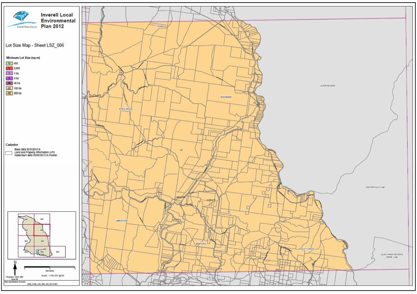


Annex B
PMST Search

EPBC Act Protected Matters Report
This report provides general guidance on matters of national environmental significance and other mattersprotected by the EPBC Act in the area you have selected.
Information on the coverage of this report and qualifications on data supporting this report are contained in thecaveat at the end of the report.
Information is available about Environment Assessments and the EPBC Act including significance guidelines,forms and application process details.
Other Matters Protected by the EPBC Act
Acknowledgements
Buffer: 5.0Km
Matters of NES
Report created: 02/03/18 16:26:08
Coordinates
This map may contain data which are©Commonwealth of Australia(Geoscience Australia), ©PSMA 2010
CaveatExtra Information
DetailsSummary

Summary
This part of the report summarises the matters of national environmental significance that may occur in, or mayrelate to, the area you nominated. Further information is available in the detail part of the report, which can beaccessed by scrolling or following the links below. If you are proposing to undertake an activity that may have asignificant impact on one or more matters of national environmental significance then you should consider theAdministrative Guidelines on Significance.
Matters of National Environmental Significance
Listed Threatened Ecological Communities:
Listed Migratory Species:
4
Great Barrier Reef Marine Park:
Wetlands of International Importance:
Listed Threatened Species:
None
35
None
None
National Heritage Places:
Commonwealth Marine Area:
World Heritage Properties:
3
None
11
The EPBC Act protects the environment on Commonwealth land, the environment from the actions taken onCommonwealth land, and the environment from actions taken by Commonwealth agencies. As heritage values of aplace are part of the 'environment', these aspects of the EPBC Act protect the Commonwealth Heritage values of aCommonwealth Heritage place. Information on the new heritage laws can be found athttp://www.environment.gov.au/heritage
This part of the report summarises other matters protected under the Act that may relate to the area you nominated.Approval may be required for a proposed activity that significantly affects the environment on Commonwealth land,when the action is outside the Commonwealth land, or the environment anywhere when the action is taken onCommonwealth land. Approval may also be required for the Commonwealth or Commonwealth agencies proposing totake an action that is likely to have a significant impact on the environment anywhere.
A permit may be required for activities in or on a Commonwealth area that may affect a member of a listed threatenedspecies or ecological community, a member of a listed migratory species, whales and other cetaceans, or a member ofa listed marine species.
Other Matters Protected by the EPBC Act
None
None
None
Listed Marine Species:
Whales and Other Cetaceans:
17
Commonwealth Heritage Places:
None
None
Critical Habitats:
Commonwealth Land:
Commonwealth Reserves Terrestrial:
NoneCommonwealth Reserves Marine:
Extra Information
This part of the report provides information that may also be relevant to the area you have nominated.
None
1State and Territory Reserves:
Nationally Important Wetlands:
1Regional Forest Agreements:
Invasive Species: 18
NoneKey Ecological Features (Marine)

Details
Wetlands of International Importance (Ramsar) [ Resource Information ]Name ProximityBanrock station wetland complex 1100 - 1200kmRiverland 1100 - 1200kmThe coorong, and lakes alexandrina and albert wetland 1300 - 1400km
Listed Threatened Species [ Resource Information ]Name Status Type of PresenceBirds
Regent Honeyeater [82338] Critically Endangered Species or species habitatknown to occur within area
Anthochaera phrygia
Curlew Sandpiper [856] Critically Endangered Species or species habitatmay occur within area
Calidris ferruginea
Red Goshawk [942] Vulnerable Species or species habitatlikely to occur within area
Erythrotriorchis radiatus
Squatter Pigeon (southern) [64440] Vulnerable Species or species habitatlikely to occur within area
Geophaps scripta scripta
Painted Honeyeater [470] Vulnerable Species or species habitatlikely to occur within area
Grantiella picta
Swift Parrot [744] Critically Endangered Species or species habitatlikely to occur within area
Lathamus discolor
Australian Painted Snipe [77037] Endangered Species or species habitatmay occur within area
Rostratula australis
Fish
Murray Cod [66633] Vulnerable Species or speciesMaccullochella peelii
For threatened ecological communities where the distribution is well known, maps are derived from recoveryplans, State vegetation maps, remote sensing imagery and other sources. Where threatened ecologicalcommunity distributions are less well known, existing vegetation maps and point location data are used toproduce indicative distribution maps.
Listed Threatened Ecological Communities [ Resource Information ]
Name Status Type of PresenceNatural grasslands on basalt and fine-textured alluvialplains of northern New South Wales and southernQueensland
Critically Endangered Community likely to occurwithin area
New England Peppermint (Eucalyptus nova-anglica)Grassy Woodlands
Critically Endangered Community may occurwithin area
Weeping Myall Woodlands Endangered Community may occurwithin area
White Box-Yellow Box-Blakely's Red Gum GrassyWoodland and Derived Native Grassland
Critically Endangered Community likely to occurwithin area
Matters of National Environmental Significance

Name Status Type of Presencehabitat may occur withinarea
Mammals
Large-eared Pied Bat, Large Pied Bat [183] Vulnerable Species or species habitatlikely to occur within area
Chalinolobus dwyeri
Spot-tailed Quoll, Spotted-tail Quoll, Tiger Quoll(southeastern mainland population) [75184]
Endangered Species or species habitatmay occur within area
Dasyurus maculatus maculatus (SE mainland population)
Corben's Long-eared Bat, South-eastern Long-earedBat [83395]
Vulnerable Species or species habitatlikely to occur within area
Nyctophilus corbeni
Greater Glider [254] Vulnerable Species or species habitatmay occur within area
Petauroides volans
Brush-tailed Rock-wallaby [225] Vulnerable Species or species habitatknown to occur within area
Petrogale penicillata
Koala (combined populations of Queensland, NewSouth Wales and the Australian Capital Territory)[85104]
Vulnerable Species or species habitatlikely to occur within area
Phascolarctos cinereus (combined populations of Qld, NSW and the ACT)
New Holland Mouse, Pookila [96] Vulnerable Species or species habitatlikely to occur within area
Pseudomys novaehollandiae
Grey-headed Flying-fox [186] Vulnerable Foraging, feeding or relatedbehaviour may occur withinarea
Pteropus poliocephalus
Plants
Velvet Wattle [19799] Vulnerable Species or species habitatmay occur within area
Acacia pubifolia
[56312] Endangered Species or species habitatlikely to occur within area
Astrotricha roddii
Ooline [9828] Vulnerable Species or species habitatlikely to occur within area
Cadellia pentastylis
[55581] Vulnerable Species or species habitatlikely to occur within area
Callistemon pungens
bluegrass [14159] Vulnerable Species or species habitatlikely to occur within area
Dichanthium setosum
Ovenden's Ironbark [56193] Vulnerable Species or species habitatknown to occur within area
Eucalyptus caleyi subsp. ovendenii
McKie's Stringybark [20199] Vulnerable Species or species habitatlikely to occur within area
Eucalyptus mckieana
Narrow-leaved Peppermint, Narrow-leaved BlackPeppermint [20992]
Vulnerable Species or species habitatknown to occur within area
Eucalyptus nicholii
Belson's Panic [2406] Vulnerable Species or species habitatmay occur within area
Homopholis belsonii

Name Status Type of Presence
Wandering Pepper-cress [14035] Endangered Species or species habitatmay occur within area
Lepidium peregrinum
Torrington Beard-heath [14417] Endangered Species or species habitatmay occur within area
Leucopogon confertus
a leek-orchid [81964] Critically Endangered Species or species habitatmay occur within area
Prasophyllum sp. Wybong (C.Phelps ORG 5269)
Heath Wrinklewort [13132] Vulnerable Species or species habitatknown to occur within area
Rutidosis heterogama
Austral Toadflax, Toadflax [15202] Vulnerable Species or species habitatlikely to occur within area
Thesium australe
[55231] Endangered Species or species habitatmay occur within area
Tylophora linearis
Reptiles
Adorned Delma, Collared Delma [1656] Vulnerable Species or species habitatmay occur within area
Delma torquata
Dunmall's Snake [59254] Vulnerable Species or species habitatmay occur within area
Furina dunmalli
Border Thick-tailed Gecko, Granite Belt Thick-tailedGecko [84578]
Vulnerable Species or species habitatknown to occur within area
Uvidicolus sphyrurus
Bell's Turtle, Western Sawshelled Turtle, Namoi RiverTurtle, Bell's Saw-shelled Turtle [86071]
Vulnerable Species or species habitatmay occur within area
Wollumbinia belli
Listed Migratory Species [ Resource Information ]* Species is listed under a different scientific name on the EPBC Act - Threatened Species list.Name Threatened Type of PresenceMigratory Marine Birds
Fork-tailed Swift [678] Species or species habitatlikely to occur within area
Apus pacificus
Migratory Terrestrial Species
White-throated Needletail [682] Species or species habitatlikely to occur within area
Hirundapus caudacutus
Yellow Wagtail [644] Species or species habitatmay occur within area
Motacilla flava
Satin Flycatcher [612] Species or species habitatlikely to occur within area
Myiagra cyanoleuca
Rufous Fantail [592] Species or species habitatlikely to occur within area
Rhipidura rufifrons
Migratory Wetlands Species
Common Sandpiper [59309] Species or species habitatmay occur within area
Actitis hypoleucos

Name Threatened Type of Presence
Sharp-tailed Sandpiper [874] Species or species habitatmay occur within area
Calidris acuminata
Curlew Sandpiper [856] Critically Endangered Species or species habitatmay occur within area
Calidris ferruginea
Pectoral Sandpiper [858] Species or species habitatmay occur within area
Calidris melanotos
Latham's Snipe, Japanese Snipe [863] Species or species habitatmay occur within area
Gallinago hardwickii
Osprey [952] Species or species habitatmay occur within area
Pandion haliaetus
Listed Marine Species [ Resource Information ]* Species is listed under a different scientific name on the EPBC Act - Threatened Species list.Name Threatened Type of PresenceBirds
Common Sandpiper [59309] Species or species habitatmay occur within area
Actitis hypoleucos
Fork-tailed Swift [678] Species or species habitatlikely to occur within area
Apus pacificus
Great Egret, White Egret [59541] Species or species habitatlikely to occur within area
Ardea alba
Cattle Egret [59542] Species or species habitatmay occur within area
Ardea ibis
Sharp-tailed Sandpiper [874] Species or species habitatmay occur within area
Calidris acuminata
Curlew Sandpiper [856] Critically Endangered Species or species habitatmay occur within area
Calidris ferruginea
Pectoral Sandpiper [858] Species or species habitatmay occur within area
Calidris melanotos
Latham's Snipe, Japanese Snipe [863] Species or species habitatmay occur within area
Gallinago hardwickii
White-bellied Sea-Eagle [943] Species or species habitatmay occur within area
Haliaeetus leucogaster
White-throated Needletail [682] Species or species habitatlikely to occur within area
Hirundapus caudacutus
Other Matters Protected by the EPBC Act

Name Threatened Type of Presence
Swift Parrot [744] Critically Endangered Species or species habitatlikely to occur within area
Lathamus discolor
Rainbow Bee-eater [670] Species or species habitatmay occur within area
Merops ornatus
Yellow Wagtail [644] Species or species habitatmay occur within area
Motacilla flava
Satin Flycatcher [612] Species or species habitatlikely to occur within area
Myiagra cyanoleuca
Osprey [952] Species or species habitatmay occur within area
Pandion haliaetus
Rufous Fantail [592] Species or species habitatlikely to occur within area
Rhipidura rufifrons
Painted Snipe [889] Endangered* Species or species habitatmay occur within area
Rostratula benghalensis (sensu lato)
State and Territory Reserves [ Resource Information ]Name StateCrooked Creek NSW
Regional Forest Agreements [ Resource Information ]
Note that all areas with completed RFAs have been included.
Name StateNorth East NSW RFA New South Wales
Extra Information
Invasive Species [ Resource Information ]Weeds reported here are the 20 species of national significance (WoNS), along with other introduced plantsthat are considered by the States and Territories to pose a particularly significant threat to biodiversity. Thefollowing feral animals are reported: Goat, Red Fox, Cat, Rabbit, Pig, Water Buffalo and Cane Toad. Maps fromLandscape Health Project, National Land and Water Resouces Audit, 2001.
Name Status Type of PresenceBirds
Rock Pigeon, Rock Dove, Domestic Pigeon [803] Species or species habitatlikely to occur within area
Columba livia
House Sparrow [405] Species or species habitatlikely to occur within area
Passer domesticus
Common Starling [389] Species or species habitatlikely to occur within area
Sturnus vulgaris
Mammals

Name Status Type of Presence
Domestic Cattle [16] Species or species habitatlikely to occur within area
Bos taurus
Domestic Dog [82654] Species or species habitatlikely to occur within area
Canis lupus familiaris
Goat [2] Species or species habitatlikely to occur within area
Capra hircus
Cat, House Cat, Domestic Cat [19] Species or species habitatlikely to occur within area
Felis catus
Feral deer species in Australia [85733] Species or species habitatlikely to occur within area
Feral deer
Rabbit, European Rabbit [128] Species or species habitatlikely to occur within area
Oryctolagus cuniculus
Pig [6] Species or species habitatlikely to occur within area
Sus scrofa
Red Fox, Fox [18] Species or species habitatlikely to occur within area
Vulpes vulpes
Plants
Broom [67538] Species or species habitatmay occur within area
Genista sp. X Genista monspessulana
Chilean Needle grass [67699] Species or species habitatlikely to occur within area
Nassella neesiana
Prickly Pears [82753] Species or species habitatlikely to occur within area
Opuntia spp.
Radiata Pine Monterey Pine, Insignis Pine, WildingPine [20780]
Species or species habitatmay occur within area
Pinus radiata
Blackberry, European Blackberry [68406] Species or species habitatlikely to occur within area
Rubus fruticosus aggregate
Willows except Weeping Willow, Pussy Willow andSterile Pussy Willow [68497]
Species or species habitatlikely to occur within area
Salix spp. except S.babylonica, S.x calodendron & S.x reichardtii
Silver Nightshade, Silver-leaved Nightshade, WhiteHorse Nettle, Silver-leaf Nightshade, Tomato Weed,White Nightshade, Bull-nettle, Prairie-berry,Satansbos, Silver-leaf Bitter-apple, Silverleaf-nettle,Trompillo [12323]
Species or species habitatlikely to occur within area
Solanum elaeagnifolium

- non-threatened seabirds which have only been mapped for recorded breeding sites
- migratory species that are very widespread, vagrant, or only occur in small numbers
- some species and ecological communities that have only recently been listed
Not all species listed under the EPBC Act have been mapped (see below) and therefore a report is a general guide only. Where available datasupports mapping, the type of presence that can be determined from the data is indicated in general terms. People using this information in makinga referral may need to consider the qualifications below and may need to seek and consider other information sources.
For threatened ecological communities where the distribution is well known, maps are derived from recovery plans, State vegetation maps, remotesensing imagery and other sources. Where threatened ecological community distributions are less well known, existing vegetation maps and pointlocation data are used to produce indicative distribution maps.
- seals which have only been mapped for breeding sites near the Australian continent
Such breeding sites may be important for the protection of the Commonwealth Marine environment.
Threatened, migratory and marine species distributions have been derived through a variety of methods. Where distributions are well known and iftime permits, maps are derived using either thematic spatial data (i.e. vegetation, soils, geology, elevation, aspect, terrain, etc) together with pointlocations and described habitat; or environmental modelling (MAXENT or BIOCLIM habitat modelling) using point locations and environmental datalayers.
The information presented in this report has been provided by a range of data sources as acknowledged at the end of the report.Caveat
- migratory and
The following species and ecological communities have not been mapped and do not appear in reports produced from this database:
- marine
This report is designed to assist in identifying the locations of places which may be relevant in determining obligations under the EnvironmentProtection and Biodiversity Conservation Act 1999. It holds mapped locations of World and National Heritage properties, Wetlands of Internationaland National Importance, Commonwealth and State/Territory reserves, listed threatened, migratory and marine species and listed threatenedecological communities. Mapping of Commonwealth land is not complete at this stage. Maps have been collated from a range of sources at variousresolutions.
- threatened species listed as extinct or considered as vagrants
- some terrestrial species that overfly the Commonwealth marine area
The following groups have been mapped, but may not cover the complete distribution of the species:
Only selected species covered by the following provisions of the EPBC Act have been mapped:
Where very little information is available for species or large number of maps are required in a short time-frame, maps are derived either from 0.04or 0.02 decimal degree cells; by an automated process using polygon capture techniques (static two kilometre grid cells, alpha-hull and convex hull);or captured manually or by using topographic features (national park boundaries, islands, etc). In the early stages of the distribution mappingprocess (1999-early 2000s) distributions were defined by degree blocks, 100K or 250K map sheets to rapidly create distribution maps. More reliabledistribution mapping methods are used to update these distributions as time permits.
-29.172203 151.305998,-29.172128 151.305913,-29.188539 151.328486,-29.189438 151.336812,-29.183444 151.337756,-29.180821151.332778,-29.176699 151.329859,-29.173552 151.324538,-29.172952 151.322821,-29.172353 151.32368,-29.172578 151.328915,-29.174526151.332434,-29.180147 151.337842,-29.179697 151.344193,-29.188614 151.342906,-29.18809 151.345824,-29.185767 151.346253,-29.186591151.352433,-29.184718 151.352605,-29.185092 151.355694,-29.18247 151.356295,-29.183744 151.363505,-29.186067 151.363162,-29.18749151.372946,-29.192136 151.376036,-29.197606 151.377066,-29.200228 151.37741,-29.20315 151.37904,-29.205622 151.379126,-29.201951151.353034,-29.209293 151.35166,-29.208319 151.342219,-29.211616 151.341876,-29.210192 151.329344,-29.202176 151.330804,-29.199704151.314067,-29.209293 151.312436,-29.208919 151.308745,-29.20772 151.308573,-29.201352 151.305569,-29.190562 151.306599,-29.185392151.304539,-29.18157 151.304969,-29.1761 151.30411,-29.172203 151.305998
Coordinates

-Environment and Planning Directorate, ACT-Birdlife Australia-Australian Bird and Bat Banding Scheme
-Department of Parks and Wildlife, Western Australia
Acknowledgements
-Office of Environment and Heritage, New South Wales
-Department of Primary Industries, Parks, Water and Environment, Tasmania
-Department of Land and Resource Management, Northern Territory-Department of Environmental and Heritage Protection, Queensland
-Department of Environment and Primary Industries, Victoria
-Australian National Wildlife Collection
-Department of Environment, Water and Natural Resources, South Australia
This database has been compiled from a range of data sources. The department acknowledges the followingcustodians who have contributed valuable data and advice:
-Australian Museum
-National Herbarium of NSW
Forestry Corporation, NSW-Australian Government, Department of Defence
-State Herbarium of South Australia
The Department is extremely grateful to the many organisations and individuals who provided expert adviceand information on numerous draft distributions.
-Natural history museums of Australia
-Queensland Museum
-Australian National Herbarium, Canberra
-Royal Botanic Gardens and National Herbarium of Victoria
-Geoscience Australia
-Ocean Biogeographic Information System
-Online Zoological Collections of Australian Museums-Queensland Herbarium
-Western Australian Herbarium
-Tasmanian Herbarium
-Northern Territory Herbarium
-South Australian Museum
-Museum Victoria
-University of New England
-CSIRO
-Other groups and individuals-Tasmanian Museum and Art Gallery, Hobart, Tasmania
-Museum and Art Gallery of the Northern Territory
-Reef Life Survey Australia-Australian Institute of Marine Science-Australian Government National Environmental Science Program
-Australian Tropical Herbarium, Cairns
-Australian Government – Australian Antarctic Data Centre
-Queen Victoria Museum and Art Gallery, Inveresk, Tasmania
-eBird Australia
-American Museum of Natural History
© Commonwealth of Australia
+61 2 6274 1111
Canberra ACT 2601 Australia
GPO Box 787
Department of the Environment
Please feel free to provide feedback via the Contact Us page.

Annex C
NSW Wildlife Atlas Online
Database Search

Environmental Resources Management Australia Pty Ltd
DatasetName SightingKey SpeciesCode KingdomName ClassName FamilyName SortOrder ScientificN Exotic CommonName NSWStatusCommStat Sensitivity ProfileID
OEH Data from Scientific Licences dataset SJALI0007432 2139 Fauna Reptilia Gekkonidae 527 Uvidicolus sphyrurus Border Thick-tailed Gecko V,P V 10823
Spring Faunal Survey SPJGI0224441 260 Fauna Aves Psittacidae 2185 Glossopsitta pusilla Little Lorikeet V,P 20111
OEH Default Sightings SDMP96121108 302 Fauna Aves Psittacidae 2200 Neophema pulchella Turquoise Parrot V,P,3 3^^ 10555
Spring Faunal Survey SPJGI0224422 8127 Fauna Aves Climacteridae 2404 Climacteris picumnus victoriae Brown Treecreeper (eastern subspecies) V,P 10171
Spring Faunal Survey SPJGI0224393 504 Fauna Aves Acanthizidae 2554 Chthonicola sagittata Speckled Warbler V,P 10722
OEH Default Sightings SJJSI0204992 8388 Fauna Aves Pomatostomidae 2831 Pomatostomus temporalis temporalis Grey-crowned Babbler (eastern subspecies) V,P 10660
Spring Faunal Survey SPJGI0232317 549 Fauna Aves Neosittidae 2854 Daphoenositta chrysoptera Varied Sittella V,P 20135
Spring Faunal Survey SPJGI0232318 8519 Fauna Aves Artamidae 2947 Artamus cyanopterus cyanopterus Dusky Woodswallow V,P 20303
Spring Faunal Survey SPJGI0232290 380 Fauna Aves Petroicidae 3133 Petroica boodang Scarlet Robin V,P 20133
Spring Faunal Survey SPJGI0224414 652 Fauna Aves Estrildidae 3295 Stagonopleura guttata Diamond Firetail V,P 10768
OEH Data from Scientific Licences dataset SJALI0007414 1162 Fauna Mammalia Phascolarctidae 3452 Phascolarctos cinereus Koala V,P V 10616
OEH Default Sightings SEXK9907080S 1137 Fauna Mammalia Petauridae 3476 Petaurus norfolcensis Squirrel Glider V,P 10604
OEH Default Sightings SEXK9907080T 1215 Fauna Mammalia Macropodidae 3588 Petrogale penicillata Brush-tailed Rock-wallaby E1,P V 10605
OEH Default Sightings SEXK9907090A 1372 Fauna Mammalia Vespertilionidae 3678 Falsistrellus tasmaniensis Eastern False Pipistrelle V,P 10331
OEH Default Sightings SEXK99070906 1834 Fauna Mammalia Vespertilionidae 3682 Miniopterus schreibersii oceanensis Eastern Bentwing-bat V,P 10534
OEH Default Sightings SEXK99070907 1361 Fauna Mammalia Vespertilionidae 3707 Scoteanax rueppellii Greater Broad-nosed Bat V,P 10748
MACINTYRE Vegetation Survey SPJGI4114300 8538 Flora Flora Fabaceae (Faboideae) 9873 Swainsona sericea Silky Swainson-pea V,P 10783

Annex D
Bushfire Prone Land


Annex E
Contaminated Land Search


Annex F
AHIMS Search

AHIMS Web Services (AWS)Extensive search - Site list report
SiteID SiteName Datum Zone Easting Northing Context SiteFeatures SiteTypes Reports
Your Ref/PO Number : 0450869
Client Service ID : 331690
Site Status
11-3-0041 S19 AGD 56 335382 6770551 Open site Valid Artefact : - Isolated Find
PermitsRobert PatonRecordersContact
11-3-0047 EL35 AGD 56 342100 6767700 Open site Valid Artefact : -
PermitsRobert PatonRecordersContact
11-3-0063 EL34 AGD 56 342150 6767550 Open site Valid Artefact : -
PermitsRobert PatonRecordersContact
11-3-0064 EL33 AGD 56 342100 6767500 Open site Valid Art (Pigment or
Engraved) : -
PermitsRobert PatonRecordersContact
11-3-0065 EL32 AGD 56 342000 6767000 Open site Valid Artefact : -
PermitsRobert PatonRecordersContact
11-3-0066 EL36 AGD 56 342100 6767500 Open site Valid Artefact : -
PermitsRobert PatonRecordersContact
11-3-0080 TSR Dumaresq River OCS GDA 56 335700 6772930 Open site Valid Artefact : 500
PermitsMiss.Karen GloverRecordersSearleContact
11-3-0083 Tenterfield-Dumaresq OS14 GDA 56 338395 6768085 Open site Valid Artefact : -
PermitsOzArk Environmental and Heritage Management,Mr.Ben ChurcherRecordersContact
11-3-0084 Tenterfield-Dumaresq OS15 GDA 56 342072 6768358 Open site Valid Artefact : -
PermitsOzArk Environmental and Heritage Management,Mr.Ben ChurcherRecordersContact
11-3-0093 Tenterfield Dumaresq OS 4 & PAD GDA 56 342136 6768402 Open site Valid Artefact : -
PermitsOzArk Environmental and Heritage Management,Mr.Ben ChurcherRecordersContact
Report generated by AHIMS Web Service on 05/03/2018 for Eliza Collison for the following area at Lat, Long From : -29.2336, 151.2741 - Lat, Long To : -29.1502, 151.4063 with a Buffer of 0
meters. Additional Info : Site Feasibility Report. Number of Aboriginal sites and Aboriginal objects found is 10
This information is not guaranteed to be free from error omission. Office of Environment and Heritage (NSW) and its employees disclaim liability for any act done or omission made on the information and consequences of such
acts or omission.
Page 1 of 1

ERM has over 100 officesacross the followingcountries worldwide
Australia
Argentina
Belgium
Brazil
China
France
Germany
Hong Kong
Hungary
India
Indonesia
Ireland
Italy
Japan
Korea
Malaysia
Mexico
Netherlands
New Zealand
Peru
Poland
Portugal
Puerto Rico
Singapore
Spain
Sri Lanka
Sweden
Taiwan
Thailand
UK
USA
Venezuela
Vietnam
Environmental Resources Management
PO Box 803Newcastle NSW 2300Watt Street Comercial Centre45 Watt Street Newcastle NSW2300 T: +61 2 49 035500F: +61 2 49 295363www.erm.com