(Bock et al. G-cubed, 2012)
48
(Bock et al. G-cubed, 2012)
Transcript of (Bock et al. G-cubed, 2012)
(Bock et al. G-cubed, 2012)
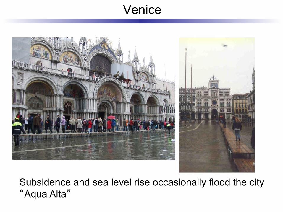
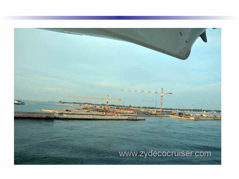
Venice
Subsidence and sea level rise occasionally flood the city “Aqua Alta”
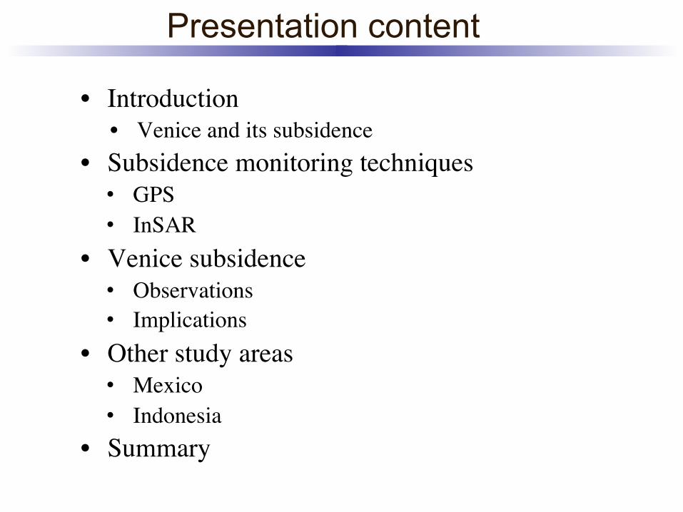
Presentation content
• Introduction • Venice and its subsidence
• Subsidence monitoring techniques • GPS • InSAR
• Venice subsidence • Observations • Implications
• Other study areas • Mexico • Indonesia
• Summary
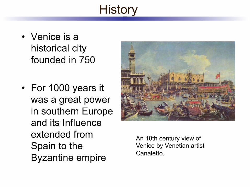
History
• Venice is a historical city founded in 750
• For 1000 years it was a great power in southern Europe and its Influence extended from Spain to the Byzantine empire
An 18th century view of Venice by Venetian artist Canaletto.
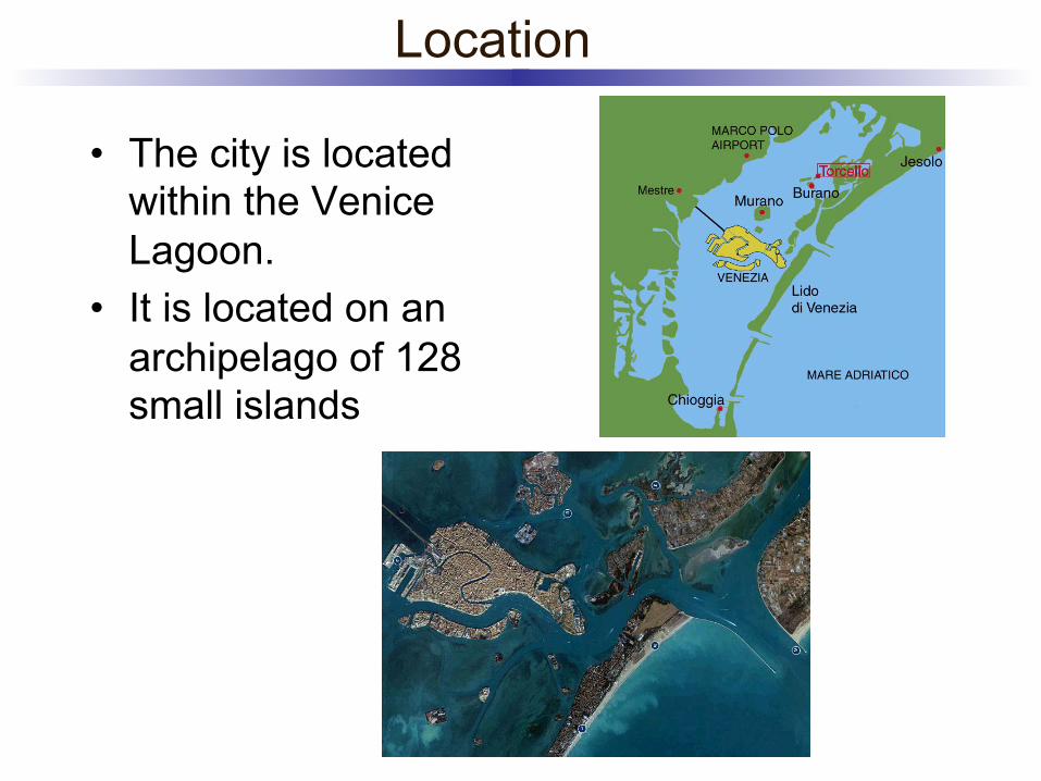
Location
• The city is located within the Venice Lagoon.
• It is located on an archipelago of 128 small islands
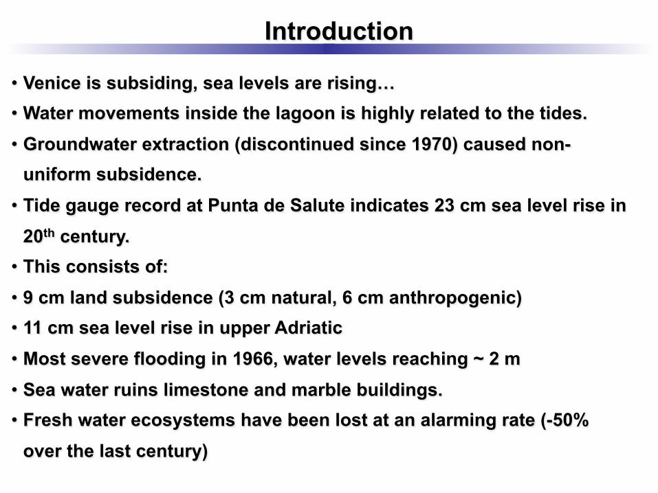
Introduction
• Venice is subsiding, sea levels are rising… • Water movements inside the lagoon is highly related to the tides. • Groundwater extraction (discontinued since 1970) caused non-
uniform subsidence. • Tide gauge record at Punta de Salute indicates 23 cm sea level rise in
20th century. • This consists of: • 9 cm land subsidence (3 cm natural, 6 cm anthropogenic) • 11 cm sea level rise in upper Adriatic • Most severe flooding in 1966, water levels reaching ~ 2 m • Sea water ruins limestone and marble buildings. • Fresh water ecosystems have been lost at an alarming rate (-50%
over the last century)
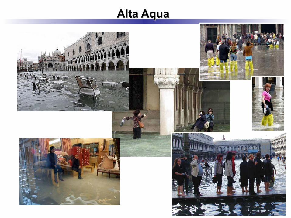
Alta Aqua
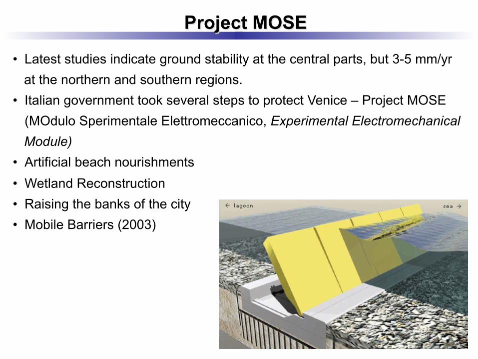
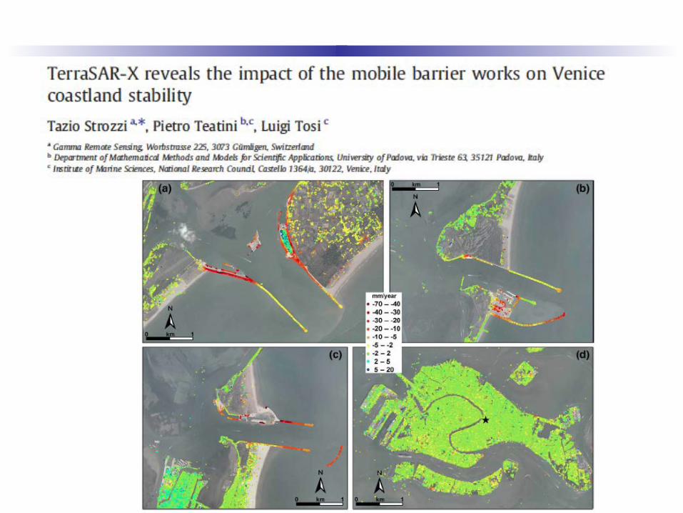
• Latest studies indicate ground stability at the central parts, but 3-5 mm/yr at the northern and southern regions.
• Italian government took several steps to protect Venice – Project MOSE (MOdulo Sperimentale Elettromeccanico, Experimental Electromechanical Module)
• Artificial beach nourishments • Wetland Reconstruction • Raising the banks of the city • Mobile Barriers (2003)
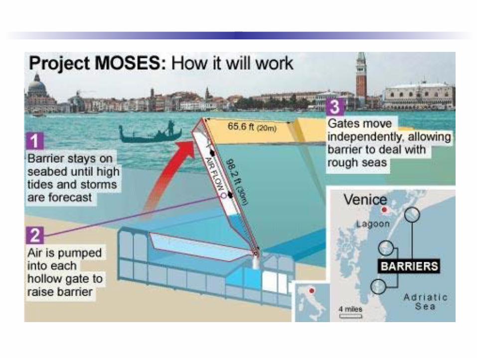
Project MOSE
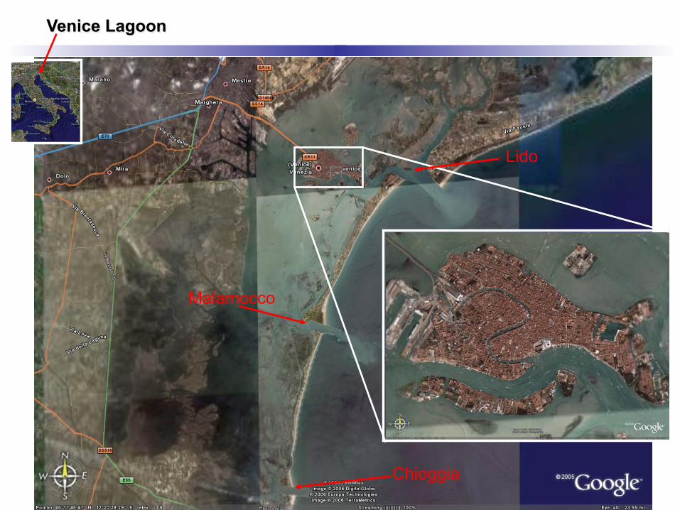
Venice Lagoon
Chioggia
Malamocco
Lido

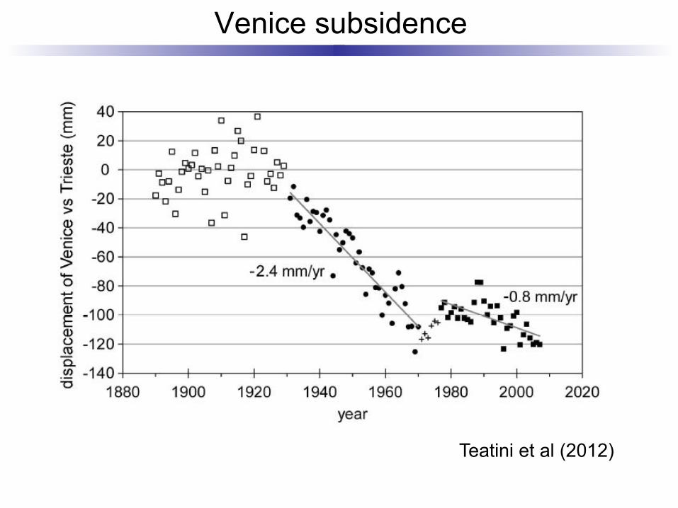
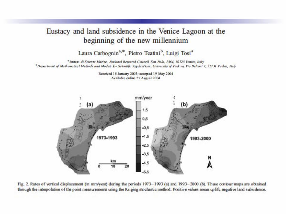
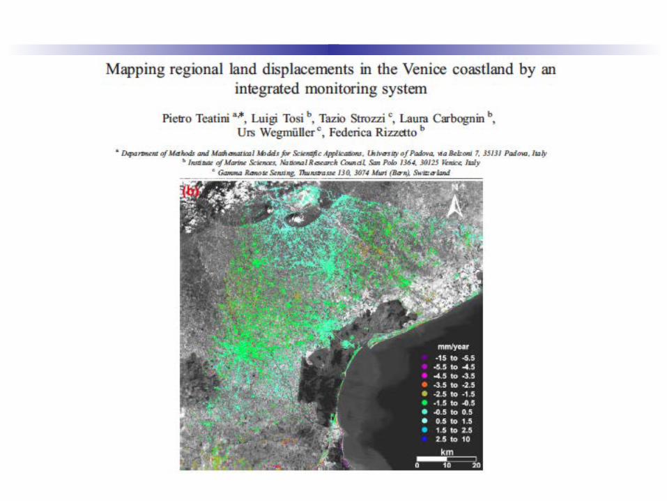
Venice subsidence
Teatini et al (2012)
Space geodetic measurements
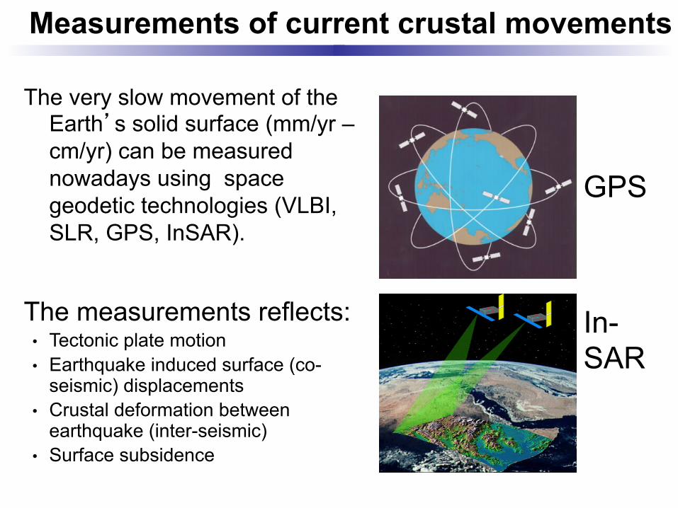
Measurements of current crustal movements
The very slow movement of the Earth’s solid surface (mm/yr – cm/yr) can be measured nowadays using space geodetic technologies (VLBI, SLR, GPS, InSAR).
In-SAR
GPS
The measurements reflects: • Tectonic plate motion • Earthquake induced surface (co-
seismic) displacements • Crustal deformation between
earthquake (inter-seismic) • Surface subsidence
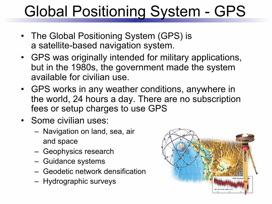
• The Global Positioning System (GPS) is a satellite-based navigation system.
• GPS was originally intended for military applications, but in the 1980s, the government made the system available for civilian use.
• GPS works in any weather conditions, anywhere in the world, 24 hours a day. There are no subscription fees or setup charges to use GPS
• Some civilian uses: – Navigation on land, sea, air
and space – Geophysics research – Guidance systems – Geodetic network densification – Hydrographic surveys
Global Positioning System - GPS
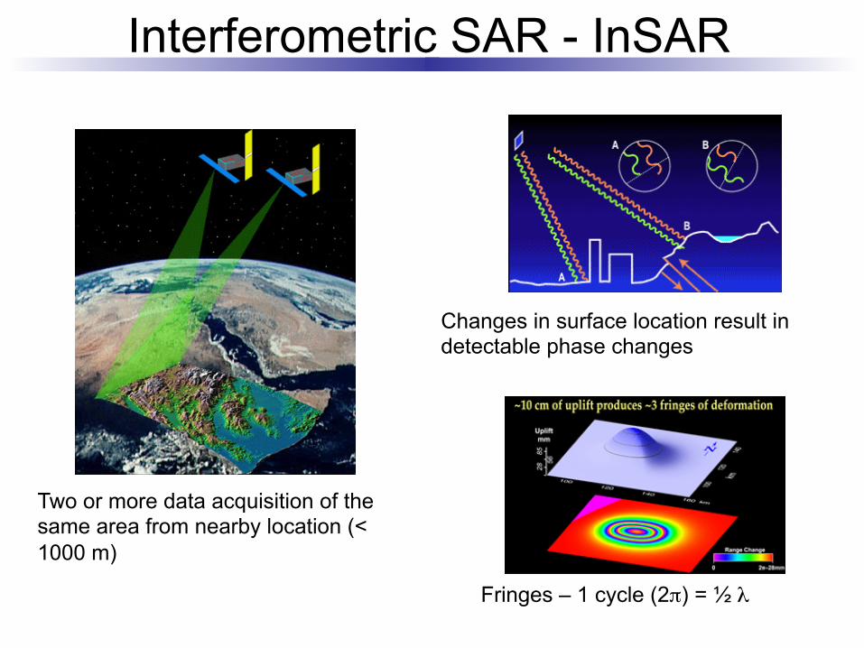
Interferometric SAR - InSAR
Two or more data acquisition of the same area from nearby location (< 1000 m)
Changes in surface location result in detectable phase changes
Fringes – 1 cycle (2π) = ½ λ
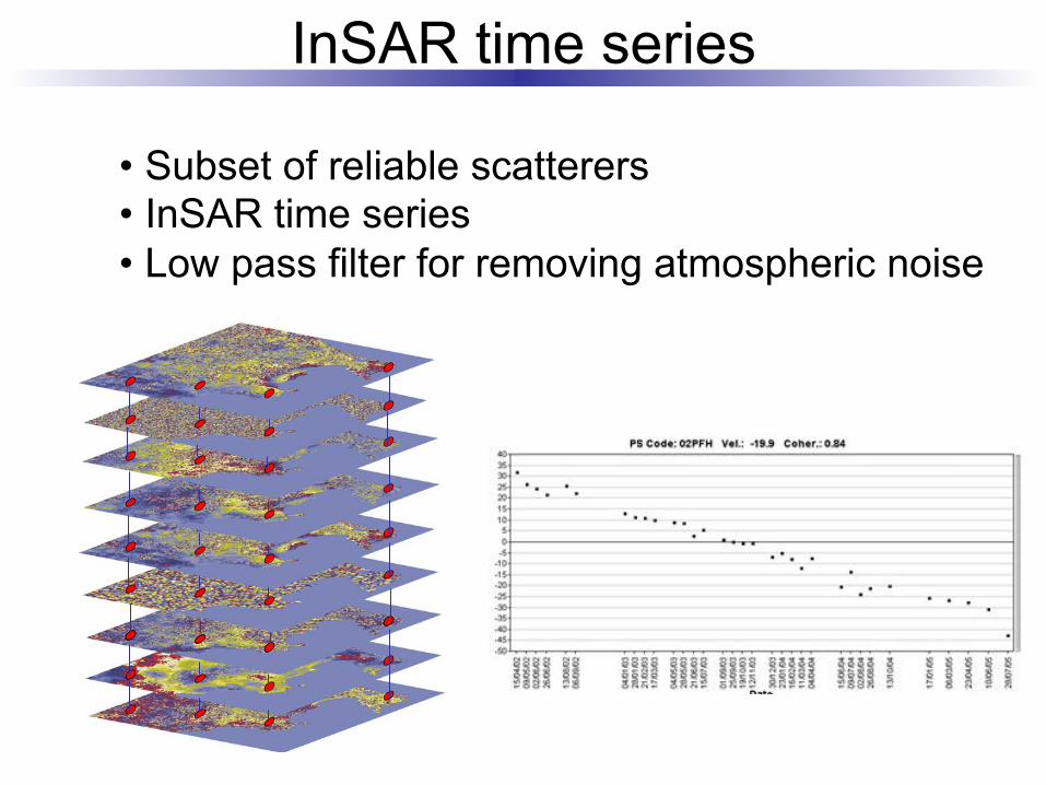
InSAR time series
• Subset of reliable scatterers • InSAR time series • Low pass filter for removing atmospheric noise
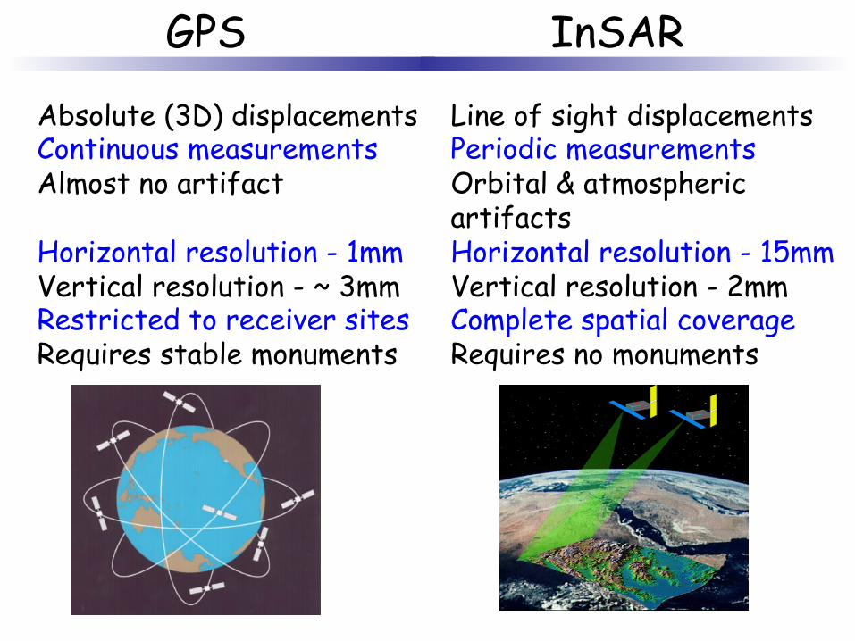
Absolute (3D) displacements Continuous measurements Almost no artifact Horizontal resolution - 1mm Vertical resolution - ~ 3mm Restricted to receiver sites Requires stable monuments
Line of sight displacements Periodic measurements Orbital & atmospheric artifacts Horizontal resolution - 15mm Vertical resolution - 2mm Complete spatial coverage Requires no monuments
GPS InSAR

Space geodetic measurements of the Venice Lagoon
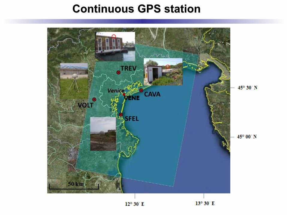
Continuous GPS station
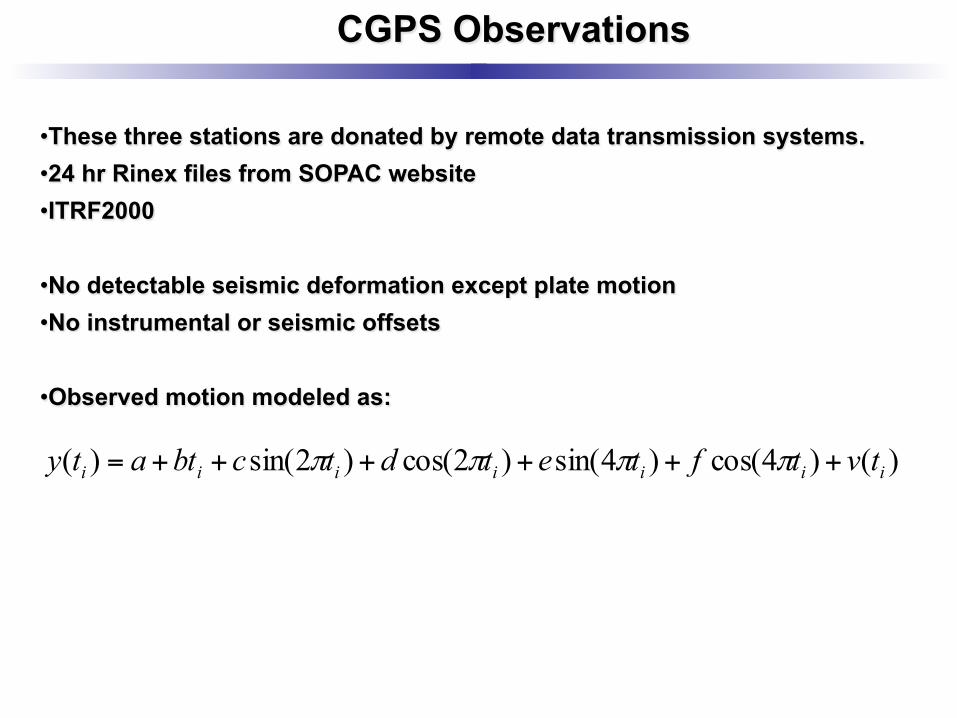
CGPS Observations
• These three stations are donated by remote data transmission systems. • 24 hr Rinex files from SOPAC website • ITRF2000
• No detectable seismic deformation except plate motion • No instrumental or seismic offsets
• Observed motion modeled as:
)()4cos()4sin()2cos()2sin()( iiiiiii tvtftetdtcbtaty ++++++= ππππ
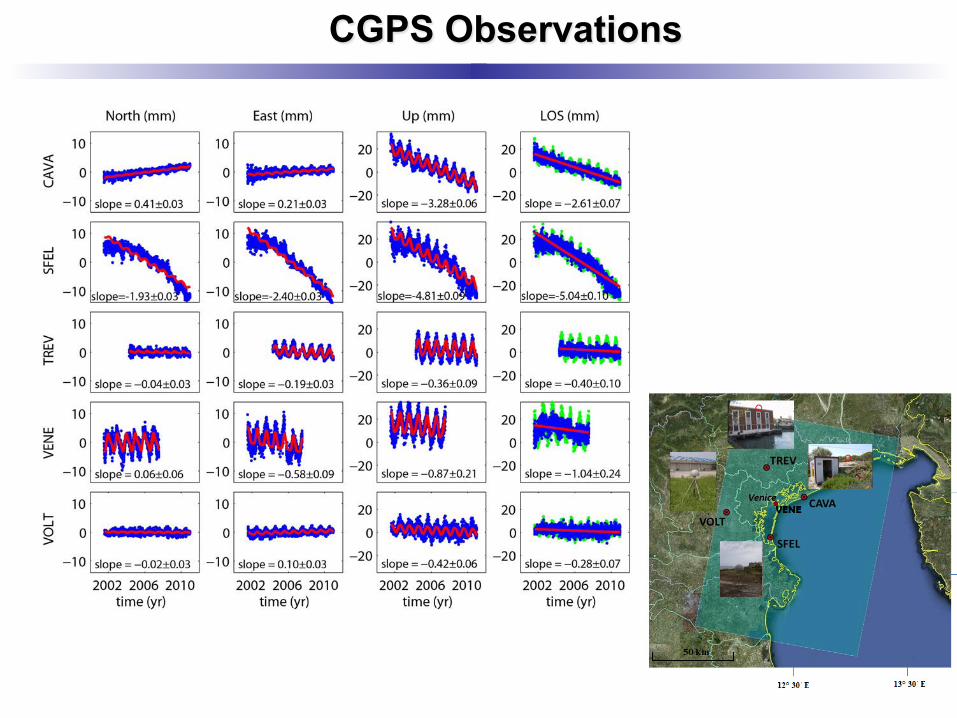
CGPS Observations
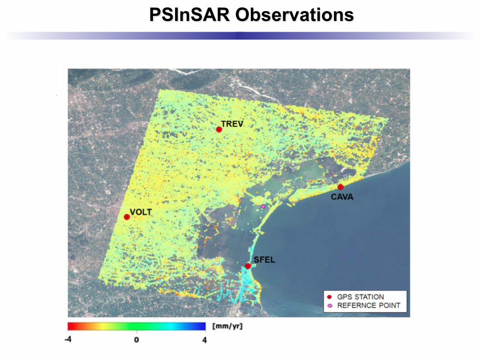
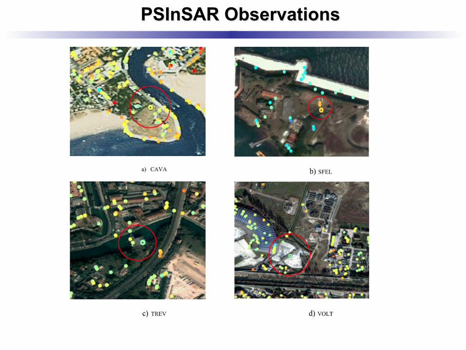
PSInSAR Observations
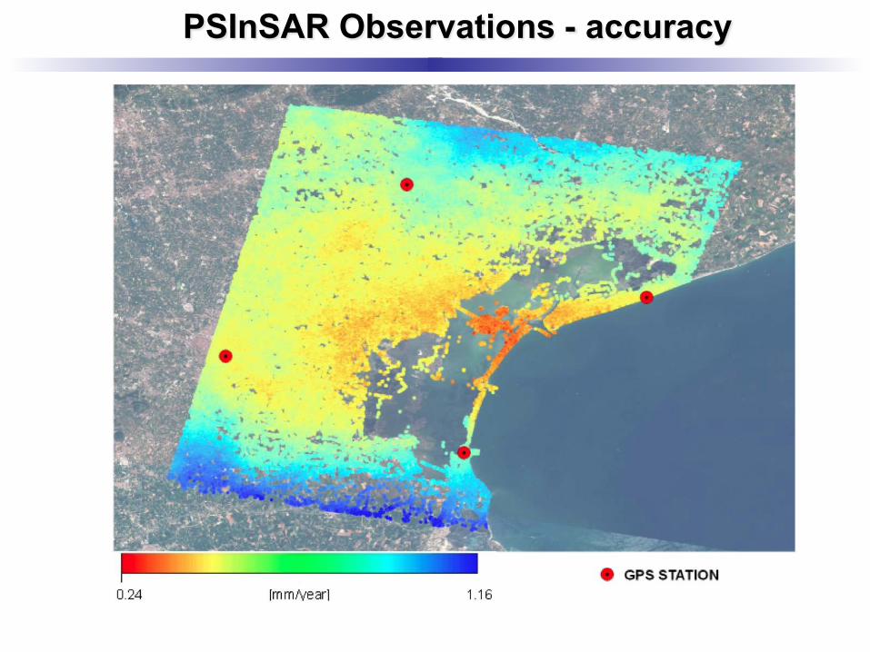
PSInSAR Observations - accuracy
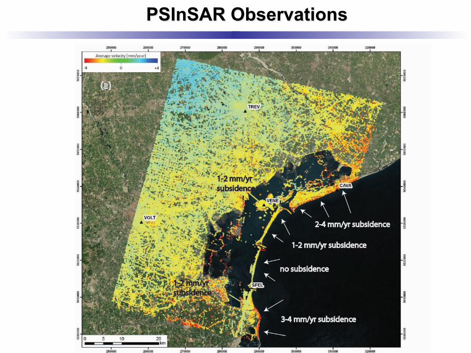
PSInSAR Observations
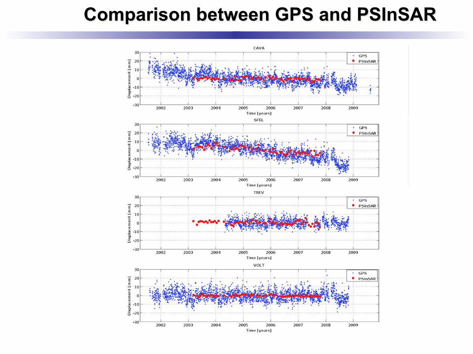
Comparison between GPS and PSInSAR
PSInSAR Observations
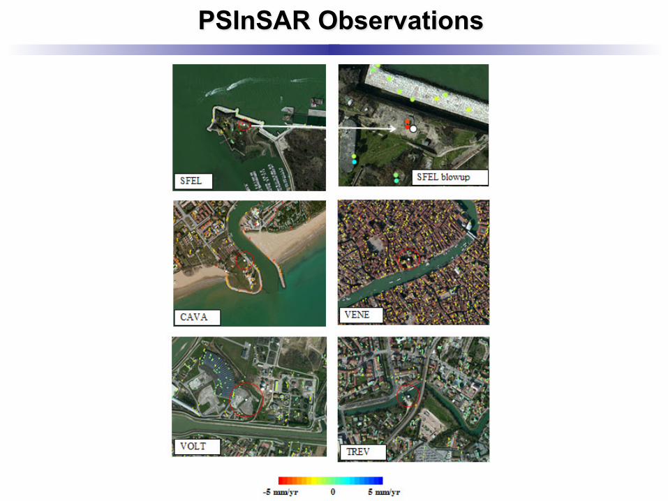
PSInSAR Observations
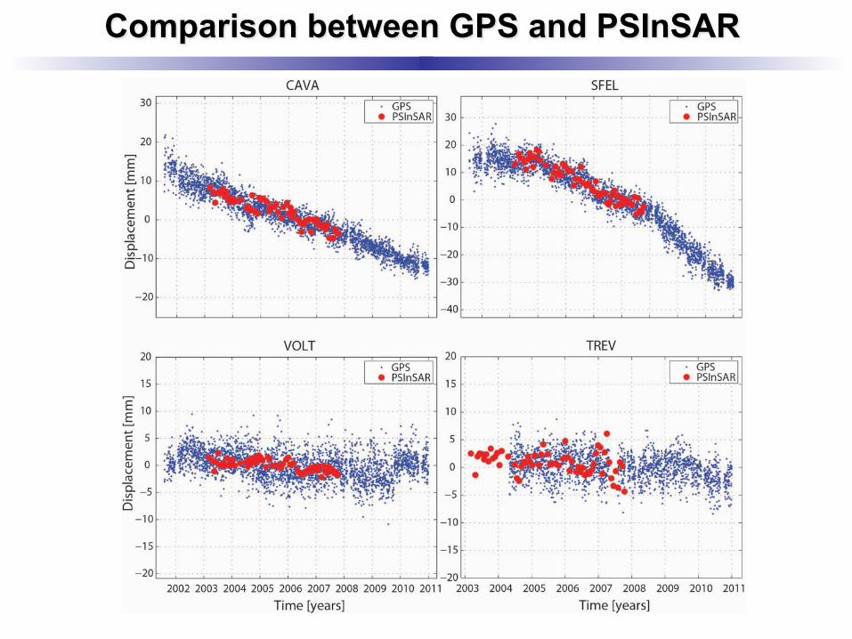
Comparison between GPS and PSInSAR
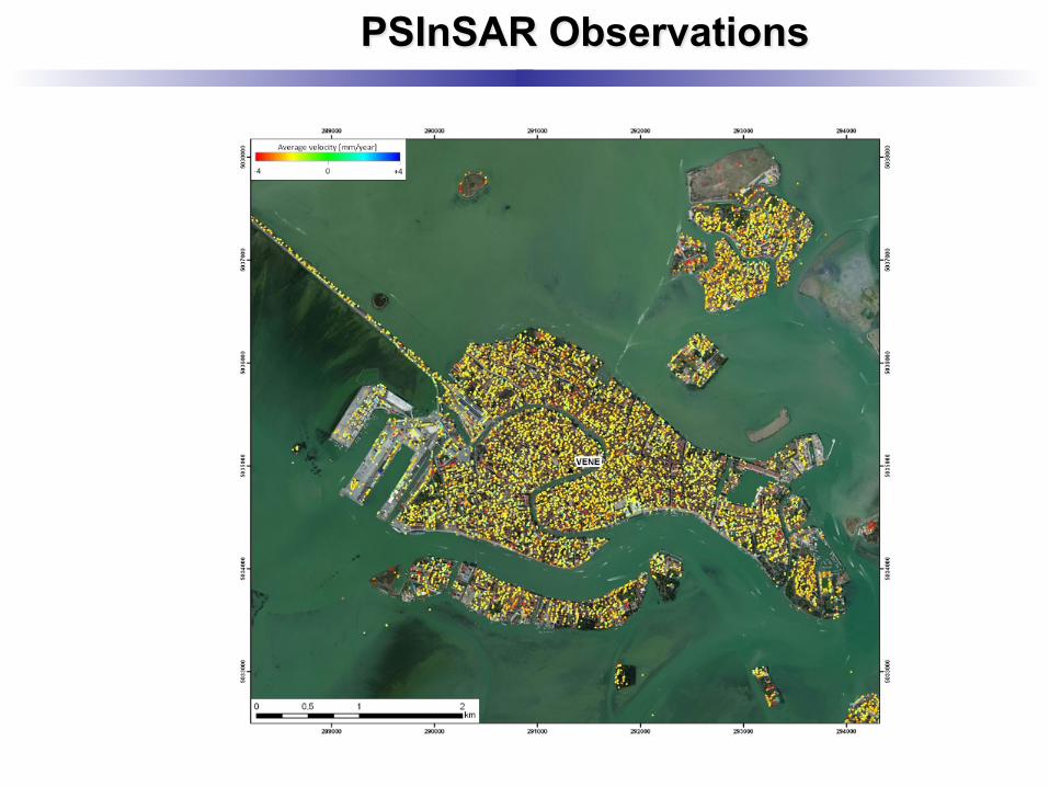
PSInSAR Observations
Other studies
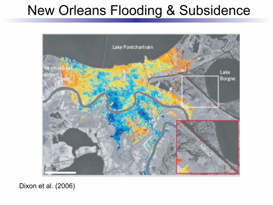
New Orleans Flooding & Subsidence
Dixon et al. (2006)
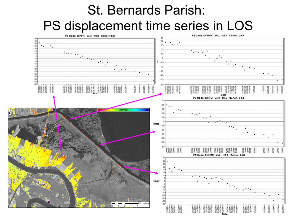
St. Bernards Parish: PS displacement time series in LOS
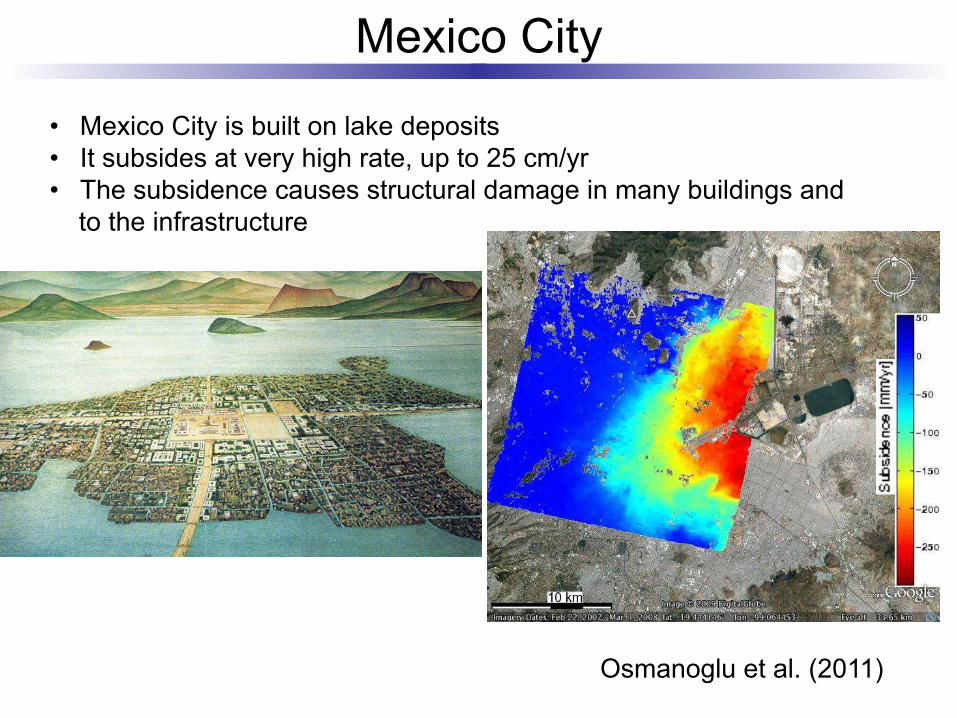
Mexico City
• Mexico City is built on lake deposits • It subsides at very high rate, up to 25 cm/yr • The subsidence causes structural damage in many buildings and
to the infrastructure
Osmanoglu et al. (2011)
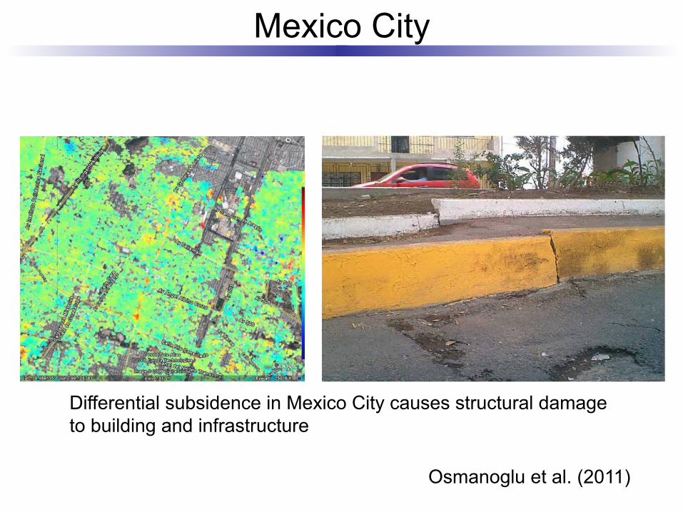
Mexico City
Differential subsidence in Mexico City causes structural damage to building and infrastructure
Osmanoglu et al. (2011)
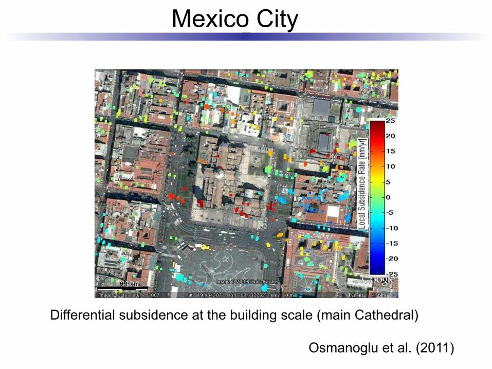
Mexico City
Differential subsidence at the building scale (main Cathedral)
Osmanoglu et al. (2011)
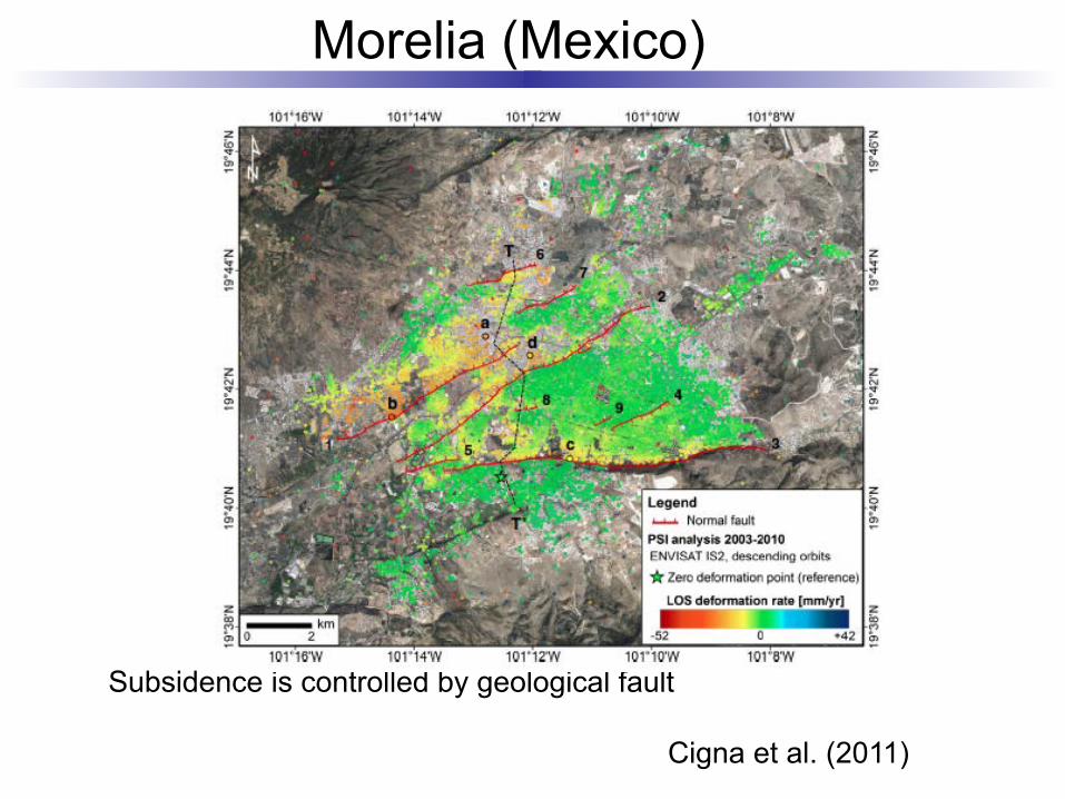
Morelia (Mexico)
Subsidence is controlled by geological fault
Cigna et al. (2011)
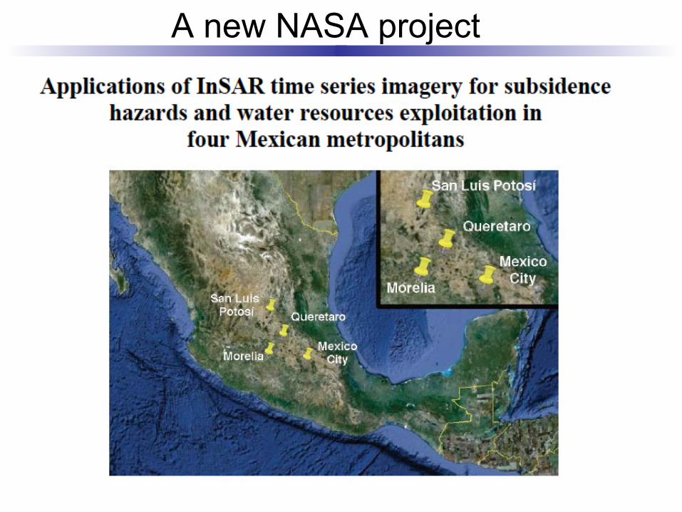
A new NASA project
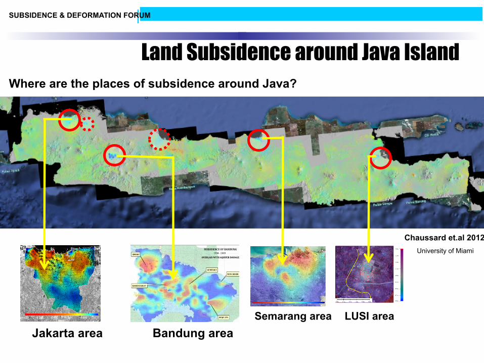
SUBSIDENCE & DEFORMATION FORUM
Where are the places of subsidence around Java?
Jakarta area Bandung area Semarang area LUSI area
Chaussard et.al 2012 University of Miami
Land Subsidence around Java Island
SUBSIDENCE & DEFORMATION FORUM
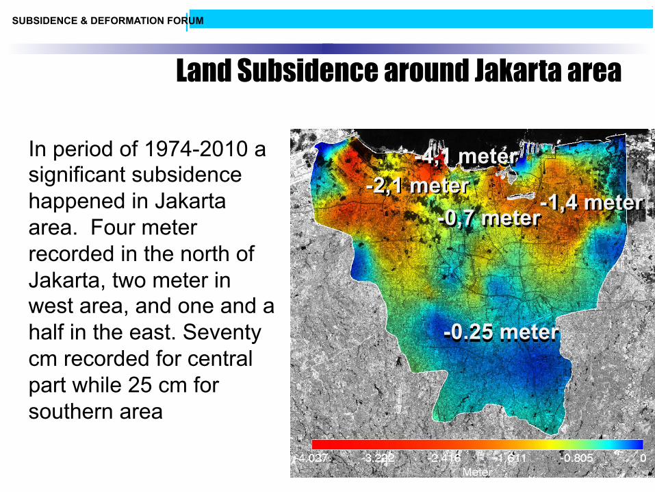
In period of 1974-2010 a significant subsidence happened in Jakarta area. Four meter recorded in the north of Jakarta, two meter in west area, and one and a half in the east. Seventy cm recorded for central part while 25 cm for southern area
-4,1 meter
-1,4 meter -2,1 meter
-0,7 meter
-0.25 meter
-4,1 meter -2,1 meter
-1,4 meter -0,7 meter
-0.25 meter
Land Subsidence around Jakarta area
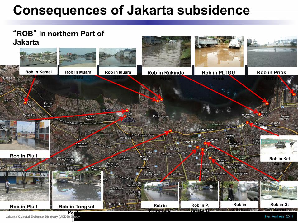
Jakarta Coastal Defense Strategy (JCDS) Study Heri Andreas 2011
Consequences of Jakarta subsidence
Rob in Priok Harbor
Rob in Rukindo Priok
Rob in Pluit Rob in Tongkol Ps Ikan
Rob in PLTGU Priok
Rob in Muara Baru
Rob in Pluit
Rob in Muara Baru
Rob in Kamal Muara
Rob in G. Sahari
Rob in G.Sahari
Rob in P. Jayakarta
Rob in P.Jayakarta
“ROB” in northern Part of Jakarta
Rob in Kel Ancol
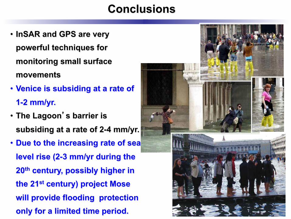
Conclusions
• InSAR and GPS are very powerful techniques for monitoring small surface movements
• Venice is subsiding at a rate of 1-2 mm/yr.
• The Lagoon’s barrier is subsiding at a rate of 2-4 mm/yr.
• Due to the increasing rate of sea level rise (2-3 mm/yr during the 20th century, possibly higher in the 21st century) project Mose will provide flooding protection only for a limited time period.
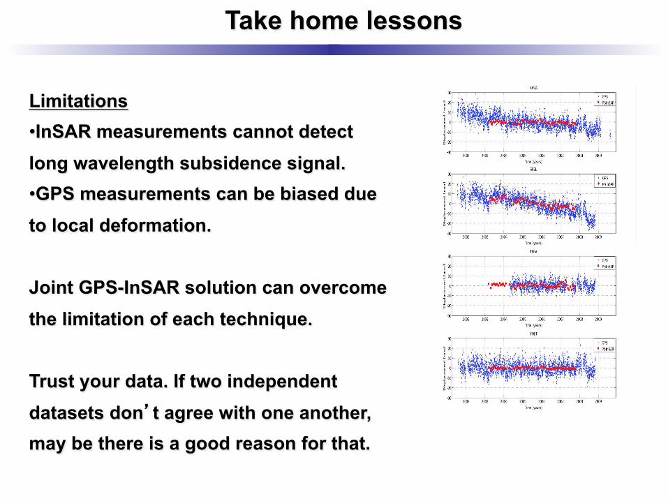
Take home lessons
Limitations • InSAR measurements cannot detect long wavelength subsidence signal. • GPS measurements can be biased due to local deformation. Joint GPS-InSAR solution can overcome the limitation of each technique. Trust your data. If two independent datasets don’t agree with one another, may be there is a good reason for that.

Subsidence of Venice Lagoon
… and subsidence