Bike Share Project 2.0
22
Audubon Park Bike & Ride Ambar Vizcarrondo & Lisa Caldes Traditional Town Planning Dr. R. B. Stephenson Rollins College April 25, 2015
-
Upload
ambar-vizcarrondo -
Category
Documents
-
view
9 -
download
1
Transcript of Bike Share Project 2.0

Audubon Park
Bike & Ride
Ambar Vizcarrondo &
Lisa Caldes
Traditional Town Planning Dr. R. B. Stephenson
Rollins College April 25, 2015

Audubon Park Garden District Orlando, Florida
Contents: Neighborhood Information
Juice Bike Share Proposed Bike Route
GIS Map of Proposed Route Safety and Our Bike Route
GIS Map of Crashes Bicycle Boulevard Madison B-Cycle
Baseline Data from Green Works Orlando Policies of East Central Florida 2060 Plan
References
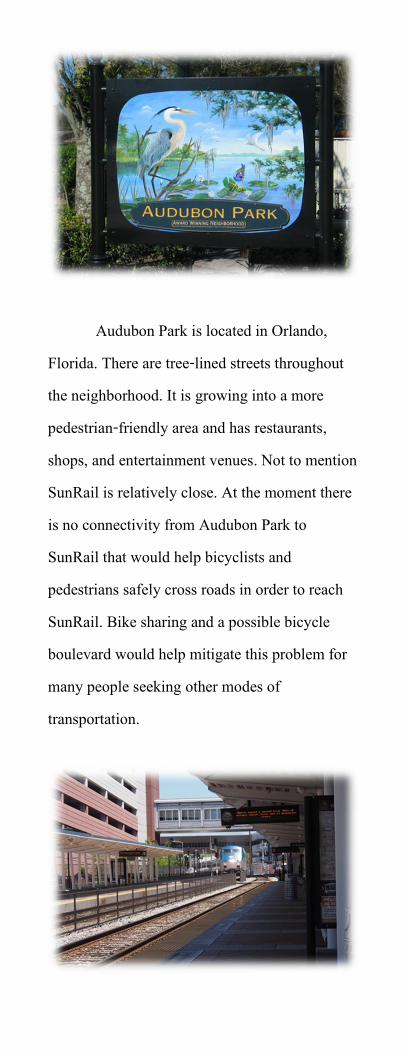
Audubon Park is located in Orlando, Florida. There are tree-lined streets throughout the neighborhood. It is growing into a more pedestrian-friendly area and has restaurants, shops, and entertainment venues. Not to mention SunRail is relatively close. At the moment there is no connectivity from Audubon Park to SunRail that would help bicyclists and pedestrians safely cross roads in order to reach SunRail. Bike sharing and a possible bicycle boulevard would help mitigate this problem for many people seeking other modes of transportation.
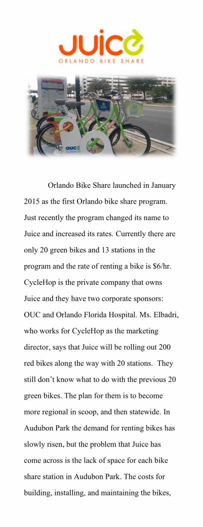
Orlando Bike Share launched in January 2015 as the first Orlando bike share program. Just recently the program changed its name to Juice and increased its rates. Currently there are only 20 green bikes and 13 stations in the program and the rate of renting a bike is $6/hr. CycleHop is the private company that owns Juice and they have two corporate sponsors: OUC and Orlando Florida Hospital. Ms. Elbadri, who works for CycleHop as the marketing director, says that Juice will be rolling out 200 red bikes along the way with 20 stations. They still don’t know what to do with the previous 20 green bikes. The plan for them is to become more regional in scoop, and then statewide. In Audubon Park the demand for renting bikes has slowly risen, but the problem that Juice has come across is the lack of space for each bike share station in Audubon Park. The costs for building, installing, and maintaining the bikes,
GPS tracking devices, and stations are information they were unwilling to share, but it’s most certainly not cheap. Private funding is how Juice gets money for its bike share program, not through the government.
For residents to quickly rent a bike at any of the station locations they must first reserve a bike at the station, online, or through the mobile app SoBi, which is a bike sharing app that Juice works in conjunction with.
In order to rent a bike cyclists must be 18 years old. Renting the bike by the hour is $6 which is prorated. A monthly membership of $30 includes 60 minutes free each day. When someone wants to join for a year they have the option of paying $79/year or $99/year. With either annual membership the cost of renting a bike goes down to $5/hr., but if people choose the founding member annual plan they receive extra goodies like limited edition Juice t-shirt, water bottle, and sunglasses, as well as exclusive deals to local businesses and events. There are also fees to discourage people from taking the bikes too far out of city limits like a $2 fee for locking outside a Juice station and a $20 fee for locking outside the system area.

As with many bike share systems Juice
offers rewards to people who ride & return bikes locked “out of hub” to hub locations. It is also easy to find bikes using the real-time GPS tracking system that is attached to each one. The map on the website and mobile app indicate where there are bike stations with and without bikes.
Using the GPS tracking device that is fixed to every bike it is easy to find where a bike is located at the many stations around Downtown Orlando. Stations are located as far north as College Park and south at OUC headquarters. There is a station on Mills 50 to the east, and a station at City View to the west. The rest of the stations are scattered Lake Eola
OUR PROPOSED BIKE ROUTE
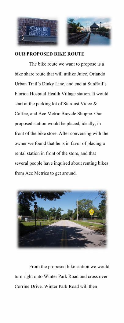
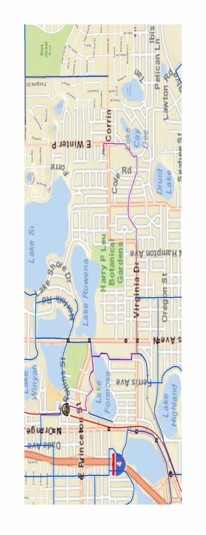
The bike route we want to propose is a bike share route that will utilize Juice, Orlando Urban Trail’s Dinky Line, and end at SunRail’s Florida Hospital Health Village station. It would start at the parking lot of Stardust Video & Coffee, and Ace Metric Bicycle Shoppe. Our proposed station would be placed, ideally, in front of the bike store. After conversing with the owner we found that he is in favor of placing a rental station in front of the store, and that several people have inquired about renting bikes from Ace Metrics to get around.
From the proposed bike station we would
turn right onto Winter Park Road and cross over Corrine Drive. Winter Park Road will then
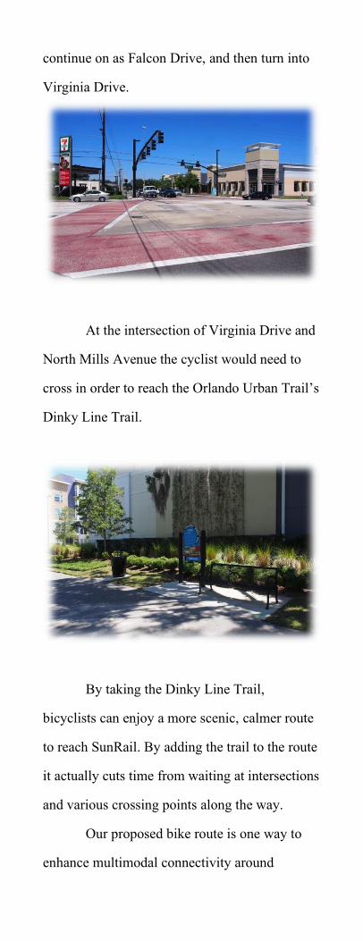
continue on as Falcon Drive, and then turn into Virginia Drive.
At the intersection of Virginia Drive and
North Mills Avenue the cyclist would need to cross in order to reach the Orlando Urban Trail’s Dinky Line Trail.
By taking the Dinky Line Trail, bicyclists can enjoy a more scenic, calmer route to reach SunRail. By adding the trail to the route it actually cuts time from waiting at intersections and various crossing points along the way.
Our proposed bike route is one way to enhance multimodal connectivity around
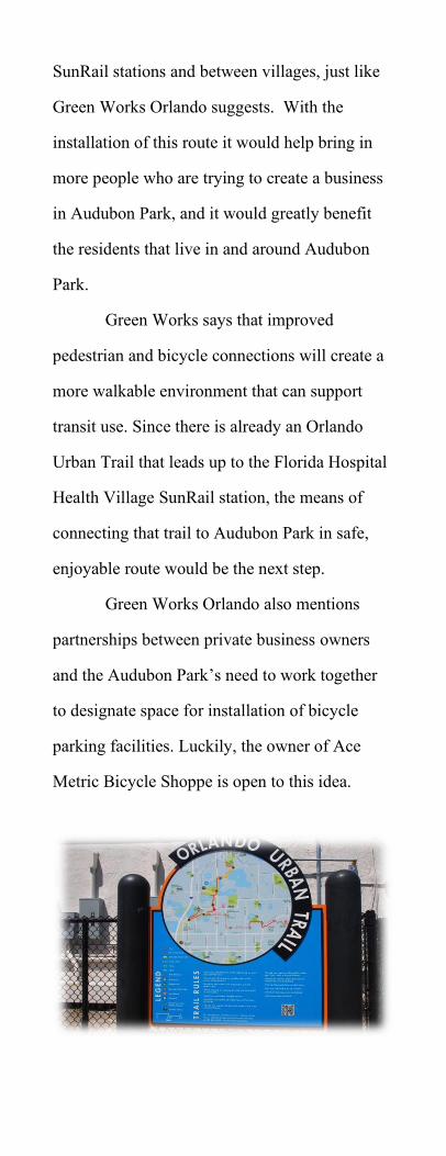
SunRail stations and between villages, just like Green Works Orlando suggests. With the installation of this route it would help bring in more people who are trying to create a business in Audubon Park, and it would greatly benefit the residents that live in and around Audubon Park.
Green Works says that improved pedestrian and bicycle connections will create a more walkable environment that can support transit use. Since there is already an Orlando Urban Trail that leads up to the Florida Hospital Health Village SunRail station, the means of connecting that trail to Audubon Park in safe, enjoyable route would be the next step.
Green Works Orlando also mentions partnerships between private business owners and the Audubon Park’s need to work together to designate space for installation of bicycle parking facilities. Luckily, the owner of Ace Metric Bicycle Shoppe is open to this idea.
SAFETY AND OUR BIKE ROUTE
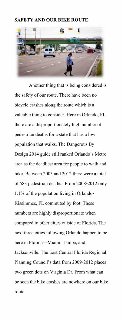
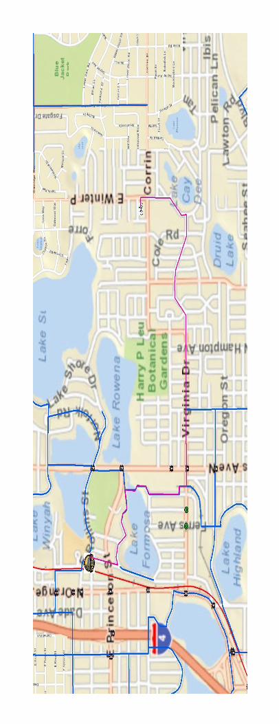
Another thing that is being considered is the safety of our route. There have been no bicycle crashes along the route which is a valuable thing to consider. Here in Orlando, FL there are a disproportionately high number of pedestrian deaths for a state that has a low population that walks. The Dangerous By Design 2014 guide still ranked Orlando’s Metro area as the deadliest area for people to walk and bike. Between 2003 and 2012 there were a total of 583 pedestrian deaths. From 2008-2012 only 1.1% of the population living in Orlando-Kissimmee, FL commuted by foot. These numbers are highly disproportionate when compared to other cities outside of Florida. The next three cities following Orlando happen to be here in Florida—Miami, Tampa, and Jacksonville. The East Central Florida Regional Planning Council’s data from 2009-2012 places two green dots on Virginia Dr. From what can be seen the bike crashes are nowhere on our bike route.
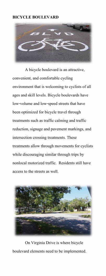
BICYCLE BOULEVARD
A bicycle boulevard is an attractive, convenient, and comfortable cycling environment that is welcoming to cyclists of all ages and skill levels. Bicycle boulevards have low-volume and low-speed streets that have been optimized for bicycle travel through treatments such as traffic calming and traffic reduction, signage and pavement markings, and intersection crossing treatments. These treatments allow through movements for cyclists while discouraging similar through trips by nonlocal motorized traffic. Residents still have access to the streets as well.
On Virginia Drive is where bicycle
boulevard elements need to be implemented.
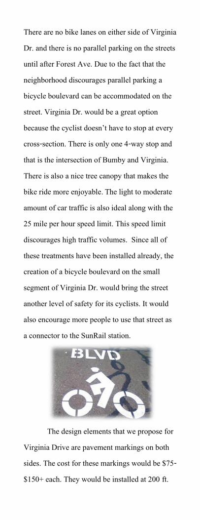
There are no bike lanes on either side of Virginia Dr. and there is no parallel parking on the streets until after Forest Ave. Due to the fact that the neighborhood discourages parallel parking a bicycle boulevard can be accommodated on the street. Virginia Dr. would be a great option because the cyclist doesn’t have to stop at every cross-section. There is only one 4-way stop and that is the intersection of Bumby and Virginia. There is also a nice tree canopy that makes the bike ride more enjoyable. The light to moderate amount of car traffic is also ideal along with the 25 mile per hour speed limit. This speed limit discourages high traffic volumes. Since all of these treatments have been installed already, the creation of a bicycle boulevard on the small segment of Virginia Dr. would bring the street another level of safety for its cyclists. It would also encourage more people to use that street as a connector to the SunRail station.
The design elements that we propose for
Virginia Drive are pavement markings on both sides. The cost for these markings would be $75-$150+ each. They would be installed at 200 ft.
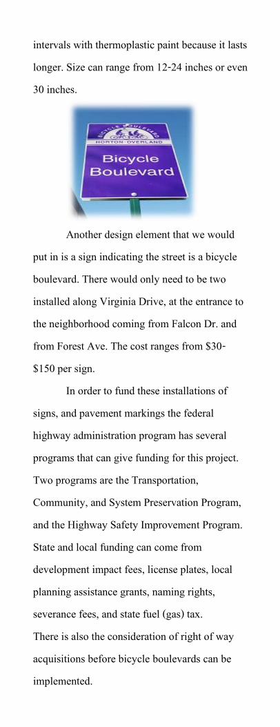
intervals with thermoplastic paint because it lasts longer. Size can range from 12-24 inches or even 30 inches.
Another design element that we would
put in is a sign indicating the street is a bicycle boulevard. There would only need to be two installed along Virginia Drive, at the entrance to the neighborhood coming from Falcon Dr. and from Forest Ave. The cost ranges from $30- $150 per sign.
In order to fund these installations of signs, and pavement markings the federal highway administration program has several programs that can give funding for this project. Two programs are the Transportation, Community, and System Preservation Program, and the Highway Safety Improvement Program. State and local funding can come from development impact fees, license plates, local planning assistance grants, naming rights, severance fees, and state fuel (gas) tax. There is also the consideration of right of way acquisitions before bicycle boulevards can be implemented.
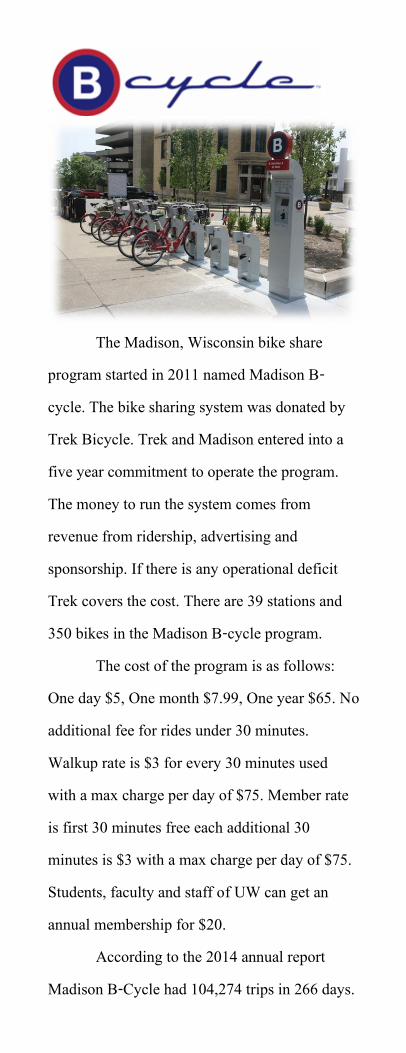
The Madison, Wisconsin bike share program started in 2011 named Madison B-cycle. The bike sharing system was donated by Trek Bicycle. Trek and Madison entered into a five year commitment to operate the program. The money to run the system comes from revenue from ridership, advertising and sponsorship. If there is any operational deficit Trek covers the cost. There are 39 stations and 350 bikes in the Madison B-cycle program.
The cost of the program is as follows: One day $5, One month $7.99, One year $65. No additional fee for rides under 30 minutes. Walkup rate is $3 for every 30 minutes used with a max charge per day of $75. Member rate is first 30 minutes free each additional 30 minutes is $3 with a max charge per day of $75. Students, faculty and staff of UW can get an annual membership for $20.
According to the 2014 annual report Madison B-Cycle had 104,274 trips in 266 days.
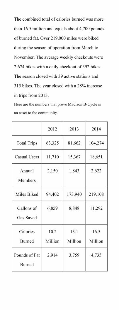
The combined total of calories burned was more than 16.5 million and equals about 4,700 pounds of burned fat. Over 219,000 miles were biked during the season of operation from March to November. The average weekly checkouts were 2,674 bikes with a daily checkout of 392 bikes. The season closed with 39 active stations and 315 bikes. The year closed with a 28% increase in trips from 2013. Here are the numbers that prove Madison B-Cycle is an asset to the community.
2012 2013 2014
Total Trips 63,325 81,662 104,274
Casual Users 11,710 15,367 18,651
Annual Members
2,150 1,843 2,622
Miles Biked 94,402 173,940 219,108
Gallons of Gas Saved
6,859 8,848 11,292
Calories Burned
10.2 Million
13.1 Million
16.5 Million
Pounds of Fat Burned
2,914 3,759 4,735
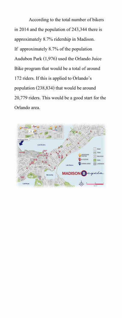
According to the total number of bikers in 2014 and the population of 243,344 there is approximately 8.7% ridership in Madison. If approximately 8.7% of the population Audubon Park (1,976) used the Orlando Juice Bike program that would be a total of around 172 riders. If this is applied to Orlando’s population (238,834) that would be around 20,779 riders. This would be a good start for the Orlando area.
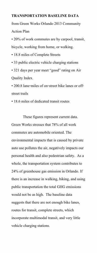
TRANSPORTATION BASELINE DATA from Green Works Orlando 2013 Community Action Plan • 20% of work commutes are by carpool, transit, bicycle, working from home, or walking. • 18.8 miles of Complete Streets • 33 public electric vehicle charging stations • 321 days per year meet “good” rating on Air Quality Index. • 200.8 lane-miles of on-street bike lanes or off-street trails • 18.6 miles of dedicated transit routes
These figures represent current data. Green Works stresses that 78% of all work commutes are automobile oriented. The environmental impacts that is caused by private auto use pollutes the air, negatively impacts our personal health and also pedestrian safety. As a whole, the transportation system contributes to 24% of greenhouse gas emission in Orlando. If there is an increase in walking, biking, and using public transportation the total GHG emissions would not be as high. The baseline data suggests that there are not enough bike lanes, routes for transit, complete streets, which incorporate multimodal transit, and very little vehicle charging stations.
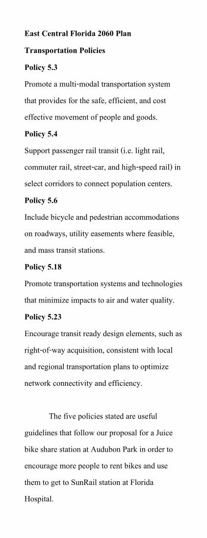
East Central Florida 2060 Plan Transportation Policies Policy 5.3 Promote a multi-modal transportation system that provides for the safe, efficient, and cost effective movement of people and goods. Policy 5.4 Support passenger rail transit (i.e. light rail, commuter rail, street-car, and high-speed rail) in select corridors to connect population centers. Policy 5.6 Include bicycle and pedestrian accommodations on roadways, utility easements where feasible, and mass transit stations. Policy 5.18 Promote transportation systems and technologies that minimize impacts to air and water quality. Policy 5.23 Encourage transit ready design elements, such as right-of-way acquisition, consistent with local and regional transportation plans to optimize network connectivity and efficiency.
The five policies stated are useful
guidelines that follow our proposal for a Juice bike share station at Audubon Park in order to encourage more people to rent bikes and use them to get to SunRail station at Florida Hospital.
References Juice Orlando Bike Share http://orlandobikeshare.com/ Orlando Sentinel 1. http://articles.orlandosentinel.com/2013-08-23/business/os-bike-share-bidders-20130823_1_orlando-health-bike-share-bicycle-sharing-program 2. http://www.orlandosentinel.com/features/jon-busdeker/os-juice-bike-share-orlando-post.html B-Cycle https://www.bcycle.com/default.aspx City-Data http://www.city-data.com/neighborhood/Audubon-Park-Orlando-FL.html United States Census Bureau 1.http://quickfacts.census.gov/qfd/states/55/5548000.html 2.http://quickfacts.census.gov/qfd/states/12/1253000.html Green Works Orlando 2014 Community Action Plan Dangerous By Design 2014

East Central Florida 2060 Plan East Central Florida Regional Planning Council Madison B-Cycle 2014 Annual Report Fundamentals of Bicycle Boulevard Planning & Design